Showing 293 items matching "slate roofs"
-
 Flagstaff Hill Maritime Museum and Village
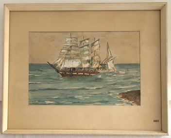
Painting - Watercolour painting, Early 20th century
... , including pieces of roof slate and coils of barbed wire...., including pieces of roof slate and coils of barbed wire. The Falls ...FALLS of HALLADALE - History The Falls of Halladale was a four-masted sailing ship built-in 1886 in Glasgow, Scotland, for the long-distance cargo trade and was mostly used for Pacific grain trade. She had a sturdy construction, built to carry maximum cargo and maintain full sail in heavy gales. She was one of the last of the ‘windjammers’ that sailed the Trade Route and one of the first vessels to include fore and aft lifting bridges, which kept the crew safe and dry in as they moved around the decks in stormy conditions. She was owned by Wright, Breakenridge & Co of Glasgow and was one of several Falls Line ships, all of which were named after waterfalls in Scotland. On 4th August 1908, with new sails, 29 crew, and 2800 tons of cargo, the Falls of Halladale left New York, bound for Melbourne and Sydney via the Cape of Good Hope. The cargo on board was valued at £35,000 and included 56,763 tiles of American slate roofing tiles, 5,673 coils of barbed wire, 600 stoves, 500 sewing machines, 6,500 gallons of oil, 14,400 gallons of benzene, plumbing iron, 117 cases of crockery and glassware and many other manufactured items. The Falls of Halladale had been at sail for 102 days when, at 3 am on the of 14th November 1908, under full sail in calm seas with a six knots breeze behind and misleading fog along the coast, the great vessel rose upon an ocean swell and settled on top of a submerged reef near Peterborough on south-west Victoria’s coast. The ship was jammed on the rocks and began filling with water. The crew launched the two lifeboats and all 29 crew landed safely on the beach over 4 miles away at the Bay of Islands. The postmistress at Peterborough, who kept a watch for vessels in distress, saw the stranding and sent out an alert to the local people. A rescue party went to the aid of the sailors and the Port Campbell rocket crew was dispatched, but the crew had all managed to reach shore safely by the time help arrived. The ship stayed in full sail on the rocky shelf for nearly two months, attracting hundreds of sightseers who watched her slowly disintegrate until the pounding seas and dynamiting by salvagers finally broke her back, and her remains disappeared back into deeper water. The valuable cargo was largely lost, despite two salvage attempts in 1908-09 and 1910. Further salvage operations were made from 1974-1986, during which time 22,000 slate tiles were recovered with the help of 14 oil drums to float them, plus personal artefacts, ship fittings, reams of paper and other items (a list of items held at Flagstaff Hill Maritime Village is included below). The Court of Marine Inquiry in Melbourne ruled that the foundering of the ship was entirely due to Captain David Wood Thomson’s navigational error, not to technical failure of the Clyde-built ship. The shipwreck is a popular site for divers, about 300m offshore and in 3 – 15m of water. Some of the original cargo can be seen at the site, including pieces of roof slate and coils of barbed wire.The Falls of Halladale shipwreck is listed on the Victorian Heritage Register (No. S255). She was one of the last ships to sail the Trade Routes. She is one of the first vessels to have fore and aft lifting bridges. She is an example of the remains of an International Cargo Ship and also represents aspects of Victoria’s shipping industry. The wreck is protected as a Historic Shipwreck under the Commonwealth Historic Shipwrecks Act (1976).Watercolour painting behind glass, framed in the Art Deco style - stippled cream painted wood. There are some age marks under the glass. The painting depicts the Falls of Halladale with its stern under water. The back of the painting contains facts about the shipwreck handwritten in a similar style to the artist’s signature. The artist’s signature is not clear enough to identify. Inscription on the back: Pasted on typed text: Peterborough Handwriting: Falls of Halladale 2085 tons 4 masted iron barque wrecked Saturday November 14th 1908 Captain Thomson crew of 28 !st mate F Pearson 2nd mate T Griffinflagstaff hill, warrnambool, flagstaff hill maritime museum & village, maritime museum, maritime village, shipwreck coast, 1908 shipwreck, falls of halladale, peterborough, peterborough shipwreck, great ocean road, captain thomson, 1880s sailing ship, cargo vessel, 1st mate f pearson, 2nd mate t griffin, watercolour painting -
 Flagstaff Hill Maritime Museum and Village
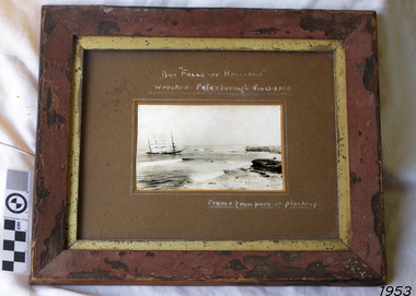
Photograph - Vessel, Sailing Ship, Falls of Halladale, After 13-11-1908
... of the original cargo can be seen at the site, including pieces of roof... of the original cargo can be seen at the site, including pieces of roof ...Falls of Halladale The Falls of Halladale was a four-masted sailing ship built-in 1886 in Glasgow, Scotland, for the long-distance cargo trade and was mostly used for Pacific grain trade. She had a sturdy construction built to carry maximum cargo and able to maintain full sail in heavy gales, one of the last of the ‘windjammers’ that sailed the Trade Route. She was one of the first vessels to include fore and aft lifting bridges, which kept the crew safe and dry in as they moved around the decks in stormy conditions. She was owned by Wright, Breakenridge & Co of Glasgow and was one of several Falls Line ships, all of which were named after waterfalls in Scotland. On 4th August 1908, with new sails, 29 crew, and 2800 tons of cargo, the Falls of Halladale left New York, bound for Melbourne and Sydney via the Cape of Good Hope. The cargo on board was valued at £35,000 and included 56,763 tiles of American slate roofing tiles, 5,673 coils of barbed wire, 600 stoves, 500 sewing machines, 6,500 gallons of oil, 14,400 gallons of benzene, plumbing iron, 117 cases of crockery and glassware and many other manufactured items. The Falls of Halladale had been at sail for 102 days when, at 3 am on the of 14th November 1908, under full sail in calm seas with a six knots breeze behind and misleading fog along the coast, the great vessel rose upon an ocean swell and settled on top of a submerged reef near Peterborough on south-west Victoria’s coast. The ship was jammed on the rocks and began filling with water. The crew launched the two lifeboats and all 29 crew landed safely on the beach over 4 miles away at the Bay of Islands. The postmistress at Peterborough, who kept a watch for vessels in distress, saw the stranding and sent out an alert to the local people. A rescue party went to the aid of the sailors and the Port Campbell rocket crew was dispatched, but the crew had all managed to reach shore safely by the time help arrived. The ship stayed in full sail on the rocky shelf for nearly two months, attracting hundreds of sightseers who watched her slowly disintegrate until the pounding seas and dynamiting by salvagers finally broke her back, and her remains disappeared back into deeper water. The valuable cargo was largely lost, despite two salvage attempts in 1908-09 and 1910. Further salvage operations were made from 1974-1986, during which time 22,000 slate tiles were recovered with the help of 14 oil drums to float them, plus personal artefacts, ship fittings, reams of paper and other items (a list of items held at Flagstaff Hill Maritime Village is included below). The Court of Marine Inquiry in Melbourne ruled that the foundering of the ship was entirely due to Captain David Wood Thomson’s navigational error, not too technical failure of the Clyde-built ship. The shipwreck is a popular site for divers, about 300m offshore and in 3 – 15m of water. Some of the original cargo can be seen at the site, including pieces of roof slate and coils of barbed wire. The Falls of Halladale shipwreck is listed on the Victorian Heritage Register (No. S255). She was one of the last ships to sail the Trade Routes. She is one of the first vessels to have fore and aft lifting bridges. She is an example of the remains of an International Cargo Ship and also represents aspects of Victoria’s shipping industry. The wreck is protected as a Historic Shipwreck under the Commonwealth Historic Shipwrecks Act (1976).Photograph of the wrecked ship, the Falls of Halladale, sails still flying. The ship was wrecked at Peterborough on Nov 13, 1908. The outer frame is made from a piece of planking. Handwritten inscriptions in white ink on the top of the matt board, and on the lower right.BQE "Falls of Halladale" "Wrecked. Peterborough. Nov 13. 1908" "Frame. from piece of planking."flagstaff hill, warrnambool, shipwrecked-coast, flagstaff-hill, flagstaff-hill-maritime-museum, maritime-museum, shipwreck-coast, flagstaff-hill-maritime-village, shipwreck, photograph, falls of halladale, planking frame -
 Flagstaff Hill Maritime Museum and Village
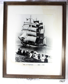
Photograph - Vessel, Sailing Ship, Falls of Halladale 1886 - 1908, 1908
... , including pieces of roof slate and coils of barbed wire. ABOUT..., including pieces of roof slate and coils of barbed wire. ABOUT ...The photograph shows some of the hundreds of sightseers who visited the site of the wreced Falls of Halladale, watching the fully rigged ship slowly disintegrate over two months or more. The Falls of Halladale was a four-masted sailing ship built in 1886 in Glasgow, Scotland, for the long-distance cargo trade and was mostly used for the Pacific grain trade. The ship was sturdy. It could carry maximum cargo and maintain full sail in heavy gales. It was one of the last of the ‘windjammers’ that sailed the Trade Route, and one of the first vessels to include fore and aft lifting bridges, which kept the crew safe and dry as they moved around the decks in stormy conditions. It was one of several Falls Line ships named after the waterfalls of Glasgow by its owner, Wright, Breakenridge & Co of Glasgow. On 4th August 1908, with new sails, 29 crew, and 2800 tons of cargo, the Falls of Halladale left New York, bound for Melbourne and Sydney via the Cape of Good Hope. The cargo on board was valued at £35,000. It included 56,763 tiles of American slate roofing tiles, 5,673 coils of barbed wire, 600 stoves, 500 sewing machines, 6,500 gallons of oil, 14,400 gallons of benzene, plumbing iron, 117 cases of crockery and glassware and many other manufactured items. The Falls of Halladale had been at sail for 102 days when, at 3 am on the 14th November 1908, under full sail in calm seas with a six knots breeze behind and misleading fog along the coast, the great vessel rose upon an ocean swell and settled on top of a submerged reef near Peterborough on south-west Victoria’s coast. The ship was jammed on the rocks and began filling with water. The crew launched the two lifeboats and all 29 crew landed safely on the beach over 4 miles away at the Bay of Islands. The postmistress at Peterborough, who kept a watch for vessels in distress, saw the stranding and sent out an alert to the local people. A rescue party went to the aid of the sailors and the Port Campbell rocket crew was dispatched, but the crew had all managed to reach shore safely by the time help arrived. The ship stayed in full sail on the rocky shelf for nearly two months, attracting hundreds of sightseers who watched her slowly disintegrate until the pounding seas and dynamiting by salvagers finally broke her back, and her remains disappeared back into deeper water. The valuable cargo was largely lost, despite two salvage attempts in 1908-09 and 1910. Further salvage operations were made from 1974-1986, during which time 22,000 slate tiles were recovered with the help of 14 oil drums to float them, plus personal artefacts, ship fittings, reams of paper and other items (a list of items held at Flagstaff Hill Maritime Village is included below). The Court of Marine Inquiry in Melbourne ruled that the foundering of the ship was entirely due to Captain David Wood Thomson’s navigational error, not too technical failure of the Clyde-built ship. The shipwreck is a popular site for divers, about 300m off-shore and in 3 – 15m of water. Some of the original cargo can be seen at the site, including pieces of roof slate and coils of barbed wire. ABOUT THE ‘FALLS OF HALLADALE’ (1886 - 1908) Built: in1886 by Russell & Co., Greenock shipyards, River Clyde, Scotland, UK. The company was founded in 1870 (or 1873) as a partnership between Joseph Russell (1834-1917), Anderson Rodger and William Todd Lithgow. During the period 1882-92 Russell & Co., standardised designs, which sped up their building process so much that they were able to build 271 ships over that time. In 1886 they introduced a 3000 ton class of sailing vessel with auxiliary engines and brace halyard winches. In 1890 they broke the world output record. Owner: Falls Line, Wright, Breakenridge & Co, 111 Union Street, Glasgow, Scotland. Configuration: Four-masted sailing ship; iron-hulled barque; iron masts, wire rigging, fore & aft lifting bridges. Size: Length 83.87m x Breadth 12.6m x Depth 7.23m, Gross tonnage 2085 ton Wrecked: the night of 14th November 1908, Curdies Inlet, Peterborough south west Victoria Crew: 29The Falls of Halladale shipwreck is listed on the Victorian Heritage Register (No. S255). It was one of the last ships to sail the Trade Routes. The ship was one of the first vessels to have fore and aft lifting bridges. The wreck is an example of an International Cargo Ship and represents aspects of Victoria’s shipping industry. The wreck is protected as a Historic Shipwreck under the Commonwealth Historic Shipwrecks Act (1976).Photograph, behind glass in a timber frame. Image of a group of people seated on the ground with the stranded barque, the Falls of Halladale, in full sail nearby in the water. The photograph was taken at Peterborough, southwest Victoria, on November 13th 1908. A typed inscription is below the picture.Typed beneath photograph "Falls of Halladale 1886 - 1908"flagstaff hill, maritime museum, maritime village, flagstaff hill maritime museum and village, great ocean road, shipwreck, peterborough, falls of halladale, 1908, barque, scotish, 4-masted, sailing ship, 1886, glasgow, trade, grain trade, cargo, windjammer, fore and aft bridges, falls line, wright, breakenridge & co, american slate, roofing tiles, barbed wire, sewing machines, oil, benzene, port campbell rocket crew, sightseers, salvage, captain david wood thomson, captain thomson, navigational error, clyde-built, russell & co -
 Eltham District Historical Society Inc
Photograph - Digital Photograph, Marguerite Marshall, Jelbart home, 93 Arthur Street, Eltham, 11 November 2006
... or warehouses, and recycled slate was used for roofs and floors. Quality... or warehouses, and recycled slate was used for roofs and floors. Quality ...Situated at the top of the hill in Arthur Street, the former Jelbart residence and barn were part of a major change that transformed Eltham's character in the late 1960s. Built from the mid 1940s through mid 1950s when Eltham was a rural community, the Jelbrat residence and barn are all that remain of a family property of some 250 acres (100 ha). With growing population pressures, in the late 1960s, owners Ron and Yvonne Jelbart decided to subdivide their property creating the Woodridge Estate in the early 1970s, a major factor towards the transformation of Eltham to the suburb it is today. The Jelbarts had moved to Eltham in the early 1940s when they purchased a poultry farm in New Street, now Lavendar Park Road. (The local Black Friday bushire of January 13, 1939 had started at C.A. (Clarrie) Hurst’s Eltham Poultry Farm and Hatchery in New Street.) Jelbart was primarily a businessman importing office machinery but desired farm beef and dairy cattle so the couple purchased the virgin bushland at what was then at the end of a dirt road, Arthur Street. With post war shortages of most building materials, they followed the example of the Eltham Artists' Colony (later called Montsalvat) and built thier home from mud-bricks and recyclked materials. The barn was first to be completed in 1945 which they made their home whilst building the main residence. It took eight years to complete the two buildings. Both the main residence and the barn are now separate homes, and along with the remaining property being sub-divided further in 1998 are now part of the Kinloch Gardens Estate at 93 Arthur Street. Covered under Heritage Overlay, Nillumbik Planning Scheme. Published: Nillumbik Now and Then / Marguerite Marshall 2008; photographs Alan King with Marguerite Marshall.; p139 Standing on a hilltop at Arthur Street, Eltham, the Jelbart residence and former barn were part of a major change that transformed Eltham’s character in the late 1960s. Built from the late 1940s to the mid 1950s when Eltham was a rural community, they are all that remain of what was once a family property of around 250 acres (100 ha). As population pressure increased in the late 1960s, owners Ron and Yvonne Jelbart, decided to subdivide their property. The break-up of this property into the Woodridge Estate in the early 1970s, was a major factor towards transforming Eltham into the suburb it is today.1 Although standing only a few minutes from Eltham’s busy hub and hundreds of houses in Woodridge, scarcely any urban sound disturbs the peace. Views from the two buildings are almost exclusively of trees and extend to Mt. Dandenong to the south-east, the Great Divide to the north, and Melbourne city to the south-west. The Jelbarts had lived in Eltham since the early 1940s when they bought a poultry farm in New Street, now Lavender Park Road. Although Jelbart was primarily a businessman importing office machinery, he was keen to farm dairy and beef cattle, so the couple bought rough bushland at what was then the end of Arthur Street. But a shortage of building materials following World War Two hampered their plans to build their new home, so they followed the example of the Eltham Artists’ Colony (later called Montsalvat) and used mud-bricks and recycled materials.2 With great determination the family and friends constructed their house. Massive timber frames and huge quantities of mud-bricks were made on site. The barn was built first in 1945, and two years later, while camping inside, the Jelbarts started building their house. It took eight years to construct the two buildings, even with the help of professional tradesmen. The buildings, with timber frames infilled with mud-brick and plastered, are reminiscent of the English Tudor style. The Jelbarts are of Cornish stock. Much of the timber framework came from demolished bridges or warehouses, and recycled slate was used for roofs and floors. Quality second-hand materials were readily available in the late 1940s and 1950s when there was much demolition in Melbourne and little respect for heritage. A former 19th century Toorak mansion Woorigoleen provided the magnificent stone fireplace, the timber panelling and the parquetry floor in the living room. The large stone gateposts at the entry of the property came from Melbourne University. Almost no mechanical equipment was used to build the 55 square house and the 25 square barn. Massive timber frames were erected using block and tackle pulleys and timbers were shaped, sawn and drilled by hand. Son and architect Ian, with his family, have lived in and extensively renovated both buildings since the early 1970s. Ian transformed the steep ridge of the property into a plateau, where the main house Kinloch stands, surrounded by terraces and lawns. The grounds retain many native plants, including massive yellow boxes – some nudging 80 years. Ian attached 70 metres of pergolas draped with wisteria, roses and grape vines, to three sides of the house. The beautiful garden is featured in the book Through the Rose Arbour by Rosemary Houseman. The two-storey barn – now a house – retains traces of its original use. The cow-shed with milking and feed-rooms, and the machinery-shed remain. The house, separated on the ground floor by a breeze-way, soars two storeys and includes a mezzanine. These are connected by spiral staircases, to timber-beamed and plaster-lined high-pitched ceilings. The house also descends to a wine cellar. Curiously the roof is of corrugated iron on the south and slate on the north, to save costs. Small-paned windows and three French doors open onto the front lawn, which extends to Jelbart Court.This collection of almost 130 photos about places and people within the Shire of Nillumbik, an urban and rural municipality in Melbourne's north, contributes to an understanding of the history of the Shire. Published in 2008 immediately prior to the Black Saturday bushfires of February 7, 2009, it documents sites that were impacted, and in some cases destroyed by the fires. It includes photographs taken especially for the publication, creating a unique time capsule representing the Shire in the early 21st century. It remains the most recent comprehenesive publication devoted to the Shire's history connecting local residents to the past. nillumbik now and then (marshall-king) collection, eltham, arthur street, jelbart barn, jelbart home, kinloch gardens -
 Glen Eira Historical Society
Document - Shoobra Road, 19, Elsternwick, 'Ettrick'
Two copies of a one page chronological report prepared by the Brighton Historical Society, dated 29/02/1988, about the occupiers of the property 'Ettrick', located at 19 Shoobra Road, Elsternwick. The report also includes a brief history of the property, a description of the property’s roof and information on the origins of the property’s name. The file also includes one page of handwritten undated and unattributed working notes.ettrick', carlingford street, brown robert s, turnbull james a, peters j, slate tiles, ross william a, ross elizabeth a, pollard a k, shoobra road, elsternwick -
 Wycheproof & District Historical Society Inc.
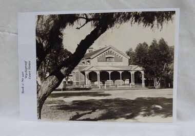
Photograph, Wycheproof Court House, (estimated); mid to late 19th century
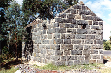
... and gabled pavilions that protect the street facade. The roof... and gabled pavilions that protect the street facade. The roof ...The Court House opened as a court of petty sessions in 1890 and closed as a court in the early 1980s. It is now a 'Place of Deposit' for paper based products, maps, documents and photographs, and the home of the Wycheproof and District Historical Society Inc. The local Craft Group met at the Court House between 1982 and 2010. The Buloke Shire Council oversees the maintenance of the building.The Court House is No H 1656 on the Victorian Heritage Register. It is the one of only two buildings with this listing in Wycheproof, and characteristic of the type of building constructed in the early days of settlement in Wycheproof. The architecture is of aesthetic value and although some restoration work has taken place to maintain the structure, it remains in good condition and with some of the original furnishings intact.Sepia print of the Wycheproof-Court-House. It was constructed during 1889/90 and commissioned on September 23,1890 as a court-of-petty-sessions. A simple form of Court House built of red-face-brick but embellished by stepped brick work in the principal gable and by the traverse veranda with elaborate frieze and gabled pavilions that protect the street facade. The roof is of slate.Nonecourt house, wycheproof heritage 1890, petty sessions, building, red face brick, gabled pavilions -
Glenelg Shire Council Cultural Collection
Functional object - Roof tiles, n.d
3 slate roofing tiles, various dimensions.roof, tiles, building, industry, trade -
 Victoria Police Museum
Police stations (Aitken's Gap)
... in 1857 from bluestone quarried in the area. The roof was made... in 1857 from bluestone quarried in the area. The roof was made ...Aitken's Gap, otherwise known as The Gap or Buttlejork, and 3km west of Sunbury, was established as a township in 1845. It is in the area which is now bordered by the Calder Highway and Gap Road. The village was named after John Aitken, a Port Phillip pastoralist who took up the Mount Aitken run in 1836. Aitken's Gap Police Barracks (in the District of Bourke) opened in 1853 and was staffed by two Mounted Constables and one Foot Constable. The gaol (used to house prisoners and also gold en route to Melbourne) was built in 1857 from bluestone quarried in the area. The roof was made of slate. In 1861 it was staffed by 1 Mounted Senior Constable and 1 Foot Constable. The Barracks closed in 1863 when the Bendigo rail line was completed and the gold was transported to Melbourne by rail. All the buildings, except the gaol, were moved to Sunbury. The land was sold in 1870 and in 1989 the current owner donated the building to the Sunbury Police. The original building was dismantled, restored and rebuilt outside Sunbury police station.15 colour photos and 1 black and white photopolice stations; aitken's gap police station -
 Glen Eira Historical Society
Album - Album page, Nithsdale now Five Way Hill, Kambrook Road, Circa 1972
... slate roof... 1850's 1880's italianate rendered five way hill nithsdale slate ...This photograph is part of the Caulfield Historical Album 1972. This album was created in approximately 1972 as part of a project by the Caulfield Historical Society to assist in identifying buildings worthy of preservation. The album is related to a Survey the Caulfield Historical Society developed in collaboration with the National Trust of Australia (Victoria) and Caulfield City Council to identify historic buildings within the City of Caulfield that warranted the protection of a National Trust Classification. Principal photographer thought to be Trevor Hart, member of Caulfield Historical Society. Most photographs were taken between 1966-1972 with a small number of photographs being older and from unknown sources. All photographs are black and white except where stated, with 386 photographs over 198 pages. Glen Eira Heritage Management Plan (1996) by Andrew Ward and Associates - Vol 3 "Nithsdale", built for J.S. Crouchin 1858 and extended in 1885 with a tower and associated rooms, survives as testimony to the nineteenth century occupation of the vicinity of the Kambrook/Glen Eira Road intersection. Caulfield's Building Heritage by Dr Geulah Solomon, Vol 1 p49 records it as a small Victorian mansion home on bluestone foundations of Italianate style with a tower. Built for J S Chambers circa 1860, it was built in stages and then the land subdivided in the 1920s. Other owners include Adolph F Brockhoff (of Brockhoff Biscuits company). Names used besides Nithsdale have been Bundoora and Five Way Hill. Page 102 of Photograph Album with four photographs (three landscape and one portrait) of Nithsdale, now known as Five Way Hill. Three views of the tower and one of the house.Handwritten: "Nithsdale" now "Five Way Hill" Kambrook road [top right] / CNR KAMBROOK AND GLENEIRA ROADS [under bottom right photo] / 102 [bottom right]trevor hart, north caulfield, victorian, mid victorian, late victorian, tower, j.s. crouchin, 1850's, 1880's, italianate, rendered, five way hill, nithsdale, slate roof, plaster arches, ornamental columns, triangular pediment, ornamental parapet, cast iron balconies, kambrook road, glen eira road, t crouch, j s crouchin, mansions, j s chambers, bluestone foundations, land subdivision, adolph f brockhoff, bundoora, house names -
 Glen Eira Historical Society
Album - Album page, Leamington Crescent, Circa 1972
... slate roof... crescent ornate cornerstone slate roof triple windows decorative ...This photograph is part of the Caulfield Historical Album 1972. This album was created in approximately 1972 as part of a project by the Caulfield Historical Society to assist in identifying buildings worthy of preservation. The album is related to a Survey the Caulfield Historical Society developed in collaboration with the National Trust of Australia (Victoria) and Caulfield City Council to identify historic buildings within the City of Caulfield that warranted the protection of a National Trust Classification. Principal photographer thought to be Trevor Hart, member of Caulfield Historical Society. Most photographs were taken between 1966-1972 with a small number of photographs being older and from unknown sources. All photographs are black and white except where stated, with 386 photographs over 198 pages. Page 118 Photograph Album with one photograph (landscape) of a brick house at Leamington Crescent.Handwritten: 21 Leamington (Street) [crossed out] / Crescent [top right] / 118 [bottom right]trevor hart, verandah, arched windows, leamington crescent, ornate cornerstone, slate roof, triple windows, decorative brackets, eave brackets, leamington street, caulfield east, cast iron frieze, victorian architectural style, cast iron work, polychrome bricks -
 Glen Eira Historical Society
Album - Album page, Malakoff Street, Circa 1972
... slate roof... 198 pages. trevor hart bracketed eaves slate roof bay windows ...This photograph is part of the Caulfield Historical Album 1972. This album was created in approximately 1972 as part of a project by the Caulfield Historical Society to assist in identifying buildings worthy of preservation. The album is related to a Survey the Caulfield Historical Society developed in collaboration with the National Trust of Australia (Victoria) and Caulfield City Council to identify historic buildings within the City of Caulfield that warranted the protection of a National Trust Classification. Principal photographer thought to be Trevor Hart, member of Caulfield Historical Society. Most photographs were taken between 1966-1972 with a small number of photographs being older and from unknown sources. All photographs are black and white except where stated, with 386 photographs over 198 pages. Page 126 of Photograph Album with two landscape photographs of a Victorian house.Handwritten: Malakoff Street [top right] / 126 [bottom right]trevor hart, bracketed eaves, slate roof, bay windows, decorative brackets, verandah, caulfield north, malakoff street, cast iron work, stairs, victorian style -
 Glen Eira Historical Society
Album - Album page, Labassa, 4 Manor Grove, Circa 1972
... slate roof... 2004] trevor hart bracketed eaves slate roof bay windows ...This photograph is part of the Caulfield Historical Album 1972. This album was created in approximately 1972 as part of a project by the Caulfield Historical Society to assist in identifying buildings worthy of preservation. The album is related to a Survey the Caulfield Historical Society developed in collaboration with the National Trust of Australia (Victoria) and Caulfield City Council to identify historic buildings within the City of Caulfield that warranted the protection of a National Trust Classification. Principal photographer thought to be Trevor Hart, member of Caulfield Historical Society. Most photographs were taken between 1966-1972 with a small number of photographs being older and from unknown sources. All photographs are black and white except where stated, with 386 photographs over 198 pages. HISTORY:-- From Victorian Heritage Database citation for Labassa https://vhd.heritagecouncil.vic.gov.au/places/278 as at (26/10/2020) Labassa, Caulfield is one of Melbourne's most lavishly decorated nineteenth century mansions. It resulted from the extensive remodelling in 1890, of an earlier house, known as Sylliott Hill, which was begun in 1862-3 for lawyer, Richard A. Billing. The land at the corner of Balaclava and Orrong Roads was first acquired in 1854 by William Lyall, transferred to his partner, John Mickle, in 1859, who also acquired the adjoining allotment in Balaclava Road, and the three allotments were conveyed to Billing. His first eight-roomed house was extended significantly in 1873 into a twenty-roomed house by architects Crouch and Wilson, who were possibly also responsible for the first house. This reflected Billing's success as a barrister, and he resided at this property until his death in 1882. In 1883 prominent Melbourne businessman, Alexander William Robertson, leased the Sylliott Hill property from Billing's widow, and in 1885 he purchased the adjoining allotment in Balaclava Road. He purchased the Billing's property in 1887 and renamed the 6.31 hectare property, Ontario. In 1889-90, Robertson commissioned the German born architect, John A. B. Koch, to extensively remodel the house into a thirty-five roomed mansion. The existing house was extended and altered, largely resulting in the nineteenth century mansion as it now appears. After Robertson's death in 1896, the house was tenanted until it was eventually sold to the mining millionaire, John Boyd Watson, in 1904. He renamed the property Labassa and carried out repair and re-decoration work to the house. In the early twentieth century, many large estates were subdivided into smaller allotments as the demand for land grew and it became difficult to maintain such large estates. After Watson's death in 1911, portions of the Labassa estate were offered for sale, with Mrs Watson retaining a 1.73 hectare portion containing the house. In 1913 forty-six allotments were auctioned at Labassa Estate, with the formation of Labassa Grove and Ontario Street to the east of the property. Labassa was first recorded as containing flats in 1923 and in the late 1920s, the owner, Robert Hannon, built a red brick block of flats adjacent to the house. Subdivision continued, until the National Trust of Australia (Victoria) purchased the house in 1980 and subsequently purchased adjoining sites, one to the south-east in 1984 (house demolished in 1988) and to the west in 1988. Labassa as it now stands is substantially as it appeared when Koch completed the work in 1890. The original two storey house was transformed into a French Renaissance style mansion, with the addition of a two level L-shaped arcaded verandah and two prominent terminating bays to the south and the east. The building is of unpainted cement render with dressed bluestone plinths, balustraded parapet and steep, slate covered, flat topped mansard roofs behind. A truncated conical roof is a feature of the south bay and a helmeted head is incorporated in the parapet over the east bay. The main south and east facades incorporate many cast cement details, including sculptures, elaborate cornices, swagged Corinthian columns and caryatid consoles flanking the entrance porch, as well as pink marble panels and imitation marble, or scagliola, on curved surfaces. At the rear of the building is a two storey wing and a single storey cottage, the former being connected to the main house by a tower. This section of the house was constructed in 1873. The estate at its peak included stables (1873), conservatory (probably 1890) and a tennis pavilion (probably 1890). All of these outbuildings survive, with the stables and conservatory being converted for residential use after 1922. Internally a range of decorative treatments remain from the late nineteenth century and the early twentieth century, both from the Robertson and Watson periods of occupancy. These include wallpapers, ceiling decoration, chimney pieces, mouldings, joinery and decorative glass. From Victorian Heritage Database citation for H0135 Labassa 2/2A Manor Grove Caulfield North https://vhd.heritagecouncil.vic.gov.au/places/278 as at (26/10/2020) HOW IS IT SIGNIFICANT? Labassa, Caulfield is of architectural, aesthetic and historical significance to the State of Victoria. WHY IS IT SIGNIFICANT? Labassa, Caulfield is of architectural significance as the most prominent example of a small number of houses built in Australia in the French Renaissance style. It is of further note due to the German interpretation of the style and the use of Hellenistic sources, via Germany. It is exceptional for its lavish treatment externally, including marble, scagliola, caryatids, swagged columns, mansard roofs and ornamental cresting. Labassa is of architectural significance as the most important surviving example of German architect, John Koch's domestic work. He undertook a large variety of work in Melbourne, including a number of houses, however Labassa is the most lavish example of his work. Labassa is of aesthetic significance for its outstanding assemblage of late nineteenth and early twentieth century European style interior decoration, which remain remarkably intact. These include a trompe l'oeil ceiling, painted ceilings, embossed imitation leather and other papers, chimney pieces, ceramic tilework, oak parquetry and stained glass, including a tripartite window by Ferguson and Urie, probably dating from the 1873 period. Labassa is of historical significance as an illustrative example of the wealth acquired by a number of prominent Victorian families in the second half of the 19th century. The early development of the property, Sylliott Hill, was due to the wealth acquired by Richard Billing, barrister and fifth Victorian to be appointed Queen's Counsel in 1878. The significant development in 1890 of Ontario, is illustrative of the wealth of Alexander Robertson, a partner in Cobb and Co., a director of Goldsborough Mort & Co., and a pastoral speculator. John B. Watson, whose father had acquired great wealth from the goldfields of Bendigo and subsequently invested in city and country properties, was the third resident to impact on the house, particularly the interiors. The Labassa estate is of historical significance as an illustrative example of the development that occurred in such suburbs as Caulfield in the 1880s due to the land boom, its proximity to Melbourne and the establishment of the Melbourne to Gippsland railway in 1879. It is also illustrative of an estate which succumbed to the pressures of subdividing in the early twentieth century, as properties became difficult to maintain and demand for land close to the city grew. It was typically divided into flats in the 1920s and was used as such for about sixty years. It is of historical significance for its associations with the remnants of the earlier estate which remain extant. These include the stables, conservatory (H2005) and tennis pavilion which all remain on separate sites. Also significant are the remains of early electrical wiring and fittings. Labassa was one of the first houses in Caulfield to be electrified and some of the original wires remain. [Online Data Upgrade Project 2004]Page 128 of Photograph Album with four photographs (two portrait and two landscape) of Labassa.Handwritten: "Labassa" 4 Manor Grove [top right] / Neg 232 8 Oct 1966 [under bottom right photo] / 128 [bottom right]trevor hart, bracketed eaves, slate roof, bay windows, decorative brackets, caulfield north, labassa, richard a. billing, balaclava road, orrong road, sylliott hill, william lyall, crouch and wilson, alexander william robertson, ontario, 1880's, john a. b. koch, mansion, john boyd watson, labassa grove, french renaissance style, l-shaped arcaded verandah, bluestone plinths, balustraded parapet, flat topped mansard roofs, conical roof, elaborate cornices, corinthian columns, caryatid consoles, marble panels, imitation marble, scagliola, tower, conservatory, stables, tennis pavilion, mouldings, decorative glass, caryatids, swagged columns, ornamental cresting, trompe l'oeil ceiling, embossed imitation leather, oak parquetry, stained glass, tripartite window, triple window, ferguson and urie, 1870's, flats, 1920's, electric wiring, 1860's, verandahs, curved windows, arched windows, italianate, terraces, gargoyles, ornamentation, ornate entrance, la bassa, manor grove, st kilda east, victorian, cast iron work, john koch, richard billing, architects, electrification, john mickle, land subdivision, mrs watson, labassa estate, robert hannon, national trust of australia (victoria), sculpture -
 Glen Eira Historical Society
Album - Album page, Labassa, 4 Manor Grove, Circa 1972
... slate roof... 2004] trevor hart bracketed eaves intricate lacework slate roof ...This photograph is part of the Caulfield Historical Album 1972. This album was created in approximately 1972 as part of a project by the Caulfield Historical Society to assist in identifying buildings worthy of preservation. The album is related to a Survey the Caulfield Historical Society developed in collaboration with the National Trust of Australia (Victoria) and Caulfield City Council to identify historic buildings within the City of Caulfield that warranted the protection of a National Trust Classification. Principal photographer thought to be Trevor Hart, member of Caulfield Historical Society. Most photographs were taken between 1966-1972 with a small number of photographs being older and from unknown sources. All photographs are black and white except where stated, with 386 photographs over 198 pages. HISTORY:-- From Victorian Heritage Database citation for Labassa https://vhd.heritagecouncil.vic.gov.au/places/278 as at (26/10/2020) Labassa, Caulfield is one of Melbourne's most lavishly decorated nineteenth century mansions. It resulted from the extensive remodelling in 1890, of an earlier house, known as Sylliott Hill, which was begun in 1862-3 for lawyer, Richard A. Billing. The land at the corner of Balaclava and Orrong Roads was first acquired in 1854 by William Lyall, transferred to his partner, John Mickle, in 1859, who also acquired the adjoining allotment in Balaclava Road, and the three allotments were conveyed to Billing. His first eight-roomed house was extended significantly in 1873 into a twenty-roomed house by architects Crouch and Wilson, who were possibly also responsible for the first house. This reflected Billing's success as a barrister, and he resided at this property until his death in 1882. In 1883 prominent Melbourne businessman, Alexander William Robertson, leased the Sylliott Hill property from Billing's widow, and in 1885 he purchased the adjoining allotment in Balaclava Road. He purchased the Billing's property in 1887 and renamed the 6.31 hectare property, Ontario. In 1889-90, Robertson commissioned the German born architect, John A. B. Koch, to extensively remodel the house into a thirty-five roomed mansion. The existing house was extended and altered, largely resulting in the nineteenth century mansion as it now appears. After Robertson's death in 1896, the house was tenanted until it was eventually sold to the mining millionaire, John Boyd Watson, in 1904. He renamed the property Labassa and carried out repair and re-decoration work to the house. In the early twentieth century, many large estates were subdivided into smaller allotments as the demand for land grew and it became difficult to maintain such large estates. After Watson's death in 1911, portions of the Labassa estate were offered for sale, with Mrs Watson retaining a 1.73 hectare portion containing the house. In 1913 forty-six allotments were auctioned at Labassa Estate, with the formation of Labassa Grove and Ontario Street to the east of the property. Labassa was first recorded as containing flats in 1923 and in the late 1920s, the owner, Robert Hannon, built a red brick block of flats adjacent to the house. Subdivision continued, until the National Trust of Australia (Victoria) purchased the house in 1980 and subsequently purchased adjoining sites, one to the south-east in 1984 (house demolished in 1988) and to the west in 1988. Labassa as it now stands is substantially as it appeared when Koch completed the work in 1890. The original two storey house was transformed into a French Renaissance style mansion, with the addition of a two level L-shaped arcaded verandah and two prominent terminating bays to the south and the east. The building is of unpainted cement render with dressed bluestone plinths, balustraded parapet and steep, slate covered, flat topped mansard roofs behind. A truncated conical roof is a feature of the south bay and a helmeted head is incorporated in the parapet over the east bay. The main south and east facades incorporate many cast cement details, including sculptures, elaborate cornices, swagged Corinthian columns and caryatid consoles flanking the entrance porch, as well as pink marble panels and imitation marble, or scagliola, on curved surfaces. At the rear of the building is a two storey wing and a single storey cottage, the former being connected to the main house by a tower. This section of the house was constructed in 1873. The estate at its peak included stables (1873), conservatory (probably 1890) and a tennis pavilion (probably 1890). All of these outbuildings survive, with the stables and conservatory being converted for residential use after 1922. Internally a range of decorative treatments remain from the late nineteenth century and the early twentieth century, both from the Robertson and Watson periods of occupancy. These include wallpapers, ceiling decoration, chimney pieces, mouldings, joinery and decorative glass.From Victorian Heritage Database citation for H0135 Labassa 2/2A Manor Grove Caulfield North https://vhd.heritagecouncil.vic.gov.au/places/278 as at (26/10/2020) HOW IS IT SIGNIFICANT? Labassa, Caulfield is of architectural, aesthetic and historical significance to the State of Victoria. WHY IS IT SIGNIFICANT? Labassa, Caulfield is of architectural significance as the most prominent example of a small number of houses built in Australia in the French Renaissance style. It is of further note due to the German interpretation of the style and the use of Hellenistic sources, via Germany. It is exceptional for its lavish treatment externally, including marble, scagliola, caryatids, swagged columns, mansard roofs and ornamental cresting. Labassa is of architectural significance as the most important surviving example of German architect, John Koch's domestic work. He undertook a large variety of work in Melbourne, including a number of houses, however Labassa is the most lavish example of his work. Labassa is of aesthetic significance for its outstanding assemblage of late nineteenth and early twentieth century European style interior decoration, which remain remarkably intact. These include a trompe l'oeil ceiling, painted ceilings, embossed imitation leather and other papers, chimney pieces, ceramic tilework, oak parquetry and stained glass, including a tripartite window by Ferguson and Urie, probably dating from the 1873 period. Labassa is of historical significance as an illustrative example of the wealth acquired by a number of prominent Victorian families in the second half of the 19th century. The early development of the property, Sylliott Hill, was due to the wealth acquired by Richard Billing, barrister and fifth Victorian to be appointed Queen's Counsel in 1878. The significant development in 1890 of Ontario, is illustrative of the wealth of Alexander Robertson, a partner in Cobb and Co., a director of Goldsborough Mort & Co., and a pastoral speculator. John B. Watson, whose father had acquired great wealth from the goldfields of Bendigo and subsequently invested in city and country properties, was the third resident to impact on the house, particularly the interiors. The Labassa estate is of historical significance as an illustrative example of the development that occurred in such suburbs as Caulfield in the 1880s due to the land boom, its proximity to Melbourne and the establishment of the Melbourne to Gippsland railway in 1879. It is also illustrative of an estate which succumbed to the pressures of subdividing in the early twentieth century, as properties became difficult to maintain and demand for land close to the city grew. It was typically divided into flats in the 1920s and was used as such for about sixty years. It is of historical significance for its associations with the remnants of the earlier estate which remain extant. These include the stables, conservatory (H2005) and tennis pavilion which all remain on separate sites. Also significant are the remains of early electrical wiring and fittings. Labassa was one of the first houses in Caulfield to be electrified and some of the original wires remain. [Online Data Upgrade Project 2004]Page 129 of Photograph Album with three landscape photographs of Labassa. One of the photographs is of Labassa's drive and gates.Handwritten: 4 JUNE 1910 / SALE JUNE 28 1910 "LA BASSA' / "AUSTRALASIAN" FORMERLY "ONTARIO"/ RES OF JOHN B WATSON / 15 ACRES 3 ROADS [under bottom left photo] / 4 JUNE 1910 [under bottom right photo] / 129 [bottom left]trevor hart, bracketed eaves, intricate lacework, slate roof, bay windows, decorative brackets, caulfield north, labassa, richard a. billing, balaclava road, orrong road, sylliott hill, william lyall, crouch and wilson, alexander william robertson, ontario, 1880's, john a. b. koch, mansion, john boyd watson, labassa grove, french renaissance style, l-shaped arcaded verandah, bluestone plinths, balustraded parapet, flat topped mansard roofs, conical roof, elaborate cornices, corinthian columns, caryatid consoles, marble panels, imitation marble, scagliola, tower, conservatory, stables, tennis pavilion, mouldings, decorative glass, caryatids, swagged columns, ornamental cresting, trompe l'oeil ceiling, embossed imitation leather, oak parquetry, stained glass, tripartite window, triple window, ferguson and urie, 1870's, flats, 1920's, electric wiring, 1860's, verandahs, curved windows, arched windows, italianate, terraces, gargoyles, ornamentation, ornate entrance, la bassa, manor grove, st kilda east, gates, cast iron work, richard billing, architects, john koch, electrification, victorian style, drives, john mickle, land subdivision, mrs watson, labassa estate, robert hannon, national trust of australia (victoria), sculpture -
 Glen Eira Historical Society
Album - Album page, Meadow Street, Circa 1972
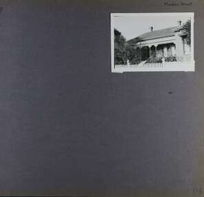
... slate roof... picket fence slate roof chimneys garden cast iron columns cast ...This photograph is part of the Caulfield Historical Album 1972. This album was created in approximately 1972 as part of a project by the Caulfield Historical Society to assist in identifying buildings worthy of preservation. The album is related to a Survey the Caulfield Historical Society developed in collaboration with the National Trust of Australia (Victoria) and Caulfield City Council to identify historic buildings within the City of Caulfield that warranted the protection of a National Trust Classification. Principal photographer thought to be Trevor Hart, member of Caulfield Historical Society. Most photographs were taken between 1966-1972 with a small number of photographs being older and from unknown sources. All photographs are black and white except where stated, with 386 photographs over 198 pages. Page 134 of Photograph Album with one landscape photograph of a Victorian house on Meadow Street.Handwritten: Meadow Street [top right] / 134 [bottom right]trevor hart, east st kilda, decorative brackets, picket fence, slate roof, chimneys, garden, cast iron columns, cast iron frieze, meadow street, st kilda east, caulfield, victorian style, cast iron work, verandahs -
 Glen Eira Historical Society
Album - Album page, Fairfield Hall, 225 North Road, Circa 1972
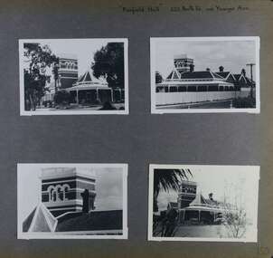
... verandah fairfield estate fairfield street slate roofed red brick ...This photograph is part of the Caulfield Historical Album 1972. This album was created in approximately 1972 as part of a project by the Caulfield Historical Society to assist in identifying buildings worthy of preservation. The album is related to a Survey the Caulfield Historical Society developed in collaboration with the National Trust of Australia (Victoria) and Caulfield City Council to identify historic buildings within the City of Caulfield that warranted the protection of a National Trust Classification. Principal photographer thought to be Trevor Hart, member of Caulfield Historical Society. Most photographs were taken between 1966-1972 with a small number of photographs being older and from unknown sources. All photographs are black and white except where stated, with 386 photographs over 198 pages. Glen Eira Heritage Management Plan 1996 by Andrew Ward https://www.gleneira.vic.gov.au/media/4777/heritage_mment_plan_vol_3b.pdf (as of 27/01/2021) - p90 An imposing single storeyed Italianate bi-chromatic brick villa with three staged tower surmounting the entry and facetted corner bay with conical roof. White tuckpointed black body bricks are relieved with reds and stucco work. Gable ends are fretted and there is a concave cast iron verandah to the principal elevations.Victorian Heritage Database (as of 27/10/2020) - HO49 225 North Road Caulfield South https://vhd.heritagecouncil.vic.gov.au/places/42426 "Maniar" (?) is a substantial late Victorian Italianate villa with tower and extensive grounds built for Frederick Curwan, an inspector of the National Bank, in 1890. It is aesthetically and historically important. An imposing single storeyed ltalianate bi-chromatic brick villa with three staged tower surmounting the entry and facetted comer bay with conical roof. White tuckpointed black body bricks are relieved with reds and stucco work. Gable ends are fretted and there is a concave cast iron verandah to the principal elevations. It is aesthetically important as an imposing and substantially intact villa residence demonstrating the changing architectural fashions of the 1890's, evidenced by the use of face brickwork and fretted gables in the Queen Anne manner. It is historically important for the manner in which it demonstrates the lifestyle to which a businessman could aspire during the boom period.Page 150 of Photograph Album with four landscape photographs of Fairfield Hall on North Road.Handwritten: "Fairfield Hall" 225 North Rd cnr Younger Ave [top right] / 150 [bottom right]trevor hart, jenny o'donnell, verandah, porch, tower house, tower, mansion, three storey tower, bichromatic brickwork, fairfield hall, 1890's, george jobbins, conical roofed projecting corner bay, conical roofed bay, timber ceilings, north road, younger avenue, frederick wallis curwan, curwan, italianate, queen anne, australian homestead, arched windows, curved windows, columned parapet, return verandah, fairfield estate, fairfield street, slate roofed, red brick, polychrome bricks, victorian style, cast iron work, caulfield south, maniar, house names -
 Glen Eira Historical Society
Album - Album page, Grimwade House, Orrong Road, Circa 1972
... slate roof... inception on this site in 1911. trevor hart verandah porch slate ...This photograph is part of the Caulfield Historical Album 1972. This album was created in approximately 1972 as part of a project by the Caulfield Historical Society to assist in identifying buildings worthy of preservation. The album is related to a Survey the Caulfield Historical Society developed in collaboration with the National Trust of Australia (Victoria) and Caulfield City Council to identify historic buildings within the City of Caulfield that warranted the protection of a National Trust Classification. Principal photographer thought to be Trevor Hart, member of Caulfield Historical Society. Most photographs were taken between 1966-1972 with a small number of photographs being older and from unknown sources. All photographs are black and white except where stated, with 386 photographs over 198 pages. From Victorian Heritage Database citation HO54 Grimwade House, former Harleston stables, outbuilding, garden, gate and Picconia excelsa tree. https://vhd.heritagecouncil.vic.gov.au/places/35573 as at (28/10/2020) ''Harleston'', now "Grimwade House", is situated at no. 67 Balaclava Road, Caulfield North, at the Orrong Road corner. It was built for Frederick, later Sir Frederick, Grimwade, to the design of architect Thomas Watts in 1875. Today the complex has been incorporated in the Melbourne Grammar Junior School campus. It retains not only the main house but also the stables and mature garden setting with driveway and gates. It is historically, aesthetically and socially significant.From Victorian Heritage Database citation HO54 Grimwade House, former Harleston stables, outbuilding, garden, gate and Picconia excelsa tree. https://vhd.heritagecouncil.vic.gov.au/places/35573 as at (28/10/2020) It is historically significant (Criterion A) as the former home of prominent business man, speculator and benefactor, Sir Frederick Grimwade. Both Grimwade and his house are exemplars of the commercial enterprise of the Boom period and the amassing of personal fortunes with which it is associated. It is aesthetically significant (Criterion E) as an imposing yet stately large house of its time, the classic Italian form with comer verandah terminated by projecting wings being most distinctively seen in this instance. It is enhanced not only by the garden setting but also by the delicate cast iron verandah spandrels, stained glass work and stencilled ceiling in the music room. It is socially significant (Criterion G) on account of the value placed on it by the community associated with the Melbourne Grammar Junior School since its inception on this site in 1911.Page 154 of Photograph Album with five photographs (4 landscape and one portrait) including Grimwade House, gates and a tram shelter.Handwritten: Grimwade House (Melbourne Grammar Prep School) / incorporating "Harleston" Orrong Rd. S.E cnr Balaclava Rd [top right] / 154 [bottom right]trevor hart, verandah, porch, slate roof, garden, grimwade house, grimwade, harleston, sir frederick grimwade, thomas watts, orrong road, balaclava road, melbourne grammar, melbourne grammar junior school, italianate, cast iron verandah spandrels, stained glass, stencilled ceiling, mgs, m.g.s, school, grimwade family, jessie grimwade, gates, palisade style fence, cast iron spears, stone plinths, melbourne grammar prep school, victorian style, cast iron work, caulfield north, gardens, cars, tram services, outbuildings, stables, trees, picconia excelsa tree -
 Glen Eira Historical Society
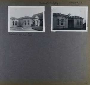
Album - Album page, St Joseph's Presbytery, Orrong Road, Circa 1972
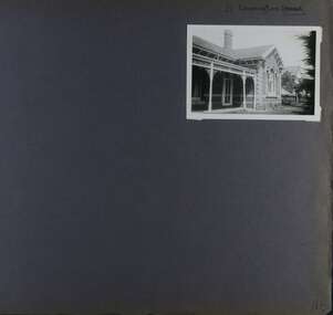
... slate roof... brackets arched windows bay window portico slate roof st joseph's ...This photograph is part of the Caulfield Historical Album 1972. This album was created in approximately 1972 as part of a project by the Caulfield Historical Society to assist in identifying buildings worthy of preservation. The album is related to a Survey the Caulfield Historical Society developed in collaboration with the National Trust of Australia (Victoria) and Caulfield City Council to identify historic buildings within the City of Caulfield that warranted the protection of a National Trust Classification. Principal photographer thought to be Trevor Hart, member of Caulfield Historical Society. Most photographs were taken between 1966-1972 with a small number of photographs being older and from unknown sources. All photographs are black and white except where stated, with 386 photographs over 198 pages. St Joseph's buildings and grounds are contributory properties to HO72 Elsternwick Estate and environs - City of Glen Eira.Page 162 - two photographs of St Joseph's Presbytery, Orrong Road.Handwritten: St Joseph's Presbytery Orrong Road [top right] / PREVIOUSLY "THE EMS" 1908 [under left photo] / 162 [bottom right]trevor hart, orrong road, curved windows, decorative brackets, arched windows, bay window, portico, slate roof, st joseph's presbytery, catholic church, st joseph's church, st joseph's primary school, porte cochere, the ems, elsternwick, rendered walls, clergy residences, drives, late victorian style, house names -
 Glen Eira Historical Society
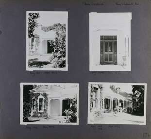
Album - Album page, Rose Craddock, Rose Craddock Avenue, Circa 1972
... slate roof... central section with hipped slate roof and timber posted verandah ...This photograph is part of the Caulfield Historical Album 1972. This album was created in approximately 1972 as part of a project by the Caulfield Historical Society to assist in identifying buildings worthy of preservation. The album is related to a Survey the Caulfield Historical Society developed in collaboration with the National Trust of Australia (Victoria) and Caulfield City Council to identify historic buildings within the City of Caulfield that warranted the protection of a National Trust Classification. Principal photographer thought to be Trevor Hart, member of Caulfield Historical Society. Most photographs were taken between 1966-1972 with a small number of photographs being older and from unknown sources. All photographs are black and white except where stated, with 386 photographs over 198 pages. From Victorian Heritage Database citation for H0589 Rosecraddock 4-10 Craddock Avenue and 2-8 Keverell CAULFIELD NORTH https://vhd.heritagecouncil.vic.gov.au/places/35279 as at (30/10/2020) "Rosecraddock" is regionally important as a surviving large villa from the early Victorian (1850's) period, offering insight into the lifestyles of the privileged in Caulfield at that time. Its importance is enhanced through its long association with the Langdon family and, in particular, Henry Joseph Langdon, founder of H.J. Langdon and Company, China merchants. Victorian Heritage Database HO16 Rosecraddock, 2-8 Keverell Road & 4-10 Craddock Avenue Caulfield North https://vhd.heritagecouncil.vic.gov.au/places/35279 (as of 17/02/2021) A single storeyed stuccoed villa with west facing facade consisting of a parapeted and recessed central section with hipped slate roof and timber posted verandah with cast iron lace. Projecting pavilions have bayed windows and a secondary wing runs north with angled corners and prominent chimney stack. The front entrance is situated at the north end of the central section and is given emphasis by a small hip roof and false pediment to the verandah. Outbuildings include the timber stables with characteristic hay loft gablet and fretted barges to the south-east. Rear additions in brick and timber are of an early date and utilitarian in character. Also see https://vhd.heritagecouncil.vic.gov.au/places/277 for Significance Statement for the H0589 Victorian Heritage Register listing.Page 174 of Photograph Album with four photographs of Rose Craddock.Handwritten: "Rose Craddock" Rose Craddock Ave. top right] / Neg 197 Nov 1972 [under top left photo] / Neg 209 Nov 1972 [under top right photo] / Neg 196 Nov 1972 [under bottom left photo] / Neg 195 198 Nov 1972 [under bottom right photo] / 174 [bottom right]trevor hart, chimneys, porch, rose craddock, rosecraddock, ringwood, 1850's, henry joseph langdon, h.j. langdon, h.j. langdon and company, china merchants, rosecraddock place, slate roof, return verandah, decorative brackets, keverell road, caulfield north, early victorian style, protruding bay windows, cast iron work, rendered walls, entrances, mansions, craddock avenue -
 Glen Eira Historical Society
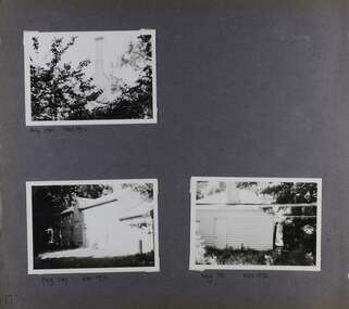
Album - Album page, Rose Craddock, Rose Craddock Avenue, Circa 1972
... slate roof... merchants rosecraddock place slate roof return verandah decorative ...This photograph is part of the Caulfield Historical Album 1972. This album was created in approximately 1972 as part of a project by the Caulfield Historical Society to assist in identifying buildings worthy of preservation. The album is related to a Survey the Caulfield Historical Society developed in collaboration with the National Trust of Australia (Victoria) and Caulfield City Council to identify historic buildings within the City of Caulfield that warranted the protection of a National Trust Classification. Principal photographer thought to be Trevor Hart, member of Caulfield Historical Society. Most photographs were taken between 1966-1972 with a small number of photographs being older and from unknown sources. All photographs are black and white except where stated, with 386 photographs over 198 pages. From Victorian Heritage Database citation for Rosecraddock https://vhd.heritagecouncil.vic.gov.au/places/35279 as at (30/10/2020) City of Glen Eira Heritage Listing HO16 "Rosecraddock" is regionally important as a surviving large villa from the early Victorian (1850's) period, offering insight into the lifestyles of the privileged in Caulfield at that time. Its importance is enhanced through its long association with the Langdon family and, in particular, Henry Joseph Langdon, founder of H.J. Langdon and Company, China merchants.There is a separate statement of significance at https://vhd.heritagecouncil.vic.gov.au/places/277 for H0589 Rosecraddock 2-8 KEVERELL ROAD and 4-10 CRADDOCK AVENUE CAULFIELD NORTH - Victorian Heritage RegisterPage 175 of Photograph Album with three photographs of Rose Craddock.Handwritten: Neg 190 Nov 1972 [under top left photo] / Neg 207 Nov 1972 [under bottom left photo] / Neg 191 Nov 1972 [under bottom right photo] / 175 [bottom left]trevor hart, chimneys, porch, rose craddock, rosecraddock, 1850's, henry joseph langdon, h.j. langdon, h.j. langdon and company, china merchants, rosecraddock place, slate roof, return verandah, decorative brackets, cast iron lacework, keverell road, caulfield north, early victorian style, mansions, protruding bay windows, cast iron work, outbuildings, craddock avenue, gardens -
 Glen Eira Historical Society
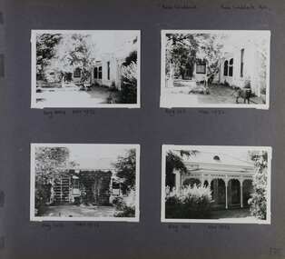
Album - Album page, Rose Craddock, Rose Craddock Avenue, Circa 1972
... slate roof... and company china merchants rosecraddock place mansion slate roof ...This photograph is part of the Caulfield Historical Album 1972. This album was created in approximately 1972 as part of a project by the Caulfield Historical Society to assist in identifying buildings worthy of preservation. The album is related to a Survey the Caulfield Historical Society developed in collaboration with the National Trust of Australia (Victoria) and Caulfield City Council to identify historic buildings within the City of Caulfield that warranted the protection of a National Trust Classification. Principal photographer thought to be Trevor Hart, member of Caulfield Historical Society. Most photographs were taken between 1966-1972 with a small number of photographs being older and from unknown sources. All photographs are black and white except where stated, with 386 photographs over 198 pages. From Victorian Heritage Database citation for HO16 Rosecraddock 4-10 Craddock Avenue and 2-8 Keverell CAULFIELD NORTH https://vhd.heritagecouncil.vic.gov.au/places/35279 as at (30/10/2020) - the City of Glen Eira Heritage listing "Rosecraddock" is regionally important as a surviving large villa from the early Victorian (1850's) period, offering insight into the lifestyles of the privileged in Caulfield at that time. Its importance is enhanced through its long association with the Langdon family and, in particular, Henry Joseph Langdon, founder of H.J. Langdon and Company, China merchants. There is a separate statement of significance at https://vhd.heritagecouncil.vic.gov.au/places/277 for H0589 Rosecraddock 2-8 KEVERELL ROAD and 4-10 CRADDOCK AVENUE CAULFIELD NORTH - Victorian Heritage RegisterPage 176 of Photograph Album with four photographs of Rose Craddock.Handwritten: "Rose Craddock" Rose Craddock Ave. [top right] / Neg 204 Nov 1972 [under top left photo] / Neg 193 Nov 1972 [under top right photo] / Neg 208 Nov 1972 [under bottom left photo] / Neg 194 Nov 1972 [under bottom right photo] / 176 [bottom right]trevor hart, chimneys, porch, rose craddock, rosecraddock, 1850's, henry joseph langdon, h.j. langdon, h.j. langdon and company, china merchants, rosecraddock place, mansion, slate roof, return verandah, decorative brackets, cast iron lacework, keverell road, caulfield north, early victorian style, protruding bay windows, cast iron work, gardens, craddock avenue -
 Glen Eira Historical Society
Album - Album page, Glenmoore, St George's Road, Circa 1972
... slate roof... and central tympanum enrichment. The hipped roof is in slate and has ...This photograph is part of the Caulfield Historical Album 1972. This album was created in approximately 1972 as part of a project by the Caulfield Historical Society to assist in identifying buildings worthy of preservation. The album is related to a Survey the Caulfield Historical Society developed in collaboration with the National Trust of Australia (Victoria) and Caulfield City Council to identify historic buildings within the City of Caulfield that warranted the protection of a National Trust Classification. Principal photographer thought to be Trevor Hart, member of Caulfield Historical Society. Most photographs were taken between 1966-1972 with a small number of photographs being older and from unknown sources. All photographs are black and white except where stated, with 386 photographs over 198 pages. From Victorian Heritage Database citation for HO59 Glenmoore, 1 St Georges Road Elsternwick https://vhd.heritagecouncil.vic.gov.au/places/35202 as at 30/10/2020 "Glenmoore" is locally significant as a surviving mid nineteenth century villa residence in the then fashionable bi-chromatic brick form. It is also important as the home of Hugh Moore who built several shops in nearby Glen Huntly Road and which remain as important contributors to the architectural character of the Elsternwick Shopping Centre.Victorian Heritage Database citation HO59 Glenmoore, 1 St Georges Road Elsternwick https://vhd.heritagecouncil.vic.gov.au/places/35202 An imposing two storeyed villa in bichrome brick with two storeyed timber posted verandah, coupled with cast iron lace frieze, spandrels and central tympanum enrichment. The hipped roof is in slate and has a prominent crean1 brick chimney stack forming part of the facade. Openings are flat arched although the entrance is round arched with a fan light. The south elevation has bayed windows. Two storeyed hip roofed additions are sympathetic and attached on the north side and at the rear. Inside, the staircase and stained glasswork with initials "HM" and family coat of arms are important surviving elements. INTEGRITY: Good, timber outbuildings of an early date, mature and spacious front garden includes early palm trees. Alterations include reconstruction of facade verandah including tiled pavement and front door on east side. Interior has a high level of integrity. Original grounds included adjoining "Carramar".Page 178 of Photograph Album with three photographs of Glenmoore, St Georges Road. Handwritten: "Glenmoore" 1 St George's Road [top right] / 178 [bottom right]trevor hart, chimneys, porch, mansion, slate roof, return verandah, stained glass, cast iron frieze, glenmoore, 1860's, hugh moore, glenmoore estate, double storey, elsternwick shops, st george's road, thomas watts, elsternwick, victorian style, protruding bay windows, cast iron work, bi-chromatic bricks, gardens, balconies, moore's buildings, glen huntly road, stairs, house names -
 Glen Eira Historical Society
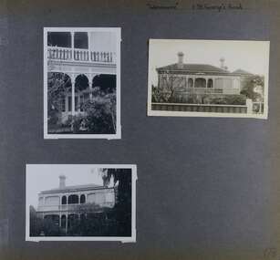
Album - Album page, Staniland Grove, Circa 1972
... slate roof... decorative brackets cast iron lacework 1880's slate roof single ...This album was created in approximately 1972 as part of a project by the Caulfield Historical Society to assist in identifying buildings worthy of preservation. The album is related to a Survey the Caulfield Historical Society developed in collaboration with the National Trust of Australia (Victoria) and Caulfield City Council to identify historic buildings within the City of Caulfield that warranted the protection of a National Trust Classification. Principal photographer thought to be Trevor Hart, member of Caulfield Historical Society. Most photographs were taken between 1966-1972 with a small number of photographs being older and from unknown sources. All photographs are black and white except where stated, with 386 photographs over 198 pages. 15 Staniland Grove is a contributory property to HO72 Elsternwick Estate and environs.Page 192 of Photograph Album with one photograph of a house on Staniland Grove.Handwritten: Staniland Street altered to Staniland Grove [top right] / 15 STANILAND ST [under photo] /192 [bottom right]trevor hart, chimneys, porch, villa residence, garden, verandah, 1890's, late victorian, decorative brackets, cast iron lacework, 1880's, slate roof, single storey, cast iron columns, cast iron frieze, elsternwick, boom period, triangulated pediment, coloured glass, mosaic tiling, complex tiled patterns, pots, italianate, staniland grove, rendered -
 Glen Eira Historical Society
Photograph, Murrumbeena Road, 235, Murrumbeena, 2001
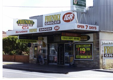
Originally labelled "Beauville Estate, Established 1936, Still Thriving 65 years on, 10th March 2001", the Beauville Estate Album contains colour photographs of houses in the Estate. They were taken around the time of the Beauville Estate’s 65th Heritage Celebration held on 10/03/2001 and donated to the Caulfield Historical Society shortly afterwards. Photographer unknown. No. 235 is NOT covered by the Heritage Overlay HO12.Colour photograph of a supermarket. The property features a flat roof awning, corrugated parapet, irregular multi-coloured slate tile and brick facade and extensive advertising over the front and side of the building plus on the gate to the right.Murumbeena FRIENDLY GROCER IGA / OPEN 7 DAYS / NEWSPAPERS / COLD SOFT DRINKmurrumbeena, architectural styles, 1930's, inter war style, a.v. jennings, av jennings, jennings, beauville estate, murrumbeena road, commercial establishments, shops, supermarkets, sir albert victor jennings, a v jennings construction co, beauville estate heritage area, glen eira city council, architectural features, jennings group limited, land subdivision, beauville historic area, brick shops, parapets, advertising signs, murumbeena friendly grocer iga -
 Glen Eira Historical Society
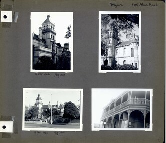
Album - Album page, Myoora, 405 Alma Road, Circa 1972
... slate roof... brick slate roof cast iron verandah cast iron balconies ...This photograph is part of the Caulfield Historical Album 1972. This album was created in approximately 1972 as part of a project by the Caulfield Historical Society to assist in identifying buildings worthy of preservation. The album is related to a Survey the Caulfield Historical Society developed in collaboration with the National Trust of Australia (Victoria) and Caulfield City Council to identify historic buildings within the City of Caulfield that warranted the protection of a National Trust Classification. Principal photographer thought to be Trevor Hart, member of Caulfield Historical Society. Most photographs were taken between 1966-1972 with a small number of photographs being older and from unknown sources. All photographs are black and white except where stated, with 386 photographs over 198 pages. Myoora - Victorian Heritage Register (VHR) Number H0490 https://vhd.heritagecouncil.vic.gov.au/places/275 Myoora, 405 Alma Road, North Caulfield, was designed by Reed, Henderson & Smart and can be attributed to Anketell Henderson. It was built in 1886 and 1887 for Thomas Christian, who had founded the fabled gold mine, the Day Dawn at Charters Towers. He never occupied the house although his widow lived there for some time. The house was subdivided into three and later six flats. Myoora was one of many large mansions on broad acres with gardens in Caulfield. Perhaps the grandest was Labassa. The mansions date from the 1850s through to the late 1890s. The siting of Myoora on a ridge influenced its planning and composition. A central hall and corridor along the ridge is entered from the centre of the more formal north facade. The entrance is marked by an elaborately detailed tower. A stair turret provides a second accent. The western end of the building is completed by a massively detailed chimney as the service wing. The south facade enjoyed an outlook to port phillip from a two-storey cast iron verandah. Bay windows, chimneys, the tower and the turret and minor details are brought together in a sophisticated asymmetrical composition. This is reflected in the planning. The asymmetry of Myoora pivoting on the tower is the most notable feature of the building. The walls are built of cement rendered brick. The cement render has not been painted. The roof is slate. The balconies and verandah are cast iron. The footings and cellar are bluestone. The architectural firm Reed, Henderson & Smart was very prominent in Victoria in the nineteenth century. Anketell Henderson was an eminent and well respected member of the profession. He worked successfully in London and interstate as well as in Victoria. They were better known for commercial and public buildings. Myoora is an important private commission. The style of Myoora is a combination of details from the Continental and English Renaissance through the boom style and the Queen Anne style. There is also an early influence from the American Romanesque style especially in the stair turret. The latter style was important at the turn of the century and Myoora is a significant precursor. Other buildings of a similar scale survive in Caulfield and elsewhere. Labassa, the most fabulous, is quite different stylistically as are most of the other comparable mansions.Page 6 of Photograph Album including four black and white photographs of the mansion Myoora. Two photographs in the top half of the page are in portrait orientation while the two photographs in the bottom half of the page are in landscape orientation.Handwritten: "Myoora" 405 Alma Rd [top right hand corner] / 8 Oct 1966 Neg 229 [underneath top left photograph] / 8 Oct 1966 Neg 230 [underneath bottom left photograph] / 6 [bottom right]caulfield north, trevor hart, alma road, mansion, myoora, tower, lacework, arched windows, anketell henderson, thomas christian, 1880's, cement rendered brick, slate roof, cast iron verandah, cast iron balconies, bluestone footings, queen anne, american romanesque, bay windows, boom style, continental and english renaissance, cast iron work, reed henderson & smart, flats, gardens, asymmetrical style -
 Glen Eira Historical Society
Album - Album page, Kynaston now Kahlyn, Bambra Road, Circa 1972
... slate roof... verandah victorian decorative brackets slate roof curved windows ...This photograph is part of the Caulfield Historical Album 1972. This album was created in approximately 1972 as part of a project by the Caulfield Historical Society to assist in identifying buildings worthy of preservation. The album is related to a Survey the Caulfield Historical Society developed in collaboration with the National Trust of Australia (Victoria) and Caulfield City Council to identify historic buildings within the City of Caulfield that warranted the protection of a National Trust Classification. Principal photographer thought to be Trevor Hart, member of Caulfield Historical Society. Most photographs were taken between 1966-1972 with a small number of photographs being older and from unknown sources. All photographs are black and white except where stated, with 386 photographs over 198 pages.https://vhd.heritagecouncil.vic.gov.au/places/35575 From: Glen Eira Heritage Management Plan (1996) by Andrew Ward and Associates Significance: "Kynaston" is locally important as a large late Victorian villa residence, demonstrating something of the lifestyle to which a senior government bureaucrat could aspire during the late nineteenth century boom period. The design of the verandah, though defaced, is unusual in Caulfield and, therefore, important. A substantial late Victorian stuccoed Bool11 style villa residence with tower surmounting the entrance porch, fluted columns to the ground level verandah and parapeted balcony over, now built in with a sympathetic addition at the north-west corner. The principal rooms and staircase are intact and representative of the period.Page 34 of Photograph Album with two portrait photographs of exterior of Kynaston - 2 views highlighting the front of the mansionHand written: "Kynaston" now "Kahlyn" Bambra Road [top right] / 34 [bottom right] trevor hart, caulfield north, bambra road, 1850's, mansion, villa residence, cast iron verandah, victorian, decorative brackets, slate roof, curved windows, 1880's, kynaston, kynaston l murray, kahlyn private hospital, kahlyn, return verandah, enclosed verandah, cast iron work, double storey mansions, towers, balconies -
 Glen Eira Historical Society
Album - Album page, Glenferrie Street, 4, Circa 1972
... has a pyramidal slate roof with prominent chimney stacks ...This photograph is part of the Caulfield Historical Album 1972. This album was created in approximately 1972 as part of a project by the Caulfield Historical Society to assist in identifying buildings worthy of preservation. The album is related to a Survey the Caulfield Historical Society developed in collaboration with the National Trust of Australia (Victoria) and Caulfield City Council to identify historic buildings within the City of Caulfield that warranted the protection of a National Trust Classification. Principal photographer thought to be Trevor Hart, member of Caulfield Historical Society. Most photographs were taken between 1966-1972 with a small number of photographs being older and from unknown sources. All photographs are black and white except where stated, with 386 photographs over 198 pages. From Glen Eira Heritage Management Plan 1996 by Andrew Ward: In 1905, most of portion 27 was vacant land, however Glenferrie Street had been formed and the land subsequently subdivided. In 1906, Robert Joseph Haddon, architect and painter, designed and built for his private residence, a brick house on the west side. Haddon named the house "Anselm". Also built on the property were a garage and fibro cement studio. "Anselm" is architecturally important at the State level as a substantially intact, highly personalised and boldly expressed house expressive the Arts and Crafts movement and incorporating Art Nouveaux enrichment in a variety of forms, the use of ornamental terra cotta tiles to the comer tower being of special note. Its importance at the State level is strengthened by its place as the home of the noted architect and Melbourne's most influential exponent (Freeland, J.M., Architecture in Australia, p. 213) of the Art Nouveaux movement.https://vhd.heritagecouncil.vic.gov.au/places/4442 Victorian Heritage Register: What is significant? Anselm was designed by noted English born architect Robert Joseph Haddon(1866-1929) as his own house and constructed in 1906. A single storey Arts and Crafts influenced red brick house with attic, Anselm has a pyramidal slate roof with prominent chimney stacks. There is a octagonal corner tower with saucer shaped domed roof surmounted by a weather vane, and the tower has decorative terracotta panels immediately below the eaves line. The front door opens immediately into a large living or common room, screened from view by a timber and bottle glass screen. The large room was designed to function as a drawing and dining room. The house is rich with hand crafted details including door and window furniture, wrought iron gutter brackets, fireplaces (one with built in wood box), and fire tools. The interior decoration includes hand painted frieze of Port Phillip in the study, and a hand painted frieze of turbulent sea with sailing boats in the tiled bathroom. There is a small hand painted tile at the base of the tower which states ?This building was erected AD1906 from designs by Robt J Haddon FRIBA,Lond FRIVA Melb Architect?. He also designed an attic addition which was constructed in 1927. Anselm is substantially intact although the double casement window immediately to the south of the front door was originally circular....Page 60 of Photograph Album with three exterior photographs (one portrait and two landscape) of Anselm.Hand written: 4 Glenferrie Street [top right] / ANSELM 4 Glenferrie St [under top photo] / 60 [bottom right] trevor hart, anselm, art nouveaux, arts and crafts, tower, bay window, glenferrie street, robert joseph haddon, 1900's, terra cotta tiles, double storey, caulfield north, corner tower, gates, cast iron work -
 Glen Eira Historical Society
Album - Album page, Glenferrie Street, 4, Circa 1972
... a pyramidal slate roof with prominent chimney stacks ...This photograph is part of the Caulfield Historical Album 1972. This album was created in approximately 1972 as part of a project by the Caulfield Historical Society to assist in identifying buildings worthy of preservation. The album is related to a Survey the Caulfield Historical Society developed in collaboration with the National Trust of Australia (Victoria) and Caulfield City Council to identify historic buildings within the City of Caulfield that warranted the protection of a National Trust Classification. Principal photographer thought to be Trevor Hart, member of Caulfield Historical Society. Most photographs were taken between 1966-1972 with a small number of photographs being older and from unknown sources. All photographs are black and white except where stated, with 386 photographs over 198 pages. From Glen Eira Heritage Management Plan 1996 by Andrew Ward: In 1905, most of portion 27 was vacant land, however Glenferrie Street had been formed and the land subsequently subdivided. In 1906, Robert Joseph Haddon, architect and painter, designed and built for his private residence, a brick house on the west side. Haddon named the house "Anselm". Also built on the property were a garage and fibro cement studio. "Anselm" is architecturally important at the State level as a substantially intact, highly personalised and boldly expressed house expressive the Arts and Crafts movement and incorporating Art Nouveaux enrichment in a variety of forms, the use of ornamental terra cotta tiles to the comer tower being of special note. Its importance at the State level is strengthened by its place as the home of the noted architect and Melboume's most influential exponent (Freeland, J.M., Architecture in Australia, p. 213) of the Art Nouveaux movement. Victorian Heritage Register https://vhd.heritagecouncil.vic.gov.au/places/4442 What is significant? Anselm was designed by noted English born architect Robert Joseph Haddon(1866-1929) as his own house and constructed in 1906. A single storey Arts and Crafts influenced red brick house with attic, Anselm has a pyramidal slate roof with prominent chimney stacks. There is a octagonal corner tower with saucer shaped domed roof surmounted by a weather vane, and the tower has decorative terracotta panels immediately below the eaves line. The front door opens immediately into a large living or common room, screened from view by a timber and bottle glass screen. The large room was designed to function as a drawing and dining room. The house is rich with hand crafted details including door and window furniture, wrought iron gutter brackets, fireplaces (one with built in wood box), and fire tools. The interior decoration includes hand painted frieze of Port Phillip in the study, and a hand painted frieze of turbulent sea with sailing boats in the tiled bathroom. There is a small hand painted tile at the base of the tower which states ?This building was erected AD1906 from designs by Robt J Haddon FRIBA,Lond FRIVA Melb Architect?. He also designed an attic addition which was constructed in 1927. Anselm is substantially intact although the double casement window immediately to the south of the front door was originally circular....Page 61 of Photograph Album with one exterior photograph (portrait) of Anselm.Hand written: 61 [bottom left] trevor hart, anselm, art nouveaux, arts and crafts, tower, bay window, glenferrie street, robert joseph haddon, 1900's, terra cotta tiles, double storey, caulfield north, corner tower, brick house, attics -
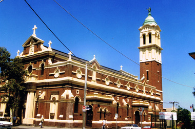 St Kilda Historical Society
Photograph, Sacred Heart Church in St Kilda
... bricks, cement dressings and a slate roof. It indicated ...The church was opened and dedicated on 7/12/1884, and completed in 1922. http://skhs.org.au/SKHSchurches/Sacred%20Heart%20Church.htmThe church is of architectural significance due to its Italian Renaissance Baroque Style, with red bricks, cement dressings and a slate roof. It indicated the abandonment of the Gothic Revival style favoured by Victoria's Roman Catholics and set the new style for subsequent Roman Catholic churches in Victoria. It was designed by Reed, Henderson & Smart. colour photographst kilda, churches, catholic churches, sacred heart -
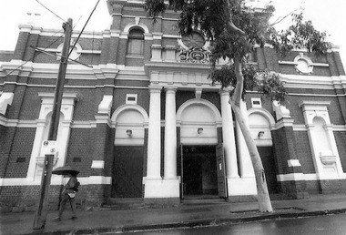 St Kilda Historical Society
Photograph
... bricks, cement dressings and a slate roof. It indicated ...The church was opened and dedicated on 7/12/1884, and completed in 1922. http://skhs.org.au/SKHSchurches/Sacred%20Heart%20Church.htmThe church is of architectural significance due to its Italian Renaissance Baroque Style, with red bricks, cement dressings and a slate roof. It indicated the abandonment of the Gothic Revival style favoured by Victoria's Roman Catholics and set the new style for subsequent Roman Catholic churches in Victoria. It was designed by Reed, Henderson & Smart.Black and white photograph, unmountedst kilda, sacred heart church, sacred heart catholic church, grey street, catholic churches -
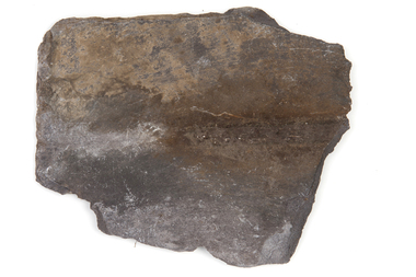 Uniting Church Archives - Synod of Victoria
Roof slate
... Roof slate... church was built on Mt Alexander Road in 1865. Roof slate ...Flemington Wesleyan Methodist church was built on Mt Alexander Road in 1865.