Showing 908 items matching "eltham east"
-
 Eltham District Historical Society Inc
Photograph - Aerial Photograph, Landata, Lower Plenty, Feb. 1956
Centred on present day 217 Old Eltham Road, Lower Plenty bounded by Pitt Street to north, Yarra River to south, Main Road to east and Bonds Road to west. Historic Aerial Imagery Source: Landata.vic.gov.au Aerial Photo Details: Project No :250 Project : MELBOURNE OUTER SUBURBS PROJECT Run : 17 Frame : 116 Date : 02/1956 Film Type : B/W Camera : EAG9 Flying Height : 10000 Scale : 12000 Film Number : 1176 GDA2020 : 37°43'58"S, 145°07'49"E MGA2020 : 335237, 5822186 (55) Melways : 21 E10 (ed. 42)aerial photo, 1956-02, neil webster collection, eltham, main road, bonds road, elham, lower plenty, melway 21e10, pitt street, yarra river -
 Eltham District Historical Society Inc
Photograph - Aerial Photograph, Landata, Eltham, Feb. 1956
Centred on present day Mount Plaeasant Road near Dalton Street, Eltham bounded by Luck Street to north, Eltham Lower Park to south, Reynolds Road to east and Central Park to west Historic Aerial Imagery Source: Landata.vic.gov.au Aerial Photo Details: Project No :250 Project : MELBOURNE OUTER SUBURBS PROJECT Run : 18 Frame : 93 Date : 02/1956 Film Type : B/W Camera : EAG9 Flying Height : 10000 Scale : 12000 Film Number : 1176 GDA2020 : 37°43'02"S, 145°09'38"E MGA2020 : 337871, 5823961 (55) Melways : 22 B6 (ed. 42)aerial photo, 1956-02, neil webster collection, eltham, central park, eltham lower park, luck street, melway 22b6, nyora road, reynolds road, dalton street, mount pleasant road -
 Eltham District Historical Society Inc
Photograph - Aerial Photograph, Landata, Eltham, Feb. 1956
Centred on present day Shalbury Avenue, Eltham bounded by Leane Drive and Parsons Road to north, Nyora Road to south, Reynolds Road to east and the Diamond Creek to west Historic Aerial Imagery Source: Landata.vic.gov.au Aerial Photo Details: Project No :250 Project : MELBOURNE OUTER SUBURBS PROJECT Run : 18 Frame : 95 Date : 02/1956 Film Type : B/W Camera : EAG9 Flying Height : 10000 Scale : 12000 Film Number : 1176 GDA2020 : 37°41'57"S, 145°09'51"E MGA2020 : 338145, 5825965 (55) Melways : 22 C1 (ed. 42)aerial photo, 1956-02, neil webster collection, eltham, diamond creek (creek), melway 22c1, nyora road, parsons road, reynolds road, shalbury avenue -
 Eltham District Historical Society Inc
Photograph - Aerial Photograph, Landata, Eltham, Vic, Feb. 1956
Centred on present day Parsons Avenue at Leane Drive near the Maroondah Aqueduct, Eltham bounded by Lorimer Road to north, Thompson Crescent and Norman Road to south, Bells Hill Road to east and Parsons Road to west Historic Aerial Imagery Source: Landata.vic.gov.au Aerial Photo Details: Project No :250 Project : MELBOURNE OUTER SUBURBS PROJECT Run : 19 Frame : 5 Date : 02/1956 Film Type : B/W Camera : EAG9 Flying Height : 10000 Scale : 12000 Film Number : 1176 GDA2020 : 37°42'04"S, 145°11'09"E MGA2020 : 340064, 5825786 (55) Melways : 22 H1 (ed. 42)aerial photo, 1956-02, neil webster collection, allendale road, bells hill road, eltham, leane drive, lorimer road, maroondah aqueduct, melway 22h1, norman road, parsons road, research (vic.), thompson crescent -
 Eltham District Historical Society Inc
Photograph - Aerial Photograph, Landata, Research, Vic, Feb. 1956
Centred on present day Thompson Crescent, Research bounded by Maroondah Aqueduct to north, Thompson Crescent and Nyora Road to south, Bells Hill Road to east and Eucalyptus Road to west Historic Aerial Imagery Source: Landata.vic.gov.au Aerial Photo Details: Project No :250 Project : MELBOURNE OUTER SUBURBS PROJECT Run : 19 Frame : 6 Date : 02/1956 Film Type : B/W Camera : EAG9 Flying Height : 10000 Scale : 12000 Film Number : 1176 GDA2020 : 37°42'38"S, 145°11'02"E MGA2020 : 339927, 5824736 (55) Melways : 22 H4 (ed. 42)aerial photo, 1956-02, neil webster collection, bells hill road, eltham, eucalyptus road, maroondah aqueduct, melway 22h4, nyora road, research (vic.), thompson crescent -
 Eltham District Historical Society Inc
Photograph - Aerial Photograph, Landata, Eltham, Vic, Apr. 1963
Centred on present day Zig Zag Road and Main Road, Eltham bounded by Maroondah Aqueduct to north, Thompson Crescent and Arthur Street to south, Parsons Road to east and Glen Park Road and Banks Road to west. Historic Aerial Imagery Source: Landata.vic.gov.au Aerial Photo Details: Project No :486 Project : MELBOURNE (1963) PROJECT Run : 5 Frame : 59 Date : 04/1963 Film Type : B/W Camera : RC8 Flying Height : 5100 Scale : 9600 Film Number : 1805 GDA2020 : 37°42'24"S, 145°08'52"E MGA2020 : 336716, 5825114 (55) Melways : 21 J3 (ed. 42)aerial photo, neil webster collection, eltham, 1963-04, arthur street, banks road, glen park road, maroondah aqueduct, melway 21j3, parsons road -
 Eltham District Historical Society Inc
Photograph - Aerial Photograph, Landata, Eltham, Vic, Apr. 1963
Centred on present day Floriston Grove, Eltham bounded by Maroondah Aqueduct to north, Thompson Crescent and Diosma Road to south, Research Shops to east and Glen Park Road and Park West Road to west. Historic Aerial Imagery Source: Landata.vic.gov.au Aerial Photo Details: Project No :486 Project : MELBOURNE (1963) PROJECT Run : 5 Frame : 60 Date : 04/1963 Film Type : B/W Camera : RC8 Flying Height : 5100 Scale : 9600 Film Number : 1805 GDA2020 : 37°42'24"S, 145°09'29"E MGA2020 : 337622, 5825128 (55) Melways : 22 B3 (ed. 42)aerial photo, neil webster collection, eltham, 1963-04, diosma road, floriston grove, maroondah aqueduct, melway 22b3, park west road, research (vic.), research shops -
 Eltham District Historical Society Inc
Photograph - Aerial Photograph, Landata, Eltham, Vic, Apr. 1963
Centred on present day John Street, Eltham between Main and Bible streets bounded by Elsa Court to north, Main Road Bridge to south, Wattle Grove to east and Bolton Street to west. Historic Aerial Imagery Source: Landata.vic.gov.au Aerial Photo Details: Project No :486 Project : MELBOURNE (1963) PROJECT Run : 6 Frame : 123 Date : 04/1963 Film Type : B/W Camera : RC8 Flying Height : 5100 Scale : 9600 Film Number : 1805 GDA2020 : 37°43'12"S, 145°08'54"E MGA2020 : 336800, 5823623 (55) Melways : 21 J6 (ed. 42)aerial photo, neil webster collection, 1963-04, bolton steet, elsa court, eltham, john street, main road, main road bridge, melway 21j6, wattle grove -
 Eltham District Historical Society Inc
Photograph - Aerial Photograph, Landata, Eltham, Vic, Apr. 1963
Centred on present day Eltham Ridge, Bolton Street, Eltham bounded by Elsa Court to north, Main Road to south, Bible Street to east and Reichelt Avenue and Rattray Road to west. Historic Aerial Imagery Source: Landata.vic.gov.au Aerial Photo Details: Project No :486 Project : MELBOURNE (1963) PROJECT Run : 6 Frame : 124 Date : 04/1963 Film Type : B/W Camera : RC8 Flying Height : 5100 Scale : 9600 Film Number : 1805 GDA2020 : 37°43'12"S, 145°08'16"E MGA2020 : 335876, 5823604 (55) Melways : 21 G6 (ed. 42)aerial photo, neil webster collection, 1963-04, bible street, bolton street, eltham, eltham ridge, main road, montmorency, rattray road, reichelt avenue -
 Eltham District Historical Society Inc
Photograph - Aerial Photograph, Landata, Lower Plenty, Vic, Apr. 1963
Centred on present day Old Eltham Road near Araluen Centre, Lower Plenty bounded by Cromwell Street to north, Yarra River to south, Main Road at Mount Pleasant Road to east and Panorama Avenue to west. Historic Aerial Imagery Source: Landata.vic.gov.au Aerial Photo Details: Project No :486 Project : MELBOURNE (1963) PROJECT Run : 7 Frame : 231 Date : 04/1963 Film Type : B/W Camera : RC8 Flying Height : 5100 Scale : 9600 Film Number : 1805 GDA2020 : 37°44'03"S, 145°07'56"E MGA2020 : 335420, 5822027 (55) Melways : 21 F10 (ed. 42)aerial photo, neil webster collection, 1963-04, araluen, cromwell street, eltham, lower plenty, main road, melway 21f10, mount pleasant road, old eltham road, panorama avenue, yarra river -
 Eltham District Historical Society Inc
Photograph - Aerial Photograph, Landata, Eltham, Vic, Apr. 1963
Centred on present day Eltham Lower Park bounded by Brougham Street to north, Yarra River and Fitzsimons Lane Bridge to south, Main Road at Kent Hughes Road to east and Bolton Street to west. Historic Aerial Imagery Source: Landata.vic.gov.au Aerial Photo Details: Project No :486 Project : MELBOURNE (1963) PROJECT Run : 7 Frame : 232 Date : 04/1963 Film Type : B/W Camera : RC8 Flying Height : 5100 Scale : 9600 Film Number : 1805 GDA2020 : 37°44'03"S, 145°08'33"E MGA2020 : 336329, 5822040 (55) Melways : 21 H10 (ed. 42)aerial photo, neil webster collection, 1963-04, bolton steet, brougham steet, eltham, eltham lower park, fitzsimons lane bridge, kent hughes road, melway 21h10, yarra river -
 Eltham District Historical Society Inc
Photograph - Aerial Photograph, Landata, Eltham, Vic, Apr. 1963
Centred on present day Griffith Park Road, Eltham bounded by Mount Pleasant Road to north, Yarra River and Templestowe to south, Main Road at Reynolds Road to east and Falkiner Street to west. Historic Aerial Imagery Source: Landata.vic.gov.au Aerial Photo Details: Project No :486 Project : MELBOURNE (1963) PROJECT Run : 7 Frame : 233 Date : 04/1963 Film Type : B/W Camera : RC8 Flying Height : 5100 Scale : 9600 Film Number : 1805 GDA2020 : 37°44'04"S, 145°09'10"E MGA2020 : 337237, 5822053 (55) Melways : 22 A10 (ed. 42)aerial photo, neil webster collection, 1963-04, eltham, falkiner street, griffith park road, melway 22a10, mount pleasant road, reynolds road, templestowe, yarra river -
 Eltham District Historical Society Inc
Photograph - Aerial Photograph, Landata, Eltham North, Vic, Apr. 1972
Centred on present day Eltham North reserve near Eltham North Primary School, Eltham North bounded by Allendale Road to north, Bellevue Road to south, Zig Zag Road and Beard Street to east and Ryans Road to west. Historic Aerial Imagery Source: Landata.vic.gov.au Aerial Photo Details: Project No :985 Project : MELBOURNE 1972 Run : 26 Frame : 190 Date : 04/1972 Film Type : B/W Camera : RC10 Flying Height : 5700 Scale : 9600 Film Number : 2636 GDA2020 : 37°41'52"S, 145°08'52"E MGA2020 : 336705, 5826102 (55) Melways : 11 J12 (ed. 42)aerial photo, neil webster collection, 1972-04, allendale road, beard street, bellevue road, eltham, eltham north, eltham north reserve, melway 11j12, ryans road, zig zag road, eltham north primary school -
 Eltham District Historical Society Inc
Photograph - Aerial Photograph, Landata, Eltham, Vic, Apr. 1972
Centred on present day Zig Zag Road near Coolabah Drive, Eltham bounded by Allendale Road to north, Park West Road to south, Parsons Road to east and Banks Road to west. Historic Aerial Imagery Source: Landata.vic.gov.au Aerial Photo Details: Project No :985 Project : MELBOURNE 1972 Run : 26 Frame : 191 Date : 04/1972 Film Type : B/W Camera : RC10 Flying Height : 5700 Scale : 9600 Film Number : 2636 GDA2020 : 37°41'56"S, 145°09'26"E MGA2020 : 337533, 5826000 (55) Melways : 22 A1 (ed. 42)aerial photo, neil webster collection, 1972-04, allendale road, eltham, eltham north, zig zag road, banks road, coolabah drive, melway 22a1, park west road, parsons road -
 Eltham District Historical Society Inc
Photograph - Aerial Photograph, Landata, Eltham, Vic, Apr. 1972
Centred on present day Parsons Road, Eltham bounded by Allendale Road to north, Frank Street to south, Research Shops and Raglan Road to east and Zig Zag Road to west. Historic Aerial Imagery Source: Landata.vic.gov.au Aerial Photo Details: Project No :985 Project : MELBOURNE 1972 Run : 26 Frame : 192 Date : 04/1972 Film Type : B/W Camera : RC10 Flying Height : 5700 Scale : 9600 Film Number : 2636 GDA2020 : 37°42'00"S, 145°09'59"E MGA2020 : 338360, 5825897 (55) Melways : 22 D1 (ed. 42)aerial photo, neil webster collection, 1972-04, allendale road, eltham, zig zag road, frank street, melway 22d1, parsons road, raglan road, research (vic.), research shops, eltham barrel -
 Eltham District Historical Society Inc
Photograph - Aerial Photograph, Landata, Research, Vic, Apr. 1972
Centred on present day Main Road, Research near Maroondah Aqueduct and Eltham College bounded by Allendale Road to north, Research-Warrandyte Road to south, Swipers Gully Training Restaurant to east and Reynolds Road to west. Historic Aerial Imagery Source: Landata.vic.gov.au Aerial Photo Details: Project No :985 Project : MELBOURNE 1972 Run : 26 Frame : 194 Date : 04/1972 Film Type : B/W Camera : RC10 Flying Height : 5700 Scale : 9600 Film Number : 2636 GDA2020 : 37°42'07"S, 145°11'07"E MGA2020 : 340015, 5825692 (55) Melways : 22 H1 (ed. 42)aerial photo, neil webster collection, 1972-04, allendale road, eltham college, main road, maroondah aqueduct, melway 22h1, research (vic.), research-warrandyte road, reynolds road, swiper's gully -
 Eltham District Historical Society Inc
Photograph - Aerial Photograph, Landata, Eltham, Vic, Apr. 1972
Centred on present day Main Road at Pryor Street, Eltham bounded by Park West Road to north, Napoleon Street to south, Woodridge Estate to east and Ryans Road to west. Historic Aerial Imagery Source: Landata.vic.gov.au Aerial Photo Details: Project No :985 Project : MELBOURNE 1972 Run : 27 Frame : 47 Date : 04/1972 Film Type : B/W Camera : RC10 Flying Height : 5700 Scale : 9600 Film Number : 2636 GDA2020 : 37°42'45"S, 145°09'12"E MGA2020 : 337223, 5824470 (55) Melways : 22 A4 (ed. 42)aerial photo, neil webster collection, 1972-04, eltham, eltham railway station, woodridge estate, eltham shops, main road, melway 22a4, napoleon street, park west road, pryor street, ryans road -
 Eltham District Historical Society Inc
Photograph - Aerial Photograph, Landata, Eltham, Vic, Apr. 1972
Centred on present day Ryans Road at Sandra Avenue, Eltham bounded by Progress Road to north, Brougham Street to south, Bible Street to east and Outlook Crescent to west. Historic Aerial Imagery Source: Landata.vic.gov.au Aerial Photo Details: Project No :985 Project : MELBOURNE 1972 Run : 27 Frame : 48 Date : 04/1972 Film Type : B/W Camera : RC10 Flying Height : 5700 Scale : 9600 Film Number : 2636 GDA2020 : 37°42'41"S, 145°08'38"E MGA2020 : 336392, 5824574 (55) Melways : 21 H4 (ed. 42)aerial photo, neil webster collection, 1972-04, eltham, bible street, brougham steet, melway 21h4, outlook crescent, progress road, ryans road, sandra avenue, montmorency -
 Eltham District Historical Society Inc
Photograph - Aerial Photograph, Landata, Montmorency, Vic, Apr. 1972
Centred on present day Olympic Avenue at Grand Boulevard, Montmorency bounded by Meruka Drive to north, Main Road to south, Main Road to east and Alban Street to west. Historic Aerial Imagery Source: Landata.vic.gov.au Aerial Photo Details: Project No :985 Project : MELBOURNE 1972 Run : 28 Frame : 206 Date : 04/1972 Film Type : B/W Camera : RC10 Flying Height : 5700 Scale : 9600 Film Number : 2635 GDA2020 : 37°43'21"S, 145°07'46"E MGA2020 : 335154, 5823329 (55) Melways : 21 E7 (ed. 42)aerial photo, neil webster collection, 1972-04, eltham, alban street, grand boulevard, lower plenty, main road, melway 21e7, meruka drive, montmorency, olympic avenue -
 Eltham District Historical Society Inc
Photograph - Aerial Photograph, Landata, Eltham, Vic, Apr. 1972
Centred on present day Diamond Creek Trail at the Eltham Leisure Centre bounded by Central Park to north, Main Road at Falkiner Street to south, MacMahon Ball Paddock to east and Grand Boulevard at Buena Vista Drive to west. Historic Aerial Imagery Source: Landata.vic.gov.au Aerial Photo Details: Project No :985 Project : MELBOURNE 1972 Run : 28 Frame : 207 Date : 04/1972 Film Type : B/W Camera : RC10 Flying Height : 5700 Scale : 9600 Film Number : 2635 GDA2020 : 37°43'25"S, 145°08'20"E MGA2020 : 335985, 5823223 (55) Melways : 21 G7 (ed. 42)aerial photo, neil webster collection, 1972-04, eltham, buena vista drive, central park, diamond creek trail, eltham leisure centre, falkiner street, grand boulevard, macmahon ball paddock, main road, melway 21g7 -
 Eltham District Historical Society Inc
Photograph - Aerial Photograph, Landata, Eltham, Vic, Apr. 1972
Centred on present day Dalton Street at Mount Pleasant Road, Eltham bounded by Arthur Street to north, Yarra River and Kent Hughes Road to south, Eucalyptus Road to east and Susan Street to west. Historic Aerial Imagery Source: Landata.vic.gov.au Aerial Photo Details: Project No :985 Project : MELBOURNE 1972 Run : 28 Frame : 208 Date : 04/1972 Film Type : B/W Camera : RC10 Flying Height : 5700 Scale : 9600 Film Number : 2635 GDA2020 : 37°43'29"S, 145°08'54"E MGA2020 : 336816, 5823118 (55) Melways : 21 J8 (ed. 42)aerial photo, neil webster collection, 1972-04, eltham, arthur street, dalton street, eucalyptus road, kent hughes road, melway 21j8, mount pleasant road, susan street, yarra river -
 Eltham District Historical Society Inc
Photograph - Aerial Photograph, Landata, Eltham, Vic, Apr. 1972
Centred on present day Mays Road at Stringybark Road, Eltham bounded by Nyora Road to north, Yarra River to south, Reynolds Road to east and Bible Street to west. Historic Aerial Imagery Source: Landata.vic.gov.au Aerial Photo Details: Project No :985 Project : MELBOURNE 1972 Run : 28 Frame : 209 Date : 04/1972 Film Type : B/W Camera : RC10 Flying Height : 5700 Scale : 9600 Film Number : 2635 GDA2020 : 37°43'33"S, 145°09'28"E MGA2020 : 337647, 5823013 (55) Melways : 22 B8 (ed. 42)aerial photo, neil webster collection, 1972-04, eltham, bible street, mays road, melway 22b8, nyora road, reynolds road, stringybark road, yarra river -
 Eltham District Historical Society Inc
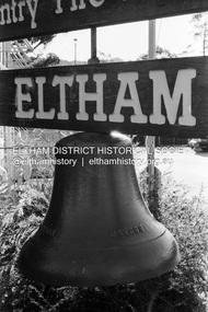
Photograph (Item) - Print, Samantha Robertson, Untitled (Fire Bell), 1988
Original bell from the first Eltham Fire Station in Arthur Street erected on a tower in November 1928, the station opened in January 1929. In 1988 the bell was mounted beneath a wooden sign of Country Fire Authority, Eltham Fire Station, 909 Main Road, Eltham. As of September 2023 the bell is in the same location, with the signboard gone, suspended in a steel metal tower-like frame. The bell has seen service at the original Eltham Fire Station in Arthur Street (1928-1931), Henry Street beside the Rechabite Hall (1931-1935), Main Road (east side, site of present-day Coles 1935-1965) and 909 Main Road (1965-present). Samantha Robertson 1988 Entrant No. 1 Ref: Series 34 Items 1, 2, 42-45 SHIRE OF ELTHAM COMMUNITY PHOTOGRAPHIC SURVEY Photography is an artform which many of us practice, sometimes purely for artistic pursuit, sometimes to record the people and events in our lives. In 1988, as part of a local Bicentennial project, the Shire of Eltham conducted the Eltham Community Photographic Survey. Up to 100 entries were to be selected by a panel of photographers for entry into the Eltham Photographic Survey Exhibition. Entries had to be submitted by May 13, 1988. Entrants whose images were selected for the exhibition were contacted and requested to further submit an entry form providing entrant’s name, area of residence, age, and proposed captions. These details were then used to produce labels for the exhibition mounts. Where negatives had not been supplied, these were requested to support the display of printed enlargements mounted on 10” x 8” cardboard. The mounted prints were made available post exhibition for sale at $8.50 each for colour prints and $7.00 for B&W prints. Residents in the Shire were invited to collect a free roll of film and take a photograph of what they either liked or did not like about the area. A total of 160 entrants submitted multiple entries for the exhibition. Of those selected for exhibition, entrants ranged in age from 9 to 70 years. All custom colour and black and white printing for the exhibition was completed by Wattle Studios of Eltham. The Eltham Photographic Survey was jointly auspiced by the Shire of Eltham and Wattle Studios, of 953 Main Road, Eltham. The project was greatly assisted by: • David McRitchie, Media Studies Lecturer Victoria College, Rusden Campus. • Ian and Annette Toohill of Wattle Studios • Tracy Naughton, Eltham Community Arts Officer • Neville Emerson Pty. Ltd. • Superior Press, Eltham • Kodak Australasia Pty. Ltd. • Agfa Gevaert Ltd. • Townsend Colourtech Pty. Ltd. • The Australian Bicentennial Authority • Eleanor Bowers, Secretary, Eltham Arts Council The exhibition was placed on display in the Woolworths Arcade, Eltham between Monday June 6th and Saturday June 11, 1988. It was also intended to hold the exhibition at a venue in the Shire’s North Riding from Monday, June 20 to Friday June 24. It was then displayed at the Were Street Theatre, Montmorency from Friday, June 24 to Thursday, July 7. Series 34: Eltham Community Photographic Survey 1988 - Prints & Documentation Series consists of 117 photographs of Shire scenes taken by members of the community. Items I - 41 are larger photographs mounted on card, which were exhibited. Items 42 - 117 are unmounted copies, alternative takes and other entries. Corresponding negatives contained in Series 35: Eltham Community Photographic Survey 1988 – Negatives which consists of 267 colour and B&W negatives and one colour slide of Shire scenes taken by members of the community. The negatives are arranged by the entrant number of the photographer. The Eltham Community Photographic Survey collection is significant to the local community as it was curated by the local community - ordinary people of all ages - representing what they liked and did not like in the area where they lived. It represents an unfiltered representation of the Shire of Eltham as it was in 1988. It also represents one of many projects as part of the national programme of events and celebrations to commemorate the bicentenary. It is a time capsule of life in the 1980s of this urban and rural municipality in Melbourne's north. Front: Entrant No. and name on printed label Rear: Entrant No., name and address on printed label; also 'Series 34' and the 'Item No.' in pencilshire of eltham archives, bicentennial project, country fire authority, eltham, eltham community photographic survey, eltham fire station, eltham photographic survey exhibition, film - ilford xp1 400, fire bell, main road, samantha robertson, scan - 35mm negative, series 34, series 35 -
 Eltham District Historical Society Inc
Photograph (Item) - Print, Ed Stuyfbergen, View Of Eltham Tavern, 1988
... melbourne View looking east from Montmorency towards the Eltham ...View looking east from Montmorency towards the Eltham Tavern (Eltham Hotel) Ed Stuyfbergen 1988 Entrant No. 26 Ref: Series 34, Items 13, 14, 66-68 SHIRE OF ELTHAM COMMUNITY PHOTOGRAPHIC SURVEY Photography is an artform which many of us practice, sometimes purely for artistic pursuit, sometimes to record the people and events in our lives. In 1988, as part of a local Bicentennial project, the Shire of Eltham conducted the Eltham Community Photographic Survey. Up to 100 entries were to be selected by a panel of photographers for entry into the Eltham Photographic Survey Exhibition. Entries had to be submitted by May 13, 1988. Entrants whose images were selected for the exhibition were contacted and requested to further submit an entry form providing entrant’s name, area of residence, age, and proposed captions. These details were then used to produce labels for the exhibition mounts. Where negatives had not been supplied, these were requested to support the display of printed enlargements mounted on 10” x 8” cardboard. The mounted prints were made available post exhibition for sale at $8.50 each for colour prints and $7.00 for B&W prints. Residents in the Shire were invited to collect a free roll of film and take a photograph of what they either liked or did not like about the area. A total of 160 entrants submitted multiple entries for the exhibition. Of those selected for exhibition, entrants ranged in age from 9 to 70 years. All custom colour and black and white printing for the exhibition was completed by Wattle Studios of Eltham. The Eltham Photographic Survey was jointly auspiced by the Shire of Eltham and Wattle Studios, of 953 Main Road, Eltham. The project was greatly assisted by: • David McRitchie, Media Studies Lecturer Victoria College, Rusden Campus. • Ian and Annette Toohill of Wattle Studios • Tracy Naughton, Eltham Community Arts Officer • Neville Emerson Pty. Ltd. • Superior Press, Eltham • Kodak Australasia Pty. Ltd. • Agfa Gevaert Ltd. • Townsend Colourtech Pty. Ltd. • The Australian Bicentennial Authority • Eleanor Bowers, Secretary, Eltham Arts Council The exhibition was placed on display in the Woolworths Arcade, Eltham between Monday June 6th and Saturday June 11, 1988. It was also intended to hold the exhibition at a venue in the Shire’s North Riding from Monday, June 20 to Friday June 24. It was then displayed at the Were Street Theatre, Montmorency from Friday, June 24 to Thursday, July 7. Series 34: Eltham Community Photographic Survey 1988 - Prints & Documentation Series consists of 117 photographs of Shire scenes taken by members of the community. Items I - 41 are larger photographs mounted on card, which were exhibited. Items 42 - 117 are unmounted copies, alternative takes and other entries. Corresponding negatives contained in Series 35: Eltham Community Photographic Survey 1988 – Negatives which consists of 267 colour and B&W negatives and one colour slide of Shire scenes taken by members of the community. The negatives are arranged by the entrant number of the photographer. The Eltham Community Photographic Survey collection is significant to the local community as it was curated by the local community - ordinary people of all ages - representing what they liked and did not like in the area where they lived. It represents an unfiltered representation of the Shire of Eltham as it was in 1988. It also represents one of many projects as part of the national programme of events and celebrations to commemorate the bicentenary. It is a time capsule of life in the 1980s of this urban and rural municipality in Melbourne's north. Front: Entrant No. and name on printed label Rear: Entrant No., name and address on printed label; also 'Series 34' and the 'Item No.' in pencilshire of eltham archives, bicentennial project, eltham, eltham community photographic survey, eltham photographic survey exhibition, series 34, series 35, ed stuyfbergen, eltham hotel, eltham tavern, film - ilford fp4, scan - 35mm negative -
 Eltham District Historical Society Inc
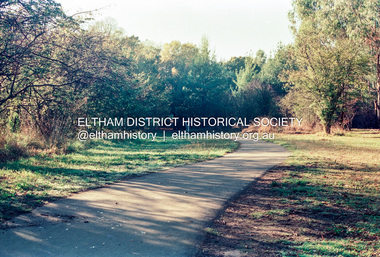
Photograph (Item) - Print, Mathew Wakefield, Untitled (Path through parklands), 1988
... Eltham District Historical Society Inc 728 Main Rd Eltham ...View looking east along present-day Wingrove Park Trail towards Dalton Street and Main Road. Mathew Wakefield 1988 Entrant No. 40 Ref: Series 34, Items 87, 88 The photographer noted that in a sad indictment of the local community, this German Shepherd dog and another had been abandoned by their owners to scavenge through the bins and chase the drunks around the lake at dawn. Both dogs were impounded and the owners never claimed them. As a consequence they were eventually both put down. SHIRE OF ELTHAM COMMUNITY PHOTOGRAPHIC SURVEY Photography is an artform which many of us practice, sometimes purely for artistic pursuit, sometimes to record the people and events in our lives. In 1988, as part of a local Bicentennial project, the Shire of Eltham conducted the Eltham Community Photographic Survey. Up to 100 entries were to be selected by a panel of photographers for entry into the Eltham Photographic Survey Exhibition. Entries had to be submitted by May 13, 1988. Entrants whose images were selected for the exhibition were contacted and requested to further submit an entry form providing entrant’s name, area of residence, age, and proposed captions. These details were then used to produce labels for the exhibition mounts. Where negatives had not been supplied, these were requested to support the display of printed enlargements mounted on 10” x 8” cardboard. The mounted prints were made available post exhibition for sale at $8.50 each for colour prints and $7.00 for B&W prints. Residents in the Shire were invited to collect a free roll of film and take a photograph of what they either liked or did not like about the area. A total of 160 entrants submitted multiple entries for the exhibition. Of those selected for exhibition, entrants ranged in age from 9 to 70 years. All custom colour and black and white printing for the exhibition was completed by Wattle Studios of Eltham. The Eltham Photographic Survey was jointly auspiced by the Shire of Eltham and Wattle Studios, of 953 Main Road, Eltham. The project was greatly assisted by: • David McRitchie, Media Studies Lecturer Victoria College, Rusden Campus. • Ian and Annette Toohill of Wattle Studios • Tracy Naughton, Eltham Community Arts Officer • Neville Emerson Pty. Ltd. • Superior Press, Eltham • Kodak Australasia Pty. Ltd. • Agfa Gevaert Ltd. • Townsend Colourtech Pty. Ltd. • The Australian Bicentennial Authority • Eleanor Bowers, Secretary, Eltham Arts Council The exhibition was placed on display in the Woolworths Arcade, Eltham between Monday June 6th and Saturday June 11, 1988. It was also intended to hold the exhibition at a venue in the Shire’s North Riding from Monday, June 20 to Friday June 24. It was then displayed at the Were Street Theatre, Montmorency from Friday, June 24 to Thursday, July 7. Series 34: Eltham Community Photographic Survey 1988 - Prints & Documentation Series consists of 117 photographs of Shire scenes taken by members of the community. Items I - 41 are larger photographs mounted on card, which were exhibited. Items 42 - 117 are unmounted copies, alternative takes and other entries. Corresponding negatives contained in Series 35: Eltham Community Photographic Survey 1988 – Negatives which consists of 267 colour and B&W negatives and one colour slide of Shire scenes taken by members of the community. The negatives are arranged by the entrant number of the photographer. The Eltham Community Photographic Survey collection is significant to the local community as it was curated by the local community - ordinary people of all ages - representing what they liked and did not like in the area where they lived. It represents an unfiltered representation of the Shire of Eltham as it was in 1988. It also represents one of many projects as part of the national programme of events and celebrations to commemorate the bicentenary. It is a time capsule of life in the 1980s of this urban and rural municipality in Melbourne's north. Rear: Entrant No., name and address in blue ink; also 'Series 34' and the 'Item No.' in orange inkshire of eltham archives, bicentennial project, eltham, eltham community photographic survey, series 34, series 35, dalton street, film - fuji 100, main road, mathew wakefield, scan - 35mm negative, wiingrove park trail -
 Eltham District Historical Society Inc
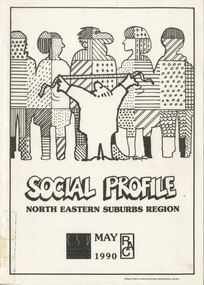
Book, Community Services Victoria, Social Profile: North Eastern Suburbs Region, May 1990
Local Government summaries for Diamond Valley, Eltham, Heidelberg, Northcote, Preston, Whittlesea. Provides census data and comparisons between years with summaries on topics including: Population, Age Distribution, Marital Status, Single Parents, Family Annual Income, Personal Annual Income, Social Security Income, Psychiatric Hospitla Admissions and departures, Aboriginal and Torres Strait Islanders, Persons born Overseas and country of origin, Langauges, English competence of overseas born persons, Occupancy of dwellings, Structure of occupied dwellings, type of occupanncy, private rents, monthly mortgages, households with no vehicle, level of qualifications, occupational status, employment, industry groups, unemployment, school attendance.119 pagesnon-fictionLocal Government summaries for Diamond Valley, Eltham, Heidelberg, Northcote, Preston, Whittlesea. Provides census data and comparisons between years with summaries on topics including: Population, Age Distribution, Marital Status, Single Parents, Family Annual Income, Personal Annual Income, Social Security Income, Psychiatric Hospitla Admissions and departures, Aboriginal and Torres Strait Islanders, Persons born Overseas and country of origin, Langauges, English competence of overseas born persons, Occupancy of dwellings, Structure of occupied dwellings, type of occupanncy, private rents, monthly mortgages, households with no vehicle, level of qualifications, occupational status, employment, industry groups, unemployment, school attendance.statistics, population, demographics, social profile, census data -
 Eltham District Historical Society Inc
Photograph - Digital Photograph, Alan King, The Diamond Creek Bridge, 30 March 2008
Old Bridge on Main Hurstbridge road in Diamond Creek township crossing the Diamond Creek. The bridge opened in April 1898. Evelyn Observer, and South and East Bourke Record (Vic. : 1882 - 1902), Friday 22 April 1898, page 2 "Diamond Creek Bridge. The official opening of this bridge took place yesterday (Thursday) in the presence of a large gathering of people. The bridge-a substantial iron structure, costing .~r 2oo-was profusely decorated with "flags of all nations" for the occasion. In the absence of the Minister' of Public Works-who was unavoidably prevented from attending-the opening ceremony was neatly performed by President Lugton, of the Heidelberg Shire, in a few wellchosen words, after which an adjournment was made to the Literary Institute, where some sixty gentlemen were entertained at luncheon, followed by speeches, songs, and recitations. It was a red letter day for the Creek, and everything passed off with becoming eclat." Published: Nillumbik Now and Then / Marguerite Marshall 2008; photographs Alan King with Marguerite Marshall.; p7This collection of almost 130 photos about places and people within the Shire of Nillumbik, an urban and rural municipality in Melbourne's north, contributes to an understanding of the history of the Shire. Published in 2008 immediately prior to the Black Saturday bushfires of February 7, 2009, it documents sites that were impacted, and in some cases destroyed by the fires. It includes photographs taken especially for the publication, creating a unique time capsule representing the Shire in the early 21st century. It remains the most recent comprehenesive publication devoted to the Shire's history connecting local residents to the past. nillumbik now and then (marshall-king) collection, diamond creek, diamond creek bridge, main hurstbridge road -
 Eltham District Historical Society Inc
Document (Item) - Book, City of Heidelberg, Restructuring Local Government for the 21st Century: Heidelberg's approach to the North East Region, February 1994
The City of Heidelberg's Council first preference is "no change" [to municipal restructure] but if this option is unacceptable, the Council would prefer to form larger municipality/municapilites involving the exisitng City of Heidelberg and the Shires of Diamond Valley and Eltham. This report includes an exective summary, Introduction, A Brief History, Heidelberg and its [municiapl] neighbours now, opportunities for restructure, detailed analysis and preferred structure. Includes fold out maps.This report by the City of Heidleberg is a significant local contribution in the consultation leading to a significant change to local government in Victorian when, in 1994 the Kennett State government restructed local government. The reforms dissolved 201 Councils and created 78 new councils through amalgamations. In suburban Melbourne 53 municipalities were reduced to 26. The City of Heidelberg was amalgamated with parts of the Shire of Eltham and Diamond Valley to become the City of Banyule.annexation, council amalgamation, local government -
 Eltham District Historical Society Inc
Document - Folder, Maxwell, Keith
Keith Maxwell lived in East Brunswick before his family moved to Eltham in 1938. Contents Newspaper article: "Facing good and bad times with enthusiasm," Diamond Valley News, 21 October 1986, outlines Keith Maxwell's activities.Newspaper clippings, A4 photocopies, etckeith maxwell, edna maxwell, progress hall eltham north, department of aircraft, cycling, frank penhalurack, fitzroy cycling club, victorian horticultural society, montmorency garden club -
 Eltham District Historical Society Inc
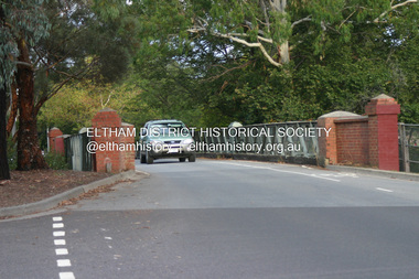
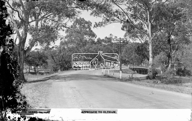
Negative - Photograph postcard, The Rose Stereograph Company, Approach To Eltham, c.1939
... Eltham District Historical Society Inc 728 Main Rd Eltham ...Looking east along the unsealed main road heading into Eltham across the concrete bridge over the Diamond Creek circa 1939. The original wooden bridge was destroyed by flood waters in 1924. This glass plate negative was used to manufacture postcards (1:1 printing) for commercial sale by the Rose Sterograph Company and its subsidiaries. George Rose founded the Rose Stereograph Company in 1880 and was joined by Herbert (Bert) Cutts in the early 20th Century. The pair formed a lifetime working partnership and strong personal friendship. Assisted by George’s two sons, Herbert George and Walter, and later by Neil Cutts, the Rose Stereograph Company continued its operations for more than 140 years. The company was initially built on stereographs, but as cinema took over and stereographs fell out of fashion, the Rose Stereograph Company developed Australia’s first commercially viable photographic postcard business. Specialising in postcards of iconic historical moments and significant landmarks, The Rose Stereograph Company became a staple of the Australian travel industry.This remarkable collection of glass plate negatives, transparencies, and postcards – arguably Australia’s most significant photography collection outside of public hands – has been passed down through the generations, surviving war, relocation, and the harsh Victorian climate. The historic Rose Stereograph collection is the culmination of George Rose’s dream of capturing and preserving precious moments in time and remains the legacy of the Rose and Cutts families. It is with great sadness that the Cutts family says goodbye to a collection that spans five generations and 140 years. The Cutts family understands that for these historically important pieces to rest with one family is to deny others the pleasure of their custodianship.Glass Plate Negative Size: 9 x 14 cmApproach to Eltham, Valentine Series No. 3197, Copyrightbuildings, electricity lines, eltham, postcard, travel, rose stereograph company, valentine series postcard, main road bridge, glass plate negative, main road, peter and elizabeth pidgeon collection, diamond creek (creek), eltham south, rose stereograph