
Showing 29 items matching " hamilton highway"
-
 Wodonga & District Historical Society Inc
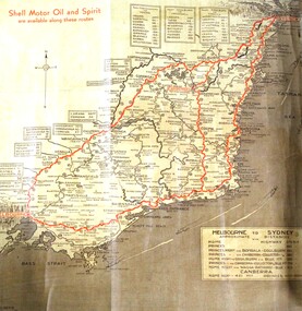
Map - Hamilton-Smith Collection Highway Map mid 1900s
... Hamilton-Smith Collection Highway Map mid 1900s...Hamilton-Smith Collection Highway Map mid 1900s...highway...wodonga...melbourne...sydney...travel...hamilton...It contributes to our understanding of social life in mid-twentieth century Wodonga, as well as providing interpretative capacity for themes including local history and social history. map highway wodonga melbourne sydney travel hamilton-smith hamilton-smith collection driving drive car road A brown and tan highway map with red road markings showing the south east of Australia from Melbourne to Sydney Hamilton-Smith Collection Highway Map mid 1900s Map Hamilton-Smith Collection Highway Map mid 1900s ...The Hamilton-Smith collection was donated by the children of Grace Mary Hamilton-Smith nee Ellwood (1911-2004) and William John (Jack) Hamilton-Smith (1909-1984) who settled in Wodonga in the 1940s. The Ellwood family had lived in north-east Victoria since the late 1800s. Grace’s mother, Rosina Ellwood nee Smale, was the first teacher at Baranduda in 1888, and a foundation member of the C.W.A. Rosina and her husband Mark retired to Wodonga in 1934. Grace and John married at St. David’s Church, Albury in 1941. John was a grazier, and actively involved in Agricultural Societies. The collection contains significant items which reflect the local history of Wodonga, including handmade needlework, books, photographs, a wedding dress, maps, and material relating to the world wars.This item has well documented provenance and a known owner. It forms part of a significant and representative historical collection which reflects the local history of Wodonga. It contributes to our understanding of social life in mid-twentieth century Wodonga, as well as providing interpretative capacity for themes including local history and social history.A brown and tan highway map with red road markings showing the south east of Australia from Melbourne to Sydney map, highway, wodonga, melbourne, sydney, travel, hamilton-smith, hamilton-smith collection, driving, drive, car, road -
 Ballaarat Mechanics' Institute (BMI Ballarat)
Film - Photograph by Herb Richmond. ca 1971, Scarsdale- Bridge Over Smythes Creek with the old Frd in the foreground (Hamilton Highway)
... Scarsdale- Bridge Over Smythes Creek with the old Frd in the foreground (Hamilton Highway)...Scarsdale- Bridge Over Smythes Creek with the old Frd in the foreground (Hamilton Highway) Film Photograph by Herb Richmond. ca 1971 ...Ballarat History35mm B&W Kodak Plus X Pan Film.ballarat, ballaraat, scarsdale, bridge, smythes-creek -
 Ballaarat Mechanics' Institute (BMI Ballarat)
Film - Photograph by Herb Richmond. ca 1971, Scarsdale- Bridge Over Smythes Creek with the old Frd in the foreground (Hamilton Highway)
... Scarsdale- Bridge Over Smythes Creek with the old Frd in the foreground (Hamilton Highway)...Scarsdale- Bridge Over Smythes Creek with the old Frd in the foreground (Hamilton Highway) Film Photograph by Herb Richmond. ca 1971 ...Ballarat History35mm B&W Kodak Plus X Pan Film.ballarat, ballaraat, scarsdale, bridge, smythes-creek -
 Ballarat Tramway Museum
Photograph - Black & White Photograph/s, Jim Seletto, 1956
... ... Hamilton Highway...Sebastopol, just prior to the intersection with the Hamilton Highway. Tram showing destination of "Sebastopol". ...Sebastopol, just prior to the intersection with the Hamilton Highway. Tram showing destination of "Sebastopol". ...Black and white photograph of SEC trams No. 38 outbound along Albert St. Sebastopol, just prior to the intersection with the Hamilton Highway. Tram showing destination of "Sebastopol". Has large reflective triangles on the cabs panels. Hamilton direction sign alongside tram. Photo taken after the tram has passed the Photographer. Photograph by Jim Seletto. On Agfa paper. Colour photocopy, laminated, of this photograph on display 5/2000 at 02-02-06In black ink "In the leisurely days of 1956 (wot again) Ballarat 38 trundles out to Sebastopol on a midweek service - despite CRB notices trying to entice it out to Hamilton" and in a purple ink stamp Photograph by J. Seletto".trams, tramways, sebastopol, albert st, hamilton highway, tram 38 -
 Ballarat Heritage Services
digital photographs, Lisa Gervasoni, Glenthompson, c2010-2017
... Hamilton Highway, Glenthompson, Victoria, Australia ...building, heritage, glenthompson, industry, industrial heritage, brickworks -
 Ballarat Heritage Services
digital photographs, Lisa Gervasoni, Glenthompson, c2010-2017
... Hamilton Highway, Glenthompson, Victoria, Australia ...building, heritage, glenthompson, industry, industrial heritage, brickworks, kiln -
 Ballarat Heritage Services
digital photographs, Lisa Gervasoni, Glenthompson Brickworks, 2010-2017
... Hamilton Highway, Glenthompson, Victoria, Australia ...Colour photograph of the interior of Glenthompson Brickworks.building, heritage, glenthompson, industry, industrial heritage, brickworks, kiln -
 Ballarat Heritage Services
digital photographs, Lisa Gervasoni, Glenthompson, c2010-2017
... Hamilton Highway, Glenthompson, Victoria, Australia ...building, heritage, glenthompson, industry, industrial heritage, brickworks, kiln -
 Ballarat Heritage Services
digital photographs, Lisa Gervasoni, Glenthompson, c2010-2017
... Hamilton Highway, Glenthompson, Victoria, Australia ...building, heritage, glenthompson, industry, industrial heritage, brickworks, clay, quarry -
 Ballarat Heritage Services
digital photographs, Lisa Gervasoni, Glenthompson, c2010-2017
... Hamilton Highway, Glenthompson, Victoria, Australia ...Colour photograph of brickworks at Glenthompson.building, heritage, glenthompson, industry, industrial heritage, brickworks -
 Ballarat Heritage Services
digital photographs, Lisa Gervasoni, Glenthompson, c2010-2017
... Hamilton Highway, Glenthompson, Victoria, Australia ...building, heritage, glenthompson, industry, industrial heritage, brickworks, boilers -
 Ballarat Heritage Services
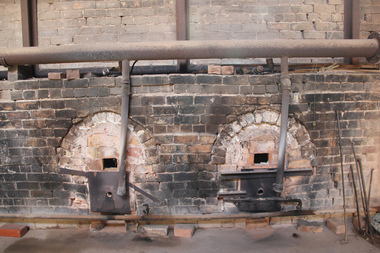
digital photographs, Lisa Gervasoni, Glenthompson Brickworks, c2010-2017
... Hamilton Highway, Glenthompson, Victoria, Australia ...The Thompson brothers, George and Joseph, formerly of Ballarat and the new owners of Yallum Park, established the Glenthompson Brickworks in 1900. The entire process of creating a solid, pressed Glenthompson Brick happens on site, where red and cream clay is excavated. Brick presses dating back to 1940 are still in operation today, the kilns are stacked by hand to ensure specific needs are met and colour varieties are achieved. Refined oil is used to fire down draught kilns, which allows temperatures to be adjusted to ensure unique colour ranges are achieved.Colour photographs of kilns at Glenthompson Brickworks. building, heritage, glenthompson, industry, industrial heritage, brickworks, oven, glenthompson brickworks, george thompson, joseph thompson -
 Moorabbin Air Museum
Document (Item) - Draft of a History of Ansett, Highway from Hamilton
... Highway from Hamilton...Appears to be a draft of a history commissioned by Ansett, although curiously it seems its original name was "Rise & Fall of Ansett" Collection of loose leaf paper secured in a clear sleeve. Highway from Hamilton Document Draft of a History of Ansett ...Appears to be a draft of a history commissioned by Ansett, although curiously it seems its original name was "Rise & Fall of Ansett" -
 Ballarat Tramway Museum
Slide - 35mm slide/s, Chas Bevan, 19/12/1970 12:00:00 AM
... Highway... Hamilton Ave...Colour slide - 35mm - of Ballarat single trucker turning from Sturt St West (Western Highway) into Hamilton Ave. Shows the gravel roads and the number of trees in the area. ...Yields information about the turn from Sturt St West into Hamilton Ave for trams in 1970. Tramways trams Wendouree Parade Western Highway Hamilton Ave tram 27 "Ballarat tram crossing West'rn H'wg 19-12-70" in ink. ...Yields information about the turn from Sturt St West into Hamilton Ave for trams in 1970.Colour slide - 35mm - of Ballarat single trucker turning from Sturt St West (Western Highway) into Hamilton Ave. Shows the gravel roads and the number of trees in the area. Photo taken by Chas Bevan on Saturday 19-12-1970."Ballarat tram crossing West'rn H'wg 19-12-70" in ink.tramways, trams, wendouree parade, western highway, hamilton ave, tram 27 -
 Ballarat Tramway Museum
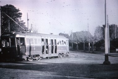
Slide - 35mm slide/s, Wal Jack, 23/6/1949
... Photograph of Geelong No. 35 turning out of Aberdeen St (Now Hamilton Highway) into Pakington St South, with the destination of Chilwell. ...Photograph of Geelong No. 35 turning out of Aberdeen St (Now Hamilton Highway) into Pakington St South, with the destination of Chilwell. ...Photograph of Geelong No. 35 turning out of Aberdeen St (Now Hamilton Highway) into Pakington St South, with the destination of Chilwell. See also Reg item 4212 for the same photo - of Wal Jack dated 23/6/1949. Slide produced by Travis Jeffrey.Yields information about the appearance of one Geelong's bogie trams on its way to the terminus of Chilwell.Agfachrome Professional plastic mount (blue base, white cover) reproduction slide of a black and white photo."G 20" and "1 -20" in pencil.tramways, trams, geelong, chilwell, pakington st, tram 35 -
 Ballarat Tramway Museum
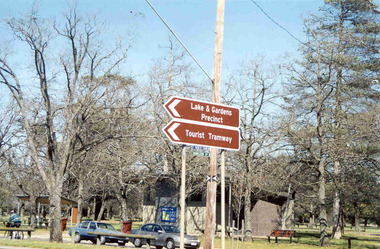
Photograph - Colour Photograph/s - set of 2, Warren Doubleday, 13/09/2003 12:00:00 AM
... Hamilton Ave... Western Highway...West, or Western Highway at the intersection with Hamilton Ave. Photos taken by Warren Doubleday on 13.09.2002. ...BTM Hamilton Ave Western Highway Sturt St West On rear of each photo in brown felt tip pen, the words "New Signage at Highway". ...Set of two colour photographs of the then new road signs indicating the BTM using the words "Tourist Tramway" in the central median strip of Sturt St. West, or Western Highway at the intersection with Hamilton Ave. Photos taken by Warren Doubleday on 13.09.2002. Printed on Agfa Paper. 2604.1 - Taken from the western side 2604.2 - ditto, but further back. On rear of each photo in brown felt tip pen, the words "New Signage at Highway".btm, hamilton ave, western highway, sturt st west -
 Ballarat Tramway Museum
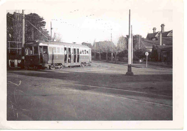
Photograph - SECV Geelong 35 - Aberdeen St, Wal Jack, 23/06/1949
... Photograph of Geelong No. 35 turning out of Aberdeen St (Now Hamilton Highway) into Pakington St South, with the destination of Chilwell. ...Photograph of Geelong No. 35 turning out of Aberdeen St (Now Hamilton Highway) into Pakington St South, with the destination of Chilwell. ...Photograph of Geelong No. 35 turning out of Aberdeen St (Now Hamilton Highway) into Pakington St South, with the destination of Chilwell. Photographed by Wal Jack on 23-6-1949. See also Reg item 2680 for the same photo. i1 - scan of print in the album i2 - rear of image i3 - scan of negative at 3200dpi added 18/6/2020.Yields information about the appearance of one Geelong's bogie trams on its way to the terminus of Chilwell.Black and white photograph and negative.On rear of print in ink "SEC Geelong Bogie 35 turning out of Aberdeen St into Pakington St south 23-6-49" and in top right hand corner, stamped in purple ink "W. Jack No. Copyright" with Number T292 in ink.tramways, trams, geelong, chilwell, pakington st, tram 35 -
 Warrnambool and District Historical Society Inc.
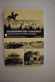
Book, StarPrinting Service Pty ltd, Soldiering On – Caramut and the Soldier Settler Movement, 2018
... Caramut is a town in Western Victoria in the Shire of Moyne on the Hamilton Highway, 55 kilometres north of Warrnambool. ...Caramut is a town in Western Victoria in the Shire of Moyne on the Hamilton Highway, 55 kilometres north of Warrnambool. ...This book records the history of the post World War Two soldier settlement farms in the Caramut area. Number two in a series of books on Soldier Settlements in Western Victoria.This is a soft cover book of 315 pages. It has a buff-coloured cover with black and white photographs and white printing on the front cover and black printing on the spine. The book includes printed material, black and white photographs, maps and plans. non-fiction This book records the history of the post World War Two soldier settlement farms in the Caramut area. Number two in a series of books on Soldier Settlements in Western Victoria.james affleck, peterborough, soldier settlement, caramut, history of warrnambool, soldier settlement, caramut -
 Warrnambool and District Historical Society Inc.
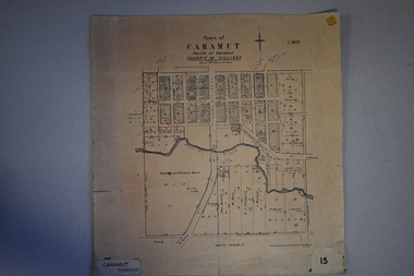
Map, Department of Lands and Survey (Lithographers), Caramut township, 1938
... Caramut is a Victorian Western District town on Mustons Creek on the Hamilton Highway 48 kilometres from Warrnambool. ...Caramut is a Victorian Western District town on Mustons Creek on the Hamilton Highway 48 kilometres from Warrnambool. ...This map of the township of Caramut was produced in 1938 but shows the original land owners of each town allotment and of the surrounding area. The size of all the allotments and the date of the original purchase are also shown. Caramut is a Victorian Western District town on Mustons Creek on the Hamilton Highway 48 kilometres from Warrnambool. This map was used by Rolf Crawley when he was the engineer for the Shire of Warrnambool from 1935 to 1968. The annotations on the map have probably been made by Rolf Crawley as they refer to the records and letter books of his father, John William Crawley, Junior (Shire of Warrnambool Engineer 1895 to 1935). Both Rolf Crawley and his father, John had private businesses as architects, surveyors and engineers and the map could have been used in connection with both their official Shire duties and their private businesses. The last owner of the map was the surveyor, Michael Hand who took over the business of Rolf Crawley in the late 1960s. This map is of great interest firstly because it has all the historical details of the land first purchased in the town of Caramut and area and secondly because it came from the office of Rolf Crawley, the engineer for the Shire of Warrnambool from 1935 to 1968. This is a buff-coloured paper map with a cloth backing. The map details are in black and white print. There are some handwritten red and black annotations on the map. “Town of Caramut Parish of Caramut County of Villiers’town of caramut, john william crawley junior, warrnambool, rolf crawley, warrnambool -
 Ringwood and District Historical Society
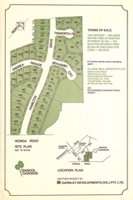
Flyer, Land Sale Advertisement - Banool Gardens Subdivision, Ringwood, Vic. c.1985
... Subdivision includes Wonga Road, Hamilton Drive, Tinworth Place, Andrea Parade and Benjamin Court, Ringwood North. Managing agent - Ollson Real Estate Pty. Ltd., North Croydon Shopping Plaza, Maroondah Highway. ...Subdivision includes Wonga Road, Hamilton Drive, Tinworth Place, Andrea Parade and Benjamin Court, Ringwood North. Managing agent - Ollson Real Estate Pty. Ltd., North Croydon Shopping Plaza, Maroondah Highway. ...Double-sided advertisement for Banool Gardens subdivision with site plan, location plan, terms of sale, and summary of homesite features and local services & facilities. Subdivision includes Wonga Road, Hamilton Drive, Tinworth Place, Andrea Parade and Benjamin Court, Ringwood North. Managing agent - Ollson Real Estate Pty. Ltd., North Croydon Shopping Plaza, Maroondah Highway. Croydon, Vic. 3136. Telephone 726 9988 After Hours 876 4190. Project by Darnley Developments (Vic.) Pty. Ltd. Accompanying handwritten notation by Richard Carter R.E.S.I. - "Part of original Banool property (Mahon, sold to Stallman, sold to McMahon, sold to Len Macley etc etc). Hamilton Drive named after Lynn Hamilton McMahon, Tinworth Place after his son-in-law, David Tinworth". -
 Mortlake and District Historical Society
Ceramic - Jug, bone china, Melba Bone China, Mortlake Soldiers Memorial, china memorbilia, Probably 1950's, 1960's
... It forms one part of the Mortlake's tribute, the others being the Soldiers' Memorial Hall (which incorporates the old Mechanics' Institute) and the Avenue of Honour (cypress) along the Hamilton Highway on the eastern side of the town. 1914 1918 world war memorial memorials mortlake souvenirs Captioned: 'Soldier's Monument Mortlake'. ...This small white jug was probably created as a souvenir of Mortlake. Its depiction of the 'Soldier's Monument' (War Memorial completed 1920), is quite accurate and perhaps reflects the importance of such monuments in small country towns. Memorials created in many country towns, cities and suburbs after the Great War, reflected civic pride and were created in recognition of the sacrifice of so many men in defence of the realm. Mortlake's 'Soldier's Memorial' is typical of many such memorials Australia wide. It forms one part of the Mortlake's tribute, the others being the Soldiers' Memorial Hall (which incorporates the old Mechanics' Institute) and the Avenue of Honour (cypress) along the Hamilton Highway on the eastern side of the town. Small glazed white jug, with gold rim, handle; transfer picture of the Mortlake War Memorial - showing plinth, column, soldier and fence with backdrop of mature trees. Captioned: 'Soldier's Monument Mortlake'. On base: 'Melba Bone China (followed by crown insignia) Guaranteed Made In England.'1914, 1918, world, war, memorial, memorials, mortlake, souvenirs -
 Warrnambool and District Historical Society Inc.
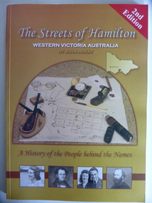
Book, Streets of Hamilton, 2007 (revised and reprinted 2009)
... Hamilton is a city in Western Victoria at the intersection of the Glenelg Highway and the Henty Highway. ...Hamilton is a city in Western Victoria at the intersection of the Glenelg Highway and the Henty Highway. ...This is a book providing information on the streets of Hamilton, Victoria and the origin of the names. Hamilton is a city in Western Victoria at the intersection of the Glenelg Highway and the Henty Highway. European settlement began with the arrival of pastoralists following the 1836 explorations of Major Thomas Mitchell. The Wedge family in 1839 had the property ‘The Grange’ which covered the site of Hamilton today. The town was gazetted in 1851 and named after a place in Scotland. Hamilton Victoria is the centre of a sheep-grazing and agricultural district. The book won an award in the 2008 Victorian Community History Awards. This book is of interest as it gives information on the Hamilton streets and the origin of their names. The history of Hamilton is of particular interest to those also living in the Western District. The book will be a useful research tool. This is a soft cover book of 174 pages. The back cover has a white background with black and white photographs of five local Hamilton people. The front cover has a yellow and brown background with black and white photographs of five local Hamilton people, an outline of a map of Victoria and a photograph of a map of the Hamilton area with some artefacts placed on the map. The book contains an Introduction, a Preface, a Foreword, an Early Days Overview, a list of Contents, a list of the streets in alphabetical order with information on the origin of the names, two Appendices and an Index. The book has many black and white photographs and sketches. Front Cover: ‘2nd Edition’ ‘The Streets of Hamilton’ ‘Western Victoria Australia’ ‘By John McKay’ ‘A History of the People behind the Names’hamilton, victoria, john mckay, street names of hamilton, warrnambool -
 Warrnambool and District Historical Society Inc.
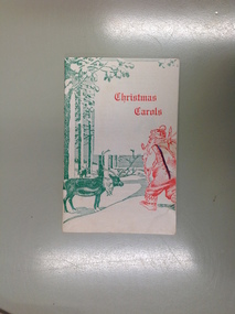
Booklet, Christmas Carols
... Contains a list of businesses in the 1970’s around Warrnambool and district warrnambool daltons highway panels warrnambool saunder's toys and hobbies ted wilson motors bob hagan elliots cleaning silver ball beauty salon shamrock hotel Cream coloured card cover with red and green drawing of Santa Claus and reindeer. Back cover has advertisement for G I Panels of Hamilton ...Warrnambool businesses included in the booklet include Dalton’s Highway Panels, Saunders Toys and Hobbies, Ted Wilson Motors, Bob Hagan & Staff, Elliots Cleaning, Silver Ball Beauty Salon, Shamrock Hotel, Hotel Criterion. The carols included are all well known.Contains a list of businesses in the 1970’s around Warrnambool and districtCream coloured card cover with red and green drawing of Santa Claus and reindeer. Back cover has advertisement for G I Panels of Hamilton and Merry Christmas in green in the bottom part of page. 47 pages. It contains words to carols on alternate pages with advertisements for businesses from Portland, Hamilton and Warrnambool.warrnambool, daltons highway panels warrnambool, saunder's toys and hobbies, ted wilson motors, bob hagan, elliots cleaning, silver ball beauty salon, shamrock hotel -
 Stawell Historical Society Inc
Photograph, Stawell People in Horsham Paper Wimmera Advertiser
... Highway Stawell Accident. 4/9/1987. Driver Mark Lever Stawell -7 Lyle McIntyre memorial fun run Winner. 28/7/1986 -8 Shirley Clarke Stawell 18/10/1991 -9 Murray Emerson 23/8/1991 -10 Stawell Dolls 9/12/1985 -11 Angela Murphy Stawell SES 9/10/1992 -12 Reg Chapman Stawell 22/1/1986 -13 Wedding Photo Brian Barber & Anthea Byron 18/5/1990 Photo by Mervyn J Dean -14 Lyn Hamilton Netball Stawell 21/5/1990 -15 Protesters Stawell - John Brumby, Marion Downie, Jenny Holmes 22/7/1988 -16 Stawell Conservation 22/5/1989. ...Highway Stawell Accident. 4/9/1987. Driver Mark Lever Stawell -7 Lyle McIntyre memorial fun run Winner. 28/7/1986 -8 Shirley Clarke Stawell 18/10/1991 -9 Murray Emerson 23/8/1991 -10 Stawell Dolls 9/12/1985 -11 Angela Murphy Stawell SES 9/10/1992 -12 Reg Chapman Stawell 22/1/1986 -13 Wedding Photo Brian Barber & Anthea Byron 18/5/1990 Photo by Mervyn J Dean -14 Lyn Hamilton Netball Stawell 21/5/1990 -15 Protesters Stawell - John Brumby, Marion Downie, Jenny Holmes 22/7/1988 -16 Stawell Conservation 22/5/1989. ...7259 Ken Tschampion Pianist back right 24/2/1986 -1 David Upson the man from Stawell with his ROCKY 4WD -2 Andrew Davies Stawell pushing his Honda CR 259 out of the creek 30/7/1986 -3 Great Western Races 27/1/1988 -4 Ian Jackson Art display 22/1/1986 -5 Dale Bibby Jockey. Twins Brett & Craig Stewart. Navarre 1/10/1991 -6 Wimmera Highway Stawell Accident. 4/9/1987. Driver Mark Lever Stawell -7 Lyle McIntyre memorial fun run Winner. 28/7/1986 -8 Shirley Clarke Stawell 18/10/1991 -9 Murray Emerson 23/8/1991 -10 Stawell Dolls 9/12/1985 -11 Angela Murphy Stawell SES 9/10/1992 -12 Reg Chapman Stawell 22/1/1986 -13 Wedding Photo Brian Barber & Anthea Byron 18/5/1990 Photo by Mervyn J Dean -14 Lyn Hamilton Netball Stawell 21/5/1990 -15 Protesters Stawell - John Brumby, Marion Downie, Jenny Holmes 22/7/1988 -16 Stawell Conservation 22/5/1989. Barry Clugston -17 Judith Crouch Stawell 26/10/1990 -18 Cath Rickard on right -19 Stawell Historical Society Photo Display. 22/1/1986 -20 Reg Chapman Stawell 22/1/1986 -21 Betty Jackson Stawell 22/1/1986 Stawell Historical Society B/W Photographs -
 Sunshine and District Historical Society Incorporated
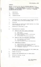
Administrative record - City of Sunshine - Commissioner Mr Alexander Alex George Gillon Collection 1976 - 1982 - Notice of Ordinary Meeting 16th November 1982, City of Sunshine, 16th November 1982
... Hamilton Street...Burnside Street...Christie Street...Tulloch Street...Multi-Cultural Senior Citizens' Club of West Sunshine...Showers Street...Braybrook...Wright Street...Kalingra Road...Armbrook Siding...Tottenham...Hampstead Road...Mitchell Street...Washington Street...St. Albans...Hampton Avenue...Reid Street...Albion...Boral Resources...Previously Albion Reid...Glendenning Street...Princes Highway...City of Sunshine Alexander "Alex" George Gillon Clyde Street Maidstone Chaplin Reserve Anderson Road Sunshine Maribyrnong Valley Service Street Ballarat Road Deer Park Lewin Street Robinsons Road Hamilton Street Burnside Street Christie Street Tulloch Street Multi-Cultural Senior Citizens' Club of West Sunshine Showers Street Braybrook Wright Street Kalingra Road Armbrook Siding Tottenham Hampstead Road Mitchell Street Washington Street St. Albans Hampton Avenue Reid Street Albion Boral Resources Previously Albion Reid Glendenning Street Princes Highway ...Ordinary meeting notice including reports from Council's officers Report of the Town Clerk's Department Report of the Town Clerk Accounts for Payment as at 25th October 1982 Statistical Report for Year October 1981 to September 1992 Proposed Discontinuance of Right of Way Beside 36 Clyde Street Maidstone Telephone Number Metropolitan Fire Brigade Acquisition Chaplin Reserve Community Facility Sunshine West United Nations Association of Australia Possible Membership Salvation Army Western Region Advisory Committee Council Representation Open Space Area Maribyrnong Valley Meeting Dates 1993 Proposal to Close Part of Service Street Sealing of General Rate Year Ending 30th September 1983 Use of Council Facilities Saturday 4th December 1982 Sunshine International Women's Year Action Group Discontinuance of Right of Way Between Lewin Street and Robinsons Road South Side of Ballarat Road Deer Park Discontinuance of Right of Way Between Hamilton Street, Burnside Street, Christie Street and Tulloch Street Deer Park Report of Chief Health Surveyor Registration of Premises Health Act Transfer of Premises Health Act Prosecution Proceedings Sunshine Magistrate Court Delivery of Advertising Material / Junk mail Health Act Registration Fees Report of the Medical Officer of Health Report of the Superintendent Traffic and By-Laws Dog Act Traffic and Parking Infringements Court Proceedings Proposed Procession Italian Festival Deer Park Parking Infringements Increase In Penalties Report of the Chief Librarian Children's Pre-Christmas workshops Report of the Co-Ordinator of Welfare Services Multi-Cultural Senior Citizens' Club of West Sunshine Registration and Maintenance Subsidy Showers Street Housing Commission Estate Furnishings Community Room Showers Street Housing Commission Estate Twin Tub Washing Machines Special Bus Emergency Foster Care Report of the City Engineer / Planner Western Suburbs Study Department of Planning Planning Permit Application Advertising Sign 35 Wright Street Planning Permit Application Extensions to Existing Abattoir Kalingra Road (Armbrook Siding) Brooklyn Melbourne Metropolitan Planning Scheme Amendment No 190 On Exhibition Planning Permit Application Extensions to Existing Premises Corner Hampstead Road and Mitchell Street Maidstone Plan of Proposed Strata Subdivision 35 Washington Street St. Albans Plan of Proposed Transfer Hampton Avenue Plan of Subdivision Reid Street Sunshine Boral Resources (Previously Albion Reid Pty Ltd) Glendenning Street Traffic Problems Half Cost Footpath and Kerb And Channel Various Locations Traffic Signals Linking On Princes Highway West From Little Boundary Road to Sommerville Road Parking Restrictions At Municipal Offices Grade Separated Pedestrian Crossings Sunshine Centre Plaza Shopping Centre Traffic Control Items Bus Shelter At Stop 45 Ashley Street Maidstone Melbourne And Metropolitan Tramway Board Neale Road / Station Road Proposes Traffic Signals No Standing Prohibition Load Limits Various Roads Half Cost Fencing 11 Ravenna Street St. Albans Thompson Hall Maidstone West Gate Bridge Charges City of Williamstown Report of the Building Surveyor Building Over Easement 26 Krambrook Street Sunshine West Building Over Easement 36 Summers Street Deer Park Building Over Easement 2 The Mews Ardeer Building Over Easement 18 Merrivale Avenue Sunshine West Building Over Easement 34 Summers Street Deer Park Building Over Easement 83 Tamar Drive St. Albans Building Over Easement 7 Salvia Street St. Albans Building Over Easement 28 Yallourn Street Ardeer Substandard Allotment Lot 62 Tulloch Street Deer Park Height of Fence 100 Ballarat Road Extension of Building Time 52B Forrest Street Sunshine Orders of the Day Planning Permit Application Restaurant and Take Away Food Ballarat Road Sunshine Planning Permit Application Consulting Rooms Main Road West St. Albans city of sunshine, alexander "alex" george gillon, clyde street, maidstone, chaplin reserve, anderson road, sunshine, maribyrnong valley, service street, ballarat road, deer park, lewin street, robinsons road, hamilton street, burnside street, christie street, tulloch street, multi-cultural senior citizens' club of west sunshine, showers street, braybrook, wright street, kalingra road, armbrook siding, tottenham, hampstead road, mitchell street, washington street, st. albans, hampton avenue, reid street, albion, boral resources, previously albion reid, glendenning street, princes highway, little boundary road, sommerville road, sunshine centre plaza shopping centre, hampshire road, ravenna street, thompson hall, krambrook street, summers street, the mews, ardeer, merrivale avenue, tamar drive, salvia street, yallourn street, forrest street -
 Wodonga & District Historical Society Inc
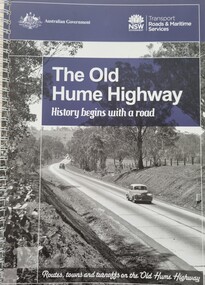
Book - The Old Hume Highway - History begins with a Road, 2014
... Old Hume Highway hume highway Travel Guide Hume Highway \ The Hume Highway was officially named in 1928, when both the New South Wales and Victorian governments agreed to give the unified inland route between Sydney and Melbourne the name, honouring explorer Hamilton Hume who, with William Hovell, first found the overland path in 1824. ...The Hume Highway was officially named in 1928, when both the New South Wales and Victorian governments agreed to give the unified inland route between Sydney and Melbourne the name, honouring explorer Hamilton Hume who, with William Hovell, first found the overland path in 1824. Much of the original highway followed their overland route wherever the landscape allowed. The road connected many small communities and rural properties, although in many parts was narrow and unsurfaced. Over the following years alterations and some deviations occurred with changing transport needs and heavier traffic loads. One of these deviations was completed in 1933 at Table Top north of Albury between Ettamogah and Mullengandra due to the construction of the Hume Weir which flooded the existing highway. Gradually sections of the road were converted to a dual carriageway. In 1961 the first modern freeway-standard, four-lane section was completed in Victoria at Craigieburn. The Hume Highway was also rerouted in Albury to avoid the town centre. Many major bypasses and duplications in New South Wales were completed throughout the 1980s and 1990s. In 1994 the last section of the Hume Highway in Victoria was duplicated with the completion of the Wangaratta bypass. The Albury-Wodonga bypass was opened in 2007 and in 2013 the final section, the Holbrook Bypass in NSW, was opened to traffic on August 7, completing the full Sydney-Melbourne dual carriageway link. In the course of this gigantic engineering achievement, many small, historic towns throughout Victoria and New South Wales were bypassed and often forgotten by passing commuters in a rush to reach their destination. This publication includes maps and information about the sites and landmarks in these towns. It encourages travellers to venture of the modern highway and rediscover the Old Hume Highway and the stories it holds about out past.A spiral bound volume of 122 pages including maps, photographs and illustrations prepared as a travel guide to the Old Hume Highway. It includes a Foreword by Peter FitzSimons.The Hume Highway was officially named in 1928, when both the New South Wales and Victorian governments agreed to give the unified inland route between Sydney and Melbourne the name, honouring explorer Hamilton Hume who, with William Hovell, first found the overland path in 1824. Much of the original highway followed their overland route wherever the landscape allowed. The road connected many small communities and rural properties, although in many parts was narrow and unsurfaced. Over the following years alterations and some deviations occurred with changing transport needs and heavier traffic loads. One of these deviations was completed in 1933 at Table Top north of Albury between Ettamogah and Mullengandra due to the construction of the Hume Weir which flooded the existing highway. Gradually sections of the road were converted to a dual carriageway. In 1961 the first modern freeway-standard, four-lane section was completed in Victoria at Craigieburn. The Hume Highway was also rerouted in Albury to avoid the town centre. Many major bypasses and duplications in New South Wales were completed throughout the 1980s and 1990s. In 1994 the last section of the Hume Highway in Victoria was duplicated with the completion of the Wangaratta bypass. The Albury-Wodonga bypass was opened in 2007 and in 2013 the final section, the Holbrook Bypass in NSW, was opened to traffic on August 7, completing the full Sydney-Melbourne dual carriageway link. In the course of this gigantic engineering achievement, many small, historic towns throughout Victoria and New South Wales were bypassed and often forgotten by passing commuters in a rush to reach their destination. This publication includes maps and information about the sites and landmarks in these towns. It encourages travellers to venture of the modern highway and rediscover the Old Hume Highway and the stories it holds about out past.old hume highway, hume highway, travel guide hume highway, \ -
 Surrey Hills Historical Society Collection
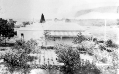
Photograph, 'Glenisla', 18 Chestnut Street, Surrey Hills, c 1920, 1920
... The house was named after 'Glenisla', a western District grazing property located between Hamilton and Horsham on the Henty Highway and on the edge of the Grampians National Park. ...The house was named after 'Glenisla', a western District grazing property located between Hamilton and Horsham on the Henty Highway and on the edge of the Grampians National Park. ...Date is approximate. In 1920 this became the home of Mr and Mrs Robert Moore, whose daughter Mabel Annie married Norman Brodley Carter of Mont Albert. The house was named after 'Glenisla', a western District grazing property located between Hamilton and Horsham on the Henty Highway and on the edge of the Grampians National Park. This was established as a super-fine wool stud in 1860 and was passed down the family until it was sold in 1922. The family transferred from this property to Melbourne. Robert is listed as a grazier in the 1924 electoral roll at Chestnut Street. With him are Victor Cecil listed as a carpenter; Isabella, Mabel Annie and Edgar Gilbert listed as an orchardist. In 2003 the house was extant minus the verandas. This photo may have been taken from the rear of the property. Ref: History of original property - Age newspaper article: 'The Best - Glenisla: historic Grampians property', 7 January 1994. Moore family details: Robert Moore born 1857 on Isle of Man; died Surrey Hills 1940 Isabella Bateson born 1869; died Surrey Hills 1938 Married in 1894 in Miram, 10 km north-east of Kaniva in the northern Wimmera. All the children were born in Kaniva. Children: Lena Florence (1895-1980) Victor Cecil (1896-1984) - a builder Edgar Gilbert (1897-1976); died Surrey Hills; married Myrtle Emary, daughter of Henry John Emary of Surrey Hills Ernest Alan (1900-1900) Mabel Annie (1901-1957); died Surrey Hills married Norman Brodley Carter (1899-1984) Clarence Arthur (1904-2004). Norman Carter took many photos in the Surrey Hills and Mont Albert are from the 1920s; many is connection with Church of England events and activities. Robert and Isabella Moore are buried in Box Hill Cemetery. Black and white photo of a Victorian home with a veranda with a corrugated iron roof and lacework on 2 sides. It appears to have a later extension at the rear. It is surrounded by mature gardens with ornamental trees (cypresses) and an area with plants in rows, which may be a vegetable garden. There appears to be significant areas of open space around the house.glenisla, homes, victorian style, gardens, norman carter, robert moore, miss isabella bateson, mrs isabella moore, victor cecil moore, edgar gilbert moore, miss mabel annie moore, box hill cemetery -
 Sunshine and District Historical Society Incorporated
Administrative record - Minutes of the Ordinary Meeting of Council held on 12th February 1980, City of Sunshine, 12th January 1980
... Highway...Duke Street...Burke Street...Alfrieda Street...Collins Street...Sunshine Road...Gould Street...Mawson Avenue...Melissa Nook...Elsum Avenue...Birchwood Boulevard...Hogan Street...Quinn Street...Hamilton...Western Highway (Ballarat Road), Hogan Street, Quinn Street and Hamilton Street Deer Park Main Outfall Sewer Reconditioning Brooklyn and Near Hoppers Crossing Sewered Facilities Fitzgerald Road, Hall Street, Allison Street & Hilma Street Sunshine West Tenders for Street Sweeper Report of the Building Surveyor Building Over Easement 15 Merrivale Avenue Sunshine West Building Over Easement 16 Glenrobe Street Deer Park Building Over Easement 18 Bunya Drive St. ...Western Highway (Ballarat Road), Hogan Street, Quinn Street and Hamilton Street Deer Park Main Outfall Sewer Reconditioning Brooklyn and Near Hoppers Crossing Sewered Facilities Fitzgerald Road, Hall Street, Allison Street & Hilma Street Sunshine West Tenders for Street Sweeper Report of the Building Surveyor Building Over Easement 15 Merrivale Avenue Sunshine West Building Over Easement 16 Glenrobe Street Deer Park Building Over Easement 18 Bunya Drive St. ...Notice of Ordinary Meeting of the Council 12th February 1980 Report of the Town Clerk's Department Report of the Town Clerk Land Transfers to and from Council Drainage Easement Rear of Sunshine Swimming Pool, Withers Street (Last house owned by Ada Mary Bell Nee Jelly to be converted in council car parking area) and Stanley Street Land Transfers to and from Sunshine R.S.L. Licence Agreement Sunshine Swimming Pool Kiosk Churchill Fellowship Payment of Salaries Licences and Leases Council Properties Introduction of Electric Trolley Bus Services Attendance at Seminars Proposed Review of Voters Rolls Rates, Sanitary and Interest Charges Adjustments and Abandonments Extension of Insurance Cover Child Care Centres Attendance of Shop Stewards at Industrial Relations Course 11th to 13th February 1980 Rates, Sanitary and Interest Charges Adjustments and Abandonments Public Liability Insurance Cleaning Contract Proposed Lease YCW Building Co-Operative Kinder Smith Reserve Local Government (General Amendment) Bill Training of Swimming Pool Attendants Arrears of Fire Hazard Charges Abandonment Supplementary Valuations Alteration of Closing of Poll Proposed Branch Library at the Deer Park Shopping Centre Proposed Purchase of Land from ICI - ICI Oval and Surrounding Lands and Land Fitzgerald Road and Whitesides Avenue Report of Board of Review into the Roles and Structure and Administration of Local Government in Victoria National Wage Decision January 1980 Outlines of Activities at the Rainbow Workshop Over the Past Twelve Months Report by Project Officer Rainbow Workshop Report of the Co-Ordinator of Welfare Services Children's Services Development Officer Quarterly Report Caretaker Lions House of Sunshine Care for Kids Calendar Orama Street Child Care Centre Subsidy for Children's Services Development Officer Financial Assistance Request Footscray Migrant Information Centre Northumberland Road Child Care Centre Repatriation Benefits or Allied Veterans Funding of Women's Refuges Community Youth Support Scheme Community Youth Support Scheme Submission for Refunding Report of the Chief Health Surveyor After Hours Telephone Contact Health Department Builders' Sanitary Service Request for Payment from Clarke Richards Grant & Co Solicitors Sampling Milk Infant Welfare Subsidy Deer Park Infant Welfare Centre and Highpoint West Infant Welfare Centre Thomas Borthwick & Sons (Australasia) Ltd Francis Street Brooklyn Section 95 Health Act 1958 Consent to Construct a Safety Access Walkway Across the Roof of the Sheep and Lamb Dressing Floor Pollution Control Head Lice Statistics 1979 Demonstration of Resuscitation Method Waste Management Conference Melbourne 26th - 28th March 1980 Includes Special Types of Waste Radioactive Waste & Asbestos Rubbish Dumping Incident Station Road Deer Park Burns Street Infant Welfare Centre Maidstone Hours of Infant & Maternal Child Welfare Centres Removal of Dwelling Outside of Municipality Ex Caretaker's House Pig Market Market Road Sunshine to Lot 2 Stanbridge Street Daylesford Infant Welfare Sister Subsidy Health Act Registration for 1980 Application for Transfer of Proprietorship of Premises Under the Health Act Prosecution Proceedings Sunshine Magistrates Court Diamond Avenue Infant Welfare Centre Albanvale Airconditioning Defects Report of the Superintendent Traffic & By-Laws Dog Act Court Proceedings Parking & Traffic Infringements Declaration of Such other Place Derelict Vehicles Fixing of Fees Report of the Municipal Recreation Officer Basketball Stadium Robert Barrett Reserve January 1980 Holiday Programmes Report of the City Engineer & Planner Urban Renewal Vicrail South Road Housing Estate Proposed Legislation Planning Appeal Board Bill Summary of Planning Applications for 1979 Planning Permit Application Display Homes and Associated Commercial Car Parking Lot 29, 30 & 31 Station Road Town Planning Enforcement 36 Wintersun Drive Albanvale Panel Beating and Mechanical Repairs Planning Permit Application Extensions to Existing Workshop for Mentally Retarded People Day Training Centre Council Reserve Bounded by Churchill Avenue, Darnley Street and Ravenhall Street Braybrook Planning Permit Application Vehicular Access to Lot 59 Ballarat Road Deer Park Town Planning Appeal Planning Permit Application Extension to Existing Educational Establishment Involving Agriculture and Husbandry Corner Station Road and Middle Road Deer Park Planning Permit Application Cafe Lot 3 Watt Street Sunshine Planning Permit Application Take Away Food Shop and Self-Serve Petrol Sales Lot 1 Ballarat Road Braybrook Planning Permit Application Pole Sign 83 Mitchell Street Maidstone Planning Permit Consulting Room (Doctor's Surgery) 88 Ashley Street Maidstone Planning Permit Application Floodlit Signs on Fascia Lots 3 & 4 St. Albans Road St. Albans Planning Permit Application Seven Villa Units Lots 54. 55 & 56 Salmond Street Deer Park Planning Permit Application Amusement Parlour 93 Glengala Road Sunshine West Planning Permit Application Illuminated Sign 760 Ballarat Road Deer Park Planning Permit Application Mechanical Repairs Workshop Lot 170 Comley Street Sunshine North Planning Permit Application Illuminated Sign Lot 1 Hampshire Road Sunshine Planning Permit Application Medical Consulting Rooms Shop 99A Deer Park Shopping Centre Neale Road Deer Park Planning Permit Application Two Lot Subdivision Ballarat Road North Side 275 metres West of Kororoit Creek Planning Permit Application Illuminated Sky Sign Coner Glengala Road and Evelyn Crescent Sunshine West Planning Permit Application Cafe Shop 2 Lot 2 Watt Street Sunshine Planning Permit Application Six Factories Lot 1 Berkshire Road Sunshine North Planning Permit Application Unclassified Road Corner Lot 19 Francis Street and Geelong Road Brooklyn Planning Permit Application Detached House Within 60 Metres of the Maribyrnong River Lot 88 Chifley Drive Maribyrnong Planning Permit Application Factory Lot 12 McIntyre Road Sunshine North Planning Permit Car Sales Yard Rosamond Road Maidstone Enforcement Notice Planning Permit Application Factory Extension Lot 6 Lacy Street Braybrook Planning Permit Cluster Subdivision and Display Homes Station Road Deer Park Ainsworth Reserve Sunshine Heights Football Club Liquor Licence Glengala Road Planning Permit Application Pedestrian Bridge Lawrence Street / Verdant Avenue Ardeer Planning Permit Application Extension to School (Educational Religious Centre) 204 Churchill Avenue Braybrook Planning Permit Application Garden Furnishings and Supplies Corner Main Road East, McIntyre Road and Sunshine Avenue Sunshine North Planning Permit Application Amusement Parlour and Cafe 54A Station Place Planning Permit Application Amusement Machine Watt Street Sunshine Planning Permit Sunroom Addition to Existing Apartment House and Caretaker's Residence 16 Ridley Street Albion Planning Permit Application Amusement Parlour & Cafe 93 Glengala Road Sunshine West Planning Permit Application Hot Bread Bakery 69 McIntyre Road Sunshine North Appointment of Authorised Officers Under the Town & Country Planning Act Creation of Easement 40 Mernda Street Sunshine West Consolidation of Title 26 Mernda Street Sunshine West Plans of Consolidation St. Albans Continental Hotel McKechnie Street St. Albans Consolidation of Title lots 13 & 14 Francis Street Brooklyn Consolidation of Title Cranwell Street and Evans Street Braybrook Consolidation of Title Inkerman Street Maidstone Strata Subdivision 40 Mernda Street Sunshine West Maintenance Agreement Albanvale Estate Stage 23 Plan of Subdivision McIntyre Road, Sproul Street & Tennant Street Sunshine North Plan of Subdivision Hook Street & Vule Street St. Albans Foundation for the Technical Advancement of Local Government Engineering in Victoria electrification of Railway Line to Deer Park Westgate Bridge Authority Proposal for Feeder Route to West Gate Freeway Intersection Fairbairn Road / Wright Steet Sunshine West Proposed Private Street Scheme Program Ayton Street / Steers Street Private Street Scheme Western Highway (Ballarat Road) / Duke Street Proposed Traffic Signals Western Highway (Ballarat Road) Street Lighting West of Burke Street to East of Evans Street Braybrook Installation of Pedestrian Operated Signals Under the Statcon Programme Pedestrian Operated Signals Main Road East Between Alfrieda Street and Collins Street St. Albans Station Road Widening Melbourne Metropolitan Planning Scheme Amendment No 81 Part Lot 35 Station Road Sewerage Facilities Sunshine West Overhead Powerlines in Market Road City of Footscray Power Line Extension Market Road to Sunshine Road Sunshine Statcon Programme Additions to Network Proposed School Crossing Gould Street Between Mawson Avenue & Melissa Nook Deer Park and Neale Road between Elsum Avenue & Birchwood Boulevard Deer Park Purchase of Water Tanker Boring Operations by M.M.B.W. Western Highway (Ballarat Road), Hogan Street, Quinn Street and Hamilton Street Deer Park Main Outfall Sewer Reconditioning Brooklyn and Near Hoppers Crossing Sewered Facilities Fitzgerald Road, Hall Street, Allison Street & Hilma Street Sunshine West Tenders for Street Sweeper Report of the Building Surveyor Building Over Easement 15 Merrivale Avenue Sunshine West Building Over Easement 16 Glenrobe Street Deer Park Building Over Easement 18 Bunya Drive St. Albans Building Over Easement 6 Warwick Road Sunshine North Building Over Easement Lot 474 Birchwood Boulevard Deer Park Building Over Easement 122 McIntyre Road Sunshine North Building Over Easement 4 Concord Circuit Albanvale Building Over Easement Lot 4 Devonshire Road Sunshine Building Over Easement 19 Lorna Crescent Sunshine West Building Over Easement 2 Firbank Terrace St. Albans Building Over Easement 9 Mernda Street Sunshine West Building Over Easement 10 Shipley Court Sunshine Building Over Easement 17 Aycliffe Drive Deer Park Building Over Easement Lot 136 Clover Avenue St. Albans Building Over Easement 84 Allison Street Deer Park Fence 21 Willaton Street St. Albans Fence 60 Ford Avenue Sunshine North Siting of Building 23 Stanbury Court Ardeer Siting of Building 8 Dale Street Maribyrnong Siting of Building 100 Ballarat Road Maidstone Installation of Underground Tanks Corner Geelong Road and Francis Street Brooklyn Report of the Structural Aspects of the houses in The South Road Railway's Estate Report of the Director of Parks & Recreation Landscaping Bon Thomas Pre-School Centre Extra Work St. Albans Tennis Club Synthetic Tennis Courts Schedule for Authorising of Affixing the Common Seal of the Municipality to Documents Orders of the Day Accounts Submitted for Payment as at 15th December 1979, 15th January 1980 & 31st January 1980 Resort and recreation Account Proposals for Sporting Pavilions and Improvements Extraordinary Business Report of the City Engineer & Planner Planning Permit Application New and Used Car Sales and Service Dealership Corner Ballarat Road and Ashley Street Maidstone Planning Permit Application Warehouse McIntyre Road Sunshine Northici oval, ballarat road, fitzgerald road, whitesides avenue, ardeer, sunshine swimming pool, kennedy street, stanley street, braybrook, ycw, kinder smith reserve, lily street, deer park library, station road, neale road, deer park, withers street, sunshine r.s.l, deer park shopping centre, lions house of sunshine, watt street, corio street, sunshine, orama street child care centre, orama street, footscray migrant information centre, northumberland road child care centre, northumberland road, sunshine north, deer park infant welfare centre, highpoint west infant welfare centre, rosamond road, maribyrnong, thomas borthwick & sons, francis street, brooklyn, burns street infant welfare centre, burns street, maidstone, pig market, market road, diamond avenue infant welfare centre, diamond avenue, albanvale, robert barrett reserve, wintersun drive, churchill avenue, darnley street, ravenhall street, middle road, mitchell street, ashley street, st. albans road, salmond street, glengala road, sunshine west, comley street, hampshire road, kororoit creek, evelyn crescent, berkshire road, geelong road, maribyrnong river, chifley drive, mcintyre road, lacy street, sunshine heights football club, lawrence street, lawrence street bridge, verdant avenue, main road east, sunshine avenue, station place, ridley street, albion, mernda street, st. albans continental hotel, mckechnie street, cranwell street, evans street, sproul street, tennant street, hook street, vule street, fairbairn road, wright steet, ayton street, steers street, western highway, duke street, burke street, alfrieda street, collins street, sunshine road, gould street, mawson avenue, melissa nook, elsum avenue, birchwood boulevard, hogan street, quinn street, hamilton street, hall street, allison street, hilma street, merrivale avenue, glenrobe street, bunya drive, warwick road, concord circuit, devonshire road, lorna crescent, firbank terrace, shipley court, aycliffe drive, clover avenue, allison stree, willaton street, ford avenue, stanbury court, dale street, bon thomas pre-school centre, st. albans tennis club -
 Sunshine and District Historical Society Incorporated
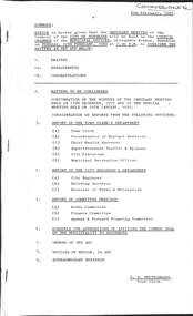
Administrative record - City of Sunshine - Commissioner Mr Alexander Alex George Gillon Collection 1976 - 1982 - Notice of ordinary meeting of the council 12th February 1980, City of Sunshine, 6th January 1980
... Highway...Duke Street...Burke Street...Alfrieda Street...Collins Street...Sunshine Road...Gould Street...Mawson Avenue...Melissa Nook...Elsum Avenue...Birchwood Boulevard...Hogan Street...Quinn Street...Hamilton...Western Highway (Ballarat Road), Hogan Street, Quinn Street and Hamilton Street Deer Park Main Outfall Sewer Reconditioning Brooklyn and Near Hoppers Crossing Sewered Facilities Fitzgerald Road, Hall Street, Allison Street & Hilma Street Sunshine West Tenders for Street Sweeper Report of the Building Surveyor Building Over Easement 15 Merrivale Avenue Sunshine West Building Over Easement 16 Glenrobe Street Deer Park Building Over Easement 18 Bunya Drive St. ...Western Highway (Ballarat Road), Hogan Street, Quinn Street and Hamilton Street Deer Park Main Outfall Sewer Reconditioning Brooklyn and Near Hoppers Crossing Sewered Facilities Fitzgerald Road, Hall Street, Allison Street & Hilma Street Sunshine West Tenders for Street Sweeper Report of the Building Surveyor Building Over Easement 15 Merrivale Avenue Sunshine West Building Over Easement 16 Glenrobe Street Deer Park Building Over Easement 18 Bunya Drive St. ...Notice of Ordinary Meeting of the Council 12th February 1980 Report of the Town Clerk's Department Report of the Town Clerk Land Transfers to and from Council Drainage Easement Rear of Sunshine Swimming Pool, Withers Street (Last house owned by Ada Mary Bell Nee Jelly to be converted in council car parking area) and Stanley Street Land Transfers to and from Sunshine R.S.L. Licence Agreement Sunshine Swimming Pool Kiosk Churchill Fellowship Payment of Salaries Licences and Leases Council Properties Introduction of Electric Trolley Bus Services Attendance at Seminars Proposed Review of Voters Rolls Rates, Sanitary and Interest Charges Adjustments and Abandonments Extension of Insurance Cover Child Care Centres Attendance of Shop Stewards at Industrial Relations Course 11th to 13th February 1980 Rates, Sanitary and Interest Charges Adjustments and Abandonments Public Liability Insurance Cleaning Contract Proposed Lease YCW Building Co-Operative Kinder Smith Reserve Local Government (General Amendment) Bill Training of Swimming Pool Attendants Arrears of Fire Hazard Charges Abandonment Supplementary Valuations Alteration of Closing of Poll Proposed Branch Library at the Deer Park Shopping Centre Proposed Purchase of Land from ICI - ICI Oval and Surrounding Lands and Land Fitzgerald Road and Whitesides Avenue Report of Board of Review into the Roles and Structure and Administration of Local Government in Victoria National Wage Decision January 1980 Outlines of Activities at the Rainbow Workshop Over the Past Twelve Months Report by Project Officer Rainbow Workshop Report of the Co-Ordinator of Welfare Services Children's Services Development Officer Quarterly Report Caretaker Lions House of Sunshine Care for Kids Calendar Orama Street Child Care Centre Subsidy for Children's Services Development Officer Financial Assistance Request Footscray Migrant Information Centre Northumberland Road Child Care Centre Repatriation Benefits or Allied Veterans Funding of Women's Refuges Community Youth Support Scheme Community Youth Support Scheme Submission for Refunding Report of the Chief Health Surveyor After Hours Telephone Contact Health Department Builders' Sanitary Service Request for Payment from Clarke Richards Grant & Co Solicitors Sampling Milk Infant Welfare Subsidy Deer Park Infant Welfare Centre and Highpoint West Infant Welfare Centre Thomas Borthwick & Sons (Australasia) Ltd Francis Street Brooklyn Section 95 Health Act 1958 Consent to Construct a Safety Access Walkway Across the Roof of the Sheep and Lamb Dressing Floor Pollution Control Head Lice Statistics 1979 Demonstration of Resuscitation Method Waste Management Conference Melbourne 26th - 28th March 1980 Includes Special Types of Waste Radioactive Waste & Asbestos Rubbish Dumping Incident Station Road Deer Park Burns Street Infant Welfare Centre Maidstone Hours of Infant & Maternal Child Welfare Centres Removal of Dwelling Outside of Municipality Ex Caretaker's House Pig Market Market Road Sunshine to Lot 2 Stanbridge Street Daylesford Infant Welfare Sister Subsidy Health Act Registration for 1980 Application for Transfer of Proprietorship of Premises Under the Health Act Prosecution Proceedings Sunshine Magistrates Court Diamond Avenue Infant Welfare Centre Albanvale Airconditioning Defects Report of the Superintendent Traffic & By-Laws Dog Act Court Proceedings Parking & Traffic Infringements Declaration of Such other Place Derelict Vehicles Fixing of Fees Report of the Municipal Recreation Officer Basketball Stadium Robert Barrett Reserve January 1980 Holiday Programmes Report of the City Engineer & Planner Urban Renewal Vicrail South Road Housing Estate Proposed Legislation Planning Appeal Board Bill Summary of Planning Applications for 1979 Planning Permit Application Display Homes and Associated Commercial Car Parking Lot 29, 30 & 31 Station Road Town Planning Enforcement 36 Wintersun Drive Albanvale Panel Beating and Mechanical Repairs Planning Permit Application Extensions to Existing Workshop for Mentally Retarded People Day Training Centre Council Reserve Bounded by Churchill Avenue, Darnley Street and Ravenhall Street Braybrook Planning Permit Application Vehicular Access to Lot 59 Ballarat Road Deer Park Town Planning Appeal Planning Permit Application Extension to Existing Educational Establishment Involving Agriculture and Husbandry Corner Station Road and Middle Road Deer Park Planning Permit Application Cafe Lot 3 Watt Street Sunshine Planning Permit Application Take Away Food Shop and Self-Serve Petrol Sales Lot 1 Ballarat Road Braybrook Planning Permit Application Pole Sign 83 Mitchell Street Maidstone Planning Permit Consulting Room (Doctor's Surgery) 88 Ashley Street Maidstone Planning Permit Application Floodlit Signs on Fascia Lots 3 & 4 St. Albans Road St. Albans Planning Permit Application Seven Villa Units Lots 54. 55 & 56 Salmond Street Deer Park Planning Permit Application Amusement Parlour 93 Glengala Road Sunshine West Planning Permit Application Illuminated Sign 760 Ballarat Road Deer Park Planning Permit Application Mechanical Repairs Workshop Lot 170 Comley Street Sunshine North Planning Permit Application Illuminated Sign Lot 1 Hampshire Road Sunshine Planning Permit Application Medical Consulting Rooms Shop 99A Deer Park Shopping Centre Neale Road Deer Park Planning Permit Application Two Lot Subdivision Ballarat Road North Side 275 metres West of Kororoit Creek Planning Permit Application Illuminated Sky Sign Coner Glengala Road and Evelyn Crescent Sunshine West Planning Permit Application Cafe Shop 2 Lot 2 Watt Street Sunshine Planning Permit Application Six Factories Lot 1 Berkshire Road Sunshine North Planning Permit Application Unclassified Road Corner Lot 19 Francis Street and Geelong Road Brooklyn Planning Permit Application Detached House Within 60 Metres of the Maribyrnong River Lot 88 Chifley Drive Maribyrnong Planning Permit Application Factory Lot 12 McIntyre Road Sunshine North Planning Permit Car Sales Yard Rosamond Road Maidstone Enforcement Notice Planning Permit Application Factory Extension Lot 6 Lacy Street Braybrook Planning Permit Cluster Subdivision and Display Homes Station Road Deer Park Ainsworth Reserve Sunshine Heights Football Club Liquor Licence Glengala Road Planning Permit Application Pedestrian Bridge Lawrence Street / Verdant Avenue Ardeer Planning Permit Application Extension to School (Educational Religious Centre) 204 Churchill Avenue Braybrook Planning Permit Application Garden Furnishings and Supplies Corner Main Road East, McIntyre Road and Sunshine Avenue Sunshine North Planning Permit Application Amusement Parlour and Cafe 54A Station Place Planning Permit Application Amusement Machine Watt Street Sunshine Planning Permit Sunroom Addition to Existing Apartment House and Caretaker's Residence 16 Ridley Street Albion Planning Permit Application Amusement Parlour & Cafe 93 Glengala Road Sunshine West Planning Permit Application Hot Bread Bakery 69 McIntyre Road Sunshine North Appointment of Authorised Officers Under the Town & Country Planning Act Creation of Easement 40 Mernda Street Sunshine West Consolidation of Title 26 Mernda Street Sunshine West Plans of Consolidation St. Albans Continental Hotel McKechnie Street St. Albans Consolidation of Title lots 13 & 14 Francis Street Brooklyn Consolidation of Title Cranwell Street and Evans Street Braybrook Consolidation of Title Inkerman Street Maidstone Strata Subdivision 40 Mernda Street Sunshine West Maintenance Agreement Albanvale Estate Stage 23 Plan of Subdivision McIntyre Road, Sproul Street & Tennant Street Sunshine North Plan of Subdivision Hook Street & Vule Street St. Albans Foundation for the Technical Advancement of Local Government Engineering in Victoria electrification of Railway Line to Deer Park Westgate Bridge Authority Proposal for Feeder Route to West Gate Freeway Intersection Fairbairn Road / Wright Steet Sunshine West Proposed Private Street Scheme Program Ayton Street / Steers Street Private Street Scheme Western Highway (Ballarat Road) / Duke Street Proposed Traffic Signals Western Highway (Ballarat Road) Street Lighting West of Burke Street to East of Evans Street Braybrook Installation of Pedestrian Operated Signals Under the Statcon Programme Pedestrian Operated Signals Main Road East Between Alfrieda Street and Collins Street St. Albans Station Road Widening Melbourne Metropolitan Planning Scheme Amendment No 81 Part Lot 35 Station Road Sewerage Facilities Sunshine West Overhead Powerlines in Market Road City of Footscray Power Line Extension Market Road to Sunshine Road Sunshine Statcon Programme Additions to Network Proposed School Crossing Gould Street Between Mawson Avenue & Melissa Nook Deer Park and Neale Road between Elsum Avenue & Birchwood Boulevard Deer Park Purchase of Water Tanker Boring Operations by M.M.B.W. Western Highway (Ballarat Road), Hogan Street, Quinn Street and Hamilton Street Deer Park Main Outfall Sewer Reconditioning Brooklyn and Near Hoppers Crossing Sewered Facilities Fitzgerald Road, Hall Street, Allison Street & Hilma Street Sunshine West Tenders for Street Sweeper Report of the Building Surveyor Building Over Easement 15 Merrivale Avenue Sunshine West Building Over Easement 16 Glenrobe Street Deer Park Building Over Easement 18 Bunya Drive St. Albans Building Over Easement 6 Warwick Road Sunshine North Building Over Easement Lot 474 Birchwood Boulevard Deer Park Building Over Easement 122 McIntyre Road Sunshine North Building Over Easement 4 Concord Circuit Albanvale Building Over Easement Lot 4 Devonshire Road Sunshine Building Over Easement 19 Lorna Crescent Sunshine West Building Over Easement 2 Firbank Terrace St. Albans Building Over Easement 9 Mernda Street Sunshine West Building Over Easement 10 Shipley Court Sunshine Building Over Easement 17 Aycliffe Drive Deer Park Building Over Easement Lot 136 Clover Avenue St. Albans Building Over Easement 84 Allison Street Deer Park Fence 21 Willaton Street St. Albans Fence 60 Ford Avenue Sunshine North Siting of Building 23 Stanbury Court Ardeer Siting of Building 8 Dale Street Maribyrnong Siting of Building 100 Ballarat Road Maidstone Installation of Underground Tanks Corner Geelong Road and Francis Street Brooklyn Report of the Structural Aspects of the houses in The South Road Railway's Estate Report of the Director of Parks & Recreation Landscaping Bon Thomas Pre-School Centre Extra Work St. Albans Tennis Club Synthetic Tennis Courts Schedule for Authorising of Affixing the Common Seal of the Municipality to Documentsici oval, ballarat road, fitzgerald road, whitesides avenue, ardeer, sunshine swimming pool, kennedy street, stanley street, braybrook, ycw, kinder smith reserve, lily street, deer park library, station road, neale road, deer park, withers street, sunshine r.s.l, deer park shopping centre, lions house of sunshine, watt street, corio street, sunshine, orama street child care centre, orama street, footscray migrant information centre, northumberland road child care centre, northumberland road, sunshine north, deer park infant welfare centre, highpoint west infant welfare centre, rosamond road, maribyrnong, thomas borthwick & sons, francis street, brooklyn, burns street infant welfare centre, burns street, maidstone, pig market, market road, diamond avenue infant welfare centre, diamond avenue, albanvale, robert barrett reserve, wintersun drive, churchill avenue, darnley street, ravenhall street, middle road, mitchell street, ashley street, st. albans road, salmond street, glengala road, sunshine west, comley street, hampshire road, kororoit creek, evelyn crescent, berkshire road, geelong road, maribyrnong river, chifley drive, mcintyre road, lacy street, sunshine heights football club, lawrence street, lawrence street bridge, verdant avenue, main road east, sunshine avenue, station place, ridley street, albion, mernda street, st. albans continental hotel, mckechnie street, cranwell street, evans street, sproul street, tennant street, hook street, vule street, fairbairn road, wright steet, ayton street, steers street, western highway, duke street, burke street, alfrieda street, collins street, sunshine road, gould street, mawson avenue, melissa nook, elsum avenue, birchwood boulevard, hogan street, quinn street, hamilton street, hall street, allison street, hilma street, merrivale avenue, glenrobe street, bunya drive, warwick road, concord circuit, devonshire road, lorna crescent, firbank terrace, shipley court, aycliffe drive, clover avenue, allison stree, willaton street, ford avenue, stanbury court, dale street, bon thomas pre-school centre, st. albans tennis club
