
Showing 78 items matching " parks and resources"
-
 Federation University Historical Collection
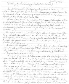
Document, History of the Ballarat Technology Park, Oakbank
... The first stage commenced on 03 August 1989 when the first sod was turned by Hon, David White, Minister for Industry, Technology and Resources. John Beaumont was the Director of the Ballarat Technology Research and Development Park in 1989....David White, the Minister for Industry, Technology and resources (See the Courier 4th August 1989) Mr Beaumont went overseas to study similar parks and look for tenants. ...David White, the Minister for Industry, Technology and resources (See the Courier 4th August 1989) Mr Beaumont went overseas to study similar parks and look for tenants. ...The Ballarat Technology Park is associated with Federation University Australia. The first stage commenced on 03 August 1989 when the first sod was turned by Hon, David White, Minister for Industry, Technology and Resources. John Beaumont was the Director of the Ballarat Technology Research and Development Park in 1989.Twenty items relating to the History of the Ballarat Technology Park as collected by John Parkin. .1) Handwritten notes by John Parkin on the history of the Ballarat Technology Park .2) Letter from A.E. Helyar (Shire of Buninyong Secretary), 08 March 1988 .3) Shire of Buninyong Minutes 07 June 1988 .4) Development of High Technology Activity by Jack Barker .5) Definition of a Technology Park by Derek Woolley .6) Shire of Buninyong minutes 28 June 1988 .7) Shire of Buninyong minutes 19 July 1988 .8) Invitation to a reception to commemorate the inauguration of the Ballarat Technology Park (John Parkin) by Shire of Buninyong President Cr Judith Coull to be held on 03 August 1989. .9) Invitation to a reception to the Ballarat Technology Park (John Beaumont) .10) Ballarat Courier article 04 August 1989 .11) Draft letter to Professor Geoffrey Blainey from John Parkin .12) Letter to the Editor from John Parkin, 18 December 2000 .13) University of Ballarat Development Appeal, 04 November 1994 .14 & .15) Invitation to installment dinner to celebrate the installation of Professor Geoffrey Blainey as Chancellor of the University of Ballarat to be held in the Union Building (now Albert Coates Building), Mt Helen campus .16) Letter to the editor from John Parkin .17) Letter from John Beaumont, 25 November 1994 .18) Invitation to the opening of the ISSC Southern Region Data Centre to be held on 24 November 1995. .19) Letter from Barry Traynor, 13 December 1995 .20) Planning Scheme information relating to the LaTrobe Research and Development Zone. .1) 2nd May 2005 History of Technology Park (I.T. centre) The history of the Technology Park started back in the mid-1980s. At the time I was a Buninyong Shire Councilor and as such I was Buninyong's representative on the then Ballarat Development Committee. At one of our meetings we received a request for information on a suitable site for a technology park. The requirements were for a site adjacent to a tertiary institution, secluded for security purposes and large enough to contain such a development. The next morning I contacted our Shire Engineer at the time, Newell Barrett and we drove around the area we both agreed that the current site was the most suitable we saw to meet the requirements. At the time it was owned by George Morrison. however the original enquiry to the B.D.C. came to nothing but the Shire Council and the B.D.C. decided to investigate the possibility of the site becoming a technology Park and information was collected. At about this time Mr Morrison put the property on the market and it was bought by a Ballarat builder, Mr John Beaumont, with the idea of developing it as a residential area. Council then arranged a meeting with Messrs Morrison and Beaumont to discuss the matter. I remember Mr Morrison saying he did not care what was done with it he just wanted to sell it and move down to the coast. Mr Beaumont, on the other hand, said he wasn't ready to retire yet and the idea interested him. As a result a committee consisting of the B.C.A.E., B.D.C. and Buninyong Shire Council (and Mr Beaumont) was formed to plan the development and rezone the area to technology park. It was previously zoned residential land and would seem to have been suitable for sub-division and residential development - its close proximity to the College being a major factor in its favour. The point of this is if Mr Beaumont had insisted on pursuing his original plan and had opposed the rezoning, I am quite confident he would have won an appeal at the A.A.T . (Administrative Appeals Tribunal - forerunner of V.C.A.T.) and the I.T. centre would not have got off the ground and the area would be covered with houses. But Mr Beaumont did go into the project with enthusiasm and the first stage was commenced on the 3rd August 1989 when the first sod was turned by Hon. David White, the Minister for Industry, Technology and resources (See the Courier 4th August 1989) Mr Beaumont went overseas to study similar parks and look for tenants. Unfortunately government did not support the project as they have now and apparently Mr Beaumont was ahead of his time for the private sector so Mr Beaumont could not continue the development and the site eventually passed to the College. I personally think more could have been done ... The work done by the Buninyong Shire Council and Ballarat Development Committee seems to have been forgotten as according to the Courier December 21, 2000 we are told the Park opened in 1995 as a joint venture between the City and the University. As a former Councillor said to me on the day "What happened to the plaque David White unveiled in 1989!" If there is any other information you want, please contact me. You may use my file for reference. Kind regards John Parkin PS I always felt a bit guilty that I encouraged John Beaumont and he was left in the lurch. ballarat technology park, parkin, john parkin, helyar, barker, woolley, shire of buninyong, beaumont, blainey, geoffrey blainey, southern region data centre, greenhill enterprise centre, stan jeffrey, jeffrey, john beaumont, david white -
 Federation University Historical Collection
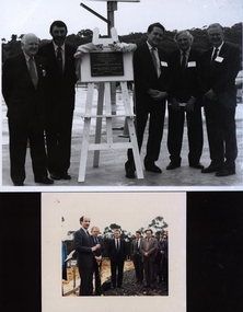
Photograph - colour, Turning the sod at the University of Ballarat Technology Park, 1989, 03/08/1989
... A number of people watch David White, Minister for Industry, Technology and Resources turn the first sod of Ballarat's Technology Park. ...University of Ballarat is a predecessor institution of Federation University Australia. ballarat technology park southern region data centre university of ballarat technology park federation university technology park david white john sharpham john beaumont stephen elder john mildren turn the sod A number of people watch David White, Minister for Industry, Technology and Resources turn the first sod of Ballarat's Technology Park. ...University of Ballarat is a predecessor institution of Federation University Australia. A number of people watch David White, Minister for Industry, Technology and Resources turn the first sod of Ballarat's Technology Park. Left to right: David White; John Sharpham (Director, Ballarat University College); John Beaumont (Director, Ballarat Technology Park); Stephen Elder M.L.A.; John Mildren M.H.R.ballarat technology park, southern region data centre, university of ballarat technology park, federation university technology park, david white, john sharpham, john beaumont, stephen elder, john mildren, turn the sod -
 Federation University Historical Collection
Report, Read Sturgess and Associates Consulting Economists et al, The Economic Significance of Grampians National Park, 1994 (and other reports), 1990-4
... .1) Grampians Surround Strategy, 1990 .2) Tourism and the Grampians Region: A Background Paper, 1990 .3) Grampians Surround Strategy and Discussion Paper, 1991 .4) The Economic Significance of Grampians National Park for the Department of Conservation and Natural Resources, 1994...victorian tourisim industry tourism halls gap grampians grampians national park recreation water production bee keeping arapiles dunkeld balmoral pomonal wartook population agriculture water supplies minerals hamilton ararat stawell horsham wimmera koorie heritage aboriginal heritage koorie art sites brambuk waterways wannon river wimmera river mount william creek rocklands reservoir lake lonsdale lake fyans lake toolando cherrypool mirranatwa zumstein Notes in pencil by Mary Hollick, lecturer in Tourism at the University of Ballarat. .1) Grampians Surround Strategy, 1990 .2) Tourism and the Grampians Region: A Background Paper, 1990 .3) Grampians Surround Strategy and Discussion Paper, 1991 .4) The Economic Significance of Grampians National Park for the Department of Conservation and Natural Resources, 1994 The Economic Significance of Grampians National Park, 1994 (and other reports) Report Read Sturgess and Associates Consulting Economists Trevor Budge and Associates Victorian Tourism Commission Hassell Planning Consultants ....1) Grampians Surround Strategy, 1990 .2) Tourism and the Grampians Region: A Background Paper, 1990 .3) Grampians Surround Strategy and Discussion Paper, 1991 .4) The Economic Significance of Grampians National Park for the Department of Conservation and Natural Resources, 1994Notes in pencil by Mary Hollick, lecturer in Tourism at the University of Ballarat.victorian tourisim industry, tourism, halls gap, grampians, grampians national park, recreation, water production, bee keeping, arapiles, dunkeld, balmoral, pomonal, wartook, population, agriculture, water supplies, minerals, hamilton, ararat, stawell, horsham, wimmera, koorie heritage, aboriginal heritage, koorie art sites, brambuk, waterways, wannon river, wimmera river, mount william creek, rocklands reservoir, lake lonsdale, lake fyans, lake toolando, cherrypool, mirranatwa, zumstein -
 Federation University Historical Collection
Booklet, Report of Natural Resources and Operations 1 Seminar April, 1983, 1983
... The program was conducted from the 6th to the 8th of April, 1983 and excursions were made to the You Yangs Forest Park, the Serendip Wildlife Research Station and Werribee Gorge National Park....The program was conducted from the 6th to the 8th of April, 1983 and excursions were made to the You Yangs Forest Park, the Serendip Wildlife Research Station and Werribee Gorge National Park. natural resources seminar school of mines ballarat ballarat school of mines victorian t.a.f.e off-campus network school of forestry creswick victorian school of forestry A ring bound booklet of 19 pages and clear laminate covers. ...This report details the program of a Natural Resources and Operations Seminar for the Victorian T.A.F.E. Off-Campus Network, hosted by the Victorian School of Forestry in Creswick. Thirty-one participants were in attendance. The program was conducted from the 6th to the 8th of April, 1983 and excursions were made to the You Yangs Forest Park, the Serendip Wildlife Research Station and Werribee Gorge National Park.A ring bound booklet of 19 pages and clear laminate covers. Includes a map of the Victorian School of Forestry, Creswick.natural resources, seminar, school of mines ballarat, ballarat school of mines, victorian t.a.f.e off-campus network, school of forestry, creswick, victorian school of forestry -
 Eltham District Historical Society Inc
Book, Land Conservation Council, Melbourne Area, District 2 Review: Final Recommendations, 1994
... A recommended Phillip Island State Park based around the penguin reserve was ultimately implemented as the Phillip Island Nature Park....A recommended Phillip Island State Park based around the penguin reserve was ultimately implemented as the Phillip Island Nature Park. ...Notices showing the boundary of the area of the review and advising that an investigation was to be carried out were published in the Victoria Government Gazette and in local and other Victorian newspapers in May 1987. A descriptive resources report was published in August 1991. Council received 1,425 submissions and letters following publication of the descriptive report. The Council considered these submissions and published proposed recommendations in April 1993. A further 1,993 submissions were received in response to the proposed recommendations. The Council published its final recommendations in July 1994. A change to legislation in 1989 enabled the LCC to make recommendations for public land within a ‘town’, though cities and rural cities remained excluded from the definition of public land. Timber resources and water quality and yield from timbered catchment areas remained significant issues in Melbourne’s catchments. Recommendations for the Yarra Ranges National Park were based around the closed Melbourne water catchments and adjoining state forest. A recommended Phillip Island State Park based around the penguin reserve was ultimately implemented as the Phillip Island Nature Park.Shire of Nillumbik DPE/Enviro -
 Glen Eira Historical Society
Article - Boyd Park
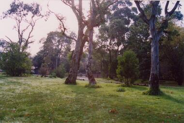
... ... Parks...Glen Eira Glen Eira Environment Group Smith Colin Caine Paul Boyd Park Murrumbeena Parks Conservation of natural land and energy economics Reserves Bushland Gardens Resources Trees Plants Article Boyd Park ...This file contains two items. Two original photographs of Boyd Park, date unknown. An article from the CAULFIELD/ PORT PHILLIP LEADER on a massive swamp gum tree that was felled by heavy winds in Boyd Park, Murrumbeena, dated 03/08/2012.glen eira, glen eira environment group, smith colin, caine paul, boyd park, murrumbeena, parks, conservation of natural land and energy economics, reserves, bushland, gardens, resources, trees, plants -
 Ringwood and District Historical Society
Newspaper, Scrapbook Clipping, Library Collection, Ringwood, Victoria
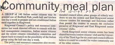
... A group of 140 Italian senior citizens may be granted use of Bedford Park youth hall and kitchen one day a week to prepare and eat a traditional Italian meal together in Ringwood. ...A group of 140 Italian senior citizens may be granted use of Bedford Park youth hall and kitchen one day a week to prepare and eat a traditional Italian meal together in Ringwood. ...Newspaper Clipping from "The Post", 12 May 1993, Page 7, "Communiy meal plan"'.A group of 140 Italian senior citizens may be granted use of Bedford Park youth hall and kitchen one day a week to prepare and eat a traditional Italian meal together in Ringwood. Ringwood Council's policy and resources committee directed officers to consult with the hall management committee, Italian senior citizens and the senior citizens' consultative committee and report back to council on the possibility of the Italian group using the hall one day a week. -
 Merri-bek City Council
Print - Silkscreen, Wendy Black, Declare Antarctica a World Park, 1982
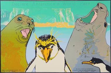
... The 1980s saw a rise in campaigns for Antarctica to be designated a World Park to ensure the ongoing protection of its natural resources and its continuation as a peace zone. ...The 1980s saw a rise in campaigns for Antarctica to be designated a World Park to ensure the ongoing protection of its natural resources and its continuation as a peace zone. ...Melbourne-based artist Wendy Black works across screenprinting, painting and drawing. The 1980s saw a rise in campaigns for Antarctica to be designated a World Park to ensure the ongoing protection of its natural resources and its continuation as a peace zone. Black’s screenprint, featuring seals and penguins set against an Arctic icecap, captures the looming threat to the precious flora and fauna of the continent. Text in the lower corner describes Black’s collaboration with the Antarctic and Southern Ocean coalition for which this poster was likely made. Donated by the artist -
University of Melbourne, Burnley Campus Archives
Plan, [Historical Maps of Richmond Park], 1862-2000
... Purchas, 9 October, 1862. (3) Plan of Richmond park. A.L. Martin Authorised Surveyor, 31st August, 1872. ...[Historical Maps of Richmond Park] Plan ...(1) Proposed reserve for Horticultural & Experimental Garden in the Survey paddock Richmond. R.19A (1865). Shows Swan Street Extension. Gazettals 1877, 1887. (2) As (1). Half of map only Annotation by A. Purchas, 9 October, 1862. (3) Plan of Richmond park. A.L. Martin Authorised Surveyor, 31st August, 1872. [Dept. of lands & Survey Melbourne, J. Noone, 6th September 1872.] Map in 4 sheets. (4) Richmond Park. Surveyed by Geo. Black, Authorised Surveyor 13.8.91 (2 copies). (5) [Richmond Park] Shows road alignments gazetted 1871 & 1881 (part copy only - Neg. 18375). (6) City of Richmond Parish of Jika Jika County of Bourke. Department of lands & Survey, 1919 (annotations i.e. Melb. City Link, Amrad, etc. to 1994.) (7) Burnley gardens, 2000. Produced by P. Tulk, Institute of Land & Food Resources, Burnley College, 2000 (re area proposed for heritage listing.)richmond park, survey paddock -
 Otway Districts Historical Society
Book, Lothian Custom Publishing, The redwoods of the Otway Ranges. Roger Smith, January 2015
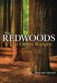
... This book is the remarkable story of the world's tallest tree species, the Redwood, growing in the Great Otway National Park in Victoria's south-west. It was originally planted by Victorian foresters for experimental purposes on land abandoned by the early settlers. ...Lothian Custom Publishing; Middle Park (Vic); 2015. ii, 202 p.; illus., maps, appendices, notes. ...This book is the remarkable story of the world's tallest tree species, the Redwood, growing in the Great Otway National Park in Victoria's south-west. It was originally planted by Victorian foresters for experimental purposes on land abandoned by the early settlers. The Coast Redwood, native of California, is now thrives in the Otways alongside the famous eucalypt, the towering Mountain Ash. The majestic Otway Redwoods, still in their youthful growth phase, have withstood adversity caused by fire, landslide, lighting and chainsaws, while the ongoing political debate about the conservation of the valuable forest resources continues.The redwoods of the Otway Ranges. Roger B. Smith. Lothian Custom Publishing; Middle Park (Vic); 2015. ii, 202 p.; illus., maps, appendices, notes. IBSN 978 1 921737 13 8. Soft cover.With best wishes from Roger Smith. -
 St Kilda Historical Society
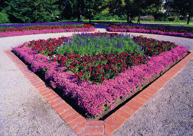
Ephemera - Postcard, City of Port Phillip, St Vincent Gardens annual bedding display 1995, c. 1995
... NATURE STRIPS MOWING: The nature strips are a vital part of the streetscapes and the assistance you provide by maintaining the grassed nature strip is appreciated. The Parks team has mown your nature strip today as it was becoming quite long, however, Council encourages residents to mow their nature strip as it has limited resources. ...NATURE STRIPS MOWING: The nature strips are a vital part of the streetscapes and the assistance you provide by maintaining the grassed nature strip is appreciated. The Parks team has mown your nature strip today as it was becoming quite long, however, Council encourages residents to mow their nature strip as it has limited resources. ...One of a series of postcards celebrating the launch of 'Flora for Victoria 1996', a project to celebrate the Royal Botanic Gardens of Melbourne`s 150th anniversary and the centenary of the death of its first director Baron Ferdinand von Mueller (1825 -1896). St Vincent Gardens is of national significance for its English style. Designed by Clement Hodgkinson in 1868 the garden reflects the Georgian era. Image description: Tree plantings are arranged in symmetrical patterns with themed plantings throughout the gardens timescale, four of which are registered with the National Trust. Message to residents on two of the postcards reads: "Dear Resident. NATURE STRIPS MOWING: The nature strips are a vital part of the streetscapes and the assistance you provide by maintaining the grassed nature strip is appreciated. The Parks team has mown your nature strip today as it was becoming quite long, however, Council encourages residents to mow their nature strip as it has limited resources. Pensioners or others unable to mow the nature strip are encouraged to advise the Parks team. Council also operates a 'Free lawn mower borrowing service' from the Albert Park Nursery, at 42 Mills Street, Albert Park. Lawn mowers are available daily 9.00am to 4.00pm except Christmas Day, Good Friday, and Anzac Day. For further information contact Parks on 9209 6672."Colour postcard (3 identical photos on each)St Vincent Gardens annual bedding display 1995 Historic gardens in the City of Port Phillip postcard series celebrating the launch of the Royal Botanic Garden's [sic] Melbourne, 'Flora for Victoria 1996' Produced by the City of Port Phillip, Melbourne Victoria Australia 9209 6209 City of Port Phillip logoalbert park, st vincent gardens, clement hodgkinson, city of port phillip, parks, gardens -
 Bendigo Historical Society Inc.
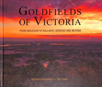
Book - "Goldfields of Victoria. From Macedon to Ballarat, Bendigo and Beyond.", 2017
... A large section of Central Victoria's architecture, natural resources and attractions are covered in this book. ...A large section of Central Victoria's architecture, natural resources and attractions are covered in this book. ...Gold mines, miner's huts, heritage gardens, wineries, wildlife parks, museums, art galleries and markets all show the charm of the goldfields areas of Central Victoria. A large section of Central Victoria's architecture, natural resources and attractions are covered in this book. Victoria became one of the largest producers of gold in the world, with Bendigo producing 700 tonnes, Ballarat 400 tonnes, and the Castlemaine-Chewton area, 130 tonnes of gold. The elaborate, grand buildings of Ballarat and Bendigo are testament to the affluence of the gold boom. This book touches on much of this heritage from the goldmining period and its legacy. "Goldfields of Victoria. From Macedon to Ballarat, Bendigo and Beyond" written by Kornelia Freeman and Ulo Pukk. Contains contents of regional towns with sub-indexes of smaller localities in that area. Published in Australia by Melbourne Books in 2017. Hard cover. Front cover has photograph/image of Australian bush scene, possibly from a hill/mountain at sunrise/sunset - hues of orange, green and ochre. Back cover is image of several men dressed colonial soldiers with historic buildings in the background - likely taken at 'Sovereign Hill', Ballarat. Book title in gold. Book includes color photos - mostly of historic buildings or natural landmarks within the designated local area. Spine in gold. Some maps in book. ISBN 9781925556223. 296 pp. macedon, bendigo, ballarat, goldfields -
 Sunshine and District Historical Society Incorporated
Administrative record - City of Sunshine - Commissioner Mr Alexander Alex George Gillon Collection 1976 - 1982 - Notice of committee meetings 26th May 1980, City of Sunshine, 21st May 1980
... Notice of Works Committee Meeting Notice of Finance Committee Meeting Report of Town Clerk Apportionment of Scheme for Construction of Right of Way Rear of Sydney Street between King Edward Avenue and Forrest Street Loan Funds Staff Training Statement of Rates, Sanitary and Interest Charges as at 5th May 1980 Statement of Rates, Sanitary and Interest Statements as at 5th May 1980 Statement of Rates, Sanitary and Interest Statements as at 5th May 1980 Progressive Analysis Accounts Outstanding Report of the City Engineer & Planner Municipal Office Extension & Alterations Notice of Agenda & Forward Planning Committee Meeting Report of the City Engineer & Planner Parks & Recreation Department Administration and Resources...Sydney Street King Edward Avenue Forrest Street Albion Notice of Works Committee Meeting Notice of Finance Committee Meeting Report of Town Clerk Apportionment of Scheme for Construction of Right of Way Rear of Sydney Street between King Edward Avenue and Forrest Street Loan Funds Staff Training Statement of Rates, Sanitary and Interest Charges as at 5th May 1980 Statement of Rates, Sanitary and Interest Statements as at 5th May 1980 Statement of Rates, Sanitary and Interest Statements as at 5th May 1980 Progressive Analysis Accounts Outstanding Report of the City Engineer & Planner Municipal Office Extension & Alterations Notice of Agenda & Forward Planning Committee Meeting Report of the City Engineer & Planner Parks & Recreation Department Administration and Resources Foolscap sized document. ...Notice of Works Committee Meeting Notice of Finance Committee Meeting Report of Town Clerk Apportionment of Scheme for Construction of Right of Way Rear of Sydney Street between King Edward Avenue and Forrest Street Loan Funds Staff Training Statement of Rates, Sanitary and Interest Charges as at 5th May 1980 Statement of Rates, Sanitary and Interest Statements as at 5th May 1980 Statement of Rates, Sanitary and Interest Statements as at 5th May 1980 Progressive Analysis Accounts Outstanding Report of the City Engineer & Planner Municipal Office Extension & Alterations Notice of Agenda & Forward Planning Committee Meeting Report of the City Engineer & Planner Parks & Recreation Department Administration and Resourcessydney street, king edward avenue, forrest street, albion -
 Sunshine and District Historical Society Incorporated
Administrative record - City of Sunshine - Commissioner Mr Alexander Alex George Gillon Collection 1976 - 1982 - Notice of Ordinary Meeting 9th March 1982, City of Sunshine, 3rd March 1982
... Albans Substandard Allotment Lot 25A Ballarat Road Sunshine Report of the Superintendent of Parks & Recreation Landscaping Selwyn Park Tennis Pavilion Removal of Trees Blanche Street Ardeer Tree Removal Request 1 Winnington Street Deer Park Tree Removal Request 12 Coronation Street Sunshine North...Albans Substandard Allotment Lot 25A Ballarat Road Sunshine Report of the Superintendent of Parks & Recreation Landscaping Selwyn Park Tennis Pavilion Removal of Trees Blanche Street Ardeer Tree Removal Request 1 Winnington Street Deer Park Tree Removal Request 12 Coronation Street Sunshine North Foolscap sized document. ...Ordinary meeting notice including reports from Council's officers Report of the Town Clerk's Department Report of the Town Clerk Deer Park Club Request for Loan for Improvement to the Bowling Green Refuse Disposal Agreements Possible Cancellations Pennel Reserve Hall Committee Replacement of Member Maribyrnong Reserve Committee of Management Replacement of Fence Sporting Complex (F.I.T. Project) New Activity The Hub Sports Centre Report of the Co-Ordinator of Welfare Services Co-Ordinator Footscray / Sunshine Early Childhood Development Programme Disability Resources Centre Pre-School Advisor Project Officer Braybrook / Glengala Estate Improvement Project Community Youth Support Scheme Report of the Chief Health Surveyor Removal of Dwelling Outside the Municipality 6 Williamson Road Maribyrnong to Shire of Maldon Temporary Public Buildings Circus's Disposal of Refure (Further Amendment) By-law Roberts Crescent Infant Welfare Centre Health Act Registrations Report of the Medical Officer of Health Report of the Chief Librarian Report of the Children's Services Librarian December / January 1981 / 1982 Holiday Programme Report of the City Engineers Department Report of the City Engineer / Planner Planning Permit Application Part Lot 2 Shopping Centre Alterations Neale Road Deer Park Planning Permit Application Presbytery Lot 59 Western Highway Deer Park Planning Permit Application Factory Lot 14 McIntyre Road Sunshine North Planning Permit Application Transport Depot Lots 1 & 2 First Avenue and Lot 2 & 4 Second Avenue Sunshine Planning Permit Application Proposed Staff Room Extension St. Bernadettes School West Moreland Road Sunshine North Planning Permit Application Alterations to Existing Office Lot 1 Rosamond Road Maidstone Planning Permit Application Panel Signs 405 Ballarat Road Sunshine Planning Permit Application Floodlit Promotions Panel Sign Lot 15 Geelong Road Brooklyn Planning Permit Application Plant Platform 51 McIntyre Road Sunshine North Plan of Proposed Consolidation Lots 41, 42 & 43 Somers Street & Grainger Street Sunshine / Deer Park Plan of Proposed Consolidation Robertsons Engineering Lots 79 & 80 Market Road Sunshine Plan of Removal of Easement Robertsons Engineering Lots 79 & 80 Market Road Sunshine Plan of Proposed Consolidation Deer Park Engineering Ballarat Road Deer Park Plan of Removal of Easement Deer Park Engineering Ballarat Road Deer Park Plan of Transfer Kentucky Fried Chicken Ballarat Road Sunshine Plan of Proposed Consolidation St. Albans Road & Princes Street St. Albans Plan of Subdivision I.C.I. Western Highway Service Road Deer Park Local Government (Land Liable to Flooding) Act 1979 designation of Flood Levels Maribyrnong River and other areas Remodel of Intersection Signals Raleigh Road / Rosamond Road Maribyrnong Hampshire Road / Herford Road Signalisation Declaration of Sewerage Area Availability of Sewerage Facilities Footpath Construction McIntyre Road from Bridge to Baldwin Avenue Sunshine North Traffic Management C.R.B. / ROSTA Deer Park Hall Report of Building Surveyor Show Cause 2 Fairbairn Road Sunshine West Location of Building 4 Western Avenue Sunshine West Location of Building McKechnie Street St. Albans Substandard Allotment Lot 25A Ballarat Road Sunshine Report of the Superintendent of Parks & Recreation Landscaping Selwyn Park Tennis Pavilion Removal of Trees Blanche Street Ardeer Tree Removal Request 1 Winnington Street Deer Park Tree Removal Request 12 Coronation Street Sunshine North city of sunshine, alexander "alex" george gillon, deer park club, ballarat road, deer park, pennell reserve hall committee, pennell reserve, burke street, braybrook, maribyrnong reserve, hortense street, maribyrnong, maribyrnong reserve committee of management, the hub, sun crescent, sunshine, williamson road, roberts crescent infant welfare centre, roberts crescent, sunshine west, neale road, mcintyre road, sunshine north, second avenue, westmoreland road, rosamond road, maidstone, geelong road, brooklyn, somers street, grainger street, market road, st. albans road, princes street, st. albans, western highway, raleigh road, hampshire road, hertford road, baldwin avenue, deer park hall, station road, fairbairn road, western avenue, mckechnie street, selwyn park, selwyn street, albion, blanche street, ardeer, winnington street, coronation street, albion tennis club -
 Sunshine and District Historical Society Incorporated
Administrative record - City of Sunshine - Commissioner Mr Alexander Alex George Gillon Collection 1976 - 1982 - Extraordinary business 8th December 1981, City of Sunshine, 8th December 1981
... Albans Purchase and Removal of Council Buildings McCracken Street Sunshine Building Over Easement 33 Newbury Street Deer Park Building Over Easement 2 Hemel Close Deer Park Building Over Easement 1 Alden Street Sunshine West Building Over Easement 9 Shipley Court Sunshine North Building Over Easement 43 Oleander Drive St. ...Albans Purchase and Removal of Council Buildings McCracken Street Sunshine Building Over Easement 33 Newbury Street Deer Park Building Over Easement 2 Hemel Close Deer Park Building Over Easement 1 Alden Street Sunshine West Building Over Easement 9 Shipley Court Sunshine North Building Over Easement 43 Oleander Drive St. ...Rezoning Application Sims Supermarket 8 Canterbury Street Deer Park Planning Permit Application First floor office and store 237 - 239 Hampshire Road Sunshine Planning Permit Application Corner of Station Road and Neale Road and Gould Street Deer Park Planning Permit Application John Darling Flour Mills Warehouse Sydney Street Albion Planning Permit Application Extension to club rooms Medway Golf Club Omar Street Maidstone Planning Permit Application Extension to existing sales area Prism Paints Lot 2 Tottenham Parade Footscray West Planning Permit Application Amusement Parlour 113 Durham Road Sunshine Planning Permit Application Restaurant 204 - 206 & 210 Ballarat Road Maidstone Planning Permit Application Workshop and offices Lots 11 & 12 Williamson Road Maribyrnong Planning Permit Application Two Villa Units 4 Vine Court Braybrook Plan of Subdivision Stages 8A & 8B Furlong Road St. Albans Planning Permit Application Boral Resources Lot 41 Reid Street Albion Proposed Plan of Consolidation Corner Mark Street and Allison Street Sunshine Plan of Proposed Subdivision Disraeli Street and Washington Street St. Albans Purchase and Removal of Council Buildings McCracken Street Sunshine Building Over Easement 33 Newbury Street Deer Park Building Over Easement 2 Hemel Close Deer Park Building Over Easement 1 Alden Street Sunshine West Building Over Easement 9 Shipley Court Sunshine North Building Over Easement 43 Oleander Drive St. Albans Building Over Easement 17 Eppalock Crescent St. Albans Extension of Building Time 11A Garfield Street St. Albans Heigh of Fence 36 Newbury Street Deer Park Storage of Volatile Fluids Lot 7 Frederick Road Brooklyn Land liable to Flooding 71 Ardoyne Street Sunshine Location of Building 35 Couch Street Sunshine Substandard Land 29 Carlyle Street Maidstonesims supermarket, canterbury street, deer park, hampshire road, sunshine, station road, neale road, gould street, john darling flour mills, sydney street, albion, medway golf club, omar street, maidstone, prism paints, tottenham parade, footscray west, durham road, ballarat road, williamson road, maribyrnong, vine court, braybrook, furlong road, st. albans, reid street, mark street, allison street, disraeli street, washington street, mccracken street, newbury street, hemel close, alden street, sunshine west, shipley court, sunshine north, oleander drive, eppalock crescent, garfield street, frederick road, brooklyn, ardoyne street, couch street, carlyle street -
Emerald Museum & Nobelius Heritage Park
Photograph - Budding at Gembrook Nurseries, Unknown photographer, 1910s
... Portions of the Gembrook Nurseries were sold at different times throughout the Twentieth Century, with the Emerald Country Club and Emerald Lake Park both occupying portions of the original land. ...Portions of the Gembrook Nurseries were sold at different times throughout the Twentieth Century, with the Emerald Country Club and Emerald Lake Park both occupying portions of the original land. ...Carl Axel Nobelius established the Gembrook Nurseries in 1886 on sixty-three acres purchased from an original selector after the area's gold rush started to diminish. It was called the Gembrook Nurseries as it was located in the Parish of Gembrook, but it was commonly referred to as the Nobelius nurseries after its founder; especially as control of the remaining portions of the nurseries remained with the Nobelius family until 1955. The Nobelius Nurseries had a substantial impact on the development of the township of Emerald, as local farmers were able to earn funds during the winter by working at the nursery which gave them financial resources while waiting for their own farms to become productive. The need to transport plants and trees to port quickly also contributed to the development of rail infrastructure in the region; C.A. Nobelius was one of thirteen witnesses to the Parliamentary Standing Committee on Railways in 1898 debating a rail connection between Gembrook and Ferntree Gully, which became today's Puffing Billy tourist service. The nurseries occupied 280 acres at their peak in 1905, with more than one million trees available for sale at that time. The nursery focused on exotic fruit and ornamental species which were supplied to public parks and gardens all over the world. In several cases the nurseries were the first suppliers of the trees in Australia. Sales records show that trees were supplied to clients in Europe, Asia, the United States, Africa and New Zealand, as well as to many Councils and Government organisations around Australia, such as Melbourne's Fitzroy Gardens and Royal Botanic Gardens. Portions of the Gembrook Nurseries were sold at different times throughout the Twentieth Century, with the Emerald Country Club and Emerald Lake Park both occupying portions of the original land. In 1981 the final twelve acres were purchased by the Shire of Sherbrooke in recognition to be used as a heritage landmark in recognition of the site's significance.The photograph is significant because it depicts work processes at the Gembrook Nurseries during the early decades of the Twentieth Century; a period in which the nurseries were the leading Southern-hemisphere supplier of plants and trees to public gardens around the world. The photograph may also depict Carl Axel Nobelius overseeing his workers, which gives insights into work practices and social dynamics of the time.Black and white rectangular photograph printed on photographic paper. The photograph of a postcard or newspaper clipping depicts twelve men in clothes associated with the first decades of the Twentieth Century undertaking planting or other field work under the gaze of a man in a suit and top hat. The item is captioned 'Budding at Gembrook Nurseries.'Obverse: BUDDING AT GEMBROOK NURSERIES. /1910s, 1900s, 1890s, 1880s, 1886, 1905, carl axel nobelius, nobelius nursery, gembrook nurseries, emerald country club, emerald lake park, fruit growing, trees, farming -
Emerald Museum & Nobelius Heritage Park
Photograph - Gembrook Nurseries, 1908-1912, Unknown photographer, 1908-1912
... Portions of the Gembrook Nurseries were sold at different times throughout the Twentieth Century, with the Emerald Country Club and Emerald Lake Park both occupying portions of the original land. ...Portions of the Gembrook Nurseries were sold at different times throughout the Twentieth Century, with the Emerald Country Club and Emerald Lake Park both occupying portions of the original land. ...Carl Axel Nobelius established the Gembrook Nurseries in 1886 on sixty-three acres purchased from an original selector after the area's gold rush started to diminish. It was called the Gembrook Nurseries as it was located in the Parish of Gembrook, but it was commonly referred to as the Nobelius nurseries after its founder; especially as control of the remaining portions of the nurseries remained with the Nobelius family until 1955. The Nobelius Nurseries had a substantial impact on the development of the township of Emerald, as local farmers were able to earn funds during the winter by working at the nursery which gave them financial resources while waiting for their own farms to become productive. The need to transport plants and trees to port quickly also contributed to the development of rail infrastructure in the region; C.A. Nobelius was one of thirteen witnesses to the Parliamentary Standing Committee on Railways in 1898 debating a rail connection between Gembrook and Ferntree Gully, which became today's Puffing Billy tourist service. The nurseries occupied 280 acres at their peak in 1905, with more than one million trees available for sale at that time. The nursery focused on exotic fruit and ornamental species which were supplied to public parks and gardens all over the world. In several cases the nurseries were the first suppliers of the trees in Australia. Sales records show that trees were supplied to clients in Europe, Asia, the United States, Africa and New Zealand, as well as to many Councils and Government organisations around Australia, such as Melbourne's Fitzroy Gardens and Royal Botanic Gardens. Portions of the Gembrook Nurseries were sold at different times throughout the Twentieth Century, with the Emerald Country Club and Emerald Lake Park both occupying portions of the original land. In 1981 the final twelve acres were purchased by the Shire of Sherbrooke in recognition to be used as a heritage landmark in recognition of the site's significance.The photograph is significant because it demonstrates the extent of stock cultivation at the Gembrook Nurseries during the early decades of the Twentieth Century; a period in which the nurseries were the leading Southern-hemisphere supplier of plants and trees to public gardens around the world. Museum acquisition records indicate this photograph was taken in the period 1908-1912.Black and white rectangular photograph printed on photographic paper. The photograph depicts a central view of cultivated fields and trees along the skyline at the Gembrook Nurseries in approximately 1908-1912.Obverse: Gembrook Nurseries - Central View /1900s, 1910s, farming, agriculture, trees, gembrook nurseries, carl axel nobelius, emerald park lake, emerald country club, parish of gembrook, fitzroy gardens, royal botanic gardens, melbourne, shire of sherbrooke -
Surrey Hills Historical Society Collection
Work on paper - Vertical File, Koori Heritage
... Aboriginal use of Water related resources (16 page book undated) 5. Tribes, Clan and Boundaries – Koorie Social Organisation. ...Aboriginal use of Water related resources (16 page book undated) 5. Tribes, Clan and Boundaries – Koorie Social Organisation. ...Koori Heritage 1. The Wurundjeri National Museum of Victoria Education service. Undated (double sided pamphlet) 2. Doncaster and Templestowe Aboriginal Sites of Archaeological Significance. Undated (pamphlet) 3. Kori Sites in the City of Whitehorse. Undated. (pamphlet) 4. Aboriginal use of Water related resources (16 page book undated) 5. Tribes, Clan and Boundaries – Koorie Social Organisation. Undated. (double sided page) 6. ‘The Traditional Owners of the Whitehorse Region’ Gary Presland 1997 (2 pages) 7. Notes from Alan J Holt’s research on ‘Possible Aboriginal Occupation: Camberwell – Box Hill Area’ August 1987. (2 pages) 8. Recollection of Bert Legg re: Beckett Park. Undated (1 page) 9. Photocopy and original of The Age article and map re: location of aboriginal relics around Melbourne. 29 September 1976. (3 pages) 10. Christmas card with 3 aboriginal paintings on bark to Miss Sanger from Ruth Trask. Undated. (1 item) 11. Copy of talk on “Once upon a Koori Time – the Surrey Hills area before white settlement” (23 pages) given by Robin Palton to SHHS on 20 October 1997. koori heritage -
 National Wool Museum
Textile - Quilt, By Wagga Design, 2017
... Barbara noted that it was cut from a blanket she purchased from a garage sale from a property that had once been a caravan park titled ‘Parkside’ in the 1960s. The filling of the wagga contains the rest of the Parkside blanket....‘By Wagga Design’ is her contemporary take on the traditional wagga that was born out of hard times and limited resources. Barbara wrote the poem below while thinking of the workers who used waggas while travelling: Black night campfire night sheep in the shadows dreams on the track a comforting wagga stitched with love for a homesick heart. ...‘By Wagga Design’ is the winner of the Art Quilt Australia 2019 Expressions: Wool Quilt Prize. Barbara Mellor, of St Helens in Tasmania, made this quilt after researching the history of waggas and was fascinated by this early form of recycling. ‘By Wagga Design’ is her contemporary take on the traditional wagga that was born out of hard times and limited resources. Barbara wrote the poem below while thinking of the workers who used waggas while travelling: Black night campfire night sheep in the shadows dreams on the track a comforting wagga stitched with love for a homesick heart. The wagga was made in 2017 and was first submitted into the Bay of Fires Art Prize. In 2018 the wagga was submitted into the Break O’Day Stitchers Quilting and Embroidery Exhibition, where it won the Hanger’s Prize. Barbara sourced the fabrics used from a variety of places. Some are from her personal collection while others were given to her. She purchased a woollen three-piece suit from a local op shop and decided to incorporate it into the design, making some unique and distinctive shapes. Another distinctive feature of the quilt is the patch labelled ‘Parkside’. Barbara noted that it was cut from a blanket she purchased from a garage sale from a property that had once been a caravan park titled ‘Parkside’ in the 1960s. The filling of the wagga contains the rest of the Parkside blanket.Quilt made from various woollen garments and bedding in cool tone colours. Patches mostly cut into square and rectangle shapes. Three patches made from a second-hand woollen suit, showcasing the arm with cuff buttons, pocket flap on a hip pocket containing a pocket square and front of vest with buttons. wagga, art quilt australia, expressions: wool quilt prize -
 Sunshine and District Historical Society Incorporated
Administrative record - City of Sunshine - Commissioner Mr Alexander Alex George Gillon Collection 1976 - 1982 - Report of committee meetings 26th May 1980, City of Sunshine, 27th May 1980
... Ground Construction of Umpire's Room Report of the Finance Committee Meeting Report of the Town Clerk Apportionment of Scheme for Construction of Right of Way Rear of Sydney Street between King Edward Avenue and Forrest Street Loan Funds Staff Training Statement of Rates, Sanitary and Interest Charges as at 5th May 1980 Report of the City Engineer & Planner Municipal Office Extension & Alterations Report of the Forward Planning Committee Meeting Report of the City Engineer & Planner Parks & Recreation Department Administration and Resources...Ground Construction of Umpire's Room Report of the Finance Committee Meeting Report of the Town Clerk Apportionment of Scheme for Construction of Right of Way Rear of Sydney Street between King Edward Avenue and Forrest Street Loan Funds Staff Training Statement of Rates, Sanitary and Interest Charges as at 5th May 1980 Report of the City Engineer & Planner Municipal Office Extension & Alterations Report of the Forward Planning Committee Meeting Report of the City Engineer & Planner Parks & Recreation Department Administration and Resources Foolscap sized document. ...Report of Committee Meetings 26th May 1980 Report of the Works Committee Meeting Kerb & Channel Lindenow Street completed Kerb & Channel Smith Street commenced Kerb & Channel Forrest Street East of Kororoit Creek completed. West of Kororoit Creek in progress Footpath McLennan Street completed Footpath Numan Street commenced Footpath Margaret Crescent completed Footpath Hampden Street completed Drainage Duke Street commenced Drainage Navigator Street completed Road Works Robinsons Road excavation completed, crush rock laid, ready for kerb & channel Road Works Billingham Road reopened for traffic Road Works Lacy Street commenced Road Works Lindenow Street 50% wet mix completed, ready for tamper Road Works Forrest Street Kororoit Creek to Anderson Road ready for tamper Parsons Reserve improvement to water service in progress Street Trees planting commenced in Churchill Avenue and Albion Areas Advanced Trees Maribyrnong Reserve completed, Eppalock Crescent in progress Rubbish bins Erected at Barclay Reserve Sassella Park delayed, waiting delivery of topsoil Aycliffe Avenue Infant Welfare & Pres-School Centre estimated completion mid June Selwyn Park Tennis Pavilion welding of beams below standard. Welds require to be broken and re-welded General Maintenance Furlong Road Pre-School Centre I.C.I. Ground Construction of Umpire's Room Report of the Finance Committee Meeting Report of the Town Clerk Apportionment of Scheme for Construction of Right of Way Rear of Sydney Street between King Edward Avenue and Forrest Street Loan Funds Staff Training Statement of Rates, Sanitary and Interest Charges as at 5th May 1980 Report of the City Engineer & Planner Municipal Office Extension & Alterations Report of the Forward Planning Committee Meeting Report of the City Engineer & Planner Parks & Recreation Department Administration and Resourceslindenow street, smith street, maidstone, forrest street, kororoit creek, albion, ardeer, mclennan street, braybrook, numan street, margaret crescent, hampden street, duke street, navigator street, maribyrnong, robinsons road, deer park, billingham road, lacy street, parsons reserve, stanford street, sunshine, churchill avenue, maribyrnong reserve, hortense street, barclay reserve, king edward avenue, sassella park, station road, aycliffe avenue infant welfare & pres-school centre, aycliffe avenue, furlong road pre-school centre, furlong road, sunshine north, i.c.i. ground, ballarat road, sydney street -
Emerald Museum & Nobelius Heritage Park
Photograph - Nursery below 'Carramar', Unknown photographer, 1910s
... The nursery focused on exotic fruit and ornamental species which were supplied to public parks and gardens all over the world. In several cases the nurseries were the first suppliers of the trees in Australia. ...The nursery focused on exotic fruit and ornamental species which were supplied to public parks and gardens all over the world. In several cases the nurseries were the first suppliers of the trees in Australia. ...Carl Axel Nobelius established the Gembrook Nurseries in 1886 on sixty-three acres purchased from an original selector after the area's gold rush started to diminish. It was called the Gembrook Nurseries as it was located in the Parish of Gembrook, but it was commonly referred to as the Nobelius nurseries after its founder; especially as control of the remaining portions of the nurseries remained with the Nobelius family until 1955. The Nobelius Nurseries had a substantial impact on the development of the township of Emerald, as local farmers were able to earn funds during the winter by working at the nursery which gave them financial resources while waiting for their own farms to become productive. The need to transport plants and trees to port quickly also contributed to the development of rail infrastructure in the region; C.A. Nobelius was one of thirteen witnesses to the Parliamentary Standing Committee on Railways in 1898 debating a rail connection between Gembrook and Ferntree Gully, which became today's Puffing Billy tourist service. The nurseries occupied 280 acres at their peak in 1905, with more than one million trees available for sale at that time. The nursery focused on exotic fruit and ornamental species which were supplied to public parks and gardens all over the world. In several cases the nurseries were the first suppliers of the trees in Australia. Sales records show that trees were supplied to clients in Europe, Asia, the United States, Africa and New Zealand, as well as to many Councils and Government organisations around Australia, such as Melbourne's Fitzroy Gardens and Royal Botanic Gardens. Emerald Museum records indicate that this photograph of the Gembrook Nursery was taken in the vicinity of Carramar, the family home built by Carl Axel Nobelius. The sixteen-room mansion was one of the premier estates in the region and was visited by guests including Dame Nellie Melba and the Governor of Victoria, Sir Reginald Talbot. The building still stands amongst gardens that feature original Gembrook Nurseries plantings. Portions of the Gembrook Nurseries (and the Carramar estate) were sold at different times throughout the Twentieth Century, with the Emerald Country Club and Emerald Lake Park both occupying portions of the original land. In 1981 the final twelve acres were purchased by the Shire of Sherbrooke in recognition to be used as a heritage landmark in recognition of the site's significance.The photograph is significant because it depicts the built environment and stock cultivation at the Gembrook Nurseries during the early decades of the Twentieth Century; a period in which the nurseries were the leading Southern-hemisphere supplier of plants and trees to public gardens around the world. Museum acquisition records indicate this photograph was taken in the vicinity of the 'Carramar' estate, the home of the Nobelius family.Black and white rectangular photograph printed on photographic paper. The photograph depicts cultivated fields, roads, fencing and buildings at the Gembrook Nurseries; in the vicinity of the 'Carramar' estate.Obverse: 70 / (?) nt /1910s, 1890s, 1900s, carl axel nobelius, gembrook nurseries, nobelius nursery, carramar, farming, buildings, agriculture, dame nellie melba, reginald talbot, emerald country club, emerald lake park, shire of sherbrooke -
 8th/13th Victorian Mounted Rifles Regimental Collection
Photograph
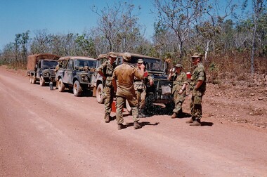
... The troop reported on the conditions of the roads, airfields, bridges (mainly causeways) resources such as fuel supplies in the towns and infrastructure. ...The troop reported on the conditions of the roads, airfields, bridges (mainly causeways) resources such as fuel supplies in the towns and infrastructure. ...The Dibb Report into mainland defence of Australia,1986, among other things identified the requirement for protection of key assets in Northern Australia and the possibility of involving Army Reserve (Ares) units in this thus releasing regular forces for offensive operations. Dibb also pointed out that this defined role would result in a huge lift in Ares morale. In June 1988, the 3rd Division (3Div) conducted a Tactical Exercise without Troops (TEWT), Exercise ‘Distant Trumpet’ in the Katherine- Darwin area to study problems associated with defence against low level incursions against Tindal RAAF Base. Exercise ‘Northern Explorer’ followed in October of that year when units of the 3Div including A Squadron 8/13 Victorian Mounted Rifles sent patrol groups to get a first taste of environment and conditions. Post-Exercise reports had to include recommendations re: health, equipment and adaptation of Standing Operating Procedures (SOPs) in preparation for the new role deploying to Northern Australia. The first deployment by 8/13 Victorian Mounted Rifles was in 1988. Deployments continued in following years. In September 1993, 3 Troop (Wangaratta) VMR Squadron 4/19 PWLH commanded by Captain Kelvin Robertson deployed to NT. The training began with airfield defence at Tindal followed by a 1000km recon into Arnhem Land in four Landrovers. The troop reported on the conditions of the roads, airfields, bridges (mainly causeways) resources such as fuel supplies in the towns and infrastructure. Each troop taking different route. 3 Troop had the Northern route through Kakadu National park across the East Alligator River to Oenpelli then to Maningrida and Ramangining and south to the Central Arnhem Road and back to Tindal Air force Base. Colour photograph of five soldiers and three vehicles of VMR Squadron,4/19 Prince of Wales's Light Horse on roadside during annual exercise in Northern Territory 1994.military, vehicles, soldiers, northern territory, training, vmr -
 8th/13th Victorian Mounted Rifles Regimental Collection
Photograph
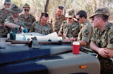
... The troop reported on the conditions of the roads, airfields, bridges (mainly causeways) resources such as fuel supplies in the towns and infrastructure. ...The troop reported on the conditions of the roads, airfields, bridges (mainly causeways) resources such as fuel supplies in the towns and infrastructure. ...The Dibb Report into mainland defence of Australia,1986, among other things identified the requirement for protection of key assets in Northern Australia and the possibility of involving Army Reserve (Ares) units in this thus releasing regular forces for offensive operations. Dibb also pointed out that this defined role would result in a huge lift in Ares morale. In June 1988, the 3rd Division (3Div) conducted a Tactical Exercise without Troops (TEWT), Exercise ‘Distant Trumpet’ in the Katherine- Darwin area to study problems associated with defence against low level incursions against Tindal RAAF Base. Exercise ‘Northern Explorer’ followed in October of that year when units of the 3Div including A Squadron 8/13 Victorian Mounted Rifles sent patrol groups to get a first taste of environment and conditions. Post-Exercise reports had to include recommendations re: health, equipment and adaptation of Standing Operating Procedures (SOPs) in preparation for the new role deploying to Northern Australia. The first deployment by 8/13 Victorian Mounted Rifles was in 1988. Deployments continued in following years. In September 1993, 3 Troop (Wangaratta) VMR Squadron 4/19 PWLH commanded by Captain Kelvin Robertson deployed to NT. The training began with airfield defence at Tindal followed by a 1000km recon into Arnhem Land in four Landrovers. The troop reported on the conditions of the roads, airfields, bridges (mainly causeways) resources such as fuel supplies in the towns and infrastructure. Each troop taking different route. 3 Troop had the Northern route through Kakadu National park across the East Alligator River to Oenpelli then to Maningrida and Ramangining and south to the Central Arnhem Road and back to Tindal Air force Base. Colour photograph of group of soldiers of VMR Squadron 4/19Prince of Wales's Light Horse studying maps on bonnet of Land Rover during annual exercise in Northern Territory 1994.Major M. Annett wearing slouch hat, Sergeant Gary Wynn,without hat,,on his left. -
 8th/13th Victorian Mounted Rifles Regimental Collection
Photograph
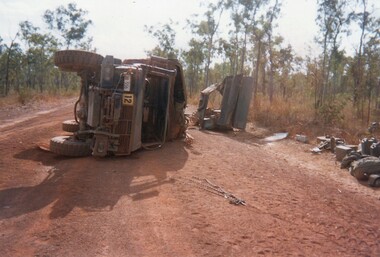
... The troop reported on the conditions of the roads, airfields, bridges (mainly causeways) resources such as fuel supplies in the towns and infrastructure. ...The troop reported on the conditions of the roads, airfields, bridges (mainly causeways) resources such as fuel supplies in the towns and infrastructure. ...The Dibb Report into mainland defence of Australia,1986, among other things identified the requirement for protection of key assets in Northern Australia and the possibility of involving Army Reserve (Ares) units in this thus releasing regular forces for offensive operations. Dibb also pointed out that this defined role would result in a huge lift in Ares morale. In June 1988, the 3rd Division (3Div) conducted a Tactical Exercise without Troops (TEWT), Exercise ‘Distant Trumpet’ in the Katherine- Darwin area to study problems associated with defence against low level incursions against Tindal RAAF Base. Exercise ‘Northern Explorer’ followed in October of that year when units of the 3Div including A Squadron 8/13 Victorian Mounted Rifles sent patrol groups to get a first taste of environment and conditions. Post-Exercise reports had to include recommendations re: health, equipment and adaptation of Standing Operating Procedures (SOPs) in preparation for the new role deploying to Northern Australia. The first deployment by 8/13 Victorian Mounted Rifles was in 1988. Deployments continued in following years. In September 1993, 3 Troop (Wangaratta) VMR Squadron 4/19 PWLH commanded by Captain Kelvin Robertson deployed to NT. The training began with airfield defence at Tindal followed by a 1000km recon into Arnhem Land in four Landrovers. The troop reported on the conditions of the roads, airfields, bridges (mainly causeways) resources such as fuel supplies in the towns and infrastructure. Each troop taking different route. 3 Troop had the Northern route through Kakadu National park across the East Alligator River to Oenpelli then to Maningrida and Ramangining and south to the Central Arnhem Road and back to Tindal Air force Base. Two colour photographs of vehicle mishap during VMR Squadron 4/19Prince of Wales's Light Horse annual exercise in Northern Territory 1994.Second photo shows driver receiving medical attention. -
 8th/13th Victorian Mounted Rifles Regimental Collection
Photograph
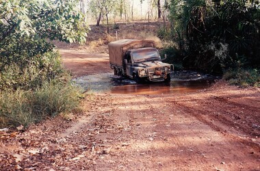
... The troop reported on the conditions of the roads, airfields, bridges (mainly causeways) resources such as fuel supplies in the towns and infrastructure. ...The troop reported on the conditions of the roads, airfields, bridges (mainly causeways) resources such as fuel supplies in the towns and infrastructure. ...The Dibb Report into mainland defence of Australia,1986, among other things identified the requirement for protection of key assets in Northern Australia and the possibility of involving Army Reserve (Ares) units in this thus releasing regular forces for offensive operations. Dibb also pointed out that this defined role would result in a huge lift in Ares morale. In June 1988, the 3rd Division (3Div) conducted a Tactical Exercise without Troops (TEWT), Exercise ‘Distant Trumpet’ in the Katherine- Darwin area to study problems associated with defence against low level incursions against Tindal RAAF Base. Exercise ‘Northern Explorer’ followed in October of that year when units of the 3Div including A Squadron 8/13 Victorian Mounted Rifles sent patrol groups to get a first taste of environment and conditions. Post-Exercise reports had to include recommendations re: health, equipment and adaptation of Standing Operating Procedures (SOPs) in preparation for the new role deploying to Northern Australia. The first deployment by 8/13 Victorian Mounted Rifles was in 1988. Deployments continued in following years. In September 1993, 3 Troop (Wangaratta) VMR Squadron 4/19 PWLH commanded by Captain Kelvin Robertson deployed to NT. The training began with airfield defence at Tindal followed by a 1000km recon into Arnhem Land in four Landrovers. The troop reported on the conditions of the roads, airfields, bridges (mainly causeways) resources such as fuel supplies in the towns and infrastructure. Each troop taking different route. 3 Troop had the Northern route through Kakadu National park across the East Alligator River to Oenpelli then to Maningrida and Ramangining and south to the Central Arnhem Road and back to Tindal Air force Base. Two colour photographs of creek crossings, one more challenging than the other,during the annual exercise in Northern Territory, conducted by VMR Squadron 4/19 Prince of Wales's Light horse, 1994. -
 8th/13th Victorian Mounted Rifles Regimental Collection
Photograph
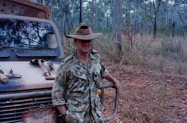
... The troop reported on the conditions of the roads, airfields, bridges (mainly causeways) resources such as fuel supplies in the towns and infrastructure. ...The troop reported on the conditions of the roads, airfields, bridges (mainly causeways) resources such as fuel supplies in the towns and infrastructure. ...The Dibb Report into mainland defence of Australia,1986, among other things identified the requirement for protection of key assets in Northern Australia and the possibility of involving Army Reserve (Ares) units in this thus releasing regular forces for offensive operations. Dibb also pointed out that this defined role would result in a huge lift in Ares morale. In June 1988, the 3rd Division (3Div) conducted a Tactical Exercise without Troops (TEWT), Exercise ‘Distant Trumpet’ in the Katherine- Darwin area to study problems associated with defence against low level incursions against Tindal RAAF Base. Exercise ‘Northern Explorer’ followed in October of that year when units of the 3Div including A Squadron 8/13 Victorian Mounted Rifles sent patrol groups to get a first taste of environment and conditions. Post-Exercise reports had to include recommendations re: health, equipment and adaptation of Standing Operating Procedures (SOPs) in preparation for the new role deploying to Northern Australia. The first deployment by 8/13 Victorian Mounted Rifles was in 1988. Deployments continued in following years. In September 1993, 3 Troop (Wangaratta) VMR Squadron 4/19 PWLH commanded by Captain Kelvin Robertson deployed to NT. The training began with airfield defence at Tindal followed by a 1000km recon into Arnhem Land in four Landrovers. The troop reported on the conditions of the roads, airfields, bridges (mainly causeways) resources such as fuel supplies in the towns and infrastructure. Each troop taking different route. 3 Troop had the Northern route through Kakadu National park across the East Alligator River to Oenpelli then to Maningrida and Ramangining and south to the Central Arnhem Road and back to Tindal Air force Base Major Annett later commanded 4/19 Prince of Wales's Light Horse, and later again 4th Brigade 2nd Division.. Colour photograph of Major M. Annett, Officer Commanding VMR Squadron 4/19Prince of Wales's Light Horse during annual exercise Northern Territory 1994. -
 Kiewa Valley Historical Society
Maps - Bogong x2, Tawonga, Omeo, Dargo, Victoria and others, 1. Bogong Alpine Area; 2. Bogong 8324; 3. Tawonga Topographical; 4. Omeo 8433; 5. Dargo 8323; 6. Victoria State
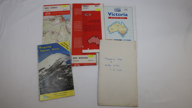
... Information for tourist in the Alpine National Park: Bogong Area. Including: recreational activities, history, weather and vegetation and a list of walks together with locality maps and photographs. ...Information for tourist in the Alpine National Park: Bogong Area. Including: recreational activities, history, weather and vegetation and a list of walks together with locality maps and photographs. ...1. Bogong Alpine Area (outdoor Leisure Map. survey & Mapping Victoria, Government of Victoria, Edition 2, reprinted 1991 with an image of Mt. Feathertop on the front. Information for tourist in the Alpine National Park: Bogong Area. Including: recreational activities, history, weather and vegetation and a list of walks together with locality maps and photographs. The front cover has an image of Mt Feathertop against a blue sky with yellow writing 'Bogong Alpine Area', there is a yellow triangular block on the right hand top corner with black writing 'Outdoor Leisure Map. On the bottom edge is a block of yellow with black writing 'Survey & Mapping Victoria' and a light green map of Victoria with 'VICMSP' printed in white. 2. 8324 Bogong Victoria, Edition 1, Commonwealth of Australia 1981. A topographical Map: 1:100,000 scale (1 cm to 1 KM). Map has a red cover with white writing together with a white block and black writing and a map insert. 3. Tawonga Topographical Map - Forests Commission Victoria, / revised 5/9/77, DEG No. 68-G/399. A Tawonga 803 folded map in a beige colour with the back blank. 4. Omeo 8433 Victoria, Edition 1, Department of Natural Resources. The map has a red and white cover with black writing and a simple map of Australia at the bottom. 5. 8323 Dargo, Edition 1, Commonwealth of Australia. A red and white cover with a map insert. 6. Victoria State Map, Hema Maps, 2002. Hema Maps, State Map, colourful cover with a map of Australia and four tourism photographs. Scale 1: 850,000 An inscription handwritten in blue pen "Trappers Gap to Mitta Mitta 1" to 1 mile". There are some pen markings and notations of tracks.maps, bogong, omeo, tawonga, dargo, victoria, bogong alpine area -
 Flagstaff Hill Maritime Museum and Village
Accessory - Bag, 1930's
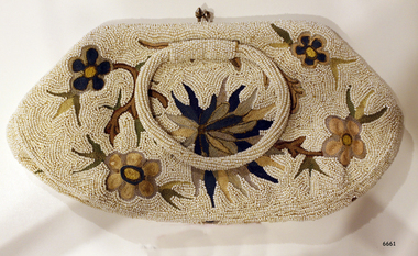
... Dedicated to her vocation, Sister Dale gave unstintingly of her effort, time and resources to create an attractive venue for mothers to visit. ...Dedicated to her vocation, Sister Dale gave unstintingly of her effort, time and resources to create an attractive venue for mothers to visit. ...In the words of Donor, Betty Stone, "Owned by my aunt Mrs Elsie Mary (nee Dale) Towers, born 24 December 1895, daughter of Ellis and Ann Dale, of Latrigg, Wangoom, Warrnambool. This beaded bag was a personal gift from Miss Lake to Elsie Dale sometime in the early 1930s. Miss Lake was a member of a leading Warrnambool family whose property Lyndoch was situated by the banks of the Hopkins River. After completing her nursing course at Warrnambool Hospital and working there for a time, Elsie Dale was appointed Sister-in-Charge of the newly formed Baby Health Centre, which initially operated in temporary accommodation at or near the Council Chambers. In 1928 the Centre moved into new brick premises on Liebig Street. The building comprised of five rooms, a back yard and a front veranda where mothers parked their prams. The Warrnambool Standard reported in February 1928. The purpose of the Clinic is to the saving of infant's life. Many mothers attended the Clinic in the former location. They were able to acquire valuable knowledge from Sister Dale who is in charge of the Clinic and also have their infants weighed and measured each week. During the early days of the Centre Miss Lake, as a patron, took a keen interest in all aspects of the Centre and co-operated very closely with Sister Dale. Miss Lake would often call in at the centre while her uniformed chauffeur would wait beside her limousine parked in the street outside the Baby Heath Centre. I also recall my aunt driving to Lyndoch to discuss matters concerning the Centre with Miss Lake. Miss Lake purchased this evening bag in England, and upon her return from her overseas tour in the early 1930s, presented it to Sister Dale as a token of appreciation. Dedicated to her vocation, Sister Dale gave unstintingly of her effort, time and resources to create an attractive venue for mothers to visit. Her contribution to the welfare of all mothers and babies in the Warrnambool area, particularly during the Depression years, was considerable. Sister Dale, who drove a Dodge Tourer car, visited mothers in their homes when necessary and regularly visited the indigenous settlement at Framlingham. Amongst my early childhood memories are those of accompanying my aunt when she drove to the Nestles factory at Dennington to purchase large tins of dried milk baby food which she then delivered to the mothers who lived at the Framlingham settlement. Sister Elsie Dale retired in 1949 and moved to Mooroopna after her marriage to Solomon Towers. (Died aged 75 years 27 July 1971) (Note: For additional information please refer to Betty Stone’s book “Pioneers and Places - A History of three Warrnambool Pioneering Families” ie. Chamberlain, Dale and Lees Families)This item is associated with the families of Chamberlain, Dale and Lees. These families are listed in the "Pioneers' Register" for Warrnambool Township and the Shire, 1835-1900, published by A.I.G.S. Warrnambool Branch. Elsie Dale was the first Sister to work in the newly established Baby Health Centre in Warrnambool.Beaded evening bag or clutch purse. The bag was a gift to Elsie Dale from friend Miss Lake, purchased in England early 1930's. The fabric is covered in tiny white beads and features a floral design in browns and greens. The bag has two bead-covered handles and the lining includes a small pocket. Part of the 'Chamberlain Dale Lees Collection'.flagstaff hill, warrnambool, shipwrecked coast, flagstaff hill maritime museum, maritime museum, shipwreck coast, flagstaff hill maritime village, great ocean road, chamberlain, dale, lees, stone, betty stone, warrnambool pioneers, elsie dale, miss lake, lyndoch, handbag, purse, evening bag, beaded handbag, beaded purse, ladies' accessory, clutch purse, warrnambool baby health centre, infant welfare centre -
 Sunshine and District Historical Society Incorporated
Administrative record - City of Sunshine - Commissioner Mr Alexander Alex George Gillon Collection 1976 - 1982 - Notice of Ordinary Meeting 16th November 1982, City of Sunshine, 16th November 1982
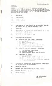
... Albans Thompson Hall Maidstone West Gate Bridge Charges City of Williamstown Report of the Building Surveyor Building Over Easement 26 Krambrook Street Sunshine West Building Over Easement 36 Summers Street Deer Park Building Over Easement 2 The Mews Ardeer Building Over Easement 18 Merrivale Avenue Sunshine West Building Over Easement 34 Summers Street Deer Park Building Over Easement 83 Tamar Drive St. ...Albans Thompson Hall Maidstone West Gate Bridge Charges City of Williamstown Report of the Building Surveyor Building Over Easement 26 Krambrook Street Sunshine West Building Over Easement 36 Summers Street Deer Park Building Over Easement 2 The Mews Ardeer Building Over Easement 18 Merrivale Avenue Sunshine West Building Over Easement 34 Summers Street Deer Park Building Over Easement 83 Tamar Drive St. ...Ordinary meeting notice including reports from Council's officers Report of the Town Clerk's Department Report of the Town Clerk Accounts for Payment as at 25th October 1982 Statistical Report for Year October 1981 to September 1992 Proposed Discontinuance of Right of Way Beside 36 Clyde Street Maidstone Telephone Number Metropolitan Fire Brigade Acquisition Chaplin Reserve Community Facility Sunshine West United Nations Association of Australia Possible Membership Salvation Army Western Region Advisory Committee Council Representation Open Space Area Maribyrnong Valley Meeting Dates 1993 Proposal to Close Part of Service Street Sealing of General Rate Year Ending 30th September 1983 Use of Council Facilities Saturday 4th December 1982 Sunshine International Women's Year Action Group Discontinuance of Right of Way Between Lewin Street and Robinsons Road South Side of Ballarat Road Deer Park Discontinuance of Right of Way Between Hamilton Street, Burnside Street, Christie Street and Tulloch Street Deer Park Report of Chief Health Surveyor Registration of Premises Health Act Transfer of Premises Health Act Prosecution Proceedings Sunshine Magistrate Court Delivery of Advertising Material / Junk mail Health Act Registration Fees Report of the Medical Officer of Health Report of the Superintendent Traffic and By-Laws Dog Act Traffic and Parking Infringements Court Proceedings Proposed Procession Italian Festival Deer Park Parking Infringements Increase In Penalties Report of the Chief Librarian Children's Pre-Christmas workshops Report of the Co-Ordinator of Welfare Services Multi-Cultural Senior Citizens' Club of West Sunshine Registration and Maintenance Subsidy Showers Street Housing Commission Estate Furnishings Community Room Showers Street Housing Commission Estate Twin Tub Washing Machines Special Bus Emergency Foster Care Report of the City Engineer / Planner Western Suburbs Study Department of Planning Planning Permit Application Advertising Sign 35 Wright Street Planning Permit Application Extensions to Existing Abattoir Kalingra Road (Armbrook Siding) Brooklyn Melbourne Metropolitan Planning Scheme Amendment No 190 On Exhibition Planning Permit Application Extensions to Existing Premises Corner Hampstead Road and Mitchell Street Maidstone Plan of Proposed Strata Subdivision 35 Washington Street St. Albans Plan of Proposed Transfer Hampton Avenue Plan of Subdivision Reid Street Sunshine Boral Resources (Previously Albion Reid Pty Ltd) Glendenning Street Traffic Problems Half Cost Footpath and Kerb And Channel Various Locations Traffic Signals Linking On Princes Highway West From Little Boundary Road to Sommerville Road Parking Restrictions At Municipal Offices Grade Separated Pedestrian Crossings Sunshine Centre Plaza Shopping Centre Traffic Control Items Bus Shelter At Stop 45 Ashley Street Maidstone Melbourne And Metropolitan Tramway Board Neale Road / Station Road Proposes Traffic Signals No Standing Prohibition Load Limits Various Roads Half Cost Fencing 11 Ravenna Street St. Albans Thompson Hall Maidstone West Gate Bridge Charges City of Williamstown Report of the Building Surveyor Building Over Easement 26 Krambrook Street Sunshine West Building Over Easement 36 Summers Street Deer Park Building Over Easement 2 The Mews Ardeer Building Over Easement 18 Merrivale Avenue Sunshine West Building Over Easement 34 Summers Street Deer Park Building Over Easement 83 Tamar Drive St. Albans Building Over Easement 7 Salvia Street St. Albans Building Over Easement 28 Yallourn Street Ardeer Substandard Allotment Lot 62 Tulloch Street Deer Park Height of Fence 100 Ballarat Road Extension of Building Time 52B Forrest Street Sunshine Orders of the Day Planning Permit Application Restaurant and Take Away Food Ballarat Road Sunshine Planning Permit Application Consulting Rooms Main Road West St. Albans city of sunshine, alexander "alex" george gillon, clyde street, maidstone, chaplin reserve, anderson road, sunshine, maribyrnong valley, service street, ballarat road, deer park, lewin street, robinsons road, hamilton street, burnside street, christie street, tulloch street, multi-cultural senior citizens' club of west sunshine, showers street, braybrook, wright street, kalingra road, armbrook siding, tottenham, hampstead road, mitchell street, washington street, st. albans, hampton avenue, reid street, albion, boral resources, previously albion reid, glendenning street, princes highway, little boundary road, sommerville road, sunshine centre plaza shopping centre, hampshire road, ravenna street, thompson hall, krambrook street, summers street, the mews, ardeer, merrivale avenue, tamar drive, salvia street, yallourn street, forrest street -
 The Beechworth Burke Museum
Photograph - Photographs, E. Yellard, c. 1950's
... Two rectangular black and white photographs of the Beechworth Mental Hospital (Mayday Hills) administrative building showing the left and right hand sides of the exterior building with three cars parked in driveway turning circle in the foreground taken in the 1950's by E. ...Two rectangular black and white photographs of the Beechworth Mental Hospital (Mayday Hills) administrative building showing the left and right hand sides of the exterior building with three cars parked in driveway turning circle in the foreground taken in the 1950's by E. ...Two rectangular black and white photographs of the Beechworth Mental Hospital (Mayday Hills) administrative building showing the left and right hand sides of the exterior building with three cars parked in driveway turning circle in the foreground taken in the 1950's by E. Yellard. Mayday Hills Hospital, originally known as the Beechworth Lunatic Asylum was constructed between 1864-67 designed by The Public Works Department. The hospital is made up of a number of buildings, landscaping, ha-ha, workshops, laundry, administrative facilities and farmland, it was constructed in 'Italianate' style by a team of up to two hundred and fifty workers (Woods p. 122). The asylum was established in response to the need for the regional shire to locally care for those particularly affected by their time working the Ovens goldfield during the Indigo Shire gold rush era where poor living conditions and isolation were significantly affecting the welfare of a great many people through poverty and lack of resources. The gaol and orphan labour systems were not able to effectively support to give housing, rehabilitation and ongoing care for the mentally ill, and transporting to Melbourne by waggon was a time consuming and counter-productive solution when the metro facilities were already overcrowded. According to Woods (A Titan's Field p. 122), between 1901 and 1911 a large percentage (thirty five percent in 1901 and twenty four in 1911) of the Beechworth population were either patients or inmates of Beechworth institutions, Mayday Hills accounted for some six hundred and seventy four patients in 1901, Beechworth's Mayday Hills was chosen as the site of Victoria's newest asylum, at the time, due to the landscape and altitude. The hilltop atmosphere and the native fauna, it was argued, would assist in the cure of the patients kept at the hospital (Wood 1985, 122). The positioning of the hospital had a beneficial effect on the rural town and the large volume of people living at the hospital and contributing to this population growth is counted as reason for the survival of Beechworth as a regional township. According to the Victorian Heritage database, during the period 1921-1950 Mayday Hills underwent some modernisation by Public Works Department architect Percy Everett which included a nurses' hostel and new ward which were further developed and continued to function as a mental hospital up until 1995 when it was sold to LaTrobe university. The building and grounds are listed on the Victorian Heritage Register under criterion A, B, D, E and F.These photographs give a good indication of the ongoing use of Mayday Hills from its original establishment in the 1860's through to almost one hundred years later when these photographs were taken. The clarity of the images combined with the style and make of the cars in the foreground give a good indication of the time period and show the continued use and need for the facility over the years. Through images of building facades such as these, we might gain fuller understanding of the structural and aesthetic characteristics to be used in any future development or restorative work.2 x black and white rectangular photographs [copies] printed on Ilford photographic paper8688.1 reverse: Beechworth / Mental / Hospital / 80% 19cm / 12 cm / 80% / 728 / New / Print / BMM / 8688.1 / E. / Yellard / [Stamped : ILFORD] 8688.2 reverse: Beechworth / Mental / Hospital / E. / Yellard / BMM / 8688.1 / [Stamped : ILFORD]administrative building, black and white photographs, beechworth, mental hospital, beechworth mental hospital, mayday hills, cars, 1950, e. yellard, the public works department, public works department, hospital, mayday hills hospital, beechworth lunatic asylum, lunatic asylum, asylum, ovens goldfield, indigo shire, indigo shire gold rush
