Showing 82 items matching " surveyors report"
-
 Bendigo Historical Society Inc.
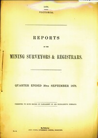
Book - REPORT OF THE MINING REGISTRARS AND SURVEYORS REPORT - SEPT. 1878, 1878
... REPORT OF THE MINING REGISTRARS AND SURVEYORS REPORT - SEPT. 1878...REPORT OF THE MINING REGISTRARS AND SURVEYORS REPORT - SEPT. 1878...History House 11 Mackenzie Street Bendigo goldfields GOLD MINING Miners' Safety Cage mining registrar and surveyors repo gold gold mining mining registrar surveyors REPORT OF THE MINING REGISTRARS AND SURVEYORS REPORT - SEPT. 1878 Book REPORT OF THE MINING REGISTRARS AND SURVEYORS REPORT - SEPT. 1878 ...REPORT OF THE MINING REGISTRARS AND SURVEYORS REPORT - SEPT. 1878gold mining, miners' safety cage, mining registrar and surveyors repo, gold, gold mining, mining registrar, surveyors -
 Port Melbourne Historical & Preservation Society
Book - Town of Port Melbourne, Arthur Victor Heath, Town Surveyor et al, Surveyors Report Book, 1901
... Surveyors Report Book...Reports to Council hand entered by Town Surveyor and ATS, with marginal notes on actions taken by Council....Gold stamped on spine 'Minute Book' but added leather label below reads 'Surveyors Report Book'. Some inserts (glued in)...Gold stamped on spine 'Minute Book' but added leather label below reads 'Surveyors Report Book'. Some inserts (glued in) Surveyors Report Book Book Town of Port Melbourne Arthur Victor Heath, Town Surveyor H V Champion, Acting Town Surveyor ...Reports to Council hand entered by Town Surveyor and ATS, with marginal notes on actions taken by Council.Book of reports of Port Melbourne Town Surveyor 1901-1911: 475 pp volume bound in dark green with maroon spine and corners. Gold stamped on spine 'Minute Book' but added leather label below reads 'Surveyors Report Book'. Some inserts (glued in)Stamped inside cover and on some pages, 'Town of Port Melbourne Surveyors Office'sandridge lagoon, local government - town of port melbourne, fishermans bend, flood, fire and fire services, port melbourne town hall, transport - horse, transport - tramways, parks and gardens, engineering - roads streets lanes and footpaths, excelsior hall, societies clubs unions and other organisations, built environment, industry - manufacturing, engineering - canals and drainage, crimes and misdemeanours, transport - ferries, south melbourne, arthur victor heath, george beazley, h v champion, business and traders - hotels -
 Bendigo Military Museum
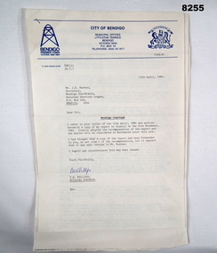
Document - SURVEYORS RESTORATION REPORT BENDIGO, Bendigo City Council, c.1986
... SURVEYORS RESTORATION REPORT BENDIGO...Surveyors report 1986 regarding the restoration of the Bendigo Cenotaph continued on from Cat No 8255. ...Main points, "Building Surveyors report - 8th September 1986 - B.18/86 - restoration of Cenotaph (32.7.1)"...Document SURVEYORS RESTORATION REPORT BENDIGO Bendigo City Council ...Surveyors report 1986 regarding the restoration of the Bendigo Cenotaph continued on from Cat No 8255. The document starts with a report to a Council meeting held on August 18th 1986. This is a more detailed report of the first by Dr. A.H. Spry (AMDEL) followed by Mr W. Barton City Engineers Department. The state of the Cenotaph was also compounded by it's situation re the Bendigo Creek. Main points where. The Cenotaph is sited on the Bridge over the Creek not alongside it as was supposed. The Cenotaph concrete foundation was resting on the old timber decking which is in an advanced state of decay among 5 main points. Report goes on with points. Conclusion; "It would of course be necessary to demolish the Cenotaph to carry out this work". Estimate of costs in brief. 1. Bridge repairs $72,000.00. 2. Cenotaph repairs. - Demolish & rebuild $110,000.00. Options - There are only two options (as per estimate) or demolish and relocate to another location under 3 sections (a) (b) (c). Recommendations; Motions referred to Estimates 1986/87 and RSL for comments - 1 carried, 1 lost.Document, paper 3 pages foolscap size, all print in black, copy of original, stapled with the pages is a Bendigo City Compliments Card in blue text.Main points, "Building Surveyors report - 8th September 1986 - B.18/86 - restoration of Cenotaph (32.7.1)"document, surveyor, cenotaph, brsl, smirsl -
 Bendigo Historical Society Inc.
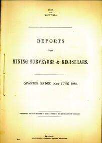
Book - MINING SURVEYORS AND REGISTRARS REPORT - 30TH. JUNE 1880, 1880
... MINING SURVEYORS AND REGISTRARS REPORT - 30TH. JUNE 1880......surveyors and registrars report...Reports of the mining surveyors and registrats quarter ended 30th. ...History House 11 Mackenzie Street Bendigo goldfields GOLD MINING Miners' Safety Cage surveyors and registrars report Bendigo goldfields gold mining mining surveyors registrars Vic. ...Reports of the mining surveyors and registrats quarter ended 30th. June 1880. 35 pagesVic. Govt.gold mining, miners' safety cage, surveyors and registrars report, bendigo, goldfields, gold mining, mining surveyors, registrars -
 Bendigo Historical Society Inc.
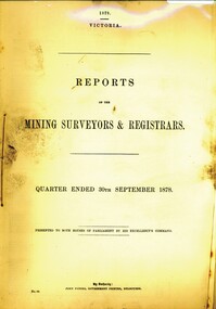
Book - REPORT OF THE MINING SURVEYORS AND REGISTRARS SEPT. 1878, 1878
... registrars and surveyors report...REPORT OF THE MINING SURVEYORS AND REGISTRARS SEPT. 1878...History House 11 Mackenzie Street Bendigo goldfields GOLD MINING Miners' Safety Cage registrars and surveyors report gold gold mining registrars and surveyors report REPORT OF THE MINING SURVEYORS AND REGISTRARS SEPT. 1878 Book REPORT OF THE MINING SURVEYORS AND REGISTRARS SEPT. 1878 ...REPORT OF THE MINING SURVEYORS AND REGISTRARS SEPT. 1878gold mining, miners' safety cage, registrars and surveyors report, gold, gold mining, registrars and surveyors report -
 Bendigo Historical Society Inc.
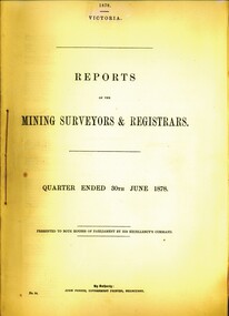
Book - REPORT OF THE MINING SURVEYORS AND REGISTRAR - JUNE 1878, 1878
... registrars and surveyors report...REPORT OF THE MINING SURVEYORS AND REGISTRAR - JUNE 1878...History House 11 Mackenzie Street Bendigo goldfields GOLD MINING Miners' Safety Cage registrars and surveyors report gold gold mining registrars and surveyors report REPORT OF THE MINING SURVEYORS AND REGISTRAR - JUNE 1878 Book REPORT OF THE MINING SURVEYORS AND REGISTRAR - JUNE 1878 ...REPORT OF THE MINING SURVEYORS AND REGISTRAR - JUNE 1878gold mining, miners' safety cage, registrars and surveyors report, gold, gold mining, registrars and surveyors report -
 Bendigo Historical Society Inc.
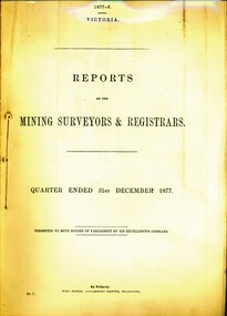
Book - REPORT OF THE MINING SURVEYORS AND REGISTRARS DEC. 1877, 1877-8
... ... surveyors report...REPORT OF THE MINING SURVEYORS AND REGISTRARS DEC. 1877...History House 11 Mackenzie Street Bendigo goldfields GOLD MINING Miners' Safety Cage registrars and surveyors report gold gold mining registrars report surveyors report REPORT OF THE MINING SURVEYORS AND REGISTRARS DEC. 1877 Book REPORT OF THE MINING SURVEYORS AND REGISTRARS DEC. 1877 ...REPORT OF THE MINING SURVEYORS AND REGISTRARS DEC. 1877gold mining, miners' safety cage, registrars and surveyors report, gold, gold mining, registrars report, surveyors report -
 Bendigo Historical Society Inc.
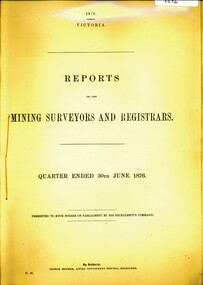
Book - REPORT OF THE MINING SURVEYORS AND REGISTRARS SEPT. 1876, 1876
... registrars and surveyors report...REPORT OF THE MINING SURVEYORS AND REGISTRARS - Sept. 1876...History House 11 Mackenzie Street Bendigo goldfields GOLD MINING Miners' Safety Cage registrars and surveyors report gold gold mining registrars and surveyors report. ...REPORT OF THE MINING SURVEYORS AND REGISTRARS - Sept. 1876gold mining, miners' safety cage, registrars and surveyors report, gold, gold mining, registrars and surveyors report. -
 Bendigo Historical Society Inc.
Book - REPORT OF THE MINING SURVEYORS AND REGISTRARS JUNE 1876, 1876
... ... surveyors report...REPORT OF THE MINING SURVEYORS AND REGISTRARS JUNE 1876...History House 11 Mackenzie Street Bendigo goldfields GOLD MINING Miners' Safety Cage registrars and surveyors report gold gold mining registrars surveyors report REPORT OF THE MINING SURVEYORS AND REGISTRARS JUNE 1876 Book REPORT OF THE MINING SURVEYORS AND REGISTRARS JUNE 1876 ...REPORT OF THE MINING SURVEYORS AND REGISTRARS JUNE 1876gold mining, miners' safety cage, registrars and surveyors report, gold, gold mining, registrars, surveyors report -
 Bendigo Military Museum
Document - CENOTAPH RESTORATION BENDIGO, City of Bendigo, C.1984
... The Surveyors Report pages 2/3 gives a background report back to 1976 re its condition by the Building Surveyor at the time Mr R.H. ...Page 2/3, “Building Surveyors Report - 21st November 1983 - B42/83 - (32.7.1)”...The Surveyors Report pages 2/3 gives a background report back to 1976 re its condition by the Building Surveyor at the time Mr R.H. ...This Document is the first in several plus photos and an article following the restoration of the Bendigo Cenotaph (Replica of the Cenotaph in Whitehall London). The letter is from the City of Bendigo Municipal Offices Lyttleton Terrace Bendigo is dated 13th April 1984 from the Building Surveyor Mr P.W. Phillips to Mr J.K. Barnes Secretary Bendigo RSL Sub Branch P.O.Box 449 Bendigo. Letter states that the Surveyors Report was adopted by Council on 21st November 1983 and would then be considered at Estimates later in the year. The Surveyors Report pages 2/3 gives a background report back to 1976 re its condition by the Building Surveyor at the time Mr R.H. Chellow and that an offer to fund at no cost was offered. Unfortunately this did not proceed. Council had approved funds for Stone work etc in the 1976/77 Estimates. The report is under several headings “Restoration of Cenotaph” being the history to this point. “Nature of Repairs Neccessary” - in brief, Extensive repairs, Granite structure is good, Sandstone needs 90% replacement, brick core in good order. “Estimate of Cost” A price of $30,000 for Budget purposes but could be as low as $25,000. “Recommendation” That Restoration be referred to the 1984/85 Estimates for consideration, copies to Bendigo RSL and State President RSL.Document 3 pages stapled together, front page is A4 and the pages 2/3 is Foolscap.Front page has a top section in blue, on the left is a depiction of a Mine Poppet Head, on the right is a Coat of Arms. The letter section is in black type, signed at the bottom in blue pen. Pages 2/3 are all black print.Page 1 points, Coat of Arms, “City of Bendigo - Progress”. “1968/84” - PWP:LT 32.7.1”. Page 2/3, “Building Surveyors Report - 21st November 1983 - B42/83 - (32.7.1)”brsl, smirsl, cenotaph, restoration -
 Bendigo Historical Society Inc.
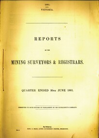
Book - REPORT OF THE MINING SURVEYORS AND REGISTRARS, 30TH. JUNE 1881, 1881
... ... mining surveyors report...REPORT OF THE MINING SURVEYORS AND REGISTRARS, 30TH. JUNE 1881. 40 pages...History House 11 Mackenzie Street Bendigo goldfields GOLD MINING Miners' Safety Cage mining surveyors and registrars rep Bendigo gold mining goldfields registrars mining surveyors report Vic. Govt. REPORT OF THE MINING SURVEYORS AND REGISTRARS, 30TH. ...REPORT OF THE MINING SURVEYORS AND REGISTRARS, 30TH. JUNE 1881. 40 pagesVic. Govt.gold mining, miners' safety cage, mining surveyors and registrars rep, bendigo, gold mining, goldfields, registrars, mining surveyors report -
 Bendigo Historical Society Inc.
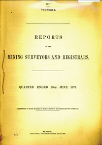
Book - REPORT OF THE MINING SURVEYORS AND REGISTRARS 30TH. JUNE 1877, 1877
... registrars and surveyors report...Report of the mining surveyors and registrars, quarter ended 30th June 1877....History House 11 Mackenzie Street Bendigo goldfields GOLD MINING Miners' Safety Cage registrars and surveyors report gold gold mining registrars surveyors Report of the mining surveyors and registrars, quarter ended 30th June 1877. ...Report of the mining surveyors and registrars, quarter ended 30th June 1877.gold mining, miners' safety cage, registrars and surveyors report, gold, gold mining, registrars, surveyors -
Port Melbourne Historical & Preservation Society
Book - Town of Port Melbourne Surveyor's reports, A V Heath, Arthur Victor Heath, Town Surveyor, 1911- 1917
... Heath's book of Town of Port Melbourne Surveyor's Reports 1911 to 1917...Heath's book of Town of Port Melbourne Surveyor's Reports 1911 to 1917 Book Town of Port Melbourne Surveyor's reports, A V Heath Arthur Victor Heath, Town Surveyor ...A.V. Heath's book of Town of Port Melbourne Surveyor's Reports 1911 to 1917local government - town of port melbourne, arthur victor heath -
Port Melbourne Historical & Preservation Society
Book - Borough of Sandridge, Charles Clay, Borough Surveyor, Surveyor's Reports, 1877
... Surveyor Charles CLAY's reports to Council March 1877 to June 1882, handwritten. 176pp volume bound in maroon linen with red spine; sticker on front: MINUTE BOOK; 'Surveyor's Reports' hand printed...Two printed Agendas 1881 and 1882 pasted in front. Surveyor Charles CLAY's reports to Council March 1877 to June 1882, handwritten. 176pp volume bound in maroon linen with red spine; sticker on front: MINUTE BOOK; 'Surveyor's Reports' hand printed Surveyor's Reports Book Borough of Sandridge Charles Clay, Borough Surveyor ...Surveyor Charles CLAY's reports to Council March 1877 to June 1882, handwritten. 176pp volume bound in maroon linen with red spine; sticker on front: MINUTE BOOK; 'Surveyor's Reports' hand printedThree names/addresses noted on first page. Two printed Agendas 1881 and 1882 pasted in front.local government - borough of sandridge, engineering - roads streets lanes and footpaths, port melbourne town hall, transport - tramways, engineering - canals and drainage, celebrations fetes and exhibitions, business and traders, fishermans bend, fire and fire services, flood, engineering - bridges, utilities, health - general health, built environment - domestic, industry - manufacturing, livestock, transport - railways, charles clay, sandridge lagoon, business and traders - hotels -
 Bendigo Historical Society Inc.
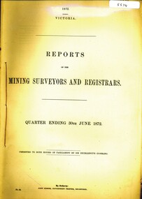
Book - REPORTS OF THE MINING SURVEYORS AND REGISTRARS, 1872
... surveyors... registrars report....REPORTS OF THE MINING SURVEYORS AND REGISTRARS. Quarter ending 30th June 1872....History House 11 Mackenzie Street Bendigo goldfields GOLD MINING Miners' Safety Cage registrars report gold gold mining surveyors registrars report. REPORTS OF THE MINING SURVEYORS AND REGISTRARS. ...REPORTS OF THE MINING SURVEYORS AND REGISTRARS. Quarter ending 30th June 1872.gold mining, miners' safety cage, registrars report, gold, gold mining, surveyors, registrars report. -
 Whitehorse Historical Society Inc.
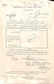
Document - Report, Section 31 Land Act 1869, 01/06/1872
... Land application by Frank Ainger, referred to District Surveyor. Report by Mounted Constable Douglas with description of proposed use of land. ...ainger frank douglas (mounted constable) assistant commissioner of lands and survey whitehorse road mitcham doncaster east road land settlement Land application by Frank Ainger, referred to District Surveyor. Report by Mounted Constable Douglas with description of proposed use of land. ...Land application by Frank Ainger, referred to District Surveyor. Report by Mounted Constable Douglas with description of proposed use of land. Map of area. The area is on the corner of Whitehorse Road and Doncaster East Road.ainger, frank, douglas (mounted constable), assistant commissioner of lands and survey, whitehorse road, mitcham, doncaster east road, land settlement -
Clunes Museum
Document
... STAPLED REPORT BY CONSULTING ENGINEERS ,SURVEYORS STRUCTURAL REPORT - CLUNES MUSEUM 7 SEPTEMBER 1998...Clunes Museum 36 Fraser Street enter building through Collins Place Clunes goldfields local history document structual appraisal structual appraisel STAPLED REPORT BY CONSULTING ENGINEERS ,SURVEYORS STRUCTURAL REPORT - CLUNES MUSEUM 7 SEPTEMBER 1998 Document DOCUMENT ...STAPLED REPORT BY CONSULTING ENGINEERS ,SURVEYORS STRUCTURAL REPORT - CLUNES MUSEUM 7 SEPTEMBER 1998local history, document, structual appraisal, structual appraisel -
 Sunshine and District Historical Society Incorporated
Administrative record - City of Sunshine - Commissioner Mr Alexander Alex George Gillon Collection 1976 - 1982 - Extraordinary Business Report Office Alterations Rosamond Road 3rd August 1982, City of Sunshine, 3rd August 1982
... Planning Permit Application Office Alterations and Extensions Rosamond Road Maidstone Robert Bruce Reserve Tin Shed removal quotations Robert Barrett Reserve Sewerage Building Surveyor Report Infringement of the Uniform Building Regulations Mawson Street Deer Park...City of Sunshine Alexander "Alex" George Gillon Rosamond Road Maidstone Robet Bruce Reserve Gould Street Deer Park Robert Barrett Reserve Maribyrnong Mawson Street Planning Permit Application Office Alterations and Extensions Rosamond Road Maidstone Robert Bruce Reserve Tin Shed removal quotations Robert Barrett Reserve Sewerage Building Surveyor Report Infringement of the Uniform Building Regulations Mawson Street Deer Park Foolscap sized document. ...Planning Permit Application Office Alterations and Extensions Rosamond Road Maidstone Robert Bruce Reserve Tin Shed removal quotations Robert Barrett Reserve Sewerage Building Surveyor Report Infringement of the Uniform Building Regulations Mawson Street Deer Park city of sunshine, alexander "alex" george gillon, rosamond road, maidstone, robet bruce reserve, gould street, deer park, robert barrett reserve, maribyrnong, mawson street -
 Sunshine and District Historical Society Incorporated
Administrative record - City of Sunshine - Commissioner Mr Alexander Alex George Gillon Collection 1976 - 1982 - Extraordinary Business Report Transport Depot 20th July 1982, City of Sunshine, 20th July 1982
... Planning Permit Application Clean Away Pty Ltd Transport Depot 11 Wright Street Sunshine Planning Permit Application Take Away Food Premise 419 Somerville Road Footscray West Building Surveyor Report Building Control Act 1981...City of Sunshine Alexander "Alex" George Gillon Wright Street Sunshine Somerville Road Footscray West Planning Permit Application Clean Away Pty Ltd Transport Depot 11 Wright Street Sunshine Planning Permit Application Take Away Food Premise 419 Somerville Road Footscray West Building Surveyor Report Building Control Act 1981 Foolscap sized document. ...Planning Permit Application Clean Away Pty Ltd Transport Depot 11 Wright Street Sunshine Planning Permit Application Take Away Food Premise 419 Somerville Road Footscray West Building Surveyor Report Building Control Act 1981 city of sunshine, alexander "alex" george gillon, wright street, sunshine, somerville road, footscray west -
 Kew Historical Society Inc
Photograph - Historic re-enactment during the Festival of Kew, 1978
... Original colour photographic positive of the [unhistoric] report by a Trinity Grammar School student, dressed in costume as the surveyor Charles Grimes, reporting to the then Mayor of Kew, Cr Noel Whiting. ...The photographs, taken by amateur and professional photographers, represent a period in time when the dominant values were those shared by the descendants of European settlers in Victoria. kew historical society trinity grammar school kew girl guides city of kew yarra river charles grimes collins expedition wurundjeri people yarra bend park colonial surveys historic re-enactments festival of kew kew festival Annotated on reverse: "GRIMES REPORTING TO MAYOR" Original colour photographic positive of the [unhistoric] report by a Trinity Grammar School student, dressed in costume as the surveyor Charles Grimes, reporting to the then Mayor of Kew, Cr Noel Whiting. ...At the 1978 Festival of Kew, a number of organisations, including the City of Kew, the Kew Historical Society, Trinity Boys Grammar School and local Girl Guides participated in a re-enactment of the expedition of the party of Charles Grimes in surveying the Yarra River as far as Kew in February 1803. The location for the event was Yarra Bend Park near the Studley Park Boat House. The event was organised by the Kew Historical Society. The re-enactment was captured by a number of amateur photographers as well as by a photographer from the local Progress Press.Local communities select events to commemorate according to their shared history and values. Commemorations of colonial exploration were popular with local historical groups such as the Kew Historical Society in the twentieth century. In re-enacting events such as the Grimes survey of the Yarra, students from a local school were encouraged to take on specific roles, including play-acting individuals involved in the survey party as well as members of the local Wurundjeri People. The photographs, taken by amateur and professional photographers, represent a period in time when the dominant values were those shared by the descendants of European settlers in Victoria. Original colour photographic positive of the [unhistoric] report by a Trinity Grammar School student, dressed in costume as the surveyor Charles Grimes, reporting to the then Mayor of Kew, Cr Noel Whiting. Wurundjeri warriors are in the foreground. .Annotated on reverse: "GRIMES REPORTING TO MAYOR"kew historical society, trinity grammar school, kew girl guides, city of kew, yarra river, charles grimes, collins expedition, wurundjeri people, yarra bend park, colonial surveys, historic re-enactments, festival of kew, kew festival -
 Victorian Aboriginal Corporation for Languages
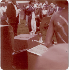
Book, Pauline Jones, Historical records of Victoria : volume 1 : beginnings of permanent government, 1981
... Reproductions of various transactions and reports dealing with the early government of Port Phillip, including laws, surveyors? ...Victorian Aboriginal Corporation for Languages 33 Saxon Street Brunswick melbourne Victorian history Port Phillip Governor Bourke Geelong John Batman treaty William Lonsdale William Buckley Werribee Reproductions of various transactions and reports dealing with the early government of Port Phillip, including laws, surveyors? ...Reproductions of various transactions and reports dealing with the early government of Port Phillip, including laws, surveyors? and administrators? reports, bills, requisitions, prices, police reports, and miscellaneous other documents dealing with the early administration of Port Phillip.victorian history, port phillip, governor bourke, geelong, john batman, treaty, william lonsdale, william buckley, werribee -
 Eltham District Historical Society Inc
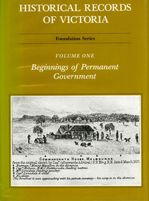
Document - Property Binder, 338 Main Road, Lower Plenty (also 37 Rangeview Road), March 2025
... Goodison, Licensed Surveyor, and attached Surveyor's Report dated 6 June 1990 (Withdrawn) 9. ...Goodison, Licensed Surveyor, and attached Surveyor's Report dated 6 June 1990 (Withdrawn) 9. ...EDHS_03095-338 | EDHS_08635-37 338 Main Road Lower Plenty | 37 Rangeview Road, Lower Plenty Original Mudbrick cottage and studio designed and built by Eltham artist, David Alan Newbury See also EDHS_06090 David Newbury (Artist) David Newbury was married to Clare Margaret Newbury. According to the 1954 Electoral Roll they were living at 36A Murphy Street, South Yarra however around 1953 they purchased Lots 3 and 4 of Main Road Lot Plan LP 23911 in Lower Plenty. A building permit, No. 71, was issued 8 December 1953 for a 5-room house of Vertical Board construction, cost £2,840, builder L. Williams, owner D. Newbury of 36 Murphy Cl., South Yarra. The large house was in fact mostly built of mudbrick, the construction method was only just becoming recognised as an acceptable form in the late 1940s for issuance of a building permit. The house was commenced in 1954, designed by David Newbury and built by David Newbury, Horrie Judd and others. Information from Newbury family friends suggests that a second mudbrick building was constructed in the late 1950s, early 1960s for use as an artist studio by Newbury. The building was connected directly to the water mains at the time and was made suitable for living accommodation during the period Newbury was teaching at Bendigo. Apparently he and Claire rented out the main house during their time in Bendigo and would reside in the studio when visiting Melbourne. No permit for this studio was found in the Building Permit Register, Shire of Eltham, 1949-1960. The last recorded entries in the register are dated May 1960. This would suggest that the studio was constructed post May 1960. It is believed the studio was constructed during the latter period of Newbury’s teaching post in Bendigo so possibly late 1960/1961. In 1963 the Newbury’s address in the Electoral Roll has the property recorded as 220 Main Road, Lower Plenty. Between 1967 to 1980 the Electoral Rolls record the property as 338 Main Road. Today the address is 37 Rangeview Road, Lower Plenty. Contents: 1. Extract from 1942 Shire of Eltham Rate Book. Muriel Gladys Reitsma listed as owner 2. Extract from 1984-85 Shire of Eltham Rate Book for Rangeview Road. (No mention of No. 37 so was probably still listed as 338 Main Road.) 3. Certificate of Title, Vol. 5601 Fol. 1120089 - Issued to David James Graham of Lower Plenty, Builder, Heidelberg for Lot 32 Block B on Plan of Subdivision No. 7606, part of Crown Portion Two, Parish of Nillumbik, County of Evelyn, 29 October 1929 4. Certificate of Title, Vol. 8008 Fol. 076 - Issued to David Alan Newbury of 36 Murphy Street, South Yarra, School Teacher for Lot 3 on Plan of Subdivision No. 23911, part of Crown Portion Two, Parish of Nillumbik, County of Evelyn, 29 October 1953. Amended 24 June 1963 to transfer portion for road widening scheme per Country Roads Board Plan 6889 - Cancelled 24 September 1984 5. Certificate of Title, Vol. 9581 Fol. 583 - Issued to Paul Robert Biber and Althea Constance Biber of 139 Lower Heidelberg Road, Ivanhoe for Lot 3 on Plan of Subdivision No. 23911, part of Crown Portion Two, Parish of Nillumbik, County of Evelyn, 24 September 1984. Derived from Vol. 8008 Fol. 076 L276994V - Cancelled 20 Nov 1992 when subdivided from one to two lots in Vol 10092 Fol. 192 and Vol. 10092 Fol. 193; LP222467B 6. Certificate of Title, Vol. 10092 Fol. 192 - Transfer to Lawrie Mein of 20 Dewar Drive, Hurstbridge of Lot 1 on Plan of Subdivision No. 222467B, lodged 17 Feb 1993, Registered 29 March 1996. Parent Titles Vol 08008 Fol 077, Vol 09581 Fol 583 7. Survey Field Notes of Part of Crown Portion 2, Parish of Nillumbik, County of Evelyn - Portion of land bounded by New Eltham Road. Application 23911 dated 8 Sep 1952 with appended Surveyor Field notes per Application 7098; R.D. Steele, Licensed Surveyor, 18 August 1950 8. Survey Field Notes of Part of Crown Portion 2, Parish of Nillumbik, County of Evelyn - Portion of land bounded by Main Road and Rangeview Road; 2 Lot subdivisions, Vol. 9581 Fol. 583 Part Lot 3 on LP 23911 and Vol. 8008 Fol, 077 Lot 4 on LP 23911; Application 221805 dated 27 November 1989; W.J. Goodison, Licensed Surveyor, and attached Surveyor's Report dated 6 June 1990 (Withdrawn) 9. Survey Field Notes of Part of Crown Portion 2, Parish of Nillumbik, County of Evelyn - Portion of land bounded by Main Road and Rangeview Road; 2 Lot subdivisions, Vol. 9581 Fol. 583 Part Lot 3 on LP 23911 and Vol. 8008 Fol, 077 Lot 4 on LP 23911; Application 222467 dated 20 November 1992 (221805 resubmitted); W.J. Goodison, Licensed Surveyor, and attached Surveyor's Report dated 6 June 1990 Notes: Items 1 to 6 donated electronically Items 7 to 9 sourced from LASSI - SPEAR, Department of Transport and Planning, Victoria State Government, https://maps.land.vic.gov.au/lassi/SpearUI.jsp main road, property, mudbrick, david newbury, phoebe mason collection, rate books, shire of eltham, certificate of title, survey plan, 37 rangeview road, 338 main road, application 23911, lower plenty, map, surveyor field notes, application 221805, application 222467 -
 Warrnambool and District Historical Society Inc.
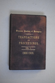
Book, Victorian Institute of Surveyors Transactions and Proceedings Vol V 1900-1909, 1910
... reports from 1905 to 1910. There are many black and white photographs and fold-out maps and plans. The signature on the second page is handwritten in black ink. Victorian Institute of Surveyors ...This book belonged to John William Crawley, Junior who had acquired it in 1910 as a member of the Victorian Institute of Surveyors. John Crawley was an engineer, architect and surveyor in private practice in Warrnambool and also the official engineer of the Shire of Warrnambool from 1896 to 1935. His father, brother and son were also engineers and worked in that capacity for the Shire of Warrnambool or as the Shire Secretary, with the Crawley family members recording a total of 132 years of service to the Shire of Warrnambool which existed from 1863 to 1994. This book is retained as it belonged to John Crawley, the engineer for the Shire of Warrnambool for forty years. This is a hard cover book with a dark brown cover with gold printing on the front cover and spine. The cover is now stained. The book contains an introduction, twenty papers and reports from 1905 to 1910. There are many black and white photographs and fold-out maps and plans. The signature on the second page is handwritten in black ink. J.W.Crawley W’bool 26.3.10crawley family, warrnambool, shire of warrnambool, history of warrnambool -
 Warrnambool and District Historical Society Inc.
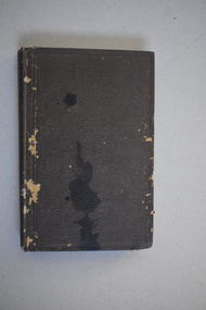
Book, Victorian Institute of Surveyors Transactions and Proceedings Vol. VI 1919, 1919
... reports of the Council for the years 1909 to 1919 and office-bearers for 1919-20. There are several black and white photographs and fold-out maps and plans. The signature on the first page is handwritten in black ink. Victorian Institute of Surveyors ...This book belonged to John William Crawley, Junior, a member of the Victorian Institute of Surveyors. He was an engineer, architect and surveyor in private practice in Warrnambool and also the engineer for the Shire of Warrnambool from 1895 to 1935. His father, brother and son were also engineers and worked in that capacity or as the Shire Secretary for the Shire of Warrnambool, with the Crawley family members recording a total of 132 years of service to the Shire of Warrnambool which existed from 1863 to 1994. This book is retained as it belonged to John Crawley, the engineer for the Shire of Warrnambool for 40 years. This is a hard cover book with a dark brown cover with gold lettering on the spine. The cover is stained and worn away in places. The book contains 14 articles, reports of the Council for the years 1909 to 1919 and office-bearers for 1919-20. There are several black and white photographs and fold-out maps and plans. The signature on the first page is handwritten in black ink.J Wm Crawley 9/9/19crawley family, warrnambool, shire of warrnambool, history of warrnambool -
 Warrnambool and District Historical Society Inc.
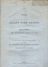
Document, Allan’s Ford Bridge 1852, 1852
... The correspondence dates from October 1850 to February 1852 and includes letters and reports from Melbourne Government employees such as Robert Hoddle, Chief Surveyor, David Lennox, Superintendent of Bridges and Lieutenant – Governor Charles La Trobe. ...The correspondence dates from October 1850 to February 1852 and includes letters and reports from Melbourne Government employees such as Robert Hoddle, Chief Surveyor, David Lennox, Superintendent of Bridges and Lieutenant – Governor Charles La Trobe. ...This is an original Victorian Government document containing the printed version of 37 reports and letters regarding the building of the first Allansford bridge completed early in 1852. The correspondence dates from October 1850 to February 1852 and includes letters and reports from Melbourne Government employees such as Robert Hoddle, Chief Surveyor, David Lennox, Superintendent of Bridges and Lieutenant – Governor Charles La Trobe. The correspondence from local settlers included the names of William and John Allan, John Davidson and James Coulstock. The correspondence shows that some settlers in the Warrnambool/Port Fairy district wanted a portion of the Government allocated funds spent on the local roads and bridges in other locations. The 1852 Allansford bridge cost £480 and was replaced in 1870. This document has strong historical significance as it relates to one of the earliest State government works in the district and records the public imput into the decision.. It contains opinions and correspondence between a number of early settlers in the district at the time.Grey/blue paper document with black text. 21 pages plus 4 page index at back.allan's ford 1852, allansford bridge, allansford, history of allansford, warrnambool -
 Warrnambool and District Historical Society Inc.
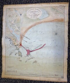
Map - Warrnambool Port 1879, 1879
... Report on the proposed Warrnambool Breakwater. The chart detail is hand-drawn and hand-tinted on canvas with the names of places, geographical and marine features and local points of interest added in print. The edges of the chart are rubbed and the chart is somewhat faded and dirty but the main colours of red, green and brown are still clearly discernible. The title of the plan is printed in an oval inset at the top of the chart. The plan shows two possible Breakwater designs, one from the Borough Surveyor...Report on the proposed Warrnambool Breakwater. The chart detail is hand-drawn and hand-tinted on canvas with the names of places, geographical and marine features and local points of interest added in print. The edges of the chart are rubbed and the chart is somewhat faded and dirty but the main colours of red, green and brown are still clearly discernible. The title of the plan is printed in an oval inset at the top of the chart. The plan shows two possible Breakwater designs, one from the Borough Surveyor ...The port facilities in Warrnambool Bay were in constant use from the first years of Warrnambool’s settlement but there were also difficulties for the shipping trade – a small and unsafe anchorage, the lack of loading facilities and little natural protection from the southerly gales. From the 1870s on there was local agitation for some sort of Breakwater to be built and an Andrew Kerr design was approved by the Warrnambool Council but no funds were made available from the Victorian Government. Throughout the 1870s the building of a Breakwater was a major political issue in the district with preliminary work being funded and started in 1874. In 1879 the Government agreed to a further inspection of the area and an official report. Sir John Coode (1816-1892) was commissioned to make this report. He had come to Australia in 1872 to advise on harbour construction. Coode recommended a 1800 feet long Breakwater and wharf connected to the shore and it was this proposal that the plan described herein and drawn up in 1879 was to accompany. The original plan was eventually modified because of the cost and a Breakwater was completed in 1890 under the direction of the engineer, Arthur Dudley Dobson, with extensions early in the 20th century. This plan is of great interest as it shows in simple graphic form the original plans proposed by Sir John Coode for the Warrnambool Breakwater. It is therefore of great historical importance. The Breakwater was not the maritime success that it was hoped it would be but it is today a significant feature of our foreshore. This is a Plan drawn up in 1879 by Victorian Harbours to accompany Sir John Coode’s Report on the proposed Warrnambool Breakwater. The chart detail is hand-drawn and hand-tinted on canvas with the names of places, geographical and marine features and local points of interest added in print. The edges of the chart are rubbed and the chart is somewhat faded and dirty but the main colours of red, green and brown are still clearly discernible. The title of the plan is printed in an oval inset at the top of the chart. The plan shows two possible Breakwater designs, one from the Borough Surveyor (Andrew Kerr?) and one from Sir John Coode.Victorian Harbours Warrnambool Plan to accompany Sir John Coode’s report Dated 28th Feby 1879 warrnambool breakwater, andrew kerr, sir john coode, arthur dudley dobson, warrnambool, warrnambool harbour, warrnambool history, warrnambool beach -
 Bendigo Military Museum
Administrative record - Trilateration with the Tellurometer - GRL Rimington 1958, Department of National Development , ACT, 26 May 1958
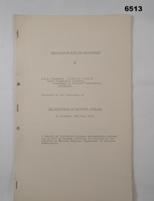
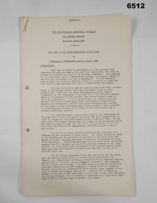
... Surveyors Conference, Brisbane 26 May 1958. This paper is a summary of Electronic distance measurements carried out in 1957 in Central Australia by officers of the division of National Mapping, Department of National Development. Trilateration is a surveying Technique that uses measurements of the sides of triangles to determine relative position. Royal Australian Survey Corps RASvy Fortuna Army Survey Regiment Army Svy Regt ASR Division of National Mapping Surveying A 11 page foolscap size stapled paper report ...trilateration with the tellurometer by GRL Rimington L.S MIS (Aust) Chief Topographic Surveyor, Department of National Development, Australia. This paper was delivered to the Institute of Surveyors Conference, Brisbane 26 May 1958. This paper is a summary of Electronic distance measurements carried out in 1957 in Central Australia by officers of the division of National Mapping, Department of National Development. Trilateration is a surveying Technique that uses measurements of the sides of triangles to determine relative position.A 11 page foolscap size stapled paper report. Two holed punched with dis-coloured pages due to age.royal australian survey corps, rasvy, fortuna, army survey regiment, army svy regt, asr, division of national mapping, surveying -
 Bendigo Military Museum
Journal - Desert Exploration - Extract from Northern Territory Lands and Survey Dept Annual Report 1960-61, Northern Territory Lands and Survey Branch, 1961
... Report 1960-61 is about Desert Exploration between Wave Hill and Tennant Creek. The 2 x fold out maps are 1:1,000,000 scale with one showing a Levelling Traverse. The exploration took place during March and April 1960. This document has been included in the RASvy collection because it was valuable information that was needed by RASvy surveyors...Report 1960-61 is about Desert Exploration between Wave Hill and Tennant Creek. The 2 x fold out maps are 1:1,000,000 scale with one showing a Levelling Traverse. The exploration took place during March and April 1960. This document has been included in the RASvy collection because it was valuable information that was needed by RASvy surveyors ...This Extract from Northern Territory Lands and Survey Dept Annual Report 1960-61 is about Desert Exploration between Wave Hill and Tennant Creek. The 2 x fold out maps are 1:1,000,000 scale with one showing a Levelling Traverse. The exploration took place during March and April 1960. This document has been included in the RASvy collection because it was valuable information that was needed by RASvy surveyors who were required to operate in the area in later years.5 x foolscap sized pages and 2 x map foldout pages held together with a slide clip. Pages and maps are two hole punchedroyal australian survey corps, rasvy, fortuna, army survey regiment, army svy regt, asr -
 Bendigo Military Museum
Administrative record - Army Survey Regiment Regimental Training 1984 - The Odd Angry Surveyor, Army Survey Regiment, Bendigo, 21 Feb 1984
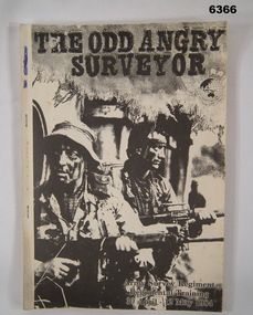
... Surveyor" during the period 30 Apr - 12 May 1984. The Exercise conducted in two phases, Phase One- being theory lessons in a number of aspects of Infantry Minor Tactics at Section Level, whilst Phase Two- was putting into practice the lessons from Phase One. Royal Australian Survey Corps RASvy Fortuna Army Survey Regiment Army Svy Regt ASR Light carboard covered A4 paper report ...This is an Administrative Instruction setting out all aspects of the Army Survey Regiment Regimental Training Exercise "Odd Angry Surveyor" during the period 30 Apr - 12 May 1984. The Exercise conducted in two phases, Phase One- being theory lessons in a number of aspects of Infantry Minor Tactics at Section Level, whilst Phase Two- was putting into practice the lessons from Phase One.Light carboard covered A4 paper report stapled on left hand sideroyal australian survey corps, rasvy, fortuna, army survey regiment, army svy regt, asr -
 Bendigo Military Museum
Administrative record - The story of the Royal Australian Survey Corps - Brigadier L Fitzgerald OBE, FIS 1962, Brigadier L Fitzgerald OBE, FIS Aust, Canberra, March 1962
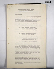
... This is a report prepared by the Director of the Royal Australian Survey Corps Brigadier L Fitzgerald OBE, FIS Aust for presentation at the Institution of Surveyors, Australia, 6th Survey Conference held in Adelaide in March 1962. ...Bendigo Military Museum 37 - 39 Pall Mall Bendigo goldfields This is a report prepared by the Director of the Royal Australian Survey Corps Brigadier L Fitzgerald OBE, FIS Aust for presentation at the Institution of Surveyors, Australia, 6th Survey Conference held in Adelaide in March 1962. ...This is a report prepared by the Director of the Royal Australian Survey Corps Brigadier L Fitzgerald OBE, FIS Aust for presentation at the Institution of Surveyors, Australia, 6th Survey Conference held in Adelaide in March 1962. This document mentions the beginning of mapping in 1907 in the Australian Intelligence Corps and how the Survey Corps was formed in 1915. The story continues until 1962. A full copy of the report is attached as a video in .mp4 format.14 x page typed foolscap size paper report, stapled and 4 x hole punched. Each page has been photographed at 200dpi and saved in .jpg format. The complete set of these .jpg pages have then been combined into a video in ,mp4 format. The Video is 1.34Mb in size and runs for 2:48 min 48.Some handwritten notes next to some paragraphs by an unknown author.royal australian survey corps, rasvy, fortuna, army survey regiment, army svy regt, asr