Showing 46 items matching " transport establishments"
-
 Glen Eira Historical Society
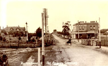
Article - MURRUMBEENA ROAD RAILWAY CROSSING
... ... Transport establishments...Transport Railway Crossing Koornang Road Railways Level Crossing Gates Trains Road Crossing Transport establishments Signal Boxes Murrumbeena Railway Station Dunbar R.P. ...This file contains eleven items: 10 original photographs and 1 newspaper cutting. 1/A black and white photograph titled in the format of the shot ‘Murrumbeena. 4. The Railway Crossing’, date unknown, estimated to be 1905. Donated by the Hermes Studio on 19/11/1980. 2/A black and white photograph with a white border of the signal box at Murrumbeena Station by R.P Dunbar dated 16/03/1979 with a handwritten description on the back. 3/A black and white photograph with a white border of the interior of the Murrumbeena Train Station Signal box with a man identified as Michael sitting, taken by R.P Dunbar dated 17/03/1979 with a handwritten description on the back. 4/A black and white photograph with a white border of the removal the boom gates at Murrumbeena Train Station railway crossing. Taken by R.P Dunbar printed 28/04/1979, which includes a handwritten description on the back. 5/A black and white photograph with a white border of the removal of the boom gates taken by R.P Dunbar dated 29/04/1979, with a handwritten description on the back. 6/A black and white photograph with a white border of Murrumbeena Road Crossing during the removal of the boom gates taken by R.P Dunbar printed 29/04/1979. This includes a hand written description on the back. 7/A black and white photograph with a white border of the Murrumbeena Road Railway Crossing during the removal of the boom games dated 29/04/1979, taken by R.P Dunbar, with a hand written description of the photograph on the back. 8/A black and white photograph with a white border of Murrumbeena Road Crossing during the removal of the boom gates dated 29/04/1979 taken by R.P Dunbar with a handwritten description on the back. 9/A black and white photograph with a white border of Murrumbeena Road Railway Crossing with a new boom barrier replacing the boom gates, taken by R.P Dunbar dated 29/04/1979. Including a handwritten description on the back. 10/A black and white photograph with a white border of Murrumbeena Railway Station, Murrumbeena Road with the replacement boom barriers in place, taken by R.P Dunbar dated 29/04/1979. Including a hand written description on the back. 11/A newspaper article titled ‘Boom gates to create road Chaos’ written by Adam Carey from ‘The Age’ dated 29/11/2011. This includes a coloured photograph of the Murrumbeena Road Level Crossing taken by Michael Clayton Jones, and a map of the train line and level crossing between Carnegie Station and Hughesdale Station. The article makes educated predictions based on VicRoads Studies of future implications on road traffic unless more level crossings are removed. In particular the Dandenong corridor and Murrumbeena Road crossings are identified as high priority on the list of potential crossings which may have to be removed. Additionally the article discusses options the government has in addressing the dilemma, and the opinion of a Carnegie pharmacist Gerald Galatis whose business is near the level crossing on Koornang Road.transport, railway crossing, koornang road, railways, level crossing, gates, trains, road crossing, transport establishments, signal boxes, murrumbeena railway station, dunbar r.p., murrumbeena road, carnegie station, railway lines, railway buildings, road traffic, galatis gerald, construction sites, poath road, neerim road, hermes studio -
 Glen Eira Historical Society
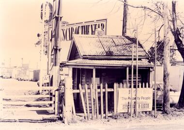
Document - NEERIM ROAD RAILWAY CROSSING AND GATES GLEN HUNTLY
... ... Transport Establishments...Glenhuntly Road Neerim Road Caulfield Railway Gates Gates Hand-Operated Railway Gates Railways Roads and Streets Railway Crossings Architectural Features Town Halls Official Buildings Vicrail Meetings Public Meetings Caulfield Town Hall Gatekeepers Caulfield City Council Elsternwick Glen Huntly Caulfield Park Caulfield Racecourse Normanby Road Dandenong Road Railway Buildings Railway Stations Land Transport Transport Establishments Hordern A.G. Dunstan Don Hordern Bill Needham J.G. ...This file contains two items: 1/Twelve photographs of the Glen Huntly, Neerim Road hand-operated railway gates, dated 1983 and November 1985, photographer unknown, and two black and white copies of two of the original photographs. Four photographs are in black and white and eight are in colour, all picturing the Gatekeeper’s shelter and/or the railway gates. Six photographs dated 1985 include the Gatekeeper, unidentified, in some photos operating the gates. 2/A three-page pamphlet dated 03/05/1979 promoting a public meeting at the Caulfield Town Hall to debate Road Grade Separation proposals for the Neerim Road and Glenhuntly Road railway crossings. Document details the proposed VicRail improvement and four alternative improvements as we as a blank questionnaire for the submission of ideas regarding the proposals to the Caulfield City Council Urban Planner. A short summary of other concerns held by two councillors and an engineer regarding the proposal is also included, as is a Railway Noise Level. Railway Pamphlet also includes a map of the area surrounding the railway crossings under discussion 1977.glenhuntly road, neerim road, caulfield, railway gates, gates, hand-operated railway gates, railways, roads and streets, railway crossings, architectural features, town halls, official buildings, vicrail, meetings, public meetings, caulfield town hall, gatekeepers, caulfield city council, elsternwick, glen huntly, caulfield park, caulfield racecourse, normanby road, dandenong road, railway buildings, railway stations, land transport, transport establishments, hordern a.g., dunstan don, hordern bill, needham j.g., advertisements, graphics, advertising, advertising signs, signs, estate agents, business people, stockdale and leggo, buildings structures and establishments, occupations, united signs, signs, communication devices, motor vehicles, glenhuntly railway station, town planning, civic and landscape art, engineers, professionals, traffic, road transport, transport, maps, documents, plans -
 Glen Eira Historical Society
Article - Grand Union Tramway Junction, Balaclava Road and Hawthorn Road
... ... Transport establishments...Prahran and Malvern Tramways Trust Caulfield Leader Bayside Weekly Tooke Craig Tourist attractions Grand Union Tramways Junction Caulfield Junction Cable Car Tramways Tram shelters Building Sheds Alma Road Orrong Road Caulfield Electric Line Balaclava Junction Elsternwick Railway Station Caulfield station Caulfield Station loop Tram services Transport establishments Thoroughfares Buildings Structures Establishments Parts of buildings or structures Documents Commercial industry Sites Historic sites Melbourne Bayside Weekly Article Grand Union Tramway Junction, Balaclava Road and Hawthorn Road ...This file contains three items. 1. A three-page Caulfield Conservation Study of the Balaclava Road/Hawthorn Road Tramway Crossing, undertake by Andrew Ward and dated September 1994. Study includes a brief history of the junction and a statement of significance. Study also includes Four black and white photographs of the junction and of architectural details of the tram tracks. 2. A letter from the Conservation Manager of the National Trust of Australia (Victoria) to the manager of the Planning Section for the City of Glen Eira, dated 15/06/2001 and attached to a six-page Classification Report. The letter informs of the Classification of the Grand Union Junction at the intersection of Balaclava and Hawthorn Road by the national trust, signed by Conservation Manager Ian Pausacker. Classification Report includes details such as the date of construction, a statement of significance, history of the junction, physical description of the junction and the condition of the junction at the time of writing. Report also includes a map of the Melbourne Tram Network drafted by Keith Kings and dated 01/005/1956, with illustration of the layout of fifteen tram depots, and updated aerial illustration of the Grand Union Junction, and a further map of Melbourne Tramways developed by North Melbourne Electric Tramways and Lighting Co. and Prahran and Malvern Tramways Trust, drafted by Keith Kings and dated January 1914 with illustrations of three tram depots. 3. Two articles from the Caulfield Leader written by Aaron Langmaid and dated 13/02/2007 and the Melbourne Bayside Weekly dated 21/02/2007 written by Joanne Sim, both concerning the Grand Union Junction. The article from the Caulfield Leader includes a picture of Executive Officer of the council of Tramway Museum of Australia Craig Tooke in front of the intersection. The article from the Bayside Weekly includes a picture of a tram passing through the junction and a brief history of the junction and tram network in Caulfield. The article also refers to twp local tram shelters at the intersection of Dandenong Road and Alma Road and also Orrong Road and Balaclava Road.caulfield, caulfield conservation, study, balaclava road, hawthorn road, grand union junction, ward andrew, tramway crossings, transport, acland street, caulfield racecourse, tram tracks, race events, event, tram routes, thorough fares, melbourne and metropolitan tramways board, prahran and malvern tramway trust, prahran and malvern district tramways, caulfield electric tramways, caulfield city council, architectural detail, city of glen eira, balaclava road and hawthorn road intersection, balaclava road and hawthorn road junction, dandenong road, glenhuntly road, four-way tram junctions, access covers darling road, cast metal access covers, hadfields patent, caulfield park, tram systems, tram networks, heritage, tramway heritage, kings keith, tram depots, glenhuntly depot, maps, glen eira, melbourne electric tramways, north melbourne electric tramways and lighting co., prahran and malvern tramways trust, caulfield leader, bayside weekly, tooke craig, tourist attractions, grand union tramways junction, caulfield junction, cable car tramways, tram shelters, building, sheds, alma road, orrong road, caulfield electric line, balaclava junction, elsternwick railway station, caulfield station, caulfield station loop, tram services, transport establishments, thoroughfares, buildings, structures, establishments, parts of buildings or structures, documents, commercial industry, sites, historic sites, melbourne bayside weekly -
 Whitehorse Historical Society Inc.
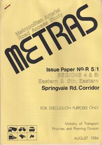
Document, METRAS, August 1984
... ...Transport Establishments...Roads Transport Transport Establishments Metropolitan Arterial Road Access Study. ...Metropolitan Arterial Road Access Study. Issue paper No.R 5/1 Regions 4 &5, Eastern & Sth Eastern.A4 43 pagesnon-fictionMetropolitan Arterial Road Access Study. Issue paper No.R 5/1 Regions 4 &5, Eastern & Sth Eastern.roads, transport, transport establishments -
 Bendigo Military Museum
Photograph - Royal Australian Survey Corps Surveyors in the Field – North Queensland and Torres Strait, 1961
... establishment of mapping and geodetic control. In this era surveyors used theodolites to observe horizontal and vertical angles and tellurometers to measure base line distances between survey stations. In photo .2P Joe Farrington is seen taking survey observations using a Tavistock V500 Series Tavistock theodolite at a survey station between the Edward River and Aurukun in the Cape York Peninsula. The Gulf of Carpentaria appears in the background. From 1957 helicopter transport...establishment of mapping and geodetic control. In this era surveyors used theodolites to observe horizontal and vertical angles and tellurometers to measure base line distances between survey stations. In photo .2P Joe Farrington is seen taking survey observations using a Tavistock V500 Series Tavistock theodolite at a survey station between the Edward River and Aurukun in the Cape York Peninsula. The Gulf of Carpentaria appears in the background. From 1957 helicopter transport ...This is a set of five photographs of surveyors and support staff in the field undertaking duties in North Queensland and Torres Strait in 1961. The surveyors were employed in the establishment of mapping and geodetic control. In this era surveyors used theodolites to observe horizontal and vertical angles and tellurometers to measure base line distances between survey stations. In photo .2P Joe Farrington is seen taking survey observations using a Tavistock V500 Series Tavistock theodolite at a survey station between the Edward River and Aurukun in the Cape York Peninsula. The Gulf of Carpentaria appears in the background. From 1957 helicopter transport of survey parties revolutionised transport in remote areas. The civilian helicopter was hired from TAA. This is a set of five photographs of surveyors and support staff in the field undertaking duties in North Queensland and Torres Strait in 1961. The photographs were printed on photographic paper and are part of the Army Survey Regiment’s Collection. The photographs were scanned at 300 dpi. .1) - Photo, colour, 1961. Andy Millar occupying a survey station on a hill in the Cape York Peninsula, QLD. .2) - Photo, colour, 1961. Joe Farrington taking observations with a V500 Series Tavistock geodetic theodolite at a survey station in the Cape York Peninsula, QLD. .3) - Photo, colour, 1961. Daryl Parker taking a break from survey observations on a hill located on Duaun Island QLD, in the Torres Strait, a few miles south of the PNG coastline. Hill height was 975 ft. .4) - Photo, colour, 1961. Three Torres Strait divers L to R: unidentified, Darku and Ray Mau Daryl standing behind a Tavistock geodetic theodolite on a hill located on Duaun Island QLD, in the Torres Strait, a few miles south of the PNG coastline. .5) - Photo, colour, 1961. Andy Millar holding meat from a small turtle on Duaun Island QLD, in the Torres Strait, a few miles south of the PNG coastline. An unidentified Duaun Island local appears in the background..1P to .5P annotated on back – personnel names, the year and the location. royal australian survey corps, rasvy, army survey regiment, asr, army svy regt, fortuna, surveying -
 Bendigo Military Museum
Photograph - Royal Australian Survey Corps Surveyors in the Field – PNG, 1962
... establishment of mapping and geodetic control. In this era surveyors used theodolites to observe horizontal and vertical angles and tellurometers to measure base line distances between survey stations. From 1957 helicopter transport...establishment of mapping and geodetic control. In this era surveyors used theodolites to observe horizontal and vertical angles and tellurometers to measure base line distances between survey stations. From 1957 helicopter transport ...This is a set of four photographs of surveyors and support staff in the field undertaking duties in Dogera, Milne Bay Province and Kerema, Gulf Province of PNG in 1962. The surveyors were employed in the establishment of mapping and geodetic control. In this era surveyors used theodolites to observe horizontal and vertical angles and tellurometers to measure base line distances between survey stations. From 1957 helicopter transport of survey parties revolutionised transport in remote areas.This is a set of four photographs of surveyors and support staff in the field undertaking duties in PNG in 1962. The photographs were printed on photographic paper and are part of the Army Survey Regiment’s Collection. The photographs were scanned at 300 dpi. .1) - Photo, colour, 1962. Unloading survey operation stores from a Landing Ship Medium (LSM) at Dogera, Milne Bay Province, PNG. .2) & .3) - Photo, colour, 1962. Hired civilian helicopter Bell 47G-2 helicopters operating at at Dogera, Milne Bay Province, PNG. .4) - Photo, colour, 1962. Survey party at survey station located near Kerema, Gulf Province southern PNG. L to R: Dave Owens, Keith Broadbent, with local villagers in background..1P to .4P annotated on back – personnel names, the year and the location. royal australian survey corps, rasvy, army survey regiment, asr, army svy regt, fortuna, surveying -
4th/19th Prince of Wales's Light Horse Regiment Unit History Room
Booklet, Defence Printing Establishment, Notes for the Guidance of Drivers and Attendants Engaged in the Transportation of Commonwealth Explosives, July 1967
... Transport. Fourth Edition - July 1967 Notes for the Guidance of Drivers and Attendants Engaged in the Transportation of Commonwealth Explosives Booklet Defence Printing Establishment ...A soft covered booklet issued by the Department of Shipping and Transport. Fourth Edition - July 1967instructions, transport, explosives -
 Kiewa Valley Historical Society
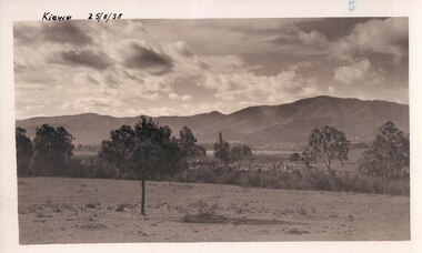
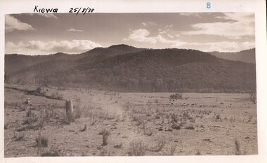
Black and white photograph of farmland, Kiewa, 25/8/38, circa 1938
... establishment of Mt. Beauty as a township. The area was still being used for grazing, and the land was eventually acquired from the local land owners by the State Electricity Commission. The construction of the road, from Tawonga to the High Plains, was commenced in April of this year. This allowed men and heavy equipment to be transported...establishment of Mt. Beauty as a township. The area was still being used for grazing, and the land was eventually acquired from the local land owners by the State Electricity Commission. The construction of the road, from Tawonga to the High Plains, was commenced in April of this year. This allowed men and heavy equipment to be transported ...This photograph was taken in August, 1938 some eight years prior to the establishment of Mt. Beauty as a township. The area was still being used for grazing, and the land was eventually acquired from the local land owners by the State Electricity Commission. The construction of the road, from Tawonga to the High Plains, was commenced in April of this year. This allowed men and heavy equipment to be transported to the work sites for the construction of the Kiewa Hydro Electric Scheme This photograph is important as it shows the upper Kiewa Valley as it was before the establishment of the town of Mt. Beauty. The land has been cleared of natural growth and has been used for grazing cattle. By 1946 housing construction had commenced for the new town of Mt. Beauty and by 1948 street construction in the southern part of the town was completed as far as Hill Street.A black and white photograph of farmland with Mt. Emu in the background. This has been taken from where Mt. Beauty township now stands prior to road making and the erection of houses. A line of trees below the hill line indicates the position of the East Kiewa River. (No. 5 in a set of 8) Handwritten in black ink on the upper left corner of the photograph is the inscription 'Kiewa 25/8/38' and the number 5 has been stamped on the upper right hand corner. On the back is the word 'Velox' which is the name of the photographic paper on which the photo was developed.road construction, kiewa, tawonga, mt. beauty, secv -
 Kiewa Valley Historical Society
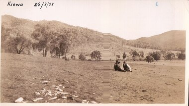
Black and white photograph of farmland, Kiewa, 25/8/38, circa 1938
... establishment of Mt. Beauty township. The area was still being used for grazing, and the land was eventually acquired from the local land owners by the State Electricity Commission. The construction of the road, from Tawonga to the High Plains, was commenced in April of this year. This allowed men and heavy equipment to be transported...establishment of Mt. Beauty township. The area was still being used for grazing, and the land was eventually acquired from the local land owners by the State Electricity Commission. The construction of the road, from Tawonga to the High Plains, was commenced in April of this year. This allowed men and heavy equipment to be transported ...This photograph was taken in August, 1938 at the time of road making in the area and some eight years prior to the establishment of Mt. Beauty township. The area was still being used for grazing, and the land was eventually acquired from the local land owners by the State Electricity Commission. The construction of the road, from Tawonga to the High Plains, was commenced in April of this year. This allowed men and heavy equipment to be transported to the work sites for the construction of the Kiewa Hydro Electric Scheme. An important photograph as it shows the upper Kiewa Valley as it was before the establishment of the town of Mt. Beauty. The land had been cleared of natural growth and has been used for grazing cattle. By 1946 housing construction had commenced for the new town of Mt. Beauty and by 1948 street construction in the southern part of the town was completed as far as Hill Street.A black and white photograph taken in the upper Kiewa Valley showing farmland with a group of three unidentified people sitting on the grass.Handwritten in black ink is the inscription 'Kiewa 25/8/1938'. In the right corner of the photograph has been stamped the number 6. On the back in a circle, some 14mm across, are the words 'Kodak Print'. The word Velox is also printed on the back.kiewa, mt. beauty, construction, grazing, secv -
 Kiewa Valley Historical Society
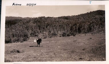
Black and white photograph of farmland, Kiewa, 25/8/38, circa 1938
... establishment of Mt. Beauty a a township. The area was still being used for grazing, and the land was eventually acquired from the local land owners by the State Electricity Commission. The construction of the road, from Tawonga to the High Plains, was commenced in April, 1938 and this photograph was taken August, 1938. This allowed men and heavy equipment to be transported...establishment of Mt. Beauty a a township. The area was still being used for grazing, and the land was eventually acquired from the local land owners by the State Electricity Commission. The construction of the road, from Tawonga to the High Plains, was commenced in April, 1938 and this photograph was taken August, 1938. This allowed men and heavy equipment to be transported ...This photograph was taken in August, 1938, some eight years prior to the establishment of Mt. Beauty a a township. The area was still being used for grazing, and the land was eventually acquired from the local land owners by the State Electricity Commission. The construction of the road, from Tawonga to the High Plains, was commenced in April, 1938 and this photograph was taken August, 1938. This allowed men and heavy equipment to be transported to the work sites for the construction of the Kiewa Hydro Electric Scheme. Prior to this access was by bridle trail, either on horse back or on foot. By 1946 housing construction had commenced for the new town of Mt. Beauty and by 1948 street construction in the southern part of the town was completed as far as Hill Street.This photograph is important as it shows the upper Kiewa Valley as it was before the establishment of the town of Mt. Beauty. The land has been cleared of natural vegetation to allow grazing of cattle. Black and white photograph of grazing farmland with one animal standing in the paddock. The area could possibly be where the golf course now stands with the road to the high plains not yet commenced.Handwritten in the upper left hand corner 'Kiewa 25/8/38'. The number 7 has been stamped in the upper right hand corner. It is part of a set of 8 photographs. On the back are the words Velox repeated several times, indicating the type of photographic papergrazing, kiewa, mt. beauty, secv -
 Kiewa Valley Historical Society
Photograph Farm Land, Kiewa, 25/8/38, circa 1938
... establishment of Mt. Beauty as a township. The area was still being used for grazing cattle and the land was eventually acquired from the local land owners by the State Electricity Commission. The construction of the road, from Tawonga to the High Plains, was commenced in April of 1938. This allowed men and heavy equipment to be transported...establishment of Mt. Beauty as a township. The area was still being used for grazing cattle and the land was eventually acquired from the local land owners by the State Electricity Commission. The construction of the road, from Tawonga to the High Plains, was commenced in April of 1938. This allowed men and heavy equipment to be transported ...This photograph was taken in august, 1938 some eight years prior to the establishment of Mt. Beauty as a township. The area was still being used for grazing cattle and the land was eventually acquired from the local land owners by the State Electricity Commission. The construction of the road, from Tawonga to the High Plains, was commenced in April of 1938. This allowed men and heavy equipment to be transported to the work sites for the construction of the Kiewa Hydro Electric Scheme. Prior to this access was by bridle trail, either on horse back or by foot. By 1946 housing construction had commenced for the new town of Mt. Beauty and by 1948 street construction in the southern part of the town was completed as far as Hill Street.This is an important photograph as it shows the upper Kiewa Valley and the site for Mt. Beauty as it was before the establishment of the town. The land has been cleared of natural vegetation and used for grazing cattle.Black and white photograph of farmland, cattle in the distance, hills in the backgroundHandwritten in the upper left hand corner, in black ink, 'Kiewa 25/8/38'. The number 8 has been stamped in the upper right hand side of the photograph. On the back have been stamped the words Velox, indicating the type of photographic paper.kiewa, mt. beauty, construction, grazing, secv -
 Flagstaff Hill Maritime Museum and Village
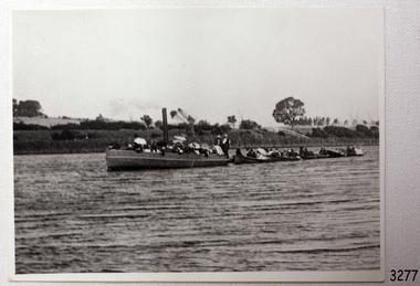
Photograph - Vessel, Steam Launch, Mrs. A. Dawson, Lady Loch, Feb 1907 - Jun 1910
... The launch had been transported by road from Ballarat, but the boiler and the engine had travelled by rail the previous day. In June 1888, Fanny Nelson purchased the steam launch Lady of the Lake for her Nelson’s Boating and Fishing Establishment on the Hopkins River, Warrnambool. ...The launch had been transported by road from Ballarat, but the boiler and the engine had travelled by rail the previous day. In June 1888, Fanny Nelson purchased the steam launch Lady of the Lake for her Nelson’s Boating and Fishing Establishment on the Hopkins River, Warrnambool. ...The photograph shows the steam launch Lady Loch towing five rowing boats full of passengers on the Hopkins River at Warrnambool. The boat is travelling downstream from the riverbank near Jubilee Park towards Warrnambool and the river mouth. A similar trip in 1909 was a fund-raising excursion when the Lady Loch was to tow boats from Flett & Sons' boating establishment on the Hopkins River, travelling towards Jubilee Park. The photograph was taken between February 1907 and June 1910 by Mrs A. G. Dawson from the Hopkins River Bank at “Allandale”, which she was leasing. She took another photograph that day, which was published in the Warrnambool Standard on 24th March 1973. At the time of the photograph the launch Lady Loch was owned by James Flett & Son who operated a boatshed on the bend of the Hopkins River. The boat was described as “a fine little steamer”. In 1916 it was licenced to carry 42 passengers. The LADY LOCH: - In February 1884 Mr Sutton’s steam launch had the name of Lady of the Lake. The boat was part of the entertainment for a Sunday school picnic at Ballarat Lake and Gardens. In October 1884 Mr Ivey from Lake Wendouree purchased two vessels, the steamer Ballarat and Mr Sutton’s well-known and popular launch, Lady of the Lake, to join his own fleet of pleasure boats. In November 1887 Mr Mark Hooper’s purchase of a ‘new’ pleasure boat, Lady of the Lake, arrived in Colac to be an addition to his boating business. The launch had been transported by road from Ballarat, but the boiler and the engine had travelled by rail the previous day. In June 1888, Fanny Nelson purchased the steam launch Lady of the Lake for her Nelson’s Boating and Fishing Establishment on the Hopkins River, Warrnambool. She renamed it Lady Loch. People have suggested the mane was in honour of the wife of the then-current Governor of Victoria, Sir Henry Loch, and the local paper stated that Lady Loch flew the Governor’s colours of yellow, black and blue on her first trip under Nelson’s ownership, Sunday 12th August 1888. In 1890 Fanny Nelson sold her complete business, including Lady Loch, to Mr Chapman. in January 1897 James Flett & Sons, already involved in boating, purchased the business from Chapman. In January 1916, Flett advertised everything for sale, including the boatshed and the steam launch Lady Loch. NOTE: - at least three vessels in Victoria were named Lady Loch; a river launch (ca 1884-ca 1916), a steamer ferry (1884-1920s) and a government steam lighthouse tender HMS Lady Loch (1886-1962)The photograph of the Lady Loch pleasure steamer represents the social and recreational activities of late 19th-century people from Warrnambool and the local district. It shows an example of the pleasure craft of that era. The history of the Lady Loch includes the history of fishing and boat hire businesses of that period. The photograph is also connected with an early Warrnambool buat builder James Flett & Sons. representing the maritime history of the town.Photograph, black and white, of the steam launch Lady Loch towing five rowing boats downstream on the Hopkins River from Jubilee Park towards the river mouth. There are many figures on the boats. The photograph was taken from a property called Allandale on the south river bank between February 1907 and June 1910. The photographer was Mrs A. G. Dawson. The Lady Loch was owned by Mr James Flett & Sons at that time. The photograph is mounted on card.flagstaff hill, warrnambool, shipwrecked-coast, flagstaff-hill, flagstaff-hill-maritime-museum, maritime-museum, shipwreck-coast, flagstaff-hill-maritime-village, lady of the lake, lady of the lake steamer, lady loch steamer, lake colac steamer, hopkins river warrnambool, jubilee park warrnambool, francis maria mann, andrew abernathy nelson iiird, hopkins hotel, nelson's boathouse, chapman's boathouse, flett's boathouse, fanny (francis) nelson, james flett & sons -
 Glen Eira Historical Society
Document - PRAHRAN AND MALVERN TRAMWAYS TRUST
... establishment and development of Tramways between suburbs of Malvern & Prahran including Elsternwick, Caulfield & Glen Huntly. Article includes 4 images plus map and diagram. Included: Photograph 3: Opening ceremony of tramway extension from Balaclava junction to Elsternwick railway station on Glen Huntly Road dated 13/11/1913. Diagram of various tramway routes including Prahran & Malvern Tramways Trust routes. Prahran and Malvern Tramways Trust P+MTT Tram companies Land transport ...This file has 3 items. 1/Photocopy of Caulfield Conservation Study Report by Andrew Ward dated January 1995 of 6-8 Rusden Street, Elsternwick being former Prahran and Malvern Tramways Trust substation. Report includes image, existing registrations, description of substation building and condition. 2/Original photograph (black and white) of tram shelter at corner of Balaclava Road and Orrong Road, Caulfield North, outside Grimwade House (school), description written on back of photo. 3/Original copy of magazine of the Tramway Museum Society of Victoria Ltd. ‘Running Journal’ Vol 7 No. 3 dated June 1970. Article (pages 3-7) entitled ‘Feeding & Filling, The Story of the Prahran & Malvern Tramways Trust’ written by Graeme Breydon. Article written for the 60th anniversary of the trust which opened for business on 30/05/1910 and describes the establishment and development of Tramways between suburbs of Malvern & Prahran including Elsternwick, Caulfield & Glen Huntly. Article includes 4 images plus map and diagram. Included: Photograph 3: Opening ceremony of tramway extension from Balaclava junction to Elsternwick railway station on Glen Huntly Road dated 13/11/1913. Diagram of various tramway routes including Prahran & Malvern Tramways Trust routes.prahran and malvern tramways trust, p+mtt, tram companies, land transport, public transport, substation, tram shelter, powerhouse, parapet, brick, stuccoed, roof lanterns, historic buildings register, national estate register, national trust register, rusden street, balaclava road, orrong road, hawthorn road, dandenong road, glen huntly road, grange road, elsternwick, elsternwick railway station, caulfield, caulfield north, caulfield railway station, point ormond, grimwade house, breydon graeme, tramcar, edwardian, transport, trams, tram depot -
Glen Eira Historical Society
Letter - Rosstown Railway
... RETURN TO ROSSTOWN: RAILWAYS LAND SALES AND SUGAR BEET VENTURES IN CAULFIELD Land Sales Walking Trails Ross William Murray Transport Objects Locomotion Walking Cycling Driving Sports Country Mansions People Caulfield John Builders Construction and Demolition Workers Occupations Careers Professionals Topography Geology Landforms Horticulture Market Gardens Primary Industry Workers City of Caulfield MOOD KEE Pennington Harold Annual General Meetings Caulfield Town Hall Glen Eira City Council Carnegie Carnegie Station Rosstown Station People by Circumstance Migrants Sugar Beet Sugar Beet Mill Sugar Beet Industry Mills Factories SEA BEACH LINES Bent Thomas Parliamentary Representatives Neville Street Miller Street Lemann’s Swamp Reserve Koornang Park Cane Sugar Industry Breweries Rabbit Processing Plants Health Establishments Hospitals Food Production Establishments Abattoirs Thieves Social Problems Vagrants Theft Squatting Financial Economics Debt Finance Industry Insurance Companies Company Managers Bentleigh Ross Leila THE GRANGE Leila Road Wild Cherry Road Financial Trouble Mortgages Gisborne Street Archibald Street Riddell Parade VICTORIA RAILWAYS Glen Huntly Road Clarence Street College Street Gladstone Parade Parrell Street Aileen Avenue Seaview Street Land Subdivisions Dover Street Sussex Street Landfill Marara Road Booran Road Woodville Avenue Dorothy Avenue Ormond Park Royal Avenue Ormond Railway Station Oakleigh Road Melten Avenue Miller Street Munro Avenue Lord Reserve Neerim Road Toolambool Road The Rosstown Hotel Rosanna Street Murrumbeena Crescent Commercial Establishments The National Bank Rosstown Road Kangaroo Road Poath Road Freda Street Hughesdale Kindergarten Oakleigh Council Hughesdale Community Centre Civic Establishments Galbally Reserve Plaques Warrigal Road OUT AND ABOUT BROCHURES Orion Estate Letter Rosstown Railway ...This file contains four items: 1/A black and white photocopy of a letter dated either 07/08/1889 or 09/08/1889, from Robert Lundon to an unidentified recipient discussing an agreement reached between the author – on behalf of the recipient – and Soon Hang Hi in regard, in regards to the allotment known as Webber’s. The agreement is outlined in the letter in what appears to be Chinese characters, and includes the marks of Robert Lundon and Soon Hang Hi. File note from Joy Wu states that the calligraphy is not Mandarin or traditional Chinese. 2/Three sheets of hand-written working notes with information taken from the Victorian Government Gazette on THE ROSSTOWN AND MURRUMBEENA LAND COMPANY LIMITED, THE ROSSTOWN JUNCTION RAILWAY AND PROSPERITY COMPANY LIOMITED, and THE ROSSTOWN JUNCTION, ELSTERNWICK, AND OAKLEIGH RAILWAY COMPANY LIMITED, covering dates between 1887 and 1894. The notes concern meetings and creditors claims relevant to the companies, with reference numbers for the information source. Date and author of the notes are not recorded. 3/A black and white photocopy of the a partial map of the Rosstown Railway and surrounding area, undated. The map includes the names of landholders in the areas of Brighton, Garden Vale and Elsternwick, as well as other railway lines present in the region. 4/A fold-out map and guide of the Rosstown Rail Trail, including a brief general history of Caulfield as well as a more extensive biography of William Murray Ross and the Rosstown Railway. The map marks and describes significant sites along the trail, including photographs of some of these sites, provided by DF Jowett.documents, correspondence, webber’s, lundon robert, chinese characters, ethnic communities, signatures, text, settlements, taxes, fraser john grieves, lovell r.h., price davies, meetings, communication activities, soon hang hi, commercial events and activities, the rosstown and murrumbeena land company limited, victorian government gazette, bulmer richard, parry john, osment henry, shareholders, creditors claims, the rosstown junction railway and property company limited, finch and best, lawyers, the rosstown junction elsternwick and oakleigh railway company limited, cameron w.c., phillips p.d., garden vale, elsternwick, elsternwick railway station, rosstown, rosstown railway, thomas street, bay street, kooyong road, melbourne and brighton railway, hawthorn road, bambra road, caulfield and frankston railway, booran road, grange road, koornang road, murrumbeena road, north road, north road railway station, east brighton railway station, south road, railway routes, railway lines, railways, land transport, murphy j., caulfield, hamilton t.f., dane p., holloway, webb, ailee john, payne t.b., brodie chas, dane john, o’neil h., mccombie john, mcmillane a., smyth c.d., cooper, ebden, landholders, jeffrey j.d., gill j., balcombe a.e., cooper h., mcnab j., white j., sutherland j., greeves a.f.a., newton m.c., chamley f.b., fowler j., inglis p., grant t., stooke j., swanson g., cochrane c., adams e.b., mccombie thas, keyes robert, brighton cemetery, burials grounds and graveyards, war-ein road, were j.b., holland j., mcmahon c., winter t.l.m., dendy henry, mitchell w., jackson s., were j.e., wickham francis dawe, bryant jane, east brighton railway station, railway stations, maps, allotments, land titles, roads and streets, rosstown rail trail, city of glen eira, tourism, trains, tourism information bureaus, tours, pamphlets, elsternwick railway park, oakleigh junction, princes park, ee gunn reserve, packer park, sites, jowett d.f., weickhardt i.g., return to rosstown: railways land sales and sugar beet ventures in caulfield, land sales, walking trails, ross william murray, transport objects, locomotion, walking, cycling, driving, sports, country mansions, people, caulfield john, builders, construction and demolition workers, occupations, careers, professionals, topography, geology, landforms, horticulture, market gardens, primary industry workers, city of caulfield, mood kee, pennington harold, annual general meetings, caulfield town hall, glen eira city council, carnegie, carnegie station, rosstown station, people by circumstance, migrants, sugar beet, sugar beet mill, sugar beet industry, mills, factories, sea beach lines, bent thomas, parliamentary representatives, neville street, miller street, lemann’s swamp reserve, koornang park, cane sugar industry, breweries, rabbit processing plants, health establishments, hospitals, food production establishments, abattoirs, thieves, social problems, vagrants, theft, squatting, financial economics, debt, finance industry, insurance companies, company managers, bentleigh, ross leila, the grange, leila road, wild cherry road, financial trouble, mortgages, gisborne street, archibald street, riddell parade, victoria railways, glen huntly road, clarence street, college street, gladstone parade, parrell street, aileen avenue, seaview street, land subdivisions, dover street, sussex street, landfill, marara road, booran road, woodville avenue, dorothy avenue, ormond park, royal avenue, ormond railway station, oakleigh road, melten avenue, miller street, munro avenue, lord reserve, neerim road, toolambool road, the rosstown hotel, rosanna street, murrumbeena crescent, commercial establishments, the national bank, rosstown road, kangaroo road, poath road, freda street, hughesdale kindergarten, oakleigh council, hughesdale community centre, civic establishments, galbally reserve, plaques, warrigal road, out and about brochures, orion estate -
 Waverley RSL Sub Branch
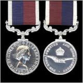
R.A.A.F. Long Service Medal
... Andrews was responsible for the establishment of the war-time structure of the Dental service, establishing new dental centres at all major bases, creating mobile and transportable dental units, ensuring the continual growth of the Branch, maintaining professional development of staff through the establishment of a professional journal, and by organising renowned lecturers to speak at RAAF bases. ...Awarded to Alan Bowers (A236814) who was a R.A.A.F. dental mechanic who serverd during WWII including service in Darwin, and then continued in the R.A.A.F. for some years after the end of WWII The Royal Australian Air Force (and all Commonwealth Air Forces) Long Service and Good Conduct Medal: Awarded to NCOs and ORs of the RAAF (RAF, RCAF etc) for 15 years service. A cupro-nickel plated medal, the obverse features the sovereign's head, the reverse features the crown and eagle emblem of the RAAF (and RAF). Officers are eligible for the award provided they have served a minimum 12 years in the ranks. The riband is dark blue and maroon with white edges. This medal ceased to be awarded in Australia in 1975 when it was replaced by the National Medal (and sbsequently the DFSM and DLSM) in the Australian system of honours and awards. http://www.heritagemedals.com.au/medals-1/service-long-service/air-force-long-service-and-good-conduct-medal.html History of the RAAF Dental Branch It took six years following the formation of the RAAF in 1921 for the first Dental Clinic to be established at Point Cook, Victoria. On 10th June 1927 Flying Officer James Carl Rosenbrock commenced work as an RAAF Dental Officer for the FlyingTraining School at Point Cook. As personnel numbers were still relatively small, Rosenbrock was also responsible for the dental care of all Victorian RAAF units, which involved treating members at 1AD Laverton, as well as Air Force Headquarters at Victoria Barracks in Melbourne. As Army Dental Officers were currently caring for RAAF personnel at Richmond, NSW, the Senior Dental Officer of the 3rd Military District in Victoria (SDO 3MD) requested through the military board that a similar arrangement be established, where that the newly appointed RAAF Dentist provide part time dental services to the Army units stationed at Queenscliff. This was seen as an effective reciprocal arrangement, with both units having a Dental Officer in attendance for, in total, around 3-4 weeks a year. Rosenbrock continued to serve as the sole RAAF Dental Officer until the middle of 1933, when the Air Board asked for his service to be terminated following ‘behaviour unbecoming of a RAAF officer'. He had borrowed several sums of money, of around 40 Pounds or so, from junior ranks on base (as well as from the Regimental Sergeant Major) and had failed to pay the money back. He was replaced by a fellow Victorian, FLGOFF Norman Henry Andrews, on the 18th Sep 1933, who went on to become our first Director of Dental Services, and was instrumental in establishing the organisations and conditions of the Branch that are still present today. Through a fair amount of persistence and hard work on the part of Norman Andrews, the RAAF Dental Branch began to expand from 1937, with the introduction of 2 additional positions, at RAAF station Richmond, and at the FlyingTraining School at Point Cook. This gave the RAAF 3 uniformed Dental Officers, which was expanded to 5 in the months leading up to WW2. 4 of these Dental Officers were based in Victoria and 1 at Richmond, with the other two RAAF units being cared for by the Army (as in the case of Pearce in WA) or by civilians (as in Darwin). With the sudden increase in RAAF personnel required at the outbreak of WW2, the number of RAAF Dental Officers increased dramatically, from 5 in 1939, 28 in 1940, 64 in 1941, 147 in 1942, 193 in 1943, 219 in 1944, and peaking at 227 in 1945. RAAF Dental Officers were required to work in a variety of locations, both in and out of Australia. Between 1940 and 1942 a massive construction programme occurred, with new dental clinics being established around Australia. Priority was given to aircrew training units in order to get these personnel dentally fit for operational deployment, but Dental Officers could equally find themselves posted to recruit depots, fixed stations, medical clearance stations, mobile dental sections, and RAAF and civilian hospitals. RAAF Dental Officers were posted to the large dental centres at Ascot Vale (Vic) and Bradfield Park (NSW) when first appointed, where they received military and clinical training, before being deployed to their needed location. Mobile Dental Units When Japan entered the war in 1941, the rapid deployment of troops to northern operational areas with less than ideal dental fitness was extremely high. As a result, the RAAF deployed a range of mobile dental units, either alone or with medical sections, to support the increasing number of isolated deployed personnel within Australia and overseas. There were three types of mobile unit used: a. Mobile Dental Unit – relied on using either a semi-trailer to get around or by building a surgery directly on to the truck chassis, and installing hydraulic chairs, units, x-rays, and laboratory equipment. They were able to move around between small units, such as RAAF radar stations, where they could plug into the local power supply and work immediately. b. Transportable Dental Units – used for stops of longer duration, where field equipment was carried in panniers from one unit to another by road or rail and housed in whatever accommodation was available at the destination. They were often carried within Australia on Tiger Moths and Dakota aircraft. c. Itinerant Dental Units – in some areas, the dental equipment was installed at the RAAF unit and the Dental Officer and their staff would travel from unit to unit, using the equipment available at each location. RAAF Dental BadgeAs the war developed in Europe, it soon became obvious that the RAF Dental support was not capable of supporting the increasing numbers of RAAF aircrew that were being sent for service with the RAF, with only enough Dental Officers available to provide one to every 2000 men ( instead of the preferred 1 to 600). As a result, the RAAF provided a mobile dental unit, fitted out in a caravan and pulled by a Ford V8 Coupe, to travel around England in support of RAAF personnel at various squadrons. Some degree of tact was needed to ensure that the RAF did not take this as a comment on the treatment they were providing, but it proved successful in maintaining a satisfactory state of dental fitness in RAAF personnel, and a second mobile unit was soon dispatched. They were also set up with a laboratory on board as well as the surgery, which was a major difference between the RAF and RAAF, as the RAF did not provide dentures for their troops (the RAAF would, providing they had served for 6 years). In 1943 the RAF was no longer able to provide Dental support to Australian troops in the Middle East, which resulted in the need for a transportable dental unit to be deployed from Australia. It functioned in a similar manner to the RAF, by moving from one squadron to another. It served in the Middle East and Africa, from Cairo across North Africa, to Italy, and eventually back to England to treat returned prisoners of war. GPCAPT Norman Andrews The growth and development of the RAAF Dental Branch owes a debt to one man in particular, GPCAPT Norman Andrews. As the second RAAF Dental Officer to enlist on 18 Sep 1933, Andrews became the principal architect of the structure and organisation of the RAAF Dental Branch leading up to and during WW2. Until early 1940, the RAAF Dental Branch was administered by the Director of Medical Services (Air), which placed it under the control of the Army Medical staff. The Army would provide their Inspector of Dental Services for advice whenever needed. In April 1940, the RAAF Medical service separated from the Army, resulting in the control of the RAAF Dental Branch shifting back to the RAAF. Andrews became the first Director of Dental Services, when the position was created in 1943 as recognition of the higher profile the Dental Branch was now playing in the RAAF Medical service. Until this time, Andrews's title had been as the Dental Staff Officer to the RAAF Medical Service. Andrews was responsible for the establishment of the war-time structure of the Dental service, establishing new dental centres at all major bases, creating mobile and transportable dental units, ensuring the continual growth of the Branch, maintaining professional development of staff through the establishment of a professional journal, and by organising renowned lecturers to speak at RAAF bases. He also believed in visiting as many dental units as possible to see for himself what conditions were like and to talk first-hand to staff in remote units. His itinerary during the war years, both in and out of Australia, shows a large number of trips in a variety of modes of transport in order to reach remote areas where units were serving. He was promoted to GPCAPT in July 1944, as the numbers of Dental Officers soon peaked at 227 towards the end of the war (1 GPCAPT, 9 WGCDRs, 60 SQNLDRs, and 157 FLTLTs). After the war, with the reduction in RAAF personnel required in uniform, the Dental Branch also reduced its numbers significantly. By 1947 there were only 18 Dental Officers serving (many part-time), with 1 GPCAPT, 1 WGCDR, 10 SQNLDRs, and 6 FLTLTs, and only 13 by 1950. With the decrease in Branch personnel numbers, the ‘powers to be' saw fit to reduce the Director of Dental Service rank to WGCDR, and as a result Norman Andrews found that in order to continue serving in the RAAF he would have to wear a reduced rank. This appears to have been a contributing factor in his decision to discharge at the relatively early age of 43 and accept an administrative job as Director of the Victorian Government's School Dental Service. Norman Andrews holds the proud honour of being the founder of the RAAF Dental Branch, which during the war was instrumental in educating servicemen of the importance of dental health and maintaining the dental fitness of troops in a variety of areas. Dental Orderlies (Assistants) The dental orderly mustering was first introduced in 1937. Until that time, medical orderlies were assigned to assist the Dental officer with their duties. As early as 1931 it had been noted by both RAAF and Army Dental Officers working in Victoria and Richmond that a lot of the troubles they were having would be solved by appointing a permanent Dental Orderly. Often they would find that the medical orderly they were assigned was a different one each day, and as a result the administration and work in general was very inefficient. By 1937, with the increase in Dental Officers to 3, it was realised that a Dental Orderly mustering needed to be created. Dental Mechanics/Technicians Before WW2, dental laboratory work was provided by civilian laboratories, as most RAAF units were stationed around metropolitan areas. At this time, service personnel were still required to pay for their own dentures, unless they had served for six years or had their dentures damaged during performance of their duties. In July 1940, mainly in response to the development of more remote RAAF dental units and the increasing demand for dental prostheses, the Dental Mechanic mustering was established. Unfortunately there was a very limited pool of civilian dental mechanics to recruit from, and as a result the RAAF set up a training school at Laverton (which was later moved to Ascot Vale) in June 1941 which conducted an intensive 6 month course in Dental mechanics. Dental mechanics were quickly in demand. In all fixed and mobile dental units at least 1 Mechanic was supplied for each Dental Officer, and indeed the RAAF supplied Dental Mechanics throughout all its deployments, something the RAF were unwilling, or unable, to do. Two grades of dental mechanic existed: the Senior Mechanic (with the rank of NCO), who was competent in all phases of laboratory work; and the Junior Mechanic, who could only handle routine work and not more advanced denture work. The progression to Senior required a further trade test in techniques including setting up, clasp-forming, casting and backing teeth. During the course of the War, two special courses were held for Mechanics. The first, directed at senior mechanics so that they could instruct others, was in 1942 when Acrylic Resin was first introduced as a denture base material, as an alternative to the current option of vulcanite. Later, towards the end of the War, a ‘refresher' course was provided for those that had served for the greatest period of time in order to allow them retraining in techniques that they had not practised during their service and which were common in civilian life. This included cast base dentures, crowns and bridges, partial dentures, and retainers. Towards the end of the War, a course was held with WAAAF trainees to train them as Mechanics. However, as the War was soon to end they never had the opportunity to progress within the mustering to become Senior Mechanics. The RAAF Dental Branch has survived 75 years of turbulence, with reviews of its viability occurring regularly every few years from as early as 1937. The Branch continues to provide excellent service to the ADF community and, despite reduced manpower, will continue to play an important role in Air Force Health operations. http://www.defence.gov.au/health/about/docs/RAAFDental.pdf40cm cupro-nickel plated medal, the obverse features the sovereign's head, the reverse features the crown and eagle emblem of the RAAF (and RAF). A23814 BOWERS.A. A. F.r.a.a.f long service medal, r.a.a.f good conduct, r.a.a.f. dental service medal -
 Greensborough Historical Society
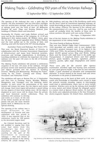
Article, Royal Historical Society of Victoria, Making tracks - celebrating 150 years of the Victorian railways 1854 - 2004, 2004_09
... Greensborough Historical Society 34A Glenauburn Road Lower Plenty Lower Plenty melbourne Brief comments on the development of railways in Victoria since their establishment in 1854, on the occasion of a travelling exhibition organised by the Royal HIstorical Society of Victoria victorian railways public transport victoria trains 2 p text with black and white photographs Making tracks - celebrating 150 years of the Victorian railways 1854 - 2004 Article Article Royal Historical Society of Victoria Genealogical Society of Victoria ...Brief comments on the development of railways in Victoria since their establishment in 1854, on the occasion of a travelling exhibition organised by the Royal HIstorical Society of Victoria2 p text with black and white photographsvictorian railways, public transport victoria, trains -
 Victorian Interpretive Projects Inc.
Photograph - digital, LJ Gervasoni, Murtoa Stick Shed 00031, 13/08/2011
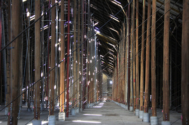
... transport elsewhere. Wheat had been handled in jute bags from the start of the Victorian wheat industry in the mid nineteenth century. Bulk storage had been developed in North America from the early 1900s. NSW began building substantial concrete silos from 1920-21. In Western Australia, farmers' co-operatives, who had to supply their own bulk storage from 1934-5, pioneered the use of low-cost horizontal sheds of timber and corrugated iron for bulk storage. Following its establishment...transport elsewhere. Wheat had been handled in jute bags from the start of the Victorian wheat industry in the mid nineteenth century. Bulk storage had been developed in North America from the early 1900s. NSW began building substantial concrete silos from 1920-21. In Western Australia, farmers' co-operatives, who had to supply their own bulk storage from 1934-5, pioneered the use of low-cost horizontal sheds of timber and corrugated iron for bulk storage. Following its establishment ...From the Victorian Heritage Register statement of significance H0791 The Marmalake/Murtoa Grain Store, originally the No.1 Murtoa Shed, is located within the Murtoa Grain Terminal, adjacent to the grain elevator tower and railway line. The shed is 280m long, 60m wide and 19m high at the ridge with a capacity of 3.4 million bushels. The hipped corrugated iron roof of the shed is supported on approximately 600 unmilled hardwood poles set in a concrete slab floor and braced with iron tie rods. These poles are the reason for use of the term "stick shed". With its vast gabled interior and the long rows of poles the space has been likened to the nave of a cathedral. An elevator at one end took wheat from railway trucks to ridge level where it was distributed by conveyor along the length of the shed, creating a huge single mound of grain. Braced internal timber bulkheads on either side took the lateral thrust of the wheat, and conveyors at ground level outside the bulkheads took wheat back to the elevator for transport elsewhere. Wheat had been handled in jute bags from the start of the Victorian wheat industry in the mid nineteenth century. Bulk storage had been developed in North America from the early 1900s. NSW began building substantial concrete silos from 1920-21. In Western Australia, farmers' co-operatives, who had to supply their own bulk storage from 1934-5, pioneered the use of low-cost horizontal sheds of timber and corrugated iron for bulk storage. Following its establishment in 1935 the Victorian Grain Elevators Board (GEB) planned a network of 160 concrete silos in country locations, connected by rail to the shipping terminal at Geelong. By the outbreak of the Second World War there was a worldwide glut of wheat, and Australia soon had a massive surplus which it was unable to export. Only 48 silos had been established under the Victorian Silo Scheme so far, and wartime material and labour restrictions prevented progress with this scheme. The storage deficit had become an emergency by 1941 as Britain obtained its imports from North America, rather than over the lengthy and difficult shipping route from Australia. In 1941 the GEB, under chairman and general manager Harold Glowrey, proposed large temporary versions of the horizontal bulk storage sheds already in use in Western Australia. The proposal was approved by the Victorian Wheat and Woolgrowers Association, who considered the use of shed storages as a longer term proposition. After initial resistance from the Australian Wheat Board, some of whose members represented wheat bagging interests, the Commonwealth and Victorian governments agreed to split the costs, and Murtoa was chosen as a suitable site for the first emergency storage. The main contractor, Green Bros, commenced work on the No.1 Murtoa Shed in September 1941, deliveries of bulk wheat began in January 1942, and the store was full by June of the same year. In the following years the Council for Scientific and Industrial Research (later CSIRO) conducted valuable research and experiment on the impacts and control of insect pests at the Murtoa No.1 shed. With these discoveries, and the development of more effective pesticides, use of the No.1 shed and the larger No.2 shed, erected in 1942/43, continued for many years. The No.2 shed was demolished in 1975. By the 1990s, pest resistance to pesticides and requirements for both pest free and insecticide free grain rendered open storage of this type unviable. The No. 1 store was also becoming increasingly expensive to maintain, and its use was phased out from 1989.Image of the Marmalake/Murtoa Grain Store which is of historical, architectural, scientific (technical) and social significance to the State of VictoriaDigital colour image of the interior of the Marmaduke . Murtoa grain storage facility better known as the Stick Shed. The shed was constructed in World War Two to store grain. The supporting columns are trees.marmalake, murtoa grain store, wheat store, stick shed, murtoa -
 Victorian Interpretive Projects Inc.
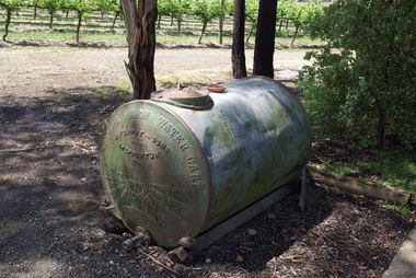
Photograph - colour, Clare Gervasoni, Furphy Water Cart, 2014, 01/11/2014
... transported for stock and domestic use. The method of carting water was then confined to horse drawn drays or sleds with mounted wooden barrels or casks. At the same time the growing demand for agricultural implements, led to the establishment of a foundry with a furnace to cast components rather than the time consuming task of forging. ...transported for stock and domestic use. The method of carting water was then confined to horse drawn drays or sleds with mounted wooden barrels or casks. At the same time the growing demand for agricultural implements, led to the establishment of a foundry with a furnace to cast components rather than the time consuming task of forging. ...The water cart was in itself a complete invention of John Furphy and was first made in the 1880's. At the time no similar article was used in Australia. Few houses of the time were designed to collect rain water from the roof and hence, water needed to be collected elsewhere and transported for stock and domestic use. The method of carting water was then confined to horse drawn drays or sleds with mounted wooden barrels or casks. At the same time the growing demand for agricultural implements, led to the establishment of a foundry with a furnace to cast components rather than the time consuming task of forging. This became the catalyst for the efficient production of the robust and mobile water carrier known then, and now, as the Furphy Farm Water Cart.Four colour photographs showing a tank made by Furphy and Sons, Shepparton.furphy, shepparton, water storage -
Port Melbourne Historical & Preservation Society
Booklet - Commonwealth Government Engine Works, 1976
... Port Melbourne Historical & Preservation Society Port Melbourne Town Hall 333 Bay Street Port Melbourne melbourne industry - manufacturing transport - shipping commonwealth government engine works Department of Supply, Commonwealth Government Engine Works Booklet containing an outline of the work of the Commonwealth Government Engine Works established in 1943 and under control of the Commonwealth Department of Supply. Also contains photos and diagrams of production facilities. Booklet Commonwealth Government Engine Works Defence Printing Establishment ...Booklet containing an outline of the work of the Commonwealth Government Engine Works established in 1943 and under control of the Commonwealth Department of Supply. Also contains photos and diagrams of production facilities.Department of Supply, Commonwealth Government Engine Worksindustry - manufacturing, transport - shipping, commonwealth government engine works -
 City of Moorabbin Historical Society (Operating the Box Cottage Museum)
Newsletter, City of Moorabbin Historical Society Feb 2010 pdf, February 2010
... A description of the establishment of Cobb & Co Coaches by Freeman Cobb in 1853, for cartage between Melbourne and the Ports but they soon began transporting people and mail to the gold fields around Victoria. 3 photocopied photographs of Cobb & Co Coaches and 1 photo of the 2 Possums ...A description of the establishment of Cobb & Co Coaches by Freeman Cobb in 1853, for cartage between Melbourne and the Ports but they soon began transporting people and mail to the gold fields around Victoria. 3 photocopied photographs of Cobb & Co Coaches and 1 photo of the 2 Possums February 2010 Newsletter, City of Moorabbin Historical Society Feb 2010 pdf Helen Stanley ...The City of Moorabbin Historical Society was formed c 1960 by a group of Moorabbin residents who were concerned that the history of the area should be preserved. A good response to a call for items related to the historical area of Moorabbin Shire brought donations of a wide variety of artefacts which are now preserved by the current members of CMHS at Box Cottage Museum . Helen Stanley, Secretary of CMHS, began producing a Newsletter for members in April 2007 to provide current information and well researched items of historical interestHelen Stanley has produced a bi-monthly Newsletter, 2007 - 2013, for the members of the City of Moorabbin Historical Society that contains well researched interesting historical items, notification of upcoming events, current advice from Royal Australian Historical Society , Museums Australia Victoria and activities of Local Historical Societies. The Newsletter is an important record of the activities of the CMHS5 x A4 paper printed on 1 side Issue 15 of the bi-monthly, City of Moorabbin Historical Society Newsletter produced by Society member and Secretary, Mrs Helen Stanley in February 2010. Notices for the meeting February 28th , subscriptions due, and this is 50th Anniversary of CMHS. Water flooded Joyce Park, the grounds of the Cottage and a little seeped into Grace Lewis Room in December 2009 when a water main at the neighbouring Bowling Club burst, but little damage occurred and the Glen Eira Council will install drainage pipes between Box Cottage and the Bowling Club. In January, 2 brush tailed possums had taken up residence in the Barn and after failed attempts by Helen and Dennis to move them, Glen Eira Council relocated them. A description of the establishment of Cobb & Co Coaches by Freeman Cobb in 1853, for cartage between Melbourne and the Ports but they soon began transporting people and mail to the gold fields around Victoria. 3 photocopied photographs of Cobb & Co Coaches and 1 photo of the 2 Possums CITY of MOORABBIN HISTORICAL SOCIETY / February 2010 NEWSLETTER city of moorabbin historical society, stanley helen, maynard dennis, melbourne, moorabbin, cheltenham, ormond, bentleigh, market gardeners, pioneers, early settlers, moorabbin shire, box cottage museum, lewis grace, cobb freeman, cobb and co coaches, ballarat, goldfields, gold miners, bendigo, castlemaine, governor latrobe, victoria, sydney road, sutherland alexander, chinese gold miners -
 Orbost & District Historical Society
black and white photograph, 1913
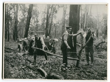
... As a result of these needs the Country Roads Act 1912 was proclaimed in 1913 providing for the establishment of the Country Roads Board as a central road authority with responsibility for those roads within the State considered to be main roads. the C.R.B. was responsible for the construction of roads and bridges including the Snowy River road bridges in Orbost.. This is a pictorial record of transport ...This photograph shows Country Roads Board men clearing a bush track at Hospital Creek. Their vehicle was bogged. The y Roads Board was formed in 1913 1910 it had become apparent that there was a need for a central roads authority to take over responsibility from the Board of Lands and Works for the care and management of the main roads of the state of Victoria. Because there was no consistent and systematic policy for road maintenance Victorian roads were in a deplorable condition. At this time the use of the motor car accentuated the demands for better roads. As a result of these needs the Country Roads Act 1912 was proclaimed in 1913 providing for the establishment of the Country Roads Board as a central road authority with responsibility for those roads within the State considered to be main roads. the C.R.B. was responsible for the construction of roads and bridges including the Snowy River road bridges in Orbost.. This is a pictorial record of transport difficulties in East Gippsland in early 20th century.A large black / white photograph of three men clearing a bush track with a motor vehicle behind them.transport roads road-maintenance country-roads-board -
 Ballarat Tramway Museum
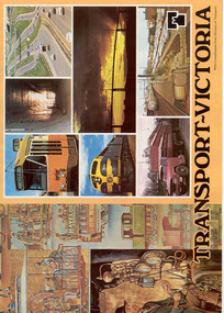
Book, Ministry of Transport, "Transport - Victoria", c1980
... Sixteen page, full cover book titled "Transport - Victoria", published by the Ministry of Transport c1980 - Robert Maclellan as Minister soon after the establishment of the Ministry, combining VicRail, MMTB, TRB, CRB, MURLA, Westgate Bridge Authority, and the Railway Construction Board. ...Ballarat Tramway Museum South Gardens Reserve Wendouree Parade Ballarat Ballarat goldfields Trams tramways MMTB VR VicRail CRB Transport Regulation Board Map Sixteen page, full cover book titled "Transport - Victoria", published by the Ministry of Transport c1980 - Robert Maclellan as Minister soon after the establishment of the Ministry, combining VicRail, MMTB, TRB, CRB, MURLA, Westgate Bridge Authority, and the Railway Construction Board. ...Sixteen page, full cover book titled "Transport - Victoria", published by the Ministry of Transport c1980 - Robert Maclellan as Minister soon after the establishment of the Ministry, combining VicRail, MMTB, TRB, CRB, MURLA, Westgate Bridge Authority, and the Railway Construction Board. Gives details of each of the component authorities, maps, their work, with the part of the Spencer St Station History of Transport Mural on the front cover.trams, tramways, mmtb, vr, vicrail, crb, transport regulation board, map -
 Ballarat Tramway Museum
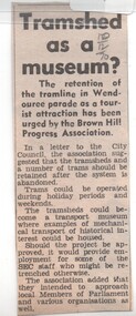
Newspaper, The Courier Ballarat, "Tram shed as a Museum?", 10/12/1970 12:00:00 AM
... Ballarat Tramway Museum South Gardens Reserve Wendouree Parade Ballarat Ballarat goldfields Trams tramways Brown Hill Progress Association Museum Establishment Tram Preservation In pencil in top right hand corner '10/12/70' Newspaper clipping from The Courier, Ballarat, 10/12/1970 about the retention of the tramline in Wendouree Parade as a tourist attraction has been urged by the Brown Hill Progress Association. Notes suggested times of operation, depot could be a mechanical transport ...Newspaper clipping from The Courier, Ballarat, 10/12/1970 about the retention of the tramline in Wendouree Parade as a tourist attraction has been urged by the Brown Hill Progress Association. Notes suggested times of operation, depot could be a mechanical transport museum and intended to approach local Members of Parliament and various organisations as well.In pencil in top right hand corner '10/12/70'trams, tramways, brown hill progress association, museum establishment, tram preservation -
 Geelong Naval and Maritime Museum
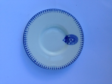
Plate, Huddart Parker Line plate, Mid to late 19th Century
... Historically, the early establishment of the company in Geelong is significant for the region. The object is significant for its connection to early Victorian transport from regional ports to larger cities. geelong maritime museum huddart parker line huddart parker C. ...Huddart Parker traded between 1876 and 1961. It was established in 1876 by James Huddart, T.J. Parker, John Traill and Captain T. Webb. The business rapidly expanded and was travelling between Melbourne and Sydney by 1882 and Melbourne to Adelaide from 1886. The Company was established in Geelong but moved its offices to Melbourne by 1890. It is likely this saucer was used on the Huddart Parker shipping line some time between 1876 and 1961. Historically, the early establishment of the company in Geelong is significant for the region. The object is significant for its connection to early Victorian transport from regional ports to larger cities.A white glazed saucer with a blue transfer print with geometric design on rim. Huddart & Parker Co. logo transfer print on rim and base.Makers Mark: "C McDANN & CO ENGLAND HANLEY R.NO 764041" on base. "HUDDART PARKER LINE" logo on rim.geelong maritime museum, huddart parker line, huddart parker, c. mcdann and company, hanley, shipping lines geelong -
 Geelong Naval and Maritime Museum
Tea Cup, Huddart Parker Line Tea Cup, 1950
... Historically, the early establishment of the company in Geelong is significant for the region. The object is significant for its connection to Victorian transport from regional ports to larger cities. ...Huddart Parker traded between 1876 and 1961. It was established in 1876 by James Huddart, T.J. Parker, John Traill and Captain T. Webb. The business rapidly expanded and was travelling between Melbourne and Sydney by 1882 and Melbourne to Adelaide from 1886. The Company was established in Geelong but moved its offices to Melbourne by 1890.It is likely this tea cup was used on the Huddart Parker shipping line some time from 1950 to the company's closure in 1961. Historically, the early establishment of the company in Geelong is significant for the region. The object is significant for its connection to Victorian transport from regional ports to larger cities. It is a good example of mid 20th Century hotelware and Duraline offerred 'unchippable crockery' for utilitarian purposes. Duraline was imported by Loftus Moran P/L who were based in South Melbourne and supplied the ware to hotels and institutions across Victoria. White glazed tea cup with blue transfer printed blue line around rim, blue geometric pattern around body and Huddart Parker line logo. Cup has a triangular shaped handle. Cup has a small hairline crack and a small chip.Dura Line/ Grafton China/ Made in Englad/ Loftus Moran Pty Ltd 1950huddart and parker line, geelong shipping, geelong maritime museum, duraline, grafton china, loftus moran p/l -
 Ballarat Tramway Museum
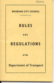
Book, Brisbane City Council, "Brisbane City Council Rules and Regulations of the Department of Transport", 1955
... Fifty Six page book with light yellow card covers, saddle stapled with two staples, titled "Brisbane City Council Rules and Regulations of the Department of Transport". Has date of adoption by the Establishment and Co-ordination Committee of 14 July 1955 on page one. ...Ballarat Tramway Museum South Gardens Reserve Wendouree Parade Ballarat Ballarat goldfields Trams tramways Brisbane BCC Rules Employees On outside front cover in black ink "32222" and on inside front cover "From John Lambert" Fifty Six page book with light yellow card covers, saddle stapled with two staples, titled "Brisbane City Council Rules and Regulations of the Department of Transport". Has date of adoption by the Establishment and Co-ordination Committee of 14 July 1955 on page one. ...Fifty Six page book with light yellow card covers, saddle stapled with two staples, titled "Brisbane City Council Rules and Regulations of the Department of Transport". Has date of adoption by the Establishment and Co-ordination Committee of 14 July 1955 on page one. Lists 213 rules for all employees, duties of employees, senior employees, offences and a detailed index.On outside front cover in black ink "32222" and on inside front cover "From John Lambert"trams, tramways, brisbane, bcc, rules, employees -
 Vision Australia
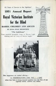
Administrative record - Text, Royal Victorian Institute for the Blind annual report 1951, 1951-1965
... This includes encouraging cricket and chess with sighted competitors, a profile of Joan Ryan who was one of the first infants admitted and received the highest marks awarded for a Matriculation exam, 3KZ's decision to share the proceeds of the Carols by Candlelight appeal between RVIB and Austin Hospital for the this and the next 2 years with funds going towards the development of the Burwood Road site, establishment of a kiosk at RVIB for a recently blinded man, introduction of a banking account for all children over the age of 6 with additional amounts added so that when they reach 16 there is 25 pounds available to them in addition to any articles they make in their leisure time which are sold, the Christmas Tree presents provided to 138 blind workers children, granting of free postage and rail transport for talking book records, sending a deaf-blind boy overseas with a nurse for special tuition, and an aerial view of the recently purchased Burwood Road site. ...This includes encouraging cricket and chess with sighted competitors, a profile of Joan Ryan who was one of the first infants admitted and received the highest marks awarded for a Matriculation exam, 3KZ's decision to share the proceeds of the Carols by Candlelight appeal between RVIB and Austin Hospital for the this and the next 2 years with funds going towards the development of the Burwood Road site, establishment of a kiosk at RVIB for a recently blinded man, introduction of a banking account for all children over the age of 6 with additional amounts added so that when they reach 16 there is 25 pounds available to them in addition to any articles they make in their leisure time which are sold, the Christmas Tree presents provided to 138 blind workers children, granting of free postage and rail transport for talking book records, sending a deaf-blind boy overseas with a nurse for special tuition, and an aerial view of the recently purchased Burwood Road site. ...From it's beginning in 1867, the Royal Victorian Institute for the Blind grew in size and its number of employees and benefactors. These bound volumes of annual reports contain the information sent to subscribers of the Institute and outline the notable events and difficulties facing the blind and the RVIB. This includes encouraging cricket and chess with sighted competitors, a profile of Joan Ryan who was one of the first infants admitted and received the highest marks awarded for a Matriculation exam, 3KZ's decision to share the proceeds of the Carols by Candlelight appeal between RVIB and Austin Hospital for the this and the next 2 years with funds going towards the development of the Burwood Road site, establishment of a kiosk at RVIB for a recently blinded man, introduction of a banking account for all children over the age of 6 with additional amounts added so that when they reach 16 there is 25 pounds available to them in addition to any articles they make in their leisure time which are sold, the Christmas Tree presents provided to 138 blind workers children, granting of free postage and rail transport for talking book records, sending a deaf-blind boy overseas with a nurse for special tuition, and an aerial view of the recently purchased Burwood Road site. 1 volume bound with illustrations.royal victorian institute for the blind, annual report, joan ryan, john doyle, margaret doyle, hugh jeffrey -
 Wodonga & District Historical Society Inc
Booklet - Driving the Fast Train Further, Wendy Everingham and John McPherson, May 2001
... It advocates the establishment of an integrated transport approach in Victoria including the need for a Rural and Regional Planning Strategy to be developed in conjunction with the Metropolitan Strategy A publication of 34 pages produced by Environment Victoria Inc. ...This document is a response by Environment Victoria to the Fast Train Report. It advocates the establishment of an integrated transport approach in Victoria including the need for a Rural and Regional Planning Strategy to be developed in conjunction with the Metropolitan StrategyA publication of 34 pages produced by Environment Victoria Inc. It has brown cover featuring an image of a locomotive superimposed over an outline map of Victoria. It consists of 36 pages including appendices, references, a map of an Environment Victoria Enhanced Victorian Passenger Rail Network and a map of the Victoria's Regional and Rural Bus service.fiction This document is a response by Environment Victoria to the Fast Train Report. It advocates the establishment of an integrated transport approach in Victoria including the need for a Rural and Regional Planning Strategy to be developed in conjunction with the Metropolitan Strategyrailways environmental impact, victorian railways, environment victoria -
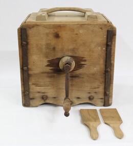 Wodonga & District Historical Society Inc
Functional object - Butter Churn - late 1800s - early 1900s, E. Cherry & Sons
... Victorian creameries regularly exported frozen butter to London, stock was transported by rail for sale in Melbourne, and of course sold and consumed locally. E.W. Mann, of the prominent local Wodonga family, was a shareholder and was closely involved in the establishment of the Wodonga Butter Company. ...Victorian creameries regularly exported frozen butter to London, stock was transported by rail for sale in Melbourne, and of course sold and consumed locally. E.W. Mann, of the prominent local Wodonga family, was a shareholder and was closely involved in the establishment of the Wodonga Butter Company. ...North east Victoria was a major dairy producing region in the late nineteenth century. The first iteration of the Wodonga Butter Factory Ltd was established in 1892. Dairy was sent from farmers across the district for processing at the factory in Wodonga in the 1890s. Victorian creameries regularly exported frozen butter to London, stock was transported by rail for sale in Melbourne, and of course sold and consumed locally. E.W. Mann, of the prominent local Wodonga family, was a shareholder and was closely involved in the establishment of the Wodonga Butter Company. Many families living on farms also owned their own cow, and had equipment to process their own dairy products at home. This item has strong links to the history of Wodonga and north east Victoria. It has interpretative potential in the areas of local agricultural history, and the social history of food and farming.A wooden butter churn with metal turning handle, and two butter paddles and removal lid.butter, butter churn, dairy, cream, milk, cow, agriculture, farms, farmers, farm, food, social history, food history -
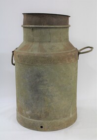 Wodonga & District Historical Society Inc
Functional object - Milk Can 1900s
... Victorian creameries regularly exported frozen butter to London, stock was transported by rail for sale in Melbourne, and of course sold and consumed locally. E.W. Manns, of the prominent local Wodonga family, was a shareholder and was closely involved in the establishment of the Wodonga Butter Company. ...Victorian creameries regularly exported frozen butter to London, stock was transported by rail for sale in Melbourne, and of course sold and consumed locally. E.W. Manns, of the prominent local Wodonga family, was a shareholder and was closely involved in the establishment of the Wodonga Butter Company. ...North east Victoria was a major dairy producing region in the late nineteenth century. The first iteration of the Wodonga Butter Factory Ltd was established in 1892. Dairy was sent from farmers across the district for processing at the factory in Wodonga in the 1890s. Victorian creameries regularly exported frozen butter to London, stock was transported by rail for sale in Melbourne, and of course sold and consumed locally. E.W. Manns, of the prominent local Wodonga family, was a shareholder and was closely involved in the establishment of the Wodonga Butter Company. Many families living on farms also owned their own cow, and had equipment to process their own dairy products at home. Milk cans such as this one were used to store and transport milk from farms to dairies and butter factories for processing.This item represents the history of local industry in Wodonga and north east Victoria. A large metal milk can with handlesmilk, butter, cream, dairy, milk can, farming, farm, cow, rural, agriculture, wodonga