Showing 334 items matching "a private viewing"
-
 Tatura Irrigation & Wartime Camps Museum
Book, A Private Viewing, 1982
... A Private Viewing...a private viewing...Back of a lady looking out a window A Private Viewing Book ...A collection of stories which shows the authors understanding of identity and compassion for human relationshipsPale blue front, white back dust cover. Blue hard cover. Black text. Back of a lady looking out a windowa private viewing, knorr h, camp 13, camp 1, tatura, ww2 camp 1, books, novels -
 Bendigo Military Museum
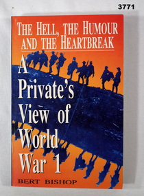
Book - BOOK WW1, Bert Bishop, The Hell, The Humour & The Heartbreak, 1991
... The Hell, The Humour & The Heartbreak - A Private's view of World War I....Bendigo Military Museum 37 - 39 Pall Mall Bendigo goldfields The Hell, The Humour & The Heartbreak - A Private's view of World War I. Book humour heartbreak Soft cardboard cover. ...The Hell, The Humour & The Heartbreak - A Private's view of World War I.Soft cardboard cover. White / black / gold print on front, spine & back. Orange background illustrated dark blue in silhouette showing Australian troops at Ypres. 268 cut, plain, white pages. No illustrations.book, humour, heartbreak -
 National Wool Museum
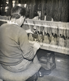
Album - Holroyd Photo Album, 1960s-1970s
... They were developed in his own private dark room and kept at his home for private viewing. Upon his death, the album went to his daughter, Judie Holroyd, who has donated them to the National Wool Museum....They were developed in his own private dark room and kept at his home for private viewing. Upon his death, the album went to his daughter, Judie Holroyd, who has donated them to the National Wool Museum. woolen mill wool production loom Numbers A collection of 38 black and white images, each individually mounted on cardboard backing, showing scenes of various stages of fabric production at the Returned Sailors and Soldiers Mill in Newtown. ...Images were taken by a staff member of the Returned Sailors and Soldiers Mill in Newtown, a MR. Norm Holroyd. The photos were taken between the 1960s-1970s. They were developed in his own private dark room and kept at his home for private viewing. Upon his death, the album went to his daughter, Judie Holroyd, who has donated them to the National Wool Museum.A collection of 38 black and white images, each individually mounted on cardboard backing, showing scenes of various stages of fabric production at the Returned Sailors and Soldiers Mill in Newtown. Each individual image page has 4 holes on the left side so it can be stored in a folder. Folder is not included in the donation.Numberswoolen mill wool production loom -
 Eltham District Historical Society Inc
Negative - Photograph, Henley Bridge, c.1928
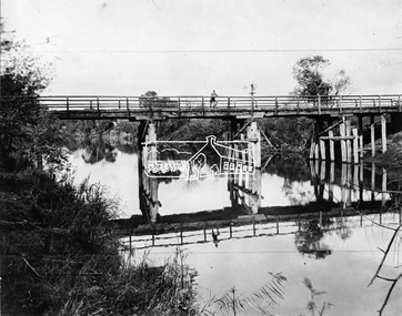
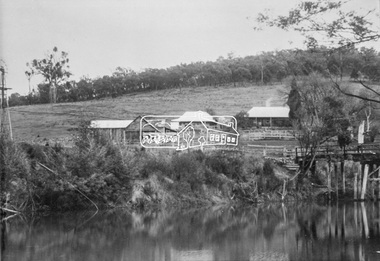
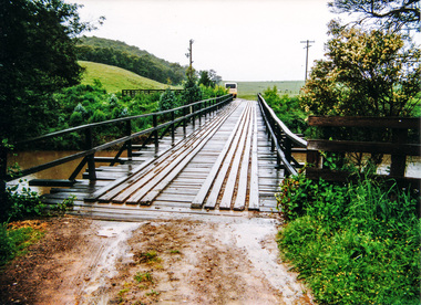
... In earlier days, when the McPhersons owned the property, their children used a punt to cross the river to attend Yering Primary School. This private bridge is best viewed from the end of Wendy Way. - Source: Christmas Hills Past and Present, Yarra Glen & District Historical Society, 2004....In earlier days, when the McPhersons owned the property, their children used a punt to cross the river to attend Yering Primary School. This private bridge is best viewed from the end of Wendy Way. - Source: Christmas Hills Past and Present, Yarra Glen & District Historical Society, 2004. ...Situated on the Yarra River, 5.5 kms south of Christmas Hills on private property. This timber trestle bridge is said to have been built some time after 1907 by Melbourne master-builder, David Mitchell (the father of Dame Nellie Melba), to connect his two "Henley Farm" properties with Lilydale. In earlier days, when the McPhersons owned the property, their children used a punt to cross the river to attend Yering Primary School. This private bridge is best viewed from the end of Wendy Way. - Source: Christmas Hills Past and Present, Yarra Glen & District Historical Society, 2004.This photo forms part of a collection of photographs gathered by the Shire of Eltham for their centenary project book,"Pioneers and Painters: 100 years of the Shire of Eltham" by Alan Marshall (1971). The collection of over 500 images is held in partnership between Eltham District Historical Society and Yarra Plenty Regional Library (Eltham Library) and is now formally known as the 'The Shire of Eltham Pioneers Photograph Collection.' It is significant in being the first community sourced collection representing the places and people of the Shire's first one hundred years.Digital image 4 x 5 inch black and white negative 9 x 12.5 cm printshire of eltham pioneers photograph collection, warrandyte, henley bridge, reflection -
 Eltham District Historical Society Inc
Photograph, Henley Bridge, c.1928
... In earlier days, when the McPhersons owned the property, their children used a punt to cross the river to attend Yering Primary School. This private bridge is best viewed from the end of Wendy Way. - Source: Christmas Hills Past and Present, Yarra Glen & District Historical Society, 2004....In earlier days, when the McPhersons owned the property, their children used a punt to cross the river to attend Yering Primary School. This private bridge is best viewed from the end of Wendy Way. - Source: Christmas Hills Past and Present, Yarra Glen & District Historical Society, 2004. ...Situated on the Yarra River, 5.5 kms south of Christmas Hills on private property. This timber trestle bridge is said to have been built some time after 1907 by Melbourne master-builder, David Mitchell (the father of Dame Nellie Melba), to connect his two "Henley Farm" properties with Lilydale. In earlier days, when the McPhersons owned the property, their children used a punt to cross the river to attend Yering Primary School. This private bridge is best viewed from the end of Wendy Way. - Source: Christmas Hills Past and Present, Yarra Glen & District Historical Society, 2004.This photo forms part of a collection of photographs gathered by the Shire of Eltham for their centenary project book,"Pioneers and Painters: 100 years of the Shire of Eltham" by Alan Marshall (1971). The collection of over 500 images is held in partnership between Eltham District Historical Society and Yarra Plenty Regional Library (Eltham Library) and is now formally known as the 'The Shire of Eltham Pioneers Photograph Collection.' It is significant in being the first community sourced collection representing the places and people of the Shire's first one hundred years.9 x 12.5 cm printshire of eltham pioneers photograph collection, warrandyte, henley bridge -
 Bendigo Historical Society Inc.
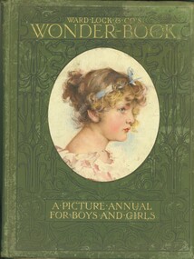
Book - WARD LOCK & CO'S WONDER BOOK, 1906
... Inscription inside front cover reads, Xmas examination 1906 prize awarded to Miss Ralla Mitchell for dux of third class 1st in arithmetic, reading, grammar, geography & spelling U V.Obrien Principal ''Vinery'' Myers St & View St private schools....Inscription inside front cover reads, Xmas examination 1906 prize awarded to Miss Ralla Mitchell for dux of third class 1st in arithmetic, reading, grammar, geography & spelling U V.Obrien Principal ''Vinery'' Myers St & View St private schools. Book WARD LOCK & CO'S WONDER BOOK ...Hard cover picture annual for boys and girls published by Ward Lock & Co Ltd London New York and Melbourne, edited by Harry Golding. A book of childrens stories with green cover showing a portrait of a young girl, title in gold lettering surrounded with black decorative design, contains black and white plus some colour illustrations. Inscription inside front cover reads, Xmas examination 1906 prize awarded to Miss Ralla Mitchell for dux of third class 1st in arithmetic, reading, grammar, geography & spelling U V.Obrien Principal ''Vinery'' Myers St & View St private schools.books, children's, picture annual -
 Eltham District Historical Society Inc
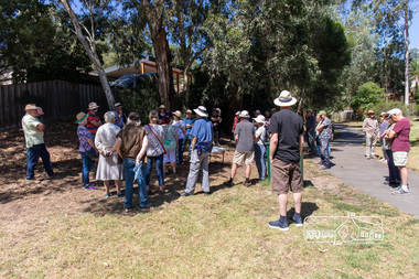
Photograph, Peter Pidgeon, Heritage Excursion: Woodridge Wander, 6 March 2021
... Permission to visit the external grounds of two private properties to view heritage listed houses not visible from the street was granted. ...Permission to visit the external grounds of two private properties to view heritage listed houses not visible from the street was granted. ...The Woodridge Estate was a major residential subdivision that was developed in many stages in the 1970s and 80s. It extended easterly from the older residential area of Eltham into what had previously been largely privately owned bushland. The subdivision design took into account the steep topography and resulted in large blocks that enabled preservation of much of the tree cover. It included a number of small parks and walkways and the one kilometre long Woodridge Linear Park. A bushland area left as a proposed school site later became the Pauline Toner Butterfly Reserve for preservation of the rare Eltham Copper Butterfly. This walk explores some Woodridge streets as well as the linear park and butterfly reserve, a hilly walk of about 3 km and includes some moderately rough tracks. Permission to visit the external grounds of two private properties to view heritage listed houses not visible from the street was granted. The walk commenced at 2pm at the access to Woodridge Linear Park in Grove Street just east of the Eltham East Primary School (Melway ref 22 B4). This free walk was open to the general public as well as Society members. Whilst COVID restrictions did not require the wearing of masks in the open, masks had to be carried and all attendees registered with name and contct number.Born Digital (41 images)covid-19, eltham, eltham district historical society, heritage excursion, woodridge estate -
Bendigo Historical Society Inc.
Document - Fortuna Article - Auction Notice, Mon to Sat 18-23 June 1934
... viewed at 'Fortuna' and later auctioned in Melbourne Town Hall (August 20–21, 1934). Highest bidder wins; disputes resolved by re-auctioning the lot.Immediate part payment required (five shillings per pound or more), with forfeiture and resale if terms are not met. All items sold 'as is', with no warranties on authenticity or condition; risk passes to buyer at the fall of the hammer. No removal of lots during the sale; all items must be paid for and collected by a set deadline. Private...viewed at 'Fortuna' and later auctioned in Melbourne Town Hall (August 20–21, 1934). Highest bidder wins; disputes resolved by re-auctioning the lot.Immediate part payment required (five shillings per pound or more), with forfeiture and resale if terms are not met. All items sold 'as is', with no warranties on authenticity or condition; risk passes to buyer at the fall of the hammer. No removal of lots during the sale; all items must be paid for and collected by a set deadline. Private ...This document is an auction catalog detailing the sale of the 'Fortuna' mansion and its contents, including terms, schedule, and highlights: The auction is for the estate of George and Edith Lansell, including the 'Fortuna' mansion in Bendigo, Victoria, and its extensive contents. The mansion features 8 reception rooms, a ballroom, multiple bedrooms and bathrooms, gymnasium, staff quarters, conservatories, swimming pool, and extensive grounds (18 acres). The property is described as suitable for a large institution and in excellent repair. The sale is spread over six days (June 18–23, 1934), with each day dedicated to specific rooms or types of items (e.g., statuary, furniture, bedrooms, ballroom, art). Special lots include valuable furniture, art, statuary, and unique items such as a Louis Quatorze writing table, Carrara marble statue, and a large bronze incense burner. Oil paintings and watercolours will be viewed at 'Fortuna' and later auctioned in Melbourne Town Hall (August 20–21, 1934). Highest bidder wins; disputes resolved by re-auctioning the lot.Immediate part payment required (five shillings per pound or more), with forfeiture and resale if terms are not met. All items sold 'as is', with no warranties on authenticity or condition; risk passes to buyer at the fall of the hammer. No removal of lots during the sale; all items must be paid for and collected by a set deadline. Private and public viewing days are scheduled before the auction, with admittance by special card or catalogue. Special motor transport is arranged from Melbourne to Bendigo for prospective buyers. The auction is conducted by K. Gardner & Lang Pty. Ltd., Leonard Joel Pty. Ltd., and J. H. Curnow & Son, in conjunction. Catalogues are required for entry and are available for purchase. All items are the property of the Lansell Estates.Fortuna Article - Auction Notice This item contains the following document: 11217.63a Twelve pages listing contents of the Fortuna Villa that are to be auctioned non-fictionbendigo, fortuna, george lansell, edith lansell -
 Eltham District Historical Society Inc
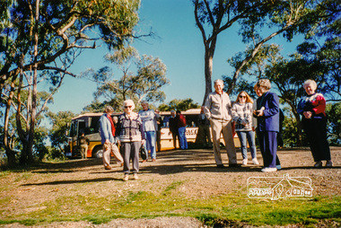
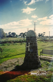
Photograph, Hume and Hovell Monument, Broadford, Autumn Excursion, Hume and Hovell's 1824 expedition, 26 May 1996, 26/05/1996
... We enjoyed a private tour, panoramic views over Melbourne and surroundings and the excitement of arriving and departing aircraft. ...We enjoyed a private tour, panoramic views over Melbourne and surroundings and the excitement of arriving and departing aircraft. ...[article by Bettina Woodburn in EDHS Newsletter No. 109, July 1996:] ON THE TRAIL OF HUME AND HOVELL - REPORT ON THE AUTUMN EXCURSION - On a green and fresh morning (Sunday 26th May 1996) the Cobb and Co coach (driven by the most obliging Peter Tampion) set off in a north easterly direction from Eltham to connect with Hume and Hovell's route on their 1824 explorations of central Victoria. The Society would follow a series of monuments erected for the 1924 centenary of the expedition from King Parrot Creek (Tuesday 7th December 1824), through Strath Creek, over Sunday Creek (Sunday 12th December 1824) at Broadford, Tullamarine, St Albans, Deer Park, through Werribee, skirting east of the You Yangs to Lara and Avalon Beach. Because their distance-measuring wheel had broken and a one degree mistake was made in calculations, the two leaders of the original group of six convict-companions arrived at Corio Bay, instead of the expected Western Port, discovered earlier by Flinders. From below Mt. Disappointment (Hume and Hovell's difficulties in "scrambling over brush and rock", "leeches in forest, as well as no water", "cutting grass 4-5 ft. high", dreadful scrub", "devil flies") we took an easier route, saw the Strath Creek memorial in ground fog and a wonderful "field of dreams", the Hume-Hovell privately owned cricket ground with its white picket boundary fence. Now, after a steep climb, in sunshine under gums we stretched and viewed magnificent rolling hills and fog-filled valleys - not "smoke from Aborigines' bush fires". After morning tea at Broadford we followed the Sunday Creek valley beside the Hume Freeway, passed the Wallan Wallan Rest Area (more appropriately Hume and Hovell Rest Area) to tum right at Beveridge. In Gellibrand Hill Park, near the headwaters of the Moonee Ponds Creek, we experienced the landscape the first European settlers saw - huge river red gums and rolling pastures. The gardens and sheltered courtyard of the 1840s, timber, brought from .....[?] prefabricated Woodlands Homestead, provided a pleasant lunch stop. We enjoyed a private tour, panoramic views over Melbourne and surroundings and the excitement of arriving and departing aircraft. Our next river crossing was at Werribee, "in a vast treeless plain", then we drove on by-ways no coach had previously travelled, to find "an immense sheet of water" salty Corio Bay, off-course to the west. In late afternoon of a super, calm, late autumn day we headed homewards. Back at Eltham we were rather surprised to find that we had travelled a total of 347 km. Thanks again to Russell Yeoman for his research and organization. What a wonderful day! Colour photographactivities, broadford, hume and hovell, monument -
 Eltham District Historical Society Inc
Photograph, Strath Creek, Autumn Excursion, Hume and Hovell's 1824 expedition, 26 May 1996, 26/05/1996
... We enjoyed a private tour, panoramic views over Melbourne and surroundings and the excitement of arriving and departing aircraft. ...We enjoyed a private tour, panoramic views over Melbourne and surroundings and the excitement of arriving and departing aircraft. ...[article by Bettina Woodburn in EDHS Newsletter No. 109, July 1996:] ON THE TRAIL OF HUME AND HOVELL - REPORT ON THE AUTUMN EXCURSION - On a green and fresh morning (Sunday 26th May 1996) the Cobb and Co coach (driven by the most obliging Peter Tampion) set off in a north easterly direction from Eltham to connect with Hume and Hovell's route on their 1824 explorations of central Victoria. The Society would follow a series of monuments erected for the 1924 centenary of the expedition from King Parrot Creek (Tuesday 7th December 1824), through Strath Creek, over Sunday Creek (Sunday 12th December 1824) at Broadford, Tullamarine, St Albans, Deer Park, through Werribee, skirting east of the You Yangs to Lara and Avalon Beach. Because their distance-measuring wheel had broken and a one degree mistake was made in calculations, the two leaders of the original group of six convict-companions arrived at Corio Bay, instead of the expected Western Port, discovered earlier by Flinders. From below Mt. Disappointment (Hume and Hovell's difficulties in "scrambling over brush and rock", "leeches in forest, as well as no water", "cutting grass 4-5 ft. high", dreadful scrub", "devil flies") we took an easier route, saw the Strath Creek memorial in ground fog and a wonderful "field of dreams", the Hume-Hovell privately owned cricket ground with its white picket boundary fence. Now, after a steep climb, in sunshine under gums we stretched and viewed magnificent rolling hills and fog-filled valleys - not "smoke from Aborigines' bush fires". After morning tea at Broadford we followed the Sunday Creek valley beside the Hume Freeway, passed the Wallan Wallan Rest Area (more appropriately Hume and Hovell Rest Area) to tum right at Beveridge. In Gellibrand Hill Park, near the headwaters of the Moonee Ponds Creek, we experienced the landscape the first European settlers saw - huge river red gums and rolling pastures. The gardens and sheltered courtyard of the 1840s, timber, brought from .....[?] prefabricated Woodlands Homestead, provided a pleasant lunch stop. We enjoyed a private tour, panoramic views over Melbourne and surroundings and the excitement of arriving and departing aircraft. Our next river crossing was at Werribee, "in a vast treeless plain", then we drove on by-ways no coach had previously travelled, to find "an immense sheet of water" salty Corio Bay, off-course to the west. In late afternoon of a super, calm, late autumn day we headed homewards. Back at Eltham we were rather surprised to find that we had travelled a total of 347 km. Thanks again to Russell Yeoman for his research and organization. What a wonderful day! Colour photographactivities, monument, hume and hovell, murchison valley, strath creek -
 Eltham District Historical Society Inc
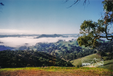
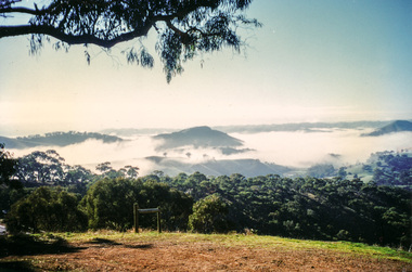
Photograph, Murchison Gap viewed from Strath Creek, Autumn Excursion, Hume and Hovell's 1824 expedition, 26 May 1996, 26/05/1996
... We enjoyed a private tour, panoramic views over Melbourne and surroundings and the excitement of arriving and departing aircraft. ...We enjoyed a private tour, panoramic views over Melbourne and surroundings and the excitement of arriving and departing aircraft. ...[article by Bettina Woodburn in EDHS Newsletter No. 109, July 1996:] ON THE TRAIL OF HUME AND HOVELL - REPORT ON THE AUTUMN EXCURSION - On a green and fresh morning (Sunday 26th May 1996) the Cobb and Co coach (driven by the most obliging Peter Tampion) set off in a north easterly direction from Eltham to connect with Hume and Hovell's route on their 1824 explorations of central Victoria. The Society would follow a series of monuments erected for the 1924 centenary of the expedition from King Parrot Creek (Tuesday 7th December 1824), through Strath Creek, over Sunday Creek (Sunday 12th December 1824) at Broadford, Tullamarine, St Albans, Deer Park, through Werribee, skirting east of the You Yangs to Lara and Avalon Beach. Because their distance-measuring wheel had broken and a one degree mistake was made in calculations, the two leaders of the original group of six convict-companions arrived at Corio Bay, instead of the expected Western Port, discovered earlier by Flinders. From below Mt. Disappointment (Hume and Hovell's difficulties in "scrambling over brush and rock", "leeches in forest, as well as no water", "cutting grass 4-5 ft. high", dreadful scrub", "devil flies") we took an easier route, saw the Strath Creek memorial in ground fog and a wonderful "field of dreams", the Hume-Hovell privately owned cricket ground with its white picket boundary fence. Now, after a steep climb, in sunshine under gums we stretched and viewed magnificent rolling hills and fog-filled valleys - not "smoke from Aborigines' bush fires". After morning tea at Broadford we followed the Sunday Creek valley beside the Hume Freeway, passed the Wallan Wallan Rest Area (more appropriately Hume and Hovell Rest Area) to tum right at Beveridge. In Gellibrand Hill Park, near the headwaters of the Moonee Ponds Creek, we experienced the landscape the first European settlers saw - huge river red gums and rolling pastures. The gardens and sheltered courtyard of the 1840s, timber, brought from .....[?] prefabricated Woodlands Homestead, provided a pleasant lunch stop. We enjoyed a private tour, panoramic views over Melbourne and surroundings and the excitement of arriving and departing aircraft. Our next river crossing was at Werribee, "in a vast treeless plain", then we drove on by-ways no coach had previously travelled, to find "an immense sheet of water" salty Corio Bay, off-course to the west. In late afternoon of a super, calm, late autumn day we headed homewards. Back at Eltham we were rather surprised to find that we had travelled a total of 347 km. Thanks again to Russell Yeoman for his research and organization. What a wonderful day! Colour photographactivities, hume and hovell, murchison valley, murchison gap, strath creek -
 Eltham District Historical Society Inc
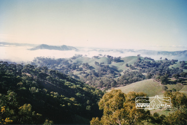
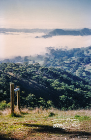
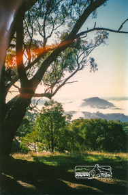
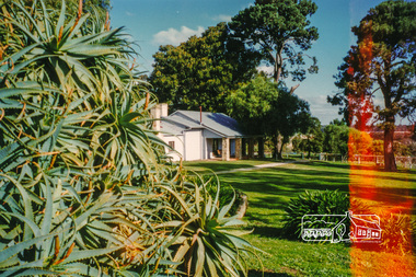
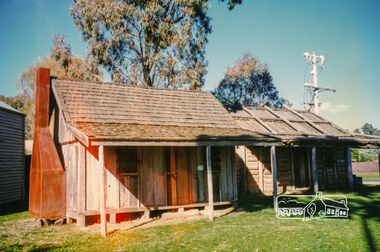
Photograph, Autumn Excursion, Hume and Hovell's 1824 expedition, 26 May 1996, 26/05/1996
... We enjoyed a private tour, panoramic views over Melbourne and surroundings and the excitement of arriving and departing aircraft. ...We enjoyed a private tour, panoramic views over Melbourne and surroundings and the excitement of arriving and departing aircraft. ...[article by Bettina Woodburn in EDHS Newsletter No. 109, July 1996:] ON THE TRAIL OF HUME AND HOVELL - REPORT ON THE AUTUMN EXCURSION - On a green and fresh morning (Sunday 26th May 1996) the Cobb and Co coach (driven by the most obliging Peter Tampion) set off in a north easterly direction from Eltham to connect with Hume and Hovell's route on their 1824 explorations of central Victoria. The Society would follow a series of monuments erected for the 1924 centenary of the expedition from King Parrot Creek (Tuesday 7th December 1824), through Strath Creek, over Sunday Creek (Sunday 12th December 1824) at Broadford, Tullamarine, St Albans, Deer Park, through Werribee, skirting east of the You Yangs to Lara and Avalon Beach. Because their distance-measuring wheel had broken and a one degree mistake was made in calculations, the two leaders of the original group of six convict-companions arrived at Corio Bay, instead of the expected Western Port, discovered earlier by Flinders. From below Mt. Disappointment (Hume and Hovell's difficulties in "scrambling over brush and rock", "leeches in forest, as well as no water", "cutting grass 4-5 ft. high", dreadful scrub", "devil flies") we took an easier route, saw the Strath Creek memorial in ground fog and a wonderful "field of dreams", the Hume-Hovell privately owned cricket ground with its white picket boundary fence. Now, after a steep climb, in sunshine under gums we stretched and viewed magnificent rolling hills and fog-filled valleys - not "smoke from Aborigines' bush fires". After morning tea at Broadford we followed the Sunday Creek valley beside the Hume Freeway, passed the Wallan Wallan Rest Area (more appropriately Hume and Hovell Rest Area) to tum right at Beveridge. In Gellibrand Hill Park, near the headwaters of the Moonee Ponds Creek, we experienced the landscape the first European settlers saw - huge river red gums and rolling pastures. The gardens and sheltered courtyard of the 1840s, timber, brought from .....[?] prefabricated Woodlands Homestead, provided a pleasant lunch stop. We enjoyed a private tour, panoramic views over Melbourne and surroundings and the excitement of arriving and departing aircraft. Our next river crossing was at Werribee, "in a vast treeless plain", then we drove on by-ways no coach had previously travelled, to find "an immense sheet of water" salty Corio Bay, off-course to the west. In late afternoon of a super, calm, late autumn day we headed homewards. Back at Eltham we were rather surprised to find that we had travelled a total of 347 km. Thanks again to Russell Yeoman for his research and organization. What a wonderful day! Colour photographactivities, hume and hovell -
 Eltham District Historical Society Inc
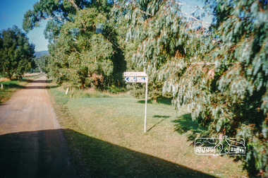
Photograph, Sign to Hume and Hovell Cricket Ground, at Allandale Road, Strath Creek, Autumn Excursion, Hume and Hovell's 1824 expedition, 26 May 1996, 26/05/1996
... We enjoyed a private tour, panoramic views over Melbourne and surroundings and the excitement of arriving and departing aircraft. ...We enjoyed a private tour, panoramic views over Melbourne and surroundings and the excitement of arriving and departing aircraft. ...[article by Bettina Woodburn in EDHS Newsletter No. 109, July 1996:] ON THE TRAIL OF HUME AND HOVELL - REPORT ON THE AUTUMN EXCURSION - On a green and fresh morning (Sunday 26th May 1996) the Cobb and Co coach (driven by the most obliging Peter Tampion) set off in a north easterly direction from Eltham to connect with Hume and Hovell's route on their 1824 explorations of central Victoria. The Society would follow a series of monuments erected for the 1924 centenary of the expedition from King Parrot Creek (Tuesday 7th December 1824), through Strath Creek, over Sunday Creek (Sunday 12th December 1824) at Broadford, Tullamarine, St Albans, Deer Park, through Werribee, skirting east of the You Yangs to Lara and Avalon Beach. Because their distance-measuring wheel had broken and a one degree mistake was made in calculations, the two leaders of the original group of six convict-companions arrived at Corio Bay, instead of the expected Western Port, discovered earlier by Flinders. From below Mt. Disappointment (Hume and Hovell's difficulties in "scrambling over brush and rock", "leeches in forest, as well as no water", "cutting grass 4-5 ft. high", dreadful scrub", "devil flies") we took an easier route, saw the Strath Creek memorial in ground fog and a wonderful "field of dreams", the Hume-Hovell privately owned cricket ground with its white picket boundary fence. Now, after a steep climb, in sunshine under gums we stretched and viewed magnificent rolling hills and fog-filled valleys - not "smoke from Aborigines' bush fires". After morning tea at Broadford we followed the Sunday Creek valley beside the Hume Freeway, passed the Wallan Wallan Rest Area (more appropriately Hume and Hovell Rest Area) to tum right at Beveridge. In Gellibrand Hill Park, near the headwaters of the Moonee Ponds Creek, we experienced the landscape the first European settlers saw - huge river red gums and rolling pastures. The gardens and sheltered courtyard of the 1840s, timber, brought from .....[?] prefabricated Woodlands Homestead, provided a pleasant lunch stop. We enjoyed a private tour, panoramic views over Melbourne and surroundings and the excitement of arriving and departing aircraft. Our next river crossing was at Werribee, "in a vast treeless plain", then we drove on by-ways no coach had previously travelled, to find "an immense sheet of water" salty Corio Bay, off-course to the west. In late afternoon of a super, calm, late autumn day we headed homewards. Back at Eltham we were rather surprised to find that we had travelled a total of 347 km. Thanks again to Russell Yeoman for his research and organization. What a wonderful day! Colour photographactivities, hume and hovell, allandale road, strath creek -
 Eltham District Historical Society Inc
Photograph, Autumn Excursion, Hume and Hovell's 1824 expedition, 26 May 1996, 26/05/1996
... We enjoyed a private tour, panoramic views over Melbourne and surroundings and the excitement of arriving and departing aircraft. ...We enjoyed a private tour, panoramic views over Melbourne and surroundings and the excitement of arriving and departing aircraft. ...[article by Bettina Woodburn in EDHS Newsletter No. 109, July 1996:] ON THE TRAIL OF HUME AND HOVELL - REPORT ON THE AUTUMN EXCURSION - On a green and fresh morning (Sunday 26th May 1996) the Cobb and Co coach (driven by the most obliging Peter Tampion) set off in a north easterly direction from Eltham to connect with Hume and Hovell's route on their 1824 explorations of central Victoria. The Society would follow a series of monuments erected for the 1924 centenary of the expedition from King Parrot Creek (Tuesday 7th December 1824), through Strath Creek, over Sunday Creek (Sunday 12th December 1824) at Broadford, Tullamarine, St Albans, Deer Park, through Werribee, skirting east of the You Yangs to Lara and Avalon Beach. Because their distance-measuring wheel had broken and a one degree mistake was made in calculations, the two leaders of the original group of six convict-companions arrived at Corio Bay, instead of the expected Western Port, discovered earlier by Flinders. From below Mt. Disappointment (Hume and Hovell's difficulties in "scrambling over brush and rock", "leeches in forest, as well as no water", "cutting grass 4-5 ft. high", dreadful scrub", "devil flies") we took an easier route, saw the Strath Creek memorial in ground fog and a wonderful "field of dreams", the Hume-Hovell privately owned cricket ground with its white picket boundary fence. Now, after a steep climb, in sunshine under gums we stretched and viewed magnificent rolling hills and fog-filled valleys - not "smoke from Aborigines' bush fires". After morning tea at Broadford we followed the Sunday Creek valley beside the Hume Freeway, passed the Wallan Wallan Rest Area (more appropriately Hume and Hovell Rest Area) to tum right at Beveridge. In Gellibrand Hill Park, near the headwaters of the Moonee Ponds Creek, we experienced the landscape the first European settlers saw - huge river red gums and rolling pastures. The gardens and sheltered courtyard of the 1840s, timber, brought from .....[?] prefabricated Woodlands Homestead, provided a pleasant lunch stop. We enjoyed a private tour, panoramic views over Melbourne and surroundings and the excitement of arriving and departing aircraft. Our next river crossing was at Werribee, "in a vast treeless plain", then we drove on by-ways no coach had previously travelled, to find "an immense sheet of water" salty Corio Bay, off-course to the west. In late afternoon of a super, calm, late autumn day we headed homewards. Back at Eltham we were rather surprised to find that we had travelled a total of 347 km. Thanks again to Russell Yeoman for his research and organization. What a wonderful day! Colour photographactivities, hume and hovell -
 Eltham District Historical Society Inc
Photograph, Murchison Gap, Autumn Excursion, Hume and Hovell's 1824 expedition, 26 May 1996, 26/05/1996
... We enjoyed a private tour, panoramic views over Melbourne and surroundings and the excitement of arriving and departing aircraft. ...We enjoyed a private tour, panoramic views over Melbourne and surroundings and the excitement of arriving and departing aircraft. ...[article by Bettina Woodburn in EDHS Newsletter No. 109, July 1996:] ON THE TRAIL OF HUME AND HOVELL - REPORT ON THE AUTUMN EXCURSION - On a green and fresh morning (Sunday 26th May 1996) the Cobb and Co coach (driven by the most obliging Peter Tampion) set off in a north easterly direction from Eltham to connect with Hume and Hovell's route on their 1824 explorations of central Victoria. The Society would follow a series of monuments erected for the 1924 centenary of the expedition from King Parrot Creek (Tuesday 7th December 1824), through Strath Creek, over Sunday Creek (Sunday 12th December 1824) at Broadford, Tullamarine, St Albans, Deer Park, through Werribee, skirting east of the You Yangs to Lara and Avalon Beach. Because their distance-measuring wheel had broken and a one degree mistake was made in calculations, the two leaders of the original group of six convict-companions arrived at Corio Bay, instead of the expected Western Port, discovered earlier by Flinders. From below Mt. Disappointment (Hume and Hovell's difficulties in "scrambling over brush and rock", "leeches in forest, as well as no water", "cutting grass 4-5 ft. high", dreadful scrub", "devil flies") we took an easier route, saw the Strath Creek memorial in ground fog and a wonderful "field of dreams", the Hume-Hovell privately owned cricket ground with its white picket boundary fence. Now, after a steep climb, in sunshine under gums we stretched and viewed magnificent rolling hills and fog-filled valleys - not "smoke from Aborigines' bush fires". After morning tea at Broadford we followed the Sunday Creek valley beside the Hume Freeway, passed the Wallan Wallan Rest Area (more appropriately Hume and Hovell Rest Area) to tum right at Beveridge. In Gellibrand Hill Park, near the headwaters of the Moonee Ponds Creek, we experienced the landscape the first European settlers saw - huge river red gums and rolling pastures. The gardens and sheltered courtyard of the 1840s, timber, brought from .....[?] prefabricated Woodlands Homestead, provided a pleasant lunch stop. We enjoyed a private tour, panoramic views over Melbourne and surroundings and the excitement of arriving and departing aircraft. Our next river crossing was at Werribee, "in a vast treeless plain", then we drove on by-ways no coach had previously travelled, to find "an immense sheet of water" salty Corio Bay, off-course to the west. In late afternoon of a super, calm, late autumn day we headed homewards. Back at Eltham we were rather surprised to find that we had travelled a total of 347 km. Thanks again to Russell Yeoman for his research and organization. What a wonderful day! Three colour photographsactivities, murchison gap, murchison valley -
 Eltham District Historical Society Inc
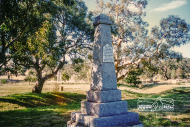
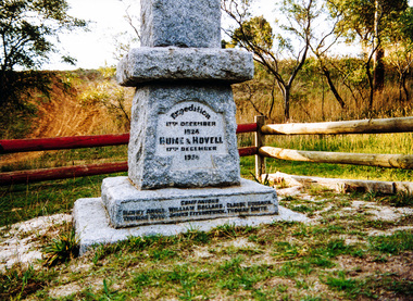
Photograph, Hume and Hovell Monument, Broadford, Autumn Excursion, Hume and Hovell's 1824 expedition, 26 May 1996, 26/05/1996
... We enjoyed a private tour, panoramic views over Melbourne and surroundings and the excitement of arriving and departing aircraft. ...We enjoyed a private tour, panoramic views over Melbourne and surroundings and the excitement of arriving and departing aircraft. ...[article by Bettina Woodburn in EDHS Newsletter No. 109, July 1996:] ON THE TRAIL OF HUME AND HOVELL - REPORT ON THE AUTUMN EXCURSION - On a green and fresh morning (Sunday 26th May 1996) the Cobb and Co coach (driven by the most obliging Peter Tampion) set off in a north easterly direction from Eltham to connect with Hume and Hovell's route on their 1824 explorations of central Victoria. The Society would follow a series of monuments erected for the 1924 centenary of the expedition from King Parrot Creek (Tuesday 7th December 1824), through Strath Creek, over Sunday Creek (Sunday 12th December 1824) at Broadford, Tullamarine, St Albans, Deer Park, through Werribee, skirting east of the You Yangs to Lara and Avalon Beach. Because their distance-measuring wheel had broken and a one degree mistake was made in calculations, the two leaders of the original group of six convict-companions arrived at Corio Bay, instead of the expected Western Port, discovered earlier by Flinders. From below Mt. Disappointment (Hume and Hovell's difficulties in "scrambling over brush and rock", "leeches in forest, as well as no water", "cutting grass 4-5 ft. high", dreadful scrub", "devil flies") we took an easier route, saw the Strath Creek memorial in ground fog and a wonderful "field of dreams", the Hume-Hovell privately owned cricket ground with its white picket boundary fence. Now, after a steep climb, in sunshine under gums we stretched and viewed magnificent rolling hills and fog-filled valleys - not "smoke from Aborigines' bush fires". After morning tea at Broadford we followed the Sunday Creek valley beside the Hume Freeway, passed the Wallan Wallan Rest Area (more appropriately Hume and Hovell Rest Area) to tum right at Beveridge. In Gellibrand Hill Park, near the headwaters of the Moonee Ponds Creek, we experienced the landscape the first European settlers saw - huge river red gums and rolling pastures. The gardens and sheltered courtyard of the 1840s, timber, brought from .....[?] prefabricated Woodlands Homestead, provided a pleasant lunch stop. We enjoyed a private tour, panoramic views over Melbourne and surroundings and the excitement of arriving and departing aircraft. Our next river crossing was at Werribee, "in a vast treeless plain", then we drove on by-ways no coach had previously travelled, to find "an immense sheet of water" salty Corio Bay, off-course to the west. In late afternoon of a super, calm, late autumn day we headed homewards. Back at Eltham we were rather surprised to find that we had travelled a total of 347 km. Thanks again to Russell Yeoman for his research and organization. What a wonderful day! Colour photographactivities, broadford, hume and hovell, monument -
 Eltham District Historical Society Inc
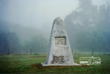
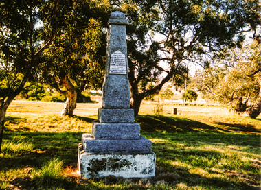
Photograph, Hume and Hovell Monument, Autumn Excursion, Hume and Hovell's 1824 expedition, 26 May 1996, 26/05/1996
... We enjoyed a private tour, panoramic views over Melbourne and surroundings and the excitement of arriving and departing aircraft. ...We enjoyed a private tour, panoramic views over Melbourne and surroundings and the excitement of arriving and departing aircraft. ...[article by Bettina Woodburn in EDHS Newsletter No. 109, July 1996:] ON THE TRAIL OF HUME AND HOVELL - REPORT ON THE AUTUMN EXCURSION - On a green and fresh morning (Sunday 26th May 1996) the Cobb and Co coach (driven by the most obliging Peter Tampion) set off in a north easterly direction from Eltham to connect with Hume and Hovell's route on their 1824 explorations of central Victoria. The Society would follow a series of monuments erected for the 1924 centenary of the expedition from King Parrot Creek (Tuesday 7th December 1824), through Strath Creek, over Sunday Creek (Sunday 12th December 1824) at Broadford, Tullamarine, St Albans, Deer Park, through Werribee, skirting east of the You Yangs to Lara and Avalon Beach. Because their distance-measuring wheel had broken and a one degree mistake was made in calculations, the two leaders of the original group of six convict-companions arrived at Corio Bay, instead of the expected Western Port, discovered earlier by Flinders. From below Mt. Disappointment (Hume and Hovell's difficulties in "scrambling over brush and rock", "leeches in forest, as well as no water", "cutting grass 4-5 ft. high", dreadful scrub", "devil flies") we took an easier route, saw the Strath Creek memorial in ground fog and a wonderful "field of dreams", the Hume-Hovell privately owned cricket ground with its white picket boundary fence. Now, after a steep climb, in sunshine under gums we stretched and viewed magnificent rolling hills and fog-filled valleys - not "smoke from Aborigines' bush fires". After morning tea at Broadford we followed the Sunday Creek valley beside the Hume Freeway, passed the Wallan Wallan Rest Area (more appropriately Hume and Hovell Rest Area) to tum right at Beveridge. In Gellibrand Hill Park, near the headwaters of the Moonee Ponds Creek, we experienced the landscape the first European settlers saw - huge river red gums and rolling pastures. The gardens and sheltered courtyard of the 1840s, timber, brought from .....[?] prefabricated Woodlands Homestead, provided a pleasant lunch stop. We enjoyed a private tour, panoramic views over Melbourne and surroundings and the excitement of arriving and departing aircraft. Our next river crossing was at Werribee, "in a vast treeless plain", then we drove on by-ways no coach had previously travelled, to find "an immense sheet of water" salty Corio Bay, off-course to the west. In late afternoon of a super, calm, late autumn day we headed homewards. Back at Eltham we were rather surprised to find that we had travelled a total of 347 km. Thanks again to Russell Yeoman for his research and organization. What a wonderful day! Two colour photographsactivities, hume and hovell, monument -
 Eltham District Historical Society Inc
Photograph, Henley Bridge, Spring Excursion, Exploring the Upper Yarra, 22 October 1995, 22/10/1995
... In earlier days, when the McPhersons owned the property, their children used a punt to cross the river to attend Yering Primary School. This private bridge is best viewed from the end of Wendy Way. - Source: Christmas Hills Past and Present, Yarra Glen & District Historical Society, 2004....In earlier days, when the McPhersons owned the property, their children used a punt to cross the river to attend Yering Primary School. This private bridge is best viewed from the end of Wendy Way. - Source: Christmas Hills Past and Present, Yarra Glen & District Historical Society, 2004. activities henley bridge upper yarra Two colour photographs Henley Bridge, Spring Excursion, Exploring the Upper Yarra, 22 October 1995 Photograph Photograph ...[article by Bettina Woodburn in EDHS Newsletter No. 105, November 1995:] EXPLORING THE UPPER YARRA - We enjoyed the Spring Excursion, this year "Exploring the Upper Yarra" - in spite of the constant rain and the countryside under the cloud cover, especially in the valleys, being mainly shiny shades of green. The occasional fields of buttercups, clumps of arum lilies and splendid rhododendron and other flowering bushes became very special. The Cobb and Co coach was warm and a cosy retreat as we zig-zagged on the highways and byways to glimpse the Yarra River, upstream and down, its secret places, and particularly the many bridges. Russell excelled as 'Poet Laureate', reading from Dacre Smyth's book. This 1979 publication includes paintings of all the bridges along the river with poems and brief descriptions of each one. Some of the bridges are in out-of-the-way places and are not very well known. We looked forward to hearing the poetry as much as seeing the 'constructions'… Big Pat (was he short or tall, lean or fat? - he did win the £200 reward for discovering gold and had the creek named after him), about the 'Eddies'?, and the disliked 'meccano' bridge in Warburton, etc. etc. The hot roast lunch in the old Reefton Hotel was also most welcome. It was easy to imagine it peopled by miners and early settlers. Starting by crossing the new (1974) concrete bridge at Warrandyte we headed through Wonga Park with views to the Christmas Hills and to the escarpment of the Yering Gorge, which causes flood waters to back up through the Yarra Glen plain, so avoiding disasters downstream. At the end of a long driveway we found the wooden, privately owned Henley Bridge (1935 after the 1934 floods). This facilitates access to different parts of Henley Farm and to Lilydale. Everard Park, named after Blanche Shallard's father, a State Member for 17 years, below the Highway Yarra crossing was in need of care. It is 10 miles from Yarra Glen by road but, as "Yarra Marra” canoeists well know, 32 winding miles down by water. After more delightful countryside scenes we joined the Warburton Highway at Woori Yallock. From the old Railway Station at Launching Place the Centennial Trail for walkers, cyclists and horse riders has replaced the rails. The line from Lilydale was opened in 1901, and the last diesel freight train ran to Warburton in 1965. It continued to rain as we had morning tea in Warburton in a shelter between footbridges. From here we continued upstream past the Bridge to O'Shannassy Lodge and Reservoir, Starvation Creek, and the Peninsular tunnel (miners dug it as at Pound Bend) which we visited (scrambling down those steps!) on our return after lunch. Our furthermost point was the Upper Yarra Dam Reserve (and vast catchment area). Finished in 1957 after ten years' work and 100 years after Yan Yean, it supplies much of Melbourne's water. After crossing the 30m Launching Place Bridge to the Eltham side of the Yarra and Healesville, we saw in the distance the Yarra Glen Timber Trestle Bridge over the river flats "the longest for years in the land it was said!" Harry's dream of "better weather over the Divide" unfortunately didn't come true, but I'm sure we 36 members will retain happy memories of a day that was wet and green and filled with Bridges. Situated on the Yarra River, 5.5 kms south of Christmas Hills on private property. This timber trestle bridge is said to have been built some time after 1907 by Melbourne master-builder, David Mitchell (the father of Dame Nellie Melba), to connect his two "Henley Farm" properties with Lilydale. In earlier days, when the McPhersons owned the property, their children used a punt to cross the river to attend Yering Primary School. This private bridge is best viewed from the end of Wendy Way. - Source: Christmas Hills Past and Present, Yarra Glen & District Historical Society, 2004.Two colour photographsactivities, henley bridge, upper yarra -
 Warrnambool and District Historical Society Inc.
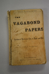
Book, The Vagabond Papers, 1877
... It is not always the view of Melbourne as a prosperous and developing city which is presented but it is experienced first hand by the author to which he also imparts social commentary on the many difficult situations. Melbourne 1877 social commentary Melbourne 1870's social life and customs Reprinted from the Argus corrected and revised by the author. Dedicated to the Conductors of the Argus in recognition of many private ...As the title states this book provides sketches of Melbourne life in light and shade. It was written in 1877 and published by George Robertson . It is one of a series and this edition covers the following: A night in the model lodging -House, A day in the Immigrants' Home, A morning at the Hospital, Three days in the Benevolent Asylum, Our Lunatic Asylums, Sixpenny restaurants and The Theatre Vestibules. Throughout all he comments on the social situations and dilemmas in which he finds himself and which others must endure.The Vagabond Papers provides a valuable record of life in Melbourne in the 1870's. It is not always the view of Melbourne as a prosperous and developing city which is presented but it is experienced first hand by the author to which he also imparts social commentary on the many difficult situations. Small faded hard covered book with black text. Contains 205 pages with advertisements on front and back covers.Reprinted from the Argus corrected and revised by the author. Dedicated to the Conductors of the Argus in recognition of many private and professional Kindnesses.melbourne 1877, social commentary melbourne 1870's, social life and customs -
 Warrnambool and District Historical Society Inc.
Plaque - Certificate, WWI, In Memoriam, BEA Henderson
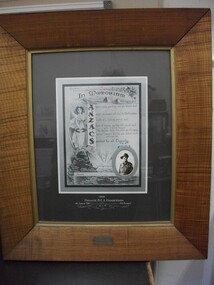
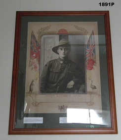
... PRIVATE B.E.A. HENDERSON/5th Pioneer Batt 5Division/A.I.F. The mass produced decorative mount has battle place names and a bird's eye view of battlefields in France. ...PRIVATE B.E.A. HENDERSON/5th Pioneer Batt 5Division/A.I.F. The mass produced decorative mount has battle place names and a bird's eye view of battlefields in France. ...Private Bertie Ernest Alfred Henderson served in the 5th Pioneer Battalion, 5th Division of the AIF. He died of wounds In France on 29/5/1918 or 1/6/1918. His burial place is Crouy British Cemetery, Crouy-sur-Somme. The framed 'In Memoriam' has been in the custody of family members until presented to W&DHS in 2013 by Mrs Beris Porter. Pte BEA Henderson, 1866, 3 Pioneer Battalion(2 Reinforcement Group) was a farmer and single. His father was Mr HH Henderson of Naringal. He enlisted on 27/5/1916 then sailed on the Themistocles on 28/7/1916 and transferred to the 5 Pioneer Battalion. His name is recorded on the War Memorial, Artillery Crescent, Warrnambool as having made the supreme sacrifice.Mass produced Memorial page with a sepia original half portrait photograph of a soldier surrounded with two mounts,narrow white and dark/grey brown, and a thin gold gilt surround next to an inward angled plain, wooden frame with clear glass. Hand white painted name, rank, number, battalion, division with decorative flourishes. A. tarnished plaque is on the mid lower frame Front- White hand painted dedication: 1866/PRIVATE B.E.A. HENDERSON/5th Pioneer Batt 5Division/A.I.F. The mass produced decorative mount has battle place names and a bird's eye view of battlefields in France. In sepia 'Glory' stand atop a rock and cross with a laurel wreath in her right hand and a scroll with ANZACS falling from her left hand. A verse is written Anzacs, you've graved your name upon Immortal Scroll/Naught can compare with what the World a claims/Zenith of a fighting patriotic soul./A host of heroes, you have but echoed back with Clarion tongue/the Spartan Sires from who you fitly sprung Coo-ee! Comrades, 'Kia-Ora' you didn't ant couch will ever be./Sacred to all Eternity. An oval cut-out holds a half portrait of the soldier in uniform. Plaque on lower wooden frame FRANCE/29.5.18 Reverse- in pencil handwriting: ? o/c/... ... A. Henderson/of ...T/Yar..galin memoriam, wwi, 5th pioneer battalion, 5th division, aif, private bea henderson, warrnambool, anzac -
 Warrnambool and District Historical Society Inc.
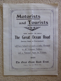
Leaflet, Motorists and Tourists
... private trust to build the Great Ocean Road in Victoria. This road is today of international significance great ocean road great ocean road trust 1918 warrnambool history memorial great ocean road This is an unbound leaflet of 8 pages (almost A4 size) folded into two insert pages. It has 10 photographs of views ...This leaflet published by The Great Ocean Road Trust in 1918 gives information about the proposed building of the Great Ocean Road from Barwon Heads to Warrnambool as a memorial to Victorian soldiers in World War One. The President of the Trust, which was a private company seeking donations from the public, was Howard Hitchcock, the Mayor of Geelong. The Memorial Great Ocean Road commenced in 1919 with 3000 ex-servicemen employed to build the road. In 1932 the road was completed to Apollo Bay and in 1936 the road was officially handed into the care of the State Government. This leaflet is of some significance as it shows the initial efforts by Howard Hitchcock of Geelong and a private trust to build the Great Ocean Road in Victoria. This road is today of international significance This is an unbound leaflet of 8 pages (almost A4 size) folded into two insert pages. It has 10 photographs of views along the Great Ocean Road and typed information on the Great Ocean Road Trust and its Building Appeal. It was produced in 1918.great ocean road, great ocean road trust 1918, warrnambool history, memorial great ocean road -
 Bendigo Military Museum
Photograph - THE GRINTON COLLECTION, FRAMED, 2008 - 2009
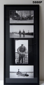
... From Jack's writing the other soldier is a Private Knight. The first building in the rear is the "Don View Bar" suggesting that this is Scotland when on leave. ...From Jack's writing the other soldier is a Private Knight. The first building in the rear is the "Don View Bar" suggesting that this is Scotland when on leave. ...Frame 9. Photo 1. Jack Grinton on leave in Paris, early 1919 with captured German guns. The place is the 'Arc de Triomphe' . Photo 2. Jack Grinton on the right. From Jack's writing the other soldier is a Private Knight. The first building in the rear is the "Don View Bar" suggesting that this is Scotland when on leave. Photo 3. Coming home, Jack on the deck of the "Karmala". They left Plymouth Harbour on 1/7/1919. Photo 4. Ships in Plymouth Harbour. Refer Cat No. 5880P for exhibition details. Refer Cat No. 1280 for Jack GRINTON Service Records.Photographs - black and white on paper. 4 photographs, top to bottom. 1. Soldier with German guns in Paris. 2. Two soldiers with buildings in the background. 3. Soldier on deck of a ship. 4. Ships in harbour. Frame - timber with black colour paint. Glass front. Mount - black colour cardboard. Backing cardboard - with handwritten notation. Backing cardboard - handwritten in blue felt tip pen "9."framed photographs, grinton collection, ww1, 38th -
 Bendigo Military Museum
Photograph - PHOTOGRAPH, FRAMED, Framed Photograph of PRIVATE C.F. PIERCE
... The original photo can be viewed in Cat No 5459P. photography - photographs frame accessories History Army WW1 Framed and mounted Photograph of Private G.F Pierce DCM in a wooden frame with glass cover. ...George Frederick Pierce DCM No 2839, KIA 4.10.1917, refer Cat No 4136P for his service details. This photo is part of a photo that originally had 3 soldiers in it. It has been cropped out, enlarged and colour enhanced. The original photo can be viewed in Cat No 5459P.Framed and mounted Photograph of Private G.F Pierce DCM in a wooden frame with glass cover. Photograph - sepia toned half length portrait of soldier in uniform centred over a beige coloured background illustrated in colour, flags, animals and flowers. Frame - timber, mid brown stain, decorative edge, glass front. Mount - dark green cardboard.photography - photographs, frame accessories, history, army, ww1 -
Marysville & District Historical Society
THE TRIANGLE NEWS-VOL 5 NO 26-AUGUST 15 1980
... Marysville & District Historical Society 39 Darwin Street Marysville yarra-valley-and-the-dandenong-ranges marysville victoria australia photographer advertising rates for sale l.a. meeting mountain views home improvements centre 1st marysville scout committee buxton red cross concert community care centre kindergarten birthday greetings farewell sister sadler thank you debutante ball think it over wanted to buy dog loose in buxton for sale football wanted wool wirranda appaloosa stud bingo presentation night private sale hereford bull pumpernickel restaurant THE TRIANGLE NEWS-VOL 5 NO 26-AUGUST 15 1980 ...marysville, victoria, australia, photographer, advertising rates for sale, l.a. meeting, mountain views home improvements centre, 1st marysville scout committee, buxton red cross concert, community care centre, kindergarten, birthday greetings, farewell sister sadler, thank you, debutante ball, think it over, wanted to buy, dog loose in buxton, for sale, football, wanted wool, wirranda appaloosa stud, bingo, presentation night, private sale hereford bull, pumpernickel restaurant -
 Lara RSL Sub Branch
Photograph, Set 4 photographs. and others for Torquay Light Horse camp, 1940
... view plaque) The plaque identifies a significant event in Torquay’s history and the sentiments of ‘change’ for the Light Horse Brigade – from horses to machines. In 1940 the four Light Horse Regiments (4th, 8th, 13th and 20th), some 5000 Light Horse and 2000 horses camped and trained at Torquay. Three other regiments, formerly mounted on horses, were also at Torquay ‘mounted’ on privately...view plaque) The plaque identifies a significant event in Torquay’s history and the sentiments of ‘change’ for the Light Horse Brigade – from horses to machines. In 1940 the four Light Horse Regiments (4th, 8th, 13th and 20th), some 5000 Light Horse and 2000 horses camped and trained at Torquay. Three other regiments, formerly mounted on horses, were also at Torquay ‘mounted’ on privately ...These images capture for all time Light Horsemen travelling through Geelong on their way to camp at Torquay for the last Group meeting in Australia . information following - details obtained from .........https://torquayhistory.com/light-horse-brigade/ On Australia Day, 1997, Sir John Young unveiled this plaque on Point Danger, Torquay. Torquay history, Light Horse Training Camp, WW2 Plaque at Pt. Danger Note----- (See images to view plaque) The plaque identifies a significant event in Torquay’s history and the sentiments of ‘change’ for the Light Horse Brigade – from horses to machines. In 1940 the four Light Horse Regiments (4th, 8th, 13th and 20th), some 5000 Light Horse and 2000 horses camped and trained at Torquay. Three other regiments, formerly mounted on horses, were also at Torquay ‘mounted’ on privately owned trucks and cars. Division troops included Artillery, Engineers, Signals, Field Ambulance and other branches of the Army necessary to enable a Division to function. It wasn’t just the sheer numbers of men coming to this little town that made the event significant, it was also the fact that the men of the Light Horse were dramatic, almost glamorous figures and it is easy to see their exploits as some splendid adventure. Horses have played a special role in the story of Australia. They were the only means of transport across this huge country, so it was necessary for everyone to have the ability to ride a horse. When war broke out in 1899 between Britain and the Boers of South Africa (“Boer” was Dutch for “farmer”) Australia sent troops to fight. At first Britain was wary of using untried, unprofessional colonial cavalrymen but soon saw that the slouch-hatted Australian “bushmen” were a match for the fast-moving and unconventional mounted commandos of the Boers. The Australians proved themselves to be expert rough-riding horsemen and good shots. Bush life had hardened them to go for long periods with little food and water. They also showed remarkable ability to find their way in a strange country and use its features for cover, in both attack and defence. By 1914, when Australia joined the war against Germany, there were 23 Light Horse regiments of militia volunteers. Many men from these units joined the Light Horse regiments of the Australian Imperial Force (AIF). Men were given remounts (if not using their own horses) – army horses bought by Commonwealth purchasing officers from graziers and breeders. These were called “walers” because they were a New South Wales stockhorse type – strong, great-hearted animals with the strains of the thoroughbred and semi-draught to give them speed, strength and stamina. On 1st November, 1914, Australia’s First Infantry Division and the first four Light Horse regiments sailed for England in a fleet of transport ships. The first of the Light Horse arrived at Gallipoli in May without their horses. Back with their horses after Gallipoli, they were formidable combatants across the Sinai and Palestine. Some British commanders observed that the light horseman moved with a “lazy, slouching gait, like that of a sleepy tiger” but described how the promise of battle “changes that careless gait, into a live athletic swing that takes him over the ground much quicker than other troops”. They had Light Horse, Torquay, training campdeveloped a reputation as formidable infantrymen. The Turks called them “the White Ghurkas” – a reference to their deadly skill with the bayonet. The Arabs called them “The Kings of the Feathers”. The plume had originally been a battle honour of the Queensland Mounted Infantry for their work in the shearer’s strike of 1891. During WW1 it was adopted by almost all the Light Horse Regiments. It was the proud badge of the light horseman. The most famous of their battles was the attack on Beersheba- the charge of the 4th Light Horse Brigade. Mounted infantrymen and their superb walers had carried out one of the most successful cavalry charges in history – against what seemed impossible odds. They surprised the Turks by charging cavalry-style, when they would normally have ridden close to an objective then dismounted to fight. The fall of Beersheba swung the battle tide against the Turks in Palestine; and changed the history of the Middle East. While 19 men from the Surf Coast Shire served with the 4th Light Horse over the course of WW1, only four were involved in the charge of Beersheba- John GAYLARD, Philip QUINN.(Winchelsea); Wallace FINDLAY (Anglesea); Harry TRIGG (Bambra). After the war, Light Horse units played a key role in the Australian Government’s compulsory military training programme. The Citizen Military Forces (C.M.F.) thrived on the glamour of the wartime Light Horse tradition, ignoring the possibility that motor vehicles would soon replace the horses. When training was no longer compulsory, the C.M.F. regiments declined and horses became more of a luxury during the 1930s depression years of poverty and unemployment. Some regiments were motorised. Then, in 1939, Australia joined Britain in another world war. Training was increased for the militia at both home bases and regional training camps. The camp at Torquay in 1940, commanded by Major General Rankin, was at Divisional strength. By the end of the camp some felt that the Division was ready for active service. Gradually, over the next four years, the Australian Light Horse units were mounted on wheels and tracks and the horses were retired. Six men enlisted at the Torquay camp and another 57 men and women enlisted at Torquay for service in WW2. Those who served in the Militia provided valuable Officers and NCOs and men for the armed services during the war. Each infantry division of the 2nd AIF had a Light Horse regiment attached to it. But the day of the Australian mounted soldier hadn’t quite passed. During World War II, Australia’s 6th Cavalry Regiment formed a mounted unit they called “The Kelly Gang” which did valuable scouting work. In New Guinea, a mounted Light Horse Troop did patrol duty and helped carry supplies. Some fully equipped walers were flown into Borneo for reconnaissance in rugged mountain country. But by the end of the war, in 1945, the horse had disappeared from the Australian Army. References: Australian Light Horse Association www.lighthorse.org.au National Australia Archives Australian War Memorial Surf Coast Shire WW1 memorials www.togethertheyserved.com The Light horse- a Cavalry under Canvas Light Horse, Training Camp, Torquay, WW2 Late in 1939 it was decided to set up a Lighthorse training camp in Torquay to train both men and horses for the battles of the Second World War. Horses, men and equipment came on special trains from all over Victoria and NSW, and as you would expect horseman came from areas such as Omeo and Sale, the Wimmera and the Western District. They arrived at the Geelong racecourse for watering in the Barwon River and then were ridden across the ford at the breakwater and began their 11 mile trek to Torquay. Light Horse, Training Camp, Torquay, WW2 Tent city By the end of January 1940 the camp at Torquay accommodated some 5000 men and 2500 horses of the Second Cavalry Division. The rows of horses, tents and huts near Blackgate Road were quite a sight. While the cavalrymen engaged in exercises on the land and on the beaches, many of the troops took over the Torquay School for special training of men and officers. Mr Bob Pettit local farmer and Councillor for the Barrabool Shire, wrote about the Light horse in the Surf Coast Community News in 1985 saying “They used to travel about the district riding four abreast in one long convoy. To my annoyance they went through my property and shut all the gates behind them. I had certain gates open to let stock in to the water holes and it would take me three -quarters of an hour to follow the horsemen up and put all the gates right again” he continued “the men from the Light Horse were here when the fire went through in March 1940. He recalled an incident when early one morning, as some one blew the bugle, a soldier putting a white sheet on the line frightened the horses. They panicked and ran off in all directions. Six went over the cliff near Bird Rock, five were never found, and the rest were gathered up after nearly a fortnight in the bush around Addiscott and Anglesea" Light Horse, Training Camp, Torquay, WW2, Geelong Parade Geelong parade The training camp culminated in a parade through the streets of Geelong on March 12th 1940. The salute was given at the Town Hall and the troops continued on a route to the You Yang’s for a training exercise. Note-----(see media section for photograph) The Camp was abandoned in mid 1940 as it was deemed unsuitable for training during winter and the cost of a permanent camp could not be justified if it could not be used all year. Historic.......Rare,,,Interpretive.Sepia photographs.set of four ....post card size ....Horses &LighthorsemenNo 1, Lighthorsemen Regiment Geelong 1940......No 2 Light Horse at Breakwater Geelong 1938 to 1940....No 3 Light Horse at Breakwater Geelong 1938 to 1940.....No 4 Light Horse crossing Breakwater camped at Geelong Showgrounds. These markings are on reverse of photographs.light horsemengeelong 1940., world war 2