Showing 31 items matching "aboriginal occupation"
-
 Truganina Explosives Reserve Preservation Society Inc (TERPS)
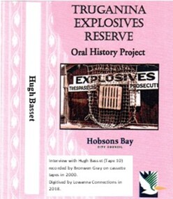
Digitised Oral History – Truganina Explosives Reserve - Tape 10 Hugh Basset, 2018
... ...aboriginal occupation...He was struck by the industrial, environment and indigenous significance of the site A primary source of information on memories of the Truganina Explosives Reserve and Altona,Victoria Nessie Hardy Cheetham Salt Works migratory birds explosives reserve explosives Point Gellibrand National Trust tin fence sand ridges Altona Skipper Butterfly middens aboriginal occupation Judy Hindle Digital copy of original cassette recorded in 2000 and digitised in 2018 Digitised Oral History – Truganina Explosives Reserve - Tape 10 Hugh Basset ...The interviews were recorded in 2000 by Bronwen Gray and Alan Young for the production of Unreserved, Stories from Truganina Explosives Reserve, animated stories from past residents, workers and interested people of the Reserve (subject to copyright 2004). As the then President of the Inner West Branch of the National Trust, Hugh was unaware of the Truganina Explosives Reserve until contacted by Nessie Hardy about the proposed sale of the site by the State Government. He was struck by the industrial, environment and indigenous significance of the site A primary source of information on memories of the Truganina Explosives Reserve and Altona,VictoriaDigital copy of original cassette recorded in 2000 and digitised in 2018nessie hardy, cheetham salt works, migratory birds, explosives reserve, explosives, point gellibrand, national trust, tin fence, sand ridges, altona skipper butterfly, middens, aboriginal occupation, judy hindle -
 Lakes Entrance Historical Society
Book, Howe, K.R, Mallacoota Reflections, 1990
... A short history of Mallacoota, Victoria, and district, covering a range of subjects from Aboriginal occupation to late 20th.Century residents and lifestyle....Lakes Entrance Historical Society 4 Marine Parade Lakes Entrance gippsland Township Aboriginals A short history of Mallacoota, Victoria, and district, covering a range of subjects from Aboriginal occupation to late 20th.Century residents and lifestyle. ...A short history of Mallacoota, Victoria, and district, covering a range of subjects from Aboriginal occupation to late 20th.Century residents and lifestyle.township, aboriginals -
Lakes Entrance Historical Society
Book, Morgan, Patrick, The Settling of Gippsland - A Regional History, 1997
... A history of Gippsland from Aboriginal occupation to white settlement from the squatting years to present industry. ...Lakes Entrance Historical Society 4 Marine Parade Lakes Entrance gippsland Bibliography Aboriginals Settlers A history of Gippsland from Aboriginal occupation to white settlement from the squatting years to present industry. ...A history of Gippsland from Aboriginal occupation to white settlement from the squatting years to present industry. Includes extensive bibliography, indexed.bibliography, aboriginals, settlers -
 Lakes Entrance Historical Society
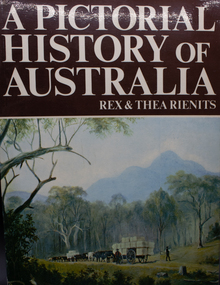
Book, Rienits, Rex and Thea, A Pictorial History of Australia, 1980
... History of Australia from Aboriginal occupation, early European contact as a penal settlement, federation, until the mid 20th century. ...Lakes Entrance Historical Society 4 Marine Parade Lakes Entrance gippsland Social History Photography History of Australia from Aboriginal occupation, early European contact as a penal settlement, federation, until the mid 20th century. ...History of Australia from Aboriginal occupation, early European contact as a penal settlement, federation, until the mid 20th century. Well illustrated and indexed.social history, photography -
Lakes Entrance Historical Society
Book, Mallacoota and District Historical Society, Mallacoota Memories, 1980
... Record of the history of Mallacoota Victoria from Aboriginal occupation to approximately 1970 includes early settlers industries commerce tourism shipwrecks and a list of local place names....Lakes Entrance Historical Society 4 Marine Parade Lakes Entrance gippsland Township Aboriginals Settlers Industrial Record of the history of Mallacoota Victoria from Aboriginal occupation to approximately 1970 includes early settlers industries commerce tourism shipwrecks and a list of local place names. ...Record of the history of Mallacoota Victoria from Aboriginal occupation to approximately 1970 includes early settlers industries commerce tourism shipwrecks and a list of local place names.township, aboriginals, settlers, industrial -
 Surrey Hills Historical Society Collection
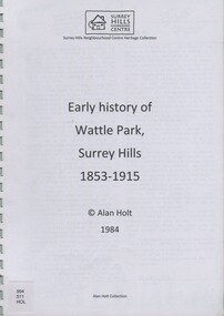
book, Early history of Wattle Park, Surrey Hills 1853-1915, 1984
... A spiral bound manuscript which includes a physical description of Wattle Park as well as covering aboriginal occupation, pastoral and timber cutting, the original purchasers and locations of neighbouring farms....Alan used this information to give talks and tours of the area and gifted his material to the local history collection through Jocelyn Hall. back creek wattle park delany's paddock cleary's paddock blood's paddock conran's paddock udimore lodge (mr) george thomas usher (mr) orlando fenwick phoenix grange (mr) john filson (mr) denis delany (mr) john crimp (mr) james atkinson (mr) john lawler (mr) henry de carle (mr) walter craig (mr) daniel dunn (mr) frederick goyder (mrs) eliza welch metropolitan tramways d h dureau (mr) robert beckett (mr) alexander gerald proudfoot (mr) james conran (mr) thomas blood (mr) william smith payne and glass A spiral bound manuscript which includes a physical description of Wattle Park as well as covering aboriginal occupation, pastoral and timber cutting, the original purchasers and locations of neighbouring farms. ...Author: Alan Judge Holt amassed a significant collection of historical material related to the Surrey Hills area. Born in Moonee Ponds in 1912 to Edmund Holt and Ellen Ruby Sutton, he married Edna Jean Pallot in 1937. They lived at 62 Broughton Road, Surrey hills, had 3 sons and were strongly associated with the Surrey Hills Methodist Church. Alan was Secretary of the Victorian Lands Department and in his spare time recorded the occupancy of every property in Surrey Hills and Mont Albert at the beginning of each decade from 1890 to 1980. His collection of files and individual cards covers people, places, churches, clubs, businesses and other organisations in the area. Alan used this information to give talks and tours of the area and gifted his material to the local history collection through Jocelyn Hall.A spiral bound manuscript which includes a physical description of Wattle Park as well as covering aboriginal occupation, pastoral and timber cutting, the original purchasers and locations of neighbouring farms.back creek, wattle park, delany's paddock, cleary's paddock, blood's paddock, conran's paddock, udimore lodge, (mr) george thomas usher, (mr) orlando fenwick, phoenix grange, (mr) john filson, (mr) denis delany, (mr) john crimp, (mr) james atkinson, (mr) john lawler, (mr) henry de carle, (mr) walter craig, (mr) daniel dunn, (mr) frederick goyder, (mrs) eliza welch, metropolitan tramways, d h dureau, (mr) robert beckett, (mr) alexander gerald proudfoot, (mr) james conran, (mr) thomas blood, (mr) william smith, payne and glass -
 Otway Districts Historical Society
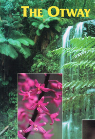
Book, Yaugher Print, The Otway Ranges, 1998
... Flora and fauna found through the Otway Ranges interspersed with historical references from aboriginal occupation to the present day....Otway Districts Historical Society Cliff Young Drive Beech Forest great-ocean-road Flora and fauna found through the Otway Ranges interspersed with historical references from aboriginal occupation to the present day. otway ranges; natural history; description; travel; geology; timber; The Otway Ranges.Trevor Pescott. 1st ed. ...Flora and fauna found through the Otway Ranges interspersed with historical references from aboriginal occupation to the present day.The Otway Ranges.Trevor Pescott. 1st ed. Belmont (Vic); Yaugher Print; 1998. 112 p.; illus, map, bibliography. Soft cover. ISBN 0 9586562 1 5otway ranges; natural history; description; travel; geology; timber; -
Whitehorse Historical Society Inc.
Document, Melbourne and Metropolitan Archaeological survey, 1/03/1982
... History of Aboriginal occupation of the Melbourne area. Evidence of shell midden refuse associated with their campsites. ...Ministry for Conservation Victoria Archaeological Survey History of Aboriginal occupation of the Melbourne area. Evidence of shell midden refuse associated with their campsites. ...History of Aboriginal occupation of the Melbourne area. Evidence of shell midden refuse associated with their campsites. Evidence of scarred trees and scatters of stone artefacts along major stream systems. It has been established that man was in the Melbourne area 40,000 years ago and that Aboriginal occupation probably continued uninterrupted throughout the extremes of the last ice age, around 20,000 years ago when Port Phillip itself was dry land. Study will take 2 - 3 years. Aims (1) identify areas of potential archaeological importance (2) implement a pilot survey program (3) prepare comprehensive proposals for survey of sites. (4) liaise and establish rapport with municipal authorities in study area.aborigines, wurundjeri, bunurong, australian heritage commission, victoria. ministry for conservation, victoria archaeological survey -
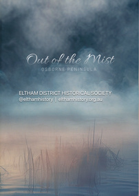 Eltham District Historical Society Inc
Book, Jenny Brown et al, Out of the Mist; Osborne Peninsula, 2024
... Contents: Welcome: The landform: The River: Aboriginal occupation: The Miners: North Warrandyte :The Subdivision: The Lowes: The Osbornes: The Last Osborne: The Elders: The Relics: Dray Track: Water Wheel"Kauri Plaque: River track: Pines: Windmill Creek Bridge: The Koornong School: The Houses" Man Cave: MidCentury Classic: Enduring Original" Masterwork: The Muddies: The State Park: The Saving of Koornong Reserve: The Landcare Story: Flora and Fauna: The Vulnerable, Endangered and threatened: Birds: Mammals: "Waring" the wombat: Reptiles: Fish: Invertebrates: Flora: Fire. ...Contents: Welcome: The landform: The River: Aboriginal occupation: The Miners: North Warrandyte :The Subdivision: The Lowes: The Osbornes: The Last Osborne: The Elders: The Relics: Dray Track: Water Wheel"Kauri Plaque: River track: Pines: Windmill Creek Bridge: The Koornong School: The Houses" Man Cave: MidCentury Classic: Enduring Original" Masterwork: The Muddies: The State Park: The Saving of Koornong Reserve: The Landcare Story: Flora and Fauna: The Vulnerable, Endangered and threatened: Birds: Mammals: "Waring" the wombat: Reptiles: Fish: Invertebrates: Flora: Fire. ...The Osborne Peninsula on the Yarra River at Warrandyte accommodates a limited number of properties and residents (70 households). The area is rich in geology and ecology, and an unusually rich endowment of human, built and creative history. Contents: Welcome: The landform: The River: Aboriginal occupation: The Miners: North Warrandyte :The Subdivision: The Lowes: The Osbornes: The Last Osborne: The Elders: The Relics: Dray Track: Water Wheel"Kauri Plaque: River track: Pines: Windmill Creek Bridge: The Koornong School: The Houses" Man Cave: MidCentury Classic: Enduring Original" Masterwork: The Muddies: The State Park: The Saving of Koornong Reserve: The Landcare Story: Flora and Fauna: The Vulnerable, Endangered and threatened: Birds: Mammals: "Waring" the wombat: Reptiles: Fish: Invertebrates: Flora: Fire. Published by the North Warrandyte (Osborne Peninsula) Landcare Group. Includes photos from EDHS collection.64 p. : ill., map ; 29.7 x 21 cm. (2 copies)yarra river, birrarung, dray track, fauna, geology, houses, indigenous history, koornong reserve, koornong school, lowe family, mining, mudbrick houses, north warrandyte, osborne family, warrandyte state park, water wheel, north warrandyte (osborne peninsula) landcare group, osborne peninsula -
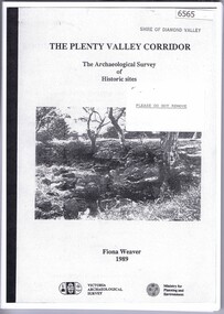 Greensborough Historical Society
Book, The Plenty Valley Corridor: the archaelogical survey of historic sites, by Fiona Weaver, for the Ministry of Planning & Environment, 1989_
... The study was intended to provide a brief history of Aboriginal and European occupation and use of the area and an outline of the geography of the chief areas of cultural heritage concern, with recommendations for protection of significant cultural sites and recommendations for further research, survey and consultation....The study was intended to provide a brief history of Aboriginal and European occupation and use of the area and an outline of the geography of the chief areas of cultural heritage concern, with recommendations for protection of significant cultural sites and recommendations for further research, survey and consultation. plenty river fiona weaver victorian archaeological survey 115 p., photocopy, unbound. ...The Victorian Archaelogical Survey managed this study onbehalf of the Ministry for Planning & Environment. The study was intended to provide a brief history of Aboriginal and European occupation and use of the area and an outline of the geography of the chief areas of cultural heritage concern, with recommendations for protection of significant cultural sites and recommendations for further research, survey and consultation.115 p., photocopy, unbound. Illus., mapsplenty river, fiona weaver, victorian archaeological survey -
Federation University Historical Collection
Document, Zelda Martin, Central Victorian Goldmining towns - Boom Towns or Ghost Towns?, c1996
... aboriginal studies in the State Library of Victoria", ed. Tom Griffiths, Melb. Friends of the State Library, 1989 +"The Public Lands of Australia Felix"; settlement and land appraisal in Victoria1834-91 with special reference to the Western Plains", J.M.Powell, Melb. Oxford University Press 1970 +*Bibliography of the Victorian Aborigines' from the earliest manuscripts to 31st December 1970, Massoa, Aldo, Melb. Hawthorn Press, 1971 +"Aborigines in Colonial Victoria, 1836-1886", M.F. Christie, Sydney University Press, 1979 +"Urban and Industrial Australia: readings in Human Geography" ed J.M. Powell, Melb. Sorrett Pub. 1974 *Extracts: -Processes of Pioneer Settlement - The Squatting Occupation...aboriginal studies in the State Library of Victoria", ed. Tom Griffiths, Melb. Friends of the State Library, 1989 +"The Public Lands of Australia Felix"; settlement and land appraisal in Victoria1834-91 with special reference to the Western Plains", J.M.Powell, Melb. Oxford University Press 1970 +*Bibliography of the Victorian Aborigines' from the earliest manuscripts to 31st December 1970, Massoa, Aldo, Melb. Hawthorn Press, 1971 +"Aborigines in Colonial Victoria, 1836-1886", M.F. Christie, Sydney University Press, 1979 +"Urban and Industrial Australia: readings in Human Geography" ed J.M. Powell, Melb. Sorrett Pub. 1974 *Extracts: -Processes of Pioneer Settlement - The Squatting Occupation ...Zelda Martin was a PhD candidate at the University of Melbourne.[.1] 4th item in light blue display book titled Research Approach/Overview of Chapters/Confirmation of Canditure/Chapters1,2,3&4 of proposed thesis. *Twenty-seven page article on Victorian goldfields towns titled: Central Victorian Goldmining Towns - Boom Towns or Ghost Towns. The article was written during the author's PhD study. It outlines the context methodology, and resources and the chapters of the proposed thesis: (1) Central Victorian Goldmining Towns - The Context (2) Contemporary Views of the Factors Necessary for Town Growth (3) Outward Manifestations of Town Growth (4) The Trappings of Government (5-9) The Main Towns and Their Hinterland. [.2] 5th item in Light Blue display book as above item. *Chapter 1 of proposed thesis titled 'Pick, Shovel and Tin Dish Mining.' Covers in Section A: Central Victoria - Pre 1851: Aborigines in Central Victoria, Squatters, and Government. Section B: The years 1851-1854: The Early Gold Rushes, Government Reaction, Township Surveys, Legislation, Town Development, Local Government and Early Settlement. [.3] 6th item in Light Blue display book as above item. *2A of proposed thesis titled 'Contemporary Views of the Factors Necessary for Town Growth'. Similar information to Chapter 1 plus extra re towns and maps. Sections: Introduction, Context of Place - Geographical Towns Listed, The Context of Time - Pre1851 Aborigines, Governance of Port Phillip, The Squatters, The Villages of Central Victorian Highlands, Conclusion, Condensed Version of Chapter2B. [.4] 7th item in Light Blue display book as above item. *Chapter2B of proposed thesis. Sections: Area of Research, Schools, Banks, Newspapers, Progress Association, Town Development - Sandhurst (Bendigo), Ballarat, Castlemaine,, Maryborough, Ararat and Stawell. [.5] 8th item in Light Blue display book as above item. *Chapter 3 of proposed thesis titled 'Outward Manifestations of Town Growth'. Sections: Introduction, Contemporary Writing, Educationalists, The Bankers, The Townsfolk, Current Theory, General Theories of Urban Development, and Conclusion. [.6] 9th item in Light Blue display book as above item. *Chapter 4 of proposed thesis titled 'Trappings of Government' Sections: Introduction, Early Government Attitudes to Mining and Town Development, Law and Order, Township Surveys, Legislation, Local Government, Transport and Communication, The People and Lobbyists. [.7] 10th item in Light Blue display book as above item. *'The Rise and Fall of Central Victorian Goldmining Towns'. Includes a map showing main Goldfields, a table showing towns and villages at two points in time - 1857 and 1871; a Bibliography of Primary and Secondary Sources. [.8] Resource No1. Black display book titled Local Towns 1 : Alma: *Brief history *Directory *Maps Amphitheatre / Mountain Hut: *Brief History Post Office Directory Ararat: *Brief History *Post Office Directory 1869 - Alphabetical Listing by Occupation *Ararat - Prominent Citizens of 1858 *Langi-Morgala Museum Avoca: *Brief History *Excerpts from 'Avoca The Early Years', Margery and Betty Beavis; pg1 - Beginnings; pg11 - The Midas Touch; pg25 - Local Gold Escorts; pg27 - A Town is Born; pg51- The Administration of Justice; pg53 - The Ways of the Law; pg61 - News of the Day; pg65 - A Time to Play; pg72 - Land Ownership *Post Office Directory (Bailliere's) 1869 *Tourism Map and Information of area *Historic Avoca - A 5.5km Tour *Avoca & the Pyrenees Region - information pamphlet Ballarat: *Early History of Ballarat - Ballarat Historical Society, Publication No.1: origin of the name; Ballaarat - the Beginning; Fabulous Yields from the Ballaarat Goldfield; *Streetscape Lydiard Street. *Hand drawn map showing Leigh River, Old Portland Bay Road, plaque on road to Colac; etc. *Newspaper article re 'The Theatre Royal' ( which stood in the vicinity of the current Owen Williams store) - 'The News'15/04/1998 *Article - 'Ballarat's Mechanics' Institute Lives On' Ballarat Courier, 14/09/1985 *Article - Standing the Test of Time' The News 17/11/1993 re The Mechanics Institute & picture of the Reading Room *'Ballarat a Study of a City, Phyllis Reichl, pub. Nelson, 1968; no.3 place, time and people field studies series *Investigator Vol.33 No.2, 1998 Geelong Historical Society. Article on pg75 describes Ballarat in 1861 *Folded poster - 'Ballarat 100' a history of telegraph communication, pub. Telecom. Beaufort (Fiery Creek): *Brief history *Post Office Directory [.9] Resource No.2 Black Folder Titled Towns cont.No2 Bendigo (Sandhurst): *'Family & Local History at the Bendigo Library - 1851-2001 150 years of gold'. *Bendigo Government Camp in 1853 illustration; key to sketch and names of Government officers stationed there *Excerpts from 'Bendigo and Vicinity' Adolph Haman *The Bendigo Goldfield Registry - pgs 1-7 Introduction *Excerpt: 'Breaking the Grip' *Excerpt: The Most Go-Ahead Place *Excerpts from 'History of Bendigo' - anti license agitation; laying out of town; proposed railway; gold calls and dividends; the Sandhurst Municipality; journalism *Bibliography Blackwood: *Excerpts from 'Aspects of Early Blackwood - The Goldfield, the Landmarks, the Pioneers' Alan J Buckingham and Margaret F Hitchcock, JG Publishing,1980 Buninyong: *A Brief History *Investigator Vol1 No.2 Feb 1966 Geelong Historical Society. Pg3 - Article re gold escort route - Mt Alexander to Adelaide - (see a simple monument on the Western Highway a few miles out of Horsham. Pg 15 - Ballarat Excursion - re the finding of gold. *Three articles published by Buninyong and District Historical Society Inc: (Magpie Exploration; Finding Gold In The Green Hills; Magpie Exploration; Burnt Bridge to Cargarie to Mt Mercer) *Copies of newspaper articles/items *Buninyong Street Directory Carisbrook: *In the Beginning There Was Carisbrook *The History of the Carisbrook Racecourse Carngham / Snake Valley: *Brief History *Directory Castlemaine: *Directory 1865-1866 - Alphabetical and Street *Poster - Castlemaine A Contemporary Guide "The Great Centre" 1866 - A Contemporary Guide to the Fascinating Past *Pamphlet - Castlemaine District Community Hospital *Map - Castlemaine, Maldon & Surrounding Districts *Map and Information - The Dry Diggings Track - a 55kl walk among historic goldfields relics ( Castlemaine Fryerstown Vaughan Mt Franklin Hepburn Daylesford) *Postcard - Former Court House *Directory 1867 - Alphabetical, Trade [.10] Resource No.3 Grey folder Titled Towns 3 Creswick to Maryborough Creswick: *Brief History *Booklet - "Creswick Cemetery Walk" *Booklet - The Buried Rivers of Gold Heritage Trail Creswick *Creswick Historical Museum Information Sheet *Chronological History of Creswick *Alphabetical Directory of the Borough of Creswick *Creswick's Creek Directory 1856 *Historic Creswick Walking Tour *A Brief Account of the Schools of Creswick - Past and Present *100 Years of Railway Travel in Creswick *The Berry Deep Leads *The Spence Home at Jackass Gully in the Creswick State Forest ( William Guthrie Spence - Pioneer) *The New Australian Mine and the 1882 Disaster *Creswick District News, Issue 7, July August 1999 *The Creswick Miners Walk - Information and Map *Maps Chewton: *Brief History *Directory Clunes: *Brief History *Clunes Street Directory Daylesford: *Brief History *Notable Bushfires in Daylesford District Over More Than a Century - "Black Thursday" 1851; 1862; 1899; the Disastrous Hepburn Fire of 1906; 1939; 1944; 1969. *Post Office Directory -Daylesford and Hepburn Dunolly / Inkerman: *Brief History *Directory *Pamphlet - Goldfields Historical Museum *Pamphlet - Historic Dunolly - Victoria's Best Kept Secret *Map of Gold Workings at Dunolly Area - showing where the main gold rushes occurred *Brief History - Inglewood *Directory - Inglewood - Name Occupation, Dwelling Kingower: *Brief History *Directory - Name / Ocupation / Dwelling Linton / Happy Valley / Piggoreet: *Brief History *Directory - Lintons McIvor: *"A History of the Shire and the Township of Heathcote" by J.O. Randell Majorca: *Brief History *Official Post Office Directory 1869 - Name / Occupation/ Address Maldon (Tarrangower): *Brief History Part 1 *Brief History Part 2 *Post Office Directory *List - Alphabetical Order by Names plus Business and Trade (Tarrangower Times Oct/1858) *List - Alphabetical Order by Trade plus Name and Business *Directory - Name / Occupation / Dwelling Maryborough: *Worsley Cottage - built by Arthur Worsley, a contractor in stonework in 1894 [.11] Resource No. 4 Blue Display Book titled Towns 4 Moliagul to Stawell Moliagul: *Brief History *Moligul Legislative Assembly (Voting?) List - Names and Occupations *Moliagul Victorian Post Office Directory 1868 - Name / Ocupation / Address / Comments *"The Welcome Stranger" gold nugget *The Sunday School *The Welcome Stranger Discovery Walk - information and map Moonambel (Mountain Creek) Redbank *Brief History *List of names extracted from advertisments of the Pioneer and Mountain Creek Advertiser 16/02/1861. *Bailliere's Directory 1869 - Alphabetical List of Name / Occupation / Place St Arnaud: *Brief History Sebastapol: *Brief History *Directory 1869 - Alphabetical by Name; plus occupation and address. Browns and Scarsdale: *Brief History *Browns Street Directory - Name and Occupation Smythesdale: *Brief Description *Smythesdale Street Directory -Name and Occupation Stawell (Pleasant Creek) *Brief History *Victorian Official Post Office Directory - Name /Occupation / Dwelling *Chronology - 1841-1920 *Production of gold statistics - 1879 - 1900 *Big Hill *Extracts from "The Golden Years of Stawell". Chapt 1 - Stawell's Coming Out. Capt. 2 - The Gold Rush. Caapt.3 - Cradle of Democracy. Chapt.4 - The Reefs Becomes Stawell. Chapt. 5 - Rushing In. Chapt.6 - The Pioneers. Chapt 7 - The Decade of Optimism. [.12] Resource No. 5: Blue Display Book titled 'Towns Steiglitz to the The Golden Triangle. Steiglitz: Brief History Victorian Post Office Directory 1869 *Map of Steiglitz *List of maps relevant to Steiglitz history *Information 6 tables of data from "Reports of Mining Surveyors Talbot (Back Creek) Brief History Taradale: Post office Directory 1869 - Name/Occupation/Street. Also list in alphabetical order by Occupation Taradale *Chronological Reference to Taradale Mines *Water - The Coliban System of Waterworks *Joseph Brady *The Syphon Tarnagulla (Sandy Creek) *Brief History *Tarnagulla Businessmen Cameos to give depth to advertisments in 'The Tarnagulla Courier' various issues 1864-1871 *Directory - Name/Occupation /Address *List - Name/Business/Trade Wedderburn (Koorong) *Brief History *List - Name/Occupation The Golden Triangle: *The Early Rushes - Wedderburn / Moliagul / Sandy Creek - Tarnagulla / Jones Creek - Waanyarra / Kingower / Dunolly - Goldsborough / Inglweood *Census of 1857 - Population / Occupations *1858-1871 - A Time of Consolidation- Wedderburn / Moliagul / Sandy Creek- Tarnagulla / Arnold *Census 1871 - Population *Information gleaned from the census data - Demographics / Population / Occupations / marital / Birthplace / Religion / Literacy/ Occupation and Housing Cameos *Graphs - Birthplace of settlers /Male-Female Ratio / Married males / Children under 15 as Percentage of Population / Religion *Census 1857 - Statistical data *Maps *Bibliography [.13] Resource No. 6 - Black Display Book Information and Research in Central Victoria including: *Banking - Research from ANZ Bank Archives *Institutions - also includes articles listed from the Ballarat Times Newspaper *Australian mining History Association - A.M.H.A. Bibliography *Australia's Mining History * Bibliography - Land Surveys Victoria - *1853 Administration (Statistics and Other) includes: schools / ministers of religion / police / military / local administration / licences for sale of spirits / distances between various Victorian gold fields. * Victoria Government Gazette (Copy) - N0. 116, 12/12/1854 includes: Gold Felds Commission of Enquiry & No. 85, 15/09/1854 - Addresses presented to the Lieutenant Governor (Sir Charles Hotham) during his tour through the Gold Fields of Victoria,1854. Addresses on behalf of : the people of Bendigo; Members of the Church of England, Bendigo; Members of the Wesleyan Church on the Bendigo Gold Fields; Bendigo Gold District General Hospital; the Bendigo Prospecting Association; Committee of the Bendigo Local Exhibition; Bendigo District Medical Association; Coloured Americans Resident at Bendigo; German Inhabitants of Bendigo; Landowners, Inhabitants, and Miners of Castlemaine; Inhabitants of Forest Creek; Inhabitants of Heathcote and Gold Miners of McIvor; Residents and landholders of the District of Bacchus Marsh; Inhabitants of Kilmore and Vicinity. *Gold Fields Correspondence 1853: letter from Lieutenant Colonel Valiant, (Officer commanding the Troops in Victoria) to the Lieutenant Governor re threatened disturbance at Sandhurst (Bendigo) regarding the Gold License Fee. * Extracts from a book "Victoria" re Gold Fields Commission of Enquiry involving mainly Ballarat and Castlemaine and a chapter titled 'A Tour to the Victorian Gold-Fields' *Lists of central Victorian newspapers - listed by date published 1851to 1874; by first date available to State Library. *A list of cities and towns showing County, population in 1861 &1871, and municipal status. [.14] Resource no.7. Black display book. *Reference: Papers presented to Parliament Victoria - 1859-1860 4 volumes - relevant sections copied. Contains information on Branches of Government. General / Finance / Gold / Gazette / Commission and Warrant / Statistic. *Gold Fields Act. In accordance with the Act the gold fields are divided into six districts - Ballaarat, Castlemaine , Sandhurst, Avoca, Ararat, and Beechworth.. Official staff in each gold district consists of a Resident Warden, Wardens, Wardens' Clerks, Bailiffs, Chinese Protectors, Chinese Interpreters, and Mining Surveyors. *Gold Receiver *Gaols *Police magistrates and Clerks of Petty Sessions, etc. *Field Branch *Immigration and Emigration Overland - Chinese - 1859 *Population on the Goldfields *The Geological Survey - The Government Geologist is assisited by staff from four branches - the office Branch; the Publishing Branch; the Field Branch and the Museum Branch. *Commission to Enquire Into Sludge dated 10/02/1859 (Some sections copied) - Report to the Honorable Chief Commissioner of Public Works, Melbourne re the mode of carrying the sludge from the puddling mills in Sandhurst without interfering with the drainage of the town and the roads in the neighbourhood. [.15] Resource No.8: Camel display book titled Resource No. 8. Aborigines *Lists of book titles - +"Readings in Victorian prehistory" +"The Aborigines of Port Phillip" +Aboriginal languages and clans" +"A History of the Port Phillip District" +"Langi Ghiran 1: Aboriginal Rock...." +"Koorie History: sources for aboriginal studies in the State Library of Victoria", ed. Tom Griffiths, Melb. Friends of the State Library, 1989 +"The Public Lands of Australia Felix"; settlement and land appraisal in Victoria1834-91 with special reference to the Western Plains", J.M.Powell, Melb. Oxford University Press 1970 +*Bibliography of the Victorian Aborigines' from the earliest manuscripts to 31st December 1970, Massoa, Aldo, Melb. Hawthorn Press, 1971 +"Aborigines in Colonial Victoria, 1836-1886", M.F. Christie, Sydney University Press, 1979 +"Urban and Industrial Australia: readings in Human Geography" ed J.M. Powell, Melb. Sorrett Pub. 1974 *Extracts: -Processes of Pioneer Settlement - The Squatting Occupation of Victoria, 1834-60. J.M. Powell -Areal Variations in the Class Structure of the Central-Place Hierarchy. P. Scott - Volume1 and Volume 2: Notes Relating to the Habits of the Natives of Other Parts of Australia and Tasmania. Compiled from various sources for the Government of Victoria by R Brough Smyth. John Curry, O'Neil, Melb. 1st pub. Melb. 1876. p31-45 - Numbers and Distribution of the Aborigines in Victoria -Victorian Aborigines 1835-1901 - A Resource Guide to the Holdings of the Public Record Office, Victoria; published by the Government Information Centre 1984. *History of the Aboriginal Artefacts Displayed in the Daylesford Museum. F. G. Powell (4 page pamphlet) *Letter to Zelda Martin from Peter Lovett, Cultural Officer, Ballarat & District Aboriginal Co- Operative, 05/02/1997 *Map: Ian Clarke Victorian Tribunal Boundary Map - Clans of Central Victoria. *Victorian Rock Art and Mythology - Article about Mount Langhi Ghiran and myths of the Tjapwarong people. *Two Aboriginal myths relating to the Grampians - 'The Monster Emu' / 'The Aquisition of Fire', by the Aborigines in the Grampians Areas *Article titled (chapter 8) Ballarat - information re camping sites in the region. Lake Wendouree / Lake Burrumbeet (includes a myth) / Mt Bunninyong / Lal Lal / Pitfield / Mount Elephant / Mount Egerton / Meredith / Lake Goldsmith / Lake Learmonth / Ercildoune *Notes on the Aborigines of the Wider Ballarat Region plus European names=Aboriginal names. John Morris 26/07/1995 *Role of Aborigines in Town Development in Central Victoria. Mentions Native Police Force est. in Port Phillip 1842 and Central Board for Aborigines est. 1860 *The Grave of King Billy. (Frank Wilson) Pamphlet. *Camping Places in Central and Northern Victoria. Article re Lake Burrumbeet site. *Programme for the Unveiling of Memorial Cairn for Edward Stone Parker 1802-1865. Note portrait not accurate. Accurate portrait is available in the book "A Successful Failure A Trilogy The Aborigines and Early Settlers", Edgar Morrison, Graffiti Publications, 2002. * Large envelope addressed to Mr G Netherway containing newspaper cuttings regarding the life of Edward Stone Parker, the unveiling of the Memorial Cairn as mentioned above, articles titled 'Episodes from Our Early Days' (Edgar Morrison, Yandoit)- The Black's School, A School At Last and The Final years. Also a typed page titled 'Historical Background to E.S.Parker's Career. Includes an interesting tale titled 'When the cat lay doggo' re laying power leads for the unveiling ceremony at the memorial site. [.16] green display folder titled 'Research Aids' *List of references to Commissioners' & W'ardens' Reports (formerly held at La Trobe Library Archives, now at Public Records Office [PRO]). Indicates town referred to / date of report / name of camp if different to town. * Archive information re Anglican Records *Movement around the Goldfields - Miners and Storekeepers - usefulness of newspapers in providing information - areas covered - Castlemaine, Maldon, Ararat, Stawell, Tarnagulla, Dunolly. *Port Phillip /Victoria Directories 1839/1867 - Chronological list of Directories included in this series. *"Notes on the History of Local Government in Victoria" A.W. Greig Melb. University Press 1925 - Photo-copied extract p5-p40. (Source - Deakin University Library) - Introduction by W.Harrison Moore. Section 1 - Development in New South Wales Before Separation. Section 2 - Development in Victoria After Its Separation from New South Wales. Hand written notations: 'roads, markets, and local government 1855 on' ;'opportunity of squatters in parliament' and 'opportunities of matters in parliament p33' * Notes on the Establishment of Surveyor General's Department 1851and Commissioner of Crown Lands and Survey. * Newspaper articles from The Argus, 1849, re the discovery of gold in the Pyrenees region. * Excerpt - a report on schools - A.B.Orlebar, Inspector; re the need for permanent school buildings rather than tents. *Excerpt from - 'Approaches to Urban History', Sean Glynn: The Case for Caution * Except from - 'The Urban Sprinkle', Weston Bate: Country Towns and Australian Regional History *Reference- 'The History of Land Tenure in the Colony of Victoria', John Quick. References the Haines Land Bill, land tenure and Land Leagues. [.17] Light blue envelope folder titled 'Birtchnell's Ballarat, etc. Directory 1862 *Contains various directories for Smythesdale, Buninyong, Clunes, Brown's and Creswick. [.18] Red envelope folder no.2 titled Victorian Gazetteer *Selected pages from 1869 Victorian Gazetteer on A4 paper (with a handwritten note questioning if some pages are from 1868 Victorian Gazetteer as appears to be different sizes - A3 pages.) Information includes locations and descriptions of towns, hotels, banks, communications and populations. (Does not include names, residences and occupations) [.19] Red Envelope folder titled Bailliere's Official Post Office Directory 1868 (or1869 or a mixture of both?) *Preface *Contains a selection of pages of towns highlighted in yellow in the the index *Work on this directory was commenced in 1867. *Information includes: Municipalities - mayors and councilors; lists of towns naming male inhabitants and their occupations. [.20]Yellow manila folder titled Post Grad Seminar Presentation 1996 *Gives some background to Zelda Martin's proposed thesis and why she chose the topic Gold Mining Towns Boom or Bust [.21] A3 display book - No. 1A * A list of 'Relevant Newspapers collected: The Tarrangower Times and Maldon Advertiser (first published 1858) Includes dates 1858-1867. The Mount Alexander Mail. Includes dates 1854-1866 The Tarnagulla Courier. Includes dates from1864-1871 Dunolly and Burnt Creek Express. Includes dates from 1862-1871 * Selection of newspaper pages from The Mount Alexander Mail 1854 to 1856, mostly showing advertisements for businesses and services provided to that community. [.22] A3 display book - No. 1B * Selection of newspaper pages from The Mount Alexander Mail 1857 to 1866, mostly showing advertisements for businesses and services provided to that community. [.23] A3 display book -No. 2 * Selection of newspaper pages from The Tarnagulla Courier 1864 to 1871, mostly showing advertisements for businesses and services provided to that community. [.24] A3 display book - No. 3 *Selection of newspaper pages from The Tarrangower Times (and Maldon and Newstead) Advertiser 1858 to1867, mostly showing advertisements for businesses and services provided to that community. [.25] A3 display book - No.4 * Selection of newspaper pages from The Dunolly and Burnt Creek Express; and The Dunolly and Betbetshire Express 1862 to 1871, mostly showing advertisements for businesses and services provided for that community. [.26] A3 display book - No.5 Includes: * Bryce Ross's Diggings Directory. Includes instructions for using this directory. This directory was used by "all persons having connexion or desiring to communicate with 'working parties, private friends, or Stores at the Diggings." As a directory for each area wwas completed it was published in each month's issue of Bonwick's "Digger's Magazine." Years c1852/1853. This Directory commences first at the head of Forest Creek. Includes a directory for Bendigo and Ballarat. Of interest at the end of the Bendigo and Ballarat directory is a list of the number of storekeepers, butchers, doctors, smiths, eating houses, lemonade sellers and chapels. * The Castlemaine Directory and Book of General Information Comprehending Glass's Model Calendar for the Two Years 1862 and1863. "zelda martin, victorian goldfield towns, bendigo, castlemaine, ballarat, maldon, stawell, ararat, maryborough, creswick, avoca, heathcote, banks, bank of australasia, union bank of australia, government camp, sandhurst, water supply, tarnagulla, talbot, back creek, mountain creek, police court, carisbrook, dunolly, thompson's foundry, charles clacy, anthony trollope, robert cecil, mount alexander, urbanisation, national schools, education, govenrment, industry, railway, transport, settlement, land settlement in central victoria, steiglitz, joseph brady, the new australian mine, berry deep leads, william guthrie spence, creswick state forest, arthur worsley, worsley cottage, the welcome stranger, moliagul, moonambel, redbank, st arnaud, sebastapol, brown's, scarsdale, clunes, chewton, daylesford, bushfires, inkerman, inglewood, kingower, lintons, happy valley, piggoreet, mcivor, majorca, tarrangower, taradale, the coliban system, the syphon, sandy creek, wedderburn, koorong, arnold, jones creek, waanyarra, the golden triangle, census 1857, blackwood, buninyong, durham lead, magpie, carngham, snake valley, alma, amherst, daisy hill, amphitheatre, mountain hut, beaufort, fiery creek, counties, population, gold fields commission of enquiry1854, william westgarth, gold license fee, lieutenant colonel valiant, administration of the victorian gold fields, commission to enquire into sludge 1859, e.s. parker, edward stone parker, edgar morrison, mount franklin protectorate, dja dja wurrung, memorial cairn, franklinford, mt franklin memorial cairn, jajowurrong, dja dja wurung, tjaowarong, wothowurong, assistant protectors, daylesford museum, buluk, rock art - grampians, aboriginal mythology - grampians, aborigines, first nations people, mount franklin, aboriginal artifacts, lake burrumbeet, native police force, central board of aborigines, yandoit, commissioners' reports, wardens' reports, port phillip/victoria directories 1839-1867, local government - victoria 1853/1854, surveyor general's department - 1850's, victorian schools 1850's, a.b.orlebar, haines land bill, william charles haines, wilson gray, land tenure, land leagues, victorian gazetteer, the tarrangower times and maldon advertiser - 1858-1867, the mount alexander mail 1854-1866, the tarnagulla courier 1864, dunolly and burnt creek express 1862-1871, bryce rose's diggings directory, the castlemaine directory 1862-1863 -
 Orbost & District Historical Society
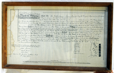
framed document, Batman's Melbourne Deed, 1966
... The document came to be known as Batman's Treaty and is considered significant as it was the first and only documented time when Europeans negotiated their presence and occupation of Aboriginal lands directly with the traditional owners. ...The Batman Deed is sometimes called the Batman Treaty, the Dutigullar Deed, the Dutigullar Treaty or the Melbourne Deed. The deeds had been drafted by JT Gellibrand, a leading lawyer in the colony. Batman's Treaty was a document signed on 6 June 1835 by John Batman, an Australian grazier, businessman and explorer, and a group of Wurundjeri elders, for the purchase of land around Port Phillip, near the present site of the city of Melbourne. The document came to be known as Batman's Treaty and is considered significant as it was the first and only documented time when Europeans negotiated their presence and occupation of Aboriginal lands directly with the traditional owners. The so-called treaty was implicitly declared void on 26 August 1835 by the Governor of New South Wales, Richard Bourke. The original Batman Deed is of enormous significance to the history of the European settlement of Victoria. Framed print of the Batman Deed, dated 1835. This is a printed copy of the Batman Deed, made in 1966 from the 'original' by the State Library of Victoria. The frame is wood. The document consists of handwritten text in black ink with eight signatures in the lower right hand side and three signatures in the lower left hand corner. It has been signed by John Batman beneath the eight signatures.document batman-deed melbourne -
 Eltham District Historical Society Inc
Audio - Audio Recording, Jim Connor - Eltham Lower Park, 8 Feb. 2023
... aboriginal culture. The sculpture “Not Just a Pretty Place” by Aleks Danko, located near the junction of these two watercourses pays tribute to this important cultural location. The first European settlers were squatters or leaseholders and itinerants such as timber workers. Records of their early occupation...aboriginal culture. The sculpture “Not Just a Pretty Place” by Aleks Danko, located near the junction of these two watercourses pays tribute to this important cultural location. The first European settlers were squatters or leaseholders and itinerants such as timber workers. Records of their early occupation ...EDHS Newsletter No. 268 February 2023 Prior to the extension of European people into the lands of the Nillum-bik in the late 1830s the Wurundjeri people had been meeting in the area now known as Eltham Lower Park for thousands of years. Waterway junctions had a particular attraction as tribal meeting places and the junction of the Diamond Creek with the Yarra River (Birr-arung to the Wurundjeri) was one such important location in terms of aboriginal culture. The sculpture “Not Just a Pretty Place” by Aleks Danko, located near the junction of these two watercourses pays tribute to this important cultural location. The first European settlers were squatters or leaseholders and itinerants such as timber workers. Records of their early occupation are sketchy but the Eltham Lower Park area was probably included within the pastoral run established in 1841 by Henry Foley. He sold his leasehold in 1845 to Joseph Wilson who in turn sold it to Frederick Faulkner soon after. From this early history the Eltham Lower Park area has undergone many changes and has been developed to provide residents and visitors with a range of passive and active public open space, including even being used for various horse racing events. At our next meeting, Jim Connor will explore the history of Eltham Lower Park and touch on various individuals and groups involved along the way.1:05:19 duration Digital MP3 file; 22.4MBaudio recording, eltham district historical society, meeting, society meeting, jim connor, eltham, eltham lower park -
 Narre Warren and District Family History Group
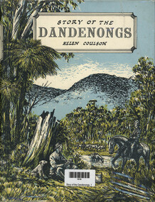
Book, Helen Coulson, Story of the Dandenongs, 1959
... Early pastoralists History of European settlement of Dandenong ranges; minimal references to Aboriginal occupation. xv, 416 p.; 26 cm Story of the Dandenongs Book Helen Coulson Cheshire ...History of European settlement of Dandenong ranges; minimal references to Aboriginal occupation.xv, 416 p.; 26 cmnon-fictionHistory of European settlement of Dandenong ranges; minimal references to Aboriginal occupation. dandenong ranges, land settlement, ferntree gully, scoresby (vic.), lysterfield (vic.), macclesfield (vic.), avonsleigh (vic.), wantirna (vic.), bayswater (vic.), rowville (vic.), emerald (vic.), yellingbo (vic.), cockatoo (vic.), early pastoralists -
 Sunshine and District Historical Society Incorporated
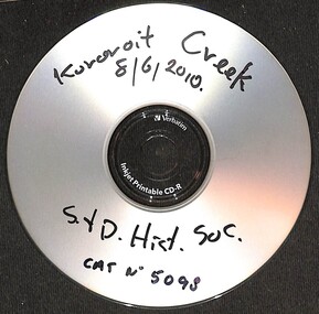
Photograph - Kororoit Creek Photograph Compilation
... Kororoit Creek has deep Aboriginal significance, with evidence of long-standing occupation and cultural practices along its banks. ...Kororoit Creek has deep Aboriginal significance, with evidence of long-standing occupation and cultural practices along its banks. ...Kororoit Creek flows through Albion, Deer Park & Sunshine. It is a vital ecological corridor and recreational trail, known for its basalt cliffs, revegetation efforts, and community significance. Kororoit Creek has deep Aboriginal significance, with evidence of long-standing occupation and cultural practices along its banks. The area surrounding Kororoit Creek is part of the traditional lands of the Wurundjeri Woi-wurrung people, who belong to the Kulin Nation. The name Kororoit is thought to have been derived from an Aboriginal word meaning male kangaroo, but the meaning is in dispute, the name may be also derived from the Woiwurrung language, meaning “Creek on the western plain".Korotoit Creek 8/6/2010kororoit creek -
 Victorian Aboriginal Corporation for Languages
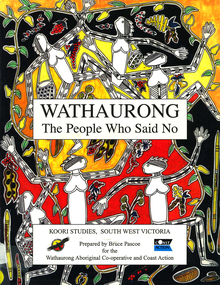
Book, Bruce Pascoe et al, Wathaurong : the people who said no, 2003
... Victorian Aboriginal Corporation for Languages 33 Saxon Street Brunswick melbourne Wathaurong Wadtharung Port Philllip Bay Western Port Bay Lorne South West Victoria Battle Creek Aire River Werribee Ballarat Wathaurong Aboriginal Cooperative Coast Action Koori studies John Batman William Buckley Aboriginal studies policy secondary school education hissing swan Victorian history maps, colour illustrations, b&w illustrations, colour photographs, word lists The Wathaurong people of South Western Victoria said no to European invasion. Learn about this heroic resistance to the occupation ...The Wathaurong people of South Western Victoria said no to European invasion. Learn about this heroic resistance to the occupation of their lands. Can white and black live together or must we be always at war? The answer can only be given by young Australians. Includes a comprehensive historical timeline.maps, colour illustrations, b&w illustrations, colour photographs, word listswathaurong, wadtharung, port philllip bay, western port bay, lorne, south west victoria, battle creek, aire river, werribee, ballarat, wathaurong aboriginal cooperative, coast action, koori studies, john batman, william buckley, aboriginal studies policy, secondary school education, hissing swan, victorian history -
 Victorian Aboriginal Corporation for Languages
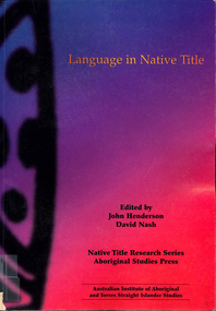
Book, John Henderson, Language in native title, 2002
... Aboriginal people: a linguistic report in a native title claim /? Tamsin Donaldson Labels, language and native title groups: the Miriuwung-Gajerrong case /? Greg McIntyre and Kim Doohan Historical linguistic geography of south-east Western Australia /? David Nash Language ownership: a key issue for native title /? Michael Walsh Can lexicostatistics contribute an absolute time-scale to discussions of continuity of occupation...Aboriginal people: a linguistic report in a native title claim /? Tamsin Donaldson Labels, language and native title groups: the Miriuwung-Gajerrong case /? Greg McIntyre and Kim Doohan Historical linguistic geography of south-east Western Australia /? David Nash Language ownership: a key issue for native title /? Michael Walsh Can lexicostatistics contribute an absolute time-scale to discussions of continuity of occupation ...Introduction /? John Henderson and David Nash Language and native title /? John Henderson Linguistic evidence and native title cases in Australia /? Peter Sutton Linguistic continuity in colonised country /? Jeanie Bell Country and the word: linguistic evidence in the Croker Sea claim /? Nicholas Evans Linguistics and the Yorta Yorta native title claim /? Heather Bowe The language of the Peak Hill Aboriginal people: a linguistic report in a native title claim /? Tamsin Donaldson Labels, language and native title groups: the Miriuwung-Gajerrong case /? Greg McIntyre and Kim Doohan Historical linguistic geography of south-east Western Australia /? David Nash Language ownership: a key issue for native title /? Michael Walsh Can lexicostatistics contribute an absolute time-scale to discussions of continuity of occupation in native title determinations? /? Barry Alpher Linguistic stratigraphy and native title: the case of ethnonyms /? Patrick McConvell Making your skin fit properly: displaced equivalence in 'skin' systems in the Barkly /? Gavan BreenMaps, tables, b&w diagramsyorta yorta, yoda yoda, yabala yabala, bangerang, shepparton, miriuwung, gajerrong, native title -
Victorian Aboriginal Corporation for Languages
Book, Thomas Francis Bride, Letters from Victorian pioneers : being a series of papers on the early occupation of the colony, the Aborigines, etc. : addressed by Victorian pioneers to His Excellency Charles Joseph La Trobe Esq., Lieutenant-Governor of the Colony of Victoria, 1898
... s role with the Aboriginal people after he returned to White society. Letters from Victorian pioneers : being a series of papers on the early occupation of the colony, the Aborigines, etc. : addressed by Victorian pioneers to His Excellency Charles Joseph La Trobe Esq., Lieutenant-Governor of the Colony of Victoria Book Thomas Francis Bride ...Original edition of the letters from pioneering families in the Colony iof Port Phillip. It looks at their daily lives and hardships. It includes first hand reports of William Buckley?s role with the Aboriginal people after he returned to White society.maps, b&w illustrations -
 Victorian Aboriginal Corporation for Languages
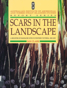
Book, Ian Clark, Scars in the landscape : a register of massacre sites in Western Victoria 1803-1859, 1995
... Victorian Aboriginal Corporation for Languages 33 Saxon Street Brunswick melbourne Dhauwurd wurrung Djab wurrung Djadja wurrung Djargurd wurrung Gadubanud Girai wurrung Keerray-Woorroong Gulidjan Jardwadjali Watha wurrung Wathaurong Wergaia colonisation race relations racism European occupation government policy maps, colour photographs, b&w photographs Register and documentation of massacre sites in ten language groups of Western Victoria; each language group includes details of clans, history of European occupation and government policy. ...Register and documentation of massacre sites in ten language groups of Western Victoria; each language group includes details of clans, history of European occupation and government policy.maps, colour photographs, b&w photographsdhauwurd wurrung, djab wurrung, djadja wurrung, djargurd wurrung, gadubanud, girai wurrung, keerray-woorroong, gulidjan, jardwadjali, watha wurrung, wathaurong, wergaia, colonisation, race relations, racism, european occupation, government policy -
 Victorian Aboriginal Corporation for Languages
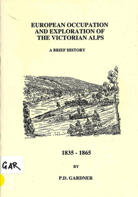
Book, P D Gardner, European occupation and exploration of the Victorian Alps : a brief history, 1835-1865, 1996
... Victorian Aboriginal Corporation for Languages 33 Saxon Street Brunswick melbourne Ngarigo Jaitmathang Ngunawal Kosciusko Djilamatang Charlie Tarra Strzelecki Gibbo Range Omeo Jemmy Gibber E W Bayliss Matooka Matoka Monaro Maps, b&w illustrations European occupation and exploration of the Victorian Alps : a brief history, 1835-1865 Book P D Gardner ...Maps, b&w illustrationsngarigo, jaitmathang, ngunawal, kosciusko, djilamatang, charlie tarra, strzelecki, gibbo range, omeo, jemmy gibber, e w bayliss, matooka, matoka, monaro -
 Victorian Aboriginal Corporation for Languages
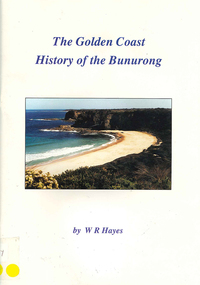
Book, W R Hayes, The golden coast : history of the Bunurong, 1998
... Includes descriptions of the impacts and consequences of European occupation on the Aboriginal people of this region....Victorian Aboriginal Corporation for Languages 33 Saxon Street Brunswick melbourne Bunurong Boon wurrung Andersons Inlet Cape Woolamai colonisation maps, colour photographs, b&w photographs, b&w illustrations A history of the section of Victorian coastline from Andersons Inlet to Cape Woolamai. Includes descriptions of the impacts and consequences of European occupation ...A history of the section of Victorian coastline from Andersons Inlet to Cape Woolamai. Includes descriptions of the impacts and consequences of European occupation on the Aboriginal people of this region.maps, colour photographs, b&w photographs, b&w illustrationsbunurong, boon wurrung, andersons inlet, cape woolamai, colonisation -
 Wodonga & District Historical Society Inc
Book - The Book of the Murray, Lawrence, G. V.; and Smith, Graeme Kinross, 1975
... Lindsay, The Aboriginal Occupation – Norman B. Tindale 12. Fish of the Murray River – John S. ...This book contains contributions from 16 writers who have first-hand knowledge of the Murray River area. It provides a comprehensive picture of the river in all its aspects. It gives a fascinating look at one of Australia's most important geographical and historical features. Contributors and chapters in this book are: - 1. Past, Present and Future – G. V. Lawrence 2. The Structure of the Murray – Edmund D. Gill 3. Seeing the Murray – Graeme Kinross Smith 4. The Mountains at the Source – Elyne Mitchell 5. The Explorers – Leigh Betheras 6. The Irrigators – G. Arch Grosvenor 7. Murray Water Conservation – W. G. L. Harrison & K. E. Johnson 8. The Murray River Steamers – Ian Mudie 9. Pioneer Days: A Story of Seventy Years Ago – Dorothy Roysland 10. Birdlife of the Murray Valley – John Eckert 11 .Aborigines in the Murray Valley, How We Learned the Story – H. A. Lindsay, The Aboriginal Occupation – Norman B. Tindale 12. Fish of the Murray River – John S. Lake 13. Native Plants of the Murray Valley – J. H. Willis 14. Murray Wildlife – K. N. G. SimpsonThis publication has a hard cover with blue boards and a pictorial dust jacket. It consists of 264 pages.This book contains contributions from 16 writers who have first-hand knowledge of the Murray River area. It provides a comprehensive picture of the river in all its aspects. It gives a fascinating look at one of Australia's most important geographical and historical features. Contributors and chapters in this book are: - 1. Past, Present and Future – G. V. Lawrence 2. The Structure of the Murray – Edmund D. Gill 3. Seeing the Murray – Graeme Kinross Smith 4. The Mountains at the Source – Elyne Mitchell 5. The Explorers – Leigh Betheras 6. The Irrigators – G. Arch Grosvenor 7. Murray Water Conservation – W. G. L. Harrison & K. E. Johnson 8. The Murray River Steamers – Ian Mudie 9. Pioneer Days: A Story of Seventy Years Ago – Dorothy Roysland 10. Birdlife of the Murray Valley – John Eckert 11 .Aborigines in the Murray Valley, How We Learned the Story – H. A. Lindsay, The Aboriginal Occupation – Norman B. Tindale 12. Fish of the Murray River – John S. Lake 13. Native Plants of the Murray Valley – J. H. Willis 14. Murray Wildlife – K. N. G. Simpsonmurray river, australian geography, settlement on the murray river, native plants, aborigines in the murray valley, murray valley flora and fauna -
Koorie Heritage Trust
Journal - Serials, Department of Pacific and Southeast Asian History, Australian National University, Aboriginal History - Volume 17.1-2 1993, 1993
... Aboriginal Australians -- Periodicals. | Ethnology -- Australia -- Periodicals. | Settlement and contacts - Colonisation - 1788-1850 | Race relations - Violent - Massacres murders poisonings etc. - To 1900 | Settlement and contacts - Explorers | Occupations - Domestic servants | Social organisation - Kinship - Systems | Occupations - Pastoral industry workers | Race relations - Racism - Stereotyping | Under the title " John Piper, "Conqueror of the Interior", the article deals with the Aboriginal who accompanied Major Mitchell on his 1836 expedition. ...Under the title " John Piper, "Conqueror of the Interior", the article deals with the Aboriginal who accompanied Major Mitchell on his 1836 expedition. The article relates the whole journey with an extensive picture of his travels through Victoria.194 P.; refs; footnotes; reviews; bib; 25 cm.Under the title " John Piper, "Conqueror of the Interior", the article deals with the Aboriginal who accompanied Major Mitchell on his 1836 expedition. The article relates the whole journey with an extensive picture of his travels through Victoria.aboriginal australians -- periodicals. | ethnology -- australia -- periodicals. | settlement and contacts - colonisation - 1788-1850 | race relations - violent - massacres, murders, poisonings etc. - to 1900 | settlement and contacts - explorers | occupations - domestic servants | social organisation - kinship - systems | occupations - pastoral industry workers | race relations - racism - stereotyping | -
Koorie Heritage Trust
Journal - Serials, Department of Pacific and Southeast Asian History, Australian National University, Aboriginal History - Volume 07. 1-2 1983, 1983
... Aboriginal Australians -- Periodicals. | Ethnology -- Australia -- Periodicals. | Child welfare - Child / parent separation - Stolen generations | Social welfare - Wards of state | Social welfare | Social welfare - Government | Government policy - Assimilation | Family | Child welfare | Child welfare - Adoption and fostering | Government policy - Commonwealth | Government policy - Self determination - 1993-2004 | Occupations - Pastoral industry workers | Race relations - Violent - Massacres murders poisonings etc. - To 1900 | Politics and Government - Political action - Petitions | Cooper William (1861Ð1941) | Victoria. ...A series of articles by leading writers on Aboriginal History.228 P.; refs. bibs. tables; maps; ports.; 25 cm.A series of articles by leading writers on Aboriginal History.aboriginal australians -- periodicals. | ethnology -- australia -- periodicals. | child welfare - child / parent separation - stolen generations | social welfare - wards of state | social welfare | social welfare - government | government policy - assimilation | family | child welfare | child welfare - adoption and fostering | government policy - commonwealth | government policy - self determination - 1993-2004 | occupations - pastoral industry workers | race relations - violent - massacres, murders, poisonings etc. - to 1900 | politics and government - political action - petitions | cooper, william (1861ð1941) | victoria. aborigines welfare board | victoria. board for the protection of aborigines | victoria. ministry of aboriginal affairs | mclean report | music - vocal - origins | language - kriol - pidgins and creoles - torres strait creole | -
Koorie Heritage Trust
Book, Broome, Richard, Aboriginal Australians. Black Responses to white Dominance 1788-1994. (Second Edition), 1994
... Aboriginal Australians -- Social conditions. | Race discrimination -- Australia. | Australia -- Race relations. | Economic sectors - Agriculture and horticulture - Pastoral industry - Beef cattle | Religions - Christianity - Missions | Settlement and contacts - 20th Century | Enterprises - Pastoral industry | Government policy - Assimilation | Government policy - Initial period and protectionism | Government policy - Integration | Government policy - State and territory - New South Wales | Government policy - State and territory - Victoria | Law - Land | Land rights - Mining industry | Land rights - Pastoral industry | Socioeconomic conditions - Living conditions | Occupations - Pastoral industry workers | Law enforcement - Police - Native police | Law enforcement - Police conduct and attitudes | Politics and Government - Political action - Land rights | Race relations - Violent - Massacres murders poisonings etc. - To 1900 | Race relations - Racism - Stereotyping | Surveys traditional life and values, confrontations with the British; violent conflicts with settlers, native police throughout the country; attacks on Aboriginal initiative at Coranderrk, Cumeroogunja and other settlements; racial legislation, missionary attitudes; cattle industry, mining; discrimination; growth of Aboriginal rights movement, Aboriginal organizations, land rights. 4-275 P.; plates; ill,; appendices; notes; bib.; index; 22 cm. ...Surveys traditional life and values, confrontations with the British; violent conflicts with settlers, native police throughout the country; attacks on Aboriginal initiative at Coranderrk, Cumeroogunja and other settlements; racial legislation, missionary attitudes; cattle industry, mining; discrimination; growth of Aboriginal rights movement, Aboriginal organizations, land rights.4-275 P.; plates; ill,; appendices; notes; bib.; index; 22 cm.Surveys traditional life and values, confrontations with the British; violent conflicts with settlers, native police throughout the country; attacks on Aboriginal initiative at Coranderrk, Cumeroogunja and other settlements; racial legislation, missionary attitudes; cattle industry, mining; discrimination; growth of Aboriginal rights movement, Aboriginal organizations, land rights.aboriginal australians -- social conditions. | race discrimination -- australia. | australia -- race relations. | economic sectors - agriculture and horticulture - pastoral industry - beef cattle | religions - christianity - missions | settlement and contacts - 20th century | enterprises - pastoral industry | government policy - assimilation | government policy - initial period and protectionism | government policy - integration | government policy - state and territory - new south wales | government policy - state and territory - victoria | law - land | land rights - mining industry | land rights - pastoral industry | socioeconomic conditions - living conditions | occupations - pastoral industry workers | law enforcement - police - native police | law enforcement - police conduct and attitudes | politics and government - political action - land rights | race relations - violent - massacres, murders, poisonings etc. - to 1900 | race relations - racism - stereotyping | -
Koorie Heritage Trust
Document - Report, Brown, Jill W. (Roisin Hirschfeld and Diane Smith; under the supervision of Professor Edna Chamberlain), Aboriginals and Islanders in Brisbane, 1974
... Aboriginal Australians -- Queensland -- Brisbane -- Social conditions. | Torres Strait Islanders -- Queensland -- Brisbane -- Social conditions. Demographic data on race, age, sex, marital status and mobility; education levels; housing and problems in finding accommodation; occupations and income; medical, legal, welfare and other services; hostels. ix, 119 p. ; 25 cm. ...Demographic data on race, age, sex, marital status and mobility; education levels; housing and problems in finding accommodation; occupations and income; medical, legal, welfare and other services; hostels.ix, 119 p. ; 25 cm.Demographic data on race, age, sex, marital status and mobility; education levels; housing and problems in finding accommodation; occupations and income; medical, legal, welfare and other services; hostels.australian aborigines. social conditions. brisbane | torres strait islanders. social conditions. brisbane | aboriginal australians -- queensland -- brisbane -- social conditions. | torres strait islanders -- queensland -- brisbane -- social conditions. -
 Sunbury Family History and Heritage Society Inc.
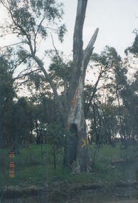
Photograph, 18th October 1998
... The scarred tree is evidence of Aboriginal occupation in the area as the bark from such trees was used for many items. ...The Aboriginal scarred tree was growing along the Redesdale Road just north of the Langley State School. Redesdale is NW of Melbourne in the Greater Bendigo area. The traditional owners are the Dja Dja Wurrung People.The scarred tree is evidence of Aboriginal occupation in the area as the bark from such trees was used for many items. A non-digital coloured photograph of a scarred tree with other smaller trees in the background. The tree has a yellow cross painted on its trunk.scarred trees, aboriginal society, aboriginal technology, langley, dja dja wurrung people -
Whitehorse Historical Society Inc.
Document, The Traditional owners of the Whitehorse Region, 1997
... Whitehorse Historical Society Inc. 2-10 Deep Creek Road Mitcham melbourne Aborigines Woiworung aboriginal tribe Wurundjeri aboriginal tribe City of Whitehorse Brief outline of the Wurundjeri people's occupation of the Whitehorse area. ...Brief outline of the Wurundjeri people's occupation of the Whitehorse area.Brief outline of the Wurundjeri people's occupation of the Whitehorse area.Brief outline of the Wurundjeri people's occupation of the Whitehorse area.aborigines, woiworung aboriginal tribe, wurundjeri aboriginal tribe, city of whitehorse -
 Bacchus Marsh & District Historical Society
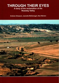
Book, Through Their Eyes : A Story of the Reclamation of the Rowsley Valley
... Bacchus Marsh & District Historical Society Lerderderg Library Main Street Bacchus Marsh Environmental Restoration Projects Rowsley Valley Victoria Environmental History Conservation of Natural Resources Aboriginal Australians Bacchus Marsh Region History Wadawurrung People History This book contains a collection of articles written by landholders, local residents and members of corporate and volunteer organisations describing their roles in the restoration of Rowsley Valley. The historical scope of this book encompasses the geological and environmental history of the area prior to human habitation, occupation ...This book contains a collection of articles written by landholders, local residents and members of corporate and volunteer organisations describing their roles in the restoration of Rowsley Valley. The historical scope of this book encompasses the geological and environmental history of the area prior to human habitation, occupation by the Wadawurrung people prior to European colonisation, and the colonial and post colonial eras. This introductory contextual background is complemented by the rest of the book which describes the various aspects of the environmental restoration of the Rowsley Valley from the latter part of the 20th century continuing to the present day.Printed foolscap size book. Softcover. 112 pages. Colour and black and white photos. Maps, figures, tables. Index. Publication details. Graham Simpson (Publisher, Bacchus Marsh, Victoria, 2021. Lead authors Graham Simpson, Jeanette McGonegal and Alan Morton.This book contains a collection of articles written by landholders, local residents and members of corporate and volunteer organisations describing their roles in the restoration of Rowsley Valley. The historical scope of this book encompasses the geological and environmental history of the area prior to human habitation, occupation by the Wadawurrung people prior to European colonisation, and the colonial and post colonial eras. This introductory contextual background is complemented by the rest of the book which describes the various aspects of the environmental restoration of the Rowsley Valley from the latter part of the 20th century continuing to the present day.environmental restoration projects, rowsley valley victoria environmental history, conservation of natural resources, aboriginal australians bacchus marsh region history, wadawurrung people history -
 Narre Warren and District Family History Group
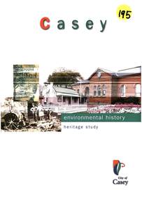
Book, Graeme Butler & Associates, City of Casey Heritage Study : Environmental History, 1998
... Manufacturing The study highlights the rich history and development of the City of Casey, showcasing its transformation from a region of Aboriginal occupation and pastoral runs to a modern city with diverse industries, residential estates, and cultural heritage. ...A comprehensive environmental history of the City of Casey, covering its heritage, development, and key historical aspects. Some of the themes explored are: 1. Explorers and First Contact 2. Peopling the Continent 3. Promoting Settlement 4. Developing Primary Production 5. Exploiting Natural Resources 6. Building Settlements 7. Governing and Administrative Structures 8. Altering the Environment 9. Communication and Transport 10. Education 11. Recreation 12. Manufacturing The study highlights the rich history and development of the City of Casey, showcasing its transformation from a region of Aboriginal occupation and pastoral runs to a modern city with diverse industries, residential estates, and cultural heritage. This publication can be downloaded from the City of Casey website.non-fictionA comprehensive environmental history of the City of Casey, covering its heritage, development, and key historical aspects. Some of the themes explored are: 1. Explorers and First Contact 2. Peopling the Continent 3. Promoting Settlement 4. Developing Primary Production 5. Exploiting Natural Resources 6. Building Settlements 7. Governing and Administrative Structures 8. Altering the Environment 9. Communication and Transport 10. Education 11. Recreation 12. Manufacturing The study highlights the rich history and development of the City of Casey, showcasing its transformation from a region of Aboriginal occupation and pastoral runs to a modern city with diverse industries, residential estates, and cultural heritage. This publication can be downloaded from the City of Casey website.lysterfield reservoir, koo wee rup swamp, berwick (vic.), endeavour hills (vic.), cranbourne (vic.), narre warren north (vic.), tooradin (vic.), hampton park (vic.), doveton (vic.)