
Showing 20 items matching "board of lands and works"
-
 Ringwood and District Historical Society
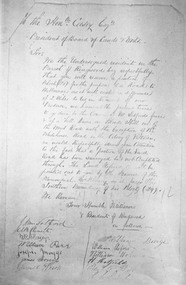
Document, Petition by the residents of Ringwood to the Hon. Mr Casey Esq. President of Board of Lands and Works dated 4/9/1872
... President of Board of Lands and Works dated 4/9/1872. ...President of Board of Lands and Works dated 4/9/1872. Document ...Copy of hand written documentPetition requests the completion of a road to Melbourne from 'Blood's Hill' (eventual corner of Bedford Road and Dublin Road Ringwood East). Signed by a number of Ringwood residents. -
 Whitehorse Historical Society Inc.
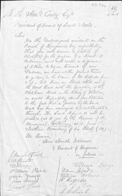
Letter - Correspondence, Roads, n.d
... Request from 'Residents of Ringwood' to President of Board of Lands & Works, the Hon. Mr Casey for provision of a road alternative to 'Blood's Hill ' route. ...Request from 'Residents of Ringwood' to President of Board of Lands & Works, the Hon. Mr Casey for provision of a road alternative to 'Blood's Hill ' route. ...Request from 'Residents of Ringwood' to President of Board of Lands & Works, the Hon. Mr Casey for provision of a road alternative to 'Blood's Hill ' route. Signed by J. M. Setford and others. n.d.roads and streets, setford, j.m., ringwood, clements, a.b., blazey, w.r., parr, william, maggs, joseph, morriss, james, burge, william, holmes, william, hatfield, h., leach, g.w. -
 Warrnambool and District Historical Society Inc.
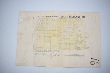
Original Document, Map: Agricultural area of Ballangeich 1865, 1865
... At the top: Plan of the Agricultural area of Ballangeich 1865 At the bottom left: Prepared by the Board of Lands & Works in accordance with the Amending Land Act 1865 Lands & Survey Office Melbourne 13th April 1865. ...This map is typical of many which were produced in the 1860's in Victoria during a significant period of Victoria's and Warrnambool district history. history of warrnambool ballangeich Land surveys Victoria 1865 Lands Act 1865 Victoria Ballangeich map 1865 At the top: Plan of the Agricultural area of Ballangeich 1865 At the bottom left: Prepared by the Board of Lands & Works in accordance with the Amending Land Act 1865 Lands & Survey Office Melbourne 13th April 1865. ...George Eddington arrived in Australia in 1839 and named and established property in 1841 calling the property Ballangeich after a Pass near his home town of Stirling in Scotland. It is situated 151 miles west of Melbourne and to the south of Mortlake and was originally part of the Mortlake shire, which was proclaimed 26th Jan 1864. Nearest streams are the Hopkins Riverand Lyall and Drysdale creek running through good agricultural land. This map relates to the breaking up of large runs which the Victorian government enabled through selection acts of the 1860's. The previously larger runs which were mainly cattle and sheep based were now more open to closer settlement and a greater variety in farming.The lots range in size from approximately 50 acres to around 600 acres.Some areas are set aside for reserves. By 1886 the population of Ballangeich had grown to around 600 with an hotel, three state schools and a church.Tri weekly coaches ran to Colac, Warrnambool and Camperdown providing access to supplies mail and communication. This map is typical of many which were produced in the 1860's in Victoria during a significant period of Victoria's and Warrnambool district history.Rectangular light card paper with black text showing allotments of land The area is coloured in green with scale at bottom right cornerAt the top: Plan of the Agricultural area of Ballangeich 1865 At the bottom left: Prepared by the Board of Lands & Works in accordance with the Amending Land Act 1865 Lands & Survey Office Melbourne 13th April 1865. With signaturehistory of warrnambool, ballangeich, land surveys victoria 1865, lands act 1865 victoria, ballangeich map 1865 -
 Glenelg Shire Council Cultural Collection
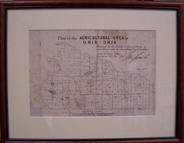
Map - Map of Drik-Drik, 1865
... Front: Plan of the Agricultural Area of Drik-Drik L.2556/Prepared by the Board of Lands and Works in accordance with the "Amending Land Act 1865". ...Displayed at History House. map drik drik plan geography cartography Front: Plan of the Agricultural Area of Drik-Drik L.2556/Prepared by the Board of Lands and Works in accordance with the "Amending Land Act 1865". ...Displayed at History House.Print of map pasted onto board, mounted and framed under glass. Buff-coloured mount. Mahogany stained moulded wood frame, black inner frame.Front: Plan of the Agricultural Area of Drik-Drik L.2556/Prepared by the Board of Lands and Works in accordance with the "Amending Land Act 1865". Lands and Survey Office, Melbourne 11th May 1865. (printed, upper centre). Back: Duncan Hedditchmap, drik drik, plan, geography, cartography -
 Orbost & District Historical Society
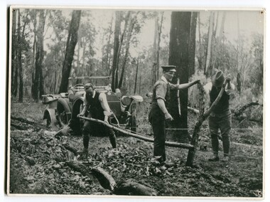
black and white photograph, 1913
... The y Roads Board was formed in 1913 1910 it had become apparent that there was a need for a central roads authority to take over responsibility from the Board of Lands and Works for the care and management of the main roads of the state of Victoria. ...The y Roads Board was formed in 1913 1910 it had become apparent that there was a need for a central roads authority to take over responsibility from the Board of Lands and Works for the care and management of the main roads of the state of Victoria. ...This photograph shows Country Roads Board men clearing a bush track at Hospital Creek. Their vehicle was bogged. The y Roads Board was formed in 1913 1910 it had become apparent that there was a need for a central roads authority to take over responsibility from the Board of Lands and Works for the care and management of the main roads of the state of Victoria. Because there was no consistent and systematic policy for road maintenance Victorian roads were in a deplorable condition. At this time the use of the motor car accentuated the demands for better roads. As a result of these needs the Country Roads Act 1912 was proclaimed in 1913 providing for the establishment of the Country Roads Board as a central road authority with responsibility for those roads within the State considered to be main roads. the C.R.B. was responsible for the construction of roads and bridges including the Snowy River road bridges in Orbost.. This is a pictorial record of transport difficulties in East Gippsland in early 20th century.A large black / white photograph of three men clearing a bush track with a motor vehicle behind them.transport roads road-maintenance country-roads-board -
 Orbost & District Historical Society
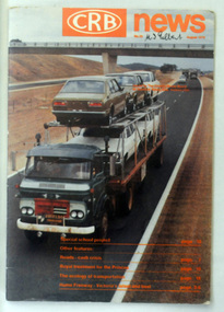
magazine, CRB News, August 1976
... By 1910 it had become apparent that there was a need for a central roads authority to take over responsibility from the Board of Lands and Works for the care and management of the main roads of the state of Victoria. ...By 1910 it had become apparent that there was a need for a central roads authority to take over responsibility from the Board of Lands and Works for the care and management of the main roads of the state of Victoria. ...By 1910 it had become apparent that there was a need for a central roads authority to take over responsibility from the Board of Lands and Works for the care and management of the main roads of the state of Victoria. Because there was no consistent and systematic policy for road maintenance Victorian roads were in a deplorable condition. At this time the use of the motor car accentuated the demands for better roads. As a result of these needs the Country Roads Act 1912 was proclaimed in 1913 providing for the establishment of the Country Roads Board as a central road authority with responsibility for those roads within the State considered to be main roads. the C.R.B. was responsible for the construction of roads and bridges including the Snowy River road bridges in Orbost. This was a major project involving not only a new bridge over the Snowy River (including Lochiel Lagoon), but other bridges over Ashby’s Gulch and Watt’s Gulch. These new bridges were opened in November 1976 with the unveiling of a plaque on the eastern end of the $2.4M Snowy River Bridge. (ref. May Leatch) This is a useful reference tool on the history of the construction of the Snowy River road bridges.A journal, titled "CRB News" . On the front cover the title is in orange print with No. 33 August 1976 above a coloured photo of a truck carrying two tiers of new vehicles along a main sealed road. It contains information and photos of the construction of the Snowy River road bridges.on front cover - handwritten in black - "M. I. Gilbert"crb-news country-roads-board snowy-river-road-bridges -
 Orbost & District Historical Society
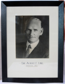
framed photo, APFA- Davisigns (PG & ME Davis)
... Lind was made Minister of Forests, President of the Board of Land and Works and Commissioner of Crown Lands and Survey in Albert Dunstan's cabinet. ...Lind was made Minister of Forests, President of the Board of Land and Works and Commissioner of Crown Lands and Survey in Albert Dunstan's cabinet. ...This photo was inherited with the building when the museum was established. Lind was born in 1878 in East Charlton, Victoria, the son of Oliver Nicholas Lind, a farmer from Denmark, and his Welsh wife Mary Ann Clay. In 1882, drought forced the family to move to East Gippsland where Lind was educated at Lucknow, and then to Bairnsdale in 1884 where he attended Bairnsdale state school. In October 1920, he was elected to the Victorian Legislative Assembly for the seat of Gippsland East for the Victorian Farmers' Union. Lind was made Minister of Forests, President of the Board of Land and Works and Commissioner of Crown Lands and Survey in Albert Dunstan's cabinet. He was knighted in 1951. In 1926 two national parks east of Orbost were named the Albert and the Lind national parks after him.A framed photo of Sir Albert Eli Lind. It is a black and white head and shoulders photo in a black wooden frame.Sir Albert E. Lind Knighted !951photograph politician lind-albert government -
 Orbost & District Historical Society
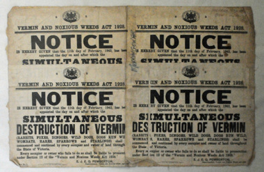
map/poster, Victorian Government Printer, 22.4.1926
... The Department of Crown Lands and Survey was originally established in 1857 as part of the Board of Land and Works. ...The Department of Crown Lands and Survey was originally established in 1857 as part of the Board of Land and Works. ...The Department of Crown Lands and Survey was originally established in 1857 as part of the Board of Land and Works. In 1964 it ceased to be controlled by the Board. The Department functioned for almost twenty more years before being combined with other Ministries to form the Department of Conservation, Forests and Land. It was responsible for the management of the State's Crown land and pastoral estates. This map was used by Don Mehlert after 1928. The VERMIN AND NOXIOUS WEEDS ACT 1928 was an Act to consolidate the Law relating relating to Vermin and Noxious Weeds. E. J. E. G. Pemberton who published this poster was Superintendent of Field Staff, Dept. of Lands and Survey. This map and posters are significant records of early settlement history in Murrangower, between Cabbage Tree and Orbost,A paper map of Murrangower showing settlement subdivisions. This is glued onto the back of four overlapping cloth poster of "Notices of Vermin Destruction". All print is black."DON MEHLERT" in black pen. Pike's block shaded in blue. School site marked in blue pencil. on poster "MURRANGOWAR" along side.map-murrangower poster-vermin-and-noxious-weeds murrangower-settlement -
 Orbost & District Historical Society
certificate, March 29th 1888
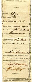
... of Land and Works ...From the THE LAND ACT 1884.-REGULATIONS: "Any person duly licensed under section 93 of The Land Act 1884 to cut and take away any live or dead timber on Crown lands, and any person specially licensed in that behalf by the Governor in Council, may at all times enter upon the said land and therefrom cut and take away live or dead timber. "The Richardson family was one of the very early settler families to establish themselves in the Orbost district. Samuel Richardson was builder of the Paddle Steamer Curlip.A white paper licence certificate No. 182 made out to Samuel Richardson & Son for the purpose of a Saw Mill. It was to cost ten pounds per annum. Print is black and details are hand-written.richardson-samuel certificate-lands-sawmill -
 Eltham District Historical Society Inc
Photograph - Aerial Photograph, Central Plan Office, Eltham, Jan. 1960
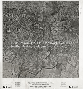
... No. 21451 (Print) Dept. of Lands & Survey and the Melb. & Metro. Board of Works. Aerial Photo Details: MELBOURNE METROPOLITAN AREA Section : 12 G West Date : Jan....No. 21451 (Print) Dept. of Lands & Survey and the Melb. & Metro. Board of Works. Aerial Photo Details: MELBOURNE METROPOLITAN AREA Section : 12 G West Date : Jan. ...Centred on Bolton Street and Brougham Street, Eltham bounded by Progress Road to north, Yarra River to south, Andrews Street and Euclyptus Road to east and Greensborough Railway Station to west. Historic Aerial Imagery Source: Central Plan Office Neg. No. 21451 (Print) Dept. of Lands & Survey and the Melb. & Metro. Board of Works. Aerial Photo Details: MELBOURNE METROPOLITAN AREA Section : 12 G West Date : Jan./Feb. 1960 Scale : 800 feet to 1 inch 37°43'18.2"S 145°08'13.0"E Melways : 21 J6 (ed. 42)aerial photo, lower plenty, main road, montmorency, eltham, eltham lower park, heidelberg golf club, hurstbridge railway line, main road eltham, yarra river, 1960-01, andrews street, arthur street, bolton street, briar hill, brougham steet, dave lyon house, eltham north, eltham-yarra glen road, ernie andrew house, eucalyptus road, greensborough railway station, henry street, karingal road, melway 21j6, montmorency railway station, mount pleasant road, progress road, railway road, southernwood, were street -
 Queenscliffe Maritime Museum
Container - Basket, fisherman's
... Irish-born Duffy was the Commissioner for Public Works, President of the Board of Land and Works, and Commissioner for Crown Lands and Survey, later to become Premier of Victoria. ...Irish-born Duffy was the Commissioner for Public Works, President of the Board of Land and Works, and Commissioner for Crown Lands and Survey, later to become Premier of Victoria. ...In July 1862, Victoria’s out-going Inspector of Fisheries and Oyster Beds, James Putwain, wrote a report of his observations of the colony’s commercial fisheries to deputy premier Charles Duffy. Irish-born Duffy was the Commissioner for Public Works, President of the Board of Land and Works, and Commissioner for Crown Lands and Survey, later to become Premier of Victoria. Reckoned to be of public interest, Putwain’s report was published in the Lands Circular of the day. Apart from its general historical interest in describing the fishes, fishing gear and boats of the time, this report remarks on the vulnerability of commercial fishermen to market wholesalers. It also comments on the particular role of Chinese, both as fishermen and as a discrete section of the fish-buying community at the time. FISHERIES OF VICTORIACane woven fisherman's basket for storage of catchfishing in port phillip and hobson's bay -
 Bendigo Historical Society Inc.
Document - LANDS OFFICE: CERTIFIED PLAN REGISTER
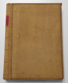
... of land and works, gazette page, name of surveyors, date of survey, sent to, date. ...Document: hard cover journal. Buff cover with embossed edges. Spine has red insert with 'Certified Plan Register' printed in gold. 250 pages, with index in front of register. LH page: number, date of receipt, name, parish, tracing book, plan, decision of Board of land and works, gazette page, name of surveyors, date of survey, sent to, date. RH page: précis of minute. Dated 1878 - 1893, includes areas in central and northern Victoria.plan register, lands office, bendigo, plans, surveyed, victoria, northern victoria -
 Sunshine and District Historical Society Incorporated
Administrative record - City of Sunshine - Commissioner Mr Alexander "Alex" George Gillon Collection 1976 - 1982 - Notice of Ordinary Meeting of the City of Sunshine on 13th June 1978, City of Sunshine, 7th June 1978
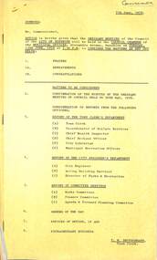
... Local Unit McIntyre Road / Sunshine Avenue Construction Construction of Wright Street Bridge Account for Reinstatement 11 Commercial Street Allocation of Funds Joint Works Main and Unclassified Roads Proposed Intersection Signals St. ...Local Unit McIntyre Road / Sunshine Avenue Construction Construction of Wright Street Bridge Account for Reinstatement 11 Commercial Street Allocation of Funds Joint Works Main and Unclassified Roads Proposed Intersection Signals St. ...Notice of Ordinary Meeting of the City of Sunshine on 13th June 1978 Report of the Town Clerk's Department Report of the Town Clerk Increased Crime Request for Royal Commission Loan Programme Increased Borrowing Allocation for 1978/79 Pre-Natal Clinic Sunshine Infant Welfare Centre Land Transfer Discontinued Road Between Verdun Street and Mitchell Street Crown Lands Adjoining Kororoit Creek / Anderson Road / Graham Street Proposed Committee of Management Lease Italo-Australian Co-Operative Social Club Ltd Separate Rate Off Street Parking Scheme Melbourne Metropolitan Board of Works Representation Report of the Co-Ordinator of Welfare Services Family and Community Service Programme State Grants (Home Care) Act Welfare Officers Subsidies Proposal for Funding for Emergency Relief in the Western Region Caretaker / Cleaner Lions House of Sunshine Senior Citizens Club Howard Kingham Lodge Hostel for the Frail Aged Proposal for Upgrading Housing Commission Areas Report of the Acting Chief Health Inspector Prosecution Proceedings Sunshine Magistrates Court Quarterly Return of Food Samples Infant Welfare Immunisation St. Albans Deer Park Infant Welfare Centre Gas fired Toilet "Destroilet" Report of the By-Lawa Officer Court Proceedings Parking Infringements Report of the City Librarian Second Bookmobile School Holiday Programme 15th to 26th May Children's Literature Second National Seminar September 1st to 5th 1978 Report of the Municipal Recreation Officer Proposed Formation of Western Region Commission Municipal Recreation Officers' Sub Committee Ground Allocations Winter Seasons 1978 Report of the City Engineer Proposed Amendment No 81 to the Melbourne Metropolitan Planning Scheme Land Acquisition Maribyrnong Valley Land Use Permit Application Extensions to Marian College Secondary School Lots 590 & 591 Glengala Road Land Use Permit Application Flats Lot 31 Bardsley Street Land Use Permit Application Take Away Foods Lot 8 Market Place Land Use Permit Application Advertising Sign A.C. Sheeting Pty Ltd 1 Fourth Avenue Land Use Permit Application Drive In Bottle Shop and Extension to St. Albans Hotel McKechnie Street Plan of Subdivision Gladstone Street and Garfield Street Strata Subdivision 11 Yarmouth Avenue Consolidation of Title Somers Street and Henderson Street Plan of Subdivision Geelong Road and Francis Street Tenders for Surplus Equipment Mowers Contract Construction of Neale Road Somerville Road Outfall Drain Subsidy for Victoria S.E.S. Local Unit McIntyre Road / Sunshine Avenue Construction Construction of Wright Street Bridge Account for Reinstatement 11 Commercial Street Allocation of Funds Joint Works Main and Unclassified Roads Proposed Intersection Signals St. Albans Road / Main Road East / East Esplanade Give Way to Right Signs Western Highway Fitzgerald Road / Boundary Road Funds Street Lighting Western Highway (Ballarat Road, Ashley Street and Mitchell Street Intersection Princess Highway West Old Geelong Road to McDonald Road Northern Service Road Replacement of Plant Nos 51 & 58 Chamberlin Front End Loaders Sunshine Swimming Pool Progress Report Relocation of Steel Framed Steel Clad Sheds to Errington Reserve and Robert Bruce Reserve Fairbairn Road Pre-School Centre Toilet Blocks Various Reserves Scovell Reserve Proposal by Maidstone Junior Sporting Club to Construct a Recreation Hall Report of the Acting Building surveyor Outbuilding 19 Charlotte Street Sunshine West Outbuilding 34 Bent Street St. Albans Outbuilding 2 Lynch Street Sunshine Outbuilding 18 Hertford Road Sunshine Outbuilding 16 Baynton Avenue Sunshine North Dangerous and Ruinous Building Van Ness Avenue (Former Rock Crushing Plant) Report of the Director Parks & Recreation Summer School Park Management 1979 Children's Playgrounds Burnley Horticultural College Nursery Trends and Development Bon Thomas Reserve Development Main Pavilion House McKay Gardens Demolition Bon Thomas Reserve Development Tender Tree Surgery Maintenance Seminar Royal Australian Institute of Parks & Recreations Victoria Region city of sunshine, alexander "alex" george gillon, sunshine infant welfare centre, verdun street, mitchell street, maidstone, kororoit creek, anderson road, graham street, sunshine, italo-australian co-operative social club, furlong road, st. albans, lions house of sunshine senior citizens club, watt street, corio street, howard kingham lodge hostel, darnley street, braybrook, deer park infant welfare centre, maribyrnong valley, marian college, glengala road, bardsley street, sunshine west, market place, fourth avenue, st. albans hotel, mckechnie street, gladstone street, garfield street, yarmouth avenue, somers street, henderson street, sunshine north, geelong road, francis street, brooklyn, mcintyre road, sunshine avenue, wright street bridge, wright street, commercial street, st. albans road, main road east, east esplanade, western highway, fitzgerald road, boundary road, ballarat road, ashley street, princess highway, old geelong road, mcdonald road, sunshine swimming pool, kennedy street, errington reserve, robert bruce reserve, station road, deer park, scovell reserve, maidstone junior sporting club, charlotte street, bent street, lynch street, hertford road, baynton avenue, van ness avenue, maribyrnong, bon thomas reserve, quinn street -
 Victorian Aboriginal Corporation for Languages
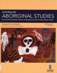
Periodical, Australian Institute of Aboriginal and Torres Strait Islander Studies, Australian Aboriginal studies : journal of the Australian Institute of Aboriginal and Torres Strait Islander Studies, 2008
... Do they see non-Aboriginal Australians as other? However, art works produced for this exhibition rejected curatorial constructions of Black and White, instead presenting viewers with more complex and ambivalent notions of Aboriginality and non-Aboriginality. ...Do they see non-Aboriginal Australians as other? However, art works produced for this exhibition rejected curatorial constructions of Black and White, instead presenting viewers with more complex and ambivalent notions of Aboriginality and non-Aboriginality. ...1. Rock-art of the Western Desert and Pilbara: Pigment dates provide new perspectives on the role of art in the Australian arid zone Jo McDonald (Australian National University) and Peter Veth (Australian National University) Systematic analysis of engraved and painted art from the Western Desert and Pilbara has allowed us to develop a spatial model for discernable style provinces. Clear chains of stylistic connection can be demonstrated from the Pilbara coast to the desert interior with distinct and stylistically unique rock-art bodies. Graphic systems appear to link people over short, as well as vast, distances, and some of these style networks appear to have operated for very long periods of time. What are the social dynamics that could produce unique style provinces, as well as shared graphic vocabularies, over 1000 kilometres? Here we consider language boundaries within and between style provinces, and report on the first dates for pigment rock-art from the Australian arid zone and reflect on how these dates from the recent past help address questions of stylistic variability through space and time. 2. Painting and repainting in the west Kimberley Sue O?Connor, Anthony Barham (Australian National University) and Donny Woolagoodja (Mowanjum Community, Derby) We take a fresh look at the practice of repainting, or retouching, rockart, with particular reference to the Kimberley region of Western Australia. We discuss the practice of repainting in the context of the debate arising from the 1987 Ngarinyin Cultural Continuity Project, which involved the repainting of rock-shelters in the Gibb River region of the western Kimberley. The ?repainting debate? is reviewed here in the context of contemporary art production in west Kimberley Indigenous communities, such as Mowanjum. At Mowanjum the past two decades have witnessed an artistic explosion in the form of paintings on canvas and board that incorporate Wandjina and other images inspired by those traditionally depicted on panels in rock-shelters. Wandjina also represents the key motif around which community desires to return to Country are articulated, around which Country is curated and maintained, and through which the younger generations now engage with their traditional lands and reach out to wider international communities. We suggest that painting in the new media represents a continuation or transference of traditional practice. Stories about the travels, battles and engagements of Wandjina and other Dreaming events are now retold and experienced in the communities with reference to the paintings, an activity that is central to maintaining and reinvigorating connection between identity and place. The transposition of painting activity from sites within Country to the new ?out-of-Country? settlements represents a social counterbalance to the social dislocation that arose from separation from traditional places and forced geographic moves out-of-Country to government and mission settlements in the twentieth century. 3. Port Keats painting: Revolution and continuity Graeme K Ward (AIATSIS) and Mark Crocombe (Thamarrurr Regional Council) The role of the poet and collector of ?mythologies?, Roland Robinson, in prompting the production of commercial bark-painting at Port Keats (Wadeye), appears to have been accepted uncritically - though not usually acknowledged - by collectors and curators. Here we attempt to trace the history of painting in the Daly?Fitzmaurice region to contextualise Robinson?s contribution, and to evaluate it from both the perspective of available literature and of accounts of contemporary painters and Traditional Owners in the Port Keats area. It is possible that the intervention that Robinson might have considered revolutionary was more likely a continuation of previously well established cultural practice, the commercial development of which was both an Indigenous ?adjustment? to changing socio-cultural circumstances, and a quiet statement of maintenance of identity by strong individuals adapting and attempting to continue their cultural traditions. 4. Negotiating form in Kuninjku bark-paintings Luke Taylor (AIATSIS) Here I examine social processes involved in the manipulation of painted forms of bark-paintings among Kuninjku artists living near Maningrida in Arnhem Land. Young artists are taught to paint through apprenticeships that involve exchange of skills in producing form within extended family groups. Through apprenticeship processes we can also see how personal innovations are shared among family and become more regionally located. Lately there have been moves by senior artists to establish separate out-stations and to train their wives and daughters to paint. At a stylistic level the art now creates a greater sense of family autonomy and yet the subjects link the artists back in to much broader social networks. 5. Making art and making culture in far western New South Wales Lorraine Gibson This contribution is based on my ethnographic fieldwork. It concerns the intertwining aspects of the two concepts of art and culture and shows how Aboriginal people in Wilcannia in far western New South Wales draw on these concepts to assert and create a distinctive cultural identity for themselves. Focusing largely on the work of one particular artist, I demonstrate the ways in which culture (as this is considered) is affectively experienced and articulated as something that one ?comes into contact with? through the practice of art-making. I discuss the social and cultural role that art-making, and art talk play in considering, mediating and resolving issues to do with cultural subjectivity, authority and identity. I propose that in thinking about the content of the art and in making the art, past and present matters of interest, of difficulty and of pleasure are remembered, considered, resolved and mediated. Culture (as this is considered by Wilcannia Aboriginal people) is also made anew; it comes about through the practice of artmaking and in displaying and talking about the art work. Culture as an objectified, tangible entity is moreover writ large and made visible through art in ways that are valued by artists and other community members. The intersections between Aboriginal peoples, anthropologists, museum collections and published literature, and the network of relations between, are also shown to have interesting synergies that play themselves out in the production of art and culture. 6. Black on White: Or varying shades of grey? Indigenous Australian photo-media artists and the ?making of? Aboriginality Marianne Riphagen (Radboud University, The Netherlands) In 2005 the Centre for Contemporary Photography in Melbourne presented the Indigenous photo-media exhibition Black on White. Promising to explore Indigenous perspectives on non-Aboriginality, its catalogue set forth two questions: how do Aboriginal artists see the people and culture that surrounds them? Do they see non-Aboriginal Australians as other? However, art works produced for this exhibition rejected curatorial constructions of Black and White, instead presenting viewers with more complex and ambivalent notions of Aboriginality and non-Aboriginality. This paper revisits the Black on White exhibition as an intercultural event and argues that Indigenous art practitioners, because of their participation in a process to signify what it means to be Aboriginal, have developed new forms of Aboriginality. 7. Culture production Rembarrnga way: Innovation and tradition in Lena Yarinkura?s and Bob Burruwal?s metal sculptures Christiane Keller (University of Westerna Australia) Contemporary Indigenous artists are challenged to produce art for sale and at the same time to protect their cultural heritage. Here I investigate how Rembarrnga sculptors extend already established sculptural practices and the role innovation plays within these developments, and I analyse how Rembarrnga artists imprint their cultural and social values on sculptures made in an essentially Western medium, that of metal-casting. The metal sculptures made by Lena Yarinkura and her husband Bob Burruwal, two prolific Rembarrnga artists from north-central Arnhem Land, can be seen as an extension of their earlier sculptural work. In the development of metal sculptures, the artists shifted their artistic practice in two ways: they transformed sculptural forms from an earlier ceremonial context and from earlier functional fibre objects. Using Fred Myers?s concept of culture production, I investigate Rembarrnga ways of culture-making. 8. 'How did we do anything without it?': Indigenous art and craft micro-enterprise use and perception of new media technology.maps, colour photographs, b&w photographswest kimberley, rock art, kuninjku, photo media, lena yarinkura, bob burruwal, new media technology -
 Bayside Gallery - Bayside City Council Art & Heritage Collection
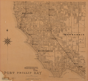
Map, Department of Lands and Survey, Land under the control of the City of Sandringham, 1962
... ...Board of Lands and Works...The cadastral map showing land under the control of the City of Brighton in 1962. map plan foreshores sndringham hampton beaumaris cheltenham department of lands and survey cartographic material moorabbin black rock street map City of Sandringham Board of Lands and Works Print. Map in black ink on cream paper by the Department of Lands and Survey, Melbourne that indicates area placed under control of the Council of City of Sandringham, on 7th February 1962. ...The cadastral map showing land under the control of the City of Brighton in 1962.map, plan, foreshores, sndringham, hampton, beaumaris, cheltenham, department of lands and survey, cartographic material, moorabbin, black rock, street map, city of sandringham, board of lands and works -
 Kew Historical Society Inc
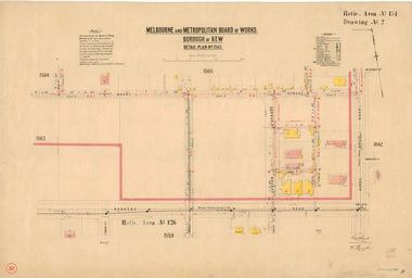
Plan, Melbourne & Metropolitan Board of Works : Borough of Kew : Detail Plan No.1561, 1905
... At this time, the area nearest Burke Road had been subdivided and developed whereas the lands to the west were as yet undeveloped. The houses represented are not named on the Plan. Melbourne & Metropolitan Board of Works : Borough of Kew : Detail Plan No.1561 Plan Plan Melbourne and Metropolitan Board of Works ...The Melbourne and Metropolitan Board of Works (MMBW) plans were produced from the 1890s to the 1950s. They were crucial to the design and development of Melbourne's sewerage and drainage system. The plans, at a scale of 40 feet to 1 inch (1:480), provide a detailed historical record of Melbourne streetscapes and environmental features. Each plan covers one or two street blocks (roughly six streets), showing details of buildings, including garden layouts and ownership boundaries, and features such as laneways, drains, bridges, parks, municipal boundaries and other prominent landmarks as they existed at the time each plan was produced. (Source: State Library of Victoria). This plan forms part of a large group of MMBW plans and maps that was donated to the Society by Mr Poulter, City Engineer of the City of Kew in 1989. Within this collection, thirty-five hand-coloured plans, backed with linen, are of statewide significance as they include annotations that provide details of construction materials used in buildings in the first decade of the 20th century as well as additional information about land ownership and usage. The copies in the Public Record Office Victoria and the State Library of Victoria are monochrome versions which do not denote building materials so that the maps in this collection are invaluable and unique tools for researchers and heritage consultants. A number of the plans are not held in the collection of the State Library of Victoria so they have the additional attribute of rarity.Original survey plan, issued by the MMBW to a contractor with responsibility for constructing sewers in the area identified on the plan within the Borough of Kew. The plan was at some stage hand-coloured, possibly by the contractor, but more likely by officers working in the Engineering Department of the Borough and later Town, then City of Kew. The hand-coloured sections of buildings on the plan were used to denote masonry or brick constructions (pink), weatherboard constructions (yellow), and public buildings (grey). MMBW Detail Plan 1561 outlines those residences in the area bordered by Burke Road, Loxton Street, Mount Street and Barkers Road that had been constructed by 1905 when the land was surveyed. At this time, the area nearest Burke Road had been subdivided and developed whereas the lands to the west were as yet undeveloped. The houses represented are not named on the Plan.melbourne and metropolitan board of works, detail plans, mmbw 1561, cartography -
Whitehorse Historical Society Inc.
Map, M.M.B.W, c1962
... Board of Works...Victoria. Department of Lands and Survey...Prepared by Department of Lands and Survey and Melbourne and Metropolitan Board of Works from State aerial Survey, June 1957 and Cadastral Survey information, August 1960. ...Prepared by Department of Lands and Survey and Melbourne and Metropolitan Board of Works from State aerial Survey, June 1957 and Cadastral Survey information, August 1960. ...Prepared by Department of Lands and Survey and Melbourne and Metropolitan Board of Works from State aerial Survey, June 1957 and Cadastral Survey information, August 1960. ...Melbourne Metropolitan Area Base Map series sheet 235, covering part, Mitcham, Nunawading and Ringwood areas.Melbourne Metropolitan Area Base Map series sheet 235, covering part, Mitcham, Nunawading and Ringwood areas. Prepared by Department of Lands and Survey and Melbourne and Metropolitan Board of Works from State aerial Survey, June 1957 and Cadastral Survey information, August 1960. Scale 1:4,800.Melbourne Metropolitan Area Base Map series sheet 235, covering part, Mitcham, Nunawading and Ringwood areas. maps, mitcham, nunawading, ringwood, melbourne and metropolitan board of works, victoria. department of lands and survey -
 University of Melbourne, Burnley Campus Archives
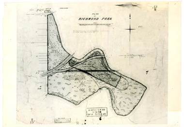
Plan, Plan of Richmond Park, 1886-1948
... Original plan dated 31 August 1872, note of Crown Grant to the Board of Land & Works and Richmond City Council 1886; showing land, "Permanently Preserved for the Gardens". Stamp, "Department of Lands...Original plan dated 31 August 1872, note of Crown Grant to the Board of Land & Works and Richmond City Council 1886; showing land, "Permanently Preserved for the Gardens". Stamp, "Department of Lands ...(1) Black and white photographed copy of an original coloured plan. Plan of Richmond Park with Horticultural Society Gardens marked in. Includes additional land which became the Field Station. Original plan dated 31 August 1872, note of Crown Grant to the Board of Land & Works and Richmond City Council 1886; showing land, "Permanently Preserved for the Gardens". Stamp, "Department of Lands and Survey Photographed at the Central Plan Office 1/1 Plate 7.12.48" (2) Also 2 photocopies, 1 reduced - possibly used in a publication1 photocopy has "Figure 1. Plan of Burnley Gardens circa 1863 [sic]gardens, richmond, horticultural society of victoria, richmond park, a.l. martin -
 Sunshine and District Historical Society Incorporated
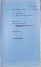
Administrative record - City of Sunshine - Commissioner Mr Alexander Alex George Gillon Collection 1976 - 1982 - Minutes of the Ordinary Meeting of Council Held on 13th June 1978, City of Sunshine, 13th June 1978
... Local Unit McIntyre Road / Sunshine Avenue Construction Construction of Wright Street Bridge Account for Reinstatement 11 Commercial Street Allocation of Funds Joint Works Main and Unclassified Roads Proposed Intersection Signals St. ...Local Unit McIntyre Road / Sunshine Avenue Construction Construction of Wright Street Bridge Account for Reinstatement 11 Commercial Street Allocation of Funds Joint Works Main and Unclassified Roads Proposed Intersection Signals St. ...Report of the Town Clerk's Department Report of the Town Clerk Increased Crime Request for Royal Commission Loan Programme Increased Borrowing Allocation for 1978/79 Pre-Natal Clinic Sunshine Infant Welfare Centre Land Transfer Discontinued Road Between Verdun Street and Mitchell Street Crown Lands Adjoining Kororoit Creek / Anderson Road / Graham Street Proposed Committee of Management Lease Italo-Australian Co-Operative Social Club Ltd Separate Rate Off Street Parking Scheme Melbourne Metropolitan Board of Works Representation Report of the Co-Ordinator of Welfare Services Family and Community Service Programme State Grants (Home Care) Act Welfare Officers Subsidies Proposal for Funding for Emergency Relief in the Western Region Caretaker / Cleaner Lions House of Sunshine Senior Citizens Club Howard Kingham Lodge Hostel for the Frail Aged Proposal for Upgrading Housing Commission Areas Report of the Acting Chief Health Inspector Prosecution Proceedings Sunshine Magistrates Court Quarterly Return of Food Samples Infant Welfare Immunisation St. Albans Deer Park Infant Welfare Centre Gas Fired Toilet "Destroilet" Report of the By-Lawa Officer Court Proceedings Parking Infringements Report of the City Librarian Second Bookmobile School Holiday Programme 15th to 26th May Children's Literature Second National Seminar September 1st to 5th 1978 Report of the Municipal Recreation Officer Proposed Formation of Western Region Commission Municipal Recreation Officers' Sub Committee Ground Allocations Winter Seasons 1978 Report of the City Engineer Proposed Amendment No 81 to the Melbourne Metropolitan Planning Scheme Land Acquisition Maribyrnong Valley Land Use Permit Application Extensions to Marian College Secondary School Lots 590 & 591 Glengala Road Land Use Permit Application Flats Lot 31 Bardsley Street Land Use Permit Application Take Away Foods Lot 8 Market Place Land Use Permit Application Advertising Sign A.C. Sheeting Pty Ltd 1 Fourth Avenue Land Use Permit Application Drive In Bottle Shop and Extension to St. Albans Hotel McKechnie Street Plan of Subdivision Gladstone Street and Garfield Street Strata Subdivision 11 Yarmouth Avenue Consolidation of Title Somers Street and Henderson Street Plan of Subdivision Geelong Road and Francis Street Tenders for Surplus Equipment Mowers Contract Construction of Neale Road Somerville Road Outfall Drain Subsidy for Victoria S.E.S. Local Unit McIntyre Road / Sunshine Avenue Construction Construction of Wright Street Bridge Account for Reinstatement 11 Commercial Street Allocation of Funds Joint Works Main and Unclassified Roads Proposed Intersection Signals St. Albans Road / Main Road East / East Esplanade Give Way to Right Signs Western Highway Fitzgerald Road / Boundary Road Funds Street Lighting Western Highway (Ballarat Road, Ashley Street and Mitchell Street Intersection Princess Highway West Old Geelong Road to McDonald Road Northern Service Road Replacement of Plant Nos 51 & 58 Chamberlin Front End Loaders Sunshine Swimming Pool Progress Report Relocation of Steel Framed Steel Clad Sheds to Errington Reserve and Robert Bruce Reserve Fairbairn Road Pre-School Centre Toilet Blocks Various Reserves Scovell Reserve Proposal by Maidstone Junior Sporting Club to Construct a Recreation Hall Report of the Acting Building surveyor Outbuilding 19 Charlotte Street Sunshine West Outbuilding 34 Bent Street St. Albans Outbuilding 2 Lynch Street Sunshine Outbuilding 18 Hertford Road Sunshine Outbuilding 16 Baynton Avenue Sunshine North Dangerous and Ruinous Building Van Ness Avenue (Former Rock Crushing Plant) Report of the Director Parks & Recreation Summer School Park Management 1979 Children's Playgrounds Burnley Horticultural College Nursery Trends and Development Bon Thomas Reserve Development Main Pavilion House McKay Gardens Demolition Bon Thomas Reserve Development Tender Tree Surgery Maintenance Seminar Royal Australian Institute of Parks & Recreations Victoria Region Orders of the Day Accounts Submitted for Payment as at 31st May 1978 Extraordinary Business Report of the Town Clerk Meals on Wheels Report of the City Engineet Child Care Buildings Bon Thomas Reserve, Diamond Reserve, Orama Street & Highpoint West city of sunshine, alexander "alex" george gillon, sunshine infant welfare centre, verdun street, mitchell street, maidstone, kororoit creek, anderson road, graham street, italo-australian co-operative social club, furlong road, st. albans, lions house of sunshine senior citizens club, howard kingham lodge hostel, darnley street, braybrook, deer park infant welfare centre, maribyrnong valley, glengala road, marian college, sunshine west, bardsley street, market place, fourth avenue, sunshine, st. albans hotel, mckechnie street, gladstone street, garfield street, yarmouth avenue, somers street, henderson street, sunshine north, geelong road, francis street, brooklyn, neale road, deer park, wright street bridge, wright street, commercial street, st. albans road, main road east, east esplanade, fitzgerald road, boundary road, western highway, ballarat road, princess highway, old geelong road, mcdonald road, sunshine swimming pool, errington reserve, robert bruce reserve, station road, fairbairn road pre-school centre, fairbairn road, maidstone junior sporting club, scovell crescent, charlotte street, bent street, lynch street, hertford road, baynton avenue, van ness avenue, maribyrnong, bon thomas reserve, quinn street, diamond reserve, albanvale, orama street, highpoint west, rosamond road, scovell reserve -
 Flagstaff Hill Maritime Museum and Village
Book - Fictional Novel, James Norman Hall, Lost Island, 1945
... Another notes that Hall had made clear in earlier works that he detested the automobile and the machine age, a theme that runs through the book. ...Lost Island is a short novel about a Polynesian atoll untouched by World War II. George Dodd, an American engineer from Detroit, lands on the island with a blueprint in his pocket. Seabees and bulldozers follow him to turn the atoll into a coral-built base for American bombers. One reader describes the book as a bitter account of an American military base corrupting a traditional island culture, focused more on island society than on the war. Another notes that Hall had made clear in earlier works that he detested the automobile and the machine age, a theme that runs through the book.Hard cover book. Lost Island Author: James Norman Hall Publisher: William Collins, Sons & Co. Date: 1945 Further Information: Red Cloth hardcover with lettering and patterning to spine in black. The spine has a Library label with an inscription.fictionLost Island is a short novel about a Polynesian atoll untouched by World War II. George Dodd, an American engineer from Detroit, lands on the island with a blueprint in his pocket. Seabees and bulldozers follow him to turn the atoll into a coral-built base for American bombers. One reader describes the book as a bitter account of an American military base corrupting a traditional island culture, focused more on island society than on the war. Another notes that Hall had made clear in earlier works that he detested the automobile and the machine age, a theme that runs through the book.flagstaff-hill-maritime-museum, book, lost island, james norman hall, shipwrecked-coast, flagstaff-hill, warrnambool, maritime-museum, shipwreck-coast, flagstaff-hill-maritime-village, shipwrecked-artefact, pattison collection, warrnambool library, warrnambool mechanics’ institute, ralph eric pattison, corangamite regional library service, warrnambool city librarian, mechanics’ institute library, victorian library board, warrnambool books and records, warrnambool children’s library, great ocean road
