Showing 8972 items matching "bridging"
-
 Geelong Naval and Maritime Museum
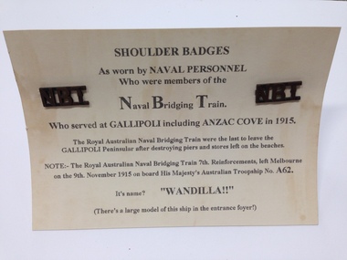
Shoulder Titles, Royal Australian Naval Bridging Train Shoulder Titles
... Royal Australian Naval Bridging Train Shoulder Titles...The Royal Australian Naval Bridging Train (RANBT) was formed of 300 men based initially at Kangaroo Beach on the Gallipoli Peninsula from 1915, during WWI. ...A pair of brass shoulder titles "NBT" from the Naval Bridging Train attached to paper card. They have a loop shank at the back for fastening...."NBT" Naval Bridging Train...Royal Australian Naval Bridging Train Shoulder Titles Shoulder Titles ...The Royal Australian Naval Bridging Train (RANBT) was formed of 300 men based initially at Kangaroo Beach on the Gallipoli Peninsula from 1915, during WWI. They built and maintained jetties and were constantly under fire. Some of these men lost their lives and a number were wounded during their 5 months of service here. As a result the RANBT was the most highly decorated unit during WWI. The unit then continued to the Middle East, operating bridges over the Suez Canal before the unit was disbanded (Australian War Memorial online, 2014).These badges represent a highly specialised and decorated Unit from WWI. The RANBT was made up of 300 men who served in Gallipoli and in the Middle East from 1915-1917. The badges are associated with Australian defense and form significant links to ANZAC history. A pair of brass shoulder titles "NBT" from the Naval Bridging Train attached to paper card. They have a loop shank at the back for fastening."NBT" Naval Bridging Trainshoulder title, royal australian naval bridging train, ranbt, navy shoulder badge -
 National Vietnam Veterans Museum (NVVM)
Booklet, British Army, Royal Engineers Supplementary Pocket Book, No. 3: Bridging 1945, 1945
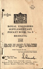
... Royal Engineers Supplementary Pocket Book, No. 3: Bridging 1945......Bridging...Royal Engineers Supplementary Pocket Book, No. 3: Bridging 1945 Booklet British Army ...A cream coloured cardbaord cover with black information on it. Top right hand side reads WO Code No 7526. There is a black and white photo of the British Empire Insignia. There are three punch holes and tow metal staples down the left hand side of the booklet.australia - armed forces - service manuals, royal engineers, pocket book, bridging -
 National Vietnam Veterans Museum (NVVM)
Booklet, British Army, Royal Engineers Supplementary Pocket Book: No. 3 - Bridging: Chapter 17: Light Floating Bridge 1964 (Copy 2), 1964
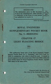
... Royal Engineers Supplementary Pocket Book: No. 3 - Bridging: Chapter 17: Light Floating Bridge 1964 (Copy 2)......Bridging...Royal Engineers Supplementary Pocket Book: No. 3 - Bridging: Chapter 17: Light Floating Bridge 1964 (Copy 2) Booklet British Army ...A greeb coloured cover with black inforation on it. Top of the page reads Crown Copyright Reserved. Near the right hand top reads WO Code No. 9456 (Chap. 17) There are two metal staples and two punch holes down the left hand side.british armed forces - service manuals, royal engineers, bridging, pocket book, light floating bridge -
 National Vietnam Veterans Museum (NVVM)
Booklet, British Army, Royal Engineers Supplementary Pocket Book: No. 3 - Bridging: Chapter 17: Light Floating Bridge 1964 (Copy 1), 1964
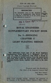
... Royal Engineers Supplementary Pocket Book: No. 3 - Bridging: Chapter 17: Light Floating Bridge 1964 (Copy 1)......Bridging...Royal Engineers Supplementary Pocket Book: No. 3 - Bridging: Chapter 17: Light Floating Bridge 1964 (Copy 1) Booklet British Army ...A bluish gray coloured cover with black inforation on it. Top of the page reads 7610-66-020-3260. Above the title of the boolet there is a stamp HQ 6 Const Op, Library. There are two metal staples and two punch holes down the left hand side.british armed forces - service manuals, royal engineers, hq 6 const op, bridging, pocket book, light floating bridge -
 Stawell Historical Society Inc
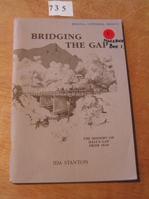
Book, Ida Stanton, Bridging The Gap 1988 -- The History of Halls Gap From 1840 by Ida Stanton, 1988
... Bridging The Gap 1988 -- The History of Halls Gap From 1840 by Ida Stanton...Fawn cover with drawing of trees and mountain in the background. in the foreground is a bridge over a river, with a woman in a dray. ...Bridging The Gap 1988 -- The History of Halls Gap From 1840 by Ida Stanton Book Ida Stanton ...Tales of Hall's Gap in the Grampians, as collected by the Pupils of Hall's Gap Primary School, from the descendants of Pioneer Families, and Recorded prior to 1940. Rerecorded from old well worn notes, by Grant W Greenwood, Head Teacher 1937-1939.Fawn cover with drawing of trees and mountain in the background. in the foreground is a bridge over a river, with a woman in a dray. Presented to Stawell Historical Society Ida Stanton May 1989stawell grampians -
 Tatura Irrigation & Wartime Camps Museum
Book, Bridging the Gap, 1971
... Bridging the Gap...Sketches, in black, of Cobb & Co, mining, bridges, wineries, Nagambie...Sketches, in black, of Cobb & Co, mining, bridges, wineries, Nagambie Bridging the Gap Book Book ...To record events as they happened and the way early settlers and families lived in the are known as "The Shire of Goulburn".Orange dust cover, white strip and writing. Sketches, in black, of Cobb & Co, mining, bridges, wineries, Nagambiemajor mitchell, nagambie, graytown, whroo, joyce hammond -
 Melbourne Tram Museum
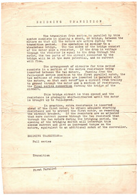
Document - Report, Melbourne & Metropolitan Tramways Board (MMTB), "Bridging Transition", early 1960's
... "Bridging Transition"...Report - single foolscap sheet titled "Bridging Transition" describing the electrical circuit arrangements while passing from series to parallel in DC traction tramway motors...."Bridging Transition" Document Report Melbourne & Metropolitan Tramways Board (MMTB) ...Report - single foolscap sheet titled "Bridging Transition" describing the electrical circuit arrangements while passing from series to parallel in DC traction tramway motors.trams, tramways, tramcars, controllers, electrical engineering, electrical equipment, motors, electric traction -
 Stawell Historical Society Inc
Photograph, Three bridges at Campbells bridge c 1960 -- Coloured
... Three bridges at Campbells bridge c 1960 -- Coloured...Coloured photo of three bridges at Campbells bridge c 1960. Phtograph show two wodden bridge structures and new cement construction bridge....Coloured photograph of three bridges over a river. Each bridge is built at a different height. ...3 Bridges @ Campbell's Bridge ...Coloured photo of three bridges at Campbells bridge c 1960. Phtograph show two wodden bridge structures and new cement construction bridge. stawell shire 3 Bridges @ Campbell's Bridge Coloured photograph of three bridges over a river. ...Coloured photo of three bridges at Campbells bridge c 1960. Phtograph show two wodden bridge structures and new cement construction bridge.Coloured photograph of three bridges over a river. Each bridge is built at a different height. 3 Bridges @ Campbell's Bridge stawell shire -
 Narre Warren and District Family History Group
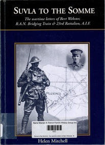
Book, Bert Webster et al, Suvla to the Somme : the wartime letters of Bert Webster, RAN bridging train & 23rd Battalion, AIF, 2001
... Suvla to the Somme : the wartime letters of Bert Webster, RAN bridging train & 23rd Battalion, AIF...In March 1915 Bert transferred to the newly formed 1st Royal Australian Naval Bridging Train similar to being Naval Engineers. ...This collection of letters by Bert Webster is a record of service of two Australian cousins both destined to die in WW1. In 1911 Bert Webster, a Victorian by birth, joined the Royal Naval Reserve. By November 1914 he was Acting Petty Officer on HMAS Cerberus. In March 1915 Bert transferred to the newly formed 1st Royal Australian Naval Bridging Train similar to being Naval Engineers. They landed at Suvla north of Anzac Cove during the August Offensives in 1915. After the Gallipoli evacuation the RANBT was disbanded at which time Bert Webster transferred the 23rd Battalion AIF. He went with the Battalion to the Western Front. Bert was killed on the night of the 28th July 1916 while in the trenches at Pozières. (Books on War)non-fictionThis collection of letters by Bert Webster is a record of service of two Australian cousins both destined to die in WW1. In 1911 Bert Webster, a Victorian by birth, joined the Royal Naval Reserve. By November 1914 he was Acting Petty Officer on HMAS Cerberus. In March 1915 Bert transferred to the newly formed 1st Royal Australian Naval Bridging Train similar to being Naval Engineers. They landed at Suvla north of Anzac Cove during the August Offensives in 1915. After the Gallipoli evacuation the RANBT was disbanded at which time Bert Webster transferred the 23rd Battalion AIF. He went with the Battalion to the Western Front. Bert was killed on the night of the 28th July 1916 while in the trenches at Pozières. (Books on War)world war 1914-1918, bert webster -
 City of Whittlesea
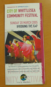
Booklet (item), City of Whittlesea Community Festival - Bridging the Gap
... City of Whittlesea Community Festival - Bridging the Gap...City of Whittlesea 25 Ferres Boulevard South Morang melbourne booklet booklet, colour City of Whittlesea Community Festival - Bridging the Gap Booklet Booklet ...booklet -
National Vietnam Veterans Museum (NVVM)
Manual, Military engineering, vol. 3 - Bridging, part 1 General, 1957
... Military engineering, vol. 3 - Bridging, part 1 General...National Vietnam Veterans Museum (NVVM) 25 Veterans Drive Newhaven phillip-island-and-the-bass-coast British Armed Forces - service manuals Military engineering, vol. 3 - Bridging, part 1 General Manual Manual British Army ...british armed forces - service manuals -
University of Melbourne, Burnley Campus Archives
Document - Examination, Answer sheet 4 Bridging Maths
... Answer sheet 4 Bridging Maths...University of Melbourne, Burnley Campus Archives 500 Yarra Boulevard Richmond melbourne questionnaire bridging maths Answers to 12 questions Answer sheet 4 Bridging Maths Document Examination ...Answers to 12 questionsquestionnaire, bridging maths -
 Victorian Aboriginal Corporation for Languages
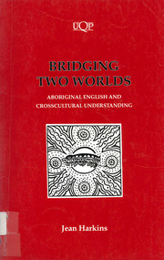
Book, Jean Harkins, Bridging two worlds : Aboriginal English and crosscultural understanding, 1994
... Bridging two worlds : Aboriginal English and crosscultural understanding...A full and varied dialect of English, Aboriginal English with its distinctive Aboriginal world view offers a rich perspective. Bridging two worlds : Aboriginal English and crosscultural understanding Book Jean Harkins ...Jean Harkins describes the interdependence of language forms and meanings in their cultural context. A full and varied dialect of English, Aboriginal English with its distinctive Aboriginal world view offers a rich perspective.yipirinya school, aboriginal english, pidgin english, bilingual education -
 Phillip Island and District Historical Society Inc.
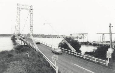
Photograph, Phillip Island Bridges, 1968/9
... First and Second Bridge to Phillip Island. From the Jack Jenner Collection....Old Suspension Bridge with cars. San Remo jetty and partly built new Bridge in background. 1968/9 Bridge with middle span uncompleted at middle right....Signs on Bridge: Pedestrians keep right on bridge. ...Phillip Island and District Historical Society Inc. phillip-island-and-the-bass-coast First and Second Bridge to Phillip Island. From the Jack Jenner Collection. local history photographs civil engineering bridges phillip island bridge black & white photograph jack jenner collection phillip island bridges public construction Signs on Bridge: Pedestrians keep right on bridge. ...First and Second Bridge to Phillip Island. From the Jack Jenner Collection.Old Suspension Bridge with cars. San Remo jetty and partly built new Bridge in background. 1968/9 Bridge with middle span uncompleted at middle right.Signs on Bridge: Pedestrians keep right on bridge. Stoppage on bridge prohibited. Fishing from bridge prohibited.local history, photographs, civil engineering, bridges, phillip island bridge, black & white photograph, jack jenner collection, phillip island bridges, public construction -
 Clunes Museum
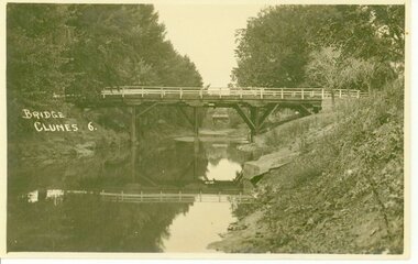
Photograph, D.S. KING
... BRIDGE OVER CRESWICK CREEK...BRIDGE OVER CREEK "BUTTER FACTORY" BRIDGE AT THE FOOT OF CAMERON ST. ...BRIDGE. CLUNES 6...Clunes Museum 36 Fraser Street enter building through Collins Place Clunes goldfields BRIDGE OVER CRESWICK CREEK local history document postcard bridges BRIDGE. ...BRIDGE OVER CRESWICK CREEKBRIDGE OVER CREEK "BUTTER FACTORY" BRIDGE AT THE FOOT OF CAMERON ST. CLUNES.BRIDGE. CLUNES 6local history, document, postcard, bridges -
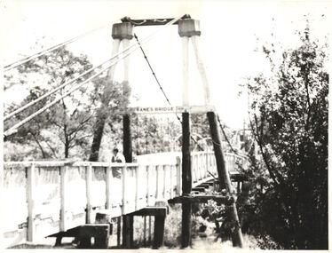 Kew Historical Society Inc
Photograph - Photograph (copy), Kanes Bridge, Studley Park, 195-1955
... Kanes Bridge, Studley Park...The total cost of construction came to 250 pounds and the bridge became known as Kane's Bridge. During the 1934 floods the bridge was washed downstream, and was subsequently rebuilt. ...A photographic copy of an older photograph of Kanes Bridge...."Kanes Bridge"...The total cost of construction came to 250 pounds and the bridge became known as Kane's Bridge. During the 1934 floods the bridge was washed downstream, and was subsequently rebuilt. ...In 1928 a footbridge was erected to link Kew with the public golf course across the Yarra. The total cost of construction came to 250 pounds and the bridge became known as Kane's Bridge. During the 1934 floods the bridge was washed downstream, and was subsequently rebuilt. The present form of the bridge resembles the earlier bridge which crossed from the Yarra Bend Asylum to Kew, further upstream. (VHD)This work forms part of the collection assembled by the historian Dorothy Rogers, that was donated to the Kew Historical Society by her son John Rogers in 2015. The manuscripts, photographs, maps, and documents were sourced by her from both family and local collections or produced as references for her print publications. Many were directly used by Rogers in writing ‘Lovely Old Homes of Kew’ (1961) and 'A History of Kew' (1973), or the numerous articles on local history that she produced for suburban newspapers. Most of the photographs in the collection include detailed annotations in her hand. The Rogers Collection provides a comprehensive insight into the working habits of a historian in the 1960s and 1970s. Together it forms the largest privately-donated collection within the archives of the Kew Historical Society.A photographic copy of an older photograph of Kanes Bridge."Kanes Bridge"kanes bridge, yarra river, bridges - kew (vic.) -
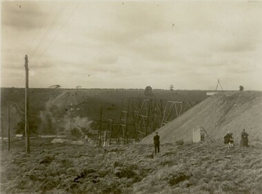
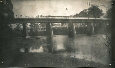 Orbost & District Historical Society
black and white photograph, July 1922
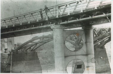
... As a result the present design was adopted as providing a sem-permanent bridge at moderate cost. The new bridge spans the river about 160 feet upstream from the old bridge on a slight skew, the piers being at an angle of 80 degrees with the centre line of the bridge. ...A black / white photograph of a pile bridge with a suspension bridge behind it. There are many people standing on the bridge....on back - "Opening of Pile Bridge - 1922"...This is a pictorial record of a significant event in Orbost's history. snowy-river-bridge ceremonies cameron-mrs on back - "Opening of Pile Bridge - 1922" A black / white photograph of a pile bridge with a suspension bridge behind it. ...A new bridge over the Snowy River at Orbost was opened for traffic on June 20th 1922. It was designed for future joint use by road and railway traffic, but it was only used for road traffic. During the last few years the condition of an old suspension bridge [the 1893 bridge] which was the only vehicular crossing between the town of Orbost and the railway station, caused much concern. The structure was of timber, except for the wire suspension cables of its central span of about 100 feet. A design was prepared in 1914 for a permanent bridge with five spans of 85 feet composed of plate girders on concrete piers. With great increase in the price of steel work during the war, the cost of this design became prohibitive, and the need for a new structure becoming urgent, alternative proposals were investigated. As a result the present design was adopted as providing a sem-permanent bridge at moderate cost. The new bridge spans the river about 160 feet upstream from the old bridge on a slight skew, the piers being at an angle of 80 degrees with the centre line of the bridge. It has a camber of about 2 feet 5 inches in its total length of 527 feet. ( information from Newsletter March 2014 - Lois Crisp) The photograph shows Mrs James Cameron cutting the ribbon at the opening of the Orbost Pile Bridge in 1922. This second bridge, was built by the Victorian Railways and the Country Roads Board. Constructed at a cost of 35,000 pounds and used second-hand girders from the Flinders Street- Spencer Street viaduct. On July 4 1922 it was officially opened by Mrs James Cameron. Unfortunately, her husband, who had long championed the building of the bridge so that it would be ready for the railway to continue to the border, was too ill to attend the ceremony. In fact, James Cameron died on July 13 after a long and severe illness (ref. S.R.M. 20.7.1922). There is a section of this ribbon in the collection - Registration No. 366. This is a pictorial record of a significant event in Orbost's history.A black / white photograph of a pile bridge with a suspension bridge behind it. There are many people standing on the bridge.on back - "Opening of Pile Bridge - 1922"snowy-river-bridge ceremonies cameron-mrs -
 Clunes Museum
Photograph
... PHOTOGRAPH TAKEN LOOKING DOWNSTREAM TULLAROOP CREEK, ABOUT 1900. GOVERNMENT BRIDGE IN FOREGROUND, JULILEE BRIDGE IN MIDDLE DISTANCE, PORT PHILLIP MINE POPPET HED IN DISTANCE.....1 ORIGINAL PHOTOGRAPH OF GOVERNMENT BRIDGE AND JUBILEE BRIDGE. TAKEN FROM CREEK PARADE. ...IN HANDWRITING : LOOKING DOWN-STREAM TULLAROOP CREEKABOUT 1900 GOVERMENT BRIDGE IN FOREGROUND JUBILEE BRIDGE IN THE MIDDLE...Clunes Museum 36 Fraser Street enter building through Collins Place Clunes goldfields PHOTOGRAPH TAKEN LOOKING DOWNSTREAM TULLAROOP CREEK, ABOUT 1900. GOVERNMENT BRIDGE IN FOREGROUND, JULILEE BRIDGE IN MIDDLE DISTANCE, PORT PHILLIP MINE POPPET HED IN DISTANCE. bridges JUBILEE BRIDGE GOVERMENT BRIDGE IN HANDWRITING : LOOKING DOWN-STREAM TULLAROOP CREEKABOUT 1900 GOVERMENT BRIDGE IN FOREGROUND JUBILEE BRIDGE IN THE MIDDLE .1 ORIGINAL PHOTOGRAPH OF GOVERNMENT BRIDGE AND JUBILEE BRIDGE. ...PHOTOGRAPH TAKEN LOOKING DOWNSTREAM TULLAROOP CREEK, ABOUT 1900. GOVERNMENT BRIDGE IN FOREGROUND, JULILEE BRIDGE IN MIDDLE DISTANCE, PORT PHILLIP MINE POPPET HED IN DISTANCE..1 ORIGINAL PHOTOGRAPH OF GOVERNMENT BRIDGE AND JUBILEE BRIDGE. TAKEN FROM CREEK PARADE. THE GOVERNMENT BRIDGE WAS BUILT CIRCA 1900. .2 ENLARGED PHOTOCOPY IN HANDWRITING : LOOKING DOWN-STREAM TULLAROOP CREEKABOUT 1900 GOVERMENT BRIDGE IN FOREGROUND JUBILEE BRIDGE IN THE MIDDLEbridges, jubilee bridge, goverment bridge -
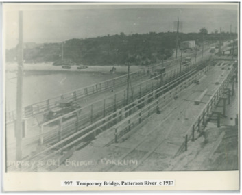 Chelsea & District Historical Society Inc
Photograph - Patterson River, Temporary and Old Bridge, c 1927
... Temporary and Old Bridge...The first bridge over the river was built in the early 1880's, prior to this it was a pontoon bridge. ...Cars using the old bridge. Rowing boats on shore. ...Temporary and old bridge, Carrum...In 1927 the construction of a concrete bridge was undertaken. Patterson River road bridge rail bridge Chelsea transport Patterson River Bridge Carrum Bridge temporary bridge cars Temporary and old bridge, Carrum Black and white photo of the old wooden road bridge (Point Nepean / Nepean Highway), and a temporary bridge over Patterson River, Carrum near the mouth of the river. ...The first bridge over the river was built in the early 1880's, prior to this it was a pontoon bridge. In 1927 the construction of a concrete bridge was undertaken.Black and white photo of the old wooden road bridge (Point Nepean / Nepean Highway), and a temporary bridge over Patterson River, Carrum near the mouth of the river. Cars using the old bridge. Rowing boats on shore. Temporary and old bridge, Carrumpatterson river, road bridge, rail bridge, chelsea, transport, patterson river bridge, carrum bridge, temporary bridge, cars -
 Sunshine and District Historical Society Incorporated
Photograph - Maribyrnong railway bridge construction, 1928
... ...Bridge...One man lost his life during the building of this bridge. The bridge was constructed by the Victorian Railways between 1927 to 1929 to carry a new double track goods line. ...Five B&W yellowing photos showing stages of construction of the Maribyrnong River Viaduct known as the Trestle Bridge but mainly known locally as the QUARTER MILE BRIDGE. ...449.01 - Maribyrnong railway bridge construction.jpg 449.02 - Maribyrnong railway bridge construction.jpg 449.03 - Maribyrnong railway bridge construction.jpg 449.04 - Maribyrnong railway bridge construction.jpg 449.05 - Maribyrnong railway bridge construction.jpg...Maribyrnong River Bridge Quarter Mile Bridge Trestle Bridge 449.01 - Maribyrnong railway bridge construction.jpg 449.02 - Maribyrnong railway bridge construction.jpg 449.03 - Maribyrnong railway bridge construction.jpg 449.04 - Maribyrnong railway bridge construction.jpg 449.05 - Maribyrnong railway bridge construction.jpg Five B&W yellowing photos showing stages of construction of the Maribyrnong River Viaduct known as the Trestle Bridge but mainly known locally as the QUARTER MILE BRIDGE. ...One man lost his life during the building of this bridge. The bridge was constructed by the Victorian Railways between 1927 to 1929 to carry a new double track goods line. This enabled trains from all parts of the state except Gippsland to have direct access to the Tottenham marshalling and sorting yards. These yards were constructed in the 1920's to relieve congestion in the Melbourne Yard near Spencer Street station. The congestion was being caused by the construction of suburban passenger platforms associated with the electrification of the suburban railway network. Initially the bridge was for goods trains but during the Second World War it was also used by troop trains. When the standard gauge line was built in 1962 all trains to Albury and Sydney have used this route, thus avoiding travelling through Essendon and Pascoe Vale on the suburban tracks. The standard gauge track across the bridge took the place of one of the broad gauge tracks so broad gauge trains crossing the bridge in either direction have to now use the same track. The bridge is 1,257 feet (383.13 metres) long and 180 feet (54.86 metres) above the water level. It is just 63 feet (19.2 metres) short of a quarter mile in length between abutments. There is a similar bridge on the same railway line crossing the Moonee Ponds Creek between Gowenbrae and Glenroy, however it is smaller at 1060 feet (323.08 metres) length and 115 feet (35.05) height.The bridge is now Victorian Heritage Registered under Number: H1197, and Heritage Overlay Numbers HO5, and HO107. On the Heritage Register it is named RAIL BRIDGE (ALBION VIADUCT). According to the Heritage Report the bridge is scientifically and architecturally important because of its large size, and because of the cost effective design features such as two girders per span (one for each track), the K bracing in the towers, and the broad flange beams as columns. When it was being built it was the largest trestle bridge in Australia, and until the Sydney Harbour bridge was constructed it was the highest railway bridge.449.01 - Maribyrnong railway bridge construction.jpg 449.02 - Maribyrnong railway bridge construction.jpg 449.03 - Maribyrnong railway bridge construction.jpg 449.04 - Maribyrnong railway bridge construction.jpg 449.05 - Maribyrnong railway bridge construction.jpgmaribyrnong river, bridge, quarter mile bridge, trestle bridge -
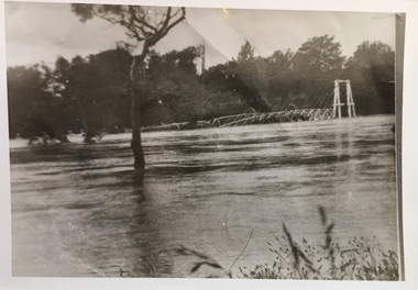 Kew Historical Society Inc
Photograph - Kane's Bridge on the Yarra River, December 1934
... The total cost of construction came to 250 pounds and the bridge became known as Kane's Bridge. During the 1934 floods the bridge was washed downstream, and was subsequently rebuilt. ...Original, black and white positive of Kane's Bridge in December 1934, when the 'great flood' of the Yarra caused the bridge's destruction. ...Inscribed verso: "Kane's Bridge Yarra in flood Dec 1934"...The total cost of construction came to 250 pounds and the bridge became known as Kane's Bridge. During the 1934 floods the bridge was washed downstream, and was subsequently rebuilt. ...In 1928 a footbridge was erected to link Kew with the public golf course across the Yarra. The total cost of construction came to 250 pounds and the bridge became known as Kane's Bridge. During the 1934 floods the bridge was washed downstream, and was subsequently rebuilt. The present form of the bridge resembles the earlier bridge which crossed from the Yarra Bend Asylum to Kew, further upstream. (VHD)Original, black and white positive of Kane's Bridge in December 1934, when the 'great flood' of the Yarra caused the bridge's destruction. Inscribed verso: "Kane's Bridge Yarra in flood Dec 1934"river yarra, yarra -- kew (vic.), kanes bridge, 1934 floods -
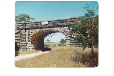 Buninyong & District Historical Society
Photograph - Colour photograph, Blue Bridge Mt. Doran
... Blue Bridge Mt. Doran...View of bluestone railway bridge built as part of the 1858 project to link Ballarat to Geelong...View of the bluestone railway bridge near Clarendon...Blue Bridge 1988...Buninyong & District Historical Society Old Court House, Buninyong Town Hall 313 Learmonth Street Buninyong goldfields View of bluestone railway bridge built as part of the 1858 project to link Ballarat to Geelong The building of the railway between Ballarat and Geelong contributed to significant change within the district Landscape Clarendon Railway Transport Blue Bridge 1988 View of the bluestone railway bridge near Clarendon Blue Bridge Mt. ...View of bluestone railway bridge built as part of the 1858 project to link Ballarat to GeelongThe building of the railway between Ballarat and Geelong contributed to significant change within the districtView of the bluestone railway bridge near ClarendonBlue Bridge 1988landscape, clarendon, railway, transport -
 Orbost & District Historical Society
black and white photographs, C1970
... These photographs are of the 1922 road bridge across the Snowy River at Orbost. This bridge over the Snowy River was opened on July 4 1922. ...Two small black / white photographs of a road bridge across a river. 3248.1 is a close-up of wooden pylons....on label on back - "Snowy River Bridge at Orbost 1922 Bridge"...These photographs are pictorial records of the 1922 brige. bridge-Orbost Snowy-River-bridge on label on back - "Snowy River Bridge at Orbost 1922 Bridge" Two small black / white photographs of a road bridge across a river. 3248.1 is a close-up of wooden pylons. black and white photographs ...These photographs are of the 1922 road bridge across the Snowy River at Orbost. This bridge over the Snowy River was opened on July 4 1922. It was constructed in 1922 alongside the previous suspension bridge. Its building was a combined effort of the Victorian Railways and the Country Roads Board at a cost of 35,000 pounds. It was replaced in 1976 by the present bridge after several major floods.This bridge was replaced in 1976 after several major floods. These photographs are pictorial records of the 1922 brige.Two small black / white photographs of a road bridge across a river. 3248.1 is a close-up of wooden pylons.on label on back - "Snowy River Bridge at Orbost 1922 Bridge"bridge-orbost snowy-river-bridge -
 Rutherglen Historical Society
Photograph - Image, c1895
... The 'new' John Foord Bridge was built between1887 and 1895, and replaced an 1862 timber bridge constructed by a company involving John Foord. ...The bridge in the foreground has just been opened and the old wooden bridge, being demolished, is shown in the background....Written on back of photo: "John Foord Bridge, Wahgunyah. New & old"...A plaque, placed on the bridge by the The Institution of Engineers, Australia names it as a "NATIONAL ENGINEERING LANDMARK". john foord bridge bridges murray river wahgunyah corowa Written on back of photo: "John Foord Bridge, Wahgunyah. ...The 'new' John Foord Bridge was built between1887 and 1895, and replaced an 1862 timber bridge constructed by a company involving John Foord. A plaque, placed on the bridge by the The Institution of Engineers, Australia names it as a "NATIONAL ENGINEERING LANDMARK". Black and white photograph of two bridges. One appearing below the span of the other. The bridge in the foreground has just been opened and the old wooden bridge, being demolished, is shown in the background.Written on back of photo: "John Foord Bridge, Wahgunyah. New & old"john foord bridge, bridges, murray river, wahgunyah, corowa -
 Stawell Historical Society Inc
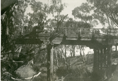
Photograph, Old Campbells Bridge over Wimmera River
... Old Campbells Bridge over Wimmera River...Old Campbells Bridge over Wimmera River. Photo identified by Stuart McGregor Aug.2009...Black and white photograph of a tall bridge in a timber setting....Old Campbells Bridge ...Old Campbells Bridge over Wimmera River. Photo identified by Stuart McGregor Aug.2009 stawell shire Old Campbells Bridge Black and white photograph of a tall bridge in a timber setting. ...Old Campbells Bridge over Wimmera River. Photo identified by Stuart McGregor Aug.2009Black and white photograph of a tall bridge in a timber setting.Old Campbells Bridge stawell shire -
 Kew Historical Society Inc
Photograph - Former Chandler Highway Bridge, 2001
... The heritage listed Fairfield Bridge was originally constructed for the Outer Circle Railway to bridge the Yarra River between East Kew and Fairfield stations. ...The heritage listed bridge was originally constructed for the Outer Circle Railway to bridge the Yarra River between East Kew and Fairfield stations. ...Ink inscription on reverse: "Chandler Highway bridge / (Originally Outer Circle Railway Bridge) / From Fairfield side towards Kew / July 2001"...In the 2010s a new concrete bridge was erected beside it to increase vehicular capacity. bridges -- kew (Vic) Fairfield bridge chandler highway bridge outer circle railway viaduct Ink inscription on reverse: "Chandler Highway bridge / (Originally Outer Circle Railway Bridge) / From Fairfield side towards Kew / July 2001" Original colour print positive of the (former) Chandler Highway bridge in 2001. ...The heritage listed Fairfield Bridge was originally constructed for the Outer Circle Railway to bridge the Yarra River between East Kew and Fairfield stations. In the 1930s it was converted for vehicular traffic. In the 2010s a new concrete bridge was erected beside it to increase vehicular capacity. Original colour print positive of the (former) Chandler Highway bridge in 2001. The point of view is from the Fairfield side of the river looking towards Kew. The heritage listed bridge was originally constructed for the Outer Circle Railway to bridge the Yarra River between East Kew and Fairfield stations. In the 1930s it was converted for vehicular traffic. In the 2010s a new concrete bridge was erected beside it to increase vehicular capacity. Ink inscription on reverse: "Chandler Highway bridge / (Originally Outer Circle Railway Bridge) / From Fairfield side towards Kew / July 2001"bridges -- kew (vic), fairfield bridge, chandler highway bridge, outer circle railway viaduct -
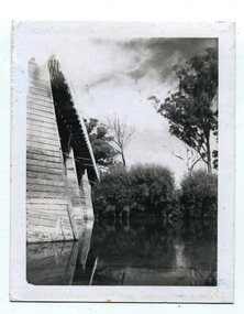
 Lakes Entrance Historical Society
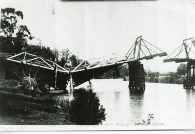
Photograph - Bridges, Bulmer H D, 1925
... Swan Reach Bridge collapsed 10.00 am 16 November 1925...Black and white photograph showing collapsed bridge over the Tambo River, bridge collapsed at eastern end. ...Swan Reach Bridge on the Tambo River...Lakes Entrance Historical Society 4 Marine Parade Lakes Entrance gippsland Swan Reach Bridge collapsed 10.00 am 16 November 1925 Waterways Boats and Boating Disasters Swan Reach Bridge on the Tambo River Black and white photograph showing collapsed bridge over the Tambo River, bridge collapsed at eastern end. ...Swan Reach Bridge collapsed 10.00 am 16 November 1925Black and white photograph showing collapsed bridge over the Tambo River, bridge collapsed at eastern end. Photo looking downstream. Two people on landing on far right bank behind right hand bridge pylon. Thick vegetation on bank. Swan Reach VictoriaSwan Reach Bridge on the Tambo Riverwaterways, boats and boating, disasters -
 Port of Echuca
Photograph, Original photo c.1920
... On 4 March 1879 citizens of Echuca and Moama stormed the bridge, opened the gates and declared it open for their use....An image of the iron bridge at Echuca, taken looking East from Victoria bank....Verso: "Iron bridge"...The bridge was shared by rail, road and pedestrian traffic. murray river bridge , echuca murray bridge, echuca Iron bridge, echuca Verso: "Iron bridge" An image of the iron bridge at Echuca, taken looking East from Victoria bank. ...The iron bridge was completed in 1878 and was used by the Deniliquin and Moama Railway company for goods trains only - it was another year before passengers were included in the transport service. On 4 March 1879 citizens of Echuca and Moama stormed the bridge, opened the gates and declared it open for their use.At the turn of the century the railway line carried produce from southern New South Wales & the Riverina to Melbourne, with goods trains being a very important mode to transport. When the bridge was being constructed, six workmen were killed and another maimed when a pile on the Moama bank collapsed. After the storming of the bridge by local people in March 1879 it was declared open for use of local residents traveling between the towns of Echuca and Moama. The bridge was shared by rail, road and pedestrian traffic.An image of the iron bridge at Echuca, taken looking East from Victoria bank.Verso: "Iron bridge"murray river bridge , echuca, murray bridge, echuca, iron bridge, echuca -
 Buninyong & District Historical Society
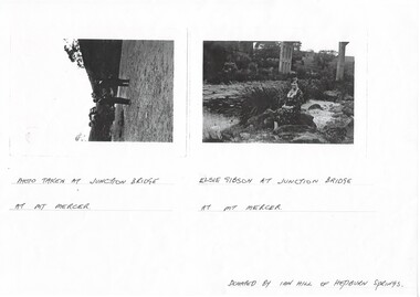
Photograph - Photocopy of two original B/W photographs, Mt Mercer Junction Bridge, photocopy made in 1995
... Mt Mercer Junction Bridge......bridge...Photos taken of the Junction Bridge at Mt Mercer, documenting the location, date unknown....Mt Mercer Junction Bridge. Photo 1 shows two men on the river bed probably looking at the bridge. ...Photo taken at Junction Bridge at Mt Mercer. Photo 2. Elsie Gibson at Junction Bridge at Mt Mercer. ...Junction Bridge Mt Mercer bridge Elsie Gibson Gibson Landscape Photo 1. ...Photos taken of the Junction Bridge at Mt Mercer, documenting the location, date unknown.The photos document the physical status of the location of the Junction Bridge at Mt Mercer at the time of photography, date unknown.Mt Mercer Junction Bridge. Photo 1 shows two men on the river bed probably looking at the bridge. Photo 2 shows Elsie Gibson sitting on the river bank with the bridge in the background.Photo 1. Photo taken at Junction Bridge at Mt Mercer. Photo 2. Elsie Gibson at Junction Bridge at Mt Mercer. Donated by Ian Hill of Hepburn Springsjunction bridge, mt mercer, bridge, elsie gibson, gibson, landscape -
 Marysville & District Historical Society
Photograph (Item) - Black and white photograph, 1953
... A black and white photograph of a bridge over the Steavenson River in Marysville in Victoria....A black and white photograph of a bridge over the Steavenson River in Marysville in Victoria....THE BRIDGE/ MARYSVILLE '53 7340...A black and white photograph of a bridge over the Steavenson River in Marysville in Victoria. ...A black and white photograph of a bridge over the Steavenson River in Marysville in Victoria.A black and white photograph of a bridge over the Steavenson River in Marysville in Victoria. The Steavenson River is named after the Victorian Assistant Commissioner of Roads and Bridges, John Steavenson who arrived in Victoria in the early 1860s.THE BRIDGE/ MARYSVILLE '53 7340marysville, victoria, steavenson river, photograph, john steavenson