
Showing 81 items matching "bush walking"
-
 Stawell Historical Society Inc
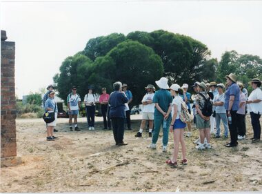
Photograph, Grampians Bush Walking Club Historical Society Tour
... Grampians Bush Walking Club Historical Society Tour....Grampians Bush Walking Club Historical Society Tour....Grampians Bush Walking Club Historical Society Tour. stawell Grampians Bush Walking Club Historical Society Tour. ...Grampians Bush Walking Club Historical Society Tour.stawell -
 Lakes Entrance Historical Society
Book, Da Costa, Grant, Car Touring and Bush Walking in East Gippsland, 1988
... Car Touring and Bush Walking in East Gippsland...Illustrated with coloured photographic Car Touring and Bush Walking in East Gippsland Book Da Costa, Grant ...Comprehensive guide to the magnificent forests and coastal areas of East Gippsland, Victoria, including twenty seven maps and notes on seventeen car tours, fifty nine locations of outstanding impact and 45 bushwalks. Illustrated with coloured photographicnatural history, vegetation, coast -
Marysville & District Historical Society
THE TRIANGLE NEWS-VOL 2 NO 37-NOVEMBER 25 1977
... ...bush walking...marysville victoria australia fire restrictions in force reprint wirreanda fire brigade new year's eve dance spectacular bingo auction footy club notice strawbs for sale bingo & kinder rosters wirreanda meetings christmas olde time dance crossways found pup kitchen tea tupperware party for sale cricket wanted narbethong fire brigade narbethong primary school open day jobs wanted el kanah christian community junior cricket bush walking kindergarten annual dinner vicswim the pumpernickel THE TRIANGLE NEWS-VOL 2 NO 37-NOVEMBER 25 1977 ...marysville, victoria, australia, fire restrictions in force, reprint, wirreanda, fire brigade, new year's eve dance spectacular, bingo, auction, footy club, notice, strawbs for sale, bingo & kinder rosters, wirreanda meetings, christmas olde time dance crossways, found pup, kitchen tea, tupperware party, for sale, cricket, wanted, narbethong fire brigade, narbethong primary school open day, jobs wanted, el kanah christian community, junior cricket, bush walking, kindergarten annual dinner, vicswim, the pumpernickel -
Glenelg Shire Council Cultural Collection
Book, Thistle Y. Harris, Naturecraft in Australia, 1956
... ... bush walking...Public Library of Victoria outdoors nature bush walking Australia Front: Public Library of Victoria stamp on title page. ...Brown cloth-covered binding with section of dustjacket glued to front cover. Title and author on spine in black lettering. 264pp.outdoors, nature, bush walking, australia -
 Halls Gap & Grampians Historical Society
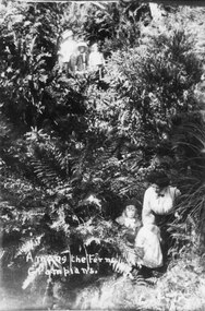
Photograph - B/W, C 1900s (?)
... ...Bush-walking...RECREATION Bush-walking "Among the Ferns. Grampians." inscribed in lower, left of photo. ...Photo shows two adults with four children among frens. One group appear on higher ground near the top of the photo, while another group of a woman, a small child and a todller are pictured among the ferns lower down."Among the Ferns. Grampians." inscribed in lower, left of photo.recreation, bush-walking -
 Halls Gap & Grampians Historical Society
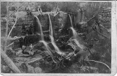
Photograph - Sepia, C 1900s
... ...Bush-walking...See p45 Bridging the Gap. RECREATION Bush-walking Balmains c1900 Photo shows group of people seated and standing by a waterfall,three men seated on top of waterfall, next level a man and a young woman ( who is holding a hiking stick), top level a man and woman both holding hiking sticks. ...Some of the people in the photo are said to be members of the Balmain family. James and his wife Amy Sophia (nee D' Alton) had three children. Amy died suddenly in 1902 at the age of 37. See p45 Bridging the Gap.Photo shows group of people seated and standing by a waterfall,three men seated on top of waterfall, next level a man and a young woman ( who is holding a hiking stick), top level a man and woman both holding hiking sticks. In front of them seated on a rock is a woman holding a hat. on her lap Waterfall is split into three and they flow over a larger rocky platform.Balmains c1900recreation, bush-walking -
 Halls Gap & Grampians Historical Society
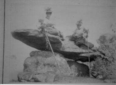
Photograph - Sepia
... ...Bush-walking...Amy died at age 37, James returned to Scotland with their 3 children. RECREATION Bush-walking Photo shows 2 women sitting on a rock formation, both are wearing hats adorned with flowers and appear to be wearing long skirts and high buttoned blouses. ...The name " Balmain " has been attributed to the photo, James Balmain and his wife, Amy Sophia [D'Alton} purchased a vacant school cottage from the area and moved it to their land and called it Bellfield. Amy died at age 37, James returned to Scotland with their 3 children.Photo shows 2 women sitting on a rock formation, both are wearing hats adorned with flowers and appear to be wearing long skirts and high buttoned blouses. They are both holding sticks which seem to be decorated with flowers,recreation, bush-walking -
 Kiewa Valley Historical Society
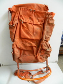
Backpack
... backpack; bush walking; Bogong high Plains; Cross country skiing...This backpack is an example of the equipment used for extended walks and/or cross country skiing. backpack; bush walking; Bogong high Plains; Cross country skiing Orange backpack with nylon front and canvas back. ...This pack is made from materials available at the time and was used to carry supplies & equipment for bushwalking and/or skiing. it is designed to protect the contents in all weather and to be as comfortable and practical as possible.The Bogong High Plains was a popular destination for bushwalking and cross country skiing. This backpack is an example of the equipment used for extended walks and/or cross country skiing.Orange backpack with nylon front and canvas back. The back flap has cord threaded along the sides for adjusting the shape of the pack. It has 6 pockets with zips - 2 each side and 2 across the back. There is 1 pocket with a velcro fastening on the outside of the flap. The cord enables the closing of the top. The frame is aluminium with 2 nearly straight sides and continuing across the top. There are 3 separate aluminium rods that are joined across and 1 piece of canvas.backpack; bush walking; bogong high plains; cross country skiing -
 Kiewa Valley Historical Society
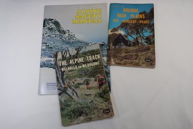
Books x3 - Walking on the Bogong High Plains, 1. The Alpine Track Walhalla to Mt Bogong. 2. Bogong High Plains and Adjacent Peaks both by John Siseman 3. Alpine Safety Manual
... bush walking...Bogong High Plains and Mt Bogong are at the upper end of the Kiewa Valley where local people and visitors spend their leisure time, walking. bush walking Bogong High Plais Walhalla to Mt Bogong Alpine Track 1. and 2. both written by John Siseman, small (pocket size), includes maps and black & white photos. ...Books were published to guide walkers travelling long distances in remote areas increasing their safety and giving them independence.Bogong High Plains and Mt Bogong are at the upper end of the Kiewa Valley where local people and visitors spend their leisure time, walking.1. and 2. both written by John Siseman, small (pocket size), includes maps and black & white photos. The covers are colored photos with the title at the top. 1. has 78 pages and 2. has 63 pages.The Alpine Safety Manual (in yellow) is twice the size of the others and published by the Department of State Development, Decentralization and Tourism.It has 40 pages, coloured and black & white photos and is held by 2 staples.bush walking, bogong high plais, walhalla to mt bogong, alpine track -
 Kiewa Valley Historical Society
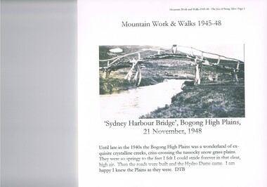
Journal - Reference, Mountain Work and Walks 1945-48,The Joy of Being Alive, circa 1950s
... ...bush walking... wise" city/town dweller that although lived in towns and cities still had the adventurers heart of their fore fathers. alpine country bush walking bogong mountain alpine adventures The author's correspondence and covering letter has his signature "D Bottomley" This item has been photocopied by the author of his journal, consisting 27 pages of A4 size paper. ...This journal detailing the author and friends walks and observations together with black and white photographs of the Kiewa Valley and the Bogong high plains regions during various "walks during the years 1945 to 1948. These walks were undertaken during the various Hydro - electricity generating plants and infra structures were being installed. It relays how the walker and adventurer enjoyed the pristine Alpine regions of Victoria. The wilderness and higher sense of adventure encountered by the author and his "walking party" is now no longer that intense. The isolation of the region was, at that time, still a barrier for the casual adventurer and required a dedication of the "pioneer" mountain walker.The significance of this journal is that both the photographs and accounts of those intrepid adventurers walking throughout the Victorian Alps and the Bogong High Plains details the countryside in one of the remaining years of relative pristine and minimal "tourist" developed regions of rural Victorian. The necessity of greater electrical power supply to the rapidly growing demand from cities and larger towns, post World War II immigration, had resulted in drastic changes to the infrastructure of the Victorian Alpine regions and particularly the Kiewa Valley. The photographs and the written accounts of the "adventurers" in this journal presents the last phases of the " Australian rough outback environment" and also the typical "bush wise" city/town dweller that although lived in towns and cities still had the adventurers heart of their fore fathers.This item has been photocopied by the author of his journal, consisting 27 pages of A4 size paper. A covering letter by the author is at the front of this loose leafed journal. The journal is bound in a yellow plastic cover with spirals. At the back is a 2 page biography of Myrtle Emily (Grigg) Deamer 1922-2006, then a photo of Meg with baby Bryn and son Tony followed by a letter from David BottomleyThe author's correspondence and covering letter has his signature "D Bottomley"alpine country, bush walking, bogong mountain, alpine adventures -
 Bendigo Historical Society Inc.
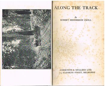
Book - ALEC H CHISHOLM COLLECTION: BOOK ''ALONG THE TRACK'' BY ROBERT HENDERSON CROLL
... ... BUSH WALKING...BOOKS Collections australiana ALEC H CHISHOLM COLLECTION ROBERT HENDERSON CROLL BUSH WALKING AUSTRALIANA Robert Henderson Croll Book. ...Book. ALEC H CHISHOLM COLLECTION. 158 page hardback with a pale green cover. An illustrated anthology of the Australian landscape by Robert Henderson Croll. Comprises a series of articles about trekking through the Australian bush, mainly in Victoria. Includes 7 Band W photos. Published c1930 by Robertson & Mullins Ltd., Melbourne and printed by Ebenezer Baylis & Son Lt., Worcester, England. Handwritten in ink on the flyleaf ''A. H. Chisholm A good companion along the track. Regards R. H. Croll''Robert Henderson Crollbooks, collections, australiana, alec h chisholm collection, robert henderson croll, bush walking, australiana -
 Kiewa Valley Historical Society
Photographs x 2- Bus tour of Wallaces Hut, 20/02/1970
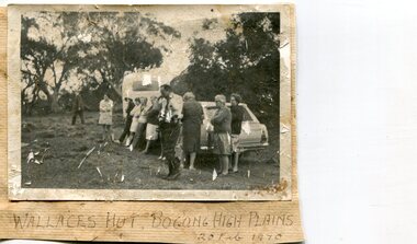
... ...bush walking...Wallace's hut Bogong High Plains bush walking cattlemen 1. Handwritten in black ink on bottom of photo 'Wallace's Hut, Bogong High Plains, 20 Feb, 1970 2. ...Wallace's hut was built in 1889 and is probably the oldest surviving hut on the high plains of north-east Victoria. It was built in six weeks by Irish immigrant brothers Arthur, William and Stewart Wallace among old snow gums on a grassy plain above the snowline. The brothers held grazing leases on the High Plains and the hut was built to provide shelter for the cattlemen working there. It is probably the oldest hut on the Victorian high plains. It is part of the early history of hydroelectricity in the state and has links with early SEC meteorological data recording in the area Apart from its historical significance, Wallace’s Hut is a popular stop for tourists and photographers and is the starting point for the Wallace’s Heritage trail, which is a popular and well used hiking track, by locals and visitors alike.2 black and white photographs mounted on buff card. Photos taken during a bus trip to Wallace's Hut on Feb. 20, 1970 1. Group of local Kiewa Valley residents on a bus tour to Wallace's hut 2. Group of adults and children pictured outside Wallace's hut1. Handwritten in black ink on bottom of photo 'Wallace's Hut, Bogong High Plains, 20 Feb, 1970 2. No markingswallace's hut, bogong high plains, bush walking, cattlemen -
 Kiewa Valley Historical Society
Papers - Edmondson's Hut, The letter is dated 8th October 1974
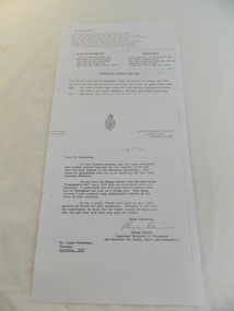
... education department. edmondson's hut. bogong high plains. cattlemen. poetry. cattleman hut. bush walking....His hut is significant in the history of Cattlemen's huts on the Bogong High Plains. education department. edmondson's hut. bogong high plains. cattlemen. poetry. cattleman hut. bush walking. 1. Emblem of Education Dept. Centre top of page. ...Edmondson's Hut is a cattleman's hut on the Bogong High Plains. Jim Edmondson obtained Run 33 (near Mt Nelse) in the early 1930s. He pre cut the timber at his property in Tawonga and along with iron for the walls, chimney and roof took it up to the Bogong High Plains on pack horse. The hut's wall and ceiling were lined and the hut had a 'fairly good floor and bunks'. In 1971 the hut was donated to the Education Department and was approved for transfer by the Lands Department in 1974. Bogong Outdoor School camp has been using the hut for students to camp in as well as National Fitness parties when walking in the area. The upper Kiewa Valley was settled from the mid 1860s and from its earliest days cattle were taken on to the Bogong High Plains to graze during summer. Jim Edmondson took his cattle from the Kiewa Valley to Mt Fainter and later to Run 33, near Mt Nelse. His hut is significant in the history of Cattlemen's huts on the Bogong High Plains.Four A4 typed sheets on white paper - 1. Acknowledgement of transfer of Edmondson's Hut. 2. History of Visitors (to the hut) Prior to 1971. 3. Two poems. 4. One poem 1. Emblem of Education Dept. Centre top of page. Addressed to James Edmondson, Tawonga, Victoria. 2. Page headed History and Visitors prior 1971. 3. My Old black Poley Cow (and) Roper's Track. 4. So Long, Mates!education department. edmondson's hut. bogong high plains. cattlemen. poetry. cattleman hut. bush walking. -
 Embroiderers Guild, Victoria
Accessory - Tree bag, Jill Dickson
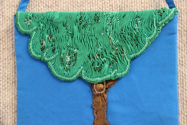
... The inspiration for this design came from reflections on a Tasmanian bush walking holiday....The inspiration for this design came from reflections on a Tasmanian bush walking holiday. The fabric was manipulated, smocked and beaded. ...The inspiration for this design came from reflections on a Tasmanian bush walking holiday.The fabric was manipulated, smocked and beaded. -
 Whitehorse Historical Society Inc.
Footwear - Walking Boots, C. 1900 - 1920
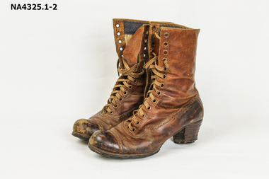
... She used to go bush walking in the 1920s...She used to go bush walking in the 1920s costume female footwear 3 426.36 Brown boots - laced up - leather - heavily repaired on sole. ...Boots belonged to donor's grandmother, who was born in 1888. She used to go bush walking in the 1920sBrown boots - laced up - leather - heavily repaired on sole. Scuffed on heels. Fancy stitching around perimeter of boots and over the toes. Long tongue with laces to tie on books. There are 13 eyelets.3 426.36costume, female footwear -
 Vision Australia
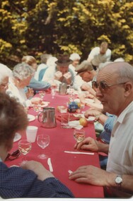
Photograph - Image, 1985 Blind Members holiday to Marysville, 1987
... These images show various people enjoying a BBQ lunch, bush walking, meeting various animals and being entertained at their accommodation....These images show various people enjoying a BBQ lunch, bush walking, meeting various animals and being entertained at their accommodation. ...In 1985 Blind Members were taken to on holiday to Marysville. These images show various people enjoying a BBQ lunch, bush walking, meeting various animals and being entertained at their accommodation.19 colour photographs of blind members on outingassociation for the blind, marysville, elsie black, may maddern, bryan sitlington, peg sitlington, john kunek, recreation -
 Kiewa Valley Historical Society
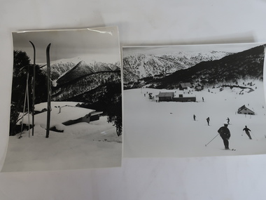
Photos x2 - Views of Skiing at Falls Creek
... The resort continued to develop becoming a destination all year round for skiing, bush walking and cycling. ...The resort continued to develop becoming a destination all year round for skiing, bush walking and cycling. Falls Creek began to develop during the construction of the KHES. ...Falls Creek is a resort town in northeastern Victoria. Its development began during the construction of the Kiewa Hydro Electric Scheme by the SECV in the late 1940s. The resort continued to develop becoming a destination all year round for skiing, bush walking and cycling. Falls Creek began to develop during the construction of the KHES.2 Black and white photos of Falls Creek during winter. 1. 5 buildings in Falls Creek Bowl including the Frying Pan Inn, Bogong Ski Club and Cummings Ski Hire and about 20 skiers on the slopes. Photo is taken from the bottom of the Summit T-bar looking towards the Gully chair and part of the Village T-bar. 2. View taken from Falls Creek village looking towards Spion Kop. 1960s cable binding skis in the foreground.On the back reference to Laurie Richards photographer.falls creek village, skiing, snow sports, laurie richards -
Vision Australia
Audio (item) - Sound recording, Royal Victorian Institute for the Blind, Around the Institute: January 9, 2001
... January 9: In the driver’s seat at Sandown – Peter Watts, Bush walking camp – Tracey Walsh....January 9: In the driver’s seat at Sandown – Peter Watts, Bush walking camp – Tracey Walsh. Royal Victorian Institute for the Blind Radio shows 1 digital sound file in WAV format Around the Institute: January 9, 2001 Audio Sound recording Royal Victorian Institute for the Blind ...Around the Institute was a weekly program designed to keep clients and staff informed of events, activities and thoughts relating to low vision and blindness. It consisted of interviews undertaken by Jo Matthews, with sound engineer Ed Gamble, designed to inform, educate and explore on a variety of topics. January 9: In the driver’s seat at Sandown – Peter Watts, Bush walking camp – Tracey Walsh.royal victorian institute for the blind, radio shows -
 Kiewa Valley Historical Society
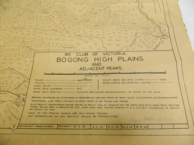
Map - Topographical, Ski Club of Victoria Bogong High Plains and Adjacent Peaks, Early 1930's
... Probably used when bush walking and skiing in the early days on the Bogong High Plains. ...Probably used when bush walking and skiing in the early days on the Bogong High Plains. ...This map has been in the Ryder family for approx. 70 years. Probably used when bush walking and skiing in the early days on the Bogong High Plains. The Ryder family are farmers in the Kiewa Valley and were involved in taking their cattle up to the Bogong High Plains where they had a lease. The State Electricity Commission of Victoria constructed the Kiewa Hydro Electric Scheme opening up the area during the 1940's and 1950's. This type of map is an early one, used by people in the Kiewa Valley and possibly by surveyors prior to construction.The map is an early topographic map used by farmers living in the Kiewa Valley. It is historically significant as these people were involved in taking cattle up to the High Plains during summer and may have been used for bush walking and skiing.This is a sepia coloured paper map which was originally printed copyright registered. It was revised in 20/6.33/4.4.37/8.4.40/24.8.43/19/6/54. It shows roads / tracks / snow poles / snow pole numbers (27) / Snow pole spacing (3 chains. 66 yards) approximately 27 poles to the mile / height above sea level in feet - 5280. Water courses not definitely located etc.Rocky Valley Dam (Kiewa Hydro Electric Scheme) has been drawn on the map by hand with a biro. There is a wooden rod at the top of the map.topographic map; kiewa valley; ryder family; high plains of victoria -
 Kiewa Valley Historical Society
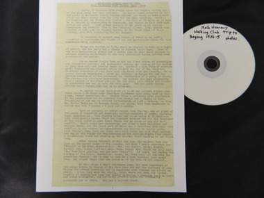
Diary Extract - Trip to Bogong High Plains Xmas 1934 & DVD photos, original diary 1934
... The Melbourne Women's Walking Club enjoyed bush walking as a hobby travelling to the north east of Victoria, using pack horses and camping on a 9 day hike. ...The Melbourne Women's Walking Club enjoyed bush walking as a hobby travelling to the north east of Victoria, using pack horses and camping on a 9 day hike. ...The Melbourne Women's Walking Club enjoyed bush walking as a hobby travelling to the north east of Victoria, using pack horses and camping on a 9 day hike. One of the woman, 'Bill' describes each day in detail - what they did, where they went and what they saw giving an insight into walking and the Bogong High Plains in the mid 1930's before the Kiewa Hydro Electric Scheme opened up the area. The diary mentions a photo being taken by Mr Blackwell on the 9th day, New Year's Eve 'from a lovely bush track from which, looking back at intervals we got our final glimpse of Fainter. 5 miles from from our destination'.Historic: This extract from the diary of 'Bill', a member of the Melbourne Women's Walking Club gives an insight into walking in the mid 1930's and describes the Bogong High Plains as it was then before it was opened up with a road built during the Kiewa Hydro Electric Scheme. It describes the area in summer including the flora & fauna, cattle grazing & cattlemen, the huts, the gauges set up by the State Electricity Commission of Victoria, the people working up there, the weather and the lifestyle of the walking group - their food, duties, swimming etc.. Six double sided typed photocopied yellow pages describing the Melbourne Women's Walking Club trip to the Bogong High Plains at Christmas in 1934. Also one page photocopied of the programme for Year 1934-35 with an arrow pointing to the above trip and a page with a photocopied sepia photo of the "Melbourne Women's Walking Club / Bogong High Plains / Dec. 1934. DVD 12 photos of the trip arrow showing trip from Programme. Title of photo "Melbourne Women's Walking Club / Bogong High Plains / Dec. 1934melbourne women's walking club. bogong high plains. camping. pack horses. cattlemen's huts. -
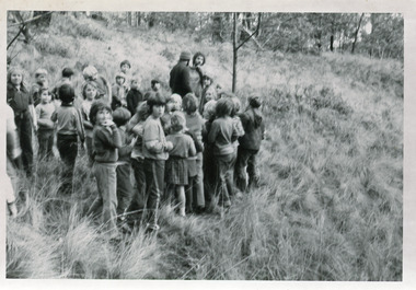 Lakes Entrance Historical Society
Photograph - Johnsonville School 1970
... Black and white photographs of group of children from primary school walking through bush and grass paddock. Johnsonville Victoria...Schools activities Black and white photographs of group of children from primary school walking through bush and grass paddock. Johnsonville Victoria Photograph Johnsonville School 1970 ...Black and white photographs of group of children from primary school walking through bush and grass paddock. Johnsonville Victoriaschools, activities -
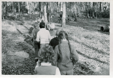 Lakes Entrance Historical Society
Photograph - Johnsonville Primary School Picnic Day at Kalimna, Victoria 1970
... Black and white photographs of group of children from Johnsonville Primary School walking through bush on Picnic Day at Kalimna, Victoria...Schools activities Black and white photographs of group of children from Johnsonville Primary School walking through bush on Picnic Day at Kalimna, Victoria Photograph Johnsonville Primary School Picnic Day at Kalimna, Victoria 1970 ...Black and white photographs of group of children from Johnsonville Primary School walking through bush on Picnic Day at Kalimna, Victoriaschools, activities -
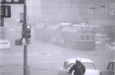 Melbourne Tram Museum
Photograph - set of 10, Ray Marsh, CBD Melbourne - floods, 17-2-1972
... Has a sign advertising Bush walking and sporting equipment above. 4 - W2 591 - north bound in Elizabeth St Essendon, route 49 looking south at corner of Collins St. ...Has a sign advertising Bush walking and sporting equipment above. 4 - W2 591 - north bound in Elizabeth St Essendon, route 49 looking south at corner of Collins St. ...Set of ten photographs of the flooding that occurred in the centre of the CBD Melbourne in 17 Feb. 1972. See Timeline History of Melbourne Trams - Barry George et al. 1 - 876 and two other trams, inbound, Bourke - Elizabeth at the height of the downpour. 2 - ditto, after the rain - looking east, with Dunklings in the view. 3 - W2, route 49, Little Collins and Swanston St looking west. Has a sign advertising Bush walking and sporting equipment above. 4 - W2 591 - north bound in Elizabeth St Essendon, route 49 looking south at corner of Collins St. Digital image of The Age article for the event supplied by Mal Rowe 4/12/12 by e-mail. 2nd copies of .2, .3 and .4 added ex donation of Keith Kings. 7 - Looking south from Bourke St / Elizabeth St. 8 - Bourke St at Elizabeth St with W6 976 and 992 in Bourke St on their way to Spencer St. 9 - Line up of trams in Bourke St (looking west) tailed by W6 999,. route 88. - two copies held. See Reg Item 5995 for photos of Flinders St at Market St. and 6, of the flooding that occurred in the centre of the CBD Melbourne in 17 Feb. 1972. See Timeline History of Melbourne Trams - Barry George et al. 10 - Elizabeth St at Little Bourke St looking north east.Yields information about a flood event in Melbourne that marooned many trams and motor vehicles and flooded shops etc.Set of ten black and white photographs of Ray MarshDetails of the event written on the back of photos collected by Keith Kings and the Ray Marsh stamp in green ink with his address details.trams, tramways, melbourne, flooding, elizabeth st, bourke st, tram 876, tram 591, tram 976, tram 992, tram 999 -
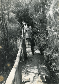 Lakes Entrance Historical Society
Photograph - Johnsonville School picnic day. 1984
... Black and white photograph of two adults Lyn Winnett and Dominique (Dommie) Spiller plus children walking along bush track, pine log hand rail, at Mississippi Creek Track, on primary school picnic day. ...Schools activities Black and white photograph of two adults Lyn Winnett and Dominique (Dommie) Spiller plus children walking along bush track, pine log hand rail, at Mississippi Creek Track, on primary school picnic day. ...Black and white photograph of two adults Lyn Winnett and Dominique (Dommie) Spiller plus children walking along bush track, pine log hand rail, at Mississippi Creek Track, on primary school picnic day. Jonsonville Victoriaschools, activities -
 Marysville & District Historical Society
Postcard (item) - Colour photographs, Nucolorvue Productions, A Souvenir of Beautiful Marysville-12 Specially Selected Views in Full Colour, 1950's
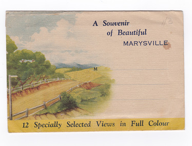
... These photographs were produced by Nucolorvue Productions in Mentone, Victoria. nicholl's lookout (image 1) eildon weir (image 2) road to lake mountain (image 3) foot of steavenson falls (image 4) steavenson falls (image 5) bush scene near marysville (image 6) bush track marysville (image 7) bridge and chalet and crossways marysville (image 8) log cabin at marysville (image 9) black spur (image 10) taggerty river (image 11) highest known hardwood tree (image 12) marysville victoria nucolorvue productions postcard souvenir A Souvenir of Beautiful MARYSVILLE 12 Specially Selected Views in Full Colour Marysville, Victoria, Australia Marysville, 60 miles from Melbourne, is one of nature's/ lovely beauty spots. The invigorating mountain air helps the/ visitor to enjoy the many delightful walks amongst the tall/ timber, or through the fern glades. Apart from many excellent walking ...An envelope of 12 colour photographs of attractions in and around Marysville in Victoria.An envelope of 12 colour photographs of attractions in and around Marysville in Victoria. These photographs were produced by Nucolorvue Productions in Mentone, Victoria.A Souvenir of Beautiful MARYSVILLE 12 Specially Selected Views in Full Colour Marysville, Victoria, Australia Marysville, 60 miles from Melbourne, is one of nature's/ lovely beauty spots. The invigorating mountain air helps the/ visitor to enjoy the many delightful walks amongst the tall/ timber, or through the fern glades. Apart from many excellent walking trips, Marysville district/ offers ample scope for car trips to the nearby Cumberland Forest,/ Buxton, Narbethong, or the Taggerty Valley. Skiers find Lake Mountain an attraction in the winter, whilst/ the hiker finds ample for his needs in the numerous mountain/ areas. Huge Eucalypt trees, revealing their ramrod straightness up/ to 300 feet in height, are a fitting background to the many/ beautiful creeks and waterfalls. PUBLISHED BY NUCOLORVUE PRODUCTIONS, MENTONE, VICTORIA.nicholl's lookout (image 1), eildon weir (image 2), road to lake mountain (image 3), foot of steavenson falls (image 4), steavenson falls (image 5), bush scene near marysville (image 6), bush track marysville (image 7), bridge and chalet and crossways marysville (image 8), log cabin at marysville (image 9), black spur (image 10), taggerty river (image 11), highest known hardwood tree (image 12), marysville, victoria, nucolorvue productions, postcard, souvenir -
 Marysville & District Historical Society
Postcard (item) - Colour photographs, Nucolorvue Productions, A Souvenir of Beautiful Marysville-12 Specially Selected Views in Full Colour, Unknown
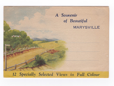
... These photographs were produced by Nucolorvue Productions in Mentone, Victoria. nicholl's lookout (image 1) eildon weir (image 2) road to lake mountain (image 3) foot of steavenson falls (image 4) steavenson falls (image 5) bush scene near marysville (image 6) bush track marysville (image 7) bridge and chalet and crossways marysville (image 8) log cabin at marysville (image 9) black spur (image 10) taggerty river (image 11) highest known hardwood tree (image 12) marysville victoria nucolorvue productions postcard souvenir A Souvenir of Beautiful MARYSVILLE 12 Specially Selected Views in Full Colour Marysville, Victoria, Australia Marysville, 60 miles from Melbourne, is one of nature's/ lovely beauty spots. The invigorating mountain air helps the/ visitor to enjoy the many delightful walks amongst the tall/ timber, or through the fern glades. Apart from many excellent walking ...An envelope of 12 colour photographs of attractions in and around Marysville in Victoria.An envelope of 12 colour photographs of attractions in and around Marysville in Victoria. These photographs were produced by Nucolorvue Productions in Mentone, Victoria.A Souvenir of Beautiful MARYSVILLE 12 Specially Selected Views in Full Colour Marysville, Victoria, Australia Marysville, 60 miles from Melbourne, is one of nature's/ lovely beauty spots. The invigorating mountain air helps the/ visitor to enjoy the many delightful walks amongst the tall/ timber, or through the fern glades. Apart from many excellent walking trips, Marysville district/ offers ample scope for car trips to the nearby Cumberland Forest,/ Buxton, Narbethong, or the Taggerty Valley. Skiers find Lake Mountain an attraction in the winter, whilst/ the hiker finds ample for his needs in the numerous mountain/ areas. Huge Eucalypt trees, revealing their ramrod straightness up/ to 300 feet in height, are a fitting background to the many/ beautiful creeks and waterfalls. PUBLISHED BY NUCOLORVUE PRODUCTIONS, MENTONE, VICTORIA.nicholl's lookout (image 1), eildon weir (image 2), road to lake mountain (image 3), foot of steavenson falls (image 4), steavenson falls (image 5), bush scene near marysville (image 6), bush track marysville (image 7), bridge and chalet and crossways marysville (image 8), log cabin at marysville (image 9), black spur (image 10), taggerty river (image 11), highest known hardwood tree (image 12), marysville, victoria, nucolorvue productions, postcard, souvenir -
 Marysville & District Historical Society
Postcard (item) - Colour photographs, Nucolorvue Productions, A Souvenir of Beautiful Marysville-12 Specially Selected Views in Full Colour, Unknown
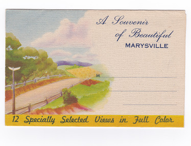
... These photographs were produced by Nucolorvue Productions in Mentone, Victoria. nicholl's lookout (image 1) eildon weir (image 2) road to lake mountain (image 3) foot of steavenson falls (image 4) steavenson falls (image 5) bush scene near marysville (image 6) bush track marysville (image 7) bridge and chalet and crossways marysville (image 8) log cabin at marysville (image 9) black spur (image 10) taggerty river (image 11) highest known hardwood tree (image 12) marysville victoria nucolorvue productions postcard souvenir A Souvenir of Beautiful MARYSVILLE 12 Specially Selected Views in Full Colour Marysville, Victoria, Australia Marysville, 60 miles from Melbourne, is one of nature's/ lovely beauty spots. The invigorating mountain air helps the/ visitor to enjoy the many delightful walks amongst the tall/ timber, or through the fern glades. Apart from many excellent walking ...An envelope of 12 colour photographs of attractions in and around Marysville in Victoria.An envelope of 12 colour photographs of attractions in and around Marysville in Victoria. These photographs were produced by Nucolorvue Productions in Mentone, Victoria.A Souvenir of Beautiful MARYSVILLE 12 Specially Selected Views in Full Colour Marysville, Victoria, Australia Marysville, 60 miles from Melbourne, is one of nature's/ lovely beauty spots. The invigorating mountain air helps the/ visitor to enjoy the many delightful walks amongst the tall/ timber, or through the fern glades. Apart from many excellent walking trips, Marysville district/ offers ample scope for car trips to the nearby Cumberland Forest,/ Buxton, Narbethong, or the Taggerty Valley. Skiers find Lake Mountain an attraction in the winter, whilst/ the hiker finds ample for his needs in the numerous mountain/ areas. Huge Eucalypt trees, revealing their ramrod straightness up/ to 300 feet in height, are a fitting background to the many/ beautiful creeks and waterfalls. PUBLISHED BY NUCOLORVUE PRODUCTIONS, MENTONE, VICTORIA.nicholl's lookout (image 1), eildon weir (image 2), road to lake mountain (image 3), foot of steavenson falls (image 4), steavenson falls (image 5), bush scene near marysville (image 6), bush track marysville (image 7), bridge and chalet and crossways marysville (image 8), log cabin at marysville (image 9), black spur (image 10), taggerty river (image 11), highest known hardwood tree (image 12), marysville, victoria, nucolorvue productions, postcard, souvenir -
 Marysville & District Historical Society
Postcard (item) - Colour photographs, Nucolorvue Productions, A Souvenir of Beautiful Marysville-12 Specially Selected Views in Full Colour, Unknown
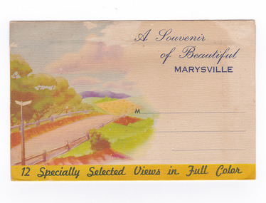
... These photographs were produced by Nucolorvue Productions in Mentone, Victoria. nicholl's lookout (image 1) eildon weir (image 2) road to lake mountain (image 3) foot of steavenson falls (image 4) steavenson falls (image 5) bush scene near marysville (image 6) bush track marysville (image 7) bridge and chalet and crossways marysville (image 8) log cabin at marysville (image 9) black spur (image 10) taggerty river (image 11) highest known hardwood tree (image 12) marysville victoria nucolorvue productions postcard souvenir A Souvenir of Beautiful MARYSVILLE 12 Specially Selected Views in Full Colour Marysville, Victoria, Australia Marysville, 60 miles from Melbourne, is one of nature's/ lovely beauty spots. The invigorating mountain air helps the/ visitor to enjoy the many delightful walks amongst the tall/ timber, or through the fern glades. Apart from many excellent walking ...An envelope of 12 colour photographs of attractions in and around Marysville in Victoria.An envelope of 12 colour photographs of attractions in and around Marysville in Victoria. These photographs were produced by Nucolorvue Productions in Mentone, Victoria.A Souvenir of Beautiful MARYSVILLE 12 Specially Selected Views in Full Colour Marysville, Victoria, Australia Marysville, 60 miles from Melbourne, is one of nature's/ lovely beauty spots. The invigorating mountain air helps the/ visitor to enjoy the many delightful walks amongst the tall/ timber, or through the fern glades. Apart from many excellent walking trips, Marysville district/ offers ample scope for car trips to the nearby Cumberland Forest,/ Buxton, Narbethong, or the Taggerty Valley. Skiers find Lake Mountain an attraction in the winter, whilst/ the hiker finds ample for his needs in the numerous mountain/ areas. Huge Eucalypt trees, revealing their ramrod straightness up/ to 300 feet in height, are a fitting background to the many/ beautiful creeks and waterfalls. PUBLISHED BY NUCOLORVUE PRODUCTIONS, MENTONE, VICTORIA.nicholl's lookout (image 1), eildon weir (image 2), road to lake mountain (image 3), foot of steavenson falls (image 4), steavenson falls (image 5), bush scene near marysville (image 6), bush track marysville (image 7), bridge and chalet and crossways marysville (image 8), log cabin at marysville (image 9), black spur (image 10), taggerty river (image 11), highest known hardwood tree (image 12), marysville, victoria, nucolorvue productions, postcard, souvenir -
 Marysville & District Historical Society
Map (Item) - Bush tracks map, John Siseman et al, MARYSVILLE BUSH TRACKS, 1987
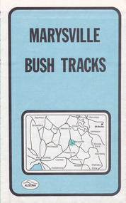
... bush tracks...pindari publications...algona publications...john siseman...gleen van der knijff...lady talbot forest drive...beauty spot walk...michaeldene track...steavenson falls...tree fern gully walk...trestle track...phantom falls...marysville town walk...marysville lookouts round walk...keppel falls...the beeches round walk...cumberland scenic reserve...cambarville...lake mountain...lake mountain walking...A fold out map of the bush tracks in and around Marysville with information regarding each track. marysville victoria australia map bush tracks pindari publications algona publications john siseman gleen van der knijff lady talbot forest drive beauty spot walk michaeldene track steavenson falls tree fern gully walk trestle track phantom falls marysville town walk marysville lookouts round walk keppel falls the beeches round walk cumberland scenic reserve cambarville lake mountain lake mountain walking track A fold out map of the bush tracks in and around Marysville with information regarding each track. ...A fold out map of the bush tracks in and around Marysville with information regarding each track. This map was published by Pindari Publications and distributed by Algona Publications. The track notes were compiled by John Siseman in 1987. The map was drawn by Glenn van der Knijff.A fold out map of the bush tracks in and around Marysville with information regarding each track.marysville, victoria, australia, map, bush tracks, pindari publications, algona publications, john siseman, gleen van der knijff, lady talbot forest drive, beauty spot walk, michaeldene track, steavenson falls, tree fern gully walk, trestle track, phantom falls, marysville town walk, marysville lookouts round walk, keppel falls, the beeches round walk, cumberland scenic reserve, cambarville, lake mountain, lake mountain walking track -
 Marysville & District Historical Society
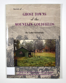
Book - Paperback book, Ghost Towns of the Mountain Goldfields, 1999
... walking along a forest track on their way to a small town. There are heavily forested mountains in the distance. Overlaid onto the drawing is a modern photograph of an old stone building. In the foreground is a green timber building with a water tank and verandah. It is all set in the clearing in the middle of a forest. Ghost Towns of the Mountain Goldfields Book Paperback book Luke Steenhuis Research Publications Pty Ltd Australian Bush ...Ghost towns of the mountain goldfields in VictoriaPaperback. Cover has a drawing depicting horses, both ridden and pack, walking along a forest track on their way to a small town. There are heavily forested mountains in the distance. Overlaid onto the drawing is a modern photograph of an old stone building. In the foreground is a green timber building with a water tank and verandah. It is all set in the clearing in the middle of a forest.Stamp of the Marysville & District Historical Society Inc / P.O. Box 22 / Marysville 3779 Also the inscription: To Alma / Thanks for your help / Signature / LS / November 1999gold, gold mining, gold town, ghost town, victoria, australia, history
