
Showing 36 items matching "coliban district"
-
 Bendigo Historical Society Inc.
Book - PASTORAL SETTLEMENT IN NORTHERN VICTORIA - VOL 1. THE COLIBAN DISTRICT, 1979
... PASTORAL SETTLEMENT IN NORTHERN VICTORIA - VOL 1. THE COLIBAN DISTRICT...Pastoral Settlement in Northern Victoria, volume 1, the Coliban District. 353 pages with illustrations, photographs and maps....Book PASTORAL SETTLEMENT IN NORTHERN VICTORIA - VOL 1. THE COLIBAN DISTRICT ...Pastoral Settlement in Northern Victoria, volume 1, the Coliban District. 353 pages with illustrations, photographs and maps.J.O. Randellhistory, agriculture, northern victoria - coliban, farming, agriculture, pastoral settlement, stations, runs -
 Bendigo Historical Society Inc.
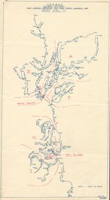
Map - STATE RIVERS AND WATER SUPPLY COMMISSION : COLIBAN DISTRICT MAP 1956, 30/11/1956
... STATE RIVERS AND WATER SUPPLY COMMISSION : COLIBAN DISTRICT MAP 1956...State Rivers and Water Supply Commission Coliban District map. Titled: S.R. & W.S.C. Coliban District Plan showing Irrigation and Town Supply Channels 1956. ...State Rivers and Water Supply Commission Coliban District map. Titled: S.R. & W.S.C. Coliban District Plan showing Irrigation and Town Supply Channels 1956. ...State Rivers and Water Supply Commission Coliban District map. Titled: S.R. & W.S.C. Coliban District Plan showing Irrigation and Town Supply Channels 1956. Scale: 1 inch = 4 miles. Indicates concrete lining and concrete re-lining channels. Printed in blue ink and information added in red. The map is dated at the bottom - 30/11/'56. There is a number, 25,491, in the bottom right corner.state infrastructure, water supply, coliban system, state rivers and water supply commission. coliban system. -
 Bendigo Historical Society Inc.
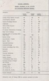
Document - COLIBAN DISTRICT BRANCH CHANNELS AS AT 1/11/67
... COLIBAN DISTRICT BRANCH CHANNELS AS AT 1/11/67...Two documents, one typewritten the other hand written both titled Coliban district branch channels as at 1/11/67. ...Document COLIBAN DISTRICT BRANCH CHANNELS AS AT 1/11/67 ...Two documents, one typewritten the other hand written both titled Coliban district branch channels as at 1/11/67. Names of the channels, total length, length lined and length unlined are recorded.civil engineering, water supply, coliban -
 Bendigo Historical Society Inc.
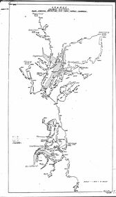
Map - STATE RIVERS AND WATER COMMISSION : COLIBAN DISTRICT IRRIGATION AND TOWN SUPPLY CHANNELS, 30/11/1956
... STATE RIVERS AND WATER COMMISSION : COLIBAN DISTRICT IRRIGATION AND TOWN SUPPLY CHANNELS...Foolscap-size map. Title : Coliban district Plan showing Irrigation and Town Supply Channels. ...Foolscap-size map. Title : Coliban district Plan showing Irrigation and Town Supply Channels. ...State Rivers and Water Supply Commission. Foolscap-size map. Title : Coliban district Plan showing Irrigation and Town Supply Channels. The map covers the area from Raywood to Guildford. Scale : 1 inch to 4 miles. Dated 30/11/56, number 5,491 in bottom right corner.state infrastructure, water supply, coliban system, state rivers and water supply commission. coliban system. -
 Bendigo Historical Society Inc.
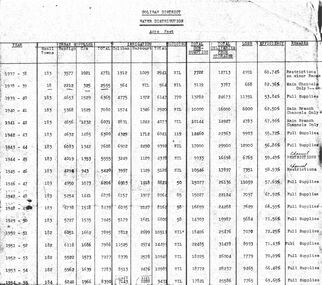
Document - STATE RIVERS AND WATER COMMISSION : COLIBAN DISTRICT WATER DISTRIBUTION ACRE FEET
... STATE RIVERS AND WATER COMMISSION : COLIBAN DISTRICT WATER DISTRIBUTION ACRE FEET...A table titled Coliban District Water Distribution Acre Feet. The dates indicated cover the period 1937-1957. ...A table titled Coliban District Water Distribution Acre Feet. The dates indicated cover the period 1937-1957. ...A table titled Coliban District Water Distribution Acre Feet. The dates indicated cover the period 1937-1957. Main column headings: Urban Supplies, Irrigation, Sluicing, Total Consumption, Total Deliveries from Storages, Loss, Efficiency, and Remarks. Years and figures are typed in red columns with some figures totalled in pencil at the bottom of the last column.state infrastructure, water supply, coliban system, state rivers and water supply commission. coliban system. -
 Bendigo Historical Society Inc.
Document - NEVILLE KING COLLECTION: MINISTER'S VISIT TO COLIBAN DISTRICT
... NEVILLE KING COLLECTION: MINISTER'S VISIT TO COLIBAN DISTRICT...Manilla folder titled: Minister's visit to Coliban district on Friday 3rd November, 1967. Inside the itinerary, a map of the Coliban system of waterworks, a one page Coliban water investigation committee invitation to lunch November 3rd, 1967 with all the names of the people invited and a three page report titled ''State rivers and water supply commission Coliban system of waterworks''...CIVIL ENGINEERING Water supply coliban Manilla folder titled: Minister's visit to Coliban district on Friday 3rd November, 1967. Inside the itinerary, a map of the Coliban system of waterworks, a one page Coliban water investigation committee invitation to lunch November 3rd, 1967 with all the names of the people invited and a three page report titled ''State rivers and water supply commission Coliban system of waterworks'' Document NEVILLE KING COLLECTION: MINISTER'S VISIT TO COLIBAN DISTRICT ...Manilla folder titled: Minister's visit to Coliban district on Friday 3rd November, 1967. Inside the itinerary, a map of the Coliban system of waterworks, a one page Coliban water investigation committee invitation to lunch November 3rd, 1967 with all the names of the people invited and a three page report titled ''State rivers and water supply commission Coliban system of waterworks''civil engineering, water supply, coliban -
 Marysville & District Historical Society
Book - Hardcover book, McCarron, Bird & Co, Victoria and its Metropolis-Past and Present-Volume 2, 1888
... ...coliban district...A history of the various colonies and districts of Victoria from the time of the discovery of Australia through until 1888. melbourne victoria pioneers colonisation history fauna flora banking finance medicine western district south-western district wimmera district geelong district ballarat district avoca district coliban district campase district loddon district lower goulburn district upper goulburn district ovens district north-east district gippsland district mornington district westernport district upper yarra district evelyn district bourke district A history of the various colonies and districts of Victoria from the time of the discovery of Australia through until 1888. ...A history of the various colonies and districts of Victoria from the time of the discovery of Australia through until 1888.Hardback. Dark brown cover with the title in gold lettering. There is also a border in gold decorating the outer edge of the front cover. The spine is also decorated in gold along with the title and the volume number.non-fictionA history of the various colonies and districts of Victoria from the time of the discovery of Australia through until 1888.melbourne, victoria, pioneers, colonisation, history, fauna, flora, banking, finance, medicine, western district, south-western district, wimmera district, geelong district, ballarat district, avoca district, coliban district, campase district, loddon district, lower goulburn district, upper goulburn district, ovens district, north-east district, gippsland district, mornington district, westernport district, upper yarra district, evelyn district, bourke district -
 Bendigo Historical Society Inc.
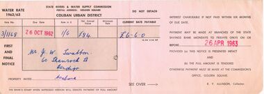
Document - J W SWATTON COLLECTION: WATER RATE NOTICE
... ... Coliban Urban District...PERSON Receipts j w swatton J W Swatton Collection State Rivers & Water Supply Commission Coliban Urban District R Y Allinson Pink Water Rate notice for 1962/63 for property at 60 Shamrock St. ...Pink Water Rate notice for 1962/63 for property at 60 Shamrock St. Bendigo. Rate for £6/6/0.person, receipts, j w swatton, j w swatton collection, state rivers & water supply commission, coliban urban district, r y allinson -
 Federation University Historical Collection
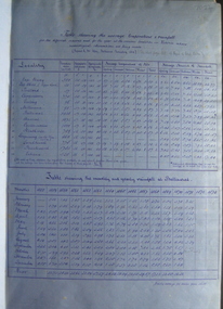
Book, Victorian Government Legislative Assembly, The Select Committee on Castlemaine and Sandhurst water supply, Report from the Select Committee on Castlemaine and Sandhurst Water Supply, together with the proceedings of the Committee, minutes of evidence and appendices, 19/5/1865 (exact)
... districts to be supplied under the Waterworks Act, 1965. It also includes: *Report of the Engineer-in-chief of Railways and Reply of the Chief Engineer of Water Supply on the works constructed by the Victorian Water Supply Department, 1869. * Coliban Water Scheme, 1864 * Ballarat and Ballarat East Water Supply (1869) including the Ballarat Water Supply List containing names of occupiers and nature of improvements on lands comprised within the proposed reserve of Gong Gong Reservoir, Ballaarat. ...districts to be supplied under the Waterworks Act, 1965. It also includes: *Report of the Engineer-in-chief of Railways and Reply of the Chief Engineer of Water Supply on the works constructed by the Victorian Water Supply Department, 1869. * Coliban Water Scheme, 1864 * Ballarat and Ballarat East Water Supply (1869) including the Ballarat Water Supply List containing names of occupiers and nature of improvements on lands comprised within the proposed reserve of Gong Gong Reservoir, Ballaarat. ...This book contains the report from the select committee on Castlemaine and Sandhurst water supply; with the proceedings of the committee, minutes of evidence and appendices. It also contains the report Of the Engineer-In-Chief of Railways, and reply of the Chief Engineer of Water Supply on the works constructed by the Victorian Water Supply Department, presented to both houses of parliament by His Excellency’s command. Ferdinand M. Krause, was a lecturer at the Ballarat School of Mines in Geology Mineralogy Mining Engineering and Surveying. He was a Fellow of the Geological Society and a Fellow of the Linnian Society. He was assistant engineer for the Ballaarat and Ballarat East Water Supply Committee and helped plan local reservoirs.A brown cloth hard cover, foolscap book with leather spine. Title is written in black on the title page. "Water Supply Reports" is engraved in gold on spine. It includes a table showing the monthly and yearly rainfall and shade temperature at Ballarat, 2nd February, 1885. It also includes two reports and two replies, a map No.7082.2 of Victorian Water Supply, Castlemaine and Sandhurst district general plan including lines of Aqueduct, Reservoirs. No. 7082.3 of Victorian Mining districts, Mining Divisions and The Gold Fields in 1866 - includes districts to be supplied under the Waterworks Act, 1965. It also includes: *Report of the Engineer-in-chief of Railways and Reply of the Chief Engineer of Water Supply on the works constructed by the Victorian Water Supply Department, 1869. * Coliban Water Scheme, 1864 * Ballarat and Ballarat East Water Supply (1869) including the Ballarat Water Supply List containing names of occupiers and nature of improvements on lands comprised within the proposed reserve of Gong Gong Reservoir, Ballaarat. At Warrenheip the names included: Honora McCallin, William Honan, C. McMahon, Patrick McMahon, J.P. Beach, J.H. Smith, Michael Nestor, Martin Quinn, Martin McIntyre, Robert Higgins, Coleman Kane, Robert Bond. At Ballarat: William Clarke, Richard White, John Hosking, Wesleyan Chapel, J. Hewitt, Robert McRobinson. At Bungaree: John Pullin, John Llewellyn. William Daw, Smith and Wynne, William Brough, A. Alexander. * Ballarat and Ballaarat East Water Supply report upon the advisability, or otherwise, of constructing a reservoir at the junction of the Yarrowee Creek and Gile's Creek, upon a site known as Gile's Reservoir (printed by Frank Pinkerton). This report has numerous notes written on it (most probably by Krause) and includes the capacity of Harry Beale's Reservoir, Pimcott's Reservoir and the Proposed Gong Gong Reservoir. * Statement as to the position of the Ballaarat and Ballaarat East Borough Councils in Connection with Water Supply, September 1869. * Ballarat and Ballaarat East Water Supply - General Statement upon the Ballaarat and Ballaarat east Scheme of Water Supply. Includes information on Moorabool reservoir, Harry Beale's Reservoir, Lal Lal Creek, Two Mile Creek, Beale's Dam, Yarrowee Creek, Gong Gong Reservoir, Kirk's Dam, Devil's Creek, Moorabool Creek. Additional handwritten notes (probably by Krause) * Engineer's Report on the resolution of the COmmittee of Water Supply, of the 7th July 1868. The report refers to the Country around Mount Warrenheip. Names mentioned are L. Abraham, Great North-West Gold Mining Company, Border Sawmills, Ferdinand Krause, Ohlfsen Bagge, W.H. Shaw, A signature by "Ferdinand M. Krause" at the top corner of the title page. A few pages have handwriting on the margins, it is believed to be his handwriting. water supply victoria, castlemaine directories, sandhurst directories, ballarat directories, james blackburn, edward wardle, daylesford water race, c j taylor, george avery fletcher, bagge, ohlfsen bagge, george foote, john h reilly, ambrose johnson, george francis, timber preservation, james forbes, alfred surplice, malcolm carmichael, robert adams, frederick hugh thomas, h o christerpherson, william downe, thomas lawrence brown, francis hadgson nixon, strangways, guildford, maldon, muckleford, lauriston, malmesbury, franklinford, walmer, strathloddon, downe, ferdinand krause, m7082, trentham, castlemaine, drummond, metcalfe, sutton grange, lockwood, ravenswood, mandurang, yandoit, c.h. ohlfsen bagge, moorabool reservoir, gong gong reservoir, harry beale's reservoir, pincott reservoir, frank pinkerton, water -
 Bendigo Historical Society Inc.
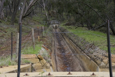
Photograph - Historical Society Field Trip to the Springs at Sedgwick, Abt 2009
... Coliban water channel from Malmsbury to the Sandhurst Reservoir in Bendigo. The water race descends through a concrete chute, and continues sharply around the contour of the hills. Once it descended into a syphon across the gully. The are 182 photos in this series and can be found at 8683.1 to 8683.11. The series also includes photos of the surrounding farming land and the remains of an old house. There are also some notes on the pioneers of the district...Coliban water channel from Malmsbury to the Sandhurst Reservoir in Bendigo. The water race descends through a concrete chute, and continues sharply around the contour of the hills. Once it descended into a syphon across the gully. The are 182 photos in this series and can be found at 8683.1 to 8683.11. The series also includes photos of the surrounding farming land and the remains of an old house. There are also some notes on the pioneers of the district ...The Phil Wilkin Collection contains a series of 11 Items. The related items can be found by clicking on the reference link below. The following history of the Young family and their descendants who lived at the Springs is provided by Phil Wilkin. His Great Grandparents were Frances Young and August Wirth. Phil has also provided notes on the Wilkin Family and some history of the gold mining in Sedgwick. Frances Young's parents Joseph and Margaret Young owned the property called "The Old Place, Preston Vale or Wellington Flat" at Sedgwick near the Springs. Joseph Young owned and Managed the Standard Brewery which was located at Campbells Creek during the late 1800’s early 1900’s. Joseph and Margaret are buried in the Harcourt cemetery. In 1880 August Wirth lived at Mosquito Creek (Lake Eppalock, Victoria) when he married Frances Young. In 1902 they moved to part of Joseph Young's property. They milked cows and sold cattle for a living. One of their children Charles Wirth (Phil Wilkin's Grandfather) bought the land in 1935 after his parents had died. Charles Wirth was a councillor and also was president of the Shire of Strathfieldsaye. The "Old Place" was part of the property owned by members of the family. The old house at the Springs was burnt out by bushfire in January 1944 and much of the stonework was later vandalized by campers. The original Coliban Water Works were designed in 1863 by the Irish engineer Joseph Brady. The system included 70 kilometres of open water channels, aqueducts, syphons and tunnels to carry water (by gravity) from the Coliban River at Malmsbury, north to Castlemaine and Bendigo. Sedgwick is a locality in Central Victoria, Australia. It is located in the City of Greater Bendigo. Facilities include a public hall that opened in 1958 and CFA Rural fire station. It was named Upper Emu Creek until 1901 when it was renamed as Sedgwick after British geologist Adam Sedgwick.Twenty nine photos taken on a field trip by the Bendigo Historical Society to "The Springs" on the main Coliban water channel from Malmsbury to the Sandhurst Reservoir in Bendigo. The water race descends through a concrete chute, and continues sharply around the contour of the hills. Once it descended into a syphon across the gully. The are 182 photos in this series and can be found at 8683.1 to 8683.11. The series also includes photos of the surrounding farming land and the remains of an old house. There are also some notes on the pioneers of the district.history, bendigo, coliban water, joseph brady, irrigation, the springs, sedgwick -
 Bendigo Historical Society Inc.
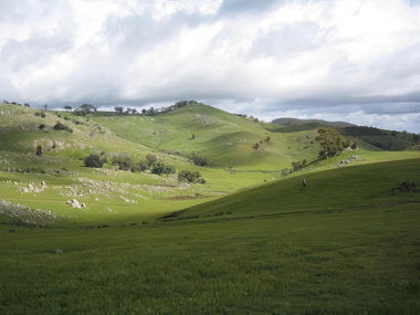
Photograph - Historical Society Field Trip to the Springs at Sedgwick, Abt 2009
... Coliban water channel from Malmsbury to the Sandhurst Reservoir in Bendigo. The water race descends through a concrete chute, and continues sharply around the contour of the hills. Once it descended into a syphon across the gully. The are 182 photos in this series and can be found at 8683.1 to 8683.11. The series also includes photos of the surrounding farming land and the remains of an old house. There are also some notes on the pioneers of the district...Coliban water channel from Malmsbury to the Sandhurst Reservoir in Bendigo. The water race descends through a concrete chute, and continues sharply around the contour of the hills. Once it descended into a syphon across the gully. The are 182 photos in this series and can be found at 8683.1 to 8683.11. The series also includes photos of the surrounding farming land and the remains of an old house. There are also some notes on the pioneers of the district ...The Phil Wilkin Collection contains a series of 11 Items. The related items can be found by clicking on the reference link below. The following history of the Young family and their descendants who lived at the Springs is provided by Phil Wilkin. His Great Grandparents were Frances Young and August Wirth. Phil has also provided notes on the Wilkin Family and some history of the gold mining in Sedgwick. Frances Young's parents Joseph and Margaret Young owned the property called "The Old Place, Preston Vale or Wellington Flat" at Sedgwick near the Springs. Joseph Young owned and Managed the Standard Brewery which was located at Campbells Creek during the late 1800’s early 1900’s. Joseph and Margaret are buried in the Harcourt cemetery. In 1880 August Wirth lived at Mosquito Creek (Lake Eppalock, Victoria) when he married Frances Young. In 1902 they moved to part of Joseph Young's property. They milked cows and sold cattle for a living. One of their children Charles Wirth (Phil Wilkin's Grandfather) bought the land in 1935 after his parents had died. Charles Wirth was a councillor and also was president of the Shire of Strathfieldsaye. The "Old Place" was part of the property owned by members of the family. The old house at the Springs was burnt out by bushfire in January 1944 and much of the stonework was later vandalized by campers. The original Coliban Water Works were designed in 1863 by the Irish engineer Joseph Brady. The system included 70 kilometres of open water channels, aqueducts, syphons and tunnels to carry water (by gravity) from the Coliban River at Malmsbury, north to Castlemaine and Bendigo. Sedgwick is a locality in Central Victoria, Australia. It is located in the City of Greater Bendigo. Facilities include a public hall that opened in 1958 and CFA Rural fire station. It was named Upper Emu Creek until 1901 when it was renamed as Sedgwick after British geologist Adam Sedgwick.Twenty five photos taken on a field trip by the Bendigo Historical Society to "The Springs" on the main Coliban water channel from Malmsbury to the Sandhurst Reservoir in Bendigo. The water race descends through a concrete chute, and continues sharply around the contour of the hills. Once it descended into a syphon across the gully. The are 182 photos in this series and can be found at 8683.1 to 8683.11. The series also includes photos of the surrounding farming land and the remains of an old house. There are also some notes on the pioneers of the district.history, bendigo, coliban water, joseph brady, irrigation, the springs, sedgwick -
 Bendigo Historical Society Inc.
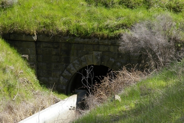
Photograph - Historical Society Field Trip to the Springs at Sedgwick, Abt 2009
... Coliban water channel from Malmsbury to the Sandhurst Reservoir in Bendigo. The water race descends through a concrete chute, and continues sharply around the contour of the hills. Once it descended into a syphon across the gully. The are 182 photos in this series and can be found at 8683.1 to 8683.11. The series also includes photos of the surrounding farming land and the remains of an old house. There are also some notes on the pioneers of the district...Coliban water channel from Malmsbury to the Sandhurst Reservoir in Bendigo. The water race descends through a concrete chute, and continues sharply around the contour of the hills. Once it descended into a syphon across the gully. The are 182 photos in this series and can be found at 8683.1 to 8683.11. The series also includes photos of the surrounding farming land and the remains of an old house. There are also some notes on the pioneers of the district ...The Phil Wilkin Collection contains a series of 11 Items. The related items can be found by clicking on the reference link below. The following history of the Young family and their descendants who lived at the Springs is provided by Phil Wilkin. His Great Grandparents were Frances Young and August Wirth. Phil has also provided notes on the Wilkin Family and some history of the gold mining in Sedgwick. Frances Young's parents Joseph and Margaret Young owned the property called "The Old Place, Preston Vale or Wellington Flat" at Sedgwick near the Springs. Joseph Young owned and Managed the Standard Brewery which was located at Campbells Creek during the late 1800’s early 1900’s. Joseph and Margaret are buried in the Harcourt cemetery. In 1880 August Wirth lived at Mosquito Creek (Lake Eppalock, Victoria) when he married Frances Young. In 1902 they moved to part of Joseph Young's property. They milked cows and sold cattle for a living. One of their children Charles Wirth (Phil Wilkin's Grandfather) bought the land in 1935 after his parents had died. Charles Wirth was a councillor and also was president of the Shire of Strathfieldsaye. The "Old Place" was part of the property owned by members of the family. The old house at the Springs was burnt out by bushfire in January 1944 and much of the stonework was later vandalized by campers. The original Coliban Water Works were designed in 1863 by the Irish engineer Joseph Brady. The system included 70 kilometres of open water channels, aqueducts, syphons and tunnels to carry water (by gravity) from the Coliban River at Malmsbury, north to Castlemaine and Bendigo. Sedgwick is a locality in Central Victoria, Australia. It is located in the City of Greater Bendigo. Facilities include a public hall that opened in 1958 and CFA Rural fire station. It was named Upper Emu Creek until 1901 when it was renamed as Sedgwick after British geologist Adam Sedgwick.Twenty six photos taken on a field trip by the Bendigo Historical Society to "The Springs" on the main Coliban water channel from Malmsbury to the Sandhurst Reservoir in Bendigo. The water race descends through a concrete chute, and continues sharply around the contour of the hills. Once it descended into a syphon across the gully. The are 182 photos in this series and can be found at 8683.1 to 8683.11. The series also includes photos of the surrounding farming land and the remains of an old house. There are also some notes on the pioneers of the district.history, bendigo, coliban water, joseph brady, irrigation, the springs, sedgwick -
 Bendigo Historical Society Inc.
Photograph - Historical Society Field Trip to the Springs at Sedgwick, Abt 2009
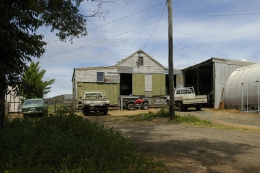
... Coliban water channel from Malmsbury to the Sandhurst Reservoir in Bendigo. The water race descends through a concrete chute, and continues sharply around the contour of the hills. Once it descended into a syphon across the gully. The are 182 photos in this series and can be found at 8683.1 to 8683.11. The series also includes photos of the surrounding farming land and the remains of an old house. There are also some notes on the pioneers of the district...Coliban water channel from Malmsbury to the Sandhurst Reservoir in Bendigo. The water race descends through a concrete chute, and continues sharply around the contour of the hills. Once it descended into a syphon across the gully. The are 182 photos in this series and can be found at 8683.1 to 8683.11. The series also includes photos of the surrounding farming land and the remains of an old house. There are also some notes on the pioneers of the district ...The Phil Wilkin Collection contains a series of 11 Items. The related items can be found by clicking on the reference link below. The following history of the Young family and their descendants who lived at the Springs is provided by Phil Wilkin. His Great Grandparents were Frances Young and August Wirth. Phil has also provided notes on the Wilkin Family and some history of the gold mining in Sedgwick. Frances Young's parents Joseph and Margaret Young owned the property called "The Old Place, Preston Vale or Wellington Flat" at Sedgwick near the Springs. Joseph Young owned and Managed the Standard Brewery which was located at Campbells Creek during the late 1800’s early 1900’s. Joseph and Margaret are buried in the Harcourt cemetery. In 1880 August Wirth lived at Mosquito Creek (Lake Eppalock, Victoria) when he married Frances Young. In 1902 they moved to part of Joseph Young's property. They milked cows and sold cattle for a living. One of their children Charles Wirth (Phil Wilkin's Grandfather) bought the land in 1935 after his parents had died. Charles Wirth was a councillor and also was president of the Shire of Strathfieldsaye. The "Old Place" was part of the property owned by members of the family. The old house at the Springs was burnt out by bushfire in January 1944 and much of the stonework was later vandalized by campers. The original Coliban Water Works were designed in 1863 by the Irish engineer Joseph Brady. The system included 70 kilometres of open water channels, aqueducts, syphons and tunnels to carry water (by gravity) from the Coliban River at Malmsbury, north to Castlemaine and Bendigo. Sedgwick is a locality in Central Victoria, Australia. It is located in the City of Greater Bendigo. Facilities include a public hall that opened in 1958 and CFA Rural fire station. It was named Upper Emu Creek until 1901 when it was renamed as Sedgwick after British geologist Adam Sedgwick.Twenty six photos taken on a field trip by the Bendigo Historical Society to "The Springs" on the main Coliban water channel from Malmsbury to the Sandhurst Reservoir in Bendigo. The water race descends through a concrete chute, and continues sharply around the contour of the hills. Once it descended into a syphon across the gully. The are 182 photos in this series and can be found at 8683.1 to 8683.11. The series also includes photos of the surrounding farming land and the remains of an old house. There are also some notes on the pioneers of the district.history, bendigo, coliban water, joseph brady, irrigation, the springs, sedgwick -
 Bendigo Historical Society Inc.
Administrative record - Commercial Egg Producers' Association of Victoria (CEPA) Central Council Correspondence, 1989
... This item includes the following documents: 8504.45a Coliban Water Tariff Schedule and Billing Notice (2001/2002)Scope and ApplicabilityThe notice applies to water and sewerage districts managed by Coliban Water, as detailed in the schedule.Charges are set in accordance with Sections 260 and 264 of the Water Act 1989. 8504.45b Coliban Water notice of workshops on their management of supplies 8504.45c This document is a notice for an educational lecture night for egg farmers in Victoria, scheduled for June 1, 1989. ...This item includes the following documents: 8504.45a Coliban Water Tariff Schedule and Billing Notice (2001/2002)Scope and ApplicabilityThe notice applies to water and sewerage districts managed by Coliban Water, as detailed in the schedule.Charges are set in accordance with Sections 260 and 264 of the Water Act 1989. 8504.45b Coliban Water notice of workshops on their management of supplies 8504.45c This document is a notice for an educational lecture night for egg farmers in Victoria, scheduled for June 1, 1989. ...The Commercial Egg Producers' Association of Victoria was active by the 1930s, engaging in industry management and lobbying.The Commercial Egg Producer's Association (CEPA) had branches in Bendigo, South Bendigo, Eaglehawk, Wedderburn, Murrabit and Euroa.CEPA Commercial Egg Producer's Association (Bendigo Region) correspondence, for the year 1989. This item includes the following documents: 8504.45a Coliban Water Tariff Schedule and Billing Notice (2001/2002)Scope and ApplicabilityThe notice applies to water and sewerage districts managed by Coliban Water, as detailed in the schedule.Charges are set in accordance with Sections 260 and 264 of the Water Act 1989. 8504.45b Coliban Water notice of workshops on their management of supplies 8504.45c This document is a notice for an educational lecture night for egg farmers in Victoria, scheduled for June 1, 1989. The event features two main presentations 8504.45d This letter from the Crystal Egg Company addresses the following Concerns About the Egg Industry Bill. The company identifies three major areas of concern in the draft Egg Industry Bill that affect the Bendigo egg industry and emphasizes the need for prompt attention. The letter suggests that the Bendigo egg industry would be more effective in achieving its objectives through a joint and coordinated lobbying effort. 8504.45e Newsletter Vol 7 No 1 of the Egg Farmers of Victoria - 4 pages 8504.45f Newsletter Vol 7 No 2 of the Egg Farmers of Victoria - 4 pages 8504.45g Newsletter Vol 7 No 3 of the Egg Farmers of Victoria - 4 pages 8504.45h Egg Farmers of Victoria Circular of Approved Distributors 8504.45i Poultry Newsletter No 47 April 1989 - 16 pages 8504.45j Poultry Newsletter No 48 June 1989 - 14 pages 8504.45k Poultry Farmer Licensing Committe Circular 32/1989 - re hen quotas 8504.45l The document is a formal letter from the Minister for Agriculture and Rural Affairs to the Secretary of the Commercial Egg Producers' Association of Victoria. The Minister thanks the Association for their correspondence regarding the Victorian Egg Marketing Board (VEMB).The government is aware of ongoing concerns within the egg industry about VEMB operations. 8504.45m This document is a formal invitation for nominations to the Victorian Egg Marketing Board, highlighting several key points. All current members' terms expire on 30 June 1989.Nomination Requirements. Three board members must be egg producers who earn a substantial portion of their income from egg production, as per Section 8 of the Marketing of Primary Products Act 1958. 8504.45n Newsletter Vol 7 No 5 of the Egg Farmers of Victoria - 4 pages 8504.45o This document is a formal letter from the Crystal Egg Company to egg producers in Bendigo, outlining key points regarding hen quota trading 8504.45p Egg Farmers of Victoria News Circular 37/89 8504.45q Egg Farmers of Victoria News Circulars 12 pages 8504.45r From the Crystal Egg Company, authorised agent for the Victorian Egg Marketing Board. Points highlight regulatory stability, improved industry conditions, and adjustments to payment terms for egg producers. 8504.45s Newspaper article. Discusses Key Points of the New Zealand Egg Industry Deregulation Document 8504.45t Newsletter Vol 7 No 6 of the Egg Farmers of Victoria - 6 pages 8504.45u The Commercial Egg Producers' Association of Victoria is invited to nominate at least five egg producers for potential appointment to the Victorian Egg Marketing Board. 8504.45v To the NSW Minister of Agriculture. The letter expresses strong concerns that deregulation could create more problems than the current regulated system. 8504.45w Key Points of the Egg Industry Regulations 1989 8504.45x This document is the 1988-89 Agricultural Catalogue produced by the Technical Book & Magazine Co. P/L, located at 295 Swanston St., Melbourne. 8504.45y Five pages from the Victorian Farmers Federation, Egg producer Survival Kit. Aims to mobilize farmers for grassroots lobbying to strengthen support for the egg industry. 8504.45z From the Poultry Research Council NSW. Six page newsletter. Key Findings of the Egg Industry Study Tour 8504.45aa Egg Industry Bill Table of Provisions. 47 pages. Government Printer Melbourne 8504.45ab Ministerial Statement on Egg Marketing. Eight pages. The statement outlines the government's reaction to the Public Bodies Review Committee's findings on egg marketing arrangements and details proposed legislative reforms. 8504.45ac Egg Industry Bill 1989. Second Reading Speech. Nine pages 8504.45ad Certificate of Incorporation Feb 1989 8504.45ae The document is a business letter from Richard A. Guy, Managing Director of Crystal Egg Company, addressed to Mr. Kevin Fitzgibbon, Secretary of CEPA. re CEPA's Opposition to Code of Practice Adoption. CEPA has decided to oppose the idea of all Farm Pride Egg franchisees adopting a Code of Practice on their farms.Mr. Fitzgibbon is preparing a letter to the Board to communicate CEPA's decision. 8504.45af Letter from Crystal Egg Company to Egg Producers re Deregulation in NSW Egg Industry The New South Wales Government deregulated its egg industry on July 26, resulting in the dissolution of the NSW Egg Corporation.Hen quotas in NSW are being compensated at $15 per bird by the government. 8504.45ag Letter from Crystal Egg Company to Egg Producers re preliminary Deregulation of the NSW Egg Industry and Its Impact on Victoria 8504.45ah Egg Industry Act amendment Bill Second Reading Speech 8504.45ai Egg Industry Licensing Committee Circular outlines the new licensing requirements for keeping hens under the Egg Industry Act 1989 8504.45aj CEPA Central Council minutes of the annual conference June 1989 8504.45ak Newsletter Egg Farmers of Victoria Jan 1989 - Four pages 8504.45al This document is a letter from the Bendigo and South Bendigo branches of CEPA to the Egg Farmers of Victoria, expressing urgent concern about the financial situation of egg producers. 8504.45am This document to the Crytal Egg Company, outlines concerns from C.E.P.A. branch members regarding financial pressures in their industry.egg producer's information, correspondence, cepa, commercial egg producers' association -
 Bendigo Historical Society Inc.
Book - BOOK: BENDIGO'S RICHES
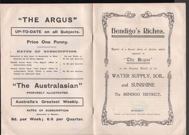
... PLACE Land agricultural Book - Bendigo's Riches The Argus Wilson and Mackinnon Councillor Carolin James Cumming Dairying Mr Elwood Mead Tomato Growing Mr B Puig y Ventura Mr Elliot Borley Fruitgrowers Bendigo Fruitgrowers' Co-operative Society Mr W A Hamilton ex-MLA Upper Coliban Coliban system Antiquated Mining Regulations Lands Department Chaffey Bros Mr G H Crawford Mine-owners' Association Councillor Andrew Mr Baillieu Miners' Association Agricultural Society Sir Thomas Bent Strathfieldsaye Shire Mr R B Brennan Mr T L Sweeny Jun Bendigo Sewerage Farm Councillor Osborne Councillor Lowndes Councillor T R Long Bendigo Chamber of Commerce Bendigo City Council Councillor Andrew Councillor H A Ross Councillor Wilkie H M Leggo and Co Small booklet titled 'Bendigo's Riches'. Reprint of a Special Series of Articles which appeared in 'The Argus' on the Potential Wealth of the Water Supply, Soil, and Sunshine of The Bendigo District ...Small booklet titled 'Bendigo's Riches'. Reprint of a Special Series of Articles which appeared in 'The Argus' on the Potential Wealth of the Water Supply, Soil, and Sunshine of The Bendigo District. Printed by Wilson and Mackinnon, Printers, Collins Street. Booklet mentions the potential wealth of Bendigo's Water, Soil and Sunshine; Orchards, Dairying, Tomato Growing, Fruit growing, Land, and Water Supply. Also discussed are Antiquated Mining Regulations, City Trust suggested, and its Advantages, Opportunities, 'The Argus' suggestions endorsed, Mine-owner's Opinion, The Mayor of Bendigo's Opinion, Statement by Strathfieldsaye Shire Secretary, Locked-up Area Useless for Timber, Shire Appeals for Unlocking the Land, 'The Argus' Thanked, Bendigo Chamber of Commerce, Bendigo City Council and Preserving Factory at Bendigo. Photos include Irrigated pastures, ryegrass and clovers on Mr. James Cumming's Farm; Irrigating Tomatoes on Mr. Elliot Borley's Farm, White Hills; Junction of Huntly and White Hills Irrigation Channels; Packing Tomatoes at Mr. B. Puig Y. Ventura's Garden, White Hills; and Tomato Patch on the Holding of Mr. T. L. Sweeny, Jun. Back of the booklet has subscription rates and price of The Argus. place, land, agricultural, book - bendigo's riches, the argus, wilson and mackinnon, councillor carolin, james cumming, dairying, mr elwood mead, tomato growing, mr b puig y ventura, mr elliot borley, fruitgrowers, bendigo fruitgrowers' co-operative society, mr w a hamilton ex-mla, upper coliban, coliban system, antiquated mining regulations, lands department, chaffey bros, mr g h crawford, mine-owners' association, councillor andrew, mr baillieu, miners' association, agricultural society, sir thomas bent, strathfieldsaye shire, mr r b brennan, mr t l sweeny jun, bendigo sewerage farm, councillor osborne, councillor lowndes, councillor t r long, bendigo chamber of commerce, bendigo city council, councillor andrew, councillor h a ross, councillor wilkie, h m leggo and co -
 Bendigo Historical Society Inc.
Book - JOSEPH BRADY COLLECTION: NOTEBOOK, BENDIGO WATER WORKS - CRUSOE RESERVOIR AND OTHER CONTRACTS 1870 TO 1874
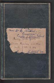
... It has costings for contracts for water supply, amounts which will supply water from the Coliban to the Castlemaine and Sandhurst districts, and if the Government should purchase the Bendigo Waterworks, and to construct the Upper Coliban reservoir, additional expenditure may be required. ...It has costings for contracts for water supply, amounts which will supply water from the Coliban to the Castlemaine and Sandhurst districts, and if the Government should purchase the Bendigo Waterworks, and to construct the Upper Coliban reservoir, additional expenditure may be required. ...Dark green covered book with gold edging front and back and seven horizontal lines on the spine. On front cover: buff sticker, with Bendigo Water Works, Crusoe Reservoir and others, contracts 1870 - 1874 written in cursive script. Later writing 'from Mrs. H. Strickland, Bungoona, Currie, King Island'. Written inside is: Presented to Bendigo Historical Society by Mrs A Strickland, Bungoona, Currie, King Island. Also the Historical Society Stamp. The next page has three newspaper cuttings. The first is 'The Victorian Waterworks'. It has costings for contracts for water supply, amounts which will supply water from the Coliban to the Castlemaine and Sandhurst districts, and if the Government should purchase the Bendigo Waterworks, and to construct the Upper Coliban reservoir, additional expenditure may be required. (from Daily Telegraph - 1868). The second is some information on The Yan Yean Aqueduct. The third is a letter to the Editor of the Argus from Joseph Brady, dated August 2, 1870, in reference to repairing the leak in the outlet tunnel of the Malmsbury Reservoir. He says the repair of the tunnel was not essential and is unnecessary and 2nd. If the bank was cut through and restored, for years the bank would not be safe, as the earth used in the restoration would require time to subside and unite with the old work. He hopes the embankment would be allowed to stand intact.civil engineering, water supply, coliban, bendigo water works - crusoe reservoir and other contracts 1870 to 1874, mrs a strictland, royal historical society of victoria bendigo branch, coliban scheme, upper coliban reservoir, daily telegraph 1868, yan yean aqueduct, age, argus 2/8/1870, malmsbury reservoir, joseph brady, charles cook, fishburn morton & kennedy, bernard ward & co, the fulton foundry co ltd, james mcewan & co, laylands foundry co, melbourne sewers & water supply, c w gore, crusoe office, john mcilwraith, edward chandler, ia-s miller & co, robison br & co, guthrie/white hills pottery, peter mcpherson, slater & co, john danks, mclean br & rigg, william beebe, t i connelly, i horwoods -
 Bendigo Historical Society Inc.
Document - LONG GULLY HISTORY GROUP COLLECTION: EAGLEHAWK & NOTED EVENTS
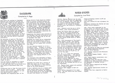
... District Roads Board... Camp Hotel... Charles Sherratt... Mt Alexander North Run... Grice and Heape... Ravenswood... Gibson and Fenton... Mrs John Kennedy... Mrs Patrick Farrel... MR J A Paton... Mr Lachlan McLachlan (Bendigo Mac)... Bendigo Hospital... Bendigo Advertiser... Theatre Royal... Lieutenant Governor Sir Charles and Lady Hotham... Harney's Bridge... E J Ennor... Sandhurst Fire Brigade... Mr Townsend... Bendigo Water Works... Cornish & Co... Post Office... Bendigo Pottery... Bendiog Agricultural Society... Benevolent Asylum... Bendigo Gas Company... Cattle yards... Coliban...BENDIGO History long gully history group The Long Gully History Group - Eaglehawk & Noted Events H Biggs June Parry James Mouat Joseph Crook Marong District Roads Board Camp Hotel Charles Sherratt Mt Alexander North Run Grice and Heape Ravenswood Gibson and Fenton Mrs John Kennedy Mrs Patrick Farrel MR J A Paton Mr Lachlan McLachlan (Bendigo Mac) Bendigo Hospital Bendigo Advertiser Theatre Royal Lieutenant Governor Sir Charles and Lady Hotham Harney's Bridge E J Ennor Sandhurst Fire Brigade Mr Townsend Bendigo Water Works Cornish & Co Post Office Bendigo Pottery Bendiog Agricultural Society Benevolent Asylum Bendigo Gas Company Cattle yards Coliban Water Supply Scheme Cr W V Simons J Mouat Sir Henry Barkly Sandhurst Borough Eaglehawk Borough Cr John McIntyre Duke of Edinburgh Latham and Watson's Mine Galatea (model ship) St Paul's Church of England Rev G P Despard Bendog Rifle Association Strathfieldsaye Shire Hall Corporate High School Bendigonian Society Richard Andrews Easter Fair G Aspinall J Burnsides Viscount Canterbury (Sir H Manners sutton) Beehive Stores Mining Exchanges Annual Waverley Prize Bendigo Water Works City Fire Brigade City Family Hotel Bendigo United Friendly Society Medical Institute and Dispensary Jewish Synagogue Masonic Hall School of Mines J H Abbott Australian Natives Association Temperance Hall Royal Princess Theatre Albion Hall Central State School High School Gravel Hill State School Early Trams Electricity Commission Notes on Eaglehawk compiled by H Biggs mentions early settlement, discovery of gold, separation of Eaglehawk from the Marong District Roads Board, Nominations for Council and Newspapers. ...Notes on Eaglehawk compiled by H Biggs mentions early settlement, discovery of gold, separation of Eaglehawk from the Marong District Roads Board, Nominations for Council and Newspapers. Noted Events compiled by June Parry mention events from 1839 to 1876 and some in 1928. These included early settlement, gold discovery at The Rocks, Churches, hospital, Bendigo Advertiser, Theatre Royal, Police Office, Post Office, Census, First Council Works, Telegraph, Mining Company, Mining Board, Public Market, various buildings built, Rates, Schools, and very early trams.bendigo, history, long gully history group, the long gully history group - eaglehawk & noted events, h biggs, june parry, james mouat, joseph crook, marong district roads board, camp hotel, charles sherratt, mt alexander north run, grice and heape, ravenswood, gibson and fenton, mrs john kennedy, mrs patrick farrel, mr j a paton, mr lachlan mclachlan (bendigo mac), bendigo hospital, bendigo advertiser, theatre royal, lieutenant governor sir charles and lady hotham, harney's bridge, e j ennor, sandhurst fire brigade, mr townsend, bendigo water works, cornish & co, post office, bendigo pottery, bendiog agricultural society, benevolent asylum, bendigo gas company, cattle yards, coliban water supply scheme, cr w v simons, j mouat, sir henry barkly, sandhurst borough, eaglehawk borough, cr john mcintyre, duke of edinburgh, latham and watson's mine, galatea (model ship), st paul's church of england, rev g p despard, bendog rifle association, strathfieldsaye shire hall, corporate high school, bendigonian society, richard andrews, easter fair, g aspinall, j burnsides, viscount canterbury (sir h manners sutton), beehive stores, mining exchanges, annual waverley prize, bendigo water works, city fire brigade, city family hotel, bendigo united friendly society medical institute and dispensary, jewish synagogue, masonic hall, school of mines, j h abbott, australian natives association, temperance hall, royal princess theatre, albion hall, central state school, high school, gravel hill state school, early trams, electricity commission -
Bendigo Historical Society Inc.
Map - CAMPBELL COLLECTION: BENDIGO AND DISTRICT MAPS, 8-6 29
... Coliban River, Knowsley, Strathfieldsaye 10 1/2 miles. Prepared in W.P.B. from Parish and Assessor's Plans. G.W.Latimer 8-6-29. (number 393 in map cupboard 1) Map CAMPBELL COLLECTION: BENDIGO AND DISTRICT MAPS ...Map. Kimbolton, Parishes of Kimbolton and Lyell, scale 20 chains to 1 inch. Area by Plamimeter 6258 acres. Coliban River, Knowsley, Strathfieldsaye 10 1/2 miles. Prepared in W.P.B. from Parish and Assessor's Plans. G.W.Latimer 8-6-29. (number 393 in map cupboard 1)G.W.Latimermap, bendigo, allotments -
 Bendigo Historical Society Inc.
Photograph - NATIONAL TRUST COLLECTION: PHOTOGRAPH ALBUM
... district. 7th and 8th November, 1998. Organized for the photographic committee by McIvor Historical Society. Photos include: Redesdale Presbyterian Church, Coliban Estate, Redesdale Hotel, Redesdale Bridge, Mia Mia Uniting Church, Spring Plains, Heathcote Hospital, Heathcote Powder Magazine, Moorabbee Ruins and grave C. ...district. 7th and 8th November, 1998. Organized for the photographic committee by McIvor Historical Society. Photos include: Redesdale Presbyterian Church, Coliban Estate, Redesdale Hotel, Redesdale Bridge, Mia Mia Uniting Church, Spring Plains, Heathcote Hospital, Heathcote Powder Magazine, Moorabbee Ruins and grave C. ...Photograph album, plastic and vinyl. Contains sixty coloured photographs of a National Trust tour of Heathcote and district. 7th and 8th November, 1998. Organized for the photographic committee by McIvor Historical Society. Photos include: Redesdale Presbyterian Church, Coliban Estate, Redesdale Hotel, Redesdale Bridge, Mia Mia Uniting Church, Spring Plains, Heathcote Hospital, Heathcote Powder Magazine, Moorabbee Ruins and grave C. Patterson, Derrinal, Mt Camel Homestead, Open Cut at Heathcote, Heathcote Church.national trust, properties, historic homesteads -
Clunes Museum
Document - CENTRAL HIGHLAND REGION WATER
... SUPPLIED BY THE STATE RIVERS & WATER SUPPLY COMMISSION - PORTION OF COLIBAN SYSTEM .3 TOWNS WATER SUPPLY DISTRICTS AND WATERWORKS TRUSTS 30 JUNE 1948...SUPPLIED BY THE STATE RIVERS & WATER SUPPLY COMMISSION - PORTION OF COLIBAN SYSTEM .3 TOWNS WATER SUPPLY DISTRICTS AND WATERWORKS TRUSTS 30 JUNE 1948 Document CENTRAL HIGHLAND REGION WATER ....1 SEWERAGE AND SANITATION - STATISTICAL SUMMERY 30 JUNE 1948 .2 TOWNS WATER SUPPLY. SUPPLIED BY THE STATE RIVERS & WATER SUPPLY COMMISSION - PORTION OF COLIBAN SYSTEM .3 TOWNS WATER SUPPLY DISTRICTS AND WATERWORKS TRUSTS 30 JUNE 1948central highland region, central highland water, state river & water supply commission -
 City of Greater Bendigo - Civic Collection
Photograph - Portrait of Councillor Keck, W H Robinson, c 1913
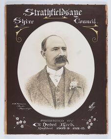
... district of Strathfieldsaye was proclaimed in 1861 and named a Shire on the 17th September in 1866. It remained a shire until amalgamation in 1994 when it became part of the City of Greater Bendigo. The shire was located 8 km to the south- east of Bendigo and covered an area of 601 square kilometres and extended from the Calder Highway to the Coliban and Campaspe Rivers. ...district of Strathfieldsaye was proclaimed in 1861 and named a Shire on the 17th September in 1866. It remained a shire until amalgamation in 1994 when it became part of the City of Greater Bendigo. The shire was located 8 km to the south- east of Bendigo and covered an area of 601 square kilometres and extended from the Calder Highway to the Coliban and Campaspe Rivers. ...The district of Strathfieldsaye was proclaimed in 1861 and named a Shire on the 17th September in 1866. It remained a shire until amalgamation in 1994 when it became part of the City of Greater Bendigo. The shire was located 8 km to the south- east of Bendigo and covered an area of 601 square kilometres and extended from the Calder Highway to the Coliban and Campaspe Rivers. The shire's administration centre was in Strathfieldsaye until 1972 when new offices were opened in Kennington.Framed black and white head and shoulder portrait of Councillor Keck with hand coloured and drawn detail. Profile slightly to right with walrus moustache. Cut oval brown mount decorated with text and flowers. Hand written title top and lower centre.Strathfieldsaye / Shire Council / W.H. Robinson / Photo / Bendigo / J.H.E Gribbs / Presented by / Cr Herbert Keck / President 1903-4. 1912-13.shire of strathfieldsaye, councillor keck, strathfieldsaye shire council, president of strathfieldsaye shire -
 City of Greater Bendigo - Civic Collection
Photograph - Councillor group portrait, W H Robinson, Strathfieldsaye Shire Council, 1909
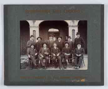
... district of Strathfieldsaye was proclaimed in 1861 and named a Shire on the 17th September in 1866. It remained a shire until amalgamation in 1994 when it became part of the City of Greater Bendigo. The shire was located 8 km to the south- east of Bendigo and covered an area of 601 square kilometres and extended from the Calder Highway to the Coliban and Campaspe Rivers. ...district of Strathfieldsaye was proclaimed in 1861 and named a Shire on the 17th September in 1866. It remained a shire until amalgamation in 1994 when it became part of the City of Greater Bendigo. The shire was located 8 km to the south- east of Bendigo and covered an area of 601 square kilometres and extended from the Calder Highway to the Coliban and Campaspe Rivers. ...The district of Strathfieldsaye was proclaimed in 1861 and named a Shire on the 17th September in 1866. It remained a shire until amalgamation in 1994 when it became part of the City of Greater Bendigo. The shire was located 8 km to the south- east of Bendigo and covered an area of 601 square kilometres and extended from the Calder Highway to the Coliban and Campaspe Rivers. The shire's administration centre was in Strathfieldsaye until 1972 when new offices were opened in Kennington.Photographic group portrait of eleven Strathfieldsaye Shire Councillors in front of the Strathfieldsaye Shire Hall. Five men are seated and six standing with one man standing further in back ground on the building's verandah. Photograph is attached directly to green mount card and framed. Gold lettering on mount.Strathfieldsaye Shire Councillors / R. B. Brennan (Sec.) W. J. Lowdes S. Doak M. Burns () N Condon B. Code (Inspector) / WH Robinson Photo Bendigo / T Somerville / W. I. Long / Fred Osborne (President) H Keck / W Dresler / With the President's (Cr. Fred Osborne) Compliments / September 23rd, 1909shire of strathfieldsaye, strathfieldsaye shire council, president of strathfieldsaye shire, strathfieldsaye shire hall -
 City of Greater Bendigo - Civic Collection
Photograph - Strathfieldsaye Shire Hall
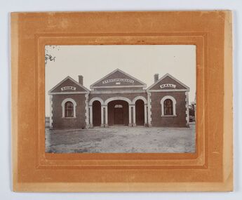
... district of Strathfieldsaye was proclaimed in 1861 and named a Shire on the 17th September in 1866. It remained a shire until amalgamation in 1994 when it became part of the City of Greater Bendigo. The shire was located 8 km to the south- east of Bendigo and covered an area of 601 square kilometres and extended from the Calder Highway to the Coliban and Campaspe Rivers. ...district of Strathfieldsaye was proclaimed in 1861 and named a Shire on the 17th September in 1866. It remained a shire until amalgamation in 1994 when it became part of the City of Greater Bendigo. The shire was located 8 km to the south- east of Bendigo and covered an area of 601 square kilometres and extended from the Calder Highway to the Coliban and Campaspe Rivers. ...The district of Strathfieldsaye was proclaimed in 1861 and named a Shire on the 17th September in 1866. It remained a shire until amalgamation in 1994 when it became part of the City of Greater Bendigo. The shire was located 8 km to the south- east of Bendigo and covered an area of 601 square kilometres and extended from the Calder Highway to the Coliban and Campaspe Rivers. The shire's administration activities were centred at the Strathfieldsaye Shire Hall which was built in 1869 at a cost of £700 based on a design by George Steane, the shire surveyor and built by George Pallett of Sandhurst. Constructed of red brick, the hall has a unique ventilation system with hollow walls open at the top and bottom to ensure a draught to cool the building in summer. Framed and mounted photograph of the Strathfieldsaye Shire Hall. Verso; W M Robinson / Photographer / Mundy Street Bendigostrathfieldsaye shire hall, shire of strathfieldsaye, strathfieldsaye shire council -
 City of Greater Bendigo - Civic Collection
Photograph - Strathfieldsaye Councillor Group Portrait, D.G. Coope & Son - Framers
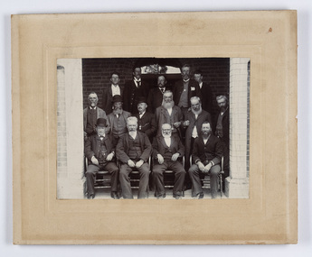
... district of Strathfieldsaye was proclaimed in 1861 and named a Shire on the 17th September in 1866. It remained a shire until amalgamation in 1994 when it became part of the City of Greater Bendigo. The shire was located 8 km to the south- east of Bendigo and covered an area of 601 square kilometres and extended from the Calder Highway to the Coliban and Campaspe Rivers. ...district of Strathfieldsaye was proclaimed in 1861 and named a Shire on the 17th September in 1866. It remained a shire until amalgamation in 1994 when it became part of the City of Greater Bendigo. The shire was located 8 km to the south- east of Bendigo and covered an area of 601 square kilometres and extended from the Calder Highway to the Coliban and Campaspe Rivers. ...The district of Strathfieldsaye was proclaimed in 1861 and named a Shire on the 17th September in 1866. It remained a shire until amalgamation in 1994 when it became part of the City of Greater Bendigo. The shire was located 8 km to the south- east of Bendigo and covered an area of 601 square kilometres and extended from the Calder Highway to the Coliban and Campaspe Rivers. The shire's administration centre was in Strathfieldsaye until 1972 when new offices were opened in Kennington.Silver gelatin framed photographic group portrait of fifteen men taken in the alcove of the Strathfieldsaye Shire Hall. Four men are seated and eleven are standing. Photograph is attached directly to cream mount card. Handwritten note with photograph: 1/ John Burke, 2/ (?), 3/ (?), 4/ RHS Abbott, 5/ M Brennan, 6/(?) 7/(?) 1/. M Condon? 2/ (?) 3/ M Burns, 4/(?) Gentlemen at back are probably council staff.shire of strathfieldsaye, strathfieldsaye shire council, president of strathfieldsaye shire, councillor john burke, councillor r.h.s. abbott, councillor brennan, councillor condon, councillor m burns -
 City of Greater Bendigo - Civic Collection
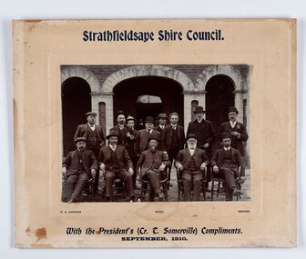
Photograph - Councillor group portrait, W H Robinson, Strathfieldsaye Shire Council
... district of Strathfieldsaye was proclaimed in 1861 and named a Shire on the 17th September in 1866. It remained a shire until amalgamation in 1994 when it became part of the City of Greater Bendigo. The shire was located 8 km to the south- east of Bendigo and covered an area of 601 square kilometres and extended from the Calder Highway to the Coliban and Campaspe Rivers. ...district of Strathfieldsaye was proclaimed in 1861 and named a Shire on the 17th September in 1866. It remained a shire until amalgamation in 1994 when it became part of the City of Greater Bendigo. The shire was located 8 km to the south- east of Bendigo and covered an area of 601 square kilometres and extended from the Calder Highway to the Coliban and Campaspe Rivers. ...The district of Strathfieldsaye was proclaimed in 1861 and named a Shire on the 17th September in 1866. It remained a shire until amalgamation in 1994 when it became part of the City of Greater Bendigo. The shire was located 8 km to the south- east of Bendigo and covered an area of 601 square kilometres and extended from the Calder Highway to the Coliban and Campaspe Rivers. The shire's administration centre was in Strathfieldsaye until 1972 when new offices were opened in Kennington. Group portrait of 13 men / councilors, 5 seated and 8 standing dressed in suits. There are another 2 men further back in front of the hall doors. Photograph is taken outside the Strathfieldsaye Shire Hall.Srathfieldsaye Shire Council. / With the President's (Cr T. Somerville) Compliments. / September, 1910 / W.H. Robinson Photo. Bendigo Verso; William Drechslershire of strathfieldsaye, president of strathfieldsaye shire, strathfieldsaye shire council -
 City of Greater Bendigo - Civic Collection
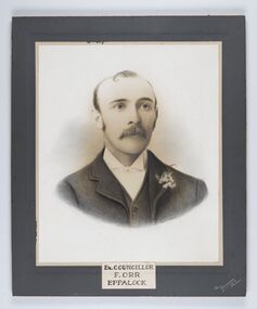
Photograph - Portrait of Councillor Orr, The Yeoman Studios, Ex. Councillor / F. Orr / Eppalock
... district of Strathfieldsaye was proclaimed in 1861 and named a Shire on the 17th September in 1866. It remained a shire until amalgamation in 1994 when it became part of the City of Greater Bendigo. The shire was located 8 km to the south- east of Bendigo and covered an area of 601 square kilometres and extended from the Calder Highway to the Coliban and Campaspe Rivers. ...district of Strathfieldsaye was proclaimed in 1861 and named a Shire on the 17th September in 1866. It remained a shire until amalgamation in 1994 when it became part of the City of Greater Bendigo. The shire was located 8 km to the south- east of Bendigo and covered an area of 601 square kilometres and extended from the Calder Highway to the Coliban and Campaspe Rivers. ...The district of Strathfieldsaye was proclaimed in 1861 and named a Shire on the 17th September in 1866. It remained a shire until amalgamation in 1994 when it became part of the City of Greater Bendigo. The shire was located 8 km to the south- east of Bendigo and covered an area of 601 square kilometres and extended from the Calder Highway to the Coliban and Campaspe Rivers. The shire's administration centre was in Strathfieldsaye until 1972 when new offices were opened in Kennington. Eppalock Ward is one of three wards in the Greater Bendigo municipality which includes the former Strathfieldsaye Shire. Framed black and white head and shoulder portrait with hand coloured detail. Man with profile slightly to right, walrus moustache, image encircled. Photograph is attached to mount card. Hand written title lower centre.Ex. Councillor / F. Orr / Eppalock / The / Yeoman / Studiosshire of strathfieldsaye, councillor orr -
 City of Greater Bendigo - Civic Collection
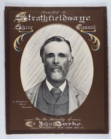
Photograph - Portrait of Councillor Burke
... district of Strathfieldsaye was proclaimed in 1861 and named a Shire on the 17th September in 1866. It remained a shire until amalgamation in 1994 when it became part of the City of Greater Bendigo. The shire was located 8 km to the south- east of Bendigo and covered an area of 601 square kilometres and extended from the Calder Highway to the Coliban and Campaspe Rivers. ...district of Strathfieldsaye was proclaimed in 1861 and named a Shire on the 17th September in 1866. It remained a shire until amalgamation in 1994 when it became part of the City of Greater Bendigo. The shire was located 8 km to the south- east of Bendigo and covered an area of 601 square kilometres and extended from the Calder Highway to the Coliban and Campaspe Rivers. ...The district of Strathfieldsaye was proclaimed in 1861 and named a Shire on the 17th September in 1866. It remained a shire until amalgamation in 1994 when it became part of the City of Greater Bendigo. The shire was located 8 km to the south- east of Bendigo and covered an area of 601 square kilometres and extended from the Calder Highway to the Coliban and Campaspe Rivers. The shire's administration centre was in Strathfieldsaye until 1972 when new offices were opened in Kennington. Framed black and white head and shoulder portrait of Councillor Burke with hand coloured and drawn detail. Profile centre facing with beard. Cut oval brown mount decorated with text and fscrolls. Hand written title top and lower centre. Wooden frame with detail and gold inner.Presented to Strathfieldsaye / shire Council / w. H. robinson / Photo / Bendigo / By the family of / Cr John Burke / President 1890 - 1899 - 1900strathfieldsaye shire council, councillor burke, president of strathfieldsaye shire -
 City of Greater Bendigo - Civic Collection
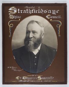
Photograph - Portrait of Councillor Thomas Somerville, W H Robinson
... district of Strathfieldsaye was proclaimed in 1861 and named a Shire on the 17th September in 1866. It remained a shire until amalgamation in 1994 when it became part of the City of Greater Bendigo. The shire was located 8 km to the south- east of Bendigo and covered an area of 601 square kilometres and extended from the Calder Highway to the Coliban and Campaspe Rivers. ...district of Strathfieldsaye was proclaimed in 1861 and named a Shire on the 17th September in 1866. It remained a shire until amalgamation in 1994 when it became part of the City of Greater Bendigo. The shire was located 8 km to the south- east of Bendigo and covered an area of 601 square kilometres and extended from the Calder Highway to the Coliban and Campaspe Rivers. ...The district of Strathfieldsaye was proclaimed in 1861 and named a Shire on the 17th September in 1866. It remained a shire until amalgamation in 1994 when it became part of the City of Greater Bendigo. The shire was located 8 km to the south- east of Bendigo and covered an area of 601 square kilometres and extended from the Calder Highway to the Coliban and Campaspe Rivers. The shire's administration centre was in Strathfieldsaye until 1972 when new offices were opened in KenningtonFramed black and white head and shoulder portrait of Councillor Somerville with hand drawn detail. Profile slightly to left, face has full beard. Cut oval brown mount decorated with text and scrolls. Hand written title top and lower centre.Presented to / Strathfieldsaye / Shire Council / W. H. Robinson / Photo / Bendigo / by / Cr Thomas Somerville / President 1892 - 3. 1901.2. 1910.11 strathfieldsaye shire council, councillor somerville, president of strathfieldsaye shire -
 City of Greater Bendigo - Civic Collection
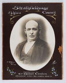
Photograph - Portrait of Councillor Michael Condon, W H Robinson
... district of Strathfieldsaye was proclaimed in 1861 and named a Shire on the 17th September in 1866. It remained a shire until amalgamation in 1994 when it became part of the City of Greater Bendigo. The shire was located 8 km to the south- east of Bendigo and covered an area of 601 square kilometres and extended from the Calder Highway to the Coliban and Campaspe Rivers. ...district of Strathfieldsaye was proclaimed in 1861 and named a Shire on the 17th September in 1866. It remained a shire until amalgamation in 1994 when it became part of the City of Greater Bendigo. The shire was located 8 km to the south- east of Bendigo and covered an area of 601 square kilometres and extended from the Calder Highway to the Coliban and Campaspe Rivers. ...The district of Strathfieldsaye was proclaimed in 1861 and named a Shire on the 17th September in 1866. It remained a shire until amalgamation in 1994 when it became part of the City of Greater Bendigo. The shire was located 8 km to the south- east of Bendigo and covered an area of 601 square kilometres and extended from the Calder Highway to the Coliban and Campaspe Rivers. The shire's administration centre was in Strathfieldsaye until 1972 when new offices were opened in KenningtonFramed black and white head and shoulder portrait of Councillor Condon with hand coloured and drawn detail. Profile slightly to left. No facial hair. Cut oval brown mount decorated with text, scrolls and flowers. Hand written title top and lower centre.Strathfieldsaye / Shire / Council / W. H. Robinson / Photo / Bendigo / JMB Gribble / Presented by / Cr Michael Condon / President 1889 - 90. 1895-6. 1904 - 5strathfieldsaye shire council, president of strathfieldsaye shire, councillor condon -
 City of Greater Bendigo - Civic Collection
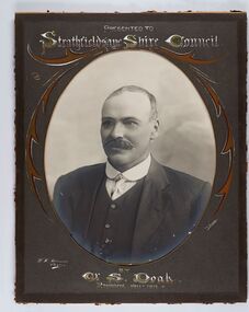
Photograph - Portrait of Councillor Doak, W H Robinson
... district of Strathfieldsaye was proclaimed in 1861 and named a Shire on the 17th September in 1866. It remained a shire until amalgamation in 1994 when it became part of the City of Greater Bendigo. The shire was located 8 km to the south- east of Bendigo and covered an area of 601 square kilometres and extended from the Calder Highway to the Coliban and Campaspe Rivers. ...district of Strathfieldsaye was proclaimed in 1861 and named a Shire on the 17th September in 1866. It remained a shire until amalgamation in 1994 when it became part of the City of Greater Bendigo. The shire was located 8 km to the south- east of Bendigo and covered an area of 601 square kilometres and extended from the Calder Highway to the Coliban and Campaspe Rivers. ...The district of Strathfieldsaye was proclaimed in 1861 and named a Shire on the 17th September in 1866. It remained a shire until amalgamation in 1994 when it became part of the City of Greater Bendigo. The shire was located 8 km to the south- east of Bendigo and covered an area of 601 square kilometres and extended from the Calder Highway to the Coliban and Campaspe Rivers. The shire's administration centre was in Strathfieldsaye until 1972 when new offices were opened in Kennington.Framed black and white head and shoulder portrait of Councillor Doak with hand coloured and drawn detail. Left facing profile with walrus moustache. Cut oval brown mount decorated with text and scrolls. Hand written title top and lower centre.Presented to / Strathfieldsaye Shire Council / W. H. Robinson / Photo / JMB Gribble / by Cr S. Doak / President 1911 - 1912strathfieldsaye shire council, president of strathfieldsaye shire, councillor doak
