
Showing 24 items matching "grampian ranges in victoria"
-
 Flagstaff Hill Maritime Museum and Village
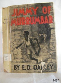
Book - A Fictional Story, Edward Daniel Oakley, Jimmy of Murrumbar, 1938
... ...grampian ranges in victoria...Pattison Collection see item 3678 Flagstaff Hill collections) https://victoriancollections.net.au/items/5580c7e72162f114d8b758db shipwrecked-coast flagstaff-hill flagstaff-hill-maritime-museum warrnambool maritime-museum shipwreck-coast flagstaff-hill-maritime-village shipwrecked-artefact book pattison collection warrnambool library warrnambool mechanics’ institute ralph eric pattison corangamite regional library service warrnambool city librarian mechanics’ institute library victorian library board warrnambool books and records warrnambool children’s library jimmy of murrumbar e d oakley edward daniel oakley novel young adult novel juvenile fiction australian black tracker law enforcement - police trackers tracking and trailing in australia australian bush grampian ranges in victoria warrnambool history fletcher jones oakbank Thomas and Eliza Oakley indigenous literature indigenous Australians The story is a children's adventure story in which Jimmy works as a police tracker, following criminals through the Victorian bush and mountain ranges. ...The story is a children's adventure story in which Jimmy works as a police tracker, following criminals through the Victorian bush and mountain ranges. The emphasis is on his "amazing ability" and "fidelity" that is, his loyalty, reliability and skill in serving the police. The plot appears to belong to the tradition of Australian juvenile bush fiction with a pursuit over difficult terrain, danger, endurance and the demonstration of specialised bush knowledge. It should not automatically be treated as a documentary account of a particular historical tracker. Unless the text contains an author's note or identifiable historical references, Jimmy is best regarded as a fictional or fictionalised character. The book is therefore both an adventure narrative and a period document revealing how Aboriginal ability was represented through a predominantly settler-colonial publishing culture.Hard cover book. Jimmy of Murrumbar Author: E D Oakley (Edward Daniel Oakley) Publisher: Osboldstone & Co, Pty Ltd Date: 1938 Further Information: Pictorial paper-covered boards or wrappers over a stiff paper binding Illustrated title/contents material and a frontispiece or inserted plate. The spine has a Library label with an inscription.fictionThe story is a children's adventure story in which Jimmy works as a police tracker, following criminals through the Victorian bush and mountain ranges. The emphasis is on his "amazing ability" and "fidelity" that is, his loyalty, reliability and skill in serving the police. The plot appears to belong to the tradition of Australian juvenile bush fiction with a pursuit over difficult terrain, danger, endurance and the demonstration of specialised bush knowledge. It should not automatically be treated as a documentary account of a particular historical tracker. Unless the text contains an author's note or identifiable historical references, Jimmy is best regarded as a fictional or fictionalised character. The book is therefore both an adventure narrative and a period document revealing how Aboriginal ability was represented through a predominantly settler-colonial publishing culture.shipwrecked-coast, flagstaff-hill, flagstaff-hill-maritime-museum, warrnambool, maritime-museum, shipwreck-coast, flagstaff-hill-maritime-village, shipwrecked-artefact, book, pattison collection, warrnambool library, warrnambool mechanics’ institute, ralph eric pattison, corangamite regional library service, warrnambool city librarian, mechanics’ institute library, victorian library board, warrnambool books and records, warrnambool children’s library, jimmy of murrumbar, e d oakley, edward daniel oakley, novel, young adult novel, juvenile fiction, australian black tracker, law enforcement - police trackers, tracking and trailing in australia, australian bush, grampian ranges in victoria, warrnambool history, fletcher jones, oakbank, thomas and eliza oakley, indigenous literature, indigenous australians -
 Warrnambool and District Historical Society Inc.
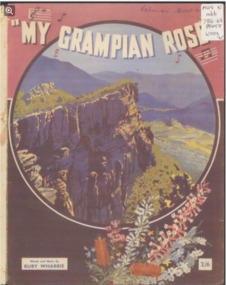
Leisure object - Sheet Music, My Grampian Rose, 1940s
... Victoria with her husband and son. Mrs Wharrie was the designer of the dolls which were made in the 1940s and 50s. One doll was named ‘Shurl’ to cash in on the popularity of the child actress Shirley Temple and the consequent popularity of the Shirley Temple doll. Stawell is a provincial city situated close to the Grampians mountain range...This is sheet music of four pages (two pages printed back to back) with the printed music on three pages and the cover having a multi-coloured illustration of the Grampians mountain range in Victoria. It is in good condition and has an old catalogue number ‘94’ on the back page. ...Ruby Wharrie My Grampian Rose sheet music Front cover: ‘My Grampian Rose, Words and Music by Ruby Wharrie, 2/6’ Inside front cover: ‘Ruby Wharrie’ This is sheet music of four pages (two pages printed back to back) with the printed music on three pages and the cover having a multi-coloured illustration of the Grampians mountain range in Victoria. It is in good condition and has an old catalogue number ‘94’ on the back page. ...This is a waltz piece of music with words and music by Ruby Wharrie. Mrs Wharrie is best known for her doll-making business which she operated in Stawell, Victoria with her husband and son. Mrs Wharrie was the designer of the dolls which were made in the 1940s and 50s. One doll was named ‘Shurl’ to cash in on the popularity of the child actress Shirley Temple and the consequent popularity of the Shirley Temple doll. Stawell is a provincial city situated close to the Grampians mountain range and the title of the music reflects Mrs Wharrie’s interest in the area. ‘My Grampian rose’ is a person and the theme of the music is the fulfilment of love - ‘I am coming back to you, my little Grampian Rose’. This music is of interest as it has been written by a person who lived in western Victoria. It has Ruby Wharrie’s signature inside the front cover, making it more valuable. It is also an example of the sweet and sentimental music produced during the 1940s and 50s as a foil to the sadness and brutality of the world war. This is sheet music of four pages (two pages printed back to back) with the printed music on three pages and the cover having a multi-coloured illustration of the Grampians mountain range in Victoria. It is in good condition and has an old catalogue number ‘94’ on the back page. Front cover: ‘My Grampian Rose, Words and Music by Ruby Wharrie, 2/6’ Inside front cover: ‘Ruby Wharrie’ ruby wharrie, my grampian rose, sheet music -
 Federation University Historical Collection
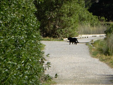
CD-ROM, Big Cats sightings in Victoria, 2012
... (http://bigcatsvic.com.au/) Australian Animal Folklore Collection JA Sharp Simon Townsend Neville Bayley St Kilda Peter Stefanis Toolangi puma tom daniel footprint pawprint cryptozoology Rex Gilroy Lancefield tiger anglesea Berringa Matthew Charles Jutin Fitzclarence harry Carlin patty smith Johannes Beach Nerida Stirling Ranges Daryl Hardy brook Kelly Carl rose ashley hall jonathan smith sally Ballieu lorraine balck wayne bower ian riordon Aleda turna John Turner Dave Moyle ben rayner stewart leach colin boord sheryl mahoney beech Forest otways tooborac geoff black panther brad blake priscilla prescott beau kapitiany Ramsay Hosn Clare Jones darren guthrie tallarook josh fairway linda wescon lithgow John Turner southern grampians A CD-ROM of multiple emails and image attachments relating to assorted sightings, footprints, killings, etc from big cats in the Otways of Victoria. ...The CD-Rom includes a range of electronic correspondence sent 'Big Cats Victoria and Simon Townsend and JohnTurner. Their website states: Big Cats Victoria Southern Australia, including south western West Australia, has a history of reports of ‘panther’ like predators dating back to the later half of the 19th century. The animals were usually described as being of black or tan colouration and with the proportions of a medium sized big-cat such as a Leopard or Puma. The records can be found in newspaper, radio and television archives, Government reports, a very few books and on the internet. The historical material is based on anecdotal reportage and has contributed to the mythification of the subject. Some Government agencies at both State and Local levels (in New South Wales), have collected records of sightings or investigated stock deaths purported to be associated with so called ‘panther’ kills. They remain understandably non committal due to the lack of a specimen of such a predator of undeniable authenticity. While other types of unknown predator have been reported in various parts of Australia they are not the concern of this website. For purposes of economy we, John Turner and Simon Townsend, confine our investigations to western Victoria and south eastern South Australia. (http://bigcatsvic.com.au/) A CD-ROM of multiple emails and image attachments relating to assorted sightings, footprints, killings, etc from big cats in the Otways of Victoria. The electronic mail was sent to 'Big Cats Victoria' Images include: This item is part of the Australian Animal Folklore Collectionaustralian animal folklore collection, ja sharp, simon townsend, neville bayley, st kilda, peter stefanis, toolangi, puma, tom daniel, footprint, pawprint, cryptozoology, rex gilroy, lancefield tiger, anglesea, berringa, matthew charles, jutin fitzclarence, harry carlin, patty smith, johannes beach, nerida, stirling ranges, daryl hardy, brook kelly, carl rose, ashley hall, jonathan smith, sally ballieu, lorraine balck, wayne bower, ian riordon, aleda turna, john turner, dave moyle, ben rayner, stewart leach, colin boord, sheryl mahoney, beech forest, otways, tooborac, geoff black, panther, brad blake, priscilla prescott, beau kapitiany, ramsay hosn, clare jones, darren guthrie, tallarook, josh fairway, linda wescon, lithgow, john turner, southern grampians -
 Federation University Historical Collection
Report, Grampians Puma
... : An up-dated Report of the Deakin Puma Study Australian Animal Folklore Collection John A Henry John Henry Maurice Hornocker grampians geranium springs puma Felis concor mt bepcha scats US Army Peter Morris hans brunner mt Gambier RAAF Ernst Wieher Ellis Tucker halls gap Peter Dryden Geoff Riddle Snow astbury robert hiatt tom schubert trevor clark dick saligari ted saligari terry zerbst brian warren gary Middleton barry henderson morrie lawson bill hower michael harrison ray kerris robert east terry rethus dougal shilcock garth rees ilka rees harry shrive ellis tucker American Airmen Mascot Billywing range Sandy mackirdy mark johnson john morris des paulson feral cat roses gap paula odare gaye beveridge donald macarthur karen jeffery plaster casts terry rethus tom schubert Victoria valley mt talbot fox john spencer ivan bother neal bother evan macklay harry shrive bill hower michael harrsion norma harrison ellis tucker gary middleton barry henderson joy potter les becker John Ryan Cam anderson Richardson Shirley farrant Adinsall max xharles margaret hurley linda crawford don anderson paddy hynes barry bell neal boethe Mark Johnson Victoria Point David Hamilton Wally Smith mythical myth folklore White A4 pages laser printed pages related to a study conducted on the possibility of a Grampians Puma (Felis concolor) populations. ...The study into the Grampians Puma was undertaken by John A. Henry to settle the question of the existence of a puma population in the mountains. People who believe they have sighted a puma, or have sighted other evidence, were interviewed. The study also looked into records relating to the potential of USA army personal leaving a mascot in the grampians. Also see cat no 14012 - Pumas in the Grampians Mountains: A compelling Case?: An up-dated Report of the Deakin Puma StudyWhite A4 pages laser printed pages related to a study conducted on the possibility of a Grampians Puma (Felis concolor) populations. Australian Animal Foklore Collectionaustralian animal folklore collection, john a henry, john henry, maurice hornocker, grampians, geranium springs, puma, felis concor, mt bepcha, scats, us army, peter morris, hans brunner, mt gambier, raaf, ernst wieher, ellis tucker, halls gap, peter dryden, geoff riddle, snow astbury, robert hiatt, tom schubert, trevor clark, dick saligari, ted saligari, terry zerbst, brian warren, gary middleton, barry henderson, morrie lawson, bill hower, michael harrison, ray kerris, robert east, terry rethus, dougal shilcock, garth rees, ilka rees, harry shrive, ellis tucker, american airmen, mascot, billywing range, sandy mackirdy, mark johnson, john morris, des paulson, feral cat, roses gap, paula odare, gaye beveridge, donald macarthur, karen jeffery, plaster casts, terry rethus, tom schubert, victoria valley, mt talbot, fox, john spencer, ivan bother, neal bother, evan macklay, harry shrive, bill hower, michael harrsion, norma harrison, ellis tucker, gary middleton, barry henderson, joy potter, les becker, john ryan, cam anderson, richardson, shirley farrant, adinsall, max xharles, margaret hurley, linda crawford, don anderson, paddy hynes, barry bell, neal boethe, mark johnson, victoria point, david hamilton, wally smith, mythical, myth, folklore -
 Federation University Historical Collection
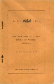
Booklet, Thomas Stephen Hart, The Highlands and Main Divide of Western Victoria, 1907, 12/12/1907
... Hart was a teacher at the Ballarat School of Mines, and a member of the Ballarat Field Naturalists Club thomas hart thomas s. hart ballarat school of mines ballarat field naturalists club royal society of victoria western victoria ballarat great dividing range mt william volcano volcanic plains waterways lal lal basin yarrowee creek ballarat common lava flow wendouree warrenheip ballarat plateau mt elephant grampians t.s. hart mt buangor mt beckworth mt misery mt bolton lal lal iron ored mt ararat mt wiliam mt cole burrumbeet mt warrenheip daylesford waubra ercildoun gap smythesdale lal lal falls parwan valley burrumbeet creek staffordshire reef pyranees bacchus marsh rowsley fault ben nevis avoca hill landsborough hill mt blowhard weatherboard mclean's hill Fyan's Creek thomas stephen hart lal lal Article with illustrations published by the Royal Society of Victoria by Thomas S. ...Thomas S. Hart was a teacher at the Ballarat School of Mines, and a member of the Ballarat Field Naturalists ClubArticle with illustrations published by the Royal Society of Victoria by Thomas S. Hart. The following plates are included: Fig 1. The Main Divide and some of the transverse ridges Fig 2. Hills on and near the Divide at the Ercildoun and Ascot Gaps Fig. 3. Profile of the Divide at Ascot Gap. Fig. 4. Sketch of the Hills west and north-west from Mt Buninyong - - The divide in Ascot Gap from Mt Blowhard (Serra Range, Mt William, Mt Ararat, Larne Gerin, Ben Major, Mt Cole, Mt Misery, Mt Bolton) Fig. 5. Diagram to illustrate the possible courses of the leads south of the present Divide - Burrumbeet Basin (Smythesdale, Ballarat, Lal Lal , Mt Doran, egerton, Parwan Creet, Rowsley Fault, Eastern Plateau) Fig. 6. Diagramatic cross section of the grampians, south of Hall's Gap. Profile of the Pyranees, from maiden Hill - Diagramatic Section of the Grampians south of Hall's Gap. (Mt Cole, Mt Mitchell, Ben Major, Ben More, Avoca Hill, Hall's Gap.) Fig. 7. Profile of the Pyrenees as seen from Maiden Hill near Waubra.thomas hart, thomas s. hart, ballarat school of mines, ballarat field naturalists club, royal society of victoria, western victoria, ballarat, great dividing range, mt william, volcano, volcanic plains, waterways, lal lal basin, yarrowee creek, ballarat common, lava flow, wendouree, warrenheip, ballarat plateau, mt elephant, grampians, t.s. hart, mt buangor, mt beckworth, mt misery, mt bolton, lal lal iron ored, mt ararat, mt wiliam, mt cole, burrumbeet, mt warrenheip, daylesford, waubra, ercildoun gap, smythesdale, lal lal falls, parwan valley, burrumbeet creek, staffordshire reef, pyranees, bacchus marsh, rowsley fault, ben nevis, avoca hill, landsborough hill, mt blowhard, weatherboard, mclean's hill, fyan's creek, thomas stephen hart, lal lal -
 Halls Gap & Grampians Historical Society
Magazine - B/W, C 1915
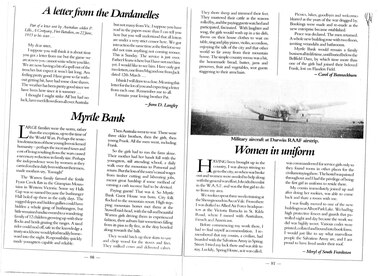
... Grampian Mountains of Western Victoria. Some say Halls Gap was so named because the bushranger Hall holed up there in the early days. The rugged slopes and hidden gullies could have hidden a whole gang of bushrangers, but little remained undiscovered to a wandering family of 12 children growing up with their flocks and herds grazing the ranges. ...Grampian Mountains of Western Victoria. Some say Halls Gap was so named because the bushranger Hall holed up there in the early days. The rugged slopes and hidden gullies could have hidden a whole gang of bushrangers, but little remained undiscovered to a wandering family of 12 children growing up with their flocks and herds grazing the ranges. ...Large families were the norm, rather than the exception up to the time of the World wars. perhaps the senseless destruction of those young lives sickened humanity- perhaps the increased taxes and cost of living resulting from the wars caused a necessary reduction in family size. Perhaps the independence won by women as they carried on their daily lives without their men, made mothers say, "Enough" The Warren family farmed the fertile Fyans Creek flats in the Grampian Mountains of Western Victoria. Some say Halls Gap was so named because the bushranger Hall holed up there in the early days. The rugged slopes and hidden gullies could have hidden a whole gang of bushrangers, but little remained undiscovered to a wandering family of 12 children growing up with their flocks and herds grazing the ranges. A tired rider could nod off, safe in the knowledge a trusty stockhorse would plod steadily homeward into the night. Responsibility quickly made youngsters capable and reliable. Then Australia went to war. There were three older brothers, then the girls, then young Frank. All the men went, including Frank. So the girls had to run the farm alone. Their mother had her hands full with the youngsters, still attending school, a daily walk over the mountain to Pomonal and return. But the loss of the men's casual wages from timber cutting and labouring jobs, meant great hardship is some method of earning a cash income had to be devised. Paying guests! That was it. So Myrtle Bank Guest House was born. City folk flocked to the mountain resort. High stepping mountain horses met them at the Stawell raid-head, with the tall and beautiful Warren girls driving them in experienced fashion, their auburn hair sometimes falling from its pins to fly free, as the dray bowled along towards the hills. The would hitch up their skirts to saw and chop wood for the stoves and fires. They milked cows and delivered calves. They shore sheep and trimmed their feet. They mustered their cattle as the seasons rolled by, and the paying guests watched and participated, fascinated. With laughter and song, the girls would wash up in a tin dish, throw on their house clothes to wait on table, sing and play piano, violin, accordion, enjoying the talk of the city and that other world so far away from their mountain home. The simple country menu was a hit, and the homemade bread, butter, jams and preserves, fruit and vegetables sent guests staggering to their armchairs. Picnics, hikes, goodbyes and welcomes blurred as the years of the war dragged by. Bookings were made and remade as the new enterprise became established. Peace was declared. the men returned A whole new building rose with two floors, inviting verandahs and bathrooms. Myrtle Bank would remain a family business all its lifetime, until buried below the Bellfield Dam, by which time more than one the girls had joined their beloved Frank, lost on Flanders Field. Article in book or magazine describing life at Myrtlebank during war years Other article written from letter from soldier P Lillis to his sister 3rd article of woman from country enlisting in WAAF Submitted by Carol of Bannockburn, Submitted by D Langley Submitted by Meryl of South Frankstonaccommodation, myrtlebank, people, warren -
 Halls Gap & Grampians Historical Society
Map - Coloured
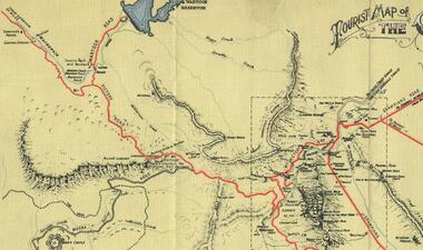
... Grampians and by the mid 1860s there were a number of families connected to the supplying of timber to Pleasant Creek living in the "Hall's Gap ranges". John Wakeham, the first store owner in Pleasant Creek in 1854, established a timer-mill in upper Stony Creek Gorge in the late 1850s. Wakeham is credited for the clearing and levelling of the first bridle-path up the gorge. 1870s By the mid 1870s the track had been extended over Valley Gap to the Victoria...Grampians and by the mid 1860s there were a number of families connected to the supplying of timber to Pleasant Creek living in the "Hall's Gap ranges". John Wakeham, the first store owner in Pleasant Creek in 1854, established a timer-mill in upper Stony Creek Gorge in the late 1850s. Wakeham is credited for the clearing and levelling of the first bridle-path up the gorge. 1870s By the mid 1870s the track had been extended over Valley Gap to the Victoria ...Background on Bridle Path up Stony Creek Gorge Pre 1840 C. B. Hall, squatter on Mokepilly Run 1841-1842, first European to discover the Fyans Creek valley, the entrance of which became known as Hall's Gap. He later recorded that he followed a number of tracks which he assumed had been made by the Aboriginies and described one as "leading up a wild romantic glen and over on to the source of the Glenelg River". This could well have been the route taken up Stony Creek gorge by the first timber-cutters in this part of the Grampians to the saddle between the Wonderland and Mt. Difficult ranges known as Valley Gap 1850s/60s Timber cutters and shingle splitters were reported to be moving into the eastern side of the Grampians and by the mid 1860s there were a number of families connected to the supplying of timber to Pleasant Creek living in the "Hall's Gap ranges". John Wakeham, the first store owner in Pleasant Creek in 1854, established a timer-mill in upper Stony Creek Gorge in the late 1850s. Wakeham is credited for the clearing and levelling of the first bridle-path up the gorge. 1870s By the mid 1870s the track had been extended over Valley Gap to the Victoria Forest (the upper region of the Victoria Valley). McKeon's bullock team was known to have hauled red gum from the Valley to Stawell in the late 1870s and the 1880s. 1880s In 1887 an article in the Pleasant Creek news describes the Stony Creek Gorge track as "being a ledge alongside the mountain range, formed in the early days with the aid of earth and timber, along which the bullock teams used to travel to Horsham and plains of the Wimmera beyond." 1890s Gold was discovered in the catchment area of Stony Creek and by the end of the 1890s a new track was built from "near the junction of Fyan's and Stony Creeks, up the gorge to the diggings settlement. The mining Department had paid L300 for its construction and, when completed, the track was "three miles and 30 chains in length, the side cuttings at the narrowest part being 10 feet between" and "the watercourses which cross the track at various points" having been "filled up with rocks rolled down the sides of the hills, and consequently there can be no damage caused by bushfires which destroyed the former wooden bridges erected on the old track to Wakeham's saw-mill, the remains of which are still to be seen at the side of the diggings" The article goes on to further describe the track as one which "can with ease travel with a two horse conveyance either up or down" and that the workmen engaged in the construction of the track would be attending "a ball that night at McKeon's farm near the mouth of the gap to celebrate the successful completion of the undertaking". 1900s At what time the bridle path was extended beyond Valley Gap to the Wartook basin on the Mt. Difficult Range has not yet been determined. However, it is known that, by the turn of the century, people were travelling between Halls Gap and the caretakers' residence at Wartook Reservoir along what was now known as the "Bluff Road. Wartook's embankment had been constructed in 1887 and at that time there was already a track from Rosebrook Station homestead (near the present day Wartook Pottery) to the reservoir. Philip Rose owned both Rosebrook and Wartook Stations from the mid 1840s to the late 1850s and had regularly leased the Wartook basin to Cobb & Co. to rest horses there. 1920s Following the war of 1914-1918, tourism really took off in the Grampians, and Halls Gap rapidly grew. People would travel as far as they could on the many tracks then hike to the many lookouts being discovered by local tour guides. This led to the need for access across the range so that horse riders and the increasing number of vehicles could travel between Horsham and Halls Gap. To this end, the Bluff Road was improved and extended on 1929 and at its opening in March, 1930, by Lady Somers it was renamed the Mt. Victory Road.Map of Mt Victory Road and othersaccess routes, mt victory rd, bridle path, roads -
 Halls Gap & Grampians Historical Society
Postcard - B/W
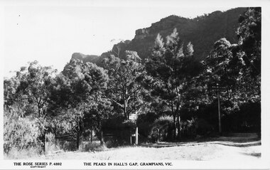
... For information on Grampian House, refer to "Victoria's Wonderland" pp. 69-75. For information on the Wonderland Range refer to pp.41, 70, 73, 77, 84, 145-146 of "Victoria's Wonderland"....For information on Grampian House, refer to "Victoria's Wonderland" pp. 69-75. For information on the Wonderland Range refer to pp.41, 70, 73, 77, 84, 145-146 of "Victoria's Wonderland". ...No. P4892 in the "Rose Series" of postcards. For information on Grampian House, refer to "Victoria's Wonderland" pp. 69-75. For information on the Wonderland Range refer to pp.41, 70, 73, 77, 84, 145-146 of "Victoria's Wonderland".Photo of the entrance to Grampian House. There is a grass are and a wire fence in the foreground. A track leads back into a bush area , there is a sign saying "Grampian House" attached to a tree. The peaks of a rocky range (the Wonderland Range) are visible behind.accommodation, guesthouses, scenery, wonderland range -
 Halls Gap & Grampians Historical Society
Photograph - B/W, C 1960s
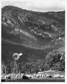
... SCENERY Grampians Ranges 'This Photograph is with, The Compliments of The . . . ,Ministry of Tourism, Government of Victoria, Please acknowledge, Photo: Michael Chesire' stamped on back. ...This photo was taken at the foot of the range at Glen Isla. It was material for a Ministry of Tourism campaign.The photo shows sheep grazing in a cleared area with a rocky range rising behind. There is a wind mill in the left foreground and a fence behind the front group of sheep.'This Photograph is with, The Compliments of The . . . ,Ministry of Tourism, Government of Victoria, Please acknowledge, Photo: Michael Chesire' stamped on back. 'Glen Isla, Grampians' written on back in black pen.scenery, grampians ranges -
 Halls Gap & Grampians Historical Society
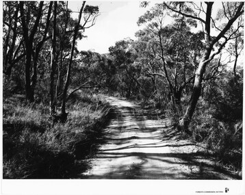
Photograph - B/W, C 1960s
... ACCESS ROUTES Roads SCENERY Grampians Ranges 'Forests Commission, Victoria' inscribed on bottom, right of border. ...Location unknown.The photo shows a sandy track through bushland.'Forests Commission, Victoria' inscribed on bottom, right of border. 'Publicity & Public relations Branch, When reproducing please Acknowledge Forests Commission, Victoria, Negative No. 322-14' stamped on back.access routes, roads, scenery, grampians ranges -
 Halls Gap & Grampians Historical Society
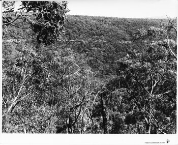
Photograph - B/W, C 1960s (?)
... ACCESS ROUTES Roads SCENERY Grampians Ranges 'Forests Commission, Victoria' inscribed on bottom, right of border. ...The location in the photo is unknown.The photo shows a road, seen on a slope, in the distance, crossing through bushland'Forests Commission, Victoria' inscribed on bottom, right of border. 'Publicity & Public relations Branch, When reproducing please Acknowledge Forests Commission, Victoria, Negative No. 322-1' stamped on back.access routes, roads, scenery, grampians ranges -
 Halls Gap & Grampians Historical Society
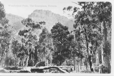
Photograph - B/W
... SCENERY Wonderland Range "Wonderland Peak, The Grampians, Victoria" inscribed on top left, and "V.G. 259" inscibed on lower left, of copy 1. ...From the inscription "V.G. 259" it would appear that this copy was made by the Victorian Government. It is a photo of Wonderland Peak.The photo shows a rocky range rising behind eucalyptus trees. There is a fallen log in the left foreground."Wonderland Peak, The Grampians, Victoria" inscribed on top left, and "V.G. 259" inscibed on lower left, of copy 1. These have been cropped out on copy 2.scenery, wonderland range -
 Halls Gap & Grampians Historical Society
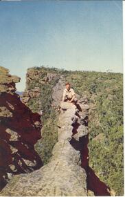
Postcard - Coloured
... Grampians, Victoria. Postcard by Nuclorvue Productions Pty. Ltd. SCENERY Grampians Ranges Postcard/letter no date except Tuesday,7th. ...The "Nerve Test" with Bellfield Peak beyond,the Grampians, Victoria. Postcard by Nuclorvue Productions Pty. Ltd.Young man crouched on top of narrow rocky outcrop, mountains in background,steep ravines on either side.Postcard/letter no date except Tuesday,7th.scenery, grampians ranges -
 Halls Gap & Grampians Historical Society
Photograph - B/W
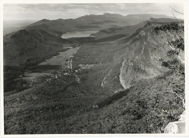
... The photo belonged to the Forestry Commission Victoria. SCENERY Grampians Ranges "Fyans Vaslley from Chataqua Peak. ...The photo is of the Fyans Valley, taken from Chatauqua Peak. Lake Bellfield and Mount William can be seen in the background. The photo belonged to the Forestry Commission Victoria.A photo of a valley between mountain ranges. A lake can be seen in the background. A road runs through the middle of the valley with houses on both sides."Fyans Vaslley from Chataqua Peak. Incl L. Bellfield & Halls Gap. photo belongs to F.C.V. Stawell. Return to V. Young, Horsham" written on back in green pencil. The "Chatauqua Peak" has been overwritten in black-lead pencil. "LC.71" is also written on the back in black-lead pencil.scenery, grampians ranges -
 Halls Gap & Grampians Historical Society
Photograph - B/W
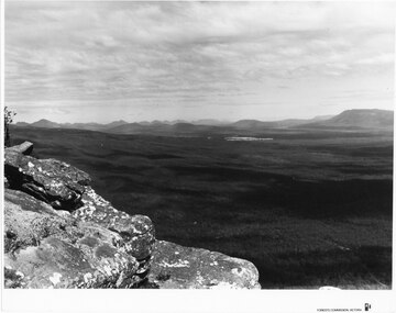
... Typical of the time as a promotional image taken by Forests Commission Victoria. SCENERY Grampians Ranges Publicity & Public Relations Branch. ...Photo is of Moora Moora in the Victorian Valley. Typical of the time as a promotional image taken by Forests Commission Victoria.View over a large Valley with ranges in the distance. Roads through the valley are visible and a body of water in the middle right of the photograph. A rocky outcrop is in the left side foreground.Publicity & Public Relations Branch. When reproducing please acknowledge Forests Commission Victoria Negative no. 322-26scenery, grampians ranges -
 Halls Gap & Grampians Historical Society
Photograph - B/W
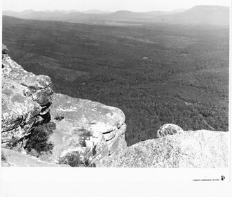
... range is Victoria Range. Photo is typical of promotional photos taken by Forests Commission Victoria SCENERY Grampians Ranges Rocky outcrop in foreground and a large, thick tree covered valley, with mountain ranges in the background. ...Photo is of the "Victoria Valley" taken from around the area of Reed's Lookout. The body of water is Moora Moora Reservoir. The background range is Victoria Range. Photo is typical of promotional photos taken by Forests Commission VictoriaRocky outcrop in foreground and a large, thick tree covered valley, with mountain ranges in the background. A body of water (near top, middle) and some roads can be seen c1960sscenery, grampians ranges -
 Halls Gap & Grampians Historical Society
Photograph - B/W
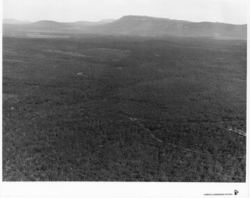
... Victoria Range in the background. Photo would have been taken from around Reed's lookout area. Photo typical of promotional photos of the time by Forests Commission SCENERY Grampians Ranges Large, densely treed valley with a body of water in background. ...Photo is of Victoria Valley with Moora Moora Reservoir and the Victoria Range in the background. Photo would have been taken from around Reed's lookout area. Photo typical of promotional photos of the time by Forests CommissionLarge, densely treed valley with a body of water in background. Some roads can be seen particularly right foreground. There is a mountain range in the background. c1960sscenery, grampians ranges -
 Halls Gap & Grampians Historical Society
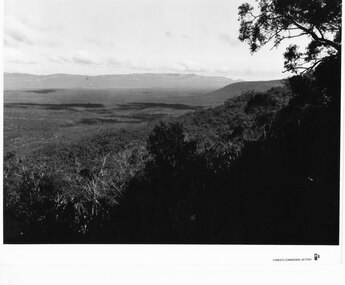
Photograph - B/W
... Victoria Range in the background. Photo is typical of promotional photographs taken by Forests Commission at that time. SCENERY Grampians ...Photo is of Victoria Valley with the Victoria Range in the background. Photo is typical of promotional photographs taken by Forests Commission at that time.a thick bush covered valley in foreground (shadowed). Mountain range in background. Photographed from a high spot looking down and across the valley. c1960sscenery, grampians ranges -
 Halls Gap & Grampians Historical Society
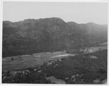
Photograph
... Grampians/ Dunkeld Road, leading to Dunkeld towards the right or Halls Gap travelling towards the left. Fyans Creek is visible in parts at the foot of the range (middle of Photo). Photo appears to have been taken from Bellfield Pk area. Photo is typical of those taken by Forests Commission of Victoria...Grampians/ Dunkeld Road, leading to Dunkeld towards the right or Halls Gap travelling towards the left. Fyans Creek is visible in parts at the foot of the range (middle of Photo). Photo appears to have been taken from Bellfield Pk area. Photo is typical of those taken by Forests Commission of Victoria ...Photo depicts Fyans Valley. The road is The Grampians/ Dunkeld Road, leading to Dunkeld towards the right or Halls Gap travelling towards the left. Fyans Creek is visible in parts at the foot of the range (middle of Photo). Photo appears to have been taken from Bellfield Pk area. Photo is typical of those taken by Forests Commission of Victoria in the 1960sPhoto shows a mountain range in the background with a valley. The Valley has a band of a mostly cleared grassy section (middle of photo) with a fairly dense treed area in the foreground. A road and some buildings can be seen where the cleared land meets the treed area.scenery, fyans valley -
 Stawell Historical Society Inc
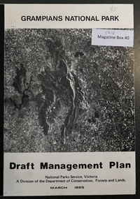
Book - Report, Grampians National Park Draft Management Plan, 1985
... Victoria. A Division of the department of Conservation, Forest and Lands $5 Barry Clugston Soft Cover with B/W Photo of aerial view of ranges of Grampians. ...For Public comment to National Park Service, Victoria. A Division of the department of Conservation, Forest and LandsSoft Cover with B/W Photo of aerial view of ranges of Grampians. Black taped Spine binding.$5 Barry Clugston -
 Stawell Historical Society Inc
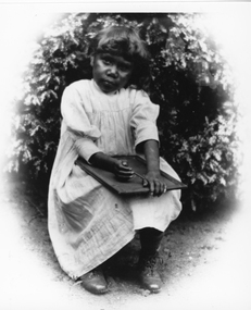
Photograph, First Nation child at Carrs Plains
... Victoria. Carrs Plains was one of the early runs. Once described as a desirable spot, with the Richardson river running through it into the first level part of the country. In later years it was described as having a fascinating view of the Grampians thirty-fourth miles to the South West. To the South the Pyrenees, East the Bolangum Ranges...Victoria. Carrs Plains was one of the early runs. Once described as a desirable spot, with the Richardson river running through it into the first level part of the country. In later years it was described as having a fascinating view of the Grampians thirty-fourth miles to the South West. To the South the Pyrenees, East the Bolangum Ranges ...First Nation child at Carrs Plains with slate on her lap. Dressed in simple frock and laced boots. (May be linked to no. 5563-1 series in records). This photograph is a copy of the original held by Museum of Victoria. Carrs Plains was one of the early runs. Once described as a desirable spot, with the Richardson river running through it into the first level part of the country. In later years it was described as having a fascinating view of the Grampians thirty-fourth miles to the South West. To the South the Pyrenees, East the Bolangum Ranges, North limitless Plains. Black and white photograph of a young child seated holding a slate on her lap. The child is dressed in a simple frock with laced boots and seated in front of a plant. Copyright Museum of Victoriastawell aboriginal portrait -
 Stawell Historical Society Inc
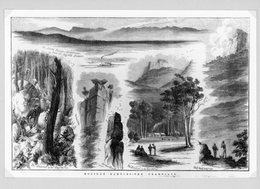
Drawing, Grampians Scenes -- Sketches
... Grampians The Sierra Range - Grampians from the Big Hill Stawell. The Descent to the Gap Valley. The Anvil Rock. Barneys Chimney. The "Selection" in the Gap Valley. Only half way up. Reproduction Rights Reserved Copied by State Library of Victoria...Grampians The Sierra Range - Grampians from the Big Hill Stawell. The Descent to the Gap Valley. The Anvil Rock. Barneys Chimney. The "Selection" in the Gap Valley. Only half way up. Reproduction Rights Reserved Copied by State Library of Victoria ...Very detailed drawings of scenes of the Grampians. Artist S. Calvert.Black and white detail drawings of series of mountain scenes. Holiday Rambles - The Grampians The Sierra Range - Grampians from the Big Hill Stawell. The Descent to the Gap Valley. The Anvil Rock. Barneys Chimney. The "Selection" in the Gap Valley. Only half way up. Reproduction Rights Reserved Copied by State Library of Victoria on the back stawell -
Stawell Historical Society Inc
Painting, Will Rees, "Evening Shadows" of Stawell Victoria Aug, 1929
... Grampians Range in background. Houses in distance and what may be a smokestack. 1929 "Evening Shadows" of Stawell Victoria Aug Painting Will Rees ...Framed painting of field trees and Grampians Range in background. Houses in distance and what may be a smokestack. 1929To Robert Rees Morcom on his 21st Birthday May 1934. From his Grandfather Will Rees and aunt Elsie Rees. -
 Stawell Historical Society Inc
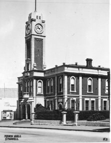
Photograph, Postcard set c.1940
... Grampians Mountain Range. 8 Sisters Rocks, on London Road and the Western Highway corner. It has been a popular place for graffiti for decades. 9 The Balconies (also known as the “ Jaws of Death ) Mt Victory Grampians. It is near Reids lookout and both have excellent views of the Victoria...Grampians Mountain Range. 8 Sisters Rocks, on London Road and the Western Highway corner. It has been a popular place for graffiti for decades. 9 The Balconies (also known as the “ Jaws of Death ) Mt Victory Grampians. It is near Reids lookout and both have excellent views of the Victoria ...-1 Stawell Town Hall, with newly constructed clocktower -2 Main Street, Looking west towards the Grampians -3 Stawell from Big Hill, looking west towards the Grampians 4 Cato Lake, looking west towards the railway line. Swimming Club Rooms on the Left, Bandstand on the Right 5 The Gardens Sundial, donated by the family of Edward Simmons who owned the Oriental Gold Mine 6 Central Park Sports Oval looking north to the Grandstand. Cricket match being played. This is the site of the annual running of the Stawell Gift. 7 Pioneers’ Memorial on Big Hill. Built in 1938 and a popular viewing area of Stawell and the Grampians Mountain Range. 8 Sisters Rocks, on London Road and the Western Highway corner. It has been a popular place for graffiti for decades. 9 The Balconies (also known as the “ Jaws of Death ) Mt Victory Grampians. It is near Reids lookout and both have excellent views of the Victoria Valley. 10 The Grand Canyon Grampians. This is a popular walk in the Wonderland Range. 11 The Whale’s Mouth Wonderland Range Grampians 12 Relph Peak in the Wonderland Range looking down on the Fyans Valley and Halls Gap 13 Bellfield Peak is part of the Wonderland Range overlooking Halls Gap and the Fyans Valley 14 Gateway of the East Winds on the Wonderland Walk 15 Mackenzie Falls on the Mackenzie River and downstream from Wartook Reservoir. This is a popular visiting place for tourists. 16 Wartook Reservoir, serving as part of Horsham’s water supply. Black & White Photograph Postcards Setstawell tourism
