
Showing 8 items matching "heidelberg historic river landscape assessment"
-
 Greensborough Historical Society
Map - Maps, Plenty River - Heidelberg Historic River Landscape Assessment, 1982
... Plenty River - Heidelberg Historic River Landscape Assessment...heidelberg historic river landscape assessment...Plenty River - Heidelberg Historic River Landscape Assessment Map Maps ...These maps show the land use along the Plenty River as it developed dating from First Nations and European settlements.Set of maps 11 showing the Plenty River.plenty river, heidelberg historic river landscape assessment -
 Greensborough Historical Society
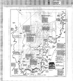
Poster - Map, Heidelberg: Historic River Landscape Assessment, Historical Maps. Map A To 1838. Country of the Wawarang, 1985c
... Heidelberg: Historic River Landscape Assessment, Historical Maps. ...Bounded by Shire of Diamond Valley to the North, Darebin Creek to the West and Plenty River to the East. heidelberg heidelberg - maps Black an white sketch map on white paper Heidelberg: Historic River Landscape Assessment, Historical Maps. ...Geographical area of around 35 sq. kilometres marked with physical features such as major roads, rivers, vegetation and properties, with contemporary notes on landowners, descriptions and comments on the land and its development. Bounded by Shire of Diamond Valley to the North, Darebin Creek to the West and Plenty River to the East.Black an white sketch map on white paperheidelberg, heidelberg - maps -
 Greensborough Historical Society
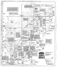
Map, Heidelberg: Historic River Landscape Assessment. Historical Maps. Map B 1838-1851, "The Distinctly aristocratic locality", 1985c
... Heidelberg: Historic River Landscape Assessment. Historical Maps. ...Bounded by Shire of Diamond Valley to the North, Darebin Creek to the West and Plenty River to the East heidelberg heidelberg - maps Black and white sketch map on white paper Heidelberg: Historic River Landscape Assessment. ...Geographical area of around 35 sq. kilometres marked with physical features such as major roads, rivers, vegetation and properties, with contemporary notes on landowners, descriptions and comments on the land and its development. Bounded by Shire of Diamond Valley to the North, Darebin Creek to the West and Plenty River to the EastBlack and white sketch map on white paperheidelberg, heidelberg - maps -
 Greensborough Historical Society
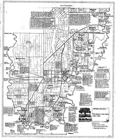
Map, Heidelberg. Historic River Landscape Assessment. Historical maps: Map C 1851-1863. "The Garden of the colony", 1985c
... Heidelberg. Historic River Landscape Assessment. Historical maps: Map C 1851-1863. ...Bounded by Shire of Diamond Valley to the North, Darebin Creek to the West and Plenty River to the East. heidelberg heidelberg - maps Black and white sketch map on white paper Heidelberg. Historic River Landscape Assessment. ...Geographical area of around 35 sq. kilometres marked with physical features such as major roads, vegetation and properties, with locations and notes of the increasing number of farms, gardens orchards and vineyards which had become established in addition to pastoral runs. Bounded by Shire of Diamond Valley to the North, Darebin Creek to the West and Plenty River to the East.Black and white sketch map on white paperheidelberg, heidelberg - maps -
 Greensborough Historical Society
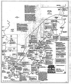
Map, Heidelberg: Historic River Landscape Assessment. Historical maps. Map D 1864 -1901 "Sleepy Hollow" and "Sleeping beauty", 1985c
... Heidelberg: Historic River Landscape Assessment. Historical maps. ...Bounded by Shire of Diamond Valley to the North, Darebin Creek to the West, and Plenty River to the East. heidelberg heidelberg - maps Black and white sketch on white paper. Second copy 600 x 430 cm printed in black on semi-opaque paper Heidelberg: Historic River Landscape Assessment. ...Geographical area of c. 35 sq. kilometres marked with physical features such as major roads, rivers, vegetation and properties, with locations and notes on the increasing number of farms, orchards and vineyards that had been developed in addition to pastoral runs. Bounded by Shire of Diamond Valley to the North, Darebin Creek to the West, and Plenty River to the East.Black and white sketch on white paper. Second copy 600 x 430 cm printed in black on semi-opaque paperheidelberg, heidelberg - maps -
 Greensborough Historical Society
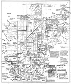
Map, Heidelberg: Historic River Landscape Assessment. Historical maps. Map E 1901-1934 "A Time of projects and improvements", 1985c
... Heidelberg: Historic River Landscape Assessment. Historical maps. ...Bounded by Shire of Diamond Valley to the North, Darebin Creek to the West and Plenty River to the East. heidelberg heidelberg - maps Black and white sketch map on white paper Heidelberg: Historic River Landscape Assessment. ...Geographical area of around 35 sq. kilometres marked with physical features such as major roads, railways (new extension to Eltham), rivers and properties, also housing sub-divisions and community facilities such as hospitals, parks and sporting reserves and indications of new small scale industries such as dairying. Bounded by Shire of Diamond Valley to the North, Darebin Creek to the West and Plenty River to the East. Black and white sketch map on white paperheidelberg, heidelberg - maps -
 Kew Historical Society Inc
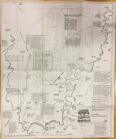
Plan, Loder & Bayly, Heidelberg: Historic River Landscape Assessment, 1982
... Heidelberg: Historic River Landscape Assessment...heidelberg Yarra valley historic plans -- heidelberg Printed annotations Plan of Heidelberg, annotated with details about the occupancy pre and post European settlement. The plan also contains geological references. The plan is included and analysed in volume 2 of the Heidelberg Conservation Study (1985). The original plan was published created in 1982. Heidelberg: Historic River Landscape Assessment ...Gwen McWilliam is well known as an authority on the history of Boroondara and the author of a large number of books and pamphlets about the City. She was awarded the medal of the Order of Australia in 2001 ‘for service to the community of Hawthorn and district, particularly through the research, documentation and publication of its history.’ This map from her collection was donated to the Kew Historical SocietyPlan of Heidelberg, annotated with details about the occupancy pre and post European settlement. The plan also contains geological references. The plan is included and analysed in volume 2 of the Heidelberg Conservation Study (1985). The original plan was published created in 1982. Printed annotationscity of heidelberg, yarra valley, historic plans -- heidelberg -
 Greensborough Historical Society
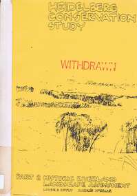
Book, Heidelberg Conservation Study: Part 2: Historic Riverland Landscape Assessment. Revised 1987, 1987_
... Heidelberg Heritage Advisory Committee. Area covered is from Darebin Parklands in the south to Plenty River at Yallambie in the north. Revised 1987. This study identifies neighbourhood character, documents past development and the capacity of the environment for future development with particular emphasis on the river precincts - Plenty River, Yarra River and Darebin Creek. heidelberg macleod heidelberg heritage advisory committee marilyn mcbriar plenty river yarra river darebin creek Stamps: Yarra Plenty Regional Library Service, and, Withdrawn Part three of set of three books. Paperback, 333 pages, Illus., maps. 2 copies. Heidelberg Conservation Study: Part 2: Historic Riverland Landscape Assessment ...Report prepared by Loder and Bayly and Marilyn McBriar on behalf of City of Heidelberg and Heidelberg Heritage Advisory Committee. Area covered is from Darebin Parklands in the south to Plenty River at Yallambie in the north. Revised 1987.This study identifies neighbourhood character, documents past development and the capacity of the environment for future development with particular emphasis on the river precincts - Plenty River, Yarra River and Darebin Creek.Part three of set of three books. Paperback, 333 pages, Illus., maps. 2 copies.Stamps: Yarra Plenty Regional Library Service, and, Withdrawnheidelberg, macleod, heidelberg heritage advisory committee, marilyn mcbriar, plenty river, yarra river, darebin creek
