
Showing 343 items matching "highway one"
-
 National Vietnam Veterans Museum (NVVM)
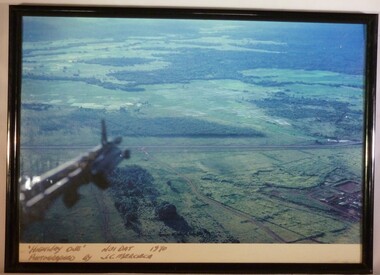
Photograph - A Framed Coloured Photograph, 'Highway One' Nui Dat 1970. Photographed by J.C. Mercieca, c.1970
... 'Highway One' Nui Dat 1970. Photographed by J.C. ......Highway one...A colour photograph in a black frame titled "Highway One" Nui Dat 1970. Below the part of the helicopter that is in the photograph you can see the lush green landscape...."Highway One" Nui Dat 1970 Photographed by J.C. ...Cpl Joseph Charles Mercieca A316866 Royal Australian Air Force No.1 Operational Support Unit Photograph Highway one Nui Dat "Highway One" Nui Dat 1970 Photographed by J.C. ...This photograph was taken by Cpl Joseph Charles Mercieca (A316866) who served with the Royal Australian Air Force. He served in Vietnam with No. 1 Operational Support Unit from July 1969 to July 1970.A colour photograph in a black frame titled "Highway One" Nui Dat 1970. Below the part of the helicopter that is in the photograph you can see the lush green landscape."Highway One" Nui Dat 1970 Photographed by J.C. Merciecacpl joseph charles mercieca, a316866, royal australian air force, no.1 operational support unit, photograph, highway one, nui dat -
 National Vietnam Veterans Museum (NVVM)
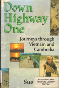
Book, Downie, Sue, Down Highway One: Journeys through Vietnam and Cambodia
... Down Highway One: Journeys through Vietnam and Cambodia....National Vietnam Veterans Museum (NVVM) 25 Veterans Drive Newhaven phillip-island-and-the-bass-coast Cambodia - Description and travel - 1975 Vietnam - Description and travel - 1975 It was a fascinating, exhausting and sometimes dangerous trip that slowly revealed the true face of Vietnam and Cambodia. Down Highway One: Journeys through Vietnam and Cambodia. ...It was a fascinating, exhausting and sometimes dangerous trip that slowly revealed the true face of Vietnam and Cambodia.It was a fascinating, exhausting and sometimes dangerous trip that slowly revealed the true face of Vietnam and Cambodia.cambodia - description and travel - 1975, vietnam - description and travel - 1975 -
 National Vietnam Veterans Museum (NVVM)
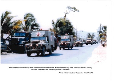
Poster - Information Board
... ...Highway one...National Vietnam Veterans Museum (NVVM) 25 Veterans Drive Newhaven phillip-island-and-the-bass-coast This item contributes to an understanding of the impact that involvement in the war in Vietnam (1962–1972) had on Australian servicemen. 8 Field Ambulance Vung Tau Vietnam Highway one Tet Offensive US Army 8 Field Ambulance South Vietnam/1967-1972 Laminated photo of a convoy of ambulances with Australian and US Army vehicles in 1968. ...This item contributes to an understanding of the impact that involvement in the war in Vietnam (1962–1972) had on Australian servicemen.Laminated photo of a convoy of ambulances with Australian and US Army vehicles in 1968. 8 Field Ambulance South Vietnam/1967-19728 field ambulance, vung tau, vietnam, highway one, tet offensive, us army -
 Box Hill Historical Society
Photograph - Gardiners Creek
... View of sculpture at Gardiner's Creek Reserve between Highbury Road and Burwood Highway. One of a collection of "Time" sculptures. ...Box Hill Historical Society Box Hill Heritage Centre Suite 7 Town Hall Hub Box Hill melbourne View of sculpture at Gardiner's Creek Reserve between Highbury Road and Burwood Highway. One of a collection of "Time" sculptures. ...View of sculpture at Gardiner's Creek Reserve between Highbury Road and Burwood Highway. One of a collection of "Time" sculptures. December 1985sculpture, gardiners creek reserve, parks and reserves, highbury road, burwood highway -
 Buninyong & District Historical Society
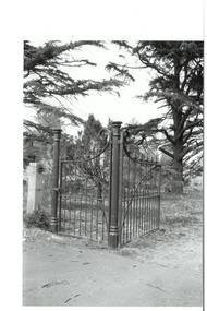
Photograph - Original B/W Photograph, Mr Clive J Brooks, Buninyong Cemetery gates, 9/4/1994
... Cast iron gates commissioned from foundry at Castlemaine, for entrance to Buninyong Cemetery, Midland Highway. One pedestrian gate, one double gate. ...Buninyong & District Historical Society Old Court House, Buninyong Town Hall 313 Learmonth Street Buninyong goldfields Cast iron gates commissioned from foundry at Castlemaine, for entrance to Buninyong Cemetery, Midland Highway. One pedestrian gate, one double gate. ...Cast iron gates commissioned from foundry at Castlemaine, for entrance to Buninyong Cemetery, Midland Highway. One pedestrian gate, one double gate. Gates acquired 1894. Originally olive green, gold-tipped spears. Painted white 1930s - 1940s. Damaged c1985, repaired by Mr Ron Nicholls, Buninyong. Repainted olive green 1992.Historically significant original gates acquired 1894.Buninyong Cemetery cast iron gatesbuninyong cemetery, gates, cast iron -
 Ballarat Tramway Museum
Slide - 35mm slide/s, Wal Jack, 26/06/1962 12:00:00 AM
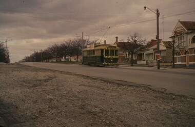
... Western highway narrow seal, one motor car in distance, Darkish photo, grainy....Western highway narrow seal, one motor car in distance, Darkish photo, grainy. ...Photo of Ballarat No. 20 climbing Victoria St. hill from Bakery Hill, 26-6-1962. Tram fitted with dash canopy lights, small white stripe, small triangles. Western highway narrow seal, one motor car in distance, Darkish photo, grainy.SEC Ballarat No. 20 in Victoria St. 26-6-62' in blue ink.tramways, trams, victoria st., tram 20 -
 Whitehorse Historical Society Inc.
Photograph - Colour Photograph, Canon Offices Tally Ho
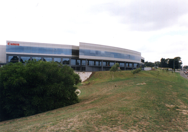
... Three coloured photographs of the Canon office in Tally Ho Business Park, which is on the corner of Burwood Highway and Springvale Road. One photo shows the western side of the Canon building (with the pond), one shows the curved southern side, and one shows the building looking east from Springvale Road....Canon makes cameras, lenses, printers, scanners, video-cameras, photo copiers and so on. tally ho business park east burwood canon pty ltd Three coloured photographs of the Canon office in Tally Ho Business Park, which is on the corner of Burwood Highway and Springvale Road. One photo shows the western side of the Canon building (with the pond), one shows the curved southern side, and one shows the building looking east from Springvale Road. ...The East Burwood Canon building is at 33 Lakeside Drive, Burwood East. Canon makes cameras, lenses, printers, scanners, video-cameras, photo copiers and so on.Three coloured photographs of the Canon office in Tally Ho Business Park, which is on the corner of Burwood Highway and Springvale Road. One photo shows the western side of the Canon building (with the pond), one shows the curved southern side, and one shows the building looking east from Springvale Road.tally ho business park, east burwood, canon pty ltd -
 Warrnambool and District Historical Society Inc.
Map - An Angler's map of the Hopkins River Estuary, Angler's map Hopkins River, 1980s
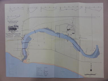
... Highway. Today the site is occupied by Deakin University, Warrnambool campus. The Warrnambool Anglers’ Club has its headquarters on the banks of the Hopkins River near the mouth of the river and the Lyndoch Aged Care facility. This map is of interest as a specialist one ...This is a map of the Hopkins River Estuary prepared by Dr John Sherwood for the benefit of anglers. The information on the sheet includes the location of sand banks, the water depths, boat ramp facilities and public access facilities. Some of the information has been gathered from aerial photographs. The map has been produced by the Warrnambool Institute of Advanced Education which was developed in the late 1960s from the tertiary section of the Warrnambool Technical College and with all its departments established by 1984 at the Sherwood Campus five kilometres from Warrnambool on the Princes Highway. Today the site is occupied by Deakin University, Warrnambool campus. The Warrnambool Anglers’ Club has its headquarters on the banks of the Hopkins River near the mouth of the river and the Lyndoch Aged Care facility.This map is of interest as a specialist one, providing fishermen with detailed information on all aspects of the Hopkins river estuary. Fishing has been both a profession and a popular recreational pursuit for Warrnambool residents since the early days of the city’s settlement. The Hopkins River Estuary has been a focal point for fishermen throughout Warrnambool’s history. This is a sheet of paper folded three times to produce a folded map. The front cover has a black and white photograph of two fishermen with a large fish. The map of the Hopkins River Estuary is in yellow, blue and black and covers the side of one sheet and three quarters of the other side. There is an advertisement for the Hopkins River Boathouse with a black and white sketch of the boathouse and notes on the map written by Dr John Sherwood. There are several diagrams showing the water depths. The map has some silverfish damage and some tearing at the folds. warrnambool anglers’ club, history of warrnambool, hopkins river, hopkins river estuary, john sherwood -
 Warrnambool and District Historical Society Inc.
Book, Jack Rooke, Life’s Highways and Byways, 1995
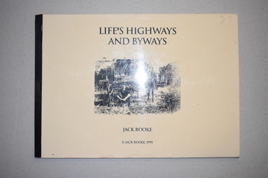
... one person facing the challenges of living in the bush in the district around Warrnambool in the 20th century. It is a simple but great social history that should be read by the younger generation today. early 20th century settlement in the warrnambool district history of warrnambool jack rooke camperdown panmure This is a soft cover book of 40 pages. It has been self-published and home-produced with a buff-coloured cover and a plastic overlay. The cover has a black and white illustration. The pages contain some sketches and black and white photographs. Life’s Highways ...This is a booklet written by Jack Rooke about his life. Born in 1910 Jack Rooke faced early the challenges of living in the bush in the Camperdown and Panmure areas. He describes the difficulties of the small farmer and the tough living conditions. He also records the struggle to survive during the Depression years in the 1930s and his heartache after his farm was burnt out in the Ash Wednesday fires. Rooke’s story mirrors that of many settlers in the Western District in the early to mid 20th century and so he has produced an important social history in a simple but compelling manner. This booklet is of considerable importance as it gives the details of the life of one person facing the challenges of living in the bush in the district around Warrnambool in the 20th century. It is a simple but great social history that should be read by the younger generation today.This is a soft cover book of 40 pages. It has been self-published and home-produced with a buff-coloured cover and a plastic overlay. The cover has a black and white illustration. The pages contain some sketches and black and white photographs. early 20th century settlement in the warrnambool district, history of warrnambool, jack rooke, camperdown, panmure -
 Warrnambool and District Historical Society Inc.
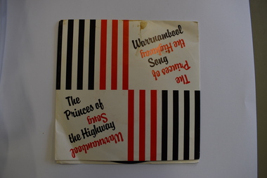
Audio - 45 R.P.M. Record, The Princes of the Highway, 1986
... Highway and the 'princes' are those who grew and picked potatoes in times past. The lyrics are by a former Warrnambool resident, Camilla Fligelman and the singer is John Stevens. Warrnambool is a city in the western district of Victoria servicing an agricultural area, particularly the dairying industry. This record is of interest as one ...This record features two songs about the city of Warrnambool, 'The Princes of the Highway' and 'Warrnambool Song'. The first-named is a reference to the fact that Warrnambool is on the Princes Highway and the 'princes' are those who grew and picked potatoes in times past. The lyrics are by a former Warrnambool resident, Camilla Fligelman and the singer is John Stevens. Warrnambool is a city in the western district of Victoria servicing an agricultural area, particularly the dairying industry. This record is of interest as one of several recordings made over the years celebrating the city of WarrnamboolThis is a 45 R.P.M. record with a red -coloured centre and black printing. It is enclosed in a thin cardboard envelope which has red and black lines and printing on the front and the lyrics of the two songs on the back.warrnambool songs -
 Warrnambool and District Historical Society Inc.
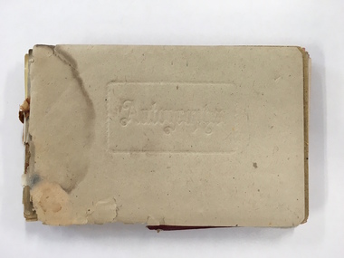
Booklet, Autograph Book, Late 1930s
... Highway between Heywood and the South Australian border. It was first settled in the late 1850s and the main industry is the processing of timber from the surrounding pine plantations. Patricia Spencer attended Warrnambool High School in the late1930s and this album contains a number of entries from Warrnambool High School in 1938. It also has a page of eleven signatures of the Head Master, George Langley and other teachers from Warrnambool High School. There are also entries from people from Mortlake and Panmure and other entries with the person’s address not indicated. Autograph books such as this one...Highway between Heywood and the South Australian border. It was first settled in the late 1850s and the main industry is the processing of timber from the surrounding pine plantations. Patricia Spencer attended Warrnambool High School in the late1930s and this album contains a number of entries from Warrnambool High School in 1938. It also has a page of eleven signatures of the Head Master, George Langley and other teachers from Warrnambool High School. There are also entries from people from Mortlake and Panmure and other entries with the person’s address not indicated. Autograph books such as this one ...According to the front page this autograph book belonged to Patricia Spencer of Spencer Street, Dartmoor. Dartmoor is a small settlement on the Princes Highway between Heywood and the South Australian border. It was first settled in the late 1850s and the main industry is the processing of timber from the surrounding pine plantations. Patricia Spencer attended Warrnambool High School in the late1930s and this album contains a number of entries from Warrnambool High School in 1938. It also has a page of eleven signatures of the Head Master, George Langley and other teachers from Warrnambool High School. There are also entries from people from Mortlake and Panmure and other entries with the person’s address not indicated. Autograph books such as this one were commonly owned by young people in the 19th and 20th centuries (up to about 1950) and were very popular with young girls.This album, although incomplete and tattered, is of interest because it is a good example of the social custom, more popular a couple of generations back than it is today, of young people owning and obtaining signatures and verses from their friends and acquaintances. It is also important because it contains signatures of Warrnambool High School teachers in 1938 and there are other entries of interest. This is a small autograph album that was originally bound with a cardboard cover with red leather backing but now has no front cover and only part of the back cover. The pages are all loose and the front section (buff-coloured) has a cardboard piece with felt padding. The pages are coloured in a variety of pastel tones and there are many handwritten entries of verses and signatures, with several from the ‘B’ Form, 1938, of ‘W.H.S. (Warrnambool High School). The album appears to have belonged to Patricia Spencer from Dartmoor. Some of the pages are torn and stained. At the back there are remnants of a sketch of an Asian scene and a letter to ‘Pat’ for her birthday. ‘Autographs’ ‘Patricia Spencer, Spencer Street, Dartmoor’ autograph albums, patricia spencer, warrnambool -
 Warrnambool and District Historical Society Inc.
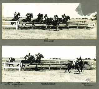
Photograph - Booval Steeplechase jumps 1921, C 1922
... Highway and Liebig St intersection. The winning horse being a horse named Bloodstain which is recorded on the mount of the photograph. This item has a social and historical significance. Socially, it shows an early association which Warrnambool has had with steeple-chasing, with jumps racing still representing an important part of the horseracing calendar. The photo has a strong link with Warrnambool, being one ...Booval Hill was an early name for the area to the north east of the Princes Highway and Liebig St intersection. The winning horse being a horse named Bloodstain which is recorded on the mount of the photograph. This item has a social and historical significance. Socially, it shows an early association which Warrnambool has had with steeple-chasing, with jumps racing still representing an important part of the horseracing calendar. The photo has a strong link with Warrnambool, being one of many photographs taken by The Jordan studios which operated out of premises in Liebig Street .Two black and white photos mounted on card showing the first and second last jumps of the Booval Steeplechase in 1921. There is text handwritten below the photographs and there is damage to the top right hand corner of the top photograph.Bottom photo signed Arthur Jordan 6 W'bool.steeplechase, warrnambool, booval, bloodstain, booval hill1921, jordan studios, horse racing -
 Kiewa Valley Historical Society
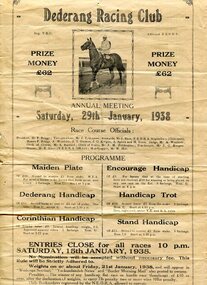
Programmes and Document - Dederang Racing Club, 1. January 1938 2. February 1924
... Highway. These races have been held annually since the mid 1850’s. The Dederang Picnic Race Club holds its one race meeting a year with the Dederang Cup in January. ...Highway. These races have been held annually since the mid 1850’s. The Dederang Picnic Race Club holds its one race meeting a year with the Dederang Cup in January. ...The Dederang Race Club is a thoroughbred Race Club that manages a country racing venue in North East Victoria at the Dederang Recreation Reserve on the Kiewa Valley Highway. These races have been held annually since the mid 1850’s. The Dederang Picnic Race Club holds its one race meeting a year with the Dederang Cup in January. Thousands of dollars have been raised in that time for charity and the community through the effort of volunteers. The race club is made up of 100% volunteers and whilst not only organising the race meeting they voluntarily maintain the racecourse and facilities to a standard that allows local trainers to use the course throughout the year. Dederang Race Club celebrated its 150 year anniversary in January 2015 with spectators dressed in period race attire and the launch of a book commemorating the organisation "Rank Outsider-A non racegoers glance at 150 years of the Dederang Race Club2 Documents regarding Dederang Racing Club meetings 1. Original printed flyer for Dederang Race Club Annual meeting Jan 29, 1938. On buff paper 2. Official programme for Dederang Racing Club Annual meeting. February 6, 1924. Buff cardboard printed programme dederang racing club; programme; dederang cup; kiewa valley -
 Kiewa Valley Historical Society
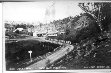
Four photographs of the Blue Duck Hotel and two Photos of the Glen Wills area, c1920 Post cards, c1949/50 small photographs
... one and he had the bronze blue duck cast and presented to the owners in the 1930's. This stands at the entrance to the premises. These photographs are of a building, in a remote area, that has provided a service to miners, anglers and travellers for over 100 years and continues to do so today. It also played a vital role in the history of the Mt. Wills/Omeo gold mining days. Blue Duck Hotel; Anglers Rest; Omeo Highway ...The Blue Duck Hotel stands at the confluence of 3 trout rivers - Cobungra, Bundarra and Mitta Mitta, called Angler's Rest. The original 1900's building was of slab construction and operated as a butcher shop, servicing miners on the track from Omeo to Mt. Wills. In 1912 it was purchased by a miner, Billy O'Connell, and he obtained a hotel license. In the early 1920's he transported 2 houses from Omeo on Horse drays. One is the main building of the Blue Duck and the other was a residence where Billy and his wife raised their nine children. The small log structure behind the pub is State School No.4286 where the children attended school. A teacher was shared with Glen Wills. By the late 1920's the hotel was discovered and patronized by keen anglers. Sir Harold Clapp (head of the railways) was one and he had the bronze blue duck cast and presented to the owners in the 1930's. This stands at the entrance to the premises.These photographs are of a building, in a remote area, that has provided a service to miners, anglers and travellers for over 100 years and continues to do so today. It also played a vital role in the history of the Mt. Wills/Omeo gold mining days.3 Post cards, Black and White photographs. 3 small black and white photographsPost Card No. 1 - "Blue Duck Hotel- Omeo-Glen wills road Ray Love Series No.2"(written on lower front) Post Card No. 2- "Looking towards Bogong High Plains. Omeo-Glen Wills road"(front, bottom, L hand) Ray Love Series No. 18 (front, lower R hand corner) On both of above photos, centre back, is stamped POST CARD and underneath this is printed "A GENUINE PHOTOGRAPH'/ Post Card No. 3 - Bottom L hand corner "Mystic Sea Australian Alps". R hand corner "(Bulmer Copyright)". Each small photograph, handwritten on back "Blue duck Hotel". All have circular stamp with "Print by Wilson White Albury" blue duck hotel; anglers rest; omeo highway; fishing; mining -
 Kiewa Valley Historical Society
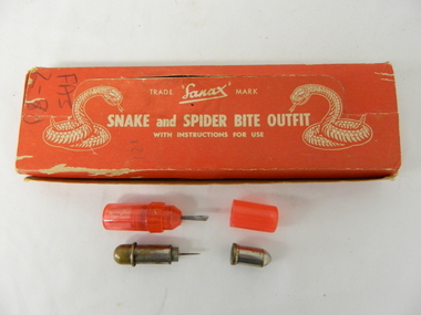
Box First Aid, Snake and Spider Outfit, Circa 1940's
... Highway Morabbin" The later printing has been severely scratched but decipherable. The back side of the box has "Note to the retailer" and due to wear no more of the writing can be read. Each side of the box is printed "SANAX" This item is a red coloured cardboard box(250 - 300 g/m) with white writing and containing the following 12 items. 7 clear red coloured capsules, 2 opaque red plastic capsules, 2 wooden capsules and 1 brass screw on capsule. The capsules are divided into two sections (compartments) horizontally. Each compartment has a screw lid. One ...At the time of manufacture, circa 1940's, the first aid treatment for snake bites, was to lance(cut) open the bite, wash it out and apply a ligature or tourniquet between the bite and the heart. This method was abandoned later after scientific evidence suggested that it was better to stop the blood system from carrying the poison to the heart (pressure immobilization). Australian snakes do not have long fangs therefore deep incisions into main arteries is rare. This research took many years to develop therefore the information supplied with the "Sanax" kits of this era is well outdated. Rural areas were more attuned to the possibilities of snake activity on farms, in sheds and in out houses and farm homesteads. This was not the case for mainly city and large townships environments. The mice plagues in wheat areas during the warmer month s has always been a high risk time for encountering snakesThese snake bite kits were issued to workers on the Kiewa Hydro Electricity Scheme. Some of these snake bite kits were kept at doctor's surgeries e.g. Bogong Village, House 13. The kit was carried by bushwalkers, scouts, farmers and high plains cattlemen. This item is of significance because it demonstrates the main dangers faced by all rural industries and towns, especially remote areas, and the portable remedies that where required as a necessity of the Australian bush environment. This item was in use at a time when the air ambulance and rescue facilities were not in existence and remote locations were more isolated and the availability of anti venom was hard to obtain locally.This item is a red coloured cardboard box(250 - 300 g/m) with white writing and containing the following 12 items. 7 clear red coloured capsules, 2 opaque red plastic capsules, 2 wooden capsules and 1 brass screw on capsule. The capsules are divided into two sections (compartments) horizontally. Each compartment has a screw lid. One compartment contains a lancet (for piercing the snake bite) and the other compartment contains the "Condy's" crystals compete with tightly rolled instructions.On top of the pull up lid, and flanked by two coiled snakes (at the strike position) is printed: "Trade Sanax Mark" below this " SNAKE and SPIDER BITE OUTFIT" and below this with instructions for use". Front side: "Sanax snake and spider bite outfit" underneath "Nepean Highway Morabbin" The later printing has been severely scratched but decipherable. The back side of the box has "Note to the retailer" and due to wear no more of the writing can be read. Each side of the box is printed "SANAX" snake, spider, first aid, kiewa hydro scheme, portable medical supplies -
 Kiewa Valley Historical Society
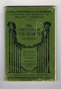
Book - Reference Cricket, The Cricket on the Hearth, circa 1930
... It seems to be one of a series of books called the 'Highways and Byways of English Literature". ...Highway and Byways of English Literature'. Centre of page is the title "The Cricket on the Hearth" and the author Dickens. Underneath this is 'Blackies English Texts Edited by W.H.D.Rouse, Litt.D." Across the foot of the page is 'Blackie and Son Limited'. On the first page, hand written in ink is "Wilma Roper, Rosehill G.S.,Albury." Book of literature by Charles Dickens. Has green cover with black lettering and decoration. It seems to be one ...A text book used by a local Tawonga student in the 1930's. The school she attended was Rosehill Girls School in Albury. This was one of the foundation schools of Scots School, Albury. Rosehill was opened in 1926 by a Miss Lillian Windridge, for both day and boarding students, in a large former residential property on the corner of Crisp and Young Streets and was named after her uncle's property 'Rosehill' near Kyneton in Victoria. It catered from kindergarten to the Leaving Class. The school flourished and extra space was made available at the adjacent 'Springfield' property for more classrooms. In 1934 lack of space forced 'Rosehill' to move to a new location in Kiewa Street. In 1938, Miss Windridge sold the school to Miss Anna Drennan, a well educated Scots woman with a Masters' degree from Edinburgh University. By early 1939 the school was again overcrowded and was moved to the property 'Woodstock' in Schubach Street, East Albury and the name changed to 'Woodstock School for Girls'. In 1972, the Woodstock Presbyterian Girls School and the Albury Grammar School amalgamated to form the Scots School Albury. Wilma's family were one of the early families to settle in the Kiewa Valley and had a property at Tawonga. After her marriage, Wilma moved, with her husband, to Mt. Beauty until 1958 when they moved back to manage the farm and remained there for the rest of her life.It has a social significance as it depicts the standard of literature that was expected to be read and appreciated by students in the 1930's era. As the school was situated in Albury, it meant that the student would have been a boarder as daily transport to and from the Kiewa Valley would have been impossible at that time, unlike the 'School Bus' run that is available today. At this time there was no 'secondary education' available in the valley and education beyond primary school would have been limited to children of families that could afford to send their children to board at privately run schools.Book of literature by Charles Dickens. Has green cover with black lettering and decoration. It seems to be one of a series of books called the 'Highways and Byways of English Literature". On the front cover, at the top, 'Highway and Byways of English Literature'. Centre of page is the title "The Cricket on the Hearth" and the author Dickens. Underneath this is 'Blackies English Texts Edited by W.H.D.Rouse, Litt.D." Across the foot of the page is 'Blackie and Son Limited'. On the first page, hand written in ink is "Wilma Roper, Rosehill G.S.,Albury."secondary education, albury, kiewa valley, tawonga -
 Victoria Police Museum
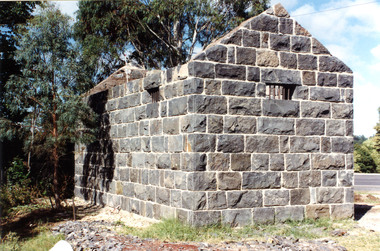
Police stations (Aitken's Gap)
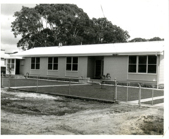
... Highway and Gap Road. The village was named after John Aitken, a Port Phillip pastoralist who took up the Mount Aitken run in 1836. Aitken's Gap Police Barracks (in the District of Bourke) opened in 1853 and was staffed by two Mounted Constables and one Foot Constable. ...Highway and Gap Road. The village was named after John Aitken, a Port Phillip pastoralist who took up the Mount Aitken run in 1836. Aitken's Gap Police Barracks (in the District of Bourke) opened in 1853 and was staffed by two Mounted Constables and one Foot Constable. ...Aitken's Gap, otherwise known as The Gap or Buttlejork, and 3km west of Sunbury, was established as a township in 1845. It is in the area which is now bordered by the Calder Highway and Gap Road. The village was named after John Aitken, a Port Phillip pastoralist who took up the Mount Aitken run in 1836. Aitken's Gap Police Barracks (in the District of Bourke) opened in 1853 and was staffed by two Mounted Constables and one Foot Constable. The gaol (used to house prisoners and also gold en route to Melbourne) was built in 1857 from bluestone quarried in the area. The roof was made of slate. In 1861 it was staffed by 1 Mounted Senior Constable and 1 Foot Constable. The Barracks closed in 1863 when the Bendigo rail line was completed and the gold was transported to Melbourne by rail. All the buildings, except the gaol, were moved to Sunbury. The land was sold in 1870 and in 1989 the current owner donated the building to the Sunbury Police. The original building was dismantled, restored and rebuilt outside Sunbury police station.15 colour photos and 1 black and white photopolice stations; aitken's gap police station -
 Victoria Police Museum
Police Stations (Apsley)
... It is on the Wimmera Highway, in the Shire of West Wimmera, 420 kilometres north-west of Melbourne, and 7 kilometres east of the South Australian border. Apsley Police Station opened on 29th November 1884 and was originally located in Wallace Street. It was staffed by one...It is on the Wimmera Highway, in the Shire of West Wimmera, 420 kilometres north-west of Melbourne, and 7 kilometres east of the South Australian border. Apsley Police Station opened on 29th November 1884 and was originally located in Wallace Street. It was staffed by one ...Apsley is a small town in Victoria, Australia. It is on the Wimmera Highway, in the Shire of West Wimmera, 420 kilometres north-west of Melbourne, and 7 kilometres east of the South Australian border. Apsley Police Station opened on 29th November 1884 and was originally located in Wallace Street. It was staffed by one Foot Constable (motor cycle). The building was described, in 1930, as a four-roomed dwelling with an iron roof, set on a quarter of an acre of land. There was a bathroom, a WC, wash-house and a garage. An office adjoined the house and there was also a lockup. The station moved several times until the mid 1960s when a timber residence was moved onto land adjacent to the Post Office. The building is believed to have been transported from the Stawell area. Apsley is one of a handful of one-man police stations in Victoria and its current location, including residence, is at 19 Splatt Street. Apsley was in the Western District when it opened, then in "L" (Wimmera) District from January 1948 and "M" (Highlands/Wimmera) District from March 1990. 4 black & white photos, 1965 3 colour photos, 1987police stations; apsley police station -
 Orbost & District Historical Society
book, Vic Roads Centenary 1913 -2013, 2013
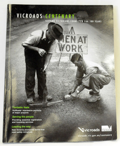
... Highway and Eastern Freeway. Other sections report on Victoria’s world-first road safety initiatives, VicRoads’ use of technology and sustainability measures. (ref VicRoads) This item is one...Highway and Eastern Freeway. Other sections report on Victoria’s world-first road safety initiatives, VicRoads’ use of technology and sustainability measures. (ref VicRoads) This item is one ...The publication, VicRoads Centenary: Keeping Victorians Connected for 100 Years, looks at the people and projects that define VicRoads’ history. Written by current and former VicRoads’ employees, the publication details the organisation’s portfolio of major projects, which includes the Great Ocean Road, Hume Highway and Eastern Freeway. Other sections report on Victoria’s world-first road safety initiatives, VicRoads’ use of technology and sustainability measures. (ref VicRoads) This item is one of several books donated by David Jellie at a presentation to Orbost Historical Society. He was a contributor to the book and was the engineer for the Snowy River Bridge (Princes Highway) at Orbost 1974-1976.This book is a useful reference tool on the history of road construction in Victoria including East Gippsland.A thick, bound paperback book, titled "VicRoads Centenary Keeping Victorians Connected for 100 Years". On the front cover is a black/white photograph of two men working on a road. One has a pick. The book contains the history of VicRoads, photographs, maps and advertisements. Some are b/w. Others are coloured.vicroads book roads snowy-river-bridge jellie-david -
Upper Yarra Museum
Lamp accessory, Tilley Lamp Company
... Highway Yarra Junction yarra-valley-and-dandenong-ranges tilley lantern vapourized fibres methylated spirits torch Printed on the lid. Methylated Spirits Fuel. for pre-heating Tilley Lamp. A glass jar supplied by the company Tilley,it is sealed with a lid The lid has a printed blue label. Inside the jar is a small wire appliance with a handle at one ...A glass jar supplied by the company Tilley,it is sealed with a lid The lid has a printed blue label. Inside the jar is a small wire appliance with a handle at one end and the other end has packed fibres on both sides of the scissor type blades. The fibres are blackened. Printed on the lid. Methylated Spirits Fuel. for pre-heating Tilley Lamp.tilley lantern vapourized fibres methylated spirits torch -
 Upper Yarra Museum
Wooden Cuboid shape
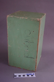
... Highway Yarra Junction yarra-valley-and-dandenong-ranges http://en.wikipedia.org/wiki/Cuboid Mathematics. A rectangular parallelepiped, In geometry, a cuboid is a solid figure bounded by six faces, forming a convex polyhedron Name also use: http://en.wikipedia.org/wiki/Cuboid_bone In the human body, the cuboid bone is one of the seven tarsal bones of the foot Cuboid Wooden shape Wooden Cuboid shape ...http://en.wikipedia.org/wiki/Cuboid Mathematics. A rectangular parallelepiped, In geometry, a cuboid is a solid figure bounded by six faces, forming a convex polyhedron Name also use: http://en.wikipedia.org/wiki/Cuboid_bone In the human body, the cuboid bone is one of the seven tarsal bones of the footCuboid Wooden shape -
 Upper Yarra Museum
Negative Photographic Reproduction, Jenkins family at Millgrove, 1893, 14.2.1988 (exact)
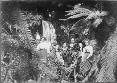
... Upper Yarra Museum Old Railway Station 2415C Warburton Highway Yarra Junction yarra-valley-and-dandenong-ranges A very popular pastime was to have outings in the bush, with friends or family. ferns millgrove falls jenkin family creek waterfall Jenkins family at Millgrove, 1893. Negative Black white. Scanned at 600 dpi. This is set amongst Tree Ferns with a small waterfall left of centre, there are 2 men to the right at the top of the falls both with mustache's one ...A very popular pastime was to have outings in the bush, with friends or family.Jenkins family at Millgrove, 1893. Negative Black white. Scanned at 600 dpi. This is set amongst Tree Ferns with a small waterfall left of centre, there are 2 men to the right at the top of the falls both with mustache's one with a hat,Below to the Left is Mr Jenkins Senior with a full beard & hands on his hips, in front is a young lady, on the right is another slightly older lady with 2 children a girl in front and boy to her right,and then Mrs Jenkins with a little girl next To her, and her mother to the right.ferns, millgrove, falls, jenkin family creek waterfall -
 Upper Yarra Museum
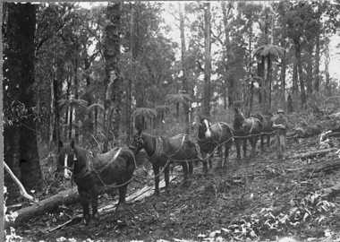
Negative Photographic Reproduction, Horse team at work, Hoddles Creek, 13/4/1983
... Upper Yarra Museum Old Railway Station 2415C Warburton Highway Yarra Junction yarra-valley-and-dandenong-ranges This was the one way of transporting logs to the Timber Mill timber horse team sandy ross hoddles creek snigging Negative Black white Scanned at 600 dpi. ...This was the one way of transporting logs to the Timber MillNegative Black white Scanned at 600 dpi. Horse team at work, Hoddles Creek, A four Horses Team "Snigging" a log out of the bush, one man in charge of the team.timber, horse team, sandy ross, hoddles creek, snigging -
 Upper Yarra Museum
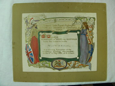
Prints offset, Julian & Howard, Ashton, Deli, Celebration of the opening Parliament of the Commonwealth of Australia
... Upper Yarra Museum Old Railway Station 2415C Warburton Highway Yarra Junction yarra-valley-and-dandenong-ranges Printed invitation one of 4 invitaions in the set ,to invite Mr & Mrs H. ...Printed invitation one of 4 invitaions in the set ,to invite Mr & Mrs H. H. Bradley from His Majesty's Ministers of State for Australia to Celebrtae the Opening Parliament of the Commonwealth of Australia to meet their Royal Highness The Duke and Dutchess of Cornwell and York. To an evening reception at the Exhibition Building Melbourne on the 9th of May 1901, at 8 o'clockSignficant collection of 4 invitatons of national signficance Plus a printed Momento from the Duke and Dutchess 00533 Evening reception to Meet the Duke and Dutchess 00534 Invitaion from the Govenment of Victoria 00535 Invitaion from Edmund Barton the Prime Minister 00536 Invitaion from the Govenment of Victoria for a conversazione 07/05/1901 at 8 pmMounted offset print. The print is mounted on brown mount board. The print has an embossed seal of Duke and Dutchess of Cornwall and York. Printed invitation from the miniters of state to invite Mr and Mrs H H Bradley to attend the reception.Invitaion hand written. On the left is a maiden , dressed in red with a helment carrying a British Shield on the Right hand side is a maiden dressed in purple carrying a St shield . The print is bordered by vines and leaves with scrolls for text details. The print has silver and gold highlights.Printed: His Majesty's Ministers of State for the Commonwealth of Australia/ request the honour of the presence of... / in the Exhibition Building, Melbourne, on Thursday, 9th May, to witness/ the Opening of the Parliament of the Commonwealth./ Edmund Barton/ Prime Ministermelbourne, australia, commonwealth, printed offset, invitaion, celebrate opening parliament commonwealth australia, parliament, duke dutchess cornwall york, mr mrs h h bradley, exhibition building, 1901, 09 05 1901 -
 Upper Yarra Museum
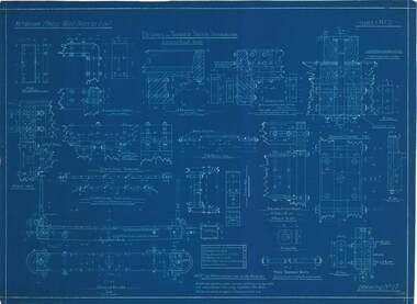
Technical drawing - blue print, Details of Timber Truck Ironwork, 17.07.1912
... Upper Yarra Museum Old Railway Station 2415C Warburton Highway Yarra Junction yarra-valley-and-dandenong-ranges Victorian Powell Wood Process Ltd details of timber truck ironwork scale 1 1/2" -3" = 1 foot Sheet No 17 11/07/12 Note:- the number off each part are for one wagon only DWR-00286 Details of Timber truck ironwork, Victorian Hardwood Company, Powelltown, 1919. ...DWR-00286 Details of Timber truck ironwork, Victorian Hardwood Company, Powelltown, 1919. Blue Print.Victorian Powell Wood Process Ltd details of timber truck ironwork scale 1 1/2" -3" = 1 foot Sheet No 17 11/07/12 Note:- the number off each part are for one wagon only -
 Upper Yarra Museum
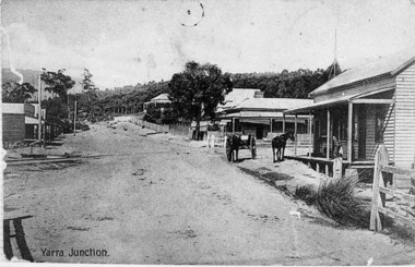
Negative Photographic Reproduction, Main St Yarra Junction
... Upper Yarra Museum Old Railway Station 2415C Warburton Highway Yarra Junction yarra-valley-and-dandenong-ranges This intersection was a busy one with the tramway traffic having Steam Engines and their trucks crossing about 8 times a day, horsedrawn vehicles often had trouble crossing the tramway because it was quite uneven at times. yarra junction main street rail crossing 03037 PC Main Street Yarra Junction, at the corner of Little Yarra Rd, the Powelltown tramway crosses the road at this intersection Upper Yarra Shire 1888-1988 Centenary collection. ...This intersection was a busy one with the tramway traffic having Steam Engines and their trucks crossing about 8 times a day, horsedrawn vehicles often had trouble crossing the tramway because it was quite uneven at times.03037 PC Main Street Yarra Junction, at the corner of Little Yarra Rd, the Powelltown tramway crosses the road at this intersection Upper Yarra Shire 1888-1988 Centenary collection. Negative, Black & white. Scanned at 600 dpi. yarra junction main street rail crossing -
 Upper Yarra Museum
Negative Photographic Reproduction, Warburton East, Primary School being demolished, 1988
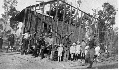
... Upper Yarra Museum Old Railway Station 2415C Warburton Highway Yarra Junction yarra-valley-and-dandenong-ranges Extract Local residents often had to provide their own school. These men with a little help from their offspring, are pulling down the Old East Warburton School to make way for a new one. ...Extract Local residents often had to provide their own school. These men with a little help from their offspring, are pulling down the Old East Warburton School to make way for a new one. Page 73, " The Upper Yarra An Illustrated History" by Brian Carroll, The Shire of Upper Yarra, 1988Warburton East, Primary School under construction Negative Black white Scanned at 600 dpi. Printed album presented to Upper Yarra Historical Society, compiled by R. Crowleyschool, east warburton -
 Australian Jazz Museum
Musical instrument, Grafton Saxophone Company, Circa 1951
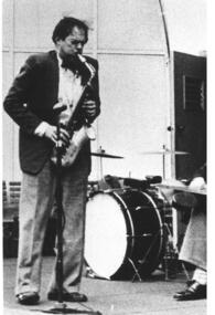
... Australian Jazz Museum Koomba Park 15 Mountain Highway Wantirna melbourne Given to Ade Monsbourgh by the Grafton Saxophone Company UK, during the Bell Second Tour C1951-1952. Ade Monsbourgh is considered one ...Given to Ade Monsbourgh by the Grafton Saxophone Company UK, during the Bell Second Tour C1951-1952. Ade Monsbourgh is considered one of Australia's most original and influential jazz musicians and composers. Rare Grafton acrylic plastic alto saxophone donated by the Grafton Saxophone Company UK, to Ade Monsbourgh during the Bell Second Tour C1951-1952 Rare cream-coloured Grafton acrylic plastic alto saxophone belonging Ade Monsbourgh together with mouthpiece Embossed Made in England Patent # 604 407 604 418 John E. Dallas & Son Ltd Sole distributors. # 10147ade monsbourgh, grafton saxophone, acrylic plastic saxophone -
 Australian Jazz Museum
Musical Instrument
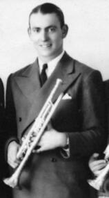
... Australian Jazz Museum Koomba Park 15 Mountain Highway Wantirna melbourne The brass cornet was owned by early Australian Jazz musician and multi-instrumentalist Benny Featherstone Benny Featherstone is considered "one of the most fascinating and gifted musicians in the history of Australian jazz" (Johnson, Oxford Companion to Australian Jazz, p 154). ...The brass cornet was owned by early Australian Jazz musician and multi-instrumentalist Benny Featherstone Benny Featherstone is considered "one of the most fascinating and gifted musicians in the history of Australian jazz" (Johnson, Oxford Companion to Australian Jazz, p 154). Once described as "Australia's Louis Armstrong"Buescher brass cornetTrue tone. Pat. Oct 89.07 287335 LP 262 The Buescher Elkhart Ind. U.S.A.benny featherstone, prince of good fellows, thirties, jazz musician, melbourne jazz musician, drummer, 1930 s, buescher cornet, trumpeter, trombonist, clarinetist, pianist, early australian jazz -
 Eltham District Historical Society Inc
Photograph - Postcard, The Great Tokyo Earthquake on September 1st, 1923: Asakusa 12-Story Tower with its Upper Floors Destroyed, 1923
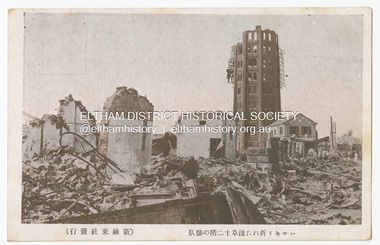
... one of them being Mitsumura Printing, which took advantage of its remaining resources to churn out postcards. When the Ōsaka Mainichi Shinbunsha published its bilingual three-volume photographic pictorial of the Great Kantō Earthquake just two weeks after the event, the calamity had already been captured in thousands of images that circulated on a national and international media highway. ...one of them being Mitsumura Printing, which took advantage of its remaining resources to churn out postcards. When the Ōsaka Mainichi Shinbunsha published its bilingual three-volume photographic pictorial of the Great Kantō Earthquake just two weeks after the event, the calamity had already been captured in thousands of images that circulated on a national and international media highway. ...The Great Kantō Earthquake of 1 September 1923 devastated the major cities of Tokyo and Yokohama, as well as five other surrounding prefectures and was one of the world’s worst natural disasters of the early twentieth century. In terms of loss of life and material damage, with an estimated 140,000 deaths and countless homeless, it is still Japan’s worst national disaster. Nearly 90% of the newspaper printers were destroyed in the earthquake. These postcards were not produced for aesthetics but as a major tool for the spread of information. Seeing how newspaper companies were left with their offices in shambles, postcard publishers tried to fill the gap hence some were in three languages. A very small number of publishing companies were fortunate enough to survive, one of them being Mitsumura Printing, which took advantage of its remaining resources to churn out postcards. When the Ōsaka Mainichi Shinbunsha published its bilingual three-volume photographic pictorial of the Great Kantō Earthquake just two weeks after the event, the calamity had already been captured in thousands of images that circulated on a national and international media highway. Commercial photographers and photojournalists produced the most abundant and immediate images of the quake, which were transmitted in newspapers, special-issue newspaper pictorials, commemorative photography collections, illustrated survivors’ accounts, and sets of commemorative postcards. These photographic images functioned as both news and souvenirs, rendering their consumers/viewers, inside and outside the devastated locale, into both witnesses and voyeurs. Images in the news media and those issued by respected publishing houses carried the visual authority of supposed facticity. As such they both produced and became the historical record of the event. Since the vast majority of 1923 disaster postcards that survive have no writing on them, they were likely treated more as collectibles than as a form of postal communication. Many were put into albums, creating new ways to combine images and create visual cultures of disaster for home viewing. Accordion-style albums allowed for personalized, serial organization of images that produced unique, imagistic narratives of the event. The album pages were also two-sided and could be stretched out to view a series of images on recto and verso. References: Imaging Disaster: Tokyo and the Visual Culture of Japan’s Great Earthquake of 1923 震災をイメージ化する 東京と1923年関東大震災のヴィジュアルカルチャー - The Asia. (2024, March 31). Retrieved from https://apjjf.org/2015/13/6/gennifer-weisenfeld/4270 The Great Kanto Earthquake: Postcards of Tragedy. (2024, March 31). Retrieved from https://www.tokyoweekender.com/art_and_culture/japanese-culture/the-great-kanto-earthquake-postcards/ See also: Postcards from Hell – Glimpses of the Great Kantō Earthquake; M. William STEELE (International Christian University, Japan) 14th Conference of the European Association of Japanese Studies: Visual Culture and Postcard Research Papers – East Asia Image Collection Blog. (2024, March 31). Retrieved from https://sites.lafayette.edu/eastasia/2014/09/01/14th-conference-of-the-european-association-of-japanese-studies-visual-culture-and-postcard-research-papers/] And https://icu.repo.nii.ac.jp/record/4503/files/ACS44_01Steele.pdfThis item, a souvenir from Japan from between the wars (circa 1923) was brought home to Research, Victoria by Bill Teagle who was serving in the Royal Australian Navy (1919-1945). Bill Teagle's sister Violet Amelda Teagle had married Theodore (Curly) Feldbauer in 1933. Bill's brother-in-law Curly was taken as a Prisoner of War by the Japanese and died at Sandakan in March 1945. The family did not learn of Curly’s death till months later and Bill's sister, Violet, herself could never forgive the Japanese for what happened to Curly. Curly is remembered on the Eltham Roll of Honour Board and his son, Albert Feldbauer (Bill’s nephew and youngest child of the children of the soldier fathers attending a school in the district), was given the honour of turning the first sod for the Eltham War Memorial Infant Welfare Centre Building. Despite this, the family maintained this cherished souvenir from a time of previous foreign friendship with Japan. The item was possibly given by Bill Teagle to his sister Margaret Rose (formerly Ingram) who later married Richard Edward (Eddie) Fielding in early 1948. (Eddie had been engaged to someone else before he went to war, but his fiancée broke it off before his return to Australia.) It was cared for by the Teagle/Fielding family for approximately one hundred years. It is of particular significance given the family's connection to the Eltham War Memorial and the significance of that memorial to the local community and represents that despite the horrors of war, former friends then foes can become friends again.tom fielding collection, japanese postcard, postcard, 1923, great kanto earthquake, japan, tokyo, yokohama
