
Showing 60 items matching "holloway street"
-
 Stawell Historical Society Inc
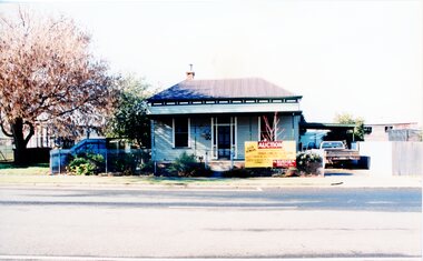
Photograph, House Removal. Victoria Street Rob Holloway, July 1996
... House Removal. Victoria Street Rob Holloway.... -4 Looking back towards the house on the truck -5 The house on the truck just before turning a corner Streetscape 6 colour photographs showing the parks and gardens superintendents house House Removal. Victoria Street Rob Holloway Photograph ...7103 - House with auction removal sign. -1 The view across the road to central park -2 View from the side showing seedling house and Stawell Bowling club -3 Showing the house on the truck looking towards the cab of the truck. -4 Looking back towards the house on the truck -5 The house on the truck just before turning a corner6 colour photographs showing the parks and gardens superintendents house streetscape -
 City of Moorabbin Historical Society (Operating the Box Cottage Museum)
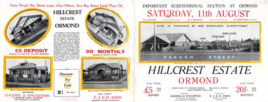
Flyer, 1928
... ...Holloway Street...Example of the progress of the Municipality of Moorabbin arker Street Holloway Street Wild Cherry Road Ormond Real Estate Hillcrest Estate, Ormond - Auction Saturday 11August 1928 Advertising flyer for auction of real estate sales - plan of building blocks for sale with pictures of local houses Flyer ...The train line from the city to Frankston was electrified which intensified the sale in the municipality of Moorabbin, particularly land which was in the vicinity of the railway stations.Example of the progress of the Municipality of MoorabbinAdvertising flyer for auction of real estate sales - plan of building blocks for sale with pictures of local housesHillcrest Estate, Ormond - Auction Saturday 11August 1928arker street, holloway street, wild cherry road, ormond, real estate -
 City of Moorabbin Historical Society (Operating the Box Cottage Museum)
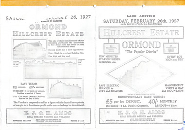
Flyer - Hillcrest Estate, Ormond, 1927
... ...Holloway Street...Example of the progress of the Municipality of Moorabbin Parker Street Holloway Street Wild Cherry Road Wallen Road Florence Street Wimmera Street Leila Road real estate Ormond auction Hillcrest Estate, Ormond - 26 Home sites for auction Saturday 26 February 1927. ...The train line from the city to Frankston was electrified in 1922 which intensified the sale in the municipality of Moorabbin, particularly land which was in the vicinity of the railway stations.Example of the progress of the Municipality of MoorabbinPhotocopy of advertising flyer for auction of real estate sales - plan of building blocks for saleHillcrest Estate, Ormond - 26 Home sites for auction Saturday 26 February 1927.parker street, holloway street, wild cherry road, wallen road, florence street, wimmera street, leila road, real estate, ormond, auction -
 City of Moorabbin Historical Society (Operating the Box Cottage Museum)
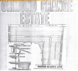
Flyer - Ormond Grange Estate, Ormond, 1913
... Holloway Street...Example of the progress of the Municipality of Moorabbin Holloway Street Wild Cherry Road Parker Street Ormond Land sales real estate Ormond Grange Estate Photo copy of advertising flyer for auction of real estate sales - plan of building blocks for sale Flyer Ormond Grange Estate, Ormond ...At the end of World War One, there was a renewed interest in residential land and a number of estates opened up in the Municipality of Moorabbin.Example of the progress of the Municipality of MoorabbinPhoto copy of advertising flyer for auction of real estate sales - plan of building blocks for saleOrmond Grange Estateholloway street, wild cherry road, parker street, ormond, land sales, real estate -
 Glen Eira Historical Society
Document - Grange Road, 77, Glen Huntly
... ... Holloway Street...Barnard Ernest F Gorrie Gertrude Gorrie Hulbert Hopetoun Hobart John Bertram Coorigil Road Carnegie Holloway St Ormond Chemists Parish of Prahran Caulfield County of Bourke Building Agreement Brick Houses Builders Plans Architectural Drawings Grange Road Glen Huntly Holloway Street Ormond Emma Street Grange Road Neerim Road Gorrie H.H Gorrie Gertrude Gorrie Hulbert H Legal Documents Barnard Ernest Franklin E. ...This file contains 4 items about the purchase and construction of this property: 1/ The original contract of sale of land dated 25/09/1936 for Gertrude & Hulbert Gorrie situated on the corner of Grange and Neerim Road. 2/ The original typed building agreement dated 25/09/1936 between the contractor Ernest F Barnard and the purchasers Mr & Mrs Hulbert Gorrie. 3/ The original blueprint plan of a brick villa at the corner of Grange & Neerim Road for Mr & Mrs Hulbert Gorrie. Dated 25/09/1936. 4/ The original specification for the dwelling on the corner of Grange & Neerim Road, Glen Huntly for Mrs Gertrude Gorrie & Mr Hulbert Hopetoun Gorrie by builder Ernest F Barnard.barnard ernest f, gorrie gertrude, gorrie hulbert hopetoun, hobart john bertram, coorigil road, carnegie, holloway st, ormond, chemists, parish of prahran, caulfield county of bourke, building agreement, brick houses, builders, plans, architectural drawings, grange road, glen huntly, holloway street, ormond, emma street, grange road, neerim road, gorrie h.h, gorrie gertrude, gorrie hulbert h, legal documents, barnard ernest franklin, e. j. & h. amos, hintons nursery, real estate agents, murrumbeena, caulfield -
 Greensborough Historical Society
Newspaper - Newspaper clipping, All roads lead to map of stories, 27/04/2011
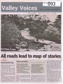
... holloway...jack shallard...susanna maria bible...bradbury...henry brougham...handfield...fay harcourt...violet bank...kangaroo ground...bells hillroad...shalbury avenue...beard street...Family history of Josiah Holloway, origins of street names in the subdivision of Eltham ...Family history of Josiah Holloway, origins of street names in the subdivision of Eltham History of Eltham and origins of street names connected with pioneers of the area. josiah holloway jack shallard susanna maria bible bradbury henry brougham handfield fay harcourt violet bank kangaroo ground bells hillroad shalbury avenue beard street brougham street main road eltham DV Leader April27 2011, p23 Newsprint, gray scale. ...Family history of Josiah Holloway, origins of street names in the subdivision of Eltham History of Eltham and origins of street names connected with pioneers of the area.Newsprint, gray scale. Photograph of Keylock's Bridge on Diamond Creek at ElthamDV Leader April27 2011, p23josiah holloway, jack shallard, susanna maria bible, bradbury, henry brougham, handfield, fay harcourt, violet bank, kangaroo ground, bells hillroad, shalbury avenue, beard street, brougham street, main road, eltham -
 Stawell Historical Society Inc
Photograph, Senior Citizens Club Office Bearers in the Clubrooms 1991-1992
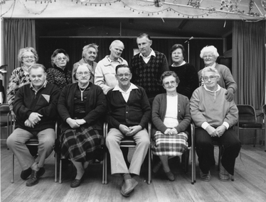
... Back row Daphne Beckwith, Nellie Blake, Myrtle Pyke, Cec Dredge, Stan Raeburn, Florence Unthank, Ella Holloway. Front Row John Street, Nat Raeburn, Jim Bigmore, Nellie Howen Bonnie Dean. ...Back row Daphne Beckwith, Nellie Blake, Myrtle Pyke, Cec Dredge, Stan Raeburn, Florence Unthank, Ella Holloway. Front Row John Street, Nat Raeburn, Jim Bigmore, Nellie Howen Bonnie Dean. stawell Black & white photograph of group of people inside a hall. ...Group inside Senior Citizens Clubrooms. Back row Daphne Beckwith, Nellie Blake, Myrtle Pyke, Cec Dredge, Stan Raeburn, Florence Unthank, Ella Holloway. Front Row John Street, Nat Raeburn, Jim Bigmore, Nellie Howen Bonnie Dean. Black & white photograph of group of people inside a hall. One row seated the other standing behind the seated row.stawell -
 Eltham District Historical Society Inc
Photograph, Wendy Wilson, Our Lady Help of Christians Primary School, 1-13 Henry St, Eltham, c.1980
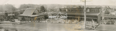
... A new church was erected on the opposite (southern) side of Henry Street in 1976, partially on the original Lot 20 Henry Street of Holloway's Little Eltham North estate. Lot 20 Henry Street was the site of the former Wesleyan Church chapel in the 1850s which also used by David and Catherine Clark to establish their first school in 1855 prior to the erection of the Dalton Street school in 1856. ...A new church was erected on the opposite (southern) side of Henry Street in 1976, partially on the original Lot 20 Henry Street of Holloway's Little Eltham North estate. Lot 20 Henry Street was the site of the former Wesleyan Church chapel in the 1850s which also used by David and Catherine Clark to establish their first school in 1855 prior to the erection of the Dalton Street school in 1856. ...Our Lady Help of Christians Primary School - The hall on the left side was the original Our Lady Help of Christians Church which was built c.1962 on the site of the former weatherboard St Mary's Church which was destroyed by fire in 1961. A new church was erected on the opposite (southern) side of Henry Street in 1976, partially on the original Lot 20 Henry Street of Holloway's Little Eltham North estate. Lot 20 Henry Street was the site of the former Wesleyan Church chapel in the 1850s which also used by David and Catherine Clark to establish their first school in 1855 prior to the erection of the Dalton Street school in 1856. The chapel was replaced by a new building, the Eltham Rechabite Hall (1893-1921) which then became the Eltham Public Hall (1922-1940). The Eltham Fire Station was also situated adjacent from 1931 to 1935. our lady help of christians primary school, henry street, eltham -
 Eltham District Historical Society Inc
Facsimile Newspaper, The Times, Late The Port Phillip Gazette, 12 April 1851, p1
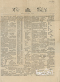
... HOLLOWAY, “Red Boot,” Swanston-street, Opposite the Shepherd’s Arms N.B....M. HOLLOWAY, “Red Boot,” Swanston-street, Opposite the Shepherd’s Arms N.B. ...Copy of front page of an early Port Phillip newspaper. It includes several articles including the announcement of a new township called Little Eltham. The artcile is transcribed as follows: NEW TOWNSHIP OF LITTLE ELTHAM Adjoining the Government Township of Eltham on the Yarra River. Half-acre Allotments for Sale in the above Township, at 35s. each; Title—A Grant from the Crown to the Vendor. THE advertiser feels persuaded that to recommend the above property he need only state the three following undeniable facts: First.—The Diamond Creek, which yields a never failing supply of the purest water, runs through the whole length of the township. Second.—The boundary of the Government township reserve was fixed years back, when Melbourne itself was not expected to rise beyond a mere village and when the valuable building ground at Collingwood was sold in allotments containing about twenty-seven acre each. Third.—Immediately beyond the Government township the bank of the Yarra is so steep that water could with difficulty be obtained from the river; making it certain that the town will extend itself in the direction of the creek. The distance from Melbourne is about eleven miles in a straight line, and between 13 and 14 miles by road. Attention is particularly directed to the following, being the second article in the condition of sale—: That, to secure to the purchaser uninterrupted possession without the expense of a deed, an attested copy on parchment of the Crown’s Grant with the Vendors Receipt for the purchase money on the same sheet, will be given to each purchaser without charge. A plan is now on view, and the lots can be chosen at once. Application to be made to J. M. HOLLOWAY, “Red Boot,” Swanston-street, Opposite the Shepherd’s Arms N.B.—A plan of the property will be given to each purchaser.The announcement of J.M. Holloway's Little Eltham township in April 1851 is a significant event in the foundation of European settlement for the suburb of Eltham and its wider community today.Laminated front page and p2 (facsimile?)little eltham, newspaper, j m holloway, 1851, port phillip -
 Federation University Historical Collection
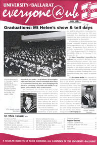
Magazine - Booklet, University of Ballarat, Everyone@UB, 2001
... Redundancy, video conferencing Images: Steve Matthews, Craig Holloway, Peter Pilven, Sneha Kirubakaran, Phil Honeywood, Kerry Cox, David Manterfield, Martin Westbrooke, Ram Karan, Barry Jones, Gael Ramsay, Jenny Hargave, Heather Hatfield. .16) Jeff Kennett, Honorary Doctorate, Technology Park, Mary Atkinson, Ian Wright, Internet, Disability Action Plan, Robert Munt obituary, Sandra Stepcich obituary, Virginia Fenwlon, East Timor, Centre for Environmental Management, Wayne Jolly, 130th anniversary, Craig Hurley, Barry Wemyss, John Murray, Tori Power, Grant Curnow. Images: Vivienne Witwer, Claire Hetherington, Ian Wright, Virginia Fenelin .17) Broadband, AARNet, David James Retirement, wetlands, Debbie Eagles, Centre for Rural and Regional Health, numeracy, nursing, Sue Turale, Max Palmer, Camp Street...Redundancy, video conferencing Images: Steve Matthews, Craig Holloway, Peter Pilven, Sneha Kirubakaran, Phil Honeywood, Kerry Cox, David Manterfield, Martin Westbrooke, Ram Karan, Barry Jones, Gael Ramsay, Jenny Hargave, Heather Hatfield. .16) Jeff Kennett, Honorary Doctorate, Technology Park, Mary Atkinson, Ian Wright, Internet, Disability Action Plan, Robert Munt obituary, Sandra Stepcich obituary, Virginia Fenwlon, East Timor, Centre for Environmental Management, Wayne Jolly, 130th anniversary, Craig Hurley, Barry Wemyss, John Murray, Tori Power, Grant Curnow. Images: Vivienne Witwer, Claire Hetherington, Ian Wright, Virginia Fenelin .17) Broadband, AARNet, David James Retirement, wetlands, Debbie Eagles, Centre for Rural and Regional Health, numeracy, nursing, Sue Turale, Max Palmer, Camp Street ...The University of Ballarat in 1998 comprised the Mt Helen Campus, SMB (Ballarat School of Mines) Campus and the Horsham Campus. It's current name is Federation University Australia. In 1998 Everyone@UB was a monthly staff newsletter edited by Peter Baird in consultation with Don Moconachie.A series of monthly bulletins covering all University of Ballarat campuses. .1) University merger, John Bailey, Michael Adermann, Vice-Chancellor, Jenny Nemeth, Katherine Birkin, Rowena Coutts, Ballarat Technology Park, Ron Wild .2) Chancellor appointment, Chancellor retirement, Geoffrey Blainey tribute, David Caro, Katherine Birkin, Arno Besse, George Murdoch, Bullarook, Stephen Kemmus, Neville French, ceramics, Tristan Smith, Horsham, Arnhem Land film, Ararat, Kerry Cox, anorexia, salary packages, University of Ballarat Brass Band, Natalie Radomski, becoming a university. Images: Geoffrey Blainey, David Caro, David James, Katherine Birkin, Arno Besse, George Murdoch, Geoffrey Blainey, Stephen Kemmis, Neville French, John Ackland, Richard Jardine, Glen Auld, Dennis Arne, Andrew Kotsonis, Kerry Cox, Suzanne McLaren, Marcia Pope, Rosemary Green, Leonie Otago, Natalie Rodomski .5) October 1998 - Carolyn Taylor, misogyny, Horsham campus building under construction, David Caro, Miranda Kerr, Martin Westbrook, Iain Reid, virtual monitors, teaching practice, Joanne Knight, John Pidgeon, Sally Buckland, arsenic, Ian Rae, Bob Allan, Patricia Cartwright, Matthew Baker, Sundru Sivamalai, Janine Smith, Pat Mann, International Student Market Research, Steve Mennen, Copyright, internet to the outback, Charters Towers, Engineering students, Darryl Dyason, Andrew McDougall, Dianne Jacono, Ross Morgan, Keith Boast, Cranbrook Academy of Art (Detroit), Helmut Stenzel, Mt Helen vegetation, Jan Bedggood, Ann-Maree Haintz, Kathleen Lakey, Adrienne Ryan, Fiona Schmidt. .11) Phil Candy, flexible learning, strategic planning. .12) diving, Reconciliation, Learning City, Student residence, Alex Rubinov, Graduate Centre, Ceramics, horse, Wimmera, tree regeneration, student poverty, UB museum, David Manterfeild, Heather Hatfeild. Redundancy, video conferencing Images: Steve Matthews, Craig Holloway, Peter Pilven, Sneha Kirubakaran, Phil Honeywood, Kerry Cox, David Manterfield, Martin Westbrooke, Ram Karan, Barry Jones, Gael Ramsay, Jenny Hargave, Heather Hatfield. .16) Jeff Kennett, Honorary Doctorate, Technology Park, Mary Atkinson, Ian Wright, Internet, Disability Action Plan, Robert Munt obituary, Sandra Stepcich obituary, Virginia Fenwlon, East Timor, Centre for Environmental Management, Wayne Jolly, 130th anniversary, Craig Hurley, Barry Wemyss, John Murray, Tori Power, Grant Curnow. Images: Vivienne Witwer, Claire Hetherington, Ian Wright, Virginia Fenelin .17) Broadband, AARNet, David James Retirement, wetlands, Debbie Eagles, Centre for Rural and Regional Health, numeracy, nursing, Sue Turale, Max Palmer, Camp Street, Arts Academy, library, SMB scholarship, Landcare, Mallee pipeline, Verna Barry, Alice Mills, Marian Brown, .18) Fiji, Texans, Greenhill, Robert Whitson, Ian Clark, Abororiginal history, Yuille St, Peter Baird, Martin Westrbrook, Robert Allen, Arts Academy, John McGrath, Phil Ruglen, 3BBB, John Ferrier .21) Beverley. Lassiter, Vice-ChAncellor appointment, Kerry Cox, Craig Hurley, Barry Wemyss, Ceramics, Bill Pryor, University Games, Olympics, Broken Hill, Alex Rubinov, Jonathan Halls, Dare to be different, Wayne Muir, Student Union Refit. Images: Wayne Muir, Alex Ruminov, Kerry Cox .22) December 2000 - nursing, David James, Phil Candy, John McLean, Debbie Eagles, brewery, brewing, Meredith Sussex, Lyn Faneco, TAFE,Joy Nunn, ARC, mosaics, Timor, Alfredo Pires, Centre for Rural and Regional Health, diabetes, kangaroos, Murray-Darling, Leagher Homestead, David Welch, Joy Nunn, Jill Blee, Maryanne Coutts, positive discrimination, Theresa Saunders, Imelda Crebbin .23) March 2001 - Nancy Lange, Paul Lambeth, Yvonne Button, Don Pennell, Natalie Radomski, Marcia Pope, McKinnon Walker, Marc Brodie, TAFE, WorldSkills, Horticulture, Ararat, Website, library, Leeanne Pitman, Liz Hartmann, nursing, Miranda Walker, Ciaran Pier, Anxiety Disorders, volcano, brewing, beer, Peter Aldred, Rob Greig, Jeremy Smith, Alice Mills, Geoff Burgess, .24) May 2001 - Graduations, Talia Venn, Stephen Carthew, Honory Doctorate, Steve Monaghetti, Heather Moore, Brendan O'Brien, Bill Pryr, Terry O'Brien, Carole Wilson, Carolyn Taylor, rape law reform, Federation at the Ballarat School of Mines, Work Skills, Debbie Eagles, Sue Purtle, Longerenong, Mohair, Early Childhood, Horsham, Kerry Cox, Willy Hobbs, David Firth, Kim Durban, BAPA, maryanne Coutts, Ewen McDonald, butterflys, Fukuoaka INstitute of Technology, Jane Wilkinson .25) Wayne Robinson, Neil McAdam retirement, Anne Beggs Sunter, nursing, Eileen Sellers, Hannelore Best, international nursing, Francis Adams, copyright, Roy Taylor, Wendy Bolger, unplugged, Horsham, Robert Irvine, Horsham graduations, Anxiety Clinic, Carole Wilson, Heart Mat, University of Ballarat Mission, Diabetes, Emelia Martinez-Brawley. Images include Wayne Robinson, Anne Beggs Sunter, Eileen Sellers, Hannelore Best, Phil Candy. Meg Tasker, Roy Taylor, Wendy Bolger, Robert Irvine, Angus McLachlan, Roger Castleman, Stephen Roberts, Philip Smith, Bob Allen, Rob Greig, Dennis Jeandet, Carole Wilson, Doug Lloyduniversity of ballarat, ballarat school of mines, wetland, broadband, david janes, smb, kennett, leadership, eagles, centre for rural and regional health, microwave, turale, arts academy, camp street, library, landcare, mallee, mallee pipeline, barry, verna barry, mills, brown, palmer, caro, geoffrey blainey, blainey, birkin, besse, kemmis, adermann, ackland, jardine, auld, mclaren, pope, green, otago, radomski, honorary doctorate, munt, stepcich, wemyss, rubinov, muir, everyone@ub, robinson, horsham, stawell, ararat, fukuoaka, taylor, moneghetti, coutt, hatfeild, westbrooke, karan, bailey, james, nemeth, wild, de bono, texas, sharpam, fiji, clark, ruyg, kropp, sugget, baird, allen, westbrook, rural health, stacpoole, mcgrath, ruglen, ferrier, manterfield, pilven, michael adermann, tafe, mount helen vegetation, dennis arne -
 Federation University Historical Collection
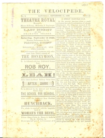
Newspaper, Untitled, The Velocipede, No 6, Saturday September 11, 1869, 11/9/1869 (exact)
... holloway...mcgowan...freyberger...theatre royal...john stout...grocer...h anderson...watchmaker...ballarat monster tea company...e meyers...bridge street...In September 1869 Velocipede Sports were held in Ballarat. tobacco holloway mcgowan freyberger theatre royal john stout grocer h anderson watchmaker ballarat monster tea company e meyers bridge street tea company g whitty george e jones r benney r wane colonial fruit and provision company david thomas butcher john buckle tailor w e jones london house j wheeler j williams bluchers central tea company pinnick and twycross london dye works west end venetian bliand manufactory james allinson saddler wilmot oakey s self balancing bycycles j walker james bull h glenny photographer jardine and quinn t carrick r lewis j pullin velocipede W Chalmers Chalmers bicycle Stamped 'W.G. ...A velocipede is a human-powered land vehicle with one or more wheels. Today the bicycle is the most common type of velocipede. In September 1869 Velocipede Sports were held in Ballarat. Four page printed newspaper with an articles including 'A Great Earthquake' [Lisbon 1755) and 'To My Pipe'. Includes numerous advertisements relating to Ballarat businesses.Stamped 'W.G. Chalmers"tobacco, holloway, mcgowan, freyberger, theatre royal, john stout, grocer, h anderson, watchmaker, ballarat monster tea company, e meyers, bridge street tea company, g whitty, george e jones, r benney, r wane, colonial fruit and provision company, david thomas, butcher, john buckle, tailor, w e jones, london house, j wheeler, j williams, bluchers, central tea company, pinnick and twycross, london dye works, west end venetian bliand manufactory, james allinson, saddler, wilmot oakey s self balancing bycycles, j walker, james bull, h glenny, photographer, jardine and quinn, t carrick, r lewis, j pullin, velocipede, w chalmers, chalmers, bicycle -
Federation University Historical Collection
Documents, Frank Pinkerton Printer and Stationer, Ballaarat Mechanics' Institute Fine Arts Exhibition 1876 Catalogue (copy), 1876
... street...c.i. burrows...j. mcdowall...thomas bath...d. book...w.q. pinnell...charles boyd...eureka stockade pike...j. holloway...fine arts exhibition ballarat mechanics' institute john ware j.w> hines a.t. turner a.m. greefield j. rice w.h. batten j. curtis a.j. boulton alex hunter w. hambly a.m. greenfield t. walton henry brind henry richards caselli isaac davis d. brophy g. willetts w.b. tappin henry sutton w. elsden julius hogarth w. weire a.l. gatliff gordon a. thomson r.s. brown h. blomfield w.r. gunn c.k. pearson w.k. watts george herbert james south b.w. wheatland c. humphreys h. weeks h. dowling j. munro j. price f. mitchell t.h. thompson p. windmiller j. reid e. towl h. wheeler robert brown l. blair r.m. serjeant j.m. fisher e. uren j. gatliff john harrison william street c.i. burrows j. mcdowall thomas bath d. book w.q. pinnell charles boyd eureka stockade pike j. holloway frank pinkerton Copy of a twenty page art exhibition catalogue Ballaarat Mechanics' Institute Fine Arts Exhibition 1876 Catalogue (copy) Documents Frank Pinkerton Printer and Stationer ...Copy of a twenty page art exhibition catalogue fine arts exhibition, ballarat mechanics' institute, john ware, j.w> hines, a.t. turner, a.m. greefield, j. rice, w.h. batten, j. curtis, a.j. boulton, alex hunter, w. hambly, a.m. greenfield, t. walton, henry brind, henry richards caselli, isaac davis, d. brophy, g. willetts, w.b. tappin, henry sutton, w. elsden, julius hogarth, w. weire, a.l. gatliff, gordon a. thomson, r.s. brown, h. blomfield, w.r. gunn, c.k. pearson, w.k. watts, george herbert, james south, b.w. wheatland, c. humphreys, h. weeks, h. dowling, j. munro, j. price, f. mitchell, t.h. thompson, p. windmiller, j. reid, e. towl, h. wheeler, robert brown, l. blair, r.m. serjeant, j.m. fisher, e. uren, j. gatliff, john harrison, william street, c.i. burrows, j. mcdowall, thomas bath, d. book, w.q. pinnell, charles boyd, eureka stockade pike, j. holloway, frank pinkerton -
 Eltham District Historical Society Inc
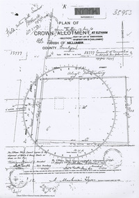
Document - Photocopy, Survey Field Notes of Part of Crown Portion 13, Section 4 at Eltham, Part of Lot 19 Subdivision of 13 Section IV (Holloways), Parish of Nillumbik, County of Evelyn, 5 May 1906
... Mackensie Tyers, Licensed Surveyor, 5 May 1906 Map Neil Webster Collection Survey Plan Surveyor Field Notes 1906 Application 33777 Application 35953 henry street Main Road Eltham Maria Street Rechabite Hall* A3 printouts, 2 pages Survey Field Notes of Part of Crown Portion 13, Section 4 at Eltham, Part of Lot 19 Subdivision of 13 Section IV (Holloways), Parish of Nillumbik, County of Evelyn Document Photocopy ...Portion of land bounded by: Main Road, Henry Street Application 35953 A. Mackensie Tyers, Licensed Surveyor, 5 May 1906map, neil webster collection, survey plan, surveyor field notes, 1906, application 33777, application 35953, henry street, main road eltham, maria street, rechabite hall* -
 Eltham District Historical Society Inc
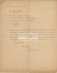
Document, Conveyance of Lot 20 Henry Street, Little Eltham North to Trustees of Wesleyan Chapel, 1856
... street...i.w. lucas...james blanch...james chapman...james william brown...john jenkins peacock...john jones...john neale...john van mangerhoussen weiss...joseph cooper...joseph morris holloway...Traces the earliest history of the Eltham Public Hall in Henry Street and the various names, occupations and abodes of the Trustees associated with the property aaron grimshaw blacksmith edmond perry eltham public hall eltham rechabite hall eltham wesleyan chapel francis thomas george smith henry street i.w. lucas james blanch james chapman james william brown john jenkins peacock john jones john neale john van mangerhoussen weiss joseph cooper joseph morris holloway josiah atwool keelbundora lancelot iredale little eltham lizar elliott mark blanchard methodist church nicholas rodda p. mather peter dredge rev barnabas shaw walker samuel jeffrey samuel moor munce thomas roberts thomas wheaten bowden william harriman william hebblewhite william john munce william matthews william rose 7 pages typed, letter size Conveyance of Lot 20 Henry Street, Little Eltham North to Trustees of Wesleyan Chapel Document ...Originally purchased in 1856 from Thomas Roberts, Yeoman of Little Eltham, for £10 for use by the Wesleyan Chapel, represented by indentured Trustees, Rev. Barnabas Shaw Walker, Minister of the Pentridge Circuit, Francis Thomas, Farmer of Keelbundora, William Harriman, Blacksmith of Nillumbik, Nicholas Rodda, Farmer of Nillumbik, Aaron Grimshaw, Farmer of Greensborough, Joseph Cooper, Gardener of Keelbundora, Peter Dredge, Scholmaster of Jika Jika and Samuel Jeffrey, Farmer of Jika Jika. Lot 20 of Subdivision of Portion 13, Section 4 of the Parish of Nillumbik in the County of Evelyn was located on the southern side of Henry street in Little Eltham North, where the current Our Lady Help of Christians Catholic Church is situated. It became the location of the Eltham Rechabite Hall. In 1893 a new hall was built and further enlarged in 1919. At the commencement of 1922, the property was purchased from the Independent Order of Rechabites with publicly subscribed funds and a new hall built at a cost of £750 and improved road access constructed to reduce the grade, running from Dudley Street to Henry Street. This hall was eventually replaced with the new Shire Offices and Hall built on the corner of Arthur Street and Main Road, which was opened in 1941. Traces the earliest history of the Eltham Public Hall in Henry Street and the various names, occupations and abodes of the Trustees associated with the propertyaaron grimshaw, blacksmith, edmond perry, eltham public hall, eltham rechabite hall, eltham wesleyan chapel, francis thomas, george smith, henry street, i.w. lucas, james blanch, james chapman, james william brown, john jenkins peacock, john jones, john neale, john van mangerhoussen weiss, joseph cooper, joseph morris holloway, josiah atwool, keelbundora, lancelot iredale, little eltham, lizar elliott, mark blanchard, methodist church, nicholas rodda, p. mather, peter dredge, rev barnabas shaw walker, samuel jeffrey, samuel moor munce, thomas roberts, thomas wheaten bowden, william harriman, william hebblewhite, william john munce, william matthews, william rose -
 Eltham District Historical Society Inc
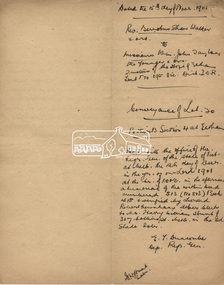
Document, Certificate of Consent of Sale of Lot 20 Henry Street, Eltham to Hope of Eltham Tent No. 195 Victoria District Independent Order of Rechabites, 28 Nov 1901
... street...hope of eltham tent no. 195...i.w. lucas...isaac hill...james blanch...james chapman...james william brown...john brown...john jenkins peacock...john jones...john neale...john van mangerhoussen weiss...joseph cooper...joseph morris holloway...Traces the earliest history of the Eltham Public Hall in Henry Street and the various names, occupations and abodes of the Trustees associated with the property aaron grimshaw blacksmith edmond perry eltham public hall eltham rechabite hall eltham wesleyan chapel francis thomas george knapman george smith henry street hope of eltham tent no. 195 i.w. lucas isaac hill james blanch james chapman james william brown john brown john jenkins peacock john jones john neale john van mangerhoussen weiss joseph cooper joseph morris holloway josiah atwool keelbundora lancelot iredale little eltham little eltham north lizar elliott mark blanchard methodist church nicholas rodda p. mather peter dredge rev barnabas shaw walker robert david taylor samuel jeffrey samuel moor munce thomas roberts thomas wheaten bowden trustee victoria district independent order of rechabites wesleyan methodist church william harriman william hebblewhite william john munce william john taylor william matthews william rose 6 pages typed, letter size, one with hand written description on reverse Certificate of Consent of Sale of Lot 20 Henry Street, Eltham to Hope of Eltham Tent No. 195 Victoria District Independent Order of Rechabites Document ...Alexander Robert Edgar, President of the Victoria and Tasmania Conference of the Wesleyan Methodist Church by Certificate of Consent of Sale dated 28 November 1901, declared that the Conference of the Church held in Melbourne, 27 February 1894, agreed to the sale by the Trustees of Lot 20 Henry Street. Indenture dated 15 November 1901 between Revd. Barnabas Shaw Walker, Minister of the Pentridge Circuit, Joseph Cooper, Gardener of Keelbundora, Samuel Jeffrey, Farmer of Jika Jika, John Brown, State School Teacher, Robert David Taylor, Gardener and Isaac Hill, Dealer, all of Eltham, the Trustees conveyed the land to William John Taylor the Younger, Gardener, George Knapman, Blacksmith and Isaac Hill junior, Carrier, all of Eltham and Trustees at the time for a Friendly Society known as the Hope of Eltham Tent No. 195 Victoria District Independent Order of Rechabites for the sum of £40. The conveyance was received into the Office of the Registrar General, State of Victoria, 12 December 1901. Originally purchased in 1856 from Thomas Roberts, Yeoman of Little Eltham, for £10 for use by the Wesleyan Chapel, represented by indentured Trustees, Rev. Barnabas Shaw Walker, Minister of the Pentridge Circuit, Francis Thomas, Farmer of Keelbundora, William Harriman, Blacksmith of Nillumbik, Nicholas Rodda, Farmer of Nillumbik, Aaron Grimshaw, Farmer of Greensborough, Joseph Cooper, Gardener of Keelbundora, Peter Dredge, Scholmaster of Jika Jika and Samuel Jeffrey, Farmer of Jika Jika. Lot 20 of Subdivision of Portion 13, Section 4 of the Parish of Nillumbik in the County of Evelyn was located on the southern side of Henry street in Little Eltham North, where the current Our Lady Help of Christians Catholic Church is situated. It became the location of the Eltham Rechabite Hall. In 1893 a new hall was built and further enlarged in 1919. At the commencement of 1922, the property was purchased from the Independent Order of Rechabites with publicly subscribed funds and a new hall built at a cost of £750 and improved road access constructed to reduce the grade, running from Dudley Street to Henry Street. This hall was eventually replaced with the new Shire Offices and Hall built on the corner of Arthur Street and Main Road, which was opened in 1941. Traces the earliest history of the Eltham Public Hall in Henry Street and the various names, occupations and abodes of the Trustees associated with the propertyaaron grimshaw, blacksmith, edmond perry, eltham public hall, eltham rechabite hall, eltham wesleyan chapel, francis thomas, george knapman, george smith, henry street, hope of eltham tent no. 195, i.w. lucas, isaac hill, james blanch, james chapman, james william brown, john brown, john jenkins peacock, john jones, john neale, john van mangerhoussen weiss, joseph cooper, joseph morris holloway, josiah atwool, keelbundora, lancelot iredale, little eltham, little eltham north, lizar elliott, mark blanchard, methodist church, nicholas rodda, p. mather, peter dredge, rev barnabas shaw walker, robert david taylor, samuel jeffrey, samuel moor munce, thomas roberts, thomas wheaten bowden, trustee, victoria district independent order of rechabites, wesleyan methodist church, william harriman, william hebblewhite, william john munce, william john taylor, william matthews, william rose -
![Photograph - Colour Print, Harry Gilham [Attrib.], Living and Learning Centre, Main Road, Eltham, Aug 1988](/media/collectors/4f729f7b97f83e03086018a5/items/6a1ccb54e43e4200865b4676/item-media/6a1ccbd3e43e4200865b58ed/item-fit-380x285.jpg?cb=6) Eltham District Historical Society Inc
Eltham District Historical Society IncPhotograph - Colour Print, Harry Gilham [Attrib.], Living and Learning Centre, Main Road, Eltham, Aug 1988
... A detailed history of the site and early development of the Eltham Living and Learning Centre can be found in EDHS_04870 - Folder, Shire of Eltham Living and Learning Centre, 1996 The original property was part of Josiah Holloways subdivision of Little Eltham. It had a 70 foot frontage to Maria Street and stretched down to the Diamond Creek. ...A detailed history of the site and early development of the Eltham Living and Learning Centre can be found in EDHS_04870 - Folder, Shire of Eltham Living and Learning Centre, 1996 The original property was part of Josiah Holloways subdivision of Little Eltham. It had a 70 foot frontage to Maria Street and stretched down to the Diamond Creek. ...North face of house viewed from the current (1990) pottery area (now pathed) The kitchen was separate from the house as a safety measure in the late 1800s. A detailed history of the site and early development of the Eltham Living and Learning Centre can be found in EDHS_04870 - Folder, Shire of Eltham Living and Learning Centre, 1996 The original property was part of Josiah Holloways subdivision of Little Eltham. It had a 70 foot frontage to Maria Street and stretched down to the Diamond Creek. John Perason, a Tanner, purchased the property in 1857 for £100 and he built a solid brick house which over the years was modified significantly by various owners and which is the basis of the present-day Living and Learning Centre. Claire Fitzpatrick and her husband Alfred, a retired chemical engineer, bought it in the early 1950's. Claire's interest in farming and animal husbandry and breeding saw her modify and establish buildings on the property to house goats and poultry with a horse stable and storage sheds for the animal food. She also built the coach house with its horse box and tack room and built an adjoining garage for their car. Structural alterations to the house were also carried out during the period of their ownership. Their house renovations removed the four fireplaces and chimneys and added a wider verandah, a fibro cement extension on the north wall requiring a doorway to be made in the brick wall for access. Part of a passage wall was removed to join the northwest room, now the "sitting room". A new jarrah floor was put in as the old one was rotten with borer. The verandahs, front and back, were re-organised in design and the front door had its leadlighting panels removed to allow more light into the house. During this period the water catchment well was filled in. This well had a concrete slab fitted onto a collar around its top. The well is 12 feet deep and 8 feet in diameter. Septic sewerage was installed and an internal toilet fitted in the house. The former northeast room was divided into bathroom/toilet and passageway with cupboards to access the extension. Kitchen stove and sink was removed (they fell apart) and a slow-combustion stove with hot water heater installed. Basins and hot water were connected to the new bathroom. In the early 1970s Eltham Shire Council, Councillors Frank Maas and Don Maling, were proposing an extended communities activities program be set up and the Commonwealth Grants Commission was approached for financial assistance to such a scheme. During 1974 a $50,000 Commonwealth Government grant was received by the Shire Council to acquire the Fitzpatrick property as part of the Shire's planning to establish an "extended community activities program". Council's Committee recommended an annual budget of $26,950 for the program and the project was named the Living and Learning Centre and in charge of the program was the first co-ordinator, Carina Hack. The activities were planned to cover "practical skills for living" and included cooking, preserving, gardening, animal husbandry, home economics, electronics, carpentry, hairdressing, making children's clothes and car maintenance. Hobbies and arts and crafts that would include amongst other future items, winemaking, music spinning and weaving and painting. 739 main road eltham, eltham living and learning centre, living and learning centre, living and learning nillumbik (eltham), main road eltham -
 Eltham District Historical Society Inc
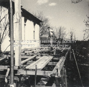
Photograph - Black and White Print, Widening of the verandah of 'Rosebank,' now Living and Learning Centre, Main Road, Eltham, c.1965
... A detailed history of the site and early development of the Eltham Living and Learning Centre can be found in EDHS_04870 - Folder, Shire of Eltham Living and Learning Centre, 1996 The original property was part of Josiah Holloways subdivision of Little Eltham. It had a 70 foot frontage to Maria Street and stretched down to the Diamond Creek. ...A detailed history of the site and early development of the Eltham Living and Learning Centre can be found in EDHS_04870 - Folder, Shire of Eltham Living and Learning Centre, 1996 The original property was part of Josiah Holloways subdivision of Little Eltham. It had a 70 foot frontage to Maria Street and stretched down to the Diamond Creek. ...Restructure of the front verandah of 'Rosebank' by widening, c.1965. It was glassed in at a later date. The west facing front verandah was widened and enclosed for additional class room use by the Living and Learning Centre. A detailed history of the site and early development of the Eltham Living and Learning Centre can be found in EDHS_04870 - Folder, Shire of Eltham Living and Learning Centre, 1996 The original property was part of Josiah Holloways subdivision of Little Eltham. It had a 70 foot frontage to Maria Street and stretched down to the Diamond Creek. John Perason, a Tanner, purchased the property in 1857 for £100 and he built a solid brick house which over the years was modified significantly by various owners and which is the basis of the present-day Living and Learning Centre. Claire Fitzpatrick and her husband Alfred, a retired chemical engineer, bought it in the early 1950's. Claire's interest in farming and animal husbandry and breeding saw her modify and establish buildings on the property to house goats and poultry with a horse stable and storage sheds for the animal food. She also built the coach house with its horse box and tack room and built an adjoining garage for their car. Structural alterations to the house were also carried out during the period of their ownership. Their house renovations removed the four fireplaces and chimneys and added a wider verandah, a fibro cement extension on the north wall requiring a doorway to be made in the brick wall for access. Part of a passage wall was removed to join the northwest room, now the "sitting room". A new jarrah floor was put in as the old one was rotten with borer. The verandahs, front and back, were re-organised in design and the front door had its leadlighting panels removed to allow more light into the house. During this period the water catchment well was filled in. This well had a concrete slab fitted onto a collar around its top. The well is 12 feet deep and 8 feet in diameter. Septic sewerage was installed and an internal toilet fitted in the house. The former northeast room was divided into bathroom/toilet and passageway with cupboards to access the extension. Kitchen stove and sink was removed (they fell apart) and a slow-combustion stove with hot water heater installed. Basins and hot water were connected to the new bathroom. In the early 1970s Eltham Shire Council, Councillors Frank Maas and Don Maling, were proposing an extended communities activities program be set up and the Commonwealth Grants Commission was approached for financial assistance to such a scheme. During 1974 a $50,000 Commonwealth Government grant was received by the Shire Council to acquire the Fitzpatrick property as part of the Shire's planning to establish an "extended community activities program". Council's Committee recommended an annual budget of $26,950 for the program and the project was named the Living and Learning Centre and in charge of the program was the first co-ordinator, Carina Hack. The activities were planned to cover "practical skills for living" and included cooking, preserving, gardening, animal husbandry, home economics, electronics, carpentry, hairdressing, making children's clothes and car maintenance. Hobbies and arts and crafts that would include amongst other future items, winemaking, music spinning and weaving and painting. 739 main road eltham, eltham living and learning centre, living and learning centre, living and learning nillumbik (eltham), main road eltham -
![Photograph - Colour Print, Harry Gilham [Attrib.], Living and Learning Centre, Main Road, Eltham, c.1988](/media/collectors/4f729f7b97f83e03086018a5/items/6a1cdaf8e43e4200865c849d/item-media/6a1cdb13e43e4200865c85b6/item-fit-380x285.jpg?cb=6) Eltham District Historical Society Inc
Eltham District Historical Society IncPhotograph - Colour Print, Harry Gilham [Attrib.], Living and Learning Centre, Main Road, Eltham, c.1988
... The 'back door' which faced the Main Road entrance to the office, Eltham Living and Learning Centre, herb garden at its peak, late 1980s A detailed history of the site and early development of the Eltham Living and Learning Centre can be found in EDHS_04870 - Folder, Shire of Eltham Living and Learning Centre, 1996 The original property was part of Josiah Holloways subdivision of Little Eltham. It had a 70 foot frontage to Maria Street and stretched down to the Diamond Creek. ...The 'back door' which faced the Main Road entrance to the office, Eltham Living and Learning Centre, herb garden at its peak, late 1980s A detailed history of the site and early development of the Eltham Living and Learning Centre can be found in EDHS_04870 - Folder, Shire of Eltham Living and Learning Centre, 1996 The original property was part of Josiah Holloways subdivision of Little Eltham. It had a 70 foot frontage to Maria Street and stretched down to the Diamond Creek. ...The 'back door' which faced the Main Road entrance to the office, Eltham Living and Learning Centre, herb garden at its peak, late 1980s A detailed history of the site and early development of the Eltham Living and Learning Centre can be found in EDHS_04870 - Folder, Shire of Eltham Living and Learning Centre, 1996 The original property was part of Josiah Holloways subdivision of Little Eltham. It had a 70 foot frontage to Maria Street and stretched down to the Diamond Creek. John Perason, a Tanner, purchased the property in 1857 for £100 and he built a solid brick house which over the years was modified significantly by various owners and which is the basis of the present-day Living and Learning Centre. Claire Fitzpatrick and her husband Alfred, a retired chemical engineer, bought it in the early 1950's. Claire's interest in farming and animal husbandry and breeding saw her modify and establish buildings on the property to house goats and poultry with a horse stable and storage sheds for the animal food. She also built the coach house with its horse box and tack room and built an adjoining garage for their car. Structural alterations to the house were also carried out during the period of their ownership. Their house renovations removed the four fireplaces and chimneys and added a wider verandah, a fibro cement extension on the north wall requiring a doorway to be made in the brick wall for access. Part of a passage wall was removed to join the northwest room, now the "sitting room". A new jarrah floor was put in as the old one was rotten with borer. The verandahs, front and back, were re-organised in design and the front door had its leadlighting panels removed to allow more light into the house. During this period the water catchment well was filled in. This well had a concrete slab fitted onto a collar around its top. The well is 12 feet deep and 8 feet in diameter. Septic sewerage was installed and an internal toilet fitted in the house. The former northeast room was divided into bathroom/toilet and passageway with cupboards to access the extension. Kitchen stove and sink was removed (they fell apart) and a slow-combustion stove with hot water heater installed. Basins and hot water were connected to the new bathroom. In the early 1970s Eltham Shire Council, Councillors Frank Maas and Don Maling, were proposing an extended communities activities program be set up and the Commonwealth Grants Commission was approached for financial assistance to such a scheme. During 1974 a $50,000 Commonwealth Government grant was received by the Shire Council to acquire the Fitzpatrick property as part of the Shire's planning to establish an "extended community activities program". Council's Committee recommended an annual budget of $26,950 for the program and the project was named the Living and Learning Centre and in charge of the program was the first co-ordinator, Carina Hack. The activities were planned to cover "practical skills for living" and included cooking, preserving, gardening, animal husbandry, home economics, electronics, carpentry, hairdressing, making children's clothes and car maintenance. Hobbies and arts and crafts that would include amongst other future items, winemaking, music spinning and weaving and painting. 739 main road eltham, eltham living and learning centre, living and learning centre, living and learning nillumbik (eltham), main road eltham -
![Photograph - Black and White Print, Harry Gilham [Attrib.], Living and Learning Centre, Main Road, Eltham, 1990](/media/collectors/4f729f7b97f83e03086018a5/items/6a1cdbffe43e4200865c95df/item-media/6a1cdc19e43e4200865c975d/item-fit-380x285.jpg?cb=6) Eltham District Historical Society Inc
Eltham District Historical Society IncPhotograph - Black and White Print, Harry Gilham [Attrib.], Living and Learning Centre, Main Road, Eltham, 1990
... The 'back door' which faced the Main Road entrance to the office, Eltham Living and Learning Centre - Shows original sandstone blocks in back verandah floor A detailed history of the site and early development of the Eltham Living and Learning Centre can be found in EDHS_04870 - Folder, Shire of Eltham Living and Learning Centre, 1996 The original property was part of Josiah Holloways subdivision of Little Eltham. It had a 70 foot frontage to Maria Street and stretched down to the Diamond Creek. ...The 'back door' which faced the Main Road entrance to the office, Eltham Living and Learning Centre - Shows original sandstone blocks in back verandah floor A detailed history of the site and early development of the Eltham Living and Learning Centre can be found in EDHS_04870 - Folder, Shire of Eltham Living and Learning Centre, 1996 The original property was part of Josiah Holloways subdivision of Little Eltham. It had a 70 foot frontage to Maria Street and stretched down to the Diamond Creek. ...The 'back door' which faced the Main Road entrance to the office, Eltham Living and Learning Centre - Shows original sandstone blocks in back verandah floor A detailed history of the site and early development of the Eltham Living and Learning Centre can be found in EDHS_04870 - Folder, Shire of Eltham Living and Learning Centre, 1996 The original property was part of Josiah Holloways subdivision of Little Eltham. It had a 70 foot frontage to Maria Street and stretched down to the Diamond Creek. John Perason, a Tanner, purchased the property in 1857 for £100 and he built a solid brick house which over the years was modified significantly by various owners and which is the basis of the present-day Living and Learning Centre. Claire Fitzpatrick and her husband Alfred, a retired chemical engineer, bought it in the early 1950's. Claire's interest in farming and animal husbandry and breeding saw her modify and establish buildings on the property to house goats and poultry with a horse stable and storage sheds for the animal food. She also built the coach house with its horse box and tack room and built an adjoining garage for their car. Structural alterations to the house were also carried out during the period of their ownership. Their house renovations removed the four fireplaces and chimneys and added a wider verandah, a fibro cement extension on the north wall requiring a doorway to be made in the brick wall for access. Part of a passage wall was removed to join the northwest room, now the "sitting room". A new jarrah floor was put in as the old one was rotten with borer. The verandahs, front and back, were re-organised in design and the front door had its leadlighting panels removed to allow more light into the house. During this period the water catchment well was filled in. This well had a concrete slab fitted onto a collar around its top. The well is 12 feet deep and 8 feet in diameter. Septic sewerage was installed and an internal toilet fitted in the house. The former northeast room was divided into bathroom/toilet and passageway with cupboards to access the extension. Kitchen stove and sink was removed (they fell apart) and a slow-combustion stove with hot water heater installed. Basins and hot water were connected to the new bathroom. In the early 1970s Eltham Shire Council, Councillors Frank Maas and Don Maling, were proposing an extended communities activities program be set up and the Commonwealth Grants Commission was approached for financial assistance to such a scheme. During 1974 a $50,000 Commonwealth Government grant was received by the Shire Council to acquire the Fitzpatrick property as part of the Shire's planning to establish an "extended community activities program". Council's Committee recommended an annual budget of $26,950 for the program and the project was named the Living and Learning Centre and in charge of the program was the first co-ordinator, Carina Hack. The activities were planned to cover "practical skills for living" and included cooking, preserving, gardening, animal husbandry, home economics, electronics, carpentry, hairdressing, making children's clothes and car maintenance. Hobbies and arts and crafts that would include amongst other future items, winemaking, music spinning and weaving and painting. 739 main road eltham, eltham living and learning centre, living and learning centre, living and learning nillumbik (eltham), main road eltham -
![Photograph - Black and White Print, Harry Gilham [Attrib.], Living and Learning Centre, Main Road, Eltham, c.1990](/media/collectors/4f729f7b97f83e03086018a5/items/6a1cddabe43e4200865cee41/item-media/6a1cddbbe43e4200865cf696/item-fit-380x285.jpg?cb=6) Eltham District Historical Society Inc
Eltham District Historical Society IncPhotograph - Black and White Print, Harry Gilham [Attrib.], Living and Learning Centre, Main Road, Eltham, c.1990
... A detailed history of the site and early development of the Eltham Living and Learning Centre can be found in EDHS_04870 - Folder, Shire of Eltham Living and Learning Centre, 1996 The original property was part of Josiah Holloways subdivision of Little Eltham. It had a 70 foot frontage to Maria Street and stretched down to the Diamond Creek. ...A detailed history of the site and early development of the Eltham Living and Learning Centre can be found in EDHS_04870 - Folder, Shire of Eltham Living and Learning Centre, 1996 The original property was part of Josiah Holloways subdivision of Little Eltham. It had a 70 foot frontage to Maria Street and stretched down to the Diamond Creek. ...Brick storage shed, south wall entry. This cool room, half set down in the soil still standing at time but with a more modern galvanised tin roof. A detailed history of the site and early development of the Eltham Living and Learning Centre can be found in EDHS_04870 - Folder, Shire of Eltham Living and Learning Centre, 1996 The original property was part of Josiah Holloways subdivision of Little Eltham. It had a 70 foot frontage to Maria Street and stretched down to the Diamond Creek. John Perason, a Tanner, purchased the property in 1857 for £100 and he built a solid brick house which over the years was modified significantly by various owners and which is the basis of the present-day Living and Learning Centre. Claire Fitzpatrick and her husband Alfred, a retired chemical engineer, bought it in the early 1950's. Claire's interest in farming and animal husbandry and breeding saw her modify and establish buildings on the property to house goats and poultry with a horse stable and storage sheds for the animal food. She also built the coach house with its horse box and tack room and built an adjoining garage for their car. Structural alterations to the house were also carried out during the period of their ownership. Their house renovations removed the four fireplaces and chimneys and added a wider verandah, a fibro cement extension on the north wall requiring a doorway to be made in the brick wall for access. Part of a passage wall was removed to join the northwest room, now the "sitting room". A new jarrah floor was put in as the old one was rotten with borer. The verandahs, front and back, were re-organised in design and the front door had its leadlighting panels removed to allow more light into the house. During this period the water catchment well was filled in. This well had a concrete slab fitted onto a collar around its top. The well is 12 feet deep and 8 feet in diameter. Septic sewerage was installed and an internal toilet fitted in the house. The former northeast room was divided into bathroom/toilet and passageway with cupboards to access the extension. Kitchen stove and sink was removed (they fell apart) and a slow-combustion stove with hot water heater installed. Basins and hot water were connected to the new bathroom. In the early 1970s Eltham Shire Council, Councillors Frank Maas and Don Maling, were proposing an extended communities activities program be set up and the Commonwealth Grants Commission was approached for financial assistance to such a scheme. During 1974 a $50,000 Commonwealth Government grant was received by the Shire Council to acquire the Fitzpatrick property as part of the Shire's planning to establish an "extended community activities program". Council's Committee recommended an annual budget of $26,950 for the program and the project was named the Living and Learning Centre and in charge of the program was the first co-ordinator, Carina Hack. The activities were planned to cover "practical skills for living" and included cooking, preserving, gardening, animal husbandry, home economics, electronics, carpentry, hairdressing, making children's clothes and car maintenance. Hobbies and arts and crafts that would include amongst other future items, winemaking, music spinning and weaving and painting. 739 main road eltham, eltham living and learning centre, living and learning centre, living and learning nillumbik (eltham), main road eltham -
![Photograph - Colour Print, Harry Gilham [Attrib.], Living and Learning Centre, Main Road, Eltham, 1995](/media/collectors/4f729f7b97f83e03086018a5/items/6a1cde5de43e4200865d0c81/item-media/6a1cde8be43e4200865d1127/item-fit-380x285.jpg?cb=6) Eltham District Historical Society Inc
Eltham District Historical Society IncPhotograph - Colour Print, Harry Gilham [Attrib.], Living and Learning Centre, Main Road, Eltham, 1995
... Grass area needs a mow - verandah with repainted stool/forms - early spring 1995 A detailed history of the site and early development of the Eltham Living and Learning Centre can be found in EDHS_04870 - Folder, Shire of Eltham Living and Learning Centre, 1996 The original property was part of Josiah Holloways subdivision of Little Eltham. It had a 70 foot frontage to Maria Street and stretched down to the Diamond Creek. ...Grass area needs a mow - verandah with repainted stool/forms - early spring 1995 A detailed history of the site and early development of the Eltham Living and Learning Centre can be found in EDHS_04870 - Folder, Shire of Eltham Living and Learning Centre, 1996 The original property was part of Josiah Holloways subdivision of Little Eltham. It had a 70 foot frontage to Maria Street and stretched down to the Diamond Creek. ...New Pavilion at left has plants appearing. Grass area needs a mow - verandah with repainted stool/forms - early spring 1995 A detailed history of the site and early development of the Eltham Living and Learning Centre can be found in EDHS_04870 - Folder, Shire of Eltham Living and Learning Centre, 1996 The original property was part of Josiah Holloways subdivision of Little Eltham. It had a 70 foot frontage to Maria Street and stretched down to the Diamond Creek. John Perason, a Tanner, purchased the property in 1857 for £100 and he built a solid brick house which over the years was modified significantly by various owners and which is the basis of the present-day Living and Learning Centre. Claire Fitzpatrick and her husband Alfred, a retired chemical engineer, bought it in the early 1950's. Claire's interest in farming and animal husbandry and breeding saw her modify and establish buildings on the property to house goats and poultry with a horse stable and storage sheds for the animal food. She also built the coach house with its horse box and tack room and built an adjoining garage for their car. Structural alterations to the house were also carried out during the period of their ownership. Their house renovations removed the four fireplaces and chimneys and added a wider verandah, a fibro cement extension on the north wall requiring a doorway to be made in the brick wall for access. Part of a passage wall was removed to join the northwest room, now the "sitting room". A new jarrah floor was put in as the old one was rotten with borer. The verandahs, front and back, were re-organised in design and the front door had its leadlighting panels removed to allow more light into the house. During this period the water catchment well was filled in. This well had a concrete slab fitted onto a collar around its top. The well is 12 feet deep and 8 feet in diameter. Septic sewerage was installed and an internal toilet fitted in the house. The former northeast room was divided into bathroom/toilet and passageway with cupboards to access the extension. Kitchen stove and sink was removed (they fell apart) and a slow-combustion stove with hot water heater installed. Basins and hot water were connected to the new bathroom. In the early 1970s Eltham Shire Council, Councillors Frank Maas and Don Maling, were proposing an extended communities activities program be set up and the Commonwealth Grants Commission was approached for financial assistance to such a scheme. During 1974 a $50,000 Commonwealth Government grant was received by the Shire Council to acquire the Fitzpatrick property as part of the Shire's planning to establish an "extended community activities program". Council's Committee recommended an annual budget of $26,950 for the program and the project was named the Living and Learning Centre and in charge of the program was the first co-ordinator, Carina Hack. The activities were planned to cover "practical skills for living" and included cooking, preserving, gardening, animal husbandry, home economics, electronics, carpentry, hairdressing, making children's clothes and car maintenance. Hobbies and arts and crafts that would include amongst other future items, winemaking, music spinning and weaving and painting. 739 main road eltham, eltham living and learning centre, living and learning centre, living and learning nillumbik (eltham), main road eltham -
![Photograph - Colour Print, Harry Gilham [Attrib.], Living and Learning Centre, Main Road, Eltham, 1995](/media/collectors/4f729f7b97f83e03086018a5/items/6a1cdf36e43e4200865d43d6/item-media/6a1cdf50e43e4200865d4778/item-fit-380x285.jpg?cb=6) Eltham District Historical Society Inc
Eltham District Historical Society IncPhotograph - Colour Print, Harry Gilham [Attrib.], Living and Learning Centre, Main Road, Eltham, 1995
... A detailed history of the site and early development of the Eltham Living and Learning Centre can be found in EDHS_04870 - Folder, Shire of Eltham Living and Learning Centre, 1996 The original property was part of Josiah Holloways subdivision of Little Eltham. It had a 70 foot frontage to Maria Street and stretched down to the Diamond Creek. ...A detailed history of the site and early development of the Eltham Living and Learning Centre can be found in EDHS_04870 - Folder, Shire of Eltham Living and Learning Centre, 1996 The original property was part of Josiah Holloways subdivision of Little Eltham. It had a 70 foot frontage to Maria Street and stretched down to the Diamond Creek. ...New verandah Eltham Living and Learning Centre on the western face looking down over the Tannery site and Diamond Creek. Pavilion in place (LH Side). The verandah with its upgrade of curtains 1995. Originally 4 feet 6 inches wide. A detailed history of the site and early development of the Eltham Living and Learning Centre can be found in EDHS_04870 - Folder, Shire of Eltham Living and Learning Centre, 1996 The original property was part of Josiah Holloways subdivision of Little Eltham. It had a 70 foot frontage to Maria Street and stretched down to the Diamond Creek. John Perason, a Tanner, purchased the property in 1857 for £100 and he built a solid brick house which over the years was modified significantly by various owners and which is the basis of the present-day Living and Learning Centre. Claire Fitzpatrick and her husband Alfred, a retired chemical engineer, bought it in the early 1950's. Claire's interest in farming and animal husbandry and breeding saw her modify and establish buildings on the property to house goats and poultry with a horse stable and storage sheds for the animal food. She also built the coach house with its horse box and tack room and built an adjoining garage for their car. Structural alterations to the house were also carried out during the period of their ownership. Their house renovations removed the four fireplaces and chimneys and added a wider verandah, a fibro cement extension on the north wall requiring a doorway to be made in the brick wall for access. Part of a passage wall was removed to join the northwest room, now the "sitting room". A new jarrah floor was put in as the old one was rotten with borer. The verandahs, front and back, were re-organised in design and the front door had its leadlighting panels removed to allow more light into the house. During this period the water catchment well was filled in. This well had a concrete slab fitted onto a collar around its top. The well is 12 feet deep and 8 feet in diameter. Septic sewerage was installed and an internal toilet fitted in the house. The former northeast room was divided into bathroom/toilet and passageway with cupboards to access the extension. Kitchen stove and sink was removed (they fell apart) and a slow-combustion stove with hot water heater installed. Basins and hot water were connected to the new bathroom. In the early 1970s Eltham Shire Council, Councillors Frank Maas and Don Maling, were proposing an extended communities activities program be set up and the Commonwealth Grants Commission was approached for financial assistance to such a scheme. During 1974 a $50,000 Commonwealth Government grant was received by the Shire Council to acquire the Fitzpatrick property as part of the Shire's planning to establish an "extended community activities program". Council's Committee recommended an annual budget of $26,950 for the program and the project was named the Living and Learning Centre and in charge of the program was the first co-ordinator, Carina Hack. The activities were planned to cover "practical skills for living" and included cooking, preserving, gardening, animal husbandry, home economics, electronics, carpentry, hairdressing, making children's clothes and car maintenance. Hobbies and arts and crafts that would include amongst other future items, winemaking, music spinning and weaving and painting. 739 main road eltham, eltham living and learning centre, living and learning centre, living and learning nillumbik (eltham), main road eltham -
Glen Eira Historical Society
Document - Sarsfield, Blanche Street, 19, Elsternwick
... Street... Elsternwick... Holloway...Historical Buildings Sarsfield Blanche Street Elsternwick Holloway J.M. Langdon Henry J. Beemery Park Rose Craddock Langdon Blanche Bardwell Everett Wynne Edwin P. ...Copy of typed document on this history and owners from 1851 to 1989 researched by Brighton Historical Society dated 09 March 1990. Handwritten notes reference to typed document regarding the owners of Sarsfield 19 Blanche Street Elsternwick.historical buildings, sarsfield, blanche street, elsternwick, holloway j.m., langdon henry j., beemery park, rose craddock, langdon blanche, bardwell everett, wynne edwin p., mcrorie william, mcrorie and co., healy j.d., healy eugene, holland ernest, holland e. w., coutts k.d., bullock hilary, landells rosalind, hocking stuart real estate agents, glenhuntly road, land division, place name, house names -
Glen Eira Historical Society
Letter - Ormond Baptist Church
... Street... Lillimur Road... Foundation Stone... Smith A.E. Rev.... Warner L.E.... Architects... Firth R.... Builders... Peterson R.H.... Lord’s Real Estate... Fullard Charles... Ormond... Glenhuntly... Glen Huntly... McDonald S.A. Rev.... Elsternwick... McKinnon... Ellingworth W.H.G.... Home Missionary Society... Elsternwick Baptist Church... Fullard C.... Fullard Mrs.... Youl W.E.... Youl Mrs.... Lever J.... Lever Mrs.... Lowry Miss... Gollan I. Miss... Bowcher Miss... Douse Mr.... Douse Mrs.... Brooks Mrs.... Brooks J.... Glenhuntly State School... Lillimur Road... Probert E.... Sunday Schools... Drummond A.... Drummond Mrs.... Ratcliff W.H.... Holloway...Street Lillimur Road Foundation Stone Smith A.E. Rev. Warner L.E. Architects Firth R. Builders Peterson R.H. Lord’s Real Estate Fullard Charles Ormond Glenhuntly Glen Huntly McDonald S.A. Rev. Elsternwick McKinnon Ellingworth W.H.G. Home Missionary Society Elsternwick Baptist Church Fullard C. Fullard Mrs. Youl W.E. Youl Mrs. Lever J. Lever Mrs. Lowry Miss Gollan I. Miss Bowcher Miss Douse Mr. Douse Mrs. Brooks Mrs. Brooks J. Glenhuntly State School Lillimur Road Probert E. Sunday Schools Drummond A. Drummond Mrs. Ratcliff W.H. Holloway ...Handwritten article by unknown author with church foundation stone inscription details, correspondence to Mr. Wells dated 23/07/1977 from Deacon Peterson regarding enclosed copy of Ormond Baptist Church history. Two real estate articles, including sketch, of property for forthcoming availability to lease property dated 22/04/2003 and 15/12/2003.ormond baptist church, walsh street, lillimur road, foundation stone, smith a.e. rev., warner l.e., architects, firth r., builders, peterson r.h., lord’s real estate, fullard charles, ormond, glenhuntly, glen huntly, mcdonald s.a. rev., elsternwick, mckinnon, ellingworth w.h.g., home missionary society, elsternwick baptist church, fullard c., fullard mrs., youl w.e., youl mrs., lever j., lever mrs., lowry miss, gollan i. miss, bowcher miss, douse mr., douse mrs., brooks mrs., brooks j., glenhuntly state school, lillimur road, probert e., sunday schools, drummond a., drummond mrs., ratcliff w.h., holloway w.h., bungey e. rev., cross w. rev., bentleigh church, hinton w.h. rev., collard w. rev., whitbourn l.j. rev., donaldson street, mckinnon, wells mr., peterson rev., north road, lord john, lord’s, estate agents -
 Eltham District Historical Society Inc
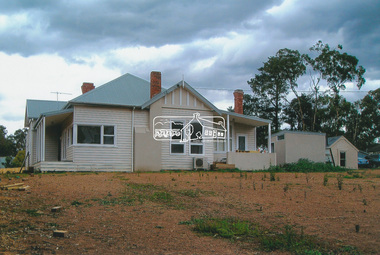
Photograph - Colour Print, Belle Vue, Livingstone Road, Eltham, c.2015
... Holloway’s 1851 Little Eltham subdivision. On the present day map the southern boundary was just north of Elsa Court and Grove Street. ...Holloway’s 1851 Little Eltham subdivision. On the present day map the southern boundary was just north of Elsa Court and Grove Street. ...Belle Vue property in Livingstone Road, Eltham was once owned by Society member Jo McCormick. Jo was a valued member of our committee and dear friend of many of our members until her death in 2009. Belle Vue is the farmhouse of a property that is now a significant part of suburban Eltham, just a short distance north of the town centre. Originally purchased by pioneer Eltham farmer Henry Stooke, the present-day old farmhouse sits within an extensive suburban residential area. The history of the property is largely based on a heritage assessment prepared by consultant Lorraine Huddle for Nillumbik Shire Council. Additional information from our Society records reveals Belle Vue farm comprised about 56 ha (140 acres) extending northerly from the northern boundary of Holloway’s 1851 Little Eltham subdivision. On the present day map the southern boundary was just north of Elsa Court and Grove Street. The western boundary was the Diamond Creek and extended northerly to Main Road where it turns easterly towards Research. It was traversed by the main road to Kangaroo Ground and beyond and from 1912 by the railway to Hurstbridge. From 1895 the farm was owned by William Williams and his wife Mary Ann. In 1914 -15 they built a new house now known as Belle Vue. They sold the land in 1920 and residential subdivision began soon after that. Belle Vue remains today on a substantially subdivided and very much reduced size residential lot in Livingstone Road. The house and many old trees on the site were subject to a heritage overlay under the Nillumbik Planning Scheme. Despite that overlay, the development and subdivision of the original land resulted in most of the heritage listed trees being removed. belle vue, eltham, livingstone road -
 Eltham District Historical Society Inc
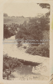
Postcard - Photograph postcard, Old Bridge, Kaylock's Crossing, Brougham Street, Eltham, c.1912
... t=115) Brougham Street was created in Josiah Holloway's 1851 subdivision of Little Eltham. ...t=115) Brougham Street was created in Josiah Holloway's 1851 subdivision of Little Eltham. ...Date estimated to be circa 1912 based on the style of printing on the reverse of the card - Kodak Austral paper for real photo postcards, the paper was manufactured c.1908-1914 (See also POSTCARDS ON KODAK PAPER - IS IT POSSIBLE TO "DATE" THEM? http://tps.org.au/bb/viewtopic.php?t=115) Brougham Street was created in Josiah Holloway's 1851 subdivision of Little Eltham. It was one of several east-west streets shown on the subdivision plan as crossing the Diamond Creek. The western part was named Wellington Street on the subdivision plan but was later changed to conform with the name of the eastern part as acknowledgement of the continuity of the street. It is not known when the first bridge was constructed in Brougham Street however it was certainly mentioned at Council’s meeting of 2 June 1884 as being in a dangerous state of repair. This photo (c.1895) of an old bridge shows a very low-level simple log girder bridge crossing the creek at a right angle and so the approaches involved bends in the road alignment. This bridge was generally known as Kaylocks Bridge or Kaylock’s Crossing after the owner of the adjoining land. It was most likely built from around the mid-1850s, or a crossing of some fashion established as Richard George Kaylock, butcher of Little Eltham and his wife Emily Ann settled there in 1854. His property was in Wellington Street (now Brougham Street) and apparently extended across the Diamond Creek. The land on the western side of the creek was farmed, the house being on the eastern side. Kaylock's Bridge formed part of the original coach road to Eltham and in 1922 was described as an "old rustic bridge". Its low level and insubstantial construction made it susceptible to flood damage, necessitating frequent closures until repairs could be carried out. In September 1922, Council called for tenders for a new timber bridge to be constructed at Kaylock’s crossing. An engineering assessment carried out for the Council by Macleod Consulting at the time of the replacement suggested that the construction details indicate that it was in the 1900s, however this dating could possibly have been the result of numerous repairs undertaken over the years to flood damage. The tender was awarded to Mr Weller of Kangaroo Ground who commenced work in February 1923 on a higher-level timber trestle bridge. Work was slowed due to illness of the contractor and the accidental death of a man in March 1923 following the collapse of the bank after he had jumped into a hole that had just been blasted. The bridge was completed around July 1923 at which point the old structure was pulled up, marking what was described in the ‘Advertiser’ newspaper as the passing of an old and well-loved landmark in the district. In April 1924 the approach to Kaylocks bridge was washed away during the heavy flooding that destroyed the Main Road bridge. The western side was repaired, and an extra span was added to the eastern side using timber from the destroyed Main Road bridge. The bridge was again severely damaged four months later in August 1924 When a lack of finances delayed repairs to the Bridge Street bridge in 1931 (also referred to as Obelisk Bridge at the time), traffic had to detour via Brougham Street for some time. Local residents feared that the Bridge Street bridge might never reopen. Kaylocks Bridge was constantly subject to damage by floods. In the 1934 flood it was submerged by two feet of water. In more recent times the bridge was again severely damaged by flooding and repairs made. A new bridge and adjoining footbridge were constructed in 2009.Digital file only Postcards scanned from the collection of Michael Aitken on loan to EDHS, 2 Sep. 2022michael aitken collection, eltham, postcards, bridge, brougham street, diamond creek (creek), kaylocks bridge, wellington street -
 Eltham District Historical Society Inc
Photograph, Fay Bridge, EDHS Heritage Walk: Shillinglaw Farm, Eltham, 2 September 2023
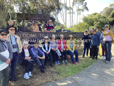
... Street then return via the Diamond Creek trail behind Andrew Park. The actual farm boundary went past the creek and further up the hill. The original farm comprised lot 90 of Holloway’s...Street then return via the Diamond Creek trail behind Andrew Park. The actual farm boundary went past the creek and further up the hill. The original farm comprised lot 90 of Holloway’s ...On Saturday September 2, 2023, Russell Yeoman led a group of 22 society members and interested others on a walk following trhe bounadries of the original Shillingalw farm. Commencing at the corner of Panther Place and Library Place, we proceeded up to Shillinglaw Cafe then the Shillinglaw trees at the former Eltham Shire Office site then along Main Road to the fire station then throughh St Laurence Lane and uinder the railway line , along Diamond Street then return via the Diamond Creek trail behind Andrew Park. The actual farm boundary went past the creek and further up the hill. The original farm comprised lot 90 of Holloway’s 1851 subdivision of Little Eltham. Its area was 30 acres lying east of the Diamond Creek and north of Henry Street. A number of stops were made to look at maps and early photos illustrating the gradual reduction of the farm area and the early history of the railway and other community uses, that occupied parts of the site.fay bridge collection, 2023-09-02, activities, eltham, eltham district historical society, heritage excursion, shillinglaw farm -
 Eltham District Historical Society Inc
Photograph, Liz Pidgeon, EDHS Heritage Walk: Shillinglaw Farm, Eltham, 2 September 2023
... Street then return via the Diamond Creek trail behind Andrew Park. The actual farm boundary went past the creek and further up the hill. The original farm comprised lot 90 of Holloway’s...Street then return via the Diamond Creek trail behind Andrew Park. The actual farm boundary went past the creek and further up the hill. The original farm comprised lot 90 of Holloway’s ...On Saturday September 2, 2023, Russell Yeoman led a group of 22 society members and interested others on a walk following trhe bounadries of the original Shillingalw farm. Commencing at the corner of Panther Place and Library Place, we proceeded up to Shillinglaw Cafe then the Shillinglaw trees at the former Eltham Shire Office site then along Main Road to the fire station then throughh St Laurence Lane and uinder the railway line , along Diamond Street then return via the Diamond Creek trail behind Andrew Park. The actual farm boundary went past the creek and further up the hill. The original farm comprised lot 90 of Holloway’s 1851 subdivision of Little Eltham. Its area was 30 acres lying east of the Diamond Creek and north of Henry Street. A number of stops were made to look at maps and early photos illustrating the gradual reduction of the farm area and the early history of the railway and other community uses, that occupied parts of the site.2023-09-02, activities, eltham, eltham district historical society, heritage excursion, shillinglaw farm, 895 main road, amplifon, andrew park, andrew pocket park, arthur street, bar de tapas, barber shop, barry plant estate agent, blockbuster, bus depot, car park, carparks, central park, cleaver & co hair, commonwealth bank, crust pizza, divine bridal, dr ash constance, dudley street, eltham book shop, eltham convenience store, eltham fire station, eltham library, eltham newsagency, eltham optical, eltham railway station, eltham shops, fay bridge, fire bell, flagpole, flight centre, grill'd, information sign, iso chook, jellis craig estate agent, judge book village, kebab nation, kx pilates, la zanyas, liquorland, little drop of poison, lorraine jones & associates solicitors, luck street, machan indian restaurant, main road, mecho en mexico, missing gorilla, morrison kleeman real estate, pavilion menswear, platform 3095, playtherapy melbourne, pryor street, ray white real estate, restaurants, sage bulk whole foods, shillinglaw trees, sign, snap fitness, southern cross medical imaging, specsavers, st laurence lane, st vincents care service, thompson's pharmacy, todaro, united service station, vyve body & skin, welcome to eltham town, westpac bank, yang's kitchen, youth road -
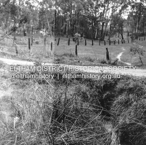 Eltham District Historical Society Inc
Negative - Photograph, J.A. McDonald, Fordhams Road, Eltham, 24 July 1962
... Culvert discharging towards land owned by Holloway & Spicer about 3pm on 24 July 1962 Heavy rain 60 years later it still appears to present as a concern - see Google Street View (Nov 2021) https://goo.gl/maps/x61yWvAc5UjJ2d8y9...Culvert discharging towards land owned by Holloway & Spicer about 3pm on 24 July 1962 Heavy rain 60 years later it still appears to present as a concern - see Google Street View (Nov 2021) https://goo.gl/maps/x61yWvAc5UjJ2d8y9 Record of various Shire of Eltham infrastructure works undertaken during the period of 1952-1962 involving bridge and road reconstruction projects, sometimes with Eltham Shire Council Project Reference numbers quoted. ...Culvert discharging towards land owned by Holloway & Spicer about 3pm on 24 July 1962 Heavy rain 60 years later it still appears to present as a concern - see Google Street View (Nov 2021) https://goo.gl/maps/x61yWvAc5UjJ2d8y9Record of various Shire of Eltham infrastructure works undertaken during the period of 1952-1962 involving bridge and road reconstruction projects, sometimes with Eltham Shire Council Project Reference numbers quoted. It was during this period that a number of significant improvements were made to roads and new bridges constructed within the shire that remain in place as of present day (2022). In many situations, the photos provide a tangible visible record of infrastructure that existed throughout the early days of the Shire. The album was put together by or under the direction of the Shire Engineer, J.A. McDonald.1962-07-24, culvert, eltham, fordhams road, infrastructure, shire of eltham -
 Eltham District Historical Society Inc
Negative - Photograph, J.A. McDonald, Fordhams Road, Eltham, 24 July 1962
... Culvert discharging towards land owned by Holloway & Spicer about 3pm on 24 July 1962 Heavy rain 60 years later it still appears to present as a concern - see Google Street View (Nov 2021) https://goo.gl/maps/x61yWvAc5UjJ2d8y9...Culvert discharging towards land owned by Holloway & Spicer about 3pm on 24 July 1962 Heavy rain 60 years later it still appears to present as a concern - see Google Street View (Nov 2021) https://goo.gl/maps/x61yWvAc5UjJ2d8y9 Record of various Shire of Eltham infrastructure works undertaken during the period of 1952-1962 involving bridge and road reconstruction projects, sometimes with Eltham Shire Council Project Reference numbers quoted. ...Culvert discharging towards land owned by Holloway & Spicer about 3pm on 24 July 1962 Heavy rain 60 years later it still appears to present as a concern - see Google Street View (Nov 2021) https://goo.gl/maps/x61yWvAc5UjJ2d8y9Record of various Shire of Eltham infrastructure works undertaken during the period of 1952-1962 involving bridge and road reconstruction projects, sometimes with Eltham Shire Council Project Reference numbers quoted. It was during this period that a number of significant improvements were made to roads and new bridges constructed within the shire that remain in place as of present day (2022). In many situations, the photos provide a tangible visible record of infrastructure that existed throughout the early days of the Shire. The album was put together by or under the direction of the Shire Engineer, J.A. McDonald.1962-07-24, culvert, eltham, fordhams road, infrastructure, shire of eltham
