
Showing 258 items matching "land register"
-
 Bendigo Historical Society Inc.
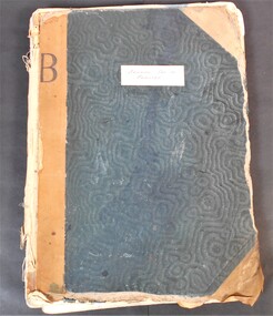
Administrative record - Land Register
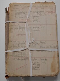
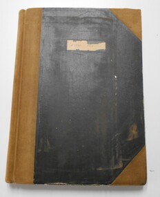
... Land Register...Land Register...Title on the front says - Bendigo Sec 12, Register. Large land register book. Board cover and back - covered by material of blue silk and leather. ...Land Register Financial Bendigo Written on spine - 5 12 1 7 1. ...Title on the front says - Bendigo Sec 12, Register. Large land register book. Board cover and back - covered by material of blue silk and leather. Paper on the inside - 101 pages - handwritten. Each page is divided into application numbers, full names, dates of application, parish of address, and details regarding the land and what is being done with it. Dates approx. ~ 1895 - 1949Written on spine - 5 12 1 7 1. Front cover large capital B on the side of the cover and in the middle is Bendigo Sec 12 Register. land register, financial, bendigo -
 Bendigo Historical Society Inc.
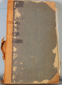
Legal record - Land Register
... Land Register ...Land Register...Land register for duration 1924 to 1951 (!!). Register contains plans of Land sales for a broad area of Central Victorian Parish / Counties. ...Land Register Central Victoria Land register for duration 1924 to 1951 (!!). ...Land register for duration 1924 to 1951 (!!). Register contains plans of Land sales for a broad area of Central Victorian Parish / Counties. Register has a stiff blue card cover originally bound with light brown leather spine and corners, presently in a dire condition with cover damaged and loose; plans also folded and damaged. Plans inserted as drawn plans within the register, later plans are included on tracing, paper and linen - in various degrees of condition / damage.land register, central victoria -
 Bendigo Historical Society Inc.
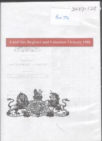
Archive - LAND TAX REGISTER, 1888
... LAND TAX REGISTER...Land tax register...DVD. Land Tax Register and Valuation Victoria 1888....Land tax register 1888 DVD. Land Tax Register and Valuation Victoria 1888. ...DVD. Land Tax Register and Valuation Victoria 1888.land tax register, 1888 -
 Bendigo Historical Society Inc.
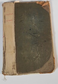
Administrative record - Land Sales Register
... Land Sales Register...Land Sales...Register...Land Sales Register On front cover page written in red is '138 Front' and '130 Rear.' ...Large land sales ledger with cloth binding on spine. 101 pages handwritten. Dates from 1908 - 1934. Ledger filled with names, addresses, financial details and remarks regarding clients. Ledger for Bendigo area.On front cover page written in red is '138 Front' and '130 Rear.' On the spine it is written in red, 'Bgo 130 +138, 138 Front, 130 Rear, 1 to 500.' On first page written in red "SEC 138 Front." Back cover is written '121 in back of book.'land sales, register -
 Bendigo Historical Society Inc.
Administrative record - Land Sales Register
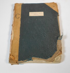
... Land Sales Register...land sales...Register...land sales Register Castlemaine Scratched on the front cover is a faded reading of 'Castlemaine.' ...Large cloth bound ledger, hard board cover, front and back. Over a hundred pages not all numbered. Handwritten. Dates from 1906 - 1922. ledger filled with names, addresses, financial details, and glued in posters of land sales associated with clients. Castlemaine is listed as the area for the ledger and also St Anaud, Maryborough, Avoca, Inglewood, Dunolly, Daylesford, Maldon, Heathcote, Woodend. Scratched on the front cover is a faded reading of 'Castlemaine.' Written onto the spine is written in blue texta, 'Land Sales, C'Maine,' and also '8.6.1906 to 23.2.1922.' land sales, register, castlemaine -
 Bendigo Historical Society Inc.
Document - LANDS OFFICE: AGRICULTURAL LAND LEASE REGISTER AMENDING LAND ACT 1865, 13.9.21 to 26.6.24
... LANDS OFFICE: AGRICULTURAL LAND LEASE REGISTER AMENDING LAND ACT 1865...Across top: Register of agricultural lands leased under ' The Amending Land Act 1865' LH page: date of lease, name of lessee, county, parish, number of, extent, no. of report. ...Document LANDS OFFICE: AGRICULTURAL LAND LEASE REGISTER AMENDING LAND ACT 1865 ...Document: buff leather covered journal containing rules pages with handwritten entries. Book is indexed A - Z. Across top: Register of agricultural lands leased under ' The Amending Land Act 1865' LH page: date of lease, name of lessee, county, parish, number of, extent, no. of report. Rh page: no. of report, remarks.Lands Officecottage, miners, lands act, lands office, agricultural land. amending land act 1865. -
 Bendigo Historical Society Inc.
Administrative record - Land Sales Register - Castlemaine sec. 12
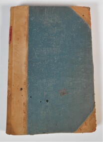
... Land Sales Register - Castlemaine sec. 12...The book is a register of land sales. The sales are recorded in alphabetical order. ...Administrative record Land Sales Register - Castlemaine sec. 12 ...Book has a blue cover and brown leather spine. The book is a register of land sales. The sales are recorded in alphabetical order. The records give the number of the application, the date of registry, the date of application, the surname of the purchaser, the Christian name and address, the parish, allotment, section and area, the decision, special condition, the license and remarks. The book covers the years from 1896 to the 1940's. On the cover a white sticker with the words: "Castlemaine Sec 12 register" and in texter the number 26 and letter C. On the spine "S 12 171"land sales, castlemaine -
 Bendigo Historical Society Inc.
Document - LAND SALES REGISTER - 1882 - 1909, 1882 - 1909
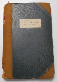
... LAND SALES REGISTER - 1882 - 1909...land sales...Bendigo... Sandhurst... auctions... sales register...The sale of land in the following areas: Sandhurst, Bendigo, Heathcote, Shepparton, Inglewood, Rushworth. On front cover label (light buff) in blue ink, Bendigo, Sale Register, 1882 - 1909. ...land sales Bendigo Sandhurst auctions sales register Land Sales Office Journal: Hard cover journal, dark green cover with buff corners and spine. ...Journal: Hard cover journal, dark green cover with buff corners and spine. Land Sales by auction 1882 - 1909. The sale of land in the following areas: Sandhurst, Bendigo, Heathcote, Shepparton, Inglewood, Rushworth. On front cover label (light buff) in blue ink, Bendigo, Sale Register, 1882 - 1909. On spine red label with gold lettering: Report of sales by auction.Land Sales Officeland sales, bendigo, sandhurst, auctions, sales register -
 Bendigo Historical Society Inc.
Document - LAND SALES REGISTER 27.7.1860 TO 12.9.1882 - SANDHURST SALES
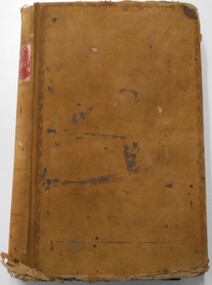
... LAND SALES REGISTER 27.7.1860 TO 12.9.1882 - SANDHURST SALES...Large register, brown cover. On spine Special Land Sales Book, Sandhurst Sales. ...Sandhurst Bendigo Land Sales Large register, brown cover. On spine Special Land Sales Book, Sandhurst Sales. ...Large register, brown cover. On spine Special Land Sales Book, Sandhurst Sales. No. 5 printed on top of spine.sandhurst, bendigo, land sales -
 Stawell Historical Society Inc
Archive, Land Title - Register. 1897 Sloane and Scotchman's Quartz Mining Co No Liability Stawell, 1897
... Land Title - Register. 1897 Sloane and Scotchman's Quartz Mining Co No Liability Stawell...Sloanes & Scotchmans Quartz Mining Co No Liability Stawell. Land Title - Register. 1897 Sloane and Scotchman's Quartz Mining Co No Liability Stawell Archive ...Black Framed Memorial Title of Land in Moore Street Stawell. Sloanes & Scotchmans Quartz Mining Co No Liability Stawell.stawell, mining -
 Bendigo Historical Society Inc.
Journal - Index Correspondence Ledger - unknown company, 28/06/2007
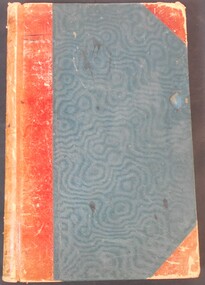
... ...Land Register...Index - Correspondence ledger Land Register marked "D" on the spine large format lined ledger for correspondence. blue water marked hard card cover with red spine and corner bindings, marked "Index, Correspondence Ledger". ...Alphabetic ledger containing names of people holding acreage in the Districts.large format lined ledger for correspondence. blue water marked hard card cover with red spine and corner bindings, marked "Index, Correspondence Ledger". Alphabetic ledger containing names of people holding acreage in the Districts.marked "D" on the spineindex - correspondence ledger, land register -
 Bendigo Historical Society Inc.
Document - RESIDENCE AREAS REGISTER SANDHURST: VOLUME 17, 1899 - 1905
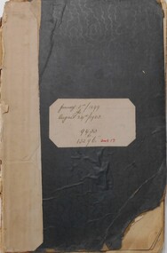
... ... land register...PLACE residence areas register Bendigo Sandhurst land register land sales Register: Residence Areas Register: Volume 17. ...Register: Residence Areas Register: Volume 17. Green covered book, bound in off white paper on spine. January 5, 1899, to August 24, 1905. 9433 to 13296. Index to above period. Front cover is disconnected from body of book.place, residence areas register, bendigo, sandhurst, land register, land sales -
 Bendigo Historical Society Inc.
Document - RESIDENCE AREAS REGISTER: SANDHURST VOLUME 5, 1885
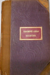
... ...Land Register...Register has blue lined pages 1 - 202 with details of land registrations....Bendigo Land Register Register: hard covered register, maroon material with dark buff spine and corners. ...Register: hard covered register, maroon material with dark buff spine and corners. Contains A-Z index in front section linked with registration details of residence areas in the Sandhurst district, Sandhurst division. Written on front cover in gold 'Residence Areas Register' and 'No. 5' on spine. Dates from 23 March 1885 to 30 November 1885. Register has blue lined pages 1 - 202 with details of land registrations.bendigo, land register -
Tatura Irrigation & Wartime Camps Museum
Book, Register of Land 1955-1956, 1955
... Register of Land 1955-1956...Rodney Irrigaton and Water Supply District 28.10.1955. Register of Land 1955-1956 Book ...Register of Lands in Tatura district with apportioned water rights 1955-56Beige covers, red spine, black lettering. Rodney Irrigaton and Water Supply District 28.10.1955.farming and irrigation, books, irrigation, rural, industry -
 Bendigo Historical Society Inc.
Document - RESIDENCE AREAS REGISTER: VOLUME 19 INDEX (2 OF 2)
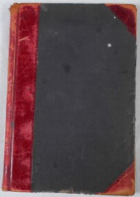
... ... land sales... register...residence areas Bendigo Sandhurst land sales register Register: Index of residence areas for register 19. ...Register: Index of residence areas for register 19. Dark Maroon cover with lighter material on spine and corners, hard cover containing alphabetical index. Holders of residence area licenses, names and addresses and page number, no book number. On spine ' Index Residence Areas: Written in front in black ink ' Index Book 19'residence areas, bendigo, sandhurst, land sales, register -
 Bendigo Historical Society Inc.
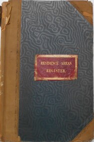
Document - RESIDENCE AREAS REGISTER: SANDHURST VOLUME 12, 1889 - 1890
... ... land sales... register...PLACE Bendigo residence areas Bendigo Sandhurst land sales register Register: hard covered register, blue material with dark buff spine and corners. ...Register: hard covered register, blue material with dark buff spine and corners. Contains A-Z index in front section linked with registration details of residence areas in the Sandhurst district, Sandhurst division. Written on front cover in gold ' Residence Areas Register' On spine '12' Dates from 22 December 1889 to 17 June 1890.place, bendigo, residence areas, bendigo, sandhurst, land sales, register -
 Bendigo Historical Society Inc.
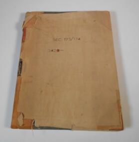
Administrative record - Application Register
... Application register...Land...register. A black label with gold letters: all other sections land act 1901 (some of the letters are damaged)...Application register Land act 1901 1874 to 1876 On the front canvas cover: sec 173/174 3420. ...The book original cover is dark green that has been wrapped in brown canvas to protect it. It has a leather spine with red and black labels. The pages in the volume are divided in columns: 1) Number of application, 2) Date of registry, 3) Date of application, 4) Surname, 5) Christian name and address, 6) Parish, 7) Allotment, 8) Section, 9) rea, 10) Local land board schedule, 11) Decision, 12) Special condition, 13) License, 14) References and remarks. The dates of the applications are from 30th August, 1874 to 26th April, 1876.On the front canvas cover: sec 173/174 3420. On the spine red label with gold letters: Application register. A black label with gold letters: all other sections land act 1901 (some of the letters are damaged)application register, land act 1901, 1874 to 1876 -
 Bendigo Historical Society Inc.
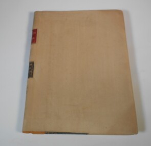
Administrative record - Application Register
... Application register...Land...register. A black label with gold letters: all other sections land act 1901. ...Application register Land act 1901 1908 On the spine red label with gold letters: Application register. ...The book is covered in a beige canvas to protect it. It has a leather spine with red and black labels. The pages in the volume are divided in columns: 1) Number of application, 2) Date of registry, 3) Date of application, 4) Surname, 5) Christian name and address, 6) Parish, 7) Allotment, 8) Section, 9) rea, 10) Local land board schedule, 11) Decision, 12) Special condition, 13) License, 14) References and remarks. Only two pages are used dated from 1908 are related to Swan Hill.On the spine red label with gold letters: Application register. A black label with gold letters: all other sections land act 1901. Also, on the spine in black texter 01 to 01 to - B - 145,187application register, land act 1901, 1908 -
 Bendigo Historical Society Inc.
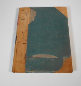
Administrative record - Application Register
... Application register...Land...register. A black label with gold letters: all other sections land act 1901. ...Application register Land act 1901 On the spine red label with gold letters: Application register. ...The volume has green front and back cover. It has a leather spine with red and black labels. The pages in the volume are divided in columns: 1) Number of application, 2) Date of registry, 3) Date of application, 4) Surname, 5) Christian name and address, 6) Parish, 7) Allotment, 8) Section, 9) rea, 10) Local land board schedule, 11) Decision, 12) Special condition, 13) License, 14) References and remarks.On the spine red label with gold letters: Application register. A black label with gold letters: all other sections land act 1901. Also on the spine in red texter "Stock Lith."application register, land act 1901 -
 Bendigo Historical Society Inc.
Document - RESIDENCE AREAS REGISTER SANDHURST: VOLUME 16, 1894 - 1899
... Residence areas register... land...PLACE Sandhurst Residence areas register land sales Book: Residence Areas Register: Volume 16. ...Book: Residence Areas Register: Volume 16. Volume has no cover, spine is in poor condition, bound by white tape to contain pages. Blue lined pages, appears to be complete. October 5, 1894, to January 4,1899. 804 pagesplace, sandhurst, residence areas register, land sales -
 Bendigo Historical Society Inc.
Document - CONNELLY, TATCHELL, DUNLOP COLLECTION: DEED OF COVENANT MR. J.B. DAVIES TO T. LUXTON
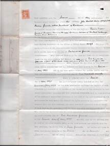
... Pale blue two page document between John Bartlett Davies of Happy Valley Bendigo formerly called Sandhurst, gentleman, land registered in Office of Titles number 101598....Pale blue two page document between John Bartlett Davies of Happy Valley Bendigo formerly called Sandhurst, gentleman, land registered in Office of Titles number 101598. ...Deed of Covenant between Mr. J.B. Davies to T. Luxton Esq., dated 5 August 1892. Pale blue two page document between John Bartlett Davies of Happy Valley Bendigo formerly called Sandhurst, gentleman, land registered in Office of Titles number 101598.cottage, miners, j.b. davies, happy valley road, thomas luxton, bendigo, sandhurst, deed of covenant -
 Bendigo Historical Society Inc.
Document - MISS G ALICE JONES COLLECTION: ACCOUNT
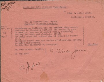
... Account for work involved in the Discharge of Mortgage, preparing State Land tax Notice and registering discharge of Mortgage. ...Account for work involved in the Discharge of Mortgage, preparing State Land tax Notice and registering discharge of Mortgage. Cost £1.1.0. ...South New Chum Syncline G.M. N.L. to Miss G. Alice Jones. Pink paper dated Feb. 12 to May 3, 1940, and 28 May 1940. Account for work involved in the Discharge of Mortgage, preparing State Land tax Notice and registering discharge of Mortgage. Cost £1.1.0. "R688 delivered 29/5/40" in top left corner.the miss g alice jones collection - account, south new chum syncline g.m. n.l. -
 Bendigo Historical Society Inc.
Document - H.A. & S.R. WILKINSON COLLECTION: CONDITION OF SALE
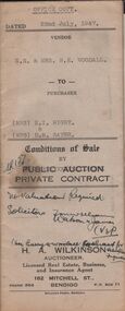
... Bice as tenant, being the land in conveyance registered No. 66, book 589. Also the land untransferred in certificate of title volume 5350 folio 1071748 Crown allotment 19 section 11B, together with 5-roomed brick and weatherboard dwelling and all sundry. ...Bice as tenant, being the land in conveyance registered No. 66, book 589. Also the land untransferred in certificate of title volume 5350 folio 1071748 Crown allotment 19 section 11B, together with 5-roomed brick and weatherboard dwelling and all sundry. ...BHS CollectionConditions of sale by private contract dated 22nd July, 1947 between N.E. & Mrs. B. E. Woodall (sellers) and Mrs N.I. Rigby & Mrs D.M. Sayer (buyer) for land situate 86 Violet Street Bendigo, at present occupied by Mr. Bice as tenant, being the land in conveyance registered No. 66, book 589. Also the land untransferred in certificate of title volume 5350 folio 1071748 Crown allotment 19 section 11B, together with 5-roomed brick and weatherboard dwelling and all sundry. Price 600 pounds.organization, business, h.a. & s.r wilkinson real estate -
 Bendigo Historical Society Inc.
Document - LANDS OFFICE BENDIGO LITHO REGISTER, Jan. 1952 - Feb. 1978
... Document: hard cover journal, black cover with buff spine and corners. Contains register of land maps sold by Bendigo Lands Office. ...Bendigo Lands Office litho register Lands Office Bendigo Document: hard cover journal, black cover with buff spine and corners. Contains register of land maps sold by Bendigo Lands Office. ...Document: hard cover journal, black cover with buff spine and corners. Contains register of land maps sold by Bendigo Lands Office. Handwritten entries on ruled pages. LH page: date, number received, name of plan, litho number, price, amount, date, name of plan, price, number sold, amount, number used in office, amount. Rh page: repeat of LH page.Lands Office Bendigobendigo, lands office, litho register -
 Bendigo Historical Society Inc.
Document - H. A. & S. R. WILKINSON COLLECTION: CONTRACT OF SALE
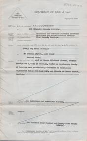
... Property: land being part of Crown allotment 11 section 25B Parish of Sandhurst City of Bendigo, land described in Conveyance registered number880 book 543 and situate 44 Rowan Street, Bendigo, together with all buildings thereon. ...Property: land being part of Crown allotment 11 section 25B Parish of Sandhurst City of Bendigo, land described in Conveyance registered number880 book 543 and situate 44 Rowan Street, Bendigo, together with all buildings thereon. ...Contract of sale of land dated 29th January, 1954 between Sandhurst & Northern District Trustees Executors and Agency, Estate of M. J. Wearne - Deceased (vendor) and Mrs. I. P. Trewella (purchaser). Property: land being part of Crown allotment 11 section 25B Parish of Sandhurst City of Bendigo, land described in Conveyance registered number880 book 543 and situate 44 Rowan Street, Bendigo, together with all buildings thereon. Price: 1,425 pounds .organization, business, h.a. & s.r wilkinson real estate -
 Orbost & District Historical Society
register, Register of Residence Areas, 10.2.1897 - 4.9.1934
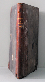
... This book is a register of land holders with miners' rights. The correspondence is associated with applications for miners' rights on privately owned land and business sites. ...This book is a register of land holders with miners' rights. The correspondence is associated with applications for miners' rights on privately owned land and business sites. ...This book is a register of land holders with miners' rights. The correspondence is associated with applications for miners' rights on privately owned land and business sites. They include application fotrms and objections to registrations. The areas referred to are Combienbar, Goongerah, Club Terrace, Wombat Creek and Dundong. One of the privileges under the Mines Act, conferred by the holding of a miner's right until 1935 was that of residence on up to one acre on a gold-fields area. Those occupying a residence area were "deemed in law to be possessed ... of such ... parcels ... and the property therein".This is a useful research tool.A large, heavy book with a grey cloth cover and red spine. The end papers are marbled. The inside pages are ruled in grey with red ruled columns. Entries are hand-written. There are copies of correspondence inside. Details given are the registration number and date, the name of the person, the number of the miner's right and its date, a description of the allotment and any remarks or references to other volumes. Any changes of ownership are shown. The book is mostly unused.register-mining miners-rights -
 Flagstaff Hill Maritime Museum and Village
Tool - Adze, Ward & Payne Ltd, Between 1843 to Mid 20th Century
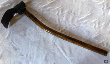
... registered in 1850 was a Letter "W" & "P" stamped into the steel. The firm was established by David Ward (1767-1822) in 1803 the company became David Ward & Sons, in 1837 after Ward's son Edward joined the firm. In 1845 Henry Payne the founder's son-in-law became a partner but died in 1850 after which the company reverted to the Ward family. The business then concentrated on making carving tools, chisels and gouges. In 1882 David Ward's grandson David Ward Jr. (1835-1889) purchased land...registered in 1850 was a Letter "W" & "P" stamped into the steel. The firm was established by David Ward (1767-1822) in 1803 the company became David Ward & Sons, in 1837 after Ward's son Edward joined the firm. In 1845 Henry Payne the founder's son-in-law became a partner but died in 1850 after which the company reverted to the Ward family. The business then concentrated on making carving tools, chisels and gouges. In 1882 David Ward's grandson David Ward Jr. (1835-1889) purchased land ...An adze is an ancient and versatile cutting tool and has been in use for thousands of years. Adze are similar to an axe but with the cutting edge perpendicular to the handle rather than parallel. They have been used since the Stone Age. Adzes are hand tools used for smoothing or carving wood. The subject item was made by Ward & Payne of the Limbrick Works at Hillsborough, Sheffield England manufacturers of hand-forged tools. Their trademark registered in 1850 was a Letter "W" & "P" stamped into the steel. The firm was established by David Ward (1767-1822) in 1803 the company became David Ward & Sons, in 1837 after Ward's son Edward joined the firm. In 1845 Henry Payne the founder's son-in-law became a partner but died in 1850 after which the company reverted to the Ward family. The business then concentrated on making carving tools, chisels and gouges. In 1882 David Ward's grandson David Ward Jr. (1835-1889) purchased land and built a factory at Sheffield North known as the "Limerick Wheel". For a time Wards operated from both 106-114 West Street Sheffield and at Limbrick Road, Hillsborough on the river Loxley. By 1911 they had expanded into making spades, forks, sheep shears and many other types of edged tools including drills and wood planes. In 1967 Wilkinson Sword purchased all the company's share capital and continued to sell Ward & Payne tools until 1970 when a fire burned the factory down and housing development was built on the site.The subject item is significant as it gives a snapshot of the technological development of sailing ships and their operation before steam-powered vessels took over around the world. Tools such as the subject item demonstrate the traditional craftsmanship and skill of the shipwright and the aesthetic quality of the timber ships designs of the time. Adze with wooden handle curved painted green with patent number and maker's name inscribed on inside curve of blade. Inscribed "Patd 561 Ward" "2w". flagstaff hill, warrnambool, flagstaff-hill, flagstaff-hill-maritime-museum, maritime-museum, shipwreck-coast, flagstaff-hill-maritime-village, smoothing tool, hand tool, carpenders tool, adze, coopers tool, woodworking tools -
 Flagstaff Hill Maritime Museum and Village
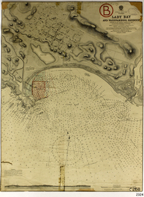
Document - Navigation Chart, Admiralty Office, Lady Bay and Warrnambool Harbour, 1893
... registered as a place of significance on the Victorian Heritage Database (VHR H2024). The Warrnambool Breakwater is one of the most important late 19th century maritime engineering projects in Victoria and significant in the development of Victorian coastal shipping. It is also significant for its connection with British harbour engineer, Sir John Coode. The chart is a historical record of structures existing in 1893; the Warrnambool Jetties, Warrnambool Breakwater in Lady Bay, the leading lights (lighthouses), streets, roads, bridges and many buildings. It also shows the lay of the land ...This navigation cart of Lady Bay and Warrnambool Harbour was originally surveyed in 1870 but this version includes the update for magnetic variation in 1893. Since the printing of the chart several annotations have been added. These include an additional stamp dated 15-8-1910, a handwritten comment across the top of the page dated August 1910, and another handwritten comment regarding the ‘Proposed Extension of Dock’ dated 19-2-1925, plus connected drawings, notes and figures. The 1925 proposal on this chart may have been a reaction to the Royal Commission of 1923, when the damaged stonework on the seaward side of the Warrnambool Breakwater, caused by the action of the sea, was the subject of enquiry. A conference between the Public Works, Water Commission and the Harbour Trust concluded that it would less costly to make repairs to prevent further damage rather than replaced the damage portion of the wall. A contract was raised in late 1924 to deposit rubble on the damaged side of the breakwater to minimise the Southern Ocean’s destructive action and work had started by August 1925. The Breakwater construction had begun in 1874 and was completed in 1890. The Victorian Government had commissioned Sir John Coode, a British harbour engineer, to present a plan to complete the Warrnambool Breakwater but his original plan was too expensive. He prepared a revised plan for a shorter structure. The construction proved to be too short to protect adequately from the weather and didn't allow enough depth for larger vessels to come into port. The decreasing trade was further affected by siltation in the bay due to the breakwater, and the completion of the railway line. The situation of the harbour became a real problem by 1910 and required continuous dredging. In 1914 the Breakwater was extended but proved to be a failure because the work began to subside and by 1920 about two thirds of the harbour was silted up. Alterations made in the 1920's increased the silting problem and by the 1940's the harbour was no longer used. More alterations were made in the 1950's and 1960's. This chart is significant for its strong connection to the maritime history of Warrnambool Harbour and Lady Bay and the Warrnambool Breakwater. The Warrnambool Breakwater is registered as a place of significance on the Victorian Heritage Database (VHR H2024). The Warrnambool Breakwater is one of the most important late 19th century maritime engineering projects in Victoria and significant in the development of Victorian coastal shipping. It is also significant for its connection with British harbour engineer, Sir John Coode. The chart is a historical record of structures existing in 1893; the Warrnambool Jetties, Warrnambool Breakwater in Lady Bay, the leading lights (lighthouses), streets, roads, bridges and many buildings. It also shows the lay of the land and seabed. Navigation Chart: Lady Bay and Warrnambool Harbour, Australia - South Coast - Victoria. Surveyed by Nav. Lieut. H.J. Stanley, R.N., 1870. Updated for Magnetic Variation, 1893. The rectangular chart is printed on heavy cream paper. Stamps are shaped rectangular, oval and round. Around the Breakwater and Jetty area are handwritten notes, dotted and joined lines, numbers and signatures, and shading of red and green. The chart shows the surrounds of Warrnambool Harbour, Lady Bay, the Breakwater and Jetty, roads, bridges and the streets in Warrnambool. It has sounding details, and angles of line from the leading lights.Stamp, rectangular, including "AUG 1910" Stamp, double oval " - - - -CHART" Stamp, hand drawn, red circle, with "B" inside Hand written note "22-8-1910 - - - - - of surveying C. Ca - - - request of 15-8-10 [initials] " Notes and lines in red pen, including a grid of sounding numbers: "1300" "1050" "1200" "Possible Extension of Dock" "19-2-25" "Dock Dredged to 20 Ft" Notes and lines in blue pen "Extension of Dock to accommodate vessels drawing 20 Feet" and "Light not visible south of this line" Red dots (4) with yellow highlight at both leading lights, breakwater and jettyflagstaff hill, warrnambool, flagstaff hill maritime museum & village, maritime museum, maritime village, shipwreck coast, map, chart, navigation chart, plan, lady bay, warrnambool harbour, port of warrnambool, breakwater, jetty, pier, dock extension, proposed extension, vhr h2024, 1870, 1893, 1910, 1925, warrnambool town late 1800s, warrnambool streets late 1800s royal commission, 1923, public works, water commission, harbour trust, victorian harbours, sir jon coode -
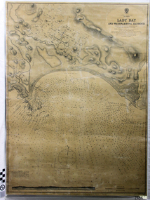 Flagstaff Hill Maritime Museum and Village
Document - Navigation Chart, Admiralty Office, Lady Bay and Warrnambool Harbour, 03/04/1871
... registered as a place of significance on the Victorian Heritage Database (VHR H2024). A copy of the same chart was used to plan several submissions for future changes to the jetty and breakwater. The chart is a historical record of structures existing in 1870; the Warrnambool Jetties, Lady Bay, the leading lights (lighthouses), streets, roads, bridges and many buildings. It also shows the lay of the land ...This Chart titled “Lady Bay and Warrnambool Harbour” was surveyed by Nav. Lieut. H.J. Stanley, of Britain's Royal Navy, in 1870 and printed in April 1871. The chart was made before the Warrnambool Breakwater was built (construction had begun in 1874 and was completed in 1890). The chart includes Directions for entering Lady Bay, Warrnambool Harbour. These are "Vessels entering Warrnambool Harbour must bring the Red Light in sight and steer in with it in line with the upper white Light bearing North, until the Green Light on the Jetty is opened, when steer towards it and anchor. The best anchorage is in 2 ¼ fms [fathoms)] of water, about a cable from ledge off Breakwater rock. Or where convenient, according to draught of water, only endeavouring to anchor as close as possible to Breakwater rock. It is not safe to enter or leave the Harbour in south westerly or Southerly gales.” This chart is significant for its strong connection to the maritime history of Warrnambool Harbour and Lady Bay, and eventually to the Warrnambool Breakwater. The Warrnambool Breakwater is registered as a place of significance on the Victorian Heritage Database (VHR H2024). A copy of the same chart was used to plan several submissions for future changes to the jetty and breakwater. The chart is a historical record of structures existing in 1870; the Warrnambool Jetties, Lady Bay, the leading lights (lighthouses), streets, roads, bridges and many buildings. It also shows the lay of the land and seabed.Canvas chart of Australia, South Coast, Victoria Title: Lady Bay and Warrnambool Harbour Surveyed by Nav. Lieut. H.J. Stanley, R.N., 1870. Magnet Variation, 1870 Published April 3, 1871, by the Admiralty, London. Directions for vessels entering Warrnambool Harbour are printed on the chart. The chart has a lacquer or seal over it.Top of chart has logo "HYDROGRAPHER OFFICE" "Price Eighteen Pence". "Engraved by Edward Weller" Along bottom of Chart: “London… Published at the Admiralty, 3rd April 1871, under the Superintendence of Rear Admiral G.H. Richards, F.R.S. Hydrographer, Corrections July 71” Bottom of chart “Australia South Coast Victoria Lady Bay and Warrnambool Harbour. 2494”flagstaff hill, warrnambool, chart of lady bay warrnambool 1870, warrnambool harbour, cartography, navigation, warrnambool breakwater, 1871, australia – south coast / victoria, lady bay, 1870, nav. lieut. h.j. stanley, r.n, directions for entering warrnambool harbour, hydrographer office, rear admiral g.h. richards, edward weller, port of warrnambool, flagstaff hill maritime museum & village, maritime museum, maritime village, shipwreck coast, map, chart, navigation chart, admiralty chart, breakwater, jetty, pier, vhr h2024 -
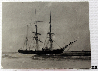 Flagstaff Hill Maritime Museum and Village
Photograph, circa 1888
... The “Edinburgh Castle” is included as one of the shipwrecks in Heritage Victoria’s Historic Shipwreck Trail on Victoria’s West Coast. flagstaff hill warrnambool shipwrecked-coast flagstaff-hill flagstaff-hill-maritime-museum maritime-museum shipwreck-coast flagstaff-hill-maritime-village great ocean road edinburgh castle barque 1863 edinburgh castle shipwreck 1888 shipwreck 15-05-1888 glasgow ship jg lawrie t skinner and co liverpool ship register captain j.b. darling gifford & nicholson cement casks cement barrels warrnambool breakwater construction breaches buoy rocket crew rocket launcher lifesaving equipment warrnambool harbour lady bay warrnambool ship pilot carless lady bay shipwreck peter ronald colin goodall lady bay diving site marine archaeology victorian heritage register vhr s209 Black and white photograph of the iron barque 'Edinburgh Castle' on breaking waves, land in the background. ...This photograph was taken close to the time of the wreck of the "Edinburgh Castle". The “Edinburgh Castle”, three-masted iron barque, was built in Glasgow, Scotland, in 1863 by J.G. Lawrie. She was 53.7 meters long and weighed 627 tons. She was owned by shipping company T Skinner and Co and registered at Liverpool, England. She sailed from 1863 to 1885 along the trade route between Scotland, China, and Singapore. In 1887 the Master, Captain J.B. Darling, sailed the “Edinburgh Castle” for its new owners Gifford & Nicholson from London to Warrnambool. Her cargo was 4,900 casks of cement for the construction of the new Warrnambool Breakwater. Over the three month journey, the ship met with rough weather and even a hurricane. On January 15th 1888 the “Edinburgh Castle” approached Lady Bay where a welcoming crowd gathered. The Port’s relief Harbour Master, Pilot Carless took over to complete the docking. As he tried to guide her, the Lighthouse Keeper signalled that the ship was too close to shore. The pilot continued on his course, causing her to ‘miss stays’ (make an incorrect tack). The crew dropped anchors and tried to lighten the load by throwing some of the casks of cement overboard but this was to no avail, and she drifted sideways in calm waters, lodging in the sand. A distress signal was sent to the coastal steamer “Julia Percy”, which spent several hours trying to pull the stranded ship away, but it would not budge. Those involved hoped to re-float the ship but efforts to save the vessel were useless. The captain and some crew stayed on board. When the weather became rough the rocket crew brought its lifesaving gear to the shore, ready to launch a line to the ship. The three men on board sent those onshore a message in a bottle to assure the on-lookers that they were quite comfortable to stay aboard. After a night of bad weather, the crew were glad to accept the rocket crew’s help and were in turn safely hauled to shore in a breeches buoy. The ship broke up quickly. Very little of the cargo could be saved. A week later all that could be seen of her was the bow and some of the stern. The beach was littered with wreckage, including cement cask fragments, for weeks. Ironically, on the morning after the ship ran aground, the very same “Edinburgh Castle” was offered for sale at an auction in Melbourne, billed as “a sound ship with all the fittings and in the best order.” The sale was completed before they heard the news that the ship was totally wrecked! Over the decades the shifting sands concealed the wreck of “Edinburgh Castle”. However, in October 1985 two local divers, Peter Ronald and Colin Goodall discovered her near the Hopkins River mouth. Peter said in his book ‘Exploring Shipwrecks of Western Victoria’, “In the midst of this sand-cloud I could clearly see row after row of neatly stacked barrels”. He remarked, “I am privileged to have had at least a glimpse of one of Warrnambool's most significant wrecks.” Some 15 – 17 ships are believed to have sunk in Lady Bay, but only two have been discovered on the seafloor; the “Edinburgh Castle” and the “La Bella”. Both wrecks are popular diving sites and are preserved as significant historical marine and marine archaeological sites. The sailing ship “Edinburgh Castle” is of local and state and national significance. It is one of the only two shipwrecks discovered in Lady Bay, Warrnambool, out of the 15-17 shipwrecks in the bay. The “Edinburgh Castle” is significant for being one of the largest vessels lost in the bay. The significance of the wreck of the “Edinburgh Castle” was recognised by being listed on the Victorian Heritage Database VHR S209. She was declared an Historic Shipwreck on 17th January 1989 under the Commonwealth Historic Shipwrecks Act (1976). The “Edinburgh Castle” wreck is also significant for the connection of its cargo with the building of the Warrnambool Breakwater, also listed on the Victorian Heritage Database VHR H2024. The “Edinburgh Castle” is included as one of the shipwrecks in Heritage Victoria’s Historic Shipwreck Trail on Victoria’s West Coast. Black and white photograph of the iron barque 'Edinburgh Castle' on breaking waves, land in the background. The ship was stranded and wrecked in Lady Bay, Warrnambool, on January 15th 1888. Figures are standing on deck. The masts are free from sails.flagstaff hill, warrnambool, shipwrecked-coast, flagstaff-hill, flagstaff-hill-maritime-museum, maritime-museum, shipwreck-coast, flagstaff-hill-maritime-village, great ocean road, edinburgh castle barque 1863, edinburgh castle shipwreck 1888, shipwreck 15-05-1888, glasgow ship, jg lawrie, t skinner and co, liverpool ship register, captain j.b. darling, gifford & nicholson, cement casks, cement barrels, warrnambool breakwater construction, breaches buoy, rocket crew, rocket launcher, lifesaving equipment, warrnambool harbour, lady bay warrnambool, ship pilot carless, lady bay shipwreck, peter ronald, colin goodall, lady bay diving site, marine archaeology, victorian heritage register, vhr s209
