
Showing 59 items matching "local government infrastructure"
-
 Broadmeadows Historical Society & Museum
Photograph (collection) - City of Broadmeadows Trucks, Don Woods, 1991
... Local government...Local government infrastructure...local government amalgamations in Victoria (1994). The images illustrate municipal branding, fleet composition, and public works operations in Broadmeadows. These photographs provide visual evidence of City of Broadmeadows municipal operations and vehicle fleet branding in 1991, contributing to the historical understanding of local government services and identity prior to council amalgamation. Municipal vehicles City of Broadmeadows Local government Local government infrastructure ...Created as part of City of Broadmeadows municipal operations. Later retained and archived by the Broadmeadows Historical Society.To document City of Broadmeadows municipal vehicles for operational, promotional, or record keeping purposes.Two colour photographs physically joined together with adhesive tape along the centre, forming a single composite photographic item. Original order maintained as received.Two colour photographs depicting City of Broadmeadows service vehicles parked at a municipal works depot: • An International ACCO 2250 water tanker marked “Broadmeadows” • An Isuzu FSR 450 tray truck bearing City of Broadmeadows livery Both images show vehicles in situ at the Broadmeadows depot.municipal vehicles, city of broadmeadows, local government, local government infrastructure, public works, council works depots, truck fleets, water tankers, utility trucks, vehicle livery, municipal branding, broadmeadows (vic.), victoria (australia), 1990s, urban services, australian local governmentmunicipal vehicles, city of broadmeadows, local government, local government infrastructure, public works, council works depots, truck fleets, water tankers, utility trucks, vehicle livery, municipal branding, broadmeadows (vic.), victoria (australia), 1990s, urban services, australian local government -
 Broadmeadows Historical Society & Museum
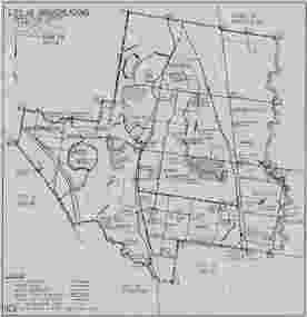
Map, City of Broadmeadows municipal map, February 1985, c. February 1985
... It records local government ward boundaries, infrastructure, reserves and neighbouring municipalities including Bulla, Whittlesea, Preston, Coburg, Essendon and Keilor. ...It records local government ward boundaries, infrastructure, reserves and neighbouring municipalities including Bulla, Whittlesea, Preston, Coburg, Essendon and Keilor. ...The map documents the City of Broadmeadows municipal area as it existed in February 1985. It records local government ward boundaries, infrastructure, reserves and neighbouring municipalities including Bulla, Whittlesea, Preston, Coburg, Essendon and Keilor. The map provides evidence of municipal organisation and land use in Broadmeadows during the mid-1980s.This map is significant as a historical record of the City of Broadmeadows shortly before substantial local government and urban development changes in Melbourne's northern suburbs. It documents municipal boundaries, infrastructure, public reserves and administrative divisions in 1985, providing valuable evidence for researchers studying local government, urban planning and community development in the Broadmeadows district.Single-sheet monochrome printed map on grey paper. Recto contains a detailed municipal map of the City of Broadmeadows. Verso is blank apart from labels and annotations. Fold marks visible.Recto, upper left: "CITY OF BROADMEADOWS" / "Metric Scale 1:40000" / "DATE FEB 1985" Verso, upper centre: "WI-3206" Verso, upper right: Handwritten and partially obscured notation present.broadmeadows (vic.), city of broadmeadows, local government, municipal boundaries, urban planning, roads, parks and reserves, cartography, melbourne northern suburbs, 1980s victoria. -
 The Beechworth Burke Museum
Audio - Oral History, Jennifer Williams, Mrs Val Mason, 5 January 2001
... local Beechworth residents which were then published in a book titled: 'Listen to what they say: voices of twentieth century Beechworth. These cassette tapes were digitised in July 2021 with funds made available by the Friends of the Burke. Mrs. Mason's story is historically significant for understanding economic and social changes in the Beechworth region during the latter half of the twentieth century. As a council representative, issues such as road and infrastructure modernisation and the transition from traditional government ...Mrs. Valerie (Val) Mason (1927-2019) was a local sheep farmer, business-woman, Beechworth shire councillor, and mother to five children. With her husband, Charles, Mrs. Mason developed and managed the Big Valley farm estate, at Everton, which is now part of a vineyard and farm stay. Mrs. Mason was instrumental in introducing a 'paddock to plate' philosophy and business model, opening a butcher shop on the farm in 1973. Concerned with improving infrastructure and developing economic opportunities in the region, Mrs. Mason successfully stood as a local council representative for South Riding in the United Shire of Beechworth, and later become the first woman Shire President in 1979. Mrs Mason was a member of the local Business and Professional Women's Club for 37 years. This oral history recording was part of a project conducted by Jennifer Williams in the year 2000 to capture the everyday life and struggles in Beechworth during the twentieth century. This project involved recording seventy oral histories on cassette tapes of local Beechworth residents which were then published in a book titled: 'Listen to what they say: voices of twentieth century Beechworth. These cassette tapes were digitised in July 2021 with funds made available by the Friends of the Burke.Mrs. Mason's story is historically significant for understanding economic and social changes in the Beechworth region during the latter half of the twentieth century. As a council representative, issues such as road and infrastructure modernisation and the transition from traditional government employment sectors, like Beechworth's care institutions, were challenges for local government. As a farmer and local employer, Mrs. Mason's story is testimony to the region's economic diversification as businesses like Big Valley farm shop helped shape the region's contemporary character. Mrs. Mason was among the first women to broach the traditionally all-male Beechworth Council Chambers and her story is socially significant for understanding the changing role of women in rural and regional Australia. This oral history recording offers interpretive capacity for social history themes and may be compared with other oral histories in the Burke Museum's collection. This oral history account is socially and historically significant as it is a part of a broader collection of interviews conducted by Jennifer Williams which were published in the book 'Listen to what they say: voices of twentieth-century Beechworth.' While the township of Beechworth is known for its history as a gold rush town, these accounts provide a unique insight into the day-to-day life of the town's residents during the 20th century, many of which will have now been lost if they had not been preserved.This is a digital copy of a recording that was originally captured on a cassette tape. The cassette tape is black with a horizontal white strip and is currently stored in a clear flat plastic rectangular container. It holds up 40 minutes of recordings on each side.Mrs Val Mason /listen to what they say, beechworth, oral history, burke museum, working women, trail blazers, farm to plate, farm shop, paddock to plate, woman farmer, united shire of beechworth, rural and regional women, beechworth's first woman shire president, women in leadership positions, women leaders, australian settlement history, settler societies, victorian gold rush, heritage tourism, culinary tourism, regional land use, indigo winery, farm stay, social history -
 Orbost & District Historical Society
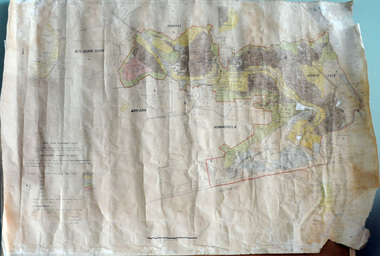
plan, before 1948
... infrastructure was developed and maintained in this region by the Snowy River Improvement Trust. The Trust was administered by a local committee and its activities funded by a local rate charged on the farmers and land owners in the Trust’s designated district. The level of the rate charged by the Trust was designed to be proportionate to the benefit derived from the works undertaken. Financial assistance was provided by the State Government...infrastructure was developed and maintained in this region by the Snowy River Improvement Trust. The Trust was administered by a local committee and its activities funded by a local rate charged on the farmers and land owners in the Trust’s designated district. The level of the rate charged by the Trust was designed to be proportionate to the benefit derived from the works undertaken. Financial assistance was provided by the State Government ...Drainage infrastructure was developed and maintained in this region by the Snowy River Improvement Trust. The Trust was administered by a local committee and its activities funded by a local rate charged on the farmers and land owners in the Trust’s designated district. The level of the rate charged by the Trust was designed to be proportionate to the benefit derived from the works undertaken. Financial assistance was provided by the State Government from time to time for specific projects such as post flood repairs but not for new capital works. The Trust undertook new drainage and river management works including tree planting, rock beach construction and servicing of the drains and flood gates. The Trust also provided a personal flood warning service to the farmers in its district. The Trust ceased to operate in 1997 with the advent of the East Gippsland Catchment Management Authority. The infrastructure developed by the Trust continues to provide a service to the farmers in the region. (ref. 4 East Gippsland CMA Submission to Inquiry into Flood Mitigation Infrastructure in Victoria) This plan is significant as a historical document. The Snowy River Improvement Trust was vital to the Orbost district because of its ability to apply local knowledge and to engage the local farming community.A large plan of divisions of land for the purpose of levying the Snowy River Improvement District - Bete Bolong, Orbost, Waygara, Newmerella and Orbost East. The properties are coloured according to levy amount. The scale is 1" - 20 chains. snowy-river-improvement-trust -
 Ringwood and District Historical Society
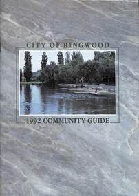
Book, City of Ringwood, City of Ringwood 1992 Community Guide, 1992
... CONTENTS: (page no.) 1991/92 COUNCIL REPRESENTATIVES 4 1992 CALENDAR 51 AQUATIC CENTRE 8 AQUATIC CENTRE VOUCHERS 49 CHIEF EXECUTIVE'S REPORT 6 CIVIC CENTRE TELEPHONE INDEX — DIRECT DIALLING 53 COMMUNITY DIRECTORY 35-47 COMMUNITY SERVICES 17-19 COUNCIL & COMMITTEE CYCLES 4 COUNCIL FINANCES & 1991/92 RATES 16 COUNCILLORS 3 FUNCTIONAL RESPONSIBILITIES 15 HISTORY OF RINGWOOD 5 HOUSING & RESIDENTIAL DEVELOPMENT 29-30 INFRASTRUCTURE 34 LOCAL, STATE & FEDERAL GOVERNMENT ELECTIONS 32 MANAGEMENT TEAM 14 MAYORAL MESSAGE – Cr. ...rinx CONTENTS: (page no.) 1991/92 COUNCIL REPRESENTATIVES 4 1992 CALENDAR 51 AQUATIC CENTRE 8 AQUATIC CENTRE VOUCHERS 49 CHIEF EXECUTIVE'S REPORT 6 CIVIC CENTRE TELEPHONE INDEX — DIRECT DIALLING 53 COMMUNITY DIRECTORY 35-47 COMMUNITY SERVICES 17-19 COUNCIL & COMMITTEE CYCLES 4 COUNCIL FINANCES & 1991/92 RATES 16 COUNCILLORS 3 FUNCTIONAL RESPONSIBILITIES 15 HISTORY OF RINGWOOD 5 HOUSING & RESIDENTIAL DEVELOPMENT 29-30 INFRASTRUCTURE 34 LOCAL, STATE & FEDERAL GOVERNMENT ELECTIONS 32 MANAGEMENT TEAM 14 MAYORAL MESSAGE – Cr. ...Community information book issued by City of Ringwood for 1992 - covering the facilities and activities of the Ringwood Council and other local organisations and associations. Includes two Aquatic Centre entry vouchers valid until June 30th, 1992.CONTENTS: (page no.) 1991/92 COUNCIL REPRESENTATIVES 4 1992 CALENDAR 51 AQUATIC CENTRE 8 AQUATIC CENTRE VOUCHERS 49 CHIEF EXECUTIVE'S REPORT 6 CIVIC CENTRE TELEPHONE INDEX — DIRECT DIALLING 53 COMMUNITY DIRECTORY 35-47 COMMUNITY SERVICES 17-19 COUNCIL & COMMITTEE CYCLES 4 COUNCIL FINANCES & 1991/92 RATES 16 COUNCILLORS 3 FUNCTIONAL RESPONSIBILITIES 15 HISTORY OF RINGWOOD 5 HOUSING & RESIDENTIAL DEVELOPMENT 29-30 INFRASTRUCTURE 34 LOCAL, STATE & FEDERAL GOVERNMENT ELECTIONS 32 MANAGEMENT TEAM 14 MAYORAL MESSAGE – Cr. Max Williams 1 NEIGHBOURHOOD MAP 26-27 NOTES 52 PAPER & CARDBOARD COLLECTION SERVICE 22 PARKS & RESERVES — PUBLIC FACILITIES 31 PROTECTING OUR COMMUNITY 23-24 PROTECTING THE ENVIRONMENT 20-21 RINGWOOD FESTIVAL & HIGHLAND CARNIVAL 13 RINGWOOD GOLF COURSE 7 STRATEGIC BIKE PLAN 11 STREET INDEX A-L 25 STREET INDEX L-Z 28 THE LIBRARY 12 THE RINGWOOD CONVENTION & PERFORMING ARTS CENTRE 10 TRAFFIC MANAGEMENT 33 YOUR PERSONAL DIRECTORY 50 rinx -
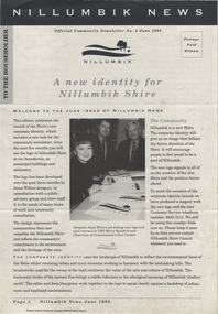 Eltham District Historical Society Inc
Journal - Newsletter, Nillumbik Shire Council, Nillumbik News, October 2000
... The newsletter outlines local government initiatives, community events, environmental programs, infrastructure projects, and cultural activities occurring in the Nillumbik Shire around October–November 2000. ...The newsletter outlines local government initiatives, community events, environmental programs, infrastructure projects, and cultural activities occurring in the Nillumbik Shire around October–November 2000. ...The newsletter outlines local government initiatives, community events, environmental programs, infrastructure projects, and cultural activities occurring in the Nillumbik Shire around October–November 2000. It highlights council plans, community participation opportunities, and local developments aimed at improving quality of life in the region. October 2000 articles include: Safer roads for the Shire Eltham Festival program announced Commercial Place design released 2000-2003 Council Plan Released National Reconciliation Framework Living and Learning Centres More Playgrounds Susan St Pavilion completed Study to plan for BMX/skate track Wattle Glen Township Strategy Community Weed Control Program Count Koala Day Environment Centre proposed for Edendale Farm Open Space Strategy findings Neighbourhood Character Study and Residential Design Guidelines Friends groups Clean Drains – Living Creeks, National Water Week Nillumbik Shire Council Cultural Plan 2000-2005 adopted 2001 Alan Marshall Short Story Award Artists’ Open Studios program Kangaroo Ground Tower Advisory Committee Environment leaders at Eltham North primary Dollars saved by regular road maintenance Regional Road upgrades Rural roads grading program Stormwater Management Plan Locality boundary update council newsletters, nillumbik news, nillumbik shire council, council plan 2000–2003, municipal road safety strategy, infrastructure services, stormwater management plan, locality boundary review, rates, sustainable agriculture rebate, capital works program, road maintenance, better roads victorian program, eltham - yarra glen road, warrandyte - kangaroo ground road, rural roads grading program, commercial place, public space, public infrastructrue, meals on wheels, eltham living and learning centre, living and learning centre, adult community education, volunteer programs, australia day awards, community groups, environmental protection, sustainability, community weed control, landcare, koalas, drainage works, waterway protection, indigenous grass, environmental education, open space, public parkland, playgrounds, bike trail, adventure playground, community reserves, kangaroo ground tower reserve, cultural plan, eltham festival, artists open studios, cultural tourism, alan marshall short story award, montsalvat, community arts program, garden walks, eltham fun run, community market, mudbrick tours, ceres environmental education centre, nillumbik tourism association, food and wine trail, yarra valley tourism campaign, road safety, adrian cully, alan marshall, andrew port, anne connor, catherine dale, chris wallace-crabbe, claire harris, david scott, david yencken, dean stewart, deb ganderton, debra wilkinson, denis ward, drew gregory, daryl taylor, fiona austin, frank butters, frank nolan, gavin jordan, glen jameson, grace mitchell, greg scott, harry gilham, helen ash, jane annois, jane viola, jan kelly, jenneke korteweg, jenni mitchell, jessica davison, jill forrest, john hewish, jules burns, julius peiker, kay steventon, kayte nunn, lesley shuttleworth, leslie avril, louise heathcote, marg jeffery, margaret jennings, martin wright, mathew hodsnesse, maurice stabb, megan mccarthy, mervyn hannan, michael jansz, michael skewes, mick woiwod, nel ten wolde, nicholas pelling, ona henderson, peter burn, piers bateman, reg cox, reg evans, robert boyle, robert hay, robert theobald, shan shnookal, sigmund jorgensen, stuart menzies, steven white, vonnie frazer, eltham district historical society, council for aboriginal reconciliation, eltham north primary school, wattle glen primary school, eltham arts council, churinga arts, harvey world travel (eltham), eltham little book shop, do lunch cafe, volumes cafe, grovedale cottage, lovegrove winery cottles bridge, yarrambat golf club, eltham football club, eltham rugby football club, lower eltham cricket club, susan street oval, syd tunn, jack rasterhoff -
Warrnambool and District Historical Society Inc.
Map (series) - Local Parish Maps, Local Government maps 1942 and three fire maps
... infrastructure such as railways and highways. Freehold land with ownership and in many cases size of freehold is marked. These maps would have been used as a resource in local government departments and private businesses associated with land transfers and similar. ...infrastructure such as railways and highways. Freehold land with ownership and in many cases size of freehold is marked. These maps would have been used as a resource in local government departments and private businesses associated with land transfers and similar. ...These show the Western District in detail with property owners named . The fire maps have properties which are numbered.western district maps, belfast, brucknell, caramut, cooramook, framlingham east, framlingham west, garvoc, laang, kangertong, meerai, minjah north, minjah, minhamite, nullawarre, narrawaturk, nirranda, paaratte, panmure, purnim, quamby north, tallangatta, quamby, timboon, wangoom, willatook, woolsthorpe, yangery, yarpturk, ecklin, yeth- youang.western district maps, belfast, brucknell, caramut, cooramook, framlingham east, framlingham west, garvoc, laang, kangertong, meerai, minjah north, minjah, minhamite, nullawarre, narrawaturk, nirranda, paaratte, panmure, purnim, quamby north, tallangatta, quamby, timboon, wangoom, willatook, woolsthorpe, yangery, yarpturk, ecklin, yeth- youang. -
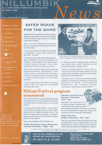 Eltham District Historical Society Inc
Journal - Newsletter, Nillumbik Shire Council, Nillumbik News, October 2000
... The newsletter outlines local government initiatives, community events, environmental programs, infrastructure projects, and cultural activities occurring in the Nillumbik Shire around October–November 2000. ...The newsletter outlines local government initiatives, community events, environmental programs, infrastructure projects, and cultural activities occurring in the Nillumbik Shire around October–November 2000. ...The newsletter outlines local government initiatives, community events, environmental programs, infrastructure projects, and cultural activities occurring in the Nillumbik Shire around October–November 2000. It highlights council plans, community participation opportunities, and local developments aimed at improving quality of life in the region. October 2000 articles include: Safer roads for the Shire Eltham Festival program announced Commercial Place design released 2000-2003 Council Plan Released National Reconciliation Framework Living and Learning Centres More Playgrounds Susan St Pavilion completed Study to plan for BMX/skate track Wattle Glen Township Strategy Community Weed Control Program Count Koala Day Environment Centre proposed for Edendale Farm Open Space Strategy findings Neighbourhood Character Study and Residential Design Guidelines Friends groups Clean Drains – Living Creeks, National Water Week Nillumbik Shire Council Cultural Plan 2000-2005 adopted 2001 Alan Marshall Short Story Award Artists’ Open Studios program Kangaroo Ground Tower Advisory Committee Environment leaders at Eltham North primary Dollars saved by regular road maintenance Regional Road upgrades Rural roads grading program Stormwater Management Plan Locality boundary update council newsletters, nillumbik news, nillumbik shire council, council plan 2000–2003, municipal road safety strategy, infrastructure services, stormwater management plan, locality boundary review, rates, sustainable agriculture rebate, capital works program, road maintenance, better roads victorian program, eltham - yarra glen road, warrandyte - kangaroo ground road, rural roads grading program, commercial place, public space, public infrastructrue, meals on wheels, eltham living and learning centre, living and learning centre, adult community education, volunteer programs, australia day awards, community groups, environmental protection, sustainability, community weed control, landcare, koalas, drainage works, waterway protection, indigenous grass, environmental education, open space, public parkland, playgrounds, bike trail, adventure playground, community reserves, kangaroo ground tower reserve, cultural plan, eltham festival, artists open studios, cultural tourism, alan marshall short story award, montsalvat, community arts program, garden walks, eltham fun run, community market, mudbrick tours, ceres environmental education centre, nillumbik tourism association, food and wine trail, yarra valley tourism campaign, road safety, adrian cully, alan marshall, andrew port, anne connor, catherine dale, chris wallace-crabbe, claire harris, david scott, david yencken, dean stewart, deb ganderton, debra wilkinson, denis ward, drew gregory, daryl taylor, fiona austin, frank butters, frank nolan, gavin jordan, glen jameson, grace mitchell, greg scott, harry gilham, helen ash, jane annois, jane viola, jan kelly, jenneke korteweg, jenni mitchell, jessica davison, jill forrest, john hewish, jules burns, julius peiker, kay steventon, kayte nunn, lesley shuttleworth, leslie avril, louise heathcote, marg jeffery, margaret jennings, martin wright, mathew hodsnesse, maurice stabb, megan mccarthy, mervyn hannan, michael jansz, michael skewes, mick woiwod, nel ten wolde, nicholas pelling, ona henderson, peter burn, piers bateman, reg cox, reg evans, robert boyle, robert hay, robert theobald, shan shnookal, sigmund jorgensen, stuart menzies, steven white, vonnie frazer, eltham district historical society, council for aboriginal reconciliation, eltham north primary school, wattle glen primary school, eltham arts council, churinga arts, harvey world travel (eltham), eltham little book shop, do lunch cafe, volumes cafe, grovedale cottage, lovegrove winery cottles bridge, yarrambat golf club, eltham football club, eltham rugby football club, lower eltham cricket club, susan street oval, syd tunn, jack rasterhoff -
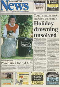 Eltham District Historical Society Inc
Newspaper - Newspaper article, Diamond Valley News, Prized uses for old bins, Diamond Valley News, December 14, p1, 1994
... Local Government Board...Montsalvat...Shire of Diamond Valley...Garbage collection...Shire of Eltham Infrastructure...Council amalgamation shire of eltham Shire of Montsalvat Shire of Nillumbik 1994 City of Banyule City of Heidelberg Local Government Board Montsalvat Shire of Diamond Valley Garbage collection Shire of Eltham Infrastructure Newsprint; Newspaper, bound volume Prized uses for old bins, Diamond Valley News, December 14, p1 Newspaper Newspaper article Diamond Valley News ...council amalgamation, shire of eltham, shire of montsalvat, shire of nillumbik, 1994, city of banyule, city of heidelberg, local government board, montsalvat, shire of diamond valley, garbage collection, shire of eltham infrastructure -
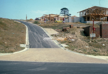 Eltham District Historical Society Inc
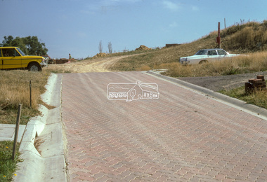
Slide - Photograph, Road infrastucture, new housing development, most likely Templestowe, c.Mar. 1985
... Eltham Shire Council officers would benchmark road infrastructure in surrounding local government areas. In this case, the street is most likely a private street scheme in a new housing development in what is present-day Manningham City Council. ...Eltham Shire Council officers would benchmark road infrastructure in surrounding local government areas. In this case, the street is most likely a private street scheme in a new housing development in what is present-day Manningham City Council. ...Eltham Shire Council officers would benchmark road infrastructure in surrounding local government areas. In this case, the street is most likely a private street scheme in a new housing development in what is present-day Manningham City Council. Areas of interest in the phioto are the roll over concrete kerbs, brick paving at road entrace and drainage.35mm colour positive transparency (1 of 15) Mount - Kodak Kodachrome Cardinfrastructure, roads, city of manningham, footpaths and gutters, housing estates, unidentified, templestowe -
 Eltham District Historical Society Inc
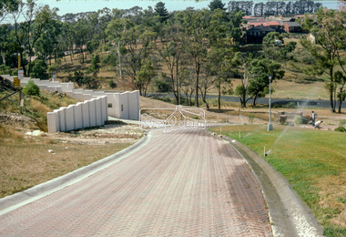
Slide - Photograph, Lomic Court, Templestowe, c.Mar. 1985
... Eltham Shire Council officers would benchmark road infrastructure in surrounding local government areas. In this case, a private street scheme in a new housing development on Lomic Court, Telmplestowe in what is present-day Manningham City Council. ...Eltham Shire Council officers would benchmark road infrastructure in surrounding local government areas. In this case, a private street scheme in a new housing development on Lomic Court, Telmplestowe in what is present-day Manningham City Council. ...Eltham Shire Council officers would benchmark road infrastructure in surrounding local government areas. In this case, a private street scheme in a new housing development on Lomic Court, Telmplestowe in what is present-day Manningham City Council. Areas of interest in the photo are the roll over concrete kerbs, brick paving and drainage.35mm colour positive transparency (1 of 15) Mount - Kodak Kodachrome Cardinfrastructure, roads, city of manningham, footpaths and gutters, housing estates, templestowe, lomic court -
 Eltham District Historical Society Inc
Slide - Photograph, Lomic Court, Templestowe, c.Mar. 1985
... Eltham Shire Council officers would benchmark road infrastructure in surrounding local government areas. In this case, a private street scheme in a new housing development on Lomic Court, Telmplestowe in what is present-day Manningham City Council. ...Eltham Shire Council officers would benchmark road infrastructure in surrounding local government areas. In this case, a private street scheme in a new housing development on Lomic Court, Telmplestowe in what is present-day Manningham City Council. ...Eltham Shire Council officers would benchmark road infrastructure in surrounding local government areas. In this case, a private street scheme in a new housing development on Lomic Court, Telmplestowe in what is present-day Manningham City Council. Areas of interest in the photo are the roll over concrete kerbs, brick paving and drainage.35mm colour positive transparency (1 of 15) Mount - Kodak Kodachrome Cardinfrastructure, roads, city of manningham, footpaths and gutters, housing estates, templestowe, lomic court -
 Warrnambool and District Historical Society Inc.
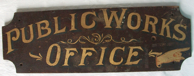
Sign - Public Works Office
... infrastructure. It had many different reponsibilities and roles from building government accommodation and fit out of buildings, licences for unused roads and water ways, main roads and bridges, ports and harbour,and water supplies. Much of this work was managed through local...infrastructure. It had many different reponsibilities and roles from building government accommodation and fit out of buildings, licences for unused roads and water ways, main roads and bridges, ports and harbour,and water supplies. Much of this work was managed through local ...This sign points has two different messages. The first states Public Works Office, which was operational in Victoria between 1855 and 1987 dealt with many aspects of the states infrastructure. It had many different reponsibilities and roles from building government accommodation and fit out of buildings, licences for unused roads and water ways, main roads and bridges, ports and harbour,and water supplies. Much of this work was managed through local offices such as the one at Warrnambool. The sign on the reverse which states Witnesses Waiting Room relates to the court house which is where this sign originated.The Warrnambool court house was built in 1870-71 by the Victorian Public Works department and it is possible that this sign relates to that period.It is one of a number of public buildings built in the period 1870-1890 including the Police station and stables and police quarters, the Post Office and drill Hall , all in the same vicinity. This building reflects the growth of the town and also the importance it held at the time from a state level. The building while no longer used as a court house is a building of significance to Warrnambool as well as to the state of Victoria, being one of six around the state which were built in free classical style. This sign denotes the waiting room for witnesses which was situated on the western side of the building.A tangible link which provides historical and social significance to Warrnambool.Rectangular wooden sign with rounded corners. There is text on both sides painted in gold paint with shadow in black. One side is a darker brown stain . There are screw holes in each corner.and one hole on left middle of sign. Rounded edge on one side.Side 1:Witnesses Waiting Room Side 2:Public Works Office.warrnambool, warrnambool court house, public works department warrnambool -
 Warrnambool and District Historical Society Inc.
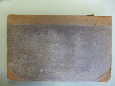
Document - Ledger: Warrnambool Shire Correspondence Letter Book, 1871-1875, Circa 1870
... The ledger contains copies of letters which were written to local shires and lands Departments and relate mainly to matters of infrastructure and local government charges There are a number of invoices at the back of the book....The ledger contains copies of letters which were written to local shires and lands Departments and relate mainly to matters of infrastructure and local government charges There are a number of invoices at the back of the book. ...A detailed continuum of correspondence showing the progress of development in the district and the co-operation and cost sharing between the different shires to have work completed. This collection of letters provides a very good overview of issues and work covered in the early settlement days of the district. Cover is brown watermarked patterned cloth with tan suede binding and corners. Inside front and back covers is green and red patterned paper. Alphabetical index at the front. The ledger contains copies of letters which were written to local shires and lands Departments and relate mainly to matters of infrastructure and local government charges There are a number of invoices at the back of the book.: Letter Book No. on spine. Gold lettering on red. Serial numbers, signatures, engravings, dedications in books, manufacturing details or personal markingswarrnambool, warrnambool shire, hampden shire, mount rouse shire, geelong to belfast road, alfred davies, 1873-1875, shire correspondence -
 Yarra City Council
Artwork, other - Mural/Installation, Martine Corompt, Momentum, 2023
... Government. Named after the former City of Richmond Mayor, the pavilion is home to the Yarra Netball Association as well as acrylic surfaced courts which cater to netball, local tennis players and groups. The new pavilion meets legislative, functional, disability access and environmental sustainability requirements, allowing the club to grow, provide greater flexibility and capacity to train and host competitions. 'Momentum' is a result of Council’s Public Art Policy 2015-2020, which ensures Council commits a percentage of the capital works budget for new community infrastructure...Government. Named after the former City of Richmond Mayor, the pavilion is home to the Yarra Netball Association as well as acrylic surfaced courts which cater to netball, local tennis players and groups. The new pavilion meets legislative, functional, disability access and environmental sustainability requirements, allowing the club to grow, provide greater flexibility and capacity to train and host competitions. 'Momentum' is a result of Council’s Public Art Policy 2015-2020, which ensures Council commits a percentage of the capital works budget for new community infrastructure ..."Situated at the intersection of three major arterial flows – a railway, a freeway and the Birrarung river, the Mary Rogers Pavilion is a place where people are drawn together through movement. The artwork 'Momentum' draws on the coalescing flows of traffic, sound, air, time, water, and human kinetic energy, mapped together into a horizon of oscillating lines."'Momentum' was commissioned for the new Mary Rogers Sports Pavilion at Ryans Reserve, Richmond, a $3 million redevelopment in partnership with the Victorian Government. Named after the former City of Richmond Mayor, the pavilion is home to the Yarra Netball Association as well as acrylic surfaced courts which cater to netball, local tennis players and groups. The new pavilion meets legislative, functional, disability access and environmental sustainability requirements, allowing the club to grow, provide greater flexibility and capacity to train and host competitions. 'Momentum' is a result of Council’s Public Art Policy 2015-2020, which ensures Council commits a percentage of the capital works budget for new community infrastructure projects over $1 million dollars to an integrated art component.A landscape/horizon of oscillating black lines (waves) and sun filled in with warm colours. accompanying plaquesport, mary rogers, women, birrarung, energy, movement -
 Myrtleford and District Historical Society
Tobacco bale stencil
... infrastructure problems when the soldier settlement scheme was being reviewed at government level. He was active locally on these issues and supported fund raising for a war memorial, memorial hall and veteran welfare. The stencil represents the achievements of A.D.Lowerson, VC as an isolated example of success as a WW1 soldier settler and as a local ...Stencil used by Sgt. Albert David Lowerson, VC, a soldier settler on Merriang Estate near Myrtleford. Lowerson acquired one of 19 blocks assigned by the Closer Settlement Board on the 700 acre estate in 1920. The stencil marked bales of cured tobacco leaves prior to shipment to Melbourne. Lowerson was one of the few successful soldier settler farmers in the district, operating a piggery, dairy farming and growing tobacco for almost 20 years on "St. Quentin". (Lowerson was awarded the Victoria Cross at Mont St. Quentin on September 1, 1918.) His success and status enabled him to lead a submission on farm debt and infrastructure problems when the soldier settlement scheme was being reviewed at government level. He was active locally on these issues and supported fund raising for a war memorial, memorial hall and veteran welfare.The stencil represents the achievements of A.D.Lowerson, VC as an isolated example of success as a WW1 soldier settler and as a local identity who stridently supported the need for recognition and support of ex-service personnel.Stencil made of thin sheet metal, rusted .Wording of stencil "A.D.LOWERSON. MYRTLEFORD." lowerson a.d., merriang estate, myrtleford, closer settlement board, tobacco, st. quentin, victoria cross, world war 1 -
 Sunshine and District Historical Society Incorporated
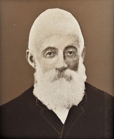
Photograph - Shire of Braybrook and City of Sunshine Town Clerks and Shire Secretaries Portraits
... Local Government Act 2020. 3. Financial Management The Shire Secretary was also the shire’s chief financial officer: - Preparing budgets - Managing rates and revenue - Overseeing expenditure - Producing annual financial statements In many small shires, the Secretary also acted as Treasurer. 4. Public Interface The Shire Secretary was the main point of contact for the community: - Handling complaints and enquiries - Issuing permits and licences - Coordinating public works requests - Communicating council decisions to residents They were often the most recognisable council official in the district. 5. Strategic and Long‑Term Planning Although less formalised than today, the Secretary played a key role in: - Planning infrastructure...Local Government Act 2020. 3. Financial Management The Shire Secretary was also the shire’s chief financial officer: - Preparing budgets - Managing rates and revenue - Overseeing expenditure - Producing annual financial statements In many small shires, the Secretary also acted as Treasurer. 4. Public Interface The Shire Secretary was the main point of contact for the community: - Handling complaints and enquiries - Issuing permits and licences - Coordinating public works requests - Communicating council decisions to residents They were often the most recognisable council official in the district. 5. Strategic and Long‑Term Planning Although less formalised than today, the Secretary played a key role in: - Planning infrastructure ...This is a collection of photographs of former Shire / City secretaries and town clerks of the former Shire of Braybrook and City of Sunshine. Before modern CEOs existed in Victorian local government, the Shire / City Secretary or Clerk was the most senior administrative officer in a shire or city. They were effectively the chief executive, chief financial officer, and chief governance officer rolled into one. Below is a detailed breakdown of what a Shire / City Secretary traditionally did. 1. Chief Administrative Office The Shire Secretary managed the entire day‑to‑day operation of the shire, including: - Supervising all council staff - Implementing council decisions - Managing correspondence, records, and official documents - Ensuring services were delivered (roads, drainage, health, building, etc.) This is the historical equivalent of the CEO role described in modern council structures. 2. Governance and Council Support The Shire Secretary was responsible for: - Preparing agendas and minutes for council meetings - Advising councillors on legislation and procedures - Ensuring compliance with the Local Government Act - Managing elections and public notices This aligns with the governance responsibilities now embedded in the Local Government Act 2020. 3. Financial Management The Shire Secretary was also the shire’s chief financial officer: - Preparing budgets - Managing rates and revenue - Overseeing expenditure - Producing annual financial statements In many small shires, the Secretary also acted as Treasurer. 4. Public Interface The Shire Secretary was the main point of contact for the community: - Handling complaints and enquiries - Issuing permits and licences - Coordinating public works requests - Communicating council decisions to residents They were often the most recognisable council official in the district. 5. Strategic and Long‑Term Planning Although less formalised than today, the Secretary played a key role in: - Planning infrastructure - Advising on township development - Managing land records and valuations - Coordinating with state government departments This mirrors the strategic functions now assigned to CEOs under the Local Government Act.This collection of photographs shown all the men who served as the Shire Secretary, Town Clerk or CEO for the Shire of Braybrook or for the City of Sunshine.Sunshine Council July 2007 5452.01 - Shire of Braybrook Shire Secretary William 'Bill' Pullar 1860 - 1907.jpg 5452.02 - Shire of Braybrook Shire Secretary D. Lingford 1908 - 1911.jpg 5452.03 - Shire of Braybrook Shire Secretary Walter John Andrew 1911 - 1927.jpg 5452.04 - Shire of Braybrook Shire Town Clerk Edgar Hargreaves 1927 - 1954.jpg 5452.05 - City of Sunshine Town Clerk Thomas William 'Bill' Deutschmann 1954 - 1984.jpg 5452.06 - City of Sunshine Town Clerk G. S. Pearson 1984 - 1987.jpg 5452.07 - City of Sunshine CEO And Town Clerk J. James 1987 - 1992.jpg 5452.08 - City of Sunshine Town Clerk John Noble Willaton 1992 - 1994.jpg 5452.09 - Shire of Braybrook Shire Secretaries and Town Clerks 1860 - 1954.jpg 5452.10 - City of Sunshine Town Clerks 1954 - 1994.jpg shire of braybrook, city of sunshine, town clerk, shire secetary, william "bill" pullar, d. lingford, walter john andrew, edgar hargreaves, thomas william "bill" deutschmann, g. s. pearson, j. james, john noble willaton -
 Sunshine and District Historical Society Incorporated
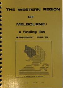
Administrative record - The Western Region of Melbourne, A finding list supplement 1978-79
... local government areas of City of Altona, City of Essendon, City of Footscray, City of Keilor, City of Sunshine, City of Williamstown, Shire of Bacchus Marsh, Shire of Melton & Shire of Werribee. The Melbourne Western Region Commission (WRC) was a collaborative body formed to address the unique planning, social, and economic challenges of the western suburbs. Its key purposes included: - Strategic Regional Planning: Coordinating infrastructure...local government areas of City of Altona, City of Essendon, City of Footscray, City of Keilor, City of Sunshine, City of Williamstown, Shire of Bacchus Marsh, Shire of Melton & Shire of Werribee. The Melbourne Western Region Commission (WRC) was a collaborative body formed to address the unique planning, social, and economic challenges of the western suburbs. Its key purposes included: - Strategic Regional Planning: Coordinating infrastructure ...The Western Region of Melbourne Commission incorporated the local government areas of City of Altona, City of Essendon, City of Footscray, City of Keilor, City of Sunshine, City of Williamstown, Shire of Bacchus Marsh, Shire of Melton & Shire of Werribee. The Melbourne Western Region Commission (WRC) was a collaborative body formed to address the unique planning, social, and economic challenges of the western suburbs. Its key purposes included: - Strategic Regional Planning: Coordinating infrastructure, transport, housing, and industrial development across multiple municipalities such as Footscray, Sunshine, Williamstown, and Werribee. - Cultural Heritage Conservation: Commissioning detailed studies to identify, document, and protect sites of industrial, social, and architectural significance. - Community Engagement and Advocacy: Acting as a voice for the western suburbs in dealings with state and federal governments and promoting equitable access to services and funding. - Support for Local Councils by providing professional services, training, and policy guidance to its member councils and shires.The Western Region of Melbourne A Finding List Supplement 1978-79western region of melbourne commission -
 Ballarat Tramway Museum
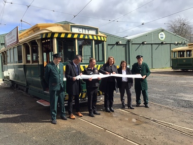
Photograph - Opening of the new track, Patricia Cameron, 10-9-2022
... Catherine King - Minister for Infrastructure, Transport, Regional Development and Local Government...Catherine King - Minister for Infrastructure, Transport, Regional Development and Local Government Provides information on the people involved at the time of the launch of the new replaced trackwork. ...Digital image by Patricia Cameron at the time of the launch or opening of the relaid or replaced track in Wendouree Parade and depot extension. Has Sam Boon, Cr Daniel Maloney, BTM President Paul Mong, Catherine King MP, Juliana Addison MP and Len Millar - standing in front of tram 13. Catherine King - Minister for Infrastructure, Transport, Regional Development and Local GovernmentProvides information on the people involved at the time of the launch of the new replaced trackwork.Digital Image of the cutting of the ribbon to open the new track - 10 September 2022 btm, trackwork, opening, launch, tram 13, museum, depot -
 Ballarat Tramway Museum
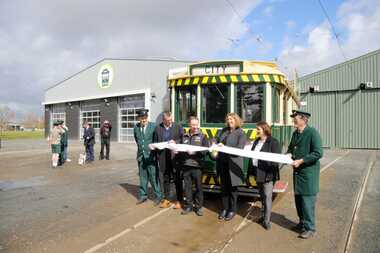
Photograph - Formal Opening of the new track, Benjamin Boehle-Mitchell, 10-9-2022
... Catherine King - Minister for Infrastructure, Transport, Regional Development and Local Government 2 - Listening to the speaches. 3 - Trams 13 and 33 at depot junction. 4 - Tram 13 at Carlton St 5 - Trams 13 and 33 at St Aidans Drive 6 - Another group photo - Daniel Maloney, Paul Mong, Catherine King, Peter Waugh and Juliania Addison....Catherine King - Minister for Infrastructure, Transport, Regional Development and Local Government 2 - Listening to the speaches. 3 - Trams 13 and 33 at depot junction. 4 - Tram 13 at Carlton St 5 - Trams 13 and 33 at St Aidans Drive 6 - Another group photo - Daniel Maloney, Paul Mong, Catherine King, Peter Waugh and Juliania Addison. ...Digital image by Benjamin Boehle-Mitchell at the time of the launch or opening of the relaid or replaced track in Wendouree Parade and depot extension. Image 1 - Has Sam Boon, Cr Daniel Maloney, BTM President Catherine King MP, Juliana Addison MP and Len Millar - standing in front of tram 13. Catherine King - Minister for Infrastructure, Transport, Regional Development and Local Government 2 - Listening to the speaches. 3 - Trams 13 and 33 at depot junction. 4 - Tram 13 at Carlton St 5 - Trams 13 and 33 at St Aidans Drive 6 - Another group photo - Daniel Maloney, Paul Mong, Catherine King, Peter Waugh and Juliania Addison.Provides information on the people involved at the time of the launch of the new replaced trackwork and the first public services.Set of six Digital Images of the cutting of the ribbon to open the new track and other associated images - 10 September 2022 btm, trackwork, opening, launch, tram 13, museum, depot, wednouree parade -
Broadmeadows Historical Society & Museum
Document - Correspondence, S. Gore, City Engineer, Guidelines for the Future Planning of the Glenroy Shopping Centre and Environs, 24 July 1979
... Local government...Suburban commercial development...City of Broadmeadows...Zoning and infrastructure...local government engagement with traders over the rezoning, transport planning, and structured redevelopment of the Glenroy Shopping Centre during a period of suburban growth and wider Victorian planning reform. This letter is significant as evidence of late 1970s municipal planning in Glenroy, illustrating the City of Broadmeadows’ role in working with local traders to shape the development of a major suburban shopping centre during a period of growth and changing planning controls. Glenroy Shopping Centre Urban planning Local government Suburban commercial development City of Broadmeadows Zoning and infrastructure ...This item documents late 1970s City of Broadmeadows planning activities, showing local government engagement with traders over the rezoning, transport planning, and structured redevelopment of the Glenroy Shopping Centre during a period of suburban growth and wider Victorian planning reform.This letter is significant as evidence of late 1970s municipal planning in Glenroy, illustrating the City of Broadmeadows’ role in working with local traders to shape the development of a major suburban shopping centre during a period of growth and changing planning controls.One typed letter on City of Broadmeadows letterhead; black ink on white paper.“SG:JG.345” (top of first page) / “24th July, 1979” (letter body)glenroy shopping centre, urban planning, local government, suburban commercial development, city of broadmeadows, zoning and infrastructure planning, community consultation, melbourne northern suburbs -
 Sunshine and District Historical Society Incorporated
Document - City Of Brimbank Annual Reports, City of Brimbank
... These reports also provided insights into emerging challenges facing the organisation and how the Council has used public resources to deliver services, programs and infrastructure in the interests of our community. These Annual Reports aligns with the principles set in the Local Government Act 2020, meeting legislative and compliance reporting requirements for local government in Victoria, thus ensuring the Council remains accountable to its community....These reports also provided insights into emerging challenges facing the organisation and how the Council has used public resources to deliver services, programs and infrastructure in the interests of our community. These Annual Reports aligns with the principles set in the Local Government Act 2020, meeting legislative and compliance reporting requirements for local government in Victoria, thus ensuring the Council remains accountable to its community. ...The Brimbank City Council Annual Reports examines the Council’s strategic, operational and financial performance for the financial year. Through these reports, Council reviews its performance, achievements and progress made towards strategic objectives and the strategic directions set out in the Council’s Plans. These reports also provided insights into emerging challenges facing the organisation and how the Council has used public resources to deliver services, programs and infrastructure in the interests of our community. These Annual Reports aligns with the principles set in the Local Government Act 2020, meeting legislative and compliance reporting requirements for local government in Victoria, thus ensuring the Council remains accountable to its community.5774.01 - City Of Brimbank Annual Report 2014 - 2015.PDF 5774.02 - City Of Brimbank Annual Report 2015 - 2016.PDF 5774.03 - City Of Brimbank Annual Report 2016 - 2017.PDF 5774.04 - City Of Brimbank Annual Report 2017 - 2018.PDF 5774.05 - City Of Brimbank Annual Report 2018 - 2019.PDF 5774.06 - City Of Brimbank Annual Report 2019 - 2020.PDF 5774.07 - City Of Brimbank Annual Report 2020 - 2021.PDF 5774.08 - City Of Brimbank Annual Report 2021 - 2022.PDF 5774.09 - City Of Brimbank Annual Report 2022 - 2023.PDF 5774.10 - City Of Brimbank Annual Report 2023 - 2024.PDF city of brimbank -
 Kew Historical Society Inc
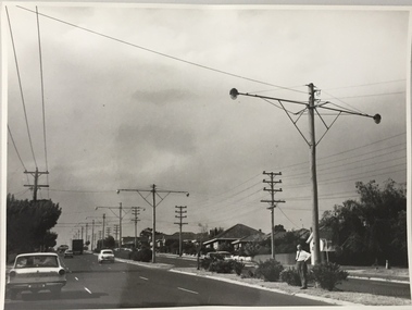
Photograph, Stuart Tompkins Studio, Electricity Supply Poles, Warrigal Road, Holmesglen, 1965
... The series from which the photograph is drawn provides a snapshot by a commercial photographic studio of each named vicinity in 1965 as well as providing examples of public works infrastructure being commissioned by local government in the 1960s. ...Research provided by Stuart Tompkins Studio, Box Hill, into alternatives for median strip street lighting to be used in Burke Road, Kew. The photographers identified variants in different suburbs appropriate to Kew's needs. The series from which the photograph is drawn provides a snapshot by a commercial photographic studio of each named vicinity in 1965 as well as providing examples of public works infrastructure being commissioned by local government in the 1960s. The photos originally formed part of the Engineering Department's files in the City of Kew before being donated to the kew Historical Society.Electricity Supply Poles, Warrigal Road, Holmesglen, 1965. Stuart Tompkins Studio provided this photograph for the Kew City Council. The photograph of Warrigal Road, north of Holmesglen looking north depicts wooden poles with bracket light fittings. These were the same as those proposed for Kew, except the lights and fittings were not to be 350 watt. Mercury lamps were preferred. [There are three copies of this photograph in the Collection.] Typed inscription on reverse: "Electricity Supply Poles. Photographed for Kew City Council 8/2/65. No.3 Warrigal Road - North of Holmesglen looking north. Wooden poles with bracket fittings same as those proposed for Kew except lights and fittings are not for 250 watt c. c. mercury lamps proposed. Wooden pole 3' up 11 3/4" dia." Studio stamp: "Stuart Tompkins Studio. 547 Station Street, Box Hill. WX1439."stuart tompkins studio, warrigal road (holmesglen) 1965, street lighting -
 Kew Historical Society Inc
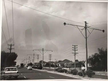
Photograph, Stuart Tompkins Studio, Electricity Supply Poles, Warrigal Road, Holmesglen, 1965
... The series from which the photograph is drawn provides a snapshot by a commercial photographic studio of each named vicinity in 1965 as well as providing examples of public works infrastructure being commissioned by local government in the 1960s. ...Research provided by Stuart Tompkins Studio, Box Hill, into alternatives for median strip street lighting to be used in Burke Road, Kew. The photographers identified variants in different suburbs appropriate to Kew's needs. The series from which the photograph is drawn provides a snapshot by a commercial photographic studio of each named vicinity in 1965 as well as providing examples of public works infrastructure being commissioned by local government in the 1960s. The photos originally formed part of the Engineering Department's files in the City of Kew before being donated to the kew Historical Society.Electricity Supply Poles, Warrigal Road, Holmesglen, 1965. Stuart Tompkins Studio provided this photograph for the Kew City Council. The photograph of Warrigal Road, north of Holmesglen looking north depicts wooden poles with bracket light fittings. These were the same as those proposed for Kew, except the lights and fittings were not to be 350 watt. Mercury lamps were preferred. [There are three copies of this photograph in the Collection.] Typed inscription on reverse: "Electricity Supply Poles. Photographed for Kew City Council 8/2/65. No.3 Warrigal Road - North of Holmesglen looking north. Wooden poles with bracket fittings same as those proposed for Kew except lights and fittings are not for 250 watt c. c. mercury lamps proposed. Wooden pole 3' up 11 3/4" dia." Studio stamp: "Stuart Tompkins Studio. 547 Station Street, Box Hill. WX1439."stuart tompkins studio, warrigal road (holmesglen) 1965, street lighting -
 Kew Historical Society Inc
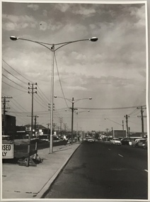
Photograph, Stuart Tompkins Studio, Electricity Supply Poles, South Road, Moorabbin, 1965
... The series from which the photograph is drawn provides a snapshot by a commercial photographic studio of each named vicinity in 1965 as well as providing examples of public works infrastructure being commissioned by local government in the 1960s. ...Research provided by Stuart Tompkins Studio, Box Hill, into alternatives for median strip street lighting to be used in Burke Road, Kew. The photographers identified variants in different suburbs appropriate to Kew's needs.The series from which the photograph is drawn provides a snapshot by a commercial photographic studio of each named vicinity in 1965 as well as providing examples of public works infrastructure being commissioned by local government in the 1960s. The photos originally formed part of the Engineering Department's files in the City of Kew before being donated to the kew Historical Society.Electricity Supply Poles, South Road, Moorabbin, 1965. Stuart Tompkins Studio provided this photograph for the Kew City Council. The photograph of South Road, Moorabbin, west of Jasper Road, looking east depicts steel poles with two lamps in a median strip and supply wires from pole to pole. The poles were described as 100′ apart. The notation on the rear of the photograph was that there were lamps along the median strip except at intersections. A wooden pole is recognised as supporting heavy supply lines across the road. The steel poles in the photograph were said to be between 3′ to 3.5′ whereas the wooden poles were three to 12.25″ in diameter. [There are three copies of this photograph in the Collection.] Typed inscription on reverse: "Electricity Supply Poles. Photographed for Kew City Council 8/2/65. No.2 South Road - Moorabbin, west of Jasper Road, looking east. Steel poles with two lamps in median strip and supply wires from pole to pole along median strip (poles only 100' apart). Lamps along median only except at intersections. Wooden pole supports heavy supply lines across the road. Wooden poles 3' up and 8 1/2" dia. Wooden poles 3' up and 12 1/2 dia." Studio stamp: "Stuart Tompkins Studio. 547 Station Street, Box Hill. WX1439."public infrastructure -- kew (vic.), city of kew - engineers department -
 Kew Historical Society Inc
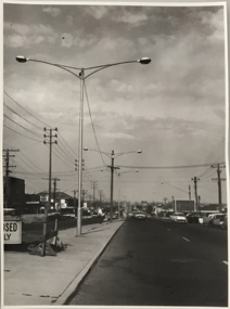
Photograph, Stuart Tompkins Studio, Electricity Supply Poles, South Road, Moorabbin, 1965
... The series from which the photograph is drawn provides a snapshot by a commercial photographic studio of each named vicinity in 1965 as well as providing examples of public works infrastructure being commissioned by local government in the 1960s. ...Research provided by Stuart Tompkins Studio, Box Hill, into alternatives for median strip street lighting to be used in Burke Road, Kew. The photographers identified variants in different suburbs appropriate to Kew's needs.The series from which the photograph is drawn provides a snapshot by a commercial photographic studio of each named vicinity in 1965 as well as providing examples of public works infrastructure being commissioned by local government in the 1960s. The photos originally formed part of the Engineering Department's files in the City of Kew before being donated to the kew Historical Society.Electricity Supply Poles, South Road, Moorabbin, 1965. Stuart Tompkins Studio provided this photograph for the Kew City Council. The photograph of South Road, Moorabbin, west of Jasper Road, looking east depicts steel poles with two lamps in a median strip and supply wires from pole to pole. The poles were described as 100′ apart. The notation on the rear of the photograph was that there were lamps along the median strip except at intersections. A wooden pole is recognised as supporting heavy supply lines across the road. The steel poles in the photograph were said to be between 3′ to 3.5′ whereas the wooden poles were three to 12.25″ in diameter. [There are three copies of this photograph in the Collection.] Typed inscription on reverse: "Electricity Supply Poles. Photographed for Kew City Council 8/2/65. No.2 South Road - Moorabbin, west of Jasper Road, looking east. Steel poles with two lamps in median strip and supply wires from pole to pole along median strip (poles only 100' apart). Lamps along median only except at intersections. Wooden pole supports heavy supply lines across the road. Wooden poles 3' up and 8 1/2" dia. Wooden poles 3' up and 12 1/2 dia." Studio stamp: "Stuart Tompkins Studio. 547 Station Street, Box Hill. WX1439."city of kew -- engineers department, public infrastructure -- kew (vic.) -
 Kew Historical Society Inc
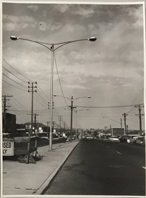
Photograph, Stuart Tompkins Studio, Electricity Supply Poles, South Road, Moorabbin, 1965
... The series from which the photograph is drawn provides a snapshot by a commercial photographic studio of each named vicinity in 1965 as well as providing examples of public works infrastructure being commissioned by local government in the 1960s. ...Research provided by Stuart Tompkins Studio, Box Hill, into alternatives for median strip street lighting to be used in Burke Road, Kew. The photographers identified variants in different suburbs appropriate to Kew's needs.The series from which the photograph is drawn provides a snapshot by a commercial photographic studio of each named vicinity in 1965 as well as providing examples of public works infrastructure being commissioned by local government in the 1960s. The photos originally formed part of the Engineering Department's files in the City of Kew before being donated to the kew Historical Society.Electricity Supply Poles, South Road, Moorabbin, 1965. Stuart Tompkins Studio provided this photograph for the Kew City Council. The photograph of South Road, Moorabbin, west of Jasper Road, looking east depicts steel poles with two lamps in a median strip and supply wires from pole to pole. The poles were described as 100′ apart. The notation on the rear of the photograph was that there were lamps along the median strip except at intersections. A wooden pole is recognised as supporting heavy supply lines across the road. The steel poles in the photograph were said to be between 3′ to 3.5′ whereas the wooden poles were three to 12.25″ in diameter. [There are three copies of this photograph in the Collection.] Typed inscription on reverse: "Electricity Supply Poles. Photographed for Kew City Council 8/2/65. No.2 South Road - Moorabbin, west of Jasper Road, looking east. Steel poles with two lamps in median strip and supply wires from pole to pole along median strip (poles only 100' apart). Lamps along median only except at intersections. Wooden pole supports heavy supply lines across the road. Wooden poles 3' up and 8 1/2" dia. Wooden poles 3' up and 12 1/2 dia." Studio stamp: "Stuart Tompkins Studio. 547 Station Street, Box Hill. WX1439."stuart tompkins studio, street lighting, south road (moorabin) 1965, public infrastructure -- city of kew, city of kew -- engineer's department -
 Kew Historical Society Inc
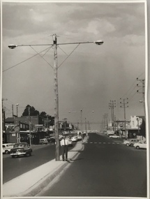
Photograph, Stuart Tompkins Studio, Electricity Supply Poles, North Road, Ormond, 1965
... The series from which the photograph is drawn provides a snapshot by a commercial photographic studio of each named vicinity in 1965 as well as providing examples of public works infrastructure being commissioned by local government in the 1960s. ...Research provided by Stuart Tompkins Studio, Box Hill, into alternatives for median strip street lighting to be used in Burke Road, Kew. The photographers identified variants in different suburbs appropriate to Kew's needs.The series from which the photograph is drawn provides a snapshot by a commercial photographic studio of each named vicinity in 1965 as well as providing examples of public works infrastructure being commissioned by local government in the 1960s. The photos originally formed part of the Engineering Department's files in the City of Kew before being donated to the kew Historical Society.Electricity Supply Poles, North Road, Ormond, 1965. Electricity supply poles photographed for the Kew City Council by Stuart Tompkins Studio. The photograph of North Road, Ormond west of Jasper Road, looking east depicts wooden poles carrying two lamps in a median strip and with two on each side alternately. It was noted that the supply wires were from one side only. The poles were described as 3′ above ground and 11.25″ in diameter. The plan was to use this approach for Burke Road, Kew. [There are three copies of this photograph in the Collection.] Typed inscription on reverse: "Electricity Supply Poles. Photographed for Kew City Council 8/2/65. No.1 North Road - Ormond, west of Jasper Road, looking east. Wooden poles carrying two lamps in median strip and two on each side alternately just as is proposed for Burke Road, Kew. Supply wires from one side only. Poles 3' above ground 11 1/4" dia." Studio stamp: "Stuart Tompkins Studio. 547 Station Street, Box Hill. WX1439."stuart tompkins studio, street lighting, south road (moorabin) 1965, public infrastructure -- city of kew, city of kew -- engineer's department -
 Kew Historical Society Inc
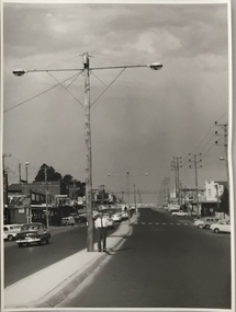
Photograph, Stuart Tompkins Studio, Electricity Supply Poles, North Road, Ormond, 1965
... The series from which the photograph is drawn provides a snapshot by a commercial photographic studio of each named vicinity in 1965 as well as providing examples of public works infrastructure being commissioned by local government in the 1960s. ...Research provided by Stuart Tompkins Studio, Box Hill, into alternatives for median strip street lighting to be used in Burke Road, Kew. The photographers identified variants in different suburbs appropriate to Kew's needs.The series from which the photograph is drawn provides a snapshot by a commercial photographic studio of each named vicinity in 1965 as well as providing examples of public works infrastructure being commissioned by local government in the 1960s. The photos originally formed part of the Engineering Department's files in the City of Kew before being donated to the kew Historical Society.Electricity Supply Poles, North Road, Ormond, 1965. Electricity supply poles photographed for the Kew City Council by Stuart Tompkins Studio. The photograph of North Road, Ormond west of Jasper Road, looking east depicts wooden poles carrying two lamps in a median strip and with two on each side alternately. It was noted that the supply wires were from one side only. The poles were described as 3′ above ground and 11.25″ in diameter. The plan was to use this approach for Burke Road, Kew. [There are three copies of this photograph in the Collection.] Typed inscription on reverse: "Electricity Supply Poles. Photographed for Kew City Council 8/2/65. No.1 North Road - Ormond, west of Jasper Road, looking east. Wooden poles carrying two lamps in median strip and two on each side alternately just as is proposed for Burke Road, Kew. Supply wires from one side only. Poles 3' above ground 11 1/4" dia." Studio stamp: "Stuart Tompkins Studio. 547 Station Street, Box Hill. WX1439."stuart tompkins studio, street lighting, south road (moorabin) 1965 -
 Kew Historical Society Inc
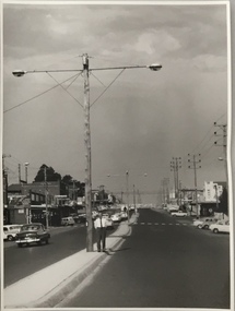
Photograph, Stuart Tompkins Studio, Electricity Supply Poles, North Road, Ormond, 1965
... The series from which the photograph is drawn provides a snapshot by a commercial photographic studio of each named vicinity in 1965 as well as providing examples of public works infrastructure being commissioned by local government in the 1960s. ...Research provided by Stuart Tompkins Studio, Box Hill, into alternatives for median strip street lighting to be used in Burke Road, Kew. The photographers identified variants in different suburbs appropriate to Kew's needs.The series from which the photograph is drawn provides a snapshot by a commercial photographic studio of each named vicinity in 1965 as well as providing examples of public works infrastructure being commissioned by local government in the 1960s. The photos originally formed part of the Engineering Department's files in the City of Kew before being donated to the kew Historical Society.Electricity Supply Poles, North Road, Ormond, 1965. Electricity supply poles photographed for the Kew City Council by Stuart Tompkins Studio. The photograph of North Road, Ormond west of Jasper Road, looking east depicts wooden poles carrying two lamps in a median strip and with two on each side alternately. It was noted that the supply wires were from one side only. The poles were described as 3′ above ground and 11.25″ in diameter. The plan was to use this approach for Burke Road, Kew. [There are three copies of this photograph in the Collection.] Typed inscription on reverse: "Electricity Supply Poles. Photographed for Kew City Council 8/2/65. No.1 North Road - Ormond, west of Jasper Road, looking east. Wooden poles carrying two lamps in median strip and two on each side alternately just as is proposed for Burke Road, Kew. Supply wires from one side only. Poles 3' above ground 11 1/4" dia." Studio stamp: "Stuart Tompkins Studio. 547 Station Street, Box Hill. WX1439."stuart tompkins studio, street lighting, south road (moorabin) 1965
