
Showing 39 items matching "map measure"
-
 Bendigo Military Museum
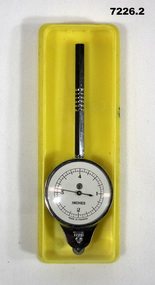
Equipment - MAP MEASURER/OPISMETER, DEPOSE
... ...map measure...Vintage opisometer used for measuring distances on maps. Part of the Kevin John Herdman, No. 397661, Collection. ...Stamped on metal near wheel: 'DEPOSE, H(logo)B'. .2) Stamped on clear cover: 'CURVIMETRE, MAP MEASURER, H(logo)B, MADE IN FRANCE'....Base is yellow, top is clear. Equipment MAP MEASURER/OPISMETER DEPOSE ...Vintage opisometer used for measuring distances on maps. Part of the Kevin John Herdman, No. 397661, Collection. See Catalogue No. 5942P for details of his service record..1) Circular chromed metal instrument with handle. Calibrated dial with black markings and hand on a white background. Reverse face has unit conversion details in black text on white background. Each face is covered with a convex glass lens. On the opposite end to the handle is a small wheel with milled edge. As it turns, the hand on the front dial turns to measure distance. .2) Rigid plastic rectangular storage case in two parts. Base is yellow, top is clear..1) Printed on front dial: 'INCHES, MADE IN FRANCE'. Printed on back dial: 'Unit conversion details'. Stamped on metal near wheel: 'DEPOSE, H(logo)B'. .2) Stamped on clear cover: 'CURVIMETRE, MAP MEASURER, H(logo)B, MADE IN FRANCE'.map, map measure, equipment, opisometer, kevin john herdman -
 Department of Energy, Environment and Climate Action
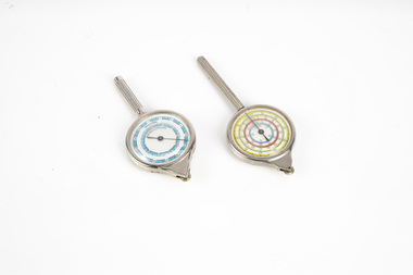
map measuring wheels
... The map wheel is a simple, fast and accurate way to measure distances on maps, whether in straight lines or along curves. ...Two metal map measuring wheel s...Hold the device from the tip and trace with the small wheel at the bottom along the line to be measured Measures distances in miles, kilometres or nautical miles depending on the scale on the side. Forests Commission Victoria (FCV) Surveying mapping Map scales on each side of wheel Two metal map measuring wheel s map measuring wheels ...The map wheel is a simple, fast and accurate way to measure distances on maps, whether in straight lines or along curves. Hold the device from the tip and trace with the small wheel at the bottom along the line to be measured Measures distances in miles, kilometres or nautical miles depending on the scale on the side.Two metal map measuring wheel sMap scales on each side of wheelforests commission victoria (fcv), surveying, mapping -
 Moorabbin Air Museum
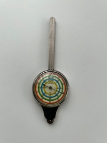
Instrument (Item) - Curvimeter (Opisometer) , Map Measuring Instrument For Measuring Curved Lines On A Map
... Curvimeter (Opisometer) , Map Measuring Instrument For Measuring Curved Lines On A Map....Curvimeter (Opisometer) , Map Measuring Instrument For Measuring Curved Lines On A Map. ... -
 Surrey Hills Historical Society Collection
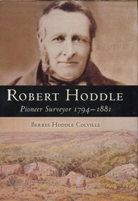
Book, Robert Hoddle: pioneer surveyor 1794-1881, 2004
... He arrived in Australia in 1823 and was one of the very earliest surveyors to explore, measure and map large areas of this vast, varied and difficult countryside, in a burgeoning era of pastoral settlement. 1837 saw him appointed Surveyor in Charge of the Port Phillip District. ...He arrived in Australia in 1823 and was one of the very earliest surveyors to explore, measure and map large areas of this vast, varied and difficult countryside, in a burgeoning era of pastoral settlement. 1837 saw him appointed Surveyor in Charge of the Port Phillip District. ...He arrived in Australia in 1823 and was one of the very earliest surveyors to explore, measure and map large areas of this vast, varied and difficult countryside, in a burgeoning era of pastoral settlement. 1837 saw him appointed Surveyor in Charge of the Port Phillip District. ...(Ms) Berres Hoddle Colville is a local Surrey Hills resident and is a descendant of Robert Hoddle. Robert Hoddle was the first Surveyor General of Victoria. He arrived in Australia in 1823 and was one of the very earliest surveyors to explore, measure and map large areas of this vast, varied and difficult countryside, in a burgeoning era of pastoral settlement. 1837 saw him appointed Surveyor in Charge of the Port Phillip District. This book is based firmly on substantial extracts from Hoddle's own diary and other writings. Includes black and white sketches, maps and colour pages.Robert Hoddle was the first Surveyor General of Victoria. He arrived in Australia in 1823 and was one of the very earliest surveyors to explore, measure and map large areas of this vast, varied and difficult countryside, in a burgeoning era of pastoral settlement. 1837 saw him appointed Surveyor in Charge of the Port Phillip District. This book is based firmly on substantial extracts from Hoddle's own diary and other writings. Includes black and white sketches, maps and colour pages.Front endpaper: SURREY HILLS HISTORICAL / SOCIETY / PURCHASED FROM / THE AUTHOR ON THE OCCASION / OF HER TALK ON ROBERT HODDLE / TO THIS SOCIETY ON 17-10-[20]05 Title page: signed by the author: Berres Hoddle Colville / 17 October 2005 /(mr) robert hoddle, surveyors, (ms) berres hoddle colville -
 Bendigo Military Museum
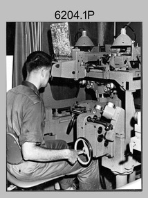
Photograph - Photogrammetric Equipment – Army Survey Regiment, Fortuna, Bendigo, c1960s to c1980s
... measure between pass, tie, and survey control points on aerial photographs. The Wild B9 and B8s were used for plotting topographic detail and contours. These analogue machines were manually controlled by adjusting the control knobs for the orientation of the 3D image. The B9s used a four and a half square, and the B8s used a nine-inch square photo image on a film or glass diapositive which allowed highly accurate extraction of map...measure between pass, tie, and survey control points on aerial photographs. The Wild B9 and B8s were used for plotting topographic detail and contours. These analogue machines were manually controlled by adjusting the control knobs for the orientation of the 3D image. The B9s used a four and a half square, and the B8s used a nine-inch square photo image on a film or glass diapositive which allowed highly accurate extraction of map ...This is a set of eight photographs of technicians operating photogrammetric equipment in Air Survey Squadron, Army Survey Regiment, Fortuna, Bendigo. c1960s to c1980s. The Wild A9 Stereocomparator and Wild B9 stereo plotter were introduced in 1962. The Wild B8 stereo plotter was introduced in 1966. Technicians used the Wild A9 Stereocomparator to accurately measure between pass, tie, and survey control points on aerial photographs. The Wild B9 and B8s were used for plotting topographic detail and contours. These analogue machines were manually controlled by adjusting the control knobs for the orientation of the 3D image. The B9s used a four and a half square, and the B8s used a nine-inch square photo image on a film or glass diapositive which allowed highly accurate extraction of map features. At first, plotting with B8 and B9 stereo plotters was undertaken at the aerial photography scale of 1:80,000 in pencil onto a controlled plotting sheet. Sheets were then inked up and reduced photographically to the 1: 100,000 publication scale for scribe impression production. In the early days topographic detail and contours were plotted with a pencil or ink pen mounted at the far end of the pantograph arm. The plotting procedure was upgraded to direct plotting in ink with photographic reduction to publication scale. In 1975 four B8s were upgraded with tri-axis locaters as part of the Input Sub-system to enable digital extraction to AUTOMAP 1’s topographic database. When AUTOMAP 2 was introduced in 1982 these B8s were upgraded, and additional machines added to expand the Army Survey Regiment’s digital capture capability. This is a set of eight photographs of technicians operating photogrammetric equipment in Air Survey Squadron, Army Survey Regiment, Fortuna, Bendigo. c1960s to c1980s. Black and white and colour photos are on photographic paper and scanned at 300 dpi. .1) - Photo, black & white, c1965. Unidentified technician operating a Wild A9 Stereocomparator. .2) - Photo, black & white, c1965. Unidentified technician operating a Wild B9 stereo plotter. .3) - Photo, black & white, c1967. L to R: Unidentified technician, SPR Ken Jeffery operating a Wild B9 stereo plotter. .4) - Photo, colour, c1974. Unidentified technician, operating a Wild B8 stereo plotter. .5) - Photo, black & white, c1974. Unidentified technician operating a Wild B8 stereo plotter. .6) to .7) - Photo, black & white, c1979. Unidentified technicians operating a Wild B8 stereo plotter. .8) - Photo, black & white, c1985. Unidentified technician in AUTOMAP 2 operating a Wild B8 stereo plotter..1P, .2P, .4P, .5P, .7P – no annotations. .3P – annotated ‘Standing - , Seated SPR Ken Jefferies (sic). .6P – annotated with date ‘1979’ .8P – annotated ‘AUTOMAP 2’royal australian survey corps, rasvy, army survey regiment, army svy regt, fortuna, asr, air survey, photogrammetry -
 Bendigo Military Museum
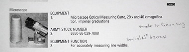
Instrument - Microscope Optical Measuring Cartographic, Hensoldt Wetzlar, Circa 1960
... Could be used to measure positive or negative line-weights or scribed lines in imperial measurements. Used at the Army Survey Regiment during the manual production of maps or charts....Could be used to measure positive or negative line-weights or scribed lines in imperial measurements. Used at the Army Survey Regiment during the manual production of maps or charts. ...A very accurate microscope for measuring cartographic line-weights (thickness) during the Mapping process. Could be used to measure positive or negative line-weights or scribed lines in imperial measurements. Used at the Army Survey Regiment during the manual production of maps or charts.Silver alloy protecting Tube 5.5cms diameter and 12cms in height containing a Cartographic Microscope with imperial measurements. The Microscope is capable of 20 to 40 times magnification.Manufactured by "HENSOLDT WETZLAR" Serial Number 63024royal australian survey corps, rasvy, fortuna, army survey regiment, army svy regt, asr -
 Bendigo Military Museum
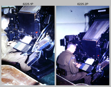
Photograph - Cartographic Production – Army Survey Regiment, Fortuna, Bendigo, c1960 -1975
... map type styles and sizes quickly and reliably, as well as text panels. Output on Copy proof adhesive backed stripping type film replaced messy wax and spray adhesives in 1978. The Editwriter capability supported all RASvy units and its contractor type setting requirements. The Aristo Co-ordinatorgraph shown in photos .5P to .7P was introduced in 1962. It was a large heavy steel framed light table with a scribing head that moved in a XY direction using a vernier calibrated measuring...map type styles and sizes quickly and reliably, as well as text panels. Output on Copy proof adhesive backed stripping type film replaced messy wax and spray adhesives in 1978. The Editwriter capability supported all RASvy units and its contractor type setting requirements. The Aristo Co-ordinatorgraph shown in photos .5P to .7P was introduced in 1962. It was a large heavy steel framed light table with a scribing head that moved in a XY direction using a vernier calibrated measuring ...This is a set of 10 photographs of Cartographic Squadron technicians undertaking map production tasks in at the Army Survey Regiment, Fortuna, Bendigo circa 1968 to 1975. Production was undertaken on the top floor of Fortuna Villa. The Fotosetter type setting machine shown in photos .1P and .2P. replaced the letterpress method of type production in 1956. CPL Arty Lane specialised in the operation of the Fotosetter type setting machine for many years. For more information on the Fotosetter, see page 71 of Valerie Lovejoy’s book 'Mapmakers of Fortuna – A history of the Army Survey Regiment’ ISBN: 0-646-42120-4. The computer based Editwriter Model 7500 typesetting system shown in photos .3P and .4P. was introduced in 1975 as a replacement to the aging Fotosetter. It was operated by a specialised technician, who generated a large variety of map type styles and sizes quickly and reliably, as well as text panels. Output on Copy proof adhesive backed stripping type film replaced messy wax and spray adhesives in 1978. The Editwriter capability supported all RASvy units and its contractor type setting requirements. The Aristo Co-ordinatorgraph shown in photos .5P to .7P was introduced in 1962. It was a large heavy steel framed light table with a scribing head that moved in a XY direction using a vernier calibrated measuring scale to 0.001 of an inch. Whilst hand operated it was much quicker and accurate than manual grid and graticule calculation, plotting and scribing. The history of co-ordinatorgraphs is covered in more detail with additional historic photographs, in pages 50 to 51 and page 88 of Valerie Lovejoy’s book 'Mapmakers of Fortuna – A history of the Army Survey Regiment’ ISBN: 0-646-42120-4. The scribing process as shown in photos .8P to .9P was the cartographic process of drafting features such as drainage, relief, vegetation, roads and culture on specially coated map reproduction material. The cartographic technician scribed out the map feature such as a contour to a specified line width on the map sheet, using a tool affixed with a sapphire tipped cutter. The quality control edit (Proving) stage of map production shown in photo .10P was the first opportunity to independently and systematically inspect a proof of the map.This is a set of 10 photographs of cartographic Squadron technicians undertaking map production tasks at the Army Survey Regiment, Fortuna, Bendigo, c1968 to c1975. The photographs were on 35mm colour slides and scanned at 96 dpi. They are part of the Army Survey Regiment’s Collection. .1) to .2) - Photo, colour, c1968, Fotosetter type setting machine, CPL Arty Lane. .3) to .4) - Photo, colour, c1975, Typesetting machine, ‘Editwriter’ Model 7500. .5) - Photo, colour, c1960s, PTE Desi Asaris and CPL Kalen Sargent operating Aristo Co-ordinatorgraph equipment. .6) - Photo, colour, c1970s, L to R: CPL Desi Asaris, CPL John Bennett, operating Aristo Co-ordinatorgraph equipment. .7) - Photo, colour, c1970s, L to R: CPL John Bennett, CPL Desi Asaris operating Aristo Co-ordinatorgraph equipment. .8) - Photo, colour, c1970s, L to R: CPL Desi Asaris scribing drainage, CPL John Bennett. .9) - Photo, colour, c1970s, CPL Desi Asaris scribing drainage. .10) - Photo, colour, c1970s, L to R: CPL Desi Asaris, CPL John Bennett and their supervisor WO2 Roger Rix inspecting features on an aeronautical chart proof. .1P to .10P There are no annotations stored with the 35mm slides.royal australian survey corps, rasvy, army survey regiment, army svy regt, fortuna, asr, carto -
 Bendigo Military Museum
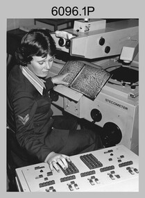
Photograph - Army Survey Regiment – Map Production, Fortuna, Bendigo, c1980s
... Map Production and car park, at the Army Survey Regiment, Fortuna, Bendigo, c1980s. The photographs were printed on photographic paper and is part of the Army Survey Regiment’s Collection. Photograph .1P was scanned at 200 dpi. The others were scanned at 300 dpi. .1) - Photo, black & white, c1980s: CPL Marrianne (Van De Zee) De Groot measuring...Map Production and car park, at the Army Survey Regiment, Fortuna, Bendigo, c1980s. The photographs were printed on photographic paper and is part of the Army Survey Regiment’s Collection. Photograph .1P was scanned at 200 dpi. The others were scanned at 300 dpi. .1) - Photo, black & white, c1980s: CPL Marrianne (Van De Zee) De Groot measuring ...These five photographs of map production and the car park area were taken at Fortuna, Bendigo, c1980s. The first three photographs were taken in Air Survey Squadron, where aerotriangulation and digital photogrammetric extraction of topographic features from aerial photography were undertaken. Photo .4P was taken in Cartographic Squadron’s Correcting Section, located in the Attic. The technicians were probably involved in a rapid response map production, as they all were wearing field uniforms. The Army Survey Regiment’s Duty Room, RAP and Carpark appear in Photo .5P. It was probably taken from the top steps near the SGT’s accommodation block in 1986. Photos .4P and .5P are also published with item 6395.17P.This is a set of five photograph of Map Production and car park, at the Army Survey Regiment, Fortuna, Bendigo, c1980s. The photographs were printed on photographic paper and is part of the Army Survey Regiment’s Collection. Photograph .1P was scanned at 200 dpi. The others were scanned at 300 dpi. .1) - Photo, black & white, c1980s: CPL Marrianne (Van De Zee) De Groot measuring aerial photographs with a stecometer. .2) - Photo, colour, c1980s: Two unidentified technicians assessing a flight line diagram. .3) - Photo, black & white, c1980s: SPR Scheryl Delforce digitising map features on an AUTOMAP 1 Graticon table. .4) - Photo, black & white, 1986: L to R: CPL Andy Lucas, SPR Chris Gordon, unidentified, SPR Jan (Crighton) Minchin, SPR Robin Marshall, CPL Frank Downie, SPR Gayle Humphrey, unidentified technicians in the Attic, Fortuna. .5) - Photo, black & white, 1986: Army Survey Regiment Duty Room, RAP and Carpark at Fortuna. .1P - Annotated on back ‘Maryanne Degroot’ .2P, .4P to .5P – no annotation .3P - Annotated on back ‘Scheryl Delforce’royal australian survey corps, rasvy, army survey regiment, army svy regt, fortuna, asr, air survey, carto, aerotrig -
 Flagstaff Hill Maritime Museum and Village
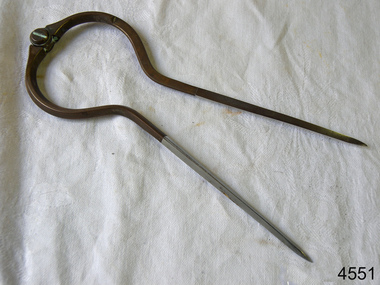
Dividers, Early 20th Century
... Dividers are used by navigators to measure the distance between two points on a map or chart. Each point of the divider is places on a map point, then the distance between the points of the divider is measured against the scale of the chart or map. ...Flagstaff Hill Maritime Museum and Village 89 Merri Street Warrnambool great-ocean-road Dividers are used by navigators to measure the distance between two points on a map or chart. Each point of the divider is places on a map point, then the distance between the points of the divider is measured against the scale of the chart or map. ...Dividers are used by navigators to measure the distance between two points on a map or chart. Each point of the divider is places on a map point, then the distance between the points of the divider is measured against the scale of the chart or map. This helps determine the ship's path of travel, the distance travelled and the current location.Not very significant as not associated with any historical event or person, same pattern of dividers is available today from many retail outlets. Also item was probably made around 1940s to 1950sDividers; brass navigator's dividers with fine, stainless steel points. Made in Britain by W & H C (inscription). This navigational tool is used by a ship's navigator to mark the ship's position. Each end point of the divider is placed on a position on a chart or map, then the length between the points of the divider is measured on the chart's scale.Inscribed "British Made" and "W & H C". flagstaff hill, warrnambool, shipwrecked-coast, flagstaff-hill, flagstaff-hill-maritime-museum, maritime-museum, shipwreck-coast, flagstaff-hill-maritime-village, navigational dividers, navigational tool, dividers made by w & hc, w & hc britain -
 Frankston RSL Sub Branch
Magnifier, Map Reading
... When unfolded this forms a "U" shape with the glass lens positioned conveniently for map viewing and the base can be used to measure scaled distances....When unfolded this forms a "U" shape with the glass lens positioned conveniently for map viewing and the base can be used to measure scaled distances. ...A small pocket size folding magnifier used for enlarging detail when reading maps or examining aerial photographs complete with a leather storage pouch. Manufactured of brass by Casartelli of Manchester, England. When unfolded this forms a "U" shape with the glass lens positioned conveniently for map viewing and the base can be used to measure scaled distances.This item is stamped "CASARTELLI, MANCHESTER" and has 1/4, 1/2 and 1 inch markings. -
Frankston RSL Sub Branch
Rule, Scale, E. ESDAILE & SONS, 1942
... A scale rule used by artillery units to measure distance between map co-ordinates on the 1 to 25,000 scale military map series. ...Frankston RSL Sub Branch 183 Cranbourne Road Frankston mornington-peninsula artillery rule scale imperial metric distance world war 2 ww2 The rule is stamped with the following: "SCALE, ARTY, No 2, MKI, E.ESDAILE & SONS, D^D, 1942" A scale rule used by artillery units to measure distance between map co-ordinates on the 1 to 25,000 scale military map series. ...A scale rule used by artillery units to measure distance between map co-ordinates on the 1 to 25,000 scale military map series. The rule is accurately machined from flat stainless steel strip and is stamped with Imperial measurements (thousands of yards) and metric measurements (thousands of metres).The rule is stamped with the following: "SCALE, ARTY, No 2, MKI, E.ESDAILE & SONS, D^D, 1942"artillery, rule, scale, imperial, metric, distance, world war 2, ww2, -
 Greensborough Historical Society
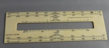
Ruler, Scale rule for map reading, 1950c
... Small rule to measure distance when reading a scale map. Measurements in yards or meters....Greensborough Historical Society 34A Glenauburn Road Lower Plenty Lower Plenty melbourne Small rule to measure distance when reading a scale map. Measurements in yards or meters. map reading scale ruler Small plastic rule, cream colour with black markings. ...Small rule to measure distance when reading a scale map. Measurements in yards or meters.Small plastic rule, cream colour with black markings.map reading, scale ruler -
 Bendigo Historical Society Inc.
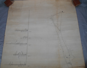
Plan - South Frederick The Great Mine, Sebastian
... SOUTH FREDERICK THE GREAT MINE Location Unreserved Crown Land along the southern boundary of Sebastian School, east of Three Chain Road, Frederick the Great/Carshalton Reef, Sebastian Map Reference Raywood 1:25000 - BV488.447 Mine site: Capped shaft still surrounded by its mullock paddock. At the base of the paddock on the northern side is a concrete winding engine foundation measuring 8 by 4 feet, and standing 2 feet high. ...History House 11 Mackenzie Street Bendigo goldfields SOUTH FREDERICK THE GREAT MINE Location Unreserved Crown Land along the southern boundary of Sebastian School, east of Three Chain Road, Frederick the Great/Carshalton Reef, Sebastian Map Reference Raywood 1:25000 - BV488.447 Mine site: Capped shaft still surrounded by its mullock paddock. At the base of the paddock on the northern side is a concrete winding engine foundation measuring 8 by 4 feet, and standing 2 feet high. ...SOUTH FREDERICK THE GREAT MINE Location Unreserved Crown Land along the southern boundary of Sebastian School, east of Three Chain Road, Frederick the Great/Carshalton Reef, Sebastian Map Reference Raywood 1:25000 - BV488.447 Mine site: Capped shaft still surrounded by its mullock paddock. At the base of the paddock on the northern side is a concrete winding engine foundation measuring 8 by 4 feet, and standing 2 feet high. The foundation has ¾-inch mounting bolts. Battery site 70 metres to the west of the mine site are the concrete foundations of a 10head battery. The foundations measure 16 by 11 feet, and stand 4 feet high. Part of the battery's loading ramp still survives, and on the eastern side of the battery foundations is a large concrete engine foundation. Near this engine foundation is a 3 foot square concrete pad, which still retains a circular impression. Presumably this was a stand for a gas producer cylinder. Located between the battery and the mine site is a rubbish dump which contains sections of an iron stack, and perhaps the remains of the gas producer cylinder. History Period of activity: 1871 (South Frederick the Great); 1881-1889 (Amalgamated South Frederick the Great); 1897-1906 (South Frederick the Great); 1933-1937 (South Frederick the Great) Line of reef: Sebastian/Carshalton Maximum recorded annual production: unknown Total production: 511ozs obtained from 1773 tons between 1934 and 1937 Deepest working level: 300 feet (Amalgamated South Frederick the Great) Deepest shaft: 307 feet (Amalgamated South Frederick the Great)(below water level) Source: City of Greater Bendigo: Marong Heritage Study chrome-extension://efaidnbmnnnibpcajpcglclefindmkaj/http://images.heritage.vic.gov.au/attachment/70493Mining SitesTransverse and longitudinal plans on one sheet, of South Frederick The Great Mine, Sebastian. Forms part of the Margaret Roberts Collection of mining records.bendigo, margaret roberts, gold, south frederick the great mine, margaret roberts collection, sebastian -
Bendigo Historical Society Inc.
Book - THE AUSTRALIAN BOY SCOUT DIARY 1933, 1933
... Maps. Fires. First Aid. Headquaters Address. Holidays. Knots, Bends and Hitches. List of Badges. Local Fixtures. Morse. Our Flag. Personal Memoranda. Pioneering. Plan of Camp. Rover Scouts. Scout Uniform. Scout Signs and Salutes. Sea Scouts. Sea Scouting - Notes on Boat Handling. Semaphore. South by the Stars. Swimming. Torch. Treatment of Snakebite. Troop Camps. Weights and Measures...Maps. Fires. First Aid. Headquarters Address. Holidays. Knots Bends and Hitches. List of Badges. Local Fixtures. Morse. Our Flag. Personal Memoranda. Pioneering. Plan of Camp. Rover Scouts. Scout Uniform. Scout Signs and Salutes. Sea Scouts. Sea Scouting - Notes on Boat Handling. Semaphore. South by the Stars. Swimming. Torch. Treatment of Snakebite. Troop Camps. Weights and Measures ...The Australian Boy Scout Diary 1933. Inside front cover is an intimate picture of Chief & his family. With specially written notes and Sketches for Cubs, Scouts, Rovers and Scouters. Obtainable at all State Headquaters in Australia. Prepared and Published by the Victorian Section in conjuntion with the Federal Scout Council of Australia. Printed by Exchange Press Pty Ltd, 310 Spencer Street, Melbourne. Index: Boy Scouts. Bush Fires. Calendars 1933, 1934. 1934 Calendar. Conventional Signs and Maps. Fires. First Aid. Headquaters Address. Holidays. Knots, Bends and Hitches. List of Badges. Local Fixtures. Morse. Our Flag. Personal Memoranda. Pioneering. Plan of Camp. Rover Scouts. Scout Uniform. Scout Signs and Salutes. Sea Scouts. Sea Scouting - Notes on Boat Handling. Semaphore. South by the Stars. Swimming. Torch. Treatment of Snakebite. Troop Camps. Weights and Measures. Wolf Cubs. Wood Badge. Uses of Scout Staff. Inside rear cover is a sepia photo of the site of the 1933 Jamboree at Godollo, Hungary. Book is very detailed giving information on all aspects of Scout life, with sketches for knots, maps, etc. Inscriptions are on page 58: Troup or Pack - 1st Epsom Pack. Watch No. 4133033. Season Ticket No. Commonwealth acc 957. Savings No. 4729. Size in Hats: 7. Size of Boots: 5. Size of Collar 14 1/2. Size of Gloves 6 1/4. Iinscription on page 60: Books Read: In Search of Wales, Morton. Faraway, Priestly. Jock the Scot, Alice Grant Rosemary. Bernard Shaw, Frank Harris.Exchange Press Pty Ltd., Melbournebook, bendigo, scouts, the australian boy scout diary 1933. photo of chief & his family. notes and sketches for cubs, scouts, rovers and scouters. obtainable at all state headquarters in australia. published by the victorian section in conjunction with the federal scout council of australia. exchange press pty ltd, melbourne. index: boy scouts. bush fires. calendars 1933, 1934. 1934 calendar. conventional signs and maps. fires. first aid. headquarters address. holidays. knots, bends and hitches. list of badges. local fixtures. morse. our flag. personal memoranda. pioneering. plan of camp. rover scouts. scout uniform. scout signs and salutes. sea scouts. sea scouting - notes on boat handling. semaphore. south by the stars. swimming. torch. treatment of snakebite. troop camps. weights and measures. wolf cubs. wood badge. uses of scout staff. sepia photo of the site of the 1933 jamboree at godollo, hungary. information on all aspects of scout life, with sketches for knots, maps, etc. inscriptions page 58: troup or pack - 1st epsom pack. watch no. 4133033. season ticket no. commonwealth acc 957. savings no. 4729. size in hats: 7. size of boots: 5. size of collar 14 1/2. size of gloves 6 1/4. page 60: books read: in search of wales, morton. faraway, priestly. jock the scot, alice grant rosemary. bernard shaw, frank harris. -
 Cheese World Museum
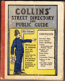
Book, Queen City Printers Pty Ltd, Collins Street Directoryand Publice Guide: 8th Edition
... COLLINS' STREET DIRECTORY/AND/PUBLIC GUIDE/8th Edition/2/6 each/CONTENTS/ Suburban Maps/Street Indices/Public Buildings/Tourist Information and Holiday Notes/Weights and Measures/Postal Rates/Calendar/Conversion Tables/Justices of the Peace/And other useful and up-to-date matter...-not listed Allansford Uebergang street directory public guide Collins Melbourne maps tourist information Queen City Printers Pty Ltd almanacs local history COLLINS' STREET DIRECTORY/AND/PUBLIC GUIDE/8th Edition/2/6 each/CONTENTS/ Suburban Maps/Street Indices/Public Buildings/Tourist Information and Holiday Notes/Weights and Measures/Postal Rates/Calendar/Conversion Tables/Justices of the Peace/And other useful and up-to-date matter White hard cover pocket-sized street directory book with red cloth spine. ...The Percy Uebergang family lived at Tooram Park, Allansford from 1912 until 1992. This booklet was part of the collection of items given into the care of the Cheese World Museum. Uebergang catalogue No. -not listed White hard cover pocket-sized street directory book with red cloth spine. The front cover has a blue and yellow background with title, contents, edition listed and a policeman in a blue uniform. The back cover has information in black print. Melbourne and suburbs maps throughout. 439 pages.COLLINS' STREET DIRECTORY/AND/PUBLIC GUIDE/8th Edition/2/6 each/CONTENTS/ Suburban Maps/Street Indices/Public Buildings/Tourist Information and Holiday Notes/Weights and Measures/Postal Rates/Calendar/Conversion Tables/Justices of the Peace/And other useful and up-to-date matterallansford, uebergang, street directory, public guide, collins, melbourne, maps, tourist information, queen city printers pty ltd, almanacs, local history -
Glenelg Shire Council Cultural Collection
Souvenir - Drink Coasters, n.d
... Black line border, 'PORTLAND DEVELOPMENT COMMITTEE', map of Victoria, green and purple 'Prosper in Portland' overlaid. Identification Numbers 6349, 6349 a Measures each 9.3 cm diameter...Black line border, 'PORTLAND DEVELOPMENT COMMITTEE', map of Victoria, green and purple 'Prosper in Portland' overlaid. Identification Numbers 6349, 6349 a Measures each 9.3 cm diameter Souvenir Drink Coasters ...2 x Round, white cardboard coasters. Black line border, 'PORTLAND DEVELOPMENT COMMITTEE', map of Victoria, green and purple 'Prosper in Portland' overlaid. Identification Numbers 6349, 6349 a Measures each 9.3 cm diameter -
Glenelg Shire Council Cultural Collection
Plan - Glenelg Shire Council Plan 2004-2008, c. 2004
... Black cover of the document shows a map of Glenelg Shire Council and lists associated contact details. Inside fold out are key objectives/commitments for the years 2004-2008. Document size folded measures...Black cover of the document shows a map of Glenelg Shire Council and lists associated contact details. Inside fold out are key objectives/commitments for the years 2004-2008. Document size folded measures ...Glenelg Shire Council Plan 2004-2008. -
 Flagstaff Hill Maritime Museum and Village
Map - Survey Map, F.F. McGovern, Yangery - County of Villiers, 1884
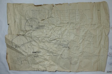
... A surveyor was employed to measure the land designated as Yangery, County of Villiers, in the Borough of Warrnambool. The area on the map is similar to the earlier Farnham Survey undertaken by William Rutledge in the 1850's. ...Flagstaff Hill Maritime Museum and Village 89 Merri Street Warrnambool great-ocean-road A surveyor was employed to measure the land designated as Yangery, County of Villiers, in the Borough of Warrnambool. The area on the map is similar to the earlier Farnham Survey undertaken by William Rutledge in the 1850's. ...A surveyor was employed to measure the land designated as Yangery, County of Villiers, in the Borough of Warrnambool. The area on the map is similar to the earlier Farnham Survey undertaken by William Rutledge in the 1850's. Warrnambool was a Borough between 1863-1883. Coutours, waterways, sea and other significant points are shown. The distances are accurately measured. This survey map was used for planning future land sales, recreation areas and roads. WILLIAM RUTLEDGE (1806-1876) William Rutledge surveyed the land known as Farnham in southwest Victoria in 1843. His tenants made him a profitable business from working the land there. In 1863 Rutledge moved from nearby Port Fairy to Farnham and became very successful in breeding sheep, which he imported from J.R. Kirkham of Lincolnshire, England. He also bred horses on his land. The survey map of Yangery is important for its connection with renowned surveyor William Rutledge. The map shows the growth of landholders in the district when compared to the original Rutledge survey of the 1850's.Survey map of Yangery, titled "Yangery - County of Villiers". Printed on white paper, mounted on brown paper. c. 1863-1876. Comments printed on the Map include; Special Survey by William Rutledge, Photo-lithographed at the Department of Lands and Survey, Melbourne by W.J. Burson, Price 1/- [one shilling]. Scale is in Chains. Map has boundaries of Koroit Borough, Meerai, Purnim, Wangoom, Borough of Warrnambool, Mentions the Proposal of Tower HIll for Public Recreation. The map names the owners of the land at that time. Hand written pencil marks and figures and "Sauls fence" drawn on map. Hand written pencil markes and figures and "Sauls fence" drawn onto map. "For Department Use only". "Scale: 8 chains to 1 inch" flagstaff hill, warrnambool, shipwrecked-coast, flagstaff-hill, flagstaff-hill-maritime-museum, maritime-museum, shipwreck-coast, flagstaff-hill-maritime-village, county of villiers map, yangery district, w.j. burson, borough of warrnambool, koroit, purnim, meerai, wangoom, proposal of tower hill for public recreation, special survey by william rutledge, william rutledge, farnham, lincolnshire sheep, clydesdale -
 Flagstaff Hill Maritime Museum and Village
Functional object - Map Calipers/ Divider, Unknown
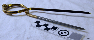
... Or the marine dividers used to measure the distance a vessel has travelled by transferring the vessels distance from a map with the divider and transferring that measurement to a marine ruler to mathematical calculate the distance....Or the marine dividers used to measure the distance a vessel has travelled by transferring the vessels distance from a map with the divider and transferring that measurement to a marine ruler to mathematical calculate the distance. ...Compass, divider, and caliper are basically instruments that have two legs pivoted to each other at the top and are concerned with small-distance measurement or transfer. The compass and divider have straight legs; the caliper has curved legs. Dividers and Calipers were known to both the Greeks and Romans, though the caliper was uncommon. A divider with a circular sector, or wing, connecting the two legs was sketched in 1245, its modern counterpart is the wing divider with a thumbscrew clamp and screw for fine adjustment. Or the marine dividers used to measure the distance a vessel has travelled by transferring the vessels distance from a map with the divider and transferring that measurement to a marine ruler to mathematical calculate the distance.Item is believed to be a replica/ copy of a 19th century map calipers used in marine navigation to determine distance travelled. Item was probably purchased between 1972-1975 to add to the marine displays at Flagstaff Hill.Stainless steel dividers used in navigation charts. Top half is alloy plated. "W & HC" and "Made in England".flagstaff hill, warrnambool, shipwrecked-coast, flagstaff-hill, flagstaff-hill-maritime-museum, maritime-museum, shipwreck-coast, flagstaff-hill-maritime-village, stainless steel dividers, steel dividers, dividers -
 Coal Creek Community Park & Museum
Terrestrite measuring equipment, 1888 (Approx)
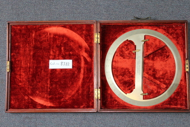
... . - a h x 8382.1 - Metal (likely steel) protractor, marked down to 0.5, used mostly in map drafting. 8382.2 - Wooden red velvet-lined case. Terrestrite measuring equipment ...8382.1 - Metal (likely steel) protractor, marked down to 0.5, used mostly in map drafting. 8382.2 - Wooden red velvet-lined case.- Flavelle bros and Roberts, Sydney and Brisbane. - 6692 a s x- similar marks were made and scratched out. - a h x -
 Sunshine and District Historical Society Incorporated
Map - City of Sunshine Map
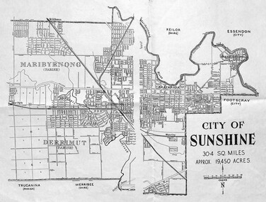
... Map shows boundary and streets of the City of Sunshine - possibly pre 1961|shows the City of Sunshine as being 30.4 square miles and approximating 19,450 acres|Measures 25cm x 40cm...City of Sunshine Map Map shows boundary and streets of the City of Sunshine - possibly pre 1961|shows the City of Sunshine as being 30.4 square miles and approximating 19,450 acres|Measures 25cm x 40cm City of Sunshine Map - undated Map City of Sunshine Map ...Map shows boundary and streets of the City of Sunshine - possibly pre 1961|shows the City of Sunshine as being 30.4 square miles and approximating 19,450 acres|Measures 25cm x 40cmcity of sunshine, map -
 Bendigo Historical Society Inc.
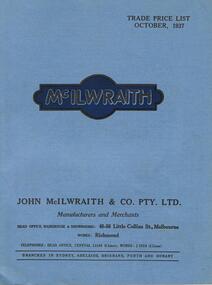
Document - ABBOTT COLLECTION: TRADE CATALOGUE, 1937
... It measures 18.5 x 24.2cm. Contains lists of products, photographs, maps and illustrations all in Black and white print. ...It measures 18.5 x 24.2cm. Contains lists of products, photographs, maps and illustrations all in Black and white print. ...John McIllwraith began the Melbourne Lead Works in 1854. After his death in Scotland in 1902, the business was continued by his sons, John, Thomas and David. In 1870 John became a member of the Melbourne Council and served as mayor in 1873/74. The business expanded to become a major supplier of plumbing supplies.Trade Price list for McIlwraith and Co 1937. Manufacturers and Merchants 48-56 Little Collins st Melbourne. It is a paper booklet covered in a steel blue light cardboard cover with 96 pages. It measures 18.5 x 24.2cm. Contains lists of products, photographs, maps and illustrations all in Black and white print. Printed by Osboldstone & Co Melbournejohn mcilwraith, abbott -
 Creswick Campus Historical Collection - University of Melbourne
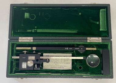
Instrument - Compensating Polar Planimeter, Keuffel & Esser 620015 KE Compensating Polar Planimeter
... A precision tool for measuring areas of both regular and irregular shape from maps, plans, blueprints, photographs, and other documents. ...A precision tool for measuring areas of both regular and irregular shape from maps, plans, blueprints, photographs, and other documents. ...Research and TrainingA precision tool for measuring areas of both regular and irregular shape from maps, plans, blueprints, photographs, and other documents. Simply trace the outline of an area with the cursor to obtain its size. The 620015 Paragon model features adjustable-length tracer arm measures and adjustable-length pole armK&E Germany Paragon.31427. Hand engraved: VSF006. -
 Creswick Campus Historical Collection - University of Melbourne
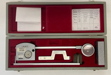
Instrument - Compensating Polar Planimeter, A. Ott Compensating Polar Planimeter. M8630
... A precision tool for measuring areas of both regular and irregular shape from maps, plans, blueprints, photographs, and other documents. ...University of Melbourne - 40500 A precision tool for measuring areas of both regular and irregular shape from maps, plans, blueprints, photographs, and other documents. ...Research and TrainingA precision tool for measuring areas of both regular and irregular shape from maps, plans, blueprints, photographs, and other documents. Simply trace the outline of an area with the cursor to obtain its size. A.OTT, Kempten. Made in West Germany. University of Melbourne - 40500 -
 Victorian Aboriginal Corporation for Languages
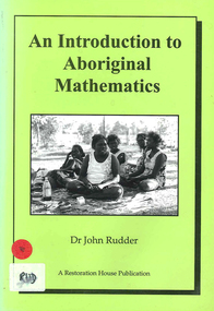
Book, John Rudder, An introduction to Aboriginal mathematics, 1999
... Victorian Aboriginal Corporation for Languages 33 Saxon Street Brunswick melbourne North East Arnhem Land turtle egg mathematics Aboriginal mathematics Aboriginal social life measuring space measuring time flora fauna maps, b&w illustrations, b&w photographs Aboriginal mathematics tends to focus on the relationship of numbers rather than quantities. ...Aboriginal mathematics tends to focus on the relationship of numbers rather than quantities. This book shows why numbers were irrelevant to Aborigines and outlines the kind of mathematics that was used.maps, b&w illustrations, b&w photographsnorth east arnhem land, turtle egg mathematics, aboriginal mathematics, aboriginal social life, measuring space, measuring time, flora, fauna -
 Wodonga & District Historical Society Inc
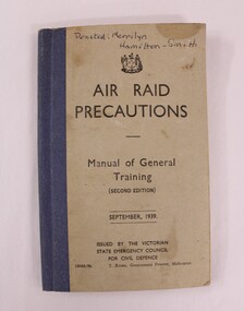
Booklet - Hamilton-Smith Collection Air Raid Precautions Booklet, T. Rider - Government Printer, September 1939
... maps, and material relating to the world wars. This Air Raid Precautions booklet was one of thousands distributed to households across Australia during WW2. They provided instructions on what to do during an air raid and were based on emergency response protocols established in Britain. Other measures...maps, and material relating to the world wars. This Air Raid Precautions booklet was one of thousands distributed to households across Australia during WW2. They provided instructions on what to do during an air raid and were based on emergency response protocols established in Britain. Other measures ...The Hamilton-Smith collection was donated by the children of Grace Mary Hamilton-Smith nee Ellwood (1911-2004) and John Hamilton-Smith (1909-1984) who settled in Wodonga in the 1940s. The Ellwood family had lived in north-east Victoria since the late 1800s. Grace’s mother, Rosina Ellwood nee Smale, was the first teacher at Baranduda in 1888, and a foundation member of the C.W.A. Rosina and her husband Mark retired to Wodonga in 1934. Grace and John married at St. David’s Church, Albury in 1941. John was a grazier, and actively involved in Agricultural Societies. The collection contains significant items which reflect the local history of Wodonga, including handmade needlework, books, photographs, a wedding dress, maps, and material relating to the world wars. This Air Raid Precautions booklet was one of thousands distributed to households across Australia during WW2. They provided instructions on what to do during an air raid and were based on emergency response protocols established in Britain. Other measures adopted by State Governments during this period included the installation of air raid sirens and bomb shelters, and the training of volunteers in firefighting and first aid. This item has well documented provenance and a known owner. It forms part of a significant and representative historical collection which reflects the local history of Wodonga. It contributes to our understanding of life in Australia during WW2. A small booklet containing illustrations and text instructing people what to do during an air raid. Front cover in pen: "Donated: Merrilyn/Hamilton-Smith"ww2, world war two, world war, war, 1940s, air raid, defence, bomb -
Creswick Campus Historical Collection - University of Melbourne
Equipment, Curvimeter
... For measuring distance of irregular line on maps. Cased in blue box with clear lid...For measuring distance of irregular line on maps. Cased in blue box with clear lid Equipment Curvimeter Equipment ...Steel tool with moving wheel attached to measurement dial. For measuring distance of irregular line on maps. Cased in blue box with clear lidEquipment -
 Bendigo Military Museum
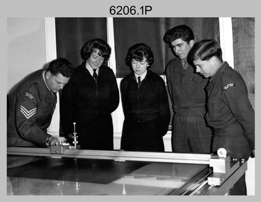
Photograph - Co-ordinatorgraph Map Grid Production, Army Survey Regiment, Fortuna Bendigo, c1960s to 1970s
... map grid production using co-ordinatorgraphs at the Army Survey Regiment, Fortuna Bendigo. c1960s to 1970s. The Aristo Co-ordinatorgraph introduced in 1962 was a large heavy steel framed light table with a scribing head that moved in a XY direction using a vernier calibrated measuring scale to 0.001 of an inch. ...map grid production using co-ordinatorgraphs at the Army Survey Regiment, Fortuna Bendigo. c1960s to 1970s. The Aristo Co-ordinatorgraph introduced in 1962 was a large heavy steel framed light table with a scribing head that moved in a XY direction using a vernier calibrated measuring scale to 0.001 of an inch. ...This is a set of seven photographs of map grid production using co-ordinatorgraphs at the Army Survey Regiment, Fortuna Bendigo. c1960s to 1970s. The Aristo Co-ordinatorgraph introduced in 1962 was a large heavy steel framed light table with a scribing head that moved in a XY direction using a vernier calibrated measuring scale to 0.001 of an inch. Whilst hand operated it was much quicker and accurate than manual grid and graticule calculation, plotting and scribing. Mapping PNG presented the Regiment with many challenges. WO1 Farrington and CPL John Dean developed computer software for the digitally controlled co-ordinatorgraph, the Calcomp 718 Flatbed Plotter. Much time was saved by automatically plotted cartographic grids and graticules, and automatically draw base compilation sheets complete with aerial triangulated stereo model control. This could be used for a number of maps and was the first step towards map automation. The history of co-ordinatorgraphs is covered in more detail with additional historic photographs, in pages 50 to 51 and page 88 of Valerie Lovejoy’s book 'Mapmakers of Fortuna – A history of the Army Survey Regiment’ ISBN: 0-646-42120-4. SGT Bill Boyd appearing in photo .1P reach the rank of WO1 and for 11 years was the technical warrant officer at the Detachment Army Survey Regiment located at Bonegilla, Victoria. He was awarded the OAM, the Order of Australia Medal for the development of the Flexiflow quality control system. This system comprised a series of job plans and charts linked to a task allocation to resource magnetic planning board. Using critical path analysis and task prioritisation, complex job planning was efficiently scheduled, and re-prioritisations readily made. Reproduction requirements were effectively coordinated by way of weekly courier to the Army Survey Regiment. Supervisors and technicians fully embraced the system as they could understand their role, others around them and the positive production achievements. Bendigo. See page 178 of Valerie Lovejoy’s book for more information on WO1 Boyd’s contribution to RA Svy.This is a set of seven photographs of map grid production using co-ordinatorgraphs at the Army Survey Regiment, Fortuna Bendigo. c1960s to 1970s. The photographs were printed on photographic paper and are part of the Army Survey Regiment’s Collection. The photographs were scanned at 300 dpi. .1) - Photo, black & white, c1960s, L to R: SGT Bill Boyd demonstrating Aristo Co-ordinatorgraph equipment to unidentified technicians (x3) .2) - Photo, black & white, c1960s, Aristo Co-ordinatorgraph equipment. .3) - Photo, black & white, c1960s, unidentified technician operating Aristo Co-ordinatorgraph equipment. .4) - Photo, black & white, c1960s, L to R: PTE Desi Asaris and CPL Kalen Sargent operating Aristo Co-ordinatorgraph equipment. .5) - Photo, black & white, Photo, black & white, c1970s, John Bloor operating Calcomp co-ordinatorgraph equipment. .6) - Photo, black & white, Photo, black & white, c1970s, unidentified technician operating Calcomp co-ordinatorgraph equipment. .7) - Photo, black & white, Photo, black & white, c1970s, L to R: SGT Andy Covington and SGT John Waight operating Calcomp co-ordinatorgraph equipment..7P annotated on back ‘Covington & Waight’.royal australian survey corps, rasvy, army survey regiment, army svy regt, fortuna, asr, carto, air survey -
 Flagstaff Hill Maritime Museum and Village
Book - Reference Book/Atlas, G. Woolworth Colton, Coltons General Atlas, 1866
... map dates are not always the same thing. Because the center page of the Book has the heading of "Register of Authorised Copies of The Standard Weights and Measures Issued 1866." ...map dates are not always the same thing. Because the center page of the Book has the heading of "Register of Authorised Copies of The Standard Weights and Measures Issued 1866." ...Colton’s General Atlas is a 19th century commercial world atlas by G. Woolworth Colton, with descriptive text by Richard Swainson Fisher, and it was issued in multiple editions through the late 1800s. The atlas began as Colton’s earlier Atlas of the World in 1855–1856, then was reduced to a single volume work under the title “Colton’s General Atlas” starting in 1857. The subject work is an 1866 copy, and is a later edition in a long running atlas series. The 1866 edition is bibliographically useful because it sits in the transitional period after Colton’s firm had already changed hands and reorganised, and references note that the 1866 issue differs from 1865, particularly in western mapping.Hard cover book, Coltons General Atlas. Author: G. Woolworth Colton Publisher: G.W. & C.B. Colton, New York USA. Date: 1866 Light brown cloth hardcover and spine, spine has black repair tape, front cover has reinforced corners in black.non-fictionColton’s General Atlas is a 19th century commercial world atlas by G. Woolworth Colton, with descriptive text by Richard Swainson Fisher, and it was issued in multiple editions through the late 1800s. The atlas began as Colton’s earlier Atlas of the World in 1855–1856, then was reduced to a single volume work under the title “Colton’s General Atlas” starting in 1857. The subject work is an 1866 copy, and is a later edition in a long running atlas series. The 1866 edition is bibliographically useful because it sits in the transitional period after Colton’s firm had already changed hands and reorganised, and references note that the 1866 issue differs from 1865, particularly in western mapping. flagstaff hill, warrnambool, maritime village, maritime museum, shipwreck coast, great ocean road, coltons general atlas, weights and measures, atlas -
 Bendigo Historical Society Inc.
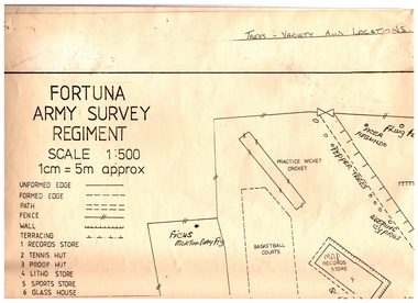
Administrative record - Ex-Fortuna Survey Association Collection: Conservation Management Plans, 1994-96
... Maintain plant health and species diversity to enhance the area's character. 2 Address financial constraints, human use, military requirements, and stakeholder engagement. 3 Employ qualified experts to prepare the plan. 4 Address historical significance, plant health, heritage value, remedial works, and visual character (including maintaining views and screening modern structures). 5 Restore garden design to its original character where possible. 6 Recommend measures for future works to protect garden health and significant trees. 7 Identify and map significant plants and recommend suitable species for replanting. ...Maintain plant health and species diversity to enhance the area's character. 2 Address financial constraints, human use, military requirements, and stakeholder engagement. 3 Employ qualified experts to prepare the plan. 4 Address historical significance, plant health, heritage value, remedial works, and visual character (including maintaining views and screening modern structures). 5 Restore garden design to its original character where possible. 6 Recommend measures for future works to protect garden health and significant trees. 7 Identify and map significant plants and recommend suitable species for replanting. ...'Fortuna' was developed by George Lansell, the 'Quartz King', from the 1870s to 1906. The estate features a mansion, a notable Italian water garden with imported elements, and a large lake originally used for mining. The property covers 6.7 hectares and contains many mature trees, including palms, poplars, pepper trees, Norfolk Island pines, and various specimen trees. Since 1942 to the 1980s, the Department of Defence has owned and maintained the property. General Considerations are to: 1 Preserve and restore the heritage value and history of the gardens to complement historic buildings. Maintain plant health and species diversity to enhance the area's character. 2 Address financial constraints, human use, military requirements, and stakeholder engagement. 3 Employ qualified experts to prepare the plan. 4 Address historical significance, plant health, heritage value, remedial works, and visual character (including maintaining views and screening modern structures). 5 Restore garden design to its original character where possible. 6 Recommend measures for future works to protect garden health and significant trees. 7 Identify and map significant plants and recommend suitable species for replanting. Consultant to start in September 1994 and complete by December 1994 with Regular meetings with a steering committee and encourage public involvement. The plan aims to ensure the long-term preservation, enhancement, and appropriate use of the heritage gardens, balancing historical, ecological, recreational, and military needs. In 1996 Fancine Gilfedder and Associates produced the Garden Conservation Management Plan for the Department of Defence: This Conservation Management Plan for the historic Fortuna Bendigo Garden outlines its historical development, significance, and strategies for preservation and management. 1. The plan was commissioned by the Department of Defence and prepared by Francine Gilfedder & Associates in 1996. It covers the Fortuna Garden site, its heritage status, and the methodology used for assessment. 2. Historical OverviewProvides a detailed chronology of the garden's development and its phases. Identifies significant materials, features, and architectural elements. 3. Site AssessmentSurveys existing site conditions, including plant and tree inventories.Documents architectural features and general landscape conditions. 4. Assesses the garden's heritage value using established criteria (e.g., Burra Charter, AHC criteria). Identifies elements of significance and provides comparative analysis with similar sites. 5. Summarizes the heritage value and unique aspects of the Fortuna Garden. 6. Outlines statutory and non-statutory requirements, user needs, and physical constraints affecting management. 7. Recommends general and component-specific policies for conservation. 8. Implementation Provides guidelines and specific recommendations for development and ongoing management. 9. Details best practices for tree, shrub, rose, and lawn care, as well as maintenance of paths and structures.Fortuna Villa Conservation Management Plans This Document Contains the following Items: 11231.4a This document is a draft brief by the army, 1994. It outlines the brief for a conservation management plan for the heritage gardens and surrounds of Fortuna Villa in Bendigo. It's three pages outlines Purpose, Background History and General Considerations, requirements and a summary. Seven first pages reproduced here. 11231.4b This Conservation Management Plan for the historic Fortuna Bendigo Garden outlines its historical development, significance, and strategies for preservation and management. Black Fabric Binding of approximately 110 pages (printed on both sides), photocopy with photos and plans. The first four pages showing the cover and index are shown here. 11231.4c Undated. This document is a horticultural report providing suggestions for improving the grounds and gardens at 'Fortuna', a historic estate now used by the Army Survey Regiment in Bendigo. The black and white report of approx 100 pages is "Spiralex" bound. It contains - it is compiled for the army by Karl Liffman (TAFE horticulture department) and Ian Huxley (experienced horticulturist and garden designer), with input from gardening apprentices. It contains many photos with new suggestions overlyared on top of them. The report addresses only the grounds and gardens visible to visitors: main drive, car parks, front garden, and areas around the lake. Recommendations are from a horticultural perspective, emphasizing plant variety and practical maintenance over formal landscape architecture.PurposeAims to guide the Army in developing and maintaining Fortuna’s gardens, recognizing the property's heritage and its value for public relations. 11231.4d An unbound copy of the above 11231.4e A letter to Range Control, Department of Defence, Puckapunyal, from Francine Gilfedder and Associates, Landscape Architect and Horticulturist, 15 Dover St Richmond; and a 18 page management plan. The plan aims to guide the conservation and management of the Fortuna Villa gardens, focusing on heritage values and preservation needs. May 1995. 11231.4f March 1996 five page document which outlines a conservation and restoration proposal for the Pompeii Fountain and adjacent heritage structures at Fortuna, Golden Square, Victoria. The fountain's steel column was severely rusted; rendered surfaces and marble font were deteriorating; adjacent garden walls and staircases were failing. 11231.4g Copy of above 11231.4h A five page document which contains key points from the conservation and restoration plan for Fortuna Villa. 1990s. 11231.4i A 30 page document. Part of the conservation policy and management plan for the Fortuna estate: 11231.4j A six page document is a conservation management plan and tree health report for Fortuna Villa in Bendigo, focusing on diagnosing tree diseases, assessing tree conditions, and recommending removal or treatment actions. Prepared by Francine Gilfedder and Associates, Landscape Architect and Horticulturist, 15 Dover St Richmond for the army. 11231.4k The one page document is a tree inspection report for a Sierra Redwood at Fortuna Villa, Bendigo, prepared in response to concerns about the tree's stability after the removal of a nearby specimen. Prepared by Trevor Lawrence Tree Surgeon, 830 Barkley St Ballarat. July 1995 11231.4l A 15 page document which provides an interpretive plan and historical overview for Fortuna Villa, a heritage site in Bendigo, focusing on its history, significance, and strategies for visitor engagement. 1995 prepared by Dianne Bish, Eaglehawk 11231.4m A large army plan of the Fortuna Grounds with prominent trees marked.bendigo, fortuna villa, history, army survey regiment, gardens, conservation management
