Showing 36 items
matching map of whittlesea
-
 Greensborough Historical Society
Map, Melbourne and Metropolitan Board of Works. Survey Division, MMBW, Yarra 2500 / 12.23. Janefield and Kangaroo Point, 1977_10
... map] 12-23, Municipalities of Whittlesea 239 and Diamond... of Works. Yarra 2500 [base map] 12-23, Municipalities of Whittlesea ...Melbourne and Metropolitan Board of Works. Yarra 2500 [base map] 12-23, Municipalities of Whittlesea 239 and Diamond Valley 257. No streets marked on this map. Includes Plenty River, Kangaroo Point, Janefield Colony and Janefield Reserve.MMBW Map in 1:2500 [scale] series. Cream parchment with green tape reinforcing on edges and punched holes on left edge.mmbw, melbourne and metropolitan board of works, shire of diamond valley, plenty - maps -
 Greensborough Historical Society
Map, Melbourne and Metropolitan Board of Works. Survey Division, MMBW, Yarra 2500 / 12.24. Plenty and Blue Lake, 1977_10
... map]. 12-24, Municipalities of Whittlesea 239 and Diamond... of Works. Yarra 2500 [base map]. 12-24, Municipalities ...Melbourne and Metropolitan Board of Works. Yarra 2500 [base map]. 12-24, Municipalities of Whittlesea 239 and Diamond Valley 257. Shows street names, easement sizes, lot numbers, lodged plan numbers, names of prominent features, contour values, creek or river names. Watsonia Railway Station and environs. Prominent streets: Memorial Drive. Includes Plenty River and Blue Lake in the Plenty Gorge.MMBW Map in 1:2500 [scale] series. Cream parchment with green tape reinforcing on edges and punched holes on left edge.mmbw, melbourne and metropolitan board of works, shire of diamond valley, plenty - maps, blue lake -
 Eltham District Historical Society Inc
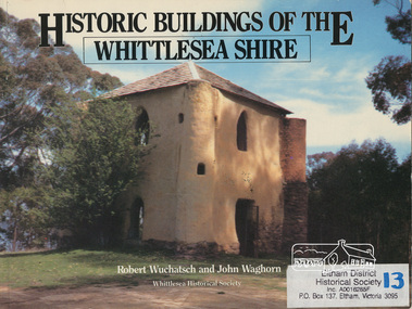
Book, Robert Wuchatsch 1950- et al, Historic buildings of the Whittlesea Shire / Robert Wuchatsch and John Waghorn, 1985
... . There are also drawings and a map of the Shire of Whittlesea. Reference... map ; 19 x 25 cm. Historic buildings of the Whittlesea Shire ...Historical accounts of 55 buildings which portray the Shire of Whittlesea's diverse history. Contains 70 photographs, all full page, 12 in colour. Each is accompanied by a comprehensive account of the homes' origins and changing ownerships through the generations. There are also drawings and a map of the Shire of Whittlesea. Reference to the Peter Lalor Home Building Co-Operative Society Ltd., a project devised to overcome the critical shortage after World War 2. Produced as part of the celebrations for Victoria's 150th anniversary by the Whittlesea Historical Society. A photograph of Bear's Castle at Yan Yean Reservoir is on the cover.Paperback; [114] p. : ill. (some col.), 1 map ; 19 x 25 cm.ISBN 0958866309buildings, shire of whittlesesa, bear's castle -
 Eltham District Historical Society Inc
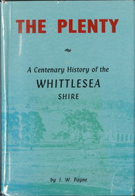
Book, J. W. Payne, The Plenty: A Centenary History of the Whittlesea Shire, 1975
This book traces the one hundered years of the development of the Shire of Whittlesea, from the discovery by Hume and Hovell in 1824 to the time of the centenary in 1975. The intervening years saw the settlement of Vandemonians, Sydney-siders, English, Scots, Irish and Germans, Black Thursday, the building of the Yan Yean Reservoir, the Plenty River flour millls, the timber industry, fruit-growing and export and vineyards. Personalities and pubs, subdivisions, stories of the Findon Hunt Club and various Shires including Epping. History of education and transiton from rural to urban in the south of the Shire. The work is illustrated with maps and photographs. The Shire is now the City of Whittlesea and is an immediate neighbour to the north of the Shire of Nillumbik. shire of whittlesea -
 Eltham District Historical Society Inc
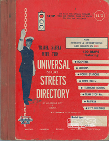
Book, Universal Business Directories (Aust.) Pty. Ltd, Universal De Luxe Streets Directory of Melbourne & Suburbs; Sixth Edition, 1960, 1960
... melbourne melbourne maps Inside cover "Fhin McPhee Whittlesea ...Hardback; xiv; 70 pages; 97 colour maps; 12 pages advertising including message on Road Safety by Chief Commissioner of Police Inside cover "Fhin McPhee Whittlesea"melbourne maps -
 Eltham District Historical Society Inc
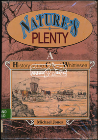
Book, Michael Jones, Nature's plenty : a history of the City of Whittlesea, 1992
This book explores Whittlesea's history from early 1830's to 1991. Environment of the Aboriginal people about the the time of European settlement. Possible use of a 'swamp management system' now buried under Yan Yean reservoir. Smallpox epidemics among Aboriginal people prior to settlement - probably from the activity of nearby European sealers. Estimations of Aboriginal populations. Scattered references throughout. Subjects Health - Infectious diseases - Smallpox. Settlement and contacts - Colonisation - 1788-1850. Settlement and contacts - Colonisation - 1851- Environment - Land management. Demography. Woiwurrung / Wurundjeri / Woiwurung people (S36) (Vic SJ55-05) Yan Yean (Vic SJ55-05) Eden Park (Vic SJ55-05) Whittlesea (Vic SJ55-05) Diamond Creek (Vic SJ55-05) Kingslake (Vic SJ55-05) Whittlesea (Vic.) -- History.xvi, 319 p., [16] p. of plates : ill. (some col.), maps (some col.), ports. ; 28 cm. the plenty, farming, settlement, gold rush, plenty river, donnybrook, germantown, separation, thomastown, whittlesea, epping, woodstock, city of whittlesea, railway, yan yean, roll of honour -
 Greensborough Historical Society
Book, Isabel Ellender, The Plenty Valley Corridor: the archaeological survey of Aboriginal sites / by Isabel Ellender 1991, 1991_
This archaeological survey of the Plenty Valley was conducted by Isabel Ellender in 1991 for the Board of Works (Melbourne Water), in particular the Plenty Gorge Metropolitan Park. The area studied is north of Greensborough to Whittlesea. A number of Aboriginal sites were identified and recommendations made for the future.67 p., illus., maps. Plastic spiral binding.plenty river, aboriginal heritage sites, plenty gorge metropolitan park -
 Greensborough Historical Society
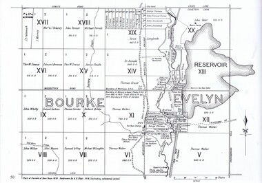
Map, Dianne Edwards, Part of Parish of Yan Yean 1878, 1978
Map includes Crown Portions V - XVII, showing Yan Yean Reservoir, Melbourne-Whittlesea Railway route, names of landowners, roads and various other features west of Greensborough Road. Redrawn by A. R. Blair in 1978.1 p. black and white photocopy of mapyan yean reservoir, yan yean -
 Greensborough Historical Society
Map, Melbourne and Metropolitan Board of Works. Survey Division, MMBW, Yarra 2500 / 12.22. Watsonia North, 1978_03
Melbourne and Metropolitan Board of Works. Yarra 2500 [base map]. 12-22, Parishes of Keelbundora 2856, Municipalities of Whittlesea 239 and Diamond Valley 257. Shows street names, easement sizes, lot numbers, lodged plan numbers, names of prominent features, contour values, creek or river names. Watsonia Railway Station and environs. Prominent streets: Edmund Rice Parade and Macorna Street. Includes Christian Brothers Edmund Rice College and Janefield Special School sites and "proposed future freeway" (now Metropolitan Ring Road).MMBW Map in 1:2500 [scale] series. Cream parchment with green tape reinforcing on edges and punched holes on left edge.mmbw, melbourne and metropolitan board of works, shire of diamond valley, watsonia - maps, bundoora - maps -
 Greensborough Historical Society
Map, Melbourne and Metropolitan Board of Works. Survey Division, MMBW, Yarra 2500 / 13.22. Greensborough, Apollo Parkways, 1979_06
Melbourne and Metropolitan Board of Works. Yarra 2500 [base map] 13-22. Greensborough, Apollo Parkways. Parishes of Nillumbik 3310 and Keelbundora 2856. Municipalities of Diamond Valley 257 and Whittlesea 239. Prominent streets include: Plenty River Drive, Diamond Creek Road and Civic Drive. Includes Diamond Valley Civi Centre, Churinga, Janefield Colony Reserve and "proposed freeway" now Greensborough Highway (Bypass)MMBW Map in 1:2500 [scale] series. Cream parchment with green tape reinforcing on edges and punched holes on left edge.mmbw, melbourne and metropolitan board of works, shire of diamond valley, greensborough - maps, apollo parkways - maps -
 Greensborough Historical Society
Map, Melbourne and Metropolitan Board of Works. Survey Division, MMBW, Yarra 2500 / 13.23. Plenty, Happy Hollow, 1979_03
Melbourne and Metropolitan Board of Works. Yarra 2500 [base map] 13-23. Plenty / Happy Hollow. Parishes of Morang 3183, Nillumbik 3310 and Keelbundora 2856. Municipalities of Diamond Valley 257 and Whittlesea 239. Prominent streets include: McLaughlans Lane and Happy Hollow Drive. Includes Janefield Colony Reserve.MMBW Map in 1:2500 [scale] series. Cream parchment with green tape reinforcing on edges and punched holes on left edge.mmbw, melbourne and metropolitan board of works, shire of diamond valley, plenty - maps, happy hollow -
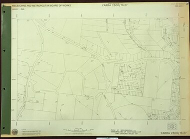
 Greensborough Historical Society
Map, Melbourne and Metropolitan Board of Works. Survey Division, MMBW, Yarra 2500 / 17.27. Central Hurstbridge, 1978_02
Melbourne and Metropolitan Board of Works. Yarra 2500 [base map] 17-27. Central Hurstbridge. Parish of Greensborough 2724, Municipalities of Diamond Valley 257, Eltham 238 and Whittlesea 239. Prominent streets include: Anzac Avenue and Hurstbridge-Arthurs Creek Road. MMBW Map in 1:2500 [scale] series. Cream parchment with green tape reinforcing on edges and punched holes on left edge.mmbw, melbourne and metropolitan board of works, shire of diamond valley, hurstbridge - maps -
 Greensborough Historical Society
Map, Melbourne and Metropolitan Board of Works. Survey Division, MMBW, Yarra 2500 / 11.22. Bundoora, 1979_01
Melbourne and Metropolitan Board of Works. Yarra 2500 [base map] 11-22. Bundoora. Parish of Keelbundoora 2856, Municipalities of Diamond Valley 257 and Whittlesea 239. Prominent streets include: Greenhills Road, Cabernet Crescent and Plenty Road. Includes Parade College (Christian Brothers) and "proposed future freeway" (now Metropolitan Ring Road)MMBW Map in 1:2500 [scale] series. Cream parchment with green tape reinforcing on edges and punched holes on left edge.mmbw, melbourne and metropolitan board of works, shire of diamond valley, bundoora - maps -
 Greensborough Historical Society
Map, Melbourne and Metropolitan Board of Works. Survey Division, MMBW, Yarra 2500 / 11.21. Bundoora, east of Plenty Road, 1979_01
Melbourne and Metropolitan Board of Works. Yarra 2500 [base map] 11-21. Bundoora, east of Plenty Road. Parish of Keelbundoora 2856, Municipalities of Diamond Valley 257, Preston 225 and Whittlesea 239. Prominent streets include: Grimshaw Street, Settlement Road and Plenty Road. Includes Yulong Park.MMBW Map in 1:2500 [scale] series. Cream parchment with green tape reinforcing on edges and punched holes on left edge.mmbw, melbourne and metropolitan board of works, shire of diamond valley, bundoora - maps -
 Greensborough Historical Society
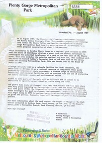
Newsletter, Plenty Gorge Metropolitan Park Newsheet No. 1 August 1989, 1989_08
The Shire of Whittlesea obtained a grant from the federal government to investigate the potential development of a park to the west of the Plenty River in 1976. A regional tip site and the Shire of Diamond Valley's Yarrambat Park were handed over to the MMBW to form the existing Metropolitan Park in 1986. A long term project to develop the park further is to commence in 1990.2 p. text, map and col. illus."With compliments of Sherryl Garbutt M.P. Member for Greensborough" (rubber stamp)plenty gorge park -
 Greensborough Historical Society
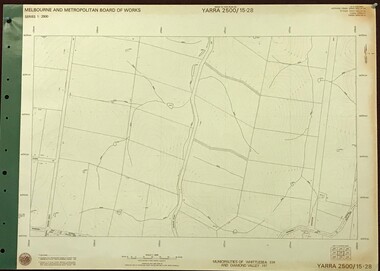
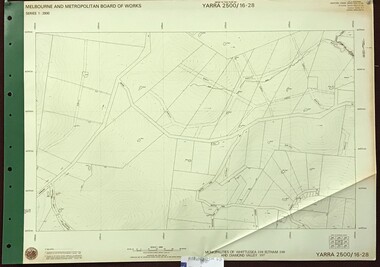
Map, Melbourne and Metropolitan Board of Works. Survey Division, MMBW, Yarra 2500 / 15.28. Yarrambat, 1977_10
Melbourne and Metropolitan Board of Works. Yarra 2500 [base map] 15-28. Yarrambat. Municipalities of Diamond Valley 257 and Whittlesea 239. Prominent streets include: Edward Henty Avenue, Charles Sturt Drive and Creighton Way. MMBW Map in 1:2500 [scale] series. Cream parchment with green tape reinforcing on edges and punched holes on left edge.mmbw, melbourne and metropolitan board of works, shire of diamond valley, yarrambat - maps -
 Greensborough Historical Society
Map, Melbourne and Metropolitan Board of Works. Survey Division, MMBW, Yarra 2500 / 16.28. East of Hurstbridge, 1977_10
Melbourne and Metropolitan Board of Works. Yarra 2500 [base map] 16.28. East of Hurstbridge. Municipalities of Whittlesea 239, Eltham 238 and Diamond Valley 257. Prominent streets include: Boyds Road, Bannons Lane and Wattle Tree Road. MMBW Map in 1:2500 [scale] series. Cream parchment with green tape reinforcing on edges and punched holes on left edge.mmbw, melbourne and metropolitan board of works, shire of diamond valley -
 Greensborough Historical Society
Map, Melbourne and Metropolitan Board of Works. Survey Division, MMBW, Yarra 2500 / 16.27. Hurstbridge, 1977_10
... of Works. Yarra 2500 [base map] 16.27. Hurstbridge. Parish ...Melbourne and Metropolitan Board of Works. Yarra 2500 [base map] 16.27. Hurstbridge. Parish of Greensborough 2724. Municipalities of Whittlesea 239 and Diamond Valley 257. Prominent streets include: Haleys Gully Road, Kendalls Lane and Bingley Avenue. MMBW Map in 1:2500 [scale] series. Cream parchment with green tape reinforcing on edges and punched holes on left edge.mmbw, melbourne and metropolitan board of works, shire of diamond valley, shire of whittlesea, hurstbridge - maps -
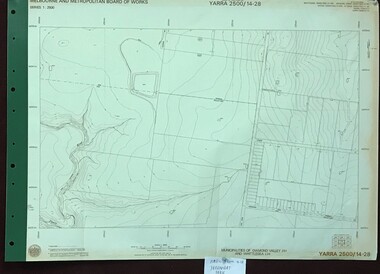 Greensborough Historical Society
Map, Melbourne and Metropolitan Board of Works. Survey Division, MMBW, Yarra 2500 / 14.28. Yarrambat Park, 1977_09
Melbourne and Metropolitan Board of Works. Yarra 2500 [base map] 14.28. Yarrambat Park. Municipalities of Diamond Valley 257 and Whittlesea 239. Prominent streets include: Bannons Road and Yan Yean Road. Features include the Plenty River.MMBW Map in 1:2500 [scale] series. Cream parchment with green tape reinforcing on edges and punched holes on left edge.mmbw, melbourne and metropolitan board of works, shire of diamond valley, whttlesea, yarrambat - maps -
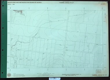 Greensborough Historical Society
Map, Melbourne and Metropolitan Board of Works. Survey Division, MMBW, Yarra 2500 / 14.27. Yarrambat, Youngs Road, 1977_09
Melbourne and Metropolitan Board of Works. Yarra 2500 [base map] 14.27. Yarrambat, Youngs Road. Municipalities of Diamond Valley 257 and Whittlesea 239. Prominent streets include: Youngs Road, Ashley Road and Yan Yean Road. MMBW Map in 1:2500 [scale] series. Cream parchment with green tape reinforcing on edges and punched holes on left edge.mmbw, melbourne and metropolitan board of works, shire of diamond valley, whttlesea, yarrambat - maps -
 Greensborough Historical Society
Map, Melbourne and Metropolitan Board of Works. Survey Division, MMBW, Yarra 2500 / 13.24. Plenty, Memorial Drive, 1979_03
Melbourne and Metropolitan Board of Works. Yarra 2500 [base map] 13-24. Plenty, Memorial Drive. Parish of Morang 3183. Municipalities of Diamond Valley 257 and Whittlesea 239. Prominent streets include: Oatland Road, River Avenue and Memorial Drive. Includes Plenty River and SEC Transmission easement.MMBW Map in 1:2500 [scale] series. Cream parchment with green tape reinforcing on edges and punched holes on left edge.mmbw, melbourne and metropolitan board of works, shire of diamond valley, plenty - maps -
 Greensborough Historical Society
Map, Melbourne and Metropolitan Board of Works. Survey Division, MMBW, Yarra 2500 / 13.26. Yarrambat, Worns Lane, 1978_02
Melbourne and Metropolitan Board of Works. Yarra 2500 [base map] 13.26. Yarrambat, Worns Lane. Municipalities of Diamond Valley 257 and Whittlesea 239. Prominent streets include: Worns Road, North Oatlands Road and Licola Street. Features include Plenty River.MMBW Map in 1:2500 [scale] series. Cream parchment with green tape reinforcing on edges and punched holes on left edge.mmbw, melbourne and metropolitan board of works, shire of diamond valley, whttlesea, yarrambat - maps -
 Greensborough Historical Society
Map, Melbourne and Metropolitan Board of Works. Survey Division, MMBW, Yarra 2500 / 13.23. Plenty, Middle Gorge, 1978_04
Melbourne and Metropolitan Board of Works. Yarra 2500 [base map] 13-23. Plenty / Middle Gorge. Parish of Morang 3183. Municipalities of Diamond Valley 257 and Whittlesea 239. Prominent streets include: Gorge Road, Kurrak Road and Browns Lane. Features include the Plenty River and Plenty Gorge Park.MMBW Map in 1:2500 [scale] series. Cream parchment with green tape reinforcing on edges and punched holes on left edge.mmbw, melbourne and metropolitan board of works, shire of diamond valley, plenty - maps, plenty gorge park -
 Greensborough Historical Society
Map, Melbourne and Metropolitan Board of Works. Survey Division, MMBW, Yarra 2500 / 13.28. Mernda, Wilton Vale, 1977_08
Melbourne and Metropolitan Board of Works. Yarra 2500 [base map] 13.28. Mernda, Wilton Vale. Municipality of Diamond Valley 257 and Whittlesea 239. Prominent streets: Wilton Vale Road. Features include Yan Yean Pipe Track and SEC Transmission Lines. The abandoned rail line (old Whittlesea line) is in the top left corner.MMBW Map in 1:2500 [scale] series. Cream parchment with green tape reinforcing on edges and punched holes on left edge.mmbw, melbourne and metropolitan board of works, shire of diamond valley, mernda - maps -
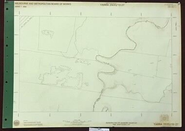 Greensborough Historical Society
Map, Melbourne and Metropolitan Board of Works. Survey Division, MMBW, Yarra 2500 / 13.27. Morang wetlands, 1977_09
Melbourne and Metropolitan Board of Works. Yarra 2500 [base map] 13.27. Morang wetlands. Municipality of Diamond Valley 257 and Whittlesea 239. Features include the Plenty River and SEC Transmission Line easement. MMBW Map in 1:2500 [scale] series. Cream parchment with green tape reinforcing on edges and punched holes on left edge.mmbw, melbourne and metropolitan board of works, shire of diamond valley, morang - maps -
 Greensborough Historical Society
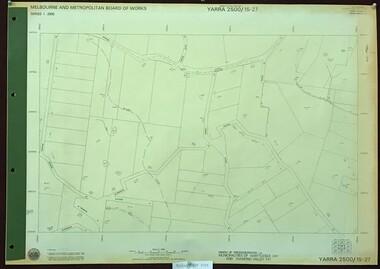
Map, Melbourne and Metropolitan Board of Works. Survey Division, MMBW, Yarra 2500 / 15.27. Yarrambat, De Fredricks Lane, 1977_10
Melbourne and Metropolitan Board of Works. Yarra 2500 [base map] 15.27. Yarrambat, De Fredricks Lane. Parish of Greensborough 2724. Municipality of Diamond Valley 257 and Whittlesea 239. Prominent streets include: De Fredricks Lane, Astons Road and Bannons Lane. Features include Scrubby Creek.MMBW Map in 1:2500 [scale] series. Cream parchment with green tape reinforcing on edges and punched holes on left edge.mmbw, melbourne and metropolitan board of works, shire of diamond valley, yarrambat - maps -
 Greensborough Historical Society
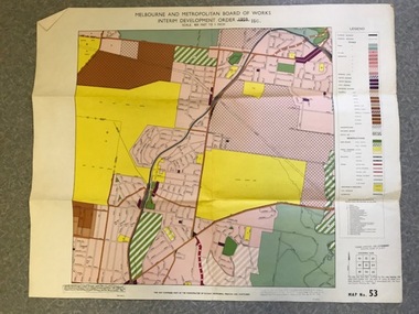
Map, Melbourne and Metropolitan Board of Works Interim Development Order 1961 Map No. 53, 27/09/1961
Denotes Zones and Reservations comprising part of the municipalities of Eltham, Heidelberg, Preston and Whittlesea, approved 27.9.61. Includes Mont Park Hospital and Watsonia Military Camp.Colour plan Date printed on plan (1959) has been over stamped with 1961. Also stamped with Government Gazette date of 27.9.1961. "Scale 800 feet to 1 inch"greensborough, watsonia -
 Eltham District Historical Society Inc
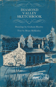
Book, Diamond Valley sketchbook / text by Brian McKinlay ; drawings by Graham Hawley, 1973
Contents include short articles and illustrations of historic properties within the municipalities of Banyule, Nillumbik and Whittlesea. Including The Griffin House, Rosehill, Lower Plenty, The Austin Hospital, Heidelberg, St John's Church, Heidelberg, Banyule, Heidelberg, Trestle Bridge, Eltham, Diamond Valley railway, The Shillinglaw Cottage, Eltham, Montsalvat, Old England Hotel, Heidelberg, Eltham Primary School, Mud brick homes, Eltham, Sweeney's Cottage, Eltham, Pound Pend Tunnel, The Gold Memorial, Potter's Cottage, Memorial Tower, Charterisville, Weller's Pub, The Barrel, Eltham, Hassall's Gallery, The Old Bridge, Greensborough, Diamond Valley Shire Offices, Greensborough, St Katherine's Chapel, Yan Yean Reservoir, Mernda Hotel, Mernda Mechanics Institute, Old Barn, Mernda, Parade College, La Trobe University.Hardback with jacket ; 63 p. : ill., maps ; 22cm. diamond valley shire, shire of nillumbik, city of whittlesea, city of banyule, shillinglaw cottage, weller's hotel -
 Eltham District Historical Society Inc
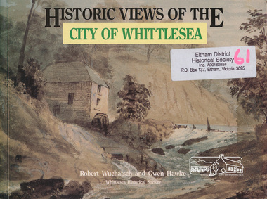
Book, Robert Wuchatsch 1950- et al, Historic views of the City of Whittlesea / Robert Wuchatsch and Gwen Hawke, 1988
Paperback; ix, 119 p. : chiefly ill. (some col.), 1 map, ports. ; 19 x 25 cm.ISBN 0958866333 [written on title page] To Eltham Historical Society, with our compliments and best regards - Whittlesea Historical Society - [signed] Robert Wuchatsch, G. Hawke. 13/12/89.whittlesea shire -
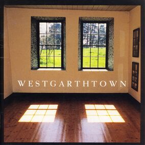 Bendigo Historical Society Inc.
Book - STRAUCH COLLECTION: WESTGARTHTOWN
A history of Westgarthtown, German and Wendish immigrants first settled at Westgarthtown in March 1850, situated 16 Kilometres north of Melbourne this land now forms part of the suburbs of Thomastown and Lalor. Soft cover 36 pages with black & white and coloured photographs,maps & illustrations. Published by the Heritage Council Victoria and the City of Whittlesea.victoria, history, german, victoria-history-german-westgarthtown