
Showing 25 items matching "murray river water commission"
-
 Tatura Irrigation & Wartime Camps Museum
Document - River Murray Commission, manilla folder containing maps, booklet, reports, copious notes of Murray River water management, River Murray Commission Manilla Folder
... River Murray Commission, manilla folder containing maps, booklet, reports, copious notes of Murray River water management...Murray River water Commission...Murray River water Commission Front and back of folder is covered in hand written place names along the Murray Manilla folder, covered with hand written names of towns along the Murray River. ...Manilla folder, covered with hand written names of towns along the Murray River. Contains maps, reports, typed notes, a booklet Murray River CommissionFront and back of folder is covered in hand written place names along the Murraymurray river water commission, -
 The Beechworth Burke Museum
Photograph, Unknown c.1930s
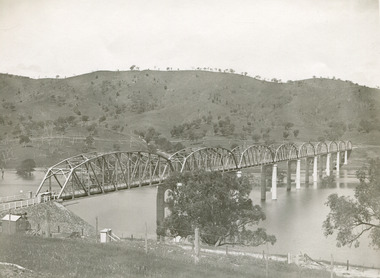
... Murray River, now part of Hume Reservoir. Because of its unique location, over the waters of a dam with the border running down the centre of the body of water, the Bethanga bridge is the only built structure shared by both New South Wales and Victoria. It was built 1.6 kilometres upstream of the dam and in 1961 was raised 300mm, with a concrete deck replacing the original wooden deck. The State Rivers and Water Supply Commission...Murray River, now part of Hume Reservoir. Because of its unique location, over the waters of a dam with the border running down the centre of the body of water, the Bethanga bridge is the only built structure shared by both New South Wales and Victoria. It was built 1.6 kilometres upstream of the dam and in 1961 was raised 300mm, with a concrete deck replacing the original wooden deck. The State Rivers and Water Supply Commission ...This image shows Bethanga Bridge, which was constructed between 1927 and 1930 in Albury, NSW. The bridge was a necessity due to the building of the Hume Dam (Wier), 1919-1936. Bethanga Bridge is a long, nine-span, riveted-steel, variable depth, Pratt Truss road bridge of nine principal spans of 82 metres and a total length of 752 metres over the flooded valley of the Murray River, now part of Hume Reservoir. Because of its unique location, over the waters of a dam with the border running down the centre of the body of water, the Bethanga bridge is the only built structure shared by both New South Wales and Victoria. It was built 1.6 kilometres upstream of the dam and in 1961 was raised 300mm, with a concrete deck replacing the original wooden deck. The State Rivers and Water Supply Commission of Victoria and the New South Wales Department of Public Works were responsible for the construction works for the Hume Weir under the River Murray Waters Agreement. It is apparent that a similar joint arrangement was made for the construction of the Bethanga Bridge as part of the Hume Weir works.This photograph of the Bethanga Bridge is of historical significance as it showcases the architectural skills of Percy Allen and Vincent Packer. Additionally, it reveals the environmental landscape of the 1920s-1930s, is linked to the Hume Dam and both New South Wales and Victorian heritage. Unmounted black and white rectangular photograph. Reverse: 1997.3196 84-20-3bethanga, bethanga bridge, hume dam, pratt truss, murray river, hume weir, transportation -
 Orbost & District Historical Society
book, Snowy Water Inquiry, Snowy Water Inquiry Final Report, 1998
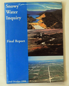
... The Snowy Water Inquiry was commissioned in 1998 with a brief to recommend environmental water release options to the Commonwealth, Victorian, and NSW Governments so that corporatisation of the Snowy Mountains Scheme could proceed. These release options related to the Snowy River below Jindabyne, the Murray...The Snowy Water Inquiry was commissioned in 1998 with a brief to recommend environmental water release options to the Commonwealth, Victorian, and NSW Governments so that corporatisation of the Snowy Mountains Scheme could proceed. These release options related to the Snowy River below Jindabyne, the Murray ...The Snowy Water Inquiry was commissioned in 1998 with a brief to recommend environmental water release options to the Commonwealth, Victorian, and NSW Governments so that corporatisation of the Snowy Mountains Scheme could proceed. These release options related to the Snowy River below Jindabyne, the Murray River and other rivers associated with the Scheme. The Inquiry objectives were that the recommendations would not adversely impact on water supplies to existing irrigators or the viability of the Snowy Mountains Scheme. (ref snowyhydro.com.au)This report contains information about water allocation and uses of the Snowy River.A book of 160 pp - Snowy River Inquiry Final report 23rd October 1998. Submitted to the Governments of New South Wales and Victoria / Commissioner: The Hon. Robert Webster. On the front cover are three aerial photographs of the Snowy River and Snowy Hydro Scheme. The book contains maps and photographs. snowy-river snowy-hydro snowy-mountains government-inquiry -
Tatura Irrigation & Wartime Camps Museum
Document - River Murray Commission, manilla folder containing maps, booklet, reports, copious notes of Murray River water management, River Murray Water Comm maps / notes / reports. Also State Rivers and Water Supply Comm
... River Murray Commission, manilla folder containing maps, booklet, reports, copious notes of Murray River water management...Front and back covered in copious hand written notes with regards the " ports " along the Murray River Manilla folder with copious notes front and back, contains maps, reports, photographs . stored in a clear plastic folder River Murray Water Comm maps / notes / reports. Also State Rivers and Water Supply Comm Document River Murray Commission ...Manilla folder with copious notes front and back, contains maps, reports, photographs . stored in a clear plastic folderFront and back covered in copious hand written notes with regards the " ports " along the Murray River -
Tatura Irrigation & Wartime Camps Museum
Video tape, Sir Ronald East, 1993/06/05
... Interview made with Sir Ronald East (Long term Chairman of State Rivers and Water Supply Commission from 1937 - 1965) and part of a longer tape made by the MDBC. Irrigation victoria state rivers and water supply commission Sir Ronald East Murray-Darling Basin Commission Sir Ronald East 5-6-1993 VHS Video Tape - Murray-Darling Basin Commission Sir Ronald East Video tape ...Interview made with Sir Ronald East (Long term Chairman of State Rivers and Water Supply Commission from 1937 - 1965) and part of a longer tape made by the MDBC.VHS Video Tape - Murray-Darling Basin CommissionMurray-Darling Basin Commission Sir Ronald East 5-6-1993irrigation, victoria state rivers and water supply commission, sir ronald east -
Tatura Irrigation & Wartime Camps Museum
Photograph, Goulburn Weir Sign, 1970s
... Sign describing Goulburn Weir - "State rivers and Water Supply Commission/Goulburn Weir/Diversion Headworks for Goulburn Irrigation System/Designed and Constructed by Victorian Water Supply Department 1891./Full Supply Level is 408 Feet Above Sea Level/Stuart Murray...Rivers and Water Supply Commission. goulburn weir victorian state rivers and supply commission Medium sized black and white photograph. Sign describing Goulburn Weir - "State rivers and Water Supply Commission/Goulburn Weir/Diversion Headworks for Goulburn Irrigation System/Designed and Constructed by Victorian Water Supply Department 1891./Full Supply Level is 408 Feet Above Sea Level/Stuart Murray ...Taken by photographer for State Rivers and Water Supply Commission.Medium sized black and white photograph. Sign describing Goulburn Weir - "State rivers and Water Supply Commission/Goulburn Weir/Diversion Headworks for Goulburn Irrigation System/Designed and Constructed by Victorian Water Supply Department 1891./Full Supply Level is 408 Feet Above Sea Level/Stuart Murray M.I.C.E Chief Engineer/William Henderson A.M.I.C.E Supervising Engineer."goulburn weir, victorian state rivers and supply commission -
Tatura Irrigation & Wartime Camps Museum
Photograph, Stuart Murray Canal Sign, 1890s
... Sign:-"STATE RIVERS AND WATER SUPPLY COMMISSION/GOULBURN IRRIGATION SYSTEM/STUART MURRAY CANAL/CONVEYS WATER FROM GOULBURN WEIR TO WARANGA RESERVOIR/DESIGNED AND CONSTRUCTED BY VICTORIAN WATER SUPPLY DEPARTMENT - 1981....Taken by photographer for State Rivers and Water Supply Commission. goulburn weir victorian state rivers and supply commission Medium sized black and white photograph. Sign:-"STATE RIVERS AND WATER SUPPLY COMMISSION/GOULBURN IRRIGATION SYSTEM/STUART MURRAY CANAL/CONVEYS WATER FROM GOULBURN WEIR TO WARANGA RESERVOIR/DESIGNED AND CONSTRUCTED BY VICTORIAN WATER SUPPLY DEPARTMENT - 1981. ...Taken by photographer for State Rivers and Water Supply Commission.Medium sized black and white photograph. Sign:-"STATE RIVERS AND WATER SUPPLY COMMISSION/GOULBURN IRRIGATION SYSTEM/STUART MURRAY CANAL/CONVEYS WATER FROM GOULBURN WEIR TO WARANGA RESERVOIR/DESIGNED AND CONSTRUCTED BY VICTORIAN WATER SUPPLY DEPARTMENT - 1981./STUART MURRAY M.I.C.E CHIEF ENGINEER."goulburn weir, victorian state rivers and supply commission -
Tatura Irrigation & Wartime Camps Museum
Photograph, Goulburn Irrigation System, 1970s
... Rivers and Water Supply Commission. goulburn weir victorian state rivers and supply commission Medium sized black and white photograph. Map showing the Goulburn Irrigation System in Northern Victoria including Eildon Reservoir, Waranga Reservoir, Eppalock Reservoir, Eppalock, Cairn Curran, Laancoorie, Tullaroop Reservoirs, the Stuart Murray, Cattanach Canal, East Goulburn Main and Waranga Western Channels. ...Taken by photographer for State Rivers and Water Supply Commission.Medium sized black and white photograph. Map showing the Goulburn Irrigation System in Northern Victoria including Eildon Reservoir, Waranga Reservoir, Eppalock Reservoir, Eppalock, Cairn Curran, Laancoorie, Tullaroop Reservoirs, the Stuart Murray, Cattanach Canal, East Goulburn Main and Waranga Western Channels.goulburn weir, victorian state rivers and supply commission -
Tatura Irrigation & Wartime Camps Museum
Book, The Supply of Water for Irrigation in Victoria 1881-1981, 1981
... Includes history of early irrigation schemes, Goulburn system, river Murray system, Post war expansion, drainage and salinity. Change from State Rivers & Water Supply Commission to Rural Commission...Includes history of early irrigation schemes, Goulburn system, river Murray system, Post war expansion, drainage and salinity. Change from State Rivers & Water Supply Commission to Rural Commission sr & wscommision books rural industry Cream cover, black writing. ...Includes history of early irrigation schemes, Goulburn system, river Murray system, Post war expansion, drainage and salinity. Change from State Rivers & Water Supply Commission to Rural CommissionCream cover, black writing. Cover photo of early days of irrigation, many channels constructed by teams of horses dragging scoops.sr & wscommision, books, rural, industry -
Tatura Irrigation & Wartime Camps Museum
Document, History of Irrigation in Goulburn Murray Irrigaton District, 1990
... Brief history of irrigation in Goulburn Murray Irrigation district and brief information on headworks supplying water to the area. document irrigation Black folder, containing papers on State Rivers and Water Supply Commission works History of Irrigation in Goulburn Murray Irrigaton District Document ...Brief history of irrigation in Goulburn Murray Irrigation district and brief information on headworks supplying water to the area.Black folder, containing papers on State Rivers and Water Supply Commission worksdocument, irrigation -
Tatura Irrigation & Wartime Camps Museum
Box, 1920's
... Rivers and Water Supply Commission for construction of Waranga Basin 1923 - 1929. Cards handwritten by D.O'Shannessy who was taught to read and write by the Waranga school teacher. tatura irrigation employment records waranga basin rural water corporation rural water commission goulburn murray water rural industry employment records Plastic box containing 235 employment cards Box ...Employment records of State Rivers and Water Supply Commission for construction of Waranga Basin 1923 - 1929. Cards handwritten by D.O'Shannessy who was taught to read and write by the Waranga school teacher.Plastic box containing 235 employment cardstatura, irrigation, employment records, waranga basin, rural water corporation, rural water commission, goulburn murray water, rural, industry, employment, records -
Tatura Irrigation & Wartime Camps Museum
Folder, Rural Water Corporation
... Contents include material on dethridge water meter, Murray-Darling basin, Lake Nillahcootie, Western port rivers. Management study of State of the rivers, Rural Water Commission school project package. 3 papers on Lake Dartmouth...Contents include material on dethridge water meter, Murray-Darling basin, Lake Nillahcootie, Western port rivers. Management study of State of the rivers, Rural Water Commission school project package. 3 papers on Lake Dartmouth rural water corporation tatura water documents reports Folder, marbled black and white cover. metal lever inside Rural Water Corporation Folder ...Contents include material on dethridge water meter, Murray-Darling basin, Lake Nillahcootie, Western port rivers. Management study of State of the rivers, Rural Water Commission school project package. 3 papers on Lake DartmouthFolder, marbled black and white cover. metal lever insiderural water corporation, tatura, water, documents, reports -
Tatura Irrigation & Wartime Camps Museum
Book, Register of Lands, 1979-1980
... Rodney irrigation area of the Goulburn-Murray Irrigation District. 1979-1980 irrigation season irrigation books history local rural industries Beige front, black back cover.Greeen cloth spine, black writing. State "Rivers & Water Supply Commission ...Register of Lands - rates payable. Rodney irrigation area of the Goulburn-Murray Irrigation District. 1979-1980 irrigation seasonBeige front, black back cover.Greeen cloth spine, black writing. State "Rivers & Water Supply Commission, Vic. 79/80" on spine.irrigation, books, history, local, rural, industries -
Tatura Irrigation & Wartime Camps Museum
Map, Irrigation Trust distribution channels
... Map retrieved from State Rivers & Water Supply Commission Offices by Gilian Payne. Map of Rodney Irrigation Trust distribution channels, 1887, prepared by Walter Scott Murray. ...Map retrieved from State Rivers & Water Supply Commission Offices by Gilian Payne. Map of Rodney Irrigation Trust distribution channels, 1887, prepared by Walter Scott Murray. ...Map retrieved from State Rivers & Water Supply Commission Offices by Gilian Payne. Map of Rodney Irrigation Trust distribution channels, 1887, prepared by Walter Scott Murray. Copied in seven sections. -
Lakes Entrance Historical Society
Book, State Rivers and Water Supply Commission, The State of the Rivers Victoria Australia, 1983
... Waterways Water supply Water pollution The third (1983) report by the Standing Consultative Committee on River Improvement, giving an overall review of the state of the rivers of Victoria and the Murray. The subject is covered from the catchment to usage, pollution and drainage. Includes cas The State of the Rivers Victoria Australia Book State Rivers and Water Supply Commission ...The third (1983) report by the Standing Consultative Committee on River Improvement, giving an overall review of the state of the rivers of Victoria and the Murray. The subject is covered from the catchment to usage, pollution and drainage. Includes caswaterways, water supply, water pollution -
 Wodonga & District Historical Society Inc
Education kit - How do towns change? - Tallangatta, SHEP Project, 1979
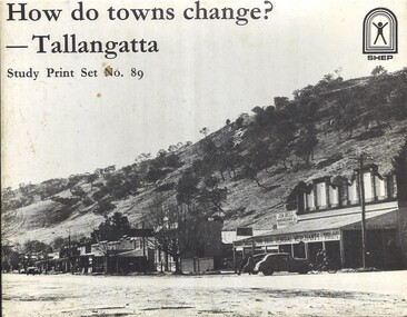
... Murray Rivers threatened the town. Stage one of Lake Hume was completed in 1936, sparing the town temporarily. After WWII, demand for irrigation water rose—and residents were told the town would be flooded. Between 1952 and 1958, Tallangatta was relocated. The State Rivers and Water Supply Commission ...The Tallangatta pastoral run was established in 1838. By the 1850s a thriving town had been established near the junction of the Mitta Mitta River and Tallangatta Creek. Officially named in 1854, Tallangatta became a vital gateway to nearby goldfields such as Mount Wills, Mitta Mitta, and Cravensville. It also grew as a service centre to the pastoralists in the surrounding area. Rail reached Tallangatta in 1891, doubling the population within a decade. A mile-long viaduct took two years to complete. The railway brought jobs and connected local mining and farming industries to broader markets. From 1918, Tallangatta's future was uncertain. Plans for a reservoir at the confluence of the Mitta Mitta and Murray Rivers threatened the town. Stage one of Lake Hume was completed in 1936, sparing the town temporarily. After WWII, demand for irrigation water rose—and residents were told the town would be flooded. Between 1952 and 1958, Tallangatta was relocated. The State Rivers and Water Supply Commission oversaw the move with a £3 million budget. Over 100 timber homes were relocated, 37 brick homes rebuilt, and 74 prefabricated houses brought in. Thirty-five new buildings were added, including hotels, banks, a butter factory, a hospital, and a modern shopping centre. The new town of Tallangatta was officially reopened by Governor Sir William Slim on June 29, 1956. In 2016, Tallangatta was designated a "Notable Town" by the National Trust for its architectural and historical significance, making it the second town to receive this honour.A set of 89 Photographs, maps and information sheets produced as a case study of the moving of the town of Tallangatta in the 1950s. It was created as a resource to enable secondary school students to investigate how towns can change over time. non-fictionThe Tallangatta pastoral run was established in 1838. By the 1850s a thriving town had been established near the junction of the Mitta Mitta River and Tallangatta Creek. Officially named in 1854, Tallangatta became a vital gateway to nearby goldfields such as Mount Wills, Mitta Mitta, and Cravensville. It also grew as a service centre to the pastoralists in the surrounding area. Rail reached Tallangatta in 1891, doubling the population within a decade. A mile-long viaduct took two years to complete. The railway brought jobs and connected local mining and farming industries to broader markets. From 1918, Tallangatta's future was uncertain. Plans for a reservoir at the confluence of the Mitta Mitta and Murray Rivers threatened the town. Stage one of Lake Hume was completed in 1936, sparing the town temporarily. After WWII, demand for irrigation water rose—and residents were told the town would be flooded. Between 1952 and 1958, Tallangatta was relocated. The State Rivers and Water Supply Commission oversaw the move with a £3 million budget. Over 100 timber homes were relocated, 37 brick homes rebuilt, and 74 prefabricated houses brought in. Thirty-five new buildings were added, including hotels, banks, a butter factory, a hospital, and a modern shopping centre. The new town of Tallangatta was officially reopened by Governor Sir William Slim on June 29, 1956. In 2016, Tallangatta was designated a "Notable Town" by the National Trust for its architectural and historical significance, making it the second town to receive this honour.moving tallangatta, tallangatta - the town that moved, history tallangatta -
Merbein District Historical Society
Newspaper, Sunraysia Daily - Merbein Golden Jubilee Feature (2 copies), 18 Aug.1959
... Roberts Irymple Packing Company - Merbein Branch Mildura Co-operative Fruit Company - Merbein Branch Merbein Methodist Church Merbein CWA Merbein Baby Health Centre Birdwoodton Soldier Settlement Merbein RSL Nelson Wellington (Colonel) John McLeod Merbein Guides Merbein Rowing Club State Rivers & Water Supply Commission Merbein Settlers Progress Association Big Lizzie Women's Welfare Club Lake School Merbein Dads Association Commercial Banking Company of Sydney Ltd. Murray ...golden jubilee, merbein higher elementary school, land board, merbein cricket club, south merbein cricket club, merbein bowling club , merbein turf club, ana, mildura winery pty. ltd. (mildara), merbein victicultural research station, e.j. roberts, irymple packing company - merbein branch, mildura co-operative fruit company - merbein branch, merbein methodist church, merbein cwa, merbein baby health centre, birdwoodton soldier settlement, merbein rsl, nelson wellington (colonel), john mcleod, merbein guides, merbein rowing club, state rivers & water supply commission, merbein settlers progress association, big lizzie, women's welfare club, lake school, merbein dads association, commercial banking company of sydney ltd., murray valley horsemen's club -
Merbein District Historical Society
Slide, Murray River view from Pump Hill, unknown
... Pump Hill Merbein Pumping Station State Rivers & Water Supply Commission Murray River view from Pump Hill Slide ...pump hill, merbein pumping station, state rivers & water supply commission -
 Wodonga & District Historical Society Inc
Souvenir - Tallangatta - Hume Weir Tiepin, 1980s
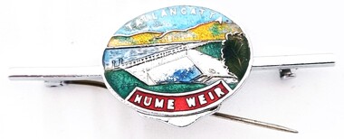
... Murray River. Work on Hume Dam started in 1919 and took 17 years to complete. Souvenir items have included chinaware, ashtrays, placemats and small jewellery items such as this tie pin. This tie pin was created as a souvenir for the town of Tallangatta. In the 1950s, the height of the Hume Weir wall was increased, resulting in a nine metre rise in the level of the water in Lake Hume. This necessitated the moving of most of the town of Old Tallangatta due to flooding. The transfer of the township by the State Rivers and Waters Supply Commission...Murray River. Work on Hume Dam started in 1919 and took 17 years to complete. Souvenir items have included chinaware, ashtrays, placemats and small jewellery items such as this tie pin. This tie pin was created as a souvenir for the town of Tallangatta. In the 1950s, the height of the Hume Weir wall was increased, resulting in a nine metre rise in the level of the water in Lake Hume. This necessitated the moving of most of the town of Old Tallangatta due to flooding. The transfer of the township by the State Rivers and Waters Supply Commission ...A wide range of items have been created as souvenirs to represent the Hume Weir on the Murray River. Work on Hume Dam started in 1919 and took 17 years to complete. Souvenir items have included chinaware, ashtrays, placemats and small jewellery items such as this tie pin. This tie pin was created as a souvenir for the town of Tallangatta. In the 1950s, the height of the Hume Weir wall was increased, resulting in a nine metre rise in the level of the water in Lake Hume. This necessitated the moving of most of the town of Old Tallangatta due to flooding. The transfer of the township by the State Rivers and Waters Supply Commission to a new site approximately 8 kilometres to the west was completed on 29 June 1956.This item is representative of many items commemorating the Hume Weir and the township of Tallangatta.A small metal and enamelled oval tie pin. It features and image of the Hume Weir.Around top edge in white: TALLANGATTA Around bottom edge" HUME WEIR"hume weir australia, tallangatta, tallangatta - the town that moved -
 Wodonga & District Historical Society Inc
Album - Hume Reservoir Australia Album - Title Page, Department of Public Works, N.S.W, 1927
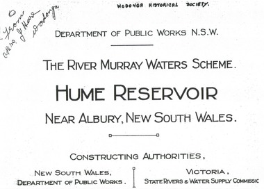
... RIVER MURRAY WATER SCHEME./ HUME RESERVOIR NEAR ALBURY, NEW SOUTH WALES/CONSSTUCTING AUTHORITIES,/ NEW SOUTH WALES/DEPARTMENT OF PUBLIC WORKS/VICTORIA/STATE RIVERS & WATER COMMISSION"...water reservoir in the British Empire. The album records the pioneering engineering work that went into its construction. Hume Reservoir Australia River Murray Waters Scheme "DEPARTMENT OF PUBLIC WORKS N.S.W./ (FROM MRS J. HORE WODONGA) /THE RIVER MURRAY WATER SCHEME./ HUME RESERVOIR NEAR ALBURY, NEW SOUTH WALES/CONSSTUCTING AUTHORITIES,/ NEW SOUTH WALES/DEPARTMENT OF PUBLIC WORKS/VICTORIA/STATE RIVERS & WATER COMMISSION" Title page of album, including official name and construction authorities. ...This set of photos is from a leather bound album bearing the inscription "HUME RESERVOIR AUSTRALIA" plus 'The Rt. Hon. L. C. M. S. Amery, P. C., M .P.' all inscribed in gold. It was presented to The Rt. Hon. L. C. M. S. Amery, P. C., M. P, Secretary of State for Dominion Affairs on the occasion of his visit to the Hume Reservoir on 2nd November 1927. To ensure preservation of the album and its contents, the images and information pages have all been digitised. It is assumed that over the past 70 to 80 years there has been some loss of contrast due to fading, and probably detail. Thus, each photo was enhanced in several steps. Digitalisation of the album was completed by Eric Eulenstein in Wodonga in April 2002. The position of Secretary of State for Dominion Affairs was a British cabinet-level position created in 1925 and responsible for British relations with the Dominions — Canada, Australia, New Zealand, South Africa, Newfoundland, and the Irish Free State — and the self-governing Crown colony of Southern Rhodesia.This album is of local and national significance as it documents the planning and development of the Hume Reservoir up to 1927. It was the largest water reservoir in the British Empire. The album records the pioneering engineering work that went into its construction.Title page of album, including official name and construction authorities."DEPARTMENT OF PUBLIC WORKS N.S.W./ (FROM MRS J. HORE WODONGA) /THE RIVER MURRAY WATER SCHEME./ HUME RESERVOIR NEAR ALBURY, NEW SOUTH WALES/CONSSTUCTING AUTHORITIES,/ NEW SOUTH WALES/DEPARTMENT OF PUBLIC WORKS/VICTORIA/STATE RIVERS & WATER COMMISSION"hume reservoir australia, river murray waters scheme -
 Wodonga & District Historical Society Inc
Album - Hume Reservoir Australia Album - Introduction - Part 1, Department of Public Works, N.S.W, 1927
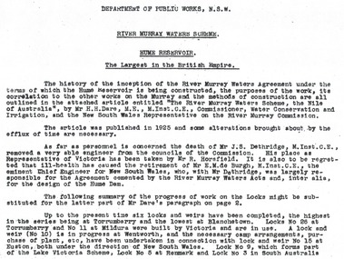
... RIVER MURRAY WATERS SCHEME, HUME RESERVOIR THE LARGEST IN THE BRITISH EMPIRE. ' The history of the inception of the River Murray Waters Agreement under the terms of which the Hume Reservoir is being constructed, the purposes of the work, its correlation to the other works on the Murray and the methods of construction are all outlined in the attached article entitled “The River Murray Waters Scheme, the Nile of Australia”, by Mr H.H. Dare, M.E., M.Inst.C.E., Commissioner, Water Conservation and Irrigation, and the New South Wales Representative on the River Murray Commission...Hume Reservoir Australia River Murray Waters Scheme RIVER MURRAY WATERS SCHEME, HUME RESERVOIR THE LARGEST IN THE BRITISH EMPIRE. ' The history of the inception of the River Murray Waters Agreement under the terms of which the Hume Reservoir is being constructed, the purposes of the work, its correlation to the other works on the Murray and the methods of construction are all outlined in the attached article entitled “The River Murray Waters Scheme, the Nile of Australia”, by Mr H.H. Dare, M.E., M.Inst.C.E., Commissioner, Water Conservation and Irrigation, and the New South Wales Representative on the River Murray Commission ...This set of photos is from a leather bound album bearing the inscription "HUME RESERVOIR AUSTRALIA" plus 'The Rt. Hon. L. C. M. S. Amery, P. C., M .P.' all inscribed in gold. It was presented to The Rt. Hon. L. C. M. S. Amery, P. C., M. P, Secretary of State for Dominion Affairs on the occasion of his visit to the Hume Reservoir on 2nd November 1927. This album is of local and national significance as it documents the planning and development of the Hume Reservoir up to 1927. It was the largest water reservoir in the British Empire. The album records the pioneering engineering work that went into its construction.RIVER MURRAY WATERS SCHEME, HUME RESERVOIR THE LARGEST IN THE BRITISH EMPIRE. ' The history of the inception of the River Murray Waters Agreement under the terms of which the Hume Reservoir is being constructed, the purposes of the work, its correlation to the other works on the Murray and the methods of construction are all outlined in the attached article entitled “The River Murray Waters Scheme, the Nile of Australia”, by Mr H.H. Dare, M.E., M.Inst.C.E., Commissioner, Water Conservation and Irrigation, and the New South Wales Representative on the River Murray Commission. The article was published in 1925 and some alterations brought about by the efflux of time are necessary. As far as personnel is concerned, the death of Mr J.S. Dethridge, M.Inst.C.E., removed a very able engineer from the councils of the Commission. His place as Representative of Victoria has been taken by Mr R. Horsfield. It is also to be regretted that ill-health has caused the retirement of Mr E.M. de Burgh, M.Inst.C.E., the eminent Chief Engineer for New South Wales, who, with Mr Dethridge, was largely responsible for the Agreement cemented by the River Murray Waters Acts and, inter alia, for the design of the Hume Dam. The following summary of the progress of work on the Locks might be substituted for the latter part of Mr Dare’s paragraph. Up to the present time six locks and weirs have been completed, the highest in the series being at Torrumberry and the lowest at Blanchetown. Locks No.26 at Torrumberry and No.11 at Mildura were built by Victoria and are in use. A lock and weir (No.10) is in progress at Wentworth, and the necessary camp arrangements, purchase of plant, etc., have been undertaken in connection with lock and weir No.15 at Euston, both under the direction of New South Wales. Lock No.9, which forms part of the Lake Victoria Scheme, Lock No.5 at Renmark and Lock No.3 in South Australia hume reservoir australia, river murray waters scheme -
 Wodonga & District Historical Society Inc
Album - Hume Reservoir Australia Album - Detailed plan and explanation, Department of Public Works, N.S.W, 1927
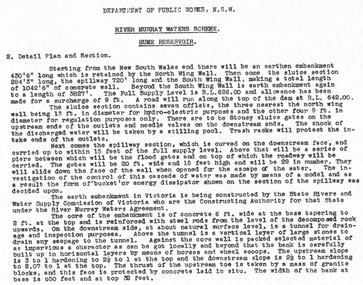
... The investigation of the control of this cascade of water was made by means of a model and as a result the form of “bucket” or energy dissipater shown on the section of the spillway was decided upon. The earth embankment in Victoria is being constructed by the State Rivers and Water Supply Commission of Victoria who are the Constructing Authority for that State under the River Murray Waters Agreement. ...The investigation of the control of this cascade of water was made by means of a model and as a result the form of “bucket” or energy dissipater shown on the section of the spillway was decided upon. The earth embankment in Victoria is being constructed by the State Rivers and Water Supply Commission of Victoria who are the Constructing Authority for that State under the River Murray Waters Agreement. ...This set of photos is from a leather bound album bearing the inscription "HUME RESERVOIR AUSTRALIA" plus 'The Rt. Hon. L. C. M. S. Amery, P. C., M .P.' all inscribed in gold. It was presented to The Rt. Hon. L. C. M. S. Amery, P. C., M. P, Secretary of State for Dominion Affairs on the occasion of his visit to the Hume Reservoir on 2nd November 1927. This album is of local and national significance as it documents the planning and development of the Hume Reservoir up to 1927. It was the largest water reservoir in the British Empire. The album records the pioneering engineering work that went into its construction.2. Detail Plan and Section. Starting from the New South Wales and there will be an earthen embankment 430 feet 6 inches long which is retained by the North Wing Wall. Then come the sluice section 284 feet 3 inches long, the spillway 720 feet long and the South Wing Wall, making a total length of 1,042 feet 6 inches of concrete wall. Beyond the South Wing Wall is earth embankment again to a length of 3,827 feet. The Full Supply Level is R.L.626.00 and allowance has been made for a surcharge of 9 feet. A road will run along the top of the dam at R.L.642.00. The sluice section contains seven offlets, the three nearest the north wing wall being 13 feet in diameter for hydro-electric purposes and the other four 9 feet in diameter for regulation purposes only. There are to be stony sluice gates on the upstream ends of the outlets and needle valves on the downstream ends. The shock of the discharged water will be taken by a stilling pool. Trash racks will protect the intake ends of the outlets. Next comes the spillway section, which is curved on the downstream face, and carried up to within 15 feet of the full supply level. Above that will be a series of piers between which will be the flood gates and on top of which the roadway will be carried. The gates will be 20 feet wide and 15 feet high and will be 29 in number. They will slide down the face of the wall when opened for the escape of the water. The investigation of the control of this cascade of water was made by means of a model and as a result the form of “bucket” or energy dissipater shown on the section of the spillway was decided upon. The earth embankment in Victoria is being constructed by the State Rivers and Water Supply Commission of Victoria who are the Constructing Authority for that State under the River Murray Waters Agreement. The core of the embankment is of concrete 6 feet wide at the base tapering to 2 feet at the top end and is reinforced with steel rods from the level of the decomposed rock upwards. On the downstream side, at about natural surface level, is a tunnel for drainage and inspection purposes. Above the tunnel is a vertical layer of large stones to drain any seepage to the tunnel. Against the core wall is packed selected material of as impervious a character as can be got locally and beyond that the bank is carefully built up in horizontal layers by means of horses and wheel scoops. The upstream slope is 3-to-1 hardening to 2½-to-1 at the top and the downstream slope is 2½-to-1 hardening to 2.07-to-1 at the top. The thrust of the upstream toe is taken by a mass of granite blocks, and this face is protected by concrete laid in situ. The width of the bank at base is 650 feet and at top 32 feet.hume reservoir australia, river murray waters scheme, hume weir diagrams, hume plan details -
 Wodonga & District Historical Society Inc
Book - Sharing the Water 100 Years of River Murray Politics, Chris Guest, 2016
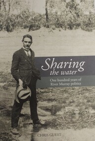
... Sharing the Water 100 Years of River Murray Politics Book Sharing the Water 100 Years of River Murray Politics Wodonga Chris Guest Murray-Darling Basin Commission ...Conflict over the control and sharing of the waters of the River Murray was one of the most contentious issues at the time of Federation. After four failed attempts, the River Murray Waters Agreement was signed in 1914 resolving the conflict. Fifteen iterations later, it is now the Murray-Darling Basin Agreement, and possibly Australia's longest standing inter-governmental compact. This book covers the making of the first River Murray Waters Agreement, in the early 1900s, the formation of the River Murray Commission in 1917, through to Queensland and the Australian Capital Territory joining the Agreement in the 1990s, the Water Act in 2007 and the Basin Plan becoming law in 2012. The book has been written by Chris Guest who, as a career public servant and economist, has had a long interest in water policy and politics, an interest that grew as governments sought to tackle the problems of over-allocation of water. The book was launched on 14 February 2017, one hundred years to the day that the commissioners of the newly formed River Murray Commission met for the first time.non-fictionConflict over the control and sharing of the waters of the River Murray was one of the most contentious issues at the time of Federation. After four failed attempts, the River Murray Waters Agreement was signed in 1914 resolving the conflict. Fifteen iterations later, it is now the Murray-Darling Basin Agreement, and possibly Australia's longest standing inter-governmental compact. This book covers the making of the first River Murray Waters Agreement, in the early 1900s, the formation of the River Murray Commission in 1917, through to Queensland and the Australian Capital Territory joining the Agreement in the 1990s, the Water Act in 2007 and the Basin Plan becoming law in 2012. The book has been written by Chris Guest who, as a career public servant and economist, has had a long interest in water policy and politics, an interest that grew as governments sought to tackle the problems of over-allocation of water. The book was launched on 14 February 2017, one hundred years to the day that the commissioners of the newly formed River Murray Commission met for the first time.river murray commission, river murray waters agreement, murray-darling basin agreement -
 Wodonga & District Historical Society Inc
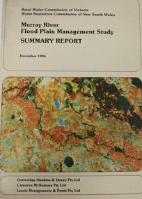
Book - Murray River Flood Management Study December 1986 - Summary Report, Rural Water Commission of Victoria
... Floodplain management -- Murray River Water Resources This publication is the Summary Report of a study of the management of water resources and management of the Murray River. It was jointly commission ...This publication is the Summary Report of a study of the management of water resources and management of the Murray River. It was jointly commission by the Rural Water Commission of Victoria and the Water Resources Commission of New South Wales. The Rural Water Commission of Victoria was established in 1984. The Commission was renamed in 1992, becoming the Rural Water Corporation. The Water Resources Commission of NSW was constituted in 1976. The Water Administration Act, 1986 abolished the Water Resources Commission replacing it with the Department of Water Resources on 1 January 1987.non-fictionThis publication is the Summary Report of a study of the management of water resources and management of the Murray River. It was jointly commission by the Rural Water Commission of Victoria and the Water Resources Commission of New South Wales. The Rural Water Commission of Victoria was established in 1984. The Commission was renamed in 1992, becoming the Rural Water Corporation. The Water Resources Commission of NSW was constituted in 1976. The Water Administration Act, 1986 abolished the Water Resources Commission replacing it with the Department of Water Resources on 1 January 1987. floodplain management -- murray river, water resources -
 Wodonga & District Historical Society Inc
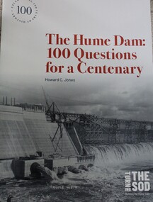
Book - The Hume Dam: 100 Questions for a Centenary, Howard C Jones, 2019
... Hume Dam was constructed for the River Murray Commission by the New South Wales Department of Public Works and the State Rivers and Water Supply Commission of Victoria, as joint constructing authorities. ...Hume Dam was constructed for the River Murray Commission by the New South Wales Department of Public Works and the State Rivers and Water Supply Commission of Victoria, as joint constructing authorities. ...A booklet describing the history of the Hume Dam in question-and-answer format, illustrated by photographs from the Albury City Collection and other sources. This booklet was produced to accompany the exhibition "Turning the sod: building the Hume Dam", on display at Lavington Library from 21 December 2019 -1 March 2020."non-fictionA booklet describing the history of the Hume Dam in question-and-answer format, illustrated by photographs from the Albury City Collection and other sources. This booklet was produced to accompany the exhibition "Turning the sod: building the Hume Dam", on display at Lavington Library from 21 December 2019 -1 March 2020." hume dam, dams -- new south wales, hume dam history, dams -- new south wales -- design and construction
