Showing 112 items matching "north-east vic"
-
 The Beechworth Burke Museum
Postcard, R & B Hall, c.1930
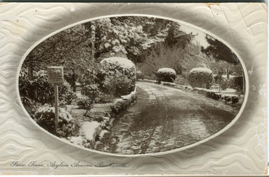
... ...snow north-east vic...Further research into the importance of the Hospital in Beechworth and it's connection to the town will be supported through images like these kept in the Mayday Hills photo album in the collection of the Burke Museum. asylum asylum avenue beechworth snow north-east vic victoria snow scene mayday hills mayday hills hospital mental hospital colonial attitudes mental health history town development postcard Obverse: Snow Scene; Asylum Avenue, Beechworth. / Reverse: POST CARD / ADDRESS ONLY / Published by R. & B. ...This postcard was published by R. & B. Hall in Beechworth and printed in Saxony, circa 1930. Saxony is a landlocked state of Germany which borders the states of Brandenburg, Saxony-Anhalt, Thuringia, Bavaria and the countries of Poland and the Czech Republic. This particular postcard is embossed with a pattern which surrounds the middle image in the center of the card. This image depicts Asylum Avenue which leads to the Mayday Hills Asylum in Beechworth, Victoria. What makes this scene particularly interesting is the appearance of snow which is rare in Beechworth. The road depicted on the postcard has track marks made by a car with thin wheels. Beechworth's Mayday Hills was chosen as the site of Victoria's newest asylum, at the time, due to the landscape and altitude. The hilltop atmosphere and the native fauna, it was argued, would assist in the cure of the patients kept at the hospital (Wood 1985, 122). The positioning of the hospital had a beneficial effect on the rural town. A pamphlet published by James Ingram and Son (1849) reveal that famous landmarks in Beechworth which included the Post Office, Gaol, Courthouse and Asylum "demonstrate the appreciation of Beechworth by the Government not only as as important district center, but also as a site unrivaled as a sanitarium". There were other locations in contention at the time, but ultimately Beechworth was chosen (Craig 2000, 33). Prior to the creation of the Asylum in Beechworth, those charged with having mental illnesses or, as it was termed, "insanity" were unable to be properly cared for in the Gaol (which is where they were often sent). John Buckley Castieau wrote, in 1861 for the Ovens and Murray Advertiser, that the Gaol was unable to properly care for those classified then as "insane" but that they would endeavor to treat them above the other inmates (which he notes is not always the case in other establishments). Castieau wrote this in favour of supporting the building of the Mayday Hills Hospital in Beechworth. It was stated that at the time the Mayday Hills Hospital was built, there were 83 prisoners kept in the Gaol who were to be rehoused to the Hospital on the grounds of "insanity". The classification as someone as "insane", in this period of time is a reflection on the inability to cure and understand illnesses of the mind during the mid to late 1800s. Beechworth's Mayday Hills was chosen as the site of Victoria's newest asylum, at the time, due to the landscape and altitude. Opening on the 24th of October 1867, the Mayday Hills Hospital was originally named the "Ovens Lunatic Asylum", a title which is very much a product of its time. Whilst controversial, changes to the name is part of the history of the Hospital and can provide much insight into the understanding of mental illness throughout history and the use/disuse of this term provides information into the reception/changing opinions of mental illness in society. The Hospital would later become known as the "Mayday Hills Asylum" and/or "Mayday Hills Hospital" with the latter being the most commonly used title. An article in the Ovens and Murray Advertiser notes that on the 7th of March 1865, the foundation stone of the Hospital was laid (it would officially open in 1867) and that it was such a moment of accomplishment and joy for Beechworth that a letter to the editor even suggested that there should be a holiday dedicated to the day the foundation stone as laid. This reveals an extent to which the townspeople of early Beechworth valued the construction of the Hospital in their town. It provided the town with a sense of prestige and honour.At first glance, the remains of the Mayday Hills Hospital in Beechworth, Victoria, inspire tragedy, trauma and beauty. The buildings themselves, with their Italianate style Renaissance architecture designed by J.J. Clark (Craig 2000, 49 & Smith 2016, 203) reflect a bygone period of European and Australian history. The gardens provide a sense of tranquility and beauty. The experience of those within these walls remains a valuable area of study to provide a more complete understanding. This particular hospital is considered the fourth of its like and one of three identified as the largest of their kind. The Mayday Hills Hospital is a sister to the Kew and Ararat Asylums in Melbourne which are both located in relative proximity. Understanding the role of the Mayday Hills Hospital in Beechworth history is integral to understanding the development of the goldfields town, but also for providing important information as to the history of caring for, and the reception of, mental illnesses in Australian and wider European history. Mayday Hills provides a case study which can be researched through oral history, an analysis of the grounds/buildings and through images like this postcard which portray the structure in a highly deliberate manner. Images like this depict the strong façade of the Hospital and provide a glimpse into the tranquility of the gardens. This has been done deliberately to provide a sense of comfort and healing about the building to those looking from the outside. Further research into the importance of the Hospital in Beechworth and it's connection to the town will be supported through images like these kept in the Mayday Hills photo album in the collection of the Burke Museum.Pale coloured rectangular postcard printed on matte embossed card.Obverse: Snow Scene; Asylum Avenue, Beechworth. / Reverse: POST CARD / ADDRESS ONLY / Published by R. & B. Hall, Beechworth. / Printed in Saxony. / 3447 [crossed out] / 1997.2492 / AFFIX STAMP /asylum, asylum avenue, beechworth, snow north-east vic, victoria, snow scene, mayday hills, mayday hills hospital, mental hospital, colonial attitudes, mental health, history, town development, postcard -
 The Beechworth Burke Museum
Photograph, J. Collins
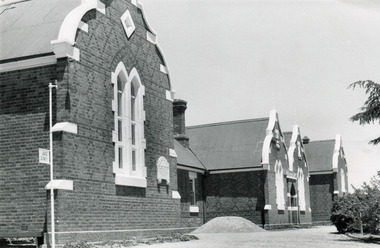
... ...north-east vic...It can also be studied for what it reveals about society in Beechworth and compared and contrasted to similar institutions across Australia and with additional photographs in the Burke Museum collection. mayday hills beechworth benevolent asylum ovens benevolent home destitute gold town beechworth victoria north-east vic Back of photograph. Handwriting: "For John Beckingsale" Black and white rectangular photograph printed on gloss photographic paper Photograph Photograph J. ...This photograph was captured sometime between an estimated 1940s-1950s. It depicts the Beechworth Benevolent Asylum (later the Ovens and Murray Hospital for the Aged) which was built in 1862. It is located on an elevated site in Beechworth, Victoria because it was believed the height was beneficial to the health of the patients at the Benevolent. Later wings were added to the original building between 1867 and 1890. The building was constructed in an unusual Flemish Gothic Revival style which contrasts with the classical style of the Mayday Hills Hospital in close proximity to the Benevolent. The Hospital was designed in Italianate Revival architecture. The appearance of buildings like the Mayday Hills Hospital and the Ovens Benevolent Asylum are representative of the importance of Beechworth as a town shortly after the goldrush. During the 1850s and 1860s, administration buildings were erected alongside churches, shops and structures of justice. This marks a movement away from the "chaotic" structure of life on the goldfields and towards a more civilised and cultural lifestyle. This social phenomenon is also witnessed in Melbourne with the creation of buildings like the State Library and the University of Melbourne. The Beechworth Benevolent Asylum was renamed the Ovens Benevolent Home in 1935. The Asylum had been set up to provide accommodation and care for permanently injured gold miners, and for women and children who were penniless, homeless, or whose parents were guests of the state. In 1954 it was renamed as The Ovens and Murray Home (as pictured in this photograph). The purpose of this building was to provide a refuge for the poor and destitute, homeless older men, deserted women and children along with providing care for the mentally ill. These buildings were built at the government's expense and are of great historical and architectural significance.This photograph depicts the Ovens and Murray Home (previously the Ovens Benevolent Home) during the 1940s or 1950s. Since this building is of great historic and architectural significance, photographs like this are especially valuable in reconstructing the use history and any changes/additions to the building over a period of time. This building is important for what it can reveal about society in Beechworth and also architectural styles. This building is made in the Flemish Gothic Revival style which is quite unusual for the 1860s. It is important as an early example of a building constructed for a specific purpose, in the case of this particular building: caring for the aged/destitute. This building is important for research into the civic development of Beechworth as an early Gold Rush town located in Victoria's North-East. During this period, Beechworth was developing as the main center of administration in this region which made it a very influential and quickly developed town. Photographs like this one which depict a building during one period in history can reveal important information for the use and alterations of a building and for preferences in architectural style. It can also be studied for what it reveals about society in Beechworth and compared and contrasted to similar institutions across Australia and with additional photographs in the Burke Museum collection.Black and white rectangular photograph printed on gloss photographic paperBack of photograph. Handwriting: "For John Beckingsale"mayday hills, beechworth benevolent asylum, ovens benevolent home, destitute, gold town, beechworth, victoria, north-east vic -
 Bendigo Historical Society Inc.
Document - ALBERT WILLIAM CRAVEN INFORMATION
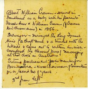
... Surveyed the 'Long Tunnel Mine' [North/East Vic?] Entered parliament as member for Benambra. ...Surveyed the 'Long Tunnel Mine' [North/East Vic?] Entered parliament as member for Benambra. ...Unknown author, handwritten notes pertaing to life of Albert William Craven. Craven of Cravens New Chum Mine in 1856. Surveyed the 'Long Tunnel Mine' [North/East Vic?] Entered parliament as member for Benambra. Notes pertained to lost photograph.gold mining, miners' safety cage, albert william craven. -
 Bendigo Military Museum
Document - DOCUMENTS WW2, post 1955
... Bendigo Military Museum 37 - 39 Pall Mall Bendigo goldfields Photos relate to CAPTAIN R EMOND's WWII service in the Middle East & North Africa. 2782.7 - 2782.9 relate to Queen Elizabeth's visit to Bendigo in March 1954. 2782.11 & 2782.12 depict soldiers marching through Charing Cross, Bendigo. 2782.13 shows CAPTAIN EMOND & Gov Dallas Brooks inspecting the 38th Battalion. documents - copies photography-photographs-copies military history Passchendaele barracks trust .13) "14 Mar 55. The Gov of Vic ...Photos relate to CAPTAIN R EMOND's WWII service in the Middle East & North Africa. 2782.7 - 2782.9 relate to Queen Elizabeth's visit to Bendigo in March 1954. 2782.11 & 2782.12 depict soldiers marching through Charing Cross, Bendigo. 2782.13 shows CAPTAIN EMOND & Gov Dallas Brooks inspecting the 38th Battalion.Collection of black & white photos & documents related to CAPTAIN RUSS EMOND. Copied photos & captions have been glued to A4 pages. x 13 pages in blue plastic display folder..13) "14 Mar 55. The Gov of Vic Sir Dallas Brookes inspecting guard of honour from 38 Inf Bn. Guard Commander - Capt Russ Emond"documents - copies, photography-photographs-copies, military history, passchendaele barracks trust -
 Kiewa Valley Historical Society
Meter Ammeter Recorder, Circa 1950
... Vic laboratories on the 17/4/77. It was used extensively as mobile recorder placed for periods of one month at locations experiencing unacceptable fluctuations of power. These locations would cover the North East...Vic laboratories on the 17/4/77. It was used extensively as mobile recorder placed for periods of one month at locations experiencing unacceptable fluctuations of power. These locations would cover the North East ...This testing voltmeter recorder was last certified by SEC Vic laboratories on the 17/4/77. It was used extensively as mobile recorder placed for periods of one month at locations experiencing unacceptable fluctuations of power. These locations would cover the North East regions of Victoria. They cover voltage drops at domestic and business properties especially those that were experiencing regular fluctuations(daily) at approximately the same time of the day. As the electrical network is required to operate within a set level of voltage, fluctuations outside of this has to be investigated and necessary remedial action taken. This is especially so for rural properties where power "drainage" can occur through animal/bird and tree interference. It can also be the result of defective wiring and overloading at peek operational times (milking machines).This mobile voltage recorder is very significant to the Kiewa Valley because it highlights the difficulties that can occur in maintaining a power supply that experiences fluctuating power demands by the rural industries that it supplies. The requirement of a mobile testing apparatus to cover the various sections in the Kiewa Valley and other rural areas in the northeast region is one of necessity as electricity once connected to a rural property is a labour saving supply as generators on rural properties require a higher degree of maintenance an ultimately at a higher cost. The testing of the SEC Vic supplied electricity to rural properties,those who had previously run on generators, had to be quick and unassuming with certainty of correct supply levels.The mechanism of this voltage recorder has been installed(by the manufacturer) into its own protective wooden box. This box has a front (swing open) lockable section which permits direct access to the installed measuring equipment (for servicing and data collection). The top section of the box has two screw on terminals for access to the machine being tested. This tester has its own inbuilt ink supply facilities and a mechanical clockwork device that unwinds a roll of paper onto a second roll at a rate of 10 mm per hour. The recording chart is marked with time slots against voltage. There is a recording arm which has an ink pen at the end. Both arm and pen carry the ink supply from the ink reservoir, located on the left side of the cabinet door in specially constructed bottle holder( three small bottle capacity). To record a suspect power problem to a home or business establishment the voltmeter is connected to a power supply outlet being tested and wind the recording clockwork mechanism (gives a four week running time). Before leaving the recorder in situ the electrician checks to see if the chart is recording the correct voltage and that the clock mechanism is advancing correctly.On the front of the access "door" at the top a metal label "RECORDING AMMETER" below this "MURDAY SYSTEM" below this "ALTERNATING CURRENT" and below this the manufacturer's registered number "No. 139156" Below this is a metal tag with State Electricity Commission of Victoria Electrical Engineer's Section equipment number "338" Below these tags and above the viewing window is the manufacturer's dtails "EVERSHED & VIGNOLES Led LONDON"sec vic kiewa hydro scheme, alternate energy supplies, alpine feasibility studies temperature, rainfall, power outages -
 Kiewa Valley Historical Society
Case Volt Meter Recorder, Circa 1950 to 1977
... Vic laboratories on the 17/4/77. It was used extensively in the transportation of the mobile recorder which was sometimes placed for periods of one month at locations experiencing unacceptable fluctuations of power. These locations would cover the North East...Vic laboratories on the 17/4/77. It was used extensively in the transportation of the mobile recorder which was sometimes placed for periods of one month at locations experiencing unacceptable fluctuations of power. These locations would cover the North East ...This case is for a testing voltmeter recorder. The last time it was certified by SEC Vic laboratories on the 17/4/77. It was used extensively in the transportation of the mobile recorder which was sometimes placed for periods of one month at locations experiencing unacceptable fluctuations of power. These locations would cover the North East regions of Victoria. They cover voltage drops at domestic and business properties especially those that were experiencing regular fluctuations(daily) at approximately the same time of the day. As the electrical network is required to operate within a set level of voltage, fluctuations outside of this has to be investigated and necessary remedial action taken. This is especially so for rural properties where power "drainage" can occur through animal/bird and tree interference. See KVHS 0302 (A) for the instrument.This case for a mobile voltage recorder is very significant to the Kiewa Valley because it highlights the difficulties that can occur in maintaining a power supply that experiences fluctuating power demands by the rural industries that it supplies. The requirement of a mobile testing apparatus to cover the various sections in the Kiewa Valley and other rural areas in the northeast region is one of necessity as electricity once connected to a rural property is a labour saving supply as generators on rural properties require a higher degree of maintenance an ultimately at a higher cost. The testing of the SEC Vic supplied electricity to rural properties,those who had previously run on generators, had to be quick and unassuming with certainty of correct supply levels.This heavy and thick all leather case for the "easy" transportation of the Volt meter recorder has a opening top which pop riveted to the main body(rivets are aluminium). The all leather top has a shaped carrying handle which is also riveted on. There are two straps on the side of the top which can be fastened to the main body by metal "shoe" buckles. The bottom end is secured to the main bag by large rivets.Tick grade stitching is on all corners.Nilsec vic kiewa hydro scheme, alternate energy supplies, alpine growth in electricity consumption -
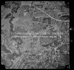
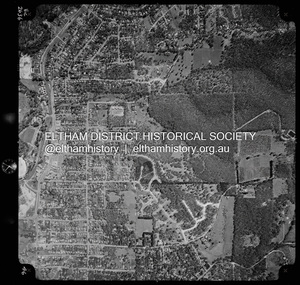
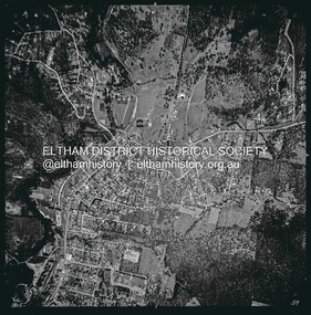
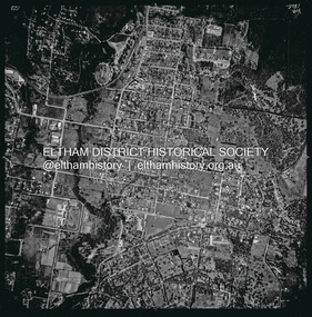
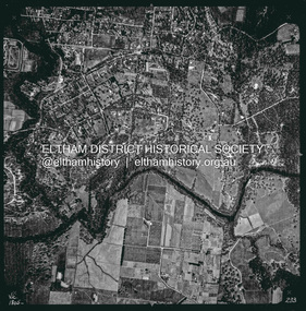 Eltham District Historical Society Inc
Photograph - Aerial Photograph, Landata, Eltham, Vic, Apr. 1963
... north, Yarra River and Templestowe to south, Main Road at Reynolds Road to east and Falkiner Street to west. Historic Aerial Imagery Source: Landata.vic.gov.au Aerial Photo Details: Project No :486 Project : MELBOURNE (1963) PROJECT Run : 7 Frame : 233 Date : 04/1963 Film Type : B/W Camera : RC8 Flying Height : 5100 Scale : 9600 Film Number : 1805 GDA2020 : 37°44'04"S, 145°09'10"E MGA2020 : 337237, 5822053 (55) Melways : 22 A10 (ed. 42) Aerial Photo Neil Webster Collection 1963-04 Eltham Falkiner Street Griffith Park Road Melway 22A10 Mount Pleasant Road Reynolds Road Templestowe Yarra River Digital jpg and electronic PDF file Eltham, Vic. ...Centred on present day Griffith Park Road, Eltham bounded by Mount Pleasant Road to north, Yarra River and Templestowe to south, Main Road at Reynolds Road to east and Falkiner Street to west. Historic Aerial Imagery Source: Landata.vic.gov.au Aerial Photo Details: Project No :486 Project : MELBOURNE (1963) PROJECT Run : 7 Frame : 233 Date : 04/1963 Film Type : B/W Camera : RC8 Flying Height : 5100 Scale : 9600 Film Number : 1805 GDA2020 : 37°44'04"S, 145°09'10"E MGA2020 : 337237, 5822053 (55) Melways : 22 A10 (ed. 42)aerial photo, neil webster collection, 1963-04, eltham, falkiner street, griffith park road, melway 22a10, mount pleasant road, reynolds road, templestowe, yarra river -
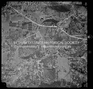
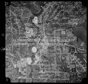
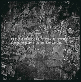
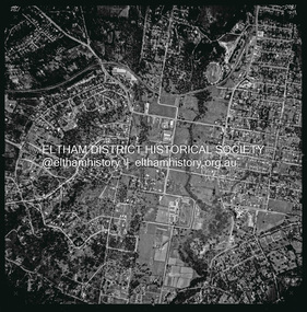
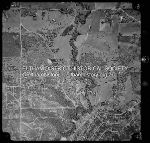 Eltham District Historical Society Inc
Photograph - Aerial Photograph, Landata, Eltham North, Vic, Apr. 1972
... east and Ryans Road to west. Historic Aerial Imagery Source: Landata.vic.gov.au Aerial Photo Details: Project No :985 Project : MELBOURNE 1972 Run : 26 Frame : 190 Date : 04/1972 Film Type : B/W Camera : RC10 Flying Height : 5700 Scale : 9600 Film Number : 2636 GDA2020 : 37°41'52"S, 145°08'52"E MGA2020 : 336705, 5826102 (55) Melways : 11 J12 (ed. 42) Aerial Photo Neil Webster Collection 1972-04 Allendale Road Beard Street Bellevue Road Eltham Eltham North Eltham North reserve Melway 11J12 Ryans Road Zig Zag Road Eltham North Primary School Digital jpg and electronic PDF file Eltham North, Vic. ...Centred on present day Eltham North reserve near Eltham North Primary School, Eltham North bounded by Allendale Road to north, Bellevue Road to south, Zig Zag Road and Beard Street to east and Ryans Road to west. Historic Aerial Imagery Source: Landata.vic.gov.au Aerial Photo Details: Project No :985 Project : MELBOURNE 1972 Run : 26 Frame : 190 Date : 04/1972 Film Type : B/W Camera : RC10 Flying Height : 5700 Scale : 9600 Film Number : 2636 GDA2020 : 37°41'52"S, 145°08'52"E MGA2020 : 336705, 5826102 (55) Melways : 11 J12 (ed. 42)aerial photo, neil webster collection, 1972-04, allendale road, beard street, bellevue road, eltham, eltham north, eltham north reserve, melway 11j12, ryans road, zig zag road, eltham north primary school -
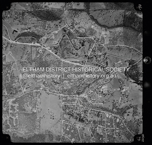
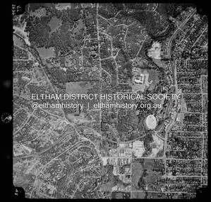
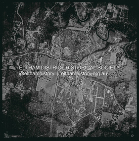
 Eltham District Historical Society Inc
Photograph - Aerial Photograph, Landata, Eltham, Vic, Apr. 1972
... north, Park West Road to south, Parsons Road to east and Banks Road to west. Historic Aerial Imagery Source: Landata.vic.gov.au Aerial Photo Details: Project No :985 Project : MELBOURNE 1972 Run : 26 Frame : 191 Date : 04/1972 Film Type : B/W Camera : RC10 Flying Height : 5700 Scale : 9600 Film Number : 2636 GDA2020 : 37°41'56"S, 145°09'26"E MGA2020 : 337533, 5826000 (55) Melways : 22 A1 (ed. 42) Aerial Photo Neil Webster Collection 1972-04 Allendale Road Eltham Eltham North Zig Zag Road Banks Road Coolabah Drive Melway 22A1 Park West Road Parsons Road Digital jpg and electronic PDF file Eltham, Vic. ...Centred on present day Zig Zag Road near Coolabah Drive, Eltham bounded by Allendale Road to north, Park West Road to south, Parsons Road to east and Banks Road to west. Historic Aerial Imagery Source: Landata.vic.gov.au Aerial Photo Details: Project No :985 Project : MELBOURNE 1972 Run : 26 Frame : 191 Date : 04/1972 Film Type : B/W Camera : RC10 Flying Height : 5700 Scale : 9600 Film Number : 2636 GDA2020 : 37°41'56"S, 145°09'26"E MGA2020 : 337533, 5826000 (55) Melways : 22 A1 (ed. 42)aerial photo, neil webster collection, 1972-04, allendale road, eltham, eltham north, zig zag road, banks road, coolabah drive, melway 22a1, park west road, parsons road -
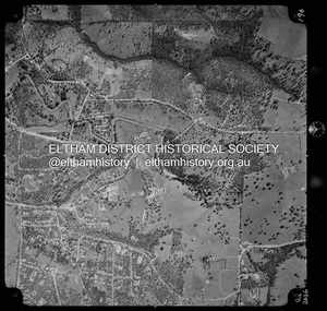
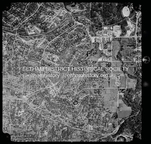
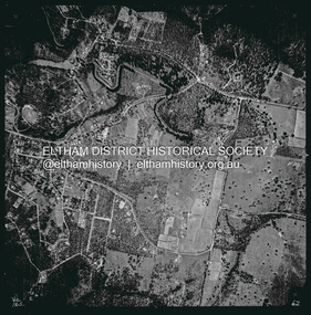
 Eltham District Historical Society Inc
Photograph - Aerial Photograph, Landata, Eltham, Vic, Apr. 1972
... north, Frank Street to south, Research Shops and Raglan Road to east and Zig Zag Road to west. Historic Aerial Imagery Source: Landata.vic.gov.au Aerial Photo Details: Project No :985 Project : MELBOURNE 1972 Run : 26 Frame : 192 Date : 04/1972 Film Type : B/W Camera : RC10 Flying Height : 5700 Scale : 9600 Film Number : 2636 GDA2020 : 37°42'00"S, 145°09'59"E MGA2020 : 338360, 5825897 (55) Melways : 22 D1 (ed. 42) Aerial Photo Neil Webster Collection 1972-04 Allendale Road Eltham Zig Zag Road frank street Melway 22D1 Parsons Road Raglan Road Research (Vic.) ...Centred on present day Parsons Road, Eltham bounded by Allendale Road to north, Frank Street to south, Research Shops and Raglan Road to east and Zig Zag Road to west. Historic Aerial Imagery Source: Landata.vic.gov.au Aerial Photo Details: Project No :985 Project : MELBOURNE 1972 Run : 26 Frame : 192 Date : 04/1972 Film Type : B/W Camera : RC10 Flying Height : 5700 Scale : 9600 Film Number : 2636 GDA2020 : 37°42'00"S, 145°09'59"E MGA2020 : 338360, 5825897 (55) Melways : 22 D1 (ed. 42)aerial photo, neil webster collection, 1972-04, allendale road, eltham, zig zag road, frank street, melway 22d1, parsons road, raglan road, research (vic.), research shops, eltham barrel -
 Eltham District Historical Society Inc
Photograph - Aerial Photograph, Landata, Research, Vic, Apr. 1972
... north, Thompson Crescent to south, Eltham College to east and Parsons Road to west. Historic Aerial Imagery Source: Landata.vic.gov.au Aerial Photo Details: Project No :985 Project : MELBOURNE 1972 Run : 26 Frame : 193 Date : 04/1972 Film Type : B/W Camera : RC10 Flying Height : 5700 Scale : 9600 Film Number : 2636 GDA2020 : 37°42'04"S, 145°10'33"E MGA2020 : 339187, 5825794 (55) Melways : 22 F1 (ed. 42) Aerial Photo Neil Webster Collection 1972-04 Allendale Road Eltham Eltham Barrel Eltham College Maroong Drive Melway 22F1 Parsons Road Research (Vic.) ...Centred on present day Maroong Drive, Research bounded by Allendale Road to north, Thompson Crescent to south, Eltham College to east and Parsons Road to west. Historic Aerial Imagery Source: Landata.vic.gov.au Aerial Photo Details: Project No :985 Project : MELBOURNE 1972 Run : 26 Frame : 193 Date : 04/1972 Film Type : B/W Camera : RC10 Flying Height : 5700 Scale : 9600 Film Number : 2636 GDA2020 : 37°42'04"S, 145°10'33"E MGA2020 : 339187, 5825794 (55) Melways : 22 F1 (ed. 42)aerial photo, neil webster collection, 1972-04, allendale road, eltham, eltham barrel, eltham college, maroong drive, melway 22f1, parsons road, research (vic.), thompson crescent -
 Eltham District Historical Society Inc
Photograph - Aerial Photograph, Landata, Research, Vic, Apr. 1972
... north, Research-Warrandyte Road to south, Swipers Gully Training Restaurant to east and Reynolds Road to west. Historic Aerial Imagery Source: Landata.vic.gov.au Aerial Photo Details: Project No :985 Project : MELBOURNE 1972 Run : 26 Frame : 194 Date : 04/1972 Film Type : B/W Camera : RC10 Flying Height : 5700 Scale : 9600 Film Number : 2636 GDA2020 : 37°42'07"S, 145°11'07"E MGA2020 : 340015, 5825692 (55) Melways : 22 H1 (ed. 42) Aerial Photo Neil Webster Collection 1972-04 Allendale Road Eltham College Main Road Maroondah Aqueduct Melway 22H1 Research (Vic.) ...Centred on present day Main Road, Research near Maroondah Aqueduct and Eltham College bounded by Allendale Road to north, Research-Warrandyte Road to south, Swipers Gully Training Restaurant to east and Reynolds Road to west. Historic Aerial Imagery Source: Landata.vic.gov.au Aerial Photo Details: Project No :985 Project : MELBOURNE 1972 Run : 26 Frame : 194 Date : 04/1972 Film Type : B/W Camera : RC10 Flying Height : 5700 Scale : 9600 Film Number : 2636 GDA2020 : 37°42'07"S, 145°11'07"E MGA2020 : 340015, 5825692 (55) Melways : 22 H1 (ed. 42)aerial photo, neil webster collection, 1972-04, allendale road, eltham college, main road, maroondah aqueduct, melway 22h1, research (vic.), research-warrandyte road, reynolds road, swiper's gully -
 Eltham District Historical Society Inc
Photograph - Aerial Photograph, Landata, Eltham, Vic, Apr. 1972
... north, Mount Pleasant Road to south, Stokes Orchard Estate to east and Eltham Railway Station to west. Historic Aerial Imagery Source: Landata.vic.gov.au Aerial Photo Details: Project No :985 Project : MELBOURNE 1972 Run : 27 Frame : 46 Date : 04/1972 Film Type : B/W Camera : RC10 Flying Height : 5700 Scale : 9600 Film Number : 2636 GDA2020 : 37°42'49"S, 145°09'46"E MGA2020 : 338053, 5824365 (55) Melways : 22 C5 (ed. 42) Aerial Photo Neil Webster Collection 1972-04 Eltham Eltham Railway Station Melway 22C5 Mount Pleasant Road Park Road Stokes Orchard Estate Woodridge Estate Digital jpg and electronic PDF file Eltham, Vic. ...Centred on present day Woodridge Estate, Eltham bounded by Park Road to north, Mount Pleasant Road to south, Stokes Orchard Estate to east and Eltham Railway Station to west. Historic Aerial Imagery Source: Landata.vic.gov.au Aerial Photo Details: Project No :985 Project : MELBOURNE 1972 Run : 27 Frame : 46 Date : 04/1972 Film Type : B/W Camera : RC10 Flying Height : 5700 Scale : 9600 Film Number : 2636 GDA2020 : 37°42'49"S, 145°09'46"E MGA2020 : 338053, 5824365 (55) Melways : 22 C5 (ed. 42)aerial photo, neil webster collection, 1972-04, eltham, eltham railway station, melway 22c5, mount pleasant road, park road, stokes orchard estate, woodridge estate -
 Eltham District Historical Society Inc
Photograph - Aerial Photograph, Landata, Eltham, Vic, Apr. 1972
... north, Napoleon Street to south, Woodridge Estate to east and Ryans Road to west. Historic Aerial Imagery Source: Landata.vic.gov.au Aerial Photo Details: Project No :985 Project : MELBOURNE 1972 Run : 27 Frame : 47 Date : 04/1972 Film Type : B/W Camera : RC10 Flying Height : 5700 Scale : 9600 Film Number : 2636 GDA2020 : 37°42'45"S, 145°09'12"E MGA2020 : 337223, 5824470 (55) Melways : 22 A4 (ed. 42) Aerial Photo Neil Webster Collection 1972-04 Eltham Eltham Railway Station Woodridge Estate Eltham Shops Main Road Melway 22A4 Napoleon Street Park West Road Pryor Street Ryans Road Digital jpg and electronic PDF file Eltham, Vic. ...Centred on present day Main Road at Pryor Street, Eltham bounded by Park West Road to north, Napoleon Street to south, Woodridge Estate to east and Ryans Road to west. Historic Aerial Imagery Source: Landata.vic.gov.au Aerial Photo Details: Project No :985 Project : MELBOURNE 1972 Run : 27 Frame : 47 Date : 04/1972 Film Type : B/W Camera : RC10 Flying Height : 5700 Scale : 9600 Film Number : 2636 GDA2020 : 37°42'45"S, 145°09'12"E MGA2020 : 337223, 5824470 (55) Melways : 22 A4 (ed. 42)aerial photo, neil webster collection, 1972-04, eltham, eltham railway station, woodridge estate, eltham shops, main road, melway 22a4, napoleon street, park west road, pryor street, ryans road -
 Eltham District Historical Society Inc
Photograph - Aerial Photograph, Landata, Eltham, Vic, Apr. 1972
... north, Brougham Street to south, Bible Street to east and Outlook Crescent to west. Historic Aerial Imagery Source: Landata.vic.gov.au Aerial Photo Details: Project No :985 Project : MELBOURNE 1972 Run : 27 Frame : 48 Date : 04/1972 Film Type : B/W Camera : RC10 Flying Height : 5700 Scale : 9600 Film Number : 2636 GDA2020 : 37°42'41"S, 145°08'38"E MGA2020 : 336392, 5824574 (55) Melways : 21 H4 (ed. 42) Aerial Photo Neil Webster Collection 1972-04 Eltham Bible Street Brougham Steet Melway 21H4 outlook crescent Progress Road Ryans Road Sandra Avenue Montmorency Digital jpg and electronic PDF file Eltham, Vic. ...Centred on present day Ryans Road at Sandra Avenue, Eltham bounded by Progress Road to north, Brougham Street to south, Bible Street to east and Outlook Crescent to west. Historic Aerial Imagery Source: Landata.vic.gov.au Aerial Photo Details: Project No :985 Project : MELBOURNE 1972 Run : 27 Frame : 48 Date : 04/1972 Film Type : B/W Camera : RC10 Flying Height : 5700 Scale : 9600 Film Number : 2636 GDA2020 : 37°42'41"S, 145°08'38"E MGA2020 : 336392, 5824574 (55) Melways : 21 H4 (ed. 42)aerial photo, neil webster collection, 1972-04, eltham, bible street, brougham steet, melway 21h4, outlook crescent, progress road, ryans road, sandra avenue, montmorency -
 Eltham District Historical Society Inc
Photograph - Aerial Photograph, Landata, Montmorency, Vic, Apr. 1972
... north, Main Road to south, Main Road to east and Alban Street to west. Historic Aerial Imagery Source: Landata.vic.gov.au Aerial Photo Details: Project No :985 Project : MELBOURNE 1972 Run : 28 Frame : 206 Date : 04/1972 Film Type : B/W Camera : RC10 Flying Height : 5700 Scale : 9600 Film Number : 2635 GDA2020 : 37°43'21"S, 145°07'46"E MGA2020 : 335154, 5823329 (55) Melways : 21 E7 (ed. 42) Aerial Photo Neil Webster Collection 1972-04 Eltham Alban Street Grand Boulevard Lower Plenty Main Road Melway 21E7 Meruka Drive Montmorency Olympic Avenue Digital jpg and electronic PDF file Montmorency, Vic. ...Centred on present day Olympic Avenue at Grand Boulevard, Montmorency bounded by Meruka Drive to north, Main Road to south, Main Road to east and Alban Street to west. Historic Aerial Imagery Source: Landata.vic.gov.au Aerial Photo Details: Project No :985 Project : MELBOURNE 1972 Run : 28 Frame : 206 Date : 04/1972 Film Type : B/W Camera : RC10 Flying Height : 5700 Scale : 9600 Film Number : 2635 GDA2020 : 37°43'21"S, 145°07'46"E MGA2020 : 335154, 5823329 (55) Melways : 21 E7 (ed. 42)aerial photo, neil webster collection, 1972-04, eltham, alban street, grand boulevard, lower plenty, main road, melway 21e7, meruka drive, montmorency, olympic avenue -
 Eltham District Historical Society Inc
Photograph - Aerial Photograph, Landata, Eltham, Vic, Apr. 1972
... north, Yarra River and Kent Hughes Road to south, Eucalyptus Road to east and Susan Street to west. Historic Aerial Imagery Source: Landata.vic.gov.au Aerial Photo Details: Project No :985 Project : MELBOURNE 1972 Run : 28 Frame : 208 Date : 04/1972 Film Type : B/W Camera : RC10 Flying Height : 5700 Scale : 9600 Film Number : 2635 GDA2020 : 37°43'29"S, 145°08'54"E MGA2020 : 336816, 5823118 (55) Melways : 21 J8 (ed. 42) Aerial Photo Neil Webster Collection 1972-04 Eltham Arthur Street Dalton Street Eucalyptus Road Kent Hughes Road Melway 21J8 Mount Pleasant Road Susan Street Yarra River Digital jpg and electronic PDF file Eltham, Vic. ...Centred on present day Dalton Street at Mount Pleasant Road, Eltham bounded by Arthur Street to north, Yarra River and Kent Hughes Road to south, Eucalyptus Road to east and Susan Street to west. Historic Aerial Imagery Source: Landata.vic.gov.au Aerial Photo Details: Project No :985 Project : MELBOURNE 1972 Run : 28 Frame : 208 Date : 04/1972 Film Type : B/W Camera : RC10 Flying Height : 5700 Scale : 9600 Film Number : 2635 GDA2020 : 37°43'29"S, 145°08'54"E MGA2020 : 336816, 5823118 (55) Melways : 21 J8 (ed. 42)aerial photo, neil webster collection, 1972-04, eltham, arthur street, dalton street, eucalyptus road, kent hughes road, melway 21j8, mount pleasant road, susan street, yarra river -
 Eltham District Historical Society Inc
Photograph - Aerial Photograph, Landata, Eltham, Vic, Apr. 1972
... north, Yarra River to south, Reynolds Road to east and Bible Street to west. Historic Aerial Imagery Source: Landata.vic.gov.au Aerial Photo Details: Project No :985 Project : MELBOURNE 1972 Run : 28 Frame : 209 Date : 04/1972 Film Type : B/W Camera : RC10 Flying Height : 5700 Scale : 9600 Film Number : 2635 GDA2020 : 37°43'33"S, 145°09'28"E MGA2020 : 337647, 5823013 (55) Melways : 22 B8 (ed. 42) Aerial Photo Neil Webster Collection 1972-04 Eltham Bible Street Mays Road Melway 22B8 Nyora Road Reynolds Road Stringybark Road Yarra River Digital jpg and electronic PDF file Eltham, Vic. ...Centred on present day Mays Road at Stringybark Road, Eltham bounded by Nyora Road to north, Yarra River to south, Reynolds Road to east and Bible Street to west. Historic Aerial Imagery Source: Landata.vic.gov.au Aerial Photo Details: Project No :985 Project : MELBOURNE 1972 Run : 28 Frame : 209 Date : 04/1972 Film Type : B/W Camera : RC10 Flying Height : 5700 Scale : 9600 Film Number : 2635 GDA2020 : 37°43'33"S, 145°09'28"E MGA2020 : 337647, 5823013 (55) Melways : 22 B8 (ed. 42)aerial photo, neil webster collection, 1972-04, eltham, bible street, mays road, melway 22b8, nyora road, reynolds road, stringybark road, yarra river -
 Eltham District Historical Society Inc
Photograph - Aerial Photograph, Landata, Eltham, Vic, Feb. 1956
... Eltham District Historical Society Inc 728 Main Rd Eltham melbourne Centred on present day Parsons Avenue at Leane Drive near the Maroondah Aqueduct, Eltham bounded by Lorimer Road to north, Thompson Crescent and Norman Road to south, Bells Hill Road to east and Parsons Road to west Historic Aerial Imagery Source: Landata.vic.gov.au Aerial Photo Details: Project No :250 Project : MELBOURNE OUTER SUBURBS PROJECT Run : 19 Frame : 5 Date : 02/1956 Film Type : B/W Camera : EAG9 Flying Height : 10000 Scale : 12000 Film Number : 1176 GDA2020 : 37°42'04"S, 145°11'09"E MGA2020 : 340064, 5825786 (55) Melways : 22 H1 (ed. 42) Aerial Photo 1956-02 Neil Webster Collection Allendale Road Bells Hill Road Eltham Leane Drive Lorimer Road Maroondah Aqueduct Melway 22H1 Norman Road Parsons Road Research (Vic.) ...Centred on present day Parsons Avenue at Leane Drive near the Maroondah Aqueduct, Eltham bounded by Lorimer Road to north, Thompson Crescent and Norman Road to south, Bells Hill Road to east and Parsons Road to west Historic Aerial Imagery Source: Landata.vic.gov.au Aerial Photo Details: Project No :250 Project : MELBOURNE OUTER SUBURBS PROJECT Run : 19 Frame : 5 Date : 02/1956 Film Type : B/W Camera : EAG9 Flying Height : 10000 Scale : 12000 Film Number : 1176 GDA2020 : 37°42'04"S, 145°11'09"E MGA2020 : 340064, 5825786 (55) Melways : 22 H1 (ed. 42)aerial photo, 1956-02, neil webster collection, allendale road, bells hill road, eltham, leane drive, lorimer road, maroondah aqueduct, melway 22h1, norman road, parsons road, research (vic.), thompson crescent -
 Eltham District Historical Society Inc
Photograph - Aerial Photograph, Landata, Research, Vic, Feb. 1956
... Eltham District Historical Society Inc 728 Main Rd Eltham melbourne Centred on present day Thompson Crescent, Research bounded by Maroondah Aqueduct to north, Thompson Crescent and Nyora Road to south, Bells Hill Road to east and Eucalyptus Road to west Historic Aerial Imagery Source: Landata.vic.gov.au Aerial Photo Details: Project No :250 Project : MELBOURNE OUTER SUBURBS PROJECT Run : 19 Frame : 6 Date : 02/1956 Film Type : B/W Camera : EAG9 Flying Height : 10000 Scale : 12000 Film Number : 1176 GDA2020 : 37°42'38"S, 145°11'02"E MGA2020 : 339927, 5824736 (55) Melways : 22 H4 (ed. 42) Aerial Photo 1956-02 Neil Webster Collection Bells Hill Road Eltham Eucalyptus Road Maroondah Aqueduct Melway 22H4 Nyora Road Research (Vic.) ...Centred on present day Thompson Crescent, Research bounded by Maroondah Aqueduct to north, Thompson Crescent and Nyora Road to south, Bells Hill Road to east and Eucalyptus Road to west Historic Aerial Imagery Source: Landata.vic.gov.au Aerial Photo Details: Project No :250 Project : MELBOURNE OUTER SUBURBS PROJECT Run : 19 Frame : 6 Date : 02/1956 Film Type : B/W Camera : EAG9 Flying Height : 10000 Scale : 12000 Film Number : 1176 GDA2020 : 37°42'38"S, 145°11'02"E MGA2020 : 339927, 5824736 (55) Melways : 22 H4 (ed. 42)aerial photo, 1956-02, neil webster collection, bells hill road, eltham, eucalyptus road, maroondah aqueduct, melway 22h4, nyora road, research (vic.), thompson crescent -
 Eltham District Historical Society Inc
Photograph - Aerial Photograph, Landata, Eltham, Vic, Apr. 1963
... north, Thompson Crescent and Arthur Street to south, Parsons Road to east and Glen Park Road and Banks Road to west. Historic Aerial Imagery Source: Landata.vic.gov.au Aerial Photo Details: Project No :486 Project : MELBOURNE (1963) PROJECT Run : 5 Frame : 59 Date : 04/1963 Film Type : B/W Camera : RC8 Flying Height : 5100 Scale : 9600 Film Number : 1805 GDA2020 : 37°42'24"S, 145°08'52"E MGA2020 : 336716, 5825114 (55) Melways : 21 J3 (ed. 42) Aerial Photo Neil Webster Collection Eltham 1963-04 Arthur Street Banks Road Glen Park Road Maroondah Aqueduct Melway 21J3 Parsons Road Digital jpg and electronic PDF file Eltham, Vic. ...Centred on present day Zig Zag Road and Main Road, Eltham bounded by Maroondah Aqueduct to north, Thompson Crescent and Arthur Street to south, Parsons Road to east and Glen Park Road and Banks Road to west. Historic Aerial Imagery Source: Landata.vic.gov.au Aerial Photo Details: Project No :486 Project : MELBOURNE (1963) PROJECT Run : 5 Frame : 59 Date : 04/1963 Film Type : B/W Camera : RC8 Flying Height : 5100 Scale : 9600 Film Number : 1805 GDA2020 : 37°42'24"S, 145°08'52"E MGA2020 : 336716, 5825114 (55) Melways : 21 J3 (ed. 42)aerial photo, neil webster collection, eltham, 1963-04, arthur street, banks road, glen park road, maroondah aqueduct, melway 21j3, parsons road -
 Eltham District Historical Society Inc
Photograph - Aerial Photograph, Landata, Eltham, Vic, Apr. 1963
... north, Thompson Crescent and Diosma Road to south, Research Shops to east and Glen Park Road and Park West Road to west. Historic Aerial Imagery Source: Landata.vic.gov.au Aerial Photo Details: Project No :486 Project : MELBOURNE (1963) PROJECT Run : 5 Frame : 60 Date : 04/1963 Film Type : B/W Camera : RC8 Flying Height : 5100 Scale : 9600 Film Number : 1805 GDA2020 : 37°42'24"S, 145°09'29"E MGA2020 : 337622, 5825128 (55) Melways : 22 B3 (ed. 42) Aerial Photo Neil Webster Collection Eltham 1963-04 Diosma Road Floriston Grove Maroondah Aqueduct Melway 22B3 Park West Road Research (Vic.) ...Centred on present day Floriston Grove, Eltham bounded by Maroondah Aqueduct to north, Thompson Crescent and Diosma Road to south, Research Shops to east and Glen Park Road and Park West Road to west. Historic Aerial Imagery Source: Landata.vic.gov.au Aerial Photo Details: Project No :486 Project : MELBOURNE (1963) PROJECT Run : 5 Frame : 60 Date : 04/1963 Film Type : B/W Camera : RC8 Flying Height : 5100 Scale : 9600 Film Number : 1805 GDA2020 : 37°42'24"S, 145°09'29"E MGA2020 : 337622, 5825128 (55) Melways : 22 B3 (ed. 42)aerial photo, neil webster collection, eltham, 1963-04, diosma road, floriston grove, maroondah aqueduct, melway 22b3, park west road, research (vic.), research shops -
 Eltham District Historical Society Inc
Photograph - Aerial Photograph, Landata, Research, Vic, Apr. 1963
... north, Nyora Road to south, Eltham College to east and Eltham Gateway Hotel to west. Historic Aerial Imagery Source: Landata.vic.gov.au Aerial Photo Details: Project No :486 Project : MELBOURNE (1963) PROJECT Run : 5 Frame : 61 Date : 04/1963 Film Type : B/W Camera : RC8 Flying Height : 5100 Scale : 9600 Film Number : 1805 GDA2020 : 37°42'24"S, 145°10'06"E MGA2020 : 338528, 5825143 (55) Melways : 22 D3 (ed. 42) Aerial Photo Neil Webster Collection Eltham 1963-04 Eltham College Eltham Gateway Hotel and Conference Centre Maroondah Aqueduct Melway 22D3 Nicholson Close Nyora Road Research (Vic.) ...Centred on present day Thompson Crescent and Nicholson Close, Research bounded by Maroondah Aqueduct to north, Nyora Road to south, Eltham College to east and Eltham Gateway Hotel to west. Historic Aerial Imagery Source: Landata.vic.gov.au Aerial Photo Details: Project No :486 Project : MELBOURNE (1963) PROJECT Run : 5 Frame : 61 Date : 04/1963 Film Type : B/W Camera : RC8 Flying Height : 5100 Scale : 9600 Film Number : 1805 GDA2020 : 37°42'24"S, 145°10'06"E MGA2020 : 338528, 5825143 (55) Melways : 22 D3 (ed. 42)aerial photo, neil webster collection, eltham, 1963-04, eltham college, eltham gateway hotel and conference centre, maroondah aqueduct, melway 22d3, nicholson close, nyora road, research (vic.), thompson crescent -
 Eltham District Historical Society Inc
Photograph - Aerial Photograph, Landata, Research, Vic, Apr. 1963
... north, Thompson Crescent to south, Joselyn Drive to east and Eltham Research Oval to west. Historic Aerial Imagery Source: Landata.vic.gov.au Aerial Photo Details: Project No :486 Project : MELBOURNE (1963) PROJECT Run : 5 Frame : 62 Date : 04/1963 Film Type : B/W Camera : RC8 Flying Height : 5100 Scale : 9600 Film Number : 1805 GDA2020 : 37°42'24"S, 145°10'43"E MGA2020 : 339434, 5825157 (55) Melways : 22 F3 (ed. 42) Aerial Photo Neil Webster Collection 1963-04 Joselyn Drive Marconi Court Melway 22F3 Research (Vic.) ...Centred on present day Marconi Court, Research bounded by Maroondah Aqueduct to north, Thompson Crescent to south, Joselyn Drive to east and Eltham Research Oval to west. Historic Aerial Imagery Source: Landata.vic.gov.au Aerial Photo Details: Project No :486 Project : MELBOURNE (1963) PROJECT Run : 5 Frame : 62 Date : 04/1963 Film Type : B/W Camera : RC8 Flying Height : 5100 Scale : 9600 Film Number : 1805 GDA2020 : 37°42'24"S, 145°10'43"E MGA2020 : 339434, 5825157 (55) Melways : 22 F3 (ed. 42)aerial photo, neil webster collection, 1963-04, joselyn drive, marconi court, melway 22f3, research (vic.), research oval, thompson crescent -
 Eltham District Historical Society Inc
Photograph - Aerial Photograph, Landata, Eltham, Vic, Apr. 1963
... north, Main Road Bridge to south, Wattle Grove to east and Bolton Street to west. Historic Aerial Imagery Source: Landata.vic.gov.au Aerial Photo Details: Project No :486 Project : MELBOURNE (1963) PROJECT Run : 6 Frame : 123 Date : 04/1963 Film Type : B/W Camera : RC8 Flying Height : 5100 Scale : 9600 Film Number : 1805 GDA2020 : 37°43'12"S, 145°08'54"E MGA2020 : 336800, 5823623 (55) Melways : 21 J6 (ed. 42) Aerial Photo Neil Webster Collection 1963-04 Bolton Steet Elsa Court Eltham John Street Main Road main road bridge Melway 21J6 Wattle Grove Digital jpg and electronic PDF file Eltham, Vic. ...Centred on present day John Street, Eltham between Main and Bible streets bounded by Elsa Court to north, Main Road Bridge to south, Wattle Grove to east and Bolton Street to west. Historic Aerial Imagery Source: Landata.vic.gov.au Aerial Photo Details: Project No :486 Project : MELBOURNE (1963) PROJECT Run : 6 Frame : 123 Date : 04/1963 Film Type : B/W Camera : RC8 Flying Height : 5100 Scale : 9600 Film Number : 1805 GDA2020 : 37°43'12"S, 145°08'54"E MGA2020 : 336800, 5823623 (55) Melways : 21 J6 (ed. 42)aerial photo, neil webster collection, 1963-04, bolton steet, elsa court, eltham, john street, main road, main road bridge, melway 21j6, wattle grove -
 Eltham District Historical Society Inc
Photograph - Aerial Photograph, Landata, Eltham, Vic, Apr. 1963
... north, Main Road to south, Bible Street to east and Reichelt Avenue and Rattray Road to west. Historic Aerial Imagery Source: Landata.vic.gov.au Aerial Photo Details: Project No :486 Project : MELBOURNE (1963) PROJECT Run : 6 Frame : 124 Date : 04/1963 Film Type : B/W Camera : RC8 Flying Height : 5100 Scale : 9600 Film Number : 1805 GDA2020 : 37°43'12"S, 145°08'16"E MGA2020 : 335876, 5823604 (55) Melways : 21 G6 (ed. 42) Aerial Photo Neil Webster Collection 1963-04 Bible Street Bolton Street Eltham Eltham Ridge Main Road Montmorency Rattray Road Reichelt Avenue Digital jpg and electronic PDF file Eltham, Vic. ...Centred on present day Eltham Ridge, Bolton Street, Eltham bounded by Elsa Court to north, Main Road to south, Bible Street to east and Reichelt Avenue and Rattray Road to west. Historic Aerial Imagery Source: Landata.vic.gov.au Aerial Photo Details: Project No :486 Project : MELBOURNE (1963) PROJECT Run : 6 Frame : 124 Date : 04/1963 Film Type : B/W Camera : RC8 Flying Height : 5100 Scale : 9600 Film Number : 1805 GDA2020 : 37°43'12"S, 145°08'16"E MGA2020 : 335876, 5823604 (55) Melways : 21 G6 (ed. 42)aerial photo, neil webster collection, 1963-04, bible street, bolton street, eltham, eltham ridge, main road, montmorency, rattray road, reichelt avenue -
 Eltham District Historical Society Inc
Book, Bush Telegraph Colour Business Guide 2003, 2003
... east...donvale...kangaroo ground...lilydale...nth croydon...nth eltham...nth ringwood...north eltham...park orchards...research (vic...This edition has broadened the demographic to include 14 suburbs. business directory chirnside park doncaster east donvale kangaroo ground lilydale nth croydon nth eltham nth ringwood north eltham park orchards research (vic.) templestowe warrandyte warranwood wonga park Soft cover book of colour display advertisements for business's located in Chirnside Park, Doncaster East, Donvale, Kangaroo Ground, Lilydale, Nth Croydon, Nth Eltham, Nth Ringwood, Park Orchards, Research, Templestowe, Warrandyte, Warranwood and Wonga Park areas arranged by category as listed in the contents page. ...Second publication following the success of the 2002 edition, aims to provide the local community with a comprehensive resource, promoting local businesses and services. This edition has broadened the demographic to include 14 suburbs.Soft cover book of colour display advertisements for business's located in Chirnside Park, Doncaster East, Donvale, Kangaroo Ground, Lilydale, Nth Croydon, Nth Eltham, Nth Ringwood, Park Orchards, Research, Templestowe, Warrandyte, Warranwood and Wonga Park areas arranged by category as listed in the contents page. Includes a sprinkling of historical images and brief descriptions of each area. Also includes lists of Child care, Churches, coming events and schools. 63 pagesbusiness directory, chirnside park, doncaster east, donvale, kangaroo ground, lilydale, nth croydon, nth eltham, nth ringwood, north eltham, park orchards, research (vic.), templestowe, warrandyte, warranwood, wonga park -
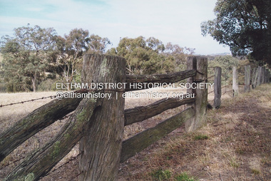 Eltham District Historical Society Inc
Photograph, Fay Bridge, Looking north towards Diamond Creek from the high point of Allendale Road, Diamond Creek, n.d
... Eltham District Historical Society Inc 728 Main Rd Eltham melbourne Situated opposite the driveway of 170 Allendale Road, Research, just east of where the Maroondah Aqueduct Trail crosses the road Fay Bridge Collection Allendale Road Diamond Creek Fences Research (Vic.) 2 images - Scanned from colour prints on loan Looking north towards Diamond Creek from the high point of Allendale Road, Diamond Creek Photograph Photograph Fay Bridge ...Situated opposite the driveway of 170 Allendale Road, Research, just east of where the Maroondah Aqueduct Trail crosses the roadfay bridge collection, allendale road, diamond creek, fences, research (vic.) -
 Glen Eira Historical Society
Document - MOORABBIN TRANSIT
... VIC 3162 melbourne This file contains one item: 1/A Moorabbin Transit printout of the bus timetable information for Route 822, effective 05/08/2002. Includes a description and a map of the route. Princes Highway Murrumbeena Road Sydney Street Hobart Road Neerim Road Crosbie Road North Road Malborough Street Stockdale Avenue Gardeners Road Quinns Road East Boundary Road Murrumbeena Bentleigh East Buses Document MOORABBIN TRANSIT ...This file contains one item: 1/A Moorabbin Transit printout of the bus timetable information for Route 822, effective 05/08/2002. Includes a description and a map of the route.princes highway, murrumbeena road, sydney street, hobart road, neerim road, crosbie road, north road, malborough street, stockdale avenue, gardeners road, quinns road, east boundary road, murrumbeena, bentleigh east, buses -
Glen Eira Historical Society
Document - COATESVILLE UNTING CHURCH CORNER NORTH AND MACKIE ROAD
... Glen Eira Historical Society 965 Glen Huntly Rd Caulfield VIC 3162 melbourne Two items about this church: 1/Photocopied details of the Church’s preliminary stages of development at Coatesville Uniting Church. 2/Photocopied article with brief details of Coatesville parish history which includes East Bentleigh Presbyterian and South Oakleigh Methodist parishes. South Oakleigh Methodist Church Reid A North ...Two items about this church: 1/Photocopied details of the Church’s preliminary stages of development at Coatesville Uniting Church. 2/Photocopied article with brief details of Coatesville parish history which includes East Bentleigh Presbyterian and South Oakleigh Methodist parishes.south oakleigh methodist church, reid a, north road, coatesville uniting church, bray mr, mackie road, harris mr, phillips l.g. rev, okey mr, adams mr, williams w.j. rev, murrumbeena, harris mr, iliffe w.r, hallibone mr, fielding mr, reynolds mr, nancarraw mr, reic a mr, thomas miss, winter mr, lanym a. mr, sturgess h mr, sturgess mrs, duncan annie, duncan gordon, sturgess edith, evans chas, ralton mr, architects, coatesville parish, uniting church, east bentleigh presbyterian church, cecil street, peerman alex rev, east bentleigh presbyterian, market gardens, st christopher’s church, bell a.f. rev, body alan rev, jassa street, manses, trevorrow mr, halls, sunday schools, bentleigh east