
Showing 35 items matching "olinda creek road"
-
 Mt Dandenong & District Historical Society Inc.
Photograph, "Shiloah" 1913
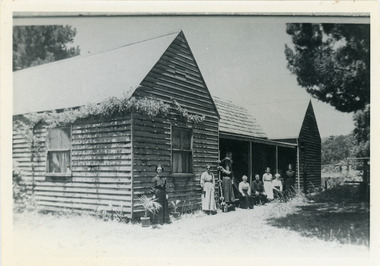
... ...Olinda Creek Road...‘Shiloah’ was a popular tourist attraction but the making of the Olinda Creek Road destroyed the fern gullies and, by the 1930s, it was all finished....‘Shiloah’ was a popular tourist attraction but the making of the Olinda Creek Road destroyed the fern gullies and, by the 1930s, it was all finished. ...'Shiloah' was the home of Isaac Jeeves the younger - son of Isaac Jeeves the Valley Pioneer and brother of Ellis Jeeves. Isaac built this house himself using local timber he cut and split. It was ready for his marriage to Selina Leach of Bayswater in 1886. ‘Shiloah' was enlarged to take guests in the early 1900s. It was situated close to a beautiful fern gully and Isaac and his family capitalised on this by setting out walking tracks through the ferns. They charged 1/- to walk through and this included afternoon tea in a garden setting. ‘Shiloah’ was a popular tourist attraction but the making of the Olinda Creek Road destroyed the fern gullies and, by the 1930s, it was all finished.Black and white photograph of wooden structure with two wings and a central verandah. Eight adults sitting or standing at the front.Handwritten on back by John Lundy-Clarke "Shiloah" 1913.isaac jeeves, isaac jeeves the younger, ellis jeeves, shiloah, guest house, guesthouse, selina leach, selina jeeves, olinda creek road -
 Mt Dandenong & District Historical Society Inc.
Photograph, The Valley of the Harmony Vale Settlement c1910, 1973
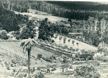
... ...Olinda Creek...Barbers Road...The valley of the Harmony Vale settlement on the Olinda Creek from Barbers Road. "Shiloah" on far left centre. ...Farndons Community Hall 42 Falls Road Mt Dandenong yarra-valley-and-the-dandenong-ranges Kalorama Harmony Vale Olinda Creek Barbers Road Shiloah sawmill Child Bert Child Glenrivers The valley of the Harmony Vale settlement on the Olinda Creek from Barbers Road. ...Scene looking across the valley of Harmony Vale from Barbers Road. c1910. Photograph copied by John Lundy-Clarke in 1973. This photograph has a detailed inscription on the back handwritten by John Lundy-Clarke in 1974.The valley of the Harmony Vale settlement on the Olinda Creek from Barbers Road. "Shiloah" on far left centre. John William Richardson's home among trees left of centre. Homestead Harmony Vale above log yard (see below) and among orchard trees. Child Bros sawmill and log yard with logs among trees above flat cultivation right of centre. Bert Childs home beyond "Harmony Vale". Lucas' "Glenrivers" is in gully above main clearing centre top left. Frank Childs home among trees centre of picture. Taken about 1910 by Rose Series. Copied 1974 JLC.kalorama, harmony vale, olinda creek, barbers road, shiloah, sawmill, child, bert child, glenrivers -
 Mt Dandenong & District Historical Society Inc.
Photograph, Tea Tables at "Shiloah"
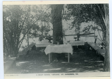
... ‘Shiloah’ was a popular tourist attraction but the making of the Olinda Creek Road destroyed the fern gullies and, by the 1930s, it was all finished. ...‘Shiloah’ was a popular tourist attraction but the making of the Olinda Creek Road destroyed the fern gullies and, by the 1930s, it was all finished. ...Originally the home of Isaac Jeeves, brother of Ellis Jeeves, ‘Shiloah’ was enlarged to take guests in the early 1900s. It was situated close to a beautiful fern gully and Isaac and his family capitalised on this by setting out walking tracks through the ferns. They charged 1/- to walk through and this included afternoon tea in a garden setting. ‘Shiloah’ was a popular tourist attraction but the making of the Olinda Creek Road destroyed the fern gullies and, by the 1930s, it was all finished. This photograph shows the tea tables at 'Shiloah' where Selina Jeeves and her daughter Elsie served afternoon tea to visitors.Black and white photograph taken from a Rose Series postcard showing tables set up in an exterior courtyard with bench seating.On front - Rose Series P. 170 A SHADY BOWER "SHILOAH" MT DANDENONG. VIC.shiloah, isaac jeeves the younger, guest house, afternoon tea, ferns, selina jeeves, elsie jeeves -
 Mt Dandenong & District Historical Society Inc.
Photograph, Isaac Jeeves' Barn
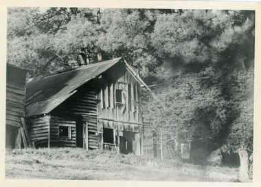
... ‘Shiloah’ was a popular tourist attraction but the making of the Olinda Creek Road destroyed the fern gullies and, by the 1930s, it was all finished. ...‘Shiloah’ was a popular tourist attraction but the making of the Olinda Creek Road destroyed the fern gullies and, by the 1930s, it was all finished. ...Large barn built c1886 by Isaac Jeeves the younger on his property where the homestead 'Shiloah' stood. The barn was reputedly made from timbers split from only one messmate tree. Originally the home of Isaac Jeeves, brother of Ellis Jeeves, ‘Shiloah’ was enlarged to take guests in the early 1900s. It was situated close to a beautiful fern gully and Isaac and his family capitalised on this by setting out walking tracks through the ferns. They charged 1/- to walk through and this included afternoon tea in a garden setting. ‘Shiloah’ was a popular tourist attraction but the making of the Olinda Creek Road destroyed the fern gullies and, by the 1930s, it was all finished. John Lundy-Clarke grew up in the Kalorama/Mt Dandenong area and later in life (1972-74) began to write a comprehensive history of the area working from an original settlement map in an effort to cover all areas.Black and white photograph showing a large wooden structure surrounded by trees. Handwritten inscription on reverse by John Lundy-Clarke.Home of Isaac Jeeves the younger. Built about 1886 of timbers split from one messmate tree. Photo 1973isaac jeeves the younger, barn, kalorama, shiloah, messmate -
 Mt Dandenong & District Historical Society Inc.
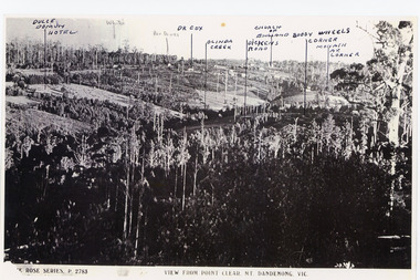
Photograph, View from Point Clear, Mt Dandenong, Vic
... Road. The following indicators have been marked on the photograph L-R Dulce Domun Hotel, White's, Rev. Davies, Dr. Cox, Olinda Creek...Road. The following indicators have been marked on the photograph L-R Dulce Domun Hotel, White's, Rev. Davies, Dr. Cox, Olinda Creek ...Rose Series Postcard number 2783Copy of Rose Series postcard #2783 showing view from Point Clear. This is taken from Ridge Road. The following indicators have been marked on the photograph L-R Dulce Domun Hotel, White's, Rev. Davies, Dr. Cox, Olinda Creek, Dickens Road, Church of England, Buggy Wheels Corner, Monash Ave. Corner.mount dandenong, ridge road, rose series, point clear -
 Mt Dandenong & District Historical Society Inc.
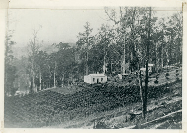
Photograph, Harry Walker's Home in Village Settlement 1908, c1908
... Road through the trees on Vil. Set Lot 18 to Barber’s house now known as “Forest Edge” on Vil Set Lot 25 down close to the Olinda Creek on Barbers Road. ...Road through the trees on Vil. Set Lot 18 to Barber’s house now known as “Forest Edge” on Vil Set Lot 25 down close to the Olinda Creek on Barbers Road. ...View of Harry Walker's home taken from waht is now known as Ridge Road, Kalorama. Raspberry crops are in the foreground. This photograph has a detailed inscription on the back handwritten by John Lundy-Clarke in 1974.1908 view of H Walker’s home on Village Settle Lot 2 Section 1. Looking from what is now Ridge Road through the trees on Vil. Set Lot 18 to Barber’s house now known as “Forest Edge” on Vil Set Lot 25 down close to the Olinda Creek on Barbers Road. The Estate Agent’s modern office is on the edge of the patch of raspberries at the lower left as the C.R.B. Mt Dandenong Rd passes just behind Walker’s house crossing the picture behind the raspberries.walker, raspberry crop, forest edge, barber -
 Emerald Museum & Nobelius Heritage Park
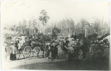
Photograph - Nobelius Employee's Picnic, 1909
... It is disputed where this photograph was taken - while we have suggested it was in the Cockatoo Creek area (now simply Cockatoo), the State Library's catalogue entry for another copy of this photograph suggests it was likely the Dandenong Ranges based on the Sassafras-Olinda label on one of the carts. Another post specifically labels it as the corner of Mount Dandenong Tourist Road...It is disputed where this photograph was taken - while we have suggested it was in the Cockatoo Creek area (now simply Cockatoo), the State Library's catalogue entry for another copy of this photograph suggests it was likely the Dandenong Ranges based on the Sassafras-Olinda label on one of the carts. Another post specifically labels it as the corner of Mount Dandenong Tourist Road ...This photograph depicts employees of C. A. Nobelius on a fruit growers employee picnic. It is disputed where this photograph was taken - while we have suggested it was in the Cockatoo Creek area (now simply Cockatoo), the State Library's catalogue entry for another copy of this photograph suggests it was likely the Dandenong Ranges based on the Sassafras-Olinda label on one of the carts. Another post specifically labels it as the corner of Mount Dandenong Tourist Road and Monbulk Road, though I don't believe we have enough information to affirm this. This image recalls the workplace recreational events of the area in the early 20th century, and has direct relevance to the Nobelius Nursery.A black and white copy of a photograph of several horse-drawn carts on a road, filled with at least thirty people - men and women - dressed in the styles of the early 20th century. There are trees and buildings in the background, and some of the picnickers are posing for the photograph.Top-left of photograph: "1909"cockatoo, 1900s, nobelius nursery -
 Eltham District Historical Society Inc
Newspaper - Newspaper articles, Sun News-Pictorial, Hills Ablaze As 27 Homes Burn, The Sun News-Pictorial, Monday, January 15, p1, 1962
... Creek...Blue Hills Gues House...Heatherset Road...Sassafras...Olinda...road deaths at week-end, p5 (Illust.) • Heartbreak, ruin as … Fire Sweeps the Hills, pp18-19 .(Illust.) • Tea; they made it for the fire fighters, pp18-19 (Illust.) Tom Fielding Collection Victorian Bushfires - 1962 Victorian Bushfires – 1962 Dandenongs The Basin Yarra Glen Healesville Montrose Chum Creek Scouts Australian Logging Co. A.W. Larkins Heathmont Vermont R. Pearson Mike Ryan Vic Parker C.G. Wilson Hillside Farm Clive Brewer Ron Anderson Mrs Anderson Mt Dandenong Healesville Rural Fire Brigade Malcolm Barber Yarra Flats R. Bicknell Ferny Creek Blue Hills Gues House Heatherset Road Sassafras Olinda ...Various news articles pertaining to the January 1962 Victorian bushfires in the Dandenong and Healesville districts. • Hills Ablaze As 27 Homes Burn; Night Fight, p1 (Illust.) • Yarra Glen, Healesville Saved; Fire into main street, p2 (Illust.) • Flare-up at Montrose, p2 • 20 scouts flee as fire sweeps camp, p2 • Gaol for fires today …, p2 • Timber lost, p2 • Heathmont home lost, but others saved, p2 • The desperate fight, p3 (Illust.) • Rubbish fire got away; Basin blaze, p3 • Panorama of destruction, p3 • Fire Captain Killed; 7 road deaths at week-end, p5 (Illust.) • Heartbreak, ruin as … Fire Sweeps the Hills, pp18-19 .(Illust.) • Tea; they made it for the fire fighters, pp18-19 (Illust.) tom fielding collection, victorian bushfires - 1962, victorian bushfires – 1962, dandenongs, the basin, yarra glen, healesville, montrose, chum creek, scouts, australian logging co., a.w. larkins, heathmont, vermont, r. pearson, mike ryan, vic parker, c.g. wilson, hillside farm, clive brewer, ron anderson, mrs anderson, mt dandenong, healesville rural fire brigade, malcolm barber, yarra flats, r. bicknell, ferny creek, blue hills gues house, heatherset road, sassafras, olinda, presbyterian manse, john gorie, janice gorie, lynette gorie, jacky wilson, patricia cortie -
 Eltham District Historical Society Inc
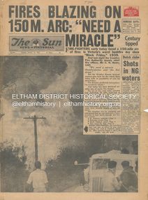
Newspaper - Newspaper articles, Sun News-Pictorial, Fires Blazing on 150M. Arc: "Need a Miracle", The Sun News-Pictorial, Tuesday, January 16, p1, 1962
... Olinda...Kalorama...Healesville...St. Andrews...Hurstbridge...Ninka Road...Kinglake...Yarra Glen...A.L. McCutcheon...St. Andrews Postmaster...Eltham Shire Secretary...Max Watson...Police Commissioner Porter...Observatory Road...Mt. Dandenong...Whittlesea...One Tree Hill...Sassafras...The Basin...Steel’s Creek...Olinda Kalorama Healesville St. Andrews Hurstbridge Ninka Road Kinglake Yarra Glen A.L. McCutcheon St. Andrews Postmaster Eltham Shire Secretary Max Watson Police Commissioner Porter Observatory Road Mt. Dandenong Whittlesea One Tree Hill Sassafras The Basin Steel’s Creek ...Various news articles pertaining to the January 1962 Victorian bushfires in the Dandenong and Healesville districts which by second day had spread on to a 150 mile front fromDaylesford and Kinglake through to the Dandenongs. Specific Eltham Shire districts mentioned include Ninka Road, St. Andrews, Kinglake, Hurstbridge on page 2 • Fires Blazing on 150M. Arc: "Need a Miracle", p1 (Illust.) – Victoria’s worst bushfire day since “Black Friday,” 1939 • Night dash as bushfire sweeps by, p2 (Illust.) • Kalorama Saved: Fire 100 Ft. Away, p2 • Stay away, says police chief, p2 • The Tragedy of the Fires, p3 (Illust.) • Good save by firemen, p4 (Illust.) • S.E.C. Firemen Saved N. Yallourn, p4 • Cherry river of flame, p4 • From the fire front: Fire-fighters are bitten by snakes, p4 • They faced the fury, p6 (Illust.) • The ’39 Blaze, p6 • They fought and failed, p6 • Hills Aflame: 2nd Day, pp16-17 (Illust.) • Respite at Olinda HQ, p16 (Illust.) • Here is Ruin, p17 (Illust.) • This fireman had to work among piled up furniture … p32 (Illust.) tom fielding collection, victorian bushfires - 1962, victorian bushfires – 1962, black friday, victorian bushfires – 1939, c.h. howe, daylesford, country fire authority, dandenongs, yallourn, central gippsland, montrose, olinda, kalorama, healesville, st. andrews, hurstbridge, ninka road, kinglake, yarra glen, a.l. mccutcheon, st. andrews postmaster, eltham shire secretary, max watson, police commissioner porter, observatory road, mt. dandenong, whittlesea, one tree hill, sassafras, the basin, steel’s creek, ruby ryan, the basin progress hall, yaallourn, yallourn north, stet electricity commission (s.e.c.), hernes oak, mcdonalds track, florence milkins, lieutenant-colonel k. leggett, bonza view road, ringwood police station, michael o’connor, volunteers, fire damage - buildings -
 Eltham District Historical Society Inc
Book, Gregory's Melbourne Street Directory of Melbourne and suburbs and metropolitan road guide (8th edition) extends to Laverton, Deer Park, Epping, Diamond Creek, Lilydale, Olinda, Belgrave, Doveton and Mornington, 1973
... Gregory's Melbourne Street Directory of Melbourne and suburbs and metropolitan road guide (8th edition) extends to Laverton, Deer Park, Epping, Diamond Creek, Lilydale, Olinda, Belgrave, Doveton and Mornington...Gregory's Melbourne Street Directory of Melbourne and suburbs and metropolitan road guide (8th edition) extends to Laverton, Deer Park, Epping, Diamond Creek, Lilydale, Olinda, Belgrave, Doveton and Mornington Book ...This is the 8th edition of Gregory's Melbourne Street Directory, fully revised and up-to-date for this edition published December 1973. It is a comprehensive guide to the streets and localities of Melbourne and suburbs at that time. The colour maps are arranged in double-page spreads. Names of streets and suburbs are arranged alphabetically in the index to streets.Hard copy with plastic cover. 382 p. streets, melbourne - maps, roads -
 Whitehorse Historical Society Inc.
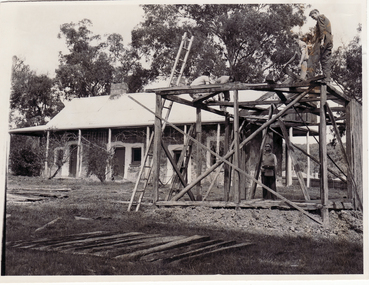
Photograph, Schwerkolt Cottage Barn
... Whitehorse Historical Society Inc. 2-10 Deep Creek Road Mitcham melbourne The barn was donated by the Ansell family of Olinda. ...The barn was donated by the Ansell family of Olinda. It was dismantled and re-erected on the Schwerkolt property by the Nunawading Apex Club during Black and white photo of building the barn at Schwerkolt Cottageschwerkolt cottage, barn, nunawading apex club -
 Whitehorse Historical Society Inc.
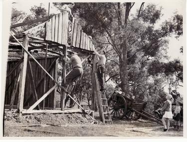
Photograph, Schwerkolt Cottage Barn
... Whitehorse Historical Society Inc. 2-10 Deep Creek Road Mitcham melbourne The barn was donated by the Ansell family of Olinda and was dismantled by the Nunawading Apex Club and re-erected at Schwerkolt Cottage in time for the opening on 17th October 1965. schwerkolt cottage barn Ansell Nunawading Apex Club Black and white photo of members of the Nunawading Apex Club erecting the barn at Schwerkolt Cottage (2 copies). ...The barn was donated by the Ansell family of Olinda and was dismantled by the Nunawading Apex Club and re-erected at Schwerkolt Cottage in time for the opening on 17th October 1965.Black and white photo of members of the Nunawading Apex Club erecting the barn at Schwerkolt Cottage (2 copies).schwerkolt cottage, barn, ansell, nunawading apex club -
 Whitehorse Historical Society Inc.
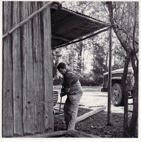
Photograph, Schwerkolt Cottage, 1969
... Whitehorse Historical Society Inc. 2-10 Deep Creek Road Mitcham melbourne schwerkolt cottage Apex Club of Nunawading Barn Black and white photo of Nunawading Apex Club members dismantling barn prior to its removal from Olinda to Schwerkolt Cottage. ...Black and white photo of Nunawading Apex Club members dismantling barn prior to its removal from Olinda to Schwerkolt Cottage. (two copies)schwerkolt cottage, apex club of nunawading, barn -
 Kew Historical Society Inc
Book, Gregory's Publishing Company Pty Ltd, Gregory's Street Directory of Melbourne and suburbs and Metropolitan Road Guide, 1971
... Revised edition of Gregory's Directory including a series of road maps of Melbourne and its suburbs, newly extending to Lilydale, Mornington, Laverton, Deer Park, Epping, Diamond Creek, Olinda, Belgrave, and Doveton....Kew Historical Society Inc Kew Court House 188 High Street Kew melbourne street directories - melbourne gregory's street directories Street Directory Revised edition of Gregory's Directory including a series of road maps of Melbourne and its suburbs, newly extending to Lilydale, Mornington, Laverton, Deer Park, Epping, Diamond Creek, Olinda, Belgrave, and Doveton. ...Street DirectoryRevised edition of Gregory's Directory including a series of road maps of Melbourne and its suburbs, newly extending to Lilydale, Mornington, Laverton, Deer Park, Epping, Diamond Creek, Olinda, Belgrave, and Doveton.non-fictionStreet Directorystreet directories - melbourne, gregory's street directories -
 Whitehorse Historical Society Inc.
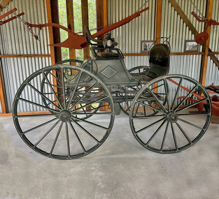
Vehicle - Buggy - 4 wheel - Double Seater
... Whitehorse Historical Society Inc. 2-10 Deep Creek Road Mitcham melbourne Purchased from the estate of J.Winter of Doncaster through Mrs. Price c/o Mrs. A. M. Ansell of Hacketts Road, Olinda ...Purchased from the estate of J.Winter of Doncaster through Mrs. Price c/o Mrs. A. M. Ansell of Hacketts Road, Olinda, Vic for £20 (pounds).Two seater, four wheel buggy painted green with cream trim. Luggage compartment at rear of seat. The two back wheels are larger than the front two. Long shafts at front. A buggy lamp is fitted at each side. Seats are curved at the back.transport, horse -
 Whitehorse Historical Society Inc.
Map, Boronia Road, Vermont, 1970
... Whitehorse Historical Society Inc. 2-10 Deep Creek Road Mitcham melbourne Boronia Road Vermont Gallus Close Vermont Moore Road Vermont Carlinga Drive Vermont Beleura Avenue Vermont Olinda Crescent Vermont Penllyne Avenue Vermont Holyrood Drive Vermont Aerial photographs Enlargement of Aerial photograph of Boronia Road Vermont, State Aerial Survey, 1970. ...Enlargement of Aerial photograph of Boronia Road Vermont, State Aerial Survey, 1970. Run 37Enlargement of Aerial photograph of Boronia Road Vermont, State Aerial Survey, 1970. Run 37Enlargement of Aerial photograph of Boronia Road Vermont, State Aerial Survey, 1970. Run 37boronia road, vermont, gallus close, vermont, moore road, vermont, carlinga drive, vermont, beleura avenue, vermont, olinda crescent, vermont, penllyne avenue, vermont, holyrood drive, vermont, aerial photographs -
Whitehorse Historical Society Inc.
Article, They're Both 100, 1/09/1965 12:00:00 AM
... Whitehorse Historical Society Inc. 2-10 Deep Creek Road Mitcham melbourne schwerkolt cottage ansell a.m barns city of nunawading They're Both 100; photo and article on the 100 year old barn donated to Nunawading City Council They're Both 100; photo and article on the 100 year old barn donated to Nunawading City Council by Mr. A. Ansell of Olinda ...They're Both 100; photo and article on the 100 year old barn donated to Nunawading City CouncilThey're Both 100; photo and article on the 100 year old barn donated to Nunawading City Council by Mr. A. Ansell of Olinda, for erection near Schwerkolt Cottage.They're Both 100; photo and article on the 100 year old barn donated to Nunawading City Councilschwerkolt cottage, ansell, a.m, barns, city of nunawading -
 Mt Dandenong & District Historical Society Inc.
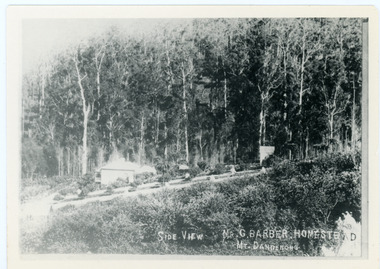
Photograph, Side View Mr G. Barber Homestead Mt Dandenong, c1905
... Farndons Community Hall 42 Falls Road Mt Dandenong yarra-valley-and-the-dandenong-ranges Built in 1898 by early settler George Barber the property is still in existence today. It was the home of George, wife Sarah Ann and daughter Ethel. Barber's home on Olinda Creek ...Built in 1898 by early settler George Barber the property is still in existence today. It was the home of George, wife Sarah Ann and daughter Ethel.Black and white photograph showing te side view of George Barber's home, later named Forest Edge. c1905. Reverse of photograph has handwritten description by John Lundy-Clarke.Barber's home on Olinda Creek. Lot 25 Sect 1 Village Settlement. Home of George Barber and wife Sarah Ann (nee Richardson). Daughter Ethel.Was bought by Munnerley later Sangster and Kinnear. Later known as Forest Edge. Buggy and wagon shed on right. Photo copied 1973 by JLC. -
 Mt Dandenong & District Historical Society Inc.
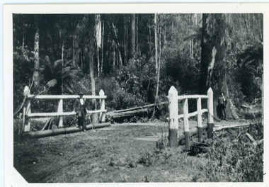
Photograph, Barber's Bridge on Olinda Creek
... Handwritten n reverse: Barbers Bridge on Olinda Creek 1910. This was a ford crossed by the road after Isaac Jeeves selected allotment “C” “Jeeves Saddle” in 1871 and stopped travel through his property. ... Handwritten n reverse: Barbers Bridge on Olinda Creek 1910. This was a ford crossed by the road after Isaac Jeeves selected allotment “C” “Jeeves Saddle” in 1871 and stopped travel through his property. ...John Lundy-Clarke grew up in the Kalorama/Mt Dandenong area and later in life (1972-74) began to write a comprehensive history of the area working from an original settlement map in an effort to cover all areas. Barbers Bridge was named after George Barber, an early settler.Black and white photograph showing a man standing on a bridge over the Olinda Creek. 1910Handwritten n reverse: Barbers Bridge on Olinda Creek 1910. This was a ford crossed by the road after Isaac Jeeves selected allotment “C” “Jeeves Saddle” in 1871 and stopped travel through his property. The bridge has been built several times but at time of writing (1974) is replaced by a culvert consisting of two pipes two feet six inches wide. They are quite incapable of carrying the maximum flow of the creek and will be swept away.lundy-clarke, barber, barbers bridge, isaac jeeves, jeeves saddle, bridge, olinda creek -
 Mt Dandenong & District Historical Society Inc.
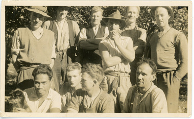
Photograph, Clint Rowse and Staff
... Farndons Community Hall 42 Falls Road Mt Dandenong yarra-valley-and-the-dandenong-ranges John Lundy-Clarke grew up in the Kalorama/Mt Dandenong area and later in life (1972-74) began to write a comprehensive history of the area working from an original settlement map in an effort to cover all areas. John Lundy-Clarke has identified the photograph as being of Clint Rowse and Staff at Olinda Creek ...John Lundy-Clarke grew up in the Kalorama/Mt Dandenong area and later in life (1972-74) began to write a comprehensive history of the area working from an original settlement map in an effort to cover all areas. John Lundy-Clarke has identified the photograph as being of Clint Rowse and Staff at Olinda Creek Valley in 1939. The workmen are: Back row from right: Bob Daly, Dud Page, Harry Dyson, Bill Cavell, Len Child, Ken Williams. Front row from right: Clint Rowse, Jack Clarke, Bernie Page, Jack Johnson (with dog). The Rowse family had extensive raspberry crops but later changed to flowers. Daisy Rowse married Hubert Jeeves. Black and white photograph showing a group of 10 workmen, one holding a dog.The names Lenny Child, Dyson, Page, Bob Daly, Jackie Johnston, J Clarke, Clint Rowse are handwritten on the back by John Lundy-Clarkelen child, bob daly, clint rowse, jack johnston, bill cavell, ken williams, jack clarke, dud page, bernie page -
 Mt Dandenong & District Historical Society Inc.
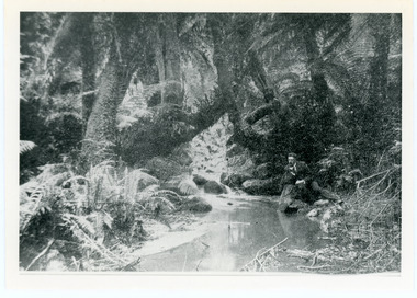
Photograph, The Olinda Creek, 1910
... Farndons Community Hall 42 Falls Road Mt Dandenong yarra-valley-and-the-dandenong-ranges The Olinda Creek in 1910. ...The Olinda Creek in 1910. Most probably in the gully behind the house of George Barber.Black and white photograph with a creek running through the centre of ferns and tree ferns. A man sits beside the creek on the RHS.olinda creek -
 Mt Dandenong & District Historical Society Inc.
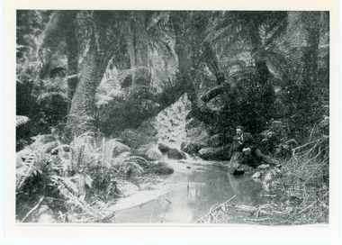
Photograph, The Olinda Creek, 1910
... Farndons Community Hall 42 Falls Road Mt Dandenong yarra-valley-and-the-dandenong-ranges The Olinda Creek, 1910 Photograph Photograph ... -
 Mt Dandenong & District Historical Society Inc.
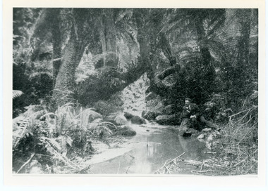
Photograph, The Olinda Creek, 1910
... Farndons Community Hall 42 Falls Road Mt Dandenong yarra-valley-and-the-dandenong-ranges Taken in 1910, this section of the Olinda Creek is in the gully behind the home of George Barber. ...Taken in 1910, this section of the Olinda Creek is in the gully behind the home of George Barber.Black and white photograph with a creek running through the centre surrounded by ferns and tree ferns. A man is leaning on rocks beside the creek on the RHS.olinda creek, creek, george barber, tree fern -
 Mt Dandenong & District Historical Society Inc.
Photograph
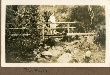
... Road and took many photographs. Most of these are glued into her photo album. The album covered the years from c1927 – 1932. Ivy married Henry William Burgess (1906 – 1968) in 1944. The photographs remain in their original state in the album with individual copies made. Ivy Child Olinda Falls bridge Handwritten below the photograph in the album: The Falls Black and white photograph showing a young woman standing on a wooden bridge with a handrail above a creek. ...The photograph is from the album of Ivy Child. The young woman standing on the bridge is Ivy Child probably aged 17 years. The location is the Olinda Falls. Ivy May Child (1910 – 1989) was the daughter of Arthur Edward (Ted) Child (1878 – 1964) and Ethel May Madden (1888 – 1970). Ted Child was the son of Matthew Francis Child (1839 – 1933) and Martha Jeeves (1857 – 1926). He was the grandson of one of the early pioneers Francis Child. Ivy grew up on the family property on Childs Road and took many photographs. Most of these are glued into her photo album. The album covered the years from c1927 – 1932. Ivy married Henry William Burgess (1906 – 1968) in 1944. The photographs remain in their original state in the album with individual copies made. Black and white photograph showing a young woman standing on a wooden bridge with a handrail above a creek. Rocks are in the foreground in the creek and bush surrounds the scene.Handwritten below the photograph in the album: The Fallsivy child, olinda falls, bridge -
 Mt Dandenong & District Historical Society Inc.
Photograph, 'Hillcrest' on Mernda Road, Olinda 1911, 1911
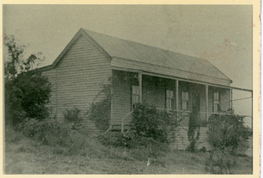
... Farndons Community Hall 42 Falls Road Mt Dandenong yarra-valley-and-the-dandenong-ranges hillcrest mernda road olinda vera devine Devine Family “Hillcrest” the home of the Devine family 1911 in Mernda Road now Coonara Road. The road was deviated here to regrade it and the deviation past to the right of the camera. The house fronted down over the valley of the Sassafras Creek ...Front view of 'Hillcrest' the Devine family home on Mernda Road, Olinda taken in 1911. The road deviation passed to the right of where the photographer was standing. The descriptive text on the reverse of this photograph was hand written by John Lundy-Clarke.“Hillcrest” the home of the Devine family 1911 in Mernda Road now Coonara Road. The road was deviated here to regrade it and the deviation past to the right of the camera. The house fronted down over the valley of the Sassafras Creek towards Kallista. It was close to the spot where the camera stood that the girls practiced the maypole dance in 1911. Vera Devine trained 11 of her mates in the dance here.hillcrest, mernda road, olinda, vera devine, devine family -
 Mt Dandenong & District Historical Society Inc.
Photograph, c1911
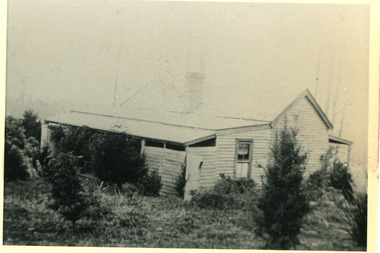
... Road Olinda 1911. The home of the Devine family. The early settlement road passed to the left of the camera. House faced down over the valley of the Sassafras + Perrin Creek towards Kallista. ...Road Olinda 1911. The home of the Devine family. The early settlement road passed to the left of the camera. House faced down over the valley of the Sassafras + Perrin Creek towards Kallista. ..."Hillcrest" on Mernda Road, Olinda. The home of the Devine Family. c1911 The descriptive text on the reverse of this photograph was hand written by John Lundy-Clarke.“Hillcrest” Mernda Road Olinda 1911. The home of the Devine family. The early settlement road passed to the left of the camera. House faced down over the valley of the Sassafras + Perrin Creek towards Kallista. The deviation to regrade the road passed to the right of the house. It was in front of the house on the left hand side of the picture that Vera Devine and her school mates practiced the maypole dance under her tuition. hillcrest, devine, devine family, mernda road -
 Mt Dandenong & District Historical Society Inc.
Photograph, View near the Falls, Mount Dandenong, early 1900s
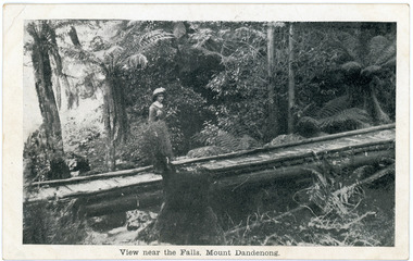
... Farndons Community Hall 42 Falls Road Mt Dandenong yarra-valley-and-the-dandenong-ranges Mason, Firth & McCutcheon Olinda Falls footbridge bridge Mt Dandenong Olinda Creek On front of postcard: View near the Falls, Mount Dandenong. ...Postcard showing a woman wearing a long dress and wide brimmed hat standing on a footbridge that crosses the Olinda Creek. Tree ferns and bushes are in the background. Taken early 1900s.On front of postcard: View near the Falls, Mount Dandenong. On back of post card: Mason, Firth & McCutcheon, Printers, Melbourne.mason, firth & mccutcheon, olinda falls, footbridge, bridge, mt dandenong, olinda creek -
 Mt Dandenong & District Historical Society Inc.
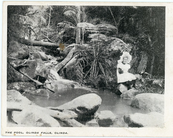
Photograph, The Pool, Olinda Falls, Olinda
... Road Mt Dandenong yarra-valley-and-the-dandenong-ranges Olinda Falls Olinda Jessie Wyles postcard Printed on front of postcard: The Pool, Olinda Falls, Olinda. "Punch" Postcard depicting a girl in a white pinafore and large, white hat sitting on a rock beside a water. Tree ferns are the backdrop. The front inscription on the postcard is The Pool, Olinda falls, Olinda.The same image appears in a photograph in the John Lundy-Clarke Collection where the girl is identified as Jessie Wyles and the location Emerald Creek. ..."Punch" Postcard depicting a girl in a white pinafore and large, white hat sitting on a rock beside a water. Tree ferns are the backdrop. The front inscription on the postcard is The Pool, Olinda falls, Olinda.The same image appears in a photograph in the John Lundy-Clarke Collection where the girl is identified as Jessie Wyles and the location Emerald Creek.Printed on front of postcard: The Pool, Olinda Falls, Olinda.olinda falls, olinda, jessie wyles, postcard -
 Mt Dandenong & District Historical Society Inc.
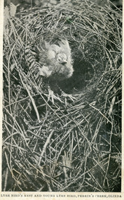
Photograph, Lyrebird's Nest and Young Lyrebird, Perrin's Creek, Olinda
... Farndons Community Hall 42 Falls Road Mt Dandenong yarra-valley-and-the-dandenong-ranges lyre bird Perrin's Creek olinda Postcard depicting Lyrebird's Nest and Young Lyrebird, Perrin's Creek, Olinda. ...Postcard depicting Lyrebird's Nest and Young Lyrebird, Perrin's Creek, Olinda.lyre bird, perrin's creek, olinda -
 Mt Dandenong & District Historical Society Inc.
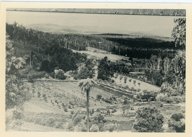
Photograph, Harmony Vale, c1913
... Harmony Vale harmony vale Child's sawmill sawmill Barbers Road Richardson Shiloah Rose Series Photo of Harmony Vale on the Olinda Creek taken from Logans Lot 28. ...View of Harmony Vale, the original Kalorama settlement taken from Barbers Road. Child's sawmill can be seen (centre) with the log yard to the right. Richardson's home "Harmony Vale' is in the orchard above the logs.Black and white photograph copied from a Rose Series postcard showing the area known as "Harmony Vale' - the original Kalorama settlement. Child's sawmill is in the centre.Rose Series Photo of Harmony Vale on the Olinda Creek taken from Logans Lot 28. Link Rd crossing centre Shiloah complex left centre. Richardsons (Jeannie’s) “Mt Calvin” between trees above tree fern. Isaac Jeeves house with the tree fern floor among trees against forest right centre. Mill yard with logs above cultivated flat. Mill to left. “Harmony Vale” homestead among orchard above logs. “Glenrivers” in gully at top of clearing. About 1913. Copied JLC 1973harmony vale, harmony vale, child's sawmill, sawmill, barbers road, richardson, shiloah
