
Showing 54 items matching "settlement scheme"
-
 Bendigo Historical Society Inc.
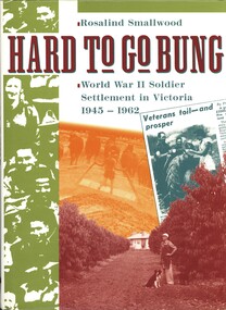
Book - HARD TO GO BUNG, 1992
... ...soldier settlement scheme victoria....This is the story of Australia's most successful soldier settlement scheme....HISTORY Australian soldier settlement scheme victoria. Rosalind Smallwood. Hard To Go Bung.World War II Soldier Settlement in Victoria, 1945 - 1962. ...Hard To Go Bung.World War II Soldier Settlement in Victoria, 1945 - 1962. This is the story of Australia's most successful soldier settlement scheme.Rosalind Smallwood.history, australian, soldier settlement scheme victoria. -
 Warrnambool and District Historical Society Inc.
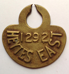
Functional object - Tag, cow Heytesbury East, late 20th century
... Heytesbury Settlement Scheme...The Heytesbury Settlement Scheme in the area west of Colac and bordering the Otway Ranges. ...The Heytesbury Settlement Scheme in the area west of Colac and bordering the Otway Ranges. ...The Heytesbury Settlement Scheme in the area west of Colac and bordering the Otway Ranges. The Settlement was established in 1960 as a dairying area and was one of the largest post World War Two farming settlements. This cow tag has been broken at the top and detached from the animal.The item is of some interest as coming from the Heytesbuty Settlement. Dairying is of major importance in the Warrnambool area and this extends to the Heytesbury area. These cow tags have now been superseded by more improved technological equipment. This is a brass cow tag. It is semi-circular with a ring top, broken or worn through at the top. ‘1292’ ‘Heytes East’ heytesbury settlement scheme, cow tag -
 Ballarat Heritage Services
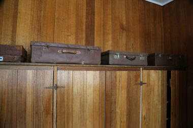
digital photographs, Lisa Gervasoni, Lady Northcote, 2014 - 2016
... ...settlement scheme...lady northcote childrens farm british settlement scheme suitcases Lady Northcote digital photographs Lisa Gervasoni ...lady northcote, childrens, farm, british, settlement scheme, suitcases -
 Ballarat Heritage Services
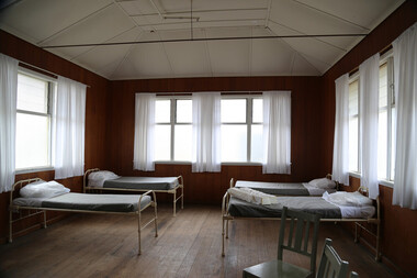
digital photographs, Lisa Gervasoni, Lady Northcote, 2014 - 2016
... ...settlement scheme...lady northcote childrens farm british settlement scheme dorms beds Lady Northcote digital photographs Lisa Gervasoni ...lady northcote, childrens, farm, british, settlement scheme, dorms, beds -
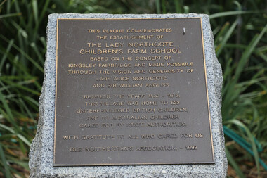 Ballarat Heritage Services
Digital photographs, Lisa Gervasoni, Plaque at the Lady Northcote Children's Farm School, 2014 - 2016
... ...settlement scheme...lady northcote childrens farm british settlement scheme plaque Colour photograph of a plaque relating to the Lady Northcote Children's Farm school. ...Colour photograph of a plaque relating to the Lady Northcote Children's Farm school.lady northcote, childrens, farm, british, settlement scheme, plaque -
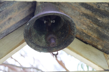 Ballarat Heritage Services
Photograph - Photograph - Colour, Lisa Gervasoni, Bell at Lady Northcote, c2015, 2014 - 2016
... ...settlement scheme...lady northcote childrens farm british settlement scheme school bell Colour photograph of a bell at Lady Northcote. ...Colour photograph of a bell at Lady Northcote.lady northcote, childrens, farm, british, settlement scheme, school, bell -
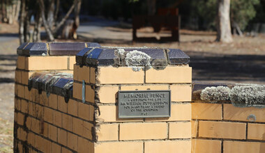 Ballarat Heritage Services
digital photographs, Lisa Gervasoni, Lady Northcote, 2014 - 2016
... ...settlement scheme...lady northcote childrens farm british settlement scheme school gates Lady Northcote digital photographs Lisa Gervasoni ...lady northcote, childrens, farm, british, settlement scheme, school, gates -
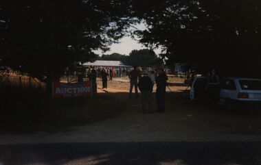 Federation University Historical Collection
Photograph - Colour, Chatham-Holmes Collection: Trawalla Estate, Victoria - Soldier Settlement
... In 1917 a large part of the Trawalla estate was acquired and subdivided by the Commonwealth Government for the Soldier Settlement Scheme. Land was subdivided into 93 allotments with sizes from 250 acres to 680 acres. ...In 1917 a large part of the Trawalla estate was acquired and subdivided by the Commonwealth Government for the Soldier Settlement Scheme. Land was subdivided into 93 allotments with sizes from 250 acres to 680 acres. ...In 1917 a large part of the Trawalla estate was acquired and subdivided by the Commonwealth Government for the Soldier Settlement Scheme. Land was subdivided into 93 allotments with sizes from 250 acres to 680 acres. The land was deemed appropriate for grazing and farming.chatham-holmes collection, soldier settlement, langi kal kal, auction, philip chatham, trawalla -
 Streatham and District Historical Society
Picture, George Davis & Bell
... Yalla-Y-Poora was a large station until the a soldier Settlement scheme which broke it up for return soldiers. ...Yalla-Y-Poora was a large station until the a soldier Settlement scheme which broke it up for return soldiers. ...Yalla-Y-Poora was a large station until the a soldier Settlement scheme which broke it up for return soldiers. Many people were employed at the station during this time. George Davis lived in Streatham during this period.Shows local areas in the Western District and one of the residents.Rectangular shape. Black & white. Man (George Davis) standing with a horse behind a barbed wire fence with several items hanging across it. There is gum trees in a line behind.In red ink stamped across back Kodak 85m. In blue ink pen, George Davis with Bell at Yalla-Y-Poora 1929.horse, agriculture, george, rural, farming, streatham, transport, yalla poora, stations, davis -
 Ballarat Diocesan Historical Commission
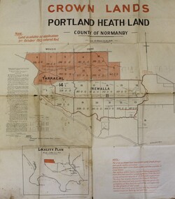
Poster, Government Land Sales Poster
... In 1917 under the provisions of the Discharged Soldiers' Settlement Act, the scheme reverted to the Soldiers' Settlement scheme when the government undertook the settlement of discharged soldiers on lands set aside exclusively for them as a reward for their war service....In 1917 under the provisions of the Discharged Soldiers' Settlement Act, the scheme reverted to the Soldiers' Settlement scheme when the government undertook the settlement of discharged soldiers on lands set aside exclusively for them as a reward for their war service. ...Government poster advertising land sales to promote closer settlement in Portland area. The acquisition of land for the purpose of closer settlement was first authorised under the provisions of the Land Act 1898. In 1917 under the provisions of the Discharged Soldiers' Settlement Act, the scheme reverted to the Soldiers' Settlement scheme when the government undertook the settlement of discharged soldiers on lands set aside exclusively for them as a reward for their war service.closer settlement, soldiers settlement, government poster. land sales, portland. -
 Warrnambool and District Historical Society Inc.
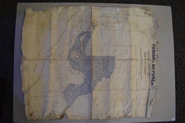
Map - Maps, Soldiers Settlement WW2, Circa 1950
... The soldiers' settlement scheme operated after the first and second world wars in an effort to more closely settle the land and also give opportunities to returned soldiers. ...The soldiers' settlement scheme operated after the first and second world wars in an effort to more closely settle the land and also give opportunities to returned soldiers. ...The soldiers' settlement scheme operated after the first and second world wars in an effort to more closely settle the land and also give opportunities to returned soldiers. Crown land and other larger estates were acquired for the purpose. Most of these maps relate to the area north of Warrnambool where many of the subdivisions were parts of larger estates.These maps pertaining to the Soldiers' Settlement program, relate to an interesting part of Australian and local history. As such they have historic and social interest and significance.A collection of 25 paper maps which relate to to the soldiers settlement post World War 2. Some have details of the people allocated the land and some smaller maps have the printed details of the applicants requirements.Text is black on white paper which in some cases is quite aged. The maps are as follows: .1 Narrapumelap Estate ( Ripon & Hampden) .2 Narrapumelap Estate Part 2 (Villers & Ripon) .3 Narrapumelap Estate Part 3 ( Villiers & Ripon) .4 Burrumbeet Estate ( Ripon) .5 ' Berrambool' Estate 9 Hampden & Villiers) .6 ' Hopkins Hill' Estate Villiers 4011 acres .7 Caramut North No 2 Estate ( Villiers ) .8 ' Morpor' Estate ( Villiers) 4172 acres .9 ' Morgiana' Estate ( Normandy) 3453 acres .10 ' Chatsworth House' ( Villiers) 9341 Acres .11 ' East Elwood' Estate Villiers 2407 acres .12 Grey's Estate ( Mornington) 1151acres .13 ' Rowes Estate' ( Buln Buln Gippsland 733 acres .14 'Tarrone' Estate No 2 Part map .15 'Chaldon Meade' Estate (Bourke) Bulla 517 acres .16 ' Terranallum South' Estate Hampden 3757 acres .17 ' Brung Brungle' Estate Dundas 695 .18 ' Armidale ' Estate ( Dundas)2108 acres .19 ' Moyne Falls' Estate ( Villiers) 627 acres .20' Yulong' Estate 9 Lowan 6321 acres .21 Murray Valley Irrigation District 9 Moira)113 acres .22 Murray Valley Irrigation District 103 acres .23 ' Mount Fyans' Estate ( Hampden) .24 ' Barwidgee ' Estate ( Villiers) 4277 acres .25 'Pine Hills' Estate 2nd portion ( Lowan) 6190 acres narrapumelap, berrambool, hopkins hill, caramut north, morpor, chatsworth house, east elwood, terrinallum, moyne falls, tarrone, caramut soldiers settlers, burrumbeet, morgiana, grey's estate mornington, chaldon meade, brung brungle -
 Bendigo Historical Society Inc.
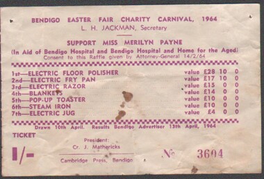
Ephemera - Bendigo Easter Fair Charity Carnival 1964 - raffle ticket
... 8375a: The Victorian soldier settlement scheme created in 1917 to lease farming land to soldiers and nurses returning from WW1. ...8375a: The Victorian soldier settlement scheme created in 1917 to lease farming land to soldiers and nurses returning from WW1. ...8375a: The Victorian soldier settlement scheme created in 1917 to lease farming land to soldiers and nurses returning from WW1. The Scheme was heavily criticised. Some reasons for this were the settlers' lack of capital, the size of the land allocated, and the prices of agricultural products both purchased and sold by the farmers. In the wake of WW2, the soldier settlement scheme was refined and, under the supervision of the Soldier Settlement Commission, was re-established. The Yarraberb Settlement was one of the settlements established in 1948. 8375b: Archibald Edmund "Archie" Robertson was born in Eaglehawk in 1884 to Martin Robertson and Anna Margaretha/Hannah Marguerita (nee. Weseloh/Wesloah). Robertson was a commissioned officer during WW1 and contributed to the welfare and advancement of the California Gully community. Following his death in 1922, following a fall from his bike, the community honoured Robertson with a memorial seat in 1923. Bendigo Easter Fair Charity Carnival 1964 - raffle ticket (ticket No 3604) costing one shilling, in support of Miss Merilyn Payne (in aid of the Bendigo Hospital and Bendigo Hospital and Home for the Aged). The raffle offers seven prizes ranging from 1st - electric floor polisher to 7th - electric jug. Printed by Cambridge Press, Bendigo.bendigo easter fair 1964, raffle ticket -
 Bendigo Historical Society Inc.
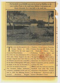
Newspaper - Newspaper articles - North Central Loddon Region
... 8375a: The Victorian soldier settlement scheme created in 1917 to lease farming land to soldiers and nurses returning from WW1. ...8375a: The Victorian soldier settlement scheme created in 1917 to lease farming land to soldiers and nurses returning from WW1. ...8375a: The Victorian soldier settlement scheme created in 1917 to lease farming land to soldiers and nurses returning from WW1. The Scheme was heavily criticised. Some reasons for this were the settlers' lack of capital, the size of the land allocated, and the prices of agricultural products both purchased and sold by the farmers. In the wake of WW2, the soldier settlement scheme was refined and, under the supervision of the Soldier Settlement Commission, was re-established. The Yarraberb Settlement was one of the settlements established in 1948. 8375b: Archibald Edmund "Archie" Robertson was born in Eaglehawk in 1884 to Martin Robertson and Anna Margaretha/Hannah Marguerita (nee. Weseloh/Wesloah). Robertson was a commissioned officer during WW1 and contributed to the welfare and advancement of the California Gully community. Following his death in 1922, following a fall from his bike, the community honoured Robertson with a memorial seat in 1923.A3 colour photocopies of newspaper articles pertaining to the North Central Victoria Region. Date of photocopy unknown. Location of original paper unknown (likely the Eaglehawk Times, unable to confirm). Both articles were cut from a larger paper. Article 8375a briefly describes the Yarraberb Solder Settlement. Article 8375b recounts the dedication of Archie Robertson's seat in California Gully. newspaper, eaglehawk heritage society, yarraberb soldiers settlement, soldier settlement commission, archie robertson, california gully, ww1, ww2 -
 Warrnambool and District Historical Society Inc.
Booklet, Collett and Bain, Heytesbury Forest School, c.1971
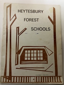
... The Heytesbury Forest was largely deforested by the Bailey Closer Settlement Scheme of the 1930s and later the establishment of more farming properties in the 1950s. ...The Heytesbury Forest was largely deforested by the Bailey Closer Settlement Scheme of the 1930s and later the establishment of more farming properties in the 1950s. ...This booklet, by Rosamund Duruz, gives the history of the schools in the Heytesbury Forest area. The Heytesbury Shire Council was established in 1863 and the first schools in the area opened in the 1870s. Most of them were closed when Timboon Consolidated School (later Timboon High School) opened in 1948. The Heytesbury Forest was largely deforested by the Bailey Closer Settlement Scheme of the 1930s and later the establishment of more farming properties in the 1950s. This booklet is of interest as a comprehensive history of the schools in the Heytesbury Forest area pre 1970. It will be useful for researchers. This is a soft-cover booklet of 63 pages. The cover is a cream colour with brown images of trees and a school on the front cover. The booklet includes a map, a sketch and several black and white photographs. The booklet is bound with metal staples.schools in heytesbury forest, victoria, rosamund duruz, historian, history of warrnambool -
 Warrnambool and District Historical Society Inc.
Book, And We Who Followed, 1988
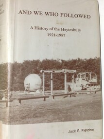
... The area, largely forested, was cleared in 1960 to establish the Heytesbury Soldier Settlement Scheme and is today an important dairying area centred around the town of Simpson....The area, largely forested, was cleared in 1960 to establish the Heytesbury Soldier Settlement Scheme and is today an important dairying area centred around the town of Simpson. ...This book contains a history of the Shire of Heytesbury from 1921 to 1987. It is written by Jack Fletcher and follows on from his book ‘The Infiltrators’ which is the history of the Heytesbury region from 1840 to 1920. The Heytesbury area in the Western District of Victoria was named after the village of Heytesbury in England and the first Baron Heytesbury, Sir William A Court, who purchased the village in 1828 and was a distinguished public figure in Great Britain at the time. The area, largely forested, was cleared in 1960 to establish the Heytesbury Soldier Settlement Scheme and is today an important dairying area centred around the town of Simpson.This book is of some interest as it details a history of an area adjoining the Warrnambool district. The Heytesbury Settlement farmers are predominantly dairy producers, similar to those in other districts around WarrnamboolThis is a hard cover buff-coloured book with a dust cover sealed down onto the hard cover. The front and back covers have a sepia coloured photograph of the Heytesbury Settlement Park.Front of dust cover – ‘And We Who Followed - A History of the Heytesbury 1921-1987-Jack S. Fletcher Spine – as above (plus a library classification) heytesbury region, victoria, heytesbury soldier settlement -
 National Wool Museum
Tool - Stencil, 1938
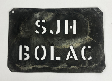
... Stanley gained the property as part of the Returned Soldiers Settlement Scheme for his service in World War 2. ...Stanley gained the property as part of the Returned Soldiers Settlement Scheme for his service in World War 2. ...The story of 90 years of wool classing between father & son begins in 1936, when a young boy by the name of Stanley James Hucker walked through the doors of the Gordon Technical School in Geelong. Born in 1921, Stanley was 15 years of age when he began his 3-year course in Wool Classing. 30 years later, Stanley’s second son Denis completed the same 3-year wool classing course. Beginning in 1966, Denis attended the same Gordon Technical School and walked the same halls as his father before him. Stanley finished his course in 1938. He went back to the family farm in Lake Bolac for a brief period before enrolling in the Second World War. At the completion of the war, Stanley returned home and married before gaining a soldier settler allotment, north of Willaura. This enabled Stan to use his wool classing knowledge. He ran between 1,500 and 2,000 sheep for many years, while his wool classer stencil also allowed him to go out and class at various sheds around the area. He held his stencil from 1938 until he retired at the age of 60 in 1981. On retirement, his second son Denis was working in the district, managing a local property while also leasing land himself. Upon his father’s retirement, Denis had the opportunity to lease his father’s farm, an opportunity he could not refuse. Denis had finished his wool classing course at the Gordon Technical School in 1968, graduating dux of his class. He began working with a local contractor and started classing wool in his team. Denis gained a great deal of experience working as part of this team in big sheds of up to 8 stands servicing between 10 & 20,000 sheep. It was not all smooth sailing for Denis however, and he soon learnt an important lesson. Class wool the way you’re taught, don’t listen to the owner standing over your shoulder. At a clip of Corriedales near Casterton, Denis was pushing too many fleeces into the line of fine wool. This resulted in a notice from the Australian Wool Exchange (AWEX) “mixing counts too much, submit three clips for inspection”. Denis was able to submit 3 clips with no further complaints, however, this proved a valuable lesson he would never forget over his long career classing wool. In the early 1980s, when Denis was leasing two properties including his father’s, things were going well until drought struck. February 1983 was the date of the Ash Wednesday bushfires, and saw Melbourne have three days over 40 °C for only the second time on record. This period saw Denis give away farming, turning towards contracting work instead. After the difficult times of the early 1980s, the next two decades were a good time for the sheep industry. 15 micron wool was selling for prices between 4 to 5,000 cents per kilo, double what you’d expect for the same wool in 2022. In 1995 a single bale of wool sold for a million dollars. This was a good time for Denis too. His contracting work saw him employing local shearers and shed staff. His team was involved with the shearing and classing of more than 130,000 sheep. After 20 years of contracting, it was time for Denis to transition into the next phase of his life. He gave up independent contracting, preferring instead to return to being a member of someone else’s team. In 2018, having completed 50 years of wool classing, it was time to call it a day and retire completely. At the annual Gordon Wool School Old Students Association dinner held in 2018, Denis was presented with his 50 years as a registered wool classer stencil awarded by the Australian Wool Exchange (AWEX). This is a rare honour achieved by few. As of February 2020, a total of 430 wool classers had achieved this 50-year milestone. For Denis however, his proudest achievement is achieving 90 years of wool classing with his father. The National Wool Museum is proud to share the collection of objects gained from 90 years in the wool classing industry by Stanley and Denis. This ranges from Stanley’s first stencil and Wool Sample book, started when he first attended the Gordon in 1936. The collection concludes 90 years later with Denis’ 50 years of wool classing Stencil. The collection contains many more objects, all telling the story of these 90 years, and the hard work invested by this dedicated father and son duo. Thin sheet of metal with letters cut to produce a consistent pattern for the surface below through the application of ink. This wool classing stencil belonged to Stanley Hucker. It was his first Wool Classing Stencil. It was used on Stanley’s property named “Yohhatnbu” in Willaura. Stanley gained the property as part of the Returned Soldiers Settlement Scheme for his service in World War 2. The role of a Wool Classer is to sort, classify, and grade wool into various ‘lines’ so that it can be sold for best market price. Wool Classers are typically also tasked with the managing and supervising of wool-handling teams. The stencil is used in the final step of preparing a bale of wool for sale. It is branded across the front of a wool bale to indicate the quality of the wool, with the classers number used as a seal of guarantee.Cut letters. “SJH / BOLAC ”wool classing, stencil, 90 years wool classing between father & son -
 Myrtleford and District Historical Society
Tobacco bale stencil
... His success and status enabled him to lead a submission on farm debt and infrastructure problems when the soldier settlement scheme was being reviewed at government level. ...His success and status enabled him to lead a submission on farm debt and infrastructure problems when the soldier settlement scheme was being reviewed at government level. ...Stencil used by Sgt. Albert David Lowerson, VC, a soldier settler on Merriang Estate near Myrtleford. Lowerson acquired one of 19 blocks assigned by the Closer Settlement Board on the 700 acre estate in 1920. The stencil marked bales of cured tobacco leaves prior to shipment to Melbourne. Lowerson was one of the few successful soldier settler farmers in the district, operating a piggery, dairy farming and growing tobacco for almost 20 years on "St. Quentin". (Lowerson was awarded the Victoria Cross at Mont St. Quentin on September 1, 1918.) His success and status enabled him to lead a submission on farm debt and infrastructure problems when the soldier settlement scheme was being reviewed at government level. He was active locally on these issues and supported fund raising for a war memorial, memorial hall and veteran welfare.The stencil represents the achievements of A.D.Lowerson, VC as an isolated example of success as a WW1 soldier settler and as a local identity who stridently supported the need for recognition and support of ex-service personnel.Stencil made of thin sheet metal, rusted .Wording of stencil "A.D.LOWERSON. MYRTLEFORD." lowerson a.d., merriang estate, myrtleford, closer settlement board, tobacco, st. quentin, victoria cross, world war 1 -
Glenelg Shire Council Cultural Collection
Book, People of the Lake - the story of Lake Condah Mission, n.d
... The Gunditjmara protested against the Mission’s closure and many continued to reside in the buildings until the majority of the reserve land was handed over to the Soldier Settlement Scheme in the 1940s.1 The mission was destroyed by the government in the 1950s in an effort to force the integration of Gunditjmara people with the general community but the Gunditjmara people continued to live in the area and protect their heritage. ...The Gunditjmara protested against the Mission’s closure and many continued to reside in the buildings until the majority of the reserve land was handed over to the Soldier Settlement Scheme in the 1940s.1 The mission was destroyed by the government in the 1950s in an effort to force the integration of Gunditjmara people with the general community but the Gunditjmara people continued to live in the area and protect their heritage. ...27,000 years ago molten lava pouring from the eruption of Budjbim (Mt. Eccles) formed Lake Condah and the unique landscape that surrounds it. Over time this area known as "The Stony Rises" or "The Stones" became an important geological area for Koories and, later, Europeans.12 page A4 size booklet, cream with brown print.27,000 years ago molten lava pouring from the eruption of Budjbim (Mt. Eccles) formed Lake Condah and the unique landscape that surrounds it. Over time this area known as "The Stony Rises" or "The Stones" became an important geological area for Koories and, later, Europeans.aboriginal history, gunditjmara, lake condah, mission history, budj bim -
 Ballarat Heritage Services
Photograph - Photograph - Colour, Former Lake Condah Aboriginal Mission, 17/04/2016
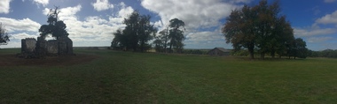
... The Gunditjmara protested against the Mission’s closure and many continued to reside in the buildings until the majority of the reserve land was handed over to the Soldier Settlement Scheme in the 1940s. The mission was destroyed by the government in the 1950s in an effort to force the integration of Gunditjmara people with the general community but the Gunditjmara people continued to live in the area and protect their heritage. ...The Gunditjmara protested against the Mission’s closure and many continued to reside in the buildings until the majority of the reserve land was handed over to the Soldier Settlement Scheme in the 1940s. The mission was destroyed by the government in the 1950s in an effort to force the integration of Gunditjmara people with the general community but the Gunditjmara people continued to live in the area and protect their heritage. ...The Lake Condah Mission site includes bluestone ruins and a reconstructed timber building, as well as the cemetery which were part of the original settlement. With European settlement in the 1830s came conflict. Gunditjmara people fought for their land during the Eumerella wars, which lasted more than 20 years. As this conflict drew to an end in the 1860s, many Aboriginal people were displaced and the Victorian government began to develop reserves to house them. Many Aboriginal people refused to move from their ancestral land and eventually the government agreed to build a mission at Lake Condah, close to some of the eel traps and within sight of Budj Bim (Mt Eccles). The mission opened in 1867. The Mission was formally closed in 1918, and Aboriginal people were forced off the Mission, some moving to Lake Tyers. The Gunditjmara protested against the Mission’s closure and many continued to reside in the buildings until the majority of the reserve land was handed over to the Soldier Settlement Scheme in the 1940s. The mission was destroyed by the government in the 1950s in an effort to force the integration of Gunditjmara people with the general community but the Gunditjmara people continued to live in the area and protect their heritage. The mission lands were returned to the Gunditjmara in 1987. Lake Condah Mission is a place with special meaning to the Gunditjmara community - as a community meeting place, an administrative centre, a symbol of political struggle and a link to family histories. As a result the Gunditjmara community do not want open public access to this site. Key Features of Interest Ruins of stone cottages and plot remains of buildings such as the church Reconstructed dormitory building (https://www.budjbim.com.au/visit/cultural-sites/lake-condah-mission/?gclid=EAIaIQobChMIz6j36ZvF-QIV8ZhmAh2tmA3qEAAYASAAEgLxrvD_BwE, accessed 2022)Colour photographs of the former Lake Condah Aboriginal Missionlake condah, lake condah aboriginal mission, aborigines, aboriginal, gunditjmara, eumerella wars -
 Sunshine and District Historical Society Incorporated
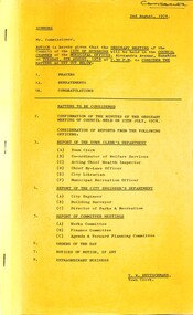
Administrative record - City of Sunshine - Commissioner Mr Alexander "Alex" George Gillon Collection 1976 - 1982 - Notice of ordinary meeting of the Council of the City of Sunshine on 8th August 1978, City of Sunshine, 2nd August 1978
... Notice of ordinary meeting of the Council of the City of Sunshine on 8th August 1978 Report of the Town Clerk's Department Report of the Town Clerk Street Construction Schemes Sheffield Estate, Bedser Street Scheme Settlement Land at Dalton Street Adjoining Council Reserve Possible Purchase Discontinued Roads Railway Land Corner of Alexandra Avenue and Service Street Municipal Accounting Regulations Review Report of the Co-Ordinator of Welfare Service Subsidies under State Grants (Home Care) Act Community Youth Support Scheme Volunteer Training Western Region Committee for the Ageing Report of the Acting Chief Health Inspector Application for Septic Tank Mantoux Testing & B.C.G. ...McKay Gardens Anderson Road Skinner Reserve Churchill Avenue Rosamond Bowling Club Lachlan Road Stevenson Street Birchwood Avenue Calder Court Collenso Street Patterson Avenue Belmore Road Ridley Street Bon Thomas Reserve Quinn Street Orama Road Notice of ordinary meeting of the Council of the City of Sunshine on 8th August 1978 Report of the Town Clerk's Department Report of the Town Clerk Street Construction Schemes Sheffield Estate, Bedser Street Scheme Settlement Land at Dalton Street Adjoining Council Reserve Possible Purchase Discontinued Roads Railway Land Corner of Alexandra Avenue and Service Street Municipal Accounting Regulations Review Report of the Co-Ordinator of Welfare Service Subsidies under State Grants (Home Care) Act Community Youth Support Scheme Volunteer Training Western Region Committee for the Ageing Report of the Acting Chief Health Inspector Application for Septic Tank Mantoux Testing & B.C.G. ...Notice of ordinary meeting of the Council of the City of Sunshine on 8th August 1978 Report of the Town Clerk's Department Report of the Town Clerk Street Construction Schemes Sheffield Estate, Bedser Street Scheme Settlement Land at Dalton Street Adjoining Council Reserve Possible Purchase Discontinued Roads Railway Land Corner of Alexandra Avenue and Service Street Municipal Accounting Regulations Review Report of the Co-Ordinator of Welfare Service Subsidies under State Grants (Home Care) Act Community Youth Support Scheme Volunteer Training Western Region Committee for the Ageing Report of the Acting Chief Health Inspector Application for Septic Tank Mantoux Testing & B.C.G. Vaccination Programme Infant Welfare Furlong Road Centre Albion North Nuisance Condition at 177 Ridgeway Parade Health Act Registrations Application to Transfer Proprietorship of Premise under the Health Act Municipal Saleyards Association (Vic) Smoking in Public Buildings Western Region Environment Committee Report of Sub-Committee on Litter Control in the Western Regions Health Act Registration Bakery 59 Main Road West Smallpox Vaccination Report of the Medical Officer of Health Report of the Chief By-Laws Officer Court Proceedings Parking Infringements Prohibited Parking Sun Crescent Prohibited Parking Gregory Street School Crossing Supervision South Road Report of City Librarian Sunshine - Melton Regional Library Service Greek Week Report of the Municipal Recreation Officer Development of Oval Diamond Avenue Reserve Albanvale Primary School & Albanvale Football Club Albion Rovers Soccer Club Department of Youth, Sport & Recreation Soccer Ground Development Plan Use of Swimming Pool for Vicswim Programme Report of City Engineer Planning Permit Application Flats Killara Street Town Planning Appeal Planning Permit Application Store Addition to Existing Shops and Dwelling Sydney Street Town Planning Appeal Planning Permit Application Flats 28 Sydney Street Planning Permit Application Sale of Motor Vehicles and Parts, and Motor Vehicle Repair Lot 20 Geelong Road Bounded by Holmwood Road, Geelong Road and Tottenham Parade Brooklyn Planning Permit Medical and Surgical Hospital Cumberland Street Bounded by Wiltshire Street to the North and Essex Street to the South Planning Permit Application Additions to Service Premise and Caretaker's Dwelling Ballarat Road Planning Permit Application Advertising Sign Lot 3 Princess Street St. Albans Planning Permit Application Advertising Sign 123 Rosamond Road Maidstone Planning Permit Application 6 Villa Units Lot 7 Ballarat Road Deer Park Amendment No 77 Part 1 to the Melbourne Metropolitan Planning Scheme Amendment No 81 Part 1 to the Melbourne Metropolitan Planning Scheme Planning Permit Application 3 Factories Lots 77, 78 & 79 Somers Street South East Corner of Henderson Street Planning Permit Application Factory Lot 71 Whitehill Avenue Consolidation of Title Cromer Avenue and McIntyre Road Strata Subdivision 18 Forrest Street Creation of Easement Evergreen Avenue Cleaning Contract Annual Supply Contract Annual Supply Contract Concrete Annual Supply Contract Kerb & Channel Berkshire Road Industrial and other Waste Collection Imposition of Load Limits Westmoreland Road and Northumberland Road Flooding of Station Road Approximately Midway Between Middle Road and Boundary Road Proposed Intersection Signals St. Albans Road / Main Road East / East Esplanade Detailed City Plans Hampshire Road / Wright Street Remodel of Traffic Signals Kororoit Creek & Maribyrnong River Catchments Disposal of Old Garbage Dumpers Replacement of Bookmobile Plant No 42 Tenders for Covering Material at Sunshine Tip Traffic Signals Tariffs Bituminous Concrete Paramount Road Private Street Scheme Warrs Road (Northern Section) Plan of Subdivision Robinsons Road Toilet Blocks Various Reserves Demolition of House McKay Gardens Alterations to Grandstand Skinner Reserve Rosamond Bowling Club Report of the Building Surveyor Application to Build Over Easement 47 Lachlan Road Sunshine West Application to Build Over Easement 18 Stevenson Street Deer Park Application to Build Over Easement 44 Birchwood Avenue Deer Park Application to Build Over Easement 173 Wright Street Sunshine Siting of Building 8 Calder Court Sunshine Siting of Building 16 Collenso Street Sunshine West Siting of Building 23 Patterson Avenue Sunshine Breaches of Regulations Lot 20 Belmore Road Sunshine North Condition of Flats 28 - 30 Ridley Street Albion Report of the Director of Parks & Recreation Royal Australian institute of Parks & Recreation Annual Conference Bon Thomas Reserve Development Provision of Main Drainage Facilities Proposed Subdivision of Land Quinn Estate All That Land Bounded by Robinsons Road, Ballarat Road, Orama Road & Quinn Street Orders of the Day Accounts Submitted for Payment as at 15th July 1978 city of sunshine, alexander "alex" george gillon, bedser street, sunshine north, dalton street, sunshine west, alexandra avenue, service street, sunshine, furlong road infant welfare centre, furlong road, ridgeway parade, main road west, st. albans, sun crescent, gregory street, south road, braybrook, diamond avenue reserve, diamond avenue, albanvale primary school, albanvale football club, albanvale, albion rovers soccer club, killara street, sydney street, albion, geelong road, holmwood road, tottenham parade, footscray west, cumberland street, wiltshire street, essex street, ballarat road, princess street, rosamond road, maidstone, deer park, somers street, henderson street, whitehill avenue, cromer avenue, mcintyre road, forrest street, evergreen avenue, berkshire road, westmoreland road, northumberland road, middle road, boundary road, derrimut, st. albans road, main road east, east esplanade, hampshire road, wright street, kororoit creek, maribyrnong river, sunshine tip, paramount road, tottenham, warrs road, maribyrnong, robinsons road, h.v. mckay gardens, anderson road, skinner reserve, churchill avenue, rosamond bowling club, lachlan road, stevenson street, birchwood avenue, calder court, collenso street, patterson avenue, belmore road, ridley street, bon thomas reserve, quinn street, orama road -
 Sunshine and District Historical Society Incorporated
Administrative record - City of Sunshine - Commissioner Mr Alexander "Alex" George Gillon Collection 1976 - 1982 - Minute of the Ordinary Meeting of Council held on 8th August 1978, City of Sunshine, 8th August 1978
... Notice of ordinary meeting of the Council of the City of Sunshine on 8th August 1978 Report of the Town Clerk's Department Report of the Town Clerk Street Construction Schemes Sheffield Estate, Bedser Street Scheme Settlement Land at Dalton Street Adjoining Council Reserve Possible Purchase Discontinued Roads Railway Land Corner of Alexandra Avenue and Service Street Municipal Accounting Regulations Review Report of the Co-Ordinator of Welfare Service Subsidies under State Grants (Home Care) Act Community Youth Support Scheme Volunteer Training Western Region Committee for the Ageing Report of the Acting Chief Health Inspector Application for Septic Tank Mantoux Testing & B.C.G. ...McKay Gardens Anderson Road Skinner Reserve Churchill Avenue Rosamond Bowling Club Lachlan Road Stevenson Street Birchwood Avenue Calder Court Collenso Street Patterson Avenue Belmore Road Ridley Street Bon Thomas Reserve Quinn Street Orama Road Sunshine Ladies Benevolent Society Disraeli Street Notice of ordinary meeting of the Council of the City of Sunshine on 8th August 1978 Report of the Town Clerk's Department Report of the Town Clerk Street Construction Schemes Sheffield Estate, Bedser Street Scheme Settlement Land at Dalton Street Adjoining Council Reserve Possible Purchase Discontinued Roads Railway Land Corner of Alexandra Avenue and Service Street Municipal Accounting Regulations Review Report of the Co-Ordinator of Welfare Service Subsidies under State Grants (Home Care) Act Community Youth Support Scheme Volunteer Training Western Region Committee for the Ageing Report of the Acting Chief Health Inspector Application for Septic Tank Mantoux Testing & B.C.G. ...Notice of ordinary meeting of the Council of the City of Sunshine on 8th August 1978 Report of the Town Clerk's Department Report of the Town Clerk Street Construction Schemes Sheffield Estate, Bedser Street Scheme Settlement Land at Dalton Street Adjoining Council Reserve Possible Purchase Discontinued Roads Railway Land Corner of Alexandra Avenue and Service Street Municipal Accounting Regulations Review Report of the Co-Ordinator of Welfare Service Subsidies under State Grants (Home Care) Act Community Youth Support Scheme Volunteer Training Western Region Committee for the Ageing Report of the Acting Chief Health Inspector Application for Septic Tank Mantoux Testing & B.C.G. Vaccination Programme Infant Welfare Furlong Road Centre Albion North Nuisance Condition at 177 Ridgeway Parade Health Act Registrations Application to Transfer Proprietorship of Premise under the Health Act Municipal Saleyards Association (Vic) Smoking in Public Buildings Western Region Environment Committee Report of Sub-Committee on Litter Control in the Western Regions Health Act Registration Bakery 59 Main Road West Smallpox Vaccination Report of the Medical Officer of Health Report of the Chief By-Laws Officer Court Proceedings Parking Infringements Prohibited Parking Sun Crescent Prohibited Parking Gregory Street School Crossing Supervision South Road Report of City Librarian Sunshine - Melton Regional Library Service Greek Week Report of the Municipal Recreation Officer Development of Oval Diamond Avenue Reserve Albanvale Primary School & Albanvale Football Club Albion Rovers Soccer Club Department of Youth, Sport & Recreation Soccer Ground Development Plan Use of Swimming Pool for Vicswim Programme Report of City Engineer Planning Permit Application Flats Killara Street Town Planning Appeal Planning Permit Application Store Addition to Existing Shops and Dwelling Sydney Street Town Planning Appeal Planning Permit Application Flats 28 Sydney Street Planning Permit Application Sale of Motor Vehicles and Parts, and Motor Vehicle Repair Lot 20 Geelong Road Bounded by Holmwood Road, Geelong Road and Tottenham Parade Brooklyn Planning Permit Medical and Surgical Hospital Cumberland Street Bounded by Wiltshire Street to the North and Essex Street to the South Planning Permit Application Additions to Service Premise and Caretaker's Dwelling Ballarat Road Planning Permit Application Advertising Sign Lot 3 Princess Street St. Albans Planning Permit Application Advertising Sign 123 Rosamond Road Maidstone Planning Permit Application 6 Villa Units Lot 7 Ballarat Road Deer Park Amendment No 77 Part 1 to the Melbourne Metropolitan Planning Scheme Amendment No 81 Part 1 to the Melbourne Metropolitan Planning Scheme Planning Permit Application 3 Factories Lots 77, 78 & 79 Somers Street South East Corner of Henderson Street Planning Permit Application Factory Lot 71 Whitehill Avenue Consolidation of Title Cromer Avenue and McIntyre Road Strata Subdivision 18 Forrest Street Creation of Easement Evergreen Avenue Cleaning Contract Annual Supply Contract Annual Supply Contract Concrete Annual Supply Contract Kerb & Channel Berkshire Road Industrial and other Waste Collection Imposition of Load Limits Westmoreland Road and Northumberland Road Flooding of Station Road Approximately Midway Between Middle Road and Boundary Road Proposed Intersection Signals St. Albans Road / Main Road East / East Esplanade Detailed City Plans Hampshire Road / Wright Street Remodel of Traffic Signals Kororoit Creek & Maribyrnong River Catchments Disposal of Old Garbage Dumpers Replacement of Bookmobile Plant No 42 Tenders for Covering Material at Sunshine Tip Traffic Signals Tariffs Bituminous Concrete Paramount Road Private Street Scheme Warrs Road (Northern Section) Plan of Subdivision Robinsons Road Toilet Blocks Various Reserves Demolition of House McKay Gardens Alterations to Grandstand Skinner Reserve Rosamond Bowling Club Report of the Building Surveyor Application to Build Over Easement 47 Lachlan Road Sunshine West Application to Build Over Easement 18 Stevenson Street Deer Park Application to Build Over Easement 44 Birchwood Avenue Deer Park Application to Build Over Easement 173 Wright Street Sunshine Siting of Building 8 Calder Court Sunshine Siting of Building 16 Collenso Street Sunshine West Siting of Building 23 Patterson Avenue Sunshine Breaches of Regulations Lot 20 Belmore Road Sunshine North Condition of Flats 28 - 30 Ridley Street Albion Report of the Director of Parks & Recreation Royal Australian institute of Parks & Recreation Annual Conference Bon Thomas Reserve Development Provision of Main Drainage Facilities Proposed Subdivision of Land Quinn Estate All That Land Bounded by Robinsons Road, Ballarat Road, Orama Road & Quinn Street Orders of the Day Accounts Submitted for Payment as at 15th July 1978 Extraordinary Business Sunshine Ladies Benevolent Society City Engineer's Report Disposal of Vehicle Fleet No 424 Enforcement 17 Disraeli Street Motor Repairs. Electrical Repairs and Servicing city of sunshine, alexander "alex" george gillon, bedser street, sunshine north, dalton street, sunshine west, alexandra avenue, service street, sunshine, furlong road infant welfare centre, furlong road, ridgeway parade, main road west, st. albans, sun crescent, gregory street, south road, braybrook, diamond avenue reserve, diamond avenue, albanvale primary school, albanvale football club, albanvale, albion rovers soccer club, sydney street, albion, geelong road, holmwood road, tottenham parade, footscray west, cumberland street, wiltshire street, essex street, ballarat road, princess street, rosamond road, maidstone, somers street, henderson street, whitehill avenue, cromer avenue, mcintyre road, forrest street, evergreen avenue, berkshire road, westmoreland road, northumberland road, station road, middle road, boundary road, derrimut, st. albans road, main road east, east esplanade, hampshire road, wright street, kororoit creek, maribyrnong, sunshine tip, paramount road, tottenham, warrs road, robinsons road, h.v. mckay gardens, anderson road, skinner reserve, churchill avenue, rosamond bowling club, lachlan road, stevenson street, birchwood avenue, calder court, collenso street, patterson avenue, belmore road, ridley street, bon thomas reserve, quinn street, orama road, sunshine ladies benevolent society, disraeli street -
 City of Melbourne Libraries
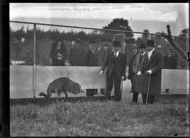
Photograph, Bull, Hugh Jones, 1897-1993, Vice-regal visit to zoo: Lord Huntingfield meets an emu
... After the First World War, many returned soldiers took up the Government’s offer of land in the Soldier Settlement Scheme. Most of the veterans had little or no farming experience and much of the land offered was of poor quality, with blocks often too small to be viable. ...After the First World War, many returned soldiers took up the Government’s offer of land in the Soldier Settlement Scheme. Most of the veterans had little or no farming experience and much of the land offered was of poor quality, with blocks often too small to be viable. ...Photographer notations on slide: "Vice Regal visit to Zoo B42" Not published. Description: A group of men and one woman all dressed in hats and overcoats stand by a wire fence while watching an emu. Research by project volunteer, Fiona Collyer: On 25 June 1934, new Victorian Governor, His Excellency Lord Huntingfield and his wife Lady Huntingfield made an official visit to the Melbourne Zoological Gardens in order to grant his patronage to the Royal Zoological and Acclimatisation Society. During the visit, zoo director Mr. Andrew Wilkie introduced them to some of the zoo’s inhabitants, including an emu. After the First World War, many returned soldiers took up the Government’s offer of land in the Soldier Settlement Scheme. Most of the veterans had little or no farming experience and much of the land offered was of poor quality, with blocks often too small to be viable. Many of the settlers had ongoing physical and mental injuries from the war. The Western Australian government allocated land to 5000 former soldiers but by 1929, one quarter of the men had already abandoned their land, unable to make a living. Not only was the world economy struggling with the Great Depression, but the settlers also had to contend with plummeting wheat and wool prices, crippling drought and rabbit infestation. The Scullin Government (Oct 1929-Jan 1932) had promised subsidies to the Western Australian farmers if they increased their wheat crops but were unable to pass the legislation in the Senate. The new Lyons Government (Jan 1932-April 1939) abandoned the legislation and the subsidies were never paid, bringing calls from Western Australia of secession from Australia. In October 1932, a deputation of soldier settlers from the Campion wheatbelt region in Western Australia, petitioned Commonwealth Minister for Defence, Western Australian Senator Sir George Pearce, for assistance. A mob of 20,000 emus were migrating to the coast after breeding and were gathering along the eastern side of the Number 1 Rabbit Proof Fence, attracted to the ripening crops and the dams the farmers had built. They were heading towards Campion, 303 kilometres east of Perth, eating and trampling the wheat, destroying the fences and letting the rabbits in. Having witnessed firsthand the effectiveness of machine guns in killing people in war, the former soldiers thought the guns would be ideal for killing emus. Sir George, wanting to demonstrate that his government was sympathetic to the settlers and hoping to quell Western Australian succession talk, agreed. However, he stipulated that no expense would be incurred by the Commonwealth Government and only active military personnel could use the machine guns. The farmers had to pay for the ammunition, food and accommodation for the military for the length of the operation. The cost for the ammunition was £50 for 10,000 rounds. Sir George also felt the operation would provide excellent target practice for the soldiers! The operation was headed by Major Gwynydd Purves Wynn-Aubrey Meredith, 1887-1975, of the Seventh Heavy Battery of the Royal Australian Artillery, and assisted by Sergeant S. McMurray and Gunner J. O'Halloran. They were equipped with two American-designed Lewis light machine guns and 10,000 rounds. Each magazine held 47 rounds of ammunition and the gun was capable of firing 500 to 600 rounds per minute with effective firing range of 800 metres. A cinematographer from British Movietone News accompanied the soldiers in order to record what was expected to be not only an easy victory but also useful propaganda for both the military and the Lyons Government. Emu (Dromaius novaehollandiae, meaning New Holland Racer) is a species of long-necked flightless bird endemic to Australia. The Tasmanian and the dwarf King and Kangaroo Island subspecies were hunted to extinction after the European settlement of Australia. It is the second largest bird in the world after the ostrich, standing up to 1.9 metres tall and weighing up to 50 kilograms. The Emu has long, powerful legs with three forward facing toes and is the only bird with calf muscles. It is able to jump 2.1 metres into the air and run 50 kilometres per hour. It communicates by drumming and booming through an inflatable neck sac which can be heard up to two kilometres away. Along with its tough hide and a body more feathers than flesh, the emu can be a tricky target. Emus had been a protected native species until 1922, when the government changed their status to “vermin” in response to the emus breaking down fences and destroying crops. Major Meredith told the press that Colonel Oswald V. Hoad of the 1st Cavalry Division NSW had especially requested he send 100 emu skins to replenish the plumage on his Light Horsemen’s hat tops. On the first day of the Emu War, 2 November 1932, Major Meredith spotted a mob of emus out of range of the guns, so he asked the farmers to use their vehicles to drive the emus towards the fence and the guns. The panicked birds split into small groups, kicking up the dust and scattering every which way. Only six were killed, though some were wounded. After that, the emus became very wary of humans. On 4 November, Major Meredith staged a dawn ambush at a dam. As 1000 emus approached to drink, the soldiers opened fire, killing 12 emus. After reloading, the gun jammed and the emus dispersed in all directions, and were not sighted again that day. The West Australian newspaper reported on 4 November 1932 that, “The emus have proved that they are not so stupid as they are usually considered to be. Each mob has its leader, always an enormous black-plumed bird standing fully six-feet high, who keeps watch while his fellows busy themselves with the wheat. At the first suspicious sign, he gives the signal, and dozens of heads stretch up out of the crop. A few birds will take fright, starting a headlong stampede for the scrub, the leader always remaining until his followers have reached safety.” In a later attempt, they mounted a gun onto the bed of a truck in order to chase and mow down the birds. However the truck couldn’t drive fast enough over the rough terrain and it was too bumpy to fire the gun accurately. The birds easily outran the truck except for one hapless emu who faltered while being chased and fell under the truck, its body wedging in the steering gear, causing the driver to crash the truck, and bringing down half a chain of the rabbit proof fence. RSPCA inspector Mr. Arthur Austin arrived with a rifle and knife in order to finish the work of the Lewis guns and dispatch injured emus. He said that while his society was sympathetic to the stricken settlers, he was anxious that wounded birds should not be left to suffer. Major Meredith told the inspector, “What speed can you run? You have to be better than Peter Pan if you want to catch wounded emus that make for the scrub.” (Racehorse “Peter Pan” had won the 1932 Melbourne Cup a few weeks earlier.) The commentator of the British Movietime newsreel uses a jocular tone to optimistically proclaim, “The scouts [emus] of the advancing army have keen eyesight, and in order to get close to the main body, our lads have to do some real stalking, with the enemy watching events through their periscopes raised up over the heads of corn... Instead of the birds ruining the farmers, tables are turned, there will be no more damage down here for many a day to come once the enemy is eliminated.” Emus proved tougher adversaries than expected, barely breaking stride even when badly injured from machine gun bullets, and the suspicious emus soon learnt to stay out of range of the men and their guns. Meanwhile, in the eastern states concern was being expressed about the cruelty of machine-gunning the native birds. Senator James Guthrie UAP of Victoria suggested that there must be “more humane, if less spectacular methods” of coping with the pests. People wrote letters to the newspapers to express their dismay at the inhumane methods used. R.F. Bellchambers from Humbug Scrub, 25 November 1932, lamented that, “At the present rate of extinctions, it will shortly be necessary to go to the Museum to see the remains of our fauna.” The Murchison Times published a letter on 16 November 1932 from “Clay Pan Joe”: “War on Emus. Slaughter of innocent birds would be more appropriate... The birds may be a nuisance and it may be necessary to destroy them, but why cause so much suffering amongst these innocent birds.” E.S. Playford of Norton’s Summit wrote to The Advertiser, 22 November 1932, that “...habitation on the earth would be impossible without bird life. Therefore, it is unwise to say that any bird is useless. Is sentiment dying? Are we so keen on personal gain that our lovely and unique birds have to be ruthlessly slaughtered in thousands and their bodies left rotting in the sun?” In Sydney, picture palace patrons expressed “considerable concern” after viewing the Movietone News newsreel of emus fleeing from the barrage of machine-guns, and wounded emus in the fields in Campion. The press had a field day, dubbing it the “The Emu War” and joking that the “Chicago method” was being used against the feathered foe. The Daily News newspaper published a cartoon depicting the emus outrunning and outsmarting the soldiers. In Parliament NSW Senator James Dunn called Sir George the “Minister for the Emu War”. Labor member Mr. Rosevear, midst great laughter, asked if the minister would consider declaring an armistice and withdrawing his troops from the Western Front. Prime Minister Joe Lyons was asked if medals would be struck for those taking part in the war. Labor parliamentarian Mr. A.E. Green declared any medals should go to the emus who had “won every round so far”. With the embarrassing press coverage and poor results, Sir George ordered a stop to the project on 9 November, and Major Meredith and the soldiers departed for Perth. The WA Premier Sir James Mitchell and the Campion farmers demanded they return, citing the continued destruction of crops and fences by the emus. Major Meredith and his two gunners were allowed to return on 13 November and seemingly having learnt from their previous experiences, had slightly more success this time killing emus. The operation finally finished on 10 December with Major Meredith reporting “definite kills” of 986 emus for 9860 rounds of ammunition, coincidentally and conveniently exactly 10% of the number of rounds used. A further 2500 birds were said to have died from their injuries and although this is a disputed figure, even if accurate, the ratio of rounds expended to emu casualties was thought too high to justify continuing. The operation barely caused a dint in the marauding mob of 20,000 emus. “There’s only one way to kill an emu”, one of the party bitterly remarked: “Shoot him through the back of the head when his mouth is closed or through the front of his mouth when his mouth is open. That’s how hard it is.” Australian ornithologist Dominic L. Serventy noted that “The machine-gunners’ dreams of point blank fire into serried masses of Emus were soon dissipated. The Emu command had evidently ordered guerrilla tactics, and its unwieldy army soon split up into innumerable small units that made use of the military equipment uneconomic. A crestfallen field force therefore withdrew from the combat area after about a month.” Major Meredith expressed the greatest of respect for the enemy. He said, “If we had a military division with the bullet-carrying capacity of these birds, it would face any army in the world. They could face machine guns with the invulnerability of tanks. They are like Zulus, whom even dum dum bullets would not stop." The Major’s official report stated that there were no human casualties in “The Emu War.” Emus are considered the victors of “The Great Emu War.” Western Australian farmers requested military assistance in 1934, 1943 and 1948, including using bombs, but the government refused. The bounty system instigated in 1923 continued, with farmers using rifles against their fleet-footed foe, with 57,034 bounties for dead emus claimed in six months in 1934 in Western Australia alone. 284,704 emus were killed in Western Australia between 1945 and 1960. The other most effective defence against the emus was the construction of a robust, vermin proof fence spanning over a long distance. Emus were formally protected in 1999 by the Environment Protection and Biodiversity Conservation Act. It’s estimated there are between 625,000 to 725,000 wild emus in Australia in 2024. An emu and a kangaroo feature on Australia’s coat of arms, holding up a shield illustrated with symbols of the six states. The animals symbolise the nation moving forward as neither animal can walk backwards. Campion is now a ghost town. A book about the operation, “Letters from the Emu War” by J.A. Bryden was published in 2023 by Playtime Books. In 2024, an Australian film called “The Emu War” was released, starring Damian Callinan and Luke McGregor. Andrew Arthur Wellesley Wilkie, 1853-1948, was Director of the Melbourne Zoo from 1923 to 1936 and was associated with the zoo for 70 years. He first worked as a horticultural assistant to Government botanist Baron Ferdinand von Mueller at the Botanical Gardens at the age of 13, along with his older brother David. One of Andrew’s jobs was to capture moths for the National Herbarium. In 1857, a group of prominent Melburnians assembled at St. Patrick’s Hall to form the Zoological Society of Victoria, with the aim of introducing animals and plants from overseas. It was conceived, “For the purposes of science and for that of affording the public the advantages of studying the habits of the animal creation in properly arranged zoological gardens.” The Victorian Government granted 32 acres (13 hectares) of land to the Zoological Society at the southern end of Richmond Paddock on the opposite bank to the Botanical Gardens. (This is where AAMI Stadium and Collingwood Football Club now stand.) In 1861, the Zoological Society of Victoria was renamed The Acclimatisation Society of Victoria. Unfortunately the Yarra River frontage was damp, swampy and subject to flooding, so the animals were briefly housed at the Botanical Gardens until in 1862, the City of Melbourne donated 55 acres (22 hectares) of land at Royal Park for the fledgling zoo. Baron von Mueller secured employment at Royal Park for Andrew and David and they helped to lay out the gardens, plant trees and take care of a collection of deer, pheasants, hares and partridges. Initially the zoo was used for the acclimatisation of animals recovering from the long voyage to Australia and for breeding them for sport. In 1872, the zoo bought two lions, a leopard and a cheetah that had been seized from circus showmen Keith and Phillips when they were unable to pay the bill of butcher Mr T K Bennet of Bourke Street. The first zoo director, Mr. Albert Le Souef, negotiated with captains of ships to buy animals at overseas ports they visited and soon a multitude of exotic species arrived, including a ten-year-old Indian elephant in 1878. In 1923, after being head keeper for some years, Andrew was appointed director of the zoo. By 1933, the zoo had 110 different species of animals, 200 species of birds and 72 species of reptiles under Andrew’s care. He had personally planted all but six trees and laid out the garden beds. As director he lobbied authorities for funds to build more humane enclosures for the animals. In June 1928, Table Talk magazine wrote of Andrew Wilkie: “Up at the Zoo there is a humble gentleman who is a lion among the lions, who knows the proper specific to employ when the boa constrictor has chilblains, and who is a friend and confidant of Queenie the elephant. His fount of zoological lore has never been plumbed. It is bottomless, like his good fellowship and geniality. Every day he may be seen somewhere in the grounds of that growing sanctuary for the strange and arresting fauna and creeping things of the world, and I assure you as one who is privy to his passion that that area and its inhabitants are rarely out of his thoughts.” Andrew retired from the zoo in 1936 at the age of 83 and in 1948 died at his home in Brunswick aged 94. He and his wife Josephine had six children. The Victorian Acclimatisation Society was founded in 1861 by Edward Wilson, 1813-1878, then owner and editor of The Argus newspaper. He said that Australian indigenous animals were practically useless, providing only “a little sport and an occasional meal”. The Society believed that Australia’s plants and animals were vastly inferior to those in Europe. They wanted to introduce and acclimatise to Victoria “all innoxious animals, birds, fishes, insects and vegetables, whether useful or ornamental” for sport and for the table, and to spread indigenous animals and plants from the colony around the world. Their motto was “if it lives, we want it”. The Society was primarily responsible for introducing sparrows, starlings, sambar and hog deer, ostriches, brown trout, blackberries, and carp to the Murray River. They released the European songbirds, thrush and blackbird to quell the homesickness of British settlers. The Society also sent Australian animals like platypus, echidnas, kangaroos and koalas to Europe for scientific and novelty purposes. Thomas Austin, a wealthy sheep farmer of Barwon Park, Winchelsea (property now owned by the National Trust) was a member and in 1859 he introduced hares, blackbirds, thrushes and partridges onto his property. He is probably best known for introducing 24 breeding rabbits onto his estate as game for shooting parties. Thomas quipped, “The introduction of a few rabbits could do little harm and might provide a touch of home, in addition to a spot of hunting." In 2022, genomic data confirmed that Australia’s feral rabbit population is entirely descended from these rabbits. Biological control has brought the rabbit population down from an estimated high of 10 billion rabbits in the 1920s to approximately 200 million today, inhabiting 70% of Australian landmass (5.3 million square kilometres). In 1872, the Acclimatisation Society was renamed The Zoological and Acclimatisation Society of Victoria and they focused on importing exotic animals for display purposes to the zoo. In 1937, the Royal Acclimatisation Society of Victoria was recreated as the Zoological Board of Victoria with a focus on research of native animals threatened with extinction. In an editorial for The Argus newspaper, 16 March 1856, Edward Wilson lamented: "...this country has been shamelessly stolen from the blacks. Had they been like the New Zealanders or the North American Indians, we should have bought their land, and supplied them with the means of living when we took it... In less than twenty years we have nearly swept them off the face of the earth. We have shot them down like dogs. In the guise of friendship we have issued corrosion sublimate in their damper, and consigned whole tribes to the agonies of an excruciating death. We have made them drunkards, and infected them with disease which has rotted the bones of their adults, and made such few children as are born amongst them a sorrow and a torture from the very instant of their birth. We have made them outcasts on their own land, and are rapidly consigning them to entire annihilation. There are but a few of them left, comparatively. This is what we would do for that few. We would feed and clothe every one of them.” [Note: this last sentence is italicized in the original newspaper article text]. Lord Huntingfield, (William Charles Arcedeckne Vanneck) 1883-1969, Governor of Victoria 1934-1939, was a British Conservative Party politician and the first ever Australian-born Governor of an Australian state (although he was always considered British). He was patron of the Royal Zoological and Acclimatisation Society of Victoria and was acting Governor-General for six months during the absence of Lord Gowie in 1938. Lady Huntingfield (née Margaret Eleanor Crosby) 1884-1943, his American-born wife showed great interest in social welfare and the advancement of women and children. She was president of the City Newsboys Society and Patroness of the Girls Friendly Society. In 1937, rose breeder Alister Clark named a yellow hybrid tea rose for her. In 1940, the City of Melbourne opened the Lady Huntingfield Free Kindergarten in North Melbourne, now the Lady Huntingfield Early Learning and Family Services Centre. Lady Huntingfield died in London in 1943 after her house was bombed during a German airstrike. The Lady Huntingfield Memorial Scholarship was established after the City of Melbourne raised £1000 in a public appeal conducted in her memory for students undertaking a Social Work degree at the University of Melbourne. It is awarded annually to this day. The Queen Victoria Hospital named a bed in her honour. References: VICE-ROYALTY GREETS THE KING OF BEASTS AT THE ZOO. (1934, June 26). The Age (Melbourne, Vic. : 1854 - 1954), p. 11. Retrieved August 23, 2024, from http://nla.gov.au/nla.news-article204818472 Prominent Personalities ANDREW WILKIE (1928, June 7). Table Talk (Melbourne, Vic. : 1885 - 1939), p. 15. Retrieved August 29, 2024, from http://nla.gov.au/nla.news-article146562949 'Edward Wilson (journalist)', Wikipedia, https://en.wikipedia.org/wiki/Edward_Wilson_(journalist) 'Thomas Austin (pastoralist)', Wikipedia, https://en.wikipedia.org/wiki/Thomas_Austin_(pastoralist) 'The Acclimatisation Society was driven by misguided ideals about 'fixing nature' in Australia', ABC News, https://www.abc.net.au/news/2022-11-04/acclimatisation-society-introduced-species-history-listen/101588262?utm_campaign=abc_news_web&utm_content=link&utm_medium=content_shared&utm_source=abc_news_web THE ABORIGINES. (1856, March 16). The Argus (Melbourne, Vic. : 1848 - 1957), p. 5. Retrieved September 28, 2024, from http://nla.gov.au/nla.news-article4833244 WAR ON EMUS. (1932, November 4). The West Australian (Perth, WA : 1879 - 1954), p. 12. Retrieved September 29, 2024, from http://nla.gov.au/nla.news-article32588972 'The Great Emu War: how it started and who won', ABC Australia, https://www.youtube.com/watch?v=Y1wA0PKeJqc Advertising (1932, November 25). The West Australian (Perth, WA : 1879 - 1954), p. 2. Retrieved October 26, 2024, from http://nla.gov.au/nla.news-article32584578 Emu Chasers Must Outstrip Peter Pan (1932, November 9). The Labor Daily (Sydney, NSW : 1924 - 1938), p. 5. Retrieved October 10, 2024, from http://nla.gov.au/nla.news-article237042749 WAR ON EMUS (1932, November 22). The Advertiser (Adelaide, SA : 1931 - 1954), p. 18. Retrieved October 15, 2024, from http://nla.gov.au/nla.news-article73997254 WAR ON EMUS. (1932, October 28). The Labor Daily (Sydney, NSW : 1924 - 1938), p. 6. Retrieved October 24, 2024, from http://nla.gov.au/nla.news-article237046601 EMU WAR (1932, December 3). Mirror (Perth, WA : 1921 - 1956), p. 7. Retrieved October 24, 2024, from http://nla.gov.au/nla.news-article75626301 Machine Gun Offensive Against Emus. (1932, November 10). Western Mail (Perth, WA : 1885 - 1954), p. 3 (PICTORIAL SECTION). Retrieved October 24, 2024, from http://nla.gov.au/nla.news-article37766670 A THOUSAND BIRDS IN LUCK. (1932, November 10). Western Mail (Perth, WA : 1885 - 1954), p. 28. Retrieved October 11, 2024, from http://nla.gov.au/nla.news-article37766849 New Strategy In A War On The Emu (1953, July 5). The Sunday Herald (Sydney, NSW : 1949 - 1953), p. 13. Retrieved October 11, 2024, from http://nla.gov.au/nla.news-article18516559 This is a nice emu-that was! (1932, November 5). The Daily News (Perth, WA : 1882 - 1955), p. 9 (HOME EDITION). Retrieved September 30, 2024, from http://nla.gov.au/nla.news-article82878309 LOCAL AND GENERAL (1932, November 16). The Murchison Times (Cue, WA : 1924 - 1937), p. 2. Retrieved October 14, 2024, from http://nla.gov.au/nla.news-article257500260 Taking Him for a Ride! (1932, October 13). The Daily News (Perth, WA : 1882 - 1955), p. 6 (HOME EDITION). Retrieved September 30, 2024, from http://nla.gov.au/nla.news-article83717338 'The Emu War', History Nuggets, https://historynuggets.squarespace.com/nuggets/2018/4/21/the-emu-war New Strategy In A War On The Emu (1953, July 5). The Sunday Herald (Sydney, NSW : 1949 - 1953), p. 13. Retrieved October 23, 2024, from http://nla.gov.au/nla.news-article18516559 'This is the story of how Australia went to war with emus and lost', First Dog on the Moon, https://www.theguardian.com/commentisfree/2018/jul/26/this-is-the-story-of-how-australia-went-to-war-with-emus-and-lost Photographer notations on slide: "Vice Regal visit to Zoo B42"emu wars, governors, melbourne zoo, city of melbourne, 1930-1939, hunting, lord huntingfield, lady huntingfield, royal park, animals, wildlife -
 Marysville & District Historical Society
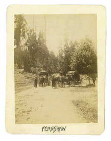
Photograph (Item) - Black and white photograph, Fernshaw, c1900
... In 1886 the Melbourne and Metropolitan Board of Works began work on the Watts River water catchment scheme – later to become Maroondah – and the Board obtained approval for the catchment country to be reserved and kept free of settlement. ...An early black and white photograph taken at Fernshaw.An early black and white photograph taken at Fernshaw. Fernshaw was a rural township 63 km north-east of Melbourne and 10 km north-east of Healesville. Situated on the Watts River, near where a log had fallen making a convenient crossing, Fernshaw was settled in the 1860s. It provided good country for orchards and berry growing. The location was at the foot of Blacks Spur, with Mounts Juliet and Mondah rising on either side, providing spectacular scenery. There were nearby fern gullies giving rise to the name – ‘shaw’ is old English for thicket or wood. By 1875 Fernshaw had a post office (1865), two hotels, a school (1871) and stores. It was famed for its beauty, attracting tourists. In 1886 the Melbourne and Metropolitan Board of Works began work on the Watts River water catchment scheme – later to become Maroondah – and the Board obtained approval for the catchment country to be reserved and kept free of settlement. This required the removal of the Fernshaw township, which was completed by about 1890. The area was described in the 1903 Australian handbook:ARMSTRONG COLLECTION 42 STATION STREET/ SANDRINGHAM 3191/ TEL. (03) 9521 5442/ IAN M.L. ARMSTRONG OAMfernshaw, healesville, watts river, orchard, berry orchard, blacks spur, black spur, mount juliet, mount mondah, maroondah dam, victoria -
 Marysville & District Historical Society
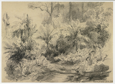
Artwork, other (Item) - Pencil Sketch, Louis Buvelot, Fernshaw 17.2.83, 1883
... In 1886 the Melbourne and Metropolitan Board of Works began work on the Watts River water catchment scheme – later to become Maroondah – and the Board obtained approval for the catchment country to be reserved and kept free of settlement. ...A copy of an early pencil sketch of Fernshaw in Victoria.A copy of an early pencil sketch of Fernshaw in Victoria by Louis Buvelot. Louis Buvelot ( 1814–1888), born Abram-Louis Buvelot, was a Swiss landscape painter who lived 17 years in Brazil and following 5 years back in Switzerland stayed 23 years in Australia, where he influenced the Heidelberg School of painters. Arriving in Melbourne in February 1865, after leaving the cold of Switzerland, which was impacting on his health, for the warmth of Australia, Buvelot was in business as a photographer in Bourke Street for a year but soon resumed his painting. He lived in Melbourne for a number of years before moving to Fitzroy. The National Gallery of Victoria purchased two of his paintings and he continued painting until his death in 1888. He was buried at the Boroondara Cemetery, where a large monument was erected in his memory. Fernshaw was a rural township 63 km northeast of Melbourne and 10 km northeast of Healesville. Situated on the Watts River, near where a log had fallen making a convenient crossing, Fernshaw was settled in the 1860s. It provided good country for orchards and berry growing. The location was at the foot of Blacks Spur, with Mounts Juliet and Mondah rising on either side, providing spectacular scenery. There were nearby fern gullies giving rise to the name – ‘shaw’ is old English for thicket or wood. By 1875 Fernshaw had a post office (1865), two hotels, a school (1871), and stores. It was famed for its beauty, attracting tourists. In 1886 the Melbourne and Metropolitan Board of Works began work on the Watts River water catchment scheme – later to become Maroondah – and the Board obtained approval for the catchment country to be reserved and kept free of settlement. This required the removal of the Fernshaw township, which was completed by about 1890.Fernshaw 17.2.83louis buvelot, fernshaw, victoria, national gallery of victoria, switzerland, boroondara cemetery, kew cemetery, artist -
 Marysville & District Historical Society
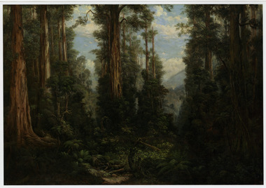
Painting (Item) - Oil painting, Isaac Whitehead, A spring morning near Fernshaw 1880, 1880
... In 1886 the Melbourne and Metropolitan Board of Works began work on the Watts River water catchment scheme – later to become Maroondah – and the Board obtained approval for the catchment country to be reserved and kept free of settlement. ...A copy of an early oil painting of Fernshaw in Victoria.A copy of an early oil painting of Fernshaw in Victoria by Isaac Whitehead. Isaac Whitehead (1819–1881) was an Irish-Australian artist who worked in watercolour and pastel. He was also a picture framer and art promoter. It is believed that Isaaz Whitehead emigrated to Australia with his family in either 1853 or 1858. Isaac Whitehead died at his home 50 Punt Road, Prahran, Melbourne, on 21 April 1881. Isaac Whitehead had established himself as the foremost picture framer in Melbourne by 1860, known for his highly ornate frames with floral decorations. Among the clients of his framing business were Louis Buvelot, Nicholas Chevalier, and Eugene von Guérard. In his own paintings, he painted a number of scenes of the forests of Gippsland, Victoria. His work focused on the rich landscapes with trees and ferns, with a high degree of botanical detail. His work won him two medals and his work was posthumously exhibited at 1884 Victorian Jubilee Exhibition, the 1886 London Colonial and Indian Exhibition, and the 1888 Melbourne Centennial Intercolonial Exhibition. Fernshaw was a rural township 63 km northeast of Melbourne and 10 km northeast of Healesville. Situated on the Watts River, near where a log had fallen making a convenient crossing, Fernshaw was settled in the 1860s. It provided good country for orchards and berry growing. The location was at the foot of Blacks Spur, with Mounts Juliet and Mondah rising on either side, providing spectacular scenery. There were nearby fern gullies giving rise to the name – ‘shaw’ is old English for thicket or wood. By 1875 Fernshaw had a post office (1865), two hotels, a school (1871), and stores. It was famed for its beauty, attracting tourists. In 1886 the Melbourne and Metropolitan Board of Works began work on the Watts River water catchment scheme – later to become Maroondah – and the Board obtained approval for the catchment country to be reserved and kept free of settlement. This required the removal of the Fernshaw township, which was completed by about 1890.isaac whitehead, fernshaw, victoria, louis buvelot, nicholas chevalier, eugene von guerard, gippsland, victorian jubilee exhibition, london colonial and indian exhibition, melbourne centennial intercolonial exhibition, watts river, healesville, blacks spur, mount juliet, mount mondah -
 Marysville & District Historical Society
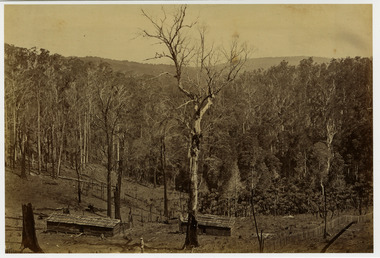
Photograph (Item) - Black and white photograph, Fred Kruger, Scene on the Watts River near Fernshaw, Unknown
... In 1886 the Melbourne and Metropolitan Board of Works began work on the Watts River water catchment scheme – later to become Maroondah – and the Board obtained approval for the catchment country to be reserved and kept free of settlement. ...A copy of a black and white photograph on the Watts River near Fernshaw in Victoria.A copy of a black and white photograph on the Watts River near Fernshaw in Victoria taken by Fred Kruger. Fred Kruger (born Johan Friedrich Carl Kruger, 18 April 1831 – 15 February 1888) was a German-born photographer noted for his early photography of landscape and indigenous peoples in Victoria, Australia. Fernshaw was a rural township 63 km northeast of Melbourne and 10 km northeast of Healesville. Situated on the Watts River, near where a log had fallen making a convenient crossing, Fernshaw was settled in the 1860s. It provided good country for orchards and berry growing. The location was at the foot of Blacks Spur, with Mounts Juliet and Mondah rising on either side, providing spectacular scenery. There were nearby fern gullies giving rise to the name – ‘shaw’ is old English for thicket or wood. By 1875 Fernshaw had a post office (1865), two hotels, a school (1871), and stores. It was famed for its beauty, attracting tourists. In 1886 the Melbourne and Metropolitan Board of Works began work on the Watts River water catchment scheme – later to become Maroondah – and the Board obtained approval for the catchment country to be reserved and kept free of settlement. This required the removal of the Fernshaw township, which was completed by about 1890.fernshaw, watts river, victoria, fred kruger, photograph -
 Orbost & District Historical Society
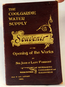
program, The Coolgardie Water Supply, 1903
... The Scheme, which pumps water from the better-watered coastal area, operates to this day. This item is associated with an historic event in the history of opening up arid areas of Australia to settlement. ...This program belonged to Dr James Kerr. Conceived by Engineer-in-Chief C.Y. O’Connor and completed in 1903, the Coolgardie Goldfields Water Supply Scheme comprised a reservoir on the Helena River, eight steam-driven pumping stations and 566 kilometres of steel pipeline supplying 23,000 kilolitres of water daily to the arid goldfields of Western Australia. The project was officially opened by Sir John and Lady Forrest in January 1903. "Great pomp and ceremony heralded the arrival of water and the opening of the Scheme. Clean, fresh water could now be easily obtained in some of Australia's harshest country. However, this victory came at a great cost. The stress of the bold project was too much for O’Connor, who, after enduring endless criticism, took his life on 10 March 1902, before the Scheme was completed." - Western Australian Museum : The Coolgardie Goldfields Water Supply Scheme was an ambitious engineering feat because at the time water had never been lifted so high nor pumped so far (about 560 km). The Scheme, which pumps water from the better-watered coastal area, operates to this day. This item is associated with an historic event in the history of opening up arid areas of Australia to settlement. The item is associated with Dr James Kerr, the first doctor to settle in Orbost.A souvenir program from the opening of the works of the Coolgardie Water Supply. It has a maroon cover with gold print. Details include the date and place.coolgardie-water-supply western-australia-goldfields -
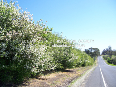 Eltham District Historical Society Inc
Photograph - Digital Photograph, Marguerite Marshall, Hawthorn hedges, Eltham-Yarra Glen Road, Kangaroo Ground, 3 October 2006
... They are "historically significant because the planting of hawthorn hedges reflects the adoption of Eurorpean farming techniques by the Kangaroo Ground population in the period following settlement and because the grid pattern of paddocks that the Hawthorn hedges define is very different to today's farm landscapes." Covered under Heritage Overlay, Nillumbik Planning Scheme. ...They are "historically significant because the planting of hawthorn hedges reflects the adoption of Eurorpean farming techniques by the Kangaroo Ground population in the period following settlement and because the grid pattern of paddocks that the Hawthorn hedges define is very different to today's farm landscapes." Covered under Heritage Overlay, Nillumbik Planning Scheme. ...Hawthorn hedges are important reminders of Kangaroo Ground's Scottish heritage. They are Registered on the Victorian Heritage Register. They are "historically significant because the planting of hawthorn hedges reflects the adoption of Eurorpean farming techniques by the Kangaroo Ground population in the period following settlement and because the grid pattern of paddocks that the Hawthorn hedges define is very different to today's farm landscapes." Covered under Heritage Overlay, Nillumbik Planning Scheme. Published: Nillumbik Now and Then / Marguerite Marshall 2008; photographs Alan King with Marguerite Marshall.; p21 Hawthorn hedges bordering Kangaroo Ground’s gently rolling farmlands are important reminders of its Scottish heritage and are rare so close to Melbourne.1 As early as the 1840s newly arrived farmers from Scotland planted hawthorn hedges around their properties, to protect crops from the numerous kangaroos and wallabies. Many of these hedges survive today. These farmers had the good fortune to settle some of the most fertile land available for cropping in the Colony of Victoria. At that time the black volcanic soil could sustain an amazing two crops a year. By the mid 1850s, 500 acres (202ha) of wheat were growing in Kangaroo Ground. But the crops were threatened by kangaroos, which were so plentiful, that Surveyor-General, Robert Hoddle, named the district Kangaroo Ground in 1838. As post-and-rail fences proved inadequate barriers for the bounding kangaroos, the Scots planted hawthorn hedgerows as they had done in Scotland. Some also used the hedges to net birds, presumably for the table. Interestingly the farmers in the bordering townships of Panton Hill and Christmas Hills, did not plant hawthorn hedges around their properties. Perhaps it was because by the time they settled in the 1860s and 1870s most of the wildlife had been gunned down by residents.2 The canny Scots planted the hedges on public land outside their own farms, as the hedgerows could spread to about five yards (five m) in width. With this impenetrable barrier Kangaroo Ground’s industrious farmers flourished to gain the economic power that saw the Shire of Eltham governed from Kangaroo Ground for 79 years (1858-1937). The Scots jealously guarded their land, so hard to get in Scotland. That is why they refused to release any of it ‘for local roads to follow easier grades as was the case in surrounding districts where roads generally followed ridgelines or streams’.3 Instead the roads were built in accordance with the magnetic bearings of their first survey in 1847 whether that suited the steep topography or not. This could force traffic to diverge when wet through Greensborough and Diamond Creek. Until 1921, the Eltham-Yarra Glen Road beside Wellers Restaurant, ‘dipped down into the upper reaches of Stony Creek’.4 Later some corners were compulsorily cut for the increasing motor traffic. As late as the 1960s, corners were cut to form sweeping curves above and alongside the Kangaroo Ground Cemetery and opposite the Emergency Operations Centre. In the latter case, the farmers – understanding their hedgerows as important heritage – insisted upon their reinstatement to conform to the altered road alignment. Kangaroo Ground’s ancient manna gums also point to the district’s history and to that of the hedgerows. The Aboriginal people had transformed the original forests into grasslands with the fires they lit to attract kangaroos, (which the Scots were to exclude by planting hedgerows). But the Wurundjeri hunters left the gums (Eucalyptus vimminalis cygnetensis), on the grasslands as ‘stalking trees’ to hunt kangaroos. The hawthorn hedges in Kangaroo Ground were neglected for around 60 years from about the middle of the 20th century. Bushfires had created gaps and the hedgerows were not trimmed. Then in late 2005, local historian Mick Woiwod, formed a group to lobby the Nillumbik Shire to restore the hedges, which could last for many centuries. Some hedges in parts of Britain date back to AD 800.5 Although the original Scottish farmers have gone, the hedges are a reminder of when they flourished in the district, which has changed little in 150 years.This collection of almost 130 photos about places and people within the Shire of Nillumbik, an urban and rural municipality in Melbourne's north, contributes to an understanding of the history of the Shire. Published in 2008 immediately prior to the Black Saturday bushfires of February 7, 2009, it documents sites that were impacted, and in some cases destroyed by the fires. It includes photographs taken especially for the publication, creating a unique time capsule representing the Shire in the early 21st century. It remains the most recent comprehenesive publication devoted to the Shire's history connecting local residents to the past. nillumbik now and then (marshall-king) collection, eltham-yarra glen road, hawthorn hedgerow, kangaroo ground -
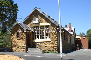 Eltham District Historical Society Inc
Photograph - Digital Photograph, Alan King, Eltham Primary School No. 209, Dalton Street, Eltham, 28 December 2007
... Scheme. Published: Nillumbik Now and Then / Marguerite Marshall 2008; photographs Alan King with Marguerite Marshall.; p49 Eltham Primary School at Dalton Street, bustling with hundreds of students, has changed dramatically since it began in July 1855.1 A reminder of its early days is the building in local sandstone with a slate roof. First head teacher was David G Clark who was officially in charge from June 1856 until 1889.2 This school was not the settlement’s...Scheme. Published: Nillumbik Now and Then / Marguerite Marshall 2008; photographs Alan King with Marguerite Marshall.; p49 Eltham Primary School at Dalton Street, bustling with hundreds of students, has changed dramatically since it began in July 1855.1 A reminder of its early days is the building in local sandstone with a slate roof. First head teacher was David G Clark who was officially in charge from June 1856 until 1889.2 This school was not the settlement’s ...This building is the earliest building remaining on site today. It was built in 1875 and was the second school building replacing the original 1856 building of stone walls with wooden shingles on the roof. That building needed to be replaced after the stone walls collapsed outwards. In August 1912 the school issued a requisition for remodelling of the school concerned with replacement of the existing windows with larger and wider windows to allow additional light into the school rooms and the erection of a wooden partition in the centre of the room. An extension to the building at rear and skylights in the roof were added in 1921. Only two low wooden stairs were originally provided to enter the porch. These were rebuilt by 1928. A steel mud grate was introduced 1930s/1940s and an infant shelter shed circa 1945. Covered under Heritage Overlay, Nillumbik Planning Scheme. Published: Nillumbik Now and Then / Marguerite Marshall 2008; photographs Alan King with Marguerite Marshall.; p49 Eltham Primary School at Dalton Street, bustling with hundreds of students, has changed dramatically since it began in July 1855.1 A reminder of its early days is the building in local sandstone with a slate roof. First head teacher was David G Clark who was officially in charge from June 1856 until 1889.2 This school was not the settlement’s first. That was the Church of England Little Eltham School, west of Diamond Creek in 1853 and closed in 1872. In 1855 David Clark and his sister Catherine, opened what was to become the present school, with eight students. The school operated elsewhere in a temporary slab building, also used for worship by the Wesleyans,3 which allowed the wind and rain easy access. As well as having to endure such Spartan conditions, the students paid one penny a week for the privilege. But in June 1856 the patrons objected to the conditions, and they and the Clarks wrote to the National Schools Board, asking for a suitable school. They asked for a grant to buy land for a school, and to appoint the Clarks. As a result, inspector Mr A B Orlebar visited the school. He found 33 children aged from four to 13 and noted, among other things: ‘There is no attempt at classification, and this is owing chiefly to the want of books, every child bringing with it any spelling or reading book he or she may find at home,4 and partly to the master and mistress having little idea of anything but individual instruction.’ Of Mr Clark, Mr Orlebar said: ‘I cannot pass him as coming up to the full standard of a probationer. He promises however to pursue a course….if the commissioners take him into their service.’ Of Catherine: ‘She makes a promise similar to that of her brother. Pupils were orderly and the school seemed well conducted. I cannot therefore hesitate to recommend them both personally as probationers.’ Later at a public meeting, Mr Orlebar pledged the commissioners would give £150 for a school, if this was matched by local residents. The meeting decided the commissioners would acquire two acres (0.8ha) for the school site. The building, constructed with local sandstone, was completed in December 1857, measuring 40 feet x 16 feet (12mx5m) and 10 feet (3m) high. It was divided into two rooms – one for the school and the other for teacher accommodation. So the Eltham school was born, in an area regarded as ‘one of the poorest in the colony’. Excerpts from inspectors’ reports in the following years, show that in some ways school has not changed that much since then: ‘Discipline only moderate. Too much chattering!’ (1873); ‘Several slates were cleaned with saliva applied by the hand! Damp rags would be much nicer.’(1891).5 In 1863 the Board of Education took over the school giving it its current name and number, Eltham Primary School No 209. Overcrowding has dogged the school over much of its history. In 1875 overcrowding spilled part of the school into the local courthouse. But that year the sandstone building, which is still standing, was built for 100 children, costing £553 and replacing the National School building. Now, this section, even following renovations, still bears part of its original graciousness, with lofty timber ceilings, tall vertical windows and original floors.This collection of almost 130 photos about places and people within the Shire of Nillumbik, an urban and rural municipality in Melbourne's north, contributes to an understanding of the history of the Shire. Published in 2008 immediately prior to the Black Saturday bushfires of February 7, 2009, it documents sites that were impacted, and in some cases destroyed by the fires. It includes photographs taken especially for the publication, creating a unique time capsule representing the Shire in the early 21st century. It remains the most recent comprehenesive publication devoted to the Shire's history connecting local residents to the past. nillumbik now and then (marshall-king) collection, dalton street, eltham primary school, state school no. 209 -
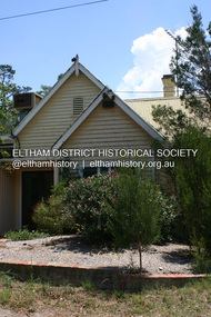 Eltham District Historical Society Inc
Photograph - Digital Photograph, Alan King, Former St Andrews State School No. 128 building, 23 January 2008
... settlement of the area and because its use of materials from the former Smith's Gully State school illustrates the common 19th and early 20th century practice of relocating State school buildings based on need. The school building is historically and socially significant because it served the local community, as a school, from 1887 to the late 1970s/early 1980s and because since then it has been used for other community purposes. Covered under Heritage Overlay, Nillumbik Planning Scheme...settlement of the area and because its use of materials from the former Smith's Gully State school illustrates the common 19th and early 20th century practice of relocating State school buildings based on need. The school building is historically and socially significant because it served the local community, as a school, from 1887 to the late 1970s/early 1980s and because since then it has been used for other community purposes. Covered under Heritage Overlay, Nillumbik Planning Scheme ...In 1858 the Caledonia Common School No.128 opened at Queenstown, about 1.6km upstream on Diamond Creek from the present site of the old St Andrews school. The school was renamed Queenstown Common School No. 128 in 1867. In 1882, due to declining numbers of pupils at Smiths Gully and increasing numbers in Queenstown the school was moved from a leased building, owned by Head Teacher Robert Harris, into a new larger building on the corner of School and Heidelberg-Kinglake roads which incorporated the original single room school building, which had been moved from Smiths Gully, and included a teacher’s three-roomed residence. In 1887 the school was replaced by the Queenstown State School No. 128. The school and town were renamed St Andrews in 1952. In 1983 a new school was built, 500 metres south of the old school and the old school became the St Andrews Community Centre. Of significance is the c1887 school building (including part of the c1876 Smith's Gully school moved to the site and incorporated into the c1887 school building), the c1911 new room, the c1929 cloakroom, the c1930 renovations, the c1956 new infant room; the c1961 office and storeroom, as well as the c1950 Himalayan Cedar tree and the entire site to the title boundaries. The school building is historically significant for its links with the early settlement of the area and because its use of materials from the former Smith's Gully State school illustrates the common 19th and early 20th century practice of relocating State school buildings based on need. The school building is historically and socially significant because it served the local community, as a school, from 1887 to the late 1970s/early 1980s and because since then it has been used for other community purposes. Covered under Heritage Overlay, Nillumbik Planning Scheme. Published: Nillumbik Now and Then / Marguerite Marshall 2008; photographs Alan King with Marguerite Marshall.; p69This collection of almost 130 photos about places and people within the Shire of Nillumbik, an urban and rural municipality in Melbourne's north, contributes to an understanding of the history of the Shire. Published in 2008 immediately prior to the Black Saturday bushfires of February 7, 2009, it documents sites that were impacted, and in some cases destroyed by the fires. It includes photographs taken especially for the publication, creating a unique time capsule representing the Shire in the early 21st century. It remains the most recent comprehenesive publication devoted to the Shire's history connecting local residents to the past. nillumbik now and then (marshall-king) collection, st andrews, queenstown state school no. 128, smiths gully state school
