Showing 805 items matching "study area"
-
 Orbost & District Historical Society
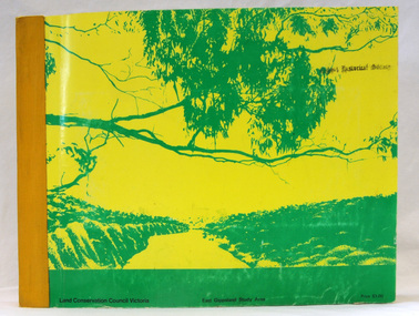
book, Report on the East Gippsland Study Area, June 1974
... Report on the East Gippsland Study Area...East-Gippsland-Study-Area conservation public-land-use...This report contains the Council’s final recommendations concerning the use of public land in the East Gippsland study area, the boundaries of which correspond to those of the Shire of Orbost. ...Report on the East Gippsland Study Area book Rixon, C.H. ...In 1961 Bruce Evans was elected to the Victorian Legislative Assembly as the member for Gippsland East. He was the party's deputy leader from 1964 to 1970 and its whip from 1970 until his retirement in 1992. "The Land Conservation Council was established by the Land Conservation Act 1970. As one of its three functions, it makes recommendations to the Minister for Planning and Environment with respect to the use of public land, in order to provide for the balanced use of land in Victoria. This report contains the Council’s final recommendations concerning the use of public land in the East Gippsland study area, the boundaries of which correspond to those of the Shire of Orbost. The recommendations in the text are grouped under major headings, such as Parks, State Forest, and so on. " The Council met on seven occasions during the year, and also made visits of inspection to each study area. The Chairman visited Shire Councils in study areas to explain the role and the functions of the Land Conservation Council and to invite submissions on the use of public land in these areas. This is the fourth annual report by the council. This is a useful research tool.A large book 236 pp book with a yellow / gold cover with a green bush scene . The binding is orange. It contains folded maps and information on public land use in East Gippsland.inside - "With Compliments - Bruce Evans, M.P."east-gippsland-study-area conservation public-land-use -
 Otway Districts Historical Society
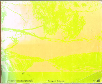
Book, Land Conservation Council, Report on the Corangamite Study Area, May 1976
... Report on the Corangamite Study Area....The Report describes and assesses the natural resources of public land in the Corangamite study area, and provides a factual basis on which members of the community may base their submissions to the Council....Report on the Corangamite study area. Land Conservation Council. Melbourne; Land Conservation Council; May 1976. x, 310 p.; illus, maps (separate). ...Report on the Corangamite Study Area. Book Land Conservation Council ...The Report describes and assesses the natural resources of public land in the Corangamite study area, and provides a factual basis on which members of the community may base their submissions to the Council.Report on the Corangamite study area. Land Conservation Council. Melbourne; Land Conservation Council; May 1976. x, 310 p.; illus, maps (separate). Soft cover.land conservation council; corangamite; geology; physiography; climate; water resources; soils; vegetation; fauna; -
 Federation University Historical Collection
Book, Historic Sites Survey: North Central Study Area, 1979, 1979
... Historic Sites Survey: North Central Study Area, 1979...The North Central Study Area included the Shires of Avoca, Bet Bet, east Loddon, Goulburn, Untly, Kara Kara, Korong, Maldon, Marong, Metcalfe, McIvor, Newstead, Strathfieldsaye, Stawell, Talbot, Clunes, Tullaroop and Waranga. ...It is an historic sites survey for the North Central Study Area commissioned by the Land Conservation Council, the Ministry for COnservation and the Australian Heritage Commission. ...Historic Sites Survey: North Central Study Area, 1979 Book Book Jacobs Lewis Vines Architects and Conservation Planners ...The North Central Study Area included the Shires of Avoca, Bet Bet, east Loddon, Goulburn, Untly, Kara Kara, Korong, Maldon, Marong, Metcalfe, McIvor, Newstead, Strathfieldsaye, Stawell, Talbot, Clunes, Tullaroop and Waranga. 153 page book with white plastic binding. It is an historic sites survey for the North Central Study Area commissioned by the Land Conservation Council, the Ministry for COnservation and the Australian Heritage Commission. castlemaine, mount alexander goldfield, maldon, percydale, warrenmang, moliagul, tarnagulla, stuart mill, the whipstick, whroo, rushworth, graytown ironbark forest, st arnoaud, new bendigo, landsborough, inglewood, kurting, wedderburn, wehla, kooroora, langham flat, mcintyre, rheola, diamond hill, fosterville, coliban water works, green gully, newstead, muckleford forest, costerfield, graytown, bailieston, waranga irrigaiton system, eucalyptus distillery, mia mia bridge, korokubeal township researce, concegella slate quarry, chewton, fryerstown, kingower, timor, talbot, majorca, carisbroook, clunes, st arnaud, taradale, icomos, dunolly, limestone, castlemaine slate quarry, harcourt granite, taradale railway viaduct, loddon united waterworks trust, gouldburn weir, carisbrook lock-up, history of tree planting in streets, history of public reserves, r.u. nicholls nurseryman, thomas lang, francis moss, ballarat botanical gardens, ballarat school of mines botanical gardens, lake wendouree, victoria park, ballarat, muont holled smith, ballaarat old cemetery planting, eastern oval, ballarat east botanical gardens, ballarat east town hall gardens, eureka stockade reserve, ballarat observatory plantings, yarrowee creek plantings, yarrowee bluestone channels, ballarat woollen mill, band and albion mullock heap, black hill plantings, yarrowee creek channels, canadian creek channel, specimen vale channel, poverty point reserve, union jack reserve buninyong, imperial mine, buninyong, victoria street plantings, bridge mall, sturt street gardens, ballarat avenue of honour plantings, white flat oval plantings, camp street, elms, burnt creek -
 Emerald Museum & Nobelius Heritage Park
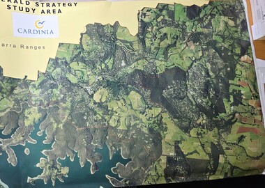
Map - Aerial Colour photographic map of Emerald township and surrounds, Emerald Strategy Study Area (Cardinia), unknown
... Emerald Strategy Study Area (Cardinia)...Emerald Strategy Study Area/Cardinia/Yarra Ranges...Emerald Museum & Nobelius Heritage Park 5 Crichton Rd Emerald yarra-valley-and-the-dandenong-ranges Aerial photograph of the Emerald township and surrounding area Emerald Strategy Study Area/Cardinia/Yarra Ranges Image of aerial photograph of the Emerald township and surrounds Emerald Strategy Study Area (Cardinia) Map Aerial Colour photographic map of Emerald township and surrounds ...Aerial photograph of the Emerald township and surrounding areaImage of aerial photograph of the Emerald township and surroundsEmerald Strategy Study Area/Cardinia/Yarra Ranges -
 Bendigo Historical Society Inc.
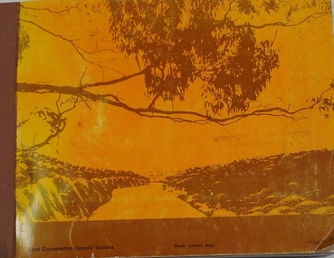
Book - REPORT ON THE NORTH CENTRAL STUDY AREA OF VICTORIA
... REPORT ON THE NORTH CENTRAL STUDY AREA OF VICTORIA...252 page Report on the North Central Study Area by the Land Conservation Council of Victoria - July 1978 Illustrated with B&W photos Back section contains several removeable maps. ...Printed by F D Atkinson, Government Printer, Melbourne Book REPORT ON THE NORTH CENTRAL STUDY AREA OF VICTORIA ...252 page Report on the North Central Study Area by the Land Conservation Council of Victoria - July 1978 Illustrated with B&W photos Back section contains several removeable maps. Printed by F D Atkinson, Government Printer, MelbourneLand Conservation Council, Victorialand conservation, north central region -
 Kiewa Valley Historical Society
Report - Alpine Study Area Volume 2 Maps, Land Conservation Council, 1970s
... Report - Alpine Study Area Volume 2 Maps...Blue box shaped folder containing 9 of 10 Maps of the Alpine Study Area produced by the Land Conservation Council. ...Minerals Land Conservation Council Report - Alpine Study Area Volume 2 Maps ...The Victorian Environmental Assessment Council and the former Environment Conservation Council (ECC) and Land Conservation Council (LCC) have completed 36 land use investigations over more than 35 years, including 27 regional reviews. They provide a framework for use of Public Land in Victoria. The Land Conservation Council was established by the Land Conservation Act 1970.These maps provide an assessment of the Alpine area at the time the maps were created. Some of the topics eg. Rainfall and water resources may change over the years thus providing a comparative analysis. Others may provide information for future development such as mineral exploration, building of a dam / tunnel etc.Blue box shaped folder containing 9 of 10 Maps of the Alpine Study Area produced by the Land Conservation Council. Maps include 1. Public land and descriptive blocks. 2. Physiography. 3. Topography. 4. Geology (missing). 5. Rainfall and water resources. 6. Vegetation 7. Land systems. 8. Recreation. 9. Primary production. 10. Minerals Ex library item. Stamped in red "Discarded From Stock / Swan Hill Regional Libraryalpine area, maps of alpine area, land conservation council -
 Orbost & District Historical Society
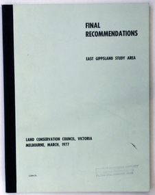
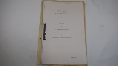
document, FINAL RECOMMENDATIONS E. GIPPSLAND STUDY AREA - LAND CONSERVATION COUNCIL, VICTORIA March 1977, March 1977
... FINAL RECOMMENDATIONS E. GIPPSLAND STUDY AREA - LAND CONSERVATION COUNCIL, VICTORIA March 1977...A document of 75 pp with a pale green cover and black print, titled Final Recommendations East Gippsland Study area. Land Conservation Council, Melbourne, March, 1977....FINAL RECOMMENDATIONS E. GIPPSLAND STUDY AREA - LAND CONSERVATION COUNCIL, VICTORIA March 1977 document Land Conservation Council ...Established in 1971, the Land Conservation Council operated under the Land Conservation Council Act 1970. In July 1997, the Environment Conservation Council Act 1997 came into operation. This Act revoked the Land Conservation Council Act 1970 and abolished the Land Conservation Council. An Environment Conservation Council was established in its place. (ref. TROVE) This document is a useful reference tool.A document of 75 pp with a pale green cover and black print, titled Final Recommendations East Gippsland Study area. Land Conservation Council, Melbourne, March, 1977.land-conservation-east-gippsland -
Lakes Entrance Historical Society
Book, Land Conservation Council Victoria East Gippsland Study Area, 1974
... Land Conservation Council Victoria East Gippsland Study Area...Report describing the nature of environmental features, together with the character and distribution of various natural resources of the East Gippsland, Victoria, study area, comprising land in the old Shire of Orbost. ...History, vegetation, flora, fauna, Land Conservation Council Victoria East Gippsland Study Area Book ...Report describing the nature of environmental features, together with the character and distribution of various natural resources of the East Gippsland, Victoria, study area, comprising land in the old Shire of Orbost. History, vegetation, flora, fauna,vegetation, natural history, vegetation -
Kiewa Valley Historical Society
Folder - Local Area Study of Mt Beauty, Local Area Study of Mt Beauty by a student, David, with acknowledgement to Alex McCullough & Mr C. De-Goi
... Folder - Local Area Study of Mt Beauty...Local Area Study of Mt Beauty by a student, David, with acknowledgement to Alex McCullough & Mr C. ...De-Goi Folder - Local Area Study of Mt Beauty ...The History of Mt Beauty is about the unique development of a construction town built in the 1940s by the State Electricity Commission of Victoria during the construction of the Kiewa Hydro Electric Scheme. This history gives an insight into a student's understanding and areas of interest in the development of Mt Beauty.Black plastic cover with three fasteners holding 188 pages with black print, photos and diagrams.'Ticks' have been added by the teacher on many of the pages. On the back of the last page: Teacher's comments and mark 195/200.history of mt beauty, secv, khes, alex mccullough -
 Wodonga & District Historical Society Inc
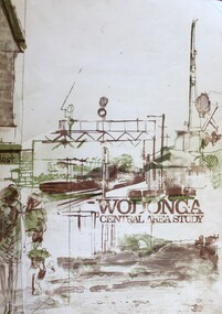
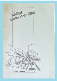
Book - Wodonga Central Area Study, Loder and Bayly, Planning & Engineering Consultants, March 1975
... Wodonga Central Area Study...Wodonga Central Area Study...Wodonga Central Area Study Book Wodonga Central Area Study Loder and Bayly, Planning & Engineering Consultants ...This report was the result of an investigation into the potential future development and town planning for the central area of Wodonga. Chapters of the final report are:- Chapter 1: Summary: Conclusions and Recommendations, Chapter 2: Setting the scene, Chapter 3: Possible futures, Chapter 4: Objectives, Chapter 5: Growth Options, Chapter 6: Recommended approaches, Chapter 7: Plan elements and Chapter 8: Ways and Means.A report of 134 pages, including illustrations and maps. The report was presented to the Albury-Wodonga Development Corporation and the Rural City of Wodonga.This report was the result of an investigation into the potential future development and town planning for the central area of Wodonga. Chapters of the final report are:- Chapter 1: Summary: Conclusions and Recommendations, Chapter 2: Setting the scene, Chapter 3: Possible futures, Chapter 4: Objectives, Chapter 5: Growth Options, Chapter 6: Recommended approaches, Chapter 7: Plan elements and Chapter 8: Ways and Means.wodonga town planning, albury-wodonga development, rural city of wodonga -
 Wodonga & District Historical Society Inc
Book - Wodonga Central Area Study 1989, Loder and Bayly, Planning & Engineering Consultants, 1989
... Wodonga Central Area Study 1989...Wodonga Central Area Study 1989...Wodonga Central Area Study 1989 Book Wodonga Central Area Study 1989 Loder and Bayly, Planning & Engineering Consultants ...This report was the result of an investigation into the potential future development and planning for commercial areas in Wodonga. Chapters of the final report are:- Chapter 1: Summary and Recommendations, Chapter 2: Wodonga Centre and its retail functioning, Chapter 3: Growth, Change and the need for a strategy, Chapter 4: Building a strategy for the Centre, Chapter 5: Components of a regional strategy, Chapter 6: A retail structure within Wodonga, Chapter 7: Future Road networks, Chapter 8: An urban design framework, Chapter 9: An overview of the emerging structure, Chapter 10: Planning scheme provisions and Chapter 11 Appendice (refer separate reports).A report of 134 pages, including illustrations and maps. The report was presented to the Albury-Wodonga Development Corporation and the Rural City of Wodonga.non-fictionThis report was the result of an investigation into the potential future development and planning for commercial areas in Wodonga. Chapters of the final report are:- Chapter 1: Summary and Recommendations, Chapter 2: Wodonga Centre and its retail functioning, Chapter 3: Growth, Change and the need for a strategy, Chapter 4: Building a strategy for the Centre, Chapter 5: Components of a regional strategy, Chapter 6: A retail structure within Wodonga, Chapter 7: Future Road networks, Chapter 8: An urban design framework, Chapter 9: An overview of the emerging structure, Chapter 10: Planning scheme provisions and Chapter 11 Appendice (refer separate reports).wodonga development planning, albury wodonga development -
 Federation University Historical Collection
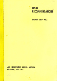
Book, Final recommendations Ballarat Study Area Land Conservation Council, Victoria, 1982, 1982
... Final recommendations Ballarat Study Area Land Conservation Council, Victoria, 1982...Maps include: The Study area 1: 250 000 Supplementary Maps...Maps include: The Study area 1: 250 000 Supplementary Maps Final recommendations Ballarat Study Area Land Conservation Council, Victoria, 1982 Book Book ...Yellow soft covered report of 95 pages . The contents of the report include: Parks, reference areas, wildlife reserves, water production, hardwood production, softwood production, flora Reserves and Flora and Fauna reserves, bushland reserves, historic area and reserves, rivers and streams, Roadside conservation and Highway parks, Education areas and School Plantations, Lake Reserves, geological reserves, recreation, scenic reserves, agriculture, mineral and stone production, utilities and survey, township land, Uncommitted Land, military training, other reserves and public land. Maps include: The Study area 1: 250 000 Supplementary Mapsland conservation authority, ballarat, endowment plantations, pine plantations, langi ghiran state park, mount buangor state park, enfield state park, ballarat-creswick regional park, rossbridge, black lake, flax mill swamp, dereel lagoon, lake bolac, lake wongan, langi ghiran reservoir, gong gong reservoir, pincotts reservoir, beales reservoir, wilsons reservoir, moorabool reservoir, korweinguboora, korweinguborra reservoir, learmonth bores, sago hill, illabarook reservoir, ballarat water commission, dunneworthy, mount cole, mont lonarch, ben major, waterloo, trawalla, linton, ross creek, canadian, shepherds flat, lal lal, mount doran, raglan, chute, carngham, buninyong, watsons hill, enfield, cape clear, illabrook, rokewood junction, mount warrenheip, nerrina, jubilee, golden stream, australasian deep lead mine, happy valley school, piggoreet, berringa, bulldog, ballarat common, wildlife, water, timber, flora, rivers, geology, agriculture, warrenheip, biodiversity -
Lakes Entrance Historical Society
Map - Land Conservation Council Victoria East Gippsland Study Area
... Land Conservation Council Victoria East Gippsland Study Area...B shows the hinterland of East Gippsland Map Land Conservation Council Victoria East Gippsland Study Area ...Two maps A shows the geology of East Gippsland. B shows the hinterland of East Gippslandtopography, waterways, land conservation -
Lakes Entrance Historical Society
Map - Alpine Study Area Public Land and Blocks, Land Conservation Council
... Alpine Study Area Public Land and Blocks...Lakes Entrance Historical Society 4 Marine Parade Lakes Entrance gippsland study Land conservation Map No. 1 Map showing public land and descriptive blocks in the Alpine area with names and numbers Map Alpine Study Area Public Land and Blocks Land Conservation Council ...Map showing public land and descriptive blocks in the Alpine area with names and numbersMap No. 1study, land conservation -
Lakes Entrance Historical Society
Map - Alpine Study Area - Physiography, Land Conservation Council
... Alpine Study Area - Physiography...Lakes Entrance Historical Society 4 Marine Parade Lakes Entrance gippsland physiography study Land conservation Map No. 2 Map shows mountanous tracts, tablelands and plataux basins Map Alpine Study Area - Physiography Land Conservation Council ...Map shows mountanous tracts, tablelands and plataux basinsMap No. 2physiography, study, land conservation -
Lakes Entrance Historical Society
Map - Alpine Study Area - Topography, Land Conservation Council
... Alpine Study Area - Topography...Lakes Entrance Historical Society 4 Marine Parade Lakes Entrance gippsland Topography study Conservation Map No. 3 Map shows Great Dividing Range Map Alpine Study Area - Topography Land Conservation Council ...Map shows Great Dividing RangeMap No. 3topography, study, conservation -
Lakes Entrance Historical Society
Map - Alpine Study Area - Geology, Land Conservation Council
... Alpine Study Area - Geology...Lakes Entrance Historical Society 4 Marine Parade Lakes Entrance gippsland Geology study Land conservation Map No. 4 Map shows mountain ranges and rivers Map Alpine Study Area - Geology Land Conservation Council ...Map shows mountain ranges and riversMap No. 4geology, study, land conservation -
Lakes Entrance Historical Society
Map - Alpine Study Area - Rainfall, Land Conservation Council
... Alpine Study Area - Rainfall...Signature Ruth Clark Map shows rainfall and water resources Golbourn River, Ovens River, Macalister Riverr Kiewa River, Mitta Mitta River, Murrary River and Snowy River Map Alpine Study Area - Rainfall Land Conservation Council ...Map shows rainfall and water resources Golbourn River, Ovens River, Macalister Riverr Kiewa River, Mitta Mitta River, Murrary River and Snowy RiverMap 5. Signature Ruth Clarkwater resources, rainfall, study -
Lakes Entrance Historical Society
Map - Alpine Study Area - Vegetation, Land Conservation Council
... Alpine Study Area - Vegetation...Map Alpine Study Area - Vegetation Land Conservation Council ...Map shows tree names in each forest area as open forest, woodland and forest, cleared land.Map No. 6vegetation, study, land conservation -
Lakes Entrance Historical Society
Map - Alpine Study Area - Land Systems, Land Conservation Council
... Alpine Study Area - Land Systems...Lakes Entrance Historical Society 4 Marine Parade Lakes Entrance gippsland Topography Land Systems Conservation Map No. 7 Map shows land systems, bounderies in the Great Dividing Range Map Alpine Study Area - Land Systems Land Conservation Council ...Map shows land systems, bounderies in the Great Dividing RangeMap No. 7topography, land systems, conservation -
Lakes Entrance Historical Society
Map - Alpine Study Area - Recreation, Land Conservation Council
... Alpine Study Area - Recreation...Lakes Entrance Historical Society 4 Marine Parade Lakes Entrance gippsland Recreation Recreation Facilities study Map No. 8 Map shows historic features, natural features, facilities, road access, walking tracks Map Alpine Study Area - Recreation Land Conservation Council ...Map shows historic features, natural features, facilities, road access, walking tracksMap No. 8recreation, recreation facilities, study -
Lakes Entrance Historical Society
Map - Alpine Study Area - Primary Production, Land Conservation Council
... Alpine Study Area - Primary Production..., uncleared area, cattle main stock route, Map Alpine Study Area - Primary Production Land Conservation Council ...Map shows private land, cropping, sheep, cattle, dairy farm, tobacco farm, walnut, chestnuts, apples. Public area, uncleared area, cattle main stock route,Map No. 9crops, livestock, study, primary production -
Lakes Entrance Historical Society
Map - Alpine Study Area - Minerals, Land Conservation Council
... Alpine Study Area - Minerals...Extractive industries material Map Alpine Study Area - Minerals Land Conservation Council ...Map shows Cassilis goldfields 1. Metallic mineral deposits. 2. Non metallic mineral deposits. 3. Fuel mineral deposits. 4. Extractive industries materialMap 10minerals, study, goldfields -
Moorabbin Air Museum
Manual (Item) - Allied Geographical Section South West Pacific Area Terrain Study No. 28 Main Routes Across New Guinea 18th October 1942
... Allied Geographical Section South West Pacific Area Terrain Study No. 28 Main Routes Across New Guinea 18th October 1942...Allied Geographical Section South West Pacific Area Terrain Study No. 28 Main Routes Across New Guinea 18th October 1942...Moorabbin Air Museum Moorabbin Airport 12 First Street Moorabbin melbourne Allied Geographical Section South West Pacific Area Terrain Study No. 28 Main Routes Across New Guinea 18th October 1942 Manual Allied Geographical Section South West Pacific Area Terrain Study No. 28 Main Routes Across New Guinea 18th October 1942 ... -
 Kiewa Valley Historical Society
Folder - Cattle Grazing, Cattle Grazing in the Alpine Study Area
... Cattle Grazing in the Alpine Study Area...Dated: June 1978 Cattle Grazing in the Alpine Study Area Folder - Cattle Grazing ...Cattlemen / Beef Farmers of the Kiewa Valley took their cattle up to the High Plains to graze during summer.Cover includes the heading 'National Parks Service' and is bound on the spine with black tape. This is followed by 'File Title' on yellow cardboard marked with column and lines. Inside: 35 pages printed on one side. Pages are bound by steel binder. Dated: June 1978J. Commins on cover page at the top.bogong high plains, cattle grazing, farmers of the kiewa valey, national parks -
Federation University Historical Collection
Book, Jacobs Lewis Vines Architects and Conservation Planners, Historic Sites Survey: Ballarat Study Area, 1980, 1980
... Historic Sites Survey: Ballarat Study Area, 1980...It includes information on sites, a schexdule of sites, silte selection and designated areas (ie around towns) Historic Sites Survey: Ballarat Study Area, 1980 Book Book Jacobs Lewis Vines Architects and Conservation Planners ...This survey was commissioned by the Land Conservation Council, Australian Heritage Commission and the Ministry for Conservation 114 page report on historic sites in the Ballarat region. It includes information on sites, a schexdule of sites, silte selection and designated areas (ie around towns)historic sites, ballarat, wendy jacobs, miles lewis, gary vines, berringa, buninyong, creswick, dunnstown, fiery creek, lal lal, langi logan, cathcart, mount cole, mount egerton, nerrina, gong gong, wombat state forest, railways, explorers routes, early roads, land conservation council, ausralian hertiage commission, department of planning, icomos (burra) charter, nigel lewis, richard aitken, freehold land, public land, langi ghiran, new jubille mine, birthday tunnel mine, pitfield plains, smythesdale, buninyong company, mount clear, mt clear, canadian gully, warrenheip distillery, thomas mitchell, waterloo, trawalla, beaufort, raglan, internment camps, forestry, mining, mining, mt egerton, mary hollick collection, jubilee mine, burra charter, historica areas data form, explorers, egerton company, black horse mine, mt egerton government battery, kaolin mines, anderson brothers, barkstead, anderson's tramway, clarkesdale, berry leads, birthday tunnel mine berringa, warrenheip, australasian company, mount mercer, lanvi-kal-kal, water race -
 Eltham District Historical Society Inc
Book, Land Conservation Council, Report on the Melbourne Study Area, December 1973
... Report on the Melbourne Study Area...This report sets out to describe and assess the natural resources of the public lands in the Melbourne area and provides a factual basis on which members of the community may base submissions to the [Land Conservation] Council of Victoria. 444 pages Report on the Melbourne Study Area Book Land Conservation Council ...This report is one of a series describings the physical nature of the land and its environment, examines the likely forms of land use, and assesses the hazards associated with these uses. It is divided into four main sections: Introduction, Characteristics of environment, main forms of land use and description of 24 specific blocks in the study area which include Torquay, Brisbane Ranges, Werribee, Wombat, Loddon, Romsey, Puckapunyal, Strathbogie, Eildon, Disappointment, Break O'Day, Black Range, Cerberean, Upper Goulburn, Kinglake, Donna Buang, Upper Yarra, Thomson, Dandenongs, Bunyip-Latrobe, Shady Creek, Tyers, Westernport and Strzelecki. The Land Conservation Act 1970 established the Land Conservation Council whose functions is to "carry out investigations and make recommendations to the Minister with respect to the use of public land in order to provide for the balanced use of land in Victoria. This report sets out to describe and assess the natural resources of the public lands in the Melbourne area and provides a factual basis on which members of the community may base submissions to the [Land Conservation] Council of Victoria.444 pagesnon-fictionThis report is one of a series describings the physical nature of the land and its environment, examines the likely forms of land use, and assesses the hazards associated with these uses. It is divided into four main sections: Introduction, Characteristics of environment, main forms of land use and description of 24 specific blocks in the study area which include Torquay, Brisbane Ranges, Werribee, Wombat, Loddon, Romsey, Puckapunyal, Strathbogie, Eildon, Disappointment, Break O'Day, Black Range, Cerberean, Upper Goulburn, Kinglake, Donna Buang, Upper Yarra, Thomson, Dandenongs, Bunyip-Latrobe, Shady Creek, Tyers, Westernport and Strzelecki. The Land Conservation Act 1970 established the Land Conservation Council whose functions is to "carry out investigations and make recommendations to the Minister with respect to the use of public land in order to provide for the balanced use of land in Victoria. This report sets out to describe and assess the natural resources of the public lands in the Melbourne area and provides a factual basis on which members of the community may base submissions to the [Land Conservation] Council of Victoria.land use, kinglake, thomson valley, conservation, public lands -
![Book - Map, Land Conservation Council, Melbourne Study Area Report, [December 1973]](/media/collectors/4f729f7b97f83e03086018a5/items/6469bc241d76dd4b008a829f/item-media/646b0013d841f8920fa4323c/item-fit-380x285.jpg?cb=6) Eltham District Historical Society Inc
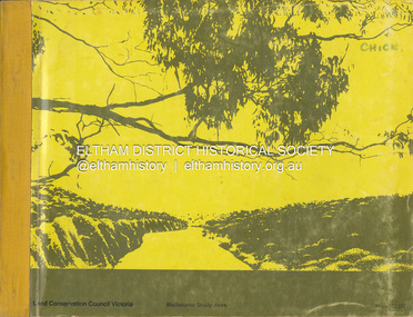
Eltham District Historical Society IncBook - Map, Land Conservation Council, Melbourne Study Area Report, [December 1973]
... Melbourne Study Area Report...A collection of eight large fold out coloured maps published in a bound book form Melbourne Study Area Report Book Map Land Conservation Council ...The Melbourne Study Report is a series of volumes describing the physical nature of the land and its environment, examines the likely forms of land use, and assesses the hazards associated with these uses. This is Volume 2 (coloured maps). The first page featues a black and white map described as "Shire of Diamond Valley" with public land marked in yellow. Followed by eight large fold out maps. Melbourne Study Area Public land and descriptive blocks, Population description, Geology, Physiography, topography and rainfall, vegetation and water supply. The Land Conservation Act 1970 established the Land Conservation Council whose functions is to "carry out investigations and make recommendations to the Minister with respect to the use of public land in order to provide for the balanced use of land in Victoria. This report sets out to describe and assess the natural resources of the public lands in the Melbourne area and provides a factual basis on which members of the community may base submissions to the [Land Conservation] Council of Victoria.A collection of eight large fold out coloured maps published in a bound book formnon-fictionThe Melbourne Study Report is a series of volumes describing the physical nature of the land and its environment, examines the likely forms of land use, and assesses the hazards associated with these uses. This is Volume 2 (coloured maps). The first page featues a black and white map described as "Shire of Diamond Valley" with public land marked in yellow. Followed by eight large fold out maps. Melbourne Study Area Public land and descriptive blocks, Population description, Geology, Physiography, topography and rainfall, vegetation and water supply. The Land Conservation Act 1970 established the Land Conservation Council whose functions is to "carry out investigations and make recommendations to the Minister with respect to the use of public land in order to provide for the balanced use of land in Victoria. This report sets out to describe and assess the natural resources of the public lands in the Melbourne area and provides a factual basis on which members of the community may base submissions to the [Land Conservation] Council of Victoria. maps, shire of diamond valley, population, geology, topography, rainfall, vegetation, water supply, land use, public lands -
Save the Dandenongs League Inc.
Archive (item), Save the Dandenongs League Incorporated, Final Recommendations - Melbourne Study Area - Land Conservation Council, Victoria - Melbourne, January, 1977
... Final Recommendations - Melbourne Study Area - Land Conservation Council, Victoria - Melbourne, January, 1977...Final Recommendations - Melbourne Study Area - Land Conservation Council, Victoria - Melbourne, January, 1977 Archive Save the Dandenongs League Incorporated ... -
Lakes Entrance Historical Society
Book, Land Conservation Council, Victoria, Final Recommendations East Gippsland Study Area 1977, 1977
... Final Recommendations East Gippsland Study Area 1977...Final Recommendations East Gippsland Study Area 1977 Book Land Conservation Council, Victoria. ...A summary of the final recommendation for the adequate management and protection of public land in East Gippsland.natural resources, recreation, agriculture