Showing 69 items matching "trestle construction"
-
 Eltham District Historical Society Inc
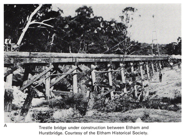
Work on paper (Sub-Item) - Photograph, Trestle bridge under construction between Eltham and Hurstbridge
... Trestle bridge under construction between Eltham and Hurstbridge...construction. The line opened at Hurstbridge in 1912. bridge hurstbridge Image printed on A4 page from 04997 Diamond Creek Basin Study, 1980 Trestle bridge under construction between Eltham and Hurstbridge Work on paper Photograph ...Black and white photograph of the bridge under construction. The line opened at Hurstbridge in 1912.bridge, hurstbridge -
 Orbost & District Historical Society
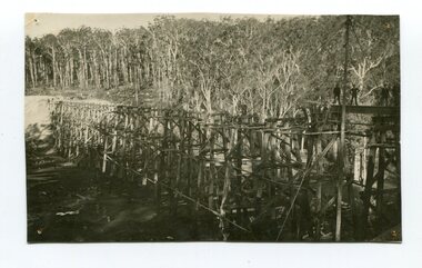
Photograph - Photograph. black + white
... ...trestle construction...This is a rare photograph and of high significance in showing the bridge under construction. construction 1916 railway bridge timber industry trestle construction stony creek bridge east gippsland bairnsdale to orbost line Landscape format black + white photograph (unframed). ...The Stony Creek Trestle Bridge was built in 1916 when the existing rail line from Melbourne to Bairnsdale was extended to Orbost. This 97km Bairnsdale to Orbost extension through rugged terrain was reputed to have been the most difficult rail project undertaken in Victoria. In service for over 60 years the bridge was damaged by bushfire in 1980, with the last train crossing in 1987. At 247m long and 20m high, it is the largest standing bridge of its kind in the State, and is listed on the Register of Historic Sites. Built of red ironbark and grey box timber, it is a fine example of the early engineering skills that utilised the resources and materials found on site. (More information Newsletter July 2013)Built during the period 1914-16, of Gippsland Grey Box and Red Ironbark, the Stoney Creek bridge on the East Gippsland Railway is a fine example of early engineering skilll , being constructed without the aid of any of the modern machinery available today. This is a rare photograph and of high significance in showing the bridge under construction.Landscape format black + white photograph (unframed). Four pin holes in each corner, tear to top left quadrant and fold / crease top to bottom in centre of image.construction, 1916, railway bridge, timber industry, trestle construction, stony creek bridge, east gippsland, bairnsdale to orbost line -
 Stawell Historical Society Inc
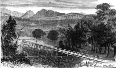
Drawing, Stawell Water Supply Bovine Aqueduct 1881 -- Sketch
... The sketch depicts a trestle bridge construction. ...The sketch depicts a trestle bridge construction. Stawell Water Supply Bovine Aqueduct 1881 -- Sketch Drawing ...Sketches of Stawell Water Supply Bovine Aqueduct October 5th 1881. The Grampian scheme planned by the the Borough Engineer John D'Alton. D'Alton's suggestion was that the water be carried from the source in an open channel two miles, then in a flume of timber. Later surveyed and planned a tunnel on a good line - to reduce the flume 72 miles and the main to Stawell to 15 miles. This sketch (illustrated Australian News October 5, 1881).Black and white photograph of a sketch a bush scene with mountains in background. The sketch depicts a trestle bridge construction. The Bovine Aqueduct stawell water supply -
 Eltham District Historical Society Inc
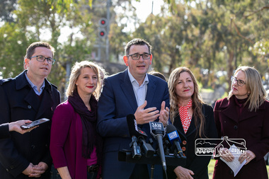
Photograph, Peter Pidgeon, Victorian Labor Government Press Release announcing planned upgrades to Hurstbridge line rail services and protection of historic Railway Trestle Bridge, Panther Place, Eltham, 1 August 2018, 1 Aug 2018
... Jacinta Allan, Minister for Public Transport, Panther Place, Premier Daniel Andrews, Press Announcement, Railway Line Construction, trestle bridge, Vicki Ward MP for Eltham, Victorian Parliament...Trestle Bridge – the last remaining timber bridge on Melbourne’s electric train network – which has local heritage protection and is an important part of the area’s character. The Liberals will leave this bridge to rot and demolish the nearby childcare centre and football club with their under-cooked and under-costed promise to upgrade the Hurstbridge line. Only Labor will protect this important piece of Melbourne’s history with planning work to be carried out for a long-term solution as part of the project. Stage two of the Hurstbridge Line Upgrade will create more than 950 jobs, with construction...Jacinta Allan, Minister for Public Transport, Panther Place, Premier Daniel Andrews, Press Announcement, Railway Line Construction, trestle bridge, Vicki Ward MP for Eltham, Victorian Parliament Born digital image (qty 27) Victorian Labor Government Press Release announcing planned upgrades to Hurstbridge line rail services and protection of historic Railway Trestle Bridge, Panther Place, Eltham, 1 August 2018 Photograph Peter Pidgeon ...Announcement by Premier Daniel Andrews, Minister for Public Transport, Jacinta Allan and Member for Eltham, Vicki Ward mad alongside the Eltham Railway Trestle Bridge. MEDIA RELEASE "More Trains And Fewer Delays On The Hurstbridge Line" https://www.premier.vic.gov.au/wp-content/uploads/2018/08/180801-More-Trains-And-Fewer-Delays-On-The-Hurstbridge-Line-1.pdf Commuters on the Hurstbridge line will have more trains, more seats and fewer delays with a re-elected Andrews Labor Government to continue its massive upgrade of the Hurstbridge line. The Andrews Labor Government said it would deliver locals in Melbourne’s north-east more peak hour train services and less time stuck at boom gates, and we have. The first stage of the Hurstbridge Line Upgrade has been delivered – six months early and on budget. This includes the new Rosanna Station, duplicated track between Heidelberg and Rosanna and the removal of the dangerous level crossings at Alphington and Rosanna. There’s more to do and only Labor will deliver the next stage of the Hurstbridge Line Upgrade to give local commuters more train services and a more comfortable commute. The $530 million project will include a brand new train station at Greensborough and the duplication of three kilometres of track between Greensborough and Montmorency, and 1.5 kilometres of track between Diamond Creek and Wattle Glen to allow more train services during the morning peak. This will allow trains to run every six and a half minutes at Greensborough, every 10 minutes at Eltham and Montmorency, and every 20 minutes at Hurstbridge, Diamond Creek and Wattle Glen – as well as two extra Hurstbridge express services. Locals on the Labor Government’s new Mernda line will also get five extra train services during the morning peak, with a major upgrade of the Clifton Hill junction where the Mernda and Hurstbridge lines connect. Labor will also protect the Eltham Trestle Bridge – the last remaining timber bridge on Melbourne’s electric train network – which has local heritage protection and is an important part of the area’s character. The Liberals will leave this bridge to rot and demolish the nearby childcare centre and football club with their under-cooked and under-costed promise to upgrade the Hurstbridge line. Only Labor will protect this important piece of Melbourne’s history with planning work to be carried out for a long-term solution as part of the project. Stage two of the Hurstbridge Line Upgrade will create more than 950 jobs, with construction to start in 2020 and finish by 2022. Quotes attributable to Premier Daniel Andrews “We said we’d upgrade the Hurstbridge line and remove dangerous and congested level crossings at Rosanna and Alphington and we did – but there’s more to do.” “Only Labor will deliver the next stage of the Hurstbridge Line Upgrade with a new Greensborough Station and more trains, more often.” Quote attributable to Minister for Public Transport Jacinta Allan “The former Liberal Government promised new train lines but didn’t deliver a single kilometre of track – now they’re promising a half-baked upgrade of the Hurstbridge line with rubbery figures that don’t add up.” Quote attributable to Member for Eltham Vicki Ward “As a fifteen year old hopping on Red Rattlers at Eltham I wanted to do something to make the Hurstbridge line better. It’s taken me a few decades but finally our line will offer the frequency of services that are expected and needed in a 21st century city.”Born digital image (qty 27)jacinta allan, minister for public transport, panther place, premier daniel andrews, press announcement, railway line construction, trestle bridge, vicki ward mp for eltham, victorian parliament -
 Eltham District Historical Society Inc
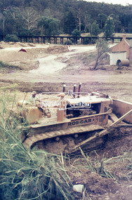
Photograph, Roadworks for Main Road widening, c.March 1968, 1968
... Bulldozer, duplication, Eltham, Main Road, Road construction, trestle bridge...Eltham District Historical Society Inc 728 Main Rd Eltham melbourne Shillinglaw Cottage and Railway Trestle bridge in background Bulldozer, duplication, Eltham, Main Road, Road construction, trestle bridge 35mm Colour positive transparency Mount - Agfacolor Service (Blue stepped) Roadworks for Main Road widening, c.March 1968 Photograph ...Shillinglaw Cottage and Railway Trestle bridge in background35mm Colour positive transparency Mount - Agfacolor Service (Blue stepped)bulldozer, duplication, eltham, main road, road construction, trestle bridge -
 Eltham District Historical Society Inc
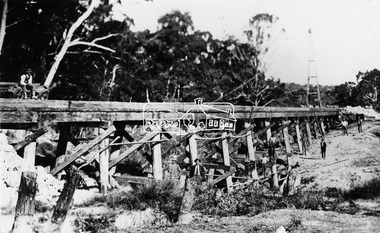
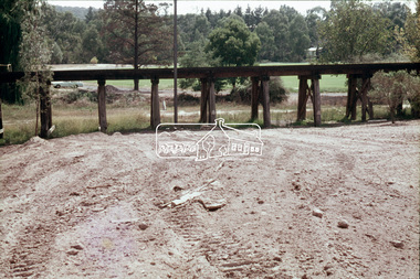
Photograph, Railway Bridge construction between Eltham and Hurstbridge, c.1912
... railway line construction...trestle...It is significant in being the first community sourced collection representing the places and people of the Shire's first one hundred years. shire of eltham pioneers photograph collection hurstbridge allendale road hurstbridge railway extension railway bridge railway line construction trestle bridge Diamond Creek (Creek) Digital image One 4 x 5 inch B&W negative One 9 x 12.5 cm print Railway Bridge construction between Eltham and Hurstbridge Photograph Photograph ...The railway was extended from Eltham to Hurstbridge in 1912. This bridge is most likely near Allendale Road, Diamond Creek. It was one of four original trestle bridges in the stretch north of Allendale Road, which were all burnt out in January 1969 (replaced by two steel bridges and two corrugated iron culverts).This photo forms part of a collection of photographs gathered by the Shire of Eltham for their centenary project book,"Pioneers and Painters: 100 years of the Shire of Eltham" by Alan Marshall (1971). The collection of over 500 images is held in partnership between Eltham District Historical Society and Yarra Plenty Regional Library (Eltham Library) and is now formally known as the 'The Shire of Eltham Pioneers Photograph Collection.' It is significant in being the first community sourced collection representing the places and people of the Shire's first one hundred years.Digital image One 4 x 5 inch B&W negative One 9 x 12.5 cm printshire of eltham pioneers photograph collection, hurstbridge, allendale road, hurstbridge railway extension, railway bridge, railway line construction, trestle bridge, diamond creek (creek) -
 Tatura Irrigation & Wartime Camps Museum
Photograph, 31/3/1916
... Descrimes, G Robinson and other men grouped around the short-sleeved paymaster / Pay books on trestle table on construction site / Timber chute running down hill beyond men / All men wearing hats....Descrimes, G Robinson and other men grouped around the short-sleeved paymaster / Pay books on trestle table on construction site / Timber chute running down hill beyond men / All men wearing hats. ...Taken by photographer for State Rivers and Water Supply Commission.Medium sized black and white photograph. Sugarloaf Reservoir pay day / R. Burns, Senior Constable Waters, P. Descrimes, G Robinson and other men grouped around the short-sleeved paymaster / Pay books on trestle table on construction site / Timber chute running down hill beyond men / All men wearing hats.victorian state rivers and supply commission, sugarloaf reservoir -
 Emerald Museum & Nobelius Heritage Park
Photograph - Photographs of rebuilding the Wright Trestle Bridge, 1990s
... The building of the original Wright Trestle Bridge in the late 1890s as part of the construction of the narrow-gauge railway from Ferntree Gully to Gembrook, was a significant engineering achievement for its time. ...Emerald Museum & Nobelius Heritage Park 5 Crichton Rd Emerald yarra-valley-and-the-dandenong-ranges The building of the original Wright Trestle Bridge in the late 1890s as part of the construction of the narrow-gauge railway from Ferntree Gully to Gembrook, was a significant engineering achievement for its time. ...The building of the original Wright Trestle Bridge in the late 1890s as part of the construction of the narrow-gauge railway from Ferntree Gully to Gembrook, was a significant engineering achievement for its time. The railway (now known as Puffing Billy) was closed in the 1950s. When it re-opened in the 1960s it terminated at Emerald Lake. In the 1990s, it was decided to rebuild the section of the line from Emerald Lake to Gembrook - this was completed in 1998. The major project challenge was to rebuild the historic Wright Trestle Bridge which traversed a very steep gully in Wrights Forest, Avonsleigh. These photographs have been provided by Graeme Smith who supplied the concrete to build the foundations of the bridgeThese photos show the foundation stage of the rebuilding of the historic Wright Trestle Bridge as part of the larger reconstruction of the Puffing Billy line from Emerald Lake to Gembrook.Five color photographs all depicting concrete foundations laid up and down a steep gully as part of the rebuilding of the Wright Trestle Bridge.On back of VEMUP1091 3/5, hand-written: 'Graeme Smith / Unloading on / Puffing Billy line / in Wright Forest / Concrete supplied / from P B M Packham'wright trestle bridge, 1998, puffing billy -
 Eltham District Historical Society Inc
Photograph - Digital Photograph, Alan King, Alistair Knox Park, Eltham, 2008
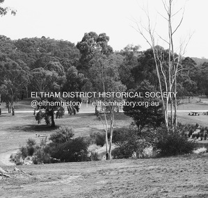
... trestle bridge and the Shillinglaw Cottage. The citation states ‘the semi-natural setting of the parkland provides a landscape which is evocative of the history of the area’. Manna Gums (Eucalyptus viminalis) and Candlebarks (Eucalyptus rubida) are significant features. Most of the park’s construction...trestle bridge and the Shillinglaw Cottage. The citation states ‘the semi-natural setting of the parkland provides a landscape which is evocative of the history of the area’. Manna Gums (Eucalyptus viminalis) and Candlebarks (Eucalyptus rubida) are significant features. Most of the park’s construction ...Alistair Knox Park, an oasis of peace and beauty. Covered under National Trust of Australia (Victoria) Landscape Significance and Heritage Overlay, Nillumbik Planning Scheme. Published: Nillumbik Now and Then / Marguerite Marshall 2008; photographs Alan King with Marguerite Marshall.; p173 It is hard to imagine that the Alistair Knox Park, an oasis of peace and beauty beside busy Main Road, Eltham, was once the township’s rubbish dump. It was only in the 1970s that the tip was transformed into this beautiful six hectare space, which later earned it a National Trust Landscape classification. Before its life as a dump, the area was used for small farms. Thanks largely to the foresight and efforts of local environmental builder Alistair Knox, the park was designed sympathetically with the character of the wider Eltham landscape. Then, appropriately, the park was named after Knox, who was an Eltham Shire Councillor from 1971 to 1975 and Shire President in 1975. The park designers were four major forces in the urban bush landscape garden –Knox, landscape designer Gordon Ford, artist Peter Glass and landscaper Ivan Stranger. The National Trust citation for the park, originally called Eltham Town Park, includes the Eltham railway trestle bridge and the Shillinglaw Cottage. The citation states ‘the semi-natural setting of the parkland provides a landscape which is evocative of the history of the area’. Manna Gums (Eucalyptus viminalis) and Candlebarks (Eucalyptus rubida) are significant features. Most of the park’s construction was directed by Bob Grant, Superintendent of the Parks and Gardens Department for the Eltham Shire Council. First plantings occurred in Arbour Week in 1973, then the lake and botanic area were completed in 1975, with Federal Government funding, and the toilet block in 1978. Bounded by the Eltham railway line, Panther Place, Main Road, Bridge and Susan Streets, the park is in a valley about a kilometre wide overlooked by steep hills at the east and west. The Diamond Creek flows through it and the picturesque historic timber trestle railway bridge edges the north. Informal plantings of Australian indigenous and native species in open and undulating grassed settings blend with the natural landscape of the Diamond Creek to the west. The bush-style plants, particularly around the creek, balance with open lawns, paths and a cascade flowing from a small lake to another below. A footbridge over the creek leads to the park’s west. The park includes an adventure playground and barbecue areas. The park stands on part of the land bought from the Crown in 1851 by Josiah Holloway, who subdivided it into allotments and which he called Little Eltham. Most of the land was subdivided into residential lots, but the creek valley, on which the park stands, was subdivided into farm-size lots, used mainly for orchards and grazing. One of the earliest owners was John Hicks Petty, who in 1874 bought a plot from Holloway. Other families who owned properties in that area, included Rees, Clark, Waterfall, Graham, Hill and Morant. In 1901 the railway was built through the area. Jock Read, an Eltham resident since around 1920, remembers several farms in the 1920s and ’30s that occupied the site of today’s park. A poultry farm, which extended from present day Panther Place, was owned by the Gahan family. Next to that farm was another for grazing cattle owned by Jack Carrucan. Beside this was land owned by John Lyon. A doctor lived beside this, and at the north-west corner of Bridge Street and Main Road stood a memorial to the soldiers who died in World War One, which was later moved to the RSL site. Mr Read also remembers other farms and orchards west of the creek In the early 1960s the Eltham Council began buying these farms and in the late 1960s turned the areas east of the Diamond Creek into a garbage tip. When this was filled above the creek’s flood plain, the tip was moved to the west of the creek.This collection of almost 130 photos about places and people within the Shire of Nillumbik, an urban and rural municipality in Melbourne's north, contributes to an understanding of the history of the Shire. Published in 2008 immediately prior to the Black Saturday bushfires of February 7, 2009, it documents sites that were impacted, and in some cases destroyed by the fires. It includes photographs taken especially for the publication, creating a unique time capsule representing the Shire in the early 21st century. It remains the most recent comprehenesive publication devoted to the Shire's history connecting local residents to the past. nillumbik now and then (marshall-king) collection, alistair knox park, eltham -
 Eltham District Historical Society Inc
Photograph, Tess Justine (Nillumbik Shire Council), Murray's Bridge over the Diamond Creek, Eltham North, 19 Feb 2022
... construction, and age. Given that the bridge was not worthy of saving, the Eltham District Historical Society with Council’s support, and the Eltham Woodworkers group endeavoured to see what suitable sized timbers were salvageable to fabricate a commemorative seat. Unfortunately, the experts at the Woodworkers group were unable to salvage any suitable length/width timbers to fabricate the seat due to the presence of rot. Last remaining wooden trestle ...Murray's Bridge over the Diamond Creek on the Diamond Creek Trail just prior to demolition and replacement with a new steel bridge. Heritage advice obtained by Nillumbik Shire Council, following a suggestion by the Eltham District Historical Society (EDHS), is that the original bridge appears to have been a simplified version of the Country Roads Board’s (CRB) standard timber bridge design of the early-to-mid 1920s. In c1990 Murray’s bridge was renovated with three recycled steel girders as part of a bike/pedestrian path in the reserve. During these alterations many parts of the bridge were removed, and some were replaced. Heritage advice indicates the condition of Murray’s bridge is poor. The remaining original parts are all in poor condition, with severe weathering, splitting and rot, especially to the stringers retained on the bridge. Heritage advice is that Murray’s Bridge does not have sufficient significance in the cultural history of the Nillumbik area to warrant inclusion in the Nillumbik Shire Heritage Overlay and also does not have sufficient significance as a rare survivor to warrant inclusion in the Nillumbik Shire Heritage Overlay. There are no indications in the historical record that this site was individually important to the cultural history of this area. EDHS is comfortable with the heritage advice provided to Council and has worked closely on this project with Council. EDHS has suggested some of the removed timbers be used in the vicinity of the bridge for landscaping and possibly seating, so as to retain these remnants close to the site of the original bridge, which is the last old timber bridge along the lower reaches of the Diamond Creek. Mary (Sweeney) Murray and John Wright Murray selected 80 acres, Lot C Section 16 and Lot 5 Section 17 Parish of Nillumbik, under an occupation license in 1866. John died in 1867 and freehold was granted to his son John in 1873. The farm was known as ‘Laurel Hill’. John Junior was an Eltham Shire councillor and sometime president from 1887 up until 1897. He added Lot A Section 16 to the farm in ca1888. John and his younger brother James arranged to rent/purchase Lot B Section 17, across Diamond Creek to the west, in ca1900. It appears that John and James farmed separately for a few years, with a new homestead built for James ad family on the high point of Lot B Section 17 in ca1910. John sold off Lot 5 Section 17 in 1912. When John died in 1912 James took over the land on both sides of the Diamond Creek. The old homestead on the west side of the Creek disappeared. A farm bridge over Diamond Creek from this period may have been located close to the northern boundary of the farm. John Langlands, owner of the farm known as ‘Ihurst’ on the west side of Diamond Creek to the south of the Murray’s land, died in 1907. In 1909 his land was then subdivided into 100 lots to become the ‘Glen Park Estate’. Other similar subdivisions of nineteenth century farms around Eltham in this period included the ‘Franktonia (or Beard’s) Estate’ to the northeast and ‘Bonsack’s Estate’ between Eltham and Greensborough. Soon after the opening of the railway extension line from Eltham to Hurstbridge in 1912, Glen Park and nearby residents including James Murray agitated for a railway station or siding to be located half-way between Eltham and Hurstbridge, so that the Glen Park residents who used the railway daily did not have to walk into the Eltham or Hurstbridge stations. Some believed Coleman’s Corner (opposite Edendale Farm) was an appropriate spot for the platform. James Murray was among those who thought the railway should be located on his land, closer to half-way between Eltham and Hurstbridge stations. The Railways Commissioners warned that the locals would have to fund these works themselves. The Glen Park Estate residents initially had difficulty accessing Eltham by road, with only an old low-level bridge over Diamond Creek at the south end of their estate. A new timber trestle bridge across the creek, now on Wattletree Road, was opened in 1915. Road access to the north was gained in 1927 when the new Murray’s Road, which crossed the Murray’s land, was built. Residents continued to agitate for a Glen Park station. By 1926 the Railways Commissioners’ preferred site was on the Murray’s land. They arranged an estimate of cost of a full-length platform. The estimate was too much for the locals, who in 1928 argued unsuccessfully for a shorter and hence cheaper platform. By 1929 Murray had agreed to donate the land, but the locals would still have to fund the works. Murray decided, unilaterally it would appear, to commence work on a timber trestle road bridge over Diamond Creek to link the new Murray Road to the proposed station. Late in 1929 he stopped work on the bridge, for reasons unknown, but started work again and completed the bridge in 1931. There is no further newspaper evidence of the campaign for the Glen Park station until 1939, when Murray and another local, Mr Maxwell, met the Railways Commissioner. The Glen Park locale now included 45 homes on the west side of the creek and 20 on the Eltham side. Most of the residents used the train every day. The Commissioner remained adamant that only a full-length platform could be built for safety reasons. It appears the campaign dissolved at this point. The increasing move to cars may have had an impact. There is no evidence of Murray’s bridge ever being connected to Murray’s Road, or of it having wide use for any purpose by locals. James Murray died in 1947 and the farm was taken over by his son James (Jim). Jim started to sell off parts of the farm in the 1980s, retaining a few acres around the ca1910 homestead and building a new house there. Recreation reserves were established along the creek. In ca1990 Murray’s bridge was renovated with steel girders as part of a bike/pedestrian path in the reserve. The old farmhouse was demolished in ca2014. * * * A theory posted on local community Facebook groups was that the bridge was built in the 1860s and was built to be more robust than was necessary for the movement of cows from one side of the creek to the other. It was suggested the robustness was necessary to support the weight of gold ore being transferred from a mine on Murray’s land to a railway siding near Murrays Bridge (presumably for transfer and processing at Diamond Creek). Perhaps this may have been one of the motivators for Murray, who really knows? Knowing when mining operations ceased on his land and how that fits the overall timeline would be useful but at the time the bridge was built, local gold production was minimal at best. The known facts are: • The railway line came to Eltham in 1902. • The extension of the railway from Eltham to Hurstbridge was constructed in 1912 so no railway line even existed through Murray's property until 1912 and the Victorian Railways maps at the time show no such siding on Murray’s property. • In 1923 a new company was formed in anticipation of the old Diamond Creek Gold Mine being re-opened. The mine had been previously closed and flooded. It was noted in the press at the time that the mine was within a mile of the railway. Nothing really came of this. • Construction of Murrays Bridge was commenced by James Murray in early 1929 in anticipation of a proposed flag station being nominated on his land, but work ceased shortly afterwards. The proposed flag station was commonly referred to as Glen Park as the residents of the Glen Park Estate wanted Option 1, located near them with the platform adjacent to Colemans corner. This was probably never going to fly as it was virtually in eyesight of Eltham station. Allandale Road was the third option, but the Commissioners' preferred option was No. 2 - on Murray's property. • The Railway Commissioners were not going to finance any such station and the works had to be funded by private landowners and residents, hence Murray investing in this himself. • Murray recommenced work two years later and finished his bridge in 1931 but unfortunately for him, the proposed flag station never eventuated. The bluestone siding you reference may well have been built by Murray as part of the proposed station platform. • Up until then, apart from the Main Road bridge, which was washed away in 1924, virtually all local crossings over the Diamond Creek were low lying bridges – Kaylocks Bridge at Brougham Street, Diamond Street bridge, Glen Park Road bridge. It is expected that Murray also had a low-lying bridge to connect his land either side of the creek. These were all washed away or severely damaged multiple times in the 1920s. Lessons were learnt, and Murrays Bridge appears to have been built in accordance with Country Road Board standards of the time. Flood damage was ongoing, and even more recently constructed raised bridges kept getting washed away, e.g., the new Wattle Tree Road bridge in 1958 just months after completion. Murray’s bridge was reinforced with steel some 30 years ago presumably to provide additional floodwater resistance, given the history of bridges disappearing in floodwaters. • In March 1932 it was reported in the Advertiser that there were still some prospectors operating around Eltham North who apart from further scarring the face of the earth over the previous two years had gained significant experience but little gold - hardly a driving factor for constructing a dedicated railway siding and bridge to transfer gold ore. It is far more probable that James Murray was hoping to have the railway station located on his property and invested his money by building the bridge to lead to it as well as a station platform. Had the station eventuated, it may well have driven up the value of his land for subdivision and new housing estates like the Glen Park Estate. That did not eventuate. Whilst the bridge was indeed old (90 years), the core structure being completed in 1931, it had been modified substantially from original and hence had no significant historic value – i.e., it was not a representative example of its type, construction, and age. Given that the bridge was not worthy of saving, the Eltham District Historical Society with Council’s support, and the Eltham Woodworkers group endeavoured to see what suitable sized timbers were salvageable to fabricate a commemorative seat. Unfortunately, the experts at the Woodworkers group were unable to salvage any suitable length/width timbers to fabricate the seat due to the presence of rot. Last remaining wooden trestle bridge on the Diamond Creek Trail just prior to demolition and replacementBorn digital image (27)diamond creek (creek), diamond creek trail, murrays bridge, ‘laurel hill’, john wright murray, mary (sweeney) murra, john murray jnr, james murray, john langlands, ‘ihurst’, ‘glen park estate’, beard's estate, franktonia, bonsack's estate, glen park estate, glen park railway station -
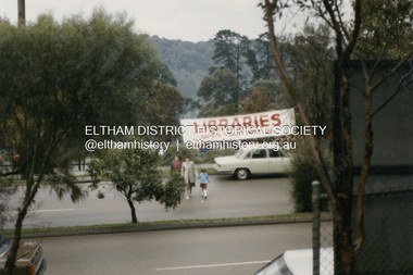 Eltham District Historical Society Inc
Photograph - Colour Print, Proposed site of the new Eltham Library, c.1992
... trestle bridge across the Eltham Common. The large Libraries banner suggests that they may being informed about the future site of the proposed new Eltham library which commenced construction in 1993 and was opened May 1994...trestle bridge across the Eltham Common. The large Libraries banner suggests that they may being informed about the future site of the proposed new Eltham library which commenced construction in 1993 and was opened May 1994 Eltham Eltham Library Main Road Eltham 895 Main Road Colour print 10 x 15 cm Originally housed in a 34.5 x 36 x 2.5 cm expandable album with padded cream covers and gold accents; 18 page inserts with clear pocket inserts holding 6 photos per side, total capacity 216 10 x 15 cm photo prints; showing yellowing with age Proposed site of the new Eltham Library Photograph Colour Print ...Viewed from the eastern side of Main Road. There is a large gathering of people at the southern end of the Shire of Eltham office driveway. The people appear to be looking towards the southwest towards the trestle bridge across the Eltham Common. The large Libraries banner suggests that they may being informed about the future site of the proposed new Eltham library which commenced construction in 1993 and was opened May 1994eltham, eltham library, main road eltham, 895 main road -
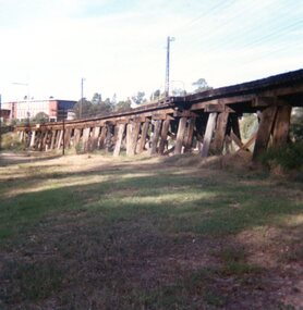 Greensborough Historical Society
Photograph, Trestle Bridge Eltham April 1979, 17/04/1979
... trestle bridge at Eltham. Built in 1902, it is the only railway bridge of predominantly timber construction that is still in regular use. ...trestle bridge at Eltham. Built in 1902, it is the only railway bridge of predominantly timber construction that is still in regular use. ...A photograph of the railway trestle bridge at Eltham. Built in 1902, it is the only railway bridge of predominantly timber construction that is still in regular use. The bridge is listed on the Victorian Heritage Database.1 colour photograph.peter graham, eltham, trestle bridge eltham -
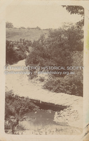 Eltham District Historical Society Inc
Postcard - Photograph postcard, Old Bridge, Kaylock's Crossing, Brougham Street, Eltham, c.1912
... An engineering assessment carried out for the Council by Macleod Consulting at the time of the replacement suggested that the construction details indicate that it was in the 1900s, however this dating could possibly have been the result of numerous repairs undertaken over the years to flood damage. The tender was awarded to Mr Weller of Kangaroo Ground who commenced work in February 1923 on a higher-level timber trestle bridge. ...An engineering assessment carried out for the Council by Macleod Consulting at the time of the replacement suggested that the construction details indicate that it was in the 1900s, however this dating could possibly have been the result of numerous repairs undertaken over the years to flood damage. The tender was awarded to Mr Weller of Kangaroo Ground who commenced work in February 1923 on a higher-level timber trestle bridge. ...Date estimated to be circa 1912 based on the style of printing on the reverse of the card - Kodak Austral paper for real photo postcards, the paper was manufactured c.1908-1914 (See also POSTCARDS ON KODAK PAPER - IS IT POSSIBLE TO "DATE" THEM? http://tps.org.au/bb/viewtopic.php?t=115) Brougham Street was created in Josiah Holloway's 1851 subdivision of Little Eltham. It was one of several east-west streets shown on the subdivision plan as crossing the Diamond Creek. The western part was named Wellington Street on the subdivision plan but was later changed to conform with the name of the eastern part as acknowledgement of the continuity of the street. It is not known when the first bridge was constructed in Brougham Street however it was certainly mentioned at Council’s meeting of 2 June 1884 as being in a dangerous state of repair. This photo (c.1895) of an old bridge shows a very low-level simple log girder bridge crossing the creek at a right angle and so the approaches involved bends in the road alignment. This bridge was generally known as Kaylocks Bridge or Kaylock’s Crossing after the owner of the adjoining land. It was most likely built from around the mid-1850s, or a crossing of some fashion established as Richard George Kaylock, butcher of Little Eltham and his wife Emily Ann settled there in 1854. His property was in Wellington Street (now Brougham Street) and apparently extended across the Diamond Creek. The land on the western side of the creek was farmed, the house being on the eastern side. Kaylock's Bridge formed part of the original coach road to Eltham and in 1922 was described as an "old rustic bridge". Its low level and insubstantial construction made it susceptible to flood damage, necessitating frequent closures until repairs could be carried out. In September 1922, Council called for tenders for a new timber bridge to be constructed at Kaylock’s crossing. An engineering assessment carried out for the Council by Macleod Consulting at the time of the replacement suggested that the construction details indicate that it was in the 1900s, however this dating could possibly have been the result of numerous repairs undertaken over the years to flood damage. The tender was awarded to Mr Weller of Kangaroo Ground who commenced work in February 1923 on a higher-level timber trestle bridge. Work was slowed due to illness of the contractor and the accidental death of a man in March 1923 following the collapse of the bank after he had jumped into a hole that had just been blasted. The bridge was completed around July 1923 at which point the old structure was pulled up, marking what was described in the ‘Advertiser’ newspaper as the passing of an old and well-loved landmark in the district. In April 1924 the approach to Kaylocks bridge was washed away during the heavy flooding that destroyed the Main Road bridge. The western side was repaired, and an extra span was added to the eastern side using timber from the destroyed Main Road bridge. The bridge was again severely damaged four months later in August 1924 When a lack of finances delayed repairs to the Bridge Street bridge in 1931 (also referred to as Obelisk Bridge at the time), traffic had to detour via Brougham Street for some time. Local residents feared that the Bridge Street bridge might never reopen. Kaylocks Bridge was constantly subject to damage by floods. In the 1934 flood it was submerged by two feet of water. In more recent times the bridge was again severely damaged by flooding and repairs made. A new bridge and adjoining footbridge were constructed in 2009.Digital file only Postcards scanned from the collection of Michael Aitken on loan to EDHS, 2 Sep. 2022michael aitken collection, eltham, postcards, bridge, brougham street, diamond creek (creek), kaylocks bridge, wellington street -
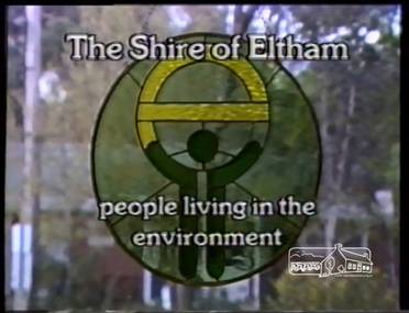 Eltham District Historical Society Inc
Film - Video (VHS), IMP Productions, Eltham Shire Council - People Living in the Environment (Series 69, Item 2), 7 Oct 1985
... trestle bridge...eltham shire council...green wedge...judy wadham...lester eaton...matcham skipper...max mcdonald...montsalvat...morris review...mudbrick construction...Other commentary is provided by locals Judy Wadham and Lester Eaton. council amalgamation cr. mary grant eltham community centre eltham railway trestle bridge eltham shire council green wedge judy wadham lester eaton matcham skipper max mcdonald montsalvat morris review mudbrick construction pauline toner rodney roscholler shire of diamond valley shire of eltham spirit of eltham st andrews market video recording shire of eltham archives VHS Video cassette Converted to MP4 file format 00:10:56; 73MB Eltham Shire Council - People Living in the Environment (Series 69, Item 2) Film Video (VHS) IMP Productions ...Shire of Eltham Archives: Series 69, Item 2 This video was produced for the Shire of Eltham in response to the 1985 Victorian Local Government Commission Report titled ‘The Restructure of Local Government in Victoria – Principles and Program’ (the Morris review). The recommendation was to amalgamate the Shires of Eltham and Diamond Valley, something that Eltham Council did not support as being appropriate for the shire or compatible with the 'Spirit of Eltham'. The video features Shire President, Cr. Mary Grant talking with the Hon. Pauline Toner MP and Max McDonald MP. Eltham Shire CEO Rodney Roschellor presents an alternate proposal for a shire merging more aligned to the 'Spirit of Eltham'.Also featured are Eltham icons such as the Eltham Railway Trestle Bridge, Montsalvat, Eltham Community Centre along with mudbrick making, artist Matcham Skipper, the Green Wedge and St Andrews Market. Other commentary is provided by locals Judy Wadham and Lester Eaton.VHS Video cassette Converted to MP4 file format 00:10:56; 73MBcouncil amalgamation, cr. mary grant, eltham community centre, eltham railway trestle bridge, eltham shire council, green wedge, judy wadham, lester eaton, matcham skipper, max mcdonald, montsalvat, morris review, mudbrick construction, pauline toner, rodney roscholler, shire of diamond valley, shire of eltham, spirit of eltham, st andrews market, video recording, shire of eltham archives -
 Eltham District Historical Society Inc
Book, Diamond Creek Basin Study. Part 1, A Compendium of Factors Relevant to Stormwater Flows, 1980
... construction...coolaroo drive...culvert...deep creek...diamond creek basin...diamond creek region...diamond creek...diamond street bridge...drainage works...eltham lower park...eltham town park...eltham trestle...Eltham District Historical Society Inc 728 Main Rd Eltham melbourne Basin Studies are studies to evaluate water supply and demand and help ensure reliable water supplies by identifying strategies to address imbalances in water supply and demand. aerial photographs allendale road arthurs creek mine arthurs creek road bridge arthurs creek bald spur look-out bank protection bolton steet bridge street bridge bridge street bridges challenger street chute street construction coolaroo drive culvert deep creek diamond creek basin diamond creek region diamond creek diamond street bridge drainage works eltham lower park eltham town park eltham trestle bridge eltham west drains eltham erosion flood management floods footbridge glen katherine estate gold mining gum glade hurstbridge kangaroo ground kinglake escarpment kinglake national park latiners hat factory main road bridge main road masons falls melbourne metropolitan board of works, monash bridge mount sugarloaf nillumbik park orchards railway culvert railway line ramptons road real estate advertisement research creek st helena east drain st helena road st helena storm sewers stormwater sugarloaf-preston transfer main crossing susan street union mine village pond water flow watkins street wattletree road weidlich road wingrove park yarra river zig zag road water supply basin study Spiral Bound. 157 leaves in various foliations (some folded) : illustrated. ...Basin Studies are studies to evaluate water supply and demand and help ensure reliable water supplies by identifying strategies to address imbalances in water supply and demand.Spiral Bound. 157 leaves in various foliations (some folded) : illustrated. (some colour.), maps (some colour.)aerial photographs, allendale road, arthurs creek mine, arthurs creek road bridge, arthurs creek, bald spur look-out, bank protection, bolton steet, bridge street bridge, bridge street, bridges, challenger street, chute street, construction, coolaroo drive, culvert, deep creek, diamond creek basin, diamond creek region, diamond creek, diamond street bridge, drainage works, eltham lower park, eltham town park, eltham trestle bridge, eltham west drains, eltham, erosion, flood management, floods, footbridge, glen katherine estate, gold mining, gum glade, hurstbridge, kangaroo ground, kinglake escarpment, kinglake national park, latiners hat factory, main road bridge, main road, masons falls, melbourne metropolitan board of works, monash bridge, mount sugarloaf, nillumbik park, orchards, railway culvert, railway line, ramptons road, real estate advertisement, research creek, st helena east drain, st helena road, st helena, storm sewers, stormwater, sugarloaf-preston transfer main crossing, susan street, union mine, village pond, water flow, watkins street, wattletree road, weidlich road, wingrove park, yarra river, zig zag road, water supply, basin study -
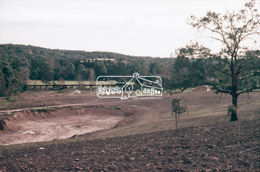 Eltham District Historical Society Inc
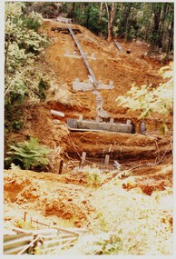
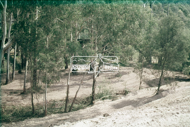
Slide, Construction of Eltham Town Park, 25 Jul 1973
... Construction of Eltham Town Park; landscape has been scupltured and lakes formed. Shillinglaw Cottage and the Eltham Trestle Bridge visible. ...Eltham District Historical Society Inc 728 Main Rd Eltham melbourne Construction of Eltham Town Park; landscape has been scupltured and lakes formed. Shillinglaw Cottage and the Eltham Trestle Bridge visible. ...Construction of Eltham Town Park; landscape has been scupltured and lakes formed. Shillinglaw Cottage and the Eltham Trestle Bridge visible. The park was later renamed Alistair Knox Park.35 mm colour positive transparency Mount - Agfacolor Service (Blue)Memorial Park 25 July 1973eltham, alistair knox park, eltham town park, shillinglaw cottage, 1973-07-25, eltham trestle bridge -
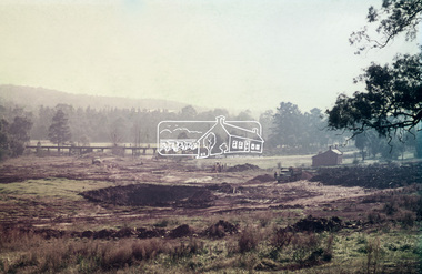 Eltham District Historical Society Inc
Slide, Construction of Eltham Town Park, 25 Jul 1973
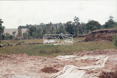
... Construction of Eltham Town Park; reclamation of the eastern end of the tip overflow and landscape in progress of being sculptured and lakes formed. Shillinglaw Cottage and the Eltham Trestle...Eltham District Historical Society Inc 728 Main Rd Eltham melbourne Construction of Eltham Town Park; reclamation of the eastern end of the tip overflow and landscape in progress of being sculptured and lakes formed. Shillinglaw Cottage and the Eltham Trestle ...Construction of Eltham Town Park; reclamation of the eastern end of the tip overflow and landscape in progress of being sculptured and lakes formed. Shillinglaw Cottage and the Eltham Trestle Bridge visible. The park was later renamed Alistair Knox Park.35 mm colour positive transparency Mount - Agfacolor Service (Blue)Memorial Park 25 July 1973eltham, alistair knox park, eltham town park, shillinglaw cottage, eltham trestle bridge, eltham tip, trestle bridge -
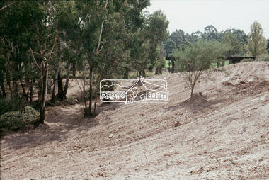 Eltham District Historical Society Inc
Slide, Construction of Eltham Town Park, 22 Feb 1974
... Construction of Eltham Town Park, later renamed Alistair Knox Park. View looking towards the Eltham Trestle Bridge....Eltham District Historical Society Inc 728 Main Rd Eltham melbourne Construction of Eltham Town Park, later renamed Alistair Knox Park. View looking towards the Eltham Trestle Bridge. alistair knox park eltham town park Eltham Trestle Bridge 35 mm colour positive transparency Mount - Agfacolor Service (Blue) Construction of Eltham Town Park Slide Slide ...Construction of Eltham Town Park, later renamed Alistair Knox Park. View looking towards the Eltham Trestle Bridge.35 mm colour positive transparency Mount - Agfacolor Service (Blue)alistair knox park, eltham town park, eltham trestle bridge -
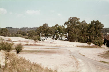 Eltham District Historical Society Inc
Slide, Construction of Eltham Town Park, 22 Feb 1974
... Construction of Eltham Town Park, later renamed Alistair Knox Park. View looking across the front of Shillinglaw Cottage and what was to be developed as the Eltham Town Common (now the site of the Eltham Library) across to the Eltham Town Park development. To the right is the Eltham Trestle...Construction of Eltham Town Park, later renamed Alistair Knox Park. View looking across the front of Shillinglaw Cottage and what was to be developed as the Eltham Town Common (now the site of the Eltham Library) across to the Eltham Town Park development. To the right is the Eltham Trestle ...Construction of Eltham Town Park, later renamed Alistair Knox Park. View looking across the front of Shillinglaw Cottage and what was to be developed as the Eltham Town Common (now the site of the Eltham Library) across to the Eltham Town Park development. To the right is the Eltham Trestle Bridge and to the left what was once the overflow site for the Susan Street Tip.35 mm colour positive transparency Mount - Agfacolor Service (Blue)alistair knox park, eltham town park, eltham tip, eltham town common, eltham trestle bridge -
 Eltham District Historical Society Inc
Slide, Construction of Eltham Town Park, 22 Feb 1974
... Construction of Eltham Town Park, later renamed Alistair Knox Park. View looking towards the Eltham Trestle Bridge through to Central Park....Eltham District Historical Society Inc 728 Main Rd Eltham melbourne Construction of Eltham Town Park, later renamed Alistair Knox Park. View looking towards the Eltham Trestle Bridge through to Central Park. alistair knox park eltham town park Eltham Trestle Bridge Central Park 35 mm colour positive transparency Mount - Agfacolor Service (Blue) Construction of Eltham Town Park Slide Slide ...Construction of Eltham Town Park, later renamed Alistair Knox Park. View looking towards the Eltham Trestle Bridge through to Central Park.35 mm colour positive transparency Mount - Agfacolor Service (Blue)alistair knox park, eltham town park, eltham trestle bridge, central park -
 Eltham District Historical Society Inc
Slide, Construction of Eltham Town Park, 22 Feb 1974
... Construction of Eltham Town Park, later renamed Alistair Knox Park. View looking towards the Eltham Trestle Bridge through the trees....Eltham District Historical Society Inc 728 Main Rd Eltham melbourne Construction of Eltham Town Park, later renamed Alistair Knox Park. View looking towards the Eltham Trestle Bridge through the trees. alistair knox park eltham town park eltham trestle bridge 35 mm colour positive transparency Mount - Agfacolor Service (Blue) Construction of Eltham Town Park Slide Slide ...Construction of Eltham Town Park, later renamed Alistair Knox Park. View looking towards the Eltham Trestle Bridge through the trees.35 mm colour positive transparency Mount - Agfacolor Service (Blue)alistair knox park, eltham town park, eltham trestle bridge -
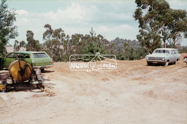
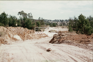
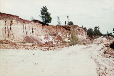
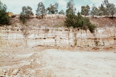
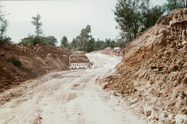
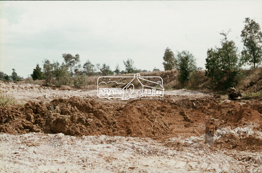
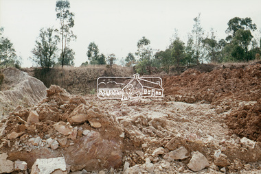
 Eltham District Historical Society Inc
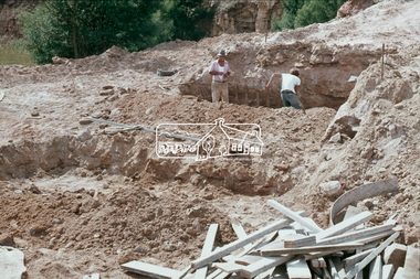
Slide, Shire of Eltham Tip site, Graham Road, Kangaroo Ground, 2 Apr 1974
... Construction of the Kangaroo Ground tip was required following filling and closure of the Susan Street tip and overflow site near the Eltam Trestle bridge...Eltham District Historical Society Inc 728 Main Rd Eltham melbourne Construction of the Kangaroo Ground tip was required following filling and closure of the Susan Street tip and overflow site near the Eltam Trestle bridge graham road kangaroo ground kangaroo ground tip 35 mm colour positive transparency (x19) Mount - Agfacolor Service (Blue) Shire of Eltham Tip site, Graham Road, Kangaroo Ground Slide Slide ...Construction of the Kangaroo Ground tip was required following filling and closure of the Susan Street tip and overflow site near the Eltam Trestle bridge35 mm colour positive transparency (x19) Mount - Agfacolor Service (Blue)graham road, kangaroo ground, kangaroo ground tip -
 Eltham District Historical Society Inc
Slide, Shire of Eltham Tip site, Graham Road, Kangaroo Ground, 2 Apr 1974
... Construction of the Kangaroo Ground tip was required following filling and closure of the Susan Street tip and overflow site near the Eltam Trestle bridge...Eltham District Historical Society Inc 728 Main Rd Eltham melbourne Construction of the Kangaroo Ground tip was required following filling and closure of the Susan Street tip and overflow site near the Eltam Trestle bridge graham road kangaroo ground kangaroo ground tip 35 mm colour positive transparency Mount - Agfacolor Service (Blue) Shire of Eltham Tip site, Graham Road, Kangaroo Ground Slide Slide ...Construction of the Kangaroo Ground tip was required following filling and closure of the Susan Street tip and overflow site near the Eltam Trestle bridge35 mm colour positive transparency Mount - Agfacolor Service (Blue)graham road, kangaroo ground, kangaroo ground tip -
 Eltham District Historical Society Inc
Slide, Shire of Eltham Tip site, Graham Road, Kangaroo Ground, 2 Apr 1974
... Construction of the Kangaroo Ground tip was required following filling and closure of the Susan Street tip and overflow site near the Eltam Trestle bridge...Eltham District Historical Society Inc 728 Main Rd Eltham melbourne Construction of the Kangaroo Ground tip was required following filling and closure of the Susan Street tip and overflow site near the Eltam Trestle bridge graham road kangaroo ground kangaroo ground tip 35 mm colour positive transparency Mount - Agfacolor Service (Blue) Shire of Eltham Tip site, Graham Road, Kangaroo Ground Slide Slide ...Construction of the Kangaroo Ground tip was required following filling and closure of the Susan Street tip and overflow site near the Eltam Trestle bridge35 mm colour positive transparency Mount - Agfacolor Service (Blue)graham road, kangaroo ground, kangaroo ground tip