Showing 127 items matching "urban heritage"
-
 Bendigo Historical Society Inc.
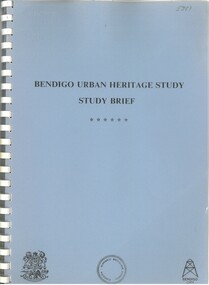
Book - BENDIGO URBAN AREA HERITAGE STUDY BRIEF, 1990
... BENDIGO URBAN AREA HERITAGE STUDY BRIEF......urban heritage study...Bendigo Urban Heritage Study, Study Brief. A joint project funded by the City of Bendigo, Borough of Eaglehawk, the Historic Buildings Register and the Victoria National Estate Committee. ...History House 11 Mackenzie Street Bendigo goldfields BENDIGO History urban heritage study Bendigo Urban Heritage Study, Study Brief. ...Bendigo Urban Heritage Study, Study Brief. A joint project funded by the City of Bendigo, Borough of Eaglehawk, the Historic Buildings Register and the Victoria National Estate Committee. Inside front cover are:1 loose sheet (17 Dec 1990) and a 3 page document stapled together (18 Dec. 1990) scoping the study to be carried out Mar 1991 to May 1992.bendigo, history, urban heritage study -
 Bendigo Historical Society Inc.
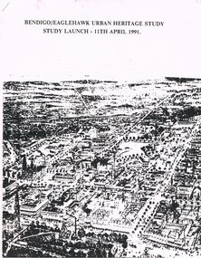
Document - BENDIGO/EAGLEHAWK URBAN HERITAGE STUD: STUDY LAUNCH 11TH APRIL 1991, 11/04/1991
... BENDIGO/EAGLEHAWK URBAN HERITAGE STUD: STUDY LAUNCH 11TH APRIL 1991...Bendigo/Eaglehawk Urban Heritage Study - Study Launch 11th April 1991. ...Document BENDIGO/EAGLEHAWK URBAN HERITAGE STUD: STUDY LAUNCH 11TH APRIL 1991 ...Bendigo/Eaglehawk Urban Heritage Study - Study Launch 11th April 1991. Three page document with attachments and appendices. Details of Purpose of the Study; Management of the Study (including names of consultants); budget area, strategy, timing etc. Three pages (illustrated of places to visit (46 numbered localities); map of Eaglehawk with 24 numbered locations; Appendices.City of Bendigo, Borough of Eaglehawk, The Historic Buildings Council, Victoria National Estate Committeebendigo, council, heritage study, heritage study, bendigo, eaglehawk. historic building council, victoria national building committee. -
 Federation University Historical Collection
Booklet, Ballarat and UNESCO Historic Urban Landscape Approach, 2013, 2013
... ...urban heritage...Barker Library (top floor) Mount Helen goldfields unesco historic urban landscape (hul) league of historical cities urban heritage ron van oers burke and wills time capsule ballarat heritage award peel st story landscape Full colour booklet with a photograph of the Ballarat Botanical Gardens on the cover. ...Full colour booklet with a photograph of the Ballarat Botanical Gardens on the cover. Anne Beggs Sunter is in a red jumper on the first page, under the verandah of the Buninyong Cake Shop. unesco, historic urban landscape (hul), league of historical cities, urban heritage, ron van oers, burke and wills time capsule, ballarat heritage award, peel st story, landscape -
Kew Historical Society Inc
Archive (Sub-series) - Subject File, Bowling Clubs, 1958
... ...urban conservation...heritage...Typically files will contain primary and secondary sources. sports clubs - kew (vic.) studley park bowling club urban conservation heritage protection Reference file containing correspondence relating to the former Studley Park Bowling Club in Barry Street, Kew and its relocation to Yarra Bend Park. ...Various partiesReference, Research, InformationKHS OrderSubject file containing correspondence relating to the former Studley Park Bowling Club in Barry Street, Kew and its relocation to Yarra Bend Park. The file includes a photocopy of the letter by Nigel Lewis to the City of Kew, describing the historic importance of the Club (established c.1903) and the necessity of moving it before demolition. The file has information relating to the pavilion’s move and restoration as an art centre. [ KHS also holds the complete archives of the Auburn Heights Recreation Club (1904-98), the Kew Bowling Club (1880-1998) and the Kew Heights Sports Club (1998-2012). These are separate archives in Provenance Order].sports clubs - kew (vic.), studley park bowling club, urban conservation, heritage protectionsports clubs - kew (vic.), studley park bowling club, urban conservation, heritage protection -
 Lakes Entrance Historical Society
Photograph - Historic House Now at Tambo Upper, 1980
... ... Urban Renewal... Heritage...See VTMH 05007 for more recent photo's Houses Urban Renewal Heritage Study Colour photograph of a small cottage situated in Church Street, has corrugated iron roof painted red, veranda across front over front door, window each side of door glazed with small panes. ...It is believed this house was situated at the New Works, the front room being used for church services. It was moved to Church St Lakes Entrance and in the early 1990's was bought by Val Northrope and moved to their property at Princes Highway. It was moved again to the Northropes property on Wards Rd Tambo upper in the early 2000's. See VTMH 05007 for more recent photo'sColour photograph of a small cottage situated in Church Street, has corrugated iron roof painted red, veranda across front over front door, window each side of door glazed with small panes. Lakes Entrance Victoriahouses, urban renewal, heritage study -
 Ballarat Heritage Services
Painting - Artwork, Lisa Gervasoni, Yandoit Creek Summer Oblique ,2021, 2021
... Dedicated to recording cultural heritage in situ Lisa Gervasoni has used photography to document urban areas, heritage sites and natural resources of Australia.She has provided over 70,000 images to the National Library of Australia Trove database via the Flickr portal. ...Dedicated to recording cultural heritage in situ Lisa Gervasoni has used photography to document urban areas, heritage sites and natural resources of Australia.She has provided over 70,000 images to the National Library of Australia Trove database via the Flickr portal. ...Interpretation of the Gervasoni farms at Yandoit Creek using a fauvist colour palette.Lisa J. GERVASONI Born Melbourne, Victoria Graduating from Royal Melbourne Institute of Technology where she received a Bachelor of Applied Science-Planning, and the University of Melbourne with a Master of Environmental Studies Lisa Gervasoni's artwork reflects her passion for the landscape and built form. Lisa Gervasoni specialises in photography, embroidery and acrylic paintings on canvas. Many of her works have the theme of interpretation of heritage and cultural spaces. Dedicated to recording cultural heritage in situ Lisa Gervasoni has used photography to document urban areas, heritage sites and natural resources of Australia.She has provided over 70,000 images to the National Library of Australia Trove database via the Flickr portal. In 2004 Lisa Gervasoni won the Daylesford Small Art Prize for an embroidered depiction of the Savoia Hotel in Hepburn Springs, and in 2022 she was shortlisted in the Harden Landscape prize. Her art mediums are photography, embroidery and acrylic on canvas. Many of her works have a theme of interpretation of heritage and cultural spaces. abstract, modernPainted stretched canvas depicting an abstract aerial oblique of Yandoit Creek, Victoria.gervasoni farm yandoit creek, lisa gervasoni, yandoit creek, italo-australians -
 Ballarat Heritage Services
Photograph, Lisa Gervasoni, Dean Store, c2010
... heritage and cultural spaces. Dedicated to ensuring Lisa Gervasoni has used photography to document urban areas, heritage sites and natural resources of Australia.She has provided over 70,000 images to the National Library of Australia Trove database via the Flickr portal. ...heritage and cultural spaces. Dedicated to ensuring Lisa Gervasoni has used photography to document urban areas, heritage sites and natural resources of Australia.She has provided over 70,000 images to the National Library of Australia Trove database via the Flickr portal. ...I have been interested in urban design and landscape since a child. My early fascination with maps corresponded to early mark making inspired by maps, topography, legends and aerial depictions. This developed into the use of a bold colour palette often used by map makers to delineate sections, contours and geology. Over time I experimented with a range of techniques and enjoy pushing expected techniques and materials to their limits. Often referred to as having a natural aesthetic, my works use various media, most often paint, textiles and photography. Lisa J. GERVASONI Born Melbourne, Victoria Graduating from Royal Melbourne Institute of Technology where she received a Bachelor of Applied Science-Planning, and the University of Melbourne with a Master of Environmental Studies Lisa Gervasoni's artwork reflects her passion for the landscape and built form. Lisa Gervasoni specialises in photography, embroidery and acrylic paintings on canvas. Many of her works have a theme of interpretation of heritage and cultural spaces. Dedicated to ensuring Lisa Gervasoni has used photography to document urban areas, heritage sites and natural resources of Australia.She has provided over 70,000 images to the National Library of Australia Trove database via the Flickr portal. In 2004 Lisa Gervasoni won the Daylesford Small Art Prize for an embroidered depiction of the Savoia Hotel, and in 2022 she was shortlisted in the Harden Landscape prize. Her art mediums are photography, embroidery and acrylic on canvas. Many of her works have a theme of interpretation of heritage and cultural spaces. A depiction of the Dean Store in stitchery. lisa gervasoni, dean, dean store, stichery, textiles, embroidery -
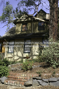
 Eltham District Historical Society Inc
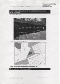
Document - Property Binder, 616 Main Road, Eltham; Plum Cottage
... This house was identified in the Shire of Shire of Eltham Heritage 1992 as contributory to the Eltham Gateway Conservation Area, then proposed as an urban conservation area (now Heritage Overlay Area). ...This house was identified in the Shire of Shire of Eltham Heritage 1992 as contributory to the Eltham Gateway Conservation Area, then proposed as an urban conservation area (now Heritage Overlay Area). ...Plum Cottage is covered by Heritage Overelay HO256 in the Nillumbuk Planning Scheme This two-lot land holding was created as a subdivision and sold to Charles Stuart McNeil by May 1955. Sometime in the period 1955-1960, the builder-designer, John Harcourt had created a pise house on the site, straddling the two subdivision lots. The designer, John M. Harcourt was a pioneer builder in pise-de-terre and mudbrick in the Eltham Shire, Eltham being synonymous with alternative lifestyles and building practises until the onset of suburbia in the late 20th and early 21st centuries. This hipped-roof house is set high above Main Road on a V-shape plan characteristic of the Arts & Crafts style, with rammed earth or pise walls, timber joinery and a cement tiled roof. The V shape plan was used by important English and Eltham Arts & Crafts designers. The use of natural materials such as stone and timber construction is an essential part of the Arts & Crafts style and Harcourt’s work. So too is the application of the style on both the exterior and interior of the house as a holistic concept. The house adjoins the Lim Joon adobe house built and designed by Alistair Knox in the same era (HO119), thus forming a distinctive pair, both using an uncommon plan form. This house was identified in the Shire of Shire of Eltham Heritage 1992 as contributory to the Eltham Gateway Conservation Area, then proposed as an urban conservation area (now Heritage Overlay Area). Land Ownership Emily Jane Smith of 12 Woodside Street Fitzroy owned Crown Allotments 1 & 2 Sections 14, 27 by August 1918, selling to William Henry Smith of 12 Woodside Street, Nth Fitzroy May 1921. (John) James Isherwood of Main Road, Eltham owned the property by 1928 (the year of his death) with the beneficiary of his estate and next owner of this site being his widow, Minnie Maria Isherwood of Cemetery Road, Eltham. His holding in Main Road included parts of what was described in rate records as allotments1 & 2 Section E6. In the late 1930s, early 1940s her son Alfred John Isherwood was also rated for the land around this site, with the rated nett annual value varying between £2 and £5. Alfred Isherwood also lived at Main Road, Eltham with his wife Ellen: her early death at the age of 24 was reported in the Argus of 1923. Part of the Isherwood land was divided off and sold to Charles Stuart McNeil by May1955. Sometime in the period 1955-1960, the builder-designer, John Harcourt had created a pise house on the site, straddling the two subdivision lots. The house is visible on an aerial photograph from 1960s. Reputedly the house was called Plum Cottage and erected for Harcourt’s mother-in-law. A garage was added in 1959. Charles McNeil died in1971 aged 87: he was the son of Don McNeil and Margaret Arkell. Available rate records from the construction era start in the of the 1970s (1972-3) and list Mr H.C. & M/S A.V. Charity at 616 Main Road Eltham of this property with a nett annual value of $740. More recent valuer's data describes the property as lots 1 & 2 LP25668, located in the Central Riding of Eltham Shire, owned by Ann Valerie Charity and later, in 1990, by the Chincarini family. Building Description This hipped roof 11 .5 square house is set high above Main Road on a characteristic-shape plan and has rammed earth or pise walls, timber joinery and a cement tiled roof. The V-shape plan was used by Important designers such as C.F.A. Voysey (UK) who interpreted medieval domestic architecture as part of the Arts & Crafts style of the late 19th and early 20th centuries. The pise walls are covered with a textured render while the cement roofing tiles are also seen in the Harcourt Hill examples. Reputedly the ceiling joists are of a deep section and span long lengths with no need for hanging beams in the roof space. The ceilings are low and panelled in main rooms with apparently Caneite soft board infill panels between the exposed ceiling beams. These are painted white but may have been stained at one time. The focus of the house is the large living area with its vast random stone fireplace. Significance Plum Cottage is significant to the locality of Eltham because: Historically: • Plum Cottage is closely associated with the important historical theme of earth construction evident in Eltham and elsewhere in the Shire since theear1y Arts & Crafts inspired creations at Penleigh Boyd's The Robins (1912, HO101) and those at Montsalvat (1934-, HO82) but more prominent from the Second War period when earth building in Eltham was promoted in national periodicals as an alternative building method that avoided the building materials shortages of that era; • The choice of the earth building technique also expresses the theme of refuge or alternative living, synonymous with Eltham in the early to mid 20th century; • as a good example of domestic architecture from John Harcourt who was the first major post Second War figure in an important phase of Eltham’s earth building development, using his characteristic Old English or Arts& Crafts style that relies in this case on the pise wall construction, pitched roof forms, exposed ceiling joists, half timbering, random stonework, and panelled internal wall finishes. Architecturally: • Plum Cottage's pise wall construction is uncommon among the early earth-walled structures in the Shire, that are mainly of adobe or mud brick, and as a building material is uncommon among the Shire’s suburban dwellings generally which are clad typically with either fired clay bricks or timber boarding. Aesthetically: • Plum Cottage is a good and well preserved example of a modern Old English or Arts & Crafts style earth-walled building in the Shire • For the proximity of the significant Lim Joon adobe house designed by Alistair Knox adjoining to the north, providing a distinctive earth wall house pair, with uncommon plan forms. Reference Heritage Assessment of Plum Cottage, 616 Main Road, Eltham; Graeme Butler & Associates 2010main road, eltham, property, houses, (john) james isherwood, alfred john isherwood, ann valerie charity, arts and crafts style, charles stuart mcneil, chincarini family, eltham gateway zone, emily jane smith, h.c. charity, heritage assessment, john harcourt, john m. harcourt, lim joon house, main road eltham, minnie maria isherwood, pise construction, plum cottage -
 Conservation Volunteers
Award: Honour Roll, United Nations Environment Program (UNEP) - 1 June 2000 - The UNEP announced that the Australian Trust of Conservation Volunteers of Australia (ATCV), has been elected to the prestigious ranks of its Global 500 Roll of Honour for outstanding contributions to the protection of the environment, Award:United Nations Environment Program (UNEP) - 1 June 2000 - UNEP announced today that the ATCV has been elected to the prestigious ranks of its Global 500 Roll of Honour for outstanding contributions to the protection of the environment
... urban, regional and remote areas of Australia each year. Activities range from bush regeneration, tree planting, seed collection, endangered species protection, weed control, flora and fauna surveys, walking trail construction, fencing, environmental monitoring and the protection of world heritage areas. ...urban, regional and remote areas of Australia each year. Activities range from bush regeneration, tree planting, seed collection, endangered species protection, weed control, flora and fauna surveys, walking trail construction, fencing, environmental monitoring and the protection of world heritage areas. ...THE AUSTRALIAN TRUST OF CONSERVATION VOLUNTEERS, ONE OF 14 INDIVIDUALS AND ORGANIZATIONS, TO RECEIVE UNITED NATIONS ENVIRONMENT AWARD NAIROBI, 1 June 2000 - The United Nations Environment Programme (UNEP) announced today that the Australian Trust of Conservation Volunteers of Australia (ATCV), has been elected to the prestigious ranks of its Global 500 Roll of Honour for outstanding contributions to the protection of the environment. ATCV is one of 14 individuals and organizations to receive this honour in 2000. Founded in 1982, ATCV is a national, not-for-profit community organization, whose mission is to attract and manage a force of volunteers in practical conservation projects for the betterment of the Australian environment. ATCV completes more than 4000 week-long conservation projects in urban, regional and remote areas of Australia each year. Activities range from bush regeneration, tree planting, seed collection, endangered species protection, weed control, flora and fauna surveys, walking trail construction, fencing, environmental monitoring and the protection of world heritage areas. ATCV community participation has resulted in more than 1.8 million trees being planted in 1999, and in more than 7.3 million trees planted over the past 10 years. Community involvement totalled 200,000 project days in 1999 and more than 700,000 days since 1989. To encourage the involvement of young people, ATCV developed and manages the federal government-funded programme Green Corps. Green Corps is a six-month traineeship for 17 to 20 year-olds, which incorporates conservation projects and accredited training. Since 1997, more than 4,000 trainees have completed the Green Corps programme. ATCV is a founding member of the International Conservation Alliance, which brings together organizations working in conservation volunteering, and is a member of the World Conservation Union (IUCN). " The award will be presented in Adelaide, Australia, at the World Environment Day ceremonies on 4 June 2000. World Environment Day, which is celebrated in some 120 countries around the world on 5 June, was established by the United Nations General Assembly in 1972 to focus global attention and action on environmental issues. Some 701 individuals and organizations, in both the adult and youth categories, have been honoured since UNEP launched the Global 500 award in 1987. Among prominent past winners are: French Marine explorer Jacques Cousteau; Sir David Attenborough, producer of environmental television programmes; Gro Harlem Brundtland, former Prime Minister of Norway; Anil Aggarwal, the prominent environmentalist from India; Ken Saro-Wiwa, the environmental and human rights activist from Nigeria who was executed for leading the resistance of the Ogoni People against the pollution of their Delta homeland; the World Wide Fund for Nature (WWF), Jimmy Carter, former President of the United States; Jane Goodall of the United Kingdom whose research on wild chimpanzees and olive baboons provided insight into the lives of non-human primates; and the late Chico Mendes, the Brazilian rubber tapper who was murdered during his fight to save the Amazon forest. To forge global links and to implement ideas, which can contribute to a more sustainable future, a network of all Global 500 laureates has been formed. Information about this unique network can be obtained at http://www.global500.org. The winners of UNEP's Global 500 Roll of Honour are members of a broad and growing environmental movement that is flourishing around the world. They have taken the path that most of us hesitate to take for want of time or caring," says UNEP's Executive Director, Klaus Toepfer. "In honouring the Global 500 laureates, UNEP hopes that others will be inspired by their extraordinary deeds."Certificatecva, conservation volunteers, conservation volunteers australia, conservation volunteers new zealand, colin jackson, better earth, environmental conservation, volunteers, volunteering, corporate volunteering, education – environmental, carbon footprint, climate change, ballarat, safety, training, partnerships, victoria, vic, nsw, queensland, act, australian capital territory, nt, northern territory, western australia, wa, south australia, sa, tasmania, new zealand, california conservation corps, atcv, unep, unep honour roll, united nations environment program -
 Eltham District Historical Society Inc
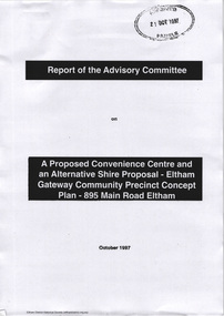
Document - Report, Paul Jerome, Advisory Committee on a Proposed Convenience Centre and an Alternative Shire Proposal - Eltham Gateway Community Precinct Concept Plan - 895 Main Road Eltham, October 1997
... In particular, these policies seek • to conserve and enhance the bushland/country atmosphere, artistic heritage and strong sense of community of the Eltham Town Centre by ensuring that the design and height of any new development is sympathetic to existing buildings • to achieve a pleasing physical environment within the Eltham Town Centre by encouraging a high standard of architecture and urban design • to encourage Improvement to pedestrian amenity through such facilities as open and shattered rest areas and meeting places, crossing facilities, pedestrian arcades, pedestrian links to car parks and pedestrian weather protection • to reduce conflict between vehicular traffic and pedestrian flows, and • to encourage pedestrian thoroughfares It is submitted, as set out In the main body of this report, that the DPP proposal fails substantially to meet these policies and In so doing does not merit the exercise of discretion In Its favour with the Issuing of a permit. ...In particular, these policies seek • to conserve and enhance the bushland/country atmosphere, artistic heritage and strong sense of community of the Eltham Town Centre by ensuring that the design and height of any new development is sympathetic to existing buildings • to achieve a pleasing physical environment within the Eltham Town Centre by encouraging a high standard of architecture and urban design • to encourage Improvement to pedestrian amenity through such facilities as open and shattered rest areas and meeting places, crossing facilities, pedestrian arcades, pedestrian links to car parks and pedestrian weather protection • to reduce conflict between vehicular traffic and pedestrian flows, and • to encourage pedestrian thoroughfares It is submitted, as set out In the main body of this report, that the DPP proposal fails substantially to meet these policies and In so doing does not merit the exercise of discretion In Its favour with the Issuing of a permit. ...On 15 December 1994 the former Shire of Eltham ceased to exist following the Liberal Kennett Government local council amalgamations. A new Nillumbik Shire Council was established with unelected commissioners appointed. That Council sold the former Eltham Shire Council Offices and land at 89S Main Road Eltham to Dallas Price Homes Pty. Ltd. the sale being conditional upon the granting of a planning permit for a petrol station/convenience store, fast food and video outlet. The sale was conditional that if the permit was not granted by 30 August. 1997, the contract could be avoided by either the purchaser or the vendor. The proposed development consisted of a petrol station with undercover fuelling facilities, convenience shopping, a drive through service facility for fast food, an 80 seat cafe, automated banking, a children's play area and retail space. In addition, the proposal included a 200 square metre community facility for Council use, provision of on site carparking over 2 levels for 83 vehicles, and advertising signage. An Advisory Committee consisting of Dimitry Reed and Margaret Pitt was appointed under Section 151 of the Planning and Environment Act 1987 to hear submissions on the proposal to develop the land at 895 Main Road Eltham, the site of the former Eltham Shire Offices. In September 1996, two applications were made by Contour Consultants Australia Pty Ltd on behalf of Dallas Price Homes Ply Ltd, to Nillumbik Shire Council. After extensive notification, the Council received 213 objections and a petition of over 1400 signatures. On October 9, 1996, Nillumbik Shire Council issued Notices of Decision to Grant Permit on Applications number 96/03376 and 96/0377 for the use and development of the land as a convenience Centre consisting of a petrol station, convenience store, cafe/takeaway food premises, a retail facility and a community facility, with associated advertising signs. Objectors to the proposals lodged Planning Appeals number 96/40724 and 96/40812 with the Administrative Appeals Tribunal on November 1, 1996. The grounds of appeal can be summarised as: inappropriate development, insufficient carparking, traffic and access issues, unsatisfactory design, inadequate permit conditions, the proposal being out of character with the area. and being contrary to the purpose and orderly development of the Eltham Town Centre, excessive noise, lack of consultation and unsuitable signage. On November 13, 1996, the Minister for Planning and Local Government directed the Registrar of the Administrative Appeals Tribunal. under Section 41 (1) (a) of the Planning Act 1980, to refer the Appeals to the Governor in Council for determination without a hearing or recommendation by the Tribunal. The Minister for Planning and Local Government called in the Appeals as he considered that they raised major issues of policy relating to the facilitation of development in accordance with the objectives set out in Section 4 of the Planning and Environment Act 1987, and that determination of the Appeals could have a substantial effect on the achievement of these planning objectives. The Minister required the Advisory Committee to consider the planning merits of the proposed use and development, and to address the issues raised in the objections. The Advisory Committee was required to produce a report providing: • The Committee's response to the matters detailed; • Relevant supporting information for the Advisory Committee's recommendation; and • A description of the proceedings conducted by the Advisory Committee and a list of those consulted or heard by the Committee. In March 1997, elections were held in the Shire of Nillumbik and the view of the new Council to this proposal differed from the view held by the earlier Council Hence the Submission made to the Committee by the Shire was against the decision by the Shire of Nillumbik to issue the Notices of Decision to Grant a Permit. The Recommendations of the Advisory Committee were: i. The cafe and take away food premises are as of right uses and are therefore allowable, but that shop and petrol station are unacceptable uses. A community facility is a discretionary use and is acceptable. ii. A development of the type and scale proposed is totally inappropriate for this land and that the Applications number 96/03376 and 96/0377 for the use and development of the land as a convenience Centre consisting of a petrol station, convenience store, café/takeaway food premises, a retail facility and a community facility, with associated advertising signs, be refused. iii. The land should be rezoned for public purposes and should remain in the community's ownership for community use. Following this, the Minister for Planning and Local Government, the Hon. Robert Maclellan, appointed Mr. Paul Jerome as an Advisory Committee under section 151 of the Planning and Environment Act 1987 to consider a Convenience Centre and an alternative proposal by Iha Shire of Nillumbik being the Eltham Gateway Community Precinct Concept Plan for the site of the former Shire of Eltham municipal offices at 895 Main Road, Eltham. In summary, the terms of reference for the Advisory Committee required it to: • consider the merits of the Council proposal • examine the merits of both proposals in terms of net community benefit • address the report of the previous Advisory Committee on the Convenience Centre proposal The Advisory Committee inspected the site and considered all the material before It including submissions made by all parties to the previous Advisory Committee and correspondence received by the Department of Infrastructure both before and after that Committee submltted its report. The Advisory Committee also held discussions with the following people: • Cr. Robert Marshall • Cr. Margaret Jennings • Cr. Lex de Man • Mr. Dallas Howgate of Dallas Price Properties, also Dallas Price Homes • Mr. Barry Rochford, CEO, Shire of Nillumbik • Ms. Yvonne Rust, Planning Officer, Shire of Nillumbik • Mr. Gregory Burgess, Architect of the Eltham Library and of Council’s Community Precinct Concept Plan • Mr. Jim Connor representing Mrs Thelma Barkway of the Eltham Senior Citizens Club Having considered all the material before it, the Committee arrived at two basic conclusions. First, the DPP proposal should be rejected because, on its merits, It does not sufficiently satisfy the requirements of the planning scheme which is a statutory document. The planning scheme requires that, before making a decision on the permit applications for the DPP proposal, a range of matters must be considered. It follows that consideration of these matters should Influence the decision. These matters include local policies relating to character and amenity. In particular, these policies seek • to conserve and enhance the bushland/country atmosphere, artistic heritage and strong sense of community of the Eltham Town Centre by ensuring that the design and height of any new development is sympathetic to existing buildings • to achieve a pleasing physical environment within the Eltham Town Centre by encouraging a high standard of architecture and urban design • to encourage Improvement to pedestrian amenity through such facilities as open and shattered rest areas and meeting places, crossing facilities, pedestrian arcades, pedestrian links to car parks and pedestrian weather protection • to reduce conflict between vehicular traffic and pedestrian flows, and • to encourage pedestrian thoroughfares It is submitted, as set out In the main body of this report, that the DPP proposal fails substantially to meet these policies and In so doing does not merit the exercise of discretion In Its favour with the Issuing of a permit. This finding is not offset by the investment and employment attributes of the proposal. They do not override the need to comply with the planning scheme. Second, the Council proposal, on Its own merits, substantially meets all statutory requirements applicable to this site with a possible reservation about car parking and traffic management which need further definition and assessment as the concept is refined. The Council proposal, however, has a serious weakness in that Its financial viability has not been adequately tested. The Committee refers to 'financial' rather than 'commercial' viability in recognition that Council owns the land and may enter into a range of agreements and partnerships to realise its concept some of which may be truly commercial and some of which may involve an element of subsidy arising from Council's involvement as a public body acting on behalf of its community. The Committee concludes that Council should be given the opportunity, within a reasonable timeframe to establish the financial feasibility of its concept and should develop a strategy for the future of Its land asset at 895 Main Road in the event that Its concept for the site cannot be realised. 895 main road, advisory committee, dallas price homes, eltham, eltham shire office, nillumbik shire council, planning application, administrative appeals tribunal -
 Eltham District Historical Society Inc
Photograph - Digital Photograph, Alan King, Little Bank Building, the former Commercial Bank of Australia Branch, Hurstbridge, 1 February 2008
... Heritage Overlay, Nillumbik Planning Scheme. Published: Nillumbik Now and Then / Marguerite Marshall 2008; photographs Alan King with Marguerite Marshall.; p13 This collection of almost 130 photos about places and people within the Shire of Nillumbik, an urban and rural municipality in Melbourne's north, contributes to an understanding of the history of the Shire. ...The Little Bank Building at the corner of Anzac Avenue, formerly a Commercial Bank of Australia branch, was moved to Hurstbridge around 1917. It was one of a few portable branch buildings, towed by horse or bullock team to a site as required. The branch operated until the early 1980s. In 1985 it was moved about 42 metres south to the Allwood House grounds to become part of the Hurstbridge Neighbourhood House. Covered under Heritage Overlay, Nillumbik Planning Scheme. Published: Nillumbik Now and Then / Marguerite Marshall 2008; photographs Alan King with Marguerite Marshall.; p13This collection of almost 130 photos about places and people within the Shire of Nillumbik, an urban and rural municipality in Melbourne's north, contributes to an understanding of the history of the Shire. Published in 2008 immediately prior to the Black Saturday bushfires of February 7, 2009, it documents sites that were impacted, and in some cases destroyed by the fires. It includes photographs taken especially for the publication, creating a unique time capsule representing the Shire in the early 21st century. It remains the most recent comprehenesive publication devoted to the Shire's history connecting local residents to the past. nillumbik now and then (marshall-king) collection, cba bank, commercial bank of australia, hurstbridge, little bank building, portable buildings -
 Eltham District Historical Society Inc
Photograph - Digital Photograph, Alan King, Yarrambat Heritage Museum, 23 January 2008
... urban and rural municipality in Melbourne's north, contributes to an understanding of the history of the Shire. Published in 2008 immediately prior to the Black Saturday bushfires of February 7, 2009, it documents sites that were impacted, and in some cases destroyed by the fires. It includes photographs taken especially for the publication, creating a unique time capsule representing the Shire in the early 21st century. It remains the most recent comprehenesive publication devoted to the Shire's history connecting local residents to the past. Nillumbik Now and Then (Marshall-King) Collection Yarrambat Heritage ...Original Yarrambat Primary School building at the Yarrambat Heritage Museum, Yarrambat Park. At the museum, visitors can gain an insight into Yarrambat’s past since non-Aboriginal settlement. The museum includes the original Yarrambat Primary School, which was moved to the site in 2000 and now serves as the Yarrambat Historical Society headquarters.The museum also includes a fully operational battery (gold-bearing ore crusher) driven by a McDonald 30HP diesel engine built in Richmond in 1938. The battery was relocated from the Golden King Mine in North Oatlands Road, Yarrambat, where it operated until 1984.1 Other exhibits include farming implements and machinery from the Yarrambat district. Published: Nillumbik Now and Then / Marguerite Marshall 2008; photographs Alan King with Marguerite Marshall.; p25This collection of almost 130 photos about places and people within the Shire of Nillumbik, an urban and rural municipality in Melbourne's north, contributes to an understanding of the history of the Shire. Published in 2008 immediately prior to the Black Saturday bushfires of February 7, 2009, it documents sites that were impacted, and in some cases destroyed by the fires. It includes photographs taken especially for the publication, creating a unique time capsule representing the Shire in the early 21st century. It remains the most recent comprehenesive publication devoted to the Shire's history connecting local residents to the past. nillumbik now and then (marshall-king) collection, yarrambat heritage museum, yarrambat historical society, yarrambat primary school -
 Eltham District Historical Society Inc
Photograph - Digital Photograph, Alan King, Southernwood, cnr Bolton and Brougham Street, Eltham, 30 January 2008
... Heritage Overlay, Nillumbik Planning Scheme. Published: Nillumbik Now and Then / Marguerite Marshall 2008; photographs Alan King with Marguerite Marshall.; p105 This collection of almost 130 photos about places and people within the Shire of Nillumbik, an urban and rural municipality in Melbourne's north, contributes to an understanding of the history of the Shire. ...Walter Withers once lived at the corner of Bolton and Brougham Streets, Eltham. Covered under Heritage Overlay, Nillumbik Planning Scheme. Published: Nillumbik Now and Then / Marguerite Marshall 2008; photographs Alan King with Marguerite Marshall.; p105This collection of almost 130 photos about places and people within the Shire of Nillumbik, an urban and rural municipality in Melbourne's north, contributes to an understanding of the history of the Shire. Published in 2008 immediately prior to the Black Saturday bushfires of February 7, 2009, it documents sites that were impacted, and in some cases destroyed by the fires. It includes photographs taken especially for the publication, creating a unique time capsule representing the Shire in the early 21st century. It remains the most recent comprehenesive publication devoted to the Shire's history connecting local residents to the past. nillumbik now and then (marshall-king) collection, bolton steet, brougham steet, eltham, southernwood, walter withers house -
 Eltham District Historical Society Inc
Photograph - Digital Photograph, Alan King, Stonygrad, 34 Hamilton Road, North Warrandyte, 30 January 2008
... Heritage Overlay, Nillumbik Planning Scheme. Published: Nillumbik Now and Then / Marguerite Marshall 2008; photographs Alan King with Marguerite Marshall.; p135 This collection of almost 130 photos about places and people within the Shire of Nillumbik, an urban and rural municipality in Melbourne's north, contributes to an understanding of the history of the Shire. ...Vassilieff dynamited rock from his own property to build his house. Stonygrad is reminiscent of a grotto and in parts, of a sculpture. Covered under Heritage Overlay, Nillumbik Planning Scheme. Published: Nillumbik Now and Then / Marguerite Marshall 2008; photographs Alan King with Marguerite Marshall.; p135This collection of almost 130 photos about places and people within the Shire of Nillumbik, an urban and rural municipality in Melbourne's north, contributes to an understanding of the history of the Shire. Published in 2008 immediately prior to the Black Saturday bushfires of February 7, 2009, it documents sites that were impacted, and in some cases destroyed by the fires. It includes photographs taken especially for the publication, creating a unique time capsule representing the Shire in the early 21st century. It remains the most recent comprehenesive publication devoted to the Shire's history connecting local residents to the past. nillumbik now and then (marshall-king) collection, danila vassilieff, hamilton road, north warrandyte, stonygrad -
 Eltham District Historical Society Inc
Photograph - Digital Photograph, Alan King, Busst House, cnr Silver Street and Kerrie Crescent, Eltham, 2 February 2008
... Heritage Overlay, Nillumbik Planning Scheme. Published: Nillumbik Now and Then / Marguerite Marshall 2008; photographs Alan King with Marguerite Marshall.; p143 This collection of almost 130 photos about places and people within the Shire of Nillumbik, an urban and rural municipality in Melbourne's north, contributes to an understanding of the history of the Shire. ...Considered the best of the early mud-brick houses built by Alistair Knox. Covered under Heritage Overlay, Nillumbik Planning Scheme. Published: Nillumbik Now and Then / Marguerite Marshall 2008; photographs Alan King with Marguerite Marshall.; p143This collection of almost 130 photos about places and people within the Shire of Nillumbik, an urban and rural municipality in Melbourne's north, contributes to an understanding of the history of the Shire. Published in 2008 immediately prior to the Black Saturday bushfires of February 7, 2009, it documents sites that were impacted, and in some cases destroyed by the fires. It includes photographs taken especially for the publication, creating a unique time capsule representing the Shire in the early 21st century. It remains the most recent comprehenesive publication devoted to the Shire's history connecting local residents to the past. nillumbik now and then (marshall-king) collection, alistair knox, alistair knox design, busst house, kerrie crescent, mudbrick construction, mudbrick houses, silver street -
 Eltham District Historical Society Inc
Photograph - Digital Photograph, Alan King, Langi Dorn, Fay Street, Eltham, 29 January 2008
... Heritage Overlay, Nillumbik Planning Scheme. Published: Nillumbik Now and Then / Marguerite Marshall 2008; photographs Alan King with Marguerite Marshall.; p151 This collection of almost 130 photos about places and people within the Shire of Nillumbik, an urban and rural municipality in Melbourne's north, contributes to an understanding of the history of the Shire. ...Langi Dorn, Fay Street. This house is reminiscent of ‘ye olde’ England, with its steep-pitched gabled roof. The rectangular single storey building with two attics has a warm atmosphere, created in part by the extensive use of timber in walls and floors. Some walls are framed in timbers as in the English Tudor style. Covered under Heritage Overlay, Nillumbik Planning Scheme. Published: Nillumbik Now and Then / Marguerite Marshall 2008; photographs Alan King with Marguerite Marshall.; p151This collection of almost 130 photos about places and people within the Shire of Nillumbik, an urban and rural municipality in Melbourne's north, contributes to an understanding of the history of the Shire. Published in 2008 immediately prior to the Black Saturday bushfires of February 7, 2009, it documents sites that were impacted, and in some cases destroyed by the fires. It includes photographs taken especially for the publication, creating a unique time capsule representing the Shire in the early 21st century. It remains the most recent comprehenesive publication devoted to the Shire's history connecting local residents to the past. nillumbik now and then (marshall-king) collection, eltham, fay street, john harcourt, langi dorn -
 Eltham District Historical Society Inc
Photograph - Digital Photograph, Marguerite Marshall, Former office of Alistair Knox, King Street, Eltham, 16 January 2006
... Heritage Overlay, Nillumbik Planning Scheme. Published: Nillumbik Now and Then / Marguerite Marshall 2008; photographs Alan King with Marguerite Marshall.; p145 This collection of almost 130 photos about places and people within the Shire of Nillumbik, an urban and rural municipality in Melbourne's north, contributes to an understanding of the history of the Shire. ...Situated in King Street, Eltham, Alistair Knox built his home and office in 1962-1963 with mud-bricks made from the local soil and recycled materials blending the house with bush around it. Knox popularised the Eltham earth building movement, begun by Montsalvat founder, Justus Jorgensen. Alistair Knox (1912-1986) was also an Eltham Shire Councillor 1971-1975 and Shire President in 1975. He established the inaugural Eltham Community Festival in 1975. Covered under Heritage Overlay, Nillumbik Planning Scheme. Published: Nillumbik Now and Then / Marguerite Marshall 2008; photographs Alan King with Marguerite Marshall.; p145This collection of almost 130 photos about places and people within the Shire of Nillumbik, an urban and rural municipality in Melbourne's north, contributes to an understanding of the history of the Shire. Published in 2008 immediately prior to the Black Saturday bushfires of February 7, 2009, it documents sites that were impacted, and in some cases destroyed by the fires. It includes photographs taken especially for the publication, creating a unique time capsule representing the Shire in the early 21st century. It remains the most recent comprehenesive publication devoted to the Shire's history connecting local residents to the past. nillumbik now and then (marshall-king) collection, alistair and margot knox house, alistair knox design, mudbrick construction, eltham, king street -
 Eltham District Historical Society Inc
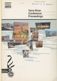
Book, Melbourne Metropolitan Board of Works, Yarra River Conference Proceedings, 1991
... Heritage and Environment: Flora and fauna / Paul Gullan. -- Geology and topography / Brian Finlayson. -- Aboriginal culture / Margaret Gardiner. Session 2 History. Session 3: Management plans and policies : overview of responsibilities / Dr Colin Leigh. --Role of the media / Peter Cole-Adams. -- Urban ...Conference staged by the Board of Works to present a range of papers examining the river's environment, recreational uses, natural resources, development, commerce and land use. Conference delegates included representatives from Eltham Shire Council and was held in April 1991. Session 1 Heritage and Environment: Flora and fauna / Paul Gullan. -- Geology and topography / Brian Finlayson. -- Aboriginal culture / Margaret Gardiner. Session 2 History. Session 3: Management plans and policies : overview of responsibilities / Dr Colin Leigh. --Role of the media / Peter Cole-Adams. -- Urban development / Paul Jerome. -- Port of Melbourne area / Leigh McKay. -- Recreation / Ken Marriott. Session 4: Perspectives - the current view. Session 5: Issues, challenges, potential solutions.non-fictionConference staged by the Board of Works to present a range of papers examining the river's environment, recreational uses, natural resources, development, commerce and land use. Conference delegates included representatives from Eltham Shire Council and was held in April 1991. Session 1 Heritage and Environment: Flora and fauna / Paul Gullan. -- Geology and topography / Brian Finlayson. -- Aboriginal culture / Margaret Gardiner. Session 2 History. Session 3: Management plans and policies : overview of responsibilities / Dr Colin Leigh. --Role of the media / Peter Cole-Adams. -- Urban development / Paul Jerome. -- Port of Melbourne area / Leigh McKay. -- Recreation / Ken Marriott. Session 4: Perspectives - the current view. Session 5: Issues, challenges, potential solutions.yarra river, melbourne -
Glen Eira Historical Society
Letter - Heritage Watch Caulfield
... Heritage... Preservation... Urban...Labassa Derby Road Inkerman Road Kerr Paul Glen Huntly Road Victorian Houses Gladstone Parade Hawthorn Road O’Neill College Miners Cottage Regent Street Elsternwick Buildings Heritage Preservation Urban Conservation Policy Caulfield City Council Campbell Mr. + Mrs. ...This file contains 5 items: 1/Documents related to the establishment of Heritage Watch in Caulfield. This includes a typed letter to Mrs. And Mr. Campbell from Graham Walsh inviting them to attend a meeting concerning the potential establishment of Heritage Watch – dated 08/11/1989. A nomination form to elect a committee –dated 27/06/1991, and documents outlining goals, maps of proposed area designated by the council, and black-and-white photographs of Miners Cottage Elsternwick and a mansion in Ripponlea, Elsternwick. 2/Minutes of Caulfield Heritage Watch Committee meetings on 04/12/1999, 22./01/1990, 08/10/1990 and 26/11/1990. It includes aims, general business, publicity and discussion on ‘Rosecraddock’. 3/Caulfield Heritage Watch Newsletter issue number three dated June 1991. It includes a paragraph on Rosecraddock, The Grand Union Tram Junction, Caulfield Heritage Study and an invitation to the annual general meeting on 27/06/1991. 4/Financial statement for Caulfield Heritage Watch for November 1989 to May 1991. 5/A handwritten submission to save Rosecraddock from demolition, date and author unknown.caulfield train station, margaret street 28, walsh graham a., caulfield manor grove 1, shellard mr., labassa, derby road, inkerman road, kerr paul, glen huntly road, victorian houses, gladstone parade, hawthorn road, o’neill college, miners cottage regent street elsternwick, buildings, heritage, preservation, urban conservation policy, caulfield city council, campbell mr. + mrs., caulfield heritage watch committee, snowball b., kay w., spencer d., dustan don, dustan david, campbell f., hill tess, jordan p., ritchie jack, architecture, development, cultural structures and establishments, residential development, murray, wells, hopkins sherry, caulfield town hall, rodder a., caulfield contact, spiker mr., elsternwick railway, elsternwick club, committees and inquiries, meetings, rosecraddock, construction sites, property, hill l., mayoress’ room caulfield, city hall, morris e., feehan j., molony v., moore mrs., elsternwick sandham street 19, elsternwick bowling club, ward andrew, shellard mr., construction and demolition, balaclava road, tramways, tram junction, kerr paul, gardens, save rosecraddock neighbourhood group -
Glen Eira Historical Society
Document - Historic Conservation Areas Project
... Heritage Studies... Housing... Royal Historical Society of Victoria (RHSV)... Read Michael... Plans... Local Government... Historical Societies... Committee for Urban...Historic Conservation Areas Project Niven Barbara Newsletters Town Planning Historic Buildings Heritage Studies Housing Royal Historical Society of Victoria (RHSV) Read Michael Plans Local Government Historical Societies Committee for Urban Action (CUA) National Trust Hopkins Sherry Ms. ...Contains 4 items relating to historic conservation: 1/Five newsletters (one page each newsletter, dated 07/1975, 08/1975, 09/1975, 10/1975 and the final one 12/1975) describing how the project evolved, project funds, progress, study method, project 1 report, project 2 report and summary as no further funds available. Project was to include all of Melbourne but funding did not allow this. Note: newsletters stamped with Caulfield Historical Society. 2/Letter (one page on official city of Caulfield letterhead) from Andrew Rodda (manager planning) to Hazal Ford (dated 13/11/1989) describing ‘council resolved on 18/07/1989 to proceed with preliminary conservation survey’ and mentions that a copy is included. 3/Preliminary conservation survey for the City of Caulfield (nine pages) describing background, study area, budget, purpose, study outline, timeframe, report format, ownership, tasks and background information (mentions number and types of houses and properties as at 1986 and 1988) and a map of City of Caulfield. 4/Booklet (28 pages) titled ‘Heritage Area – Caulfield North Draft Heritage Guidelines July 1999 – City of Glen Eira’, containing Caulfield North Heritage Area, cultural heritage, Heritage Overlay Area, architectural description, common architectural forms and features, development guidelines, key design checklist. It includes a map of the Caulfield North Heritage Overlay Area, two illustrations about the development envelope and many black-and-white photographs of houses and architectural features.historic conservation areas project niven barbara, newsletters, town planning, historic buildings, heritage studies, housing, royal historical society of victoria (rhsv), read michael, plans, local government, historical societies, committee for urban action (cua), national trust, hopkins sherry ms., ford hazel, preliminary conservation survey, town planning, heritage studies, rodda andrew, city of caulfield, housing estates, victoria national estate grants program, australia icomos, burra charter, buildings structures and establishments, land surveys, suburbs, historic buildings, architectural significance, ‘caulfield’s heritage study’, soloman geulah dr., caulfield library, dandenong road, nepean highway, hotham street, iknerman road, orrong road, north road, poath road, ‘plan of the city of caulfield’, north ward, east ward, south ward, west ward, kooyong road, neerim road, bambra road, balaclava road, shire of caulfield, railways, world war 1914-1918, depression 1929-1939, rippon lea, labassa, parks, mansions, community services, ‘caulfield north draft heritage guidelines july 1999’, city of glen eira, caulfield north heritage area, glen eira heritage management plan, mayfield grove, normanby avenue, carnarvon street, glenferrie street, arthur street, malakoff street, normanby road, heritage advisory service, construction materials, victorian style, mediterranean style, spanish mission style, californian bungalow style, federation style, architectural style, architectural features, heritage conservation design, building construction, building regulations, aboriginal peoples, carnarvon road -
 Eltham District Historical Society Inc
Photograph - Digital Photograph, Alan King, Original Kangaroo Ground Primary School No. 2105 building, Eltham-Yarra Glen Road, Kangaroo Ground, 28 December 2007
... Heritage Overlay, Nillumbik Planning Scheme. Published: Nillumbik Now and Then / Marguerite Marshall 2008; photographs Alan King with Marguerite Marshall.; p35 This collection of almost 130 photos about places and people within the Shire of Nillumbik, an urban and rural municipality in Melbourne's north, contributes to an understanding of the history of the Shire. ...Kangaroo Ground's first school began in 1851 with 22 pupils from the district's ten families. It was a single room school located further south on the site, which also served as a Presbyterian church. The first teacher was Andrew Ross. The school building was used as a Post Office between 1854 and 1858 and during 1857 also served as a Court of Petty Sessions. With a growing farming community, a new building was warranted and the original Sate School No. 352 was closed and a new building, State School No. 2105 was oipened October 1, 1878. A residence for Head Teacher Henry Wallace School was erected in 1879 attached to the left of the school building. That residence is now home to the Andrew Ross Museum, which opened in 1993. Covered under Heritage Overlay, Nillumbik Planning Scheme. Published: Nillumbik Now and Then / Marguerite Marshall 2008; photographs Alan King with Marguerite Marshall.; p35This collection of almost 130 photos about places and people within the Shire of Nillumbik, an urban and rural municipality in Melbourne's north, contributes to an understanding of the history of the Shire. Published in 2008 immediately prior to the Black Saturday bushfires of February 7, 2009, it documents sites that were impacted, and in some cases destroyed by the fires. It includes photographs taken especially for the publication, creating a unique time capsule representing the Shire in the early 21st century. It remains the most recent comprehenesive publication devoted to the Shire's history connecting local residents to the past. nillumbik now and then (marshall-king) collection, kangaroo ground, eltham-yarra glen road, kangaroo ground primary school no. 2105, kangaroo ground state school, state school no. 2105 -
 Eltham District Historical Society Inc
Photograph - Digital Photograph, Alan King, Eltham Hotel, cnr Main Road and Pitt Street, 28 December 2007
... Heritage Overlay, Nillumbik Planning Scheme. Published: Nillumbik Now and Then / Marguerite Marshall 2008; photographs Alan King with Marguerite Marshall.; p41 This collection of almost 130 photos about places and people within the Shire of Nillumbik, an urban and rural municipality in Melbourne's north, contributes to an understanding of the history of the Shire. ...The Eltham Hotel is the oldest continually operating hotel in the Eltham district. Initially referred to as the Little Eltham Hotel, it has been known as the Eltham Hotel since the mid-1850s through to the present except for a brief period as the Eltham Tavern in the late 1980s. The original hotel opened in 1854 by Richard Warren was built by Benjamin Oliver Wallis. The Fountain of Friendship Hotel on the opposite side of Maria Street (Main Road) opened shortly after. The hotel was a well-known resting place for gold diggers during the gold rush at Woods’ Point and Warren would buy the gold from the diggers. Warren ran into financial difficulties and determined to return to England. Wallis bought the hotel in 1861 and ran it till 1886 when he sold it to Christopher Watson Snr. When Christopher Watson Snr died a year after purchase, his son Christopher took over until his death in 1909 when it passed to wife Emily and then their youngest son, Herbert James (Jim) Watson in 1915. In July 1925, Jim Watson demolished the original building and, in its place, erected a modern hotel which remains the foundation of the present-day Eltham Hotel. Covered under Heritage Overlay, Nillumbik Planning Scheme. Published: Nillumbik Now and Then / Marguerite Marshall 2008; photographs Alan King with Marguerite Marshall.; p41This collection of almost 130 photos about places and people within the Shire of Nillumbik, an urban and rural municipality in Melbourne's north, contributes to an understanding of the history of the Shire. Published in 2008 immediately prior to the Black Saturday bushfires of February 7, 2009, it documents sites that were impacted, and in some cases destroyed by the fires. It includes photographs taken especially for the publication, creating a unique time capsule representing the Shire in the early 21st century. It remains the most recent comprehenesive publication devoted to the Shire's history connecting local residents to the past. nillumbik now and then (marshall-king) collection, eltham, eltham hotel, main road, pitt street -
 Eltham District Historical Society Inc
Photograph - Digital Photograph, Alan King, Jarrold Cottage, 701 Main Road, Eltham, 29 January 2008
... Heritage Overlay, Nillumbik Planning Scheme. Published: Nillumbik Now and Then / Marguerite Marshall 2008; photographs Alan King with Marguerite Marshall.; p47 This collection of almost 130 photos about places and people within the Shire of Nillumbik, an urban and rural municipality in Melbourne's north, contributes to an understanding of the history of the Shire. ...Jarrold Cottage or White Cloud is known by many to be associated with the Skipper family, and has been since 1944 when Lena Skipper, wife of Mervyn Skipper purchased the cottage. She purchased it from the Estate of Thekla Jarrold who had died in March of the previous year. By the time Thekla died, she had lived in the Jarrold Cottage for 50 years. Thekla Alvenia Sissilia Ellian married John William Jarrold in 1888 at Clifton Hill. They started their family there but when John’s father William (who was married to Hannah Coleman) died in 1893 the family moved to Eltham. William had married Hannah Coleman in 1856 at his home in Eltham. William had arrived in the colony in 1848 so it is believed the Jarrold Cottage goes back at least to 1856 and possibly early 1850s. For a short period of time the cottage was rented to the Police as a temporary Police Station whilst a new and more permanent station was built further up the hill in 1859. The cottage was originally located closer to the Diamond Creek but was subject to flooding so was relocated to its present position on top a mound of rubble placed there from the nearby quarry next to the Dalton Street school (on Main Road). By 1916, John Henry Clark, a photographer who took many early photos of Eltham relocated from Fitzroy to Eltham and boarded with recently widowed Thekla Jarrold and her family. He changed professions from photographer to boot and harness maker around 1931 and Thekla had a small bootmakers shop built ifor him in the corner of her property next to the family home. J.H. Clark remained living at the property until his death in December 1956. At some stage after Clark's death, Lena Skipper is recorded living at the property having relocated from Montsalvat following the death of her husband Mervyn. The property continues to remain within the Skipper family as of 2023. Covered under Heritage Overlay, Nillumbik Planning Scheme. Published: Nillumbik Now and Then / Marguerite Marshall 2008; photographs Alan King with Marguerite Marshall.; p47This collection of almost 130 photos about places and people within the Shire of Nillumbik, an urban and rural municipality in Melbourne's north, contributes to an understanding of the history of the Shire. Published in 2008 immediately prior to the Black Saturday bushfires of February 7, 2009, it documents sites that were impacted, and in some cases destroyed by the fires. It includes photographs taken especially for the publication, creating a unique time capsule representing the Shire in the early 21st century. It remains the most recent comprehenesive publication devoted to the Shire's history connecting local residents to the past. nillumbik now and then (marshall-king) collection, bootmaker's shop, hannah coleman, jarrold cottage, john henry clark, john william jarrold, lena skipper, police station, thekla alvenia sissilia jarrold (nee ellian), white cloud cottage, william jarrold -
 Eltham District Historical Society Inc
Photograph - Digital Photograph, Alan King, Former bootmaker's shop, Main Road Eltham, 29 January 2008
... Heritage Overlay, Nillumbik Planning Scheme. Published: Nillumbik Now and Then / Marguerite Marshall 2008; photographs Alan King with Marguerite Marshall.; p47 This collection of almost 130 photos about places and people within the Shire of Nillumbik, an urban and rural municipality in Melbourne's north, contributes to an understanding of the history of the Shire. ...The former bootmaker's shop is one of only three remaining original shops from the early 20th century in what was once Little Eltham, the others being the present day Cafe Zen-Den at 736 Main Road and the former Burgoyne General Store and Post Office, present-day San Antonio Barbershop at 820 Main Road. Jarrold Cottage or White Cloud is known by many to be associated with the Skipper family, and has been since 1944 when Lena Skipper, wife of Mervyn Skipper purchased the cottage. She purchased it from the Estate of Thekla Jarrold who had died in March of the previous year. By the time Thekla died, she had lived in the Jarrold Cottage for 50 years. Thekla Alvenia Sissilia Ellian married John William Jarrold in 1888 at Clifton Hill. They started their family there but when John’s father William (who was married to Hannah Coleman) died in 1893 the family moved to Eltham. William had married Hannah Coleman in 1856 at his home in Eltham. William had arrived in the colony in 1848 so it is believed the Jarrold Cottage goes back at least to 1856 and possibly early 1850s. For a short period of time the cottage was rented to the Police as a temporary Police Station whilst a new and more permanent station was built further up the hill in 1859. The cottage was originally located closer to the Diamond Creek but was subject to flooding so was relocated to its present position on top a mound of rubble placed there from the nearby quarry next to the Dalton Street school (on Main Road). By 1916, John Henry Clark, a photographer who took many early photos of Eltham relocated from Fitzroy to Eltham and boarded with recently widowed Thekla Jarrold and her family. He changed professions from photographer to boot and harness maker around 1931 and Thekla had a small bootmakers shop built ifor him in the corner of her property next to the family home. J.H. Clark remained living at the property until his death in December 1956. At some stage after Clark's death, Lena Skipper is recorded living at the property having relocated from Montsalvat following the death of her husband Mervyn. The property continues to remain within the Skipper family as of 2023. Covered under Heritage Overlay, Nillumbik Planning Scheme. Published: Nillumbik Now and Then / Marguerite Marshall 2008; photographs Alan King with Marguerite Marshall.; p47This collection of almost 130 photos about places and people within the Shire of Nillumbik, an urban and rural municipality in Melbourne's north, contributes to an understanding of the history of the Shire. Published in 2008 immediately prior to the Black Saturday bushfires of February 7, 2009, it documents sites that were impacted, and in some cases destroyed by the fires. It includes photographs taken especially for the publication, creating a unique time capsule representing the Shire in the early 21st century. It remains the most recent comprehenesive publication devoted to the Shire's history connecting local residents to the past. nillumbik now and then (marshall-king) collection, bootmaker's shop, jarrold cottage, john henry clark, lena skipper, thekla alvenia sissilia jarrold (nee ellian), white cloud cottage, shops -
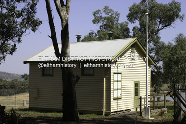
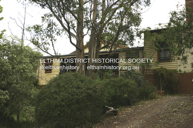
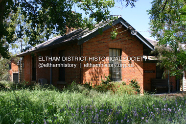
 Eltham District Historical Society Inc
Photograph - Digital Photograph, Marguerite Marshall, Souter House, 23 Falkiner Street, Eltham, 20 June 2008
... Heritage Overlay, Nillumbik Planning Scheme. Published: Nillumbik Now and Then / Marguerite Marshall 2008; photographs Alan King with Marguerite Marshall.; p51 This collection of almost 130 photos about places and people within the Shire of Nillumbik, an urban and rural municipality in Melbourne's north, contributes to an understanding of the history of the Shire. ...Originally built in the 1850s by Charles Souter from earth excavated from his property. It was a forerunner for a building style that was later to be synonymous with Eltham. The house is historically significant as the oldest mud brick building in the Shire of Nillumbik, as one of less than half a dozen buildings from the 1850s that survive in the Shire. It underwent several additions and alterations between c.1950s-1980s. It is also significant for its associations with Mervyn Skipper from the well-known Eltham family who was one of the founders of the artist's colony at Montsalvat. The house is architecturally significant because its north section was designed by the noted 'Eltham-style' architect, Alistair Knox, and the two long Oregon beams supporting the main floor were added by the noted 'Eltham-style' builder, Horrie Judd who built the southern room. A onetime tenant in the house, Judd built many Eltham houses and was a major builder of Montsalvat. The 1934 flood destroyed the south wall and the house remained unoccupied for some time. Sonia Skipper, one of Montsalvat’s builders who also worked for Alistair Knox oversaw rebuilding it. She employed landscape designer Gordon Ford, artist Peter Glass and Tim Burstall. The house originally had a cellar for making and storing wine, reputedly the first made in the district according to Alistair Knox in his book ‘We are what we stand on’ (p33). Water would seep into the cellar so Sonia’s father and then owner of the house, Mervyn Skipper bulldozed a channel outside to divert it. The Brocksopp family purchased the house in 1950 and added an outside door to the cellar and converted it into a gallery. Covered under Heritage Overlay, Nillumbik Planning Scheme. Published: Nillumbik Now and Then / Marguerite Marshall 2008; photographs Alan King with Marguerite Marshall.; p51This collection of almost 130 photos about places and people within the Shire of Nillumbik, an urban and rural municipality in Melbourne's north, contributes to an understanding of the history of the Shire. Published in 2008 immediately prior to the Black Saturday bushfires of February 7, 2009, it documents sites that were impacted, and in some cases destroyed by the fires. It includes photographs taken especially for the publication, creating a unique time capsule representing the Shire in the early 21st century. It remains the most recent comprehenesive publication devoted to the Shire's history connecting local residents to the past. nillumbik now and then (marshall-king) collection, eltham, falkiner street, mud brick building, mudbrick houses, souter house -
 Eltham District Historical Society Inc
Photograph - Digital Photograph, Alan King, Former Police Residence, 728 Main Road, Eltham, 28 December 2007
... Heritage Overlay, Nillumbik Planning Scheme. Published: Nillumbik Now and Then / Marguerite Marshall 2008; photographs Alan King with Marguerite Marshall.; p65 This collection of almost 130 photos about places and people within the Shire of Nillumbik, an urban and rural municipality in Melbourne's north, contributes to an understanding of the history of the Shire. ...The institutions of law and order in Colonial Victoria included the police, courts and prisons. The 1852 report of the Snodgrass Select Committee appointed to "identify the policing needs of the colony” noted there existed seven independent police forces that did not co-operate or regularly communicate. Following the committee's report all these police entities were merged into the Victoria Police, founded on 8 January 1853, to implement law and order responsibilities throughout the Colony of Victoria. The Eltham Courthouse (1860) and adjacent Police Residence (1859) formed a justice precinct established in the immediate aftermath of the 1852 police inquiry and the effects of the gold rush. The physical presence of these buildings, in the centre of the early Eltham township, defined centralised control over law and order. In the early days the Police Constable in charge would conduct his duties travelling around the district by horse; a stable was located at the rear of the residence. At times the horse would be grazed on the paddocks across the road. Horseshoes were forged by the blacksmith beside the Courthouse on the high side of “Policeman’s Hill”. Along with the stable, there was a two-cell bluestone lockup where prisoners were held awaiting trial in the adjacent Courthouse. Their meals were usually provided by the policeman’s wife or from the hotel just up the road. With the arrival of the railway in 1902 the town centre gradually shifted towards the railway station. The Police Station and operations were moved into the town centre in 1961 to a renovated house in Pryor Street, which was later replaced by the current Police Station. From 1961-1981 the residence was occupied by the Vermin and Noxious Weeds Destruction Section of the Department of Crown Lands and Survey. Prior to August 1967 the former Police Station was dragged to the rear of Police Residence to make way for the construction of a driveway and access from Main Road. The building was placed on the site of a former Scullery and modified for Lands Department use. In 1981 the Shire of Eltham took over management of the former Police Residence in Eltham. It remained unoccupied for a period whilst its future was discussed in Council. It was then used for a community job creation scheme until 1985. In 1985 the Shire of Eltham Parks and Environment occupied the residence. Council improved the driveway but later added a second rear access from Brougham Street due to the dangerous nature of the Main Road entrance. Additionally, a rear toilet facility between the Police Residence and the relocated former Police Station, which was doubling up as a lunchroom. Council also commenced discussions to re-establish a replica Police Station. Around November 1986 the former Police Station was demolished; believed to have been suffering termite damage. About 1989, after some years of discussion, a replica Police Station was built, based on photographs, to act as a lunchroom and meeting room for the Parks and Environment staff and volunteers doing community service. In 1996 Eltham District Historical Society held discussions with Nillumbik Shire Council commissioners throughout the year regarding a home for the Society. A proposal was put forward by the Society in October to occupy the former Police Residence. In March 1997 Eltham District Historical Society gained access to former Police Residence and on July 12, 1998, moved into its Local History Centre. In July 2018, Eltham District Historical Society gained access to the replica Police Station (which had been used as a music library and storage for the Eltham Concert Band) for use as part of regular heritage tours for schools and community-based groups. Covered under Heritage Overlay, Nillumbik Planning Scheme. Published: Nillumbik Now and Then / Marguerite Marshall 2008; photographs Alan King with Marguerite Marshall.; p65This collection of almost 130 photos about places and people within the Shire of Nillumbik, an urban and rural municipality in Melbourne's north, contributes to an understanding of the history of the Shire. Published in 2008 immediately prior to the Black Saturday bushfires of February 7, 2009, it documents sites that were impacted, and in some cases destroyed by the fires. It includes photographs taken especially for the publication, creating a unique time capsule representing the Shire in the early 21st century. It remains the most recent comprehenesive publication devoted to the Shire's history connecting local residents to the past. nillumbik now and then (marshall-king) collection, eltham, main road, eltham district historical society, eltham justice precinct, little eltham, local history centre, police residence, police station -
 Eltham District Historical Society Inc
Photograph - Digital Photograph, Alan King, St Margaret's Anglican Church, Pitt Street, Eltham, 30 January 2008
... National Trust of Australia (Victoria) State significance Victorian Heritage Published: Nillumbik Now and Then / Marguerite Marshall 2008; photographs Alan King with Marguerite Marshall.; p67 This collection of almost 130 photos about places and people within the Shire of Nillumbik, an urban and rural municipality in Melbourne's north, contributes to an understanding of the history of the Shire. ...St Margaret’s Church of England was officially opened on December 12, 1861. It is the oldest intact church building in Eltham. At the time it was known as Christ Church until its consecration in 1871, when it was completely free of debt (£1,700 for the church and parsonage) despite the district’s poverty. This was largely due to the free labour and materials, including locally made bricks donated by local artisans and others. The church is historically significant because it is the oldest church in the former Shire of Eltham and has associations with the philanthropist and founder of Brighton, Henry Dendy (who donated the land on which the church is built), the architect Nathaniel Billing and the prominent local builder, George Stebbing. The church is architecturally and aesthetically significant because it is constructed in the Gothic Revival style with several stained-glass windows of various dates and is also a very early use of polychromatic brickwork in Victoria. Billing was one of the first Melbourne architects to employ polychromatic brickwork and an important early architect. The rear wall was intended to be temporary. A major feature of the design is the large buttresses with long, steeply graded upper faces. The overall design is well proportioned with the surface brick patterns relieving an otherwise austere design. The church is spiritually and socially significant because it has been an important place of worship for the people of Eltham for almost 150 years. The land on which the buildings stand was donated by Henry Dendy. Dendy arrived in Melbourne in 1841 after purchasing in England eight square miles at Brighton under the system of "special surveys". After this land passed out of his hands, Dendy moved about Victoria, visited England, then returned to settle in Eltham where he purchased a flour mill. Dendy chaired the meeting held in 1860 “for the purpose of devising such means as may be expedient for the establishment of a Church of England in the township of Eltham”. He became chairman and treasurer of the church committee. Unlike the establishment of many early churches in Victoria where a vicar was appointed to a parish and later a permanent church was constructed, the population at Eltham initiated action to build a church. The nearest church at that time was at Heidelberg and the Eltham settlement was part of the parish of St Johns Heidelberg. Isolation and the tedious, time consuming journey between Heidelberg and Eltham resulted in the Eltham community taking its own action. The original vicarage (Dendy House) at the rear of the church is also an important part of the cultural significance of this place because it is connected to the church and the development of the Eltham area. Together, the church and the vicarage are aesthetically significant because they form a significant streetscape feature. The mud-brick community hall designed by Robert Marshall was added in 1978. In 2014 the original temporary rear wall was removed as part of a modern extension designed by Architects Atelier Wagner and constructed by Conrad Construction and Management. Covered under Heritage Overlay, Nillumbik Planning Scheme. National Trust of Australia (Victoria) State significance Victorian Heritage Published: Nillumbik Now and Then / Marguerite Marshall 2008; photographs Alan King with Marguerite Marshall.; p67This collection of almost 130 photos about places and people within the Shire of Nillumbik, an urban and rural municipality in Melbourne's north, contributes to an understanding of the history of the Shire. Published in 2008 immediately prior to the Black Saturday bushfires of February 7, 2009, it documents sites that were impacted, and in some cases destroyed by the fires. It includes photographs taken especially for the publication, creating a unique time capsule representing the Shire in the early 21st century. It remains the most recent comprehenesive publication devoted to the Shire's history connecting local residents to the past. nillumbik now and then (marshall-king) collection, eltham, st margaret's anglican church, st margaret's church, christ church -
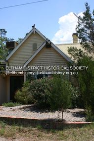 Eltham District Historical Society Inc
Photograph - Digital Photograph, Alan King, Former St Andrews State School No. 128 building, 23 January 2008
... Heritage Overlay, Nillumbik Planning Scheme. Published: Nillumbik Now and Then / Marguerite Marshall 2008; photographs Alan King with Marguerite Marshall.; p69 This collection of almost 130 photos about places and people within the Shire of Nillumbik, an urban and rural municipality in Melbourne's north, contributes to an understanding of the history of the Shire. ...In 1858 the Caledonia Common School No.128 opened at Queenstown, about 1.6km upstream on Diamond Creek from the present site of the old St Andrews school. The school was renamed Queenstown Common School No. 128 in 1867. In 1882, due to declining numbers of pupils at Smiths Gully and increasing numbers in Queenstown the school was moved from a leased building, owned by Head Teacher Robert Harris, into a new larger building on the corner of School and Heidelberg-Kinglake roads which incorporated the original single room school building, which had been moved from Smiths Gully, and included a teacher’s three-roomed residence. In 1887 the school was replaced by the Queenstown State School No. 128. The school and town were renamed St Andrews in 1952. In 1983 a new school was built, 500 metres south of the old school and the old school became the St Andrews Community Centre. Of significance is the c1887 school building (including part of the c1876 Smith's Gully school moved to the site and incorporated into the c1887 school building), the c1911 new room, the c1929 cloakroom, the c1930 renovations, the c1956 new infant room; the c1961 office and storeroom, as well as the c1950 Himalayan Cedar tree and the entire site to the title boundaries. The school building is historically significant for its links with the early settlement of the area and because its use of materials from the former Smith's Gully State school illustrates the common 19th and early 20th century practice of relocating State school buildings based on need. The school building is historically and socially significant because it served the local community, as a school, from 1887 to the late 1970s/early 1980s and because since then it has been used for other community purposes. Covered under Heritage Overlay, Nillumbik Planning Scheme. Published: Nillumbik Now and Then / Marguerite Marshall 2008; photographs Alan King with Marguerite Marshall.; p69This collection of almost 130 photos about places and people within the Shire of Nillumbik, an urban and rural municipality in Melbourne's north, contributes to an understanding of the history of the Shire. Published in 2008 immediately prior to the Black Saturday bushfires of February 7, 2009, it documents sites that were impacted, and in some cases destroyed by the fires. It includes photographs taken especially for the publication, creating a unique time capsule representing the Shire in the early 21st century. It remains the most recent comprehenesive publication devoted to the Shire's history connecting local residents to the past. nillumbik now and then (marshall-king) collection, st andrews, queenstown state school no. 128, smiths gully state school -
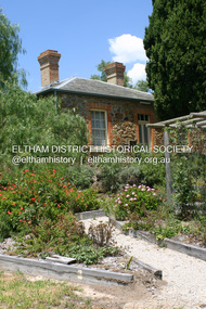 Eltham District Historical Society Inc
Photograph - Digital Photograph, Alan King, Ellis Cottage, Diamond Creek, 23 January 2008
... Two mature Italian Cypresses at the entry are also heritage protected as they relate to similar trees planted at Shillinglaw Cottage and other early buildings in Nillumbik Shire. This collection of almost 130 photos about places and people within the Shire of Nillumbik, an urban and rural municipality in Melbourne's north, contributes to an understanding of the history of the Shire. ...Built by William Ellis in 1865 of local uncut stone about 30cm thick, the cottage is now a museum and home to the Nillumbik Historical Society. Ellis Cottage is historically significant for its association with the Ellis family, who were pioneers of the Diamond Creek district and the benefactors of the notable Nillumbik Cemetery gateway. It illustrates the development of farming in the area. Ellis Cottage is historically and technically significant for its rare use of uncut local stone for building purposes. Covered under Heritage Overlay, Nillumbik Planning Scheme. National Estate Published: Nillumbik Now and Then / Marguerite Marshall 2008; photographs Alan King with Marguerite Marshall.; p79 Ellis Cottage, built by William Ellis, is a memorial to the courage of pioneers in the Diamond Valley area.1 Now a museum and home to the Nillumbik Historical Society, it is a fine example of an early settler’s house in Diamond Creek – and one of the few original buildings standing from the middle of the 19th century. It is a poor man’s cottage – typical of the dwellings of those who had to work hard to wrest a living in this district, because most of the land was not fertile enough for major forms of farming. The pretty stone cottage at 10 Nillumbik Square, built in 1865, is made of local uncut stone about one foot (30 cm) thick. It once stood near the centre of the 147 acres (59.4ha) Ellis bought in 1850. The property extended from Diamond Creek to Reynolds Road and from Perversi Avenue to the Wattle Glen School. It stood in the electoral parish of Nillumbik. The Nillumbik township (later called Diamond Creek) was not created until 1867. In 1912 the property was cut in half by the new railway to Hurstbridge. Ellis paid £147/10/- for the land - about three times what a Victorian farmer would usually earn in a year. Despite the poor quality soil Ellis became a very successful farmer with an orchard, vegetables and a dairy herd. Five years later, in 1855, Ellis bought 70 acres (28.3ha) from neighbour, Hugh Larimour. In 1857 Ellis bought 208 acres (84ha) at Yarra Glen. In 1877 he bought 122 acres (49.3ha) at Diamond Creek and later bought land at Greensborough and Woodstock. Ellis was born in 1815 at Blackawton, a small Devonshire village, and became a tenant farmer. It is not known why Ellis came out to Australia or settled in Diamond Creek. In 1847 he married Margaret Child at the Melbourne Presbyterian Church. Ellis and Child had no children and 18 years after the wedding, while probably living in Kangaroo Ground, Ellis built this small cottage. The simple cottage has a central hall and two rooms on each side. To maximise the small space the ceiling cavity was designed large enough to provide sleeping accommodation accessed via a ladder. Each room was heated by an open fireplace and the one in the kitchen was large enough to roast a sheep. A large cellar under the front room probably stored farm produce. Water came from a well as reticulated water did not arrive at Diamond Creek until 1914. In 1870 Ellis’ 22 year-old nephew Nathaniel joined him from England.2 Until 1890 they developed Ellis Park, praised in The Evelyn Observer, May 30,1890 as a model farm. Ellis had become wealthy, and on his death in 1896 his estate was valued at £9000. In his will he left £100 to construct memorial gates at the Nillumbik Cemetery where he was buried.3 Ellis left the farm to his second wife Louisa. As he had no children, upon her death the farm passed to Nathaniel, but he did not take it up. The farm was sold and leased several times until 1967, when engineer Phillip Lovitt bought the property and carried out major structural works. The Shire of Diamond Valley bought it in the 1980s and in 1989 restored it with the Nillumbik Historical Society. The stone walls of the cottage had been plastered with mud and straw mortar, which were removed as they were riddled with vermin. Doors, windows and a floor were replaced and the original roof of timber shingles had been replaced with slate. The well was too deeply cracked to be restored, so was used for a flower bed. Two mature Italian Cypresses at the entry are also heritage protected as they relate to similar trees planted at Shillinglaw Cottage and other early buildings in Nillumbik Shire.This collection of almost 130 photos about places and people within the Shire of Nillumbik, an urban and rural municipality in Melbourne's north, contributes to an understanding of the history of the Shire. Published in 2008 immediately prior to the Black Saturday bushfires of February 7, 2009, it documents sites that were impacted, and in some cases destroyed by the fires. It includes photographs taken especially for the publication, creating a unique time capsule representing the Shire in the early 21st century. It remains the most recent comprehenesive publication devoted to the Shire's history connecting local residents to the past. nillumbik now and then (marshall-king) collection, ellis cottage, diamond creek, nillumbik historical society, william ellis -
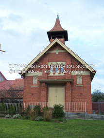 Eltham District Historical Society Inc
Photograph - Digital Photograph, Marguerite Marshall, Parish Hall, St John's Anglican Church, Diamond Creek, 7 September 2008
... Heritage Overlay, Nillumbik Planning Scheme. National Estate Ntionl Trust of Australia (Victoria) Local significance Published: Nillumbik Now and Then / Marguerite Marshall 2008; photographs Alan King with Marguerite Marshall.; p85 References: St Johns Anglican Church complex, Sunday School and Parish Hall 61 Main Street DIAMOND CREEK, NILLUMBIK SHIRE. (2023, June 7). Retrieved from https://vhd.heritagecouncil.vic.gov.au/places/64023 Diamond Creek, VIC. – St John’s Anglican (2023, June 7). Retrieved from https://www.churchhistories.net.au/church-catalog/diamond-creek-vic-st-johns-anglican This collection of almost 130 photos about places and people within the Shire of Nillumbik, an urban ...The building was designed by Charles Maplestone of Heidelberg, son-in-law to Anthony Beale of St Helena. Maplestone was a prominent architect who came out to Australia with his family in 1852. The foundation stone was laid by Mrs Isabella Maplestone on 11th November 1867. The bricklayers for the church were George Stebbing, H Limmer, H Spicer and a Mr Timm while Thomas Day was the stonemason. Another three years were to pass before sufficient money could be raised for its completion. It was opened by Bishop Perry on 1st November, 1870. The church bell which hung under a tree for 50 years until it was incorporated in the parish hall was brought out from England and presented by Charles Orme. In 1916, the estate of George Martin Pizzey left sufficient money to build the red brick hall, which still stands today (2023) though in January 1969 the hall and bell tower were badly damaged by bushfire. Coincidentally the former home of benefactor, George Pizzey was destroyed in the same fire. Of particular significance are the interior and exterior of the church, the Sunday school and hall with emphasis on pre-World War I fabric (excluding the 1990s additions) and the three coloured glass windows currently suspended in the 1990s entry foyer. In 2011 further alterations were made to the front of the Church. The church is historically significant because it was the oldest public building in the former Diamond Valley Shire, is amongst the oldest buildings in the Shire of Nillumbik and is associated with the early settlement of the Diamond Creek district. The church is historically, socially and spiritually significant because it has been a place of worship for over 150 years and continues to be, an important meeting place in the Shire. The church is aesthetically significant for the three stained glass windows executed by the noted stained glass manufacturers, Ferguson & Urie, as well as the supporting coloured glass windows in the church. The Sunday school & parish hall is architecturally significant because the hall is a well executed and preserved example of the work of noted church architects, North & Williams. It is historically significant because it is connected with local parishioner and Melbourne industrialist, George Pizzey, who bequeathed funds for its construction. Covered under Heritage Overlay, Nillumbik Planning Scheme. National Estate Ntionl Trust of Australia (Victoria) Local significance Published: Nillumbik Now and Then / Marguerite Marshall 2008; photographs Alan King with Marguerite Marshall.; p85 References: St Johns Anglican Church complex, Sunday School and Parish Hall 61 Main Street DIAMOND CREEK, NILLUMBIK SHIRE. (2023, June 7). Retrieved from https://vhd.heritagecouncil.vic.gov.au/places/64023 Diamond Creek, VIC. – St John’s Anglican (2023, June 7). Retrieved from https://www.churchhistories.net.au/church-catalog/diamond-creek-vic-st-johns-anglican This collection of almost 130 photos about places and people within the Shire of Nillumbik, an urban and rural municipality in Melbourne's north, contributes to an understanding of the history of the Shire. Published in 2008 immediately prior to the Black Saturday bushfires of February 7, 2009, it documents sites that were impacted, and in some cases destroyed by the fires. It includes photographs taken especially for the publication, creating a unique time capsule representing the Shire in the early 21st century. It remains the most recent comprehenesive publication devoted to the Shire's history connecting local residents to the past. nillumbik now and then (marshall-king) collection, st john's anglican church, diamond creek, parish hall