
Showing 14 items matching "vegetation list"
-
 Bendigo Historical Society Inc.
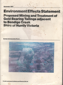
Document - Environment Effects Statement, Bendigo Gold Associates Pty Ltd, Environment Effects Statement Proposed Mining and Treatment of Gold Bearing Tailings adjacent to Bendigo Creek, Shire of Huntly, Victoria, November 1987
... ...vegetation list...Information comprised of three parts: 1. summary and review providing a brief outline of the proposal and main issues and impacts 2. investigations describing existing environment and proposal in detail 3. appendices and bibliography Appendices include: vegetation list of study site; habitat value of study area; list of bird species in the Bendigo Whipstick area; map and table of land systems of Campaspe river catchment; geomorphology of Bendigo Creek Valley; regional geology Huntly area; water quality analysis for Bendigo Creek; date describing the depth of the tailings deposit; CIP plant; preliminary geotechnical investigation for tailings dam; tailings dam seepage; rehabilitation; report on impacts of mercury by Sinclair Knight and Partners and acoustic and noise level details. ...It was envisaged that the mine site could be progressively restored to a wooded wetland environment which, it was believed, was its original condition prior to the deposition of the material. environment effects statement mining gold bearing tailings Bendigo Creek Shire of Huntly Campaspe river catchment geomorphology of Bendigo Creek Valley regional geology Huntly area water quality analysis for Bendigo Creek date describing the depth of the tailings deposit CIP plant preliminary geotechnical investigation for tailings dam tailings dam seepage rehabilitation report on impacts of mercury bird lists vegetation list mine site Bendigo Gold Associates Pty Ltd. ...This Environment Effects statement was prepared to support a proposal by Bendigo Gold Associates Pty Ltd. to recover gold from material deposited along Bendigo Creek. It was proposed to recover approximately 800 kg of gold, valued at $15.5 million, as at August 1986 gold prices, over an anticipated project life of 5 years. It was envisaged that the mine site could be progressively restored to a wooded wetland environment which, it was believed, was its original condition prior to the deposition of the material. Document, ninety pages plus appendices and figures, published in November 1987. Information comprised of three parts: 1. summary and review providing a brief outline of the proposal and main issues and impacts 2. investigations describing existing environment and proposal in detail 3. appendices and bibliography Appendices include: vegetation list of study site; habitat value of study area; list of bird species in the Bendigo Whipstick area; map and table of land systems of Campaspe river catchment; geomorphology of Bendigo Creek Valley; regional geology Huntly area; water quality analysis for Bendigo Creek; date describing the depth of the tailings deposit; CIP plant; preliminary geotechnical investigation for tailings dam; tailings dam seepage; rehabilitation; report on impacts of mercury by Sinclair Knight and Partners and acoustic and noise level details. Report prepared by Forsite Landscape Architects and Planners Pty Ltd. for Bendigo Gold Associates Pty Ltd. environment effects statement, mining, gold bearing tailings, bendigo creek, shire of huntly, campaspe river catchment, geomorphology of bendigo creek valley, regional geology huntly area, water quality analysis for bendigo creek, date describing the depth of the tailings deposit, cip plant, preliminary geotechnical investigation for tailings dam, tailings dam seepage, rehabilitation, report on impacts of mercury, bird lists, vegetation list, mine site, bendigo gold associates pty ltd. -
 Ringwood and District Historical Society
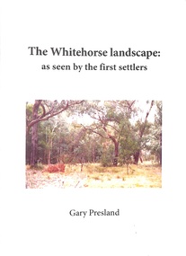
Book - Booklet, Gary Presland, Booklet titled 'The Whitehorse Landscape' as seen by the first settlers by Gary Presland, 2011. Contains photographs of flora and fauna plus details of the local weather and geology, 2011
... The Whitehorse Landscape as seen by the first settlers contains elements of natural history, geology, weather, local hydrology, vegetation and Fauna. With list of sources, glossary of terms and index. ...The Whitehorse Landscape as seen by the first settlers contains elements of natural history, geology, weather, local hydrology, vegetation and Fauna. With list of sources, glossary of terms and index. ...The Whitehorse Landscape as seen by the first settlers contains elements of natural history, geology, weather, local hydrology, vegetation and Fauna. With list of sources, glossary of terms and index. With photographs.25 page booklet, indexed. White covers with picture on front and embedded in the text. +Additional Keywords: Presland, GaryThe Whitehorse Landscape' -
 Kiewa Valley Historical Society
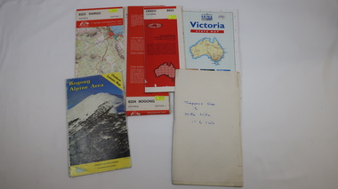
Maps - Bogong x2, Tawonga, Omeo, Dargo, Victoria and others, 1. Bogong Alpine Area; 2. Bogong 8324; 3. Tawonga Topographical; 4. Omeo 8433; 5. Dargo 8323; 6. Victoria State
... Including: recreational activities, history, weather and vegetation and a list of walks together with locality maps and photographs. ...Including: recreational activities, history, weather and vegetation and a list of walks together with locality maps and photographs. ...1. Bogong Alpine Area (outdoor Leisure Map. survey & Mapping Victoria, Government of Victoria, Edition 2, reprinted 1991 with an image of Mt. Feathertop on the front. Information for tourist in the Alpine National Park: Bogong Area. Including: recreational activities, history, weather and vegetation and a list of walks together with locality maps and photographs. The front cover has an image of Mt Feathertop against a blue sky with yellow writing 'Bogong Alpine Area', there is a yellow triangular block on the right hand top corner with black writing 'Outdoor Leisure Map. On the bottom edge is a block of yellow with black writing 'Survey & Mapping Victoria' and a light green map of Victoria with 'VICMSP' printed in white. 2. 8324 Bogong Victoria, Edition 1, Commonwealth of Australia 1981. A topographical Map: 1:100,000 scale (1 cm to 1 KM). Map has a red cover with white writing together with a white block and black writing and a map insert. 3. Tawonga Topographical Map - Forests Commission Victoria, / revised 5/9/77, DEG No. 68-G/399. A Tawonga 803 folded map in a beige colour with the back blank. 4. Omeo 8433 Victoria, Edition 1, Department of Natural Resources. The map has a red and white cover with black writing and a simple map of Australia at the bottom. 5. 8323 Dargo, Edition 1, Commonwealth of Australia. A red and white cover with a map insert. 6. Victoria State Map, Hema Maps, 2002. Hema Maps, State Map, colourful cover with a map of Australia and four tourism photographs. Scale 1: 850,000 An inscription handwritten in blue pen "Trappers Gap to Mitta Mitta 1" to 1 mile". There are some pen markings and notations of tracks.maps, bogong, omeo, tawonga, dargo, victoria, bogong alpine area -
 Ringwood and District Historical Society
Newspaper, Scrapbook Clipping, Library Collection, Ringwood, Victoria, `
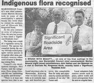
... The listing was the result of a vegetation suvey by council. Pictured are: Jan Bateman, John Nathan and new Maroondah Chief Commissioner, Moreton Browne....The listing was the result of a vegetation suvey by council. Pictured are: Jan Bateman, John Nathan and new Maroondah Chief Commissioner, Moreton Browne. ...``Newspaper clipping from "The Post", 23-8-95, P 2. Indigenous flora recognised Maroondah Council's new chief Commissioner Moreton Brown took in some of the municipality's natural beauty this week when he visited the northern end of Glenvale Rd., Ringwood North. As the area contains an array of indigenous flora, the area has recently been listed a "Significent Roadside Area". The listing was the result of a vegetation suvey by council. Pictured are: Jan Bateman, John Nathan and new Maroondah Chief Commissioner, Moreton Browne.` -
 Ringwood and District Historical Society
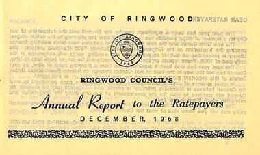
Pamphlet, Ringwood Council's Annual Report To The Ratepayers - December 1968, 1968
... list of departing and current Council Representatives. Also includes general reminders regarding rat extermination, free firewood for age pensioners, overhanging vegetation, and spouses voting rights....list of departing and current Council Representatives. Also includes general reminders regarding rat extermination, free firewood for age pensioners, overhanging vegetation, and spouses voting rights. ...City of Ringwood community information annual report for 1968, including sections covering Finance, General Valuation and Rater Payments, Property Ownership Changes, Refuse, Sanitary Serviced, Sewerage Connections to MMBW, Dandenong Valley Authority, Residential Flat Control Planning Scheme, Immunisation, Home Help, Elderly Citizens' Clubrooms, Library, Civic Centre, Golf Course, Sale of Council Land, Swimming Centre, Holiday Play Centre, Civic Week, Lake Reserve Improvements, Rubbish Dumping, Street Trees, Vandalism, White Ants, Street Construction, Fire Hazards, Dog Nuisance, House Numbering, Citizens' Advisory Service, Infant Welfare Centres, and a list of departing and current Council Representatives. Also includes general reminders regarding rat extermination, free firewood for age pensioners, overhanging vegetation, and spouses voting rights.Obituary - Mr. F.P. Dwerryhouse, Town Clerk for the past 9-1/2 years passed away on 6th December after a short illness.rinx -
 Eltham District Historical Society Inc
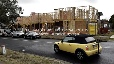
Photograph - Digital Photograph, Joan Castledine, 95 Bible Street, Eltham, 28 May 2025
... listed for sale by Morrison Kleeman on 22 February 2021 and sold for $1,275,000 on 13 March 2021. Planning application 557/2021/03P was submitted 23 June 2021 for demolition of original free standing cottage and buildings and works to construct four (4) two-story townhouse dwellings and removal of vegetation. ...listed for sale by Morrison Kleeman on 22 February 2021 and sold for $1,275,000 on 13 March 2021. Planning application 557/2021/03P was submitted 23 June 2021 for demolition of original free standing cottage and buildings and works to construct four (4) two-story townhouse dwellings and removal of vegetation. ...95 Bible Street, Eltham was a 1950s weatherboard cottage situated on the northwest corner of Dudley Street and Bible Street on a land size of approximately 695 square metres. It was listed for sale by Morrison Kleeman on 22 February 2021 and sold for $1,275,000 on 13 March 2021. Planning application 557/2021/03P was submitted 23 June 2021 for demolition of original free standing cottage and buildings and works to construct four (4) two-story townhouse dwellings and removal of vegetation. The application was refused by Nillumbik Shire Council on 4 April 2022 and the developer subsequently lodged an Appeal at VCAT on 11 May 2022. The application was approved by VCAT on 2 February 2023. Construction commenced in 2025 with anticipated completion late 2025.95 bible street, bible street, building construction, developer, dudley street, etham, joan castledine collection, properties -
 Eltham District Historical Society Inc
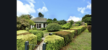
Photograph - Digital Photograph, Morrison Kleeman, 95 Bible Street, Eltham, February 2021
... listed for sale by Morrison Kleeman on 22 February 2021 and sold for $1,275,000 on 13 March 2021. Planning application 557/2021/03P was submitted 23 June 2021 for demolition of original free standing cottage and buildings and works to construct four (4) two-story townhouse dwellings and removal of vegetation. ...listed for sale by Morrison Kleeman on 22 February 2021 and sold for $1,275,000 on 13 March 2021. Planning application 557/2021/03P was submitted 23 June 2021 for demolition of original free standing cottage and buildings and works to construct four (4) two-story townhouse dwellings and removal of vegetation. ...95 Bible Street, Eltham was a 1950s weatherboard cottage situated on the northwest corner of Dudley Street and Bible Street on a land size of approximately 695 square metres. It was listed for sale by Morrison Kleeman on 22 February 2021 and sold for $1,275,000 on 13 March 2021. Planning application 557/2021/03P was submitted 23 June 2021 for demolition of original free standing cottage and buildings and works to construct four (4) two-story townhouse dwellings and removal of vegetation. The application was refused by Nillumbik Shire Council on 4 April 2022 and the developer subsequently lodged an Appeal at VCAT on 11 May 2022. The application was approved by VCAT on 2 February 2023. Construction commenced in 2025 with anticipated completion late 2025.95 bible street, bible street, developer, dudley street, etham, properties, morrison kleeman estate agents -
 Kiewa Valley Historical Society
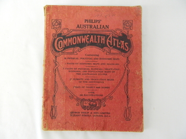
Atlas Australian Commonwealth, Philips' Australian Commonwealth Atlas, 1944
... list. The inside cover has the atlas title and contents and the publisher details. The atlas contain 56 pages of world and Australian maps, vegetation and rainfall maps. ...list. The inside cover has the atlas title and contents and the publisher details. The atlas contain 56 pages of world and Australian maps, vegetation and rainfall maps. ...This atlas, printed in 1944, details not only the geographic and political boundaries of the world as it was at that time but also the snap shot of life of the time. This snap shot in time covers the major Australian cities, the major farming, grazing, industrial and sporting/recreational activities. Also there are snap shots of similar activities from other global areas. The period also covered World War II, detailed by a photo of "shell making", munitions, required by Australian soldiers. The great political and territorial changes made as a result of World War II can be clearly identified for example , Israel (the Jewish homeland). The various prewar colonies of major European nations.This atlas was used by children of a Kiewa Valley family and shows the value and the general educational exposure that these children had at this time. The rural setting and within the backdrop of a world war did not severely alter the life style of children in this region. The "news reels" shown in cinemas of cities and larger towns were the only visual realisations of major events of global significance available to these children. The information provided by this atlas allowed students to glimpse at what the "outside world" was. The majority of these students would possibly never see these regions for themselves. The great communication facilities of the late 1900s and beyond, was still only science fiction.This atlas has a thick (350 g/m) red cardboard cover with bold black lettering and shading. The cover is set out within a shield like frame. The shield is held up by two square markings, each with a four part circular pattern and a cord entwining two pendulum structures ending with a bowl figure at the bottom. There is a semi circular form enclosing a printed book contents list. The inside cover has the atlas title and contents and the publisher details. The atlas contain 56 pages of world and Australian maps, vegetation and rainfall maps. Within this atlas there are 27 double sided pages of black and white photographs depicting life styles, buildings, landscapes and prominent and significant to Australia males from 1652 to 1944. The pages are of approximately 200 g/m and have the yellow aged appearance.On front cover "Philips' Australian COMMONWEALTH ATLAS" and underneath "Containing" underneath "60 PHYSICAL, POLITICAL AND ECONOMIC MAPS". Publisher George Philip & Son, Limited 32 Fleet Street, London E.C. 4. Inside cover are: written, in freehand and in ink the following names and dates; "J.Muller Form V 1945", "L L Muller Form IV 1946", "N.J. Muller Form I + II + III 1948 +49 + 50" and "D Muller Form I 1949". also handwritten and in pencil is "Peter Leslie". On the last page is a small freehand sketch of Australia in biro.1940s school curriculum, rural education, 1940s atlas, australian atlas -
 Ballarat Heritage Services
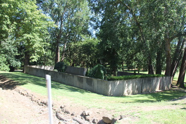
Photograph, Former Buninyong Swimming Pool
... listed on the Victorian Heritage Register and remains a significant past of Buninyong's social and recreational history. In 2025 a project was started to stabilise and preseve the 160 year old structure by adding new foundattons, replacing damages wall panels, sealing cracks and improving drainage. Vegetations...listed on the Victorian Heritage Register and remains a significant past of Buninyong's social and recreational history. In 2025 a project was started to stabilise and preseve the 160 year old structure by adding new foundattons, replacing damages wall panels, sealing cracks and improving drainage. Vegetations ...Originally built as a bluestone water reservoir, it was used as a swimming pool from 1872 to the 1930s. The site is listed on the Victorian Heritage Register and remains a significant past of Buninyong's social and recreational history. In 2025 a project was started to stabilise and preseve the 160 year old structure by adding new foundattons, replacing damages wall panels, sealing cracks and improving drainage. Vegetations from inside the pool was cleared and reinsation is planned once works are finishes (around June 2026)Colour photographs of the former Buninyong Baths in the Buninyong Botanical Gardens.buninyong swimming pool, buninyong baths, pre-olympic swimming pool -
 Whitehorse Historical Society Inc.
Pamphlet, Collina Glen, 2004 - 2007
... Collina Glen Bushland Vegetation Action Statement by Parks Wide stating management recommendations, a sketch of the area, and plant list. ...Collina Glen Bushland Vegetation Action Statement by Parks Wide stating management recommendations, a sketch of the area, and plant list. ...Collina Glen Bushland Vegetation Action Statement by Parks Wide.Collina Glen Bushland Vegetation Action Statement by Parks Wide stating management recommendations, a sketch of the area, and plant list. Also copies of letters and emails to and from Valda Arrowsmith and Whitehorse Council.Collina Glen Bushland Vegetation Action Statement by Parks Wide. collina glen, mitcham, city of whitehorse, arrowsmith, valda, parks wide, parks and reserves -
University of Melbourne, Burnley Campus Archives
Plan, Circus Site, c. 1990
... (1) Copy of Plan: City of Richmond City Engineers Department Circus Site: includes Descriptions of Site Preparation, Plant List and Plant Order List. (2) On tracing paper: Plant Plan. (3) On tracing paper: "Yarra Vegetation Survey - Site 3," Plant Plan...circus survey Richmond vegetation survey Colin Mock Yarra River (1) Handwritten on reverse, "Richmond Council - Yarra Blvd to Bridge Road." (1) Copy of Plan: City of Richmond City Engineers Department Circus Site: includes Descriptions of Site Preparation, Plant List and Plant Order List. (2) On tracing paper: Plant Plan. (3) On tracing paper: "Yarra Vegetation Survey - Site 3," Plant Plan Circus Site Plan ...(1) Copy of Plan: City of Richmond City Engineers Department Circus Site: includes Descriptions of Site Preparation, Plant List and Plant Order List. (2) On tracing paper: Plant Plan. (3) On tracing paper: "Yarra Vegetation Survey - Site 3," Plant Plan(1) Handwritten on reverse, "Richmond Council - Yarra Blvd to Bridge Road."circus, survey, richmond, vegetation survey, colin mock, yarra river -
Southern Sherbrooke Historical Society Inc.
Information folder - Elvery family
... Photo supplied by David Elvery 2/6/99" -Photocopy of photo, Belgrave South Football Club team, probably 1945, plus list of names of team - from David Elvery 2/6/99 -printout, State Library of Victoria Multimedia Catalogue, Rose Series postcard of "Sunnyside Lodge" Lockwood, Belgrave South -copy of printed letter from David Elvery to CEO Shire of Yarra (sic) dated 8/6/99 re. vegetation on Mt Morton. ...Photo supplied by David Elvery 2/6/99" -Photocopy of photo, Belgrave South Football Club team, probably 1945, plus list of names of team - from David Elvery 2/6/99 -printout, State Library of Victoria Multimedia Catalogue, Rose Series postcard of "Sunnyside Lodge" Lockwood, Belgrave South -copy of printed letter from David Elvery to CEO Shire of Yarra (sic) dated 8/6/99 re. vegetation on Mt Morton. ...Folder contains information pertaining to the Elvery family of Belgrave Heights. Contents: -Trifold A3 pamphlet, glossy paper, black, white and orange "The Lodge Just the perfect place to stay" c1990s advertisement flyer. -Map, hand-drawn with photos attached, "9 Hole Golf Course. Belgrave Heights - 1930-1943". Photocopy of large poster made by Betty DeCoite (original in map drawer) -Photocopy of photo, annotated in ink "Photo taken in Dandenongs - possibly Monbulk/the Patch? Photo supplied by David Elvery 2/6/99" -Photocopy of photo, Belgrave South Football Club team, probably 1945, plus list of names of team - from David Elvery 2/6/99 -printout, State Library of Victoria Multimedia Catalogue, Rose Series postcard of "Sunnyside Lodge" Lockwood, Belgrave South -copy of printed letter from David Elvery to CEO Shire of Yarra (sic) dated 8/6/99 re. vegetation on Mt Morton. Handwritten additions plus p'copy of Valentine Series postcard #3832 "Panorama From Mount Morton, Belgrave Heights" -p'copy of typed speech with annotations, by Rev. A.C. Beckingham at the opening of Lockwood -p'copy of photo, Harrison and Dalny Elvery and children David and Wendy c1936. Annotated by David Elvery 30/5/99 -printout, SLV Multimedia Catalogue, Rose Series postcard "Lockwood House" Lockwood, Belgrave South -p'copy, subdivision map "Lockwood Estate" lodged plan 6548 -p'copy, subdivision map Lockwood area, plan #6970 -A3 sheet, p'copies 6 postcards of Belgrave Heights -p'copy photo Elvery house, later "Sunnyside" and "Devon Lodge" annotated by David Elvery 2/6/99 -3 p'copied photos, Belgrave Heights, possibly Varney's butchers shop, possibly Whitlam residence. Annotated by David Elvery -2 p'copied photos, "Lockwood House", Golf links (Bill Woodfull, Principal of Upwey High School in photo), annotated David Elvery 2/6/99 -2 photos from David Elvery - moving Melbourne tram into "house" location at Lockwood, and bus "W. Dyke" unknown date and location. -3 photos from David Elvery - David on Gypsy (pony) Mt Morton Rd c1937, Wendy and David at entrance 37 Lockwood Rd c1942, David on Mack (horse) on golf links c1947 -Photo Arthur and Harrison Elvery, Lockwood House in background c1916 -photo Mrs Elvery, p'copy of postcard 26/3/20 addressed to "Dear Maud", mentions Charlie's wife and Laura (incomplete) -photo George Rae (Narre Warren North) Harold Allen and three other boys c1939 -6 photos, unlabelled (duplicates?) -photo Orchard Rd, Belgrave Heights -photo unlabelled, woman with child in pram, house in background (Lockwood?) -photo David Elvery on Gypsy as above -Rose postcard P2032 "Lockwood" Belgrave, Victoria -photo David Elvery on Mack (as above) -photo Wendy and David Elvery (as above) -2 photos, tram being moved (as above), football team -p'copy of Certificate of Title Vol.4562 Fol. 912336 dated 31/1/1922 - see list of names in folder -p'copy Memorial of Instruments (Land Title) dated 14/1/1914 -p'copy Cert. of Title Vol. 4562 Fol. 912335 dated 31/1/1922 -handwritten note, David Elvery to Susan Heywood-Downard -p'copy Memorial of Instruments dated 14/1/1914 -p'copy subdivision map, area bounded by Glen, Orchard, Avonside and Bay Rds, Belgrave Heights -p'copy Cert. of Title, Vol. 4810 Fol. 961945, dated 2/1/1924 -p'copy Cert. of Title, Vol. 4562 Fol. 912337, dated 31/1/1922 -Typed list of photo caption, relating to some of above photos -List of names and dates appearing on land title documents enclosed -Printout, Australian Dictionary Of Biography - Davies family - handwritten addition, marriage details, Arthur Elvery & Hannah Ord. -Printout - Family Search, Maria Louisa Davies, and family group, Ebenezer Davies & Ruth Bartlett. -letter to editor, Northern Star, Lismore, NSW, 11 Aug. 1923, Hannah Elvery, re. sport on Sunday -typescript - Elvery Family History, part of the "Alstonville" Elvery story, supplied by David H. Elvery 30th May 1999. From Bob Quincey.elvery family, lockwood house, belgrave heights, devon lodge -
Surrey Hills Historical Society Collection
Work on paper - Vertical File, Boroondara Indigenous Plants
... list Council brochure, undated, 2 copies (1 page printed both sides). 2. Boroondara – Local Plants, Council brochure, undated (1 page printed both sides). 3. Surrey Hills History Society Minutes Meeting 16 September 2002 Guest Speakers Aidrian Hotchin and Peter Tucker “Indigenous Vegetation of the Boroondara Area”. ...list Council brochure, undated, 2 copies (1 page printed both sides). 2. Boroondara – Local Plants, Council brochure, undated (1 page printed both sides). 3. Surrey Hills History Society Minutes Meeting 16 September 2002 Guest Speakers Aidrian Hotchin and Peter Tucker “Indigenous Vegetation of the Boroondara Area”. ...BOROONDARA INDIGENOUS PLANTS 1. Indigenous plant list Council brochure, undated, 2 copies (1 page printed both sides). 2. Boroondara – Local Plants, Council brochure, undated (1 page printed both sides). 3. Surrey Hills History Society Minutes Meeting 16 September 2002 Guest Speakers Aidrian Hotchin and Peter Tucker “Indigenous Vegetation of the Boroondara Area”. (one page) 4. ‘Plant the right gum trees’, Progress Leader, letter from Vikki Oates, Hawthorn, 8.8.2017 (1 page). 5. Boroondara – Local Plants, Council brochure, undated, different from No. 1 (1 page printed both sides). (2 x copies) boroondara local plants -
Emerald Museum & Nobelius Heritage Park
Photograph - Nobelius Packing Shed, Unknown photographer, 2000s
... listed on the Victorian Heritage Register. Nobelius Nursery Packing Shed 2000s Puffing Billy Railway Nobelius Heritage Park No inscriptions/marks A coloured rectangular photograph of the Nobelius Nurseries Packing Shed. The photograph was taken in the grounds looking up towards the packing shed. There are various trees and vegetation ...The Gembrook Nurseries, informally known as the Nobelius Nurseries after the founder Carl Axel Nobelius, began with the purchase of sixty-three acres in 1886 and boomed in the 1890s due to opportunities provided by employment-promoting schemes to develop public parks and gardens and street shade by local and State Governments around Australia. Trees were sold to more than forty councils and Government organisations in the 1890s, including the Department of Agriculture, Lands Department and Victorian Railways. The need to transport nursery products by train via Ferntree Gully rather than by bullock dray to Narre Warren was a factor in the successful petition to develop what is now known as the Puffing Billy Railway. Railway developments in 1900 included the creation of a siding and Packing Shed, known as Nobelius Station, which is featured in this photograph. The Packing Shed was able to handle 250,000 cases of fruit each year at the height of the nurseries' activities. The image shows the Packing Shed with boarded-up windows, suggesting it was taken prior to the purchase of the facility for use in the Puffing Billy Railway service. Gembrook Nurseries had an indirect influence on the development of other farms and industries in the region. As a wholesale nursery with high sales volumes it was an important employer of local people. Peak season for employees was during the cooler months, during most farmers' off-season. This provided local farmers with a source of income while their own farms were becoming established.The photograph is significant because it depicts infrastructure associated with the Gembrook or Nobelius Nurseries, a business which was instrumental to the development of Emerald as a settlement in the 19th and 20th Centuries and also influenced the development of public and private gardens and the farming of several species in Australia and internationally. The Nobelius Nursery is listed on the Victorian Heritage Register.A coloured rectangular photograph of the Nobelius Nurseries Packing Shed. The photograph was taken in the grounds looking up towards the packing shed. There are various trees and vegetation throughout the grounds and surrounding the packing shed. The Nobelius Nurseries Packing Shed was used to sort and pack trees to be sent overseas during the 1900s-1940s.No inscriptions/marksnobelius nursery, packing shed, 2000s, puffing billy railway, nobelius heritage park
