Showing 15 items matching "victorian cartography"
-
 Wodonga & District Historical Society Inc
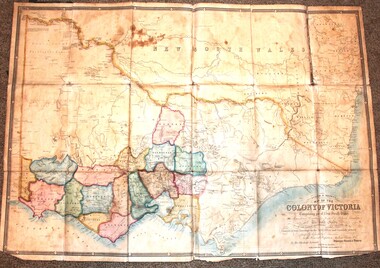
Map - Tulloch & Brown's Map of the Colony of Victoria, Tulloch & Brown, 1856
... ...Victorian cartography...Tulloch and Brown maps Rare maps Victoria Victorian cartography At bottom right hand section of map: Tulloch & Brown's map of the Colony of Victoria : comprising part of New South Wales, the boundaries, counties, also seaport & inland townships, the gold fields with the latest discoveries, roads, tracks, &c. ...The map was created by Tulloch and Brown. David Tulloch was one of the earliest engravers and lithographers in the state of Victoria. He arrived in Melbourne from Greenock, Scotland, on 3 January 1849. Following the discovery of gold Tulloch went to the Victorian goldfields in 1851, commissioned to make sketches of the diggers and the diggings for Ham’s Illustrated Australian Magazine. In November 1852 Tulloch set up in business as engraver, draughtsman, copperplate printer and lithographer. Tulloch took a map engraver, James Davie Brown, into partnership in March 1853; the several maps and specimens of commercial engraving they showed at the 1854 Melbourne Exhibition were awarded a bronze medal. That year Tulloch and Brown also received a silver medal at the Victorian Industrial Exhibition. The partnership was dissolved towards the end of 1856.This is a very early map of the Colony of Victoria including Belvoir (now know as Wodonga).A foldable map mounted on linen and with a board cover. It records the Colony of Victoria according to Surveyor's Records revised in 1857. Areas of the map are shaded to highlight different counties.At bottom right hand section of map: Tulloch & Brown's map of the Colony of Victoria : comprising part of New South Wales, the boundaries, counties, also seaport & inland townships, the gold fields with the latest discoveries, roads, tracks, &c. &c. / compiled from drawings in the Survey Office and correctly revised till 1857. Respectfully dedicated by Permission, to the Honorable Captain Andrew Clarke R.E. Surveyor General of Victoria by His Obediant Servants Tulloch & Brown, Engravers & Publishers, Melbourne". At bottom right below border : Published as the Act directs by the Proprietors, Melbourne, 1st Feb. 1856. tulloch and brown maps, rare maps victoria, victorian cartography -
 Bendigo Military Museum
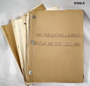
Administrative record - LHQ Cartographic Coy - Map Printing and Reprints 1 July 1942- 31 Dec 1947, LHQ Cartographic Coy, 1942-1947
... Cartographic Company relocated to Fortuna Villa, Bendigo in 1942. With printing presses acquired from a number of civilian organizations it printed the maps needed for the Australian WW11 war effort. These records detail which maps were printed during those years. Photographs of the printing machines and the printers who used them are shown in Victorian...Cartographic Company relocated to Fortuna Villa, Bendigo in 1942. With printing presses acquired from a number of civilian organizations it printed the maps needed for the Australian WW11 war effort. These records detail which maps were printed during those years. Photographs of the printing machines and the printers who used them are shown in Victorian ...The Land Headquarters Cartographic Company relocated to Fortuna Villa, Bendigo in 1942. With printing presses acquired from a number of civilian organizations it printed the maps needed for the Australian WW11 war effort. These records detail which maps were printed during those years. Photographs of the printing machines and the printers who used them are shown in Victorian Collections item 6148 LHQ Carto Coy Souvenir Booklet. 6352.1 Map Publishing and Reprinting Reports 1 July 1942 - 31 Dec 1943 6352.2 Map Publishing and Reprinting Reports 1 July 1943 - 31 Dec 1944 6352.3 Map Publishing and Reprinting Reports 1 July 1944 - 31 Dec 1945 6352.4 Map Publishing and Reprinting Reports 1 July 1945 - 31 Dec 1946 6352.5 Map Publishing and Reprinting Reports 1 July 1946 - 31 Dec 1947Five Manilla Folders containing Map Printing ReportsHand written on the Folder covers: 6352.1 Map Publishing and Reprinting Reports 1 July 1942 - 31 Dec 1943 6352.2 Map Publishing and Reprinting Reports 1 July 1943 - 31 Dec 1944 6352.3 Map Publishing and Reprinting Reports 1 July 1944 - 31 Dec 1945 6352.4 Map Publishing and Reprinting Reports 1 July 1945 - 31 Dec 1946 6352.5 Map Publishing and Reprinting Reports 1 July 1946 - 31 Dec 1947royal australian survey corps, rasvy, fortuna, army survey regiment, army svy regt, asr -
 Phillip Island and District Historical Society Inc.
Book, F.E. Hiscocks &? Co, F.E. Hiscocks &? Co.'s new Victorian counties atlas, 1874 [cartographic material] : together with map of Victoria, indicating roads, distances, relative position of counties, &?c, 1874
... s new Victorian counties atlas, 1874 [cartographic material] : together with map of Victoria, indicating roads, distances, relative position of counties, &? ...Labelled 'Cowes Free Public Library', 'Phillip Island Historical Society, Cleeland Bequest'.victoria, maps -
 Bendigo Historical Society Inc.
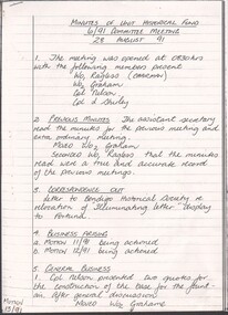
Document - Minutes of Army Survey Regiment Unit Historical Fund, Fortuna Villa
... Fortuna was compulsorily acquired by the Commonwealth in 1942 as the Cartographic Headquarters of the Australian Survey Corps during World War II, and many ancillary structures were added while preserving the main house and ornamental grounds. Victorian...Fortuna was compulsorily acquired by the Commonwealth in 1942 as the Cartographic Headquarters of the Australian Survey Corps during World War II, and many ancillary structures were added while preserving the main house and ornamental grounds. Victorian ...Fortuna Villa was initially commenced as a modest single storey home in 1861 next to the 180 Mine by Theodore Ballerstedt, who sold the mine and house to George Lansell in 1869. Lansell already owned the adjacent Fortuna Mine, and through deeper mining techniques greatly expanded the mine's operation, his personal wealth, and the house and grounds. Lansell was soon known as the 'Quartz King', Australia's first gold mining millionaire and credited as the driving force behind much of Bendigo's prosperity. He continuously added to and expanded the villa, decorating it extravagantly with the finest of artworks and materials, into a sprawling mansion with extensive landscaped grounds, to create a house and grounds of a size and grandeur with few rivals in Australia. After his death in 1907, his second wife Edith carried on with improvements, creating a house and grounds developed over 50 years. The attached mine also contributes to its significance, being one of the richest mines in Bendigo, and at one stage probably the deepest gold mine in the world at 3176 feet. The 1875 crushing works are attached directly to the mansion, and the mine's tailings and settling ponds (turned into ornamental lakes) represent a direct link between George Lansell's wealth and its source. Fortuna was compulsorily acquired by the Commonwealth in 1942 as the Cartographic Headquarters of the Australian Survey Corps during World War II, and many ancillary structures were added while preserving the main house and ornamental grounds. Victorian Heritage Database Report https://vhd.heritagecouncil.vic.gov.au/places/68334/download-reportMinutes of Army Survey Regiment Unit Historical Fund, Fortuna Villa (28 Aug 1991 - 25 Nov 1992) 28 August 1991 - cost of construction of base of the fountain, and letter to Bendigo Art Gallery to follow-up loan of the "Venus" statue for display in the RM's office and resurfacing of marble baths in the CO and adjutant's offices. Single undated page from Unit Historical Fund Committee in 1991. 11 Nov 1992 - discussion of Christmas tours and a plaque for hallway. 25 Nov 1992 - lights for the Company's office, and a discussion of five tasks for next year. Lansell's Fortuna flyer for tour.fortuna villa, minutes -
 Bendigo Historical Society Inc.
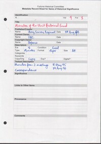
Administrative record - Minute records Army Survey Regiment Fortuna Historical Society
... Fortuna was compulsorily acquired by the Commonwealth in 1942 as the Cartographic Headquarters of the Australian Survey Corps during World War II, and many ancillary structures were added while preserving the main house and ornamental grounds. Victorian...Fortuna was compulsorily acquired by the Commonwealth in 1942 as the Cartographic Headquarters of the Australian Survey Corps during World War II, and many ancillary structures were added while preserving the main house and ornamental grounds. Victorian ...Fortuna Villa was initially commenced as a modest single storey home in 1861 next to the 180 Mine by Theodore Ballerstedt, who sold the mine and house to George Lansell in 1869. Lansell already owned the adjacent Fortuna Mine, and through deeper mining techniques greatly expanded the mine's operation, his personal wealth, and the house and grounds. Lansell was soon known as the 'Quartz King', Australia's first gold mining millionaire and credited as the driving force behind much of Bendigo's prosperity. He continuously added to and expanded the villa, decorating it extravagantly with the finest of artworks and materials, into a sprawling mansion with extensive landscaped grounds, to create a house and grounds of a size and grandeur with few rivals in Australia. After his death in 1907, his second wife Edith carried on with improvements, creating a house and grounds developed over 50 years. The attached mine also contributes to its significance, being one of the richest mines in Bendigo, and at one stage probably the deepest gold mine in the world at 3176 feet. The 1875 crushing works are attached directly to the mansion, and the mine's tailings and settling ponds (turned into ornamental lakes) represent a direct link between George Lansell's wealth and its source. Fortuna was compulsorily acquired by the Commonwealth in 1942 as the Cartographic Headquarters of the Australian Survey Corps during World War II, and many ancillary structures were added while preserving the main house and ornamental grounds. Victorian Heritage Database Report https://vhd.heritagecouncil.vic.gov.au/places/68334/download-reportMinutes of the Fortuna Historical Committee held 24 August 1994 (hand written minutes over four sheets, referenced Vol 9 Fol 3) including four pages of stakeholder feedback tabled at the meetingfortuna, historical unit -
 Bendigo Historical Society Inc.
Document - Pompeii Fountain & Adjacent Structures at "Fortuna"
... Fortuna was compulsorily acquired by the Commonwealth in 1942 as the Cartographic Headquarters of the Australian Survey Corps during World War II, and many ancillary structures were added while preserving the main house and ornamental grounds. Victorian...Fortuna was compulsorily acquired by the Commonwealth in 1942 as the Cartographic Headquarters of the Australian Survey Corps during World War II, and many ancillary structures were added while preserving the main house and ornamental grounds. Victorian ...Fortuna Villa was initially commenced as a modest single storey home in 1861 next to the 180 Mine by Theodore Ballerstedt, who sold the mine and house to George Lansell in 1869. Lansell already owned the adjacent Fortuna Mine, and through deeper mining techniques greatly expanded the mine's operation, his personal wealth, and the house and grounds. Lansell was soon known as the 'Quartz King', Australia's first gold mining millionaire and credited as the driving force behind much of Bendigo's prosperity. He continuously added to and expanded the villa, decorating it extravagantly with the finest of artworks and materials, into a sprawling mansion with extensive landscaped grounds, to create a house and grounds of a size and grandeur with few rivals in Australia. After his death in 1907, his second wife Edith carried on with improvements, creating a house and grounds developed over 50 years. The attached mine also contributes to its significance, being one of the richest mines in Bendigo, and at one stage probably the deepest gold mine in the world at 3176 feet. The 1875 crushing works are attached directly to the mansion, and the mine's tailings and settling ponds (turned into ornamental lakes) represent a direct link between George Lansell's wealth and its source. Fortuna was compulsorily acquired by the Commonwealth in 1942 as the Cartographic Headquarters of the Australian Survey Corps during World War II, and many ancillary structures were added while preserving the main house and ornamental grounds. Victorian Heritage Database Report https://vhd.heritagecouncil.vic.gov.au/places/68334/download-reportConservation report for the Pompeii Fountain & Adjacent Structures at "Fortuna" Chum Street, Golden Square, Victoria. Prepared for Fortuna Historical Committee. March 1996.Halina Eckersley, Architect & Conservation Planner, Kewpompeii fountain, greenhouse, fortuna lake, gardens -
 Bendigo Historical Society Inc.
Document - Preliminary report of Structural assessment Fortuna
... Fortuna was compulsorily acquired by the Commonwealth in 1942 as the Cartographic Headquarters of the Australian Survey Corps during World War II, and many ancillary structures were added while preserving the main house and ornamental grounds. Victorian...Fortuna was compulsorily acquired by the Commonwealth in 1942 as the Cartographic Headquarters of the Australian Survey Corps during World War II, and many ancillary structures were added while preserving the main house and ornamental grounds. Victorian ...Fortuna Villa was initially commenced as a modest single storey home in 1861 next to the 180 Mine by Theodore Ballerstedt, who sold the mine and house to George Lansell in 1869. Lansell already owned the adjacent Fortuna Mine, and through deeper mining techniques greatly expanded the mine's operation, his personal wealth, and the house and grounds. Lansell was soon known as the 'Quartz King', Australia's first gold mining millionaire and credited as the driving force behind much of Bendigo's prosperity. He continuously added to and expanded the villa, decorating it extravagantly with the finest of artworks and materials, into a sprawling mansion with extensive landscaped grounds, to create a house and grounds of a size and grandeur with few rivals in Australia. After his death in 1907, his second wife Edith carried on with improvements, creating a house and grounds developed over 50 years. The attached mine also contributes to its significance, being one of the richest mines in Bendigo, and at one stage probably the deepest gold mine in the world at 3176 feet. The 1875 crushing works are attached directly to the mansion, and the mine's tailings and settling ponds (turned into ornamental lakes) represent a direct link between George Lansell's wealth and its source. Fortuna was compulsorily acquired by the Commonwealth in 1942 as the Cartographic Headquarters of the Australian Survey Corps during World War II, and many ancillary structures were added while preserving the main house and ornamental grounds. Victorian Heritage Database Report https://vhd.heritagecouncil.vic.gov.au/places/68334/download-reportPreliminary report of Structural assessment of Building 16 Fortuna Complex, Chum Street, Bendigo. Four page preliminary report finding the building is structurally safe as at Wed 19 December 2007 with three recommendations. Prepared for DIGO by Structural Engineers - Terry Stevens Consulting Engineers Pty Ltd.fortuna, structural assessment -
 Bendigo Historical Society Inc.
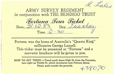
Ephemera - Tour Ticket
... Fortuna was compulsorily acquired by the Commonwealth in 1942 as the Cartographic Headquarters of the Australian Survey Corps during World War II, and many ancillary structures were added while preserving the main house and ornamental grounds. Victorian...Fortuna was compulsorily acquired by the Commonwealth in 1942 as the Cartographic Headquarters of the Australian Survey Corps during World War II, and many ancillary structures were added while preserving the main house and ornamental grounds. Victorian ...Fortuna Villa was initially commenced as a modest single storey home in 1861 next to the 180 Mine by Theodore Ballerstedt, who sold the mine and house to George Lansell in 1869. Lansell already owned the adjacent Fortuna Mine, and through deeper mining techniques greatly expanded the mine's operation, his personal wealth, and the house and grounds. Lansell was soon known as the 'Quartz King', Australia's first gold mining millionaire and credited as the driving force behind much of Bendigo's prosperity. He continuously added to and expanded the villa, decorating it extravagantly with the finest of artworks and materials, into a sprawling mansion with extensive landscaped grounds, to create a house and grounds of a size and grandeur with few rivals in Australia. After his death in 1907, his second wife Edith carried on with improvements, creating a house and grounds developed over 50 years. The attached mine also contributes to its significance, being one of the richest mines in Bendigo, and at one stage probably the deepest gold mine in the world at 3176 feet. The 1875 crushing works are attached directly to the mansion, and the mine's tailings and settling ponds (turned into ornamental lakes) represent a direct link between George Lansell's wealth and its source. Fortuna was compulsorily acquired by the Commonwealth in 1942 as the Cartographic Headquarters of the Australian Survey Corps during World War II, and many ancillary structures were added while preserving the main house and ornamental grounds. Victorian Heritage Database Report https://vhd.heritagecouncil.vic.gov.au/places/68334/download-reportTicket for Fortuna Villa Tour conducted by the Army Survey Regiment and the National Trust. 31/12/1985. Black printing on yellow card.fortuna villa, tour -
 Bendigo Historical Society Inc.
Document - Preservation proposal
... Fortuna was compulsorily acquired by the Commonwealth in 1942 as the Cartographic Headquarters of the Australian Survey Corps during World War II, and many ancillary structures were added while preserving the main house and ornamental grounds. Victorian...Fortuna was compulsorily acquired by the Commonwealth in 1942 as the Cartographic Headquarters of the Australian Survey Corps during World War II, and many ancillary structures were added while preserving the main house and ornamental grounds. Victorian ...Fortuna Villa was initially commenced as a modest single storey home in 1861 next to the 180 Mine by Theodore Ballerstedt, who sold the mine and house to George Lansell in 1869. Lansell already owned the adjacent Fortuna Mine, and through deeper mining techniques greatly expanded the mine's operation, his personal wealth, and the house and grounds. Lansell was soon known as the 'Quartz King', Australia's first gold mining millionaire and credited as the driving force behind much of Bendigo's prosperity. He continuously added to and expanded the villa, decorating it extravagantly with the finest of artworks and materials, into a sprawling mansion with extensive landscaped grounds, to create a house and grounds of a size and grandeur with few rivals in Australia. After his death in 1907, his second wife Edith carried on with improvements, creating a house and grounds developed over 50 years. The attached mine also contributes to its significance, being one of the richest mines in Bendigo, and at one stage probably the deepest gold mine in the world at 3176 feet. The 1875 crushing works are attached directly to the mansion, and the mine's tailings and settling ponds (turned into ornamental lakes) represent a direct link between George Lansell's wealth and its source. Fortuna was compulsorily acquired by the Commonwealth in 1942 as the Cartographic Headquarters of the Australian Survey Corps during World War II, and many ancillary structures were added while preserving the main house and ornamental grounds. Victorian Heritage Database Report https://vhd.heritagecouncil.vic.gov.au/places/68334/download-reportProposal for the formation of a Fortuna Commission to ensure the preservation of Fortuna Villa. Written by Daryl McClure. May 2012fortuna villa, preservation, daryl mcclure -
 Flagstaff Hill Maritime Museum and Village
Document - Navigation Chart, Admiralty Office, Lady Bay and Warrnambool Harbour, 03/04/1871
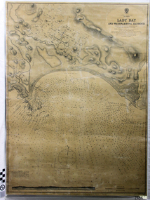
... Victorian Heritage Database (VHR H2024). A copy of the same chart was used to plan several submissions for future changes to the jetty and breakwater. The chart is a historical record of structures existing in 1870; the Warrnambool Jetties, Lady Bay, the leading lights (lighthouses), streets, roads, bridges and many buildings. It also shows the lay of the land and seabed. flagstaff hill warrnambool chart of lady bay warrnambool 1870 warrnambool harbour cartography ...This Chart titled “Lady Bay and Warrnambool Harbour” was surveyed by Nav. Lieut. H.J. Stanley, of Britain's Royal Navy, in 1870 and printed in April 1871. The chart was made before the Warrnambool Breakwater was built (construction had begun in 1874 and was completed in 1890). The chart includes Directions for entering Lady Bay, Warrnambool Harbour. These are "Vessels entering Warrnambool Harbour must bring the Red Light in sight and steer in with it in line with the upper white Light bearing North, until the Green Light on the Jetty is opened, when steer towards it and anchor. The best anchorage is in 2 ¼ fms [fathoms)] of water, about a cable from ledge off Breakwater rock. Or where convenient, according to draught of water, only endeavouring to anchor as close as possible to Breakwater rock. It is not safe to enter or leave the Harbour in south westerly or Southerly gales.” This chart is significant for its strong connection to the maritime history of Warrnambool Harbour and Lady Bay, and eventually to the Warrnambool Breakwater. The Warrnambool Breakwater is registered as a place of significance on the Victorian Heritage Database (VHR H2024). A copy of the same chart was used to plan several submissions for future changes to the jetty and breakwater. The chart is a historical record of structures existing in 1870; the Warrnambool Jetties, Lady Bay, the leading lights (lighthouses), streets, roads, bridges and many buildings. It also shows the lay of the land and seabed.Canvas chart of Australia, South Coast, Victoria Title: Lady Bay and Warrnambool Harbour Surveyed by Nav. Lieut. H.J. Stanley, R.N., 1870. Magnet Variation, 1870 Published April 3, 1871, by the Admiralty, London. Directions for vessels entering Warrnambool Harbour are printed on the chart. The chart has a lacquer or seal over it.Top of chart has logo "HYDROGRAPHER OFFICE" "Price Eighteen Pence". "Engraved by Edward Weller" Along bottom of Chart: “London… Published at the Admiralty, 3rd April 1871, under the Superintendence of Rear Admiral G.H. Richards, F.R.S. Hydrographer, Corrections July 71” Bottom of chart “Australia South Coast Victoria Lady Bay and Warrnambool Harbour. 2494”flagstaff hill, warrnambool, chart of lady bay warrnambool 1870, warrnambool harbour, cartography, navigation, warrnambool breakwater, 1871, australia – south coast / victoria, lady bay, 1870, nav. lieut. h.j. stanley, r.n, directions for entering warrnambool harbour, hydrographer office, rear admiral g.h. richards, edward weller, port of warrnambool, flagstaff hill maritime museum & village, maritime museum, maritime village, shipwreck coast, map, chart, navigation chart, admiralty chart, breakwater, jetty, pier, vhr h2024 -
 Williamstown Historical Society Inc
Book - Book - Victoria at War 1914 - 1918, Mckernan, Michael (1945, Victoria at war : 1914-1918 / Michael McKernan, 2014
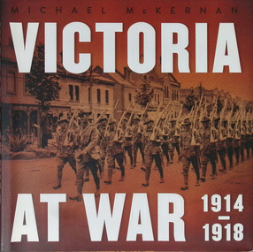
... Victorian service people were dead and 42,000 wounded. Bestselling military historian Michael McKernan tells stories from the home front and battlefield that commemorates the generosity, devotion, sacrifice and spirit of a community pushed towards breaking point" -- from dust jacket. 230 pages : illustrations (some colour), portraits (some colour), colour maps ; 26 x 27 cm. cartographic image Victoria at war : 1914-1918 / Michael McKernan Book Book - Victoria at War 1914 - 1918 Mckernan, Michael (1945 - New South Publishing: University of New South Wales Press Ltd. ..."During the First World War, in Melbourne and communities throughout Victoria, schoolchildren knitted socks for the troops serving in Gallipoli, the Middle East and on the Western Front. Their families set up Red Cross branches to support the 91,000 Victorian servicemen and women overseas. Victoria at War records the achievements of the state's soldiers, nurses and their families - including the Whitelaws from Gippsland with six sons enlisting, 'Bert' Jacka, the first Australian to be awarded the Victoria Cross in the First World War, and commander Sir John Monash. By the end of the war 19,000 Victorian service people were dead and 42,000 wounded. Bestselling military historian Michael McKernan tells stories from the home front and battlefield that commemorates the generosity, devotion, sacrifice and spirit of a community pushed towards breaking point" -- from dust jacket.230 pages : illustrations (some colour), portraits (some colour), colour maps ; 26 x 27 cm. cartographic imagenon-fiction"During the First World War, in Melbourne and communities throughout Victoria, schoolchildren knitted socks for the troops serving in Gallipoli, the Middle East and on the Western Front. Their families set up Red Cross branches to support the 91,000 Victorian servicemen and women overseas. Victoria at War records the achievements of the state's soldiers, nurses and their families - including the Whitelaws from Gippsland with six sons enlisting, 'Bert' Jacka, the first Australian to be awarded the Victoria Cross in the First World War, and commander Sir John Monash. By the end of the war 19,000 Victorian service people were dead and 42,000 wounded. Bestselling military historian Michael McKernan tells stories from the home front and battlefield that commemorates the generosity, devotion, sacrifice and spirit of a community pushed towards breaking point" -- from dust jacket.world war 1, victoria at war -
 Bayside Gallery - Bayside City Council Art & Heritage Collection
Map, H.B. Foot, Plan of the Brighton Estate containing 5120 acres, first special survey at Port Phillip, c. 1842
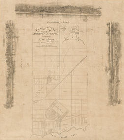
... cartographic material H.B. Foot Lithograph. Rectangular shaped sheet of cream paper with a central rectangular plan and three tinted drawings on the top, left and right sides printed in black ink. The title and scale are situated on the top left side of the plan, and on the top right side of the plan is a drawing of the Victorian coastline around the Bay, situating the Brighton Estate. ...This plan records the Brighton Estate, also known as Dendy's Special Survey. In 1840 Henry Dendy, a farmer in Surrey, England acquired a "Special Survey" from the Commissioners for Land and Emigration which gave him the right to choose land in Port Phillip for the low price of £1 per acre for 5120 acres. Dendy appointed Jonathan Binns Were, as his agent, who later became a partner. Together, Dendy and Were decided on an area 5 miles south from Melbourne, bounded by North Road, East Boundary Road, South Road and to the west by Port Phillip Bay. Their Brighton Estate was first surveyed by T. S. Townsend in May 1841 and was re-surveyed by Robert Hoddle. Dendy and Were were making plans to sell the land and advertised a 30-guinea prize for the best subdivision which was to be divided into a village, marine residences, suburban and cultivation allotments, with the remainder being divided into country sections. The competition was won by H.B. Foot, who planned the village around a reserve and crescents and a 'green belt' forming the town boundary. brighton estate, dendy's special survey, special survey, henry dendy, jonathan binns were, w.b. were, survey, plan, map, brighton, george ward cole, baker's lithographer, hibernian, subdivision, town planning, cartographic material, h.b. foot -
 Kew Historical Society Inc
Map, Whitehead's Map of Victoria, With Alphabetical Key, 1869, 1869
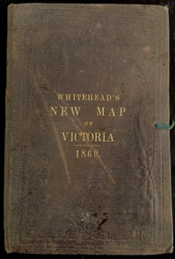
... Victorian Gold Rush (1851-1869). In addition to its historical significance, this is a rare map, of which the only known copies in Australian public collections are those held at the National Library of Australia, the State Library of Victoria, State Library of New South Wales and the University of Queensland Library. maps - victoria - 1860s e whitehead's new map of victoria 1869 whitehead's map of victoria with alphabetical key 1869 cartography gold rush Cover "WHITEHEAD'S NEW MAP OF VICTORIA 1869" Map of Victoria with gold mining areas, notes on topography, transport routes. ...When E. Whitehead's New Map of Victoria was released in 1869, an advertisement in the Bendigo Advertiser (16 July 1869) noted that: "This beautifully engraved Map has been revised and brought down to the present time; and, with the Alphabetical Key, is the most complete and the cheapest Map ever published; Price, 6d plain; 1s colored; 2s 6d in case; on linen, post free, 2d extra. E.. WHITEHEAD and CO, Publishers, 67 Collins-street east." The following year, 1870, Whitehead's promoted the edition in the Portland Guardian and Normanby General Advertiser (3 January 1870), advising that: "WHITEHEAD'S NEW MAP OF VICTORIA, 1869 ... is corrected to the latest date, and around is arranged an Alphabetical Key, with Post Towns and Money Order Olffices marked. The Map being divided into squares and numbered, by reference to the Key any place can be found immediately. Price Is beautifully colored, or mounted on linen in case, 2s 6d. Post free, 2d extra, in Victoria. B. Whitehead and C0., Puolishers, 67 Collins-street East, Melbourne". In the same edition of the Portland Advertiser, they also promoted their business generally, saying: "E WHITEHEAD and Co., Stationers, Engravers, Lithographers, 67 Collins street East, execute every description of Lithographic PRINTING, BILL-HEADS. NOTE Headings. Business Dies Engraved and Embossed on Envelopes &c. ARMS, MONOGRAMS, AND CRESTS Engraved and Embossed in Colour, superior to any other house in the Colony. Specimens, post free, 2d. Lithographers, &c, to H.R.H. the Duke of Edinburgh, and Die-inkers and Embossers to His Excellency Sir J. H. T. Manners-Sutton, K C.B. Orders executed for the Trade". Whitehead’s New Map of Victoria 1869 is is an important record of region created towards the end of the Victorian Gold Rush (1851-1869). In addition to its historical significance, this is a rare map, of which the only known copies in Australian public collections are those held at the National Library of Australia, the State Library of Victoria, State Library of New South Wales and the University of Queensland Library.Map of Victoria with gold mining areas, notes on topography, transport routes. Relief shown by hachures. List of towns with distance from Melbourne in map margin. [Melbourne] : Printed & Published by ... E Whitehead & Co ... 67 Collins Street East, 1869 1 map : col., mounted on linen ; 38.4 x 55.4 cm, folded to 18 x 12 cm.Cover "WHITEHEAD'S NEW MAP OF VICTORIA 1869"maps - victoria - 1860s, e whitehead's new map of victoria 1869, whitehead's map of victoria with alphabetical key 1869, cartography, gold rush -
 Kew Historical Society Inc
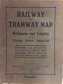
Map, Osboldstone & Co Pty Ltd, Railway and Tramway Map of Melbourne and Suburbs With Tram Timetables, 1917
... As such it illustrrates the theme: Connecting Victorians by transport and communications. railway maps -- melbourne (vic.) tramways maps -- melbourne (vic.) public transport -- melbourne (vic.) -- 1910-1920 cartography Printed card-covered pocket sized map that folds out with three horizontal and vertical folds. ...The Railway and Tramway Map of Melbourne and Suburbs With Tram Timetables lists existing Cable Tram Services before the entire network was electrified. By 1917 the tramways system was divided into regions including: the Melbourne Cable Tram Service; Prahran - Malvern Electric Trams; Hawthorn Electric Trams; Melbourne, Brunswick and Coburg Electric Trams; and Brighton Beach Electric Trams. The old Outer Circle railway line is marked as ending in Deepdene, with the remainder of the line to Fairfield marked as 'Unused'. The Kew tram along High Street in 1917 ended at the Harp Junction. The Kew Spur Line is also marked on the map.The Railway and Tramway Map of Melbourne and Suburbs With Tram Timetables is historically significant as it captures at a point in time, 1917, the development of public transport infrastructure in Melbourne. As such it illustrrates the theme: Connecting Victorians by transport and communications.Printed card-covered pocket sized map that folds out with three horizontal and vertical folds. Colour map, with scale, of the rail and tram networks on one side and sixteen sections of black and white printed text and timetable information on the reverse.railway maps -- melbourne (vic.), tramways maps -- melbourne (vic.), public transport -- melbourne (vic.) -- 1910-1920, cartography -
 Flagstaff Hill Maritime Museum and Village
Book - Atlas, F.E. Hiscocks and Co, New Victorian Counties Atlas, 1874
... Hiscocks & Co.’s New Victorian Counties Atlas is a monumental 19th-century cartographic and statistical record of the colony of Victoria. ...Published in Melbourne in 1874 by the prominent bookseller and publisher George Robertson, F.E. Hiscocks & Co.’s New Victorian Counties Atlas is a monumental 19th-century cartographic and statistical record of the colony of Victoria. While George Robertson was the publisher responsible for production, marketing, and distribution, the detailed compiling and surveying were executed by F.E. Hiscocks & Co., with the striking colour lithography handled by the renowned Melbourne firm Hamel & Ferguson.Hard cover book, New Victorian Counties Atlas Author: F.E. Hiscocks and Co, Publisher: George Robertson, Melbourne Vic. Date: 1874 Morocco Olive hardcover with a damaged black spine, reinforced corners to hardcover gold edging to where spine meets hardcover. Title in a lozenge on front cover edged with a decorative panel. non-fictionPublished in Melbourne in 1874 by the prominent bookseller and publisher George Robertson, F.E. Hiscocks & Co.’s New Victorian Counties Atlas is a monumental 19th-century cartographic and statistical record of the colony of Victoria. While George Robertson was the publisher responsible for production, marketing, and distribution, the detailed compiling and surveying were executed by F.E. Hiscocks & Co., with the striking colour lithography handled by the renowned Melbourne firm Hamel & Ferguson.flagstaff hill, warrnambool, maritime village, maritime museum, shipwreck coast, great ocean road, new victorian counties atlas, hiscocks and co, atlas, maps