Showing 97 items matching "water supply maps"
-
 Bacchus Marsh & District Historical Society
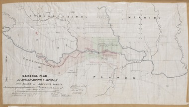
Map, General Plan for Water Supply Works, Shire of Bacchus Marsh 1887
... Water Supply...Water Supply Maps...A single page paper map showing a general plan for the supply of water in the Bacchus Marsh area.The plan shows the route of the 'Main Channel' near the Werribee River and a proposed route for a Parwan Channel. ...water supply and its planning and development took place in the Bacchus Marsh region from the 1850s through into the twentieth century. This plan was part of documentation to support an application for an additional loan of money from the Ministry of Water Supply to the Bacchus Marsh Shire Water Supply Trust. The plan includes the route of a proposed water channel in the Parwan area, and other features of water supply infrastructure such as the location of standpipes and gates are also shown on the plan. Water Supply Water Supply Maps ...Debate about water supply and its planning and development took place in the Bacchus Marsh region from the 1850s through into the twentieth century. This plan was part of documentation to support an application for an additional loan of money from the Ministry of Water Supply to the Bacchus Marsh Shire Water Supply Trust. The plan includes the route of a proposed water channel in the Parwan area, and other features of water supply infrastructure such as the location of standpipes and gates are also shown on the plan.A single page paper map showing a general plan for the supply of water in the Bacchus Marsh area.The plan shows the route of the 'Main Channel' near the Werribee River and a proposed route for a Parwan Channel. The location of 'Dryden's House' near the Werribee River is also shown and the locations of land held by T. (Tom) Oliver and the Racecourse Reserve in Maddingley. Scale 40 chains to 1 inch. The plan is signed by Bacchus Marsh Shire Engineer, W.E. Standfield. The map is pasted into a bound volume containing 76 maps or plans in total. High resolution digital image stored on BMDHS computer network. General Plan of Water Supply Works in the Shire of Bacchus Marsh. Accompanying application for 2nd additional Loan. Original Waterworks district. Additional area. W.E. Standfield, 30/8/87.water supply, water supply maps, water supply bacchus marsh, irrigation, bacchus marsh victoria maps -
 Tatura Irrigation & Wartime Camps Museum
Book, History of Valvers of Water Commmission of Victoria 1905 - 1994, 2014
... State Rivers and Water Supply Commission map of Victoria water storage information on back cover...Tatura Irrigation & Wartime Camps Museum 49 Hogan Street Tatura the-murray Includes names of valvers who served in Tatura victoria state rivers and water supply commission Blue and white front cover. Taken at a conference. State Rivers and Water Supply Commission map of Victoria water storage information on back cover History of Valvers of Water Commmission of Victoria 1905 - 1994 Book ...Includes names of valvers who served in TaturaBlue and white front cover. Taken at a conference. State Rivers and Water Supply Commission map of Victoria water storage information on back covervictoria state rivers and water supply commission -
 Clunes Museum
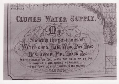
Document - MAP
... CLUNES WATER SHED SUPPLY MAP SHEWING THE POSITION OF WATERSHED ECT. ...PHOTOCOPY SECTION OF PHOTOGRAPH AND PLAQUE AND MAP OF CLUNES WATER SUPPLY. SHOWING THE POSITION OF WATERSHED, DAM, WEIR PIPEHEAD RESERVOIR PIPE TRACK....Clunes Museum 36 Fraser Street enter building through Collins Place Clunes goldfields CLUNES WATER SHED SUPPLY MAP SHEWING THE POSITION OF WATERSHED ECT. ...CLUNES WATER SHED SUPPLY MAP SHEWING THE POSITION OF WATERSHED ECT. FOR THE COLLECTION AND DISTRIBUTION OF WATER FOR DOMESTIC AND MINING PURPOSES TO THE TOWN OF & GOLDMINES IN AND AROUND CLUNES.PHOTOCOPY SECTION OF PHOTOGRAPH AND PLAQUE AND MAP OF CLUNES WATER SUPPLY. SHOWING THE POSITION OF WATERSHED, DAM, WEIR PIPEHEAD RESERVOIR PIPE TRACK.SEE PHOTOGRAPH ON BACK OF HISTORY OF OBJECT.local history, photographs, water supply -
 Bendigo Historical Society Inc.
Map - STATE RIVERS AND WATER COMMISSION : COLIBAN DISTRICT IRRIGATION AND TOWN SUPPLY CHANNELS, 30/11/1956
... State Rivers and Water Supply Commission. Foolscap-size map. Title : Coliban district Plan showing Irrigation and Town Supply Channels. ...History House 11 Mackenzie Street Bendigo goldfields STATE INFRASTRUCTURE Water supply coliban system State Rivers and Water Supply Commission. Coliban System. State Rivers and Water Supply Commission. Foolscap-size map ...State Rivers and Water Supply Commission. Foolscap-size map. Title : Coliban district Plan showing Irrigation and Town Supply Channels. The map covers the area from Raywood to Guildford. Scale : 1 inch to 4 miles. Dated 30/11/56, number 5,491 in bottom right corner.state infrastructure, water supply, coliban system, state rivers and water supply commission. coliban system. -
 Bendigo Historical Society Inc.
Map - STATE RIVERS AND WATER SUPPLY COMMISSION : COLIBAN DISTRICT MAP 1956, 30/11/1956
... STATE RIVERS AND WATER SUPPLY COMMISSION : COLIBAN DISTRICT MAP 1956...State Rivers and Water Supply Commission Coliban District map. Titled: S.R. & W.S.C. ...History House 11 Mackenzie Street Bendigo goldfields STATE INFRASTRUCTURE Water supply coliban system State Rivers and Water Supply Commission. Coliban System. State Rivers and Water Supply Commission Coliban District map. ...State Rivers and Water Supply Commission Coliban District map. Titled: S.R. & W.S.C. Coliban District Plan showing Irrigation and Town Supply Channels 1956. Scale: 1 inch = 4 miles. Indicates concrete lining and concrete re-lining channels. Printed in blue ink and information added in red. The map is dated at the bottom - 30/11/'56. There is a number, 25,491, in the bottom right corner.state infrastructure, water supply, coliban system, state rivers and water supply commission. coliban system. -
 Warrnambool and District Historical Society Inc.
Ledger, Letter book 1892-1904, 1892
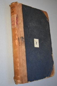
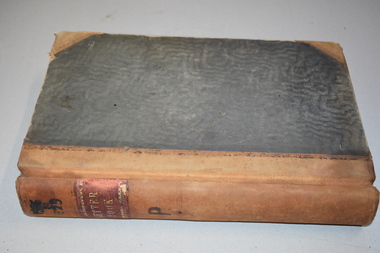
... maps, plans, sketches and written information which is the work of John William Crawley Junior, the engineer for the Shire of Warrnambool for 40 years. It will be very useful to researchers. john william crawley, junior, warrnambool rolf crawley, warrnambool shire of warrnambool ‘Letter Book 1892 to 1901’ ‘Rolf L. Crawley, Civil Engineer, Drainage and Water Supply ...This letter book has letters, sketch maps and plans and dates from 1892 to 1904. It came from the office of John William Crawley, Junior, an engineer, architect and surveyor in private practice in Warrnambool and also the engineer of the Shire of Warrnambool from 1895 to 1935. His father, brother and son were also engineers and worked in that capacity or as the Shire Secretary for the Shire of Warrnambool, with the Crawley family recording a total of 132 years of service to the Shire. This letter book was passed on to John Crawley’s son, Rolf Crawley, Engineer for the Shire of Warrnambool from 1935 to 1968. The letter book then came into the possession of Michael Hand who took over the private surveying business of Rolf Crawley in Warrnambool. The Warrnambool and District Historical Society has acquired the letter book, one of several Crawley ledgers, from the Michael Hand estate. This letter book is of considerable significance as it contains maps, plans, sketches and written information which is the work of John William Crawley Junior, the engineer for the Shire of Warrnambool for 40 years. It will be very useful to researchers. This is a hard cover letter book of 500 pages. The cover is black with leather binding on the edges of the cover and on the spine. The pages contain an alphabetical listing of the letters, handwritten letters and many sketch maps and plans. There are several loose pages of plans and diagrams at the back of the book. The inside of the covers has a blue mottled pattern. The edges of the cover are torn. There is a mauve stamp on the first page. ‘Letter Book 1892 to 1901’ ‘Rolf L. Crawley, Civil Engineer, Drainage and Water Supply Engineer, Licensed Surveyor, Registered Architect, Warrnambool’ john william crawley, junior, warrnambool, rolf crawley, warrnambool, shire of warrnambool -
 Warrnambool and District Historical Society Inc.
Letter Book 3, 1901 - 1908, 1900
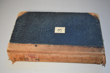
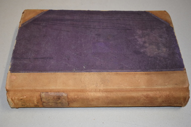
... maps, plans and letters produced by John William Crawley Junior, the engineer for the Shire of Warrnambool for 40 years. It will be very useful for research. John William Crawley Junior, Warrnambool Rolf Crawley, Warrnambool history of warrnambool ‘3’ ‘Letter Book 1901 to 1908’ ‘Letter Book J.Wm. Crawley’ ‘Rolf L. Crawley, Civil Engineer, Drainage and Water Supply ...This letter book has letters, plans and maps and dates from 1901 to 1908. It came from the office of John William Crawley, Junior, an engineer, architect and surveyor in private practice in Warrnambool and also the engineer for the Shire of Warrnambool from 1895 to 1935. His father, brother and son were also engineers and worked in that capacity or as the Shire Secretary for the Shire of Warrnambool, with the Crawley family recording a total of 132 years of service to the Shire. The letter book was passed on to John Crawley’s son, Rolf, engineer for the Shire of Warrnambool from 1935 to 1968. The letter book then came into the possession of Michael Hand who took over the private surveying business of Rolf Crawley in Warrnambool. The Warrnambool and District Historical Society has acquired the letter book, one of several Crawley ledgers, from the Michael Hand estate. The Shire of Warrnambool existed from 1863 to 1994. This letter book is of considerable significance as it contains maps, plans and letters produced by John William Crawley Junior, the engineer for the Shire of Warrnambool for 40 years. It will be very useful for research. This is a hard cover letter book of 717 pages. It has a black cover with brown leather binding on the cover edges and spine. The leather is worn away in places. The letter book contains an alphabetical index, handwritten letters, sketch plans and maps. There is a mauve stamp on the inside front cover. ‘3’ ‘Letter Book 1901 to 1908’ ‘Letter Book J.Wm. Crawley’ ‘Rolf L. Crawley, Civil Engineer, Drainage and Water Supply Engineer, Licensed Surveyor, Registered Architect, Warrnambool’ john william crawley junior, warrnambool, rolf crawley, warrnambool, history of warrnambool -
 Warrnambool and District Historical Society Inc.
Letter Book 4, 1901, 1908
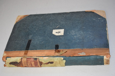
... maps, plans, sketches and written information on the work of John William Crawley, the engineer for the Shire of Warrnambool for 40 years. Rolf Crawley, Warrnambool John William Crawley, Junior, Warrnambool history of warrnambool ‘Letter Book’ ‘J.Wm. Crawley (Private)’ ‘ Rolf L. Crawley, Civil Engineer, Drainage and Water Supply ...This letter book has letters, invoices, sketch maps and plans and dates from 1908 to 1910. It came from the office of John William Crawley Junior, an engineer, architect and surveyor in private practice in Warrnambool and also the official engineer of the Shire of Warrnambool from 1895 to 1935. His father, brother and son were also engineers and worked in that capacity or as the Shire Secretary for the Shire of Warrnambool, with the Crawley family members recording a total of 132 years of service to the Shire. The letter book was passed on to John Crawley’s son, Rolf, Engineer for the Shire of Warrnambool from 1935 to 1968. The letter book then came into the possession of Michael Hand who took over the private surveying business of Rolf Crawley in Warrnambool and the Warrnambool and District Historical Society has acquired the letter book, one of several Crawley ledgers, from the Michael Hand estate. This letter book is of considerable significance as it contains maps, plans, sketches and written information on the work of John William Crawley, the engineer for the Shire of Warrnambool for 40 years. This is a black-covered letter book with copies of letters and field maps and plans and an alphabetical listing at the front. Some of the letters are invoices for work carried out. The leather section of the front cover has been almost completely torn away and the binding is mended with adhesive tape. There are some torn pages. The front page has a signature and a mauve stamp. ‘Letter Book’ ‘J.Wm. Crawley (Private)’ ‘ Rolf L. Crawley, Civil Engineer, Drainage and Water Supply Engineer, Licensed Surveyor, Registered Architect, Warrnambool’ ‘4’ rolf crawley, warrnambool, john william crawley, junior, warrnambool, history of warrnambool -
 Warrnambool and District Historical Society Inc.
Letter book 5, 1910
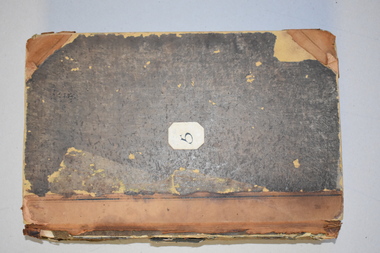
... maps, plans, sketches and written information, the work of John William Crawley, Junior, the Shire of Warrnambool engineer for 40 years. It will be very useful for research purposes. Rolf Crawley, Warrnambool John William Crawley, Junior, Warrnambool ‘5’ ‘Rolf L. Crawley, Civil Engineer, Drainage and Water Supply ...This letter book has letters, invoices and sketch maps and dates from 1910 to 1914. It came from the office of John William Crawley, Junior, an engineer, surveyor and architect in private practice in Warrnambool and also the official engineer for the Shire of Warrnambool from 1895 to 1935. His father, brother and son were also engineers and worked in that capacity or as the Shire Secretary for the Shire of Warrnambool, with the Crawley family recording a total of 132 years of service to the Shire. The letter book was passed on to John Crawley’s son, Rolf, engineer for the Shire of Warrnambool from 1935 to 1968. The letter book then came into the possession of Michael Hand who took over the private surveying business of Rolf Crawley in Warrnambool and the Warrnambool and District Historical Society has acquired the letter book, one of several Crawley ledgers, from the estate of Michael Hand.This letter book is of considerable significance as it contains maps, plans, sketches and written information, the work of John William Crawley, Junior, the Shire of Warrnambool engineer for 40 years. It will be very useful for research purposes. This is a brown-covered letter book of 750 pages with a mottled blue inside lining. The pages contain an alphabetical index and copies of handwritten letters and sketch maps and plans. There is one loose letter dated 1937. The pages are somewhat stained and the spine on the cover has been torn away. There is a mauve stamp on the first page. ‘5’ ‘Rolf L. Crawley, Civil Engineer, Drainage and Water Supply Engineer, Licensed Surveyor, Registered Architect, Warrnambool’ rolf crawley, warrnambool, john william crawley, junior, warrnambool -
 Warrnambool and District Historical Society Inc.
Letter book 11, Letters 1926 - 1929, 1926
... maps drawn up by John William Crawley, Junior who had a private engineering and surveying practice in Warrnambool and was the engineer for the Shire of Warrnambool for 40 years. It will be very useful for researchers. John William Crawley Junior, Warrnambool Rolf Crawley, Warrnambool Shire of Warrnambool ‘Letter Book 1926 to 1929’ ‘P’ ‘Rolf. L. Crawley, Civil Engineer, Drainage and Water Supply ...This letter book contains handwritten letters and sketch maps and dates from 1926 to 1929. It came from the office of John William Crawley Junior, an engineer, surveyor and architect in private practice in Warrnambool and also the engineer for the Shire of Warrnambool from 1895 to 1935. His father, brother and son were also engineers and worked in that capacity or as the Shire Secretary for the Shire of Warrnambool, with the Crawley family recording a total of 132 years of service to the Shire. The Shire of Warrnambool existed from 1863 to 1994. The letter book was passed on to John Crawley’s son, Rolf, the engineer for the Shire of Warrnambool from 1935 to 1968. It then came into the possession of Michael Hand who took over the private surveying practice of Rolf Crawley. The Warrnambool and District Historical Society acquired the letter book, along with several other Crawley ledgers, from the estate of Michael Hand. This letter book is of considerable significance as it contains letters and maps drawn up by John William Crawley, Junior who had a private engineering and surveying practice in Warrnambool and was the engineer for the Shire of Warrnambool for 40 years. It will be very useful for researchers. This is a green hard cover letter book of 1000 pages. It has handwritten letters and sketch maps and an alphabetical index at the front. The cover has brown binding on the edges of the cover and the spine. There is gold lettering on the spine. The cover has an inside mottled red lining. There is a mauve stamp on the first page. ‘Letter Book 1926 to 1929’ ‘P’ ‘Rolf. L. Crawley, Civil Engineer, Drainage and Water Supply Engineer, Licensed Surveyor, Registered Architect, Warrnambool’ john william crawley junior, warrnambool, rolf crawley, warrnambool, shire of warrnambool -
 Warrnambool and District Historical Society Inc.
Letter book 13, 1920
... maps drawn up by John William Crawley, an engineer in the Shire of Warrnambool for 40 years. It will be very useful for researchers. John William Crawley Junior, Warrnambool Rolf Crawley, Warrnambool Shire of Warrnambool ‘Letter Book 1920 to 1923’ ‘Rolf. L. Crawley Civil Engineer, Drainage and Water Supply ...This letter book contains letters, sketch maps and plans and dates from 1920 to 1923. It came from the office of John William Crawley Junior, an engineer, architect and surveyor in private practice in Warrnambool and also the engineer for the Shire of Warrnambool from 1895 to 1935. His father, brother and son were also engineers and worked in that capacity or as the Shire Secretary for the Shire of Warrnambool, with the Crawley family recording a total of 132 years of service to the Shire. The letter book was passed onto John Crawley’s son, Rolf, the engineer for the Shire of Warrnambool from 1935 to 1968. It then came into the possession of Michael Hand who took over the private surveying business on Rolf Crawley in Warrnambool. The Warrnambool and District Historical Society acquired the letter book, along with several other Crawley ledgers, from the estate of Michael Hand. This letter book is of considerable significance as it contains letters and maps drawn up by John William Crawley, an engineer in the Shire of Warrnambool for 40 years. It will be very useful for researchers.This is a dark red hard- cover letter book of 1001 pages. The book has brown binding on the corners of the cover and on the spine. There is gold lettering on the spine. The inside of the cover is lined with a multi-coloured mottled pattern. The cover is stained and scuffed. The pages contain handwritten letters, sketch maps and plans and an alphabetical index at the front. There are three loose pages. There is a mauve stamp on the first page.‘Letter Book 1920 to 1923’ ‘Rolf. L. Crawley Civil Engineer, Drainage and Water Supply Engineer, Licensed Surveyor, Registered Architect, Warrnambool’ john william crawley junior, warrnambool, rolf crawley, warrnambool, shire of warrnambool -
 Warrnambool and District Historical Society Inc.
Letter book 14, 1923
... maps and plans drawn up by John William Crawley, an engineer and surveyor in private practice in Warrnambool and the engineer for the Shire of Warrnambool for 40 years. It will be useful for researchers. John William Crawley Junior, Warrnambool Rolf Crawley, Warrnambool Shire of Warrnambool ‘Letter Book 1923 to 1926’ ‘J. Wm. Crawley Shire Hall Warrnambool (Private)’ ‘Rolf L. Crawley Civil Engineer, Drainage and Water Supply ...This letter book contains letters, sketch maps and plans and dates from 1923 to 1926. It came from the office of John William Crawley, Junior, an engineer, surveyor and architect in private practice in Warrnambool and also the engineer for the Shire of Warrnambool from 1895 to 1935. His father, brother and son were also engineers, working in that capacity or as the Shire Secretary for the Shire of Warrnambool, with the Crawley family recording a total of 132 years of service to the Shire. The Shire of Warrnambool existed from 1863 to 1994. This letter book was passed on to John Crawley’s son, Rolf, the engineer for the Shire of Warrnambool from 1935 to 1968. It then came into the possession of Michael Hand who took over the private surveying business of Rolf Crawley in Warrnambool. The Warrnambool and District Historical Society acquired the letter book, along with several other Crawley ledgers, from the estate of Michael Hand.This letter book is of considerable significance as it contains letters, maps and plans drawn up by John William Crawley, an engineer and surveyor in private practice in Warrnambool and the engineer for the Shire of Warrnambool for 40 years. It will be useful for researchers. This is a brown hard cover letter book of 1010 pages, with brown binding on the corners of the cover and on the spine. The cover is cuffed and torn. There is gold lettering on the spine. The book contains handwritten letters, maps and plans and an alphabetical index at the front, The pages are water-stained. There is a mauve stamp on the first page.‘Letter Book 1923 to 1926’ ‘J. Wm. Crawley Shire Hall Warrnambool (Private)’ ‘Rolf L. Crawley Civil Engineer, Drainage and Water Supply Engineer, Licensed Surveyor, Registered Architect, Warrnambool’ john william crawley junior, warrnambool, rolf crawley, warrnambool, shire of warrnambool -
 Bendigo Military Museum
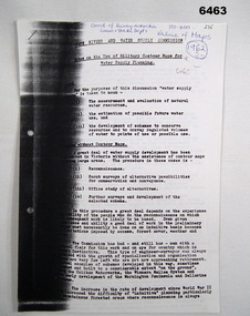
Administrative record - Use of Military maps for water supply planning, 1962
... These are typed notes on the use of Military maps for water supply planning. This demonstrates the value of Military Mapping containing accurate relief information that can then be used for water supply planning....Royal Australian Survey Corps RASvy Fortuna Army Survey Regiment Army Svy Regt ASR State Rivers and Water Supply Commission 5 x A4 pages of typed notes, poorly photocopied Use of Military maps for water supply planning Administrative record Use of Military maps for water supply planning State Rivers and water supply Commision, Division of National Mapping ...These are typed notes on the use of Military maps for water supply planning. This demonstrates the value of Military Mapping containing accurate relief information that can then be used for water supply planning.5 x A4 pages of typed notes, poorly photocopiedroyal australian survey corps, rasvy, fortuna, army survey regiment, army svy regt, asr, state rivers and water supply commission -
 Kiewa Valley Historical Society
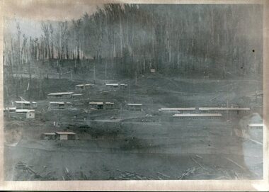
Photograph - Bogong Village (7 copies), Approx 1940
... water storage reservoirs used to supply the power stations their main power to run the huge turbines generating the final product, electricity. Evidence can be seen of the 1939 bushfires. Bogong Village SECV Handwritten on the back of one photo - Bogong Village approx. 1940, after 1939 bush fires. Staff residences to left. Kiewa House, General offices and test lab to the right. Hand drawn map ...In 1940 Field Headquarters for the Kiewa Scheme were established at Bogong with office, workshop facilities and accommodation for workmen, staff and some families constructed. (There had been a 'tent camp' on this site in 1939 but was destroyed by bushfires) Construction of accommodation continued until 1947. A total of 40 houses plus a hostel for single staff, post office, police station, medical centre and primary school all with water and sewerage and electricity supply. The staff hostel was known as Kiewa House and is now occupied by the Education Department. Lake Guy was named after Mr. L.T. Guy who was the Resident Engineer in charge of construction work and associated activities on the Kiewa area. He held this position from 1939 to November 1946 when he was transferred to Head Office. The Bogong Township was developed firstly as an accommodation centre (base camp) for construction workers employed under the Kiewa Hydroelectric Scheme. Due to the influx of European workers into the Township the beautification of the immediate surrounds (gardens etc.) had a distinct European flavour. This environment has been very beneficial for tourism in later years. At the completion of the scheme, in the 1960's, the village was opened to public/tourism use. Strict environmental control has not allowed for any extensive redevelopment in tourist accommodation and basically restricted it to the accommodation initially built for the construction workers. Activities such a bike riding, snow skiing, restricted horse riding and bush walking on the Alpine plains and mountains are now a viable part of the Kiewa Valley Tourist Industry. The lake is one of the many water storage reservoirs used to supply the power stations their main power to run the huge turbines generating the final product, electricity. Evidence can be seen of the 1939 bushfires.Set of 7 identical black and white photographs of Bogong Village after 1939 bush firesHandwritten on the back of one photo - Bogong Village approx. 1940, after 1939 bush fires. Staff residences to left. Kiewa House, General offices and test lab to the right. Hand drawn map on the back of one photo.bogong village, secv -
 Kiewa Valley Historical Society
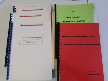
Collection of Papers and Books re - Mt Beauty Heritage Centre
... Water Supply Catchment 8. Geological Survey of Vic., Plates, Bulletin No. 44 - in battered paper 'bag' with front cover list of contents - 15 plates 9. Geological Survey - A3 photo copies of pages 106-117 10. Geological Survey of Vic. - Report of Progress No VII 1884 - bound book 11. Geological Survey of Vic. Bulletin 56 - includes nth east Vic. 1958 - bound book with green cloth spine 12. Department of Mines Report Vic. 1906 - booklet held with two staples 13. Royal Society of Vic book - The Geology of the Kiewa Area 1961 14. Miscellaneous papers - Geological Survey, Reports of Fossil Specimens and maps...Water Supply Catchment 8. Geological Survey of Vic., Plates, Bulletin No. 44 - in battered paper 'bag' with front cover list of contents - 15 plates 9. Geological Survey - A3 photo copies of pages 106-117 10. Geological Survey of Vic. - Report of Progress No VII 1884 - bound book 11. Geological Survey of Vic. Bulletin 56 - includes nth east Vic. 1958 - bound book with green cloth spine 12. Department of Mines Report Vic. 1906 - booklet held with two staples 13. Royal Society of Vic book - The Geology of the Kiewa Area 1961 14. Miscellaneous papers - Geological Survey, Reports of Fossil Specimens and maps ...In the early 1990s the KVHS applied for a grant to create the Mt Beauty Heritage Centre / Discovery Centre. This involved employing consultants and further research.This collection includes a lot of detail of the Kiewa Valley area.1. Bogong - The Alpine Discovery Centre 2. Heritage Centre - black folder 3. Heritage Centre - manila folder 4. High Country Heritage Centre - 1991 - green spiral folder 5. Six Heritage Centre - Matt Viney & Associates - white spiral folders 6. Landscape Consultants - Susan Campbell & son - red spiral folder 7. Plant List - Upper Kiewa Valley Water Supply Catchment 8. Geological Survey of Vic., Plates, Bulletin No. 44 - in battered paper 'bag' with front cover list of contents - 15 plates 9. Geological Survey - A3 photo copies of pages 106-117 10. Geological Survey of Vic. - Report of Progress No VII 1884 - bound book 11. Geological Survey of Vic. Bulletin 56 - includes nth east Vic. 1958 - bound book with green cloth spine 12. Department of Mines Report Vic. 1906 - booklet held with two staples 13. Royal Society of Vic book - The Geology of the Kiewa Area 1961 14. Miscellaneous papers - Geological Survey, Reports of Fossil Specimens and maps of local area 15. Gold - Appendix K and Appendix 111, Part C - photocopied pages from Vic Mining Registrars Report 1888 - manila foldermt beauty heritage centre, mt beauty discovery centre, geological surveys -
 Orbost & District Historical Society
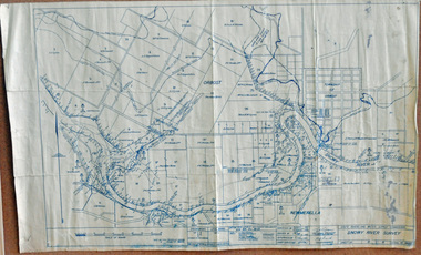
survey, 1941
... A survey map produced by the State Rivers and Water Supply Commission. It is on white paper with blue ink. ...Orbost & District Historical Society Ruskin Street Orbost gippsland this item is a useful reference tool. survey map Snowy-River A survey map produced by the State Rivers and Water Supply Commission. It is on white paper with blue ink. ...this item is a useful reference tool.A survey map produced by the State Rivers and Water Supply Commission. It is on white paper with blue ink. It is a hand-drawn survey of the Snowy River in 1939-40.survey map snowy-river -
 Eltham District Historical Society Inc
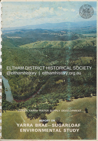
Book, Melbourne Metropolitan Board of Works, Lower Yarra Water Supply DeVelopment: Report on Yarra Brae-Sugarloaf Environmental Study, April 1974
... Eltham District Historical Society Inc 728 Main Rd Eltham melbourne Environmental Study Melbourne Metropolitan Board of Works Report Sugarloaf Reservoir water catchment area water supply Yarra Brae Dam Yarra River Valley A4 x 3cm Spiral bound 1 v. (various paging) : ill. (some col.), maps ...environmental study, melbourne metropolitan board of works, report, sugarloaf reservoir, water catchment area, water supply, yarra brae dam, yarra river valley -
 Glen Eira Historical Society
Document - Melbourne and Metropolitan Board of Works
... The report contains information about water supply, sewerage and drainage infrastructure completed or in progress during this period including infrastructure in Caulfield, Ormond, Carnegie and Bentleigh. 3/ A periodical feature from the MMBW titled ‘Living City’, issue no. 16, Spring/Summer 1974. Included in the article titled ‘Program’ is a notice that construction will continue on the Elster Creek drain from Thomas St. to Wheatley Road, McKinnon. The periodical also includes the names of commissioners W. R. Walters from Caulfield and G. R. Bricker from Moorabbin (back cover). 4/ 2 maps...The report contains information about water supply, sewerage and drainage infrastructure completed or in progress during this period including infrastructure in Caulfield, Ormond, Carnegie and Bentleigh. 3/ A periodical feature from the MMBW titled ‘Living City’, issue no. 16, Spring/Summer 1974. Included in the article titled ‘Program’ is a notice that construction will continue on the Elster Creek drain from Thomas St. to Wheatley Road, McKinnon. The periodical also includes the names of commissioners W. R. Walters from Caulfield and G. R. Bricker from Moorabbin (back cover). 4/ 2 maps ...This file contains five items relating to Caulfield Council Visits with the Melbourne & Metropolitan Board of Works (MMBW) from 1919 to circa 1974: 1/ A photo album containing photos from the MMBW ‘visit to the Headworks, Yan Yean Water Supply, Wallaby and Silvery Creeks’ from 28/02/1919 to 03/03/1919, attended by members of the Caulfield City Council. The album contains 13 original black-and-white photographs, 3 of which are of the council members. The album is accompanied by a report by Felicitie Campbell, written 11/2008, about these visits. 2/ A publication from the MMBW documenting its review of operations for 1973-1974. The report contains information about water supply, sewerage and drainage infrastructure completed or in progress during this period including infrastructure in Caulfield, Ormond, Carnegie and Bentleigh. 3/ A periodical feature from the MMBW titled ‘Living City’, issue no. 16, Spring/Summer 1974. Included in the article titled ‘Program’ is a notice that construction will continue on the Elster Creek drain from Thomas St. to Wheatley Road, McKinnon. The periodical also includes the names of commissioners W. R. Walters from Caulfield and G. R. Bricker from Moorabbin (back cover). 4/ 2 maps and 1 information booklet from the Thomson Project Open Day attended by Felicite and John Campbell as representatives of the Caulfield City Council. This was an annual MMBW open date. Date unknown. 5/ Research notes by Kate Aldred about the photo album and Thomson Project Open Day booklet and their links to Felicitie Campbell 01/04/2014.koornang road, draper street, hall street, centre road, brewers road, caulfield intercepting sewer, byron street, caulfield park, elster creek, caulfield, carnegie, ormond, bentleigh, thomas street, brighton east, wheatley road, mckinnon, city of caulfield, bricker g. r., walters w. r., caulfield city council, melbourne and metropolitan board of works, hall councillor, murray councillor, murphy councillor, wharington councillor, phillips councillor, blyth councillor, best robert sir, reid doctor, jowett mr., wooley mr., hindle mr., annual reports, water supply structures and establishments, sewerage and sanitation, sewerage establishments, drainage, town planning, business and finance, councillors, mayors, acqueducts, dams and reservoirs, creeks, waterfalls, rivers, construction sites, north road, north road pumping station, cities and towns, campbell felicitie -
![Book - Map, Land Conservation Council, Melbourne Study Area Report, [December 1973]](/media/collectors/4f729f7b97f83e03086018a5/items/6469bc241d76dd4b008a829f/item-media/646b0013d841f8920fa4323c/item-fit-380x285.jpg?cb=6) Eltham District Historical Society Inc
Eltham District Historical Society IncBook - Map, Land Conservation Council, Melbourne Study Area Report, [December 1973]
... maps. Melbourne Study Area Public land and descriptive blocks, Population description, Geology, Physiography, topography and rainfall, vegetation and water supply. ...The Melbourne Study Report is a series of volumes describing the physical nature of the land and its environment, examines the likely forms of land use, and assesses the hazards associated with these uses. This is Volume 2 (coloured maps). The first page featues a black and white map described as "Shire of Diamond Valley" with public land marked in yellow. Followed by eight large fold out maps. Melbourne Study Area Public land and descriptive blocks, Population description, Geology, Physiography, topography and rainfall, vegetation and water supply. The Land Conservation Act 1970 established the Land Conservation Council whose functions is to "carry out investigations and make recommendations to the Minister with respect to the use of public land in order to provide for the balanced use of land in Victoria. This report sets out to describe and assess the natural resources of the public lands in the Melbourne area and provides a factual basis on which members of the community may base submissions to the [Land Conservation] Council of Victoria.A collection of eight large fold out coloured maps published in a bound book formnon-fictionThe Melbourne Study Report is a series of volumes describing the physical nature of the land and its environment, examines the likely forms of land use, and assesses the hazards associated with these uses. This is Volume 2 (coloured maps). The first page featues a black and white map described as "Shire of Diamond Valley" with public land marked in yellow. Followed by eight large fold out maps. Melbourne Study Area Public land and descriptive blocks, Population description, Geology, Physiography, topography and rainfall, vegetation and water supply. The Land Conservation Act 1970 established the Land Conservation Council whose functions is to "carry out investigations and make recommendations to the Minister with respect to the use of public land in order to provide for the balanced use of land in Victoria. This report sets out to describe and assess the natural resources of the public lands in the Melbourne area and provides a factual basis on which members of the community may base submissions to the [Land Conservation] Council of Victoria. maps, shire of diamond valley, population, geology, topography, rainfall, vegetation, water supply, land use, public lands -
 Bendigo Historical Society Inc.
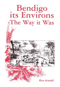
Book - BENDIGO ITS ENVIRONS THE WAY IT WAS, 2003
... A brief history of Bendigo & surrounding areas & of the water supply and railway line to Bendigo & surrounds. Contains 432 pages with photographs, illustrations and maps, published by Crown Castleton....A brief history of Bendigo & surrounding areas & of the water supply and railway line to Bendigo & surrounds. Contains 432 pages with photographs, illustrations and maps, published by Crown Castleton. ...Bendigo its Environs The way it Was. A brief history of Bendigo & surrounding areas & of the water supply and railway line to Bendigo & surrounds. Contains 432 pages with photographs, illustrations and maps, published by Crown Castleton.Ken Arnoldbendigo, history, bendigo & district, signed by author, limited edition number 175 -
 Bendigo Historical Society Inc.
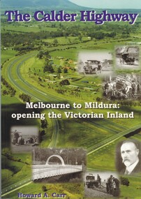
Book - THE CALDER HIGHWAY, 2006
... Water Supply calder highway Calder Highway infrastructure Howard A. Carr The Calder Highway - Melbourne to Mildura: opening the Victorian Inland. 128 pages with photos and illustrations, maps. ...The Calder Highway - Melbourne to Mildura: opening the Victorian Inland. 128 pages with photos and illustrations, maps. Inscribed on fly page ' to Jim Evans with my thanks, Howard Carr'Howard A. Carrstate infrastructure, water supply, calder highway, calder highway, infrastructure -
 Bendigo Historical Society Inc.
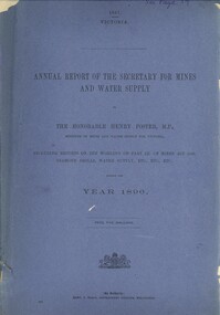
Book - ANNUAL REPORT OF THE SECRETARY FOR MINES AND WATER SUPPLY, c1897
... Annual Report Of The Secretary For Mines And Water Supply, Victoria 1896. Publisher: Government Printer, Melbourne. 71 pages. Maps & drawings. ...History House 11 Mackenzie Street Bendigo goldfields VICTORIA victorian mining report mining machinery mine safety mining statistics bendigo mines Annual Report Of The Secretary For Mines And Water Supply, Victoria 1896. Publisher: Government Printer, Melbourne. 71 pages. Maps & drawings. ...Annual Report Of The Secretary For Mines And Water Supply, Victoria 1896. Publisher: Government Printer, Melbourne. 71 pages. Maps & drawings. Inscriptions: Little 180, see page 59 (cover), A Richardson, 29 Harrison St, Bendigo (1st page).victoria, victorian mining report, mining machinery mine safety mining statistics bendigo mines -
 Bendigo Historical Society Inc.
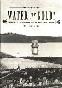
Book - WATER FOR GOLD, 2009
... Published by Australian Scholarly Publishing with a grant from Coliban Water to celebrate the 15th anniversary of the first serious attempts by the Bendigo Water Works Company in 1859 to supply water to the goldfields of Central Victoria, 288 pages photographs, illustrations & maps. ...Published by Australian Scholarly Publishing with a grant from Coliban Water to celebrate the 15th anniversary of the first serious attempts by the Bendigo Water Works Company in 1859 to supply water to the goldfields of Central Victoria, 288 pages photographs, illustrations & maps. ...Water for Gold, The fight to quench central Victoria's goldfields. Published by Australian Scholarly Publishing with a grant from Coliban Water to celebrate the 15th anniversary of the first serious attempts by the Bendigo Water Works Company in 1859 to supply water to the goldfields of Central Victoria, 288 pages photographs, illustrations & maps. Signed by the author.Geoffrey Russellvictoria, history, water, bendigo - history, central victorian goldfields, coliban water. -
 Bendigo Historical Society Inc.
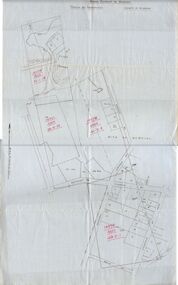
Document - MCCOLL, RANKIN AND STANISTREET COLLECTION: MAP OF MINE LEASES SYMONDS STREET, MCKENZIE ST WEST AREA BENDIGO, 2nd September, 1936
... Map indicates gully leading into and State Rivers and Water supply reservoir, water race; siphon, shaft, dam, residential area and some residential lots marked. ...Map indicates gully leading into and State Rivers and Water supply reservoir, water race; siphon, shaft, dam, residential area and some residential lots marked. ...Blue waxed linen paper map. On top' Mining District of Bendigo' Parish of Sandhurst, County of Bendigo' Map shows lease 10135, area 32.1.19; lease 10371, area 30.0.23; lease 10179 area 41.3.4; lease 10370, area 49.0.1. Map indicates gully leading into and State Rivers and Water supply reservoir, water race; siphon, shaft, dam, residential area and some residential lots marked. Streets include Holly Street, MacKenzie Street West, Symonds Street, Aspinall Street, Emmett Street; Bendigo Creek marked at bottom of map. Scale 4 chains to one inch. Map is not dated.bendigo, mining, mccoll rankin & stanistreet -
 Bendigo Historical Society Inc.
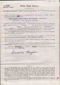
Document - MCCOLL, RANKIN AND STANISTREET COLLECTION: WATER RIGHT LICENCE NORTH DEBORAH MINING COMPANY NO LIABILITY, 19th August, 1941
... 4 page document plus map, Water Right Licence No. 1172, between King George VI ( the Crown ) and North Deborah Mining Company No Liability, Parish of Sandhurst., dated 19th August 1941. "to take and divert water at the points marked 'source of supply...(Golden Square) 4 page document plus map, Water Right Licence No. 1172, between King George VI ( the Crown ) and North Deborah Mining Company No Liability, Parish of Sandhurst., dated 19th August 1941. "to take and divert water at the points marked 'source of supply ...4 page document plus map, Water Right Licence No. 1172, between King George VI ( the Crown ) and North Deborah Mining Company No Liability, Parish of Sandhurst., dated 19th August 1941. "to take and divert water at the points marked 'source of supply' on the said plan the quantity thereof not to exceed in the aggregate one hundred thousand gallons per diem' Plan: 'Mining District of Bendigo No. 1172 W.R., County of Bendigo, Parish of Sandhurst. Plan has dam area coloured in red, with pipe line drawn in red, leading from Battery marked on lease 11145 across lease 9988 to dam. Streets marked: Adams Road, Honeybone Street, Griston Street. (Golden Square area)bendigo, mining, north deborah mining company, north deborah mining company, adams, honeybone, and griston streets. (golden square) -
 Greensborough Historical Society
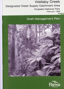
Booklet, Parks Victoria, Wallaby Creek: designated water supply catchment area. Kinglake National Park: Draft management plan 1998, 1998_02
... water supplied to Melbourne's water supply system. Kingllake National Park water supply wallaby creek parks victoria 26 p. black print on white paper, green cover, three folded maps Wallaby Creek: designated water supply catchment area. ...Wallaby Creek is part of Kinglake National Park, and is a restricted access catchment area to protect quality of water supplied to Melbourne's water supply system. 26 p. black print on white paper, green cover, three folded mapskingllake national park, water supply, wallaby creek, parks victoria -
 Greensborough Historical Society
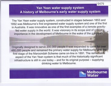
Booklet, Yan Yean water supply system: a history of Melbourne's early water supply system, 2010c
... water supply system - Melbourne's earliest. This is an early version of the history. yan yean reservoir melbourne water Link: 6479:6482 24 p., colour illus., maps Yan Yean water supply system: a history of Melbourne's early water supply system Booklet Melbourne Water ...History of the Yan Yean water supply system - Melbourne's earliest. This is an early version of the history.Link: 6479:6482 24 p., colour illus., mapsyan yean reservoir, melbourne water -
 Greensborough Historical Society
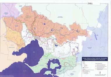
Maps, Greater Melbourne Water Authority, Municipality and Registered Aboriginal party Boundaries, 18/07/2018
... Greensborough Historical Society 34A Glenauburn Road Lower Plenty Lower Plenty melbourne Shows Melbourne Water and Municipal area boundaries, with boundaries of registered aboriginal parties, in central Victoria. aborigines victoria water supply melbourne water Map reference 20180746 Printed in colour one side Greater Melbourne Water Authority, Municipality and Registered Aboriginal party Boundaries Maps Melbourne Water ...Shows Melbourne Water and Municipal area boundaries, with boundaries of registered aboriginal parties, in central Victoria.Printed in colour one sideMap reference 20180746aborigines victoria, water supply, melbourne water -
 Greensborough Historical Society
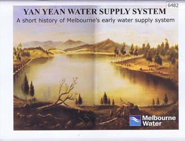
Booklet, Yan Yean water supply system: a short history of Melbourne's early water supply system, 2011c
... Greensborough Historical Society 34A Glenauburn Road Lower Plenty Lower Plenty melbourne Early history of the Yan Yean water supply system yan yean reservoir toorourrong reservoir melbourne water Link: 6479:6482 40 p., colour illus. and maps Yan Yean water supply system: a short history of Melbourne's early water supply system Booklet Melbourne Water ...Early history of the Yan Yean water supply systemLink: 6479:6482 40 p., colour illus. and mapsyan yean reservoir, toorourrong reservoir, melbourne water -
 Greensborough Historical Society
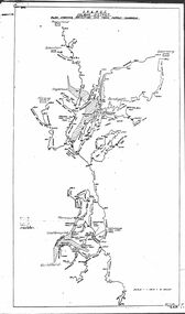
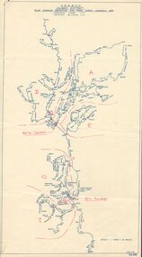
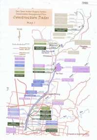
Maps, Yan Yean Water Supply System Conservation Management Plan: Construction dates Map 1, 2007_
... Yan Yean Water Supply System Conservation Management Plan: Construction dates Map 1...Greensborough Historical Society 34A Glenauburn Road Lower Plenty Lower Plenty melbourne Plan of Yan Yean Water Supply System, showing natural and constructed features from 1850s to 1930s from Silver Creek Weirs to Eastern Freeway. water supply yan yean reservoir plenty river Printed in colour one side. 3 copies Yan Yean Water Supply System Conservation Management Plan: Construction dates Map 1 Maps Spatial Vision ...Plan of Yan Yean Water Supply System, showing natural and constructed features from 1850s to 1930s from Silver Creek Weirs to Eastern Freeway.Printed in colour one side. 3 copieswater supply, yan yean reservoir, plenty river