Historical information
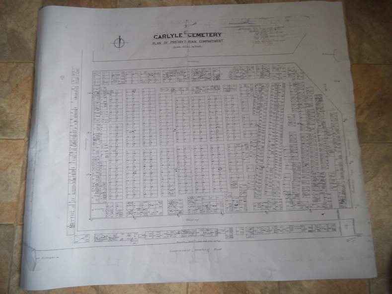
This is a map produced to attempt to bring order to the cemetery. Originally the layout was not well defined and it is difficult to use this plan to locate a particular grave, also the fact that not all graves are marked and foot paths are not defined has exacerbated this issue.
Physical description
Photocopy, White paper, black printing, black line work showing lot and compartment boundaries
Inscriptions & markings
References Grid Survey points at 50 feet centres shown (as a cross with the reference mark number in brackets)
Lot Number shown at left side of graves.
Burial Number shown at right side of grave.
Lots with unidentified burials show with dashed cross with in the lot.