


Historical information
Before metrication was introduced into Australia in the 1970s land was measured in chains and links.
Many old parish plans show length measurements in chains and links. Area was shown in acres, roods and perches.
Gunter's chain was used for measuring distance in surveying. It was designed and introduced in 1620 by English clergyman and mathematician Edmund Gunter (1581–1626).
Gunter developed the measuring chain of 100 links. The chain and the link, became statutory measures in England and subsequently the British Empire.
After metrication units of length were measured in meters and area in hectares.
The chain was later superseded by steel ribbon tape.
Physical description
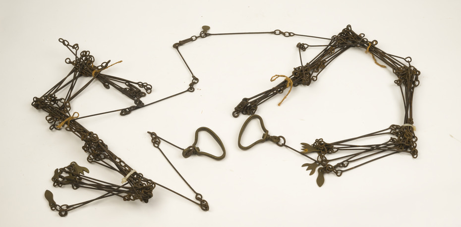
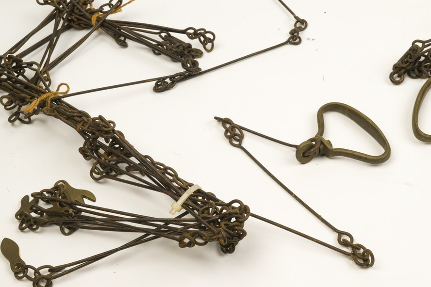
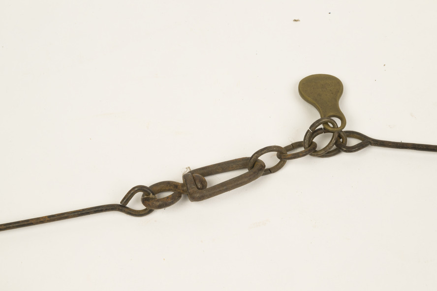
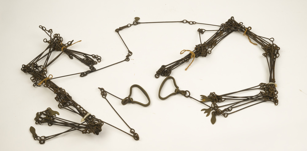
The 66-foot long (1 chain) Gunter's Chain was a fundamental instrument for land surveying.
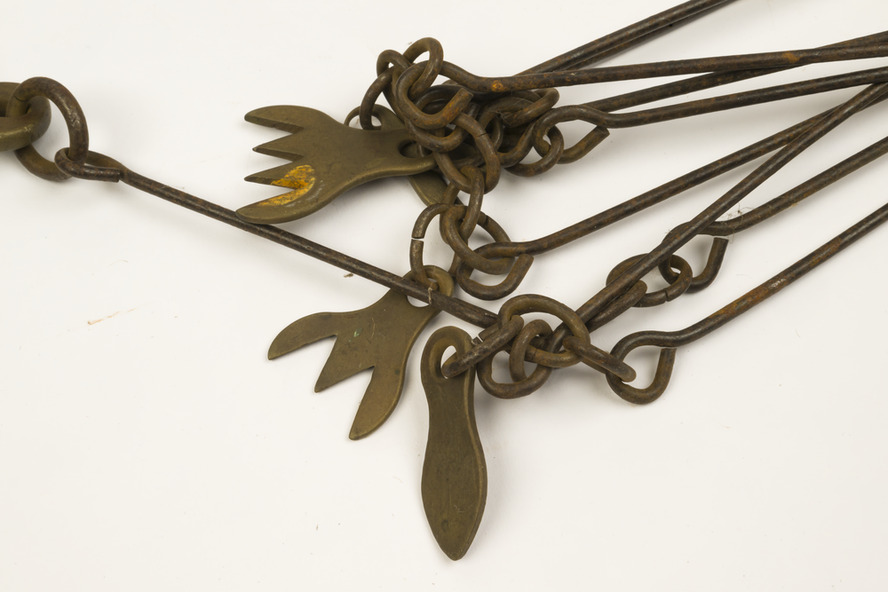
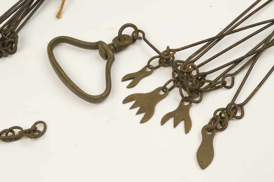
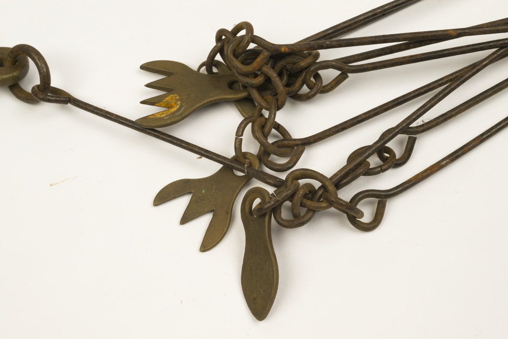
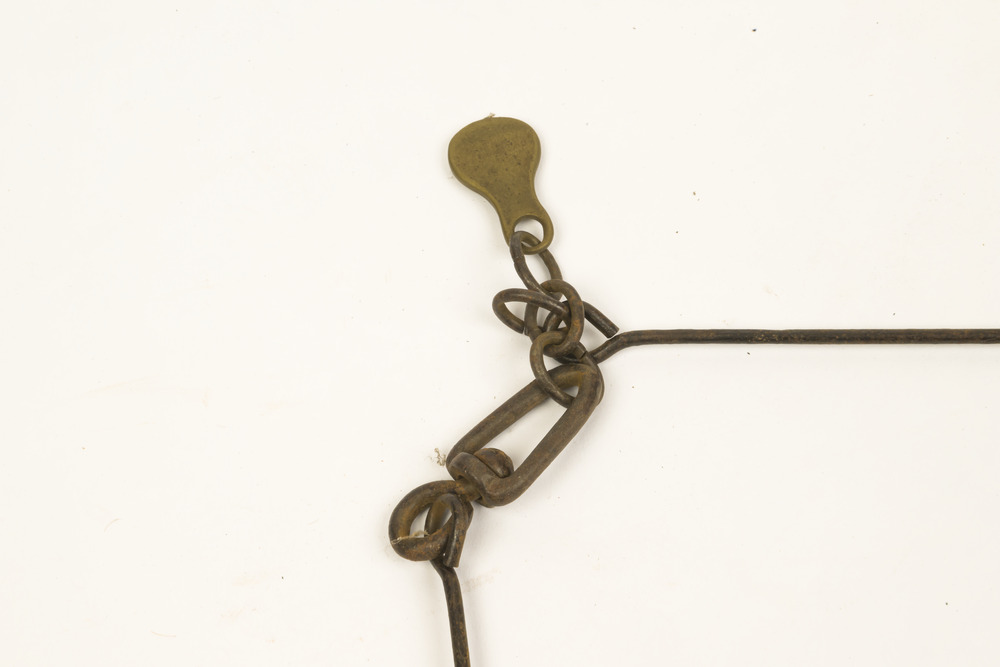
It is divided into 100 links (each 7.92 inches long) which are marked off into groups of 10 by brass tags with 'fingers' to indicate 10, 20, 30, 40 and 50 links from the hand grips, thus simplifying intermediate measurements.
Each end of the chain is fitted with a brass hand grip.
It was heavy and sturdy enough to be dragged through the bush and over rough terrain on surveying transects. Giving rise to the common forestry term "chainman" for the person tasked with dragging it.
1 chain = 100 links = 22 yards = 66 feet = 792 inches = 4 rods, poles or perches.
10 chains = 1 furlong
80 chains = 1 mile
1 acre = 10 square chains = 4 roods = 160 square rods, poles or perches.