Physical description
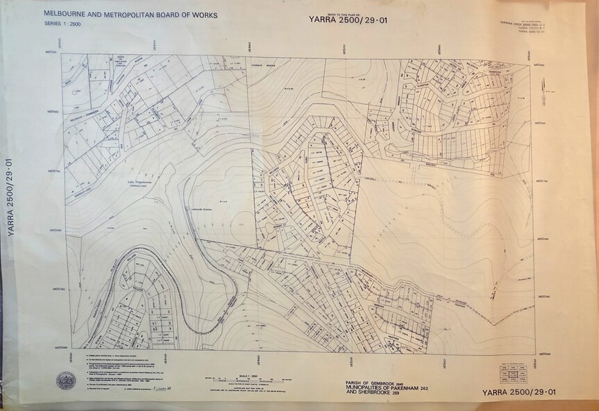
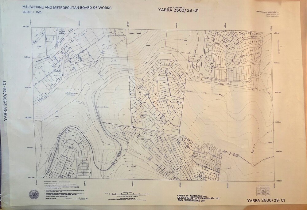
Image transparency of printed Melbourne & Metropolitan Board of Works topographical map - Emerald - Yarra 2500/29.01
Publication type
non-fiction
Inscriptions & markings
Lodged plans marked * have easements omitted/Lot boundaries are based on occupation and are not necessarily title/The grid lines on this sheet represent the A.M.G. plan boundaries for the 1:500 series. The reference number of the 1:500 series plan in the S.W corner of this sheet is YARRA500/141-001/Topography from the photogrammetry compiled by Australian Aerial Mapping (Vic.) Pty.Ltd. Date of Photography: January 1984/Base prepared by the Survey Division, Melbourne and Metropolitan Board of Works, under the direction of B.K. Marwick, Chief Surveyor, Engineering Branch: May 1986/Survey Co-ordination Act plan classification BB2/Revised and re-issued/Latest cadastral amendment 15.1.88/Scale 1:2500/Parish of Gembrook 2645, Municipalities of Pakenham 262 And Sherbrooke259/YARRA 2500/29.01
Summary
Topographical map of Emerald township from 1988