


Historical information
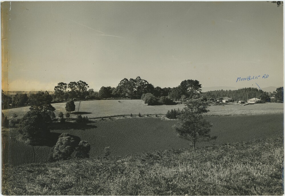
This photograph appears to be taken from a hill. While Main Road and Monbulk Road are both in Monbulk, the reference to Madigan's abattoir indicates that the annotations are more likely to be referring to Main Street and Emerald-Monbulk Road in Emerald. It's difficult to determine whether the annotation means it is taken from Main Street or looking down to Main Street, but the absence of buildings in this relatively recent photograph indicate that it is likely the former. It could have been taken from Main Street, looking down at Madigan Way and the undeveloped land behind it. However, it is difficult to confidently assess any of this information, as it is to determine when this picture was taken.
Significance
The photograph likely captures a unique perspective on an area of Emerald that has since been transformed by time.
Physical description
A black and white picture printed on glossy photograph paper. The photograph is taken from atop a grassy hill, looking down at a plowed field with occasional trees. Behind the field is a road with fences on either side, continuing across the view from left to right. Behind the road are pastures with scattered animals (two horses or cows, possibly several sheep) leading in to a line of trees in the central background. On the left side a hill rises on the horizon, while on the right are several buildings with higher hills or mountains rising in the far background. On the right, handwritten text in blue pen accompanies an arrow pointing to a roadway - 'Monbulk Rd'. The reverse features more writing, both in blue pen and in pencil. The extreme left side of the object is discoloured by yellow tape.
Inscriptions & markings
Obverse, Pen: "MONBULK RD"
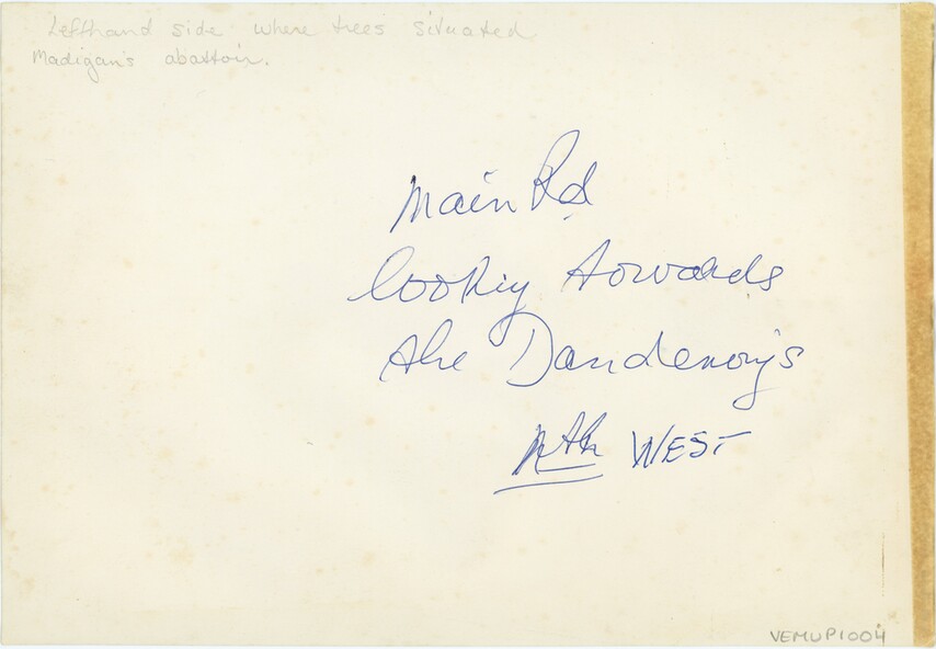
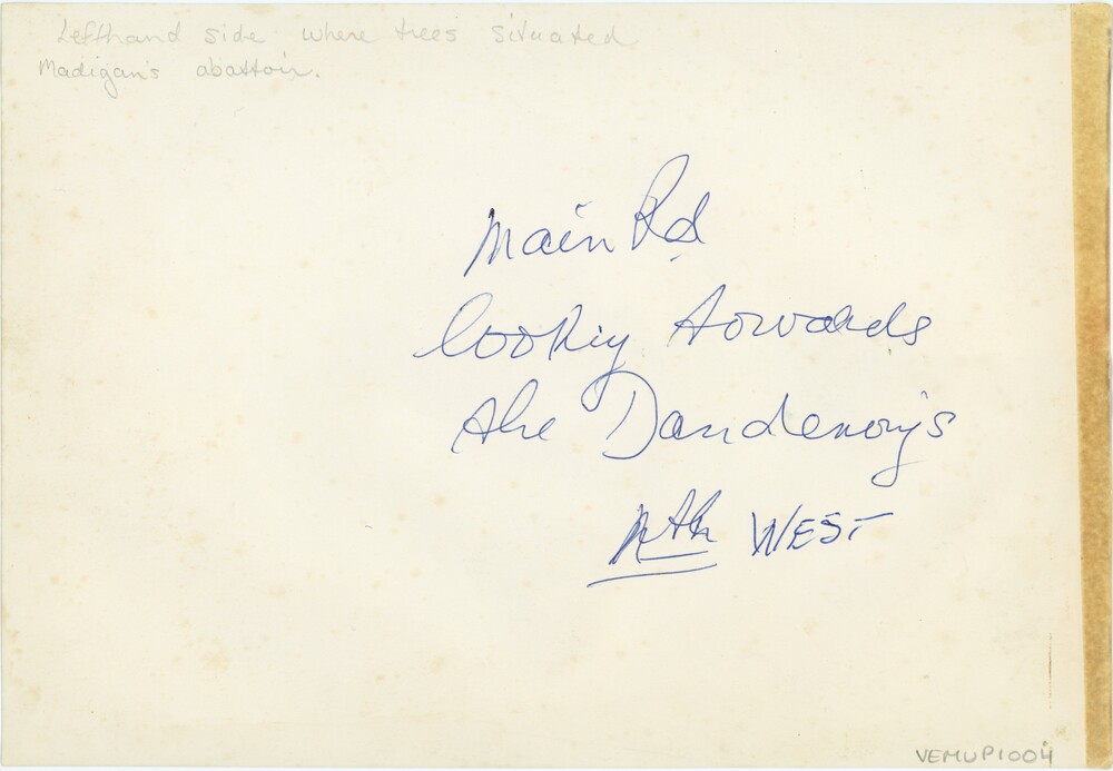
Reverse, Pencil: "Lefthand side where trees situated / Madigan's abattoir."
Reverse, Pen: "Main Rd / looking towards / the Dandenongs / Nth WEST"