Showing 8993 items matching "royal australian"
-
 Moorabbin Air Museum
Booklet - Stories from WW2 regarding this Mosquito squadron's service, ROYAL AUSTRALIAN AIR FORCE No 87 Squadron, Richard J. Keir, ROYAL AUSTRALIAN AIR FORCE No 87 Squadron, 2008
... , ROYAL AUSTRALIAN AIR FORCE No 87 Squadron...ROYAL AUSTRALIAN AIR FORCE No 87 Squadron..., ROYAL AUSTRALIAN AIR FORCE No 87 Squadron...Front paged headed by title as follows "ROYAL AUSTRALIAN..., ROYAL AUSTRALIAN AIR FORCE No 87 Squadron Stories from WW2 ...Stories from WW2 regarding this Mosquito squadron's service, ROYAL AUSTRALIAN AIR FORCE No 87 SquadronFront paged headed by title as follows "ROYAL AUSTRALIAN AIR FORCE No 87 Squadron", above letter signed by Richard J. Keirnon-fictionStories from WW2 regarding this Mosquito squadron's service, ROYAL AUSTRALIAN AIR FORCE No 87 Squadron -
 Bendigo Military Museum
Photograph - Royal Australian Survey Corps Personnel – School of Military Survey, Bonegilla and Army Survey Regiment, Bendigo, 1977 to 1989
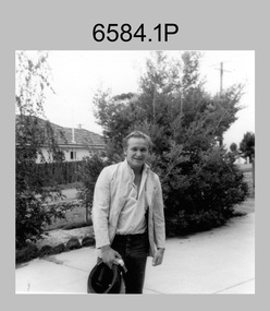
... Royal Australian Survey Corps Personnel – School of...Royal Australian Survey Corps Personnel – School of...Royal Australian Survey Corps...This is a collection of 19 photographs of Royal Australian...This is a collection of 19 photographs of Royal Australian...This is a collection of 19 photographs of Royal Australian ...This is a collection of 19 photographs of Royal Australian Survey Corps personnel taken at the School of Military Survey (SMS), Bonegilla and the Army Survey Regiment (ASR), Bendigo from 1977 to 1989. Personnel identified in photographs .1P to .6P were attending their initial employment training at the SMS. Personnel identified in the remaining photographs were posted to the ASR in the 1980s.This is a collection of 19 photographs of Royal Australian Survey Corps personnel probably taken at the School of Military Survey, Bonegilla and the Army Survey Regiment, Bendigo from 1977 to 1989. The black and white and colour photographs are printed on photographic paper and scanned at 300 dpi. They are part of the Army Survey Regiment Collection. .1) - Photo, black & white, c1977 Wolfgang Thun. .2) - Photo, black & white, c1977, Alan Wilkins. .3) - Photo, black & white, c1977, Scott Hatten. .4) - Photo, black & white, c1977, Mark Casey. .5) - Photo, black & white, c1977, Marty George. .6) - Photo, black & white, c1977, Mark Lander. .7) - Photo, black & white, c1980s, L to R: Chris ‘Charlie’ Brown, Jamie ‘Fish’ McRae. .8) - Photo, black & white, c1980s, L to R: Scott Payne, Steve Drummond. .9) - Photo, black & white, c1980s, David Murphy. .10) - Photo, black & white, c1980s, Bob Sheppard. .11) - Photo, black & white, c1980s, Lyall Camp. .12) - Photo, black & white, c1980s, Peter ‘Spoon’ Lefel. .13) - Photo, black & white, c1980s, L to R: Greg Honan, Jann (Caithness) Lambton-Young. .14) - Photo, black & white, c1980s, L to R: Brian Fauth – partially obscured, Mick Gillham, Sherri (Dally) Burke, Gordon Lowery. .15) - Photo, black & white, c1980s, Lorraine (Daly) Talbot-Smith. .16) - Photo, black & white, c1980s, Lance Strudwick. .17) - Photo, black & white, c1980s, L to R: Geunther Ebenwaldner – partially obscured, Roy Hicks. .18) - Photo, black & white, c1980s, L to R: Paul Hopes, Steve Drummond, Rob Straube. .19) - Photo, black & white, c1980s, L to R: Geunther Ebenwaldner – facing away, unidentified, Bob Thrower. .1P to .19P The are no annotations.royal australian survey corps, rasvy, army survey regiment, army svy regt, fortuna -
 Bendigo Military Museum
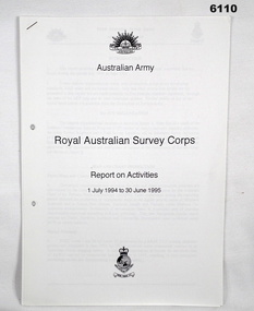
Administrative record - Royal Australian Survey Corps Report on Activities - 1 July 1994 - 30 Jun 1995, DSvy - A, Circa 1995
... Royal Australian Survey Corps Report on Activities - 1 July...Royal Australian Survey Corps Report on Activities - 1 July...Royal Australian Survey Corps...Report is a summary of activities of the Royal Australian... goldfields Report is a summary of activities of the Royal Australian ...Report is a summary of activities of the Royal Australian Survey Corps Financial year 94/958 pages, stapled, reports and diagrams royal australian survey corps, rasvy, fortuna, army survey regiment, army svy regt, asr -
 Bendigo Military Museum
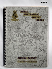
Administrative record - Royal Australian Survey Corps Report on Activities - 1 July 1988 - 30 Jun 1989, Army Survey Regiment, 30 Jun 1989
... Royal Australian Survey Corps Report on Activities - 1 July...Royal Australian Survey Corps Report on Activities - 1 July...Royal Australian Survey Corps...This is a Report summarizing the activities of the Royal... Australian Survey Corps during the F/Y 1988/89 Royal Australian ...This is a Report summarizing the activities of the Royal Australian Survey Corps during the F/Y 1988/89A4 Booklet, plastic ring binding with part of 1:250,000 map of SI5-15 Canberra printed on the front cover. Includes text, photos, maps and diagramsroyal australian survey corps, rasvy, fortuna, army survey regiment, army svy regt, asr -
 Bendigo Military Museum
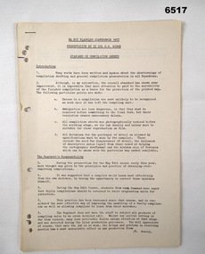
Administrative record - Royal Australian Survey Corps Planning Conference 1972 - Standard of Compilation sheets by LtCol DR Ridge (RASvy), LtCol DR Ridge (RASvy), Fortuna Bendigo, Circa 1972
... Royal Australian Survey Corps Planning Conference 1972...Royal Australian Survey Corps Planning Conference 1972...Royal Australian Survey Corps... at the Royal Australian Survey Corps Planning Conference 1972 held... at the Royal Australian Survey Corps Planning Conference 1972 held ...This is a paper that was prepared for and delivered at the Royal Australian Survey Corps Planning Conference 1972 held at Fortuna Bendigo. The paper was written and delivered by LtCol DR Ridge RASvy.A 6 x A4 page report with typed text, stapled and four hole punchedroyal australian survey corps, rasvy, fortuna, army survey regiment, army svy regt, asr -
 Bendigo Military Museum
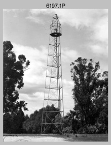
Photograph - Royal Australian Survey Corps Survey Observation Towers, c1950s
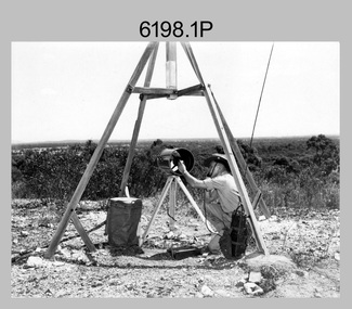
... Royal Australian Survey Corps Survey Observation Towers...Royal Australian Survey Corps Survey Observation Towers...Royal Australian Survey Corps...This is a set of seven photographs of Royal Australian...This is a set of seven photographs of Royal Australian... goldfields This is a set of seven photographs of Royal Australian ...This is a set of seven photographs of Royal Australian Survey Corps surveyors setting up observation towers in the field and undertaking survey observations during mapping and geodetic control operations. c1950s. Survey observation towers were used mainly to take angular measurements in flat or heavily forested terrain, where height was necessary to achieve observer’s line-of-sight between field survey station. The Bilby Tower seen in photo .5P was erected to a height of 75 feet (23m) above ground level. The use of the Bilby Tower in Topographic Squadron’s field survey operations from 1955 to 1966 is described in page 54 of Valerie Lovejoy’s book 'Mapmakers of Fortuna – A history of the Army Survey Regiment’ ISBN: 0-646-42120-4. CAPT George Ricketts’ period of service was from 1942 to 1976 reaching the rank of LTCOL. It is noted in page 35 of Valerie Lovejoy’s book that then SGT Ricketts hand lettering skills came to the fore from his contribution to the draughting of one of the Japan’s Instruments of Surrender in 1945.This is a set of seven photographs of Royal Australian Survey Corps surveyors setting up observation towers in the field and undertaking survey observations during mapping and geodetic control operations. c1950s. The photographs were printed on photographic paper and are part of the Army Survey Regiment’s Collection. The photographs were scanned at 300 dpi. .1) - Photo, black & white, c1950s, ‘Bilby’ survey observation tower. .2) - Photo, black & white, c1950s, CAPT George Ricketts climbing ‘Bilby’ survey observation tower. .3) - Photo, black & white, c1950s, geodetic survey equipment on ‘Bilby’ survey observation tower. .4) - Photo, black & white, c1950s, two unidentified field surveyors on ‘Bilby’ survey observation tower. .5) - Photo, black & white, c1950s, two unidentified field surveyors, with CAPT Ricketts climbing ‘Bilby’ survey observation tower. .6) - Photo, black & white, c1950s, two unidentified field surveyors undertaking observations on survey observation tower. .7) - Photo, black & white, c1950, two unidentified field surveyors erecting or dismantling a survey observation tower..1P with paper tag annotated ‘Bilby Tower’ .4P on back – ‘Bilby Tower’. .5P on back – ‘Survey Observing Tower. Observing tower used for angular measurement in flat country. 75’ high – CAPT Ricketts climbing. .6P, .7P on back. ‘1960s?’royal australian survey corps, rasvy, army survey regiment, army svy regt, fortuna, asr, surveying -
 Bendigo Military Museum
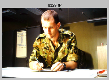
Photograph - Tasks Demonstrated by Royal Australian Survey Corps Technicians, c1990s
... Tasks Demonstrated by Royal Australian Survey Corps...Tasks Demonstrated by Royal Australian Survey Corps...Royal Australian Survey Corps... the Royal Australian Survey Corps undertaking technical tasks circa... the Royal Australian Survey Corps undertaking technical tasks... the Royal Australian Survey Corps undertaking technical tasks circa ...This is a set of 17 photographs of technicians from the Royal Australian Survey Corps undertaking technical tasks circa 1990s. Photos .1P to .9P were taken at the Army Survey Regiment, Fortuna, Bendigo. Photos .10P to .15P and .17P of students operating survey equipment, were taken at the School of Military Survey, Bonegilla and survey stations surrounding Lake Hume. The base camp at photo .16P was probably taken at Sandy Creek, near Tallangatta Victoria, during the field phase of a basic or advanced RA Svy training course. CPL Steve Nokes appearing in photo .17P was attending the 1/90 Map Control Survey Course.This is a set of 17 photographs of technicians from the Royal Australian Survey Corps undertaking technical tasks at the Army Survey Regiment, Fortuna, Bendigo, and the School of Military Survey, Bonegilla c1992. Colour photos are on 35mm slide film and were scanned at 96 dpi. Photo .17P is in black & white, printed on photographic paper and scanned at 300 dpi. The photos are part of the Army Survey Regiment’s Collection. .1) – Photo, colour, c1992, Aerial photography Assessment, SGT Tony Grivell. .2) – Photo, colour, c1992, Aerial photography Assessment, L to R: WO2 Noel McNamara and LCPL Grant Lloyd. .3) – Photo, colour, c1992, Wild PUG4 point transfer device, LCPL Mark Fedden. .4) – Photo, colour, c1992, AUTOMAP 2 Graphic Edit Workstation, unidentified technician. .5) – Photo, colour, c1992, Heidelberg Speedmaster 102 computer-controlled five colour lithographic offset printing press, CPL Nick Vanderzwan. .6) – Photo, colour, c1992, Daylight film contact frame, SPR Ken Labourchardiere. .7) – Photo, colour, c1992, Heidelberg Speedmaster 102 Map Colour Evaluation Workstation, SGT Stuart Ridge. .8) – Photo, colour, c1992, Map proof evaluation, CPL John Bragg. .9) – Photo, colour, c1992, Wohlenberg MCS-2 guillotine, unidentified technician. .10) – Photo, colour, c1992, Wild T2 Theodolite, L to R: SPR Matt Arnold, SPR Kim Baker. .11) – Photo, colour, c1992, Wild T2 Theodolite, L to R: SSGT Bob Bright, SPR Kim Baker. .12) to .14) – Photo, colour, c1992, MRA-7 Tellurometer, CPL Mark Bourne. .15) – Photo, colour, c1992, Plane Tabling, CPL Mark Bourne. .16) – Photo, colour, c1992, School of Military Survey base camp, Sandy Creek, VIC. .17) – Photo, black & white, 1990, MRA-7 Tellurometer, CPL Steve Nokes. .1P to .16P - There are no annotations. .17P – annotated on back ‘CPL NOKES WITH MRA7 ON 1/90 MAP CONTROL COURSE’royal australian survey corps, rasvy, army survey regiment, army svy regt, school of military survey, fortuna, asr -
 Bendigo Military Museum
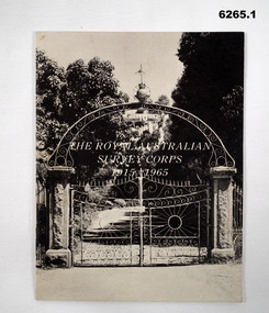
Booklet - The Royal Australian Survey Corps 1915-1965, Army Headquarters Survey Regiment, 14.11.1965
... The Royal Australian Survey Corps 1915-1965...The Royal Australian Survey Corps 1915-1965...Royal Australian Survey Corps...) Anniversary of the Royal Australian Survey Corps, contains...) Anniversary of the Royal Australian Survey Corps, contains ...A booklet produced to commemorate the 50th (Jubilee) Anniversary of the Royal Australian Survey Corps, contains an historical record of the Corps units, nominal roll of AHQ Survey Regiment unit members during the Jubilee year, photos and plans of Fortuna Villa.Booklet, 16 pages 6265.1 Front cover has black and white photo of the gated entrance to Fortuna Villa 6265.2 Front cover has an extract from the 1:100,000 map of Canberra, ACT. 6265.2 Internal contents are a reprint of 6265.1Inside of the booklet is signed by LtCol JK Nolan CO AHQ Svy Regt, later Director of the Survey Corps.royal australian survey corps, rasvy, fortuna, army survey regiment, army svy regt, asr -
 Bendigo Military Museum
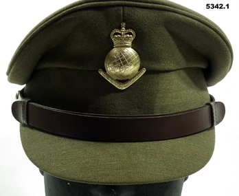
Uniform - SERVICE DRESS, ARMY - Royal Australian Army Survey Corps Uniform, Commonwealth Govt Clothing Factory, 1970-1988
... SERVICE DRESS, ARMY - Royal Australian Army Survey Corps...SERVICE DRESS, ARMY - Royal Australian Army Survey Corps...Royal Australian Survey Corps... Thomas William Pattison, Royal Australian Survey Corps, Army... Officer Thomas William Pattison, Royal Australian Survey Corps ...This is the peaked cap and uniform of 36898 Warrant Officer Thomas William Pattison, Royal Australian Survey Corps, Army Survey Regiment who served from 21 Mar 1960 until 16 Jan 1993 and died whilst in service.1. Cap - Polyester, Khaki, small peak, leather band, metal Insignia. 2. Jacket - polyester, khaki, yellow metal buttons, Insignia badges, purple lanyard, embroidered Insignia lower sleeves. 3, Shirt - polyester, short sleeves, embroidered insignia on sleeves. 4. Pants - Polyester, Khaki.Jacket - embroidered Insignia on lower sleeves - Crown.uniform, army, royal australian survey corps, rasvy, army survey regiment, army svy regt, asr -
 Bendigo Military Museum
Photograph - Royal Australian Survey Corps Aerial Surveys, c1980
... Royal Australian Survey Corps Aerial Surveys...Royal Australian Survey Corps Aerial Surveys...Royal Australian Survey Corps... the Royal Australian Survey Corps operating aerial surveys equipment... the Royal Australian Survey Corps operating aerial surveys equipment... the Royal Australian Survey Corps operating aerial surveys equipment ...This is a set of nine photographs of technicians from the Royal Australian Survey Corps operating aerial surveys equipment c1980s. In photo .1P, CPL Steve Gloster was operating a RC10 air survey camera mounted in an Australian Army Pilatus Porter aircraft. The Wild RC10 super wide-angle air survey cameras were first introduced in 1971, were equipped with virtual distortion free lenses for supplementary, spot and special photography. In photo .2P, Roger Rees was operating Air Profile Recorder (APR) equipment. it was possibly taken during OP NERVOSE 84, sometime between June – August 1984 when based in Ngukurr, Northern Territory. The APR was operated at this time in unison with an RC10 camera. In 1963 the Royal Australian Survey Corps introduced the radar airborne profile recorder (Canadian Applied Research Ltd, Mark V, Airborne Profiler Recorder) was introduced for 1:100,000 mapping to replace terrain heighting by aneroid barometry. Later in 1974-1975, the Australian developed WREMAPS II airborne laser terrain profile recorder was introduced. In photo .3P, Neil Jones appears at the door of Airsearch Beechcraft Queen Air aircraft, Registration / Serial VH-MWX. This aircraft was typically used by RA Svy on air survey operations flying mission with Aerodist, APR and RC10 camera equipment. The Australian Army’s Pilatus Porter (short take-off and landing turbo propeller) was also equipped with a Wild RC10 aerial mapping camera for identification photography. The Pilatus Porter was also used on RA Svy’s map field checking operations. Photo .9P was taken at a survey station at an unknown location. In this photo an Australian Army Kiowa Light Observation Helicopter (LOH) is supporting a field survey party undertaking Magnavox AN/PRR-14 portable Doppler satellite observations. The satellite receiver’s antenna is plumbed over the survey ground mark surrounded by white plastic panels. The panels were used to identify the survey station on aerial photography. Introduced in 1974–1975, the Magnavox AN/PRR-14 portable Doppler satellite (US Navy Navigation Satellite System – TRANSIT) receivers and computing system provided independent three-dimensional point positions anywhere in the world, anytime, in any weather accurate to about 1.5metres with precise satellite ephemerides. The Bell OH-58 Kiowa LOH was a family of military helicopters used for observation, utility, and direct fire support. It was identified by RA Svy in the mid-1970s that considerable time was lost in replacing unserviceable remote equipment by road. Therefore Aerodist operations (pre-dating satellite receiver operations) were fully supported by Army’s Kiowa LOH aircraft. This is a set of nine photographs of technicians from the Royal Australian Survey Corps operating aerial surveys equipment c1980s. .1P to .3P, .5P to .9P - Colour and black and white photos on photographic paper and scanned at 300 dpi. .4P - Colour photo on 35mm slide film and scanned at 96 dpi. .1) & .2) - Photo, black & white, c1980s, CPL Steve Gloster operating an RC10 air camera. .3) - Photo, colour, 1984, Roger Rees operating Air Profile Recorder (APR) equipment. .4) - Photo, colour, c1980s, Neil Jones at the door of an Airsearch Beechcraft Queen Air aircraft, typically used by RA Svy on air survey operations. .5) - Photo, colour, c1980s. A Beechcraft King Air aircraft, also used by RA Svy on air survey operations. .6) - Photo, colour, c1980s. An Australian Army Pilatus Porter, used by RA Svy on air survey and map field checking operations. SGT Peter Mustart is possibly in the foreground. .7) to .8) - Photo, colour, c1980s. An Australian Army Pilatus Porter and unidentified personnel, used by RA Svy on air survey and map field checking operations. .9) - Photo, colour, c1980s. An Australian Army Kiowa helicopter supporting a field survey party undertaking Magnavox AN/PRR-14 portable Doppler satellite observations. There are biro marks on photos .4P to .9Proyal australian survey corps, rasvy, army survey regiment, asr, fortuna, aerial surveys -
 Waverley RSL Sub Branch
Plaque Royal Australian Engineers, Royal Australian Engineers
... Plaque Royal Australian Engineers ...Royal Australian Engineers ...The Royal Australian Engineers (RAE) is a corps...Royal Australian Engineers ... melbourne The Royal Australian Engineers (RAE) is a corps ...The Royal Australian Engineers (RAE) is a corps of the Australian Army (although the word corps does not appear in their name or on their badge). The RAE is ranked fourth in seniority of the corps of the Australian Army, behind the Staff Cadets, Armoured and Artillery Corps. The Corps was formed by the amalgamation of the various colonial engineer corps of the States and territories of Australia in 1902[2] and since then has served in various conflicts including World War I, World War II and the Vietnam War. The Corps has also served on numerous peacekeeping operations and is currently involved in the Australian contribution to the war in Afghanistan. The RAE provides combat engineering, construction and other technical support to the Australian Defence Force. One of the main roles of the Corps is to provide mobility and counter mobility capabilities to the Australian Army and its allies. This means enhancing the ability of friendly forces to move while denying movement to enemy forces. In order to provide these capabilities, engineers are required to conduct many tasks including penetrating minefields, locating and disarming booby traps, purifying water and building roads and bridges. The Corps also performs the majority of the Australian Army's demolition tasks and is trained to fight as infantry if needed. http://en.wikipedia.org/wiki/Royal_Australian_EngineersWooden Plaque 15cm x 13cmRoyal Australian Engineers -
 Bendigo Military Museum
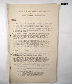
Administrative record - Application of Light Aircraft to Royal Australian Survey Corps Survey Operations - MAJ LB Sprenger (RASvy) 1957, Major LB Sprenger (RASvy), November 1957
... Application of Light Aircraft to Royal Australian Survey...Application of Light Aircraft to Royal Australian Survey...Royal Australian Survey Corps...Application of Light Aircraft to Royal Australian Survey...Application of Light Aircraft to Royal Australian Survey ...Application of Light Aircraft to Royal Australian Survey Corps Survey Operations - MAJ LB Sprenger (RASvy) 1957. This is a report to determine if light aircraft was suitable and financially beneficial for use in Royal Australian Survey Corps Survey Operations. The results were so successful that funds were made available to RASvy for operation of light aircraft for survey purposes in the financial year 1958/59. For a number of years the US and Canadian Armies had made significant use of helicopters for survey purposes, this is the Australian experience. RASvy extensively used light aircraft for survey operations following this experience. MAJ LB Sprenger was later promoted and as LtCol LB Sprenger MBE he was the Commanding Officer of the Army Survey Regiment, Bendigo in 1969/70 and passed away during that appointment.A 23 x Foolscap page report of typed text, held together by staples and an ARNOS fastenerroyal australian survey corps, rasvy, fortuna, army survey regiment, army svy regt, asr -
 Bendigo Military Museum
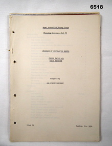
Administrative record - Royal Australian Survey Corps Planning Conference 1972 - Standard of Compilation sheets by Army Survey Regiment, Army Survey Regiment, Bendigo, 03.10.1972
... Royal Australian Survey Corps Planning Conference 1972...Royal Australian Survey Corps Planning Conference 1972...Royal Australian Survey Corps...This booklet was prepared for the Royal Australian Survey...This booklet was prepared for the Royal Australian Survey ...This booklet was prepared for the Royal Australian Survey Corps Planning Conference 1972 by the Army Survey Regiment held at Fortuna Bendigo. It was intended to provide a trouble shooting guide for personnel engaged in the production of map compilation sheets. See also item Number 6517 "Standard of Compilation Sheets" by LtCol DR Ridge (RASvy)26 x A4 page document containing typed text diagrams and copied map extracts, photocopies and Oza film. Item is four hole puched and is held together by an ARNOS Fastenerroyal australian survey corps, rasvy, fortuna, army survey regiment, army svy regt, asr -
 Bendigo Military Museum
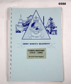
Booklet - Royal Australian Survey Corps Corps History 1915 - 1990 - Lt Col Clem Sargent, LtCol Clem Sargent, 1990
... Royal Australian Survey Corps Corps History 1915 - 1990...Royal Australian Survey Corps Corps History 1915 - 1990...Royal Australian Survey Corps... of the Royal Australian Survey Corps at the time. The Colonel... of the Royal Australian Survey Corps at the time. The Colonel ...This 31 x page booklet titled "Corps History (1915 - 1990)" was written by LtCol Clem Sargent who was the Colonel Commandant of the Royal Australian Survey Corps at the time. The Colonel Commandant was an honorary appointment charged with preserving the History of the Corps. LtCol Sargent served in the Survey Corps from 1945 till 1975 and retired at the rank of Colonel.31 x page booklet with blue card covers and black plastic binding containing text and some black and white poor-quality photos. Cover has Army Survey Regiment logo printed in blue and title "Corps History (1915 - 1990) By LtCol Clem Sargent"royal australian survey corps, rasvy, fortuna, army survey regiment, army svy regt -
 Bendigo Military Museum
Document - Royal Australian Survey Corps - School of Military Survey Precis - Corrections to 1st Order Astronomical Observations 1964, School of Military Survey, Balcombe, 1964
... Royal Australian Survey Corps - School of Military Survey...Royal Australian Survey Corps - School of Military Survey...Royal Australian Survey Corps...This is a precis produced by the Royal Australian Survey...This is a precis produced by the Royal Australian Survey ...This is a precis produced by the Royal Australian Survey Corps School of Military Survey in 1964. This is a very technical precis that describes the corrections that need to be applied to First Order Astronomical Theodolite Observations. First Order Astronomical positioning is the highest order and the most accurate determination of position using the stars and for that reason small allowances and corrections are needed to maintain/ improve relative accuracy.A 26 x page foolscap sized paper Precis, stapled and two hole punched. The precis does not have a protective cover and pages are discoloured. The precis contains typed text, tables and diagrams.royal australian survey corps, rasvy, fortuna, army survey regiment, army svy regt, asr, astronomy -
 Bendigo Military Museum
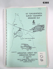
Administrative record - Royal Australian Survey Corps Report on Operation Aright 91 conducted by 1 Field Survey Squadron 1991, 1 Fd Svy Sqn, 7 Oct 1991
... Royal Australian Survey Corps Report on Operation Aright 91...Royal Australian Survey Corps Report on Operation Aright 91...Royal Australian Survey Corps...Royal Australian Survey Corps Operation Aright 91 (Field... goldfields Royal Australian Survey Corps Operation Aright 91 (Field ...Royal Australian Survey Corps Operation Aright 91 (Field Completion) was a Field Verification and Vital Assets Protection (VAP) Mapping Operation conducted in Far North Queensland during the period 18 Jun - 29 Jul 1991 by 1 Fd Svy Sqn. The Operation covered the 1:250,000 Map area of SD54-16 Hann River and SE54-7 Normanton.Pale Blue cover with motifs of North Queensland, crocodile, RASvy Corps Badge, Army Helicopter and Land rover. Contains an A4 paper report of typed pages and diagrams secured by a plastic binder.Cover Hand annotated "ASS 108" (Air Survey Sqn, copy 108)royal australian survey corps, rasvy, fortuna, army survey regiment, army svy regt, asr -
 Bendigo Military Museum
Administrative record - The story of the Royal Australian Survey Corps - Brigadier L Fitzgerald OBE, FIS 1962, Brigadier L Fitzgerald OBE, FIS Aust, Canberra, March 1962
... The story of the Royal Australian Survey Corps - Brigadier...The story of the Royal Australian Survey Corps - Brigadier...Royal Australian Survey Corps...This is a report prepared by the Director of the Royal... in .mp4 format. Royal Australian Survey Corps RASvy Fortuna Army ...This is a report prepared by the Director of the Royal Australian Survey Corps Brigadier L Fitzgerald OBE, FIS Aust for presentation at the Institution of Surveyors, Australia, 6th Survey Conference held in Adelaide in March 1962. This document mentions the beginning of mapping in 1907 in the Australian Intelligence Corps and how the Survey Corps was formed in 1915. The story continues until 1962. A full copy of the report is attached as a video in .mp4 format.14 x page typed foolscap size paper report, stapled and 4 x hole punched. Each page has been photographed at 200dpi and saved in .jpg format. The complete set of these .jpg pages have then been combined into a video in ,mp4 format. The Video is 1.34Mb in size and runs for 2:48 min 48.Some handwritten notes next to some paragraphs by an unknown author.royal australian survey corps, rasvy, fortuna, army survey regiment, army svy regt, asr -
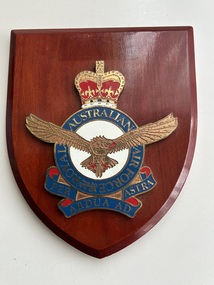 Moorabbin Air Museum
Plaque (Item) - Royal Australian Air Force Plaque
... Royal Australian Air Force Plaque....Royal Australian Air Force Plaque....Royal Australian Air Force Plaque.... Moorabbin melbourne Royal Australian Air Force Plaque. Royal ... -
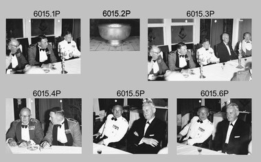 Bendigo Military Museum
Photograph - Royal Australian Survey Corps Formal Dinner, 1966
... Royal Australian Survey Corps Formal Dinner...Royal Australian Survey Corps Formal Dinner...Royal Australian Survey Corps... the 50th Year Jubilee anniversary of the Royal Australian Survey... the 50th Year Jubilee anniversary of the Royal Australian Survey ...These photographs were taken at a RASvy Corps Formal Dinner at the Army Survey Regiment in 1966. The formal dinner commemorated the 50th Year Jubilee anniversary of the Royal Australian Survey Corps’ formation. Known personnel in the photographs were Brigadier Don Macdonald AM, Director of the Survey Corps and LTCOL Frank Buckland OBE, who was the CO of the Army Survey Regiment. The 50th year Jubilee Dinner silver bowl often appeared as a centrepiece in Officer’s Mess functions.These six black and white photographs were taken at a RASvy Corps Formal Dinner at the Army Survey Regiment in 1966. The photographs were printed on photographic paper and are part of the Army Survey Regiment’s Collection. The photographs were scanned at 300 dpi. .1) Photo, black & white, L to R: BRIG Don Macdonald AM, unidentified, LTCOL Frank Buckland OBE .2) Photo, black & white, 50th year Jubilee Dinner Bowl .3) Photo, black & white, L to R: BRIG Don Macdonald AM, unidentified, LTCOL Frank Buckland OBE, unidentified .4) Photo, black & white, L to R: BRIG Don Macdonald AM, unidentified .5) Photo, black & white, L to R: LTCOL Frank Buckland OBE, unidentified .6) Photo, black & white, L to R: LTCOL Frank Buckland OBE, unidentified royal australian survey corps, rasvy, fortuna, army survey regiment, army svy regt, asr -
 Bendigo Military Museum
Administrative record - Royal Australian Survey Corps - Central Command Operation Order C/1/61 Northern Territory 1961, DAD Svy, HQ Central Command , Keswick Barracks, SA, 1961
... Royal Australian Survey Corps - Central Command Operation...Royal Australian Survey Corps - Central Command Operation...Royal Australian Survey Corps...This is a Central Command Operation for the Royal... amphibian (DUKW), Helicopter and Cessna aircraft. Royal Australian ...This is a Central Command Operation for the Royal Australian Survey Corps to conduct a Survey Operation in Northern Territory in 1961. The task is to acquire Survey Control for the production of maps coving the following 1:250 000 map areas of Alligator River, Mt Evelyn, Coburg Peninsula, (including the offshore Islands, Melville Island and Bathurst Island. The Operation Order details the tasks for the 6 x Officers (or equivalent) and 34 x OR's (or equivalent) and the support that was allocated including Frigate HMAS Gasgoyne, LSM landing craft, Trucks amphibian (DUKW), Helicopter and Cessna aircraft.A 11 x page foolscap size paper report and 1 x foldout map Annex held together with a paper clip. Two hole punched.Hand written File Number in top RH Corner "101-310-4". Distribution stamp in top LH Corner. Hand written No7 in Top RH Corner.royal australian survey corps, rasvy, fortuna, army survey regiment, army svy regt -
 National Vietnam Veterans Museum (NVVM)
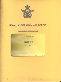
Manual, Royal Australian Air Force, Royal Australian Air Force: Engineering Publication AAP 7421.020-3M Inverter Type 200
... Royal Australian Air Force: Engineering Publication AAP...Royal Australian Airforce - manuals... the top of the cover there is the Royal Australian Air Force...Royal Australian Air Force...Royal Australian Airforce - manuals Engineering Inverter ...A yellow plastic cover with a window in the front. Near the top of the cover there is the Royal Australian Air Force Insignia with Royal Australian Air force and Engineering Publication. Through the window is the title of the Manual. Inside a plastic sleeve on yellow cardboard are the full details of the manual. The manual is held together with a large metal slide.royal australian airforce - manuals, engineering, inverter -
 Bendigo Military Museum
Booklet - Royal Australian Survey Corps - School of Military Survey Precis - Formula for Survey Calculations, School of Military Survey, Balcombe, Circa 1960s
... Royal Australian Survey Corps - School of Military Survey...Royal Australian Survey Corps - School of Military Survey...Royal Australian Survey Corps...This selection of Precis was produced by the Royal... Royal Australian Survey Corps RASvy Fortuna Army Survey Regiment ...This selection of Precis was produced by the Royal Australian Survey Corps, School of Military Survey, Balcombe, circa 1960s. The Precis are intended to instruct RASvy Surveyors employed on Engineer/ Field Survey Tasks on the calculations necessary for Surveying formula. The blue hard covered foolscap sized booklet held together with two Chicago screws contains 7 x precis listed below. .1 Setting out simple Curves .2 Earthworks .3 Calculation of area by double Latitude .4 Notes on Station Adjustment by Least Squares .5 Notes on Figure Adjustment by Least Squares .6 Technical Memo No1, Computation of Tellurometer Traverses using Plain Angles and Plain Distances by WO2 R Wilson RASvy (later Major) .7 Computing Traverses in Plane CoordinatesBlue Hard covered foolscap sized booklet held together with two Chicago screws. Booklet contains 7 x precis. .1 Setting out simple Curves .2 Earthworks .3 Calculation of area by double Latitude .4 Notes on Station Adjustment by Least Squares .5 Notes on Figure Adjustment by Least Squares .6 Technical Memo No1, Computation of Tellurometer Traverses using Plain Angles and Plain Distances by WO2 R Wilson (later Major) .7 Computing Traverses in Plane Coordinatesroyal australian survey corps, rasvy, fortuna, army survey regiment, army svy regt, asr, school of military survey -
 Bendigo Military Museum
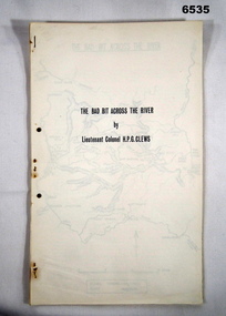
Journal - Royal Australian Survey Corps - The Bad Bit Across the River - LtCol HPG Clews 1934, LTCol HPG Clews RASvy, 1934
... Royal Australian Survey Corps - The Bad Bit Across the...Royal Australian Survey Corps - The Bad Bit Across the...Royal Australian Survey Corps... then served in the Royal Australian Survey Corps from 1912 - 1949... then served in the Royal Australian Survey Corps from 1912 - 1949 ...This Journal "The bad bit across the River" was written by - LtCol HPG Clews in 1934 and is about his experiences around the Colo River approximately 60 miles NW of Sydney, NSW. LtCol Clews was a remarkable man and his achievements were just as remarkable. He is affectionately known as "The Major." He served in the British Army 1909 - 1911 with the Sherwood Foresters. He then served in the Royal Australian Survey Corps from 1912 - 1949 and then served as the Senior Surveyor with the Snowy Mountains Authority from 1950-1958. A Survey Cairn is errected in Khancoban to record his life 1890 - 1980. This Journal records the field trip to establish Survey Control in very rugged country by a handful of party members on foot. The map shows the routes taken.14 x foolscap pages stapled and two hole punched. The Journal includes a map, 7 x pages of typed text and 4 x Annexesroyal australian survey corps, rasvy, fortuna, army survey regiment, army svy regt, asr, 2nd field survey company -
 Moorabbin Air Museum
Plaque (Item) - Royal Australian Air Force 75 Squadron Wooden Plaque
... Royal Australian Air Force 75 Squadron Wooden Plaque....Royal Australian Air Force 75 Squadron Wooden Plaque....Royal Australian Air Force 75 Squadron Wooden Plaque.... Australian Air Force 75 Squadron Wooden Plaque. Royal Australian Air ...75 Squadron, Motto Seek And Destroy -
 Bendigo Military Museum
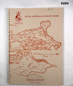
Booklet - Royal Australian Survey Corps - Annual Report 1 Jul 87 - 30 Jun 88, Director of Military Survey -Army, 01.09.1988
... Royal Australian Survey Corps - Annual Report 1 Jul 87 - 30...Royal Australian Survey Corps - Annual Report 1 Jul 87 - 30...Royal Australian Survey Corps...Royal Australian Survey Corps Annual Report detailing... goldfields Royal Australian Survey Corps Annual Report detailing ...Royal Australian Survey Corps Annual Report detailing Surveying and mapping activities 1 July 87 - 30 Jun 88. The first part of the report details the highlights during the period followed by Annexes A to J detailing Australian Map and Chart production. Annex A: 45 pages, Annex B: 1 page Aust Doppler Satelite Stations, Annex C: 1 page, Aust airborne Profile Recording, Annex D: 1 page Aust Aerial photography, Annex E: 1 page Aust Analytical Aerotriangulation, Annex F: 1 page Inertial Positioning System Network Traverses Fils Svy, Annex G: 1 page Global Positioning System Station/networks TI4100 Svy, Annex H: 1 page, Defence Cooperation Programme, Annex I 3 Pages RASvy Officer Manning, Annex J: 1 page RASvy ARES Manning Levels.Buff coloured light cardboard covers. Old map of Sydney Cove area printed in red/brown on front cover and Survey Corps Badge in red top left corner. "Map of the town of Sydney 1836" printed on back cover. A4 sized paper pages, 17 numbered pages plus, Annex A: 45 x pages, Annex B: 1 x page Aust Doppler Satellite Stations, Annex C: 1 x page, Aust Airborne Profile Recording, Annex D: 1 x page Aust Aerial photography, Annex E: 1 x page Aust Analytical Aerotriangulation, Annex F: 1 x page Inertial Positioning System Network Traverses Fils Svy, Annex G: 1 x page Global Positioning System Station/Networks TI4100 Svy, Annex H: 1 x page, Defence Cooperation Programme, Annex I 3 x pages RASvy Officer Manning, Annex J: 1 x page RASvy ARES Manning Levels.royal australian survey corps, rasvy, fortuna, army survey regiment, army svy regt, asr -
 Bendigo Military Museum
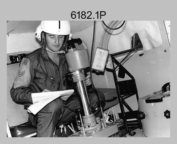
Photograph - Royal Australian Survey Corps Electronic Distance Measuring Equipment Demonstration, c1960s
... Royal Australian Survey Corps Electronic Distance Measuring...Royal Australian Survey Corps Electronic Distance Measuring...Royal Australian Survey Corps...) of the Royal Australian Survey Corps from 1978 to 1983. Jim Stedman...) of the Royal Australian Survey Corps from 1978 to 1983. Jim Stedman ...This is a set of five photographs of CAPT James ‘Jim’ Leslie Stedman in the field demonstrating the setup of prisms used as electric distance measurement (EDM) receiver reflectors for tellurometer equipment and the sighting of a large surveyor’s light. This equipment was deployed in establishing mapping and geodetic control operations. The photos were most likely taken in the late 1950s or early 1960s. The tellurometers of this era were man-portable systems that improved geodetic survey efficiencies for rapid network extension and densification replacing triangulation with EDM and theodolite traverse sometimes using Bilby Towers to extend line lengths. Jim Stedman later reached the rank of Colonel, was Director of Military Survey from 1975 to 1978 and was appointed as Colonel Commandant (honorary appointment, Retd) of the Royal Australian Survey Corps from 1978 to 1983. Jim Stedman is demonstrating EDM equipment. See item 6180.16P, photos .14) to .16) for more information and photos of Jim Stedman’s EDM demonstration. This is a set of five photographs of a surveyor in the field demonstrating electric distance measurement (EDM) equipment. c1950s – 1960s. The photographs were printed on photographic paper and are part of the Army Survey Regiment’s Collection. The photographs were scanned at 300 dpi. .1) to .2) - Photo, black & white, c1960s, CAPT Jim Stedman demonstrating the sighting of a large surveyor’s light. .3) to .5) – Photo, black & white, c1960s, CAPT Jim Stedman demonstrating EDM prism equipment. .1P to .5P on back – CAPT Stedman EDM Eqpt.royal australian survey corps, rasvy, army survey regiment, army svy regt, fortuna, asr, surveying -
 Bendigo Military Museum
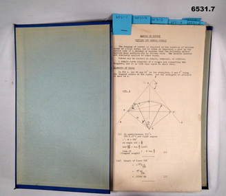
Administrative record - Royal Australian Survey Corps - 1st, 2nd and 3rd Order Triangulation Precis, School of Military Survey, Balcombe, Circa 1948 - 1960
... Royal Australian Survey Corps - 1st, 2nd and 3rd Order...Royal Australian Survey Corps - 1st, 2nd and 3rd Order...Royal Australian Survey Corps... and 3rd Order Triangulation using the Royal Australian Survey... and 3rd Order Triangulation using the Royal Australian Survey ...A School of Military Survey Precis, 8 x foolscap sized pages of typed text, stapled and two hole punched. The precis No 3 covers the Observation procedure to be used for 1st, 2nd and 3rd Order Triangulation using the Royal Australian Survey Corps standard Cooke, Troughton and Simms Tavistock or Wild T2. The geodetic model Tavistock with a 5.25" horizontal circle should be used for 1st Order Triangulation and maybe used for 2nd Order Triangulation if specially directed. The standard Tavistock with 3.5" horizontal circle or the Wild T2 should be used for 2nd and 3rd Order observations. The Precis discusses the types of errors, the source of errors and the best ways of managing them. In surveying, triangulation is the process of determining the location of a point by measuring only angles to it from known points at either end of a fixed baseline by using trigonometry, rather than measuring distances to the point directly as in trilateration.A School of Military Survey Precis, 8 x foolscap sized pages of typed text, stapled and two hole punched.royal australian survey corps, rasvy, fortuna, army survey regiment, army svy regt, asr, school of military survey, sms, balcombe -
 National Vietnam Veterans Museum (NVVM)
Manual, Royal Australian Air Force, Royal Australian Air Force: Engineering Publication AAP 7537.004-3M Fatigue Meters Types, M1946, M1947, M1948 and M1967
... Royal Australian Air Force: Engineering Publication AAP...Royal Australian Airforce - manuals... the top of the cover there is the Royal Australian Air Force...Royal Australian Air Force...Royal Australian Airforce - manuals Engineering Fatigue ...A yellow plastic cover with a window in the front. Near the top of the cover there is the Royal Australian Air Force Insignia with Royal Australian Air force and Engineering Publication. Through the window is the title of the Manual. Inside a plastic sleeve on yellow cardboard are the full details of the manual. The manual is held together with a large metal slide. the back of the manual is a blue cardboard cover.royal australian airforce - manuals, engineering, fatigue meters -
 Bendigo Military Museum
Photograph - Royal Australian Survey Corps - Map Production Processes, c1990
... Royal Australian Survey Corps - Map Production Processes...Royal Australian Survey Corps - Map Production Processes...Royal Australian Survey Corps...This is a collection of 20 photographs of Royal Australian...This is a collection of 20 photographs of Royal Australian ...This is a collection of 20 photographs of Royal Australian Survey Corps phases of map production at the School of Military Survey, Bonegilla, the Army Survey Regiment, Bendigo, and the Army Map Depot, Bandiana circa 1990. Colour photos are on 35mm slide film and were scanned at 96 dpi. They are part of the Army Survey Regiment’s Collection. Photo .1P was probably taken on a survey station overlooking Lake Hume near Albury-Wodonga. The field party occupying the survey station was likely from a Map Control Survey course conducted by the School of Military Survey, Bonegilla. This survey station was part of a geodetic network used in field survey training and RASvy’s Lake Hume Test Range. Photos .3P to .16P were taken at the Army Survey Regiment, Bendigo and photos .17P & .18P were taken at the Army Map Depot, Bandiana. Photo .19P depicts a map of RASvy’s ARA units before the disbandment of 5th Field Survey Squadron, Perth and 2nd Field Survey Squadron, Sydney in 1990. This is a collection of 20 photographs of map production processes taken at the School of Military Survey, Bonegilla, the Army Survey Regiment, Bendigo, and the Army Map Depot, Bandiana circa 1990. Colour photos are on 35mm slide film and were scanned at 96 dpi. They are part of the Army Survey Regiment’s Collection. Photo .2P is printed on photographic and scanned at 300 dpi. .1) – Photo, colour, c1980s. Geodetic Surveying: AN/PRR-14 Geoceiver antenna on hill surrounding Lake Hume. Series 3 Land Rover, field party tent and survey station beacon in background. .2) – Photo, black & white, c1980s. Geodetic Surveying: AN/PRR-14 Geoceiver antennas set up at the School of Military Survey, Bonegilla, Victoria. .3) – Photo, colour, c1990. Aerotriangulation: Wild PUG4 point transfer device, SSGT Bruce Hammond. .4) – Photo, colour, c1990. Aerotriangulation: Zeiss (Jena) Stecometer, SSGT Bruce Hammond. .5) – Photo, colour, c1990. Aerotriangulation: computer tape maintenance, SSGT Noel McNamara. .6) – Photo, colour, c1990. AUTOMAP 2: computer tape maintenance, SPR Nadine (Paul) Read. .7) - Photo, colour, c1990s. AUTOMAP 2: Optronics 4040 scanning/film output in Lithographic Squadron, SGT Sherri (Dally) Burke. .8) - Photo, colour, c1990s. AUTOMAP 2: Benson verification plotter output, SPR Nadine (Paul) Read. .9) – Photo, colour, c1990. Aerotriangulation: data management, SGT Neil ‘Ned’ Kelly. .10) & .11) - Photo, colour, c1990s. AUTOMAP 2: Wild B8 Aviograph stereoplotter Feature Extraction, unidentified technician. .12) - Photo, colour, c1990s. AUTOMAP 2: Graphic Edit Workstation, SPR Nadine (Paul) Read. .13) - Photo, colour, c1990s. AUTOMAP 2: Graphic Edit Workstation, SPR Dawn Hoadley. .14) & .15) - Photo, colour, c1990s. AUTOMAP 2: Graphic Edit Workstation, unidentified technician. .16) – Photo, colour, c1990s. Heidelberg Speedmaster 102 computer-controlled five colour lithographic offset printing press. .17) & .18) – Photo, colour, c1990s. Army Map Depot, unidentified storeman, Bandiana. .19) – Photo, colour, c1990. RASvy ARA Unit Locations before disbandment of field units in Perth and Sydney. .20) – Photo, colour, c1990. Set of overlapping aerial photography..1P, .3P to .20P - Some equipment is identified on the frame of the 35mm slides.royal australian survey corps, rasvy, army survey regiment, army svy regt, fortuna, asr, school of military survey, army map depot -
 Bendigo Military Museum
Manual - Royal Australian Survey Corps - Northern Command Field Survey Unit Technical Instructions 1966-73, Northern Command Field Survey Unit, Brisbane, Aug 1966 - Feb 1973
... Royal Australian Survey Corps - Northern Command Field...Royal Australian Survey Corps - Northern Command Field...Royal Australian Survey Corps...The Royal Australian Survey had Field Survey Units located...The Royal Australian Survey had Field Survey Units located ...The Royal Australian Survey had Field Survey Units located in most States of Australia. Northern Command Field Survey Unit was located in Brisbane. This folder contains technical Instructions for tasks carried out by the Unit from Survey control and data capture through to Field completion. The folder is held together by Chicago screws so that Instructions could be updated when necessary. Instruction No1 Production Data Records Aug 1966 23x pages, Instruction No2 Standard Operating Procedure for B8 Stereoplotting Oct 1967 4 x pages, Instruction No3 Provisional Compilation Specifications 1:100 mapping contouring Oct 1967 (Missing), Instruction No4 Horizontal Control Station Summaries Aug 1972 13 x pages, Instruction No5 Airphotography Mar 1972 8 x pages, Instruction No6 Reconnaisance Station marking and Station Notes Aerodist Operations Mar 1972, 13 x pages, Instruction No7 Field Completion Feb 1973, 7 x pages.A hard green plastic covered manual of 68 x paper pages of typed text diagrams and tables, some fold out Annexes. The pages are held together with two Chicago screwsWhite # "5 " inside front and back coversroyal australian survey corps, rasvy, fortuna, army survey regiment, army svy regt, asr, norther command field survey unit