Showing 114 items matching "somers street"
-
 Melbourne Legacy
Letter, Re Balnarring Camp Property, c.1930
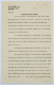
Referring to the legal history and transfer of land for the Junior Legacy Club Balnarring camp from Legatee Savige. Melbourne Legacy provided camps for junior legatees - the children of deceased servicemen. It started with outings to the property of Legacy founder, Legatee Stan Savige, who had a place in Balnarring. Permanent camp buildings were built in 1930. Lord Somers (Governor of Victoria) also ran a camp in the area and the area became known as Somers. These documents record the transfer of the land to Legacy. The camps gave the children an opportunity of a summer beach holiday with other Legacy children.An important record of the history of the land owned by Stan Savige that was used for Legacy Camp, it adds to the other material available about Legacy Camp at Somers.White foolscap paper with black typed x 5 pages. Single sided. Black type with red corrections and some grey lead remarks. Addressed to ‘The chairman,/ Junior Legacy Club,/ 55 Market Street,/ Melbourne. C.1. From ‘Yrs Faithfully/ sgd/ J.H. Armstrong and W. A. Tregent. See also collection item 00253. somers camp, properties, land transfer -
 Melbourne Legacy
Film - Video tape, Somers 2002, 2002
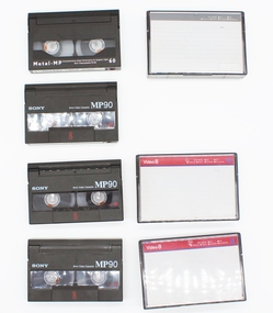
The series of 4 video cassettes shows holiday activities of children in the care of Legacy at the Legacy Camp for children at Somers, Victoria in 2002.Significant in that the 4 videos demonstrate the commitment of Legacy volunteers and that the funds raised from public donations go to the people it is intended to support.Four video cassettes about Somers Camp in 2002. Clear plastic outer case, with black plastic cassettes. ** There are 2 copies of this video. *** There is a total of four video cassettes in this item. See comments below. Casette Sony, 8mm Video Cassette MP90, the number 8 in red, title Somers 2002 written in black texta.somers camp, camp, junior legatee outing -
 Melbourne Legacy
Photograph, Somers Camp, 1940
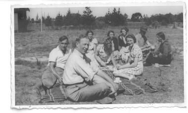
Photo of a group of people on a picnic rug at Somers Camp in 1940. Melbourne Legacy provided camps for junior legatees - the children of deceased servicemen. It started in the early years of Legacy with outings to the property of Legacy founder, Legatee Stan Savige, who had a place in Balnarring. Permanent camp buildings were built in the 1930s and with an association with Lord Somers (Governor of Victoria) it was called Somers Camp. The camps gave the children an opportunity of a summer beach holiday with other Legacy children.A photograph of Stan Savige at Somers Camp.Black and white photo of Stan Savige at Somers Camp 1940."Norman Smith ILC" in blue pen and "Stan Savige at Somers Camp just before his departure with 17th Bde 1940" in pencil on reverse.stan savige, somers camp, camp -
 Melbourne Legacy
Photograph - Photo, Somers Camp
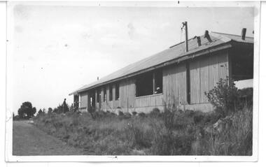
Photograph of a building at Somers Camp. Melbourne Legacy provided camps for junior legatees - the children of deceased servicemen. It started in the early years of Legacy with outings to the property of Legacy founder, Legatee Stan Savige, who had a place in Balnarring. Permanent camp buildings were built in the 1930s and with an association with Lord Somers (Governor of Victoria) it was called Somers Camp. The camps gave the children an opportunity of a summer beach holiday with other Legacy children.An original building at Somers Camp.Black and white photo of buildings at Somers Camp."Norman Smith ILC" in blue pen and "Legacy Somers Camp (original Camp at Somers)" in pencil on reverse.somers camp, camp -
 Melbourne Legacy
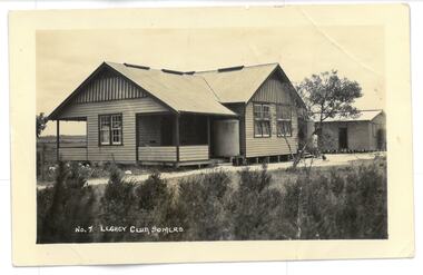
Photograph, Legacy Club, Somers
Photograph of a building on Legatee Stan Savige's property. It is labelled as Legacy Camp, Somers. This appears to be the original camp buildings established by Legacy in the 1930s. Melbourne Legacy provides camps for junior legatees. The camps gave the children an opportunity of a summer beach holiday with other Legacy children. It started with outings to the property of Legacy founder, Legatee Stan Savige, who had a place in Balnarring East, close to the beach. Permanent camp buildings were built in 1930. In 1930 Lord Somers (Governor of Victoria) also started a camp at a nearby property and the area was renamed Somers. Legacy Somers Camps continued intermittently at Stan's property until it was decided in 1951 to make other arrangements for holidays. An original building at Somers Camp.Black and white photo of No. 7 Legacy Club Somers and white envelope.00398.1 Photo. "No. 7 Legacy Club Somers" on front. POST CARD in black ink on reverse. Pencil "To Ey?? / Legacy Camp / Bonnie" in pencil on reverse. 00398.2 Envelope. Archives June 1995. Legacy Camp. Legacy on Parade" in blue pen. "L/G D. Simonson" in black penjunior legatee outing, savige property, legacy somers camp, camps -
 Melbourne Legacy
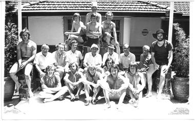
Photograph, Big Camp 1973 at Lord Somers Camp, January 1973
A photo of a group of 7 men and 11 young men at Big Camp 1973, held at Lord Somers Camp. Big Camp was for older youths. The camps gave the children an opportunity of a summer beach holiday with other Legacy children. Melbourne Legacy provided camps for junior legatees - the children of deceased servicemen. It started with outings to the property of Legacy founder, Legatee Stan Savige, who had a place in Balnarring near the beach. Permanent camp buildings were built in 1930. In 1930 Lord Somers (Governor of Victoria) also started a camp at a nearby property and the area was renamed Somers. Legacy Somers Camps continued intermittently at Stan's property until it was decided in 1951 to make other arrangements for holidays.A record of Junior Legatee camps.Black and white photo of Legatees and senior boys at Big Camp 1973.Handwritten 'Somers Jan 73' in red pen on reverse.junior legatee outing, big camp, lord somers camp -
 Melbourne Legacy
Photograph - Junior legatee outing, Somers Camp 1979, 1979
Photograph of a large group of boys playing tug of war on beach. From the inscription it was at Somers Camp in January 1979. Melbourne Legacy provided camps for junior legatees. It started with outings to the property of Legacy founder, Legatee Stan Savige, who had a place in Balnarring. Permanent camp buildings were built and with an association with Lord Somers (Governor of Victoria) it was called Somers Camp. The camps gave the children an opportunity of a summer beach holiday with other Legacy children.A record of Junior Legatees enjoying an outing or a camp.Black and white photo of children playing tug of war on a beach January 1979."Jan 79" in blue pen on reverse. Stamped "Copyright / The Herald and Weekly Times" in blue ink. Stamped "The Property of Melbourne Legacy" in purple ink on reverse.somers camp, camp, junior legatee outing, beach -
 Melbourne Legacy
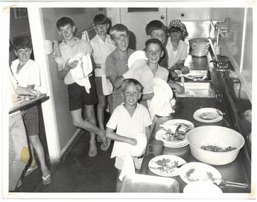
Photograph - Junior legatee outing, Somers Camp, 01/1968
A photo of 8 boys in a camp kitchen cleaning up after a meal. From the inscriptions it is Somers Camp in January 1968. Melbourne Legacy provided camps for junior legatees - the children of deceased servicemen. It started with outings to the property of Legacy founder, Legatee Stan Savige, who had a place in Balnarring. Permanent camp buildings were built and with an association with Lord Somers (Governor of Victoria) it was called Somers Camp. The camps gave the children an opportunity of a summer beach holiday with other Legacy children. It came from a Legacy envelope marked "P6 Junior Legatee Camps and Hols" in red pen, and dated Jan 1977 in pencil. The contents will be items 00418 to 00425. A record of Junior Legatee camps.Black and white photo of boys cleaning up the camp kitchen.Legacy P6 in blue pen. Stamped "The Property of Melbourne Legacy" and 19 Jan 1968 in purple ink. Stamped "Copyright Herald and Weekly Times" in blue ink. Paper label typed in black ink "(k) After a 'dip in the briny' and a big meal, even washing up the dishes is fun for these country Junior Legatees at our Somers Camp." Also "K" underlined twice in black texta.somers camp, junior legatee outing, kitchens -
 Melbourne Legacy
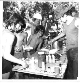
Photograph - Junior legatee outing, Somers Camp
A photo of boys in line receiving a meal at a camp at an unknown camp or date. It came from an envelope with other Camp photos of varying dates. The Legacy envelope was marked "P6 Junior Legatee Camps and Hols" in red pen, and dated Jan 1977 in pencil. The contents will be items 00418 to 00425. Melbourne Legacy arranged many events for Junior Legatees to experience. For many years a regular event was a two week camp at Somers Camp. It started in the 1930s with outings to the property of Legacy founder, Legatee Stan Savige, who had a place in Balnarring. Permanent camp buildings were built and with an association with Lord Somers (Governor of Victoria) it was called Somers Camp. The camps gave the children an opportunity of a summer beach holiday with other Legacy children.A record of Junior Legatee camps.Black and white photo of boys being fed at a camp.P6 / Legacy / 4 in blue pen. Stamped "Copyright Herald and Weekly Times" in blue ink. somers camp, junior legatee outing -
 Melbourne Legacy
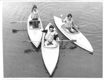
Photograph - Junior legatee outing, Somers Camp 1972, 01/1972
A photo of 3 boys waving from kayaks in the water. It came from an envelope with other camp photos. It came from a Legacy envelope marked "P6 Junior Legatee Camps and Hols" in red pen, and dated Jan 1977 in pencil. The contents will be items 00418 to 00425. Melbourne Legacy provided camps for junior legatees - the children of deceased servicemen. It started with outings to the property of Legacy founder, Legatee Stan Savige, who had a place in Balnarring. Permanent camp buildings were built and with an association with Lord Somers (Governor of Victoria) it was called Somers Camp. The camps gave the children an opportunity of a summer beach holiday with other Legacy children.A record of Junior Legatee camps.Black and white photo of boys in kayaks.Stamped "The Property of Melbourne Legacy" in purple ink. Stamped "Copyright The Age" in blue ink. "Jan 1972" in blue ink and 4347 in pencil.somers camp, junior legatee outing, kayaks -
 Melbourne Legacy
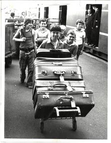
Photograph - Junior legatee outing, Somers Camp 1973, 01/1973
A photo of 6 boys with a trolley of suitcases at Spencer Street Railway Station, Melbourne (since renamed Southern Cross Station). They have arrived from country towns to attend Legacy Somers Camp in January 1973. It came from an envelope with other camp photos. The Legacy envelope was marked "P6 Junior Legatee Camps and Hols" in red pen, and dated Jan 1977 in pencil. The envelope contents are items 00418 to 00425. Melbourne Legacy provided camps for junior legatees - the children of deceased servicemen. It started with outings to the property of Legacy founder, Legatee Stan Savige, who had a place in Balnarring. Permanent camp buildings were built and with an association with Lord Somers (Governor of Victoria) it was called Somers Camp. The camps gave the children an opportunity of a summer beach holiday with other Legacy children.A record of Junior Legatee camps and shows style of suitcase used for travelling in 1970s.Black and white photo of children with their suitcases at Spencer St station.Handwritten on the back "P6 Incoming Camps and Hols / Legacy" in blue pen. Stamped "The Property of Melbourne Legacy" in purple ink. Stamped "Copyright The Herald and Weekly Times" in blue ink. Green paper label says "Country Junior Legatees, having arrived at Spencer Street Railway Station, Melbourne, move on to Somers for fun and games at Legacy's recent annual Holiday Camp held in January 1973."somers camp, junior legatee outing, trains -
 Melbourne Legacy
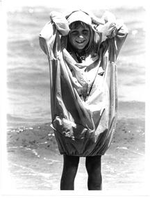
Photograph - Junior legatee outing, Somers Camp 1977, 01/1977
A photo of a smiling girl wading in the ocean. It came from an envelope with other camp photos. Junior Legatees attended Somer's Camp over summer holidays organised by Melbourne Legacy. The newspaper article on 12 January 1977 says it was a day where junior legatees were treated to sailing activities by yachtsmen of Westernport. The boys were at Somers Camp and the girls had been holidaying in the Legacy Camp at Kew. The Legacy envelope was marked "P6 Junior Legatee Camps and Hols" in red pen, and dated Jan 1977 in pencil. The contents will be items 00418 to 00425. Melbourne Legacy provided camps for junior legatees - the children of deceased servicemen. It started with outings to the property of Legacy founder, Legatee Stan Savige, who had a place in Balnarring. Permanent camp buildings were built and with an association with Lord Somers (Governor of Victoria) it was called Somers Camp. The camps gave the children an opportunity of a summer beach holiday with other Legacy children.A record of Junior Legatee camps.Black and white photo of a girl at the beach.Handwritten on the back "Holiday Camp at Somers" in blue pen. Stamped "Melbourne Legacy" and "11 Jan 1977" in purple ink. Stamped "Copyright The Herald and Weekly Times" in blue ink. somers camp, junior legatee outing, beach -
 Melbourne Legacy
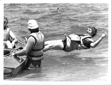
Photograph - Junior legatee outing, Somers Camp 1977, 01/1977
A photo of a teenager hanging out from sail boat in a harness. It came from an envelope with other camp photos. The newspaper article on 12 January 1977 says it was a day where junior legatees were treated to sailing activities by yachtsmen of Westernport. The boy was Wayne Cowards 15, of Morwell getting some practice on the trapeze of a Flying Dutchman. The boys were at Somers Camp and the girls had been holidaying in the Legacy Camp at Kew. The Legacy envelope was marked "P6 Junior Legatee Camps and Hols" in red pen, and dated Jan 1977 in pencil. The contents will be items 00418 to 00425. Melbourne Legacy provided camps for junior legatees - the children of deceased servicemen. It started with outings to the property of Legacy founder, Legatee Stan Savige, who had a place in Balnarring. Permanent camp buildings were built and with an association with Lord Somers (Governor of Victoria) it was called Somers Camp. The camps gave the children an opportunity of a summer beach holiday with other Legacy children.A record of Junior Legatee camps.Black and white photo of a youth leaning out of a small sailboat.Handwritten on back "Holiday Camp at Somers" in blue pen. Stamped "Melbourne Legacy" and "11 Jan 1977" in purple ink. Stamped "Copyright The Herald and Weekly Times" in blue ink. somers camp, junior legatee outing, boats -
 Melbourne Legacy
Photograph - Junior legatee outing, Big Camp 1970 at Somers Camp, 1970
A photo of a large group of teenage boys and men from Big Camp, January 1970. Big camp was for older junior Legatees. One of the men appears to be Sir Rohan Delacombe, the Governor of Victoria and patron of Legacy (fourth from the left centre road). Melbourne Legacy provided camps for junior legatees - the children of deceased servicemen. It started with outings to the property of Legacy founder, Legatee Stan Savige, who had a place in Balnarring. Permanent camp buildings were built and with an association with Lord Somers (Governor of Victoria) it was called Somers Camp. The camps gave the children an opportunity of a summer beach holiday with other Legacy children. It came from an envelope with other Big camp photos. The Legacy envelope was marked "P5 Power House" in red pen, and Box 15 in blue pen. The contents will be items 00427 to 00430.A record of Junior Legatee camps.Black and white photo of Legatees and senior boys at Big Camp 1970.Front of photo has text over the photo: "Big Camp Jan___ 1970". On reverse "P5 Legacy / 1970 Big Camp" written in blue pen.somers camp, junior legatee outing, big camp -
 Melbourne Legacy
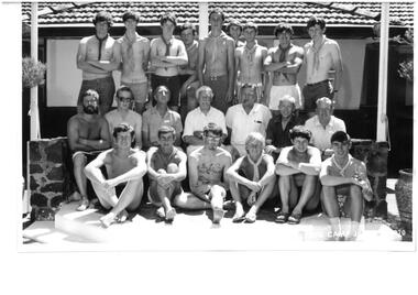
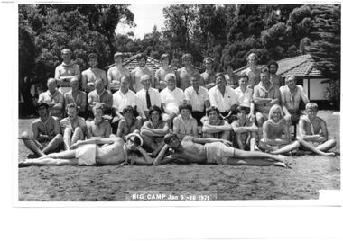
Photograph, Big Camp 1971 at Lord Somers Camp, 1971
A photo of a large group of teenage boys and men from Big Camp, January 1971. Big camp was for older junior Legatees at Lord Somers Camp. One of the men is Sir Rohan Delacombe, the Governor of Victoria and patron of Legacy (sixth from the left). Melbourne Legacy provides camps for junior legatees. The camps gave the children an opportunity of a summer beach holiday with other Legacy children. It started with camps on the property of Legacy founder, Legatee Stan Savige, who had a place in Balnarring, close to the beach. Permanent camp buildings were built in 1930. In 1930 Lord Somers (Governor of Victoria) also started a camp at a nearby property and the area was renamed Somers. Legacy Somers Camps continued intermittently at Stan's property until it was decided in 1951 to make other arrangements for holidays. Including at two other camps in the Somers area: Lord Somers Camp and the Somers School Camp (owned by the Education Department). It came from an envelope with other Big camp photos. The Legacy envelope was marked "P5 Power House" in red pen, and Box 15 in blue pen. The contents will be items 00427 to 00430.A record of Junior Legatee camps.Black and white photo of Legatees and senior boys at Big Camp 1971.Front of photo has text over the photo: "Big Camp Jan 9 - 16 1971". On reverse "P5 Legacy" written in blue pen.somers camp, junior legatee outing, big camp -
 Melbourne Legacy
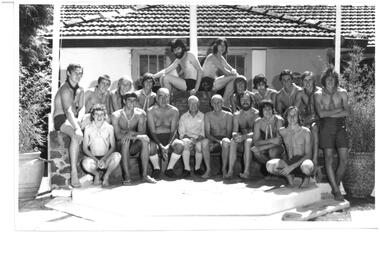
Photograph, Big Camp 1972 at Lord Somers Camp, 1972
A photo of a large group of teenage boys and men from Big Camp, January 1972. Big camp was for older junior Legatees at Lord Somers Camp. One of the men is Sir Rohan Delacombe, the Governor of Victoria and patron of Legacy (seated centre). Melbourne Legacy provides camps for junior legatees. The camps gave the children an opportunity of a summer beach holiday with other Legacy children. It started with camps on the property of Legacy founder, Legatee Stan Savige, who had a place in Balnarring, close to the beach. Permanent camp buildings were built in 1930. In 1930 Lord Somers (Governor of Victoria) also started a camp at a nearby property and the area was renamed Somers. Legacy Somers Camps continued intermittently at Stan's property until it was decided in 1951 to make other arrangements for holidays. Including at two other camps in the Somers area: Lord Somers Camp and the Somers School Camp (owned by the Education Department). It came from an envelope with other Big camp photos. The Legacy envelope was marked "P5 Power House" in red pen, and Box 15 in blue pen. The contents will be items 00427 to 00430.A record of Junior Legatee camps.Black and white photo of Legatees and senior boys at Big Camp 1972On reverse "P5 Legacy 20/1/72" written in blue pen.somers camp, junior legatee outing, big camp, lord somers camp -
 Melbourne Legacy
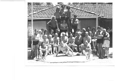
Photograph, Big Camp 1974 at Somers Camp, 1974
A photo of a large group of teenage boys and men from Big Camp, January 1974. Big camp was for older junior Legatees at Lord Somers Camp. Melbourne Legacy provides camps for junior legatees. The camps gave the children an opportunity of a summer beach holiday with other Legacy children. It started with camps on the property of Legacy founder, Legatee Stan Savige, who had a place in Balnarring, close to the beach. Permanent camp buildings were built in 1930. In 1930 Lord Somers (Governor of Victoria) also started a camp at a nearby property and the area was renamed Somers. Legacy Somers Camps continued intermittently at Stan's property until it was decided in 1951 to make other arrangements for holidays. Including two other camps in the Somers area: Lord Somers Camp and the Somers School Camp (owned by the Education Department). It came from an envelope with other Big camp photos. The Legacy envelope was marked "P5 Power House" in red pen, and Box 15 in blue pen. The contents will be items 00427 to 00430. A record of Junior Legatee camps.Black and white photo of Legatees and senior boys at Big Camp 1974On reverse "P5 Legacy" written in blue pen, and "second week Lord Somers Camp / Jan 19 - 26 1974" in pencil.somers camp, junior legatee outing, big camp, lord somers camp -
 Kew Historical Society Inc
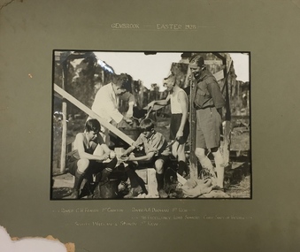
Photograph, 1st Kew Scout Group, 1st Kew Scouts - Gembrook, Easter 1928, 1928
The 1st Kew Scouts was one of the first Scout Troops in Victoria, being formed in 1909. From 1927 they met in a magnificent Scout Hall in Disraeli Street, Kew until it was demolished in 1993. Still operating (in 2020) from their new Scout Hall on the corner of Kilby Road and Kellett Grove, Kew.1st Kew Scouts with the Governor of Victoria and Chief Scout, Lord Somers. For many years Victorian Scouts participated in a competition camp at the Gilwell Park Scout Camp at Gembrook. The Governor of Victoria has traditionally taken on the honorary role of Victorian Chief Scout and would have been visiting the camp to encourage the Scouts. The names of the Scouts featured in the photograph are inscribed on the mount and include two Rovers, who would have been acting as Scout Leaders on the camp, and two Scouts (who are peeling some spuds for dinner).Front: "Gembrook, Easter, 1928 / Rover C.H. Fraser 1st Croxton, Rover A.A. Drohan 1st Kew / His Excellency Lord Somers Chief Scout of Victoria / Scouts Whelan & Sturdy 1st Kew"scouts - kew, 1st kew scouts, lord somers - governor of victoria, scout camp -
 Freemasons Victoria - United Grand Lodge of Victoria
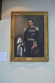
Painting, MWBro. Lord Somers D.C.M.G., D.S.O.M.C. Grand Master 1927-1932, 1930s
The right honourable Lieutenant-Colonel Arthur Tennyson Somers Cocks, was born in Herefordshire. Served with distinction in the Army and was twice decorated with bravery, before being appointed as Governor of Victoria. This portrait of Lord Somers is the only one in which a Grand Master is not in masonic regalia. Lord Somers insisted he not be seen dressed in a manner which could give offence to any other organization, with which he was associated in Public Life or Private Life. He was deeply involved in the Scouting Movement and was Chief Scout in Victoria and succeeded Baden-Powell as Chief Scout of the British Commonwealth.The portrait of Lord Somers holds great significance as it is the only painting within the Library and Museum collection of a Grand Master without his masonic regalia. Lord Somers stands beside his hat and is in uniform, no apron or other freemason regalia. Freemason Victoria coat of arms in upper left corner.Framed oil painting on canvas with stretcher/strainer. Wood/metal composite brackets used to fix painting to wall. 'Compo' ornamented gilt frame with running designs. Metal placque with two screws holding it to frame. portrait, painting, freemasons victoria, freemasonry, victoria, grand master -
 Expression Australia
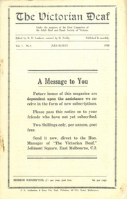
Newsletter, The Victorian Deaf - July-August 1930
Under the auspices of the Deaf Committee of the Adult Deaf and Dumb Society of Victoria - Edited by R. H. Lambert assisted by H. PuddyThe Victorian Deaf Newsletter is significant publication as an historical record giving and insight into the people, activities and events of the Deaf Community in Victoria.Vol. 1 No. 4 July-August 1930; Size 21.5cmHx14cmWlord somers, dr f. w. head, a graham, mrs w. taylor, alex hull, w. h. crush, victorian school for deaf children, thomas williamson, mr e. f. carmichael, c. a. buck, h. puddy, ben hall, william newton, lacrosse, tennis, young ladies guild, young mens guild, deaf church -
 National Wool Museum
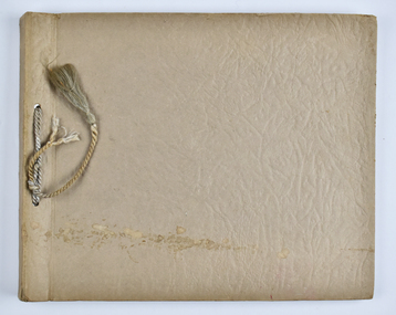
Album - Photo Album, 3 of 3, J W Allen, 1928-1929
This album is one of three albums compiled and owned by J W Allen, Secretary of New South Wales Grazier's, and is associated with the New South Wales Graziers Association world tour of sheep 1928-1929. This album contains photographs of travel, sheep, farms, stations, people and landscapes from around the world. Locations include Warren (NSW), Molong (NSW), Gamboola (NSW), Forbes (NSW), Hay (NSW), Conargo (NSW), Mokine (WA), New Zealand, Hawke's Bay, Southland, Lyttleton Harbour, Rotorua, Christchurch, Lincoln, Banks Peninsula, Akaroa, Pigeon Bay, Darfield, Rakahuri, Kaiwara, Highbank, Lake Heron, Mt Somers, Otago, Moa Flat, Waimahaka, Tarras, Moeraki and Blenheim. Properties depicted include Haddonrig, Egelabra, Bundemar, Redbank, Wandary, Tubbo Station, Coonong Station, Boonoke Station, Wanganella Estate, Yoorooga Estate, Taruna Farm, Harpenden Wool Works, Keppoch Estate, Bushey Park, Morven Downs, Meadowbank, Te Apiti and Penrose Farm. The album was found in a clean out at the Great Southern Agricultural Research Institute and donated to the National Wool Museum, along with other related material such as photographs, glass lantern slides and ephemera.Photo album with card cover and silk string binding. Inside are twenty four pages of brown carded paper with black and white photos and hand written black text. A white piece of paper with hand written text has been added to the inside front page.new south wales graziers association, world tour, sheep, farm, rural, agriculture, travel, new zealand, warren, molong, gamboola, forbes, hay, conargo, mokine, hawke's bay, southland, lyttleton, rotorua, christchurch, lincoln, banks peninsula, akoroa, pigeon bay, darfield, rakahuri, kaiwara, highbank, lake heron, mt somers, otago, moa flat, waimahaka, tarras, moeraki, blenheim, haddonrig, egelabra, bundemar, redbank, wandary, tubbo station, coonong station, boonoke station, wanganella estate, yoorooga estate, taruna farm, harpenden wool works, keppoch estate, bushey park, morven downs, meadowbank, te apiti, penrose farm -
 Melbourne Legacy
Slide, Legacy Boys Camp 1955, 1955
Colour slide taken at a Legacy Boys camp, it appears to be at Lord Somers Camp at Somers. Was with many other slides taken in the 1950s and 1960s. The slides have been photographed to make digital images and moved to archive quality sleeves. In many cases the original images were not well focussed and the digital image is the best available.A record of a Legacy camp in 1955.Colour slide of Somers Camp in 1955, in a glass mount with green tape.Caption 'Legacy Boys Camp 1955' and '4' in black ink.lord somers camp, camp -
 Melbourne Legacy
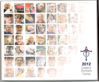
Book, Legacy Somers Camp 2012, 2012
A book of photos that records the activities of the dependents with disabilities group during Legacy's Somers Camp in 2012. It is full of photos without captions but the enjoyment of the participants is clear. Part of the introduction says: "Our sixty dependants enjoyed 12 days in each others company supported by a team of generous volunteers. Melbourne Legacy's support of or Dependants with Disabilities represents a very important part of the work which Legacy does. Our widows are reassured in the knowledge that their children will have support throughout their lives from a caring and concerned organisation." Most junior legatees are helped until they reach 18 years of age. However, the group of disabled dependents are helped for their whole life. Which gives peace of mind to the family that Legacy will always be there to care. Photographed by Andrew Gooden.Legacy have pledged to look after the disabled dependents for their entire lifeColour book x 60 pages of photos from disabled dependent activities in 2012.disabled dependents, handicapped dependents, activities -
 Melbourne Legacy
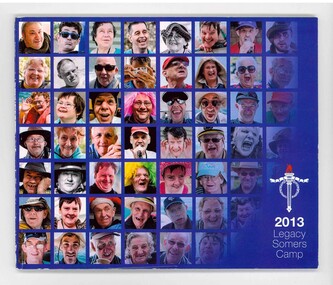
Book, Legacy Somers Camp 2013, 2013
A book of photos that records the activities of the dependents with disabilities group during Legacy's Somers Camp in 2013. It is full of photos without captions but the enjoyment of the participants is clear. Part of the introduction says: "Our sixty dependants enjoyed 12 days in each others company supported by a team of generous volunteers. Melbourne Legacy's support of or Dependants with Disabilities represents a very important part of the work which Legacy does. Our widows are reassured in the knowledge that their children will have support throughout their lives from a caring and concerned organisation." Most junior legatees are helped until they reach 18 years of age. However, the group of disabled dependents are helped for their whole life. Which gives peace of mind to the family that Legacy will always be there to care. Photographed by Andrew Gooden.Legacy have pledged to look after the disabled dependents for their entire lifeColour book x 100 pages of photos from disabled dependent activities in 2013.disabled dependents, handicapped dependents, activities -
 Melbourne Legacy
Article, Sir Stanley George Savige, Legacy and Somers, 2010+
An article from a magazine about Stan Savige and the Somers area. Name of the magazine is not known but appears to be about the Mornington Peninsula. Some of the facts are slightly incorrect. Date is not known but sometime after 2010.A record of the life and service of Legatee Stan Savige.White A4 paper photocopy x 3 pages of an article about Stan Savige from a magazine.stan savige, somers -
 Melbourne Legacy
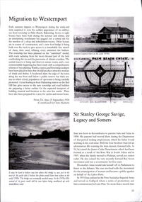
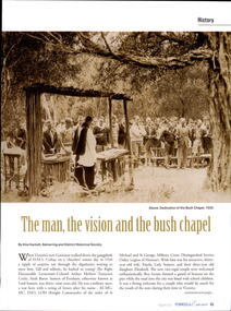
Article, Somers Camp. The man, the vision and the bush chapel, 2022
An article from a magazine about Lord Somers Camp published in the Peninsula Essence magazine in August 2022. Legacy has provided camps for Junior Legatees for many years. It started in the early years when Legacy organised outings to the property of Legacy founder, Legatee Stan Savige, who had a place close to the beach. In later years children went to camps around Victoria. Occasionally it was to Lord Somers Camp in Somers.A record of the formation of Lord Somers Camp in the area early Legatees held camps.White pages x 7 of an article about Somers Camp from the Peninsula Essence magazine.somers, lord somers -
 Melbourne Legacy
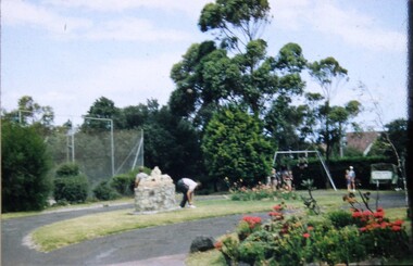
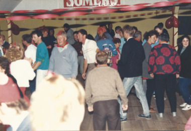
Photograph, Somers Camp, 1991
Photographs of Junior Legatees at Lord Somers Camp (according to the label) enjoying music and dance. There was an annual camp for the handicapped dependents (HDC). Names are unknown. Believed to be early in 1991. It was with a group of photos from 1990/91 in a folio with paper labels.A record of events run for the handicapped dependents by Melbourne Legacy.Colour photo x 2 of a party at Somers Camp.Yellow paper label: "Melbourne Legacy's Handicapped dependants enjoying activities at the annual two week holiday at Lord Somers" in black type.junior legatee outing, handicapped dependents, hdc, camps -
 Melbourne Legacy
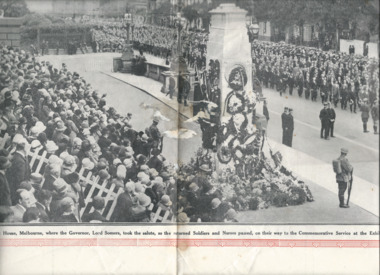
Newspaper - Document, article, 25,000 Returned Soldiers, Headed By Their Leader, Sir John Monash, Marched Past The Cenotaph On Anzac Day, 05/05/1928
A newspaper photo of returned servicemen and nurses marching past the original First World War memorial during an Anzac Day march in 1928. It was published as a centre page spread on 5 May 1928 in the The Weekly Times. '25,000 Returned Soldiers, Headed By Their Leader, Sir John Monash, Marched Past The Cenotaph On Anzac Day.' A war memorial to the 1914-1918 war was originally erected in Spring Street outside the Victorian Parliament Building (at that time it was the being used by the Australian Federal Parliament, from 1901-1927 when it moved to Canberra). Anzac Day services were held at this memorial in the 1920s and early 1930s. Items were in an envelope with other photos and programmes from different items relating to the Shrine of Remembrance - including discussions on its location and design. Labelled 'Shrine of Remembrance S1 - S14' it was part of an old archive numbering system (S=Shrine), that showed there has been efforts in the past to collect, order and save items of Legacy's history. From articles in Trove: The temporary cenotaph was the original first world war memorial until the Shrine of Remembrance was dedicated in 1937. The cenotaph was a half size replica of the London Symbol of Remembrance in Whitehall. It was made from timber and plaster and was initially meant to only last for the 1926 Anzac day service and be removed. With annual upkeep it remained until at least 1934 when ex-service men proceeded from the incomplete Shrine to the cenotaph on the steps of Parliament House on Anzac day.A record of an Anzac Day ceremony at the old First World War memorial in Spring Street in 1928. Not many photos are available of the original memorial. The size of the march past (reported as 25,000 soldiers) points to the enormous number of Victorians who served in the First World War. Black and white newspaper article about ANZAC Day at the old First World War memorial in Spring Street in 1928.Title: '25,000 Returned Soldiers, Headed By Their Leader, Sir John Monash, Marched Past The Cenotaph On Anzac Day.' Caption: " Scene at Parliament House, Melbourne, where the Governor, Lord Somers, took the salute, as returned Soldiers and Nurses passed, on they way to the Commemorative Service at the Exhibition.'anzac day, wreath laying ceremony -
 Melbourne Legacy
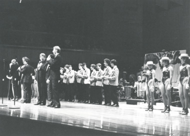
Photograph, A Legacy Night to Remember, charity concert 1985, 1985
These are photos of a Melbourne Legacy charity concert, which is possibly it is the concert in September 1985. Photos of singers and performers during the concert also guests and some performers afterwards. According to a programme stored at 00056, 'A Legacy Night to Remember' concert was at Melbourne Concert Hall, some of the performers were Barry Crocker, Simon Gallaher, Rolf Harris, Anne & Johnny Hawker's Band, Colleen Hewett, Jackie Love, Paul Martelle, 3rd Military District 'Redcoats'. Special guest compere - Daryl Somers. One of the photos show a lady holding a programme saying 'National Australia Bank proudly supports The Melbourne Legacy Charity Concert' - so it might be a different concert but the same performers are present. 01412.6 shows Legatee J C Dean who was president in 1984. The photos came from a Legacy envelope marked "P3 Fund Raising" in red pen, with assorted photos of fundraising events, including appeal tins in different years and a charity concert, and a fundraising marathon run (some are items 00433 to 00438, 01410 to 01415).A record of a Legacy run event for fundraising in either 1984 or 1985.Black and white photo x 6 of a charity concert for Legacy and 3 proof sheets.Proof sheets are labelled 'Cassidy and Baker, 226 Coventry St, South Melbourne, 699 4000 / Neg: ' The negative numbers are '4663', 4664' and '4665'fundraising, concert, gala performance -
 Melbourne Legacy
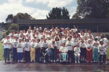
Photograph, HDC Camp 1991, 1991
Every month Legacy's handicapped dependents are invited to go on outing for take part in recreational and educational activities. These programmes aim to develop independence and thus lessen the need for reliance on others for simple routine functions. Once a year there is a two week camp at Somers Camp (believed to be Somers School Camp). This photo is from 1991. An article in the widows' newsletter in 1992 explains more detail on the 1992 camp. The article mentions that the annual camps run for two weeks at Somers Camp. It is a wonderful gathering of Junior Legatees, Legatees, and dedicated helpers. 50 junior legatees attended this camp (in 1992) with the personal attention almost one-to-one. With ages ranging from 22 to into the 60s, Legacy has to ensure it caters for the differing needs. Legatees headed by Camp Chief, Jim Hammon and Chairman of the Handicapped Dependents Committee, Merv Tickell, were supported by two Camp Co-Ordinators and 50 helpers known as 'leaders'. Many of the leaders are people in the workforce wishing to give something back to the community. Junior Legatees are organised into groups. They participate in horse-riding, swimming, golfing, strawberry picking, and many other activities. Photos were in a scrapbook of photos spanning 1983 to 1991.A record of the type of activities Legacy provided for the handicapped dependents of the Legacy families. Colour photo of a HDC camp and a yellow paper label.Handwritten in blue pen ' HDC Camp Jan 91'junior legatee outing, hdc, somers camp