Showing 612 items
matching royal survey regiment
-
 Bendigo Military Museum
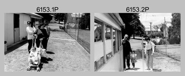
Photograph - Christmas Children’s Party - Army Survey Regiment, Fortuna, Bendigo, 1992
This set of 16 photos of the Christmas Children’s Party were taken in the and the grounds of Fortuna, Army Survey Regiment in 1992. The Christmas party was an annual event enjoyed by the soldiers’ families, featuring amusements such as the ‘pig train’ and pony rides, a historic fire engine provided by the Golden Square Fire Brigade with Santa on board and refreshments such as cordial, lollies, ice creams and fairy floss. Single members readily volunteered to assist in the running of the party. An occasional highlight was displays of military hardware such as tanks and APC from the Puckapunyal’s Armoured Centre. Catering staff/contractors taking a break outside the kitchen are also featured in this collection. The Army Survey Regiment Wives Club was instrumental in establishing the Tennis Hut, featuring in photos .1P to .5P. The Wives Club initiated many social events. Examples of activities initiated by the club and their importance to the social fabric of the unit are described in more detail on page 151 of Valerie Lovejoy’s book 'Mapmakers of Fortuna – A history of the Army Survey Regiment’ ISBN: 0-646-42120-4.This set of 16 photos were taken in the grounds and kitchen area of Fortuna, Army Survey Regiment, Bendigo, at Christmas time in 1992. The photographs are on 35mm negative film and were scanned at 96 dpi. They are part of the Army Survey Regiment’s Collection. .1) - Photo, black & white, 1992, unidentified civilians and person. .2) - Photo, black & white, 1992, SGT Brian Fauth, SPR Carmel (Butler) Fauth and their child. .3) - Photo, black & white, 1992, L to R: SPR Joyce Gray, unidentified, SPR Andrew Arman. .4) to .5) - Photo, black & white, 1992, unidentified. .6) - Photo, black & white, 1992, Craig Kellett. .7) - Photo, black & white, 1992, L to R: Cam Bramich, unidentified (x2). .8) to.10) - Photo, black & white, 1992, unidentified. .11) to .15) - Photo, black & white, 1992, unidentified catering staff and contractors. .16) - Photo, black & white, 1992, Children’s rides on parade ground.No personnel are identified.royal australian survey corps, rasvy, army survey regiment, army svy regt, fortuna, asr -
 Bendigo Military Museum
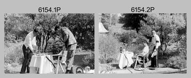
Photograph - Silver Service Morning Tea – Army Survey Regiment, Fortuna, Bendigo, 1991
These six photos were taken in the grounds of the Army Survey Regiment, Fortuna in spring 1991. MAJ Ray Redman appears in his mess dress by the Roman fountain, serving a silver service morning tea to CPL Pat Drury, as a result of a losing bet on the 1991 Rugby League Grand Final. Pat Drury was a very keen rugby league supporter and followed Penrith, who lost its first Grand Final appearance to the Canberra Raiders in 1990. Penrith reversed the result the following year against Canberra winning their first premiership. This occasion is covered on page 152 of Valerie Lovejoy’s book 'Mapmakers of Fortuna – A history of the Army Survey Regiment’ ISBN: 0-646-42120-4.This is a set of six photographs of two Army Survey Regiment personnel in the grounds of Fortuna, Bendigo, 1991. The photographs were on 35mm negative film and were scanned at 96 dpi. They are part of the Army Survey Regiment’s Collection. .1) to .6) - Photo, black & white, 1991, MAJ Ray Redman and CPL Pat Drury. No personnel are identified.royal australian survey corps, rasvy, army survey regiment, army svy regt, fortuna, asr -
 Bendigo Military Museum
Photograph - Equipment and Personnel, Lithographic Squadron - Army Survey Regiment, Bendigo, c1975
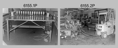
This is a set of 21 photographs of Lithographic Squadron equipment and personnel as well equipment operated by Cartographic Squadron, Army Survey Regiment, Fortuna, Bendigo circa 1975. The photos were mainly taken in the Printing, Camera, proofing and external buildings. Cartographic Squadron’s CPL Arty Lane operated the Fotosetter type setting machine, as shown in photo .21P for many years in a room on the top floor of Fortuna Villa. There is more information on the Ultra-MAN-III Printing Presses, the KLIMSCH Commodore camera, Gavin Neilson and the Fotosetter type setting machine on pages 70-71, and the Newkoni Komori printing press on page 120 of Valerie Lovejoy’s book 'Mapmakers of Fortuna – A history of the Army Survey Regiment’ ISBN: 0-646-42120-4.This is a set of 21 photograph of Lithographic Squadron equipment and personnel, Army Survey Regiment at Fortuna, Bendigo, 1989. Black and white photographs .1P to .13P are on 35mm negative film and scanned at 96 dpi. Black and white photos .14P to .21P are on photographic paper and were scanned at 300 dpi. .1) - Photo, black & white, c1975, tri-linear film punch. .2) to .5) - Photo, black & white, c1975, Newkoni Komori printing press components. .6) - Photo, black & white, c1975, Newkoni Komori printing press components, Alex Cook. .7) - Photo, black & white, c1975, Newkoni Komori printing press components. .8) to .12) - Photo, black & white, c1975, northern exterior of print buildings. .13) - Photo, black & white, c1975, L to R: unidentified (x2), Jim Mulqueen, Ian ‘Lofty’ Turner. .14) - Photo, black & white, c1975, Log Electonics film processor. .15) - Photo, black & white, c1975, contact frame. .16) - Photo, black & white, c1975, film tri-punch stud registration table. .17) - Photo, black & white, c1975, Ultra-MAN-III Printing Presses. .18) to .19) - Photo, black & white, c1975, KLIMSCH Commodore camera, Gavin Neilson. .20) - Photo, black & white, c1975, map proof whirler. .21) - Photo, black & white, c1975, Fotosetter type setting machine.No personnel are identified. .14P, .16P to .19P and .20P to .21P are annotated with 5-digit numbers on top right corner of photo.royal australian survey corps, rasvy, army survey regiment, army svy regt, fortuna, asr, litho, carto -
 Bendigo Military Museum
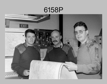
Photograph - First Topographic Map Printed on Speedmaster Press - Army Survey Regiment, Fortuna, Bendigo, c1992
This is a photograph of the Director Survey - COL Simon Lemon, CO Army Svy Regt - LTCOL Bob McHenry and probably OC Litho - MAJ Terry Lord inspecting the 1St topographic map printed on the new Heidelberg Speedmaster 102 Printing Press in c1992. *Estimated date based on the Director’s and CO’s period of appointment. The computer-controlled five colour lithographic offset printing press provided the Royal Australian Survey Corps vastly improved printing capability, as the five colours for a standard topographic map was printed in a single pass. The print room was named Wayzgoose Hall after a medieval printing house festival. Wayzgoose Hall and the Speedmaster printing capability was commissioned by the Commander of the 3rd Military District BRIG P. Davies AM, ADC on Wednesday 27th June 1990. This occasion is covered in more detail in page 145 of Valerie Lovejoy’s book 'Mapmakers of Fortuna – A history of the Army Survey Regiment’ ISBN: 0-646-42120-4. Colonel Simon Lemon was Director of the Royal Australian Survey Corps from January 1991 to June 1996.This is a photograph of three senior RASvy officers inspecting the first topographic map printed on the Heidelberg Speedmaster 102 Printing Press in Lithographic Squadron, Army Survey Regiment, Fortuna, Bendigo, c1992. The photograph is on 35mm black and white negative film and was scanned at 96 dpi. It is part of the Army Survey Regiment’s Collection. No personnel are identified. royal australian survey corps, rasvy, army survey regiment, army svy regt, fortuna, asr -
 Bendigo Military Museum
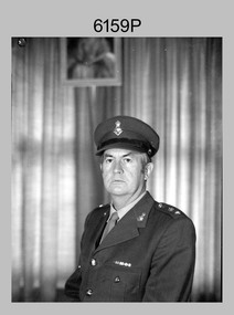
Photograph - CO Army Survey Regiment - LTCOL Constantine AM, Fortuna, Bendigo, 1975-1976
This is a photograph of LTCOL Peter Constantine AM, who was the CO of the Army Survey Regiment from 1975 to 1976. He then assumed command of the School of Military Survey (SMS) from 1976 to his retirement in January 1982. LTCOL Constantine was one of RASvy’s most revered officers in this era, with 32 years of meritorious service as a leader on active duty in Vietnam in 1969 and the commanding officer of the Regiment and School. His memoirs of active duty in Vietnam ‘Surveyor - Printer Behind the Lines’ was published in 2022.This is a photograph of LTCOL Peter Constantine AM, who was the CO of the Army Survey Regiment at Fortuna, Bendigo, from 1975 to 1976. The black and white photograph was printed on photographic paper and is part of the Army Survey Regiment’s Collection. The photograph was scanned at 300 dpi. There is no annotation.royal australian survey corps, rasvy, army survey regiment, army svy regt, fortuna, asr -
 Bendigo Military Museum
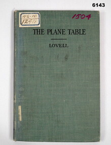
Manual - The Plane Table - Its Use in Surveying, McGraw Publishing Company, New York, USA, 1908
The plane table instrument was a simple but very effective early method of producing maps. Some very early editions were produced by the Australian Survey Corps after its formation in 1915 using this method. This manual details how to use the "Plane Table" for Surveying purposes.Hard Cloth covered Covers front and back, paper pages. title page has rubber stamp impressions (see below). Contents page, symbols page, pages 1-47 and index page.Adhesive label on front "46.10 and 12411", "1504" in purple also on front cover, Numbers inside front cover - "Acc. No. 000076" and crossed out. "scm - B0 - 86-72" written underneath. stamps- Australian Intelligence Corps, Headquarters library No 150 (difficult to read) on first page and stamped "CANCELLED" , Stamp School of Military Survey Library Call No 526 - 9825 LOV. Another stamp on title page - Department of Defence Library 46.10 and 12411. Second stamp 2/D. M.O.S. 2012 with CANCELLED. royal australian survey corps, rasvy, army survey regiment, army svy regt, asr, fortuna -
 Bendigo Military Museum
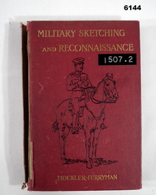
Book - Military Sketching and Reconnaissance, Muckler Ferryman, Royal Military College, Sandhurst, UK, 1903
British Military method of compiling field sheets for mapping purposesRed Hard covered book, rider and horse on cover, 203 pages, 17 chapters, 4 Appendices, 57 Illustrations.Lieut -Col AF Mockler - Ferryman, Late professor of Military Topography, Royal Military College, Sandhurstroyal australian survey corps, rasvy, fortuna, army survey regiment, army svy regt, asr -
 Bendigo Military Museum
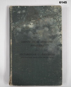
Manual - Mathematical Tables for the Computation of Geographic positions and Rectangular Coordinates, 1942
Numerous mathematical tables for the computation of Geographical Positions and rectangular coordinatesHard covered Book, cloth covered, A5 in size, 169 pages, Title Page, contents Page, 5 x blank pages at front, 15 x blank pages at rear."? Slattery" , "Sgt RC Andrews. School Tac? Adm. Seymour" all crossed out, on 1st page inside cover. "Please Return to: Survey Directorate AHQ Victoria Barracks Melbourne" Front and rear pages.royal australian survey corps, rasvy, fortuna, army survey regiment, army svy regt, asr -
 Bendigo Military Museum
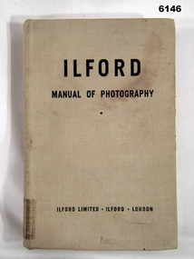
Manual - Ilford Manual of Photography, Ilford Limited, Henry Greenwood &Co. Ltd. & Percy Lund, Humphries & Co. Ltd, First Published in October 1942
... Regiment, Royal Australian Survey Corps" Handwritten - Accession... Melbourne" Stamp - "AHQ Survey Regiment, Royal Australian Survey ...Manual describing all facets of photography using Ilford Cameras and includes developing and printing of photographs. The map making production at the Army Survey Regiment, Bendigo, made extensive use of photographic processes.A5 sized book, Hard Covers front and back. 470 numbered glossy pages.Inside front cover - "L33", stamp - "EXPENDABLE STORES" (twice), "Unreadable signature - QM 30/7/82", Stamp- "AHQ Survey Regiment, Royal Australian Survey Corps" Handwritten - Accession No 167 (and then crossed out), Stamp "29" First Page "15/-", Stamp "2 Topo Svy Coy, Powlett Street Training Depot (partly crossed out), Stamp Technical Book and Magazine Co, 295 -299 Swanston St. Opp Old Melbourne Hospital cert 2041, Melbourne. Title Page - "Accession No16, stamp 2 Topo Svy Coy Powlett Street Training Depot, East Melbourne" Stamp - "AHQ Survey Regiment, Royal Australian Survey Corps" - Accession No 167 (faded). Back Cover - Stamp - "AHQ Survey Regiment, Royal Australian Survey Corps"royal australian survey corps, rasvy, fortuna, army survey regiment, army svy regt, asr -
 Bendigo Military Museum
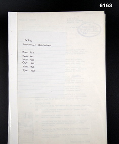
Administrative record - 2 Fd Svy Sqn Monthly Report : Jan - Apr 1981, Apr 1981
Monthly reports were mandatory for all RASvy unitsA plastic bound, A4 cardboard covered report that includes text and diagramsroyal australian survey corps, rasvy, fortuna, army survey regiment, army svy regt, asr -
 Bendigo Military Museum
Administrative record - 4 Fd Svy Sqn Monthly Report: Jul - Nov 1978, Nov 1978
Monthly Reports were mandatory for all RASvy units.A plastic bound, A4 carboard covered report that includes text and diagramsroyal australian survey corps, rasvy, fortuna, army survey regiment, army svy regt, asr -
 Bendigo Military Museum
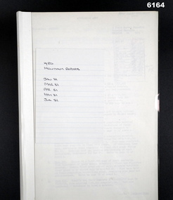
Administrative record - 4 Fd Svy Sqn Monthly Report: Jul - Dec 1979, Dec 1979
Monthly Reports were mandatory for all RASvy units.A plastic bound, A4 Cardboard covered report that includes text and diagramsroyal australian survey corps, rasvy, fortuna, army survey regiment, army svy regt, asr -
 Bendigo Military Museum
Administrative record - 4 Fd Svy Sqn Monthly Report: Jul - Dec 1980, Dec 1980
Monthly Reports were mandatory for all RASvy unitsA plastic bound, A4 cardboard covered report that includes text and diagrams.royal australian survey corps, rasvy, fortuna, army survey regiment, army svy regt, asr -
 Bendigo Military Museum
Administrative record - 4 Fd Svy Sqn Monthly Report: Jan - Jul 1981, Jul 1981
Monthly reports were mandatory for all RASvy unitsA Plastic bound, A4 cardboard covered report that includes text and diagramsroyal australian survey corps, rasvy, fortuna, army survey regiment, army svy regt, asr -
 Bendigo Military Museum
Administrative record - 4 Fd Svy Sqn Monthly Report: Aug - Dec 1981, Dec 1981
Monthly Reports were mandatory for all RASvy Units.A Plastic bound, A4 cardboard covered Report that includes text and diagramsroyal australian survey corps, rasvy, fortuna, army survey regiment, army svy regt, asr -
 Bendigo Military Museum
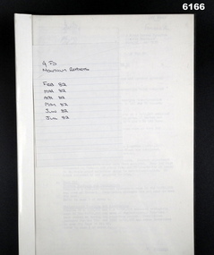
Administrative record - 4 Fd Svy Sqn Monthly Report: Feb - Jul 1982, Jul 1982
Monthly Reprts were mandatory for all RASvy UnitsA plastic bound, A4 cardboard covered report that includes text and diagramsroyal australian survey corps, rasvy, fortuna, army survey regiment, army svy regt, asr -
 Bendigo Military Museum
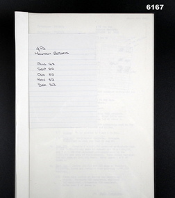
Administrative record - 4 Fd Svy Sqn Monthly Report: Aug - Dec 1982, Dec 1982
Monthly Reports were mandatory for all RASvy UnitsA plastic bound, A4 carboard covered report that contains text and diagramsroyal australian survey corps, rasvy, fortuna, army survey regiment, army svy regt, asr -
 Bendigo Military Museum
Administrative record - 8 Fd Svy Sqn Monthly Report: Feb - Oct 1979, Oct 1979
Monthly Reports were mandatory for all RASvy UnitsA Plastic bound, A4 cardboard covered report that includes text and diagramsroyal australian survey corps, rasvy, fortuna, army survey regiment, army svy regt, asr -
 Bendigo Military Museum
Administrative record - 8 Fd Svy Sqn Monthly Report: Feb - Jun 1982, Jun 1982
Monthly Reports were mandatory for all RASvy UnitsA plastic bound, A4 cardboard covered report that includes text and diagrams.royal australian survey corps, rasvy, fortuna, army survey regiment, army svy regt, asr -
 Bendigo Military Museum
Administrative record - Design Brief for Refurbishment of Facilities at "Fortuna Villa", Peter Jordan Architects, 55 Clements St, South Yarra, Vic 3141, 1994
Refurbishment Plans for building Works at Fortuna Villa, Building 23 (Ordinary Ranks Accommodation Barracks) were completed, Building 8 works were never commenced.Plastic Covered Book, A4 Pages, Building plansPeter Jordan Architects, 55 Clements St, South Yarra, Vic, 3141royal australian survey corps, rasvy, fortuna, army survey regiment, army svy regt, asr -
 Bendigo Military Museum
Book - Darbys Clangers, Times and Chimes, WO2 Graham Squire, 1978
This book was hand made in Bendigo and presented to the Army Survey Regiment Sergeants Mess by WO2 Graham Squire (Later WO1 RSM RASvy). The book is to record events when the Sgts Mess Bell was rung, signaling that money was put over the bar for those present. Events such as promotions, departures, birthdays, birth of children and grandchildren were celebrated in this way and hence recorded in this book. The Bell itself was presented by WO1 Alex "Darby" Munro and that is the reason for the naming of the book "Darby's Clangers, Times and Chimes". the first entry in the book is 30 Nov 1978 and the last entry is 29 Nov1996 to celebrate the departure of the last serving members of the unit.Large handmade book with many unused pages, book is housed in a vinyl covered cardboard box.Page 1 Top - " Please leave first entry space vacant for WO2 G Squire (Fishing Warden), Thank you, Max Neil WO2 for PMC" Page 1 Bottom - "The one that got away!" Last entry "Three cheers for Litho!" signed by LTCOL Duncan Burns Commanding Officer Army Survey Regiment 29 Nov 1996.royal australian survey corps, rasvy, fortuna, army survey regiment, army svy regt, asr -
 Bendigo Military Museum
Administrative record - Minutes of the Unit (Army Survey Regiment) Historical Fund Committee Meeting 24 May 94 and 10 May 95, 10.05.1995
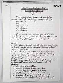
Considering the historical importance of Fortuna Villa, a small group of interested Unit members formed the Army Survey Regiment Historical Fund. The aim of the committee was to manage historical issues and raise funds to improve or preserve the Unit History or historical items. These minutes are a small sample record of the activities of the Unit Historical Fund. 6 x A4 pages of Minutes, photocopies, stapled in top left hand corner.royal australian survey corps, rasvy, fortuna, army survey regiment, army svy regt, asr -
 Bendigo Military Museum
Photograph - Printer Technicians Operating Printing Presses at the Army Survey Regiment, c1970s, c1980s
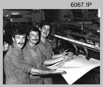
These ninephotographs of Printer Technicians operating printing presses were probably taken circa 1970s and 1980s in Lithographic Squadron at the Army Survey Regiment, Fortuna, Bendigo.They are most likely operating the Komoni, Planeta or Ultra-MAN-III offset printing presses. Although these photos are not annotated most personnel are positively identified.This is a set of photographs of Printer Technicians operating printing presses at the Army Survey Regiment, Bendigo, c1970s, c1980s. The photographs were printed on photographic paper and are part of the Army Survey Regiment’s Collection. The photographs were scanned at 300 dpi. .1) - Photo, black & white, c1980s, L to R: Roy Hicks, Peter Dillon, Terry Winzar, Lithographic Squadron .2) - Photo, black & white, c1980s, Daryl South, Lithographic Squadron .3) - Photo, black & white, c1980s, Greg Rowe, Lithographic Squadron .4) - Photo, black & white, c1980s, L to R: Terry Winzar, unidentified, unidentified, Lithographic Squadron .5) - Photo, black & white, c1980s, unidentified, Lithographic Squadron .6) - Photo, black & white, c1980s, Stuart Ridge, Lithographic Squadron .7) - Photo, black & white, c1980s, Stuart Ridge, Lithographic Squadron .8) - Photo, black & white, c1980s, Jim Ash, Lithographic Squadron .9) - Photo, colour, c1970s, L to R: Paul Davis, Alan Fitts, John ‘Flash’ Anderson, Lithographic Squadron.1P to .8P – no annotationroyal australian survey corps, rasvy, army survey regiment, army svy regt, fortuna, asr, litho, printing -
 Bendigo Military Museum
Photograph - Printer Technicians Performing Quality Checks at the Army Survey Regiment, c1980s
These six photographs of Printer Technicians performing quality checks off the printing press were probably taken circa 1980s in Lithographic Squadron at the Army Survey Regiment, Fortuna, Bendigo. c1980s. Although the photos are not annotated, most personnel are positively identified. Quality control was applied progressively in the printing process, with registration checks and adjustments between colours on the first pass. In these photos a quality check was performed off the press before the printing press was prepared with the new set of printing plates and colours for the next pass. When all passes were complete a final quality check off the press was performed before the Printer Technicians trimmed, wrapped and dispatched the product to customers.This is a set of photographs of Printer Technicians checking the quality of a printed product at the Army Survey Regiment, Bendigo c1980s. The photographs were printed on photographic paper and are part of the Army Survey Regiment’s Collection. The photographs were scanned at 300 dpi. .1) - Photo, black & white, c1980s, L to R: unidentified, Paul Davis, Terry Winzar, CPL Kim Reynolds, Lithographic Squadron .2) - Photo, black & white, c1980s, L to R: CPL Kim Reynolds, Paul Davis, Terry Winzar, Lithographic Squadron .3) - Photo, black & white, c1980s, L to R: Per Andersen, Peter Dillon, Lithographic Squadron .4) - Photo, black & white, c1980s, L to R: Per Andersen, Peter Barrett, Peter Dillon, Lithographic Squadron .5) - Photo, black & white, c1980s, L to R: SSGT Peter Barrett, Greg Rowe, Lithographic Squadron .6) - Photo, black & white, c1980s, unidentified Lithographic Squadron.1P to .6P – no annotationroyal australian survey corps, rasvy, army survey regiment, army svy regt, fortuna, asr, litho, printing -
 Bendigo Military Museum
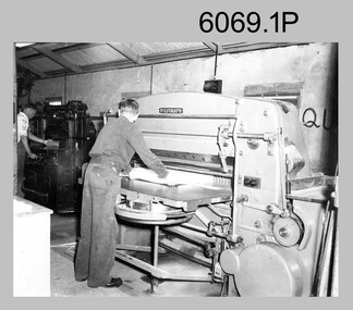
Photograph - Printer Technicians trimming printed map stock at the Army Survey Regiment, c1960s to c1980s
These six photographs of Printer Technicians using a heavy-duty guillotine to trim bulk printed map stock were probably taken circa 1960s to 1980s in Lithographic Squadron at the Army Survey Regiment, Fortuna, Bendigo. Personnel are not identified on Photos .3P and .4P, however names are annotated on photos .1P, .2P, .4P and .5P. Cartographers normally provided trim marks to specified map dimensions as guidance to the printer. The trimming stage, like all the other printing processes required high levels of accuracy. These guillotines were extremely powerful to cut through bulk quantities of printed maps, as evident in photos .1P .3P, .4P and .6P.This is a set of photographs of Printer Technicians using a heavy-duty guillotine to trim bulk printed map stock c1960s to 1980s. The photographs were printed on photographic paper and are part of the Army Survey Regiment’s Collection. The photographs were scanned at 300 dpi. .1) - Photo, black & white, c1960s, L to R: ‘Wanger’ Payne, unidentified, Lithographic Squadron .2) - Photo, black & white, c1980s, CPL Ken Cavanagh, Lithographic Squadron .3) - Photo, black & white, c1970s, unidentified, Lithographic Squadron .4) - Photo, colour, c1970s, Peter Saunders, Lithographic Squadron .5) - Photo, black & white, c1980s, L to R: unidentified, WO1 Noel ‘Nesty’ Coulthard, Lithographic Squadron .6) - Photo, black & white, c1980s, unidentified, Lithographic Squadron.1P, .2P, .4P and .5P. personnel annotation on back. * unidentified on .1P due to poor writing. .3P and .6P – no annotationroyal australian survey corps, rasvy, army survey regiment, army svy regt, fortuna, asr, litho, printing -
 Bendigo Military Museum
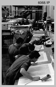
Photograph - Maps despatched by Printer Technicians at the Army Survey Regiment, c1970s to c1990s
These nine photographs of Printer Technicians working on the despatch of bulk printed map stock to customers, were probably taken circa 1970s to 1990s in Lithographic Squadron at the Army Survey Regiment, Fortuna, Bendigo. Except for photo .3P, personnel are not annotated on the photos. Despatch was the final task performed by a team of Printer Technicians. It involved the wrapping of trimmed bulk maps into manageable parcels and sending them by freight to customers or to the Army Map Depot at Bandiana, VIC. The task’s Due date and sensitivity were essential considerations in the planning of production affecting the lead time and method of delivery. Freighting by commercial means was the normal method for routine tasks. The method of despatch for urgent time-critical tasks sometimes meant having to use military freight or safe-handed by Army Survey Regiment personnel. The mishap captured in photos .6P and .7P was rare, but costly if it was a time critical task. The Print Room’s Map Handling Station in photos .8P and .9P provided ergonomic benefits to the Printer Technician and improved despatch productivity.This is a set of photographs of Printer Technicians involved in the despatch of bulk printed map stock c1970s to c1990s. The photographs were printed on photographic paper and are part of the Army Survey Regiment’s Collection. The photographs were scanned at 300 dpi. .1) - Photo, black & white, c1970s, L to R: unidentified, unidentified, Lithographic Squadron .2) - Photo, black & white, c1980s, Steve Egan, Lithographic Squadron .3) - Photo, black & white, c1980s, L to R: unidentified, Kim Reynolds, Lithographic Squadron .4) - Photo, colour, c1980s, L to R: Jeff Willey, Gary Kerr, Lithographic Squadron .5) - Photo, black & white, c1980s, L to R: Jim Ash, Mark ‘Dogs’ Doherty, Stuart Ridge, Lithographic Squadron .6) - Photo, colour, c1980s, printed maps toppled, Lithographic Squadron .7) - Photo, colour, c1980s, printed maps toppled, Lithographic Squadron .8) - Photo, black & white, c1990s, L to R: unidentified, unidentified, Lithographic Squadron .9) - Photo, black & white, c1990s, unidentified, Lithographic Squadron .3P, personnel annotation on back. .1P, .2P, .4P, .5P, .8P and .9P – no personnel annotated .6P and .7P – ‘Good one Daryl’ annotated on back.royal australian survey corps, rasvy, army survey regiment, army svy regt, fortuna, asr, litho, printing -
 Bendigo Military Museum
Photograph - Lithographic Squadron Personnel and Others at the Army Survey Regiment, c1970s
These two photographs were taken circa 1970s at the Army Survey Regiment, Fortuna, Bendigo. Photo .1P was taken in 1971 when the then Justice John Kerr (later Sir John Kerr AK, GCMG, GCVO, QC) visited the Regiment. At that time, he was the Chairman of the Committee of Enquiry into Service Pay and Conditions. Personnel from Lithographic Squadron had submitted a grievance regarding salaries to the Committee, who during this visit reviewed their technical skills and conducted interviews. This ultimately led to the personnel achieving salary parity with other technical trades in RASvy. Photo .2P was taken after a formal medal presentation at the Army Survey Regiment in c1976. The Defence Force Service Medal was presented to personnel in recognition of 15 years of efficient remunerated service, or the Clasp for 5 years of additional service.This is a set of photographs of Lithographic Squadron Personnel, Justice John Kerr and other RASvy personnel at the Army Survey Regiment, Bendigo c1970s. The photographs were printed on photographic paper and are part of the Army Survey Regiment’s Collection. The photographs were scanned at 300 dpi. .1) - Photo, black & white, 1971, L to R: Jim Mulqueen, Sir John Kerr AK, GCMG, GCVO, QC, LTCOL Bill Howarth .2) - Photo, black & white, c1976, L to R: WO1 Joe Farrington, John Rankine, CPL Ian ‘Lofty’ Turner, SGT Peter Saunders, LTCOL George Ricketts, SGT Ross Hyde, WO1 Ian ‘Ike’ Lever, WO1 Aub Harvey, SGT Jim Mulqueen.1P to .2P – personnel annotated royal australian survey corps, rasvy, army survey regiment, army svy regt, fortuna, asr, printing -
 Bendigo Military Museum
Photograph - Printer Technicians and other RASvy personnel at the Army Survey Regiment, c1980s
These ten photographs were probably taken circa 1980s in Lithographic Squadron at the Army Survey Regiment, Fortuna, Bendigo. Most of the photos were taken on the shop floor in the Print Room.This is a set of photographs of Printer Technicians and other RASvy personnel in Lithographic Squadron, Army Survey Regiment, Bendigo c1980s. The photographs were printed on photographic paper and are part of the Army Survey Regiment’s Collection. The photographs were scanned at 300 dpi. .1) - Photo, black & white, c1980s, WO2 Steve Egan, Lithographic Squadron .2) - Photo, black & white, c1980s, WO2 Jeff Lynch, Lithographic Squadron .3) - Photo, colour, c1980s, SPR Peter Dillon, Lithographic Squadron .4) - Photo, black & white, c1980s, L to R: Peter Dillon, unidentified, Lithographic Squadron .5) - Photo, black & white, c1980s, L to R: SPR Colin Yeats, SPR Graeme Spong, CPL Peter Dillon, Lithographic Squadron .6) - Photo, black & white, c1980s, L to R: SPR Colin Yeats, WO2 Ralph Chant, Lithographic Squadron .7) - Photo, black & white, c1980s, L to R: Dale Hudson, Mark ‘Dogs’ Doherty, Lithographic Squadron .8) - Photo, black & white, c1980s, L to R: SGT Greg Rowe, WO1 Trevor Osborne, Dale Hudson, Lithographic Squadron .9) - Photo, black & white, c1980s, L to R: unidentified, SGT Kim Reynolds, Shane ‘Soupy’ Campbell, Lithographic Squadron .10) - Photo, colour, 1987, L to R: Jim Ash, Daryl South, Jeff Willey, unidentified, Lithographic Squadron.1P to .4P – not annotated .5P - annotated on front with ‘I AM BROKE, I’M NOT and me neither’, annotated on back with ‘Curly Larry Moe’ .6P to .9P – not annotated .10P – annotated with dateroyal australian survey corps, rasvy, army survey regiment, army svy regt, fortuna, asr, litho, printing -
 Bendigo Military Museum
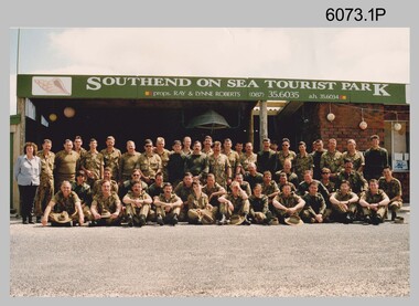
Photograph - Group Photos of Lithographic Squadron, Army Survey Regiment, c1990s
These three photographs of Lithographic Squadron were taken in the 1990s. Photos .2P and .3P were taken at the Army Survey Regiment, Fortuna, Bendigo. .1P was taken as the background sign indicates, at the Southend on Sea Tourist Park, close to the township of Millicent in South Australia. Lithographic Squadron was in this location probably as part of Regimental or Adventurous Training in 1992.This is a set of photographs of Lithographic Squadron, Army Survey Regiment, Bendigo c1990s. The photographs were printed on photographic paper and are part of the Army Survey Regiment’s Collection. The photographs were scanned at 300 dpi. .1) - Photo, colour, 1992, Lithographic Squadron .2) - Photo, colour, 1991, Lithographic Squadron .3) - Photo, colour, Sep 1993, Lithographic Squadron.1P and .2P - annotated on back with date .3P – annotated on front with dateroyal australian survey corps, rasvy, army survey regiment, army svy regt, fortuna, asr, litho -
 Bendigo Military Museum
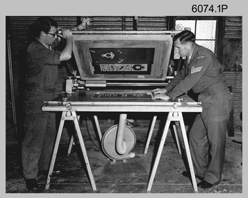
Photograph - Lithographic Technicians Screen Printing at the Army Survey Regiment, c1970s
These two photographs were most likely taken in the 1970s at the Army Survey Regiment’s Drill Hall Golden Square, Bendigo. The photos are annotated with the name of the technicians written on the back. In these photos the technicians are performing screen printing tasks.This is a set of photographs of lithographic technicians using screen printing equipment at the Army Survey Regiment, Bendigo from c1960s to c1980s. The photographs were printed on photographic paper and are part of the Army Survey Regiment’s Collection. The photographs were scanned at 300 dpi. .1) - Photo, black & white, c1970s, L to R: Bruce Appleford, SGT Evan Giri, Lithographic Squadron .2) - Photo, black & white, c1970s, Ian ‘Lofty’ Turner, Lithographic Squadron.1 to .2 – personnel names (less rank) annotated on back. royal australian survey corps, rasvy, army survey regiment, army svy regt, fortuna, asr, litho, printing