Showing 4127 items matching "road plans"
-
 Kew Historical Society Inc
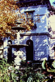
Slide - Derham House (formerly 'Mount View), 8 Selbourne Road, 1979
One of a group of slides taken by members of the Society of built heritage in Kew in 1979-80. The selection of subject matter reflects the priorities of the period. The colour of some slides has degraded.The slides represent a snapshot in time of built architecture in Kew, much of which has changed in the forty-plus period since they were created.Colour positive transparency (slide) of the the fountain and garden of Derham House, formerly 'Mount View', 8 Selbourne Road, Kew. The house wa designed in 1888 by the architect Frederick de Garis as his home. Prue Sanderson, 'Kew Conservation Study: Vol.II" wrote about Mount View that: "The house is typical of the late Victorian period in it being clad in render and styled in the Italianate. It has an asymmetrical composition with polygon bay windows extending up both floors, to each of the main facades. The ground floor is heavily incised with banded rustication, while the first floor is distinguished by the cast iron balconettes to each window. The fountain and pond in the garden appear to be those depicted in the 1903 MMBW plan of the property.""Fountain Ruyton in front of Derham House"historic houses -- kew (vic.), ruyton girls' school, derham house, mount view, italianate architecture, fountains -
 Kew Historical Society Inc
Photograph - 'Reno', 10 St John's Parade, John T Collins, 1977
‘Reno’, stood on the east side of St John’s Parade. Its earliest recorded owner was the architect Samuel Cocking who lived there from c.1865 until his death in 1888. The original landholding was bordered by Cotham Road, Glenferrie Road, Wellington Street, and Charles Street. The southern portion of this land included a fine orchard, with many imported trees. The old summer house, at first in the orchard, was later removed to the house garden. The MMBW Detail Plan No.1576 (1904) shows the remaining portion of the original land holding, including a semi-circular pathway at the front, and garden features such as an aviary, a fountain and grotto, and a fernery. The garden including rare plants supplied by Baron Von Mueller, surrounds the cottage in a tangled frenzy. Despite a ‘local significance’ classification by the National Trust, the house was demolished in 1977.Partial view, north side of the weatherboard cottage in St John's Parade, Kew, known as 'Reno' (demolished 1977). Architectural elements revealed in this photo by John T Collins include: two wing, hip roof construction; external buildings at angles to main wing; corrugated iron roofing [over shingles]; brick chimney external to building; unvarnished/unpainted external weatherboards. General dilapidated condition. "Kew 'Reno' 10 St Johns Pde / John Collins, 11 Anderson Road, Hawthorn East, 3123, Film 35B Exposure 27"reno - st john's parade -- kew (vic.), john t collins -
 Kew Historical Society Inc
Photograph - 'Reno', 10 St John's Parade, John T Collins, 1977
‘Reno’, stood on the east side of St John’s Parade. Its earliest recorded owner was the architect Samuel Cocking who lived there from c.1865 until his death in 1888. The original landholding was bordered by Cotham Road, Glenferrie Road, Wellington Street, and Charles Street. The southern portion of this land included a fine orchard, with many imported trees. The old summer house, at first in the orchard, was later removed to the house garden. The MMBW Detail Plan No.1576 (1904) shows the remaining portion of the original land holding, including a semi-circular pathway at the front, and garden features such as an aviary, a fountain and grotto, and a fernery. The garden including rare plants supplied by Baron Von Mueller, surrounds the cottage in a tangled frenzy. Despite a ‘local significance’ classification by the National Trust, the house was demolished in 1977.Partial view, side of the weatherboard cottage in St John's Parade, Kew, known as 'Reno' (demolished 1977). Architectural elements revealed in this photo by John T Collins include: hip roof construction; corrugated iron roofing [over shingles]; unvarnished/unpainted external weatherboards; Externally opening 1860s-style casement window. General dilapidated condition. "Kew 'Reno' 10 St Johns Pde / John Collins, 11 Anderson Road, Hawthorn East, 3123, Film 35B Exposure 26"reno - st john's parade -- kew (vic.), john t collins -
 Kew Historical Society Inc
Photograph - 'Reno', 10 St John's Parade, John T Collins, 1977
‘Reno’, stood on the east side of St John’s Parade. Its earliest recorded owner was the architect Samuel Cocking who lived there from c.1865 until his death in 1888. The original landholding was bordered by Cotham Road, Glenferrie Road, Wellington Street, and Charles Street. The southern portion of this land included a fine orchard, with many imported trees. The old summer house, at first in the orchard, was later removed to the house garden. The MMBW Detail Plan No.1576 (1904) shows the remaining portion of the original land holding, including a semi-circular pathway at the front, and garden features such as an aviary, a fountain and grotto, and a fernery. The garden including rare plants supplied by Baron Von Mueller, surrounds the cottage in a tangled frenzy. Despite a ‘local significance’ classification by the National Trust, the house was demolished in 1977.Side of the original, relocated summer house of 'Reno' at 10 St John's Parade, Kew, (demolished 1977). Architectural elements revealed in this photo by John T Collins include: four-sided construction; trellis and weatherboard walls; corrugated iron roofing. Re-use as woodshed. General dilapidated condition. "Kew 'Reno' 10 St Johns Pde / John Collins, 11 Anderson Road, Hawthorn East, 3123, Film 35B Exposure 24"reno - st john's parade -- kew (vic.), john t collins -
 Kew Historical Society Inc
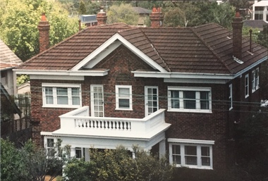
Photograph - 264 Cotham Road, 1988
... ) (Boroondara Planning Scheme) 264 cotham road -- kew (vic.) Colour ...The dwelling is representative of the development of the Georgian Revival style in the 1920s and 30s and its popularity amongst the upper-middle classes as a result of the work of William Hardy Wilson and Professor Leslie Wilkinson. It is of importance as a fine and largely intact designer/builder example of the Georgian Revival style, with American Georgian Revival influences. The dwelling embodies the principal characteristics of the style. American Georgian Revival influences are noted in the deep eaves with modillions, central broken pediment, brick quoins and presentation of the central porch. The garden wall, with arched opening, in the side setback appears to be an early or original landscape feature, based on the comparable brick work detail construction with that of the house. Considering this, it is the only early landscape feature extant which assists in providing some understanding of the original landscape layout of the property. (Criteria D and E) (Boroondara Planning Scheme)Colour photographic positive of 264 Cotham Road, Kew. The residence was constructed in 1931 for the Howitt family. 264 Cotham Road, Kew (HO813) is an individually listed building of significance under Amendment C294 of the Boroondara Planning Scheme. 264 cotham road -- kew (vic.) -
 Kew Historical Society Inc
Photograph - Kew War Memorial, 1927
The Kew War Memorial was planned and constructed at the apex of Cotham Road and High Street, Kew. It was built to commemorate those soldiers from Kew who served in the First World War. The Memorial was designed by the architect Harry Tompkins. It was unveiled by the Governor of Victoria in 1925.An early photograph of this iconic Memorial that locates it in its context. Small black and white photographic positive showing the Kew War Memorial in 1927, two years after its opening. The shops, known then as 'The Block' can be seen behind the Memorial.Annotated verso "Kew Memorial"kew war memorial, war memorials -- kew -- victoria -- australia, architects - harold tompkins, cotham road, high street -- kew (vic.), wwi -
 Clayton RSL Sub Branch
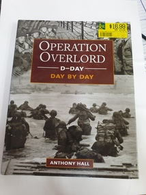
Non-fiction book, The Brown Reference Group, Operation Overload, 2003
The largest amphibious assault ever conductedBook contains a full blow b y blow description of the landings and subsequent fighting, containing maps and battle plansHard cover book with 192 pages -
 Clayton RSL Sub Branch
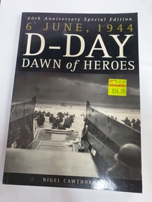
soft cover non-fiction book, Arcturus Publishing, 6 June 1944 D-Day Dawn of Heroes, 2004
Tells the story of Operation Overlord, the largest most meticulously planned seaborne invasion in the history of warfare.soft cover non-ficton book -
 Clayton RSL Sub Branch
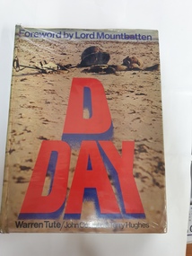
hard cover non-fiction book, Nautic Presentations, D-Day: Dawn to midnight June 6, 1944, 1974
Information contained in the book came from reports, secret planning papers drawing from memoirs and diaries.Foreward by Lord Mountbattenhard cover non-fiction booksticker on the inside jacket: P.Cooper (personal details noted) Sticker The Library United Service Institution of Victoria -
 Glen Eira City Council History and Heritage Collection
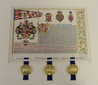
Letters Patent, Letters Patent for the Grant of Arms to the City of Caulfield presented on 1st May, 1977, 01/05/1977
Glen Eira has a long history of association with various heraldic forms. From its early years the municipality of Caulfield had used the armorial bearings of the Caulfield Family (the Charlemonts of Castle Caulfield) to represent the roads board and later the town and city. In 1969 Caulfield City Council began planning to apply for an official coat of arms for the City. In 1974 Horace Hall, a Balwyn North resident and member of the Heraldry Society in London advised Council that the current usage was illegal, and that the Houston family, current owners of the Caulfield Arms could take legal action against Council for 'usurping their arms'. Mr Hall was commissioned to develop new heraldry for the City, and in conjunction with J. P. Brooke Little at the College of Arms, London, he prepared an acceptable design for Caulfield's Coat of Arms. The Council paid an additional sum to have a standard painted on the Letters Patent and the municipality's new coat of arms was drawn up in June 1975. The Coat of Arms retains a number of heraldic elements from the original Caulfield family insignia, including the dragons, the colours and the elements of the shield. The newly registered coat of arms and Letters Patent document for the granting of arms was presented at a civic service to mark the granting of armorial ensigns and the city banner to the City of Caulfield on the 1st May 1977. Significant elements of the coat of arms granted by these Letters Patent are as follows: The motto 'Labore Vinces' translates to 'By our labours we will conquer'. The helmet represents the rank of the owner. Public authorities are granted an esquire's helmet. The brickwork on the crest is a recognised emblem of local government. The Letters Patent also display a banner and a badge, both official symbols of the City of Caulfield. The badge, which is displayed on the banner as well as on its own, features a bridled horse. This represents the importance of racing, the Caulfield racecourse and the Caulfield cup to the municipality. These letters patent officially proclaim the granting of the coat of arms to the City of Caulfield. They are highly significant to the City of Glen Eira as they are the primary document that signifies the official and ceremonial heraldic powers of the Coat of Arms of the City of Caulfield. Mounted Letters Patent illuminated document for the Grant of Arms to the City of Caulfield presented on 1st May, 1977. Hand written and hand painted on cream coloured parchment using different coloured inks, mainly black, blue, red and gouache and gold paint. The bottom edge is folded up over itself approx. 45mm revealing the flesh side of the parchment, which displays black ink signatures and three sets of two horizontal slits that hold three blue ribbon. The ribbons support three wax seals in round, gold coloured metal cases held by the wax through slots in the casing. Although covered by the cap top, each wax seal within displays a different flag emblem with a crown on top, surrounded by a ring of text (difficult to read), noted when the cases were opened during conservation treatment. See attached transcription.arms, symbol, heraldry, glen eira, council, caulfield -
 Glen Eira City Council History and Heritage Collection
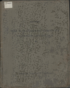
Book, "Report to the Post War Planning Committee, Caulfield City Council"
The Post War Planning Report was prepared by Leslie M. Perrott & Partners: (City Planning Consultants) and according to the report, it was submitted to the Council of the Municipality of Caulfield through its Special Committee on Post War Planning. The report has no evident date however the introduction text suggests that it was prepared before the end of World War II. The report is the only known extant copy and therefore considered rare. Bound report with grey cover titled: "Report to the Post War Planning Committee Caulfield City Council". Interior pages include x83 pages typed text printed on blue print paper; x3 pages copies of black and white photographs; 10 blueprint plans. 86 pages consistent in size with book cover, 10 x blueprint plans varying dimensions, folded and bound within the report. Printed on white sticker on spine of book "LH 994. 51" and on first page inside "CAULFIELD LIBRARY SERVICE REFERENCE BOOK" and on the verso of this page, another stamp with CAULFIELD LIBRARY SERVICE and LH REF 12/7 hand written in black ink and a 14 digit reference number below this. On the back of the last plan in the book, there is a blue stamp with "REFERENCE BOOK TO BE USED IN THE LIBRARY ONLY". Below this is a black and white barcode with a black line through it and a round, blue sticker beside it. -
 Glen Eira City Council History and Heritage Collection
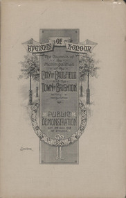
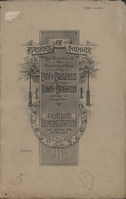
Booklet, "AVENUES OF HONOUR The Councils of the Municipalities of the CITY OF CAULFIELD TOWN OF BRIGHTON acting in conjunction PUBLIC DEMONSTRATION SAT 3rd AUG. 1918 AT 3oCLOCK"
Souvenir Programme from the Councils of the Municipalities of the City of Caulfield and the Town of Brighton for a Public Demonstration to be held on Sat 3rd August 1918 at 3 o'clock for the proposed Avenues of Honour to be planted in memory of fallen WWI soldiers. From Honour Roll Display 2019 interpretation panel - Brighton-Caulfield Avenue of Honour It is hard to imagine but a grand arboreal Avenue of Honour once lined parts of North Road, McMillan Street and Point Nepean Road (now Nepean Highway). The Avenue of Honour was a distinctly Australian phenomenon with hundreds being constructed throughout Australia during and following World War One, most of these in Victoria. Consisting of tree lined streets with each tree representing a solider, the Avenue of Honour signalled a more egalitarian approach to commemoration where rank was not a consideration. Arguably the most famous Avenue of Honour in Victoria still exists at Ballarat. Stretching for nearly 22 kilometres, the entrance to the Avenue is marked by the imposing Arch of Victory. Smaller in scale, the Brighton-Caulfield Avenue of Honour was dedicated to the ‘memory of (Brighton and Caulfield’s) kith and kin who came from (the) district and who died in the Great War’. A joint project between the neighbouring Councils, the idea was first reported in The Argus on 1 July 1918. Plans moved along quickly and on 3 August 1918 the Governor of Victoria Arthur Stanley planted the first Australian flowering gum. The next of kin were then invited to plant trees for lost sons, brothers, uncles, nephews and husbands. In all, over 400 trees were planted. Intensely personal, the Avenue also acted as a focus of grief and remembrance for the wider community. For many years, the annual civic Anzac Day service was held at the Avenue on Point Nepean Road, near Glen Huntly Road, Elsternwick. The service was moved to Caulfield Park upon the completion of the Cenotaph in 1930. Due to road widening and disease the last original tree was replaced in the 1980s, however a plaque in Caulfield Park records the Avenue’s plantation. Commemorative booklet, grey cover with text printed on the grey textured paper cover and an image of four trees and a wreath. Image of a kookaburra on the back. Inside, 28 numbered pages with b/w text and photographic images including a transparent paper representation of the proposed Avenues of Honour on Brighton Road and Point Nepean Road. Souvenir programme for a Public Demonstration for the Avenues of Honour as detailed on the front.city of caufield, world war one, first world war, anzac, remembrance, town of brighton, brighton, caulfield, avenue of honour -
 Glen Eira City Council History and Heritage Collection
Booklet, D. W. Paterson Co. Pty. Ltd, "AVENUES OF HONOUR The Councils of the Municipalities of the CITY OF CAULFIELD TOWN OF BRIGHTON acting in conjunction PUBLIC DEMONSTRATION SAT 3rd AUG. 1918 AT 3oCLOCK SOUVENIR"
Souvenir Programme from the Councils of the Municipalities of the City of Caulfield and the Town of Brighton for a Public Demonstration to be held on Sat 3rd August 1918 at 3 o'clock for the proposed Avenues of Honour to be planted in memory of fallen WWI soldiers. One of two known copies, this copy has "Town Clerk" stamped in the upper corner, rhs.Commemorative booklet, grey cover with text printed on the grey textured paper and an image of four trees and a wreath. Image of a kookaburra on the back. Inside, 28 numbered pages with b/w text and photographic images including a transparent paper representation of the proposed Avenues of Honour on Brighton Road and Point Nepean Road. Souvenir programme for a Public Demonstration for the Avenues of Honour as detailed on the front. From Honour Roll Display 2019 interpretation panel - Brighton-Caulfield Avenue of Honour It is hard to imagine but a grand arboreal Avenue of Honour once lined parts of North Road, McMillan Street and Point Nepean Road (now Nepean Highway). The Avenue of Honour was a distinctly Australian phenomenon with hundreds being constructed throughout Australia during and following World War One, most of these in Victoria. Consisting of tree lined streets with each tree representing a solider, the Avenue of Honour signalled a more egalitarian approach to commemoration where rank was not a consideration. Arguably the most famous Avenue of Honour in Victoria still exists at Ballarat. Stretching for nearly 22 kilometres, the entrance to the Avenue is marked by the imposing Arch of Victory. Smaller in scale, the Brighton-Caulfield Avenue of Honour was dedicated to the ‘memory of (Brighton and Caulfield’s) kith and kin who came from (the) district and who died in the Great War’. A joint project between the neighbouring Councils, the idea was first reported in The Argus on 1 July 1918. Plans moved along quickly and on 3 August 1918 the Governor of Victoria Arthur Stanley planted the first Australian flowering gum. The next of kin were then invited to plant trees for lost sons, brothers, uncles, nephews and husbands. In all, over 400 trees were planted. Intensely personal, the Avenue also acted as a focus of grief and remembrance for the wider community. For many years, the annual civic Anzac Day service was held at the Avenue on Point Nepean Road, near Glen Huntly Road, Elsternwick. The service was moved to Caulfield Park upon the completion of the Cenotaph in 1930. Due to road widening and disease the last original tree was replaced in the 1980s, however a plaque in Caulfield Park records the Avenue’s plantation. Inkstamp upper corner rhs: "TOWN CLERK" -
 Glen Eira City Council History and Heritage Collection
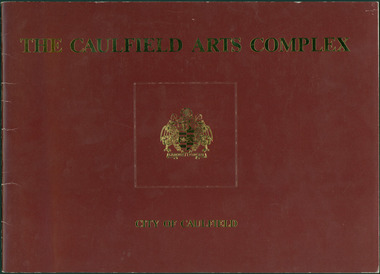
Document - Booklet, "THE CAULFIELD ARTS COMPLEX / CITY OF CAULFIELD", After 1987
Considered to be of historical and social significance. Provides information on the development of the current Town Hall Auditorium and the Glen Eira Gallery.1 x Maroon coloured booklet with gold lettering on cover published by the City of Caulfield. Inside are 14 paper pages with colour concept drawings of the proposed Caulfield Arts Complex, Concept Plans and printed text. Dated May 1987 in the opening page with an Introduction by the Mayor of Caulfield, Cr Jack Campbell. -
 Glen Eira City Council History and Heritage Collection
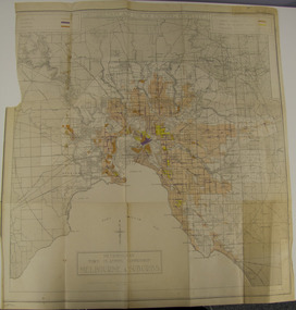
Map - Map, zoning, Metropolitan Town Planning Commission, "DISTRIBUTION AND USE OF EXISTING PROPERTY. MAP NO. 6.", 1929
The map titled: “Distribution and use of Existing property map No. 6” (Metropolitan Town Planning Commission Melbourne and Suburbs) is of historical significance. It is listed on page 168 of Chapter 4 the Zoning section of the "Plan of General Development Melbourne Report of the Metropolitan Town Planning Commission 1929" - Melbourne's first strategic plan. Map No. 6 is mentioned throughout Chapter 4 of the 1929 Report. It states on page 156 that this Map was created to graphically illustrate the data collected by the Planning Commission. The Map illustrates the general distribution of uses of existing property throughout the metropolitan area. The coloured sections show the areas which were developed or were in the process of development in 1929. The colours indicate the distribution of uses in the developed areas. The pink coloured areas, which include Caulfield, were almost completely residential.1929, metropolitan town planning commission, melbourne, suburbs -
 Glen Eira City Council History and Heritage Collection
Document (Item) - Newspaper (digital), Caulfield Contact
The Caulfield Contact was the official newspaper of the City of Caulfield from 1976-1994. The City of Caulfield was the Municipal Council for an area of the South Eastern suburbs of Melbourne, including Brighton East, Carnegie, Caulfield, Elsternwick, Gardenvale, Glen Huntly, McKinnon, Murrumbeena, Ormond and St Kilda East. Following Amalgamation of City of Caulfield and parts of the City of Moorabbin in 1994, the Caulfield Contact was followed by the Glen Eira News. Contains References to the following Freedom of Entry to 3rd ordinance of the RAAOC, visit by Sir Zelman Cowen, Return to Rosstown, A 'spacy new home' (nursery at Caulfield Park), Profile on Gus Theobold, Meals on Wheels Aviary completed Caulfield Park. Profile resident Gus Theobold. Cr Irene Capek win Herald Australia Day essay prize. Caulfields Meals on Wheels set Victorian record. Historical feature Return to Rosstown. New ambulance station Glenhuntly and Clarinda roads opens. Volume 4 Number 5 Date 03 August 1978 Features Where and How to Vote in council election. Cr Irene Capek retires from council. Profiles election candidates. Image: Image Cr Irene Capek. Images of election candidates. Volume 5 Number 1 Date 14 September 1978 Freedom of Entry to 3rd ordinance of the RAAOC, visit by Sir Zelman Cowen, Subjects from Carol: GG Sir Zelman Cowen and Lady Cowen offical visit. Off street carpark project underway Pyne St and Hawthorn Rd. City Manager Graeme Caldwell submits plans for Townhall renovations. Action plan for development of Elsternwich Shopping precint to be developed. Freedom of Entry ceremony. Profile Rosemary Keppel. Booran Motors Glenhuntly donate dual control Holden Gemini to Caulfield Tech school pre-driver education program. council election results. Comments from elected Crs Jack Campell, Bob Baxter, Dorothy Ford, Brian Rudzki. Promotion of Caulfield Institute of Technology and TAFE. Image: Image Sir Zelman Cowen, Lady Cowen. Images Freedom of Entry ceremony and citizens attending. Image Rosemary Keppel. Cartoon pre-driver education program. Image Mayor Cr Geoff Patience in robes. Volume 5 Number 2 Date 26 October 1978 Rate rise 5.73% announced. Readership of Caulfield Contact surveyed. Caulfield ranger Reg Dixon and members of works dept rescue duck family from drain and reinstate them to Caulfield Racecourse dam. Profile resident and teacher Claire Manning. Image: Image of Reg Dixon and the rescued ducks. Image Claire Manning and students at Waverley Private school. city of caulfield, caulfield, glen eira, city of glen eira, caulfield contact, freedom of entry to 3rd ordinance of the raaoc, visit by sir zelman cowen, return to rosstown, a 'spacy new home' (nursery at caulfield park), profile on gus theobold, meals on wheels -
Surrey Hills Historical Society Collection
Document - Plans, Andrew Wood, Building plans associated with Andrew Wood, builder of Surrey Hills, 1920s
... Road Canterbury melbourne These plans were associated with Mr ...These plans were associated with Mr Andrew Wood, a contract builder who worked in the 1920s and built many Californian bungalows in Surrey Hills and surrounding suburbs. Andrew Wood was born in Chiltern in 1861 to Andrew and Ellen Wood (MS: Green). His father had emigrated from Falkirk, Scotland. As a young man Andrew worked as a carpenter in the mines in South Africa (c 1899). He married Eleanor Agnes Stuchbery in Hamilton, Victoria in May 1901. They had 5 children - Doris (M Roberts), Robert Andrew, Donald Allen, Jean (M Cowan), and Gwenyth (M Bray). The first 2 children were born in Hawthorn; the other 3 in Surrey Hills. The family home at 286 Canterbury Road, Surrey Hills (on the corner of Middlesex Road) was built by Andrew. Andrew died in 1940; Eleanor died in 1977, aged 100 years. After Eleanor's death the house was sold and demolished. Surrey Lighting was established on the site. Gwenyth May Wood (3 May 1917, Surrey Hills - 5 Jan 2004) married Leslie David Charles Bray (1921-1983). Gwenyth was the donor's mother. Andrew, Eleanor and one son Robert are buried in Box Hill Cemetery - B-071-0028. .1: Specifications & plans for the kinder hall, Howard Street, Mont Albert for the Mont Albert Methodist Church, May 1925 .2 Plans for a proposed villa, 48 Payne's Paddock, Highfield Road, Canterbury for Mr E H Sillifant, dated 22/4/1920 .3 Plans for a timber villa for Mrs J A Burchell at Riversdale Road, Surrey Hills, stamped 9/5/1922 .4 Plan of a garage at Victoria avenue, Canterbury; stamped 14/2/1922 .5 Building permit & receipt from City of Hawthorn re Lot 16 Homebush Crescent; dated 7/4/1925 .6 Plans for a concrete house at Camberwell for Mr H W Field andrew wood, builders, box hill cemetery, kindergartens, mont albert methodist church, building plans, highfield road, ernest horatio sillifant, victoria avenue canterbury, lot 16 homebush crescent, californian bungalows, h w field -
 Brimbank City Council Art Collection
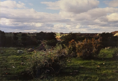
Photograph, Robert Pointon, Huntsman chemical plan in distance, 1989
Local SceneHuntsman Chemical Plant in distance. Quarry now a tip to the right. Taken in South Sunshine near Kororoit Creek - AR0036 -
 Williamstown Botanic Gardens- Hobsons Bay City Council
Oral History_Williamstown Botanic Gardens_Helen Page, 24/02/2104
The interview is one of a series recorded in 2013-2014 to document memories and experiences of the Williamstown Botanic GardensA primary source of information on the lobbying that led to master planning for rejuvenation of the Gardens and the formation of the Friends of Williamstown Botanic Gardens. CD and transcript of interview with Helen Page and her memories and experiences in lobbying for the rejuvenation and long-term viability of the Gardens. Helen was a resident of Williamstown when she contacted local Councillor, Angela Altair, in May 1999 to express her concerns about the destruction of trees in Melbourne Road and the condition of the Williamstown Botanic Gardens. The result of her communications with Councillor Altair and the Council was the formation of the Landscape Advisory Group and the Williamstown Botanic Gardens Advisory Group. Still an active member of the Williamstown Botanic Gardens Advisory Group, Helen talks of these experiences, how they led to the formation of the Friends Group and her hopes for the future of the Gardens.helen-page, angela altair, mary klestadt, mike hirst, shelley wood, andrew shannon, williamstown botanic gardens advisory group, master plan, sue murray, kim sawyer, anja lee, golden elm, advisory group, gates, pinetum, victorian heritage register -
 Surrey Hills Historical Society Collection
book, Beyond the garden wall: twenty-two gardeners and their gardens, 2008
This book was compiled by Sue Barnett at the request of the project participants from material gathered as part of the project "Beyond the Garden Wall". This project was devised and managed by a team at Surrey Hills Neighbourhood Centre Inc. with funding from the Victorian Department of Planning and Community Development (VDPCD) under the "Images of Age' grant 2007. It involved conducting oral histories, reflection on the part of the participants through visual diaries, photography and painting. A short video of some of the gardens was also commissioned. All the elements came together during Seniors Festival in an exhibition held at the Augustine Centre, and opened by Jane Edmanson. At the request of the VDPCD, a modified exhibition was held in 2008 at 'Australia on Collins' during the 2008 Seniors Festival. Sue Barnett and Jo Reitze (Mrs de Carteret) are Surrey Hills residents. This provides a snapshot of 20 gardens and the 22 passionate gardeners who created them. The prose provides a potted history of the gardeners and their philosophical approach, accompanied by portraits of them and cameo photos of their gardens, as well as a photo of the painting of the garden as seen by artist Jo Reitze. All the gardens were situated within the City of Boroondara and all the gardeners were over 60 years of age. Prose written by Sue Barnett; photography by Sue Barnett and Jo Reitze.gardening, anecdotes, (ms) jo reitze, (ms) susan barnett, sue barnett, paintings, gardeners -
 Surrey Hills Historical Society Collection
Book, Mitchell House, Penguin Land, 2015
Includes: viewing penguins in the 1920's; Summerland - AKT Sambell, 1944 Town Planning Act, the Summerland Comunity, and Summerland today. The author is a local resident and foundation member of the Surrey Hills Progress Association. Content is centred on the Phillip Island penguin parade and charts a conservation and development struggle that endured for almost 80 yearsContent is centered on the Phillip Island penguin parade and charts a conservation and development struggle that endured for almost 80 yearsSigned on inside cover page by author: Gregor Buchanan / 18/8/15penguins - phillip island, birds - victoria, wildlife conservation - victoria, phillip island penguin reserve - victoria, summerland estate -
 Surrey Hills Historical Society Collection
Book, Medlow Garden Survey and Landscape capability study 1983, Oct-83
... Road Canterbury melbourne Includes: Plan of Subdivision ...Includes: Plan of Subdivision, Detailed plan, map of garden, Auctioneer's plan for 1854 sale, Botanical plan of Medlow & Landscape history notes. Full title : Medlow Garden survey and landscape capability survey. A report for the National Trust of Australia (Victoria) A report giving a detailed landscape survey of Medlow Garden estate. Includes landscape story, cultural significance, particulars about vegetarian, garden, rehabilitation and plans.Copy of a report giving a detailed landscape survey of Medlow Garden estate. Includes landscape story, cultural significance, particulars about vegetarian, garden, rehabilitation and plans. 38 pages with illustrations.land surveys, medlow garden, bismark estate, rosalie estate, warrigal road, surrey hills, bismarck avenue, warwick avenue, t p payne, (mr) hugh glass, boroondara, (mr) (maj) - cairncross, (mrs) mary jane cairncross, (dr) (mr) richard joseph bull, (mrs) catherine grace bull, (miss) norma bull, (mr) ronald richard bull, medlow -
 Surrey Hills Historical Society Collection
Book, Medlow Garden Survey and Landscape capability study 1983, Oct-83
... Road Canterbury melbourne Includes: Plan of Subdivision ...Includes: Plan of Subdivision, Detailed plan, map of garden, Auctioneer's plan for 1854 sale, Botanical plan of Medlow & Landscape history notes. Full title : Medlow Garden survey and landscape capability survey. A report for the National Trust of Australia (Victoria) A report detailing the landscape survey of Medlow Garden estate. Includes landscape history, cultural significance, particulars about vegetarian, garden, rehabilitation and plans.A report detailing the landscape survey of Medlow Garden estate. Includes landscape history, cultural significance, particulars about vegetarian, garden, rehabilitation and plans. 38 p illland surveys, medlow garden, bismark estate, rosalie estate, warrigal road, surrey hills, bismarck avenue, warwick avenue, t p payne, (mr) hugh glass, boroondara, (maj.) (mr) - cairncross, (mrs) mary jane cairncross, (dr)(mr) richard joseph bull, (mrs) catherine grace bull, (miss) norma bull, (mr) ronald richard bull, medlow, house names, (mr) rex swanson, landform australia -
 Surrey Hills Historical Society Collection
book, Wattle Park Draft Management Plan, Sept 1991
This draft management plan has been developed after consultation with park users, and specific interest groups. It takes into account the findings of market research and community liaison.An A4 sized bookletOn top RH corner of cover: "JF Hall/own"wattle park (box hill, vic) - planning, parks - victoria- box hill- management, gardiner's creek, anniversary trails, vegetation, wattle park chalet, wattle park golf course, land use, melbourne water, riversdale golf course, national trust, riversdale road, surrey hills -
 Surrey Hills Historical Society Collection
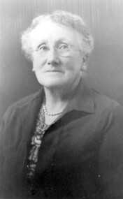
Photograph, Mrs Florence Margaret Tacey (nee Edwards)
Mrs Florence Margaret Tacey (nee Edwards) was the mother of Albert Arthur Tacey. She was born in 1863; died in 1943 in Camberwell. Her husband was William Tacey born in the Buckland Valley near Bright in 1857. There were many members of the Tacey family who were butchers. Various members of the family were associated with Tacey's Butchers at 629 Canterbury Road, Surrey Hills. According to a Context P/L heritage assessment of the property the land on which the business was built "was purchased by Edward Tacey on 16 September 1889. Edward Tacey was a butcher and the Sands & MacDougall street directory indicates that a butcher’s shop had been constructed on the site and was operating by 1890. It seems that the family lived for some time at a house located next door to the shop at 627 Canterbury Road (visible on the 1909 MMBW plan, but since demolished). On 15 June 1920 Edward Tacey transferred all three blocks of land to Joseph Tacey, most likely his son * and also a butcher, who carried on business from the same premises. Joseph Tacey died on 20 February 1933, after which administration of his estate (which included the three blocks of land) passed to his widow, Mary Dorothy Tacey." Edward Tacey (1863 - 1952) was the brother of William Tacey (1857 - 1920). The property passed to Joseph Charles Tacey (1887 - 1933), his nephew and son of William, not his son. His wife was Mary Dorothy Coates. Albert Arthur Tacey was a brother of Joseph Charles Tacey. The SHNCHC has a large framed photo collage of the Tacey butcher's shop at 629 Canterbury Road. It hung in various Tacey family-owned butcher's shops around Victoria before coming back to Surrey Hills. The donor was the daughter of Albert Arthur Tacey (1902-1959). A black and white photograph of an older lady. She has greying hair, is wearing rimless glasses, pearls and a jacket over her dress.surrey hills, butchers, mrs florence margaret tacey, miss florence margaret edwards, william tacey, joseph charles tacey, albert arthur tacey -
 Surrey Hills Historical Society Collection
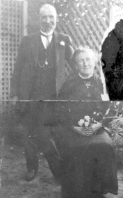
Photograph, Mr and Mrs William Tacey
William (1857 - 1920) was a butcher. William was born 7 Nov 1857 on the Buckland (River) near Bright, son of John Joseph Tacey and wife Elizabeth Cooper. This was just a few months after the Buckland River anti-Chinese riots. He had siblings Thomas (1856-1929), Mary Ann (1860-1920), Edward (1863-1952) and Arthur Edward (1870-1896). William died 30 March 1920, Camberwell. He married Florence Margaret Edwards in 1884. Both are buried in Box Hill Cemetery (CE-0162). They had 7 surviving children; 2 died in infancy. William was a butcher in Thornbury but moved to Camberwell with his brothers seeing the opportunity in the new suburbs. They set up shops in Canterbury Road, opposite Highfield Road, Surrey Hills; Burwood; corner of Elgar & Whitehorse Roads, opposite the Whitehorse Hotel and Canterbury Road, Surrey Hills just east of Surrey Hotel. The first directory entries are in 1888 & 1889 for the Surrey Hills shop & Elgar Road. In Surrey Hills a substantial property was developed on land which "was purchased by Edward Tacey on 16 September 1889. Edward Tacey was a butcher and the Sands & MacDougall street directory indicates that a butcher’s shop had been constructed on the site and was operating by 1890. It seems that the family lived for some time at a house located next door to the shop at 627 Canterbury Road (visible on the 1909 MMBW plan, but since demolished). On 15 June 1920 Edward Tacey transferred all three blocks of land to Joseph Tacey, most likely his son * and also a butcher, who carried on business from the same premises. Joseph Tacey died on 20 February 1933, after which administration of his estate (which included the three blocks of land) passed to his widow, Mary Dorothy Tacey." (Context P/L Heritage Assessment) Correction: *Edward Tacey (1863 - 1952) was the brother of William Tacey (1857 - 1920). The property passed to Joseph Charles Tacey (1887 - 1933), his nephew and son of William, not his son. His wife was Mary Dorothy Coates. Albert Arthur Tacey was a brother of Joseph Charles Tacey. Edward later moved from the area and continued in the business in a number of regional Victorian centres. In Surrey Hills the business was continued by other members of the family including Albert Arthur Tacey (1902-1959) who lived at 7 Sunbury Crescent, and daughter Stella Florence Tacey and her husband Roy Morris and their son Harry Tacey Morris. The donor of the Tacey collection of photos was Elaine Merle Tacey (1925-2003), daughter of Albert Arthur Tacey. She married Donald McKenzie. A black and white photograph of a couple in the garden. The man is standing and wearing a 3 piece suit whilst the lady is seated and holding a posy of flowers in her lap.(mr) william tacey, butchers, (mr) edward tacey, (mr) thomas tacey, (mr) joseph tacey, (mrs) stella morris, (mr) roy morris, (miss) florence margaret edwards, (mrs) florence margaret tacey, (mr) albert arthur tacey, (miss) stella tacey, (mr) harry tacey morris -
 Surrey Hills Historical Society Collection
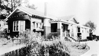
Photograph, 'Strathmore' 75 Victoria Crescent, Mont Albert
‘Strathmore’ Victoria Crescent (dem.) Joseph Sutton Crow and his wife Jessie (nee Temby) bought this property which had belonged to the Purbrick family in 1924. Sutton was an amateur ‘planner and landscape designer’ and had much pleasure in planning the use of their garden of 100 feet by 400 feet. While part remained rural with sheep, an orchard and vegetable garden, he laid out sweeping designs for the front garden which Jessie enjoyed converting into a garden worthy of display and which did gain prizes in the Herald Garden competitions of the 1930s. They entertained friends and often had as guests University Conservatorium staff and visiting musical personnel. They also opened the garden for local church fund-raising functions. Children, Jean and Ray, had areas set out for their recreation with pets and activities areas. The donor was their daughter. A black and white photograph of a Californian Style weatherboard house, painted in a dark colour. There is a well established garden in front. There is a bay window at one side of the house.house names, californian bungalow style, weatherboard, victoria crescent, surrey hills, (mr) joseph sutton crow, (mrs) jessie sutton crow, purbrick family, 1924, herald garden competitions, 1930-1939, (miss) jean sutton crow, (mr) ray sutton crow, 'strathmore' -
 Surrey Hills Historical Society Collection
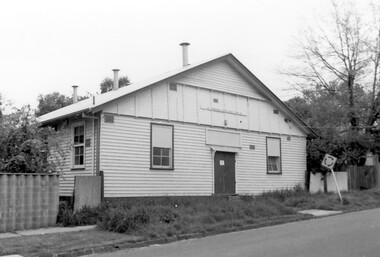
Photograph, Scout Hall at 7 Robinson Road, Surrey Hills in 1990
The Box Hill Reporter noted on 22 January 1926 that at the monthly meeting of the Surrey Hills Progress Association the Secretary reported that “the ground had been purchased for the Boy Scout Hall, that plans had been prepared, and accepted by the building committee. As soon as the timber was available the work would be proceeded with. The Boy Scout Hall movement has been taken up by the association to try to secure a permanent meeting place for the boys of the district. Up till now they have no fixed place, nor have they had a qualified scout master. Mr. Bert Chenu, one of the committee, has been appointed to that position, and is carrying out his duties energetically. Having raised enough money to purchase the land (situated in Robinson's road, Surrey-Hills near the Drill Hall) the association's committee is now about to erect the building by means of properly organised working bees.” The Association organised markets, card evenings and dances to raise necessary funds. The volunteer labour included the parents of boys who had become scouts, led by builder Robert Hayes of 186 Union Road and his son, who was also a builder. Early ownership is unclear as it is believed that it was not purchased by the scouting movement until 1955. The hall was used by other groups as well as the scouts. Benmont Kindergarten operated on the site from c1930. This is confirmed by oral testimony, Sands & McDougall entries and the Alan Hold property register (part of the SHNC Heritage Collection.) It was also used as a ballet school and for local dances. The hall was situated on a small block of land, just 410 sq m, and in late 2019 it was put up for sale by Scouts Victoria. Most recently home to 1st Boroondara Scout Group and previously 11th Camberwell Scouts, it was sold for something near $1.3M. During May 2020 the modest hall was demolished. Items of significance were removed before the sale by Scout Heritage. A black and white photograph of a building with a small sign identifying it as 11th Camberwell Central Scout Group.robinson road, surrey hills, scout halls, scouts, buildings, structures and establishments, (mr) robert hayes, union road, builders, surrey hills progress association, benmont kindergarten, dances, ballet schools -
 Surrey Hills Historical Society Collection
Book, The Conservation Plan: a guide to the preparation of conservation plans for places of European Cultural Significance, 1996
This guide is about gathering, analysing and assessing information that bears upon policy decisions and on the process of making those decisions. It offers a common ground for debate, a method and a common language to help resolve differences and achieve a balance between the old and the new. The result of these processes is a conservation plan.historic sites - australia - conservation and restoration, historic buildings - conservation and restoration - ausation of places of cultural significancetralia, monuments - australia - conservation and restoration, australia/icomos charter for the conserv -
Surrey Hills Historical Society Collection
Planning report, City of Boroondara, City of Boroondara planning report re 171 Union Road, Surrey Hills, 19/07/2004
... station. union road redevelopment shops town planning A detailed ...171 Union Road was part of the Thomas Zeplin estate. It originally had a Victorian house on it built by the Zeplin family. This was leased by Dr Percy Liddle and then Dr James Landells Blakie. Dr Blakie purchased land diagonally opposite at 174 Union Road and had a purpose-built home / surgery constructed. Later the site was occupied by COR then a BP petrol station.A detailed proposal regarding the redevelopment of the petrol station site on the corner of Union Road and Montrose Street, Surrey Hills into a 2 storey office and shop building with basement parking and access from Montrose Street. It includes attachments showing plans, elevations and details regarding objectors. The application was granted subject to additional conditions being met. union road, redevelopment, shops, town planning