Showing 4449 items
matching roads board
-
 Kew Historical Society Inc
Photograph - Kew Junction, Herald & Weekly Times, 1962
... Junction before construction of VicRoads (Country Roads Board... construction of VicRoads (Country Roads Board), Murphy's (Leo's ...This is an aerial oblique image looking north. It shows Kew Junction before construction of VicRoads (Country Roads Board), Murphy's (Leo's) supermarket, and office towers. It also shows a building on the land now known as the Raoul Wallenberg Reserve, the Kew Municipal Offices in Walpole Street, and St Paul's School for the Blind in Fernhurst Grove, and Kew Bowling Club in Wellington Street.An aerial photograph of Kew Junction, showing the intersection of High Street South, Studley Park Road, Princess Street, High Street and Denmark Street. A number of buildings, now demolished can be identified in the photo, including Jellis’ Bakeries on the corner of Princess Street and Studley Park Road." Annotation on reverse: "Kew Historical Society from Mr L. H. Chinner".kew junction, aerial photograph (kew), oblique aerial, st paul's school for the blind, kew municipal offices, high street kew, studley park road, kew war memorial, kew post office, kew police station, kew court house, high street south, kew, wellington street kew, denmark street kew -
 Sunbury Family History and Heritage Society Inc.
Photograph, Veronica Burgess, Rose Garden opening, 12 December 1999
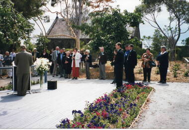
... Bulla Roads Board building. St. Mary's Church of England... Bulla Roads Board building. St. Mary's Church of England ...The Mayor of Hume City Council, Jack Ogilvie, was addressing local 12th December 1999 in the grounds of the former Bulla Roads Board building. St. Mary's Church of England is adjacent to the Rose Garden. Alister Clark, a former Bulla resident and a rosarian, developed many different species of roses at his Glenara property. The garden in Bulla has been erected in his memory.Alister Clark developed many rose varieties that could withstand Australia's climate. Many of them, such as the Lorraine Lee, have become a popular addition in gardensA non-digital coloured photograph of a man standing in front of a lectern addressing a group of people who are standing in a garden. A small bluestone church is on the adjacent property.alister clark, 'glenara' homestead, bulla, alister clark memorial rose garden, roses, jack ogilvie -
 Kew Historical Society Inc
Painting - Country Road, Frankston, Hubert C McDonald
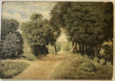
... Frankston country road. Oil on composite board by Hubert... board by Hubert Charles McDonald. Painting Country Road ...The French Collection was donated to the Society in 2022. This collection includes documents, artworks, books, costumes and artefacts belonging to two families. A number belonged to, or were made by the grandparents of the donor: Vera May Wing and her husband Hubert Charles McDonald. [Other items belonging to Vera and Hubert are in the collections of the Australian Performing Arts Museum and Museum Victoria.] A second significant group of objects were gifts made to the donor's family by Lucy (Jean) Hornby of Queen Street, Kew whose family had been early settlers in the district.Gift of Anna French, 2022Frankston country road. Oil on composite board by Hubert Charles McDonald.Reverse: "HC McDonald / Frankston"artworks, frankston, hubert c mcdonald -
 Ballarat Tramway Museum
Document - Photocopy, Neville Gower and Neville Hesketh, "Mayor's Report 1967-1968", Jul. 1997
... pages covering trams, railways, item on Country Roads Board (CRB..., railways, item on Country Roads Board (CRB) and traffic issues ...Photocopy of part of City of Ballarat's Mayor's Report for 1967 - 1968. Originals held in the Ballarat Library. Three pages covering trams, railways, item on Country Roads Board (CRB) and traffic issues in Ballarat and small photos of trams at City terminus. Page headed "City Traffic" added 19/12/2009 - and imaged along with following page which has the photo of the city tram at the terminus added. Looks at the introduction of traffic lights into the City and traffic problems and parking meters.trams, tramways, city of ballaarat, trams, railways, civic history, traffic lights -
 Orbost & District Historical Society
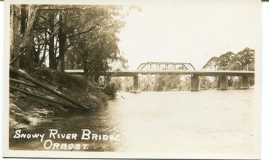
black and white photograph, Rose Stereograph Company, first half 20th century
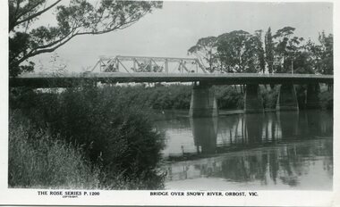
... structure, a joint Country Roads Board — Victorian Railways venture... structure, a joint Country Roads Board — Victorian Railways venture ...A new bridge over the Snowy River at Orbost was opened for traffic on June 20th 1922. It was a new timber and steel girder structure, a joint Country Roads Board — Victorian Railways venture and was built and completed at a cost of £41,000 (the steel girders came from the Flinders Street viaduct reconstruction). Subsequently it was decided not to take the railway across the river, and the bridge was only ever used by road traffic. Postcards form a vital part of social and historical records for researchers. This postcard is a pictorial record of an earlier bridge across the Snowy River at Orbost.A black / white postcard photograph of a bridge over the Snowy River at Orbost.0n front - The Rose Series P1200 copyright Bridge Over Snowy River Orbost Vic.snowy-river-bridge -
 Stawell Historical Society Inc
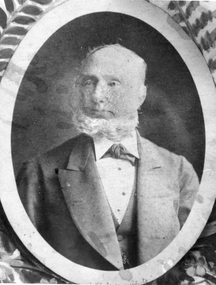
Photograph, Mr George Jennings -- Studio Portrait
... Jennings was elected to Old Roads Board in 1863. Except... Jennings was elected to Old Roads Board in 1863. Except ...Portrait of George Jennings "Mayo Park" Lubeck. George Jennings was elected to Old Roads Board in 1863. Except for the years 1882 - 84. He served on the Council until 1891 - 1874 Shire President. From County Galway in Ireland. Jennings arrived in Pleasant Creek in 1858. For many years he owned "The Western Turf Hotel at Quartz Reefs. Selected land on the Ashens Run - settled there in 1870.Black and white photograph of a male in a oval setting with decoration in corners making a rectangle. Photograph in brown folder. The male is dressed in a suit, tie at neck of shirt, short hair and with a beard. Also an enlargement of studio photograph.George Jennings Mayo Park Lubeck written in biro.lubeck stawell shire president -
 Orbost & District Historical Society
black and white photograph, first half 20th century
... of the Victorian Railways and the Country Roads Board at a cost of 35,000... of the Victorian Railways and the Country Roads Board at a cost of 35,000 ...This is a photograph of the second Snowy River Bridge at Orbost. The section in the central span could have been built after flood damage. This bridge over the Snowy River was opened on July 4 1922. It was constructed in 1922 alongside the previous suspension bridge. Its building was a combined effort of the Victorian Railways and the Country Roads Board at a cost of 35,000 pounds. It was replaced in 1976 by the present bridge after several major floods.This bridge was replaced in 1976 after several major floods.A black / white photograph / postcard of a bridge over a river. It has what looks like a bo girder in the central section. On the left is the river bank.on front bottom left - "SNOWY RIVER BRIDGE"orbost snowy-river-bridge transport-bridge -
![Borough of Kew - Gazetted Streets [1865-1937]](/media/collectors/550653872162f11fb04854aa/items/59614050d0cdd511a09c84a0/item-media/59614577d0cdd511a09e80c0/item-fit-380x285.jpg) Kew Historical Society Inc
Kew Historical Society IncDocument, Borough of Kew / Gazetted Streets, 1865-1937
... the Boroondara Roads Board in 1860, being declared a Municipality... Roads Board in 1860, being declared a Municipality in that year ...The Melbourne suburb of Kew gained independence from the Boroondara Roads Board in 1860, being declared a Municipality in that year. Kew became a Borough in 1863, a Town in 1910, and a City in 1921. The former City of Kew became part of a newly declared City of Boroondara in 1994. This very fragile document records the following information about streets in Kew - Name, Total Width, Width of Carriageway, Description, Government Gazetted - Year & Page.While the name of a street was formally acknowledged and published in the Victorian Government Gazettes, this document, compiled by a public officer, probably in the Town Clerk's Department, is the earliest known local record listing street names in the Borough, later Town, then City of Kew. The front page indicates that in 1865, the responsibility for an initial 36 streets in Kew was taken over by Council. The final annotation in the document was made in 1937. The document is an important record for researchers seeking to understand the dating of streets in the district.27-page document compiled by officers of the Borough, Town and City of Kew, listing the names of streets taken over by Council, and providing details of their proportions and gazettiing. The document covers the period of 1865 to 1937. Handwritten documentborough of kew, streets -- kew (vic.) -
 Federation University Historical Collection
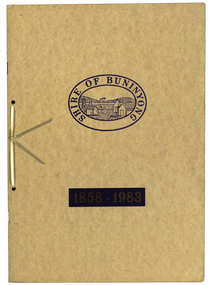
Book, Waller & Chester Printers, Shire of Buninyong 1858-1983, 1983
... of the first meeting of the Buninyong District Road Board.. Includes... meeting of the Buninyong District Road Board.. Includes images ...Documents special meeting of Buninyong Shire Council held on 30 August 1983 to commemorate the 125th anniversary of the first meeting of the Buninyong District Road Board.. Includes images of four generations of Archibald Fisken, photographic copy of Victoria Government Gazette proclamations of the Buninyong Road District, details of inaugural meeting and minutes of the first and second meetings, members of council 1983, a list of Chairmen, Mayors and Presidents and extracts from past records.Beige soft covered book 14 pages with images of four Archibald Fisken, KW McManus and other details related to the 100 years of the Bininyong Shire Council. Ink on paper.Shire of Buninyong 1858-1983buninyong shire council, buninyong road district, archibald fisken, local government -
 Eltham District Historical Society Inc
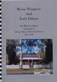
Book, Maureen Jones, Bessie Wingrove and Early Eltham by Maureen Jones, 2016
... Roads Board. Much of the publication describes the Wingrove... Roads Board. Much of the publication describes the Wingrove ...Bessie Wingrove (1870-1955) was born in Eltham, one of ten children born to Charles Wingrove, former Secretary of the Eltham Roads Board. Much of the publication describes the Wingrove family. Bessie attended University and graduated as a teacher, she travelled and returned to live in Eltham. Includes endnotes and Family Group Record for Charles Symons Wingrove and his wife Katherine Nodin. See also EDHS Newsletter Number 223 July 2015 for article on Bessie Wingrove by Maureen Jones This book is significant in that not only does it document broadly the history of Charles Wingrove a key person in the early history of Eltham but also his family, and specifically his daughter Bessie, ensuring that women's stories are added to the early male dominated and documented history of the area. It also gives an insight into the people and wider Eltham community.Spiral bound. 15 p. includes photographsbessie wingrove, wingrove family, eltham -
 Kew Historical Society Inc
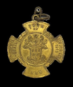
Medal, Town of Kew : To Commemorate its Jubilee, 1910
... December 1860, seceding from the Boroondara Road Board District..., seceding from the Boroondara Road Board District, then comprising ...Medal issued to commemorate the 50th jubilee of the Town of Kew. It names J.F. McCrea as Mayor. John Falding McCrea was Mayor of Kew 1910-11. Kew was proclaimed a municipality on 22 December 1860, seceding from the Boroondara Road Board District, then comprising Kew, Hawthorn and Camberwell. It was proclaimed a town on 8 December 1910, the year this medal was issued, and a city on 10 March 1921. On 22 June 1994 Kew city was united with Camberwell and Hawthorn cities to form Boroondara city. (MV)Gilt bronze Town of Kew Jubilee medal in the shape of a Maltese Cross.Obverse description Shield of six wheat-sheafs above motto CRESCO on ribbon; above shield is the Royal coat of arms with lion and unicorn supporters and, on ribbon DIEU ET MIN DROIT; on arms of cross top, TOWN / OF, bottom, KEW, left TO COMMEM / -ORATE, right, ITS JUBILEE / 1910 Reverse description shield of six wheat-sheafs above motto CRESCO on ribbon; above shield is the Royal coat of arms with lion and unicorn supporters and, on ribbon DIEU ET MIN DROIT; on arms of cross top, TOWN / OF, bottom, KEW, left TO COMMEM / -ORATE, right, ITS JUBILEE / 1910town of kew jubilee (1910), commemorative medals - kew (vic), australian commemorative medals -
 Kew Historical Society Inc
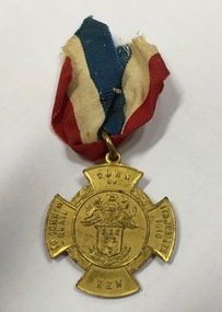
Medal, Stokes & Sons, Town of Kew : To Commemorate its Jubilee, 1910
... December 1860, seceding from the Boroondara Road Board District..., seceding from the Boroondara Road Board District, then comprising ...Medal issued to commemorate the 50th jubilee of the Town of Kew. It names J.F. McCrea as Mayor. John Falding McCrea was Mayor of Kew 1910-11. Kew was proclaimed a municipality on 22 December 1860, seceding from the Boroondara Road Board District, then comprising Kew, Hawthorn and Camberwell. It was proclaimed a town on 8 December 1910, the year this medal was issued, and a city on 10 March 1921. On 22 June 1994 Kew city was united with Camberwell and Hawthorn cities to form Boroondara city.Mint gilt medal with original ribbon.Kew Jubilee medal in the shape of a Maltese cross. Gilded bronze with attached original red, white and blue cloth ribbon. On the front is the Coat of Arms of the Town of Kew and an inscription: ‘Town of Kew. To Commemorate Its Jubilee 1910’. On the reverse is inscribed 'Kew Jubilee 1860-1910. Cr J.F. McCrae J.P. Mayor'. The medal was also issued in bronze.Obverse description Shield of six wheat-sheafs above motto CRESCO on ribbon; above shield is the Royal coat of arms with lion and unicorn supporters and, on ribbon DIEU ET MIN DROIT; on arms of cross top, TOWN / OF, bottom, KEW, left TO COMMEM / -ORATE, right, ITS JUBILEE / 1910 Reverse description Within line circle set at centre of cross shaped flan, CR. J.F. McCREA / J.P. / MAYOR on arms of cross, top, KEW bottom, JUBILEE, left 1860, right, 1910jubilee - kew (vic), commemorative medals - kew (vic), australian commemorative medals -
 Kew Historical Society Inc
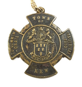
Medal, Stokes & Sons, Town of Kew : To Commemorate its Jubilee, 1910
... December 1860, seceding from the Boroondara Road Board District..., seceding from the Boroondara Road Board District, then comprising ...Medal issued to commemorate the 50th jubilee of the Town of Kew. It names J.F. McCrea as Mayor. John Falding McCrea was Mayor of Kew 1910-11. Kew was proclaimed a municipality on 22 December 1860, seceding from the Boroondara Road Board District, then comprising Kew, Hawthorn and Camberwell. It was proclaimed a town on 8 December 1910, the year this medal was issued, and a city on 10 March 1921. On 22 June 1994 Kew city was united with Camberwell and Hawthorn cities to form Boroondara city. (MV)This work forms part of the collection assembled by the historian Dorothy Rogers, that was donated to the Kew Historical Society by her son John Rogers in 2015. The manuscripts, photographs, maps, and documents were sourced by her from both family and local collections or produced as references for her print publications. Many were directly used by Rogers in writing ‘Lovely Old Homes of Kew’ (1961) and 'A History of Kew' (1973), or the numerous articles on local history that she produced for suburban newspapers. Most of the photographs in the collection include detailed annotations in her hand. The Rogers Collection provides a comprehensive insight into the working habits of a historian in the 1960s and 1970s. Together it forms the largest privately-donated collection within the archives of the Kew Historical Society.Bronze Town of Kew Jubilee medal in the shape of a Maltese Cross.Obverse description Shield of six wheat-sheafs above motto CRESCO on ribbon; above shield is the Royal coat of arms with lion and unicorn supporters and, on ribbon DIEU ET MIN DROIT; on arms of cross top, TOWN / OF, bottom, KEW, left TO COMMEM / -ORATE, right, ITS JUBILEE / 1910 Reverse description shield of six wheat-sheafs above motto CRESCO on ribbon; above shield is the Royal coat of arms with lion and unicorn supporters and, on ribbon DIEU ET MIN DROIT; on arms of cross top, TOWN / OF, bottom, KEW, left TO COMMEM / -ORATE, right, ITS JUBILEE / 1910town of kew jubilee (1910), commemorative medals - kew (vic), australian commemorative medals -
 Ballaarat Mechanics' Institute (BMI Ballarat)
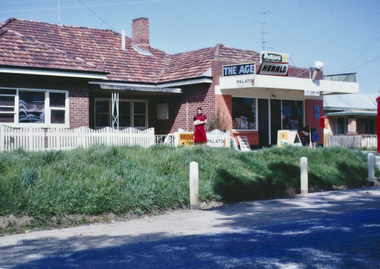
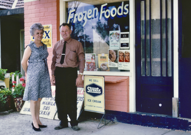
General store Geelong Road Mt Clear 1963-1969
... in the 1950s and demolished in 1969 by the Country Roads Board to widen... in the 1950s and demolished in 1969 by the Country Roads Board to widen ...Ballarat HistoryThis photograph features this mixed business described by donor Ray Giles as: One of the two shops between Ballarat and Buninyong that carried a variety of services, owned by Mick and Blanche Giles between 1963 and 1969. The shop was built in the 1950s and demolished in 1969 by the Country Roads Board to widen the Geelong Rd. The shop served the community with an array of services and goods- -State Savings Bank -Milk bar -News agent with two paper boys -Post Office -Groceries -Cigarettes -Briquettes -Kerosine -Chook food -Fire crackers -Public Phone boxshop,, ballarat, giles, mt clear, groceries, 1960s -
 Ballaarat Mechanics' Institute (BMI Ballarat)
Print, General store Geelong Road Mt Clear 1963-1969
... in the 1950s and demolished in 1969 by the Country Roads Board to widen... was built in the 1950s and demolished in 1969 by the Country Roads ...Ballarat HistoryThis photograph features this mixed business described by donor Ray Giles as: One of the two shops between Ballarat and Buninyong that carried a variety of services, owned by Mick and Blanche Giles between 1963 and 1969. The shop was built in the 1950s and demolished in 1969 by the Country Roads Board to widen the Geelong Rd. The shop served the community with an array of services and goods- -State Savings Bank -Milk bar -News agent with two paper boys -Post Office -Groceries -Cigarettes -Briquettes -Kerosine -Chook food -Fire crackers -Public Phone boxshop,, ballarat, giles, mt clear, groceries, 1960s, ballaarat -
 Eltham District Historical Society Inc
Negative - Photograph, George W. Bell, Wingrove Cottage, Main Road, Eltham, Vic, c.1955
... to the Eltham District Road Board and Shire Council from 1858 to 1904... to the Eltham District Road Board and Shire Council from 1858 to 1904 ...View looking across Main Road to Wingrove Cottage (c.1950s), former home Charles Symons Wingrove. Charles Wingrove was a prominent figure in Victorian local government, as secretary to the Eltham District Road Board and Shire Council from 1858 to 1904, and, as Shire Engineer and Secretary to the Heidelberg Road Board. He was part of the Committee to establish the Church of England at Eltham. The Wingroves were an important pioneer family of Eltham and Wingrove Cottage is one of the most important heritage buildings in Eltham as one of the few surviving 19th century buildings. Reputedly built in 1858, Wingrove Cottage was recorded in the 1859-60 Eltham Road District rates book as a brick house owned and occupied by Wingrove with a Net Annual Value (NAV) of ₤30. In 1861, the year the Church opened, Wingrove's house was identified as a two -roomed brick cottage. Charles Wingrove is buried with other members of his family in the cemetery at St Katherine’s Church, St. Helena. This image is believed to have been incorporated in a presentation by Russell Yeoman to the 10 November 2004 Society meeting on "Significant Trees, Wildflowers and Local Gardens."This photo forms part of a collection of photographs gathered by the Shire of Eltham for their centenary project book,"Pioneers and Painters: 100 years of the Shire of Eltham" by Alan Marshall (1971). The collection of over 500 images is held in partnership between Eltham District Historical Society and Yarra Plenty Regional Library (Eltham Library) and is now formally known as the 'The Shire of Eltham Pioneers Photograph Collection.' It is significant in being the first community sourced collection representing the places and people of the Shire's first one hundred years.Digital image 4 x 5 inch B&W Negshire of eltham pioneers photograph collection, eltham, main road, wingrove cottage, george w. bell collection, significant tree -
 Orbost & District Historical Society
black and white photographs, Howard D. Bulmer, first half 20th century
... This bridge was built in the 1920s as a road and rail... gippsland This bridge was built in the 1920s as a road and rail ...This bridge was built in the 1920s as a road and rail bridge, and was partly washed away by flood waters in 1934. After the end of the first World War the Victorian Railways considered an extension of the railhead across the river at Orbost, and in 1922 a new timber and steel girder structure, a joint Country Roads Board — Victorian Railways venture, was built and completed at a cost of £41,000 (the steel girders came from the Flinders Street viaduct reconstruction). Subsequently it was decided not to take the railway across the river, and the bridge has only been used by road traffic. This is a pictorial record of an early bridge across the Snowy River at Orbost.A large black / white photograph of the Orbost Snowy River bridge. There is a large copy as well as a postcard copy in sepia.on front - Snowy River Bridge Orbost H.D. Bulmer - photo - Lake Tyers.snowy-river-bridge-orbost -
 Kiewa Valley Historical Society
Black and white photograph of Surveyor's Camp, 1938, Kiewa River and surveyor's Camp 25/8/38, 25/08/1938
... by the Country Roads Board, on behalf of the State Electricity Commission..., 1938. The actual work was undertaken by the Country Roads Board ...Surveying under the prevailing conditions at this time was an arduous and demanding task. There were no roads beyond Tawonga and access was by bridle tracks, on foot or horseback. This camp was to provide accommodation to those men who were surveying the road from South Tawonga to the Bogong High Plains which was commenced in April, 1938. The actual work was undertaken by the Country Roads Board, on behalf of the State Electricity Commission, using three Caterpillar diesel crawler tractors equipped with Kay Bruneriei (Brunner) lhydraulically operated trailbuilders (angle dozers)This photograph shows the primitive living conditions that were endured by those carrying out the initial field investigations and surveys for the Kiewa Hydro Electric Scheme. It is possibly one of the few photographs in existence of this camp and of the very rustic timber foot bridge across the West Kiewa river. It has been taken from approx. 100m up Simmonds Creek Road. A black and white photograph showing a small, timber foot bridge across the West Kiewa River. There is a man standing on the bridge and two small huts on the far side of the river, against a backdrop of Mt. Beauty and Mt. Bogong.At the top of the photograph, handwritten in black ink is the inscription "Kiewa River and Surveyor's Camp 25/8/38". The number 4 is stamped towards the right upper corner. On the back, in a circle, about 1.3cm in diameter, are the words "Kodak Print". The word "Velox" is faintly discernible on the back as well.surveyor, tawonga, west kiewa river, bridge, camp, secv -
 Kew Historical Society Inc
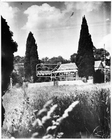
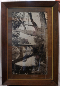
Photograph - 'Fernhurst', 13 Fernhurst Grove, 1978
... separation from the Boroondara District Road Board, he was elected... separation from the Boroondara District Road Board, he was elected ...George Wharton arrived in Melbourne in 1844. An architect and surveyor, he was appointed to lay out the 'Village of Kew' by N.A. Fenwick following the land sales of 1851. A protagonist for Kew's separation from the Boroondara District Road Board, he was elected chairman when Kew achieved municipal status in December 1860. His home, 'Fernhurst', was built in 1866 on eight acres in Studley Park, with a four-storey tower and pyramidal roof. The Italianate home was a prominent Kew landmark. It was demolished in 1979 and replaced by St Paul's College in 1980.Rare colour photograph of what was once a significant mansion in Kew.Original colour positive photograph (Kodak print) of 'Fernhurst' in 1978. Photographed by Stewart West in May 1978, one year before it was demolished, the photograph gives little idea of the large landholding once surrounding the house. Originally accessed from near the corner of Princess Street and Studley Park Road, its gardens had been subdivided in the 1900s and its footprint restricted to 13 Fernhurst Grove. Like many other grand houses, by the 1970s it had been converted into apartments. From the photograph, one can see that the house had retained many of its original features such as the distinctive tower and the wide bow-fronted verandah. The slates on the roof (apart from those on the tower) had been replaced by tiles and the cement render of the exterior painted white. Annotated reverse: "View of Fernhurst Home Taken from Street / 10"fernhurst, 13 fernhurst grove -- kew (vic.), george wharton, italianate architecture, vila maria society, st paul's school for the blind -
 Kew Historical Society Inc
Photograph - 'Fernhurst', 13 Fernhurst Grove, 1978
... separation from the Boroondara District Road Board, he was elected... separation from the Boroondara District Road Board, he was elected ...George Wharton arrived in Melbourne in 1844. An architect and surveyor, he was appointed to lay out the 'Village of Kew' by N.A. Fenwick following the land sales of 1851. A protagonist for Kew's separation from the Boroondara District Road Board, he was elected chairman when Kew achieved municipal status in December 1860. His home, 'Fernhurst', was built in 1866 on eight acres in Studley Park, with a four-storey tower and pyramidal roof. The Italianate home was a prominent Kew landmark. It was demolished in 1979 and replaced by St Paul's College in 1980.Rare colour photograph of what was once a significant mansion in Kew.Original colour positive photograph (Kodak print) of 'Fernhurst' in 1978. Photographed by Stewart West in May 1978, one year before it was demolished, the photograph gives little idea of the large landholding once surrounding the house. Originally accessed from near the corner of Princess Street and Studley Park Road, its gardens had been subdivided in the 1900s and its footprint restricted to 13 Fernhurst Grove. Like many other grand houses, by the 1970s it had been converted into apartments. From the photograph, one can see that the house had retained many of its original features such as the distinctive tower and the wide bow-fronted verandah. The slates on the roof (apart from those on the tower) had been replaced by tiles and the cement render of the exterior painted white. Annotated reverse: "Fernhurst from higher ground level side shot / 7"fernhurst, 13 fernhurst grove -- kew (vic.), george wharton, italianate architecture, vila maria society, st paul's school for the blind -
 Kew Historical Society Inc
Photograph - 'Fernhurst', 13 Fernhurst Grove, 1978
... separation from the Boroondara District Road Board, he was elected... separation from the Boroondara District Road Board, he was elected ...George Wharton arrived in Melbourne in 1844. An architect and surveyor, he was appointed to lay out the 'Village of Kew' by N.A. Fenwick following the land sales of 1851. A protagonist for Kew's separation from the Boroondara District Road Board, he was elected chairman when Kew achieved municipal status in December 1860. His home, 'Fernhurst', was built in 1866 on eight acres in Studley Park, with a four-storey tower and pyramidal roof. The Italianate home was a prominent Kew landmark. It was demolished in 1979 and replaced by St Paul's College in 1980.Rare colour photograph of what was once a significant mansion in Kew.Original colour positive photograph (Kodak print) of 'Fernhurst' in 1978. Photographed by Stewart West in May 1978, one year before it was demolished, the photograph gives little idea of the large landholding once surrounding the house. Originally accessed from near the corner of Princess Street and Studley Park Road, its gardens had been subdivided in the 1900s and its footprint restricted to 13 Fernhurst Grove. Like many other grand houses, by the 1970s it had been converted into apartments. From the photograph, one can see that the house had retained many of its original features such as the distinctive tower and the wide bow-fronted verandah. The slates on the roof (apart from those on the tower) had been replaced by tiles and the cement render of the exterior painted white. Annotated reverse: "Back view of Fernhurst / 8"fernhurst, 13 fernhurst grove -- kew (vic.), george wharton, italianate architecture, vila maria society, st paul's school for the blind -
 Kew Historical Society Inc
Photograph - 'Fernhurst', 13 Fernhurst Grove, 1978
... separation from the Boroondara District Road Board, he was elected... separation from the Boroondara District Road Board, he was elected ...George Wharton arrived in Melbourne in 1844. An architect and surveyor, he was appointed to lay out the 'Village of Kew' by N.A. Fenwick following the land sales of 1851. A protagonist for Kew's separation from the Boroondara District Road Board, he was elected chairman when Kew achieved municipal status in December 1860. His home, 'Fernhurst', was built in 1866 on eight acres in Studley Park, with a four-storey tower and pyramidal roof. The Italianate home was a prominent Kew landmark. It was demolished in 1979 and replaced by St Paul's College in 1980.Rare colour photograph of what was once a significant mansion in Kew.Original colour positive photograph (Kodak print) of 'Fernhurst' in 1978. Photographed by Stewart West in May 1978, one year before it was demolished, the photograph gives little idea of the large landholding once surrounding the house. Originally accessed from near the corner of Princess Street and Studley Park Road, its gardens had been subdivided in the 1900s and its footprint restricted to 13 Fernhurst Grove. Like many other grand houses, by the 1970s it had been converted into apartments. From the photograph, one can see that the house had retained many of its original features such as the distinctive tower and the wide bow-fronted verandah. The slates on the roof (apart from those on the tower) had been replaced by tiles and the cement render of the exterior painted white. Annotated reverse: "Fernhurst front view taken from across Fernhurst Grove / 6"fernhurst, 13 fernhurst grove -- kew (vic.), george wharton, italianate architecture, vila maria society, st paul's school for the blind -
 Kew Historical Society Inc
Photograph - 'Fernhurst', 13 Fernhurst Grove, 1978
... separation from the Boroondara District Road Board, he was elected... separation from the Boroondara District Road Board, he was elected ...George Wharton arrived in Melbourne in 1844. An architect and surveyor, he was appointed to lay out the 'Village of Kew' by N.A. Fenwick following the land sales of 1851. A protagonist for Kew's separation from the Boroondara District Road Board, he was elected chairman when Kew achieved municipal status in December 1860. His home, 'Fernhurst', was built in 1866 on eight acres in Studley Park, with a four-storey tower and pyramidal roof. The Italianate home was a prominent Kew landmark. It was demolished in 1979 and replaced by St Paul's College in 1980.Rare colour photograph of what was once a significant mansion in Kew.Original colour positive photograph (Kodak print) of 'Fernhurst' in 1978. Photographed by Stewart West in May 1978, one year before it was demolished, the photograph gives little idea of the large landholding once surrounding the house. Originally accessed from near the corner of Princess Street and Studley Park Road, its gardens had been subdivided in the 1900s and its footprint restricted to 13 Fernhurst Grove. Like many other grand houses, by the 1970s it had been converted into apartments. From the photograph, one can see that the house had retained many of its original features such as the distinctive tower and the wide bow-fronted verandah. The slates on the roof (apart from those on the tower) had been replaced by tiles and the cement render of the exterior painted white. Annotated reverse: "Front view of Fernhurst showing tower to advantage / 9"fernhurst, 13 fernhurst grove -- kew (vic.), george wharton, italianate architecture, vila maria society, st paul's school for the blind -
 Kew Historical Society Inc
Photograph - 'Fernhurst', 13 Fernhurst Grove, 1978
... separation from the Boroondara District Road Board, he was elected... separation from the Boroondara District Road Board, he was elected ...George Wharton arrived in Melbourne in 1844. An architect and surveyor, he was appointed to lay out the 'Village of Kew' by N.A. Fenwick following the land sales of 1851. A protagonist for Kew's separation from the Boroondara District Road Board, he was elected chairman when Kew achieved municipal status in December 1860. His home, 'Fernhurst', was built in 1866 on eight acres in Studley Park, with a four-storey tower and pyramidal roof. The Italianate home was a prominent Kew landmark. It was demolished in 1979 and replaced by St Paul's College in 1980.Rare colour photograph of what was once a significant mansion in Kew.Original colour positive photograph (Kodak print) of 'Fernhurst' in 1978. Photographed by Stewart West in May 1978, one year before it was demolished, the photograph gives little idea of the large landholding once surrounding the house. Originally accessed from near the corner of Princess Street and Studley Park Road, its gardens had been subdivided in the 1900s and its footprint restricted to 13 Fernhurst Grove. Like many other grand houses, by the 1970s it had been converted into apartments. From the photograph, one can see that the house had retained many of its original features such as the distinctive tower and the wide bow-fronted verandah. The slates on the roof (apart from those on the tower) had been replaced by tiles and the cement render of the exterior painted white. Annotated reverse: "Fernhurst corner shot through trees / 12-22"fernhurst, 13 fernhurst grove -- kew (vic.), george wharton, italianate architecture, vila maria society, st paul's school for the blind -
 Falls Creek Historical Society
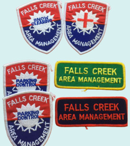
Badge - Falls Creek Area Management Cloth Badges
... , the Country Roads Board, the Ski Tow company and a Representative..., the Country Roads Board, the Ski Tow company and a Representative ...Falls Creek was operated by the Falls Creek Area Management Committee. Its composition changed over time but generally the Committee was composed of representatives of the State Electricity Commission, Representatives from Ski Clubs and commercial enterprises, the Country Roads Board, the Ski Tow company and a Representative of the Upper Murray Regional Committee of the Central Planning Authority. This Committee was responsibility for long term planning for the Falls Creek Tourist Area as well as the day to day running of the Village, These patches were part of the uniform of people employed by the Management Committee.These cloth badges are significant because they indicated employees of the Area Management Committee and the role they played in Falls Creek.A group of cloth badges indicating the role of personnel employed by the Falls Creek Area Management. Shield shaped badges - 2 Falls Creek Area Management - PARKING CONTROL 1 Falls Creek Area Management - with red cross of SKI PATROL Rectangular - Green and yellow - FALLS CREEK AREA MANAGEMENT Red and blue - FALLS CREEK AREA MANAGEMENTfalls creek village, falls creek area management committee -
 Eltham District Historical Society Inc
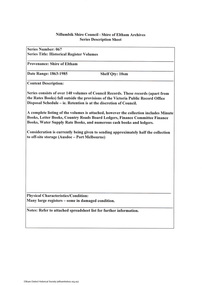
Document - Series Listing, Fraser Faithfull et al, Series 67: Historical Register Volumes, 2000
... , Country Roads Board Ledgers, Finance Committee Finance Books..., Country Roads Board Ledgers, Finance Committee Finance Books ...Series consists of over 140 volumes of Council Records. These records (apart from the Rates Books) fall outside the provisions of the Victoria Public Record Office Disposal Schedule - ie. Retention is at the discretion of Council. A complete listing of the volumes is attached, however the collection includes Minute Books, Letter Books, Country Roads Board Ledgers, Finance Committee Finance Books, Water Supply Rate Books, and numerous cash books and ledgers. Consideration is currently being given to sending approximately half the collection to off-site storage (Ausdoc - Port Melbourne)shire of eltham archives, series listing -
 Orbost & District Historical Society
black and white photograph, first half 20th century
... and steel girder structure, a joint Country Roads Board — Victorian... and steel girder structure, a joint Country Roads Board — Victorian ...This is a bridge across the Snowy River at Orbost. This bridge was built in the 1920s as a road and rail bridge, and was partly washed away by flood waters in 1934. After the end of the first World War the Victorian Railways considered an extension of the railhead across the river at Orbost, and in 1922 a new timber and steel girder structure, a joint Country Roads Board — Victorian Railways venture, was built and completed at a cost of £41,000 (the steel girders came from the Flinders Street viaduct reconstruction). Subsequently it was decided not to take the railway across the river, and the bridge has only been used by road traffic.This is a pictorial record of an early bridge across the Snowy River at Orbost.A very large black / white photograph under glass in a timber frame. It is of a bridge across a river and is framed by trees.bridge snowy-river-bridge road-transport-orbost -
 Federation University Historical Collection
Booklet, John Fraser & Son, Shire of Buninyong, 1858-1958, 1958
... district road board... meeting of the Buninyong District Road Board held on 30th August... of the Buninyong District Road Board held on 30th August 1858. A special ...Booklet of loose pages held together with yellow ribbon. Photographs of Buninyong.non-fictioncentenary, fisken, shire council, district road board, buninyong, 1958, dallas brookes, governor of victoria, archibald fisken -
 Bacchus Marsh & District Historical Society
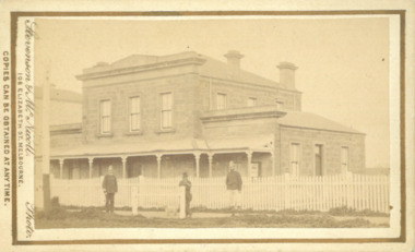
Photograph, Court House Main Street Bacchus Marsh 1883
... -1865, and as meeting rooms for the Bacchus Marsh Roads Board...-1865, and as meeting rooms for the Bacchus Marsh Roads Board ...The Court House in Main Street Bacchus Marsh was built in 1858 using local sandstone. It opened in 1859. It has been used for jury trials, a Court of Petty Sessions, a County Court and a Crown Land sales office. Other uses included an office for the Registrar of Births and Deaths, a Dairy Inspectors office from 1863-1865, and as meeting rooms for the Bacchus Marsh Roads Board, a forerunner of the Shire Council. It was also used by the Bacchus Marsh Shire Council for its offices until at least 1884. In more recent years it has functioned as a Magistrates Court with weekly court sessions. Small sepia unframed photograph on card with gold border framing photograph. Housed in the album, 'Photographs of Bacchus Marsh and District in 1883 by Stevenson and McNicoll'. The view of the Court House building is seen from the northern side of Main Street looking south or south-east. Three men are standing in the street in front of the building. The men on the left and the right wearing police helmets appear to be police officers. The man in the middle is in civilian clothes and might be an officer or employee of the Court House. He has his dog with him. A white picket fence runs along the front of the building. The front courtyard of the building has been renovated since, but this building still operates as a court house.On the front: Stevenson & McNicoll. Photo. 108 Elizabeth St. Melbourne. COPIES CAN BE OBTAINED AT ANY TIME. On the back: LIGHT & TRUTH inscribed on a banner surmounted by a representation of the rising sun. Copies of this Portrait can be had at any time by sending the Name and Post Office Money Order or Stamps for the amount of order to STEVENSON & McNICOLL LATE BENSON & STEVENSON, Photographers. 108 Elizabeth Street, MELBOURNE. stevenson and mcnicoll 1883 photographs of bacchus marsh and district, courthouses, bacchus marsh court house -
 Orbost & District Historical Society
black and white photograph, Howard D. Bulmer, first half 20th century
... Roads Board — Victorian Railways venture, was built... Roads Board — Victorian Railways venture, was built ...A new bridge over the Snowy River at Orbost was opened for traffic on June 20th 1922. It was intended as a road and rail bridge, and was again partly washed away by flood waters in 1934. After the end of the first World War the Victorian Railways considered an extension of the railhead across the river at Orbost, and in 1922 a new timber and steel girder structure, a joint Country Roads Board — Victorian Railways venture, was built and completed at a cost of £41,000 (the steel girders came from the Flinders Street viaduct reconstruction). Subsequently it was decided decided not to take the railway across the river, and the bridge was only used by road traffic. This is a pictorial record of an early bridge over the Snowy River at Orbost.A black / white postcard photograph of a bridge across a shallow river with men on horseback underneath.snowy-river-bridge