Showing 4374 items matching "west street"
-
 Beechworth Honey Archive
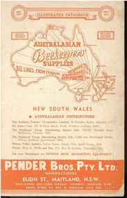
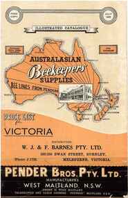
Publication, Australasian Beekeepers' Supplies. (Pender Bros. Pty. Ltd.) West Maitland, 1972, 1972
35 pages, illustratedDistributed by WJ and F Barnes Pty, Ltd. 536-556 Swan Street, Burnley, Melbourne. publication, pender, bee-keepers, supplies, australasian, victoria, beechworth honey, publication, pender, bee-keepers, supplies, australasian, victoria, beechworth honey -
 Beechworth Honey Archive
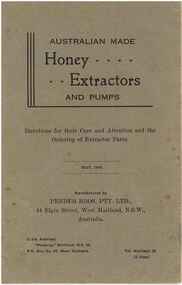
Publications, Australian made Honey......Extractors and pumps: directions for their care and attention and the ordering of extractor parts. (Pender Bros. Pty Ltd). West Maitland, 1946, 1946
26 pages, illustrated.publication, pender, extractors, pumps, bee-keepers, supplies, australasian, victoria, beechworth honey -
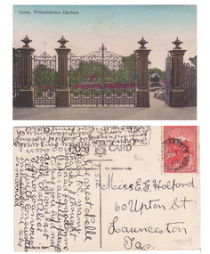 Williamstown Botanic Gardens- Hobsons Bay City Council
Postcard - Williamstown Botanic Gardens, c1900-1910
The original postcards in this series (2013.002 to 2013.018) were generously loaned to Williamstown Botanic Gardens by a private collector for copying. The cast iron gates (manufactured in Glasgow) introduced at the North West entrance in 1907. The gates were purchased from ‘Fairlie” corner of Acland and Anderson Streets, South Yarra at the cost of 72 pounds and cost 60 pounds to install. They had originally cost the owners of ‘Fairlie’ 1200 pounds. The postcards are evidence of the interest the gardens held as a subject for postcard publishers. The text and images provide a snapshot into fashions, social interests and concerns of the time. The professionally produced images provide a pictorial history of Gardens including changing planting styles, various structures and features of the Gardens eg the aviary, cannons, the fountain, the second Curator’s Lodge and gates. The images offer an opportunity to compare garden vistas with the present day. The image in this postcard shows the gates intact and as installed in 1907. The current layout of this area still reflects the change of design, which followed the 1907 removal of the first gardener's residence and the subsequent re-organisation of this quarter of the gardens. This postcard is evidence of the placement of one of the cannons relocated from Fort Gellibrand in 1906. They were removed from the Gardens in the 1960s. These same cannons remain a feature on the Williamstown waterfront in 2013. Postcard in colour of main entrance gates, one of the cannons can be seen through the pedestrian gate on the right. The gates are cast iron, double carriage gates with single pedestrian gates on either side and supported by four cast iron posts with ornamental finials. Front: ‘Gates, Williamstown Gardens’. Reverse: Vertical on left side of card ‘O Rippon Se..es’ [name of the publisher is unclear]. Top centre of card: ‘POST [logo of card publisher] CARD’. Left side of card: ‘This space may be used for communication.’ Right side of card: ‘for Address only.’ Left bottom corner: ‘Printed in ……..’ [name unclear]. Top right hand corner: a red one penny Tasmanian stamp with a depiction of Mount Wellington. Bottom right corner in pencil ‘1908’ believed to be inserted by the vendor. The card is dated 15.5.10 by the sender. It is addressed to Miss E G Holford of Launceston, Tasmania and sent by Addie.postcard, gardens, post-card, williamstown-botanic-gardens, hobsons-bay-city-council, entrance gates, entrance-gates, cast iron, finials, cannon, 1910, 1908, tasmania, tasmanian-stamp -
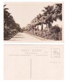 Williamstown Botanic Gardens- Hobsons Bay City Council
Postcard - Williamstown Botanic Gardens
The original postcards in this series (2013.002 to 2013.018) were generously loaned to Williamstown Botanic Gardens by a private collector for copying. The postcards are evidence of the interest the gardens held as a subject for postcard publishers. The text and images provide a snapshot into fashions, social interests and concerns of the time. The professionally produced images provide a pictorial history of Gardens including changing planting styles, various structures and features of the Gardens eg the aviary, cannons, the fountain, the second Curator’s Lodge and gates. The images offer an opportunity to compare garden vistas with the present day. This postcard, looking east on the main east-west axial path with a typical Victorian/Edwardian mown grass strip which in turn borders formal shrub beds with herbaceous plantings. The photo was taken after the Mexican Fan Palms (Washingtonia robusta) planted in 1915, which in turn were replaced with the same species in 1987. Sepia image of main path of Gardens, looking east towards the Osborne Street gates and three people. The path is lined with grass, shrubs and palms. Reverse: ‘POST CARD / CARTE POSTALE / Communication – Correspondence Address – Adresse’. Top right corner: a rectangle with a logo in the centre and ‘STAMP / HERE’. In pencil ‘AUSTRALIA / 50p / 1920s’postcard, gardens, post-card, williamstown-botanic-gardens, hobsons-bay-city-council, garden-path, palms, osborne street, 1920 -
 Williamstown Botanic Gardens- Hobsons Bay City Council
Photos - Cannons, 1970
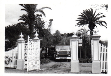
The Armstrong Cannons were originally placed at Fort Gellibrand, located at the southernmost tip of the Williamstown peninsula. The Fort was developed during the 1850s as part of a defensive system for the city and port of Melbourne. The importance of the Fort batteries declined from the 1890s, when they were effectively replaced by new facilities at Queenscliff and Point Nepean, but they were still used for gunnery practice. Local residents, through the Williamstown Town Council, complained to the Acting Minister for Defence that the concussion from the guns damaged windows, walls and foundations of buildings. The Armstrong Cannons were moved from Fort Gellibrand to the Gardens in 1906. A primary source of evidence of the cannons being in the Gardens. The cannons are remembered fondly as play equipment for the local children. Many tales have been told of climbing over them and pretending to be shot out of them A collection of seven black and white photographs documenting the removal of the cannons from the Gardens Photo 1 (a) Black and white landscape image. View is looking through the main gates looking at the front of the truck, which has the name Walter Wright across the front bumper, the crane and canon. The gates and fence are painted a light colour, probably white. Photo 2 (b) Black and white landscape image. Back of loader with cannon on it. Man standing on top of the cannon bending over either tying or untying ropes. Trunk of a palm tree is on the left side of the photo with a top of a palm tree in the background. Photo 3 (c) Black and portrait white image. A cannon being loaded by the crane on to trailer. Palm tree is in the background and fronds from a palm tree can be seen in the right top corner. Photo 4 (d) Black and white landscape image. Side on view of a cannon on the truck parked outside the grounds of the Gardens. The logo of the name of the trucking company is on the door of the truck above the words ‘WALTER H WRIGHT / TRANSPORT PTY LTD / S SCHULZ ST WEST MELB’. A second cannon can be seen in the background. A bus is in the background on the middle right side of the image. Photo 5 (e) Black and white landscape image. Truck with cannon on the back leaving the ground of the Gardens. Tree on the right side of the image and power pole is behind the truck. The logo of the name of the trucking company is on the door of the truck above the words ‘WALTER H WRIGHT / TRANSPORT PTY LTD / S SCHULZ ST WEST MELB’. ‘WALTER WRIGHT’ is on the front bumper Photo 6 (f) Black and white landscape image. Cannon tied down on the back of the truck as it is being driven across the street. Three houses in the background and two cars, one is a Volkswagen Photo 7 (g) Black and white landscape image. Cannon on the back of the truck which is parked over the street from the Gardens. Three houses are in the background. Two trees bare of leaves. The front of a car in in the foreground – it has a sun visor and the steering wheel is a light colour.armstrong cannons, williamstown botanic gardens, hobsons bay city council, 1970, walter h wright / transport pty ltd -
 Beechworth Honey Archive
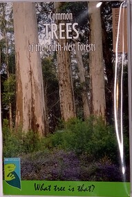
Publication, Common TREES of the South-West Forests (Judy Wheeler- Dept of Parks and Wildlife)First printed 1996, reprinted 2000,2003,2007,2016, 2016
Soft Cover Slightly larger than A7 size, Picture on cover is Karri Forest with a flowering understorey 72 pages -
 Beechworth Honey Archive
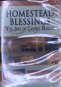
DVD, Homestead Blessings - The Art of Candle Making (Featuring the West Ladies - Hannah, Vicki, Ce-Ce & Jasmine), 2008
DVD - cover has the title, a small photo of the sisters & some burning candles. On the back is a blurb about the DVD - Duration - 56 minutes -
 Beechworth Honey Archive
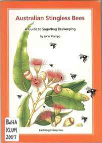
Publication, Australian stingless bees: a guide to sugarbag beekeeping. (Klumpp, J.). West End, 2007, 2007
-
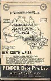 Beechworth Honey Archive
Publication, Australasian Beekeepers' Supplies. (Pender Bros. Pty. Ltd.) West Maitland, 1941, 1941
32 pages, illustrated.publication, pender bros, beekeeping supplies, publication, pender bros, beekeeping supplies -
 Beechworth Honey Archive
Publication, Australasian Beekeepers' Supplies. (Pender Bros. Pty. Ltd.) West Maitland, 1939. 47th edition, 1939
32 pages, illustratedDistributed by WJ & F Barnes, 550-556 Swan Street, Burnley, Victoria.publication, pender bros, beekeeping supplies. -
 Surrey Hills Historical Society Collection
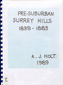
Book, Alan Judge Holt (deceased), Pre-Suburban Surrey Hills 1839-1883, 1989
Author: Alan Judge Holt amassed a significant collection of historical material related to the Surrey Hills area. Born in Moonee Ponds in 1912 to Edmund Holt and Ellen Ruby Sutton, he married Edna Jean Pallot in 1937. They lived at 62 Broughton Road, Surrey hills, had 3 sons and were strongly associated with the Surrey Hills Methodist Church. Alan was Secretary of the Victorian Lands Department and in his spare time recorded the occupancy of every property in Surrey Hills and Mont Albert at the beginning of each decade from 1890 to 1980. His collection of files and individual cards covers people, places, churches, clubs, businesses and other organisations in the area. Alan used this information to give talks and tours of the area and gifted his material to the local history collection through Jocelyn Hall.Unpublished manuscript / notes written by Alan Holt about settlers in and around Surrey Hills bound in-house. It is supported by maps showing landowners over various years from about 1840-1885(mr) henry jamieson, (mr) ken hall, (ms) edna holt, (mr) frank bamford, (mr) harrison buchanan, scouts, grange hill, wattle park, round hill, bona vista, mount albert, barton street, (mr) john raeburn, (mr) edmund holt, (mr) james dunn, butter merchant, mont albert road, elgar road, view hill, new street, surry mont, delany's hill, reservoir hill, riversdale road, middlesex road, surrey hills, (mr) aldo massora, aborigines, damper creek, back creek, west creek, kooyongkoot creek, (mr) john gardiner, (mr) chas mullins, (mr) henry elgar, (mr) robert campbell, (mr) alexander dyce, (mr) robert brooks, t budds payne, (mr) hugh glass, (mr) patrick trainer, w virtue, (mr) t fulton, (mr) john crimp, (mr) w dempsey, (mr) w e stanbridge, (mr) james atkinson, j porter, j collings, w edde, (mr) orlando fenwick, (dr)(mr) l l smith, (mr) j h knipe, (mr) george cockcroft, (sr) (mr) john martin kleinert, w morton, d delaney, a moeller, (mr) william smith, (mr) e.p.s.sturt, (mr) thomas blood, (mr) patrick mornane, (mr) henry de carle, w craig, j hill, w oliver, j keogh, a laing, vineyards, toll gates, (mr) david staig, (mr) phillip kleeper, (mr) goyder usher, (mr) james lawler, (mr) w.e. stanbridge, (mr) gideon rutherford, c a f mater, j gadsby, w h wrixon, e h lamont, i ainger, (mr) james henty, (mr) henry henty, w freemantle, w palmer, beckett park, maranoa gardens -
 Surrey Hills Historical Society Collection
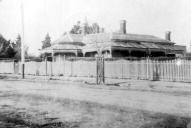
Photograph, 215 Union Road, c 1920
The house was variously known as ‘Mintaro’, ‘Montiere’ and ‘Goonoo Goonoo’, the later after 1920 when it was purchased by Natale Cerini and his wife Ethel May (nee Swan), who were married in 1918. Built 1887-1888 by William Wigley. The original colour was deep cream with dark green trim. Property included a block of land on south side and also land to the north. The original coach house was on what became 213 Union Road and was used to build a yacht in by the then neighbours, the Flemings. The street plane trees were replaced in the 1970s with melaleucas and in 1987 new plane trees were planted between the melaleucas. Sepia copy of an older photo of 215 Union Road from diagonally across the road. Shows street surface, bluestone kerbing, a young tree within a guard and a Victorian style home with 3 chimneys, a slate roof and a veranda on at least the south and west side. Beyond the house are mature cypress and other trees and a spire. The spire belonged to Surrey College, a boys' boarding school (later Nethercourt Hospital and St Judes.)'mintaro', 'montiere', 'goonoo goonoo', william wigley, mrs ethel may cerini, miss ethel may swan, miss jocelyn cerini, mrs jocelyn hall, miss lynette cerini, victorian style, 215 union road -
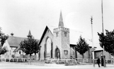
 Surrey Hills Historical Society Collection
Photograph, Surrey Hills Methodist Church in 1918, 1918
The original Methodist (Wesleyan) Church was built on the corner of Alexandra Crescent and Windsor Lane in 1888. It was enlarged in 1892. In 1908 this building was removed to Valonia Avenue by horse-drawn dray. The brick church was built in 1915 after which the earlier building became the Sunday School. In 1977 the Methodist Church joined with others to become the Uniting Church. In more recent times, the brick church has been painted but architectural details visible in this photo can still be discerned.Black and white photo of a brick and rendered building taken from diagonally opposite across Canterbury Road looking to the north-west. The church sits behind a woven-wire fence with an opening at the front and at the side to a portico off Valonia Street. On the RHS is the church hall and on the LHS a small part of the adjacent house can be seen.surrey hills methodist (wesleyan) church, surrey hills uniting church -
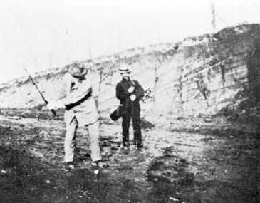 Surrey Hills Historical Society Collection
Photograph, Surrey Hills Golf Club - the cutting in (now) Whitehorse Road, 1905, 1905
Reproduced by permission of Mr John Arnold from his book: "The Riversdale Golf Club - a history, 1892-1977." Copyright to book: Riversdale Golf Club. Surrey Hills Golf Club operated from 1892-1908 then moved and became Riversdale Golf Club. The game was played across paddocks from Trafalgar Street, Mont Albert to Whitehorse Road and down Victoria Crescent to where Box Hill TAFE is now located in Elgar Road. There were problems with cows eating the tee flags! The clubhouse still exists as 30 Trafalgar Street. The men are standing on what is now Whitehorse Road in the cutting which can still be seen near the Box Hill Motel. Walter John Carre Riddell: Born c1859; died 12 March 1930; unmarried. Father came from Riddell in Scotland and took up land at Riddell's Creek, near Gisborne. W J Carre Riddell was educated at Melbourne Grammar, graduated in law from Melbourne University in 1882 and practised law until 1907. MLA for West Bourke for 17 years. Chairman of MMBW from 1907 until retirement in 1927. Versatile sportsman. REF: Obituary in Trove - The Argus, 13 March, 1930, p8.The image is significant for its association with Walter John Carre Riddell who was a significant identity in early 20th century Melbourne. His was well-known for his sporting prowess. In early life he was a keen footballer, cricketer and tennis player. In his later years he took up golf. Was President of Royal Melbourne Golf Club and Chairman of the Victorian Golf Association. The 'coffin hole' was a notoriously difficult position to play out from.Black and white photo of 2 men, one swinging his golf club; the other carrying a golf bag and watching. They are dressed in suits and hats and are standing in a cutting, the face of which shows rock strata."W. J. Carre Riddell playing out of the coffin, 1905."sports grounds, surrey hills golf club, riversdale golf club, jon arnold, w j carre-riddell, walter john carre riddell -
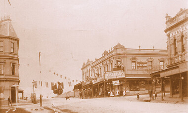 Surrey Hills Historical Society Collection
Photograph, Kenneth (Ken) Tudor Hall, Alfred Davies grocery store, corner Canterbury and Union Roads, 1906 or 1909, Original: 1906 or 1909; Copy photo by Ken Hall c1982
Ref: Mr & Mrs J Davies, Greensborough - Alfred Davies took over this store in 1904. He lived with his wife, Lucretia and 5 children above the store. His son Cyril recalled sleeping on the corner balcony on hot nights. Alfred Davies was a strong Temperance man and gave up the store when clients pressured him to collect their beer from the hotel opposite and deliver it with their grocery orders. The pharmacy moved across the road to this corner in 1936 when acquired by Dartnells. The corner shop in Woodheads building was a store and other businesses over the years. The "Druggist" on right, in Hansen's Exchange building, was established in 1889. From 1910 Percy Cathcart conducted the pharmacy there until 1936 when he was joined by Vic Dartnell, his cousin. In 1940, Vic transferred the business to Woodheads corner. His son John followed as a pharmacist until his daughter Amanda became the pharmacist. After the Dartnell family sold the business, the pharmacy continued in a similar manner as a compounding pharmacy and retained 'Dartnell' in its name.This documents the importance given to celebration of the British Empire in the Surrey Hills area in the first half of the 20th century. It also documents the earliest centre of business activity in the area with 2 major sets of dual occupancy residential and retail terraces - the Woodhead buildings and Hansen's Exchange, the later set of terraces having been demolished c1971.Sepia photo of the corner of Canterbury and Union Roads in 1906 or 1909 festooned with flags and lanterns for Empire Day celebrations. On the SE corner is Alfred Davies grocery store with advertising signs for Rosella jams and Southern Seas soap. There are people standing on a balcony above the Rosella advertising sign. Other adults and children stand in the street and there is a cab outside the draper's further east in Canterbury Road. On the opposite corner to Alfred Davies is a druggist and on the north-west corner is McNeil's Family Hotel.mcneil's family hotel, empire day, festivals and celebrations, grocers, pharmacists, alfred davies, businesses, woodhead's buildings, john woodhead, percy cathcart, hansen's exchange, hansen's folly -
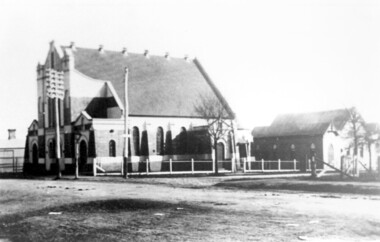
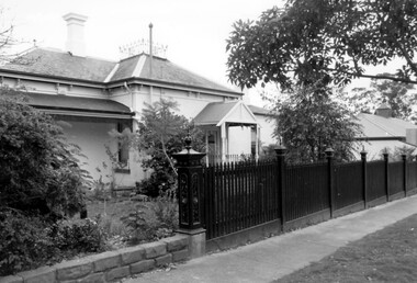
 Surrey Hills Historical Society Collection
Photograph, Holy Trinity Church of England, Surrey Hills post 1926, After 1926
St George's Church of England, Mont Albert was built in 1886 and from 1904 until 1907 was known as Holy Trinity, Surrey Hills. As the population increased there was a need for a church in Surrey Hills. This brick church was consecrated in 1922 and replaced the earlier one built in 1907 on the adjacent site in Union Road. After construction of the brick church, the earlier one became a Sunday School. The copper spire was added in 1926, which dates this photo as post-1926. Norman Carter took many photos of Surrey Hills and Mont Albert in the 1920s; many were associated with events and activities of the Church of England.Black and white photo of the 'newly' constructed brick Holy Trinity Church in Union Road, Surrey Hills taken from near the south-west corner of Guildford Road. Further up the hill is the earlier church. Both buildings are bounded by a simple post and rail fence. Immature street trees are planted on both sides of Union Road.churches, holy trinity church, anglican church, sunday schools, norman carter -
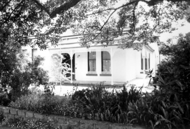
 Surrey Hills Historical Society Collection
Photograph, Union Road looking west from the steeple of Holy Trinity Church, 1922, 1922
At the edge of the church roof and on the horizon is 'The Knoll' on the corner of Union Road and Wandsworth Road. To the left of this is 297 Mont Albert Road, home of the Michael Parer family and further left is "Quamby", home of the Sherar family. This is easily recognised by the square viewing tower located on the west wing of the house. The Sherar family owned 'Quamby' from 1900 until 1925, when it became Mosgiel Private Hospital. Norman Carter took many photos of Surrey Hills and Mont Albert in the 1920s; many associated with events and activities of the Church of England. Black and white photo of taken from the steeple of Holy Trinity Church, during its construction, across Union Road to the north-west. In the foreground immature street trees can be seen and an original telephone pole with white insulators. The street has formed paths and bluestone kerb and channelling. holy trinity anglican church, union road, the knoll, quamby, street trees, telegraph and light poles, mosgiel hospital -
 Surrey Hills Historical Society Collection
Photograph, "Ancyra" 25 Weybridge Street, Surrey Hills
John Butler Maling, retired farmer, built his home on the corner of his property which extended from Weybridge Street to Whitehorse Road and from James to Ross Street. From 1853 he lived in a simple farmhouse located near the present Ross Street until he had 'Ancyra' built in c.1889 from bricks made from clay dug from a quarry on the property. This was located in the now-park in James Street. John Butler Maling Snr was born in Shepreth, Cambridgeshire. He married Kate Conlan in 1882 and they had 3 children - Silas, Alick and Zillah. He died in 1912 and is buried in Box Hill Cemetery. Often referred to as John Butler Maling Senior as he had a nephew by the same name. He also lived on a similar sized property known as 'The Willows', located to the west. He became the first Mayor of Camberwell. From c1936 til c1960 the property was used as a rest home (Ancyra Rest Home) and then a nursery (Pied Piper Nursery).This property is important as one of few remaining extant links to pre-urban Surrey Hills, and built from local material.A black and white photograph of a brick house with a slate roof and corrugated iron over the verandah and portico. A picket fence painted a dark colour features decorative finals on the tops of the posts.ancyra, house names, weybridge street, surrey hills, whitehorse road, james street, ross street, john butler maling (snr), mrs kate maling, silas maling, alick maling, zillah maling, miss kate conlan, box hill cemetery, ancyra rest home, pied piper nursery -
 Surrey Hills Historical Society Collection
Photograph, "Ancyra", 25 Weybridge Street, Surrey Hills
John Butler Maling, retired farmer, built his home on the corner of his property which extended from Weybridge Street to Whitehorse Road and from James to Ross Street. From 1853 he lived in a simple farmhouse located near the present Ross Street until he had 'Ancyra' built in c.1889 from bricks made from clay dug from a quarry on the property. This was located in the now-park in James Street. John Butler Maling Snr was born in Shepreth, Cambridgeshire. He married Kate Conlan in 1882 and they had 3 children - Silas, Alick and Zillah. He died in 1912 and is buried in Box Hill Cemetery. Often referred to as John Butler Maling Senior as he had a nephew by the same name. He also lived on a similar sized property known as 'The Willows', located to the west. He became the first Mayor of Camberwell. From c1936 til c1960 the property was used as a rest home (Ancyra Rest Home) and then a nursery (Pied Piper Nursery). This is one of relatively few surviving houses that provides links to pre0urban Surrey Hills. It is also built from locally quarried material.A black and white photograph of a house viewed through the front garden.ancyra, house names, weybridge street, surrey hills, james street, bricks, john butler maling senior, miss kate conlan, mrs kate maling, alick maling, silas maling, zillah maling, ancyra rest home, pied piper nursery, box hill cemetery -
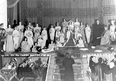 Surrey Hills Historical Society Collection
Photograph, Holy Redeemer Queen Carnival, 1938, 1938
Donor identifies the following: Parish priest - Dr W M Collins Queen - Molly Baker Attendants - Marg Wise, Lola Sans, Gertie Baker Flower girls - Madge Wise, Molly Brown, Rita O'Sullivan Probably taken in Our Holy Redeemer Hall, Mont Albert Road, Surrey Hills.This is one of only a few photos in our collection which are evidence of Queen Carnivals which originated as fundraising events. They were particularly popular in both Australian and New Zealand during the early 20th century. They were particularly common during and after World War I when they were used to raise funds for returned soldiers. It is currently the only photo in the collection of a social event connected to Our Holy Redeemer Church and the only one which includes Dr William M Collins who was the parish priest from 1933-1941. Dr Collins was a significant figure in the Catholic Church in Melbourne in the first half of the 20th century. REF: The Advocate: The first priest-editor by Fiona Power; Kairos Catholic Journal Volume 22, Issue 16. - 2 September 2011": Summary: Born in Kilmore in 1884, William Collins attended South Melbourne College and then the University of Melbourne, where he assisted in the formation of the Newman Society of Victoria. After graduating in arts in 1911, he worked at the Melbourne Public Library and the Education Department. In 1912, at the age of 28, he went to Rome, where he studied for the priesthood at Urban College. He obtained doctorates in philosophy and theology and was ordained on 3 June 1917. He returned to Melbourne and was appointed curate at St Mary’s, West Melbourne, and St Francis’, Lonsdale Street. In 1918, Dr Collins became editor of The Advocate. He remained in the role for seven years. Dr Collins was parish priest of Dandenong, Daylesford, East Malvern, Surrey Hills and Kew, and administrator at St Francis’. He died in 1959 and a Requiem Mass was held at Sacred Heart, Kew. Black and white photo of the participants in the Queen Carnival arranged on a stage in a tableaux of the coronation of the Queen. To the right are the parish priest and the archbishop and there is a man at the bottom of the stairs centre front of the stage. Guests are seated at a table to the right of the stairs and to the left of the stairs is a table with floral arrangements and other objects. "1938" hand-written on the original photo in upper LH corner.festivals and celebrations, queen carnivals, our holy redeemer church, dr w m collins, rev william m collins, (miss) molly baker, (miss) marg wise, (miss) lola sans, (miss) gertie baker, (miss) madge wise, (miss) molly brown, (miss) rita o'sullivan -
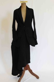 Brighton Historical Society
Clothing - Riding habit, 1910s-20s
... 4 Brook Street, London West, England ...This item is from the "Barone" Collection. "Barone" (also known as "Seaview") was a stately Brighton home built at 9 Moule Avenue prior to 1855 and demolished in 1986. The house's residents included Edward Elgin Browne (during 1859-72), a Melbourne tea merchant, and the family and descendants of retired Scottish Army captain Archibald Black (during the period 1880-1970). Its neighbors included “St Ninians” owned by the Ward- Cole family, “Seacombe” owned by the Moule family, and the home of James Grahame and his family. The items in the "Barone" collection were largely donated by two of the house's later owners, Mrs Doris Halkyard and Mrs Brian Brandt.An English-made “Busvine” black wool herringbone twill riding habit comprising jacket and safety skirt, (jodhpurs missing) from late 1800’s to early 1900’s. The jacket (.1) features a black short pile silk velvet inset notched lapel collar secured with a single button at the apex of the waist and a single button near the collar for use in inclement weather. The sleeves join the bodice high on the shoulder with a full cut head to the sleeve and a tapered curved shape to the hand. The sleeve secures at the wrist with four black buttons. From the waist the jacket flares over the hip through princess line shaping and finishes with a curved front on either side. The seams of the shaping panels intersect single functional flapped besom pockets on either front panel. The back of the jacket features a centre back seam and two princess-line shaping seams that finish in a double vent on either side of the centre back. The jacket length would have finished approximately just below the bottom of the wearer. The apron fronted safety skirt (.2) secures from the waist at the front of the left thigh with five buttons. Over the wearers, right leg the skirt shapes to accommodate the rider’s right knee whilst sitting sidesaddle with her legs on the horses left flank. The base of the skirt has an elastic strap, which hooks around the rider’s leg to reduce the danger of the rider’s skirt become tangled, should the rider become un-seated. When the riders is not mounted the skirt can be secured with a button around the body to provide additional modesty as well as assist walking without the skirt dragging on the ground.Jacket: Manufacturer's label “Busvine, By serial appointment to Her Majesty The Queen, 4 Brook Street W.” Owner label “Doreen Wright” this label appears far more modern than the manufacturers label. Skirt: Manufacture's label: “J. Busvine and Co, 4 Brook Street, London W." In handwriting “Miss Wingfield” Manufacturers label: Busvines Patent Safety Skirt, protected by two separate patents. 4 Brooks St London West.barone, riding habit, j. busvine and co, seaview, brighton -
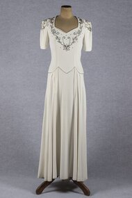 Brighton Historical Society
Clothing - Dress, Wedding dress, 1941
Worn by three brides in 1941, 1944 and 1948. The dress was made for Eva Elizabeth (Bid) Harvey for her marriage to Morris Langlo West on 2 October 1941 at St James Catholic Church, North Road, Gardenvale. They had two children, Julian (1942-2005) and Sr. Elizabeth West (born 1942). Bid was born in 1906 to Michael and Kitty Harvey. They lived at 51 Cole Street, Elwood. The bridesmaid was Bid's niece Jocelyn Hickey. The dress was also worn by Jocelyne Dorothy Taylor when she married John Carlisle (Carl) Harvey (Bid's brother) at James Catholic Church, Gardenvale on 30 June 1944. Jocelyne's bridesmaid was Jocelyn Hickey and the best man was Basil Robinson. The reception was held at 'Birdwood', Birdwood Avenue, Brighton. Jocelyne was born in Rangoon, Burma in 1921 and was the eldest daughter of Stanley and Dorothy Taylor. Carl was the only son of Michael and Kitty Harvey. Jocelyne and Carl lived at 15 Harwood Street, Elwood and later at 54 North Road, Brighton. They had five children, Michael, David, Jennifer, Robert and Eric. The third bride to wear the dress was Jocelyn Mary Hickey, who was bridesmaid to Bid and Jocelyne. Jocelyn Hickey was born in 1929 to Daniel and Doreen Hickey (Bid's sister and Jocelyne's sister-in-law). Jocelyn married Gerard Leslie O'Donnell at St James Catholic Church, Gardenvale in 1948. The bride's attendants were Adita Smith, Maureen Bow and Jacqueline Connell. The groom's attendants were Jack Fallon and Con O'Donnell. The reception was held at 51 Cole Street, Elwood. Jocelyn and Gerard had three daughters, Maree, Carlene and Janine. They lived in Bunyip, Victoria. (Information provided by the donor).Cream crepe wedding dress with short sleeves and dropped waist. Sweetheart neckline, bodice and sleeves decorated with floral design in bugle beads. Fastens with metal zip in left side seam.wedding dress, wartime bride, 1940s, eva elizabeth harvey, jocelyne dorothy taylor, jocelyn mary hickey -
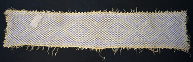 Brighton Historical Society
Table linen, Table runner, 1916
This table runner was made by Corporal Herbert Burdekin during the First World War around 1916 while he was recovering from a bullet wound. Herbert joined the 8th (Reserve) Battalion of the West Yorkshire Regiment (Leeds Rifles) in November 1914 and was deployed to France in April 1915. In July 1916 he received a gunshot wound to the arm and was sent home to England to recover, during which time he crocheted this table runner. He returned to France in early 1917 and was wounded a second time by a gas shell on 23 July 1917. Herbert likely never fully recovered from his exposure to gas during the war. He received a medical discharge in November 1918 due to "debility caused by war service" and died only a few years later in 1922, aged 26. His widow Mary and young daughter Hilda moved to Australia and settled in Brighton, with Mary living at 4 Collins Street until her death in 1966.Hand crocheted table runner featuring an interlocking diamond pattern in cream, pale purple and pale yellow. Bordered by pale yellow fringe.first world war, world war i, herbert burdekin, crochet, table runner, army -
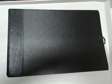 National Wool Museum
Book - Wool sample book
Book was given to Mr Robert 'Bob' Edward Mitchell in 1938. Mr Mitchell trained as a wool classer in the 1930's and was awarded this book as the senior prize. Mr. Mitchell grew up on the Moorabinda sheep property and is on the honour roll as a past student who served in World War II from Wharparilla West State School.Large black bound book containing 12 double-sided pages, each with several wool samples mounted to a blue paper with the name of sheep breed which the wool came from. Each page also has a loose sheet of wax paper over the wool. Book can be closed and secured with a length of black material which can be tied up. -
 National Wool Museum
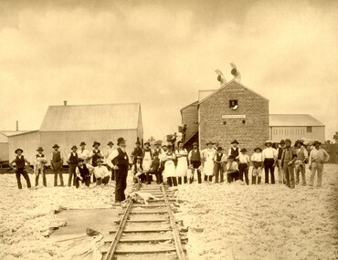
Photograph - Geelong Victoria, 1889
Image was donated by Mr. Peter JM Bell of West Yorkshire, UK in 2009. Mr. Bell worked for Robert Jowitt & Sons between 1999 and 2006 when the company ceased operations. Mr. Bell discovered this photo and decided to donate it to the National Wool Museum. Jowitt & Sons was established in 1775 and became a limited company in 1919. They were wool merchants and had buying branches in Australia - Fremantle, Melbourne, Sydney and Adelaide.Photo of approximately 30 men standing on and perpendicular to a railway track. Behind the group are four buildings, two on the left, two on the right. A dog is resting on the railway track. The ground has been covered in wool and a sign on the right-hand building reads 'ROBERT JOWITT & SONS".Wording: Geelong- Victoria/ 1889;Method: printed;Location: bottom centrewool, railway, dog, jowitt & sons -
 National Wool Museum
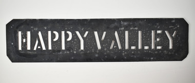
Stencil - HAPPY VALLEY
This stencil was used as a location stamp for the transportation of wool bales. Happy Valley is a town located in Golden Plains Shire, south-west of Ballarat, Victoria. Wool bales marked HAPPY VALLEY would have been transported to or from Happy Valley.Wool bale stencil - HAPPY VALLEY HAPPY VALLEY wool sales, wool transportation, wool export -
 Vision Australia
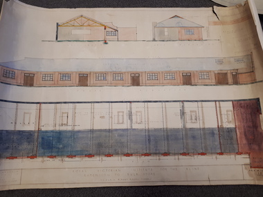
Plan - Image, Royal Victorian Institute for the Blind Extension to Bulk Store, 27/8/1925 (according to Mosiac entry)
In this undated drawing, believed to have been done in 1925, an existing bluestone store was extended out into the courtyard area. The extensions were on the south and west elevations, and the drawing includes a floor plan of these areas. Noted on the plan is the removal of fireplaces that existed in this building, the location abutting the Alfred Hospital reserve and location of the motor room.1 architectural plan of extension to bulk storeStephenson & Meldrum, Architects 374 Little Collins Street Melbourne Phone: 6990 On the back: Widening of old bluestone store plans & specroyal victorian institute for the blind, plans -
 Port Fairy Historical Society Museum and Archives
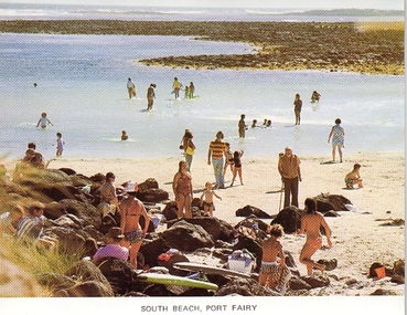
Photograph - Postcard, South Beach Port Fairy
Colour photographic postcard South Beach Port Fairy, Looking WestSouth Beach Port Fairysouvenir, port-fairy, post card, south beach, pea soup -
 Port Fairy Historical Society Museum and Archives
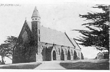
Photograph
The Catholic Church in Port Fairy was built 1859-1867 Foundation stone laid in July 1857, money being raised be subscription and a government grant. Charles Hansom was the Architect, Nathaniel Billing Engineer. Chancel and sacristy were added in 1867, stained glass windows added in 1868.Black and white photograph of church with a spire located on a rise west of Port fairysouvenir, port-fairy, catholic, st pats, st patricks, nathaniel billing, charles hansom, 1857, belfast -
 Port Fairy Historical Society Museum and Archives
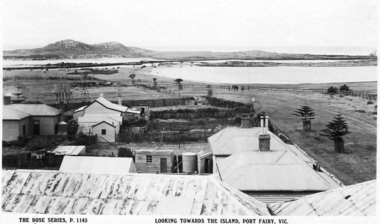
Postcard - Post Card, Looking towards the island Port Fairy
... Gipps Street, Port Fairy, South West, Victoria, Australia ...Looking towards the island Port Fairyblack and white photograph taken from the mill looking towards Griffith Island.town, townscape, river, griffith island, south west passage, causeway bridge, span bridge, ocean, sea, wetland