Showing 35820 items matching "buildings--historic"
-
 Eltham District Historical Society Inc
Photograph, Peter Pidgeon, Victorian Labor Government Press Release announcing planned upgrades to Hurstbridge line rail services and protection of historic Railway Trestle Bridge, Panther Place, Eltham, 1 August 2018, 1 Aug 2018
Announcement by Premier Daniel Andrews, Minister for Public Transport, Jacinta Allan and Member for Eltham, Vicki Ward mad alongside the Eltham Railway Trestle Bridge. MEDIA RELEASE "More Trains And Fewer Delays On The Hurstbridge Line" https://www.premier.vic.gov.au/wp-content/uploads/2018/08/180801-More-Trains-And-Fewer-Delays-On-The-Hurstbridge-Line-1.pdf Commuters on the Hurstbridge line will have more trains, more seats and fewer delays with a re-elected Andrews Labor Government to continue its massive upgrade of the Hurstbridge line. The Andrews Labor Government said it would deliver locals in Melbourne’s north-east more peak hour train services and less time stuck at boom gates, and we have. The first stage of the Hurstbridge Line Upgrade has been delivered – six months early and on budget. This includes the new Rosanna Station, duplicated track between Heidelberg and Rosanna and the removal of the dangerous level crossings at Alphington and Rosanna. There’s more to do and only Labor will deliver the next stage of the Hurstbridge Line Upgrade to give local commuters more train services and a more comfortable commute. The $530 million project will include a brand new train station at Greensborough and the duplication of three kilometres of track between Greensborough and Montmorency, and 1.5 kilometres of track between Diamond Creek and Wattle Glen to allow more train services during the morning peak. This will allow trains to run every six and a half minutes at Greensborough, every 10 minutes at Eltham and Montmorency, and every 20 minutes at Hurstbridge, Diamond Creek and Wattle Glen – as well as two extra Hurstbridge express services. Locals on the Labor Government’s new Mernda line will also get five extra train services during the morning peak, with a major upgrade of the Clifton Hill junction where the Mernda and Hurstbridge lines connect. Labor will also protect the Eltham Trestle Bridge – the last remaining timber bridge on Melbourne’s electric train network – which has local heritage protection and is an important part of the area’s character. The Liberals will leave this bridge to rot and demolish the nearby childcare centre and football club with their under-cooked and under-costed promise to upgrade the Hurstbridge line. Only Labor will protect this important piece of Melbourne’s history with planning work to be carried out for a long-term solution as part of the project. Stage two of the Hurstbridge Line Upgrade will create more than 950 jobs, with construction to start in 2020 and finish by 2022. Quotes attributable to Premier Daniel Andrews “We said we’d upgrade the Hurstbridge line and remove dangerous and congested level crossings at Rosanna and Alphington and we did – but there’s more to do.” “Only Labor will deliver the next stage of the Hurstbridge Line Upgrade with a new Greensborough Station and more trains, more often.” Quote attributable to Minister for Public Transport Jacinta Allan “The former Liberal Government promised new train lines but didn’t deliver a single kilometre of track – now they’re promising a half-baked upgrade of the Hurstbridge line with rubbery figures that don’t add up.” Quote attributable to Member for Eltham Vicki Ward “As a fifteen year old hopping on Red Rattlers at Eltham I wanted to do something to make the Hurstbridge line better. It’s taken me a few decades but finally our line will offer the frequency of services that are expected and needed in a 21st century city.”Born digital image (qty 27)jacinta allan, minister for public transport, panther place, premier daniel andrews, press announcement, railway line construction, trestle bridge, vicki ward mp for eltham, victorian parliament -
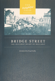 Federation University Historical Collection
Booklet, Doug Bradby, Bridge Street: The Historic Heart of Ballarat, 2020
Twenty eight page dark green covered book on Ballarat's Bridge Street, including information on the Gravel Pits, Main Road shops, floods, Chinese cerneval, Queen carneval, Yarrowee Bridge, Eureka Stockade, fire, Yarrowee Creek.non-fictionballarat, gravel pits, main road shops, floods, chinese cerneval, queen carneval, yarrowee bridge, eureka stockade, fire, yarrowee creek, bridge street -
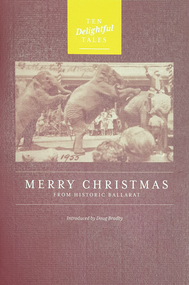 Federation University Historical Collection
Booklet, Doug Bradby, Merry Christmas From Historic Ballarat, 2020
Twenty eight page maroon covered book on Christmas on the goldfields of Ballarat.non-fictionballarat, christmas, goldfield -
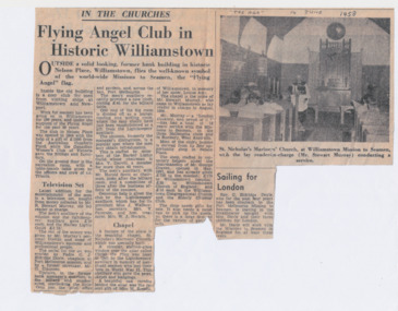 Mission to Seafarers Victoria
Article - Newspaper clipping, The Age, Flying Angel Club in Historic Williamstown, 14 June 1958
Colour photocopy on A4 size paperInscription handwritten in black ink in capital letters by Nancy Oakley: "The Age" 14 June 1958nancy oakley, mission to seamen, nancy dingle, williamstown, st nicholas the mariner chapel, randall stewart murray, george craven, opportunity shop, claude james eldridge-doyle, maude breaks, reredos, louise (lulu) amy breaks, hlg, j. wallace, mrs v. paterson, mrs w.j. hockin, mrs v. darvill -
 Phillip Island and District Historical Society Inc.
Book, Australian Council of National Trusts, Historic houses of Australia, 1974
Stamped 'Cowes Public Library'.historic buildings, australia, history -
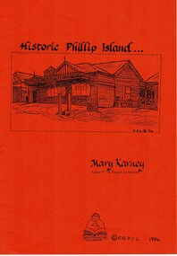 Phillip Island and District Historical Society Inc.
Book, KARNEY, Mary, Historic Phillip Island, 1994
HistoricalA4 orange soft covered with photocopied pages. phillip island, victoria, history, mary karney, robb family, west family, postal services, chicory industry, rescue practice, severance of phillip island, albert k. t. samble, cr dawson davie, water supply, ferries, broadwater guesthouse cowes phillip island, phillip island library -
Phillip Island and District Historical Society Inc.
Book, VALENTINE, James, Then and now : historic roads around Sydney, 1939
-
 Greensborough Historical Society
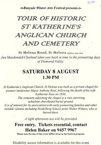
Flyer - Flyer and notes, Tour of historic St Katherine's Anglican Church and cemetery
Tour of St Katherine's Anglican Church and cemetery, facilitated by Jan Macdonald as part of the Banyule Winter Arts Festival in the 1990s.2 pages, text only. st katherines church, st helena, anthony beale, st helena cemetery, banyule winter arts festival -
 Greensborough Historical Society
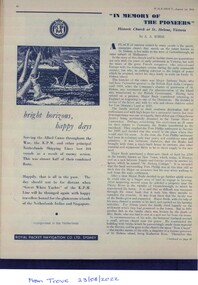
Article - Magazine clipping, A. A. Burns, "In Memory of the pioneers": Historic Church at St Helena, Victoria, 01/08/1949
A short history of St.Katherine's church in St.Helena includes information on Anthony Beale.Printed from Trove records. Printed on white paper with photo illustrations.st.helena, st.katherine's church, anthony beale -
 Mission to Seafarers Victoria
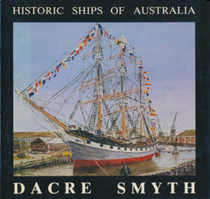
Book, Dacre Smyth, Historic Ships of Australia, : A third book of paintings, poetry, and prose, 1982
Foreword by Admiral Lionel Lockwood.non-fictionkeith oliver, donation, commodore dacre smyth, commodore dacre smyth (1923-2008) -
 Greensborough Historical Society
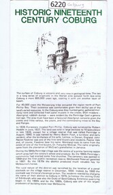
Leaflet, Coburg Historical Society, Historic nineteenth century Coburg, 1980s
A short history of 19th century Coburg, Victoria covering points of interest. Includes a map of the landmarks covered in the text. One page, printed on both sides in black and white text, drawings and photographs. Folded into 5. coburg (victoria), pentridge -
 Greensborough Historical Society
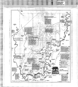
Map, Heidelberg: Historic River Landscape Assessment, Historical Maps. Map A To 1838. Country of the Wawarang, 1985c
Geographical area of around 35 sq. kilometres marked with physical features such as major roads, rivers, vegetation and properties, with contemporary notes on landowners, descriptions and comments on the land and its development. Bounded by Shire of Diamond Valley to the North, Darebin Creek to the West and Plenty River to the East.Black an white sketch map on white paperheidelberg, heidelberg - maps -
 Greensborough Historical Society
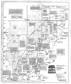
Map, Heidelberg: Historic River Landscape Assessment. Historical Maps. Map B 1838-1851, "The Distinctly aristocratic locality", 1985c
Geographical area of around 35 sq. kilometres marked with physical features such as major roads, rivers, vegetation and properties, with contemporary notes on landowners, descriptions and comments on the land and its development. Bounded by Shire of Diamond Valley to the North, Darebin Creek to the West and Plenty River to the EastBlack and white sketch map on white paperheidelberg, heidelberg - maps -
 Greensborough Historical Society
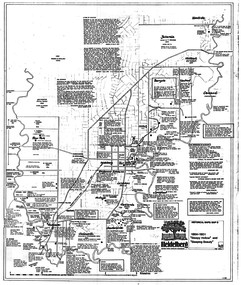
Map, Heidelberg. Historic River Landscape Assessment. Historical maps: Map C 1851-1863. "The Garden of the colony", 1985c
Geographical area of around 35 sq. kilometres marked with physical features such as major roads, vegetation and properties, with locations and notes of the increasing number of farms, gardens orchards and vineyards which had become established in addition to pastoral runs. Bounded by Shire of Diamond Valley to the North, Darebin Creek to the West and Plenty River to the East.Black and white sketch map on white paperheidelberg, heidelberg - maps -
 Greensborough Historical Society
Map, Heidelberg: Historic River Landscape Assessment. Historical maps. Map D 1864 -1901 "Sleepy Hollow" and "Sleeping beauty", 1985c
Geographical area of c. 35 sq. kilometres marked with physical features such as major roads, rivers, vegetation and properties, with locations and notes on the increasing number of farms, orchards and vineyards that had been developed in addition to pastoral runs. Bounded by Shire of Diamond Valley to the North, Darebin Creek to the West, and Plenty River to the East.Black and white sketch on white paper. Second copy 600 x 430 cm printed in black on semi-opaque paperheidelberg, heidelberg - maps -
 Greensborough Historical Society
Map, Heidelberg: Historic River Landscape Assessment. Historical maps. Map E 1901-1934 "A Time of projects and improvements", 1985c
Geographical area of around 35 sq. kilometres marked with physical features such as major roads, railways (new extension to Eltham), rivers and properties, also housing sub-divisions and community facilities such as hospitals, parks and sporting reserves and indications of new small scale industries such as dairying. Bounded by Shire of Diamond Valley to the North, Darebin Creek to the West and Plenty River to the East. Black and white sketch map on white paperheidelberg, heidelberg - maps -
 Greensborough Historical Society
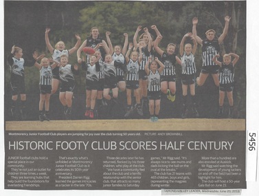
Newspaper Clipping, Diamond Valley Leader, Historic Footy Club scores half century, 20/06/2018
Montmorency Junior Football Club celebrates its 50th year anniversary.News article 1 page, black text and colour image .montmorency junior football club, montmorency football club -
 Greensborough Historical Society
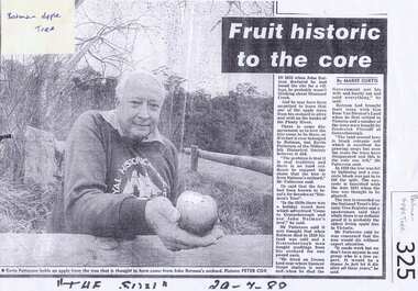
Newspaper clipping, Fruit historic to the core, 29/07/1988
Local historian Kevin Patterson discusses the origins of the "Batman" apple tree on the banks of the Plenty River.Photocopy of news clipping from "The Sun" 29/7/1988Handwritten in black pen "The Sun" 29/7/1988.batman apple tree, greensborough, kevin patterson, frederick flintoff, plenty river -
 Greensborough Historical Society
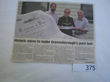
Newspaper clipping, Historic move to make Greensborough's past last, 19/03/2010
This article advertises the public meeting in March 2010 to gauge interest in forming the Greensborough Historical Society. First media coverage for Greensborough Historical SocietyBlack text on newsprint, colour photograph of Steve Whatmough, Faye Fort and Noel Withers outside the DVLCgreensborough historical society -
 Greensborough Historical Society
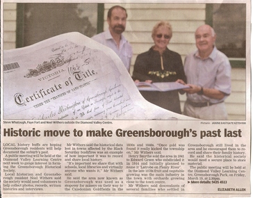
Newspaper clipping, Historic move to make Greensborough's past last, 19/03/2010
This article publicises the public meeting prior to formation of the Greensborough Historical Society in 2010. Shown in the image are inaugural President Noel Withers and descendants of pioneer families Faye Fort (nee Partington) and Steve Whatmough.News article black text and coloured image.greensborough historical society, noel withers, faye fort (nee partington), steve whatmough -
 Greensborough Historical Society
Newspaper Clipping, Diamond Valley Leader, Historic Plough Stolen, 25/01/2017
A beloved artefact [donated by the Partington Family] was stolen from outside Greensborough Historical Society, bewildering residents and history buffsNews article 1 page, black text, colour image.greensborough historical society, theft, historic plough, partington family -
 Greensborough Historical Society
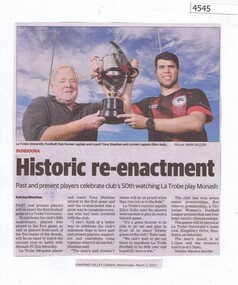
Newspaper Clipping, Historic re-enactment, 01/03/2017
Past and present players from La Trobe University Football Club will re-enact the first football game at La Trobe University, celebrating the Club's 50th anniversary.News article 1 page, black text, colour image.bundoora, la trobe university, latrobe university football club -
 Greensborough Historical Society
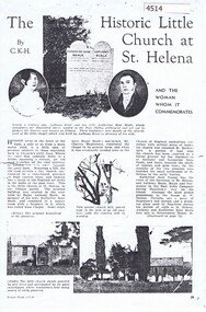
Article - Article, Journal, Women's World, Historic little church at St Helena, and the woman whom it commemorates; by C. K-H, 01/07/1934
The original Rose Chapel was erected in 1866 by Major Anthony Beale in memory of his wife Katherine Rose Beale; later renovated and handed over to the Church of England and renamed St Katherine's.Concerns the early history of St Helena and the Beale familyTwo photocopied pages, text with photos. 2 copiesWomen's World, 1/7/1934beale family, st katherines church st helena -
 Greensborough Historical Society
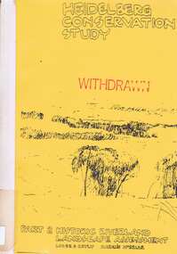
Book, Heidelberg Conservation Study: Part 2: Historic Riverland Landscape Assessment. Revised 1987, 1987_
Report prepared by Loder and Bayly and Marilyn McBriar on behalf of City of Heidelberg and Heidelberg Heritage Advisory Committee. Area covered is from Darebin Parklands in the south to Plenty River at Yallambie in the north. Revised 1987.This study identifies neighbourhood character, documents past development and the capacity of the environment for future development with particular emphasis on the river precincts - Plenty River, Yarra River and Darebin Creek.Part three of set of three books. Paperback, 333 pages, Illus., maps. 2 copies.Stamps: Yarra Plenty Regional Library Service, and, Withdrawnheidelberg, macleod, heidelberg heritage advisory committee, marilyn mcbriar, plenty river, yarra river, darebin creek -
4th/19th Prince of Wales's Light Horse Regiment Unit History Room
Document, Victoria's First Mounted Soldiers. An Historic Perspective, 1980's
An extract from the book "Hooves Wheels and Tracks" by Dr David Holloway, contained in a plastic folder covering the colonial era.light horse, colonial era -
 Eltham District Historical Society Inc
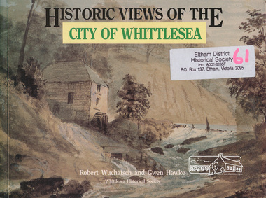
Book, Robert Wuchatsch 1950- et al, Historic views of the City of Whittlesea / Robert Wuchatsch and Gwen Hawke, 1988
Paperback; ix, 119 p. : chiefly ill. (some col.), 1 map, ports. ; 19 x 25 cm.ISBN 0958866333 [written on title page] To Eltham Historical Society, with our compliments and best regards - Whittlesea Historical Society - [signed] Robert Wuchatsch, G. Hawke. 13/12/89.whittlesea shire -
 Eltham District Historical Society Inc
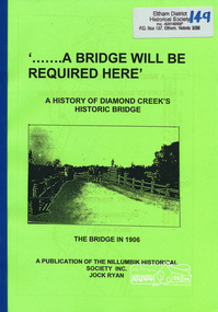
Book, Nillumbik Historical Society, '.......A Bridge Will Be Required Here': A history of Diamond Creek's historic bridge by Jock Ryan, 2005
7 pages, mapsdiamond creek, bridge -
 Eltham District Historical Society Inc
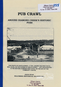
Book, Nillumbik Historical Society, Pub Crawl: around Diamond Creek's historic pubs by Jock Ryan, 2001
Hotels described include: Evelyn Arms Hotel or Tunnel Camp Hotel or Half-Way House, the Diamond Reef Hotel, the Loyal Diamond Lodge Hotel and the Royal Mail Hotel all located in Diamond Creek during a rapid population growth in Diamond Creek in the 1860s.This small publication discusses the history of local hotels in the Diamond Creek area during a significant period of development in the 1860s when mining took place in the local area. The history of hotels connects to the wider history and important social and civic link to the community at that time. [10] p. includes text and very poor photocopy reproductions of historical photographs. Perfect bound with plastic front cover only.EDHS Property stamp on front coverdiamond creek, hotels, pubs, bars, 1860s -
 Eltham District Historical Society Inc
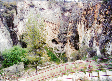
Photograph, Balaclava Open Cut Mine near Whroo Historic Reserve; 9 Oct 1994, 09/10/1994
Colour photograph and newsclippingactivities, 1994, balaclava hill, balaclava mine, gold mining, whroo historic reserve -
 Ringwood and District Historical Society
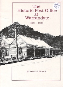
Book, The Historic Post Office at Warrandyte
History of Warrandyte Post Office from 1876 to 1988