Showing 1102 items
matching information map
-
 Glenelg Shire Council Cultural Collection
Photograph - Photograph -Port of Portland office, n.d
Port of Portland Authority ArchivesBack: White Sticker ---Trade Fair 61-67 - black biroport of portland archives, offices, map, victoria -
 Ringwood and District Historical Society
Newspaper, Scrapbook Clipping, Library Collection, Ringwood, Victoria, `
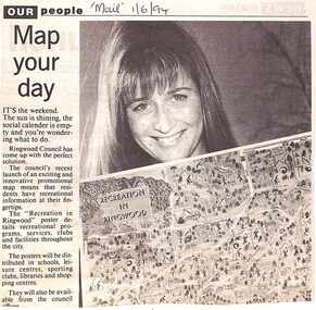
``Newspaper clipping from "The Mail" 1-6-94 OUR people Map your dayThe Ringwood Council's recent launch of an exciting and innovative promotional map means that residents have recreational information at their fingertips. The "Recreation in Ringwood"poster details recreational pograms, services, clubs and facilities throughout the city` -
 Ringwood and District Historical Society
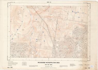
Map - Melbourne Metropolitan Area Base Map Series, Sheet 215 - Ringwood area, 1967
Map prepared by Dept of Lands and Survey and MMBW from State Aerial Survey June 1957 and Cadastral Survey information July 1967. This sheet comprises parts of Municipalities of Doncaster & Templestowe, Nunawading and Ringwood, and Parishes of Nunawading and Warrandyte.Scale: 400 feet to 1 inch. Contours at 5 feet vertical interval. By Authority: A.C. Brooks, Commonwealth Printer, Melbourne. -
 Ringwood and District Historical Society
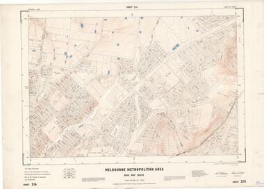
Map - Melbourne Metropolitan Area Base Map Series, Sheet 216 - Ringwood area, 1967
Map prepared by Dept of Lands and Survey and MMBW from State Aerial Survey June 1957 and Cadastral Survey information July 1967. This sheet comprises parts of Municipalities of Croydon, Doncaster & Templestowe, and Ringwood, and Parishes of Ringwood and Warrandyte.Scale: 400 feet to 1 inch. Contours at 5 feet vertical interval. By Authority: A.C. Brooks, Commonwealth Printer, Melbourne. -
 Ringwood and District Historical Society
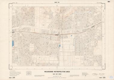
Map - Melbourne Metropolitan Area Base Map Series, Sheet 235 - Ringwood area, 1960
Map prepared by Dept of Lands and Survey and MMBW from State Aerial Survey June 1957 and Cadastral Survey information August 1960. This sheet comprises parts of Municipalities of Doncaster & Templestowe, Nunawading and Ringwood, and Parishes of Nunawading, Ringwood and Warrandyte.Scale: 400 feet to 1 inch. Contours at 5 feet vertical interval. By Authority: A.C. Brooks, Commonwealth Printer, Melbourne. -
 Ringwood and District Historical Society
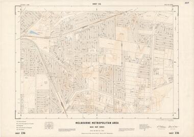
Map - Melbourne Metropolitan Area Base Map Series, Sheet 236 - Ringwood area, 1961
Map prepared by Dept of Lands and Survey and MMBW from State Aerial Survey June 1957 and Cadastral Survey information May 1961. This sheet comprises parts of the Municipalities of Croydon and Ringwood, and Parishes of Ringwood and Warrandyte.Scale: 400 feet to 1 inch. Contours at 5 feet vertical interval. By Authority: A.C. Brooks, Commonwealth Printer, Melbourne. -
 Ringwood and District Historical Society
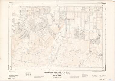
Map - Melbourne Metropolitan Area Base Map Series, Sheet 255 - Ringwood area, 1963
Map prepared by Dept of Lands and Survey and MMBW from State Aerial Survey December 1956 and Cadastral Survey information May 1963. This sheet comprises parts of the Municipalities of Ferntree Gully, Nunawading and Ringwood, and Parishes of Nunawading, Ringwood and Scoresby.Scale: 400 feet to 1 inch. Contours at 5 feet vertical interval. By Authority: A.C. Brooks, Commonwealth Printer, Melbourne. -
 Ringwood and District Historical Society
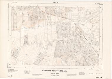
Map - Melbourne Metropolitan Area Base Map Series, Sheet 256 - Ringwood area, 1962
Map prepared by Dept of Lands and Survey and MMBW from State Aerial Survey December 1956 and Cadastral Survey information December 1962. This sheet comprises parts of the Municipalities of Croydon, Ferntree Gully, and Ringwood, and Parishes of Ringwood and Scoresby.Scale: 400 feet to 1 inch. Contours at 5 feet vertical interval. By Authority: A.C. Brooks, Commonwealth Printer, Melbourne. -
 Ringwood and District Historical Society
Map - State Aerial Survey, Dandenong Ranges Area, Parishes of Warrandyte and Ringwood - 1956
Map of central and southern areas of Ringwood and part of Ringwood East and Heathmont compiled by Dept of Lands and Survey, July 1956, from aerial photographs and Cadastral Survey information. Subsequent hand-drawn addition of streets showing layout of "Township of Ballyduffy Estate 1858-60", an earlier proposed subdivision that did not eventuate. (See attached 5009b Ballyshanassy_ Melbourne’s lost suburb.pdf for Ballyduffy historical naming relevance). Ballyduffy Estate streets include City Road, West Prussia Road, Duffy Street, Ireland Street, Evans Street, Victoria Street, Regina Street, Short Road, Prussia Road, Duffy Street East, Ireland Street East, Evans Street East, Chapman Street. Misc Topo 93 Sheet 22, Ringwood A4B2. Scale: 4 chains to 1 inch. Contour interval 20 feet. -
 Ringwood and District Historical Society
Map - State Aerial Survey, Dandenong Ranges Area, Parts of Parishes of Nunawading, Warrandyte and Ringwood - 1956
Map of Ringwood North and parts of Mitcham, Donvale, Park Orchards and Ringwood East compiled by Dept of Lands and Survey, July 1956, from aerial photographs and Cadastral Survey information. Sheet 1, Ringwood A2D or 849 A2D Zone 7. Scale: 4 chains to 1 inch. Contour interval 20 feet. -
 Ringwood and District Historical Society
Map - State Aerial Survey, Dandenong Ranges Area Sheet 7, Parishes of Warrandyte, Scoresby, Ringwood and Nunawading - 1956
Map of central and southern areas of Ringwood and part of Ringwood East and Heathmont compiled by Dept of Lands and Survey, July 1956, from aerial photographs and Cadastral Survey information. Subsequent coloured hand-drawn additions showing layout of a number of post-NSW Separation era proposed subdivisions that did not eventuate, including Village of Studley Estate, Township of East Kew Estate, Township of Ballyduffy Estate, Township of New Flemington Estate, Township of East Hawthorne Estate. Ringwood A4B2, 849 A4B Zone 7. Scale: 10 chains to 1 inch. Contour interval 20 feet. -
 City of Moorabbin Historical Society (Operating the Box Cottage Museum)
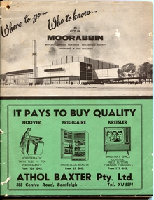
Magazine - Where to go .. Who to know .. in City of Moorabbin, Metropolitan Business Directories, Bentleigh, Ormond, McKinnon, Cheltenham, Highett, Moorabbin and East Bentleigh, 1962
... , index of street names, Maps and more.... Information booklet ...A booklet printed for the residents of the City of Moorabbin to acquaint them with the many amentities and services, as well as the employment opportunities, available close to their own homes. Booklet contains useful information about the City of Moorabbin, the services provided in the area, advertisements for local businesses, index of street names, Maps and more....Information booklet provided for the residents in the City of MoorabbinInformation booklet - 88 pagesbusiness, maps, city of moorabbin, bentleigh, ormond, mckinnon, cheltenham, highett, moorabbin, east bentleigh -
 Bendigo Historical Society Inc.
Document - BENDIGO SALEYARDS COLLECTION: THE BENDIGO SALEYARDS ECONOMIC VIABILITY STUDY
140 Loose pages titled The Bendigo Saleyards Economic Viability Study. Report written by Kate Millard on behalf of the Bendigo Development Committee Inc. Contents include: Chapter 1 - Background Information, Chapter 1 - Present Operations at the Saleyards, Chapter 3 - Economic Factors, Chapter 4 - Environmental Factors, Chapter 5 - Selling Techniques, Chapter 6 - Employment Study, Management and Sundry Issues, Chapter 7 - Survey of Farmers and Saleyard Users in the 'Catchment Area', and Chapter 8 - Recommendations of the Report. Includes diagrams and maps. Recommendations printed on dark yellow paper.bendigo, council, cattle markets, bendigo saleyards collection - the bendigo saleyards economic viability study, bendigo development committee inc., kate millard, loddon campaspe planning authority, street, ryan and associates, bendigo city council, strathfieldsaye shire council, department of industry technology & resources, national library of australia, meldrum burows & partners, core wilson sayer, town planning appeals panel, ces, victorian farmers and graziers association, stock agents association, department of agriculture, department of industry technology & resources, department of conservation forests and land, cr jock comini, rca depot, wellsford rifle range, bendigo airport, bendigo field naturalists club, mr david kennedy, mr john brumby, mr john radford, neil o'keefe, bendigo east progress association, bendigo east traders, trades hall council, mr tom uren, mr frank wilkes, mr bruce reid, mr k i m wright, mr e t ebery, bendigo pastoral council of the vfga, victorian meatworks association, bendigo stock & station agents association, rutlands transport, mr don pickles, country abattoirs & wholesalers association association of victoria, meat and allied trade federation of australia, bendigo saleyards advisory committee, bendigo residents & ratepayers association, a h & n graham, mrs p unmack australian bureau of statistics, mr lloyd houlden, cr c rodda, mr jolly, mr tony milanese, dr robert carter, university of melbourne, bendigo college of tafe, t matthews, a s & r d rutland, john kerr, j talbot, g l o'sullivan, penney & lang pty ltd, graeme pickering, pickhall j w & sons, r a plant, w k schmidt, t j vick, k & j wignall, a e wright, g chapman, a j gillies, p g & m m harris, ian r hollingsworth, b kennedy, s letcher, s & d k letcher, p m llewellyn, l g mason, boyer r t, connally m f, kennedy & mortlock, nevins j p, r w johnstone, w j keith, b d kelly, notman r, pitts a j & c a, pitts mervyn l & co, rowe w o, warren k m, associated stock & station agents, dalgety farmers ltd, elders dsm estates, ellis nuttall & co, gallagher g d, hamilton real estate, mcgregor ralph h & co, mckean w & co, miller turner livestock co, vains e m & co, victorian producers, hill m j & co, bennetts meats, comell bros, davis b & d, hardwick g f & v c, penney & lang p/l, tendercut meats, northern seed supply co, bendigo fertilizers, agri business pty ltd, agrilink consulting group pty ltd, acil aust pty ltd, mcgowan & associates, chapman w c, talbot e j, mcculloch w & sons pty ltd, k v equipment, commercial egg producers assoc co-op, monsanto aust ltd, balmer bryan r, barry i j, bath l, clarke b j, treacy k m, turner j m, bendigo mower serv pty ltd, everlast concrete tank tyltd, wicks bros, canvas goods, don mcarthur, bendigo communications, transcom, emdell pty ltd, epsom pharmaceutical supplies, sandhurst fencing pty ltd, arnolds gates & fencing, r furniss, carne neville, awa & unicla, ajm refrigeration, bendigo concrete sawing service, hamilton r j, hearpes t w, j e brown, campey dr a r, fyffe j j, kangaroo flat vet clinic, ottrey k e, bendigo sprinkler installations, milnes irrigation, onga pumpshop, barastoc products, bush's produce stores, epsom produce, k m m pty ltd, bendigo grain co, eaglehawk chaff mills, grain elevators board dept, bonneys pest control, knights pest control, brown wk & l d, bendigo sewerage authority, bendigo water board, aci computer services, leham donald, a e hueffer & associates, wolmoke planners, p langley, mr ken strachan, mr evan jones, mr peter byrnes, mr wayne street, street ryan & associates -
 Bendigo Historical Society Inc.
Book - WHERE DO WE COME FROM? EARLY DAYS OF THE QUARRY HILL CROQUET CLUB, 2017
Where did we come from? Early days of the Quarry Hill Croquet Club (Bendigo Vic) Historic papers pertaining to the formation and early days of the club, collated by Terry Potter, and added to with information from the clubs minutes and items from the Bendigo Advertiser to produce a story detailing the how, when and why the club was formed. 38 pages in a spring bound binder with black and white photographs & maps.Collated by Tery Potterorganization, club / society, croquet club -
 Bendigo Historical Society Inc.
Book - WOMEN BEHIND THE BAR
Women behind the bar, Hotels & Goldmining in Maldon, Eaglehawk & Bendigo 1860 - 1920 a pictorial history, dark blue hard cover with 204 pages containing black & white and coloured photographs plus maps. Compiled by Brian Kenneth Randall & Robin Anne Randall 2014, contains family history information on the Randall, Cullen & Banks families.victoria, history, hotels -
 Bendigo Historical Society Inc.
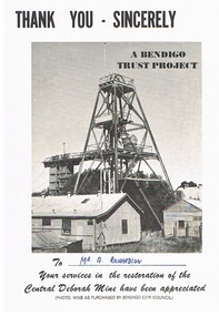
Document - CENTRAL DEBORAH MINE
5 pieces of information/advertising material for the Central Deborah Mine. A. Thankyou card presented to A. Richardson in appreciation of assistance with restoration of the mine. B&C. Diagram of the layout of the mine area, including highlights of underground tours, Key dates of the mine history and a map key to layout on the front of the pamphlet. D&E. Complimentary copy of a guide to the Central Deborah Gold Mine, showing the layout of the area and a description of each numbered site at the site. F&G. Advertising brochure, similar to the previous copy, D&E, with numbered locations at the site, and descriptions of each site. Includes additonal information re, Room 2 (change room) and Model room. H&I. Pamphlet of the mine area, showing chronological history, and short description of theach numbered site.gold mining, miners' safety cage, central deborah mine. -
 Bendigo Historical Society Inc.
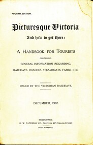
Book - PICTURESQUE VICTORIA
Picturesque Victoria and how to get there, a handbook for tourists containing information regarding railways, coaches, steamboats, fares, etc. Issued by the Victorian Railways December 1907. Printed by D W Paterson Co Melbourne, contains 246 pages with maps and black and white illustrations.books, natural history, victoria -
 Bendigo Historical Society Inc.
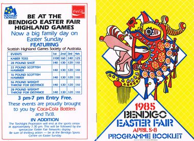
Document - BENDIGO EASTER FAIR 1985, 5 April 1985
Bendigo Easter Fair 1985, April 5-8. Programme Booklet. Friday: Sun Loon Display, Easter Bowling Carnival, Rotary Easter Art Show, Book Bazaar, Model Railroaders Exhibition, Dudley House, Exhibition of Dolls, Embroiderers Guild, Art Gallery. Saturday: Mardi-Gras Street Carnival, Busking, Outdoor Theatre, Arts & Music, Bendigo Theatre Company, Cynthia Holland & Bendigo Talent Club Sun Loong Display, Rotary Art Show, Handcraft Bazaar, Motorcycle Show-Sandhurst Historic Vehicle Club Trams, Central Deborah, Dudley House, Exhibition Dolls, Antique Fair, Model Railroaders, Fire Brigades' Carnival for Children, Horse & Harness Parade, Book Bazaar, Bowling Carnival, Football, Photographic Exhibition, Family Activities, Cinema 180, Exhibition of Paintings silver furniture & porcelain, Embroiders Guild. Sunday: Horse Spectacular, Model Railroaders, Rotary Art Show, Handcraft Bazaar, Antique & Historical Display of Arms Weapons & Military, Antique Fair, Torchlight Procession, Awakening of Dragon, Exhibition of Dolls, Dudley House, Trams, Central Deborah, Book Bazaar, Mardi-Gras Street Carnival, Hargreaves Mall, Motorcycle Show, Photographic Exhibition, Family Activities, Cinema 180, Art Gallery, Embroiderers Guild. Monday: Philatelic Society Exhibition, Rotary Art Show, Handcraft Bazaar, Antique Fair, Model Railroaders, Bendigo District Bowling Assn. Easter Bowling Carnival, Exhibition of Dolls, Dudley House Bendigo Branch Royal Historical Society, Trams, Central Deborah, Motorcycle Show, Antique and Historical Display of Arms Weapons & Militaria, Mardi-Gras Street Carnival, Hargreaves Mall, Gala Street Procession, Carnival For Children, Sun Loong on Display, Photographic Exhibition, Fusion, Cinema 180, Art Gallery, Embroiders Guild. Church Services in Bendigo City Area During Easter (listings for Thursday, Good Friday, Eater Saturday, Easter Day). The Bendigo & District Tourism Association Welcomes you to Victoria's Premier Town. Listing of events over Easter with map to guide all around. Bendigo Easter Fair Incorporated Phone: (054) 43 9191Bendigo Easter Fair Inc. would like to thank the Ministry for the Arts for its continued assistance over the past 11 years. 3 1/2 pages of information on the Bendigo Easter Fair and its rich history dating back to 1871. The first Fair was held to aid 2 charities: Bendigo Base Hospital and the Home and Hospital for the Aged (Benevolent Asylum). Gone are the days of the Fancy Bazaar, Fat Baby Contest and the greasy Pig Chase, many tradition remain the same. Links to the Chinese community date back to when the first settlers arrived seeking gold. This gives the Fair its unique quality and Brings visitors in their thousands each Easter. The Monday Procession has always been the most famous as many old photographs show. Some photos taken before the turn of the century. Many made the journey to Bendigo from Melbourne and outlying districts. Visitors line the route to see floats, bands, and the once a year appearance of the Chinese Dragon, ''Sun Loong'' or ''New Dragon''. The longest Imperial Dragon in the World; 300ft plus in length. His predecessor, ''Long'', is acclaimed as the worlds oldest Imperial Dragon. Easter Saturday Procession has taken form of a Horse and Harness Parade, attracting and immense variety of entrants. The torchlight Procession on Sunday evening includes fireworks, Fire Brigades, Fire Trucks, firemen, marching girls and illuminated floats. The Army has helped with the procession since around the time of Federation. 15th Transport Squadron (15 Tpt. Sqdn.), processions are assembled & dispatched with Army efficiency. Marshalling the Monday Procession this year will be done by the Army as well as our own Easter Fair marshalls with a new communications system.1930 the Popular Girl contest was introduced. The four main streets of Bendigo, Pall Mall, Mitchell Street, Hargreaves Street and Williamson Street (formerly View Street), sponsored their particular girl by means of raffles, street stalls and a variety of fund raising. The winner was the one that raised the most money, and was announced from the balcony of the Shamrock Hotel, by the Mayor of Bendigo on Easter Saturday Night. The Popular girl contest is still held with a lot of the fund raising now done by service clubs and voluntary organizations. 1984 fund raising efforts, in excess of $50,000 was distributed to charities in our area. The combined Bendigo Brigades' record support for the Easter Fair goes back of many years in a variety of ways. Bendigo people are known for their love of sport and the choice in the city is very wide. There will be no Easter Sports Carnival this year but Easter Fair will still be holding functions at the Bendigo Sports Centre in Park Road. Bendigo city centre will be alive with stalls, raffles and rides of every description over the three days of sports, Sat-Sun. Hargreaves Mall will be the focus of relaxation, buskers, community theatre, arts with craft activity & musical entertainment. The Rotary Club of Bendigo and the Easter Fair Society had had independent Arts Shows but in 1981amalgamate their shows. 1981 Rotary Club of Bendigo added the Antique Fair to the Easter Program, held in the RSL Memorial Hall, Pall Mall. Last year some event were cancelled, but last year's Fair was quite a success. With many outdoor activities, the weather plays a vital role. It has been necessary to alter some venues in the past years, with Easter being a week early in April this year we are looking forward to fine conditions. The Chinese and Bendigo Easter Fair, The First Chinese arrived on the goldfields in mid 1850's in teams or groups to work the rich alluvial gold fields of Dai Gum San (Big Gold Mountain). Most were of poorer class from the district of See Yup, an area of four villages near the provincial capital Canton (Kwangchow). By far the largest group came from the village of Toi Shan. The alluvial gold quickly petered out so by the time of the first Bendigo Easter Fair in 1871 most Chinese had either left for richer fields or turned to other pursuits such as stores, market gardens, laundries, herbalists etc.. Many of course had died on the fields from the rigors of mining of diseases not encountered in their homeland. The Benevolent Asylum (Home & Hospital for the age) and Bendigo Base Hospital had become places of rest, help and haven for old, sick and lonely Chinese. SO when the idea was mooted to hold a charity fair to raise money for these worthy establishments, the Chinese were only too happy to join with the Easter Fair Society in this charitable work. It has for over 113 years. Chinese showed their costumes, scenery, and weapons of warfare, but it was not until 1892, that the first of the 5 loongs (dragons) appeared.. . The pageant was marshalled by Mr T Chapman and headed by Mr Moody, attired in habiliments of a most gorgeous character on a gaily caparisoned horse, and his get up as a Chinese grandee was perfect. . . Tom toms , bagpipes. . Wind instrument resembling a clarinet. . Bagpipes,.. The Weekly Advertiser, Friday, April 22,1892. . . Today the Chinese Association, made up of descendants and families of the early Chinese and associate members, carries on the charitable works of their predecessors. A Little Of Dragons, We have all heard of St. George Bendigo dragons (loongs) have none of these characteristics, in fact they have only brought good to Bendigo. There are 3 chief species of Chinese Dragons of which ''The Lung'' (Loong) is the most powerful. It is also the spiritual dragon which produces wind and rain. It has 9 resemblances, the head of a camel, horns of a deer, eyes of a rabbit ears of a cow, neck of a snake, belly of a frog, scales of a carp, claws of a hawk and palm of a tiger. Loong is a vegetarian, favourite food pomelo (ooluk), the father of our modern grapefruit. The abode, according to legend is the sky or water. He is also deaf, thus requiring loud noises to awaken him and to keep him awake. . . Number of claws they have represent rank. Dragons have 2, 3, 4 or 5 claws, the latter being reserved for the Emperor. Loong and Sun Loong have both five claw dragons. Bendigo has had 5 or 6 dragons, the number being confused by the fact each dragon was called 'Loong'. Today Three dragons remain in Bendigo, Loong, Sun Loong, and Yar Loong. Loong is the oldest Imperial Dragon in the world. He continued his walk through the streets of Bendigo til his retirement in 1970. He was created in Fat Shan in the Peoples Republic of China. Built of. . . Sun Loong replaced Loong after the 2 dragon procession of 1970. Created by Mr Law On, . . Yar Loong is a night dragon, came in 1930's. . . Long history of dragons. . The Birth Of A Dragon. . . To awaken A Dragon. . . The Easter Monday Chinese Procession. . . Procession divided into 6 sections,.. The Easter Monday Procession comprises,… over 350 people. Conclusion It is hoped that in the near future a museum can be built to house the priceless regalia gathered together over the last century and a half by the Bendigo Chinese Association. Advertisements; Historic Bendigo Pottery, Mim's Restaurant, Antique Fair (Rotary), The Copper Pot, Sandhurst Town (Develop Victoria Council Tourism Award 1983-1985), Bendigo Motor Co. (Mazda), Diggers, Chaplin's, Bendigo's Dunny Diner, Arakoon, Quin's Bluebird, Allara Motor Lodge, Lakeview Motor Inn, The Armoured Car Company, Gillies, Mardi Gras Street Carnival, Handcraft Bazaar, Art Show (Rotary) Bendigo Model Railroaders (Easter Exhibition), Bendigo Easter Fair Highland Games brought to you by TV8 and Coca-Cola Bottlers. Design and Finished Art By Graphics Group, Bendigo.Graphics Group Bendigoevent, easter fair, bendigo easter fair incorporated, bendigo easter fair 1985, april 5-8. programme. friday: sun loon display, easter bowling carnival, rotary easter art show, book bazaar, model railroaders exhibition, dudley house, exhibition of dolls, embroiderers guild, art gallery. saturday: mardi-gras street carnival, busking, outdoor theatre, arts & music, bendigo theatre company, cynthia holland & bendigo talent club sun loong display, rotary art show, handcraft bazaar, motorcycle show-sandhurst historic vehicle club trams, central deborah, dudley house, exhibition dolls, antique fair, model railroaders, fire brigades' carnival for children, horse & harness parade, book bazaar, bowling carnival, football, photographic exhibition, family activities, cinema 180, exhibition of paintings silver furniture & porcelain, embroiders guild. sunday: horse spectacular, model railroaders, rotary art show, handcraft bazaar, antique & historical display of arms weapons & military, antique fair, torchlight procession, awakening of dragon, exhibition of dolls, dudley house, trams, central deborah, book bazaar, mardi-gras street carnival, hargreaves mall, motorcycle show, photographic exhibition, family activities, cinema 180, art gallery, embroiderers guild. monday: philatelic society exhibition, rotary art show, handcraft bazaar, antique fair, model railroaders, bendigo district bowling assn. easter bowling carnival, exhibition of dolls, dudley house bendigo branch royal historical society, trams, central deborah, motorcycle show, antique and historical display of arms weapons & militaria, mardi-gras street carnival, hargreaves mall, gala street procession, carnival for children, sun loong on display, photographic exhibition, fusion, cinema 180, art gallery, embroiders guild. church services bendigo city easter , eater saturday bendigo & district tourism association victoria's premier town. bendigo easter fair incorporated bendigo easter fair rich history 1871. base hospital and the home and hospital for the aged (benevolent asylum). fancy bazaar, fat baby contest greasy pig chase, many old photographs floats, bands, chinese dragon, ''sun loong'' or ''new dragon''. the longest imperial dragon in the world; 300ft plus in length easter saturday procession horse harness parade. torchlight procession on sunday evening includes fireworks, fire brigades, fire trucks, firemen, marching girls and illuminated floats. army helped federation. 15th transport squadron (15 tpt. sqdn). monday procession by the army 1930 popular girl contest introduced. four main streets, pall mall, mitchell street, hargreaves street williamson street. winner announced shamrock hotel, easter saturday night. popular girl contest fund raising service clubs voluntary organizations. 1984 fund raising efforts, in excess $50, 000 distributed to charities. combined bendigo brigades'. no easter sports carnival holding functions bendigo sports centre in park road. stalls, raffles three days sports, sat-sun. relaxation, buskers, community theatre, arts with craft activity & musical rotary club of bendigo easter fair society independent arts shows in 1981amalgamate antique fair, held last year some event cancelled. with many outdoor activities, weather plays vital role. alter some venues in the past, easter being a week early first chinese arrived goldfields in mid 1850's dai gum san (big gold mountain). see yup, canton (kwangchow). toi shan. first easter fair in 1871 for richer fields other pursuits stores, market gardens, laundries, herbalists etc. benevolent asylum (home & hospital for the age) bendigo base hospital had become places of rest, help and haven for old, chinese. charity fair to raise money, chinese join easter fair society in this charitable work. costumes, scenery, weapons of warfare, 1892, the first of the 5 loongs. marshalled by mr t chapman by mr moody, caparisoned horse, chinese grandee. tom toms, wind instrument. bagpipes, advertiser, april 22, 1892. chinese association, descendants chinese and associate charitable works. st. george ''the lung'' most powerful. spiritual dragon wind rain. 9 resemblances, camel, deer, rabbit cow, snake, frog, carp, hawk tiger. a vegetarian, pomelo (ooluk), the abode, legend is the sky or water. deaf loud noises to keep him awake. claws represent rank. 2, 3, 4 or 5 claws, reserved for emperor. had 5 or 6 dragons called 'loong'. three dragons loong, sun loong, yar loong. loong oldest imperial dragon in the world. retirement 1970. created in fat shan peoples republic of china. built of. sun loong, loong 2 dragon procession 1970. created mr law on, yar loong a night dragon1930's.history dragons. birth of a dragon. awaken a dragon. easter monday chinese procession divided 6 sections 350 people. priceless regalia last century bendigo chinese association. advertisements; historic bendigo pottery, mim's restaurant, antique fair (rotary), the copper pot, sandhurst town (develop victoria council tourism award 1983-1985), bendigo motor co. (mazda), diggers, chaplin's, bendigo's dunny diner, arakoon, quin's bluebird, allara motor lodge, lakeview motor inn, armoured car company, gillies, mardi gras street carnival, handcraft bazaar, art show model railroaders highland games tv8 coca-cola. art by graphics group -
 Bendigo Historical Society Inc.
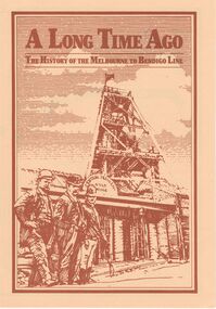
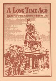
Document - ''A LONG TIME AGO'': THE HISTORY OF THE MELBOURNE TO BENDIGO LINE
''A Long Time Ago'' - The history of the Melbourne to Bendigo line. V/Line publication (fold-out) with brief history of construction and simplified route map of line with brief description of some of the railway line features as well as information about towns and special features on the route.V/Line Publication, Walker Printing Bendigo.bendigo, history, bendigo railway, bendigo railway, stations on the bendigo line -
 Bendigo Historical Society Inc.
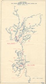
Map - STATE RIVERS AND WATER SUPPLY COMMISSION : COLIBAN DISTRICT MAP 1956, 30/11/1956
State Rivers and Water Supply Commission Coliban District map. Titled: S.R. & W.S.C. Coliban District Plan showing Irrigation and Town Supply Channels 1956. Scale: 1 inch = 4 miles. Indicates concrete lining and concrete re-lining channels. Printed in blue ink and information added in red. The map is dated at the bottom - 30/11/'56. There is a number, 25,491, in the bottom right corner.state infrastructure, water supply, coliban system, state rivers and water supply commission. coliban system. -
 Bendigo Historical Society Inc.
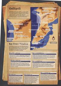
Document - AUSTRALIANS IN ACTION: ANZAC BISCUIT STORY
Information sheet from Australian War Memorial detailing brief stories of Australians in Action, the Anzac Biscuit Story, about the RSL and a timeline of Gallipoli key events with map. A3 size, buff background, sepia pictures.event, war, world war 1 - gallipoli key events, gallipoli, anzac -
 Bendigo Historical Society Inc.
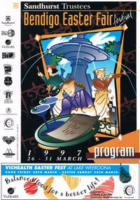
Document - BENDIGO EASTER FAIR FESTIVAL PROGRAM 1997, 26 March 1997
Bendigo Easter Fair Festival Program, 26-31 March, 1997. Festival Features, Evening of Art & Classical Music, Rotary Club of Bendigo. VicHealth Easter Fest, Victorian Health Promotion Foundation & Bendigo Community Health Services. Fine Food Fest. Free Stage. Free Evening Concert & Fireworks, Zaire. Torchlight Procession, sponsored by Prime TV & Coca Cola, Bendigo Market Place. Fireworks Spectacular, Sponsored by Bendigo Market Place & Prime TV. Street Fiesta, sponsored by Arts Victoria. Street Extravaganza, Coca Cola Carnival, Sponsored by Coca Cola. Star for a Day, Power Audio Visual & Prime Television. Handcraft Bazaar, Rotary Club of Bendigo Sandhurst Art & Craft Market. Cosmopolitan Street Café, Arts Victoria. Awakening of the Dragon, Bendigo Chinese Association. Gala Parade, Prime Television & Coca Cola. Firewalking by the Australian Skeptics, Discovery Science & Technology Centre. Up In Flames, Discovery Science & Technology Centre. Barry Kenny's Country Roundup, Nadort Promotions. School's Day. Teddy Bear's Picnic, Dragon City Marshals. Fire Brigades Children's Carnival. Family Event, Bendigo Minister's Fellowship. Bendigo Easter Antique Fair. Historic Photographic Exhibition, Burt Sargent Circa 1900. Open Garden at Nanga Gnulle (''nanga nully''). A parade of Quilts, Strathdale Bendigo Quilters Inc. Tasting the Life, Gail Tavener Studio. Snakes Alive Dangerous Australians, BRIT. Y's Men's Club of Bendigo Book Fair, YMCA. Bendigo Camera Club, BRIT. Bendigo Woodcraft Exhibition, Woodturners Bendigo Inc. Autumn Bonsai, Bendigo Bonsai Club. Convocation, National Trust Bendigo. Arms & Collectables, Golden City Collectors Assoc. In. Rotary Art Show. Rotary Pottery Exhibition. Women's Vision For The Church, Provincial Council of Mothers Union. Historic Toorak House, Lioness Club of Golden City Bendigo. White Hills Cemetery. Bendigo Cemetery. Festival of Flowers, Craft & Garden, Bendigo Jockey Club. Shannons Corporation Motorfest, City Drive Through, Static Display, Motorkhana, Time Trial. Bendigo Bank Dragon Mile. Volkswagen Car Show, a part of the 28th National Bug-In. Repco Cycles, Australian Veteran Cycling Council Inc. Championships. Under 17 Australian Badminton Championships. Palm Sunday, Bendigo Symphony Orchestra. Way of the Cross, Bendigo's Combined Churches. The Easter Story, Kangfluca Music. Sunrise Church Service, Bendigo Ministers' Fellowship. Map of CBD Advertisements: Bendigo Easter Antique Fair. Austar. Bendigo Art Gallery. Bendigo Visitor Information Centre. Prime. Golden Dragon Museum Inc. Bendigo Heritage Tours. Discovery Science & Technology Centre Bendigo. Sponsors: Sandhurst Trustees, Prime, Vic Health, ABC Radio, Arts Victoria, Coca Cola, Events Bendigo, City Of Greater Bendigo, Bendigo Community Health Services, Shannons., Morris Design PH 5448 8777Morris Designevent, easter fair, bendigo easter fair, bendigo easter fair festival program, 26-31 march, 1997. festival features, evening of art & classical music, easter fest, . fine food fest. free stage. free evening concert & fireworks. torchlight procession. fireworks spectacular, street fiesta, street extravaganza, coca cola carnival, star for a day, handcraft bazaar, art & craft market. cosmopolitan street café, awakening of the dragon. gala parade, firewalking australian skeptics, discovery science & technology centre. up in flames, barry kenny's country roundup, nadort promotions. school's day. teddy bear's picnic, fire brigades children's carnival. family event, bendigo minister's fellowship. antique fair. photographic exhibition, burt sargent circa 1900. open garden nanga gnulle a parade of quilts, strathdale bendigo quilters inc. tasting the life, gail tavener studio. snakes alive dangerous australians, brit. book fair, ymca. bendigo camera club, brit. bendigo woodcraft exhibition, woodturners bendigo inc. autumn bonsai, bendigo bonsai club. convocation, national trust bendigo. arms & collectables, golden city collectors assoc. art show. pottery exhibition. women's vision for the church, provincial council of mothers union. historic toorak house, lioness club. white hills cemetery. bendigo cemetery. festival of flowers, craft & garden, bendigo jockey club. motorfest, drive through, static display, motorkhana, time trial. dragon mile. volkswagen car show, national bug-in. repco cycles, australian veteran cycling council inc. championships. under 17 australian badminton championships. palm sunday, bendigo symphony orchestra. way of the cross, bendigo's combined churches. the easter story, kangfluca music. sunrise church service, bendigo ministers' fellowship. map of cbd advertisements: antique fair. golden dragon museum inc. bendigo heritage tours. discovery science & technology centre bendigo. sponsors: sandhurst trustees, vic health, abc radio, arts victoria, coca cola, events bendigo, city of greater bendigo, bendigo community health services, shannons., morris design. prime tv. austar. bendigo art gallery. bendigo visitor information centre. prime, victorian health promotion foundation, zaire, sponsored by bendigo market place & prime tv, sponsored by arts victoria, sponsored coca cola, power audio visual, rotary club of bendigo sandhurst, bendigo chinese association, y's men's club of bendigo -
 Bendigo Historical Society Inc.
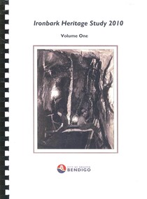
Book - IRONBARK HERITAGE STUDY
Ironbark Heritage Study 2010 Volume One & Two, contains maps and photographs of houses in area along with heritage reports and historical information. Prepared by Amanda Jean Architect and Heritage consultant for the City of Greater Bendigo.Amanda Jeanbendigo, buildings, heritage buildings -
 Bendigo Historical Society Inc.
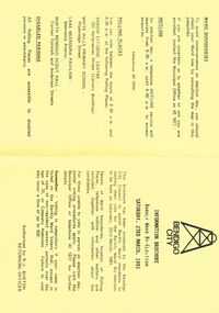
Document - BENDIGO CITY INFORMATION BROCURE BARKLY WARD, 23 March 1991
Bendigo City Information Brochure Barkly Ward By-Election. Saturday, 23rd March, 1991. Brochure by the Bendigo City Council to assist Barkly Ward residents in casting their vote in Barkly Ward, 23 March, 1991. Authorised by R J Burton, Returning Officer. Map of Barkly Ward. Candidate Information, Lois Angus, David Anderson, Lynne Geri. Ward Boundaries. Hotline. Polling places: Senior Citizens Centre (Bendigo), White Hills Primary School, Lake Weeroona Pavilion, North Bendigo Scout Hall. Disabled Persons all Polling Places are accessible to disabled persons in wheelchairs.government, local, barkly ward, bendigo city information brochure barkly ward by-election. saturday, 23rd march, 1991. 23 march, 1991. authorised by r j burton, returning officer. map of barkly ward. candidate information, lois angus, david anderson, lynne geri. ward boundaries. hotline. polling places: senior citizens centre (bendigo), white hills primary school, lake weeroona pavilion, north bendigo scout hall. all polling. accessible to disabled -
 Bendigo Historical Society Inc.
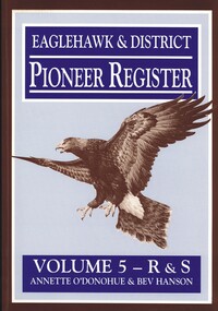
Book - EAGLEHAWK & DISTRICT PIONEER REGISTER VOLUME 5 R - S
Eaglehawk & District Pioneer Register Volume 5 R&S 1544 pages of information relating to Eaglehawk & district pioneers with black and white photographs and maps. Missing. Whereabouts unknown.Annette O'Donohue & Bev Hansonbook, bendigo, bendigo history & its people -
 Bendigo Historical Society Inc.
Document - A LONG TIME AGO: THE HISTORY OF THE MELBOURNE TO BENDIGO LINE
'A LONG TIME AGO: THE HISTORY OF THE MELBOURNE TO BENDIGO LINE' Bi-fold publication. A schematic 'strip' map of the line with particular places (approx 40) marked on the route with short descriptions of these sites. Concise description of the construction of the line; a summary of present attractions for the visitor to Bendigo and V/Line information.Walker Printing Bendigorailways, bendigo to melbourne, brochure, barkers creek , harcourt, elphinstone tunnel, malsmbury, malmsbury viaduct, kyneton, carlsruhe, hanging rock, woodend, mount macedon, riddells creek, clarkefield hotel, rupertswood, sunbury, diggers rest, sydenham, st albans, spencer street. v/line. -
 Bendigo Historical Society Inc.
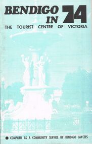
Book - BOOKLET: BENDIGO IN 74
48 paged booklet - ''Bendigo in 74 - The Tourist Centre of Victoria'' - compiled as a community service by Bendigo Jaycees. Comprehensive information about Bendigo and attractions - Index: Accommodation; Additional information; An introduction to Bendigo; Aquarium; Art Gallery; Bendigo Trust; Caravan parks; Dai Gum San; Directory; Eaglehawk Museum; Entertainment; Emergency services; Joss House; Lake Eppalock; National Trust classified buildings; Natural history; Map of Bendigo; Map of city centre; Pottery; Picnic areas; sporting facilities; 'Talking Trams'; Thanks; Tours; Tourist attractions; Victoria Hill; What's on in Bendigo.Bendigo Jaycees. Espress Printers Bendigo.bendigo, tourism, guide 1974, bendigo jaycees, radio 3bo, city family hotel, don murray's hotel motel, cambrian hotel, charlies craft & lifestyle store, powneys authorised newsagent, the bendigo trust, white hills panel works, bendigo pottery, bendigo racecourse, homestead motor inn, peter wade, the persian room, sandhurst trading co. pty. ltd., bendigo air services, bendigo sec, geo. r. innes & sons, cohns, the copper pot, sandhurst travel service. golden hills motel, welcome stranger motel, brian boru hotel, john lindsay's pharmacy & photographic centre, alf morris motors -
 Bendigo Historical Society Inc.
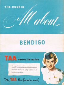
Book - BOOKLET: THE RUSKIN ALL-ABOUT
40 paged booklet - ''The Ruskin All-about'' (covering the Municipality of Bendigo facilities and activities), printed by The Ruskin Press, 1955. ''assisted by the Municipal Council and its officers and office-bearers of other organizations and associations''. Contents: Abbreviations; Baby Health Centres; Bus services; By-laws and regulations; Churches; Classified advertisers; Community activities; Doctors and surgery hours; Facts on the city; Friendly Societies; Hospitals; Magazine section; Maps; Message from the Mayor; Miscellaneous; Municipal services; The Municipality; Public and semi-public utilities; Schools and kindergartens; Sporting and recreation. Information on the forthcoming Olympic Games.Ruskin Publishing Pty. Ltd., 37 Swanston Street Melbourne.bendigo, tourism, guide -
 Bendigo Historical Society Inc.
Document - LONG GULLY HISTORY GROUP COLLECTION: BENDIGO'S TRAM SYSTEM
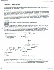
Information on trams. Includes small photo of Trams 24 & 26, Map of Bendigo Tram routes 1972and 1996, Ballarat No 26 tram, S 164 tram, and No 38 tram. Mentioned is the individual history and where they can be found, operating and non operating trams, different classes of trams. Geelong's Birney Cars, two of which came to Bendigo and the Type G (Birney Safety Cars). Other information includes Nos, First introduced, Last withdrawn, Electrics (motors), Size and Seating/Crush Load. (8 pages).bendigo, history, long gully history group, the long gully history group - bendigo's tram system, battery trams, steam trams, electricity supply company of victoria, toastrack trams, david bromage, bendigo tramways, state electricity commission of victoria, the bendigo trust, chris brownbill, bendigo talking tram, david hoadley, prahran and malvern tramways trust, hawthorn tramways trust, fitzroy northcote and preston tramways trust, melbourne brunswick and coburg tramways trust, north melbourne electric tramway and lighting co, sydney tramway museum, tramway museum of victoria, railpage australia, ballarat vintage tramway, andrew cox, russell jones, australian electric transport museum, birney cars, j g brill & co, bob hawke, adelaide municipal tramways trust, tim blythman, bill winn, john radcliffe -
 Bendigo Historical Society Inc.
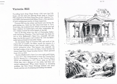
Document - LONG GULLY HISTORY GROUP COLLECTION: VICTORIA HILL
Three pages numbered 18/19, 20/21 and 22/23 titled Victoria Hill. First page has some information on Victoria Hill, a sketch of W Rae's Home and Rae's Open cut. The second page has a map of the Victoria Hill Area showing streets and the New Chum Anticline, a sketch of Ballerstedt's Open Cut and a Key to Victoria Hill Area Map. The third page mentions the Victoria Quartz mine, Tributors and quartz roasting. It also has sketch of a 20 Head Crushing Battery, Victoria Hill.bendigo, history, long gully history group, the long gully history group - victoria hill, gold mines hotel, christopher ballerstedt, theodore ballerstedt, ballerstedt's open cut, lansell's 180 mine, little 180 mine, new chum syncline battery, victoria reef quartz mining co, victoria quartz, new chum drainage scheme, a roberts and sons, tributors, william rae's bon accord mine and open cut, william rae, adventure and advance open cuts, central nell gwynne, heinz butcher shop