Showing 11152 items
matching re-survey
-
 Bendigo Military Museum
Pamphlet - Army Headquarters Survey Regiment Tour Booklet 1966, Army Headquarters Survey Regiment, Circa 1966
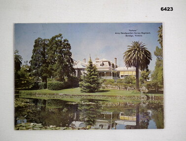
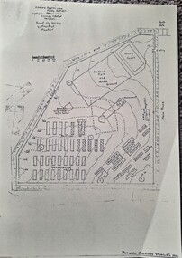
It is believed that this booklet was produced for visitors to a Fortuna Villa Open Day in 1966.Printed Colour photo of Fortuna Villa on a quarter folded A4 sheet. Contains other selected photographs and a diagram of the layout of the grounds and notes on historical background.royal australian survey corps, rasvy, fortuna, army survey regiment, army svy regt, asr -
 Bendigo Military Museum
Pamphlet - Army Headquarters Survey Regiment Tour Booklet 1967, Army Headquarters Survey Regiment, Circa 1967
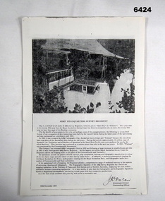
It is believed that this booklet was a revised edition of the 1966 production for visitors to a Fortuna Villa Open Day on 12 November 1967.Printed Colour photo of Fortuna Villa on a quarter folded A4 sheet. Contains other selected photographs and a diagram of the layout of the grounds and notes on historical background.royal australian survey corps, rasvy, fortuna, army survey regiment, army svy regt, asr -
 Bendigo Military Museum
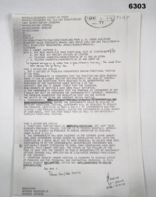
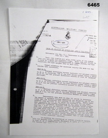
Administrative record - Telex - Army Survey Regiment direction to cease Raster Scanning Sub System acceptance testing, 17 Oct 84
Telex from Assistant Secretary Major Contracts Branch. Due to problems encountered during functional testing of the Raster Scanning Sub System (RSSS) that Army Svy Regt cease acceptance testing. Intergraph will be required to resolve the problems identified and to give the Commonwealth a high degree of confidence that the RSSS would then be able to satisfactorily complete functional testing.Photocopy of a Telex, 5 x foolscap pagesroyal australian survey corps, rasvy, fortuna, army survey regiment, army svy regt, asr -
 Bendigo Military Museum
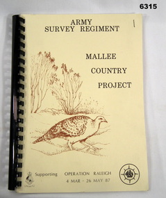
Administrative record - Army Survey Regiment - Mallee Country Project, Army Survey Regiment, 30.01.1987
This is a reconnaissance report for the Mallee Country Project supporting Operation Raleigh 4 Mar - 26 May 1987. Operation Raleigh is a scheme for International Venturers (Scouts) to develop leadership, self-reliance, initiative and team work while studying Mallee Fowl, Mammal Trapping and Cross Country Trekking. Four Annexes containing sketch maps, personnel lists, photographs and stores lists.A4 Report, soft covers front and back. Plastic ring bindingroyal australian survey corps, rasvy, fortuna, army survey regiment, army svy regt, asr -
 Bendigo Military Museum
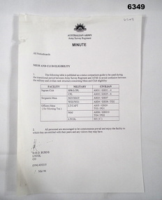
Administrative record - Army Survey Regiment - Mess and Club Eligibility, Army Survey Regiment, Bendigo, March 1996
A tabulated guide between military and civilian rank structure concerning Mess and Club elegibility.A single A4 paper page Army Minuteroyal australian survey corps, rasvy, fortuna, army survey regiment, army svy regt, asr -
 Bendigo Military Museum
Administrative record - Army Survey Regiment Minute - Activity Changes at Fortuna, Army Survey Regiment, 10.03.1995
A 'Minute' paper describing the Army Activity Changes at Fortuna as a result of the Commercial Support Programme. The new organisation to be called "The Army Topographical Support Establishment" (ATSE). contains information concerning the transition from an Army to a civilian establishment including the proposed manning and pay rates. The other items in the folder are listed under the Notes heading.A4 Paper in a Manilla folder with A "Arnos" fastener, 6 x pages. This is one of 23 miscellaneous documents in a four ring binder. Items are listed "A to V" under this item number 6264. The binder is labelled DIGO Historical Archives Vol 74.royal australian survey corps, rasvy, fortuna, army survey regiment, army svy regt, asr, army topographical support establishment, atse -
 Bendigo Military Museum
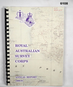
Administrative record - Royal Australian Survey Corps - Annual Report 1990/91, Royal Australian Survey Corps, Late 1991
Annual Report detailing the status of Australian mapping, charting and geodesy for the period 1 Jul 90 - 30 Jun 91A4 soft covered book, glossy paper pages and plastic pockets containing maps. Plastic ring bindingTop right hand corner "2IC Tech WO"royal australian survey corps, rasvy, fortuna, army survey regiment, army svy regt, asr -
 Federation University Historical Collection
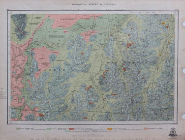
Map, Geological Survey of Victoria, 1913
Printed colour map on papervictoria, geological survey of victoria, gladstone, talbot -
 Bendigo Military Museum
Administrative record - AHQ Survey Regiment - Tests on stability of duplicate Aerial Photography negatives 1959, AHQ Survey Regiment, 8 Dec 1959
Tests on the stability of Duplicated Aerial Photography negatives. Tests were carried out using 3 x units of 2 x models from both original and duplicate films. These were all brought to a scale of 1;25,000 and horizontalized on common points and approximately 250 spot heights read on each unit.1 x A4 poorly photocopied Report. Typed text and incompleteroyal australian survey corps, rasvy, fortuna, army survey regiment, army svy regt, asr -
 Federation University Historical Collection
Map - Geological Survey, J. Phillips, Geological Survey of Victoria - Ballarat, 1857, 10/1858
Geological map of the Ballarat District featuring four colours.ballarat, geological, geology, geological plan, main road, camp, golden point, pennyweight hill, clayton hill, ballaarat cemetery, bakery hill, specimen hill, soldiers hill, nightingale lead, native youth black hill flat, white flat, mining, mines, eureka lead, old post office hill -
 Surrey Hills Historical Society Collection
Book, Medlow Garden Survey and Landscape capability study 1983, Oct-83
Includes: Plan of Subdivision, Detailed plan, map of garden, Auctioneer's plan for 1854 sale, Botanical plan of Medlow & Landscape history notes. Full title : Medlow Garden survey and landscape capability survey. A report for the National Trust of Australia (Victoria) A report detailing the landscape survey of Medlow Garden estate. Includes landscape history, cultural significance, particulars about vegetarian, garden, rehabilitation and plans.A report detailing the landscape survey of Medlow Garden estate. Includes landscape history, cultural significance, particulars about vegetarian, garden, rehabilitation and plans. 38 p illland surveys, medlow garden, bismark estate, rosalie estate, warrigal road, surrey hills, bismarck avenue, warwick avenue, t p payne, (mr) hugh glass, boroondara, (maj.) (mr) - cairncross, (mrs) mary jane cairncross, (dr)(mr) richard joseph bull, (mrs) catherine grace bull, (miss) norma bull, (mr) ronald richard bull, medlow, house names, (mr) rex swanson, landform australia -
 Tatura Irrigation & Wartime Camps Museum
Photograph, Camp 3 Compound B Survey Map, 1942
Gives an interesting and definitive idea of circumstances and life in the POW camps of Australia. Detailed sketch of Compound B Camp 3 based on survey by Manfred MuellerDetailed sketch of Compound B Camp 13 based on survey by Manfred Mueller September 1942. On cream paper, laminated.camp 13, camp sketches, manfred mueller, survey map, compound b camp 3 -
 Bendigo Military Museum
Photograph - Farewell to Retiring Army Survey Regiment RSM and RSM Handover, 1st of March 1982
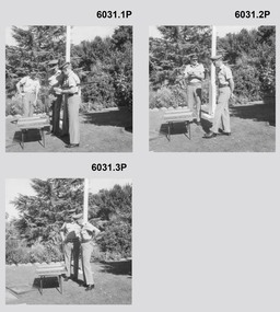
These 11 x black and white photographs were taken at a farewell to the retiring RSM WO1 Aubrey Harvey on the 1st of March 1982 at the Fortuna Villa flag pole Army Survey Regiment, Bendigo. The RSM handover also occurred that day. These proof photographs were printed on photographic paper and are part of the Army Survey Regiment’s Collection. 310963 WO1 Aubrey William Harvey served from Feb 1952 till Mar 1982, he was RSM Army Survey Regiment from 1976 -82. 54080 LTCOL Peter Eddy served from 1960-1983 and was CO Army Survey Regiment 1981-82. WO1 Robert (Bob) Mason succeeded WO1 Aub Harvey as RSM and served as RSM 1982-1986.These 11 black and white photographs were taken at a farewell to the retiring RSM WO1 Aubrey Harvey and the RSM Handover in 1982 at the Fortuna Villa flag pole, Army Survey Regiment, Bendigo. These proof photographs were printed on photographic paper and are part of the Army Survey Regiment’s Collection. The photographs were scanned at 600 dpi. 400 dpi. .1) - Photo, black & white, 1982. L - R Unknown, LTCOL Peter Eddy (CO Army Survey Regiment) WO1 Aub Harvey, WO1 Bob Mason (incoming RSM) .2) to .7) - Photo, black & white, 1982. L - R LTCOL Peter Eddy (CO Army Survey Regiment) WO1 Aub Harvey .8) to .11)- Photo, black & white, 1982. L - R WO1 Bob Mason WO1 Aub HarveyOn Rear, " WO1 Harvey's farewell" . Date '01/03/1982' provided with photos in Photo Folder 26.royal australian survey corps, rasvy, fortuna, army survey regiment, army svy regt, asr -
 Dandenong/Cranbourne RSL Sub Branch
Framed Print, Print of The hydrographic survey ship HMAS MORESBY and the oceanographic survey vessel HMAS COOK of the Western Australia coast in 1983
Print of Print of The hydrographic survey ship HMAS MORESBY and the oceanographic survey vessel HMAS COOK of the Western Australia coast in 1983 -
 Victorian Interpretive Projects Inc.
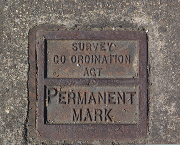
Photograph - Colour, Ballarat Survey Permanent Mark
A survey Permanent Mark was used by surveyors to enable them to plot land accurately.A colour photograph of a metal mark in the footpath on the corner of Ballarat's Sturt Street and Doveton Street. The Permanent Mark was put in place as part of the Survey Co ordination Act ballarat, survey, surveyor, footpath, infrastructure -
 Surrey Hills Historical Society Collection
Book, Medlow Garden Survey and Landscape capability study 1983, Oct-83
Includes: Plan of Subdivision, Detailed plan, map of garden, Auctioneer's plan for 1854 sale, Botanical plan of Medlow & Landscape history notes. Full title : Medlow Garden survey and landscape capability survey. A report for the National Trust of Australia (Victoria) A report giving a detailed landscape survey of Medlow Garden estate. Includes landscape story, cultural significance, particulars about vegetarian, garden, rehabilitation and plans.Copy of a report giving a detailed landscape survey of Medlow Garden estate. Includes landscape story, cultural significance, particulars about vegetarian, garden, rehabilitation and plans. 38 pages with illustrations.land surveys, medlow garden, bismark estate, rosalie estate, warrigal road, surrey hills, bismarck avenue, warwick avenue, t p payne, (mr) hugh glass, boroondara, (mr) (maj) - cairncross, (mrs) mary jane cairncross, (dr) (mr) richard joseph bull, (mrs) catherine grace bull, (miss) norma bull, (mr) ronald richard bull, medlow -
4th/19th Prince of Wales's Light Horse Regiment Unit History Room
Document, 4th Light Horse Regiment Association - Re-union Order No 1, 24 Sep 1926
It was produced for the re-union of the 4th Light Horse Regiment in 1926Re-union order No 1 by Major General J K Forsyth CMG. This is a light hearted document produced in the style of a Regimental Order.4th light horse association -
 National Wool Museum
Sign, Instructions to Employees re Registration of Time Cards
Sign gives instructions to mill employees re: registration of their time cards. This sign was used at the Collins Bros Mill which was located on La Trobe Terrace - point 10 tells employees that they are not to enter the mill via any gate other than the one on La Trobe Terrace. This sign may have been actually in use at Collins Bros, which is why it is so faded and why the original Cardbox record states that it was framed - it was not framed when the sign was located (NB: a small modern copy of this sign has been framed and is on display in Gallery 2).INSTRUCTIONS TO EMPLOYEES / RE / REGISTRATION OF TIME CARDS / [text follows]textile mills staff, textile mills management, collins bros mill pty ltd, textile mills - staff, textile mills - management -
 Warrnambool and District Historical Society Inc.
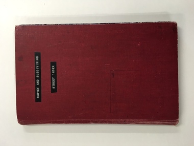
Register, Survey & subdivision street index, 1930s
This is a book with the City of Warrnambool surveys and subdivisions listed under the street names. It covers the period from 1938 to 1975. The information is listed under the headings of plan number, street name, section, allotment, date and remarks. The information contained therein would now be held as electronic data in the Council Records Department. Warrnambool, founded in 1847, became a municipality in 1856, a Borough in 1863, a Town in 1883 and a City in 1918. This book is of considerable interest because it lists Warrnambool streets from 1938 to 1975 and gives details of the subdivisions and surveys during that time. It will be very useful for researchers. This is a foolscap-size hard-cover book with a red cover with a mottled-blue pattern paper inside the covers. It has 95 pages with ruled red and blue lines. It has a handwritten alphabet index throughout the pages. The contents are handwritten in blue, green and black ink. The inside binding has been mended with adhesive tape and one page is loose. The book lists subdivisions in the City of Warrnambool under the heading of the street names and covers 1938 to 1975. The cover is somewhat grubby.Front Cover (in plastic tape): ‘Survey and Subdivision. Street Index’warrnambool city council, warrnambool streets and subdivisions -
 Bendigo Military Museum
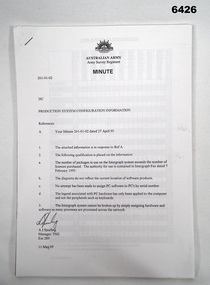
Administrative record - Army Survey Regiment Map Production System Configuration GESS/RSSS, 11 May 1995
This minute encloses a copy of the Software Licence Agreement with Intergraph Corporation Pty Ltd that applies to the software packages within the Automap Raster Sub System (RSSS) and the Graphic Edit Sub System (GESS) at the Army Survey Regiment.A4 Army Survey Regiment Minute - Author AJ Spurling Manager Tech Spt Gp 11 May 95royal australian survey corps, rasvy, fortuna, army survey regiment, army svy regt, asr, intergraph corporation -
 Bendigo Military Museum
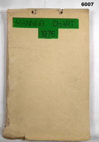
Document - Army Survey Regiment Manning Chart 1976, 1976
This document contains detailed photocopies of reports of Army Survey Regiment’s staff manning from December 1975 to August 1976. Each monthly report provided to Directorate of Survey covered the allocation of staff to Regimental Headquarters and its four sub units comprising Headquarters, Air Survey (Topographic), Cartographic and Lithographic Squadrons. Each Squadron’s troop or section structure was represented by a wire diagram with soldiers and/or civilians names assigned to rank based established positions. A detailed table at the end of each report sumarised Army Survey Regiment’s posted strength by employment category and rank.Manilla cardboard folder containing 83 photocopied pages of staff posted to the Army Survey Regiment. Pages are fixed to the folder by a metal fastener. The title of the folder is written in black ink on a green tape background.royal australian survey corps, rasvy, army survey regiment, army svy regt, asr, fortuna -
 Stawell Historical Society Inc
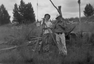
Photograph, Stawell Geodetic Survey at work. c1940's
Taken while surveying western half of Victoria to South Australian Border.Theodolite in foreground. Behind Surveyor in hat, shirt, long pants. Directly behind is Survey technician in hat, Tee shirt and shorts. Surveyor unknown. Assistant Alan Edward Tangey of Stawell. Reverse 4 2 2 6 -
 Victorian Aboriginal Corporation for Languages
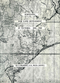
Book, K L Chappel, Surveying for land settlement in Victoria 1836-1960 : survey of the Vic-NSW boundary, survey of the Vic-SA boundary, 1996
A record of the early history of surveying for land settlement. Includes appendices on the border surveys between Victoria and South Australia and between Victoria and New South Wales.maps, b&w photographs, illustrationssurveying, land settlement -
 Kew Historical Society Inc
Plan, Survey Plan, Park Hill Road, Kew, 1880-1890
The streets identified on the survey plan - Cotham Road, Park Hill Road East, Park Hill Road West in Kew were each gazetted by the Victorian Government in 1865. The hand-coloured survey plan was completed by Holland Loxton, Town Clerk and Surveyor of the Borough of Kew from 1866. The unnamed survey plan includes names of land owners in addition to measurements (2 chains to 1 inch) and streets. Named owners include Webster, Payne and Francom which will enable us to narrow down the creation date of the survey.Handdrawn survey plan by a former surveyor and town clerk of KewHand drawn and coloured survey plan created by Holland Loxton, Surveyor and Town Clerk of Kew, showing land owned by Payne in Park Hill Road, Kew. The plan includes street names, land measurements and land owners.surveys - kew, maps - kew, holland loxton, park hill road - kew, holland loxton -- surveyor, survey plans -- parkhill road -- kew (vic.) -
 Melbourne Legacy
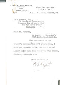
Document, re Property "Holmbush", 1267 Burke Road East Kew, 1943
Formal identification of the property to be bought as the first Melbourne Legacy residence sent to Legatee E. Russell, Chair of the Hostel Committee. The survey is hand drawn and meticulously measured.The documents demonstrate business practices in the 1940s with regard to the purchase of property, as well as being an important record of the first property to be purchased by Melbourne Legacy as a residence for children.00310.1 Letter from Dudley A. Tregent, Solicitor, dated 15 January 1943, to Legatee E. Russell, Chair of the Hostel Committee, enclosing the survey sketch plan. White paper, black letterhead and typing, two holes punched for filing 00310.2 Survey sketch plan by Meudell, Gillespie & Co, dated 13 January 1943. Black type and printing, with some red shading and writing, on white foolscap paper. 00310.3 Letter from Meudell, Gillespie & Co to Mr. D.A. Tregent, Solicitor. Quarto, black typing, red underlining, on white.00310.1 Signed by D.A. Tregent 00310.2 Signed by Percival A. Jordan 00310.3 Signed by Percival A. Jordanholmbush initial negotiations, properties, holmbush -
 Marysville & District Historical Society
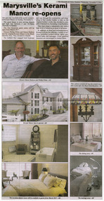
Newspaper (Item) - Newspaper article, Anne Richey, Marysville's Kerami Manor re-opens, 09-11-2016
A newspaper article regarding the re-opening of Kerami Manor in Marysville after the original guest house was destroyed in the 2009 Black Saturday bushfires.A newspaper article regarding the re-opening of Kerami Manor in Marysville after the original guest house was destroyed in the 2009 Black Saturday bushfires.marysville, victoria, australia, kerami guest house, accommodation, 2009 black saturday bushfires, newspaper article, the alexandra & eildon standard -
 Kew Historical Society Inc
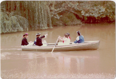
Photograph - Historic re-enactment during the Festival of Kew, 1978
At the 1978 Festival of Kew, a number of organisations, including the City of Kew, the Kew Historical Society, Trinity Boys Grammar School and local Girl Guides participated in a re-enactment of the expedition of the party of Charles Grimes in surveying the Yarra River as far as Kew in February 1803. The location for the event was Yarra Bend Park near the Studley Park Boat House. The event was organised by the Kew Historical Society. The re-enactment was captured by a number of amateur photographers as well as by a photographer from the local Progress Press.Local communities select events to commemorate according to their shared history and values. Commemorations of colonial exploration were popular with local historical groups such as the Kew Historical Society in the twentieth century. In re-enacting events such as the Grimes survey of the Yarra, students from a local school were encouraged to take on specific roles, including play-acting individuals involved in the survey party as well as members of the local Wurundjeri People. The photographs, taken by amateur and professional photographers, represent a period in time when the dominant values were those shared by the descendants of European settlers in Victoria. Original colour photographic positive showing six boys from Trinity Grammar School in a boat on the Yarra at Studley Park in a re-enactment of the survey party of Charles Grimes of February 1803.Annotated on reverse: "TRINITY BOYS IN RE-ENACTMENT OF GRIMES' / EXPLORATION OF YARRA 1803. / FESTIVAL 1978 / ORGANISED BY K.H. SOCIETY"kew historical society, trinity grammar school, kew girl guides, city of kew, yarra river, charles grimes, collins expedition, wurundjeri people, yarra bend park, colonial surveys, historic re-enactments, festival of kew, kew festival -
 Bendigo Military Museum
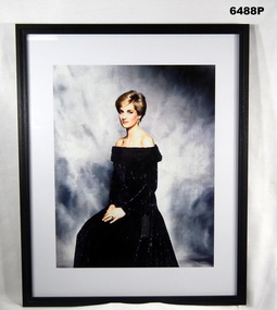
Photograph - HRH The Princess of Wales "Lady Diana" - Colonel in Chief of the Royal Australian Survey Corps, 1988
Her Majesty, Queen Elizabeth II approved the appointment of HRH The Princess of Wales "Lady Diana" as the Colonel in Chief of the Royal Australian Survey Corps (RASvy) on 1 July 1988. A copy of this image was presented to RASvy for official use.Framed photograph of HRH The Princess of Wales "Lady Diana" - Colonel in Chief of the Royal Australian Survey Corps in a black dress, white border and black frame.royal australian survey corps, rasvy, fortuna, army survey regiment, army svy regt, asr -
Whitehorse Historical Society Inc.
Document, Blackburn Market Survey in Melbourne 1965, 1965
Proposal for market on corner of Williams Road and Springfield Road Blackburn.Proposal for market on corner of Williams Road and Springfield Road Blackburn, carried out by Survey Research Centre for Lend Lease Development Pty Ltd, accompanied by letter from donor of papers, Kathleen OswinProposal for market on corner of Williams Road and Springfield Road Blackburn.blackburn north progress association, lend lease development pty ltd, markets, springfield road, blackburn, williams road, blackburn, oswin, kathleen, blackburn -
 Melbourne Tram Museum
Document - Report, Melbourne & Metropolitan Tramways Board (MMTB), "Preston Origin and Destination Survey February 1975 - Remarks on Survey Cards West Preston Route", Mar. 1975
Report - Foolscap landscape format, red comb binding - approx. 50 pages with notes, titled "Preston Origin and Destination Survey February 1975 - Remarks on Survey Cards West Preston Route". Dated March 1975.In top right hand corner "Lees" in inktrams, tramways, mmtb, tramways, west preston, surveys