
Showing 928 items matching "cross overs"
-
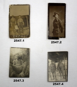 Bendigo Military Museum
Photograph - PHOTOGRAPHS WW1, c. 1915 - 1919
... Soldiers left cross: No 912 SGT SG ISSELL 38 BN AIF, Soldier right cross: No 2802 SGT HJ FRASER 38 BN AIF. .7) Black & white photo showing 2 Australian soldiers casually dressed in the ruins of an old factory. .8) Black & white mini photo showing building ruins & what appears to be derelict boilers. .9) Black & white mini photo showing what appears to be a WWI German soldier kamerading (surrendering). This is probably posing in captured enemy clothing. 10.) Black & white mini photo showing camels at rest. .11) Black & white mini photo showing a blown up British pattern tank MK1 on sandy terrain. A track has detached & curled up over...Soldiers left cross: No 912 SGT SG ISSELL 38 BN AIF, Soldier right cross: No 2802 SGT HJ FRASER 38 BN AIF. .7) Black & white photo showing 2 Australian soldiers casually dressed in the ruins of an old factory. .8) Black & white mini photo showing building ruins & what appears to be derelict boilers. .9) Black & white mini photo showing what appears to be a WWI German soldier kamerading (surrendering). This is probably posing in captured enemy clothing. 10.) Black & white mini photo showing camels at rest. .11) Black & white mini photo showing a blown up British pattern tank MK1 on sandy terrain. A track has detached & curled up over ...Items relating to the collection re Alexander Norman Cummin No 18, 38th Batt AIF, his brother Harold Nesbit Cummin No 1239 Camel Corp. Refer 2535P (Alexander) 2530.3P (Harold) for their service details. .6) Graves photo. On the left, Sydney Graham Issell. He had 4 years pre war service in Senior cadets and Citizens Forces reaching the rank of Sgt. Enlisted on 8.2.1916 No 912 with the rank of Cpl, C Coy 38th Batt age 21 years 11 months. Embark for England 20.6.1916, promoted L/Sgt, embark for France 22.11.1916, hospital 13.5.1917 (NYD) rejoin unit 19.5.1917, WIA 29.5.1917 GSW chest then restated GSW Back, severe, rejoin unit 12.3.1918, KIA 1.8.1918. On the right, Harold James Fraser. He had 5 years pre war service in the Cadets and Citizens Forces. Enlisted on 27.10.1916 No 2802 6th reinforcements 38th Batt age 22 years. Embark for England 16.12.1916, moves through 10th, 14th Training Batt’s then 66th Batt on 28.4.1917, promoted Sgt and alloted No 2802A, embark for France 25.8.1917 as reinforcement 38th Batt, awarded the Military medal (MM)) 12.10.1917 East of Eypres, KIA 1.8.1918. Both were buried at Vaire Wood near Corbie. .1) 2 Australian soldiers in fatigues with what looks like a cooking apparatus, with letters below DROW EC (stylised). .2) 1/2 length portrait of an Australian soldier. .3) Casual portrait of a soldier sitting in fatigues, probably Sandy. Boots look muddy, scrub in background. .4) Portrait of 2 soldiers (allied) fully armed & wearing helmets. .5) Portrait of a soldier (allied) fully armed & dangerous. .6) Black & white photo of 2 graves with white crosses. Soldiers left cross: No 912 SGT SG ISSELL 38 BN AIF, Soldier right cross: No 2802 SGT HJ FRASER 38 BN AIF. .7) Black & white photo showing 2 Australian soldiers casually dressed in the ruins of an old factory. .8) Black & white mini photo showing building ruins & what appears to be derelict boilers. .9) Black & white mini photo showing what appears to be a WWI German soldier kamerading (surrendering). This is probably posing in captured enemy clothing. 10.) Black & white mini photo showing camels at rest. .11) Black & white mini photo showing a blown up British pattern tank MK1 on sandy terrain. A track has detached & curled up over the front of the tank. .1) verso: “Me & Sandy Port De Nieppe May 1917” .2) verso: “Taken in Liverpool, England while on <> leave Jan 1918. To Mother Father & all at home with love from Sandy”photography-photographs, military history - army, 38th -
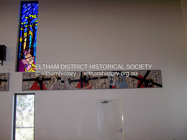 Eltham District Historical Society Inc
Photograph - Digital Photograph, Marguerite Marshall, Stations of the Cross, Clifton Pugh (1961); Our Lady Help of Christian's Church, Henry Street, Eltham, 11 October 2006
... Cross. The delicate stainless steel mesh of the figure creates a sense of the power of God over death. ...Cross. The delicate stainless steel mesh of the figure creates a sense of the power of God over death. ...Stations of the Cross by Clifton Pugh is a contempooray art piece in four sections making up 11 stations of the cross. It was commissioned by the Catholic parish in Eltham (Our Lady Help of Christians) in 1961 Published: Nillumbik Now and Then / Marguerite Marshall 2008; photographs Alan King with Marguerite Marshall.; p81 Art is an important means of nurturing faith at Our Lady Help of Christians Church, Henry Street, Eltham. The Stations of the Cross by Clifton Pugh and The Crucifix with the Ascending Jesus by sculptor Charles Rocco are two of the fine works that enhance the parishioners’ worship. These two inspiring works of art were added in 2001 – long after Roman Catholics began worshipping in Eltham around 1864. This beautiful worship centre was built following hardship and change – for parishioners have endured their church being destroyed by fire and have built four churches since they first worshipped together. Before 1864, according to local legend, a visiting priest administered sacraments in the parlour of former convict-turned-respected citizen Thomas Sweeney at Sweeneys Lane, Eltham.1 The first church was blessed in September, 1865, by the Archbishop of Melbourne, Dr Goold. It stood on an acre (0.4ha) of land in Little Eltham as that area was known then, near the present Fordhams and Main Roads and was part of the Heidelberg Church Parish. In 1912 the church was relocated to a new building on the present primary school site at 1 Henry Street. This was closer to the town centre, which had moved from Little Eltham after the railway line was extended to Eltham in 1902.2 In 1958 the church split from the Sacred Heart parish, Diamond Creek, to become a parish in its own right, with Father Tom Curran as inaugural priest. Not long after in 1961, a fire destroyed the church and huge working bees under the prominent Catholic builders, the Sibbel brothers, rebuilt and extended it, using the original altar from the first church. It was then that builder and parishioner Herman Sibbel asked his friend, artist Clifton Pugh, to paint the Stations of the Cross for the church. But the priest, Father Curran, neither approved of Pugh’s bohemian reputation nor liked the paintings, so they were hung in the corridor of Our Lady’s Primary School instead. The parishioners almost sold the paintings in 1989 to pay for major school renovations. However the paintings remained there for about 40 years, until 2001, when the church was extensively renovated by Father Barry Caldwell. Another change awaited the church, as it outgrew its building, later to be used as the school hall. So, in 1976, the present church was built across the road. Three beautiful stained-glass windows depicting the Passion, Death, Resurrection and the presence of Christ’s Spirit, link these with the church’s experiences. The first depicts a bushfire in Eltham, referring to their church damaged by fire. Another represents the Resurrection of Christ with new growth on a blackened stump and the Holy Spirit is represented by the Southern Cross. A window depicting Our Lady Help of Christians by parishioner Bill Peperkamp, was donated by parishioners to commemorate the Silver Jubilee of Father Desmond G Jenkins’ ordination to the priesthood on July 27, 1977. This, with the statue of Mary, creates a Marian shrine. In the 14 Stations of the Cross painted on four masonite panels Pugh captures the pathos of the suffering Christ and his disciples.3 The figures are stylised, except intriguingly, that of Pontias Pilate, who looks like Clifton Pugh. Charles Rocco’s sculpture is an extraordinary Jesus figure being raised from the Cross. The delicate stainless steel mesh of the figure creates a sense of the power of God over death. The organ, built in 1868 by George Fincham and Sons, was first installed in the All Saints’ Anglican Church, East St Kilda, then in the St Andrews Church, Clifton Hill. It was rebuilt into a modern instrument with a donation from parishioner Jim Murray, in memory of his wife Gwendolene Mary.4 Church members created their own work of art in front of the entrance, by painting designs and messages on 700 tiles. This work indicates the strong church family and faith expressed in art, that awaits the worshipper inside.This collection of almost 130 photos about places and people within the Shire of Nillumbik, an urban and rural municipality in Melbourne's north, contributes to an understanding of the history of the Shire. Published in 2008 immediately prior to the Black Saturday bushfires of February 7, 2009, it documents sites that were impacted, and in some cases destroyed by the fires. It includes photographs taken especially for the publication, creating a unique time capsule representing the Shire in the early 21st century. It remains the most recent comprehenesive publication devoted to the Shire's history connecting local residents to the past. nillumbik now and then (marshall-king) collection, art, clifton pugh, stations of the cross, our lady help of christans, installation -
 Eltham District Historical Society Inc
Photograph - Digital Photograph, Alan King, Monash Bridge, Hurstbridge, 23 January 2008
... The other was John McDonald of Arthurs Creek, who had built the old wooden bridge over the creek about 40 years earlier.4 Although John Monash was a fine engineer, his fame came from his brilliant war career, rather than from his engineering or his many other achievements. Monash was Corps Commander of the Australian Forces. His brilliance was recognised with his awards: Knight Grand Cross...The other was John McDonald of Arthurs Creek, who had built the old wooden bridge over the creek about 40 years earlier.4 Although John Monash was a fine engineer, his fame came from his brilliant war career, rather than from his engineering or his many other achievements. Monash was Corps Commander of the Australian Forces. His brilliance was recognised with his awards: Knight Grand Cross ...Monash Bridge spans the Diamond Creek at Hurstbridge. It was built in 1917 for the Shires of Heidelberg, Eltham and Whittlesea. It is considered Nillumbik Shire's finest engineered bridge and was construced by the engineering company of Sir John Monash. Covered under Heritage Overlay, Nillumbik Planning Scheme. Published: Nillumbik Now and Then / Marguerite Marshall 2008; photographs Alan King with Marguerite Marshall.; p117 Monash Bridge is considered the Shire’s finest engineered bridge and was constructed by the engineering company of that great Australian, Sir John Monash.1 The bridge spans Diamond Creek on the Hurstbridge-Arthurs Creek Road, linking Hurstbridge with Yarrambat and Arthurs Creek. Monash Bridge, also called Hurst’s Bridge, was built in 1917, by the Reinforced Concrete and Monier Pipe Construction Company Pty Ltd, for the Shires of Heidelberg, Eltham and Whittlesea. Although Monash was probably in action overseas during World War One when the bridge was designed and constructed, he evolved the basic design in the 1900s and it was a standard design for the firm. However J A Laing, a designer at the firm, was probably the designer, as his initials are on bridge drawings held by the Eltham District Historical Society.2 The bridge is an excellent early Australian example of an open spandrel reinforced concrete arch bridge and has a single span of 29 metres. It is unusual in Victoria, but similar to many reinforced concrete arch bridges in Europe and America, built from the late 19th century. In Victoria, Monash pioneered the use of reinforced concrete – then a revolutionary construction material. His company, Monash & Anderson, had the exclusive licence for the Monier patent for the system of reinforced concrete construction for Victoria and New South Wales. A well-known example of the Monier arch bridge is the Morell Bridge in South Yarra. The sweeping arch of the Monash Bridge combines grace and utility and blends with the surrounding rural landscape. Its design and construction have allowed it to carry increasing volumes of heavy traffic, but in modern times the one lane is considered by some to prevent easy passage through Hurstbridge. However others consider this an asset to deter too much more traffic, which would diminish Hurstbridge’s charming rural character.3 This is the third bridge across the Diamond Creek at this site. The original bridge was a log bridge upstream, constructed in the 1850s by early settler, Henry Hurst, after whom Hurstbridge was named. The bridge spanned the creek, where it divided his family’s property. In the 1880s a timber bridge replaced it, known as Hurst’s Bridge. However a more permanent bridge was considered necessary when the new railway arrived in 1912, bringing with it expectations of growth in the town and the surrounding fruit-growing district. Monash Bridge’s official opening on November 3, 1917 was a gala occasion, which took place before about 1000 spectators. Two who attended the opening had a particularly sound knowledge of the locality. One was Fred Hurst, Henry’s brother, who used to ford the creek at or near the bridge’s site more than 50 years before. The other was John McDonald of Arthurs Creek, who had built the old wooden bridge over the creek about 40 years earlier.4 Although John Monash was a fine engineer, his fame came from his brilliant war career, rather than from his engineering or his many other achievements. Monash was Corps Commander of the Australian Forces. His brilliance was recognised with his awards: Knight Grand Cross of the Order of St. Michael and St. George, and Knight Commander of the Bath. Monash was also decorated by the French, Belgian, and American Governments.5 After the war, Monash worked in many prominent civilian positions, the most notable as head of the Victorian State Electricity Commission. He was a leading and loved public figure, involved in many public and private organisations. He was president of the Australian Zionist Federation and involved in the Boy Scouts. Monash University is named after him. By the 1920s Monash was probably regarded as the greatest living Australian.6 Despite most of his life working as an administrator and leader, rather than a fighting soldier, he became integral to the ANZAC legend. Monash died in 1931.This collection of almost 130 photos about places and people within the Shire of Nillumbik, an urban and rural municipality in Melbourne's north, contributes to an understanding of the history of the Shire. Published in 2008 immediately prior to the Black Saturday bushfires of February 7, 2009, it documents sites that were impacted, and in some cases destroyed by the fires. It includes photographs taken especially for the publication, creating a unique time capsule representing the Shire in the early 21st century. It remains the most recent comprehenesive publication devoted to the Shire's history connecting local residents to the past. nillumbik now and then (marshall-king) collection, hurstbridge, monash bridge -
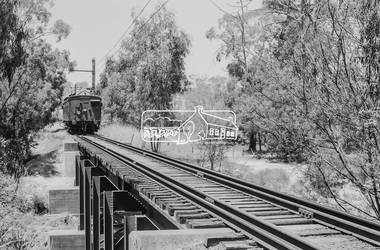 Eltham District Historical Society Inc
Photograph, George Coop, Single Motor Carriage (Red Rattler) Tait train heading for Hurstbridge about to cross over the Diamond Creek just north of Allendale Road, c.December 1980, 1980
... Single Motor Carriage (Red Rattler) Tait train heading for Hurstbridge about to cross over the Diamond Creek just north of Allendale Road, c.December 1980...The derailment guard rail is intended to prevent severe derailment and to keep errant trains in line with track when going over culverts or similar should they become derailed. 471m, allendale road, derailment guard rail, diamond creek, hurstbridge line, railway bridge, red rattler, red rattler single carriage, single motor carriage, tait train Digital TIFF file Scan of 35mm Ilford FP4 black and white transparency Single Motor Carriage (Red Rattler) Tait train heading for Hurstbridge about to cross over the Diamond Creek just north of Allendale Road, c.December 1980 Photograph George Coop ...The derailment guard rail is intended to prevent severe derailment and to keep errant trains in line with track when going over culverts or similar should they become derailed.Digital TIFF file Scan of 35mm Ilford FP4 black and white transparency471m, allendale road, derailment guard rail, diamond creek, hurstbridge line, railway bridge, red rattler, red rattler single carriage, single motor carriage, tait train -
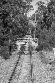 Eltham District Historical Society Inc
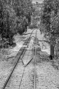
Photograph, George Coop, Derailment guard rails on the Hurstbridge line as the track crosses the Diamond Creek just north of Allendale Road, Diamond Creek, 6 December 1980, 1980
... The device pictured is intended to prevent severe derailment and to keep errant trains in line with track when going over culverts or similar should they become derailed Allendale Road, Derailment guard rail, Diamond Creek, Railway Bridge Digital TIFF file Scan of 35mm Ilford FP4 black and white transparency Derailment guard rails on the Hurstbridge line as the track crosses the Diamond Creek just north of Allendale Road, Diamond Creek, 6 December 1980 Photograph George Coop ...The device pictured is intended to prevent severe derailment and to keep errant trains in line with track when going over culverts or similar should they become derailedDigital TIFF file Scan of 35mm Ilford FP4 black and white transparencyallendale road, derailment guard rail, diamond creek, railway bridge -
 Eltham District Historical Society Inc
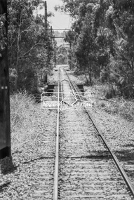
Photograph, George Coop, Derailment guard rails on the Hurstbridge line as the track crosses the Diamond Creek just north of Allendale Road, Diamond Creek, 6 December 1980, 1980
... The device pictured is intended to prevent severe derailment and to keep errant trains in line with track when going over culverts or similar should they become derailed allendale road, derailment guard rail, diamond creek, railway bridge Digital TIFF file Scan of 35mm Ilford FP4 black and white transparency Derailment guard rails on the Hurstbridge line as the track crosses the Diamond Creek just north of Allendale Road, Diamond Creek, 6 December 1980 Photograph George Coop ...The device pictured is intended to prevent severe derailment and to keep errant trains in line with track when going over culverts or similar should they become derailedDigital TIFF file Scan of 35mm Ilford FP4 black and white transparencyallendale road, derailment guard rail, diamond creek, railway bridge -
 Eltham District Historical Society Inc
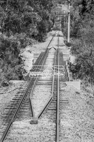
Photograph, George Coop, Derailment guard rails on the Hurstbridge line as the track crosses the Diamond Creek just north of Allendale Road, Diamond Creek, 6 December 1980, 1980
... The device pictured is intended to prevent severe derailment and to keep errant trains in line with track when going over culverts or similar should they become derailed allendale road, derailment guard rail, diamond creek, railway bridge Digital TIFF file Scan of 35mm Ilford FP4 black and white transparency Derailment guard rails on the Hurstbridge line as the track crosses the Diamond Creek just north of Allendale Road, Diamond Creek, 6 December 1980 Photograph George Coop ...The device pictured is intended to prevent severe derailment and to keep errant trains in line with track when going over culverts or similar should they become derailedDigital TIFF file Scan of 35mm Ilford FP4 black and white transparencyallendale road, derailment guard rail, diamond creek, railway bridge -
 Eltham District Historical Society Inc
Photograph, George Coop, Derailment guard rails on the Hurstbridge line as the track crosses the Diamond Creek just north of Allendale Road, Diamond Creek, 6 December 1980, 1980
... The device pictured is intended to prevent severe derailment and to keep errant trains in line with track when going over culverts or similar should they become derailed allendale road, derailment guard rail, diamond creek, railway bridge Digital TIFF file Scan of 35mm Ilford FP4 black and white transparency Derailment guard rails on the Hurstbridge line as the track crosses the Diamond Creek just north of Allendale Road, Diamond Creek, 6 December 1980 Photograph George Coop ...The device pictured is intended to prevent severe derailment and to keep errant trains in line with track when going over culverts or similar should they become derailedDigital TIFF file Scan of 35mm Ilford FP4 black and white transparencyallendale road, derailment guard rail, diamond creek, railway bridge -
 Eltham District Historical Society Inc
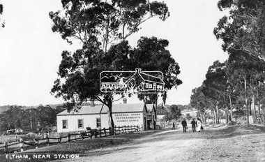
Photograph, Eltham, Main Road near station, c.1910
... Cross Ref: 609 (looking south), 612, 611 (later stage), 613. This photo forms part of a collection of photographs gathered by the Shire of Eltham for their centenary project book,"Pioneers and Painters: 100 years of the Shire of Eltham" by Alan Marshall (1971). The collection of over ...View looking north along Main Road, Eltham from near present day Dudley Street. On the immediate left is the railway station. The large weatherboard building on the bend (opposite present-day Arthur Street) with signs for General Store, Refreshments and Summer Drinks painted on the side is Luther and Ada Haley’s General Store and Bakery, built 1902. This was the first building in what is now Eltham’s present shopping town centre. Haley previously ran the General Store and Bakery on the corner of Main Road and York Street until his lease expired and the premises were bought by Mrs Sarah Burgoyne in 1902. The store later was known as Staff's Store. Followed by the saleyards, entrance to station, slaughter yard and William J Capewell’s butcher shop. Contained within the saleyards facing the street, a small shelter with the name H.H. Clark upon it. Horace Harold Clark was the son of Eltham State School’s first Head Teacher, David George Clark. As well as being a farmer, he was an Estate Agent and conducted auction sales, presumably from this shelter. On the eastern (right) side of Main Street is Haley’s Paddock, which was used on occasions for community picnics. Capable of holding 10,000 people, with ample shade and hilly surroundings it was an ideal place for any community gathering such as the State Schools’ Picnic in 1904. A worker from the bakery store is standing in the gateway at the rear of the store observing the photographer. People in the ‘Sunday Best’ are milling in front of the bakery or strolling down the centre of Main Road. The picture was most likely taken on a Sunday. With the opening of the railway to Eltham in 1902, Melbourne residents would regularly enjoy a Sunday excursion journey on the train to Eltham for a day’s outing to the countryside or beyond to Hurstbridge from 1912 when the railway was extended. Picture dated as c.1910 based on similar picture published in the Weekly Times, Feb. 1912. Cross Ref: 609 (looking south), 612, 611 (later stage), 613.This photo forms part of a collection of photographs gathered by the Shire of Eltham for their centenary project book,"Pioneers and Painters: 100 years of the Shire of Eltham" by Alan Marshall (1971). The collection of over 500 images is held in partnership between Eltham District Historical Society and Yarra Plenty Regional Library (Eltham Library) and is now formally known as the 'The Shire of Eltham Pioneers Photograph Collection.' It is significant in being the first community sourced collection representing the places and people of the Shire's first one hundred years.Digital image (4 x 5 inch negative missing - scanned from print) Printbaker, eltham, eltham railway station, general store, haley's paddock, luther haley, luther haley general store, main road, shire of eltham pioneers photograph collection, sign, summer drinks, butcher, railway station, w.j. capewell, eltham town centre, hot water, m.m. clark, eltham sale yards, eltham slaughter yard, staffs general store -
 Eltham District Historical Society Inc
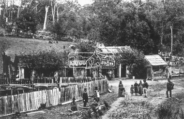
Photograph, Rourkes Ridge, on the Yea border, near Kinglake
... Cross Ref: 915 Source: National Library, Canberra from Album of Victorian Views, photographed by C. Nettleton This photo forms part of a collection of photographs gathered by the Shire of Eltham for their centenary project book,"Pioneers and Painters: 100 years of the Shire of Eltham" by Alan Marshall (1971). The collection of over ...Reproduced on p23 of 'Pioneers & Painters' Cross Ref: 915 Source: National Library, Canberra from Album of Victorian Views, photographed by C. NettletonThis photo forms part of a collection of photographs gathered by the Shire of Eltham for their centenary project book,"Pioneers and Painters: 100 years of the Shire of Eltham" by Alan Marshall (1971). The collection of over 500 images is held in partnership between Eltham District Historical Society and Yarra Plenty Regional Library (Eltham Library) and is now formally known as the 'The Shire of Eltham Pioneers Photograph Collection.' It is significant in being the first community sourced collection representing the places and people of the Shire's first one hundred years.Digital imagekinglake, pioneers and painters, rourkes ridge, sepp, shire of eltham pioneers photograph collection -
 Eltham District Historical Society Inc
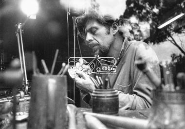
Photograph, Matcham Skipper at work; Eltham artist from Montsalvat, c.1970
... Awarded the Churchill Fellowship Award Reproduced Page 122 of "Pioneers and Painters" Cross Ref: SEPP_0732 Source/Photographer: Mark Strizic This photo forms part of a collection of photographs gathered by the Shire of Eltham for their centenary project book,"Pioneers and Painters: 100 years of the Shire of Eltham" by Alan Marshall (1971). The collection of over ...Awarded the Churchill Fellowship Award Reproduced Page 122 of "Pioneers and Painters" Cross Ref: SEPP_0732 Source/Photographer: Mark StrizicThis photo forms part of a collection of photographs gathered by the Shire of Eltham for their centenary project book,"Pioneers and Painters: 100 years of the Shire of Eltham" by Alan Marshall (1971). The collection of over 500 images is held in partnership between Eltham District Historical Society and Yarra Plenty Regional Library (Eltham Library) and is now formally known as the 'The Shire of Eltham Pioneers Photograph Collection.' It is significant in being the first community sourced collection representing the places and people of the Shire's first one hundred years.Digital image of black and white print 16 x 21.5 cmeltham local characters, pioneers and painters, sepp, shire of eltham pioneers photograph collection, matcham skipper -
 Eltham District Historical Society Inc
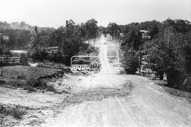
Photograph, Brougham Street, Eltham, c. Sep. 1966
... over the road. That tree still stands today and is outside No. 102. The two houses on the right are possibly numbers 94 and 96. brougham street eltham infrastructure road construction roads Originally located in a Filmpro King Size Prints processing envelope $3.01 Shire of Eltham 9/9/66 and noted as Calrossie Ave area and crossed out Eltham-Yarra Glen Road, Bridge Street to Elsa Court existing conditions mid 1967 Black and white photographic print Brougham Street, Eltham Photograph Photograph ...Taken from alongside the Justice Precinct looking east. In the distance on the right hand verge there is a large Eucalyptus tree with a branch growing out over the road. That tree still stands today and is outside No. 102. The two houses on the right are possibly numbers 94 and 96.Black and white photographic printOriginally located in a Filmpro King Size Prints processing envelope $3.01 Shire of Eltham 9/9/66 and noted as Calrossie Ave area and crossed out Eltham-Yarra Glen Road, Bridge Street to Elsa Court existing conditions mid 1967brougham street, eltham, infrastructure, road construction, roads -
 Eltham District Historical Society Inc
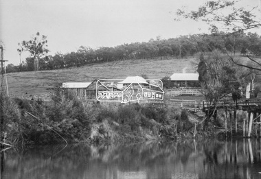
Photograph, Henley Bridge, c.1928
... cross the river to attend Yering Primary School. This private bridge is best viewed from the end of Wendy Way. - Source: Christmas Hills Past and Present, Yarra Glen & District Historical Society, 2004. This photo forms part of a collection of photographs gathered by the Shire of Eltham for their centenary project book,"Pioneers and Painters: 100 years of the Shire of Eltham" by Alan Marshall (1971). The collection of over ...Situated on the Yarra River, 5.5 kms south of Christmas Hills on private property. This timber trestle bridge is said to have been built some time after 1907 by Melbourne master-builder, David Mitchell (the father of Dame Nellie Melba), to connect his two "Henley Farm" properties with Lilydale. In earlier days, when the McPhersons owned the property, their children used a punt to cross the river to attend Yering Primary School. This private bridge is best viewed from the end of Wendy Way. - Source: Christmas Hills Past and Present, Yarra Glen & District Historical Society, 2004.This photo forms part of a collection of photographs gathered by the Shire of Eltham for their centenary project book,"Pioneers and Painters: 100 years of the Shire of Eltham" by Alan Marshall (1971). The collection of over 500 images is held in partnership between Eltham District Historical Society and Yarra Plenty Regional Library (Eltham Library) and is now formally known as the 'The Shire of Eltham Pioneers Photograph Collection.' It is significant in being the first community sourced collection representing the places and people of the Shire's first one hundred years.9 x 12.5 cm printshire of eltham pioneers photograph collection, warrandyte, henley bridge -
 Eltham District Historical Society Inc
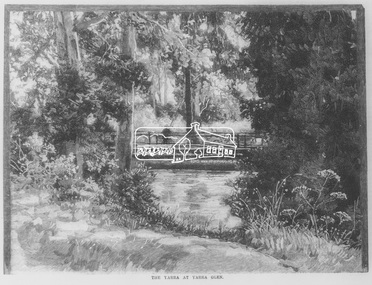
Negative - Photograph, Australasian Sketcher, The Yarra at Yarra Glen, 1889
... "As the train on its journey from Melbourne to Healesville crosses the Yarra-flats, many glimpses are caught of the Yarra, sometimes between large belts of gumtrees, and splashing over boulders with is bosum covered with bubbles, dancing with sunlight, and racing each other until lost in the dark shadows of the wattles. ..."As the train on its journey from Melbourne to Healesville crosses the Yarra-flats, many glimpses are caught of the Yarra, sometimes between large belts of gumtrees, and splashing over boulders with is bosum covered with bubbles, dancing with sunlight, and racing each other until lost in the dark shadows of the wattles. ..."As the train on its journey from Melbourne to Healesville crosses the Yarra-flats, many glimpses are caught of the Yarra, sometimes between large belts of gumtrees, and splashing over boulders with is bosum covered with bubbles, dancing with sunlight, and racing each other until lost in the dark shadows of the wattles. Another turn catches it in a sombre mood, stealing slowly beneath some rustic bridge, whereon stands a patient fisherman waiting for a fish, which if the bait be correct, comes pretty frequently. Our illustration depicts one of these pretty nooks, and a very good idea is given of our picturesque river before it is polluted and turned into a sewer at Prince's Bridge."This photo forms part of a collection of photographs gathered by the Shire of Eltham for their centenary project book,"Pioneers and Painters: 100 years of the Shire of Eltham" by Alan Marshall (1971). The collection of over 500 images is held in partnership between Eltham District Historical Society and Yarra Plenty Regional Library (Eltham Library) and is now formally known as the 'The Shire of Eltham Pioneers Photograph Collection.' It is significant in being the first community sourced collection representing the places and people of the Shire's first one hundred years.Digital image 35mm Negativesepp, shire of eltham pioneers photograph collection, yarra glen, steels creek, cave hill -
 Glen Eira Historical Society
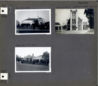
Album - Album page, Alma Road, circa 1972
... over 198 pages. Church of Christ, 514 Dandenong Rd, Caulfield https://vhd.heritagecouncil.vic.gov.au/places/43594 The Dandenong Road Church of Christ has regional importance as a landmark building along the Dandenong Road. It successfully addresses its triangular site by placing the belltower at the apex, deploying Romanesque and Gothic elements freely and to dramatic effect, heightened by the symbolism of the Cross (compare Robert Haddon's St Stephens in Balaclava Road of 1926). caulfield north trevor hart alma road houses churches church of christ caulfield north dandenong road bell towers romanesque architectural style gothic architectural style bi-chromatic brickwork cast iron work verandahs victorian architectural style Handwritten in black pen: Alma Road [top right of page] / 325 Alma Road [above top left photograph] / Church of Christ Caulfield North 14 Dec 1972 [above top right photograph] / 323-325 Alma Road [above bottom left photograph] / 4 [bottom right] Page 4 of Photograph Album including three black and white photographs of properties on Alma Road. ...This photograph is part of the Caulfield Historical Album 1972 but first photo on page has been mis-labelled as this house is 323 Alma Road. It follows that third photo label should be 325-323 Alma Road (reading left to right). This album was created in approximately 1972 as part of a project by the Caulfield Historical Society to assist in identifying buildings worthy of preservation. The album is related to a Survey the Caulfield Historical Society developed in collaboration with the National Trust of Australia (Victoria) and Caulfield City Council to identify historic buildings within the City of Caulfield that warranted the protection of a National Trust Classification. Principal photographer thought to be Trevor Hart, member of Caulfield Historical Society. Most photographs were taken between 1966-1972 with a small number of photographs being older and from unknown sources. All photographs are black and white except where stated, with 386 photographs over 198 pages. Church of Christ, 514 Dandenong Rd, Caulfield https://vhd.heritagecouncil.vic.gov.au/places/43594 The Dandenong Road Church of Christ has regional importance as a landmark building along the Dandenong Road. It successfully addresses its triangular site by placing the belltower at the apex, deploying Romanesque and Gothic elements freely and to dramatic effect, heightened by the symbolism of the Cross (compare Robert Haddon's St Stephens in Balaclava Road of 1926).Page 4 of Photograph Album including three black and white photographs of properties on Alma Road. Two photographs are in the top half of the page and the third is in the bottom left hand side.Handwritten in black pen: Alma Road [top right of page] / 325 Alma Road [above top left photograph] / Church of Christ Caulfield North 14 Dec 1972 [above top right photograph] / 323-325 Alma Road [above bottom left photograph] / 4 [bottom right]caulfield north, trevor hart, alma road, houses, churches, church of christ caulfield north, dandenong road, bell towers, romanesque architectural style, gothic architectural style, bi-chromatic brickwork, cast iron work, verandahs, victorian architectural style -
 Glen Eira Historical Society
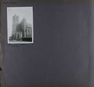
Album - Album page, Glen Huntly Road, Circa 1972
... over 198 pages. From: Glen Eira Heritage Management Plan (1996) by Andrew Ward and Associates This Area is marked by the imposing brick and freestone gothic Revival church of the Holy Cross, built in 1937 to the design of O.H. ...over 198 pages. From: Glen Eira Heritage Management Plan (1996) by Andrew Ward and Associates This Area is marked by the imposing brick and freestone gothic Revival church of the Holy Cross, built in 1937 to the design of O.H. ...This photograph is part of the Caulfield Historical Album 1972. This album was created in approximately 1972 as part of a project by the Caulfield Historical Society to assist in identifying buildings worthy of preservation. The album is related to a Survey the Caulfield Historical Society developed in collaboration with the National Trust of Australia (Victoria) and Caulfield City Council to identify historic buildings within the City of Caulfield that warranted the protection of a National Trust Classification. Principal photographer thought to be Trevor Hart, member of Caulfield Historical Society. Most photographs were taken between 1966-1972 with a small number of photographs being older and from unknown sources. All photographs are black and white except where stated, with 386 photographs over 198 pages. From: Glen Eira Heritage Management Plan (1996) by Andrew Ward and Associates This Area is marked by the imposing brick and freestone gothic Revival church of the Holy Cross, built in 1937 to the design of O.H. Jorgensen. Church of the Holy Cross and Presbytery are contributory buildings to HO66.Page 65 of Photograph Album with one exterior photograph (landscape) of a brick church with a three storey tower.Hand written: Glenhuntly Rd [top left] / HOLY CROSS RC CHURCH / Dec 1972 [written underneath the photo] / 65 [bottom left] trevor hart, 1930's, gothic revival, brick, bell tower, spire, facade, catholic church, o h jorgensen, holy cross catholic church, caulfield, glenhuntly road, caulfield south, presbytery -
 Glen Eira Historical Society
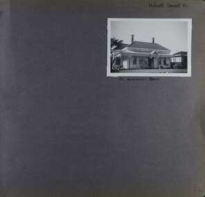
Album - Album page, Hobart Road, Circa 1972
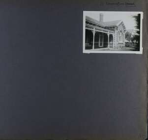
... All photographs are black and white except where stated, with 386 photographs over 198 pages. trevor hart 1880's cast iron verandah murrumbeena hobart road victorian columns cast iron frieze decorative brackets iron roof cast iron work houses chimneys Handwritten: Hobart Street RD - the word Street has been crossed out [top right] / 40 HOBART ROAD [Under photo] / 84 [bottom right] Page 84 of Photograph Album with one portrait photograph of a house on Hobart Road. ...This photograph is part of the Caulfield Historical Album 1972. This album was created in approximately 1972 as part of a project by the Caulfield Historical Society to assist in identifying buildings worthy of preservation. The album is related to a Survey the Caulfield Historical Society developed in collaboration with the National Trust of Australia (Victoria) and Caulfield City Council to identify historic buildings within the City of Caulfield that warranted the protection of a National Trust Classification. Principal photographer thought to be Trevor Hart, member of Caulfield Historical Society. Most photographs were taken between 1966-1972 with a small number of photographs being older and from unknown sources. All photographs are black and white except where stated, with 386 photographs over 198 pages. Page 84 of Photograph Album with one portrait photograph of a house on Hobart Road. Handwritten: Hobart Street RD - the word Street has been crossed out [top right] / 40 HOBART ROAD [Under photo] / 84 [bottom right]trevor hart, 1880's, cast iron verandah, murrumbeena, hobart road, victorian, columns, cast iron frieze, decorative brackets, iron roof, cast iron work, houses, chimneys -
 Glen Eira Historical Society
Album - Album page, Leamington Crescent, Circa 1972
... All photographs are black and white except where stated, with 386 photographs over 198 pages. trevor hart verandah arched windows leamington crescent ornate cornerstone slate roof triple windows decorative brackets eave brackets leamington street caulfield east cast iron frieze victorian architectural style cast iron work polychrome bricks Handwritten: 21 Leamington (Street) [crossed out] / Crescent [top right] / 118 [bottom right] Page 118 Photograph Album with one photograph (landscape) of a brick house at Leamington Crescent. ...This photograph is part of the Caulfield Historical Album 1972. This album was created in approximately 1972 as part of a project by the Caulfield Historical Society to assist in identifying buildings worthy of preservation. The album is related to a Survey the Caulfield Historical Society developed in collaboration with the National Trust of Australia (Victoria) and Caulfield City Council to identify historic buildings within the City of Caulfield that warranted the protection of a National Trust Classification. Principal photographer thought to be Trevor Hart, member of Caulfield Historical Society. Most photographs were taken between 1966-1972 with a small number of photographs being older and from unknown sources. All photographs are black and white except where stated, with 386 photographs over 198 pages. Page 118 Photograph Album with one photograph (landscape) of a brick house at Leamington Crescent.Handwritten: 21 Leamington (Street) [crossed out] / Crescent [top right] / 118 [bottom right]trevor hart, verandah, arched windows, leamington crescent, ornate cornerstone, slate roof, triple windows, decorative brackets, eave brackets, leamington street, caulfield east, cast iron frieze, victorian architectural style, cast iron work, polychrome bricks -
 Waverley RSL Sub Branch
Poster, Changi Chapel
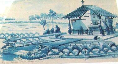
... cross that his father made onto the wreathed altar in the new Chapel. He was claimed to have cried while doing so, as this was one of the only chances he got to interact with his father(through his work) as "Harry" Stogden died during the war. The Museum has a collection of paintings, photographs and personal effects donated by former POWs. Among the collection is a series of paintings and sketches by a POW named William Haxworth which provide valuable insight on the daily life of the internees during the occupation. In 1986, Haxworth's wife donated a collection of over...cross that his father made onto the wreathed altar in the new Chapel. He was claimed to have cried while doing so, as this was one of the only chances he got to interact with his father(through his work) as "Harry" Stogden died during the war. The Museum has a collection of paintings, photographs and personal effects donated by former POWs. Among the collection is a series of paintings and sketches by a POW named William Haxworth which provide valuable insight on the daily life of the internees during the occupation. In 1986, Haxworth's wife donated a collection of over ...The Changi Museum is a museum dedicated to Singapore's history during the Second World War. The original chapel has been re-erected at Duntroon Military Academy and is on public display as a memorial to the P.O.W's In 1988, Singapore built a replica Chapel and Museum next to the Changi Prison. When Changi Prison was expanded in 2001, the Chapel and Museum was relocated to a new site 1 km away and the Changi Chapel and Museum was officially established on 15 February 2001. Bernard Stogden, the son of Sgt. Harry Stogden, was invited to place the cross that his father made onto the wreathed altar in the new Chapel. He was claimed to have cried while doing so, as this was one of the only chances he got to interact with his father(through his work) as "Harry" Stogden died during the war. The Museum has a collection of paintings, photographs and personal effects donated by former POWs. Among the collection is a series of paintings and sketches by a POW named William Haxworth which provide valuable insight on the daily life of the internees during the occupation. In 1986, Haxworth's wife donated a collection of over 400 paintings and sketches to the National Archives of Singapore. Also in the museum is a collection of watercolour paintings by Mary Angela Bateman who was among the thousands of women and children held at Changi Prison for more than three years during the war.[1]Poster produced by Australian War Memorial detailing the history of The Changi Chapel Framedchangi, changi chapel, changi history -
 Eltham District Historical Society Inc
Slide, Maroondah Aqueduct, Research, Victoria, 22 Mar. 1981
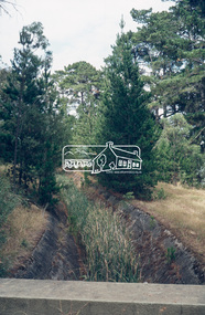
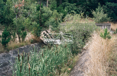
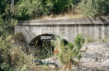
... An inspection tour of the Maroondah Aqueduct was undertaken by the Shire of Eltham Historical Society on Sunday, March 22nd, 1981, commening where the aqueduct crosses Main Rd., Research, just below Eltham College. The Maroondah Aqueduct was part of Melbourne’s water supply system. It carried water over...An inspection tour of the Maroondah Aqueduct was undertaken by the Shire of Eltham Historical Society on Sunday, March 22nd, 1981, commening where the aqueduct crosses Main Rd., Research, just below Eltham College. The Maroondah Aqueduct was part of Melbourne’s water supply system. It carried water over ...An inspection tour of the Maroondah Aqueduct was undertaken by the Shire of Eltham Historical Society on Sunday, March 22nd, 1981, commening where the aqueduct crosses Main Rd., Research, just below Eltham College. The Maroondah Aqueduct was part of Melbourne’s water supply system. It carried water over the 66 km from the Maroondah Reservoir on the Watts River at Healesville to the Preston Reservoir. Of this length, 41 km were open channel, 10 km, tunnel through hills and 15 km in 14 inverted siphons across stream valleys. The route of the aqueduct is north of Tarrawarra and Yarra Glen, along the Yarra escarpment south of Christmas Hills and crossing Watsons Creek into the present Shire of Eltham near Henley Rd. The eastern part of the route lies entirely within the former boundaries of the shire. The aqueduct passes south of Kangaroo Ground to Research and crosses the Diamond Creek by siphon at Allendale Rd., Eltham North. It then extends to Reservoir via St. Helena, Greensborough North and Bundoora. Water first flowed through the aqueduct in February 1891 when it was fed by a diversion weir on the Watts River. Records of the building of the aqueduct indicate that it was a significant construction achievement. The present Maroondah Reservoir was completed in 1927 and the aqueduct was enlarged at that time to take increased flows. About 1971 the section of the aqueduct through and north of Research was replaced by a large pipe and that section of the channel is now unused. The channel has remained largely intact (unlike sections at Greensborough and Bundoora where long lengths of the disused aqueduct have been demolished or filled in). The M.M.B.W. relinquished control of the disused aqueduct reserve which is crown land and the Shire of Eltham took control of this section of the reserve as a linear park. The Maroondah Aqueduct is considered to be an important historic structure, not just to the local area but to the metropolitan area generally. It is considered important to preserve substantially intact long lengths of the disused aqueduct, together with its bridges and other associated structures. 35 mm colour positive transparency (1 of 5) Mount - Agfachrome Agfa CS System black 8 dotsactivities, heritage excursion, maroondah aqueduct, research (vic.), shire of eltham historical society -
 Eltham District Historical Society Inc
Slide, Maroondah Aqueduct, Research, Victoria, 22 Mar. 1981
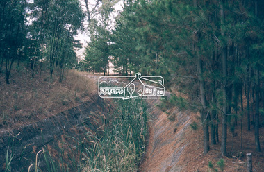
... An inspection tour of the Maroondah Aqueduct was undertaken by the Shire of Eltham Historical Society on Sunday, March 22nd, 1981, commening where the aqueduct crosses Main Rd., Research, just below Eltham College. The Maroondah Aqueduct was part of Melbourne’s water supply system. It carried water over...An inspection tour of the Maroondah Aqueduct was undertaken by the Shire of Eltham Historical Society on Sunday, March 22nd, 1981, commening where the aqueduct crosses Main Rd., Research, just below Eltham College. The Maroondah Aqueduct was part of Melbourne’s water supply system. It carried water over ...An inspection tour of the Maroondah Aqueduct was undertaken by the Shire of Eltham Historical Society on Sunday, March 22nd, 1981, commening where the aqueduct crosses Main Rd., Research, just below Eltham College. The Maroondah Aqueduct was part of Melbourne’s water supply system. It carried water over the 66 km from the Maroondah Reservoir on the Watts River at Healesville to the Preston Reservoir. Of this length, 41 km were open channel, 10 km, tunnel through hills and 15 km in 14 inverted siphons across stream valleys. The route of the aqueduct is north of Tarrawarra and Yarra Glen, along the Yarra escarpment south of Christmas Hills and crossing Watsons Creek into the present Shire of Eltham near Henley Rd. The eastern part of the route lies entirely within the former boundaries of the shire. The aqueduct passes south of Kangaroo Ground to Research and crosses the Diamond Creek by siphon at Allendale Rd., Eltham North. It then extends to Reservoir via St. Helena, Greensborough North and Bundoora. Water first flowed through the aqueduct in February 1891 when it was fed by a diversion weir on the Watts River. Records of the building of the aqueduct indicate that it was a significant construction achievement. The present Maroondah Reservoir was completed in 1927 and the aqueduct was enlarged at that time to take increased flows. About 1971 the section of the aqueduct through and north of Research was replaced by a large pipe and that section of the channel is now unused. The channel has remained largely intact (unlike sections at Greensborough and Bundoora where long lengths of the disused aqueduct have been demolished or filled in). The M.M.B.W. relinquished control of the disused aqueduct reserve which is crown land and the Shire of Eltham took control of this section of the reserve as a linear park. The Maroondah Aqueduct is considered to be an important historic structure, not just to the local area but to the metropolitan area generally. It is considered important to preserve substantially intact long lengths of the disused aqueduct, together with its bridges and other associated structures. 35 mm colour positive transparency (1 of 5) Mount - Agfachrome Agfa CS System black 8 dotsactivities, heritage excursion, maroondah aqueduct, research (vic.), shire of eltham historical society -
 Eltham District Historical Society Inc
Slide, Maroondah Aqueduct, Research, Victoria, 22 Mar. 1981
... An inspection tour of the Maroondah Aqueduct was undertaken by the Shire of Eltham Historical Society on Sunday, March 22nd, 1981, commening where the aqueduct crosses Main Rd., Research, just below Eltham College. The Maroondah Aqueduct was part of Melbourne’s water supply system. It carried water over...An inspection tour of the Maroondah Aqueduct was undertaken by the Shire of Eltham Historical Society on Sunday, March 22nd, 1981, commening where the aqueduct crosses Main Rd., Research, just below Eltham College. The Maroondah Aqueduct was part of Melbourne’s water supply system. It carried water over ...An inspection tour of the Maroondah Aqueduct was undertaken by the Shire of Eltham Historical Society on Sunday, March 22nd, 1981, commening where the aqueduct crosses Main Rd., Research, just below Eltham College. The Maroondah Aqueduct was part of Melbourne’s water supply system. It carried water over the 66 km from the Maroondah Reservoir on the Watts River at Healesville to the Preston Reservoir. Of this length, 41 km were open channel, 10 km, tunnel through hills and 15 km in 14 inverted siphons across stream valleys. The route of the aqueduct is north of Tarrawarra and Yarra Glen, along the Yarra escarpment south of Christmas Hills and crossing Watsons Creek into the present Shire of Eltham near Henley Rd. The eastern part of the route lies entirely within the former boundaries of the shire. The aqueduct passes south of Kangaroo Ground to Research and crosses the Diamond Creek by siphon at Allendale Rd., Eltham North. It then extends to Reservoir via St. Helena, Greensborough North and Bundoora. Water first flowed through the aqueduct in February 1891 when it was fed by a diversion weir on the Watts River. Records of the building of the aqueduct indicate that it was a significant construction achievement. The present Maroondah Reservoir was completed in 1927 and the aqueduct was enlarged at that time to take increased flows. About 1971 the section of the aqueduct through and north of Research was replaced by a large pipe and that section of the channel is now unused. The channel has remained largely intact (unlike sections at Greensborough and Bundoora where long lengths of the disused aqueduct have been demolished or filled in). The M.M.B.W. relinquished control of the disused aqueduct reserve which is crown land and the Shire of Eltham took control of this section of the reserve as a linear park. The Maroondah Aqueduct is considered to be an important historic structure, not just to the local area but to the metropolitan area generally. It is considered important to preserve substantially intact long lengths of the disused aqueduct, together with its bridges and other associated structures. 35 mm colour positive transparency (1 of 5) Mount - Agfachrome Agfa CS System black 8 dotsactivities, heritage excursion, maroondah aqueduct, research (vic.), shire of eltham historical society -
 Eltham District Historical Society Inc
Slide, Maroondah Aqueduct, Research, Victoria, 22 Mar. 1981
... An inspection tour of the Maroondah Aqueduct was undertaken by the Shire of Eltham Historical Society on Sunday, March 22nd, 1981, commening where the aqueduct crosses Main Rd., Research, just below Eltham College. The Maroondah Aqueduct was part of Melbourne’s water supply system. It carried water over...An inspection tour of the Maroondah Aqueduct was undertaken by the Shire of Eltham Historical Society on Sunday, March 22nd, 1981, commening where the aqueduct crosses Main Rd., Research, just below Eltham College. The Maroondah Aqueduct was part of Melbourne’s water supply system. It carried water over ...An inspection tour of the Maroondah Aqueduct was undertaken by the Shire of Eltham Historical Society on Sunday, March 22nd, 1981, commening where the aqueduct crosses Main Rd., Research, just below Eltham College. The Maroondah Aqueduct was part of Melbourne’s water supply system. It carried water over the 66 km from the Maroondah Reservoir on the Watts River at Healesville to the Preston Reservoir. Of this length, 41 km were open channel, 10 km, tunnel through hills and 15 km in 14 inverted siphons across stream valleys. The route of the aqueduct is north of Tarrawarra and Yarra Glen, along the Yarra escarpment south of Christmas Hills and crossing Watsons Creek into the present Shire of Eltham near Henley Rd. The eastern part of the route lies entirely within the former boundaries of the shire. The aqueduct passes south of Kangaroo Ground to Research and crosses the Diamond Creek by siphon at Allendale Rd., Eltham North. It then extends to Reservoir via St. Helena, Greensborough North and Bundoora. Water first flowed through the aqueduct in February 1891 when it was fed by a diversion weir on the Watts River. Records of the building of the aqueduct indicate that it was a significant construction achievement. The present Maroondah Reservoir was completed in 1927 and the aqueduct was enlarged at that time to take increased flows. About 1971 the section of the aqueduct through and north of Research was replaced by a large pipe and that section of the channel is now unused. The channel has remained largely intact (unlike sections at Greensborough and Bundoora where long lengths of the disused aqueduct have been demolished or filled in). The M.M.B.W. relinquished control of the disused aqueduct reserve which is crown land and the Shire of Eltham took control of this section of the reserve as a linear park. The Maroondah Aqueduct is considered to be an important historic structure, not just to the local area but to the metropolitan area generally. It is considered important to preserve substantially intact long lengths of the disused aqueduct, together with its bridges and other associated structures. 35 mm colour positive transparency (1 of 5) Mount - Agfachrome Agfa CS System black 8 dotsactivities, heritage excursion, maroondah aqueduct, research (vic.), shire of eltham historical society -
 Eltham District Historical Society Inc
Photograph, Pepper's Paddock, Wattle Glen, c.1927, 1927c
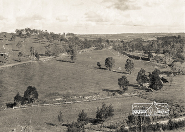
... Originally dated in pen on reverse as 1920 then crossed out to 1925 but it must be post August 1926 due to presence of an electric train. However no sign of the Sunnyside Estate development (1926?) although most of it could be over...Originally dated in pen on reverse as 1920 then crossed out to 1925 but it must be post August 1926 due to presence of an electric train. However no sign of the Sunnyside Estate development (1926?) although most of it could be over ...Originally dated in pen on reverse as 1920 then crossed out to 1925 but it must be post August 1926 due to presence of an electric train. However no sign of the Sunnyside Estate development (1926?) although most of it could be over the hill out of shot. The furrows suggest that the paddock had been an orchard (probably apple).Digital copy of black and white photographelectric train, hurstbridge railway line, railway line, wattle glen, pepper's paddock, lesley mitchell (nee pepper) collection -
 Bendigo Military Museum
Plaque - SOUTH QUEENSLAND LOGISTICS GROUP PLAQUE
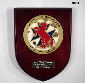
... Insignia featured a red coloured horse over a blue coloured Maltese cross. Background is white. ...Insignia featured a red coloured horse over a blue coloured Maltese cross. Background is white. Gold coloured circular border has South Queensland Logistics Group' inscribed in black lettering. ...Part of the Cooper Collection. See Catalogue to 9586.2 for details of No.3798359, 'Keith Cooper's service'Shield shaped brown coloured wooden plaque with circular metal insignia attached. Insignia featured a red coloured horse over a blue coloured Maltese cross. Background is white. Gold coloured circular border has South Queensland Logistics Group' inscribed in black lettering. Gold coloured plate at bottom with engraved details.Engraved on gold coloured rectangular plate: 'WO1 'Shorty' Cooper for assistance o the IHO Team'.cooper collection, keith cooper, south queensland logistics group -
 Bendigo Military Museum
Postcard - PHOTOGRAHIC POSTCARDS WW1, C.1919
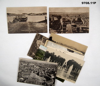
... McQuie MM, refer Cat No 9680P for his service details. .1) .2) Dated 5.9.19, appears to be McQuie's hand writing. .3) Has 3 letter signature unclear, talks about leaving for Ostend at 10.15pm. .4) Dated 8.9.19, to McQuie's Father, talks about leaving for Amsterdam, having a good time. .5) Dated 15.9.19, to Mr McQuie, talks about having a good time. .6) On the rear has a full page description of the Catacombs. .7) Dated 22.9.19, to McQuie's Father. .8) Dated 26.9.19. .9) Dated 20.9.19, to McQuie's father, talks about visiting Rome, Naples, Mt Vesuviuos and Pompei, leaving for Paris. .10) Dated 26.9.19. .11) dated 17.9.19, to Lieut F.J.Terry Paris France, from is unclear. postcards photos McQuie .1) On rear, "5.7.19, Crossed this in error". .2) "5.7.19". .3) "Sept 3/19 Dunkirk". .5) "Venice 15.9.19". .6) "16.9.19". 7) On front in red "BOPPARD" Ten postcards different views, different tones, all dated over 2019. .1).2) Sepia tone, views over Southampton, text on rear in black. .3) Sepia tone, Bomb damage scene Dunkirk, text on rear in black. .4) Sepia tone, view of Rotterdam, text on rear in black. .5) B&W, view of Venice, text on rear in black pen, has two green stamps. .6) B&W Plan of the Catacombs of Callistus with description on rear. .7) Colour enhanced, scene over a river, text in black, two red stamps on. .8) B&W, Water garden in Versailles, text on rear in black. .9) B&W, view over Rome, text on rear in black, one red stamp on. .10) B&W, water scene Versailles, text on rear in black. .11) Sepia water fall scene, text on rear in black, one stamp in red. ...Items in the collection relating to C.J.C. McQuie MM, refer Cat No 9680P for his service details. .1) .2) Dated 5.9.19, appears to be McQuie's hand writing. .3) Has 3 letter signature unclear, talks about leaving for Ostend at 10.15pm. .4) Dated 8.9.19, to McQuie's Father, talks about leaving for Amsterdam, having a good time. .5) Dated 15.9.19, to Mr McQuie, talks about having a good time. .6) On the rear has a full page description of the Catacombs. .7) Dated 22.9.19, to McQuie's Father. .8) Dated 26.9.19. .9) Dated 20.9.19, to McQuie's father, talks about visiting Rome, Naples, Mt Vesuviuos and Pompei, leaving for Paris. .10) Dated 26.9.19. .11) dated 17.9.19, to Lieut F.J.Terry Paris France, from is unclear. Ten postcards different views, different tones, all dated over 2019. .1).2) Sepia tone, views over Southampton, text on rear in black. .3) Sepia tone, Bomb damage scene Dunkirk, text on rear in black. .4) Sepia tone, view of Rotterdam, text on rear in black. .5) B&W, view of Venice, text on rear in black pen, has two green stamps. .6) B&W Plan of the Catacombs of Callistus with description on rear. .7) Colour enhanced, scene over a river, text in black, two red stamps on. .8) B&W, Water garden in Versailles, text on rear in black. .9) B&W, view over Rome, text on rear in black, one red stamp on. .10) B&W, water scene Versailles, text on rear in black. .11) Sepia water fall scene, text on rear in black, one stamp in red..1) On rear, "5.7.19, Crossed this in error". .2) "5.7.19". .3) "Sept 3/19 Dunkirk". .5) "Venice 15.9.19". .6) "16.9.19". 7) On front in red "BOPPARD"postcards, photos, mcquie -
 Kiewa Valley Historical Society
Seal Skins Ski Straps / Soles
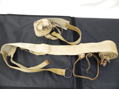
... over snow without slipping when going up hills. They took the skins off when they wanted to slide down hills. In later years, waxes were used for cross country skiing and then 'fish tail' markings on the back of skis to enable skiers to travel distances up and down mountains. ...cross country skiing. alpine sports. Each Seal skin has: Seal skin sewn onto one side of a strap of webbing. There is a webbing loop on the front that slips over a small point at the front of the ski. ...Seal skin straps and webbing were introduced into the Victorian Alps by European skiers. Enthusiasts travelled to enjoy the snow and to explore the Victorian Alps including the Bogong High Plains. This equipment enabled them to travel over snow without slipping when going up hills. They took the skins off when they wanted to slide down hills. In later years, waxes were used for cross country skiing and then 'fish tail' markings on the back of skis to enable skiers to travel distances up and down mountains. Later developments also included motor transport (replacing horses to get to the snow line) and roads to take skiers to the ski fields and mechanised tows to take skiers up mountains so they could ski down (downhill skiing). Skate skiing has also developed as another form of skiing.Skiers visited the Bogong High Plains during summer and winter to explore and enjoy the High Plains. The equipment used was a forerunner to the variety used today and the different types of skiing done today. Falls Creek was developed during the construction of the Kiewa Electric Hydro Scheme and was influenced by the number of Europeans working on the scheme and their desire to make use of the snow during winter.Each Seal skin has: Seal skin sewn onto one side of a strap of webbing. There is a webbing loop on the front that slips over a small point at the front of the ski. There is a webbing strap attached to the back of the seal skin sole coming over the back of the ski that clips metal fasteners onto a loop of webbing behind the boot.skiing. snow. high plains. seal skins. cross country skiing. alpine sports. -
 Kiewa Valley Historical Society
Backpack
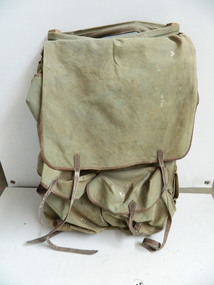
... crossed out. Heavy green canvas back pack with flap at top to cover contents and to attach at base. Sides fold over ...This pack is made from materials available at the time and was used to carry supplies and equipment for bushwalking and/or cross country skiing. It is designed to protect the contents in all weather and to be as comfortable and practical as possible. The Bogong High Plains was a popular destination for bushwalking and cross country skiing. This backpack is an early example of the equipment used for extended walks and/or cross country skiing. Heavy green canvas back pack with flap at top to cover contents and to attach at base. Sides fold over at the top. The back is attached with zig zag cord with 5 holes down each side. The front piece has 2 pockets with straps to secure them. The sides have a wooden rectangular piece wrapped by canvas to maintain the shape of the pack. There are webbed shoulder straps on an angle attached to the back with adjustable straps. There is a thin metal rod on the outside of each side presumably to enable items to be hung from them. On the inside of the flap: Leon Henry/Trendweth(?)/ West Brunswick/Melbourne/ Victoria/ Australia Previous name and address has been crossed out.backpack; bogong high plains; bushwalking; cross country skiing -
 Kiewa Valley Historical Society
Book - Cross Country Skiing x2, Worldloppet - 30 Years of Skiing Around the World, 2007
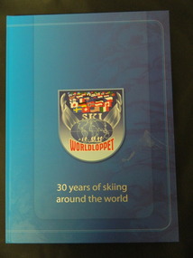
... cross country skiers. American Tony Wise conceived the idea of bringing together long distance skiers together. 14 ski marathons held in 4 continents (Europe, North America, Australia and Asia) with over 90,000 skiers each year....cross country skiers. American Tony Wise conceived the idea of bringing together long distance skiers together. 14 ski marathons held in 4 continents (Europe, North America, Australia and Asia) with over 90,000 skiers each year. ...The Worldloppet is a skiing race held throughout the world for cross country skiers. American Tony Wise conceived the idea of bringing together long distance skiers together. 14 ski marathons held in 4 continents (Europe, North America, Australia and Asia) with over 90,000 skiers each year.Falls Creek is on the Bogong High Plains at the top of the Kiewa Valley. Falls Creek held the first Kangaroo Hoppet in 1979 over a distance of 21 km with 80 participants. In 1995 a record 1588 participants took part. They received membership of the Worldloppet in 1991 holding the event on the last Saturday of August and haven't had to cancel the event. Two copies of a blue hard covered book with 167 pages consisting of an index (Kangaroo Hoppet page 54), information on 30 years of (cross country) skiing around the world with colored photos. cross country skiing; worldloppet; falls creek -
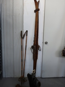 Kiewa Valley Historical Society
Skis, Boots, Stocks
... over the years from the 1940s to the present day. The collection of skis etc. is an example of the changes The Kiewa Valley is below the Bogong High Plains with the ski resort Falls Creek 30 km away. The local people are involved with the ski industry providing ski equipment to the visitors. skis ski boots ski stocks cross country skiing downhill skiing A variety of skis, stocks and boots used for cross country skiing and downhill skiing. ...Skis and snow equipment has changed / developed over the years from the 1940s to the present day. The collection of skis etc. is an example of the changesThe Kiewa Valley is below the Bogong High Plains with the ski resort Falls Creek 30 km away. The local people are involved with the ski industry providing ski equipment to the visitors. A variety of skis, stocks and boots used for cross country skiing and downhill skiing.skis, ski boots, ski stocks, cross country skiing, downhill skiing
