
Showing 621 items matching "rail line"
-
 Ballarat Tramway Museum
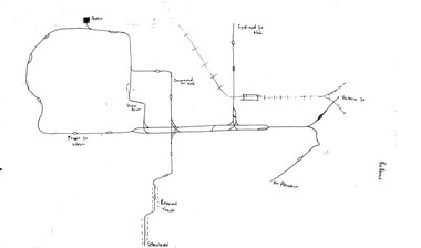
Map, Ballarat and Bendigo tram systems, 1960's or 1970's
... Set of two hand drawn maps of the Ballarat and Bendigo tram systems, showing loops, terminus, depots and rail lines, including out of use loops and reserved track. Possibly made during the 1960's or early 1970's. Drawn on lined...Trams tramways Map Drawings Ballarat Bendigo Set of two hand drawn maps of the Ballarat and Bendigo tram systems, showing loops, terminus, depots and rail lines, including out of use loops and reserved track. Possibly made during the 1960's or early 1970's. Drawn on lined ...Yields information about the extent of the Ballarat and Bendigo tramway systems and possibly has a strong association with the work of Tom Murray.Set of two hand drawn maps of the Ballarat and Bendigo tram systems, showing loops, terminus, depots and rail lines, including out of use loops and reserved track. Possibly made during the 1960's or early 1970's. Drawn on lined foolscap paper - have been torn from a pad.trams, tramways, map, drawings, ballarat, bendigo -
 Ballarat Tramway Museum
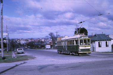
Photograph - Digital image Set of 10, Tony Smith, 1971
... IN the background is the rail bridge over the Eureka line and a shelter. .5 - 11 in bound from Victoria St, shows the bleakness of the street at the time. ...IN the background is the rail bridge over the Eureka line and a shelter. .5 - 11 in bound from Victoria St, shows the bleakness of the street at the time. ...Yields information about Ballarat Tramways and trams prior to the closure of the tramway system.Set of 10 digital images of Ballarat trams prior to closure, scanned from original slides by Tony Smith, 1971 prior to closure of the system. .1 - 37 at the Lydiard St North terminus, with the shelter in the background. .2 - 33 at the Mount Pleasant terminus, has the corner store with a "The Sun" advertisement and the general store on the right side of the road in the background. Has signs for Streets Ice Cream and Coca Cola. Also has the tram stop signs - painted pole and enamel sign. .3 -33 arriving at the Mt Pleasant terminus with the conductor stepping off the back step, a lady walking across to the tram. Tram has a Twin Lakes sign. .4 - 11 at Victoria St terminus, with conductor turning the pole. Tram has a Twin Lakes sign. IN the background is the rail bridge over the Eureka line and a shelter. .5 - 11 in bound from Victoria St, shows the bleakness of the street at the time. Tram has Twin Lakes and a SEC Briquettes signs. .6 - 12 outbound to Mt Pleasant in Main St and the corner with Humffray St. Tram has a Twin Lakes sign. .7 - 11 in bound from Victoria St, in Bridge St, with junction in background. Tram has Twin Lakes and a SEC Briquettes signs. In the background are Rodda's, C.W. Pennant wall papers and Gill and O'Keffe footwear stores. .8 - 21 in Wendouree Parade, in bound to Victoria St, with the Lake in the background, near Macarthur St. .9 - 21 ditto, nearing the Macarthur St junction. Has the shelter and tram stop signage for View Point in the background. .10 - 34 sitting on the depot fan, 2 road, ready to run out. Has Mt Pleasant as the destination.trams, tramways, lydiard st north, mount pleasant terminus, victoria st, main st, bridge st, wendouree parade, macarthur st, view point, depot, tram 37, tram 33, tram 11, tram 12, tram 21, tram 34 -
 Ballarat Tramway Museum
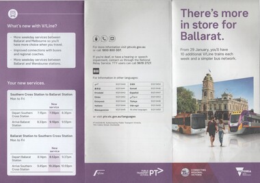
Pamphlet, Public Transport Corporation (PTC), "There's more in store for Ballarat", Jan. 2017
... Set of two pamphlets distributed at the time of the introduction of revised routing of Ballarat bus services and the introduction of further trains on the Ballarat line - and the opening of Caroline Springs Station on 29.1.2017. .1 - 6 fold to DL size from an A3 sheets - titled "There's more in store for Ballarat", colour on white paper showing the new Ballarat bus network map, discontinued routes, additional train services and a summary of changes. .2 - a grab rail pamphlet listing the new bus routes for use on the buses - piece of heavy card with a round top and a slit to enable it to be placed on a grab rail within the bus itself. ...Trams tramways Ballarat Public Transport Buses PTV Public Transport Victoria Timetables Set of two pamphlets distributed at the time of the introduction of revised routing of Ballarat bus services and the introduction of further trains on the Ballarat line - and the opening of Caroline Springs Station on 29.1.2017. .1 - 6 fold to DL size from an A3 sheets - titled "There's more in store for Ballarat", colour on white paper showing the new Ballarat bus network map, discontinued routes, additional train services and a summary of changes. .2 - a grab rail pamphlet listing the new bus routes for use on the buses - piece of heavy card with a round top and a slit to enable it to be placed on a grab rail within the bus itself. ...Set of two pamphlets distributed at the time of the introduction of revised routing of Ballarat bus services and the introduction of further trains on the Ballarat line - and the opening of Caroline Springs Station on 29.1.2017. .1 - 6 fold to DL size from an A3 sheets - titled "There's more in store for Ballarat", colour on white paper showing the new Ballarat bus network map, discontinued routes, additional train services and a summary of changes. .2 - a grab rail pamphlet listing the new bus routes for use on the buses - piece of heavy card with a round top and a slit to enable it to be placed on a grab rail within the bus itself. Two copies of each held.trams, tramways, ballarat public transport, buses, ptv, public transport victoria, timetables -
 Ballarat Tramway Museum
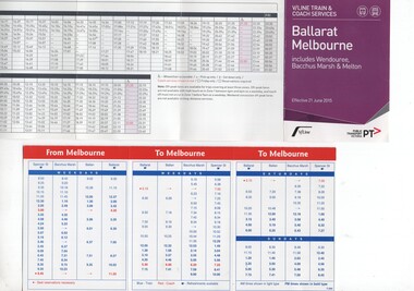
Ephemera - Timetable, "Ballarat to Melbourne", 1998 to 2023
... Rail car on the front. Dated 6/12/1998 - has the VLine logos. 2 - six fold heavy paper timetable listing all services on the Ballarat line, including Wendouree, Bacchus Marsh and Melton - dated 21/6/2015 - has the VLine and PTC logos. 3 - nine fold paper timetable, listing all services on the Ballarat line, including Wendouee, Bacchus Marsh, Melton and Caroline Springs. ...Set of three timetables for the Ballarat to Melbourne line. .1 - three fold card pocket timetable listing services to Bacchus Marsh, Ballarat and Ballarat from Spencer St station - has a photo of a Sprinter Rail car on the front. ...rail services to and from Ballarat and how they have developed. Ballarat VLine PTV Public Transport Victoria Timetables Set of three timetables for the Ballarat to Melbourne line. .1 - three fold card pocket timetable listing services to Bacchus Marsh, Ballarat and Ballarat from Spencer St station - has a photo of a Sprinter Rail car on the front. ...1 - three fold card pocket timetable listing services to Bacchus Marsh, Ballarat and Ballarat from Spencer St station - has a photo of a Sprinter Rail car on the front. Dated 6/12/1998 - has the VLine logos. 2 - six fold heavy paper timetable listing all services on the Ballarat line, including Wendouree, Bacchus Marsh and Melton - dated 21/6/2015 - has the VLine and PTC logos. 3 - nine fold paper timetable, listing all services on the Ballarat line, including Wendouee, Bacchus Marsh, Melton and Caroline Springs. Dated 28 May 2023. Has the Vline and PTV logos. Since 2015 an additional station at Cobblebank has been added. See Reg Items 6824, 8116, 8117 and for 1998, 1957, 1981, 2021 respectively.Yields information about rail services to and from Ballarat and how they have developed.Set of three timetables for the Ballarat to Melbourne line. .1 - three fold card pocket timetable listing services to Bacchus Marsh, Ballarat and Ballarat from Spencer St station - has a photo of a Sprinter Rail car on the front. Dated 6/12/1998 - has the VLine logos. .2 - six fold heavy paper timetable listing all services on the Ballarat line, including Wendouree, Bacchus Marsh and Melton - dated 21/6/2015 - has the VLine and PTC logos. See Reg Items 6824, 8116, 8117 and for 1998, 1957, 1981, 2021 respectively.ballarat, vline, ptv, public transport victoria, timetables -
 Ballarat Tramway Museum
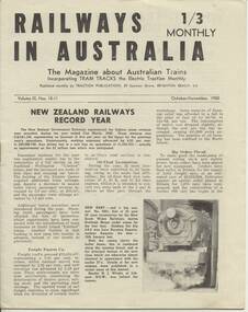
Magazine, Traction Publications, Railways In Australia - Oct/Nov 1950, Nov. 1950
... line soon for NSWR? - p3 About Locomotives - QGR Garratt's, VR N class, R class, NSW 58, TGR diesels - p4 and 5 Holiday by Rail - C.Einsiedel - Vic and NSW Comparisons are Odious - An American View - PCC tram for MMTB - p9 More Fare increase - Sydney, Melbourne and elsewhere - p10 Operation 'Strike' - Melbourne Trams Handle Crowds - by KSK - p 1 2 and 13 (VR trains on strike) - very interesting. - has map of ~B including authorised lines. ...line soon for NSWR? - p3 About Locomotives - QGR Garratt's, VR N class, R class, NSW 58, TGR diesels - p4 and 5 Holiday by Rail - C.Einsiedel - Vic and NSW Comparisons are Odious - An American View - PCC tram for MMTB - p9 More Fare increase - Sydney, Melbourne and elsewhere - p10 Operation 'Strike' - Melbourne Trams Handle Crowds - by KSK - p 1 2 and 13 (VR trains on strike) - very interesting. - has map of ~B including authorised lines. ...24 page magazine, publisher by Traction publication recording current event in Australia & New Zealand railways & tramways - with photos, advertisements, see list for contents. Railways in Australia The Magazine about Australian Trains, incorporating TRAM TRACKS, the Electric Traction Monthly Contents (Summary) Articles New Zealand Railways - Record Year - pl, 2 and 3 Diesel operation of South line is SAR plan - p2 Comrails plan big improvements - p3 New north line soon for NSWR? - p3 About Locomotives - QGR Garratt's, VR N class, R class, NSW 58, TGR diesels - p4 and 5 Holiday by Rail - C.Einsiedel - Vic and NSW Comparisons are Odious - An American View - PCC tram for MMTB - p9 More Fare increase - Sydney, Melbourne and elsewhere - p10 Operation 'Strike' - Melbourne Trams Handle Crowds - by KSK - p 1 2 and 13 (VR trains on strike) - very interesting. - has map of ~B including authorised lines. High Voltage ~ Electric Railway news - NSW, VR, Gippsland - p 14 Model Railways in Australia - p 1 8 and 19 The Mayfield Lines ( large garden 0 gauge model railway, by L.A. Clark, includes plan - p20 and 2 I.) Photographs NSW steam loco 5801 - pl TGR diesel railcars built by Comeng - p3 NSW 38's - p4 MMTB PCC tram 980 and interior view - p9 Photo of St Louis Car Co. B3 bogie used under PCC car - p10 Perth Trolley Bus - No. 41 - p 1 3 Advertisements McGills Newsagency - p2 John C. Beckett - photographer - p6 Meadmores model engineering Co. - p6 and p 14 WAGR institute magazine - p6 Wattle Park - p7 Australian Model Hobbies - SA - p 1 5 Traction Publications - p 1 5 The Main Hobby Depot - Melbourne - p 1 5 Railway Destination Rolls, LA Clark - pl 5 Model repairs - R.Pearson - p19 Hearn's Hobbies- p21 The Hobby Shop p21 Herbert Small - p21 Australia Railway Models - p22 Scale Model Railway Equipment - p23 Bames Tennis Centre - p23 Traction publications listings and books etc. - p24 - and where to purchase magazine. Amalgamated Blind and Tent Co. - p24 Other List of office bearers and general information for ARLHS Obituary for Maj Gen. A.C.Fewtrell Chief Civil Engineer for NSWGR Tramway news - Sydney King St. Closure, Wanganui system closure, Latrobe St. Melbourne, Melbourne VR trams, SEC trams purchasing maximum traction trams, Launceston, Hobart, Kalgoorlie - p I 1, Brisbane, Perth and Adelaide - p I 5 Drawing of Adelaide H class trams - p 1 9 Club noticeboard, and Question box - on Outer circle Railway. Wad 25.11.95 Record images added 20/8/2013. trams, tramways, australian railways, new zealand railways, model railways, model tramways -
 Ballarat Tramway Museum
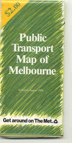
Map, Ministry of Transport and The Met, "Public Transport Map of Melbourne" - "Effective August 1988", 1988
... On the rear, route numbers, line maps of tram routes, train lines, outer metropolitan services, ticketing information, Transport Neighbourhoods, . Shows the St Kilda and Port Melbourne light rail lines. ...On the rear, route numbers, line maps of tram routes, train lines, outer metropolitan services, ticketing information, Transport Neighbourhoods, . Shows the St Kilda and Port Melbourne light rail lines. ...Map - Pocket size - folded - public transport map of Melbourne, printed in colour on art paper, showing public transport services in greater Melbourne, an index of localities. The City Saver area shown in detail. On the rear, route numbers, line maps of tram routes, train lines, outer metropolitan services, ticketing information, Transport Neighbourhoods, . Shows the St Kilda and Port Melbourne light rail lines. Price $2. Shows "The Met" logo. On front under The Met logo and above the scale bar is "Effective 1/7/1988". Niltrams, tramways, melbourne, map, routes -
 Ballarat Tramway Museum
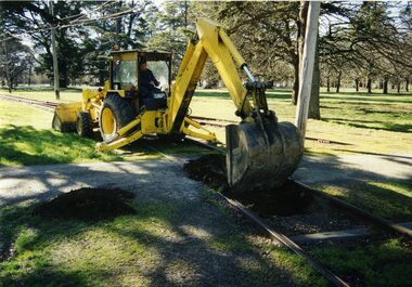
Photograph - Colour Print/s - set of 10, Warren Doubleday, 13/09/2003 12:00:00 AM
... line, BTM Depot, taken by Warren Doubleday on 13.09.2002. Printed on Agfa Paper. 2603.1 - Commencing excavations - Oedf Byslma on backhoe. 2603.2 - Exposing and pulling out sleepers. 2603.3 - offloading sleepers 2603.4 - inserting sleepers 2603.5 - ditto 2603.6 - Sleepers installed 2603.7 - view along inside rail 2603.8 - view along outside rail 2603.9 - Dog spiking - Alan Snowball, Greg Histen , Danny Smith, Richard Gilbert and Garry Wood, 2603.10 -ditto ...line, BTM Depot, taken by Warren Doubleday on 13.09.2002. Printed on Agfa Paper. 2603.1 - Commencing excavations - Oedf Byslma on backhoe. 2603.2 - Exposing and pulling out sleepers. 2603.3 - offloading sleepers 2603.4 - inserting sleepers 2603.5 - ditto 2603.6 - Sleepers installed 2603.7 - view along inside rail 2603.8 - view along outside rail 2603.9 - Dog spiking - Alan Snowball, Greg Histen , Danny Smith, Richard Gilbert and Garry Wood, 2603.10 -ditto Photograph Colour Print/s - set of 10 Warren Doubleday ...Set of ten colour photographs of the renewal of the sleepers under the level crossing on the main access line, BTM Depot, taken by Warren Doubleday on 13.09.2002. Printed on Agfa Paper. 2603.1 - Commencing excavations - Oedf Byslma on backhoe. 2603.2 - Exposing and pulling out sleepers. 2603.3 - offloading sleepers 2603.4 - inserting sleepers 2603.5 - ditto 2603.6 - Sleepers installed 2603.7 - view along inside rail 2603.8 - view along outside rail 2603.9 - Dog spiking - Alan Snowball, Greg Histen , Danny Smith, Richard Gilbert and Garry Wood, 2603.10 -ditto On rear of each photo in brown felt tip pen, the details of the location and date.btm, access track, trackwork -
 Stawell Historical Society Inc
Archive - CD/DVD, Stawell Rail Photos - Various photographs of trains at Stawell, Stawell Station, Stawell Cutting, Stawell Turntable, Sloane Street Crossing, Goods Shed, Signal Box, Stawell Gift Special, Silo's, Grampians Line
... Stawell Rail Photos - Various photographs of trains at Stawell, Stawell Station, Stawell Cutting, Stawell Turntable, Sloane Street Crossing, Goods Shed, Signal Box, Stawell Gift Special, Silo's, Grampians Line....Stawell Transport Railways Stawell Rail Photos - Various photographs of trains at Stawell, Stawell Station, Stawell Cutting, Stawell Turntable, Sloane Street Crossing, Goods Shed, Signal Box, Stawell Gift Special, Silo's, Grampians Line. ...stawell, transport, railways -
 St Kilda Historical Society
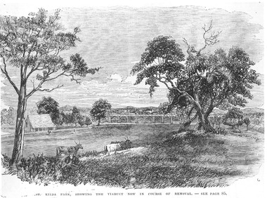
Photograph - Artwork, St Kilda Park, showing the viaduct now in course of removal, 25/06/1867
... The loop line ran from the St Kilda railway station on a combination of wooden viaducts and earth embankments fifteen feet high, crossing over St Kilda and Punt Roads by way of bridges and then gradually decreasing to a level crossing at Union Street and then on to Windsor station. St Kilda Railway Station Albert Park Windsor to St Kilda Rail ...St Kilda Park, now Albert Park Reserve, showing cows, eucalyptus trees, oval and a railway viaduct in background. The viaduct was part of the Windsor to St Kilda loop line which operated between 1857 and 1867. The loop line ran from the St Kilda railway station on a combination of wooden viaducts and earth embankments fifteen feet high, crossing over St Kilda and Punt Roads by way of bridges and then gradually decreasing to a level crossing at Union Street and then on to Windsor station. Black and white photograph of a lithograph published in a book (unidentified)ST KILDA PARK, SHOWING THE VIADUCT NOW IN COURSE OF REMOVAL - SEE PAGE 85st kilda railway station, albert park, windsor to st kilda rail loop -
 Stawell Historical Society Inc
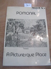
Book, Isabel Armer, Pomonal – A Picturesque Place, 1984
... Pale yellow Card Cover with black line drawing showing a house and post and rail fences in a bushland setting. ...The history of Pomonal stawell Pomonal A Picturesque Place Drawing has the Name: A G Inman 1932 Pale yellow Card Cover with black line drawing showing a house and post and rail fences in a bushland setting. ...The history of PomonalPale yellow Card Cover with black line drawing showing a house and post and rail fences in a bushland setting. Pomonal A Picturesque Place Drawing has the Name: A G Inman 1932stawell -
 Nillumbik Shire Council
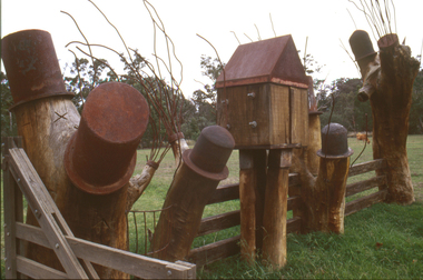
Sculpture: Tony Trembath (b.1946 Sale, Victoria), Tony Trembath, The Fences Act 1968 - Location: Edendale Farm (entrance) 30 Gastons Road, Eltham, 1989 - 1994
... line on the far side of the carpark. Trembath also absorbed significant aspects of local history, making references to Eltham's agricultural past, the clearing of the land, the destruction of trees, the ruthless pruning of trees by suburban Councils and incorporated such Australian features as the post and rail fence. ...The fence-line incorporates a functional engineered double gate and post and rail fencing. ...The fence-line incorporates a functional engineered double gate and post and rail fencing. ...Eltham Council (now the Shire of Nillumbik) commissioned this work in 1989 to create an entrance / gateway to Edendale Community Farm. It was also aided by a grant from the Ministry of the Arts (now Arts Victoria). The former name of this work was "Gateway to Edendale Farm". Edendale Farm is a demonstration farm modelling sustainable environmental practices, providing support to the local residents of Nillumbik. Established in 1986, the land was purchased in 1970. It was previously an English gentleman's residence and was used for grazing. It consists of 5.6 hectares, with the Diamond Creek meandering through the property. The Victorian Fences Act 1968 governs liability of occupiers of adjoining lands to fence, and deals with disputes between neighbours regarding boundaries fences and costs. This work took into consideration ideas and suggestions from residents and committees, who required the use of recycled materials and that the work celebrate man's relationship with nature, animals and the earth, as well as relate to the fence-line on the far side of the carpark. Trembath also absorbed significant aspects of local history, making references to Eltham's agricultural past, the clearing of the land, the destruction of trees, the ruthless pruning of trees by suburban Councils and incorporated such Australian features as the post and rail fence. 'The Fences Act 1968' is significant for aesthetic, historic and social reasons at a regional level. It makes prominent the historical and social significance of Edendale and the rural aspects of Nillumbik. The use of existing tree stumps and salt pots in the work explores the iconography of the countryside such as the isolated farmhouse, pioneering farming practices, post and rail fencing and the regrowth of lopped trees. The title of the work, as well as the extensive community involvement in its creation, also makes reference to the Victorian Fences Act 1968, which makes neighbours jointly responsible for the cost of construction and maintenance of fences in the partitioning of land for settlement. 'The Fences Act 1968' has been classified as of regional significance by the National Trust of Australia. The work is an installation of wood and metal, approximately twenty five meters long. The design is very informal and rustic and runs the full width of the fence-line. It comprises groups of recycled tree trunks fitted with metal caps (chrome-nickel 'salt pots' that are shaped like tall bowler / top hats). Metal rods protrude from the trunks and some of these rods have metal birds. Two larger, sentinel-like stumps at the two outer ends have metal flame-like wings, which bend inward. To the left of the entrance, a simple architectural element indicates an isolated farmhouse. The rustic fence runs between the groups of tree trunks with native planting in clumps along it. The fence-line incorporates a functional engineered double gate and post and rail fencing. There may be many interpretations of the work and the intention is to stimulate interest and imagination rather than alienate. Interpretation is based on the personal experience that a visitor brings. The artist recommended that no explanation of the design logic be positioned with the work. N/Apublic art, sculpture, edendale, recycled, wood, metal, fences act 1968, gate, trembath, salt pot, tree stumps -
 Nillumbik Shire Council
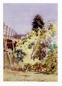
Painting: Walter WITHERS (b.1854 Warwickshire, UK — d.1914 Eltham, Aus), Trestle Bridge, Eltham, c.1903-10
... Apart from its important continuing social function as a carrier of rail transport for the Hurstbridge line, this impressive bridge and its beautiful parkland environs contribute much to the character of Eltham township and that town's special reputation as an historic centre of environmental and conservation concerns. ...Walter Withers was a significant Australian landscape artist and a member of the Heidelberg School of Australian Impressionists. In 1903 Withers bought 'Southernwood', a house on 2½ acres (1 ha) at Eltham, to which he added a studio. Because of ill health, he lived during the week at his studio in Oxford Chambers, Melbourne, and on weekends and holidays with his family at Eltham until his death in 1914. The Eltham rail bridge is a unique and valuable historic relic of an earlier steam locomotive transport era in the Diamond Creek Valley and has long formed an important part of a magnificent Eltham landscape. When built in 1902 it was close to the terminus point of the Heidelberg-Eltham rail extension, on the route of the proposed Diamond Valley Railway that was then planned to continue much further up the valley towards Kinglake. This bridge is situated in attractive river-valley parkland amidst the tall and spreading manna gums and candlebarks of the Diamond Creek Valley. The Alistair Knox Park river-valley landscape, of which the timber trestle bridge is an important visual component, has been classified by the National Trust. Large manna gum and candlebark trees adorn the adjacent creek banks, and historic Shillinglaw Cottage is also part of this much-prized Eltham landscape. Eltham is home to a historic wooden railway trestle bridge. Mainly of timber-pier and timber-beam construction, but varied by a few longer steel-joists spans on timber piers at the main stream channel, this substantial bridge has almost two hundred metres of timber deck. Built in 1902, it is the only railway bridge of predominantly timber construction that is still in regular use as an integral part of Melbourne's metropolitan electric railway network and one of extremely few timber rail bridges in the State that still carry trains. Apart from its important continuing social function as a carrier of rail transport for the Hurstbridge line, this impressive bridge and its beautiful parkland environs contribute much to the character of Eltham township and that town's special reputation as an historic centre of environmental and conservation concerns. This section of the Diamond Creek Valley was the subject of a Walter Withers painting in the earliest years of the twentieth century and has strong historic links with our Heidelberg School of painters. Watercolour painting on paper of Eltham's Trestle Bridge in the middle of the day. A small section of the wooden bridge is located to the left of the painting. The focus is predominately on the wattle, manna gum and candlebark trees that is to the right of the bridge. The golden hues typically represent the australian sunlight and landscape. "W.W" in gothic script on the lower right side of the painting. Not dated. withers, eltham, trestle bridge, railway, watercolour -
 Sunshine and District Historical Society Incorporated
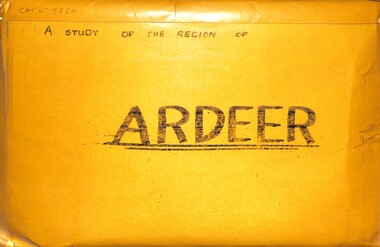
Archive - A Study Of The Region Of Ardeer, Sister Chanel (Sister Julia Williams), 1985
... There's Northing To Study 5384.02 - A Regional Study Of The Region Of Ardeer Page 8.jpg 1978 Municipal Directory 5384.02 - A Regional Study Of The Region Of Ardeer Page 9.jpg Text - Who Fosters It Image - House 5384.02 - A Regional Study Of The Region Of Ardeer Page 10.jpg Image - Market Gardens Yallourn Street Image - Yallourn Street 5384.02 - A Regional Study Of The Region Of Ardeer Page 11.jpg Image - Mother Of God Catholic Church Blanche Street Image - Mother Of God Catholic Church Blanche Street 5384.02 - A Regional Study Of The Region Of Ardeer Page 12.jpg Image - Scotch Thistles Image - Kororoit Creek Bridge West Street To Esmond Street 5384.02 - A Regional Study Of The Region Of Ardeer Page 13.jpg Image - Kororoit Creek Bridge Yalloun Street to Ballarat Road Image - Mother Of God Catholic Church Blanche Street 5384.02 - A Regional Study Of The Region Of Ardeer Page 14.jpg Text - Councillors, Politicians, People 5384.02 - A Regional Study Of The Region Of Ardeer Page 15.jpg Reality 5384.02 - A Regional Study Of The Region Of Ardeer Page 16.jpg Text - Geography Of The City Of Sunshine 5384.02 - A Regional Study Of The Region Of Ardeer Page 18.jpg Melway Map 5384.02 - A Regional Study Of The Region Of Ardeer Page 20.jpg Image - Kororoit Creek From Ballarat Road 5384.02 - A Regional Study Of The Region Of Ardeer Page 22.jpg Text - Basalt Sample Of A Basalt Rock When Laying Foundations For The Polish Community Hall In Helene Street 5384.02 - A Regional Study Of The Region Of Ardeer Page 23.jpg Image - Corner Yallourn Street And Rockbank Road Image - Tower Road Proposed Freeway Site (Now Scrapped) 5384.02 - A Regional Study Of The Region Of Ardeer Page 24.jpg Image - Kororoit Creek Bridge West Street To Esmond Street 5384.02 - A Regional Study Of The Region Of Ardeer Page 25.jpg Kororoit Creek Bridge West Street To Esmond Street 5384.02 - A Regional Study Of The Region Of Ardeer Page 26.jpg Image - Sunshine Swimming Pool Kororoit Creek 5384.02 - A Regional Study Of The Region Of Ardeer Page 27.jpg Text - Industry 5384.02 - A Regional Study Of The Region Of Ardeer Page 28.jpg Text - ICI 5384.02 - A Regional Study Of The Region Of Ardeer Page 29.jpg Text - ICINZ 5384.02 - A Regional Study Of The Region Of Ardeer Page 30.jpg Image - ICIANZ Ballarat Road Entrance 1979 Image - ICIANZ Explosive Reserve View From More Park Esmond Road 5384.02 - A Regional Study Of The Region Of Ardeer Page 31.jpg Image - Forrest Street Corner Fitzgerald Road Image - Entrance To ICIANZ Forrest Street 5384.02 - A Regional Study Of The Region Of Ardeer Page 32.jpg Image - Explosive Train Shunting Across Forrest Street 5384.02 - A Regional Study Of The Region Of Ardeer Page 33.jpg Image - Besco Batteries Forrest Street 5384.02 - A Regional Study Of The Region Of Ardeer Page 34.jpg Image - Queen Of Heaven Catholic Church Holt Street 5384.02 - A Regional Study Of The Region Of Ardeer Page 35.jpg Image - Ukrainian Catholic Church Forrest Street 5384.02 - A Regional Study Of The Region Of Ardeer Page 36.jpg Image - Mother Of God Catholic Church Blanche Street 5384.02 - A Regional Study Of The Region Of Ardeer Page 37.jpg Image - Ukrainian Hall Suspension Street Image - Polish Hall Helene Street 5384.02 - A Regional Study Of The Region Of Ardeer Page 38.jpg Image - Mother Of God Catholic Primary School Blanche Street 5384.02 - A Regional Study Of The Region Of Ardeer Page 39.jpg Image - Ardeer State School Looking From Suspension Street 5384.02 - A Regional Study Of The Region Of Ardeer Page 40.jpg Image - Polish Soccer Club Playgroup 5384.02 - A Regional Study Of The Region Of Ardeer Page 41.jpg Image - Holt Street Shopping Centre Image - Holt Street Milk Bar And Post Office 5384.02 - A Regional Study Of The Region Of Ardeer Page 42.jpg Image - 29 - 31 Maxwell Street Shopping Centre Image - 60 - 62 Maxwell Street Shopping Centre 5384.02 - A Regional Study Of The Region Of Ardeer Page 43.jpg Image - Motor Rail Train At Ardeer Station 5384.02 - A Regional Study Of The Region Of Ardeer Page 44.jpg Image - Ardeer Railway Station 5384.02 - A Regional Study Of The Region Of Ardeer Page 45.jpg Image - Railway Line Pedestrian Crossing Ardeer Station Ridgeway Parade To Forrest Street Image - Railway Line Pedestrian Crossing Ridgeway Parade To West Street 5384.02 - A Regional Study Of The Region Of Ardeer Page 46.jpg Image - Half House Image - Half House 5384.02 - A Regional Study Of The Region Of Ardeer Page 47.jpg Image - Small House Image - Vacant Block 5384.02 - A Regional Study Of The Region Of Ardeer Page 48.jpg Image - House Image - New House 5384.02 - A Regional Study Of The Region Of Ardeer Page 49.jpg Image - House 5384.02 - A Regional Study Of The Region Of Ardeer Page 50.jpg Image - Horse Riding School Forrest Street Image - Horse Riding School Forrest Street 5384.02 - A Regional Study Of The Region Of Ardeer Page 51.jpg Image - Kororoit Creek Image - Playground 5384.02 - A Regional Study Of The Region Of Ardeer Page 52.jpg Image - More Park Women's Sport Centre Esmond Street Image - Old Service Station Old Service Station 5384.02 - A Regional Study Of The Region Of Ardeer Page 53.jpg Image - Vegetable Garden Image - Vegetable Garden 5384.02 - A Regional Study Of The Region Of Ardeer Page 54.jpg Text - Open Space Analysis 5384.02 - A Regional Study Of The Region Of Ardeer Page 55.jpg 1976 Census 5384.02 - A Regional Study Of The Region Of Ardeer Page 56.jpg 1976 Census 5384.02 - A Regional Study Of The Region Of Ardeer Page 57.jpg 1979 Statistics 5384.02 - A Regional Study Of The Region Of Ardeer Page 58.jpg Text - Some Significant Realities 5384.02 - A Regional Study Of The Region Of Ardeer Page 59.jpg Text - A Typical Story From An Ardeerite 5384.02 - A Regional Study Of The Region Of Ardeer Page 60.jpg Text - Bibliography 5384.03 - A Regional Study Of The Region Of Ardeer - Donation Letter.jpg 5384.04 - A Regional Study Of The Region Of Ardeer - Sister Chanel Details.jpg ...There's Northing To Study 5384.02 - A Regional Study Of The Region Of Ardeer Page 8.jpg 1978 Municipal Directory 5384.02 - A Regional Study Of The Region Of Ardeer Page 9.jpg Text - Who Fosters It Image - House 5384.02 - A Regional Study Of The Region Of Ardeer Page 10.jpg Image - Market Gardens Yallourn Street Image - Yallourn Street 5384.02 - A Regional Study Of The Region Of Ardeer Page 11.jpg Image - Mother Of God Catholic Church Blanche Street Image - Mother Of God Catholic Church Blanche Street 5384.02 - A Regional Study Of The Region Of Ardeer Page 12.jpg Image - Scotch Thistles Image - Kororoit Creek Bridge West Street To Esmond Street 5384.02 - A Regional Study Of The Region Of Ardeer Page 13.jpg Image - Kororoit Creek Bridge Yalloun Street to Ballarat Road Image - Mother Of God Catholic Church Blanche Street 5384.02 - A Regional Study Of The Region Of Ardeer Page 14.jpg Text - Councillors, Politicians, People 5384.02 - A Regional Study Of The Region Of Ardeer Page 15.jpg Reality 5384.02 - A Regional Study Of The Region Of Ardeer Page 16.jpg Text - Geography Of The City Of Sunshine 5384.02 - A Regional Study Of The Region Of Ardeer Page 18.jpg Melway Map 5384.02 - A Regional Study Of The Region Of Ardeer Page 20.jpg Image - Kororoit Creek From Ballarat Road 5384.02 - A Regional Study Of The Region Of Ardeer Page 22.jpg Text - Basalt Sample Of A Basalt Rock When Laying Foundations For The Polish Community Hall In Helene Street 5384.02 - A Regional Study Of The Region Of Ardeer Page 23.jpg Image - Corner Yallourn Street And Rockbank Road Image - Tower Road Proposed Freeway Site (Now Scrapped) 5384.02 - A Regional Study Of The Region Of Ardeer Page 24.jpg Image - Kororoit Creek Bridge West Street To Esmond Street 5384.02 - A Regional Study Of The Region Of Ardeer Page 25.jpg Kororoit Creek Bridge West Street To Esmond Street 5384.02 - A Regional Study Of The Region Of Ardeer Page 26.jpg Image - Sunshine Swimming Pool Kororoit Creek 5384.02 - A Regional Study Of The Region Of Ardeer Page 27.jpg Text - Industry 5384.02 - A Regional Study Of The Region Of Ardeer Page 28.jpg Text - ICI 5384.02 - A Regional Study Of The Region Of Ardeer Page 29.jpg Text - ICINZ 5384.02 - A Regional Study Of The Region Of Ardeer Page 30.jpg Image - ICIANZ Ballarat Road Entrance 1979 Image - ICIANZ Explosive Reserve View From More Park Esmond Road 5384.02 - A Regional Study Of The Region Of Ardeer Page 31.jpg Image - Forrest Street Corner Fitzgerald Road Image - Entrance To ICIANZ Forrest Street 5384.02 - A Regional Study Of The Region Of Ardeer Page 32.jpg Image - Explosive Train Shunting Across Forrest Street 5384.02 - A Regional Study Of The Region Of Ardeer Page 33.jpg Image - Besco Batteries Forrest Street 5384.02 - A Regional Study Of The Region Of Ardeer Page 34.jpg Image - Queen Of Heaven Catholic Church Holt Street 5384.02 - A Regional Study Of The Region Of Ardeer Page 35.jpg Image - Ukrainian Catholic Church Forrest Street 5384.02 - A Regional Study Of The Region Of Ardeer Page 36.jpg Image - Mother Of God Catholic Church Blanche Street 5384.02 - A Regional Study Of The Region Of Ardeer Page 37.jpg Image - Ukrainian Hall Suspension Street Image - Polish Hall Helene Street 5384.02 - A Regional Study Of The Region Of Ardeer Page 38.jpg Image - Mother Of God Catholic Primary School Blanche Street 5384.02 - A Regional Study Of The Region Of Ardeer Page 39.jpg Image - Ardeer State School Looking From Suspension Street 5384.02 - A Regional Study Of The Region Of Ardeer Page 40.jpg Image - Polish Soccer Club Playgroup 5384.02 - A Regional Study Of The Region Of Ardeer Page 41.jpg Image - Holt Street Shopping Centre Image - Holt Street Milk Bar And Post Office 5384.02 - A Regional Study Of The Region Of Ardeer Page 42.jpg Image - 29 - 31 Maxwell Street Shopping Centre Image - 60 - 62 Maxwell Street Shopping Centre 5384.02 - A Regional Study Of The Region Of Ardeer Page 43.jpg Image - Motor Rail Train At Ardeer Station 5384.02 - A Regional Study Of The Region Of Ardeer Page 44.jpg Image - Ardeer Railway Station 5384.02 - A Regional Study Of The Region Of Ardeer Page 45.jpg Image - Railway Line Pedestrian Crossing Ardeer Station Ridgeway Parade To Forrest Street Image - Railway Line Pedestrian Crossing Ridgeway Parade To West Street 5384.02 - A Regional Study Of The Region Of Ardeer Page 46.jpg Image - Half House Image - Half House 5384.02 - A Regional Study Of The Region Of Ardeer Page 47.jpg Image - Small House Image - Vacant Block 5384.02 - A Regional Study Of The Region Of Ardeer Page 48.jpg Image - House Image - New House 5384.02 - A Regional Study Of The Region Of Ardeer Page 49.jpg Image - House 5384.02 - A Regional Study Of The Region Of Ardeer Page 50.jpg Image - Horse Riding School Forrest Street Image - Horse Riding School Forrest Street 5384.02 - A Regional Study Of The Region Of Ardeer Page 51.jpg Image - Kororoit Creek Image - Playground 5384.02 - A Regional Study Of The Region Of Ardeer Page 52.jpg Image - More Park Women's Sport Centre Esmond Street Image - Old Service Station Old Service Station 5384.02 - A Regional Study Of The Region Of Ardeer Page 53.jpg Image - Vegetable Garden Image - Vegetable Garden 5384.02 - A Regional Study Of The Region Of Ardeer Page 54.jpg Text - Open Space Analysis 5384.02 - A Regional Study Of The Region Of Ardeer Page 55.jpg 1976 Census 5384.02 - A Regional Study Of The Region Of Ardeer Page 56.jpg 1976 Census 5384.02 - A Regional Study Of The Region Of Ardeer Page 57.jpg 1979 Statistics 5384.02 - A Regional Study Of The Region Of Ardeer Page 58.jpg Text - Some Significant Realities 5384.02 - A Regional Study Of The Region Of Ardeer Page 59.jpg Text - A Typical Story From An Ardeerite 5384.02 - A Regional Study Of The Region Of Ardeer Page 60.jpg Text - Bibliography 5384.03 - A Regional Study Of The Region Of Ardeer - Donation Letter.jpg 5384.04 - A Regional Study Of The Region Of Ardeer - Sister Chanel Details.jpg A large envelope containing over 50 black & white photographs, statistics charts, several maps mounted on coloured card with text. ...Sister Chanel, was later known as Sister Julia Williams. She was professed on the 7th December 1963. She is mentioned in a history of the Brigidine Sister, by Morna Sturrock, Women of Strength, Women of Gentleness: Brigidine Sisters - Victoria Province, David Lovell Publishing, Victoria Australia, 1995, page 290. Sister Chanel (Sister Julia Williams) undertook a study of Ardeer in 1985, as part of her university studies. At the time, she was based at the Brigidine Convent in Blanche Street, Ardeer, opposite the Mother of God Catholic Primary School. Some years later, she was living at Unit 3, 387 Station Street, Bonbeach, Vic, 3196. Today, the Brigidine Convent at Ardeer no longer exists. The buildings have been demolished. The local schools begun by the Brigidine Sisters are now entirely staffed by lay teachers. There is a Brigidine Centre in Malvern, which contains archives relating to the Brigidine Sisters' history.The Brigidine Sisters (often misheard as “Bridiline”) are a long‑established Catholic religious congregation with a major historical presence in Melbourne, especially in education and social justice work. They arrived in Victoria in the 1880s and continue to operate schools, ministries, and community programs across the state.5384.01 - A Regional Study Of The Region Of Ardeer Envelope.jpg Text - A Regional Study Of The Region Of Ardeer 5384.02 - A Regional Study Of The Region Of Ardeer Page 1.jpg Text - A Regional Study Of The Region Of Ardeer 5384.02 - A Regional Study Of The Region Of Ardeer Page 2.jpg 5384.02 - A Regional Study Of The Region Of Ardeer Page 3.jpg Text - Subject HU211 Regionalism And Australia 5384.02 - A Regional Study Of The Region Of Ardeer Page 4.jpg Text - Ardeer Regions Selected 5384.02 - A Regional Study Of The Region Of Ardeer Page 5.jpg Melway Map 5384.02 - A Regional Study Of The Region Of Ardeer Page 6.jpg Text - Ardeer Never Heard Of It. Wheres That? 5384.02 - A Regional Study Of The Region Of Ardeer Page 7.jpg Text - Study The Region of Ardeer. There's Northing To Study 5384.02 - A Regional Study Of The Region Of Ardeer Page 8.jpg 1978 Municipal Directory 5384.02 - A Regional Study Of The Region Of Ardeer Page 9.jpg Text - Who Fosters It Image - House 5384.02 - A Regional Study Of The Region Of Ardeer Page 10.jpg Image - Market Gardens Yallourn Street Image - Yallourn Street 5384.02 - A Regional Study Of The Region Of Ardeer Page 11.jpg Image - Mother Of God Catholic Church Blanche Street Image - Mother Of God Catholic Church Blanche Street 5384.02 - A Regional Study Of The Region Of Ardeer Page 12.jpg Image - Scotch Thistles Image - Kororoit Creek Bridge West Street To Esmond Street 5384.02 - A Regional Study Of The Region Of Ardeer Page 13.jpg Image - Kororoit Creek Bridge Yalloun Street to Ballarat Road Image - Mother Of God Catholic Church Blanche Street 5384.02 - A Regional Study Of The Region Of Ardeer Page 14.jpg Text - Councillors, Politicians, People 5384.02 - A Regional Study Of The Region Of Ardeer Page 15.jpg Reality 5384.02 - A Regional Study Of The Region Of Ardeer Page 16.jpg Text - Geography Of The City Of Sunshine 5384.02 - A Regional Study Of The Region Of Ardeer Page 18.jpg Melway Map 5384.02 - A Regional Study Of The Region Of Ardeer Page 20.jpg Image - Kororoit Creek From Ballarat Road 5384.02 - A Regional Study Of The Region Of Ardeer Page 22.jpg Text - Basalt Sample Of A Basalt Rock When Laying Foundations For The Polish Community Hall In Helene Street 5384.02 - A Regional Study Of The Region Of Ardeer Page 23.jpg Image - Corner Yallourn Street And Rockbank Road Image - Tower Road Proposed Freeway Site (Now Scrapped) 5384.02 - A Regional Study Of The Region Of Ardeer Page 24.jpg Image - Kororoit Creek Bridge West Street To Esmond Street 5384.02 - A Regional Study Of The Region Of Ardeer Page 25.jpg Kororoit Creek Bridge West Street To Esmond Street 5384.02 - A Regional Study Of The Region Of Ardeer Page 26.jpg Image - Sunshine Swimming Pool Kororoit Creek 5384.02 - A Regional Study Of The Region Of Ardeer Page 27.jpg Text - Industry 5384.02 - A Regional Study Of The Region Of Ardeer Page 28.jpg Text - ICI 5384.02 - A Regional Study Of The Region Of Ardeer Page 29.jpg Text - ICINZ 5384.02 - A Regional Study Of The Region Of Ardeer Page 30.jpg Image - ICIANZ Ballarat Road Entrance 1979 Image - ICIANZ Explosive Reserve View From More Park Esmond Road 5384.02 - A Regional Study Of The Region Of Ardeer Page 31.jpg Image - Forrest Street Corner Fitzgerald Road Image - Entrance To ICIANZ Forrest Street 5384.02 - A Regional Study Of The Region Of Ardeer Page 32.jpg Image - Explosive Train Shunting Across Forrest Street 5384.02 - A Regional Study Of The Region Of Ardeer Page 33.jpg Image - Besco Batteries Forrest Street 5384.02 - A Regional Study Of The Region Of Ardeer Page 34.jpg Image - Queen Of Heaven Catholic Church Holt Street 5384.02 - A Regional Study Of The Region Of Ardeer Page 35.jpg Image - Ukrainian Catholic Church Forrest Street 5384.02 - A Regional Study Of The Region Of Ardeer Page 36.jpg Image - Mother Of God Catholic Church Blanche Street 5384.02 - A Regional Study Of The Region Of Ardeer Page 37.jpg Image - Ukrainian Hall Suspension Street Image - Polish Hall Helene Street 5384.02 - A Regional Study Of The Region Of Ardeer Page 38.jpg Image - Mother Of God Catholic Primary School Blanche Street 5384.02 - A Regional Study Of The Region Of Ardeer Page 39.jpg Image - Ardeer State School Looking From Suspension Street 5384.02 - A Regional Study Of The Region Of Ardeer Page 40.jpg Image - Polish Soccer Club Playgroup 5384.02 - A Regional Study Of The Region Of Ardeer Page 41.jpg Image - Holt Street Shopping Centre Image - Holt Street Milk Bar And Post Office 5384.02 - A Regional Study Of The Region Of Ardeer Page 42.jpg Image - 29 - 31 Maxwell Street Shopping Centre Image - 60 - 62 Maxwell Street Shopping Centre 5384.02 - A Regional Study Of The Region Of Ardeer Page 43.jpg Image - Motor Rail Train At Ardeer Station 5384.02 - A Regional Study Of The Region Of Ardeer Page 44.jpg Image - Ardeer Railway Station 5384.02 - A Regional Study Of The Region Of Ardeer Page 45.jpg Image - Railway Line Pedestrian Crossing Ardeer Station Ridgeway Parade To Forrest Street Image - Railway Line Pedestrian Crossing Ridgeway Parade To West Street 5384.02 - A Regional Study Of The Region Of Ardeer Page 46.jpg Image - Half House Image - Half House 5384.02 - A Regional Study Of The Region Of Ardeer Page 47.jpg Image - Small House Image - Vacant Block 5384.02 - A Regional Study Of The Region Of Ardeer Page 48.jpg Image - House Image - New House 5384.02 - A Regional Study Of The Region Of Ardeer Page 49.jpg Image - House 5384.02 - A Regional Study Of The Region Of Ardeer Page 50.jpg Image - Horse Riding School Forrest Street Image - Horse Riding School Forrest Street 5384.02 - A Regional Study Of The Region Of Ardeer Page 51.jpg Image - Kororoit Creek Image - Playground 5384.02 - A Regional Study Of The Region Of Ardeer Page 52.jpg Image - More Park Women's Sport Centre Esmond Street Image - Old Service Station Old Service Station 5384.02 - A Regional Study Of The Region Of Ardeer Page 53.jpg Image - Vegetable Garden Image - Vegetable Garden 5384.02 - A Regional Study Of The Region Of Ardeer Page 54.jpg Text - Open Space Analysis 5384.02 - A Regional Study Of The Region Of Ardeer Page 55.jpg 1976 Census 5384.02 - A Regional Study Of The Region Of Ardeer Page 56.jpg 1976 Census 5384.02 - A Regional Study Of The Region Of Ardeer Page 57.jpg 1979 Statistics 5384.02 - A Regional Study Of The Region Of Ardeer Page 58.jpg Text - Some Significant Realities 5384.02 - A Regional Study Of The Region Of Ardeer Page 59.jpg Text - A Typical Story From An Ardeerite 5384.02 - A Regional Study Of The Region Of Ardeer Page 60.jpg Text - Bibliography 5384.03 - A Regional Study Of The Region Of Ardeer - Donation Letter.jpg 5384.04 - A Regional Study Of The Region Of Ardeer - Sister Chanel Details.jpg -
 Sunshine and District Historical Society Incorporated
Photograph - Images of Ardeer By Sister Chanel, Sister Chanel (Sister Julia Williams), 1980's
... 5383.01 - Images of Ardeer By Sister Chanel - Holt Street Shopping Centre.jpg 5383.02 - Images of Ardeer By Sister Chanel - Holt Street Milk Bar And Post Office.jpg 5383.03 - Images of Ardeer By Sister Chanel - 29 - 31 Maxwell Street Shopping Centre.jpg 5383.04 - Images of Ardeer By Sister Chanel - 60 - 62 Maxwell Street Shopping Centre.jpg 5383.05 - Images of Ardeer By Sister Chanel - Mother Of God Catholic Church Blanche Street.jpg 5383.06 - Images of Ardeer By Sister Chanel - Mother Of God Catholic Church Blanche Street.jpg 5383.07 - Images of Ardeer By Sister Chanel - Mother Of God Catholic Church Blanche Street.jpg 5383.08 - Images of Ardeer By Sister Chanel - Mother Of God Catholic Church Blanche Street.jpg 5383.09 - Images of Ardeer By Sister Chanel - Mother Of God Catholic Primary School Blanche Street.jpg 5383.10 - Images of Ardeer By Sister Chanel - Ukrainian Catholic Church Forrest Street.jpg 5383.11 - Images of Ardeer By Sister Chanel - Ukrainian Hall Suspension Street.jpg 5383.12 - Images of Ardeer By Sister Chanel - Polish Hall Helene Street.jpg 5383.13 - Images of Ardeer By Sister Chanel - Queen Of Heaven Catholic Church Holt Street.jpg 5383.14 - Images of Ardeer By Sister Chanel - More Park Women's Sport Centre Esmond Street.jpg 5383.15 - Images of Ardeer By Sister Chanel - Kororoit Creek Bridge West Street To Esmond Street.jpg 5383.16 - Images of Ardeer By Sister Chanel - Kororoit Creek Bridge West Street To Esmond Street.jpg 5383.17 - Images of Ardeer By Sister Chanel - ICIANZ Ballarat Road Entrance 1979.jpg 5383.18 - Images of Ardeer By Sister Chanel - Ardeer Railway Station.jpg 5383.19 - Images of Ardeer By Sister Chanel - Motor Rail Train At Ardeer Station.jpg 5383.20 - Images of Ardeer By Sister Chanel - Railway Line Pedestrian Crossing Ridgeway Parade To West Street.jpg 5383.21 - Images of Ardeer By Sister Chanel - Railway Line Pedestrian Crossing Ardeer Station Ridgeway Parade To Forrest Street.jpg 5383.22 - Images of Ardeer By Sister Chanel - Old Service Station.jpg 5383.23 - Images of Ardeer By Sister Chanel - New House.jpg 5383.24 - Images of Ardeer By Sister Chanel - Ardeer State School Looking From Suspension Street.jpg 5383.25 - Images of Ardeer By Sister Chanel - Besco Batteries Forrest Street.jpg 5383.26 - Images of Ardeer By Sister Chanel - Corner Yallourn Street And Rockbank Road.jpg 5383.27 - Images of Ardeer By Sister Chanel - House.jpg 5383.28 - Images of Ardeer By Sister Chanel - Kororoit Creek From Ballarat Road.jpg 5383.29 - Images of Ardeer By Sister Chanel - Forrest Street Corner Fitzgerald Road.jpg 5383.30 - Images of Ardeer By Sister Chanel - Half House.jpg 5383.31 - Images of Ardeer By Sister Chanel - House.jpg 5383.32 - Images of Ardeer By Sister Chanel - Entrance To ICIANZ Forrest Street.jpg 5383.33 - Images of Ardeer By Sister Chanel - ICIANZ Explosive Reserve View From More Park Esmond Road.jpg 5383.34 - Images of Ardeer By Sister Chanel - Explosive Train Shunting Across Forrest Street.jpg 5383.35 - Images of Ardeer By Sister Chanel - House.jpg 5383.36 - Images of Ardeer By Sister Chanel - Kororoit Creek.jpg 5383.37 - Images of Ardeer By Sister Chanel - Market Gardens Yallourn Street.jpg 5383.38 - Images of Ardeer By Sister Chanel - Playground.jpg 5383.39 - Images of Ardeer By Sister Chanel - Polish Soccer Club Playgroup.jpg 5383.40 - Images of Ardeer By Sister Chanel - Scotch Thistles.jpg 5383.41 - Images of Ardeer By Sister Chanel - Small House.jpg 5383.42 - Images of Ardeer By Sister Chanel - Tower Road Proposed Freeway Site (Now Scrapped).jpg 5383.43 - Images of Ardeer By Sister Chanel - Vacant Block.jpg 5383.44 - Images of Ardeer By Sister Chanel - Vegetable Garden.jpg 5383.45 - Images of Ardeer By Sister Chanel - Yallourn Street.jpg 5383.46 - Images of Ardeer By Sister Chanel - Half House.jpg 5383.47 - Images of Ardeer By Sister Chanel - Horse Riding School Forrest Street.jpg 5383.48 - Images of Ardeer By Sister Chanel - Horse Riding School Forrest Street.jpg 5383.49 - Images of Ardeer By Sister Chanel - Kororoit Creek Bridge Yalloun Street to Ballarat Road.jpg 5383.50 - Images of Ardeer By Sister Chanel - Vegetable Garden.jpg ...These black & white photographs capture Ardeer's street scenes and other points of interest in the 1980's 5383.01 - Images of Ardeer By Sister Chanel - Holt Street Shopping Centre.jpg 5383.02 - Images of Ardeer By Sister Chanel - Holt Street Milk Bar And Post Office.jpg 5383.03 - Images of Ardeer By Sister Chanel - 29 - 31 Maxwell Street Shopping Centre.jpg 5383.04 - Images of Ardeer By Sister Chanel - 60 - 62 Maxwell Street Shopping Centre.jpg 5383.05 - Images of Ardeer By Sister Chanel - Mother Of God Catholic Church Blanche Street.jpg 5383.06 - Images of Ardeer By Sister Chanel - Mother Of God Catholic Church Blanche Street.jpg 5383.07 - Images of Ardeer By Sister Chanel - Mother Of God Catholic Church Blanche Street.jpg 5383.08 - Images of Ardeer By Sister Chanel - Mother Of God Catholic Church Blanche Street.jpg 5383.09 - Images of Ardeer By Sister Chanel - Mother Of God Catholic Primary School Blanche Street.jpg 5383.10 - Images of Ardeer By Sister Chanel - Ukrainian Catholic Church Forrest Street.jpg 5383.11 - Images of Ardeer By Sister Chanel - Ukrainian Hall Suspension Street.jpg 5383.12 - Images of Ardeer By Sister Chanel - Polish Hall Helene Street.jpg 5383.13 - Images of Ardeer By Sister Chanel - Queen Of Heaven Catholic Church Holt Street.jpg 5383.14 - Images of Ardeer By Sister Chanel - More Park Women's Sport Centre Esmond Street.jpg 5383.15 - Images of Ardeer By Sister Chanel - Kororoit Creek Bridge West Street To Esmond Street.jpg 5383.16 - Images of Ardeer By Sister Chanel - Kororoit Creek Bridge West Street To Esmond Street.jpg 5383.17 - Images of Ardeer By Sister Chanel - ICIANZ Ballarat Road Entrance 1979.jpg 5383.18 - Images of Ardeer By Sister Chanel - Ardeer Railway Station.jpg 5383.19 - Images of Ardeer By Sister Chanel - Motor Rail Train At Ardeer Station.jpg 5383.20 - Images of Ardeer By Sister Chanel - Railway Line Pedestrian Crossing Ridgeway Parade To West Street.jpg 5383.21 - Images of Ardeer By Sister Chanel - Railway Line Pedestrian Crossing Ardeer Station Ridgeway Parade To Forrest Street.jpg 5383.22 - Images of Ardeer By Sister Chanel - Old Service Station.jpg 5383.23 - Images of Ardeer By Sister Chanel - New House.jpg 5383.24 - Images of Ardeer By Sister Chanel - Ardeer State School Looking From Suspension Street.jpg 5383.25 - Images of Ardeer By Sister Chanel - Besco Batteries Forrest Street.jpg 5383.26 - Images of Ardeer By Sister Chanel - Corner Yallourn Street And Rockbank Road.jpg 5383.27 - Images of Ardeer By Sister Chanel - House.jpg 5383.28 - Images of Ardeer By Sister Chanel - Kororoit Creek From Ballarat Road.jpg 5383.29 - Images of Ardeer By Sister Chanel - Forrest Street Corner Fitzgerald Road.jpg 5383.30 - Images of Ardeer By Sister Chanel - Half House.jpg 5383.31 - Images of Ardeer By Sister Chanel - House.jpg 5383.32 - Images of Ardeer By Sister Chanel - Entrance To ICIANZ Forrest Street.jpg 5383.33 - Images of Ardeer By Sister Chanel - ICIANZ Explosive Reserve View From More Park Esmond Road.jpg 5383.34 - Images of Ardeer By Sister Chanel - Explosive Train Shunting Across Forrest Street.jpg 5383.35 - Images of Ardeer By Sister Chanel - House.jpg 5383.36 - Images of Ardeer By Sister Chanel - Kororoit Creek.jpg 5383.37 - Images of Ardeer By Sister Chanel - Market Gardens Yallourn Street.jpg 5383.38 - Images of Ardeer By Sister Chanel - Playground.jpg 5383.39 - Images of Ardeer By Sister Chanel - Polish Soccer Club Playgroup.jpg 5383.40 - Images of Ardeer By Sister Chanel - Scotch Thistles.jpg 5383.41 - Images of Ardeer By Sister Chanel - Small House.jpg 5383.42 - Images of Ardeer By Sister Chanel - Tower Road Proposed Freeway Site (Now Scrapped).jpg 5383.43 - Images of Ardeer By Sister Chanel - Vacant Block.jpg 5383.44 - Images of Ardeer By Sister Chanel - Vegetable Garden.jpg 5383.45 - Images of Ardeer By Sister Chanel - Yallourn Street.jpg 5383.46 - Images of Ardeer By Sister Chanel - Half House.jpg 5383.47 - Images of Ardeer By Sister Chanel - Horse Riding School Forrest Street.jpg 5383.48 - Images of Ardeer By Sister Chanel - Horse Riding School Forrest Street.jpg 5383.49 - Images of Ardeer By Sister Chanel - Kororoit Creek Bridge Yalloun Street to Ballarat Road.jpg 5383.50 - Images of Ardeer By Sister Chanel - Vegetable Garden.jpg Collection of scanned digital black & white photographs Photograph Images of Ardeer By Sister Chanel Sister Chanel (Sister Julia Williams) ...Sister Chanel, was later known as Sister Julia Williams. She was professed on the 7th December 1963. She is mentioned in a history of the Brigidine Sister, by Morna Sturrock, Women of Strength, Women of Gentleness: Brigidine Sisters - Victoria Province, David Lovell Publishing, Victoria Australia, 1995, page 290. Sister Chanel (Sister Julia Williams) undertook a study of Ardeer in 1985, as part of her university studies. At the time, she was based at the Brigidine Convent in Blanche Street, Ardeer, opposite the Mother of God Catholic Primary School. Some years later, she was living at Unit 3, 387 Station Street, Bonbeach, Vic, 3196. These photographs have been scanned from her university work "A Study Of The Region Of Ardeer" Today, the Brigidine Convent at Ardeer no longer exists. The buildings have been demolished. The local schools begun by the Brigidine Sisters are now entirely staffed by lay teachers. There is a Brigidine Centre in Malvern, which contains archives relating to the Brigidine Sisters' history.These black & white photographs capture Ardeer's street scenes and other points of interest in the 1980's5383.01 - Images of Ardeer By Sister Chanel - Holt Street Shopping Centre.jpg 5383.02 - Images of Ardeer By Sister Chanel - Holt Street Milk Bar And Post Office.jpg 5383.03 - Images of Ardeer By Sister Chanel - 29 - 31 Maxwell Street Shopping Centre.jpg 5383.04 - Images of Ardeer By Sister Chanel - 60 - 62 Maxwell Street Shopping Centre.jpg 5383.05 - Images of Ardeer By Sister Chanel - Mother Of God Catholic Church Blanche Street.jpg 5383.06 - Images of Ardeer By Sister Chanel - Mother Of God Catholic Church Blanche Street.jpg 5383.07 - Images of Ardeer By Sister Chanel - Mother Of God Catholic Church Blanche Street.jpg 5383.08 - Images of Ardeer By Sister Chanel - Mother Of God Catholic Church Blanche Street.jpg 5383.09 - Images of Ardeer By Sister Chanel - Mother Of God Catholic Primary School Blanche Street.jpg 5383.10 - Images of Ardeer By Sister Chanel - Ukrainian Catholic Church Forrest Street.jpg 5383.11 - Images of Ardeer By Sister Chanel - Ukrainian Hall Suspension Street.jpg 5383.12 - Images of Ardeer By Sister Chanel - Polish Hall Helene Street.jpg 5383.13 - Images of Ardeer By Sister Chanel - Queen Of Heaven Catholic Church Holt Street.jpg 5383.14 - Images of Ardeer By Sister Chanel - More Park Women's Sport Centre Esmond Street.jpg 5383.15 - Images of Ardeer By Sister Chanel - Kororoit Creek Bridge West Street To Esmond Street.jpg 5383.16 - Images of Ardeer By Sister Chanel - Kororoit Creek Bridge West Street To Esmond Street.jpg 5383.17 - Images of Ardeer By Sister Chanel - ICIANZ Ballarat Road Entrance 1979.jpg 5383.18 - Images of Ardeer By Sister Chanel - Ardeer Railway Station.jpg 5383.19 - Images of Ardeer By Sister Chanel - Motor Rail Train At Ardeer Station.jpg 5383.20 - Images of Ardeer By Sister Chanel - Railway Line Pedestrian Crossing Ridgeway Parade To West Street.jpg 5383.21 - Images of Ardeer By Sister Chanel - Railway Line Pedestrian Crossing Ardeer Station Ridgeway Parade To Forrest Street.jpg 5383.22 - Images of Ardeer By Sister Chanel - Old Service Station.jpg 5383.23 - Images of Ardeer By Sister Chanel - New House.jpg 5383.24 - Images of Ardeer By Sister Chanel - Ardeer State School Looking From Suspension Street.jpg 5383.25 - Images of Ardeer By Sister Chanel - Besco Batteries Forrest Street.jpg 5383.26 - Images of Ardeer By Sister Chanel - Corner Yallourn Street And Rockbank Road.jpg 5383.27 - Images of Ardeer By Sister Chanel - House.jpg 5383.28 - Images of Ardeer By Sister Chanel - Kororoit Creek From Ballarat Road.jpg 5383.29 - Images of Ardeer By Sister Chanel - Forrest Street Corner Fitzgerald Road.jpg 5383.30 - Images of Ardeer By Sister Chanel - Half House.jpg 5383.31 - Images of Ardeer By Sister Chanel - House.jpg 5383.32 - Images of Ardeer By Sister Chanel - Entrance To ICIANZ Forrest Street.jpg 5383.33 - Images of Ardeer By Sister Chanel - ICIANZ Explosive Reserve View From More Park Esmond Road.jpg 5383.34 - Images of Ardeer By Sister Chanel - Explosive Train Shunting Across Forrest Street.jpg 5383.35 - Images of Ardeer By Sister Chanel - House.jpg 5383.36 - Images of Ardeer By Sister Chanel - Kororoit Creek.jpg 5383.37 - Images of Ardeer By Sister Chanel - Market Gardens Yallourn Street.jpg 5383.38 - Images of Ardeer By Sister Chanel - Playground.jpg 5383.39 - Images of Ardeer By Sister Chanel - Polish Soccer Club Playgroup.jpg 5383.40 - Images of Ardeer By Sister Chanel - Scotch Thistles.jpg 5383.41 - Images of Ardeer By Sister Chanel - Small House.jpg 5383.42 - Images of Ardeer By Sister Chanel - Tower Road Proposed Freeway Site (Now Scrapped).jpg 5383.43 - Images of Ardeer By Sister Chanel - Vacant Block.jpg 5383.44 - Images of Ardeer By Sister Chanel - Vegetable Garden.jpg 5383.45 - Images of Ardeer By Sister Chanel - Yallourn Street.jpg 5383.46 - Images of Ardeer By Sister Chanel - Half House.jpg 5383.47 - Images of Ardeer By Sister Chanel - Horse Riding School Forrest Street.jpg 5383.48 - Images of Ardeer By Sister Chanel - Horse Riding School Forrest Street.jpg 5383.49 - Images of Ardeer By Sister Chanel - Kororoit Creek Bridge Yalloun Street to Ballarat Road.jpg 5383.50 - Images of Ardeer By Sister Chanel - Vegetable Garden.jpg -
 Sunshine and District Historical Society Incorporated
Photograph - Aerial view of Sunshine Station 1963 Photograph, 1962
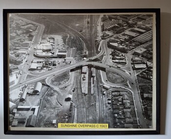
... Sunshine Rail Station Railway Sunshine Aerial view of Sunshine Station, also business and residential district after the installation of the overpass over the railway line. ...sunshine rail station, railway, sunshine -
 Sunshine and District Historical Society Incorporated
Archive - Bridges - Local Railway Bridges
... Web Search of Victorian Heritage Database Rail Bridge Albion Viaduct Victorian Heritage Register VHR H1197 Statement of Significance 27 December 2013|Extract The Railways of Victoria 1854 to 2004 Robert Lee The maribyrnong viaduct on the independent goods line from Broadmeadows to Spencer Street uder construction in the late 1920s....Bridge Web Search of Victorian Heritage Database Rail Bridge Albion Viaduct Victorian Heritage Register VHR H1197 Statement of Significance 27 December 2013|Extract The Railways of Victoria 1854 to 2004 Robert Lee The maribyrnong viaduct on the independent goods line from Broadmeadows to Spencer Street uder construction in the late 1920s. ...Web Search of Victorian Heritage Database Rail Bridge Albion Viaduct Victorian Heritage Register VHR H1197 Statement of Significance 27 December 2013|Extract The Railways of Victoria 1854 to 2004 Robert Lee The maribyrnong viaduct on the independent goods line from Broadmeadows to Spencer Street uder construction in the late 1920s.|Web Search of Maribyrnong River Viaduct Wikipedia 26 December 2013|Typed Report Victorian Heritage Database Report Rail Bridge Albion Viaduct|Web Search Vcitorian Railways Museum Victoria Construction of Maribyrnong River Viaduct 1928 Keilor East 27 December 2013|Web Search Rail Bridge Albion Viaduct Heritage Listed Location 26 December 2013|Web Search Brimbank City Council Post contact Cultural Heritage Study HO005 Quartermile Railway Trestle Bridge Location Sterling Drive Keilor East|Newspaper Article West Footscray Overpass opens|Extract The Victorian Railways Magazine September 1927 Bridge Building in Excelsis|Extract Construction of a new road overpass carrying Melbourne Road across the Williamstown railway line is well advanced. July 1975 $1.6M overpass Blackshaws Road|Brochure Linking the past preserving Victorias railway heritage|Extract The Victorian Railways Magazine August 1928|Typed Note West Gate Bridge information sheet No 3 Bridge statistics|Extract Newsrail July 2004 Between Two Bridges|Typed Report History behind the Project|Museum Catolgue Worksheet Photos of Trains on Bridgesbridge -
 Sunshine and District Historical Society Incorporated
Archive - Sunshine Railways and Trains, Various
... Drawing of signalling Diagram included dated 19th May 1996 Sunshine Issue of Caution Orders|Photocopy of The Victorian Railways Magazine dated Aug 1929 Australias Highest Railway Bridge|Photocopy of Spencer Street - Sunshine showing extra train commencing Tuesday 3 May Dated 30 April 1921|Correspondene from Secretary of the Victorian Railways Books Series 422|Photocopy of Special Train Circular S2966 Special Funeral train for HV McKay funeral on 22 May 1926|Newspaper Article The Advocate Tracking History showing photograph of Tom Rigg dated 29 April 1998|Photocopy of Victorian Railways Timetable Dec 1865|Newspaper Article about Paddy Doyle an old locomotive Dated 20 May 1925|Extract from a book about the Big Bridge across the Maribyrnong River September 1927|Newspaper Article about Project Albion Maltese Club Dated 2 September 1992|Newspaper Article about Paddy Doyle and Patsy Dooley Dated 1925|Letter and a list in chronological events for the Braybrook Junction in 1908 smash dated 12 April 1988|Photocopy of the persons employed by the Melbourne and Hobsons Bay United Railway Company on 30 June 1878|Photocopy of Tom Riggs speech as a guest speaker at the Sunshine Historical Society dated 14 August 1988|Newspaper Articl e remembering Australias second worst rail disaster 90 years after dated 13 May 1997|Photocopy of the List of the Dead and addresses for the Rail disaster 27 April 1908|Photocopy of Selection of Names for S Class Locomotives|Photocopy of Maroona to Ararat Station Details|Notes about railway guages in Australia|Photocopy of a Letter regarding Main Road St Albans Railway Station Crossing Dated 6 May 2001|Brochure St Albans to Sydenham Rail Electrification Project Bulletin 2 May 2001|Brochure St Albans to Sydenham Rail Electrification Project Bulletin 3 December 2001|Brochure St Albans to Sydenham Rail Electrification Project Bulletin 4 January 2002|Newspaper Article Star Plainly its Keilor showing photograph of Keilor Plains Dated 18 December 2001|Newspaper Article Brimbank Leader showing All aboard for Keilor Plains Dated 18 December 2001|Media release regarding St Albans to Sydenham dated 12 December 2001|Brochure Its Steam Day Tours 1984|May of Victorian Railway|Brochure of North Williamstown Railway Museum|Photocopy of Map from Footscray and Bacchus March Line 12 June 2003|Newspaper Article Brimbank Independent Residents angry over freight rail decision dated 3 February 1998|Newspaper Article Advocate Greater respect urged for dead and rescuers Dated 16 December 1998|Extract Railway intercommunication Between Werribee and Braybook Junction|Newspaper Article Star Mixed Blessings for the HV McKay building in Devonshire Road added to Victorian Heritage register dated 16 April 2002|Newspaper Article Star Sydenham rail its electifying dated 18 December 2001|Newspaper Article Herald Sun Rail Horror at Sunshine Dated 27 May 1999...Drawing of signalling Diagram included dated 19th May 1996 Sunshine Issue of Caution Orders|Photocopy of The Victorian Railways Magazine dated Aug 1929 Australias Highest Railway Bridge|Photocopy of Spencer Street - Sunshine showing extra train commencing Tuesday 3 May Dated 30 April 1921|Correspondene from Secretary of the Victorian Railways Books Series 422|Photocopy of Special Train Circular S2966 Special Funeral train for HV McKay funeral on 22 May 1926|Newspaper Article The Advocate Tracking History showing photograph of Tom Rigg dated 29 April 1998|Photocopy of Victorian Railways Timetable Dec 1865|Newspaper Article about Paddy Doyle an old locomotive Dated 20 May 1925|Extract from a book about the Big Bridge across the Maribyrnong River September 1927|Newspaper Article about Project Albion Maltese Club Dated 2 September 1992|Newspaper Article about Paddy Doyle and Patsy Dooley Dated 1925|Letter and a list in chronological events for the Braybrook Junction in 1908 smash dated 12 April 1988|Photocopy of the persons employed by the Melbourne and Hobsons Bay United Railway Company on 30 June 1878|Photocopy of Tom Riggs speech as a guest speaker at the Sunshine Historical Society dated 14 August 1988|Newspaper Articl e remembering Australias second worst rail disaster 90 years after dated 13 May 1997|Photocopy of the List of the Dead and addresses for the Rail disaster 27 April 1908|Photocopy of Selection of Names for S Class Locomotives|Photocopy of Maroona to Ararat Station Details|Notes about railway guages in Australia|Photocopy of a Letter regarding Main Road St Albans Railway Station Crossing Dated 6 May 2001|Brochure St Albans to Sydenham Rail Electrification Project Bulletin 2 May 2001|Brochure St Albans to Sydenham Rail Electrification Project Bulletin 3 December 2001|Brochure St Albans to Sydenham Rail Electrification Project Bulletin 4 January 2002|Newspaper Article Star Plainly its Keilor showing photograph of Keilor Plains Dated 18 December 2001|Newspaper Article Brimbank Leader showing All aboard for Keilor Plains Dated 18 December 2001|Media release regarding St Albans to Sydenham dated 12 December 2001|Brochure Its Steam Day Tours 1984|May of Victorian Railway|Brochure of North Williamstown Railway Museum|Photocopy of Map from Footscray and Bacchus March Line 12 June 2003|Newspaper Article Brimbank Independent Residents angry over freight rail decision dated 3 February 1998|Newspaper Article Advocate Greater respect urged for dead and rescuers Dated 16 December 1998|Extract Railway intercommunication Between Werribee and Braybook Junction|Newspaper Article Star Mixed Blessings for the HV McKay building in Devonshire Road added to Victorian Heritage register dated 16 April 2002|Newspaper Article Star Sydenham rail its electifying dated 18 December 2001|Newspaper Article Herald Sun Rail Horror at Sunshine Dated 27 May 1999 Various articles regarding railways and trains Part of E Wegeners collection of historically significant articles from various of local papers of the Sunshine district Including article from the Brimbank Independent and The Advocate also includes The Age and Herald Sun. ...Postcard Railway Museum North Williamstown|List of Railway Stations from Footscray - Sunshine and when they opened and closed|Letter regarding historic railway wagons dated 24 July 1979|Letter from Victorian Railways regarding QR wagon donation Dated 20 August 1979|Letter from Historical Society regarding wagons manufactured at Qright and Edwards Works. Dated 24 July 1979|Letter and Photocopy of Steam Locomotive 3801 at Anderson Road Level Crossing 23 April 1973|Drawing of Footscray Junction to Sunbury listing opening and closing dates|Large Drawing of Braybrook Junction Signal box tracks|Brochure for Steamrail Victoria The Vintage Train Mystery Tour on 1 July 1984|Bridge Inspection report for Devonshire Road Foot Bridge dated 26 March 1992|Complaint about goats tresspassing dated 7 July 1868|Drawing Footscray Junction Proposed alterations to Signal Arrangements 19 February 1900|Newspaper article Brimbank Messenger 8 September 1998 Technology signals new rail era about the closing of Sunshine Signal Box|Letter for amendment to 1994 Book of rules and Operating Procedures for Sunshine. Drawing of signalling Diagram included dated 19th May 1996 Sunshine Issue of Caution Orders|Photocopy of The Victorian Railways Magazine dated Aug 1929 Australias Highest Railway Bridge|Photocopy of Spencer Street - Sunshine showing extra train commencing Tuesday 3 May Dated 30 April 1921|Correspondene from Secretary of the Victorian Railways Books Series 422|Photocopy of Special Train Circular S2966 Special Funeral train for HV McKay funeral on 22 May 1926|Newspaper Article The Advocate Tracking History showing photograph of Tom Rigg dated 29 April 1998|Photocopy of Victorian Railways Timetable Dec 1865|Newspaper Article about Paddy Doyle an old locomotive Dated 20 May 1925|Extract from a book about the Big Bridge across the Maribyrnong River September 1927|Newspaper Article about Project Albion Maltese Club Dated 2 September 1992|Newspaper Article about Paddy Doyle and Patsy Dooley Dated 1925|Letter and a list in chronological events for the Braybrook Junction in 1908 smash dated 12 April 1988|Photocopy of the persons employed by the Melbourne and Hobsons Bay United Railway Company on 30 June 1878|Photocopy of Tom Riggs speech as a guest speaker at the Sunshine Historical Society dated 14 August 1988|Newspaper Articl e remembering Australias second worst rail disaster 90 years after dated 13 May 1997|Photocopy of the List of the Dead and addresses for the Rail disaster 27 April 1908|Photocopy of Selection of Names for S Class Locomotives|Photocopy of Maroona to Ararat Station Details|Notes about railway guages in Australia|Photocopy of a Letter regarding Main Road St Albans Railway Station Crossing Dated 6 May 2001|Brochure St Albans to Sydenham Rail Electrification Project Bulletin 2 May 2001|Brochure St Albans to Sydenham Rail Electrification Project Bulletin 3 December 2001|Brochure St Albans to Sydenham Rail Electrification Project Bulletin 4 January 2002|Newspaper Article Star Plainly its Keilor showing photograph of Keilor Plains Dated 18 December 2001|Newspaper Article Brimbank Leader showing All aboard for Keilor Plains Dated 18 December 2001|Media release regarding St Albans to Sydenham dated 12 December 2001|Brochure Its Steam Day Tours 1984|May of Victorian Railway|Brochure of North Williamstown Railway Museum|Photocopy of Map from Footscray and Bacchus March Line 12 June 2003|Newspaper Article Brimbank Independent Residents angry over freight rail decision dated 3 February 1998|Newspaper Article Advocate Greater respect urged for dead and rescuers Dated 16 December 1998|Extract Railway intercommunication Between Werribee and Braybook Junction|Newspaper Article Star Mixed Blessings for the HV McKay building in Devonshire Road added to Victorian Heritage register dated 16 April 2002|Newspaper Article Star Sydenham rail its electifying dated 18 December 2001|Newspaper Article Herald Sun Rail Horror at Sunshine Dated 27 May 1999railways -
 Sunshine and District Historical Society Incorporated
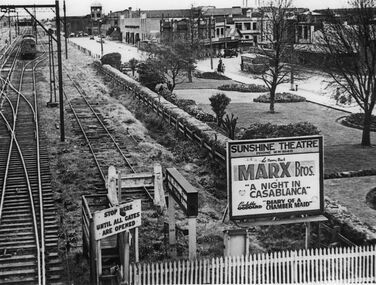
Photograph - Sunshine Gardens Bendigo line McKay factory clock Business shops Roadway of Hampshire Road and Sunshine Theatre Billboard Photograph, Late 1940s
... Photos taken from footbridge over rail lines adjacent to Sunshine Railway Station Gives a perspective view of Sunshine Gardens Bendigo line McKay factory clock business shops roadway of Hampshire Road motor vehicles tramways bus and billboard depicting picture theatre shows Billboard says Sunshine Theatre Phone MW 9140 The Merry Mad MARX Bros A Night in Casablanca Paulette Gollard Diary of a Chamber Maid This photo was reproduced for part of a display in Sunshine Librarys Interpretive Centre early 1997...McKay Memorial Gardens Anderson Road Sunshine Photos taken from footbridge over rail lines adjacent to Sunshine Railway Station Gives a perspective view of Sunshine Gardens Bendigo line McKay factory clock business shops roadway of Hampshire Road motor vehicles tramways bus and billboard depicting picture theatre shows Billboard says Sunshine Theatre Phone MW 9140 The Merry Mad MARX Bros A Night in Casablanca Paulette Gollard Diary of a Chamber Maid This photo was reproduced for part of a display in Sunshine Librarys Interpretive Centre early 1997 Sunshine Gardens Bendigo line McKay factory clock Business shops Roadway of Hampshire Road and Sunshine Theatre Billboard Photograph Photograph Sunshine Gardens Bendigo line McKay factory clock Business shops Roadway of Hampshire Road and Sunshine Theatre Billboard Photograph ...Photos taken from footbridge over rail lines adjacent to Sunshine Railway Station Gives a perspective view of Sunshine Gardens Bendigo line McKay factory clock business shops roadway of Hampshire Road motor vehicles tramways bus and billboard depicting picture theatre shows Billboard says Sunshine Theatre Phone MW 9140 The Merry Mad MARX Bros A Night in Casablanca Paulette Gollard Diary of a Chamber Maid This photo was reproduced for part of a display in Sunshine Librarys Interpretive Centre early 1997sunshine gardens, h.v. mckay memorial gardens, anderson road, sunshine -
 Sunshine and District Historical Society Incorporated
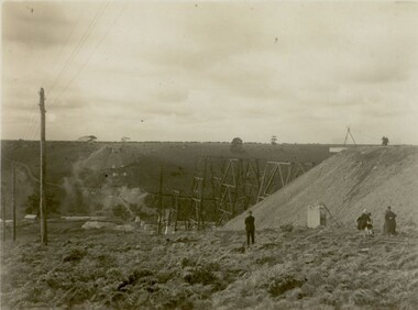
Photograph - Maribyrnong railway bridge construction, 1928
... There is a similar bridge on the same railway line crossing the Moonee Ponds Creek between Gowenbrae and Glenroy, however it is smaller at 1060 feet (323.08 metres) length and 115 feet (35.05) height. The bridge is now Victorian Heritage Registered under Number: H1197, and Heritage Overlay Numbers HO5, and HO107. On the Heritage Register it is named RAIL ...One man lost his life during the building of this bridge. The bridge was constructed by the Victorian Railways between 1927 to 1929 to carry a new double track goods line. This enabled trains from all parts of the state except Gippsland to have direct access to the Tottenham marshalling and sorting yards. These yards were constructed in the 1920's to relieve congestion in the Melbourne Yard near Spencer Street station. The congestion was being caused by the construction of suburban passenger platforms associated with the electrification of the suburban railway network. Initially the bridge was for goods trains but during the Second World War it was also used by troop trains. When the standard gauge line was built in 1962 all trains to Albury and Sydney have used this route, thus avoiding travelling through Essendon and Pascoe Vale on the suburban tracks. The standard gauge track across the bridge took the place of one of the broad gauge tracks so broad gauge trains crossing the bridge in either direction have to now use the same track. The bridge is 1,257 feet (383.13 metres) long and 180 feet (54.86 metres) above the water level. It is just 63 feet (19.2 metres) short of a quarter mile in length between abutments. There is a similar bridge on the same railway line crossing the Moonee Ponds Creek between Gowenbrae and Glenroy, however it is smaller at 1060 feet (323.08 metres) length and 115 feet (35.05) height.The bridge is now Victorian Heritage Registered under Number: H1197, and Heritage Overlay Numbers HO5, and HO107. On the Heritage Register it is named RAIL BRIDGE (ALBION VIADUCT). According to the Heritage Report the bridge is scientifically and architecturally important because of its large size, and because of the cost effective design features such as two girders per span (one for each track), the K bracing in the towers, and the broad flange beams as columns. When it was being built it was the largest trestle bridge in Australia, and until the Sydney Harbour bridge was constructed it was the highest railway bridge.449.01 - Maribyrnong railway bridge construction.jpg 449.02 - Maribyrnong railway bridge construction.jpg 449.03 - Maribyrnong railway bridge construction.jpg 449.04 - Maribyrnong railway bridge construction.jpg 449.05 - Maribyrnong railway bridge construction.jpgmaribyrnong river, bridge, quarter mile bridge, trestle bridge -
 Sunshine and District Historical Society Incorporated
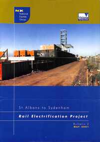
Document - St. Albans to Sydenham Rail Electrification Project
... Albans to Sydenham Rail Electrification Project completed the long waited extension of the electric train services to Sydenham (Now Watergardens). The electric line...Albans to Sydenham Rail Electrification Project completed the long waited extension of the electric train services to Sydenham (Now Watergardens). The electric line ...The St. Albans to Sydenham Rail Electrification Project completed the long waited extension of the electric train services to Sydenham (Now Watergardens). The electric line has since been extended to SunburySt. Albans to Sydenham Rail Electrification Project Bulletin 2 May 2001railway -
 Sunshine and District Historical Society Incorporated
Archive - Tom Rigg's Sunshine Railway Disaster Research Notes
... Samuel Mauger|6/ The Australian Locomotive Drivers' Guide|7/ Report of Evidence and Addresses of Counsel given at Coroner's Inquest|8/ Minutes of the Victorian Railways Commissioners Meetings 20/9/1909 & 16/4/1909|9/ Double Line Block Train Register|10/ Sunshine Railway Disaster 1909 Project Design Anne Best November 2005|11/ Sunshine Railway Disaster 20/4/1908 Notes taken for Mr William Shannon District Rolling Stock Inspector at the Enquiry|12/ Various notes on railways stations and other miscelleous articles|13/ Sunshine Rail Disaster Commemorative Service Monday 10:30pm 20/4/1998 90th Anniversary|14/ The Sunshine Railway Disaster by John Buckland|15/ Sunshine Railway Disaster verious newspaper cuttings|16/ Correspondence|17/ Poems & Sings|18/ Sunshine Disaster 20/4/1908 various|19/ The Sunshine Railway Disaster Who Was To Blame? ...Samuel Mauger|6/ The Australian Locomotive Drivers' Guide|7/ Report of Evidence and Addresses of Counsel given at Coroner's Inquest|8/ Minutes of the Victorian Railways Commissioners Meetings 20/9/1909 & 16/4/1909|9/ Double Line Block Train Register|10/ Sunshine Railway Disaster 1909 Project Design Anne Best November 2005|11/ Sunshine Railway Disaster 20/4/1908 Notes taken for Mr William Shannon District Rolling Stock Inspector at the Enquiry|12/ Various notes on railways stations and other miscelleous articles|13/ Sunshine Rail Disaster Commemorative Service Monday 10:30pm 20/4/1998 90th Anniversary|14/ The Sunshine Railway Disaster by John Buckland|15/ Sunshine Railway Disaster verious newspaper cuttings|16/ Correspondence|17/ Poems & Sings|18/ Sunshine Disaster 20/4/1908 various|19/ The Sunshine Railway Disaster Who Was To Blame? ...1/ Sunshine Diaster Easter Monday 20th April 1908 Newspaper cuttings|2/ Compensation Personal Injuries Sunshine Accident 20th April 1908 Part 1 & Part 2|3/ List of relatives of people that were involved and others|4/ Notes on some staff|5/ Legislative Assembly Wednesday 25th November 1908 Sunshine Railway Disaster Non. Samuel Mauger|6/ The Australian Locomotive Drivers' Guide|7/ Report of Evidence and Addresses of Counsel given at Coroner's Inquest|8/ Minutes of the Victorian Railways Commissioners Meetings 20/9/1909 & 16/4/1909|9/ Double Line Block Train Register|10/ Sunshine Railway Disaster 1909 Project Design Anne Best November 2005|11/ Sunshine Railway Disaster 20/4/1908 Notes taken for Mr William Shannon District Rolling Stock Inspector at the Enquiry|12/ Various notes on railways stations and other miscelleous articles|13/ Sunshine Rail Disaster Commemorative Service Monday 10:30pm 20/4/1998 90th Anniversary|14/ The Sunshine Railway Disaster by John Buckland|15/ Sunshine Railway Disaster verious newspaper cuttings|16/ Correspondence|17/ Poems & Sings|18/ Sunshine Disaster 20/4/1908 various|19/ The Sunshine Railway Disaster Who Was To Blame? Conroner's Searching Enquiry W.O. Bagley|20/ Victorian Railways Rules and Regulation for the Guidance of Employe's 1907|21/ Timetables & Fares around 1908|22/ Power to Stop Tlk to Vicrail Senior Management 7th December 1977 by A. G. Gibbs|23/ Tom Rigg's Photo Album 100th Anniversity 2008 and Book Launch|24/ Peter Alexander Assistant to Chief Mechanical Engineer Report on Train Brakessunshine railway disaster, sunshine railway station, railway, sunshine -
Tatura Irrigation & Wartime Camps Museum
Booklet, Newsrail - May 1992, 1992
... rail trains. Includes accident of Brill Railcar (known as the "Beetle") at a level crossing on Toolamba-Echuca line 1949, at Byrneside...rail trains. Includes accident of Brill Railcar (known as the "Beetle") at a level crossing on Toolamba-Echuca line 1949, at Byrneside newsrail - may 1992 vr rail motors potts d small w Victorian railways On Front cover - Central Highlands Tourist Railways' 91RM rounds a curb as it heads towards Dayelsford after a trip to Musk. ...Contains photographs of country rail trains. Includes accident of Brill Railcar (known as the "Beetle") at a level crossing on Toolamba-Echuca line 1949, at ByrnesideOn Front cover - Central Highlands Tourist Railways' 91RM rounds a curb as it heads towards Dayelsford after a trip to Musk. Sunday 15.9.91. Ads for model trains on back cover. newsrail - may 1992, vr rail motors, potts d, small w, victorian railways -
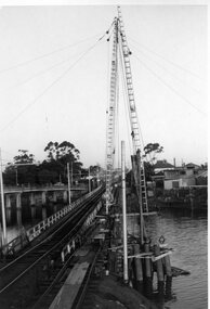 Ballarat Tramway Museum
Photograph - Black & White Photograph/s, mid to Late 1965
... line is in use for construction purposes. 1419.2 - Roadway west of bridge looking east. Shows temporary single track arrangement which allowed the operating track to switch to the south side when piling completed. W5 682 West Maribyrnong on route 57 coming off the bridge. See P.Winspur note - and Rail...line is in use for construction purposes. 1419.2 - Roadway west of bridge looking east. Shows temporary single track arrangement which allowed the operating track to switch to the south side when piling completed. W5 682 West Maribyrnong on route 57 coming off the bridge. See P.Winspur note - and Rail ...Set of two Black and white photographs of the pile driving for the reconstruction of the Maribyrnong River Bridge from a tramway only bridge to a dual road/tram bridge. The road bridge is in the background. On Kodak paper. Photo during the 2nd half of 1965. 1419.1 - Early in the process of pile driving - Bridge tram track has been reduced to single track and the former outbound line is in use for construction purposes. 1419.2 - Roadway west of bridge looking east. Shows temporary single track arrangement which allowed the operating track to switch to the south side when piling completed. W5 682 West Maribyrnong on route 57 coming off the bridge. See P.Winspur note - and Rail News Victoria May 2000, page 50. Features a photograph of a tour on the bridge on 1/10/1966.trams, tramways, maribyrnong river bridge, bridge construction, trackwork, mmtb, tram 682 -
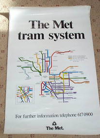 Ballarat Tramway Museum
Poster, Metropolitan Transit Authority (MTA), "The Met / tram system", c1988
... rail opened late 1987. The Met replaced by the Public Transport Corporation 1/7/1989 - See reference. Two copies held. See Time-line...rail opened late 1987. The Met replaced by the Public Transport Corporation 1/7/1989 - See reference. Two copies held. See Time-line ...Diagrammatic poster or map of "The Met / tram system" showing a plan with route numbers, zones and peak system route numbers with an enlarged central Melbourne area. Date of map 1988c, shows the St. Kilda and Port Melbourne light rail, Bundoora and the "The Met" logo. Printed on art paper. Has a telephone number for further information. Stored rolled. St. Kilda and Port Melbourne light rail opened late 1987. The Met replaced by the Public Transport Corporation 1/7/1989 - See reference. Two copies held. See Time-line history of Melbourne's Government Cable and Electric Trams and Buses.trams, tramways, melbourne, map, the met, tram routes -
 Ballarat Tramway Museum
Map, Broadbent's, "Broadbent's Map 616 Ballarat", c1960
... rail lines in the district. Trams tramways Map Ballarat Broadbent's Railways "50c" in pencil on front cover. Printed street map titled "Broadbent's Map 1616 Ballarat" printed in colour on one side only of a folded (10) sheet. Shows the suburbs of Ballarat, tram lines, has a scale in miles, Ballarat District map and an index to streets. Also points interest and historical interest. also shows railways lines. Map used as the base for the tram line ...Yields information about the extent of Ballarat in the early to mid 1960's shows the tram lines and other rail lines in the district.Printed street map titled "Broadbent's Map 1616 Ballarat" printed in colour on one side only of a folded (10) sheet. Shows the suburbs of Ballarat, tram lines, has a scale in miles, Ballarat District map and an index to streets. Also points interest and historical interest. also shows railways lines. Map used as the base for the tram line map in the display area in the depot. Large Res scan made 28/1/2011."50c" in pencil on front cover.trams, tramways, map, ballarat, broadbent's, railways -
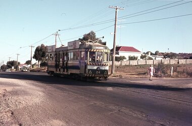 Ballarat Tramway Museum
Photograph - Digital image Set of 20, 16/04/1972 12:00:00 AM
... Set of 20 digital images of Bendigo Tramways, of the last running day of the Eaglehawk to Quarry Hill line 16 April 1972, .1 - No. 24 outbound to Eaglehawk .2 - No. 3? at Manchester Loop .3 - No. 24 outbound to Eaglehawk .4 - bogie tram crossing the rail over bridge from Eaglehawk .5 - No. 18 in View St .6 - No. 24 outbound to Eaglehawk .7 - No 18 at Eaglehawk with destination roll being changed, and shopping centre in the background. .8 - No. 24 crossing the railway overbridge, going to Eaglehawk .9 - No. 3 outbound to Eaglehawk .10 - No. 24 crossing the railway overbridge, going to Eaglehawk .11 - No. 3 and 24 crossing at Long Gully .12 - No. 18 at Eaglehawk with Leo A Hughes photographer building in the background and a CFA truck passing the tram. ...Trams tramways Bendigo Eaglehawk Long Gully Manchester Loop tram 24 tram 18 tram 3 Set of 20 digital images of Bendigo Tramways, of the last running day of the Eaglehawk to Quarry Hill line 16 April 1972, .1 - No. 24 outbound to Eaglehawk .2 - No. 3? at Manchester Loop .3 - No. 24 outbound to Eaglehawk .4 - bogie tram crossing the rail over bridge from Eaglehawk .5 - No. 18 in View St .6 - No. 24 outbound to Eaglehawk .7 - No 18 at Eaglehawk with destination roll being changed, and shopping centre in the background. .8 - No. 24 crossing the railway overbridge, going to Eaglehawk .9 - No. 3 outbound to Eaglehawk .10 - No. 24 crossing the railway overbridge, going to Eaglehawk .11 - No. 3 and 24 crossing at Long Gully .12 - No. 18 at Eaglehawk with Leo A Hughes photographer building in the background and a CFA truck passing the tram. ...Set of 20 digital images of Bendigo Tramways, of the last running day of the Eaglehawk to Quarry Hill line 16 April 1972, .1 - No. 24 outbound to Eaglehawk .2 - No. 3? at Manchester Loop .3 - No. 24 outbound to Eaglehawk .4 - bogie tram crossing the rail over bridge from Eaglehawk .5 - No. 18 in View St .6 - No. 24 outbound to Eaglehawk .7 - No 18 at Eaglehawk with destination roll being changed, and shopping centre in the background. .8 - No. 24 crossing the railway overbridge, going to Eaglehawk .9 - No. 3 outbound to Eaglehawk .10 - No. 24 crossing the railway overbridge, going to Eaglehawk .11 - No. 3 and 24 crossing at Long Gully .12 - No. 18 at Eaglehawk with Leo A Hughes photographer building in the background and a CFA truck passing the tram. Tram SEC roof advertisement and a banner for "German -?- Circus" at Eaglehawk and dates. .13 - No. 3 inbound on the Eaglehawk line. .14 - No. 18 outbound to Eaglehawk .15 - ditto .16 - No. 18 at Eaglehawk terminus with the Mechanics Institute in the background. .17 - No. 24 at the Eaglehawk terminus .18 - No 24 at the intersection with Taylor St .19 - No. 24 at the Eaglehawk terminus .20 - dittotrams, tramways, bendigo, eaglehawk, long gully, manchester loop, tram 24, tram 18, tram 3 -
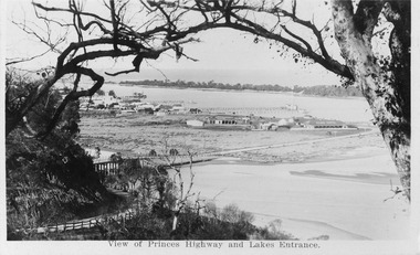 Lakes Entrance Historical Society
Postcard - View from Jemmys Point Lakes Entrance Victoria c1920
... Black and white miniature photographic postcard showing the North Arm Bridge prior 1937; post and rail fence around Kalimna road; township, Club Hotel and stables; jetties in Cunninghame Arm, Methodist Church; and sand hummocks. Telegraph line...Also 1x Miniature postcard 6cmx8.5cm ' A Glimpse of Lakes Entrance' 01153-4 Bridges Hotels Fences Public Utilities Black and white miniature photographic postcard showing the North Arm Bridge prior 1937; post and rail fence around Kalimna road; township, Club Hotel and stables; jetties in Cunninghame Arm, Methodist Church; and sand hummocks. Telegraph line ...Also 1x Miniature postcard 6cmx8.5cm ' A Glimpse of Lakes Entrance' 01153-4Black and white miniature photographic postcard showing the North Arm Bridge prior 1937; post and rail fence around Kalimna road; township, Club Hotel and stables; jetties in Cunninghame Arm, Methodist Church; and sand hummocks. Telegraph line around hill and across sand flat. Lakes Entrance Victoriabridges, hotels, fences, public utilities -
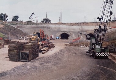 Broadmeadows Historical Society & Museum
Photograph - Road - Ring Road, Construction of the Jacana Underpass, c. 1990s
... line—making traditional tunneling or bridging methods impractical. The tunnel was constructed using a pioneering hydraulic jacking technique, where precast concrete tunnel segments, each weighing approximately 1200 tonnes, were pushed into place through pilot tunnels. This method minimised disruption to the busy transport corridor above, which carried tens of thousands of vehicles and multiple rail...line—making traditional tunneling or bridging methods impractical. The tunnel was constructed using a pioneering hydraulic jacking technique, where precast concrete tunnel segments, each weighing approximately 1200 tonnes, were pushed into place through pilot tunnels. This method minimised disruption to the busy transport corridor above, which carried tens of thousands of vehicles and multiple rail ...This photograph documents the construction of the Jacana Underpass Tunnel, a landmark infrastructure project undertaken to allow Melbourne’s Western Ring Road to pass beneath a complex transport corridor. The corridor included Pascoe Vale Road, Electric Street, and four active railway lines—two broad gauge, one standard gauge, and one commuter line—making traditional tunneling or bridging methods impractical. The tunnel was constructed using a pioneering hydraulic jacking technique, where precast concrete tunnel segments, each weighing approximately 1200 tonnes, were pushed into place through pilot tunnels. This method minimised disruption to the busy transport corridor above, which carried tens of thousands of vehicles and multiple rail services daily. The Jacana Underpass Tunnel was constructed between 1992 and 1993 as part of Melbourne’s Western Ring Road project, a major infrastructure initiative aimed at improving traffic flow and connectivity across the city’s northern suburbs. The underpass was designed to carry the freeway beneath a complex transport corridor that included Pascoe Vale Road, Electric Street, and four active railway lines—two broad gauge, one standard gauge, and one commuter line. Due to the shallow depth of cover—less than one metre in some areas—and the need to maintain uninterrupted road and rail services above, engineers employed an innovative hydraulic jacking technique. This involved pushing precast concrete tunnel segments, each weighing approximately 1200 tonnes, through pilot tunnels using hydraulic rams. The method was one of the largest of its kind in Australia at the time and allowed for the safe and efficient installation of the tunnel without open excavation. The photograph captures a key stage in the construction process, showing the dual tunnel portals, heavy machinery, and construction materials on site. It reflects the scale, complexity, and ingenuity of late 20th-century civil engineering in Victoria and provides valuable insight into the evolution of Melbourne’s transport infrastructure.This photograph documents a pivotal moment in the construction of the Jacana Underpass Tunnel, part of Melbourne’s Western Ring Road infrastructure project undertaken in the early 1990s. The image features two tunnel entrances under construction, surrounded by heavy machinery, construction materials, and temporary fencing, with a dirt access road leading into the site. The Jacana Underpass was constructed using a hydraulic jacking technique, a method that allowed large precast concrete tunnel segments—each weighing approximately 1200 tonnes—to be installed beneath a live transport corridor without disrupting traffic or rail services. This innovative approach was one of the largest of its kind in Australia and addressed significant engineering challenges, including shallow cover and complex geological conditions. The photograph is significant for its documentation of advanced civil engineering practices and the transformation of Melbourne’s northern suburbs through major infrastructure development. It provides insight into the construction techniques, site logistics, and material use typical of large-scale tunneling projects in the late 20th century. As part of an archival collection, this image contributes to the historical record of urban growth, transport planning, and engineering innovation in Victoria. It holds enduring value for researchers, historians, and infrastructure professionals studying the evolution of public works in the state.Colour photo. Construction Site. Jacana underpass tunnel.(Back - blue pen) 'Underpass/Jacana'underpass, jacana, construction, 1990's, jacana underpass tunnel, western ring road -
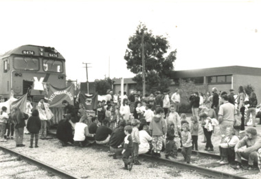 Lakes Entrance Historical Society
Photograph - Rail Service Protest, Bairnsdale Victoria, 1993
... A large number of East Gippslanders joined protesters at Bairnsdale Railway Station on Saturday 25 August 1993 to stop the last train leaving for Melbourne The train finally left early Monday morning when protesters cooperated with Police Transport protest Black and white photograph showing protesters on railway line end of train on left group of school children with banners at Bairnsdale railway station to prevent last train leaving for Melbourne Bairnsdale Victoria Bairnsdale Victoria Photograph Rail Service Protest ...A large number of East Gippslanders joined protesters at Bairnsdale Railway Station on Saturday 25 August 1993 to stop the last train leaving for Melbourne The train finally left early Monday morning when protesters cooperated with PoliceBlack and white photograph showing protesters on railway line end of train on left group of school children with banners at Bairnsdale railway station to prevent last train leaving for Melbourne Bairnsdale Victoria transport, protest -
 Ballarat Tramway Museum
Administrative record - Log book, Diary, Sands McDougall Pty Ltd, 1951
... rail, whether old or new. Loose contents 1 - 1/7/1952 page - SEC memo written on two sheets, dated 4/5/1949 regarding track work and a SEC Ballarat envelope with notes on the sheet. 2 - 3/9/1952- notes on a daily time sheet 3 - 14/11/1952 - sheet of lined paper with notes....rail, whether old or new. Loose contents 1 - 1/7/1952 page - SEC memo written on two sheets, dated 4/5/1949 regarding track work and a SEC Ballarat envelope with notes on the sheet. 2 - 3/9/1952- notes on a daily time sheet 3 - 14/11/1952 - sheet of lined paper with notes. ...Yields information about the track maintenance activities of the track gang in Ballarat, the work they did, notes, names and other information.Invicta Australian 1952 Business Diary, No. 40, printed by Sands and McDougall, green Rexene binding, card covers, sewn sections with ruled sheets providing a diary for 1952, 2 days and notes for each page. Has "useful information" sheets at from the diary. Used by the SEC Ballarat track gang to record their daily work, leave, welding, track cleaning, truck driver etc Rear pages - has a detail list of locations, depth of grove for both rails, rail type and type of rail, whether old or new. Loose contents 1 - 1/7/1952 page - SEC memo written on two sheets, dated 4/5/1949 regarding track work and a SEC Ballarat envelope with notes on the sheet. 2 - 3/9/1952- notes on a daily time sheet 3 - 14/11/1952 - sheet of lined paper with notes.tram, trams, sec, ballarat, depot, trackwork, rails
