Showing 4549 items matching "historical maps"
-
 Merbein District Historical Society
Document, Map Of Victoria (Fishers), unknown
advertisements -
Merbein District Historical Society
Map, Soil Survey Of Merbein Irrigation District, unknown
maps, irrigation, soils -
 Canterbury History Group
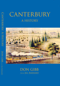
Book, Don Gibb et al, Canterbury: a history, 2022
Canterbury: A History covers the history of the suburb of Canterbury, Victoria from its Aboriginal history as part of the country of the Wurundjeri people to its completed development as a middle-class suburb by the late 1950s. The book had been a labour of love by esteemed historian, Don Gibb, for many years. Don’s sudden death in late 2017 left the manuscript uncompleted. The Canterbury History Group and the Royal Historical Society of Victoria, together with Don’s family, were determined to see Don’s book completed and published. Jill Barnard contributed the final two chapters dealing with the inter war and post-World War II decades.187 pages : illustrations, maps, portraits, facsimilesnon-fictionCanterbury: A History covers the history of the suburb of Canterbury, Victoria from its Aboriginal history as part of the country of the Wurundjeri people to its completed development as a middle-class suburb by the late 1950s. The book had been a labour of love by esteemed historian, Don Gibb, for many years. Don’s sudden death in late 2017 left the manuscript uncompleted. The Canterbury History Group and the Royal Historical Society of Victoria, together with Don’s family, were determined to see Don’s book completed and published. Jill Barnard contributed the final two chapters dealing with the inter war and post-World War II decades.canterbury, canterbury history, residential development, maling road, gibb> don -
 Victorian Railway History Library
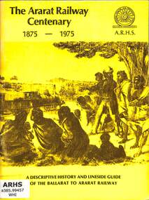
Book, Turton, Keith et al, The Ararat Railway Centenary 1875-1975, 1975
A history of the Ballarat to Ararat railway in western Victoria and a lineside guide to the stations on the line. The book was issued by the Australian Railway Historical Society, Victorian Division on the occasion of the Centenary Celebrations of the opening of the railway to Ararat on the 5th April 1875.ill, maps, p.60.non-fictionA history of the Ballarat to Ararat railway in western Victoria and a lineside guide to the stations on the line. The book was issued by the Australian Railway Historical Society, Victorian Division on the occasion of the Centenary Celebrations of the opening of the railway to Ararat on the 5th April 1875.railroad construction - victoria - history, railway services: ballarat-ararat railway. victoria. ararat region -
 National Vietnam Veterans Museum (NVVM)
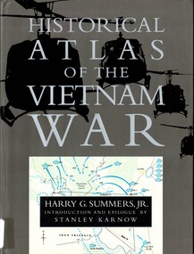
Book, Summers, Harry G. Jr, Historical Aatlas of the Vietnam War
With more that one hundred four color maps supplemented by photographs and reconsruction.With more that one hundred four color maps supplemented by photographs and reconsruction.vietnam war, 1961-1975 -- campaigns, vietnam -- politics and government -- 1945-1975 -
Bendigo Historical Society Inc.
Booklet - Victoria Hill - A historical Background
BHS CollectionsSpiral bound booklet (24 pages) entitled 'Victoria Hill' a historical background of Victoria Hill and the surrounding area. Colour image of a poppet head on front cover. Illustrated with B&W and colour photos and a map. Revised and edited in 2012 by Philip Wilkin from an original article by Mr. Albert Richardson 'The Rich Victoria Hill and its historical associations.'Signed in ink 'Philip Wilkin 3rd May 2012' on page 3victoria hill, gold mines -
 Victorian Railway History Library
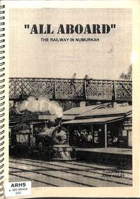
Book, Sigley, John, All Aboard The Railway in Numurkah, 2002
A history of the Victorian Railway's line to Numurkah and its branch line to Picola in Victoria.ill, maps, p.65.non-fictionA history of the Victorian Railway's line to Numurkah and its branch line to Picola in Victoria.railroad construction - victoria - history, numurkah -- railways -- history -
 Victorian Railway History Library
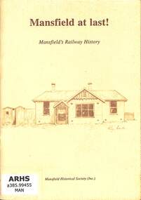
Booklet, Mansfield Historical Society, Mansfield at last! Mansfield's Railway History, 1994
A brief history of the Victorian Railway's branch line from Tallarook to Mansfield.index, ill, maps, p.29.non-fictionA brief history of the Victorian Railway's branch line from Tallarook to Mansfield.railroad construction - victoria - history, railroads - victoria - mansfield - history -
Lakes Entrance Historical Society
Book, Mallacoota and District Historical Society, A Story of Mallacoota
A brief history of Mallacoota district, Victoria, from 1837 to the 1930's. Includes a time line, sketch maps and photographs.aboriginals, settlers, township, ships and shipping -
 Bacchus Marsh & District Historical Society
Map, Atkins and Clarke Land Sale situate at Bacchus Marsh 1856 Copy 2
This plan of land allotments for sale indicates the property once owned by the Bacchus family in and around the township area of Bacchus Marsh. The Bacchus family sold their property in Bacchus Marsh to John Atkins and Robert Nalder Clarke in March 1851. Atkins and Clarke kept the property for a number of years until April 1856 when these allotments were put up for sale.This plan is almost identical to another copy held by the Bacchus Marsh and District Historical Society, VC Record 707, BMDHS collection). This plan, VC Record 452 Copy 2, contains a less detail than than VC Record 707 Copy 1. For example the selling agents and the surveyor who created the plan are not indicated on this copy of the plan. This copy of the plan does indicate the name Crook Street on the map. As the Crook family were the buyers of the Manor House property and surrounding land from Atkins and Clarke in 1856 it suggests that this copy is a later one of the earlier version. It is unlikely that the Crook family would have had the adjacent street named after them prior to purchasing the house and property. This is a very early land sales plan for the township of Bacchus Marsh and it therefore provides some clues as to how the early urban development of the township took place. Upon seeing the map in 1911 Bacchus Marsh Express newspaper editor Christopher Crisp wrote "The sale appears to have created the present township, which had a nucleus in earlier times further east", Express, 30 September, 1911, page 3. A single page paper map showing a portions of land available for sale in Bacchus Marsh in 1856. The subdivided land shown was owned by John Atkins and Robert Nalder Clarke, but previously owned by the Bacchus Family and was in and around their Manor House (Mansion) property in Bacchus Marsh.There are 5 portions of land further divided into numerous small portions. The land for sale is bounded by the present day streets of Main Street, Young Street, McFarland Street, Morton Streets, Crook Street, and part of the eastern section extends to the Lerderderg River. Scale: 4 chains to 1 inch. The map is pasted into a bound volume containing 76 maps or plans in total. High resolution digital image stored on BMDHS computer network. Plan of the first portion of land. The property of Messers Atkins and Clarke situate at Bacchus Marsh.land sales, land sales bacchus marsh, manor house bacchus marsh, crook family bacchus marsh -
 Bendigo Historical Society Inc.
Map - MAP: VICTORIA MINING DISTRICTS, MINING DIVISIONS AND THE GOLD FIELDS, 1866
Map: printed map stuck on backing paper (waxed?) to support material. Shows mining districts, divisions and goldfields of Victoria. Printed in blue ink on bottom ' this map compiled in 1866. Printed in 1869.' Printed on bottom ' engraved by William Slight under the direction of R. Brough Smyth FGS Lon., the Hon John Macgregor MLA Minister of Mines, published 24th. October 1866. Revised and corrected by Arthur Everitt, January 25th. 1869. On back of map ' this map was compiled by the Mines Department of Victoria 24th. October 1866, corrected by Arthur Everett 15th. January 1869. Presented to the Bendigo Historical Society by E. Hayward 1st. December 1950.victoria, bendigo, goldfields, gold reefs, mining divisions, map -
 Victorian Railway History Library
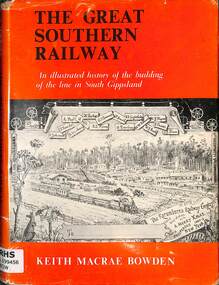
Book, Bowden, Keith Macrae, The Great Southern Railway, 1970
A illustrated history of the building of the line in South Gippsland Victoria.index, ill, maps, p.130.A illustrated history of the building of the line in South Gippsland Victoria.south gippsland - railways - history, railroad construction - victoria - history -
 Greensborough Historical Society
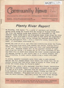
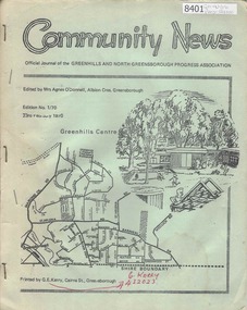
Newsletter, Greenhills and North Greensborough Progress Association, Community News: official journal of the Greenhills and Nth. Greensborough Progress Association. 25/10/72. Edition No. 8/72, 25/10/1972
This edition includes a report on the Progress Association's October 1972 meeting, Councillor's report, Plenty River report, Yandell Reserve, Talking about natives, Women... were mothers before they clerks School and Kinder news, Open forum, Amnesty International, Waterbirds, Roads report. A digital copy of this Newsletter is available from Greensborough Historical Society.Newsletter, 27 p., illus., map.greenhills and north greensborough progress association, greenhills -
 Greensborough Historical Society
Newsletter, Greenhills and North Greensborough Progress Association, Community News: official journal of the Greenhills and North Greensborough Progress Association. 23rd February 1970. Edition No.1/70, 23/02/1970
This edition includes a report on the Progress Association's February 1970 meeting, Councillors' reports, School and Kinder news, Scout and Guide news, Local wattles, Diamond Valley Repertory Group, Personal news. A digital copy of this Newsletter is available from Greensborough Historical Society.Newsletter, 14 p., illus., map.greenhills and north greensborough progress association, greenhills -
 Victorian Railway History Library
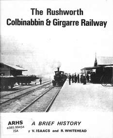
Book, Australian Railway Historical Society (Victorian Division) et al, The Rushworth Colbinabbin and Girgarre Railway, 1973
A brief history of the Rushworth, Colbinabbin & Girgarre Railway as part of tour notes for a trip by the Australian Railway Historical Society on the 21st July 1973.ill, maps, p.23.non-fictionA brief history of the Rushworth, Colbinabbin & Girgarre Railway as part of tour notes for a trip by the Australian Railway Historical Society on the 21st July 1973.railroad construction - victoria - history, australian railway historical society - tours -
 Greensborough Historical Society
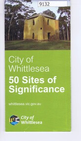
Pamphlet - Map, City of Whittlesea, City of Whittlesea, 50 Sites of Significance
Pamphlet of historical places in Whittlesea with map and imagesColour pamphlet with text, fold out map and coloured imageswhittlesea, historic sites whittlesea -
 Bendigo Historical Society Inc.
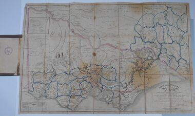
Document - HARRIS COLLECTION: HAMS SQUATTING MAP OF VICTORIA, PORT PHILLIP DISTRICT, NSW
Thomas Ham was a cartographer, engraver, lithographer and publisher in Victoria and Queensland. He compiled and printed several editions of his squatting map, beginning with A map of Australia Felix in 1847 and changing its title to Ham's squatting map of Victoria in 1851. The 1851 edition was accompanied by a key listing the names of all the squatters within squatting districts and counties. Later editions show the existing counties, but some areas of Gippsland and the Australian Alps are still described as 'unsurveyed country'. (State Library Victoria https://www.slv.vic.gov.au/squatting-map-victoria)Folding map enclosed in burgundy cover. Map backed by cloth and bound. Rare, early map of Victoria and neighbouring Port Phillip District of New South Wales. Written on bottom RH corner of map: Ham's Squatting Map of Victoria ( Port Phillip District, New South Wales ) carefully corrected to this date from the Colonial Government Surveys, Crown Lands, Commissioners & Explorers Maps, Private Surveys & c. Respectfully inscribed (with permission ) to His Excellency Sir Chas A. Fitz-Roy Knt, Governor of New South Wales &c &c by his Obedient Servant, The Compiler, 1851. Compiled, engraved and published by Thomas Ham, Melbourne. Proposed and original boundary ( in legend) have been coloured in in blue and pink ink ( later addition ?) Number on map show 'reference to proprietor's Printed on back of map ' J.G. AD 1852, with two cross hatched decorations and two hearts entwined. On other back panel in pencil enclosed in a drawn frame ' G.S.H., 1889, Axedale' (George Harris, Axedale, belongs in Harris Collection) Stamped in purple ink 'Royal Historical Society of Victoria, Bendigo Branch. Written 1959, 53.map, victoria, squatting map -
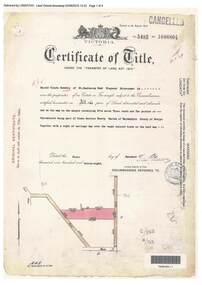 Ringwood and District Historical Society
Document, Certificate of Title - Harold Claude Howship, Nurseryman, Ringwood, Vic. - 1928
A4 copies of Landata Victoria Historical Search documents - Vol 5485 Fol 1096804. Harold Claude Howship of Mt. Dandenong Road Ringwood, Nurseryman, is now the proprietor of an Estate in Fee-simple subject to the Encumbrances notified hereunder ... 5 acres 3 roods 10 perches or thereabouts, part of Crown Section Twenty, Parish of Warrandyte, County of Evelyn, together with a right of carriage way over roads coloured brown. Subdivision map includes Wonga Road (later Warranwood Road), Grandview Grove (later Bemboka Road), and Plymouth Road, Ringwood. Proprietors and Transfers include Emily Mills, Plymouth Road Ringwood, Widow - 27th January, 1939. William George Carter, Grandview Grove Warranwod - 14th March, 1947 - 3 acres Evelyn Goudie and Beverley Gwen Goudie, Wonga Road Warranwood - 23rd October, 1950 - 1 acre -
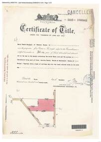 Ringwood and District Historical Society
Document, Certificate of Title - Harry Temple Marshall, Wesburn Farmer, Vic. - part of Crown Section 20, Parish of Warrandyte, County of Evelyn - 1928
A4 copies of Landata Victoria Historical Search documents - Vol 5485 Fol 1096803. Harry Temple Marshall is now the proprietor of an Estate in Fee-simple subject to the Encumbrances notified hereunder ... 10 acres 3 roods 10 perches or thereabouts, together with a right of carriage way over roads coloured brown. Subdivision map includes un-named roads - western side is Wonga Road (later Warranwood Road), and eastern side is Grandview Grove (later Bemboka Road), both north of Plymouth Road, Ringwood, Vic. Transfers include Harold Claude Howship, 1st December, 1928 James Bell McAlpin, 26th March, 1939. -
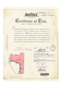
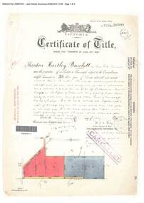 Ringwood and District Historical Society
Document, Certificate of Title - Theodore Hartley Burchett - part of Crown Section 20, Parish of Warrandyte, County of Evelyn - 1911
A4 copies of Landata Victoria Historical Search documents - Vol 3520 Fol 703991.Theodore Hartley Burchett of Lara Lake, Farmer, is now the proprietor of an Estate in Fee-simple subject to the Encumbrances notified hereunder ... 180 acres 01 rood 27 perches or thereabouts, being lots 1, 8, 9 and 10 on plan of subdivision no.4315. Subdivision map includes un-named roads - lower western side is Wonga Road (later Warranwood Road), and eastern side is Grandview Grove (later Bemboka Road), both north of Plymouth Road, Ringwood, Vic. Transfers include Anna Maria Wicks and Henry James Trowbridge, 3rd October, 1911 Elizabeth Ann Walden, 18th September, 1912 - 28ac 3rds 5per. Edward Thomas Miles, 22nd September, 1913 - 27ac 19per. Samuel Styles, 10th October, 1916 - balance. -
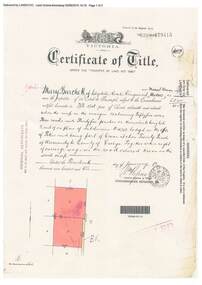 Ringwood and District Historical Society
Document, Certificate of Title - Mary Burchett, Lilydale Road, Ringwood - part of Crown Section 20, Parish of Warrandyte, County of Evelyn - 14th January, 1910
A4 copies of Landata Victoria Historical Search documents - Vol 3398 Fol 679415.Mary Burchett of Lilydale Road, Ringwood, Married Woman, is now the proprietor of an Estate in Fee-simple subject to the Encumbrances notified hereunder ... 55 acres 3 roods 35 perches or thereabouts, being lots 8 and 9 on plan of subdivision no.4315. Subdivision map includes un-named road - Grandview Grove (later Bemboka Road, Warranwood, Vic). Title transferred to Theodore Hartley Burchett, 27th July, 1911. -
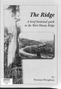 Victorian Railway History Library
Book, Houghton, Norm, The Ridge: A brief historical guide to the West Otway Ridge, 2005
A brief historical guide to the West Otway Ridge in Victoria including its railways.ill, maps, p.16.non-fictionA brief historical guide to the West Otway Ridge in Victoria including its railways.railroad construction - victoria - history, logging railroads - victoria - otway range - history -
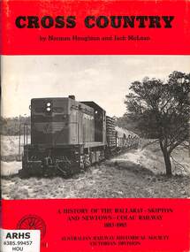 Victorian Railway History Library
Book, Houghton, Norm et al, Cross Country: A History of the Ballarat-Skipton And Newtown-Colac Railway 1883-1985, 1986
A brief history of the Victoria Railways cross country line from Ballarat to Skipton and Colac in the South West.index, ill, maps, p.64.non-fictionA brief history of the Victoria Railways cross country line from Ballarat to Skipton and Colac in the South West.railroad construction - victoria - history, railways - south west victoria - history -
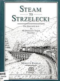 Victorian Railway History Library
Book, Ramsay, Merilyn, Steam to Strzelecki, 1991
A history of the Koo-Wee-Rup to McDonald's Track (Strzelecki) Railway in South Gippsland Victoria.index, ill, maps, p.150.non-fictionA history of the Koo-Wee-Rup to McDonald's Track (Strzelecki) Railway in South Gippsland Victoria.railroad construction - victoria - history, railroads -- victoria -- gippsland -- history -
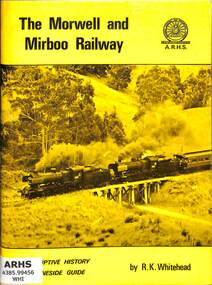 Victorian Railway History Library
Book, Whitehead, Robert, The Morwell and Mirboo Railway, 1974
A lineside guide and history of the Morwell to Mirboo North Railway in Gippsland Victoria. Issued on the occasion of the running of the 'Last Train' between Morwell and Mirboo North prior to closure of the line on the 22nd June 1974.ill, maps, p.65.non-fictionA lineside guide and history of the Morwell to Mirboo North Railway in Gippsland Victoria. Issued on the occasion of the running of the 'Last Train' between Morwell and Mirboo North prior to closure of the line on the 22nd June 1974.railroad construction - victoria - history, railroads -- victoria -- gippsland -- history -
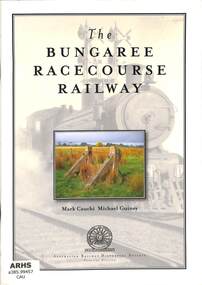 Victorian Railway History Library
Book, Cauchi, Mark et al, The Bungaree Racecourse Railway, 2009
An illustrated history narrative of Victorian Railways line from Bungaree to the Bungaree Racecourse near Ballarat.index, ill, maps, p.40.non-fictionAn illustrated history narrative of Victorian Railways line from Bungaree to the Bungaree Racecourse near Ballarat.railroad construction - victoria - history, railways - bungaree racecourse - history -
 Victorian Railway History Library
Glen Eira Historical Society Inc, Alone the line: Caulfield to Oakleigh rail stories, 2019
A history of the Caulfield to Oakleigh railway line in Melbourne Victoria.index, ill, maps, p.196.non-fictionA history of the Caulfield to Oakleigh railway line in Melbourne Victoria.railroad construction - victoria - history, railroad operations - victoria - history -
 Ringwood and District Historical Society
Document, Certificate of Title - Thomas Arthur Wentworth Burkitt - part of Crown Section 20, Parish of Warrandyte, County of Evelyn - 5th June, 1929
A4 copies of Landata Victoria Historical Search documents - Vol 5598 Fol 1119416.Thomas Arthur Wentworth Burkitt of Box Hill, Retired Clerk of Courts, is now the proprietor of an Estate in Fee-simple subject to the Encumbrances notified hereunder ... 35 acres 1 rood 11 perches or thereabouts, together with right of carriage way over part of Warrandyte Coach Road on plan of subdivision no.12040. Subdivision maps includes Brysons Road, Warrandyte Coach Road (later Wonga Road), Rangeview Parade (later Omeo Parade), and Kardinia Crescent, Warranwood. Mortgages and Transfers include Mortgate - part to the Trustees of Vic District no.82 I.O.O.R, 1st August, 1929, Mortgate - part to Arthur Edward Perry, 1st August, 1929, Transfer 1426692 - George Clements Dickason and Will Gordon Sprigg, 20th August, 1929, Transfer 1766662 - Linda Elizabeth Collins, 28th March, 1940. -
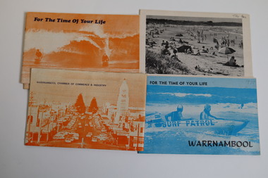 Warrnambool and District Historical Society Inc.
Booklet - Warrnambool Tourist Guides (5), Warrnambool Chamber of Commerce and Industry, Warrnambool - For the Time of Your Life, 1970-1975
Warrnambool Tourist Guides 1970-1975.1,.2,.3 - These are booklets of 36 pages with an orange cover with an illustration of two people on surf boards on the front cover and an image of a main street on the back cover. The cover has blue printing. The pages contain a map, advertisements, black and white photographs and printed text. One booklet is stapled and two have the staples removed. .4,.5 -These are booklets of 40 pages with a front cover with a photograph in blue tones of a surf patrol boat and two lifesavers and a back cover with a black and white photograph (beach scene). The pages contain a map, advertisements, black and white photographs and printed text. One booklet is stapled and one has the staples removed. non-fictionWarrnambool Tourist Guides 1970-1975warrnambool tourism, tourism in warrnambool in the 1970s -
 Warrnambool and District Historical Society Inc.
Pamphlet (Collection) - Warrnambool Tourist Maps, Warrnambool City Council, 1975 to 2002
Warrnambool Tourist Maps collected over the years by Warrnambool Historical Society membersPreservation of local maps for historical purposesEnclosed in A4 size plastic envelopes in an A4 size archival box and numbered and catalogued according to the date of acquisition.This collection has 16 pamphlets containing maps of Warrnambool and district and some accompanying printed materialwarrnambool tourism, city of warrnambool, shipwreck coast tourismwarrnambool tourism, city of warrnambool, shipwreck coast tourism