Showing 7116 items matching "snowy-river"
-
 Kiewa Valley Historical Society
7 small black and white photographs of Pretty Valley, c1948
In 1947 it was proposed to construct a dam on the Pretty Valley branch of the East Kiewa River. This was part of the initial planning in 1937. The Pretty Valley Reservoir was to be part of a pumped-storage scheme with a pumping station located immediately below the main structure. Preparatory work was commenced in 1946 with erection of staff accommodation. Between 1947 and 1950 the main camp was erected, access roads, constructed and banks and benches at the dam site undertaken. Following the financial crisis in 1951, a review of the scheme was carried out and work ceased in June 1951. Construction of the dam was deleted from the programme of works and all buildings removed.A pictorial history of part of the initial planning in 1937 for a dam to be constructed at Pretty Valley as part of the Kiewa Hydro Electric Scheme.7 small black and white photographs of Pretty ValleyAll photos have a circular stamp on the back with 'Print by Willson White Albury' enclosed. Photo 1 - on the back, handwritten in ink 'New 22Kv pump line - Pretty Valley Nov. 1948'. In pencil '18'. Photo 2 - On the back, handwritten in ink 'Pretty Valley - Staff mess on right Nov. 1948'. In pencil '18'. Photo 3 - On the back, handwritten in ink 'Pretty Valley Basin - looking S.E. Nov. 1948'. In pencil '5'. Photo 4 - On the back, handwritten in ink 'New pump 22Kv line, Pretty Valley - looking towards Mt. Mackie. Nov. 1948'. In pencil '5'. Photo 5 - On the back, handwritten in ink 'Pretty Valley. Mt. Cope just out of picture extreme right. Nov. 1948'. In pencil '78'. Photo 6 - on the back, handwritten in ink 'View from Pretty Valley Ruined Castle in Background Nov. 1948'. In pencil '78'. Photo 7 - on the back, handwritten in ink 'Pretty Valley Pump line (Nov. 1948)'. In pencil'78'.construct, dam, pretty valley -
 Warrnambool and District Historical Society Inc.
Administrative record - Warrnambool Waterworks Newspaper Cuttings, 1891 to 1917
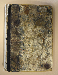
This ledger contains newspaper cuttings form The Warrnambool Standard newspaper from May 1891 to October 1917. The cuttings are reports of meetings of the Warrnambool Waterworks Trust. In the early days of Warrnambool domestic water and water for fire suppression was supplied by tanks, wells and springs. In the 1870s various schemes were proposed to find a better supply of water. In 1891 the Warrnambool Waterworks Trust was formed using water from the Merri River. This system lasted until 1939 when the Warrnambool water supply came from the Otway ranges. This system is still the water supply for Warrnambool today. The cuttings in this ledger will be useful for research.This is a ledger with a brown mottled cover and a leather spine and leather corners. The spine is partly detached. The front cover has a label pasted on it. The pages originally had hand written entries (The Minutes of a Warrnambool organisation). Newspaper cuttings have been pasted over the original writing. Warrnambool Waterworks Trust Newspaper Reports From 19th May 1891 To --- warrnambool waterworks trust, warrnambool water supply -
 Warrnambool and District Historical Society Inc.
Document - Documents (3) of Farnham Cheese and Butter factory, 1890s (originals)
These three sheets are copies of the originals and relate to the establishment of the Farnham Cheese and Butter Factory in Dennington (Warrnambool). The name 'Farnham' is the name of the Special Survey in the area first purchased by William Rutledge and also the name of the Rutledge property at Dennington. In 1889 WIlliam Rutledge (Junior) and Thomas Palmer established the Farnham Cheese and Butter Factory on the banks of the Merri River at Dennington. In 1890 they sold the factory to a farmers' co-operative. Farnham had a high reputationfor butter=making when the factory was in existence. The factory was bought out by Nestles about 1909 with that company establishing its factory on the same area.in 1911. These documents are of interest as the Farnham Cheese and Butter Factory was one of the earliest of its type in the Western District and won a Gold Medal in 1909 for butter-making at the Islington Dairy Show in competition with other butter-making countries in the world..1 sheet of paper with black and white map showing location of factory in Dennington (copy) .2 An A3 size piece of paper with a sketch map and typed material showing a Certificate of Title (copy) .3 An 3 size piece of paper with a sketch map and typed material showing a Certificate of Title (copy)farnham cheese and butter factory, nestles factory warrnambool -
 Warrnambool and District Historical Society Inc.
Medallion, Australian Felmongers Wool Sorters
This is a badge of an Australian association of fellmongers, wool sorters and scourers. This group may have been part of the Amalgamated Fellmongers, Wool Sorters and Wool Scourers Union of 1912-1918 or it may have been an earlier association. A fellmonger was a dealer in the hides or skins of animals, especially sheep, or a person who removed the skins from animals. There were several fellmongery and wool scouring establishments in 19th century Warrnambool and district. These included the Dallimore Fellmongery at Lake Gillear, the Bennett Merri Bank Fellmongery at Dennington and the fellmongery businesses of James Evenett and Henry Mawbey on the Merri River in South Warrnambool.Although it has no known local provenance, this badge is of interest because there were several fellmongery establishments in the Warrnambool district in the 19th century so it may have belonged to a local person.This medallion has a gold coloured image of a suspended lamb on a circular royal blue enamel background which in turn is surrounded by a white enamel annulus with text. The external brass edging is filigree. The medallion has an attached ring at the top with narrow gold ribbon threaded through an additional ring FELLMONGERS WOOL SORTERS & SCRS' . AUST. WOOLANDSKIN 82? G.P.O.PLACE W fellmongers, warrnambool history, dallimore fellmongery, bennett merri bank fellmongery, james evenett, henry mawbey -
 Eltham District Historical Society Inc
Photograph - Aerial Photograph, Landata, Eltham, Vic, Apr. 1972
Centred on present day Mays Road at Stringybark Road, Eltham bounded by Nyora Road to north, Yarra River to south, Reynolds Road to east and Bible Street to west. Historic Aerial Imagery Source: Landata.vic.gov.au Aerial Photo Details: Project No :985 Project : MELBOURNE 1972 Run : 28 Frame : 209 Date : 04/1972 Film Type : B/W Camera : RC10 Flying Height : 5700 Scale : 9600 Film Number : 2635 GDA2020 : 37°43'33"S, 145°09'28"E MGA2020 : 337647, 5823013 (55) Melways : 22 B8 (ed. 42)aerial photo, neil webster collection, 1972-04, eltham, bible street, mays road, melway 22b8, nyora road, reynolds road, stringybark road, yarra river -
Eltham District Historical Society Inc
Document - Folder, Oyston, Peter
Peter Oyston died in 2011. His career included being Founding Dean of drama at the Victorian College the Arts and director of Playbox Theatre. He was a champion of theatre companies including The Murray River Performing Group, The Flying Fruit Fly Circus, West Theatre and Theatreworks. He taught at the Royal Academy of Dramatic Art in London and directed more than 200 productions in Australia and other countries. He had one daughter. Contents Newspaper article: "Director takes his curtain call", Diamond Valley Leader, 19 October 2011, Obituary of Peter Oyston.Newspaper clippings, A4 photocopies, etcpeter oyston, victorian college of the arts, bend of islands, playbox theatre, the fying fruit fly circus, theatreworks, royal academy of dramatic arts london, dominque oyston, ray mooney, west theatre, the murray river performing group -
 Mission to Seafarers Victoria
Book, Melbourne Books, Wharves To The World: The Development Of Melbourne's World Trade Centre, 2011
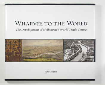
Wharves to the World: The Development of Melbourne's World Trade Centre is a photographic chronicle of the history of the World Trade Centre and its surrounds. The book traces the journey of land and the buildings that occupied it - from its beginnings with the Wurundjeri people to its role as a trading hub in early Melbourne, then as the site of the modern-day World Trade Centre, and now as part of a flourishing residential and commercial Precinct. As with any major project The World Trade Centre has face its share of fêlures, but despite thèse it has become an integral part of the City. So it goes that was once home to swampland and the City morgue has been transformer into a Diamond of the Yarra River.A 128-page book of printed matter, photographs, engravings and drawings. The hard cover is white with the title in gold lettering on the front. The dust-cover is also white with black lettering. Along the lower half of the cover, front and back, is a strip of six photos, three coloured and three black and white. 128 p. : ill. (some col.), ports. ; 22 x 25 cm.non-fictionWharves to the World: The Development of Melbourne's World Trade Centre is a photographic chronicle of the history of the World Trade Centre and its surrounds. The book traces the journey of land and the buildings that occupied it - from its beginnings with the Wurundjeri people to its role as a trading hub in early Melbourne, then as the site of the modern-day World Trade Centre, and now as part of a flourishing residential and commercial Precinct. As with any major project The World Trade Centre has face its share of fêlures, but despite thèse it has become an integral part of the City. So it goes that was once home to swampland and the City morgue has been transformer into a Diamond of the Yarra River.yarra yarra tribe, early melbourne, world trade centre, melbourne, southbank, northbank, australian wharf, siddeley street, waterfront, amy zurrer, wurundjeri, spencer street bridge, north wharf, riverlee, wtc, wharf, harbor trust, sir john coode, harbour trust, little dock, polly woodside, wharfies, divers -
 Greensborough Historical Society
Photograph - Digital Image, Pioneer Reserve 2014 -1, 21/05/2014
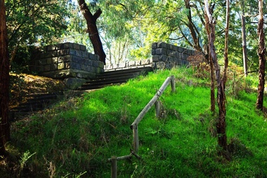
Pioneer Reserve, Greensborough is a small park on the corner of St Helena and Diamond Creek Roads. It is adjacent to the site of Greensborough's first bridge across the Plenty River, c. 1864 - 1960s. The shelter, viewing platform, retaining wall and entrance are built from the bridge's massive bluestone arched abutments dismantled between 1974 and 1983. Pioneer Reserve is historically significant for its formative association with noted local landscape designer Gordon Ford in 1968, and it is likely that remnant large field stones at the entrance drive to the Reserve remain from his design. Photograph by Marilyn Smith 2014.Digital copy of colour photograph. -
 Greensborough Historical Society
Certificate of Title, Supreme Court of Victoria (Probate Division) et al, Certificate of Title Vol. 2567 Fol. 294, Vol. 3134 Fol. 605, 22/05/1895
Title Vol. 2567 Fol. 294 in the name of The Greensborough Estate Company Limited, 164 acres four and a half perches, being part of Crown Portion 17 Parish of Keelbundora, County of Bourke. Dated 22nd May 1895. Northern boundary Greensborough Road (now Grimshaw Street), Southern boundary Nell Street, Eastern boundary Plenty River, Western boundary road (now named McDowell Street); Title Vol. 3134 Fol. 605 in the name of Adolphe Frederic Seelenmeyer, land as described above, LP 4759 and transfers and other instruments to 9 March 1948Folder containing two Certificates of Title (3p. + 9 p.) and twenty pages of miscellaneous documents, including historical summary, brief biography of A. F. Seelenmeyer, two Death Certificates and photocopied extracts from probate documents, as listed in table of contents, ed. by Peter Simmenauergreensborough, greensborough estate company limited, grimshaw street greensborough, plenty river, nell street greensborough, mcdowell street greensborough, adolphe frederic seeley, formerly seelenmeyer, adolfe frederic seelenmeyer -
 Uniting Church Archives - Synod of Victoria
Photograph, 1985
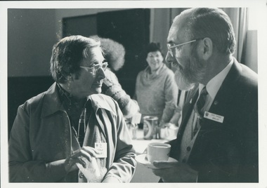
Rev Frank Morris Ordained in the Methodist Church 1966, Minster at Casterton 1966-1968, Yarram 1969-1971, Tasmania LA 1972-1989, Glamorgan 1990-1993, Hobart City Centre 1994-1995, PR 1995. Rev Des Ivens Ordained 1970 SA Minster at Robe 1963, Port MacDonnell 1964-1966, Plympton (Hare St) 1967, Bute 1968-1970, Rocky River (Laura) 1971-1973, Barunga Range 1974-1976, Kangaroo Island 1977-1981, Huon Tas 1982-1985, SA, Wallaroo 02.86 B & W waist length photograph of the Rev. Frank Morris and the Rev. Des Ivens in conversation.rev. frank morris; rev. des ivens; casterton; yarram; hobart city centre; robe; port macdonnell; plympton; bute; rocky river; barunga range; kangaroo island; huon tasmania; wallaroo -
 Peterborough History Group
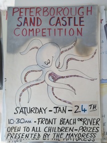
Poster - Sandcastle Competition Annual Advertising Posters
The Peterborough Sandcastle competition has been running for at least 80 years. Wokka Moore was the first "Lady Mayoress", judge of the competition, who arrived with great ceremony using different means of transport over the years - always accompanied by a "Lady in Waiting". Traditionally, this was held on the Australia Day long weekend. Competition was divided into age groups, and the venue depended on whether the river was open or closed. (If it was open there is no sand on the Front Beach). Materials used could only be what was found on the beach. Currently (2021) the Sandcastle Committee is calling for photos, memorabilia and details of winners from over the years.This event has been running for a very long time , apparently uninterrupted. It is significant to the town because of its inclusive nature - there was high anticipation and planning by the children. The roles of Lady Mayoress and Lady in Waiting were keenly sought. Wokka Moore did the job for a long time then passed the baton. Others who were honoured over the years include Alec Calvert, eight posters of various sizes with hand drawn pictures, some with dates but not year of event.sandcastle competition, peterborough, peterborough sandcastle competition, traditional summer event peterborough -
 City of Greater Bendigo - Civic Collection
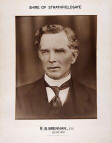
Photograph - Portrait of Shire Secretary Brennan, Unknown
The district of Strathfieldsaye was proclaimed in 1861 and named a Shire on the 17th September in 1866. It remained a shire until amalgamation in 1994 when it became part of the City of Greater Bendigo. The Shire was located 8 km to the south- east of Bendigo and covered an area of 601 square kilometres and extended from the Calder Highway to the Coliban and Campaspe Rivers. The shire's administration centre was in Strathfieldsaye until 1972 when new offices were opened in Kennington. Secretary Brennan, son of Councillor M. Brennan was appointed after his fathers death to the role and according to the The Bendigo Independent was in the role in 1917. See References.Framed black and white head and shoulder portrait of Councillor Brennan. Profile slightly to left. Cut rectangle cream mount. Hand written title top and lower centre. Shire of Strathfieldsaye / R. B. Brennan, Esq / Secretarystrathfieldsaye shire council, secretary strathfieldsaye shire -
 Wodonga & District Historical Society Inc
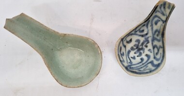
Functional object - Chinese Ceramic Spoons
During the Victorian goldrushes of the 1850s thousands of Chinese migrants arrived to seek their fortunes. At that time many came to the lucrative gold fields of Northeast Victoria. After the Gold rush, many Chinese migrants returned home. However, a number settled in the area as merchants, hawkers and market gardeners in surrounding towns including Wodonga, the Ovens, King, Buffalo River and Kiewa Valleys. They also rented lands and established themselves in the hops and tobacco farming industries. These spoons were found by Mr Robert Black when he was ploughing a paddock on his farm in Kergunyah, Victoria in the 1930s.2 small ceramic Chinese spoons. Spoon 1 has a clear light green glaze. Spoon 2 is decorated with a blue painted pattern.chinese immigration to victoria, chinese market gardens, chinese migration northeast victoria -
 Melbourne Legacy
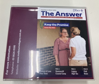
Audio - Newsletter, The Answer April/May 2022 Audio Version, 2022
The Answer is a newsletter in magazine format that is sent to the widows that are helped by Melbourne Legacy. For the widows who are sight impaired a copy of the newsletter is audio described onto CD by Vision Australia and posted to them. It contains information about meetings and activities. This edition contained articles on the Queenscliff camp, Anzac Student ceremony, Glenelg River canoe journey, donation in memory of Private Greg Sher, and Widows' High Tea. Also the history of the Battle of Lone Pine and the Lone Pine trees grown in Australia since. Also photos of our programs such as the walking group, the stamp ladies, and widows club gatherings.A record that Melbourne Legacy helps coordinate and organise events and activities for the widows, and provides items of interest for their enjoyment.Compact disc x 2 in a case that contains the audio recording of The Answer from Feb/Mar 2022.activities, answer, widows -
 Ballarat Tramway Museum
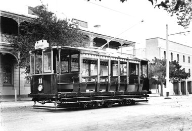
Photograph - Geelong Tramway "Summer Car"
"Summer Car" 11 outside Mac's Hotel in Corio Tce. To the right is Strachan, Murray and Shannon's wool store whose facade still stands. The tramcar, shown in pristine condition was one of the two trailers motorised in 1913 with equipment identical to that of the Duncan & Fraser cars. They were built for use mainly on the new South route to the Barwon River. The coloured destination lights were from left: Red for GEELONG WEST, blank (later blue for the East route), white for SOUTH GEELONG and green for NEWTOWN. Side destination boxes have been added. Late 1913.Black and white print on paperNo. 1 inside a circle, and 13-7 written in ink on reverse. GSR7109/13/1/7 written on reverse in pencil.geelong tramway summer car 11, geelong streetscape, geelong tramway motorised trailer, geelong tram destination lights -
 Merri-bek City Council
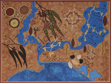
Acrylic on watercolour paper, Mandy Nicholson, Cultural Map of Melbourne, 2003
Primarily a painter, Mandy Nicholson also produces ceramics, carvings, murals, prints, designs and children’s clothing. Born in 1975, Nicholson was raised in Healesville and belongs to the Wurundjeri-willam (Woiwurrung language) clan of the Kulin Nation. Mandy’s paintings often represent important cultural rituals and are executed in her distinct graphic style using the traditional motifs of her people blended with contemporary interpretation. Cultural Map of Melbourne shows significant sites across Melbourne. These include scar trees, corroboree trees, stone quarries, bush tucker sites, significant rivers, fresh water wells and traditional campsites. -
Warrnambool and District Historical Society Inc.
Document (collection) - Henri Worland Historical Records, Henri Worland Collection, 1930s and 1940s
Henri Worland writings collected by the Warrnambool City CouncilPreservation of important historical recordsThe collection is in folders in a containerWritings on Warrnambool history by Henri Worland - radio talks, lectures, letters and notes, hand written and typed.henri worland, warrnambool historyhenri worland, warrnambool history -
 Melbourne Tram Museum
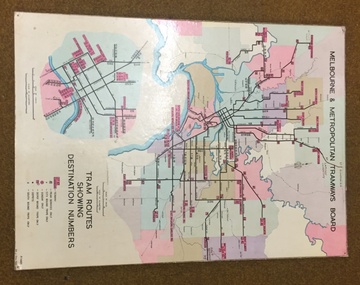
Map, Melbourne & Metropolitan Tramways Board, Del J. Chau, "Tram Routes showing destination numbers", 1972
Titled "Tram Routes showing destination numbers". Map dated 1972, showing routes with route numbers, including short working, names of main destinations, roads, railway stations and rail lines, municipalities, rivers, scales, city section in detail, depots and Sunday only services. In bottom right hand corner has number P.14431, Del J. Chau 1972. The original has been altered to show the Bundoora, La Trobe University and East Burwood lines and the change to Airport West. Type of map that was placed on the rear of the driver's doors of a W Class tramcar.Demonstrates a MMTB produced map used in trramcars.Full colour map or poster printed on heavy cardboard.trams, tramways, mmtb, map, routes -
 Orbost & District Historical Society
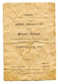
advertisement, 1902
Mrs Arthurena Dora Beattie (nee Morrison), had been teaching privately at Rosedale and came to Orbost with her husband and family in 1890. In 1892 she opened a private school in Salisbury Street (about the site of the Countryman Motor Inn) which she conducted for about 10 to 12 years. Her husband, John Wilson Beattie, a retired State School teacher, had been head teacher at the Rosedale School from July 1870 to August 1884. After coming to Orbost he selected land on Wall Creek. He was a widower with 7 of 11 surviving children when he married Arthurena in 1885. His fist wife, Georgina (nee KELLY) died at Rosedale in 1883 when the youngest child was just 5 weeks old. John and Arthurena had a further 8 children (5 born at Orbost), and after John's death she married George McCARLIE in 1916 at Sale and moved Mirboo North. (references:BEATTIE, Arthurena Dora Music teacher, Orbost - 1903 Electoral Roll. BEATTIE, Arthurena Dora Teacher, Orbost - 1912 Electoral Roll.) There was at least one other private school much earlier, in 1884. It was thought to be the first school in the district and conducted by William Ballantyne. It was located on the flat on the Newmerella side of the Snowy River near where the first railway crossing used to be. Wm Ballantyne had previously taught school at Sarsfield from June 1873 to November 1879. (information from John Phillips) This advertisement was for educational tuition by Mrs Beattie. Tuition would be from 10.00am - 12.00 and from 1.30pm - 3.30pm. Costs were thirteen shillings per quarter for children under the age of 12 years and one guinea for those over 12 years. A reduction would be given for more than one child in the same family. The 1872 legislation required all children aged 6-15 years to attend school unless they had a reasonable excuse. Parents who did not send their children to school were liable for fines up to five shillings for a first offence, with the penalty increasing to 20 shillings for each repeat offence. The Orbost State School had opened on 19th of March 1886 and this "private school" appears to have been a small private enterprise school. This is a useful research item associated with education in Orbost.A white A5 size paper advertisement which has black print. It is an advertisement for private educational tuition. Details of costs and hours are included.beattie education school advertising -
 Orbost & District Historical Society
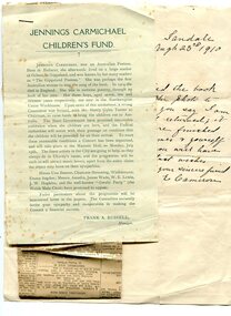
letters, 1910
These letters were received by Henry James of Orbost. Henry James (1860-1932) was a well-known identity in the Orbost district. He was a stock agent and auctioneer who helped to establish the seed bean industry in Orbost. He was the second secretary of the Snowy River Shipping Co. as well as a shire councillor and prominent member of MUIOOF. They concern a fund established to raise money to bring the three sons of Jennings Carmichael to Australia. A committee established by Henry Gyles Turner, a a notable Australian banker and historian, was formed to raise funds to bring the boys to Australia. Grace Elizabeth Jennings Carmichael (1867-1904), poet and nurse, was born on 24 February 1867 at Ballarat, Victoria, daughter of Archibald Carmichael, a miner from Perthshire, Scotland, and his wife Margaret Jennings, née Clark, from Cornwall, England. . She was educated at Melbourne and while still a child went to live on a station at Orbost, and grew up close to the bush she came to love so much. In 1888 she went to Melbourne to be trained as a nurse at the Royal Children's Hospital, Melbourne, and in 1891 published a small volume of prose sketches, Hospital Children. Having qualified she obtained a position on a station near Geelong, and subsequently married Francis Mullis. She contributed verse to the Australasian, and in 1895 Poems by Jennings Carmichael was published. She lived for a time in South Australia and then went to London, where she died in poor circumstances in 1904. Her husband, Henry Mullis, was last recorded in the workhouse in Woolrich, but then disappeared leaving the three children- Geoffrey 7 yrs, (Thomas) Clive 5 yrs & 4 year old (Archibald) Keith and one year old (Rupert) Wyatt, destitute & were sent to the Northampton workhouse, (Thomas ) Clive dying in 1906. In 1910, a group of Carmichael's admirers, discovered the whereabouts of her children, where a public fund was established to bring the children to Australia, the Victorian Government giving them free passage, arriving in Victoria in October of 1910. The children were placed in private homes and took on their mother's single name of Carmichael. In 1910 a small selection of her poems was published, in 1937 a plaque to her memory was unveiled at Orbost in the Mechanics Institute ( reg. 554), and a year later a replica was placed in the public library at Ballarat. Two of Jennings Carmichael's sons were present at the ceremony.Jennings Carmichael, a leading Australian poet spent much of her childhood in Orbost.Several letter written to H. James concerning the Jennings Carmichael Children's Fund. Stapled to one letter is a typed article about the Jennings Carmichael Children's Fund written by Frank a. Russell. The other letter is a three page stapled handwritten letter from St Oswald's, Ormond College, seeking information about Jennings Carmichael.james-henry jennings-carmichael correspondence -
 Upper Yarra Museum
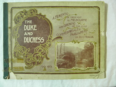
Book, D W Patterson, The Duke and Duchess, circa 1901
This book is a memento of the visit of the Duke and Duchess of Cornwell and York to Melbourne in May 1901, they came here to open the first Commonwealth Parliament of AustraliaThe book is part of a collection from the H H Bradley family, the other items are personal invitations to the opening of the first Parliament.Paperback Book. an 80 page book with soft card covers bound with green cloth binding, mainly pictorial, of their visit to opening of the 1st Commonwealth Parliament of Austrlia with a description with each photo in black and white, the cover is partly dark brown with the rest there is a photo of a river on the bottom right hand corner and the book title on the left within a scrolled frame and the dark brown background. front and back cover quite grubby, bottom right had corner missing and torn 20+20mm, a finger nail size missing middle right hand side, bottom left hand corner next to binding has a 22+25mm Piece missing -
 Kew Historical Society Inc
Photograph - Grampians, 1924
Henry Beater Christian (1886-1962) , was a descendant of one of the earliest settler families in Kew. Employed at the Kew Asylum as a 'public servant', he was a skilled amateur photographer, photographing numerous scenes in Kew and on his travels around Victoria. The majority of his photographs date from 1916 to 1929. His finest photographs are housed in two photograph albums. Digital copy of a photograph from page 13 of the 47-page photograph album containing 261 gelatinous silver images, loaned by Diane Washfold with permission given to digitise and hold a copy in our collection. The first and last pages in the album document the Yarra River at Studley Park and at Kew. The remainder of the album includes photographs of walking and car tours in rural Victoria including 'wilderness' areas in the Grampians, Gippsland and the High Country. Six album pages document a camping trip by Henry Christian to the Grampians in September 1924. The photos include pictures of lookouts, and natural features including rock faces and waterfalls, as well as his camp site. This photo is of a distant valley.. Unitled [Grampians]henry beater christian (1886-1962), landscape photography, christian-washfold collection, photograph albums, grampians, gariwerd -
 Kew Historical Society Inc
Photograph - Bruthen to Swan Reach, 1926
Henry Beater Christian (1886-1962) , was a descendant of one of the earliest settler families in Kew. Employed at the Kew Asylum as a 'public servant', he was a skilled amateur photographer, photographing numerous scenes in Kew and on his travels around Victoria. The majority of his photographs date from 1916 to 1929. His finest photographs are housed in two photograph albums. Digital copy of a photograph from page 31 of the 47-page photograph album containing 261 gelatinous silver images, loaned by Diane Washfold with permission given to digitise and hold a copy in our collection. John Chapman has written in 'Bushwalking Clubs - A Brief History', about the establishment in Victoria of the first bushwalking club in 1888, and the popularisation of bushwalking during the interwar period. Henry Christian's 'walks' appear to have been undertaken solely or with a companion/s. This black and white photo is part of a group of six photos taken on an 18 kilometre walking trip between Bruthen and Swan Reach in East Gippsland in 1926. The route of the walk followed the Tambo River."BRUTHEN TO SWAN REACH 1926"henry beater christian (1886-1962), landscape photography, christian-washfold collection, photograph albums, bushwalking, bruthen, swan reach, tambo river, east gippsland -
 Wodonga & District Historical Society Inc
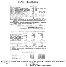
Album - Hume Reservoir Australia Album - Dimensions of Hume Reservoir, Department of Public Works, N.S.W, 1927
This set of photos is from a leather bound album bearing the inscription "HUME RESERVOIR AUSTRALIA" plus 'The Rt. Hon. L. C. M. S. Amery, P. C., M .P.' all inscribed in gold. It was presented to The Rt. Hon. L. C. M. S. Amery, P. C., M. P, Secretary of State for Dominion Affairs on the occasion of his visit to the Hume Reservoir on 2nd November 1927. This album is of local and national significance as it documents the planning and development of the Hume Reservoir up to 1927. It was the largest water reservoir in the British Empire. The album records the pioneering engineering work that went into its construction.Table outlining the Dimensions of the Hume Weir and comparisons with MAKWAR and BURRINJUCK DAMS, and some other comparisons. MAKWAR Dam is located on the Blue Nile about five miles south of Sennar and 175 miles south of Khartoum in Sudan. The construction of this dam started in 1922 and was completed in May 1925, while the British Empire colonised Sudan. It was officially opened on 21st January 1926. The BURRINJUCK DAM is situated in the upper catchment of the Murrumbidgee River, approximately 60 kms from Yass, N.S.W. It was built from 1907 to 1927 The stated purpose of the Hume Reservoir is to get storage to ensure regulated output for:- 1. Irrigation 2. Navigation 3. Hydro-electric Generation.hume reservoir australia, river murray waters scheme, hume dimensions -
 Bacchus Marsh & District Historical Society
Map, Lerderderg Park Lands sale plan. 1911
This plan was for the sale of parcels of land from the Lerderderg Park Estate property in 1911. Advertising for the sale appeared in the Bacchus Marsh Express newspaper through July of 1911. The property was situated only a few kilometers from the township of Bacchus Marsh. The agents for the sale were L. A. Fairbairn & Co.Lerderderg Park Estate was a significant and early colonial property in the Bacchus Marsh area. This plan provides details about the first time the property was subdivided for sale. It is therefore documents an important moment in the history of this property and the broader trend of the subdivision of older and larger properties in the district.A single page paper plan showing allotments of land for sale from the Lerderderg Park property owned by John Wills. The parcels of land for sale are coloured in red.The Lerderderg River and Pyke's Creek Irigation Channel shown on the plan are in blue ink. The rest of the plan is a dark cream or beige colur with the text in black ink. The plan has been extensively annotated with hand-written notes indicating the names of people who purchased the various parcels of lands and the prices paid for those lands. Part of the top of the plan containing some text appears to be missing. The plan is pasted into a bound volume containing 76 maps or plans in total. Top: Have received instructions to Sell, account Mr John Wills, his renowned LERDERDERG PARK LANDS, so well and favourably known throughout the Commonwealth. In areas from 3 acres to 1276 acres. Every lot is either rich lucerne land (or portion now under lucerne) with some higher land adjoining Railway Station, and 2 Milk factories within 2 miles, absolutely the finest land in Victoria. Bottom: THIS IS THE FIRST SUBDIVISIONAL SALE of Rich Flats in Bacchus Marsh since the Pyke's Creek Scheme, and every lot is commanded by it. Only 32 miles from Melbourne.bacchus marsh victoria maps, land sales, lerderderg park estate, land subdivision -
 Bendigo Historical Society Inc.
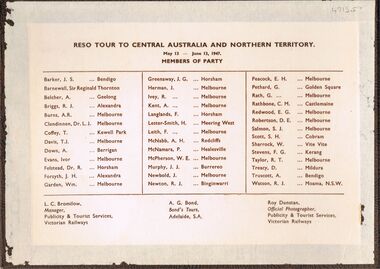
Photograph - PETHARD COLLECTION: PHOTOGRAPH RESO TOUR
George Pethard Collection including references to Taraxale Brewing Company Pty brown covered 29x19mm photographic album bound with gold string / 52 black and white Photographs of Reso tour to central Australia and Northern Territory / includes Aboriginal camps , camel trains / landscapes , war cemetery at Adelaide River / May 13- June 13 1947 / the 40 members of the party are also named includes: George Pethard / Aboriginal camp , Jay Creek consisting of makeshift tents / crowd playing 'Two Up ' Photo of the ship 'Meggs' at Darwin / Manton Dam - Darwin's water supply photo. Reso Tour to Central Australia and Northern Territory.Roy Dunstan Publicity and Tourist services Victoria Railwaysphotograph, person, male, george pethard / taraxale brewing company pty ltd / aboriginal camps / camel trains / war cemetary at adelaide river photo of the ship 'meggs' at darwin / manton dam - darwin's water supply photo -
 Bendigo Historical Society Inc.
Document - MCCOLL, RANKIN AND STANISTREET COLLECTION: MAP OF MINE LEASES SYMONDS STREET, MCKENZIE ST WEST AREA BENDIGO, 2nd September, 1936
Blue waxed linen paper map. On top' Mining District of Bendigo' Parish of Sandhurst, County of Bendigo' Map shows lease 10135, area 32.1.19; lease 10371, area 30.0.23; lease 10179 area 41.3.4; lease 10370, area 49.0.1. Map indicates gully leading into and State Rivers and Water supply reservoir, water race; siphon, shaft, dam, residential area and some residential lots marked. Streets include Holly Street, MacKenzie Street West, Symonds Street, Aspinall Street, Emmett Street; Bendigo Creek marked at bottom of map. Scale 4 chains to one inch. Map is not dated.bendigo, mining, mccoll rankin & stanistreet -
 Eltham District Historical Society Inc
Photograph, Liz Pidgeon, Heritage Excursion; Eltham Lower Park Walk and Talk, 1 July 2017, 1 July 2017
Information board: Hohnes Hill Flora & Fauna Reserve produced by Shire of Nillumbik and Parks Victoria which includes text and images with references to the Eltham Copper Butterfly. Newsletter No., 234, June 2017 Heritage Excursion - Saturday 1st July - Eltham Lower Park - Walk and Talk Eltham Lower Park has played an important part in the history of our area since the early days of European settlement when it was used by local residents as an informal racecourse. Prior to that its location at the junction of the Diamond Creek and the Yarra River made it an important meeting place for the Wurundjeri people. The park combines formal elements and sporting facilities with remnant bushland that is of environmental significance. It is home to sporting and horse riding clubs, popular play spaces and the Diamond Valley Miniature Railway, which attracts large numbers of visitors. The park will be the venue for our July excursion which will comprise a walk of about 3.5 km around the park and adjacent areas. Along the way we will discuss the history and natural history of the area. The path along the creek and the river provides a pleasant and scenic walk. This walk on Saturday 1st July is about 3.5 km in length and will take 2 to 2.5 hours. It will start at 2pm at the Main Road car park at the front of the park. (Melway ref 21 H 10). Born Digitalheritage excursion, activities, eltham district historical society, eltham lower park, hohnes hill, reserve, eltham copper butterfly, sign -
 Eltham District Historical Society Inc
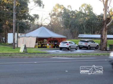
Photograph, Liz Pidgeon, Heritage Excursion; Eltham Lower Park Walk and Talk, 1 July 2017, 1 July 2017
Temporary flower vendor set up in a tent opposite Eltham Lower Park. The flower seller sets up on weekends and offers a convenient drive through service for customers. Goolge maps in February 2021 identified this site as Fleur De Feliss Roadside Store. Heritage Excursion - Saturday 1st July - Eltham Lower Park - Walk and Talk Eltham Lower Park has played an important part in the history of our area since the early days of European settlement when it was used by local residents as an informal racecourse. Prior to that its location at the junction of the Diamond Creek and the Yarra River made it an important meeting place for the Wurundjeri people. The park combines formal elements and sporting facilities with remnant bushland that is of environmental significance. It is home to sporting and horse riding clubs, popular play spaces and the Diamond Valley Miniature Railway, which attracts large numbers of visitors. The park will be the venue for our July excursion which will comprise a walk of about 3.5 km around the park and adjacent areas. Along the way we will discuss the history and natural history of the area. The path along the creek and the river provides a pleasant and scenic walk. This walk on Saturday 1st July is about 3.5 km in length and will take 2 to 2.5 hours. It will start at 2pm at the Main Road car park at the front of the park. (Melway ref 21 H 10). Newsletter No., 234, June 2017 Born Digitalheritage excursion, activities, eltham district historical society, eltham lower park, roadside store, flower vendor, fleur de feliss, tent, drive through, drive thru -
 Bendigo Military Museum
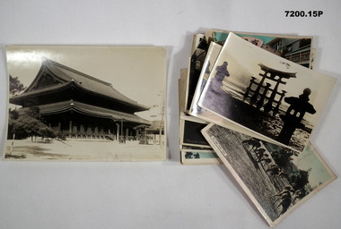
Photograph - PHOTOGRAPHS, BCOF, JAPAN, possibly pre WW2
Items in the collection re Clarence Shearing, refer Cat No 7089.16P for his service details.Photographs B & W, colour enhanced of scenes and buildings in Japan all various sizes.1 & 2. Osaka Castle. 3. Bridge at Arashiyama near Kyoto. 4. Itsukushima Jimja shrine at Miyajima. 5 & 6 Hsukushima floating Torri Gate. 7. Miyajima. 8. Wagoga castle. 9. Inuyama Castle at River Kiso. 10. Torri Gate at Yosukuni Shrine. 11. Amakusa Islands. 12. Deer Park at Nara. 13. Kinkaku-ji or Golden gate Shrine in Kyoto. 14. Temple in Kyoto. 15. Kyogoka (Theatre street) Kyoto. photographs, bcof, japan