Showing 2219 items
matching australian corps
-
 Bendigo Military Museum
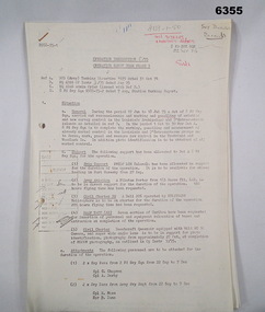
Administrative record - Royal Australian Survey Corps - Operation Sandy Bush Phase 3, Operation Instruction 8/75, 22 Sept 1975
... Royal Australian Survey Corps - Operation Sandy Bush Phase...Royal Australian Survey Corps - Operation Sandy Bush Phase...Royal Australian Survey Corps... Australian Survey Corps Fortuna Army Survey Regiment Army Svy Regt ...Operation Instruction 8/75, Operation Sandy Bush Phase 3 was conducted in the period 1 Oct to 30 Nov 1975 by Det A, 8 Fd Svy Sqn. The Operation was to complete the marking, panelling measurement of already marked control in the Louisiade and D'Entrecasteaux groups and to Recce, Mark, Panel and Measure new survey control in the Trobriand and Woodlark Islands. In addition Photo Identification was to be obtained of all marked survey control. Panelling was the process of accurately laying out large sheets of white plastic to form a cross over the Survey Control Points (Points where the position is accurately known) so that they could then be photographed from the air. The positions of these crosses could then be accurately transferred from this new photography in stereo onto the aerial photography coverage used to produce mapping.Typed Instructions and diagrams without cover, 14 x A4 pages stapled in Top Left Hand Corner.Some annotations in top LH corner8 fd svy sqn, rasvy, royal australian survey corps, fortuna, army survey regiment, army svy regt -
 Bendigo Military Museum
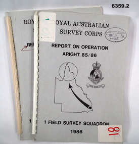
Administrative record - Royal Australian Survey Corps Report on Operation Aright 85 / 86 1 Field Survey Squadron 1986, 1986
... Royal Australian Survey Corps Report on Operation Aright 85...Royal Australian Survey Corps Report on Operation Aright 85...Royal Australian Survey Corps... were field completed. Royal Australian Survey Corps 1 Field ...Operation ARIGHT 85 was mounted by 1 Fd Svy Sqn 14 May to 8 Aug 1985 and 1 May to 15 May 1986. In the 1:250,000 SG54-15 Rutland Plains map area. In addition 18 X 1:50 000 maps were field completed.6359.1 Copy 1. 6359.2 Copy 2. A4 Cardboard cover, grey, plastic ring binder, report, diagrams, maps, plastic ring binder.royal australian survey corps, 1 field survey squadron, 1fd svy sqn, rasvy, fortuna, army survey regiment, army svy regt, asr -
 Bendigo Military Museum
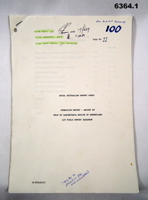
Administrative record - Royal Australian Survey Corps Report on Operation Aright 88 conducted by 1 Field Survey Squadron 1988, 1 Fd Svy Sqn, 9 Feb 1989
... Royal Australian Survey Corps Report on Operation Aright 88...Royal Australian Survey Corps Report on Operation Aright 88...Royal Australian Survey Corps... Details. Royal Australian Survey Corps RASvy Fortuna Army Survey ...Comprehensive Operation Report containing all aspects of OP Aright 88 in the Gulf of Carpentaria region of Queensland. Chapters include: General Information, Operations, Operational Support, Admin and Logistics, Communications, Conclusion and Recommendations. There are four Annexes, Area of Operations, Technical Summary, Nominal Roll, Det 1 Fd Svy Sqn and Air Support Contact Details.Unbound A4 Paper Report held together by a staple top LH corner. Typed pages and diagrams. 6364.1 is copy number 11, 6364.2 is copy number 12 6364.1 is copy number 11, "FOR AIR SURVEY RECORDS" "Tech WO", "Aero Trig", "ADJ", "SGT REES for Records" 6364.2 is copy number 12 "Placed on File and circulated", "Circular Received 15 Feb 1989" on back page. royal australian survey corps, rasvy, fortuna, army survey regiment, army svy regt, asr -
 Bendigo Military Museum
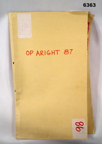
Administrative record - Royal Australian Survey Corps Report on Operation Aright 87 conducted by 1 Field Survey Squadron 1987, 1 Fd Svy Sqn, 26 Aug 1987
... Royal Australian Survey Corps Report on Operation Aright 87...Royal Australian Survey Corps Report on Operation Aright 87...Royal Australian Survey Corps... conducted and the results achieved. Royal Australian Survey Corps ...1 Fd Svy Sqn in conjunction with 2 Fd Svy Sqn conducted Operation Aright 87 in the Cape York Peninsula area over the period 8 May - 18 Jun 1987. The aim of the Survey Operation was to field verify the 70 x 1:50,000 map sheets which comprised the area of operations. This report details the activities conducted and the results achieved. Manilla Folder with title "OP ARIGHT 1987" containing a paper report of typed pages and diagrams bound together with an ARNOS fastener."OP ARIGHT 87" on front coverroyal australian survey corps, rasvy, fortuna, army survey regiment, army svy regt, asr -
 Bendigo Military Museum
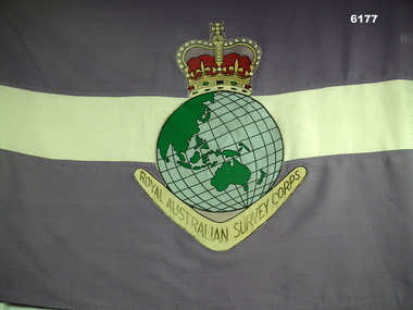
Flag - Royal Australian Survey Corps Flag - Army Survey Regiment, Mid to late 1970's
... Royal Australian Survey Corps Flag - Army Survey Regiment...Royal Australian Survey Corps Flag - Army Survey Regiment...Royal Australian Survey Corps... of the Fortuna Pipes and Drums. Royal Australian Survey Corps RASvy ...Survey Corps Flags of this type were produced mid to late 1970's and distributed to all Survey Corps Units. This flag was issued to the Army Survey Regiment, Bendigo and flew during daylight hours on the Unit flag pole at Fortuna Villa for many years. The flag was ceremonially marched out of the gate on the day that the Army Survey Regiment was disbanded in 1996. Leading the flag bearer party is the Commanding Officer of the Army Survey Regiment LTCol Duncan Burns followed by the band of the Fortuna Pipes and Drums.A full size Corps Flag, purple with 18cm horizontal white stripe. Multi-coloured Survey Corps Badge (less scroll) in the centre of the flag. White header with grommets top and bottom.royal australian survey corps, rasvy, fortuna, army survey regiment, army svy regt, asr -
 Bendigo Military Museum
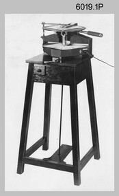
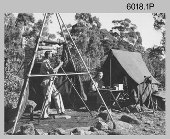
photograph - Royal Australian Survey Corps Aero-triangulation Equipment, 1936 to 1952
... Royal Australian Survey Corps Aero-triangulation Equipment ...Royal Australian Survey Corps Aero-triangulation Equipment ...Royal Australian Survey Corps... of Military Survey. Royal Australian Survey Corps RASvy Army Survey ...Although it’s unknown when these two photos were taken, the South African Pattern Mk IV Slotted Template Machine was in service from 1936 to 1952. The machine was used to cut slots and holes in an acetate film medium. This template was then used to fit several runs of aerial photography to ground control points at a desired scale with a substitution of the templates in the assembly. Radial slots on the templates from central holes representing the photograph’s principal point (centre) were placed over hollow metal studs mounted over control points on the scaled base sheet. The studs represented the intersection of radial lines through common points of detail of overlapping photos. A pricker was used to transfer from the photo-points to the templates. The slotted template methodology was later used as an essential aero-triangulation exercise in advance courses conducted at the School of Military Survey.These three photographs are of a slotted template machine used in aero-triangulation. The first two photographs were printed on photographic paper and are part of the Army Survey Regiment’s Collection. The photographs were scanned at 300 dpi. The third photograph was captured from a collection using a smart phone. .1) and .2) - Photo, black & white, 1936-1952. South African Pattern Mk IV Slotted Template Machine. .3) - Photo, black & white, 1936-1952. WO2 Bob Pratt operating the Slotted Template Machine. .1 and .2 –annotated on back “Slotted Template” .3P - annotated on front “COMPILATION SECTION SLOTTED TEMPLATE MACHINE WO2 BOB PRATT”royal australian survey corps, rasvy, army survey regiment, army svy regt, fortuna, asr, air survey, aerotrig -
 Bendigo Military Museum
Photograph - Royal Australian Survey Corps Surveyors in the Field – Project Cutlass, New Guinea, 1956 – 1957
... Royal Australian Survey Corps Surveyors in the Field...Royal Australian Survey Corps Surveyors in the Field...Royal Australian Survey Corps... 1976 to 1980. Royal Australian Survey Corps RASvy Army Survey ...This is a set of 23 photographs of surveyors and support staff in the field undertaking tasks in New Guinea 1956 – 1957. The surveyors were employed in the establishment of mapping and geodetic control for Project Cutlass, the “Ship-Shore” survey of the New Ireland province. In this survey operation surveyors used theodolites to observe horizontal and vertical angles and chains to measure base line distances between survey stations. Bob Skitch shown in photo .7P was in the 2nd year of his career in the Australian Army. He achieved the rank of Lieutenant-Colonel, and his last appointment was the CO of the Army Survey Regiment from 1976 to 1980.This is a set of 23 photographs of surveyors and support staff in the field undertaking duties during Project Cutlass located in New Ireland, New Guinea 1956 – 1957. The photographs were printed on photographic paper and are part of the Army Survey Regiment’s Collection. The photographs were scanned at 300 dpi. .1) - Photo, colour, 1956. Surveyors travelling main road from Kavieng to Namatanai, New Ireland. .2) - Photo, colour, 1956. Unidentified surveyors assessing recovery of their vehicle after bridge collapsed on west side of New Ireland. .3) - Photo, colour, 1956. Unidentified surveyors assessing recovery of their vehicle after bridge collapsed over flooded creek on west side of New Ireland. .4) - Photo, colour, 1956. Survey personnel L to R: Bev Uwins, John Lambie, Bob Thompson, New Ireland. .5) - Photo, colour, 1956. Survey base camp, New Ireland. .6) - Photo, black & white, 1956-1957. Geoff Helsham with possible human remains, New Ireland. .7) - Photo, black & white, 1956-1957. Bob Skitch undertaking survey observations using Wild T2 theodolite, New Ireland. .8) - Photo, black & white, 1956-1957. Chas Beach undertaking survey observations using Wild T2 theodolite, New Ireland. .9) & .10) - Photo, black & white, 1956-1957. Kev Parker (cook) New Ireland. .11) - Photo, colour, 1957. Brian Berkery taking a break, Top Manor Island, Lihir Island Group off New Ireland. Latitude -2° 46”, Longitude 152° 40”. .12) - Photo, colour, 1957. Survey base camp L to R: Chas Beach, Bev Uwins, Feni Islands, New Ireland. Latitude -4° 05”, Longitude 153° 45”. .13) - Photo, colour, 1957. A Hous Kiap. (Kiaps, known formally as district officers and patrol officers, were travelling representatives of the British and Australian governments), New Ireland. .14) & .15) - Photo, colour, 1957. L to R: Joe Farrington, Tom Royle Bob undertaking survey observations using theodolites from an improvised timber tower, New Ireland. .16) & .17) - Photo, colour, 1957. US Army ship FS216 used for ship-to-shore triangulation docked at Rabaul, New Britain. .18) - Photo, colour, 1957. US Army ship FS216 used for ship-to-shore triangulation docked at Kavieng, New Ireland. Sight target on top of mast. .19) - Photo, colour, 1957. Survey personnel onboard US Army ship FS392, L to R: Peter Frodsham, Bob Thompson, Doc Reid, John Underwood, remainder unidentified, New Ireland. .20) - Photo, colour, 1957. Survey base line party heading ashore, New Ireland. .21) - Photo, colour, 1957. Survey personnel rowing US Army assault boat L to R: Kev Parker, Chas Beach, folded up survey beacons overhanging stern, New Ireland. .22) - Photo, colour, 1957. Les Bailey onboard US Army ship departing Rabaul, New Britain for Brisbane. .23) - Photo, colour, 1957. Ron Newman onboard US Army ship departing Rabaul, New Britain for Brisbane. Active volcano in background..1P to .23P annotated on back – ‘Operation Cutlass’, personnel names, the year and the location. royal australian survey corps, rasvy, army survey regiment, fortuna, a, army svy regt, asr, surveying -
 Bendigo Military Museum
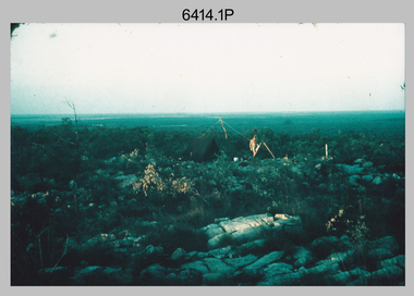
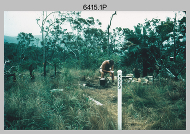
Photograph - Royal Australian Survey Corps Surveyors in the Field – Northern Territory and Queensland, 1959 – 1960
... Royal Australian Survey Corps Surveyors in the Field...Royal Australian Survey Corps Surveyors in the Field...Royal Australian Survey Corps... onto the camp oven. Royal Australian Survey Corps Surveyors ...This is a set of 10 photographs of surveyors and support staff in the field undertaking duties in the Northern Territory and North Queensland in 1959 – 1960. The surveyors were employed in the establishment of mapping and geodetic control. In this era surveyors used theodolites to observe horizontal and vertical angles and tellurometers to measure base line distances between survey stations. Laplace survey observations seen in Photo .1P was a series of precise observations carried out at geodetic survey stations to determine astronomic latitudes, longitudes and azimuths to achieve maximum precision in the survey network. Laplace observations were necessary in a geodetic network at every 6th survey station, however the National Mapping Council specified at this time the spacing would be ideally between 4-6 survey stations. The cairn shown in photo .4P was built by RASvy as a landmark over a trigonometric survey station. It was dismantled in 1960 to enable re-occupation and survey observations. It was not restored to the condition shown in the photo.This is a set of 10 photographs of surveyors and support staff in the field undertaking duties in the Northern Territory (NT) and Queensland (QLD) in 1959 – 1960. The photographs were printed on photographic paper and are part of the Army Survey Regiment’s Collection. The photographs were scanned at 300 dpi. .1) - Photo, colour, 1959. Tony Slattery occupying a Laplace survey station on a hill in the Mount Young area of the NT. .2) - Photo, colour, 1959. Surveyors’ camp in the Mount Young area of the NT, L to R: Spencer Snow and Tony Slattery. .3) - Photo, colour, 1959. Surveyors’ camp in the Peckman Hill area, near Katherine in the NT. .4) - Photo, colour, 1959. Cairn on Trig Hill, Borroloola, NT. Built by Spencer Snow, Tom Royle and Jack McCabe. .5) - Photo, colour, 1959. Survey party taking a break next to their Austin Champ vehicle, in transit between Katherine, NT and Wyndam WA. L to R: Tony Slattery, Dave Owens, John Van De Graff. .6) - Photo, colour, 1960. Surveyors’ camp between Mount Isa, QLD and Borroloola, NT. L to R: Pat Cox and John Van De Graff prepare their meal on an open fire. .7) - Photo, colour, 1960. Surveyor - Dennis Woods undertaking survey observations, using MRA1 tellurometer to measure base-line distances NW of Mount Isa, QLD. .8) - Photo, colour, 1960. Unidentified surveyors assessing recovery of their stalled Studebaker truck vehicle after attempting a water crossing in the NT. .9) - Photo, colour, 1960. Unidentified surveyor making batches of bread at a camp in the NT. Seen in the photo placing a lid with hot coals onto the camp oven. .10) - Photo, colour, 1960. Unidentified survey party occupying a survey station on a hill in the Mount near the Lawn Hill area, NW of Mount Isa, QLD. A MRA1 tellurometer to measure base-line distances appear on the right side of the photo. .9) - Photo, colour, 1960. Unidentified surveyors assessing recovery of their stalled Studebaker truck vehicle after attempting a water crossing in the NT. .10) - Photo, colour, 1960. Unidentified surveyor making batches of bread at a camp in the NT. Seen in the photo placing a lid with hot coals onto the camp oven. .1P to .10P annotated on back – personnel names, the year and the location. royal australian survey corps, rasvy, army survey regiment, asr, army svy regt, fortuna, surveying -
 Bendigo Military Museum
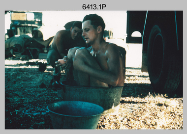
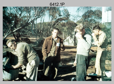
Photograph - Royal Australian Survey Corps Surveyors in the Field – North Queensland, 1958
... Royal Australian Survey Corps Surveyors in the Field...Royal Australian Survey Corps Surveyors in the Field...Royal Australian Survey Corps...’. Royal Australian Survey Corps RASvy Army Survey Regiment ASR ...This is a set of seven photographs of surveyors and support staff in the field undertaking duties in North Queensland in 1958. The surveyors were employed in the establishment of mapping and geodetic control. In this era surveyors used theodolites to observe horizontal and vertical angles and chains to measure base line distances between survey stations. Bob Skitch shown in photos .4P to .6P was in the 2nd year of his career in the Australian Army. He achieved the rank of Lieutenant Colonel and his last appointment was the CO of the Army Survey Regiment from 1976 to 1980. The annotation on the back of photo .5P ‘Black foreground is where Bob Skitch boiled billy and started a grass fire’.This is a set of seven photographs of surveyors and support staff in the field undertaking duties in North Queensland in 1958. The photographs were printed on photographic paper and are part of the Army Survey Regiment’s Collection. The photographs were scanned at 300 dpi. .1) - Photo, colour, 1958. Surveyor in Nth QLD enjoying a bath. L to R: Don Cocker, Bob Thompson. .2) - Photo, colour, 1958. Don Cocker surveyor in Nth QLD, enjoying a bath. .3) - Photo, colour, 1958. Surveyors Nth QLD undertaking survey observations, using MRA1 tellurometer to measure base-line distances. L to R: Len Davies, Lou Sommer, John Van De Graff. MRA1 was covered to stop overheating. .4) - Photo, colour, 1958. Surveyors south of Richmond, QLD digging holes for the erection of a Bilby observation tower. L to R: John Van De Graff, Bob Skitch, Kev Moody, Mal Hayes, Don Gray .5) - Photo, colour, 1958. Surveyors south of Richmond, QLD erecting a Bilby observation tower. L to R: Tom Royle, Bob Skitch (on ground level), Mal Hayes. .6) - Photo, colour, 1958. Surveyors south of Richmond, QLD erecting a Bilby observation tower. L to R: Tom Royle, Bob Skitch, Mal Hayes, Jim McGill (on ground level). .7) - Photo, colour, 1958. Surveyors south of Richmond, QLD undertaking survey measurements from a Bilby observation tower..1P to .7P annotated on back – personnel names, the year and the location. Annotated on back of .5P ‘Black foreground is where Bob Skitch boiled billy and started a grass fire’.royal australian survey corps, rasvy, army survey regiment, asr, army svy regt, fortuna, surveying -
 Bendigo Military Museum
Photograph - Royal Australian Survey Corps Surveyors in the Field – Victoria, 1956 - 1958
... Royal Australian Survey Corps Surveyors in the Field...Royal Australian Survey Corps Surveyors in the Field...Royal Australian Survey Corps... distances between survey stations. Royal Australian Survey Corps ...This is a set of two photographs of surveyors and support staff in the field undertaking tasks in Victoria 1956 – 1958. The surveyors were employed in the establishment of mapping and geodetic control. In this era surveyors used theodolites to observe horizontal and vertical angles and chains to measure base line distances between survey stations. This is a set of 23 photographs of surveyors and support staff in the field undertaking duties in Victoria 1956 – 1958. The photographs were printed on photographic paper and are part of the Army Survey Regiment’s Collection. The photographs were scanned at 300 dpi. .1) - Photo, colour, 1956. Surveyors enjoying a tea break. L to R: Tom Gilbert (cook), Barry Broad, Tony Slattery, John Van De Graff. Taken at Boonoonar, a locality south of Mildura. .2) - Photo, colour, 1958. Surveyors taking a break from driving. L to R: Leo Bub, Bob Thompson. Taken at Puckapunyal..1P to .2P annotated on back – personnel names, the year and the location. royal australian survey corps, rasvy, army survey regiment, asr, army svy regt, fortuna, surveying -
 Bendigo Military Museum
Photograph - Royal Australian Survey Corps Surveyors in the Field – North Queensland and Torres Strait, 1961
... Royal Australian Survey Corps Surveyors in the Field...Royal Australian Survey Corps Surveyors in the Field...Royal Australian Survey Corps... TAA. Royal Australian Survey Corps RASvy Army Survey Regiment ...This is a set of five photographs of surveyors and support staff in the field undertaking duties in North Queensland and Torres Strait in 1961. The surveyors were employed in the establishment of mapping and geodetic control. In this era surveyors used theodolites to observe horizontal and vertical angles and tellurometers to measure base line distances between survey stations. In photo .2P Joe Farrington is seen taking survey observations using a Tavistock V500 Series Tavistock theodolite at a survey station between the Edward River and Aurukun in the Cape York Peninsula. The Gulf of Carpentaria appears in the background. From 1957 helicopter transport of survey parties revolutionised transport in remote areas. The civilian helicopter was hired from TAA. This is a set of five photographs of surveyors and support staff in the field undertaking duties in North Queensland and Torres Strait in 1961. The photographs were printed on photographic paper and are part of the Army Survey Regiment’s Collection. The photographs were scanned at 300 dpi. .1) - Photo, colour, 1961. Andy Millar occupying a survey station on a hill in the Cape York Peninsula, QLD. .2) - Photo, colour, 1961. Joe Farrington taking observations with a V500 Series Tavistock geodetic theodolite at a survey station in the Cape York Peninsula, QLD. .3) - Photo, colour, 1961. Daryl Parker taking a break from survey observations on a hill located on Duaun Island QLD, in the Torres Strait, a few miles south of the PNG coastline. Hill height was 975 ft. .4) - Photo, colour, 1961. Three Torres Strait divers L to R: unidentified, Darku and Ray Mau Daryl standing behind a Tavistock geodetic theodolite on a hill located on Duaun Island QLD, in the Torres Strait, a few miles south of the PNG coastline. .5) - Photo, colour, 1961. Andy Millar holding meat from a small turtle on Duaun Island QLD, in the Torres Strait, a few miles south of the PNG coastline. An unidentified Duaun Island local appears in the background..1P to .5P annotated on back – personnel names, the year and the location. royal australian survey corps, rasvy, army survey regiment, asr, army svy regt, fortuna, surveying -
 Bendigo Military Museum
Photograph - Royal Australian Survey Corps Surveyors in the Field – PNG, 1962
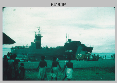
... Royal Australian Survey Corps Surveyors in the Field – PNG...Royal Australian Survey Corps Surveyors in the Field – PNG...Royal Australian Survey Corps... Australian Survey Corps RASvy Army Survey Regiment ASR Army Svy Regt ...This is a set of four photographs of surveyors and support staff in the field undertaking duties in Dogera, Milne Bay Province and Kerema, Gulf Province of PNG in 1962. The surveyors were employed in the establishment of mapping and geodetic control. In this era surveyors used theodolites to observe horizontal and vertical angles and tellurometers to measure base line distances between survey stations. From 1957 helicopter transport of survey parties revolutionised transport in remote areas.This is a set of four photographs of surveyors and support staff in the field undertaking duties in PNG in 1962. The photographs were printed on photographic paper and are part of the Army Survey Regiment’s Collection. The photographs were scanned at 300 dpi. .1) - Photo, colour, 1962. Unloading survey operation stores from a Landing Ship Medium (LSM) at Dogera, Milne Bay Province, PNG. .2) & .3) - Photo, colour, 1962. Hired civilian helicopter Bell 47G-2 helicopters operating at at Dogera, Milne Bay Province, PNG. .4) - Photo, colour, 1962. Survey party at survey station located near Kerema, Gulf Province southern PNG. L to R: Dave Owens, Keith Broadbent, with local villagers in background..1P to .4P annotated on back – personnel names, the year and the location. royal australian survey corps, rasvy, army survey regiment, asr, army svy regt, fortuna, surveying -
 Bendigo Military Museum
Photograph - Royal Australian Survey Corps Surveyors in the Field, Army Survey Regiment, 1950s to 1970s
... Royal Australian Survey Corps Surveyors in the Field...Royal Australian Survey Corps Surveyors in the Field...Royal Australian Survey Corps... in the collection with annotation. Royal Australian Survey Corps RASvy Army ...These three photographs were most likely taken from the 1950s to the 1970s. The RASvy surveyor in each photograph was taking angular measurements with the observer recording their readings on a booking form. They were probably employed in establishing mapping and geodetic control operations or the surveyors may have been in training. Photo .1P was possibly taken at Mount Alexander in Central Victoria, a location close to Bendigo, as the stone cairn in the background of the photo appears to be identical to the cairn presently located on top of the mountain. Personnel and location have been confirmed on another photo in the collection with annotation. These three photographs are of surveyors in the field undertaking observations using theodolites. The photographs were printed on photographic paper and are part of the Army Survey Regiment’s Collection. The photographs were scanned at 300 dpi. .1) - Photo, black & white, c1950s. Unidentified personnel undertaking observations with a Tavistock geodetic theodolite. .2) – Photo, colour, mounted on card, c1960s. Unidentified personnel undertaking observations with a Kern DKM2 theodolite. .3) - Photo, colour, c1970s. Unidentified personnel undertaking observations with a theodolite..1 – not annotated .2 –annotated on front “Kern DKM2, TOPO 10” royal australian survey corps, rasvy, army survey regiment, army svy regt, fortuna, asr, surveying -
 Bendigo Military Museum
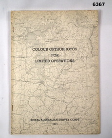
Administrative record - Royal Australian Survey Corps - Colour Orthophotos for Limited Operations 1971, Army Survey Regiment, Bendigo, 1971
... Royal Australian Survey Corps - Colour Orthophotos for...Royal Australian Survey Corps - Colour Orthophotos for...Royal Australian Survey Corps... orthohotomap of the map sheet. Royal Australian Survey Corps RASvy ...This is a report on the experimental production of the colour Orthophoto Map 1:25,000 7924 - 3 - SW Northwood (Puckapunyal area) during 1971 conducted at the Army Survey Regiment Bendigo. The report covers all aspects of production including cartographic enhancement, test proofing, platemaking and printing. While Annexes A and C are listed in the contents, they are missing from the document. A second copy has been added to this record that contains Annex A that is a colour enhanced colour orthohotomap of the map sheet.Soft covered A4 sized booklet stapled along the left hand side. Title and a greyed map image printed on cover. A second copy containing Annex A was added in 2025royal australian survey corps, rasvy, fortuna, army survey regiment, army svy regt, asr -
 Bendigo Military Museum
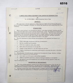
Administrative record - Royal Australian Survey Corps - A simple silk screen equipment for limited map reproduction by LTCOL HM Hall (RASvy) 1967, LtCol HM Hall (RASvy), 6 Feb 1967
... Royal Australian Survey Corps - A simple silk screen...Royal Australian Survey Corps - A simple silk screen...Royal Australian Survey Corps... typed text, photos and map extract Royal Australian Survey Corps ...This paper deals with the employment of Hand operated Mobile Screen Printing Equipment and its associated cartographic techniques for limited map reproduction and overprinting under field conditions. Written by LtCol HM Hall (RASvy)8 x A4 page document containing typed text, photos and map extractroyal australian survey corps, rasvy, fortuna, army survey regiment, army svy regt, asr, school of military survey, sms -
 Bendigo Military Museum
Administrative record - Royal Australian Survey Corps - Planning for Field Survey Operations for 1:250,000 - LtCol JK Herridge (RASvy) 1960, LtCol JB Herridge (RASvy), April 1960
... Royal Australian Survey Corps - Planning for Field Survey...Royal Australian Survey Corps - Planning for Field Survey...Royal Australian Survey Corps... 1960. Royal Australian Survey Corps RASvy Fortuna Army Survey ...This 13 x page document contains notes on planning for RASvy Field Survey Operations in Northern Command during 1958 and 1959 with helicopter support available for field operations for 1:250,000 mapping. The Document was written by LtCol JB Herridge (RASvy) at the School of Military Survey Balcombe April 1960.13 x foolscap pages of typed text, stapled and four holed punchedHand written "53" in top RH cornerroyal australian survey corps, rasvy, fortuna, army survey regiment, army svy regt, asr, school of military survey, sms -
 Bendigo Military Museum
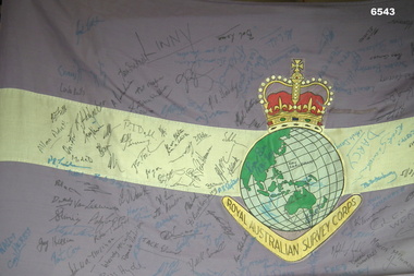
Flag - Royal Australian Survey Corps Flag - 4 Fd Svy Sqn Signed, Directorate of Military Survey, Canberra, Mid to late 1970's
... Royal Australian Survey Corps Flag - 4 Fd Svy Sqn Signed ...Royal Australian Survey Corps Flag - 4 Fd Svy Sqn Signed ...Royal Australian Survey Corps... Corps Flag - 4 Fd Svy Sqn Signed Flag Royal Australian Survey ...Survey Corps Flags of this type were produced mid to late 1970's and distributed to all Survey Corps Units. This flag was issued to 4 Fd Svy Sqn and flew during daylight hours on the Unit flag pole at Keswick Barracks, Adelaide from issue until 1995. The flag was signed by about 160 of the 208 attendees at the Ceremonial closing of the Unit on 25 November 1995. A photograph of attendees at the Closing Ceremony is at item 6542.1P and the list of names at 6542.2P and they are stored in Box 278. The Survey Corps Flag that was issued to the Army Survey Regiment is at item 6177 and is stored in Box 218.A full size Corps Flag, purple with 18cm horizontal white stripe. Multi-coloured Survey Corps Badge (less scroll) in the centre of the flag. White header with grommets top and bottom. The Flag has about 160 signatures of past unit members. The Flag is badly faded and the end is fraying.royal australian survey corps, rasvy, fortuna, army survey regiment, army svy regt, asr, 4 fd svy sqn -
 Bendigo Military Museum
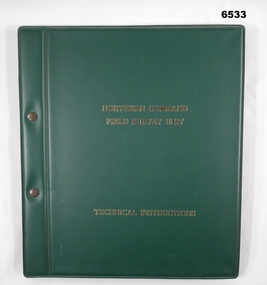
Manual - Royal Australian Survey Corps - Northern Command Field Survey Unit Technical Instructions 1966-73, Northern Command Field Survey Unit, Brisbane, Aug 1966 - Feb 1973
... Royal Australian Survey Corps - Northern Command Field...Royal Australian Survey Corps - Northern Command Field...Royal Australian Survey Corps... Completion Feb 1973, 7 x pages. Royal Australian Survey Corps RASvy ...The Royal Australian Survey had Field Survey Units located in most States of Australia. Northern Command Field Survey Unit was located in Brisbane. This folder contains technical Instructions for tasks carried out by the Unit from Survey control and data capture through to Field completion. The folder is held together by Chicago screws so that Instructions could be updated when necessary. Instruction No1 Production Data Records Aug 1966 23x pages, Instruction No2 Standard Operating Procedure for B8 Stereoplotting Oct 1967 4 x pages, Instruction No3 Provisional Compilation Specifications 1:100 mapping contouring Oct 1967 (Missing), Instruction No4 Horizontal Control Station Summaries Aug 1972 13 x pages, Instruction No5 Airphotography Mar 1972 8 x pages, Instruction No6 Reconnaisance Station marking and Station Notes Aerodist Operations Mar 1972, 13 x pages, Instruction No7 Field Completion Feb 1973, 7 x pages.A hard green plastic covered manual of 68 x paper pages of typed text diagrams and tables, some fold out Annexes. The pages are held together with two Chicago screwsWhite # "5 " inside front and back coversroyal australian survey corps, rasvy, fortuna, army survey regiment, army svy regt, asr, norther command field survey unit -
 4th/19th Prince of Wales's Light Horse Regiment Unit History Room
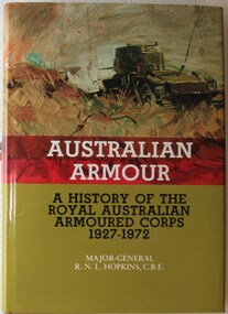
Book, Major-General R N L Hopkins CBE, Australian Armour A history of the Royal Australian Armoured Corps 1927-1972, 1978
... Australian Armour A history of the Royal Australian...royal australian armoured corps...Royal Australian Armoured Corps Tank Museum... corps history royal australian armoured corps history ISBN 0 642 ...Historical referenceHard covered book. 371 pp. ISBN 0 642 99407 2 940.5412'94royal australian armoured corps, history, royal australian armoured corps, history -
 Warrnambool RSL Sub Branch
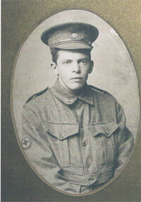
BOB and HAROLD SNAPE. 7 PHOTOS: BOB, AMC 6th Field Ambulance (x2); HAROLD, RANBT (x1) and 12th Brigade AFA (x2). QUERRIEU, France, 20 July 1918. NCOs of AUSTRALIAN CORPS HQ... Bob is on extreme Left of 3rd row
... ). QUERRIEU, France, 20 July 1918. NCOs of AUSTRALIAN CORPS HQ... Bob... of AUSTRALIAN CORPS HQ... Bob is on extreme Left of 3rd row. ...snape collection -
 Warrnambool RSL Sub Branch
AUSTRALIAN CORPS Camp Order No. 27, 10 December 1918, pp 1 - 2
... AUSTRALIAN CORPS Camp Order No. 27, 10 December 1918, pp 1... Warrnambool great-ocean-road Snape Collection AUSTRALIAN CORPS Camp ...snape collection -
 Warrnambool RSL Sub Branch
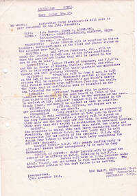
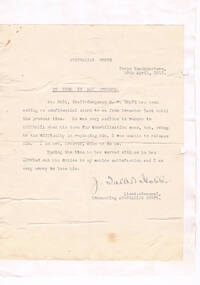
Letters (x 2) dated 20 April 1919, from J Talbot Hobbs, Lieut.General, Commanding Australian Corps, re Bob's wish for demobilisation
... , Lieut.General, Commanding Australian Corps, re Bob's wish for... Australian Corps, re Bob's wish for demobilisation. ...snape collection -
 Waverley RSL Sub Branch
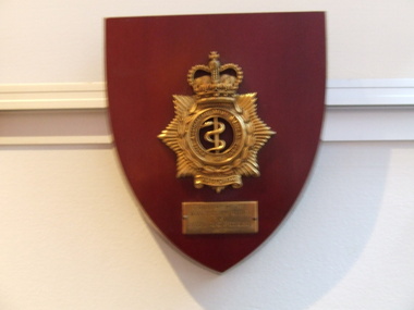
Plaque Royal Australian Army Medical Corps, Royal Australian Army Medical Corps
... Plaque Royal Australian Army Medical Corps ...Royal Australian Army Medical Corps ...Wooden Plaque 15cm x 13cm with insignia of Royal Australian...Royal Australian Army Medical Corps ... melbourne Royal Australian Army Medical Corps Wooden Plaque 15cm x ...Wooden Plaque 15cm x 13cm with insignia of Royal Australian Army Medical Corps Royal Australian Army Medical Corps -
 National Vietnam Veterans Museum (NVVM)
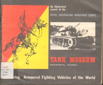
Book, Royal Australian Armoured Corps Tank Museum, An illustrated Record of the Royal Australian Armoured Corps
... An illustrated Record of the Royal Australian Armoured...Royal Australian Armoured Corps Tank Museum - Catalogs...Royal Australian Armoured Corps Tank Museum... Armoured Corps Book Book Royal Australian Armoured Corps Tank ...The RAAC Tank Museum was formed in 1971 using as a basis a number of vintage Armoured vehicles that adorned the Puckapunyal Area.The RAAC Tank Museum was formed in 1971 using as a basis a number of vintage Armoured vehicles that adorned the Puckapunyal Area.royal australian armoured corps tank museum - catalogs, armoured vehicles, military - victoria - puckapunyal - catalogs, military museums - victoria - puckapunyal - catalogs -
 Bendigo Military Museum
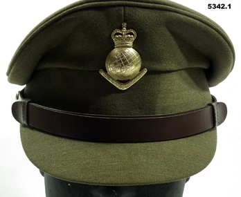
Uniform - SERVICE DRESS, ARMY - Royal Australian Army Survey Corps Uniform, Commonwealth Govt Clothing Factory, 1970-1988
... SERVICE DRESS, ARMY - Royal Australian Army Survey Corps...SERVICE DRESS, ARMY - Royal Australian Army Survey Corps...Royal Australian Survey Corps... Thomas William Pattison, Royal Australian Survey Corps, Army... Officer Thomas William Pattison, Royal Australian Survey Corps ...This is the peaked cap and uniform of 36898 Warrant Officer Thomas William Pattison, Royal Australian Survey Corps, Army Survey Regiment who served from 21 Mar 1960 until 16 Jan 1993 and died whilst in service.1. Cap - Polyester, Khaki, small peak, leather band, metal Insignia. 2. Jacket - polyester, khaki, yellow metal buttons, Insignia badges, purple lanyard, embroidered Insignia lower sleeves. 3, Shirt - polyester, short sleeves, embroidered insignia on sleeves. 4. Pants - Polyester, Khaki.Jacket - embroidered Insignia on lower sleeves - Crown.uniform, army, royal australian survey corps, rasvy, army survey regiment, army svy regt, asr -
 Lara RSL Sub Branch
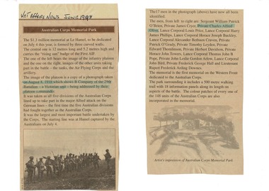
Veteran Affairs Newspaper article dated June 1998, Australian Corps Memorial Park - $1.3 million memorial at La Hamel for Australian World War 1 Soldiers
... Australian Corps Memorial Park - $1.3 million memorial at... Australian Corps Memorial Park. Article covers a Memorial cost $1.3..., heading - Australian Corps Memorial Park.... dated June 1998, heading - Australian Corps Memorial Park. A4 ...Article of World War 1 Refer to carved life size soldier with machine gun in foyer and photograph at its feet.A4 sheet of white paper has two cut-out sections of Veteran Affairs Newspaper article dated June 1998 glued on. Title Australian Corps Memorial Park. Article covers a Memorial cost $1.3 million dollars for dedication on 4th July 1998 consisting of three curved memorial walls for Australian soldiers that died during Wold War 2. The photograph included in the article was taken on August 8, 1918 which shows B company of the 29th Battalion - a Victorian Unit - being addressed by their platoon Commander. All 5 Australian Divisions took part in the major Allied attack on the German Lines - the first time the five Australian Divisions had fought together as the Australian Corps. (Under Australian Command) It is the First memorial on the Western Front dedicated to the Australian Corps. The park surrounding it includes a 500 meter walking tril with 18 information panels along its length on aspects of the battle.Article was found in Veteran Affairs News dated June 1998, heading - Australian Corps Memorial Park.veteran affairs news article, a4 paper sheet -
 National Vietnam Veterans Museum (NVVM)
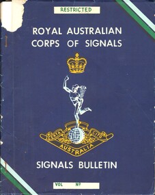
Booklet, Department of Defence, Royal Australian Corps of Signals - Signals Bulletin, 1964
... Royal Australian Corps of Signals - Signals Bulletin...Royal Australian Corps of Signals... of the Royal Australian Corps of Signals. the booklet has two rusty... is the insignia of the Royal Australian Corps of Signals. the booklet has ...A dark blue coloured cover with the word Restricted written in green ink with a white background. The main writing is in white capital letters. In the middle of the page is the insignia of the Royal Australian Corps of Signals. the booklet has two rusty metal staples down the left hand side.australia - armed forces - service manuals, royal australian corps of signals -
 Bendigo Military Museum
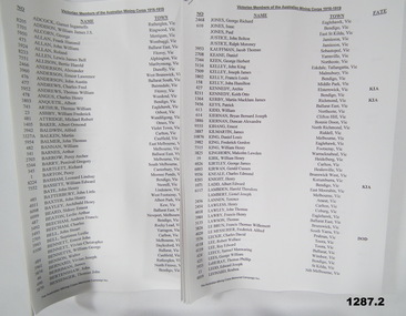
Administrative record - ADMINISTRATIVE RECORD, WW1, The Australian Mining Corps Memorial Campaign Inc, "Victorian Members of the Australian Mining Corps 1916-1919", unknown
... "Victorian Members of the Australian Mining Corps 1916-1919"..."Victorian Members of the Australian Mining Corps 1916...The Australian Mining Corps Memorial Campaign Inc.... goldfields "Victorian Members of the Australian Mining Corps 1916 ..."Victorian Members of the Australian Mining Corps 1916 - 1919". The 4 mining units formed by the Royal Australian Engineers for the British Expeditionary Force departed Australia for the United Kingdom 1916. After May 1916 the four constituent companies of the Australian Mining Corps were deployed directly as part of the Tunnelling Companies of the Royal Engineers. list produced by "The Australian Mining Corps Memorial Campaign Inc".1. & 2. Record document - facsimile copy of names. Black print on white paper. Both 8 pages - printed on one side, white paper. Stapled top left corner.records, royal australian engineers, tunnellers, ww1 -
 4th/19th Prince of Wales's Light Horse Regiment Unit History Room
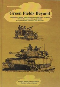
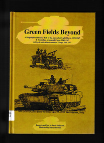
Book, David Finlayson, Green Fields Beyond - A Biographical Honour Roll of the Australian Light Horse, 1939-1947 & Australian Armoured Corps, 1941 - 1947 & Royal Australian Armoured Corps, Post 1947, 2012
... Australian Light Horse, 1939-1947 & Australian Armoured Corps, 1941...Royal Australian Armoured Corps Association ( Victorian... & Australian Armoured Corps, 1941 - 1947 & Royal Australian Armoured ...Hard Cover book, 387 pagesbook, honour roll, raac, alh, book, honour roll, raac, alh -
 Monbulk RSL Sub Branch
Book, Royal Australian Armoured Corps Association Inc, "Green fields beyond" : a biographical honour roll of the Australian Light Horse 1939-1947, Australian Armoured Corps 1941-47, & Royal Australian Armoured Corps post-1947, 2012
... Australian Light Horse 1939-1947, Australian Armoured Corps 1941-47...Royal Australian Armoured Corps Association Inc.... Light Horse 1939-1947, Australian Armoured Corps 1941-47 ...A biographical honour roll of the Australian Light Horse 1939-1947, Australian Armoured Corps 1941-47, & Royal Australian Armoured Corps post-1947Index, bibliography, ill, p.388.non-fictionA biographical honour roll of the Australian Light Horse 1939-1947, Australian Armoured Corps 1941-47, & Royal Australian Armoured Corps post-1947 regimental histories - australia, soldiers - australia - biographies