Showing 20688 items matching "time-allotment"
-
 Whitehorse Historical Society Inc.
Document, Certificate of Title, 1917 - 1933
Certificate of Title, Harrison Rotherham of 'Thulecroft', Albion Street, Surrey Hills, Merchant.Certificate of Title, Harrison Rotherham of 'Thulecroft', Albion Street, Surrey Hills, Merchant. Lots 61 & 62, subdivision 602, Part of Crown Allotment 127, Parish of Nunawading, County of Bourke with a right of carriage way over Harrison and Burnett streets, 1917. Vol 4046, Fol 809049. Also correspondence re rates, enforcement of charge, 1933.Certificate of Title, Harrison Rotherham of 'Thulecroft', Albion Street, Surrey Hills, Merchant.land titles, shire of nunawading, shire of blackburn and mitcham, rotherham, harrison, harrison street, mitcham, burnett street, mitcham -
Whitehorse Historical Society Inc.
Document, Certificate of Title, 1910, 1928, 1933
Certificate of Title, Albert Edward Ruglen.Certificate of Title, Albert Edward Ruglen. Part of Crown Allotment 118A, Parish of Nunawading, County of Bourke, 1910. Vol 3462 fol 692315 also correspondence re rate enforcement of charge. Another certificate of title for the same person, subdivision 12279, vol 5389 fol 1077705 1928 and rates - enforcement of charge 1933.Certificate of Title, Albert Edward Ruglen.ruglen, albert edward -
 Port Melbourne Historical & Preservation Society
Photograph - Display Port Melbourne City Library, Liardet Street, c.1983
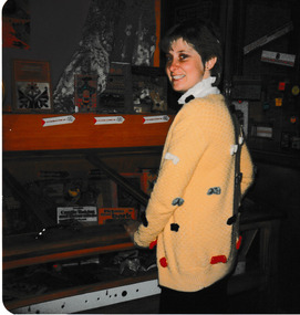
Port Melbourne Library display with part time librarian, Teresa, The display was made by donor, Jay MILLER, a newly qualified, part-time librarian at Port Melbourne City Library from 1983 - 1984. The library was then situated next to the old Fire Station on the site where Coles is now located. Photograph of part time librarian in front of Port Melbourne City Library display.jay miller, port melbourne library, coles, fire station, teresa -
Whitehorse Historical Society Inc.
Document, Jones Family History
Brief history of the Jones FamilyBrief history of the Jones Family from emigration of James Jones in 1852 to 1970 with papers relating to purchase and fencing of land, part of Crown Allotment 116G, Lot 2, for building of Nunawading South Primary School No 4808, including a native flora area, c 1957. Also papers from the Native Plants Preservation Society of Victoria.Brief history of the Jones Family jones, james, jones family, bette, walter edgar, lionel arthur, kones, k.e. & l.a., native plants preservation society of victoria, nunawading south primary school, no. 4808, mount pleasant road, nunawading, florists, lorikeet street, dagola court, koala avenue -
 Bendigo Tramways (managed by the Bendigo Heritage Attractions)
Title, Certificate of Title
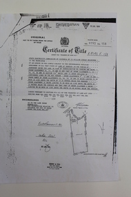
From the City of Greater Bendigo to Tim Borchers (Tramways Subtenant). Passed to Tramways Supt - Date and Reason not known.Photo Copy of Title of Crown Allotment's 24.17.18.32.V9793 F 158bendigo, tramways -
 Ringwood and District Historical Society
Map, Subdivision Plan of residential allotments in Caroline Street, Thomas Street, Emerald Street and Ford Street, Ringwood, Victoria - (Undated, circa 1930)
Map of residential allotments on blue cardboard backing.Handwritten title reference notation LP13641. -
 The 5th/6th Battalion Royal Victoria Regiment Historical Collection
Document - Commander's Commendation to LT Ian Lowen from General Wavell, Commanders Commendation from General Wavell
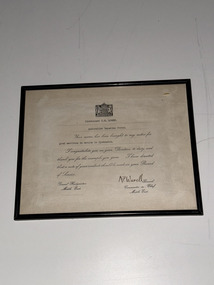
Commanders Commendation presented to Brig Lowen (LT Lowen at the time), signed by General WavellCommanders Commendation issued to LT Ian Lowen by General Wavell, it contains the wet signature of General WavellCommanders Commendation in wooden class frame contains the Commanders CommendationCommanders Commendation present to Brid Lowen (LT Lowen at the time)5/6 rvr, bhq, brig lowen, 2/5th bn, lt lowen -
Whitehorse Historical Society Inc.
Article, Still going strong after 113 years, 2000
Article on Christina Cock.Article on Christina Cock, Australia's oldest living person at the time, and Blackburn resident. With photo.Article on Christina Cock. cock, christina -
 Geelong RSL Sub Branch
Photograph, 2/4th Independent Company, circa 1943
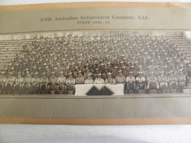
This photograph is of 2/4th Independent Company A.I.F Timor 1942-43.This Company was formed in December and posted to Katherine, NT, in March 1942. The Company was deployed to areas between McArthur and Ord Rivers and in August moved to Adelaide River. In September the Company moved to Darwin and boarded the destroyer HMAS Voyager and travelled to East Timor (then Portuguese Timor) to reinforce 2/2nd Independent Company.This photograph is the 2/4th Independent Company Members that served in East Timor 1942-43.A photograph attached to cardboard in a metal frame. The Photograph is covered by perspex instead of glass.2/4th Australian Independent Company, A.I.F. Timor 1942-43.east timor, a.i.f. 2/4th independent company. 1942-43. -
 Warrnambool and District Historical Society Inc.
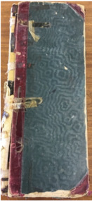
Administrative record - Prescription Book, early 20th century
This prescription book contains the entries of a chemist shop in Timor Street, Warrnambool from 1911 to 1946. During that time there were various chemists in the business trading for most of the time as R.F. Kennedy and Co. and later successors to R.F. Kennedy and Co, with one known name being that of J. Paterson. Richard Frank Kennedy established his wholesale, retail and manufacturing chemist's business in Warrnambool in 1880 and it became a leading business in Warrnambool. After Kennedy's death in 1903 the business continued as R.F.Kennedy and Co. The entries in the book show the type of medicines and prescriptions used in Warrnambool over a period of thirty years.This is a significant item, firstly because it is a record of an important business in 20th century Warrnambool and secondly because it is a great social record of one aspect of the health of residents in Warrnambool and district at that time. This is a ledger of 502 pages with a heavy cardboard cover with red leather edgings. The binding is largely missing and the ledger is held together with adhesive tape. The pages contain an alphabetical section at the front and handwritten entries in blue and black ink.R.F. Kennedy & Co. Timor St Warrnambool R.K. McDonald r. f. kennedy & co. warrnambool -
 Queenscliffe Maritime Museum
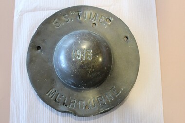
Functional object - Ship's wheel cover from SS Time, 1913 - 1949
Relic from SS Time wrecked on Corsair Rock in 1949. Ship's wheel coverSS Time Melbourne 1913, J Priestman & Co Sunderland UKss time, shipwrecks, ships wheel -
 Ringwood and District Historical Society
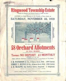
Pamphlet - Land Auction Brochure, Ringwood Township Estate, Ringwood, Victoria - 1919
Double sided bi-fold leaflet advertising subdivision site, layout of streets and allotments, summary of local features and services and terms of sale. Inset photographs of local views.Auction Saturday November 22, 1919. 58 Orchard Allotments. Formerly the residence and orchard property of Count Von Horn. Subdivision includes Wantirna Road, Ellison Street, Haig Street. Free annual railway tickets presented to cash buyers of two blocks. Agents - F.H. Patterson & Co., 19 Queen Street, Melbourne, Tel Central 4308, Sydney T. Haynes & Co., 60 Queen Street, Melbourne, Tel. Central 3400, J.B. McAlpin, Opp Railway Station, Ringwood, Tel. Ringwood 7. Auctioneer - Mr. Sydney T. Haynes. Solicitors - Messrs. Russell, Bona & Russell, 19 Queen Street, Melbourne. -
 Phillip Island and District Historical Society Inc.
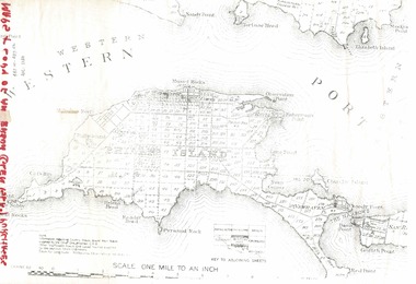
Document, 1869 Crown Land sale and map of Phillip Island showing allotments
Anderson and McHaffie were prominent early settlers of Phillip Island. These documents were from the estate of Stan Mcfee snr. Listings of auctions at Gemmell, Tuckett & Co., Collins Street, Melbourne 12 February, 1869HistoricalCopy of map showing allotments for 1869 land sale and hand written note showing allotments, area, prices for purchases of Robert Anderson and notes on McHaffie land.robert anderson, glen isla, john mchaffie, maps, land sales -
 Bendigo Historical Society Inc.
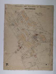
Map - Map of Inglewood, July 23rd 1857
Map of Allotments and Extension of Streets INGLEWOOD, light cream coloured background black ink, some allotments are highlighted with darker cream infills. On paper with cloth backing.map, township, allotments, inglewood -
 City of Moorabbin Historical Society (Operating the Box Cottage Museum)
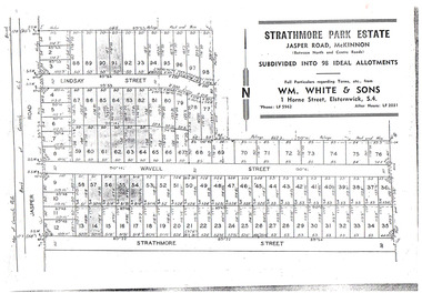
Flyer - Strathmore Park Estate, Jasper Road McKinnon, 1942
After WWII there was a decline in the market gardens in the City of Moorabbin, as the value of the land was more profitable than the crops.Example of the progress of the Municipality of MoorabbinPhotocopy of advertising flyer for auction of real estate sales - plan of building blocks for saleStrathmore Park Estate, Jasper Road Bentleigh Subdivided into 98 Ideal Allotmentsstrathmore street, wavell street, lindsay street, jasper road, mckinnon, bentleigh, real estate, auction -
 Ballarat Heritage Services
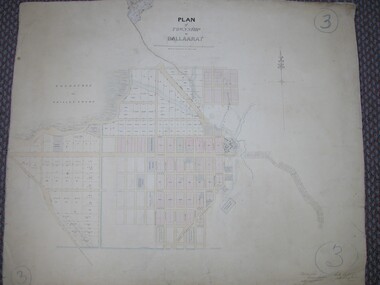
Plan, Plan of Ballarat Police Camp
Plan of Ballarat Allotments, the Ballarat Police Camp, etc.ballarat police camp, white flat co, ballarat -
 Ringwood and District Historical Society
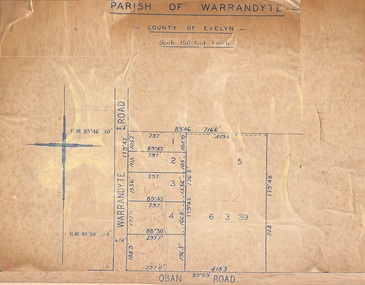
Map, Subdivision Plan of 5 residential allotments on Warrandyte Road and Oban Road, Ringwood, Victoria - (Undated - pre 1950s)
Partial copy of Crown Allotment Map on cardboard backingParish of Warrandyte, County of Evelyn. -
 Bacchus Marsh & District Historical Society
Map, Subdivision of the Manor House Property Bacchus Marsh c.1908
This land sales plan shows allotments of land offered for sale in the inner township area of Bacchus Marsh in 1908. The land put up for sale was from the estate of the late Mr and Mrs J.E. Crook. That being James Elijah Crook and his wife Harriet, (nee Athorn). The Crooks had been resident in Bacchus Marsh since the 1840s and were prominent members of the community. They were prominent in the business, social and civic affairs of the town and district. In the 1850s the Crooks acquired the Manor House and nearby land once owned by the Bacchus family. James Crook died in 1889. When Harriet Crook died in February 1908 their estate was offered for sale. This included the large stone home known as the Manor House and various parcels of land including around 50 allotments of land near the Manor House, bounded by Young, Lerderderg, Crook and Main Streets. Most of these allotments of land were sold in October 1908. The Manor House itself was passed in at the sale and continued to be owned by the Crook family for several decades after 1908.A single page map on a single page of a bound volume of maps. The map shows portions of land for sale from the subdivision of the Manor House property in Bacchus Marsh in 1908. The names of most of the buyers of the portions of land have been hand-written into the various allotments they purchased. The maps are pasted into a bound volume containing 76 maps or plans in total. High resolution digital image stored on BMDHS computer network. bacchus marsh victoria maps, land sales bacchus marsh, manor house bacchus marsh, crook family bacchus marsh -
 Queenscliffe Maritime Museum
Equipment - Ship's compass, J. Priestman & Co. Read more at wrecksite: https://wrecksite.eu/wreck.aspx?57395, 1913
On August 23rd, 1949, S. S. TIME was on voyage from Sydney to Melbourne with a cargo of sugar (3,000 tons), timber, general cargo and coal, when she was wrecked on Corsair Rock, entrance of Port Philip Bay. Read more at wrecksite: https://wrecksite.eu/wreck.aspx?57395The S.S. Time was a land mark vessel in Queenscliff and surrounding areas from August 23rd, 1949, when it was wrecked on Corsair Rock in the entrance of Port Philip Bay until the early 60s when it broke up in a storm.A brass Compass from SS Time mounted on a wooden frameNo 857 E Easdailess time, compass -
Whitehorse Historical Society Inc.
Article, Norman Munt, n.d
Norman Munt saw Nunawading grow.Norman Munt saw Nunawading grow ; article on long time real estate agent and Blackburn resident.Norman Munt saw Nunawading grow.real estate agents, j.b. thomson & co, munt, norman -
 Maldon Vintage Machinery Museum Inc
Pendulum Clock
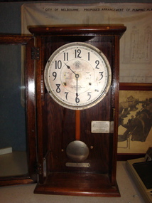
Mechanical pendulum clock mounted in a glass fronted caabinet. Constructed to time when workers start (clock on) and finish (clock off) work each day.On the clock face, "ITR logo with International across it / INGRAM Bros. / Sole Agents / Melbourne / International / Time Recording Co. / London". On a metal plate fixed to the back panel of the cabinet, instructions on maintenance of the clock.clock, pendulum -
 Warrnambool and District Historical Society Inc.
Map, Plans (5) showing Subdivisions of Warrnambool, 1989
These plans have been drawn by Steve Hester for the Warrnambool City Council to illustrate the allotments in Warrnambool concerned with the subdivisions of 1989. The streets have not been named but there is an indication of the area with the identification of known buildings (eg Hospital) and the plan numbers of each allotment is clearly marked. These numbers corresponded to the plan numbers registered in card files and ledgers in the Warrnambool City Council offices. The scale of the plans was 1 to 5000. These plans are of considerable interest because they show Warrnambool street subdivisions of 1989 in illustrative form. They show how information was collated in the late 1980s before the widespread use of computer digital means to describe and store information.These are five hand-drawn sheets showing plans of sub-divisions in Warrnambool streets in 1989 (Warrnambool City Council material). The plans are multi-coloured (crayons) and show allotments with plan numbers. The first plan has much of the material torn off but the location is known to be in the Russells Creek area. Some of the green tape around the edges is missing. Plans two to five are almost intact and are bound with green tape. Plan Two- Industrial Estate of West Warrnambool; Plan Three – Hospital/Merrivale/ Lake Pertobe areas; Plan Four – North Warrnambool, Wollaston/Brierly areas; Plan Five – Flaxman Street area. ‘Subdivision Plan, Reference Guide, Steve Hester, Oct. 1989’. warrnambool street subdivisions, steve hester, history -
Whitehorse Historical Society Inc.
Article, Mayoress of 50s dies, 15/01/1992 12:00:00 AM
Article on Mrs Eva Nettle.Article on Mrs Eva Nettle, one time mayoress of Nunawading and president of the Nunawading Ladies' Benevolent Society.Article on Mrs Eva Nettle.nettle, eva, nunawading ladies' benevolent society -
 Geelong Cycling Club
Banner, 1992
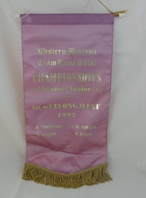
This banner is one of many awarded in the Western District of Victoria for competitive cycling races. Championship event winPink satin banner with gold fringe and gold embossed inscriptions for the Western District Team Time Trial Championships. The banner hangs from a yellow cord supported by a piece of dowel threaded through the top of the banner."Western District/Team Time Trial Championships/Senior Junior/Geelong West/1992/D Whitford M Varker D Wilson P Evans"geelong; geelong cycling club; geelong west cycling club; banner; whitford; varker; wilson; evans; 1992; championships; time trial; -
 Marysville & District Historical Society
Letter (item) - Hand written letter, L. Rowley, Unknown
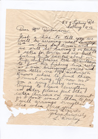
A digital copy of a hand written letter confirming the time of arrival of guests to Marysville House. Marysville House was built in the late 1920s by Arthur Dickinson.A digital copy of a hand written letter confirming the time of arrival of guests to Marysville House. Marysville House was built in the late 1920s by Arthur Dickinson.marysville, victoria, australia, marysville house, arthur james dickinson, grace dickinson, arnold spooner, eileen marie spooner, eileen marie dickinson, grace sweetland, eric dowdle, elsie may denton, elsie may dickinson, peter dickinson, linda dickinson, 2009 black saturday bushfires, letter, l. rowley -
 Bacchus Marsh & District Historical Society
Map, Bacchus Marsh Tuesday 23rd Oct. 1888, Lodge & Dunn's Paddocks 1888. Business and Mansion Sites
This map was created as a plan for an auction of land close to the Bacchus Marsh Railway Station. The auction took place on 23 October 1888. 102 allotments of land from an area known as Lodge and Dunn's paddocks was offered for sale. The auction was conducted by auctioneers based in Melbourne and was advertised in Melbourne newspapers as well as in the Bacchus Marsh Express newspaper. The auction plan contains a range of details including the selling agents, Munro and Baillieu; W.P. Lockhart; and John Turner, all of Melbourne, deposit terms for purchases, price of railway passes for a return trip from Melbourne to Bacchus Marsh of 1 shilling, and a description of the land as having 'magnificent views and perfect drainage'. A single page paper map showing allotments of land for sale along the Parwan Road in Maddingley. The map is pasted into a bound volume containing 76 maps or plans in total. High resolution digital image stored on BMDHS computer network. At bottom on left side: 'Harston & Co. Lith, Melb.'land sales bacchus marsh, land sales maddingley, bacchus marsh victoria maps, maddingley victoria maps -
 Warrnambool and District Historical Society Inc.
Label, Struth, Early 20th century
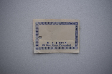
H.J. Struth was a Warrnambool butcher with a business in Timor Street. The Struth family commenced a butcher's shop in WarrnamboolWarrnambool in 1914 and H.J. Struth was the proprietor of the shop until 1956.. It is presumed he is a descendant of Alexander Struth,the Woodford miller and also of Anthony Struth who came to the district in 1843 and also related to Anthony Struth who had a chemist shop in Liebig Street in partnership with Ian Soulsby in the 1980s and the 1990s.This label is of of interest as a memento of the Struth family butchers in the early 20th century.Cream coloured paper label with dark blue text and a decorative border. There is a circular hole on one side.The reverse indicates it has been adhered to another substance.H.J. STRUTH . 232 Timor Street, Warrnambool h.j. struth, warrnambool -
 Kew Historical Society Inc
Plan - Subdivision Plan, Thornton Estate, 1918
The ‘Thornton Estate’ was the final subdivision of ‘Thornton’ in Studley Park Road. Thomas Cubitt Balmain originally owned Thornton, next to John Carson’s ‘Clutha’. Before its final subdivision, the Thomson family owned it. The Estate was a subdivision of 15 residential allotments running between Studley Park Road and Stevenson Street. The allotments faced these streets as well as Thornton Street, which the vendor undertook to make. Contemporary newspaper advertisements advised that ‘The estate possesses many advantages, notably its private and secluded, though convenient, position, splendid frontages and depths, and being close to the electric tram and Kew train, also within easy walking distance of the Victoria-street cable tram’. The terms offered purchasers were ten per cent deposit, with the balance to be paid in ten equal half-yearly payments at a rate of 5 per cent.The ‘Thornton Estate’ was the final subdivision of ‘Thornton’ in Studley Park Road. Thomas Cubitt Balmain originally owned Thornton, next to John Carson’s ‘Clutha’. Before its final subdivision, the Thomson family owned it. The Estate was a subdivision of 15 residential allotments running between Studley Park Road and Stevenson Street. The allotments faced these streets as well as Thornton Street, which the vendor undertook to make. Contemporary newspaper advertisements advised that ‘The estate possesses many advantages, notably its private and secluded, though convenient, position, splendid frontages and depths, and being close to the electric tram and Kew train, also within easy walking distance of the Victoria-street cable tram’. The terms offered purchasers were ten per cent deposit, with the balance to be paid in ten equal half-yearly payments at a rate of 5 per cent.subdivision plans - kew, thornton estate, studley park road -- kew (vic.), thornton avenue -- kew (vic.), stevenson street -- kew (vic.) -
 Ringwood and District Historical Society
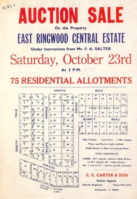
Flyer, Land Auction Sale Advertisement, East Ringwood Central Estate - 1948
See Victorian Collections reference 5125 for subsequent Central Estate East Ringwood subdivision flyer.Single sided land auction sale advertisement for residential allotments.Auction Sale on the property under instructions from Mr. F.A. Salter. Subdivision includes Dublin Road, Knaith Road, Talofa Avenue, Russet Road, and Shasta Avenue. Agent - C.E. Carter & Son, Main Street, Ringwood. WU 6024. -
Tatura Irrigation & Wartime Camps Museum
Book, Solving the Mystery, 1978
Written to record history of the Catholic Church's early days in Byrneside and Tatura and start of Catholic EducationYellow cover, green writing. Allotments map on back cover.books, history, local