Showing 972 items
matching department of planning
-
 Melbourne Tram Museum
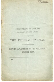
Document - Report, Walter Burley Griffin, Federal Capital Director of Design and Construction, "The Federal Capital - Report Explanatory on the Preliminary General Plan", Oct. 2013
Report - 16 pages + two plans within a grey cover stapled - titled "Commonwealth of Australia Department of Home Affairs - The Federal Capital - Report Explanatory on the Preliminary General Plan" - looking at the site, functions and layout of the proposed capital city of Australia - Canberra. Includes some notes on railways and a rapid transit facility. Signed Walter Burley Griffin, Federal Capital Director of Design and Construction, October 1913.Has in ink in the top right hand corner "Mr. Lormer"trams, tramways, commonwealth government, planning, canberra -
 Melbourne Tram Museum
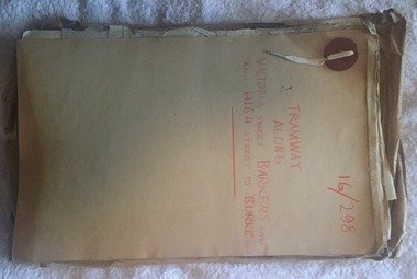
Document - Folder with papers, Public Works Department, "16/298 - Tramway Along Victoria St, Barkers Road and High Street to Burke Road", 1914 to 1916
Folder with papers or file with manila covers, secured with white cloth shoelace type retaining mechanism and red Bakelite type clips containing papers concerned with the construction of the tramway extension at Victoria Bridge (to run alongside the cable tram), the conversion of Kew Horse Tramway and construction of a new electric tramway to Burke Road - titled "16/298 - Tramway Along Victoria St, Barkers Road and High Street to Burke Road". Compiled by the Public Works Department of Victoria - generally dated 1914 to 1916 Shows the nature of the paperwork required for an Act of Parliament to authorise the work, orders in Council, drafts, actual copies of Parliamentary documents, letters to and from Councils, Members of Parliament, PMTT, plans, bridges and footpaths. Includes letters with the City of Collingwood, Kew and Richmond.trams, tramways, kew, high st, victoria st, bridges, collingwood, barkers rd, construction, cable trams, burke rd, pmtt, public works department, parliament -
 Melbourne Tram Museum
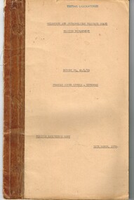
Document - Report, Melbourne & Metropolitan Tramways Board (MMTB), "Tramcar Sound Levels - External", 30/03/1950 12:00:00 AM
Report - typed carbon copy - 31 foolscap sheets with three graphs and drawings within a brown card folder bound with adhesive tape and fold back clips. Titled "Tramcar Sound Levels - External", dated 30/3/1950, prepared by the MMTB Testing Department, Report No. N1/1/38. Gives details of the purpose of the test, procedures, results, discussion and conclusions. Includes various classes of trams (including W3 and W4 class trams), appendices with sound levels, location plan for testing. Testing done on ballasted track in St Georges Road. Signed by D. H. Eakins. Two copies held.trams, tramways, preston workshops, reports, specification, wheels, tramcars, track, noise -
 Melbourne Tram Museum
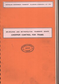
Document - Report, Melbourne & Metropolitan Tramways Board (MMTB), "Chopper Control for Trams", 1977
Report - 149 A4 pages, brown comb bound, orange card covers with two pasted on labels on the front cover. Titled "Chopper Control for Trams". Funded by the Australian Government Transport (Planning and Research) Act 1974, prepared by the MMTB Engineering Department Technical Services Department. Gives an introduction to chopper control technology, summary of the findings of the study, 25% saving in energy. Has a table of contents on page 8, many graphs, including impact of regeneration on W class tram, electromagnetic impact and many photographs of the test equipment. Includes the test program.Front and back covers stamped "Tramway Workshop Library Preston", and in top right hand corner in ink "(Z Tram #5) (1977) " and in pencil "Spare Copy"trams, tramways, mmtb, reports, testing, preston workshops, chopper control, controllers, z class, tram 5 -
 Melbourne Tram Museum
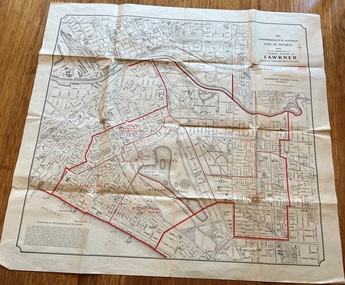
Map, Department of Lands and Survey Melbourne, Commonwealth Electoral Division of Fawkner, 1-10-1912
Shows a detailed street plan of South Melbourne, Albert Park, Prahran, South Yarra and parts of Melbourne in 1912. Used to mark the electoral boundaries of the Commonwealth Electoral Division of Fawkner. Shows all the then cable tram lines, rail lines and the electric line of the PMTT along with docks, gardens and significant buildings.Gives details of the Fawkner Electoral district in 1912.Folded sheet - Map - Commonwealth Electoral Division of Fawkner - two colours showing the subdivisions and polling placesmelbourne, fawkner, tram lines, cable trams, maps, electoral maps, south melbourne, albert park, prahran -
 Melbourne Tram Museum
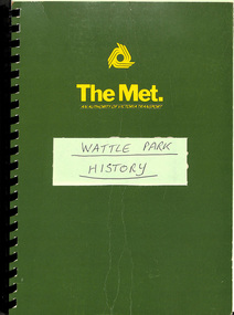
Document - Report, The Met, "Wattle Park", 1989
Report - approx. 90 A4 photocopied sheets, within a green cover preprinted for "The Met", titled "Wattle Park" containing many documents concerned with the history of Wattle Park and its status legally within a black comb binder. Comprises: 1 - Map 2 - two page letter from Tom Roper Minister for Planning and Environment to Jim Kennan Minister for Transport dated 22/11/1988. 3 - two page history 4 - two page extract from the Nov - Dec 1966 issue of MMTB News 5 - 23 pages - handwritten "Notes of Address on early history of Wattle Park given by A. J. Holt to the Box Hill Historical Society Nov. 1986. 6 - 10 page extract of the Act authorising the HTT to acquire the land and extracts from Hansard 7 - 4 page letter by the Office of the Solicitor to The Met Property department 1/12/1986 about the use of the land and charging fees for its use. 8 - 15 page legal advice re the use of the land and its permitted uses. 9 - 13 page follow up advice by P. N. Wikrama dated 20/6/1989 10 - 6 page photocopy of the certificates of title. Each section separated by a green sheet.trams, tramways, wattle park, legal agreements, htt, mmtb, the met, minister for transport -
 Melbourne Tram Museum
Administrative record - Circular, Department of Defence, Melbourne and Metropolitan Tramways Board (MMTB), Defence Week, Jan/Feb 1934
Defence Week - Monday 12/2/34 to Saturday 17/2/34 1. - Newspaper clipping - Arrangements for March - provides details and route of march through the city. 2. - Memo from Assistant Manager to Dist. Traffic Supts NS & SS, dated 5 Feb 1934, providing details of Defence Week, with plan of march. 3. - 10 pages of memos to senior inspectors for shunting arrangements. 4. - 3rd Military District Circular No 4/1934 - describing the march. 5 pages 5. - Programme for week - 2 page program of Defence Week activitiestrams, tramways, instructions, events -
 Melbourne Tram Museum
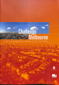
Magazine, Department of Infrastructure (DOI), "Challenge Melbourne, issues in Metropolitan Planning for the 21st Century", 2000
Report - 36 A4 pages + card covers, perfect bound, titled "Challenge Melbourne, issues in Metropolitan Planning for the 21st Century". Has a table of contents. Forward by John Thwaites - Minister for Planning and Peter Batchelor, Minister for Transport, produced by the Department of Infrastructure in 2000. Looks at the planning strategies for a future Melbourne including travel.trams, tramways, doi, melbourne, planning, transport -
 Melbourne Tram Museum
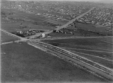
Photograph - Digital Image, Kevin O'Reilly, "Kew Burke Rd' looking at the East Kew Tram terminus, c1925
Image from CD (Compact Diskette for use in computers) - see Reg Item 135. Image titled "Kew Burke Rd' on CD, of looking at the East Kew Tram terminus with the city skyline in the background, c1925. Photo published in the Bellcord No. 16, Oct. 2012. From the article with the photograph; The terminus was located at the intersection of High St, Burke, Kilby and Doncaster Roads. We are at the outer edges of Melbourne’s suburbia at the time, unlike the current tram terminus of today. Burke Road, north of Doncaster Road is clearly under construction in preparation for the new river crossing. The vacant block of land in the foreground will remain so for another ten years or so. In 1960 the new Dickens Supermarket was built on this site and the intersection became known locally as Dickens Corner. The narrow track on the left hand side of the photo is Doncaster Road. The tram at the terminus is a straight-sill single trucker of one of the G, K, Q or R classes. It is finished in the late MMTB chocolate and cream livery. A cable grip car body has been placed as a tram shelter at the terminus. The church was subsequently relocated to Francis Street Yarraville where it still stands today as a private residence. Behind the large hedge on the south side of High Street is Smith’s Dairy. Part of this land would be sold to the MMTB for a planned new tram depot Behind the large hedge on the south side of High Street is Smith’s Dairy. Part of this land would be sold to the MMTB for a planned new tram depot but by the early 1960s it was transferred to the Education Department for construction of the Kew High School. The last portion of the dairy closed in the 1970s.trams, tramways, kew, burke rd, east kew, doncaster rd -
 Mont De Lancey
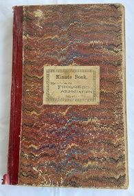
Book, Norman Bros, Silvan Progress Association Minute Book, Unknown
This blank book was used by the Silvan Progress Association. Minutes of the first meeting were taken Sat March 1th 1916 and the last minutes were held in the Library Mechanics Hall on 5th Oct. 1922. The book is filled with Minutes of the monthly meetings and has three paper insertions - a Mont De Lancey Wine List with three wines and their prices per bottle. A second quite damaged paper is: Wandin ? Progress Association Inaugurated 26th Oct 1912. The meeting was held Jan 11, 1913. It lists the monthly meetings and minutes taken up to March 28 1913. The third document is a copy of 13 typed pages from the Shire of Lillydale to Mr. S. Bradley, Hon. Secretary, Silvan Hall Committee, Silvan suggesting to the Committee that the attached plan for the maintenance and betterment for the hall be forwarded to the Public Health Department for approval. It includes a list of names of Guarantors and witnesses.A large red, blue and cream wavy lined paper patterned covered Norman Bros., Minute Book with burgundy tape on the spine. This blank book was used by the Silvan Progress Association. Minutes of the first meeting were taken Sat March 1th 1916 and the last minutes were held in the Library Mechanics Hall on 5th Oct. 1922. The book is filled with Minutes of the monthly meetings and has threeo paper insertions - a Mont De Lancey Wine List with three wines and their prices per bottle. A second quite damaged paper is: Wandin ? Progress Association Inaugurated 26th Oct 1912. The meeting was held Jan 11, 1913. It lists the monthly meetings and minutes taken up to March 28 1913. The third document, dated 17th May 1928, is a copy of 13 typed pages from the Shire of Lilydale to The Hon. Secretary, Silvan Hall Committee, Silvan. It includes a list of names of Guarantors and witnesses.non-fictionThis blank book was used by the Silvan Progress Association. Minutes of the first meeting were taken Sat March 1th 1916 and the last minutes were held in the Library Mechanics Hall on 5th Oct. 1922. The book is filled with Minutes of the monthly meetings and has three paper insertions - a Mont De Lancey Wine List with three wines and their prices per bottle. A second quite damaged paper is: Wandin ? Progress Association Inaugurated 26th Oct 1912. The meeting was held Jan 11, 1913. It lists the monthly meetings and minutes taken up to March 28 1913. The third document is a copy of 13 typed pages from the Shire of Lillydale to Mr. S. Bradley, Hon. Secretary, Silvan Hall Committee, Silvan suggesting to the Committee that the attached plan for the maintenance and betterment for the hall be forwarded to the Public Health Department for approval. It includes a list of names of Guarantors and witnesses.meetings, reports, proceedings, minutes of meetings -
 Federation University Historical Collection
Map - Geological Survey, J. Phillips, Geological Survey of Victoria - Ballarat, 1857, 10/1858
Geological map of the Ballarat District featuring four colours.ballarat, geological, geology, geological plan, main road, camp, golden point, pennyweight hill, clayton hill, ballaarat cemetery, bakery hill, specimen hill, soldiers hill, nightingale lead, native youth black hill flat, white flat, mining, mines, eureka lead, old post office hill -
University of Melbourne, Burnley Campus Archives
Plan, Wilsons Promontory8119-I and Glennie 8119-IV, 1971
State Aerial Survey Plan of Wilsons Promontory and Glennie. Dated 1971. Provisional Compilation of Sheets 8119-I and 8119-IV from Commonwealth Department of National Development Photography for the Department of Crown Lands and Survey Victoria. Students made excursions to Wilsons Promontory.wilsons promontory, glennie group, anser group, bass strait, aerial survey